Embed Size (px)
Citation preview
The National Ocean Service: america’s oceans and coasts: safe, healthy, and productive
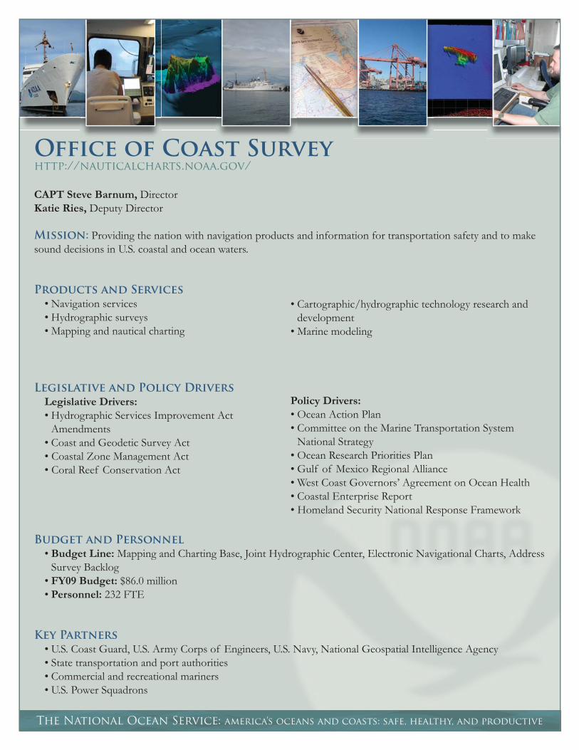
Office of Coast Surveyhttp://nauticalcharts.noaa.gov/
CAPT Steve Barnum, DirectorKatie Ries, Deputy Director
Mission: Providing the nation with navigation products and information for transportation safety and to make sound decisions in U.S. coastal and ocean waters.
Products and Services
• Navigation services• Hydrographic surveys• Mapping and nautical charting
• Cartographic/hydrographic technology research and development
• Marine modeling
Legislative and Policy Drivers
Legislative Drivers: • Hydrographic Services Improvement Act
Amendments • Coast and Geodetic Survey Act• Coastal Zone Management Act• Coral Reef Conservation Act
Policy Drivers: • Ocean Action Plan• Committee on the Marine Transportation System
National Strategy • Ocean Research Priorities Plan • Gulf of Mexico Regional Alliance • West Coast Governors’ Agreement on Ocean Health • Coastal Enterprise Report• Homeland Security National Response Framework
Budget and Personnel
• Budget Line: Mapping and Charting Base, Joint Hydrographic Center, Electronic Navigational Charts, Address Survey Backlog
• FY09 Budget: $86.0 million• Personnel: 232 FTE
Key Partners
• U.S. Coast Guard, U.S. Army Corps of Engineers, U.S. Navy, National Geospatial Intelligence Agency• State transportation and port authorities • Commercial and recreational mariners • U.S. Power Squadrons
nauticalcharts.noaa.gov
Fiscal Year 2008 Highlights
• Surveying the coast following deadly and costly hurricanes and tropical storms with success due to NOAA’s rapid response survey capabilities and pre-planning efforts with Gulf Coast maritime authorities. NOAA’s Navigation Response Teams and a new torpedo-shaped autonomous underwater vehicle surveyed critical shipping lanes for navigational obstructions on the sea fl oor. Additionally, the Offi ce of Coast Survey’s regional Navigation Managers worked directly with port authorities and pilot organizations to determine if ports and shipping lanes were safe for vessel traffi c.
• Finding, reporting, and removing navigation hazards throughout the Nation’s ports. From charting and notifying mariners about a 600-pound World War II-era torpedo in the Gulf of Mexico to locating for removal 600 tons of rock hazards from the entrance to Port Fourchon, Louisiana, the Offi ce of Coast Survey was hard at work responding to survey requests near some of the Nation’s busiest ports.
• Improving the quality and effi ciency of navigation products, which is the goal of Nautical Charting System II, a project initiated in 2004 that aims to redefi ne the production of the Offi ce of Coast Survey’s navigation products. Tying together legacy applications with streamlined workfl ows, this system will better manage data and output timely, consistent, and up-to-date navigation products.
• Publishing new editions of nautical charts that depict the boundaries of the Papahānaumokuākea Marine National Monument, the newly designated Particularly Sensitive Sea Area, Ship Reporting System Areas, and special zones known as “Areas to be Avoided.” The updated nautical charts will help mariners navigate the waters of the monument’s remote and pristine 1,200-mile stretch of coral islands, seamounts, banks, and shoals in the Northwestern Hawaiian Islands.
• Together with the NOAA Offi ce of Marine and Aviation Operations, putting into motion plans to replace existing surveying vessels and upgrade and modernize NOS’s hydrographic data collection fl eet. Two new vessels are currently under construction and the NOAA Ship Rainier added a new survey launch that features increased speed, expanded deck space, and an updated interior layout.
• Releasing a new version of the Web mapping portal NowCOAST (http://nowcoast.noaa.gov/) that provides users with near real-time coastal environmental information, including weather forecasts and global sea-surface temperature analyses. NowCOAST is used to help recreational and commercial mariners, emergency responders, coastal managers, coastal ocean modelers, marine educators, and others plan and manage coastal uses.
Organization
• The Coast Survey Development Laboratory provides many of the tools required to carry out the mission of the Coast Survey, including exploring and developing new and effi cient techniques to accomplish the Coast Survey mission.
• The Hydrographic Surveys Division directs programs for ship and shore-based hydrographic survey units and conducts general hydrographic survey operations.
• The Marine Chart Division acquires and maintains the marine navigational database to construct and maintain nautical charts and related marine products for the United States.
• The Navigation Services Division provides a focal point for customer requests and associated responses on charting issues, emergency response, hydrographic surveys, and maintains Coast Pilot Volumes.

The National Ocean Service: america’s oceans and coasts: safe, healthy, and productive
National Geodetic Surveyhttp://geodesy.noaa.gov/
Juliana Blackwell, DirectorMike Weaver, Acting Deputy Director
Mission: To deliver and evolve the foundation of reference throughout the United States for latitude, longitude, height, velocity, shoreline, and gravity with consistency, accuracy, timeliness, and easy access to support public safety, economic prosperity, and environmental wellbeing.
Products and Services
• Coastal mapping and remote sensing• Continuously Operating Reference Stations• Height modernization
• Online Positioning User Services• Airport surveys• Global Positioning System specifi cations and guidelines
Legislative and Policy Drivers
Legislative Drivers: • Coast and Geodetic Survey Act • Coastal Zone Management Act • Hydrographic Services Improvement Act
Amendments
Policy Drivers: • Ocean Action Plan• Gulf of Mexico Regional Alliance • Committee on the Marine Transportation System
National Strategy • Climate Change Science Program Synthesis and
Assessment Reports
Budget and Personnel
• Budget Line Items: Geodesy Base, National Height Modernization, Shoreline Mapping• FY09 Budget: $31.7 million• Personnel: 199 FTE
Key Partners
• Federal Emergency Management Agency, U.S. Army Corps of Engineers, Federal Aviation Administration, U.S. Geological Survey
• State departments of transportation, State Spatial Reference Centers • Coastal managers, emergency planners• Aviation industry, surveyors, geographic information system users

geodesy.noaa.gov
Fiscal Year 2008 Highlights
• Beginning proof of concept projects and test fl ights of an airborne gravimeter in support of the Gravity for the Redefi nition of the American Vertical Datum (GRAV-D) program. GRAV-D is an effort to use gravity data to redefi ne the vertical datum of the United States by 2017. The GRAV-D program, if fully funded, will allow NOAA to increase the accuracy of the geoid model and, ultimately, give users the ability to use the Global Positioning System (GPS) to determine elevations relative to sea level. Without a comprehensive, cohesive, and accurate geoid model, GPS cannot be used to accurately determine elevations.
• Releasing a new version of the Online Positioning User Service (OPUS). By using as little as 15 minutes’ worth of dual-frequency Global Positioning System (GPS) data, the new version, known as OPUS-Rapid Static (OPUS-RS), saves time and money relative to the standard OPUS, which requires at least two hours of GPS data. OPUS and OPUS-RS allow users to submit their GPS observations to NOAA, where the data are processed to determine corresponding three-dimensional positional coordinates. Each OPUS solution is estimated to save the user $600 over traditional positioning methods.
• Supporting NOAA’s Integrated Ocean and Coastal Mapping initiative to serve the greatest possible range of ocean and coastal geospatial data users through collaborative partnerships, the development of common standards, and technological innovation. Pilot projects in North Carolina, New Hampshire, and Alaska helped enhance coordination of ocean and coastal mapping activities and maximize usefulness of data and products.
• Beginning the installation of a sentinel climate change monitoring network that will monitor coastal land elevations in relation to local sea level throughout the National Estuarine Research Reserve System. In the coming years, the program will be expanded to include all reserves within the system and will become an essential component in the climate change monitoring toolbox, establishing the reserves as sentinel sites for measuring and monitoring the impacts of climate change on estuarine systems.
Organization
• The Remote Sensing Division conducts airport charting and shoreline mapping using traditional methods while exploring more effi cient technologies to complement current practices.
• The Geodetic Services Division manages the state advisor program; tests and evaluates geodetic equipment; evaluates, markets, and distributes products; and provides various training programs.
• The Spatial Reference System Division maintains the Continuously Operating Reference Station network and plans, coordinates and provides technical guidance for geodetic fi eld projects and products.
• The Observation and Analysis Division conducts geodetic surveys to support the National Spatial Reference System and the production of maps, charts, and special products and conducts fi eld surveys to support photogrammetric and hydrographic surveys.
• The Systems Development Division manages the information technology and telecommunications and network systems, and peripheral input and output systems for the National Geodetic Survey.
• The Geosciences Research Division coordinates the research, development, and management of new geodetic data products and designs and programs scientifi c and geodetic software applications and procedures.
Center for Operational
Oceanographic Products & Serviceshttp://tidesandcurrents.noaa.gov/
Mike Szabados, DirectorRich Edwing, Deputy Director
Mission: To provide accurate, reliable, and timely tide, water level, current, and other coastal information, which supports safe and effi cient navigation, the understanding of climate change, coastal hazards preparedness and response, and sound ecosystem management.
Products and Services
The National Ocean Service: america’s oceans and coasts: safe, healthy, and productive
• Long-term sea level information to monitor climate change
• Inundation analyses to manage and restore coastal ecosystems
• Data collection, quality control, and analysis standards
Legislative and Policy Drivers
Legislative Drivers: • Hydrographic Services Improvement Act
Amendments • Coast and Geodetic Survey Act • Tsunami Warning and Education Act
Policy Drivers: • Committee on the Marine Transportation System
National Strategy• Ocean Action Plan• Climate Change Science Program Synthesis and
Assessment Reports• Ocean Research Priorities Plan
Budget and Personnel
• Budget Line: Tide and Currents Data Base• FY09 Budget: $32.1 million• Personnel: 115 FTE
• Oceanographic predictions, real-time observations and forecasts
• Tidal zoning and correctors for charting and shorelines
• Tidal datums for charting, marine boundaries, and property
tidesandcurrents.noaa.gov
Key Partners
• Commercial and recreational mariners• Coastal zone managers• Local emergency managers• State transportation and port authorities• U.S. Coast Guard, U.S. Army Corps of Engineers, U.S. Navy
Fiscal Year 2008 Highlights
• Expanding the Physical Oceanographic Real-Time System (PORTS®) to four new locations in the Gulf of Mexico and on the West Coast while enhancements were made to existing PORTS® along some of the Nation’s busiest waterways. NOAA PORTS® provides accurate, real-time oceanographic and meteorological data to mariners and can reduce the risk of vessel groundings as well as increase the amount of cargo moved through a port. PORTS® data are accessible online at http://tidesandcurrents.noaa.gov/ports.html.
• Releasing three new products that use data from PORTS®. These products include a Web site that delivers a brief paragraph capturing the conditions of an estuary, port, or harbor in real time; a Web site that allows users to customize PORTS® displays to include plots from any station and data type; and an application that allows PORTS® users with Internet access on their mobile phones to view PORTS® data products directly on their mobile devices.
• Installing NOAA “Sentinels of the Coast” at four locations in the Gulf of Mexico. These water-level observing stations are built to withstand Category 4 hurricanes and deliver real-time storm-tide data during severe coastal weather events. NOAA water-level and meteorological data are key components of coastal decision making before, during, and after major storms.
• Initiating a two-year effort to add meteorological sensors to National Water Level Observation Network stations, with 25 stations upgraded in fi scal year 2008. The upgrades included the installation of wind, barometric pressure, and air temperature sensors, followed by monitoring and validation of the data. NOAA water-level and meteorological data have long been key components of safe navigation, marine weather forecasting, and coastal decision making.
• Conducting major tidal current surveys in Alaska, Florida, New York, and New Hampshire to update tidal current predictions at over 200 locations in the last three years.
Organization
• The Engineering Division is responsible for the engineering design, development, procurement, testing, and maintenance of measurement systems and develops engineering system requirements, standards, and standard operating procedures for the Center’s ocean observing systems.
• The Field Operations Division operates and maintains the oceanographic and Great Lakes observing systems needed to support the protection of life and property.
• The Oceanographic Division assesses oceanographic requirements, plans programs and projects to meet those requirements, and ensures the quality of all data collected by CO-OPS.
• The Information Systems Division provides computer-based system and application support services to the Center.
The National Ocean Service: america’s oceans and coasts: safe, healthy, and productive
NOAA Coastal Services Centerhttp://csc.noaa.gov/
Margaret Davidson, DirectorJeff Payne, Deputy Director
Mission: To support the environmental, social, and economic well-being of the coast by linking people, information, and technology.
Products and services
• Human dimensions and socioeconomic studies• Coastal remote sensing• Conservation planning and marine spatial
planning tools• Regionally focused products and services
• Training and technical assistance• Geographic information system (GIS)-related tools• Data, information, and standards development• Hazards mapping and assessment
Legislative and Policy Drivers
Legislative Drivers: • Coastal Zone Management Act• Hydrographic Services Improvement Act
Amendments • Coast and Geodetic Survey Act • National Marine Sanctuaries Act • Oceans and Human Health Act• Inland Flood Forecasting and Warning System Act
Policy Drivers: • Ocean Action Plan• Ocean Research Priorities Plan • Gulf of Mexico Regional Alliance • West Coast Governors’ Agreement on Ocean Health• Northeast Regional Ocean Council• Great Lakes Regional Collaboration• Chesapeake Bay Program• Hawaii Ocean and Coastal Council• Coastal Enterprise Report• Executive Order 12906 (Coordinating Geographic
Data Acquisition and Access to the National Spatial Data Infrastructure)
• Systematic needs assessments
Budget and Personnel
• Budget Line: Ocean Assessment Program (Coastal Services Center, Ocean Research Priorities Plan Implementation, Gulf of Mexico Regional Collaboration, Coastal Storms Program, Oceans and Human Health, Regional Spatial Modeling Grants)
• FY09 Budget: $37.2 million• Personnel: 79 FTE (96 CONTRACTOR FTE)

csc.noaa.gov
Key partners
• U.S. Geological Survey, U.S. Army Corps of Engineers, Environmental Protection Agency, Federal Emergency Management Agency, and other federal agencies
• Regional Ocean Observing Systems and Integrated Ocean Observing System Regional Associations• State coastal and natural resource agencies and programs• State emergency and fl oodplain managers• NOAA’s Northern Gulf Institute• Conservation organizations such as The Land Trust Alliance and The Nature Conservancy
Fiscal Year 2008 Highlights
• Making land-cover change maps and information available for nearly all developed areas of the nation’s coasts. These data show how much of a region is covered by forests, wetlands, impervious surfaces, and other land and water types and can be used to document land-use trends and changes over time.
• Providing accurate, accessible shoreline data and related information from NOAA and other federal agencies on one Web site – the NOAA Shoreline Web site (http://shoreline.noaa.gov). Local and state offi cials use this information to predict sea-level rise, establish setback lines, and perform a multitude of ocean and coastal community planning tasks.
• Developing a tool that combines weather forecasts with hazards planning data, allowing offi cials in California to display and animate forecasts for weather conditions such as waves, winds, temperature, humidity, and rainfall. The tool, called the Southern California Weather and Hazards Data Viewer (http://maps.csc.noaa.gov/CSP_SoCal/), makes the data easier to comprehend and use.
• Providing new coastal LIDAR (Light Detection and Ranging) data for portions of the Great Lakes, Florida, South Carolina, Mississippi, Oregon, and Southern California. LIDAR is a remote sensing technology used to collect topographic and bathymetric data. The sensors are typically mounted on an aircraft and represent a great savings of time and money for states that have used ground surveys to get this information.
• Bringing new partners together through the Digital Coast Web site (http://www.csc.noaa.gov/digitalcoast/) to address coastal issues. The Web site provides data, tools, information, and training.
• Advancing regional ocean governance by serving as an integral partner, providing federal leadership, participation, and collaborative mechanisms for local, state, and federal agencies to address coastal challenges. The range of current regional efforts has included the Gulf of Mexico Alliance, Northeast Regional Ocean Council, West Coast Governors’ Agreement on Ocean Health, Great Lakes regional collaboration, Chesapeake Bay Program, Gulf of Maine Council on the Marine Environment, and the South Atlantic Alliance.
• Training over 1,100 coastal professionals from 42 different states or territories; users of CSC’s E-learning courses logged thousands of user sessions.
Organization
• The Coastal Geospatial Services Division helps state and local coastal partners use technology to address coastal resource management issues.
• The Coastal Management Services Division provides state and local partners with products and services related to social sciences, training, and communications.
• The Integrated Information Services Division helps customers make the best use of data resources and provides internal Web and computer management and services support.
• The Regional Coastal Services Division facilitates the delivery of products and services to state and local partners, to give the organization a better (local) understanding of customer needs and support NOAA’s engagement with regional governance structures.
• The Management and Budget Division is in charge of all things administrative, including grants, facilities, budgeting, and policy and planning.

The National Ocean Service: america’s oceans and coasts: safe, healthy, and productive
NOAA Integrated Ocean Observing
System Programhttp://ioos.noaa.gov/
Zdenka Willis, DirectorSuzanne Skelley, Deputy Director
Mission: To lead the integration of ocean, coastal, and Great Lakes observing capabilities, in collaboration with federal and non-federal partners, to maximize access to data and generation of information products, inform decision making, and promote economic, environmental, and social benefi ts to our nation and the world.
Products and Services
• Integration of NOAA ocean observations to improve decision-support tools• Regional observations, data management, and regional-scale products and services• Regional, interagency, and international collaboration
Legislative and Policy Drivers
Legislative Drivers: • Draft IOOS® legislation (to be developed in the fi rst
quarter of FY09)
Policy Drivers: • Ocean Action Plan• Committee on the Marine Transportation System
National Strategy • Ocean Research Priorities Plan • Gulf of Mexico Alliance - Governors’ Action Plan for
Healthy and Resilient Coasts• West Coast Governors’ Agreement on Ocean Health • Coastal Enterprise Report
Budget and Personnel
• Budget Line: Ocean Assessment Program (IOOS Implementation, IOOS Regional Observations)• FY09 Budget: $27.5 million, including $0.9 million directed to the Alliance for Coastal Technologies• Personnel: 10 FTE
ioos.noaa.gov
Key Partners
• Seventeen federal agencies of the Interagency Working Group on Ocean Observations (IWGOO)• National Federation of Regional Associations for Coastal Ocean Observing• Academia (regional coastal ocean observing system development)• Industry (system design, value add, and benefi ciaries)• State, local, and tribal governments
Fiscal Year 2008 Highlights
• Developed a set of Web-based tools and resources to simplify submission, review, and approval of data standards on an interagency level. Participants, including 17 federal agencies, as well as state, regional, and non-governmental partners, can now actively participate to ensure standards are well vetted and appropriate for use across the IOOS community. Results were almost immediate, with 12 new standards under active review by the end of fi scal year 2008. The standards process is central to the NOAA IOOS Program’s broader strategy to increase integration within the ocean observing community.
• Leading efforts to make selected ocean observation data compatible, thereby increasing their value and utility for decision-support tools, products, and services. In FY08, NOAA IOOS focused on integration of an initial set of fi ve observations, including temperature, salinity, water level, currents, and ocean color. The program assembled a cross-NOAA team to develop standard processes for reporting and exchanging these data and identifi ed three major NOAA data providers to implement standards and begin delivering their data in a consistent manner. NOAA IOOS targeted four NOAA applications to use and evaluate benefi ts of standardized, integrated data, including harmful algal bloom forecasts, coastal fl ooding predictions, integrated ecosystem assessments, and hurricane intensity forecasts.
• Administering a merit-based, competitive funding process to develop and maintain a national network of 11 Regional Associations of Coastal Ocean Observing Systems. This network of observing systems is designed to complement federal observations, data management, and decision-support tools by providing regional-scale data, products, and services to meet regionally specifi c needs for coastal-ocean information.
Organization
• The Operations Team leads the establishment of technical infrastructure, standards, and protocols needed to improve delivery of IOOS oceanographic variables defi ned in the U.S. IOOS Development Plan.
• The Regional Implementation, Program Policy and Communications Team leads development of program policy, manages development and implementation of Regional IOOS, and manages the program’s external communications and Congressional affairs.
• The Management, Budgeting and Programming Team is responsible for execution to the annual budget for NOAA IOOS and leads efforts to resource the program through NOAA’s planning, programming, budgeting, and execution system.
The National Ocean Service: america’s oceans and coasts: safe, healthy, and productive
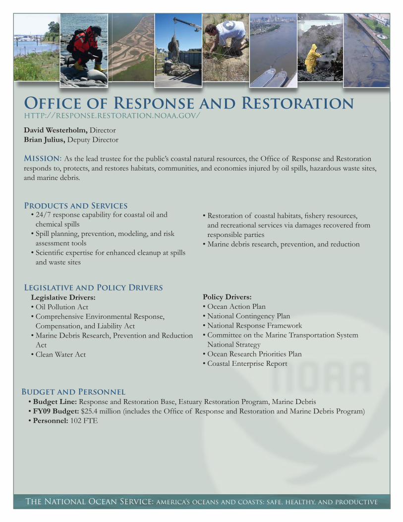
Office of Response and Restorationhttp://response.restoration.noaa.gov/
David Westerholm, DirectorBrian Julius, Deputy Director
Mission: As the lead trustee for the public’s coastal natural resources, the Offi ce of Response and Restoration responds to, protects, and restores habitats, communities, and economies injured by oil spills, hazardous waste sites, and marine debris.
Products and Services
• Restoration of coastal habitats, fi shery resources, and recreational services via damages recovered from responsible parties
• Marine debris research, prevention, and reduction
Legislative and Policy Drivers
Legislative Drivers: • Oil Pollution Act • Comprehensive Environmental Response,
Compensation, and Liability Act• Marine Debris Research, Prevention and Reduction
Act • Clean Water Act
Policy Drivers: • Ocean Action Plan• National Contingency Plan• National Response Framework• Committee on the Marine Transportation System
National Strategy • Ocean Research Priorities Plan • Coastal Enterprise Report
Budget and Personnel
• Budget Line: Response and Restoration Base, Estuary Restoration Program, Marine Debris• FY09 Budget: $25.4 million (includes the Offi ce of Response and Restoration and Marine Debris Program)• Personnel: 102 FTE
• 24/7 response capability for coastal oil and chemical spills
• Spill planning, prevention, modeling, and risk assessment tools
• Scientifi c expertise for enhanced cleanup at spills and waste sites

response.restoration.noaa.gov
Key Partners
• U.S. Coast Guard, Environmental Protection Agency, Department of the Interior• State trustee agencies • Industry and non-governmental organizations (e.g., Restore America’s Estuaries)• NOAA Restoration Center and General Council for Natural Resources
Fiscal Year 2008 Highlights
• Responded to more than 179 hazardous spill incidents, including two large oil spills: the M/V Cosco Busan in San Francisco Bay, California, and an estimated 419,000 gallon fuel oil spill from a barge on the Mississippi River near New Orleans, Louisiana. Also responded to hundreds of reported spills in the Gulf that occurred as a result of Hurricanes Ike and Gustav.
• Recovered approximately $21.3 million from responsible parties for assessment and restoration of habitats, resources, and services through the Damage Assessment Remediation Restoration Program (DARRP), which includes OR&R, the NOAA Restoration Center, and NOAA General Counsel for Natural Resources. DARRP also achieved settlements of $12.9 million with potentially responsible parties for assessment and restoration of contamination in Commencement Bay, WA. This includes a wetland restoration project on Hylebos Creek, which will enhance and restore salmon spawning and rearing habitat, restore riparian vegetation, and provide habitat for birds. With these most recent settlements, DARRP has settled natural resource damage liability with over 50 parties and implemented restoration projects totaling over 200 acres.
• Investigating environmental contaminants in and around the National Reserve Fleet in Suisun Bay, California. More than 70 vessels make up the fl eet, which is maintained by the United States Maritime Administration for national defense or emergency purposes. By Congressional request, NOAA is working with all involved stakeholders to evaluate potential environmental concerns, including heavy metals and antifouling agents in paint that is peeling off of the vessels.
• Supporting the Republic of Korea in their assessment and restoration planning activities after the 3.3 million gallon Hebei Spirit oil spill in December 2007. As part of ongoing NOAA assistance to South Korea, OR&R and the NOAA Restoration Center are advising on approaches to assess the spill-related impacts and appropriate types of restoration.
• Working to reduce the amount of derelict fi shing gear in fi shing communities and the marine environment. Developed the Fishing for Energy Project, a partnership project that provides a place for a fi shing community to dispose of, at no cost, old or derelict fi shing gear recovered while at sea. This debris is then recycled by Covanta Energy to provide electricity to New England communities. New Bedford, Massachusetts, was the fi rst port on the Eastern Seaboard to launch the program, with an additional six sites added and plans to expand to the entire East Coast.
• Completed the decade-long cleanup of the Pribilof Islands.
Organization
• The Emergency Response Division promotes effective spill response by increasing preparedness at the national and local levels, and providing scientifi c expertise during emergency response operations.
• The Assessment and Restoration Division protects and restores coastal natural resources injured by hazardous substances.
• The Marine Debris Program coordinates NOAA’s marine debris prevention, restoration, and research activities.
• The Business Services Group provides critical mission support, including cost documentation, Information Technology, and logistical support.

The National Ocean Service: america’s oceans and coasts: safe, healthy, and productive
National Centers for Coastal Ocean Sciencehttp://coastalscience.noaa.gov/
Gary Matlock, DirectorRussell Callender, Acting Deputy Director
Mission: To provide coastal managers with the scientifi c information and tools needed to balance society’s environmental, social, and economic goals.
Products and Services
• Integrated assessments• Ecological forecasting• Marine forensics• Scientifi c information from applied research
• Technology development• Ecosystem conditions and dynamics assessments• Identifi cation of the causes and consequences of
ecosystem stress
Legislative and Policy Drivers
Legislative Drivers: • Coastal Zone Management Act • National Marine Sanctuaries Act • Harmful Algal Bloom and Hypoxia Research and
Control Act • Oceans and Human Health Act • Coral Reef Conservation Act • Clean Water Act• Coastal Ocean Program• Estuary (Estuarine) Protection Act• Invasive Species Executive Order• National Coastal Monitoring Act• Magnuson-Stevens Fishery Conservation and
Management Act• Marine Mammal Protection Act• Endangered Species Act• National Contaminated Sediment Assessment and
Management Act• National Environmental Policy Act
Policy Drivers: • Ocean Action Plan• Ocean Research Priorities Plan • Gulf of Mexico Regional Alliance • West Coast Governors’ Agreement on Ocean Health • Coastal Enterprise Report
Budget and Personnel
• Budget Line: National Centers for Coastal Ocean Science Extramural Research, NCCOS Competitve Research• FY09 Budget: $53.2 million• Personnel: 177 FTE, 143 Contractors
coastalscience.noaa.gov
Key Partners:
• NOAA Line Offi ces and NOS Program Offi ces• Coastal managers and coastal state environmental agencies • Federal agencies, including the Food and Drug Administration, National Institute of Standards and Technology,
Environmental Protection Agency, U.S. Army Corps of Engineers, U.S. Geological Survey, U.S. Department of Agriculture, National Science Foundation, NASA, U.S. Coast Guard, U.S. Fish and Wildlife Service, U.S. Navy, Department of the Interior, National Institutes of Health, Department of Homeland Security, Department of Education, Department of Justice, Department of Energy, Department of Transportation
• Universities and research grantees
Fiscal Year 2008 Highlights
• Funding research that predicted that the 2008 hypoxic zone, or “dead zone,” in the northern Gulf of Mexico would be the largest on record. Later research found that the actual size of this low-oxygen zone was slightly smaller than predicted, but was still the second-largest dead zone on record. The Gulf of Mexico dead zone threatens critical commercial and recreational fi sheries. Predictions of the dead zone’s size help determine the relationships between hypoxia and nutrient pollution and provide the scientifi c foundation for management.
• Releasing a 20-year study that shows that environmental laws have had a positive effect on reducing overall contaminant levels in U.S. coastal waters. The report, which presents fi ndings in a quick reference format, nevertheless points to continuing concerns with elevated levels of metals and organic contaminants found near urban and industrial areas of the coasts.
• Funding the fi rst-ever prediction of a larger-than-normal harmful algal bloom in the Gulf of Maine in the summer of 2008. The prediction allowed shellfi sh farmers and fi shermen to shift the timing of their harvests and state resource and public health managers to make better decisions regarding closures of shellfi sh beds. These efforts helped reduce economic losses and prevented people from eating contaminated shellfi sh.
• Releasing The State of Coral Reef Ecosystems of the United States and Pacifi c Freely Associated States: 2008, a report assessing the condition of coral reef ecosystems in 15 locations ranging from the U.S. Caribbean and Gulf of Mexico to the western Pacifi c. Research in the report shows that nearly half of the Nation’s coral reefs are now considered to be in “poor” or “fair” condition. The report also describes the impacts of 13 major threats in each location and offers recommendations for conservation actions.
Organization
• The Center for Sponsored Coastal Ocean Research (Silver Spring, MD) uses a multi-disciplinary approach to understand and predict the impacts of natural and human infl uences on coastal regional ecosystems, communities, and economies through collaboration with external grantees and other partners.
• The Center for Coastal Monitoring and Assessment (Silver Spring, MD) assesses and forecasts coastal and marine ecosystem conditions through research and monitoring; conducts fi eld observations on regional and national scales; and provides scientifi c information and technical advice to resource managers and researchers.
• The Center for Coastal Fisheries and Habitat Research (Beaufort, NC, and Kasitsna Bay, AK) conducts research on estuarine processes, biological productivity of nearshore and ocean ecosystems, dynamics of coastal and reef fi shery resources, and the effects of human infl uences on resource productivity.
• The Center for Coastal Environmental Health and Biomolecular Research (Charleston, SC, and Oxford, MD) conducts interdisciplinary research on issues related to coastal ecosystem health, environmental quality, and related public health impacts.
• The Center for Human Health Risk (Charleston, SC) conducts collaborative research at the Hollings Marine Laboratory, a NOAA-operated multi-institutional facility, to provide science and biotechnology applications to sustain, protect, and restore coastal ecosystems, emphasizing linkages between environmental and human health.

The National Ocean Service: america’s oceans and coasts: safe, healthy, and productive
Office of Ocean & Coastal Resource Managementhttp://coastalmanagement.noaa.gov/
David Kennedy, DirectorDonna Wieting, Deputy Director
Mission: To lead the nation’s efforts to manage and conserve ocean and coastal resources.
Products and Services
• Coastal management• Research, education, and stewardship in
estuarine reserves• Coral reef conservation
• Coastal land acquisition• Marine protected area planning and management• Partnerships and place-based initiatives
Legislative and Policy Drivers
Legislative Drivers: • Coastal Zone Management Act • National Marine Sanctuaries Act • Coral Reef Conservation Act
Policy Drivers: • Ocean Action Plan• Committee on the Marine Transportation System
National Strategy • Ocean Research Priorities Plan • Gulf of Mexico Regional Alliance • West Coast Governors’ Agreement on Ocean Health • Coastal Enterprise Report• National Coral Reef Action Plan and Strategy• Executive Order 13089: Coral Reef Protection• Executive Order 13158: Marine Protected Areas
Budget and Personnel
• Budget Line: ORF: Coastal Management (Coastal Zone Management [CZM] Grants, CZM Program Administration Non-point Implementation Grants, National Estuarine Research Reserve System [NERRS], Marine Protected Areas) and Ocean Assessment Program (Coral Reef); PAC (Coastal and Estuarine Land Conservation Program, NERRS, Great Bay Partnership)
• FY09 Budget: $131.1 million in ORF and $25.0 million in PAC• Personnel: 62 FTE
coastalmanagement.noaa.gov
Key Partners
• 34 Coastal state and Territory Coastal Zone Management programs, 27 National Estuarine Research Reserve System (NERRS) sites, universities (NERRS partners)
• Cooperative Institute for Coastal and Estuarine Environmental Technology • U.S. Coral Reef Task Force (members: 11 other Federal Agencies, seven States/territories, three Freely
Associated States)• Environmental Protection Agency, Department of the Interior, Federal Emergency Management Agency,
Marine Protected Areas Federal Advisory Committee• National Fish and Wildlife Foundation and other conservation non-governmental organizations
Fiscal Year 2008 Highlights
• Awarding, in fi scal year 2008, $68.3 million to state and territory coastal zone management programs to implement their state coastal zone management and coastal non-point source pollution programs. Through the Coastal Zone Management Program, the Offi ce of Ocean and Coastal Resource Management assists state programs with comprehensive planning and community development and other activities to protect and restore habitats, mitigate hazards, protect water quality, and enhance public access to coastal areas. Awarding $22.2 million to 27 coastal states to implement programs, construct facilities, and acquire land at 27 National Estuarine Research Reserves and one proposed reserve.
• Led the development of the NOAA Coastal Strategy, including coordinating the major NOAA coastal program offi ces to devise a strategy to focus coastal program offi ce investments, capabilities, and deliverables around three priority objectives: coastal hazards and climate change; competing coastal uses and habitat loss; and coastal pollution and human health effects.
• Protecting more than 8,000 acres of critical coastal habitat – including 35 properties – through the Coastal and Estuarine Land Conservation Program (CELCP) in fi scal year 2008. Five new CELCP projects were selected for funding during the year; projects were chosen based on their contributions to ecological conservation, recreational opportunities, aesthetic and historical signifi cance, and technical and scientifi c merits.
• Leading activities for the International Year of the Reef, which launched in January 2008 to raise awareness of the importance of coral reef ecosystems and the threats they face, activities that are under way to protect them, and additional actions still needed.
Organization
• The Coastal Programs Division oversees the National Coastal Zone Management Program, which is composed of 34 state and territory coastal management programs.
• The Coral Reef Conservation Program supports effective management and sound science to preserve, sustain and restore valuable coral reef ecosystems.
• The Estuarine Reserves Division oversees the National Estuarine Research Reserve System, a partnership program between NOAA and the coastal states and the Cooperative Institute for Coastal and Estuarine Environmental Technology, a partnership between NOAA and the University of New Hampshire.
• The Marine Protected Areas Center facilitates the effective use of science, technology, training, and information in the planning, management, and evaluation of the nation’s system of marine protected areas.
• The National Policy and Evaluation Division leads national coastal management policy and planning efforts and is responsible for conducting periodic performance evaluations of the national estuarine research reserves and state coastal management programs as required by the Coastal Zone Management Act.
• The Business Management Division provides administrative, human resource, budget, fi nancial management, and information technology support.
The National Ocean Service: america’s oceans and coasts: safe, healthy, and productive
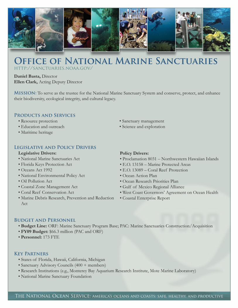
Office of National Marine Sanctuarieshttp://sanctuaries.noaa.gov/
Daniel Basta, DirectorEllen Clark, Acting Deputy Director
Mission: To serve as the trustee for the National Marine Sanctuary System and conserve, protect, and enhance their biodiversity, ecological integrity, and cultural legacy.
Products and Services
• Resource protection• Education and outreach• Maritime heritage
• Sanctuary management• Science and exploration
Legislative and Policy Drivers
Legislative Drivers: • National Marine Sanctuaries Act • Florida Keys Protection Act• Oceans Act 1992• National Environmental Policy Act• Oil Pollution Act • Coastal Zone Management Act • Coral Reef Conservation Act • Marine Debris Research, Prevention and Reduction
Act
Policy Drivers:• Proclamation 8031 – Northwestern Hawaiian Islands• E.O. 13158 – Marine Protected Areas• E.O. 13089 – Coral Reef Protection• Ocean Action Plan• Ocean Research Priorities Plan • Gulf of Mexico Regional Alliance • West Coast Governors’ Agreement on Ocean Health • Coastal Enterprise Report
Budget and Personnel
• Budget Line: ORF: Marine Sanctuary Program Base; PAC: Marine Sanctuaries Construction/Acquisition• FY09 Budget: $66.3 million (PAC and ORF)• Personnel: 173 FTE
Key Partners
• States of Florida, Hawaii, California, Michigan• Sanctuary Advisory Councils (400 + members)• Research Institutions (e.g., Monterey Bay Aquarium Research Institute, Mote Marine Laboratory)• National Marine Sanctuary Foundation

sanctuaries.noaa.gov
Fiscal Year 2008 Highlights
• Releasing draft management plans for the Papahānaumokuākea Marine National Monument in Hawaii and Stellwagen Bank National Marine Sanctuary off the coast of Massachusetts. The plans lay the foundation for protecting these marine areas and recommend actions to better manage each area and its resources.
• Advancing efforts to protect blue whales in the Santa Barbara Channel, California, following the deaths of fi ve blue whales within the Channel Islands National Marine Sanctuary during 2007. NOS forwarded a draft emergency response plan to members of a special Subcommittee of the Sanctuary Advisory Council. The plan calls for increased surveillance of whales and ships in the Channel, improved coordinated response to possible strandings, and the initiation of precautionary management actions should high-risk conditions appear.
• Commemorating the designation of the Papahānaumokuākea Marine National Monument as a Particularly Sensitive Sea Area (PSSA) by the International Maritime Organization, a specialized agency of the United Nations. The monument, which provides habitat for more than 7,000 marine species and contains 4,500 square miles of pristine coral reefs in the Northwestern Hawaiian Islands, is the twelfth PSSA in the world. The PSSA designation deems an area deserving of special protection because of its ecological, socioeconomic, or scientifi c signifi cance and its potential vulnerability to damage from international maritime activities.
• Leading a scientifi c research expedition to the site of the remains of three sunken German submarines off the coast of North Carolina. As part of an effort to properly document and protect the wrecks, NOS conducted a non-invasive archaeological survey that included photo documentation of the vessels’ visible sections and the biological communities found at the sites.
Organization
• The Technical Programs Support Division supports science and maritime heritage teams, socioeconomic work, geographic information systems work, and research coordination.
• The Conservation Policy and Planning Division supports system-wide regulations, legislation, management plans, permitting, consultation, and sanctuary advisory counsels.
• Communications, Outreach, Education supports system education, outreach, media, constituent, and legislative communications programs as well as visitor centers and video programming.
• The Northeast and Great Lakes Region provides coordination of the Thunder Bay, Stellwagen Bank, and Monitor sanctuaries.
• The Southeast, Gulf of Mexico, and Caribbean Region provides coordination of Florida Keys, Gray’s Reef, and the Flower Garden Banks national marine sanctuaries.
• The West Coast Region provides coordination of. the Channel Islands, Cordell Bank, Gulf of the Farallones, Monterey Bay, and Olympic Coast national marine sanctuaries.
• The Pacifi c Islands Region provides coordination of Hawaiian Islands Humpback Whale and Fagatele Bay national marine sanctuaries and the Papahānaumokuākea Marine National Monument.

The National Ocean Service: america’s oceans and coasts: safe, healthy, and productive
International Program Officehttp://nosinternational.noaa.gov/
Clement Lewsey, Director
Mission: To build and sustain capacities for global coastal and marine stewardship through effective international partnerships.
Products and Services
• Capacity building in coastal stewardship• Deemed exports administration• International outreach
• International partnerships and bilateral agreements• Policy vetting and operational support across NOS • Support to U.S. State Department priorities
Legislative and Policy Drivers
Legislative Drivers: • Coast and Geodetic Survey Act • Coastal Zone Management Act • National Marine Sanctuaries Act • Oil Pollution Act • Harmful Algal Bloom and Hypoxia Research and
Control Act • Oceans and Human Health Act • Coral Reef Conservation Act • Marine Debris Research, Prevention and Reduction
Act
Policy Drivers: • International Agreements• NOS International Strategic Plan• Ocean Action Plan• Committee on the Marine Transportation System
National Strategy • Ocean Research Priorities Plan • Gulf of Mexico Regional Alliance • West Coast Governors’ Agreement on Ocean Health • Coastal Enterprise Report
Budget and Personnel
FY09 Budget: $ 250,000 (excluding salary and benefi ts)Personnel: 11 FTE
Key Partners
• U.S. State Department and U.S. international aid community• United Nations: Intergovernmental Oceanographic Commission of UNESCO (IOC), United Nations
Environment Programme, United Nations Development Programme • Foreign and Intergovernmental organizations (eq. Wider-Caribbean, China, IUCN-The World Conservation
Union) • State and Local Governments, Universities, and nongovernmental organizations
nosinternational.noaa.gov
Fiscal Year 2008 Highlights
• Working with governments and the Intergovernmental Oceanographic Commission to develop integrated programs to build capacity for regional observations and environmental stewardship in the Caribbean Region.
• Assisting Trinidad and Tobago, Belize, and Grenada in the development of a National Program of Action (NPA) to improve watershed management and protect coastal resources. An NPA provides a framework for coastal management and is a national plan to prevent, reduce, control, and/or eliminate marine degradation from land-based activities. NOS helped identify major land-based pollution sources and refi ned specifi c actions to mitigate pollutant impacts in these countries.
• Administering the U.S.-China Integrated Coastal Management Program with the Chinese State Oceanic Administration. Recent program highlights have included:
o Providing technical assistance to provincial and regional working groups in developing a watershed management program and implementation plan for the greater Xiamen municipality.
o Providing technical support to the Chinese government under a United Nations Development Program/Global Environmental Facility Project on Biodiversity Management in the Coastal Area of China’s South Sea (2006-2012).
• Administering a Joint Project Agreement for Integrated Coastal and Ocean Resources Management with Ministries in Korea. The annual work plan includes a scope of work funded with approximately $400,000 per year by the Government of Korea. All NOAA line offi ces are involved in this Program.
• Developing an agency-wide International Strategic Plan. Annual Action Plans are developed that represent a full breadth of international engagements throughout the agency, with emphasis on supporting those involving more than one program offi ce.
• Coordinating International Coral Reef Conservation and Management Initiatives through the NOAA International Coral Grant Program and the Coral Reef Conservation Fund, a partnership between NOAA and the National Fish and Wildlife Foundation. During the International Year of the Reef, the two grants programs awarded nearly $1.1 million to 20 coral projects in 15 countries.
Organization
By geography and theme:• Caribbean and Latin America: Program priorities include support to the Intergovernmental Oceanographic
Commission Sub-commission for the Caribbean and Adjacent Regions and the United Nations Environmental Program and others in ways to improve regional environmental observation capacities and reduce land-based sources of pollution to the marine environment.
• Asia: Under several bilateral government-to-government agreements, NOAA works with China, Vietnam, and Korea to build capacity for integrated coastal management through technical assistance, training, and policy advice.
• Watershed Management: The NOS International Program Offi ce helps transfer knowledge, information, and tools to parties throughout the world in ways to adopt ecosystem-based management approaches to watershed management.
Agency-wide Organization and Coordination: In addition to the internal organization within IPO, the International Program Offi ce Director represents NOS in the NOAA-wide International Affairs Council and chairs the NOS-wide NOS International Coordination Council. These Councils ensure internal communication, advocacy, and coordination among NOS international programs and positions internally and across NOAA.

National Ocean Service
Program Office Key Web sites
Offi ce of Coast Survey (OCS)http://nauticalcharts.noaa.gov/Includes historic and current nautical charts (available for print-on-demand or as electronic navigational charts), products and services for geographic information systems, and a comprehensive listing of Notice to Mariner updates
NowCoast http://nauticalcharts.noaa.gov/csdl/op/nowcoast.htm Provides easy and centralized access to online, real-time physical meteorological, oceanographic, river, and air/water quality information
National Geodetic Survey (NGS)http://www.ngs.noaa.gov/ Provides information about NGS, which defi nes and manages the National Spatial Reference System—the framework of latitude, longitude, height, scale, gravity, orientation, and shoreline throughout the United States
National and Cooperative Continuously Operating Reference Stations (CORS) http://geodesy.noaa.gov/CORS/ Provides information on CORS, including a map of the newest sites, future sites, and information on how to become a CORS site
Center for Operational Oceanographic Products and Services (CO-OPS)http://tidesandcurrents.noaa.gov/ Offers one-stop shopping for real-time and historical observations of water levels, currents, meteorological, tide and tidal current predictions, and other coastal oceanographic data from sites along the U.S. coast
Physical Oceanographic Real-Time System (PORTS®) http://tidesandcurrents.noaa.gov/ports.html Provides information about the Physical Oceanographic Real-Time System, PORTS®, which measures, integrates, and disseminates observations of water levels, currents, salinity, wind, and bridge clearance
NOAA Coastal Services Center (CSC)http://csc.noaa.gov/Provides data and products for geographic information systems and social science, access to award-winning coastal publications, and outlines CSC initiatives and priorities such as Digital Coast, Coastal Resiliency, and regional and state initiatives
NOAA Integrated Ocean Observing System Program (IOOS®)http://ioos.noaa.gov/Highlights the vision, mission, and partnerships of the NOAA IOOS® Program and allows NOAA IOOS® and its partners to disseminate data, information, and publications on coastal waters, Great Lakes, and oceans
The National Ocean Service: america’s oceans and coasts: safe, healthy, and productive

oceanservice.noaa.gov
Offi ce of Response and Restoration (OR&R)http://response.restoration.noaa.gov/ Provides information about contaminants, tools, and information for emergency responders, restoration planning tools and restoration highlights, and community outreach materials
NOAA Marine Debris Program http://marinedebris.noaa.gov/ Serves as an outreach tool to coordinate, strengthen, and increase the visibility of marine debris issues and efforts within the agency, its partners, and the public
National Centers for Coastal Ocean Science (NCCOS)http://coastalscience.noaa.gov/ Provides scientifi c publications, coastal monitoring and assessment data, and overviews on current projects focused around fi ve coastal stressors (climate change, extreme events, invasive species, land and resource use, and pollution)
Offi ce of Ocean and Coastal Resource Management (OCRM)http://coastalmanagement.noaa.gov/ Includes information about the Coastal Zone Management Act, publications, and state-specifi c information for coastal resource managers, planners, educators, scientists, and others interested in balancing the conservation and use of our nation’s coastal, estuarine, and ocean resources
NOAA Coral Reef Conservation Program http://coralreef.noaa.gov/ Contains the latest news on NOAA’s coral reef conservation activities as well as information on coral reef funding opportunities throughout NOAA and resources for students and educators interested in learning about coral reefs
Marine Protected Areas (MPAs) http://mpa.gov/ Offi cial U.S. Web site on marine protected areas that provides information and resources to assist in national dialogue and decision making about MPAs
National Estuarine Research Reserve System (NERRS) http://nerrs.noaa.gov/ Describes NERRS, a network of 27 protected estuarine areas throughout the nation in which ecological research and environmental education are conducted
Offi ce of National Marine Sanctuaries (ONMS)http://sanctuaries.noaa.gov/ Provides information about the nation’s marine sanctuary system, including history, the authorizing legislation and regulations, and descriptions of the different sanctuaries and links to their Web sites
NOS International Program Offi ce (IPO)http://nosinternational.noaa.gov/ Describes IPO, which coordinates the international activities of NOS
Oceans and Human Health Initiative (OHHI)http://www.eol.ucar.edu/projects/ohhi/Provides an overview on NOAA’s OHHI, highlights the three NOAA Centers of Excellence, and access to workshop, training, and external grants information