Embed Size (px)
Citation preview
The XXXVI International Workshop on Seismicity and Earthquake Engineering
in the Extended Mediterranean Region
Special Sessions on the Preservation of Cultural Heritage Sites
UNESCO-RELEMR 2015
Workshop report
Ravenna [Italy]
An activity of the programme

SC/EES/EGR/2015/XXVI Paris, France. October 2015
Original: English United Nations Educational, Scientific and Cultural Organization – UNESCO U.S. Geological Survey – USGS University of Bologna Istituto Nazionale di Geofisica e Vulcanologia – INGV Centro Eventi Estremi e Disastri – EEDIS Italian Ministry of Cultural Heritage and Activities Scientific Committee: Alexandros Makarigakis, UNESCO Jair Torres, UNESCO Michael Foose, USGS, USA Frederick Simon, UNESCO-USGS, USA Gianluca Valensise, INGV, Italy Emanuela Guidoboni, EEDIS and University of Bologna, Italy Francesco Mulargia, University of Bologna, Italy Jean-Paul Poirier, EEDIS, France Organizing-Executive Committee Marie Schellens, UNESCO Jair Torres, UNESCO Michael Foose, USGS, USA Giovanni Gabbianelli, University of Bologna, Italy Beatrice M.S. Giambastiani, University of Bologna, Italy Nicolas Greggio, University of Bologna, Italy Cristina Massa, Flaminia Foundation, Italy Carla Rossi, Flaminia Foundation, Italy Cover photo credit Giada Giambastiani For further information, please contact: Disaster Risk Reduction and Resilience Section on Earth Sciences and Geo-Hazards Risk Reduction, Natural Science Sector UNESCO 7, place de Fontenoy, 1.035 F-75352 Paris 07 SP Tel.: +33 (0) 1 45 68 4178 E-mail: [email protected] The authors are responsible for the choice and presentation of facts contained in this publication and for the opinions expressed therein, which are not necessarily those of UNESCO and do not commit the Organization. The designations employed and the presentation of the material throughout this publication do not imply the expression of any opinion whatsoever on the part of UNESCO concerning the legal status of any country, territory, city or area or of its authorities, or concerning the delimitation of its frontiers or boundaries. © UNESCO 2015 Printed in Italy

PROCEEDINGS
The XXXVI International Workshop on Seismicity and Earthquake Engineering in the Extended Mediterranean Region an activity of the programme on Reduction of Earthquake Losses in the Extended Mediterranean Region (RELEMR) Ravenna, Italy October 26 - 29, 2015
Contents 1. Foreword ........................................................................................................................... 1
2. Agenda .............................................................................................................................. 3
3. Abstracts ........................................................................................................................... 9
4. List of Participants ......................................................................................................... 45
XXXVI UNESCO-RELEMR International Workshop Reducing Earthquake Losses in the Extended Mediterranean Region (RELEMR): Ravenna, Italy, 2015 1
1. Foreword
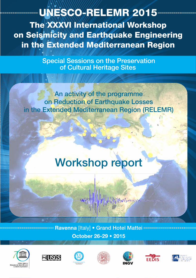
The XXXVI International Workshop on Seismicity and Earthquake Engineering in the Extended Mediterranean Region, an activity of the programme on Reduction of Earthquake Losses in the Extended Mediterranean Region (RELEMR), will be held in Ravenna, Italy, from 25 October to 30 October 2015. This meeting will have a specific focus on ways to protect cultural heritage sites.
The first day of the meeting (26 October) will focus on the assessment of seismic hazard of the extended Mediterranean area at different scales and with different methodologies, and will be open to discussion of case histories from individual countries.
During the second day (27 October) participants will discuss the state-of-the-art of knowledge on risk assessment of the many large urban centers of the extended Mediterranean area and of their cultural heritage. The recent catastrophic 25 April 2015, Nepal earthquake (Mw 7.8) will be used as a living example of how the risk mitigation strategies implemented in that country over the past two decades have contributed to the effective reduction of human and property losses.
The third day (28 October) will be dedicated to a field trip to Ferrara, about 70 km from Ravenna. Ferrara, the "City of Renaissance", was rebuilt after a devastating earthquake in 1570 and damaged by the May 2012 Emilia earthquakes. In 1995 UNESCO qualified it as World Heritage Site.
The fourth, and last, day (29 October) will be devoted to the assessment and mitigation of seismic risk of the abundant archaeological and architectural cultural heritage that exists throughout all countries represented by the RELEMR community.
Although focusing on cultural heritage preservation, the meeting will also continue the RELEMR tradition of having more general sessions that provide participating countries the opportunity to present contributions on other subjects that are part of RELEMR’s commitment to understanding regional seismology and mitigating earthquake risk.
This brochure contains a compilation of abstracts of presentations made available prior to the event. It is hoped that it will serve as a good basis for the proceedings of the workshop. We express our appreciation to the authors of these abstracts.
The content of this brochure does not necessarily reflect the views of the United Nations Educational, Scientific and Cultural Organization (UNESCO).
Paris, 20 October 2015
Alexandros Makarigakis, Ph.D Chief of Unit Disaster Risk Reduction and Resilience
Earth Sciences and Geo-hazards Risk Reduction Natural Science Sector UNESCO, Paris
XXXVI UNESCO-RELEMR International Workshop Reducing Earthquake Losses in the Extended Mediterranean Region (RELEMR): Ravenna, Italy, 2015 2
XXXVI UNESCO-RELEMR International Workshop Reducing Earthquake Losses in the Extended Mediterranean Region (RELEMR): Ravenna, Italy, 2015 3
2. Agenda
Monday, 26 October 2015 08:30 – 09:30 Registration Opening Ceremony 09:30 – 10:30
• Mr. Giannantonio Mingozzi, Deputy Mayor of Ravenna • Mr. Lanfranco Gualtieri, President of Flaminia Foundation • Prof. Enrico Dinelli, University of Bologna • Dr. Michael Foose, USGS • Dr. Alexandros Makarigakis, UNESCO
Introduction of Participants Logistical announcements 10:30 – 11:00 Coffee/tea break First Session: Assessing seismic hazard in the extended Mediterranean area - I 11:00 – 13:00 Keynote Presentations Chair: Amina Abdessemed Foufa 11:00 – 11:40 Francesco Mulargia
Earthquake physics and seismic risk reduction 11:40 – 12:20 Gianluca Valensise
Seismic hazard assessment in Europe and in the circum-Mediterranean region: state-of-the-art
12:20 – 13:00 Karin Sesetyan
The Earthquake Model of the Middle East region (EMME): PSHA results and expected developments
13:00 – 14:30 Lunch Second Session: Assessing seismic hazard in the extended Mediterranean area - II 14:30 – 15:40 Keynote Presentations Chair: Ufuk Hancilar 14:30 – 15:10 Stefano Grimaz
The methodology used in the occasion of the 2015 Nepal earthquake for the quick safety assessment of strategic buildings and for securing cultural heritage structures
15:10 – 15:40 Mourad Bezzeghoud
Seismicity and Seismic Hazard along the Western part of the Eurasia–Nubia plate boundary
XXXVI UNESCO-RELEMR International Workshop Reducing Earthquake Losses in the Extended Mediterranean Region (RELEMR): Ravenna, Italy, 2015 4
15:40 – 18:30 Contributed papers Chair: Pauline Galea 15:40 – 16:00 Abdullah M. Al-Amri and Arthur J. Rodgers
Structure of the lithosphere and upper mantle across the Arabian Peninsula 16:00 – 16:20 Galina Ataeva, Avi Shapira and Rami Hofstetter
Determination of source parameters for local and regional earthquakes in Israel
16:20 – 16:50 Coffee/tea break
16:50 – 17:10 Rami Hofstetter, P., Malin, P., Shalev, E., Ben-Avraham, Z., Sagy, A., Shalev, E., Bariudin, V. 1,256 meters inside the earth - observations of seismic activity in the Dead Sea basin using borehole seismometer
17:10 – 17:30 Nacer Jabour
Historical aspects of the tsunamis along the Moroccan Mediterranean and Atlantic coasts
17:30 – 17:50 Galina Ataeva, Yefim Gitterman and Avi Shapira
The ratio between corner frequencies of source spectra of P and S waves – a new discriminant between earthquakes and quarry blasts
17:50 – 18:10 Robert Mellors Crustal velocity structure of Oman from ambient noise correlation
18:30 Free Night
XXXVI UNESCO-RELEMR International Workshop Reducing Earthquake Losses in the Extended Mediterranean Region (RELEMR): Ravenna, Italy, 2015 5
Tuesday, 27 October 2015 Third Session: Seismic risk assessment in the extended Mediterranean area - I 09:00 – 10:40 Contributed Papers Chair: Gianluca Valensise 09:00 – 09:20 Stefano Grimaz, Petra Malisan, and Jair Torres
VISUS - Visual Inspection for defining the Safety Upgrading Strategies 09:20 – 09:40 Edward Leibovich
Assessment and seismic retrofit of existing residential buildings
09:40 – 10:00 Mohamed El Idrissi Ensuring business continuity for UAE Buildings using SHM and PBEE-Based response planning
10:00 – 10:20 Jalal Al-Dabbeek Support action for strengthening Palestine capabilities for seismic risk mitigation (SASPARM 2.0)
10:20 – 10:40 Mine Demircioglu
Earthquake risk assessment for Istanbul metropolitan area 10:40 –11:10 Coffee/tea break 11:10 – 13:00 Keynote Presentations Chair: Maria Jose Jimenez 11:10 – 12:00 Jean-Paul Poirier and Emanuela Guidoboni
The contribution of historical seismology to the evaluation of seismic risk
12:00 – 12:30 Amos Salamon Tsunamis in the Eastern Mediterranean – From historical data to modern hazard maps and warning policies
12:30 – 13:00 Djillali Benouar
Indigenous knowledge for earthquake risk prevention measures in the Casbah of Algiers (Algeria)
13:00 – 14:30 Lunch Fourth Session: Seismic risk assessment in the extended Mediterranean area - II 14:30 – 18:30 Contributed Papers Chair: Claudio Modena 14:30 – 14:50 Pauline Galea
Towards a holistic seismic risk assessment of the Maltese archipelago 14:50 – 15:10 Mohamend El Idrissi
Abu Dhabi Seismic Hazard and Risk Analysis Project 15:10 – 15:30 Mahmoud Al-Qaryouti and Ali Sawareih
State of art of knowledge on seismic risk assessment in Jordan
XXXVI UNESCO-RELEMR International Workshop Reducing Earthquake Losses in the Extended Mediterranean Region (RELEMR): Ravenna, Italy, 2015 6
15:30 – 16:00 Coffee/tea break
16:00 – 16:20 Samir Ben Abdallah Seismic risk reduction: Tunisia Case: Seismic Map 2013
16:20 – 16:40 Rengin Gök
Ground Motion Simulation in the Middle East/Gulf region
16:40 – 17:00 Antonio Pazos The WM Network, an example of regional collaboration, and the ALERTES-SC3 EEWS prototype
17:00 – 17:20 Nurcan Meral Ozel The International Monitoring System - The Globally Spanning Observation System of the CTBT Verification Regime
17:20 – 18:00 Emanuela Guidoboni, Marco Stefani and Gianluca Valensise
Presentation of the field trip to Ferrara and distribution of relevant material Welcome address by a representative of the Italian Ministry of Foreign Affairs 18:00 – 18:30 Ettore Janulardo
Le patrimoine culturel et les missions archéologiques soutenues par le MAECI (Ministero degli Affari Esteri e della Cooperazione Internazionale)
20:00 – 23:00 Workshop dinner hosted by Flaminia Foundation
XXXVI UNESCO-RELEMR International Workshop Reducing Earthquake Losses in the Extended Mediterranean Region (RELEMR): Ravenna, Italy, 2015 7
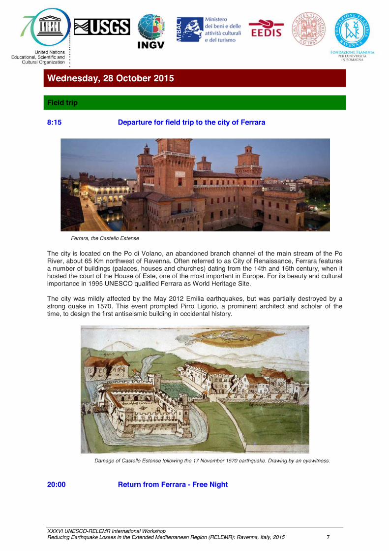
Wednesday, 28 October 2015 Field trip 8:15 Departure for field trip to the city of Ferrara
Ferrara, the Castello Estense
The city is located on the Po di Volano, an abandoned branch channel of the main stream of the Po River, about 65 Km northwest of Ravenna. Often referred to as City of Renaissance, Ferrara features a number of buildings (palaces, houses and churches) dating from the 14th and 16th century, when it hosted the court of the House of Este, one of the most important in Europe. For its beauty and cultural importance in 1995 UNESCO qualified Ferrara as World Heritage Site.
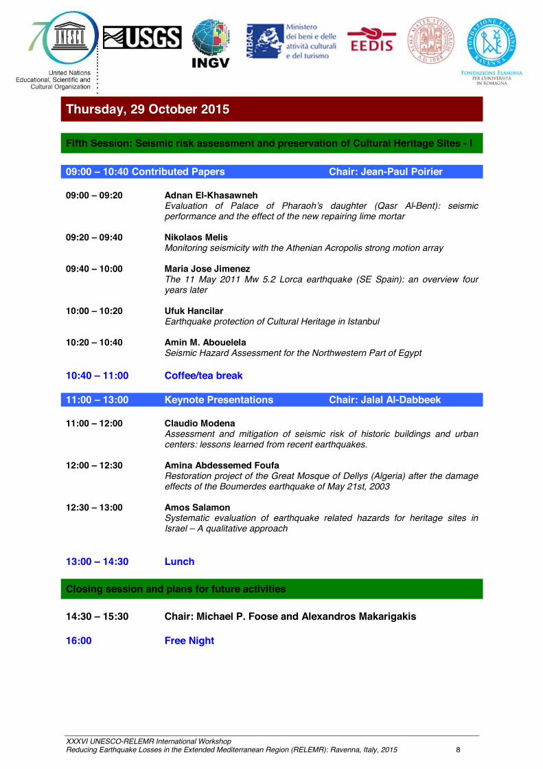
The city was mildly affected by the May 2012 Emilia earthquakes, but was partially destroyed by a strong quake in 1570. This event prompted Pirro Ligorio, a prominent architect and scholar of the time, to design the first antiseismic building in occidental history.
Damage of Castello Estense following the 17 November 1570 earthquake. Drawing by an eyewitness.
20:00 Return from Ferrara - Free Night
XXXVI UNESCO-RELEMR International Workshop Reducing Earthquake Losses in the Extended Mediterranean Region (RELEMR): Ravenna, Italy, 2015 8
Thursday, 29 October 2015 Fifth Session: Seismic risk assessment and preservation of Cultural Heritage Sites - I 09:00 – 10:40 Contributed Papers Chair: Jean-Paul Poirier 09:00 – 09:20 Adnan El-Khasawneh
Evaluation of Palace of Pharaoh’s daughter (Qasr Al-Bent): seismic performance and the effect of the new repairing lime mortar
09:20 – 09:40 Nikolaos Melis
Monitoring seismicity with the Athenian Acropolis strong motion array 09:40 – 10:00 Maria Jose Jimenez
The 11 May 2011 Mw 5.2 Lorca earthquake (SE Spain): an overview four years later
10:00 – 10:20 Ufuk Hancilar
Earthquake protection of Cultural Heritage in Istanbul
10:20 – 10:40 Amin M. Abouelela Seismic Hazard Assessment for the Northwestern Part of Egypt
10:40 – 11:00 Coffee/tea break 11:00 – 13:00 Keynote Presentations Chair: Jalal Al-Dabbeek 11:00 – 12:00 Claudio Modena
Assessment and mitigation of seismic risk of historic buildings and urban centers: lessons learned from recent earthquakes.
12:00 – 12:30 Amina Abdessemed Foufa
Restoration project of the Great Mosque of Dellys (Algeria) after the damage effects of the Boumerdes earthquake of May 21st, 2003
12:30 – 13:00 Amos Salamon Systematic evaluation of earthquake related hazards for heritage sites in Israel – A qualitative approach
13:00 – 14:30 Lunch Closing session and plans for future activities 14:30 – 15:30 Chair: Michael P. Foose and Alexandros Makarigakis 16:00 Free Night
XXXVI UNESCO-RELEMR International Workshop Reducing Earthquake Losses in the Extended Mediterranean Region (RELEMR): Ravenna, Italy, 2015 9
3. Abstracts
Earthquake physics and seismic risk reduction.
Francesco Mulargia
Dept. of Phisics and Astronomy, Geophysics Section, University of Bologna, Italy
While it is unquestionable that the deterministic prediction of individual large earthquakes is well beyond our reach for now and for the foreseeable future, it would be incorrect to state that earthquakes are totally unpredictable phenomena, equally likely to strike anywhere and at any time. In fact, it is well known that earthquakes tend to be more localized in space, primarily on plate boundaries, and more clustered in time and space than would be expected for a completely random process. In any case, this knowledge is still largely unexploited: recent earthquakes have caused substantial human casualties and economic losses in many countries, including those - like Japan - commonly believed to be the most advanced in the defense from seismic destruction. However, it is extremely rare for earthquakes to be the direct cause of casualties, which are due to the failure of buildings or other structures. Therefore, the main arena for practical steps to reduce seismic risk appears to be that of earthquake engineering.
XXXVI UNESCO-RELEMR International Workshop Reducing Earthquake Losses in the Extended Mediterranean Region (RELEMR): Ravenna, Italy, 2015 10
Seismic hazard assessment in Europe and in the circum-Mediterranean
region: state-of-the-art
Gianluca Valensise
Istituto Nazionale di Geofisica e Vulcanologia, Rome, Italy
Two large projects for a community-based probabilistic seismic hazard assessment at continental scale have been completed between 2013-2014: the EMME project, which concerned the wider Middle East region extending from the Eastern Mediterranean to the Himalayas and from the Gulf of Oman to the Greater Caucasus, and the SHARE project, which concerned Europe, part of Turkey, the Mediterranean, the Atlantic Ocean east of the mid-oceanic ridge, and the North Sea. Together these two large project encompass a very large, very seismic portion of the globe that is characterized by a great concentration of historical cities and by most of the world's cultural heritage.
I will report specifically on the 2013 European Seismic Hazard Model (ESHM13), whose results were supplied by the project "Seismic Hazard Harmonization in Europe" (SHARE, 2009-2013), a large effort funded by the European Union. The ESHM13 is a consistent seismic hazard model expressly designed to overcome the limitation of national borders and to include a thorough quantification of the uncertainties. It is also the first completed regional effort contributing to the "Global Earthquake Model" (GEM) initiative.
SHARE was conceived to serve as a reference model for various applications, from earthquake preparedness to earthquake risk mitigation strategies, including the update of the European seismic regulations for building design (Eurocode 8), and thus it is useful for future safety assessment and improvement of private and public buildings. Although its results constitute a reference for Europe, they do not replace the existing national design regulations that are in place for seismic design and construction of buildings.
I will discuss the improvements brought forward by the ESHM13 compared to previous efforts in terms of its input data and of the adoption of standard procedures and robust methods, especially for expert elicitation and consensus building among hundreds of European experts. All data, methods and results are publicly available through the European Facility for Earthquake Hazard and Risk (www.efehr.org).
XXXVI UNESCO-RELEMR International Workshop Reducing Earthquake Losses in the Extended Mediterranean Region (RELEMR): Ravenna, Italy, 2015 11
The Earthquake Model of the Middle East region (EMME):
PSHA results and expected developments
K. Sesetyan(1), L. Danciu(2), M.B. Demircioglu(1), M. Erdik(1), D. Giardini(2) and the EMME Consortium
(1) Bogazici University, Kandilli Observatory and Earthquake Research Institute, Department of Earthquake Enginnering, Istanbul, Turkey
(2)Department of Earth Science, ETH Zurich, Zurich, Switzerland
The wider Middle East region extending from the Eastern Mediterranean to the Himalayas in the East – West direction and from the Gulf of Oman to the Greater Caucasus in the North – South direction has been continuously devastated by large earthquakes throughout the history. The Earthquake Model of the Middle East Region (EMME) project was a cooperative initiative, coordinated by ETH-Zurich and Boğaziçi University, Kandilli Observatory and Earthquake Research Institute, with the participation of several regional institutes, One of the major goals of the project was to homogeneously compute the seismic hazard in the region incorporating both local and international data and expertise and to build the path towards and to provide one of the basic inputs for the assessment and mitigation of the earthquake risk in the region.
In addition to the coordinating institutes, the institutions that have contributed to the EMME hazard model were IIEES from Iran, Middle East Technical and Sakarya Universities from Turkey, American University of Beirut from Lebanon, Yarmouk University from Jordan, University of Peshawar from Pakistan, Tbilisi State University from Georgia, National Academy of Sciences from Armenia and National Academy of Sciences from Pakistan. EMME was designed to address the potential risk posed by earthquakes to the region of Middle East. We are currently in the stage of publishing the probabilistic hazard assessment results of this ambitious project, which also forms the basis of the subsequent risk assessment activities.
The probabilistic seismic hazard model involved two fully independent source models, which were the area source model and the fault source combined with smoothed seismicity in the background. The epistemic uncertainties in the ground motion estimation are addressed with the help of the ground motion prediction logic tree, the applicable ground motion models as well as the weights assigned to each branch of the GMPE logic tree branch were the outputs of the specific work package of the project. The tectonic regionalization assigned to the source models (active shallow, stable continental, subduction interface and in-slab) was the link to the associated GMPE logic tree structures. OpenQuake (Pagani et al 2014), which is the software adopted for seismic hazard computation allows for a full description of the logic tree structure comprising both the GMPE and source modeling levels of branching. Hazard computations are done for a grid of sites with 10 km spacing covering the territories of the partner countries, namely Turkey, Cyprus, Jordan, Lebanon, Iran, Georgia, Armenia, Azerbaijan and Pakistan. For the sake of regional completeness, the hazard computation also covers the territories of Afghanistan, Syria and Iraq either fully or partially. Consistency in modeling with similar regional projects (SHARE in the west and EMCA in the northeast) is carefully considered. The complete set of outputs includes mean and quantile hazard curves for the PGA and 5% damped SAs at various periods for the grid of sites as well as mean hazard maps for several return periods and uniform hazard spectra for the computation sites corresponding to these return periods and deaggregation results for selected locations.

XXXVI UNESCO-RELEMR International Workshop Reducing Earthquake Losses in the Extended Mediterranean Region (RELEMR): Ravenna, Italy, 2015 12
The methodology used in occasion of the 2015 Nepal earthquake for the quick
safety assessment of strategic buildings and for securing cultural heritage structures
Stefano Grimaz
SPRINT-Lab University of Udine, Italy
Immediately after the earthquake on 25th April 2015 in Nepal, a mission of the Italian civil protection was organized for supporting the government of Nepal in the seismic emergency response. A team of experts of the Short Term Countermeasure System (STCS) of the Italian National Fire Service made a rapid assessment of structural damage of strategic buildings and cultural heritage structures. The field surveys were carried out by adopting a new methodology based on a technical triage, developed by the SPRINT-Lab of University of Udine. During the mission, a Scientific Unit was established at the University of Udine in order to create a back-office for supporting the team and for the remote processing of the field survey data. On the field, all the operations were managed in strictly contact with UN and UNESCO local Authorities. Globally from the 1st of May to the 11th of May, 90 strategic building were assessed in the Kathmandu area. The Scientific Unit prepared the reports and the maps of the daily triage outcomes, in order to facilitate the local Authorities in decision making. In coordination with the UNESCO’s local Authorities, the monuments of the Patan Duran place in Kathmandu were assessed and specific proposals of short term countermeasures for securing the structures were developed. This experience demonstrated the effectiveness of the adopted methodology. In particular, the link between the deployed team and the back-office Scientific Unit allowed to make easier and effective not only the quick assessment and the design the short term countermeasure but also the interaction with the local Authority.

XXXVI UNESCO-RELEMR International Workshop Reducing Earthquake Losses in the Extended Mediterranean Region (RELEMR): Ravenna, Italy, 2015 13
Seismicity and Seismic Hazard of North Africa
Mourad Bezzeghoud
Dept. of Physics, School of Sciences and Technology and Institute of Earth Sciences University of Évora, Portugal
The seismic phenomenon is the most damaging natural hazard known in the Mediterranean area. The western part of the Eurasia–Nubia plate boundary extends from the Azores to the Mediterranean region. The oceanic part of the plate boundary is very well delimited from the Azores Islands, along the Azores-Gibraltar fault to approximately 12°W (west of the Strait of Gibraltar). From 12°W to 3.5°E, including the Iberia–Nubia region and extending to the western part of Algeria, the boundary is more diffuse and forms a wider area of deformation. The boundary between the Iberia and Nubia plates is the most complex part of the margin. This region corresponds to the transition from an oceanic boundary to a continental boundary, where Iberia and Nubia collide. Although most earthquakes along this plate boundary are shallow and generally have magnitudes of less than 5.5, there have been several high-magnitude events. Many devastating earthquakes, some of them tsunami-triggering, inflicted heavy loss of life and considerable economic damage to the region.
From 1920 to present, three earthquakes with magnitudes of about 8.0 (Mw 8.2, 25 November 1941; Ms 8.0, 25 February 1969; and Mw 7.9, 26 May 1975) occurred in the oceanic region, and four earthquakes with magnitudes of about 7.0 (Mw 7.1, 8 May 1939, Santa María Island and Mw 7.1, January 1980, Terceira and Graciosa Islands, both in the Azores; Ms 7.1, 20 May 1931, Azores-Gibraltar fracture zone; and Mw 7.3, 10 October 1980, El Asnam, Algeria) occurred along the western part of the Eurasia–Nubia plate boundary. In general, large earthquakes (M ≥7) occur within the oceanic region, with the exception of the El Asnam (Algeria) earthquakes. Some of these events caused extensive damage.
The 1755 Lisbon earthquake (�Mw 9) on the Portugal Atlantic margin, about 200 km W–SW of Cape St. Vincent, was followed by a tsunami and fires that caused the neartotal destruction of Lisbon and adjacent areas. Estimates of the death toll in Lisbon alone (10,000 and 100,000) make it one of the deadliest earthquakes in history. Measured in lives lost, the 1980 and 1998 Azores earthquakes (Portugal), the 1954 and 1980 El Asnam earthquakes (North Algeria), the 1994 and 2004 Alhoceima earthquakes (North Morocco), and the 2003 Boumerdes earthquakes (North Algeria) were the worst earthquakes in the past 120 years in the study area. Hence, this region has experienced many large and damaging earthquakes. The city of Cairo (Egypt) was struck in October 1992 by an Mw 5.8 magnitude earthquake, which caused large damage. In 1935, the Syrte region in Libya experienced an M6.9 earthquake with severe damage. Generally, North Africa has experienced moderate earthquakes. However, the region remains vulnerable due to the shallow character of its seismicity, the poor mechanical properties of its soil and local site conditions, and the consequent strength of the ground shaking. Knowing the behavior of a seismogenic area, particularly the fault zone, will lead us to better assess the hazard and risk in and around large urban areas.
In order to mitigate the destructive impact of the earthquakes, the regional seismic hazard in North Africa is assessed using different approaches (ex. deterministic and probabilistic) using historical and instrumental seismicity (earthquake catalogues available), earthquake sources, seismotectonic zonation, structural models and attenuation laws. As a result, reliable seismic hazard maps are produced in terms of maximum displacement and in terms of maximum intensity map.

XXXVI UNESCO-RELEMR International Workshop Reducing Earthquake Losses in the Extended Mediterranean Region (RELEMR): Ravenna, Italy, 2015 14
Structure of the Lithosphere and Upper Mantle Across the Arabian Peninsula
Al-Amri, A.M.(1) and Rodgers, A.J.(2)
(1)Dept. of Geology, King Saud Univ. Riyadh 11451, Saudi Arabia (2)Lawrence Livermore National Lab. Univ. of California, Livermore, California, United States
The Red Sea is considered one of only a few places in the world undergoing active continental rifting and formation of new oceanic lithosphere. We determined the seismic velocity structure of the crust and upper mantle of the Arabian Shield and Red Sea using a variety of analysis techniques on broadband seismic waveform data recorded by KACST and SGS seismographic Networks. Teleseismic P- and S-wave travel time tomography provided an image of upper mantle Vp and Vs velocities related to thermal variations. Regional Pn tomography delineated compressional velocity structure of the shallow mantle. Modeling of Teleseismic P-wave receiver functions estimated crustal and upper mantle discontinuity structure. Measurements of teleseismic shear-wave splitting estimated upper mantle anisotropy.
Our new results for the lithosphere suggest that the mantle lithosphere is thin and the LVZ is significant near the Red Sea, where rifting is active. The mantle lid thickens away from the Red Sea in the Arabian interior. Furthermore our results indicate the presence of polarization anisotropy in the lithospheric upper mantle, in the vicinity, as well as farther away from the Red Sea. Our modeling suggests vSV > vSH in the southern part of the Red Sea, consistent with vertical flow, and vSH > vSV in the northern part of the Red Sea and the continental interior, as is commonly reported in the continents. We would suggest that low velocity beneath the Gulf of Aqaba and southern Arabian Shield and Red Sea at depths below 200 km are related to mantle upwelling and seafloor spreading. Low velocities beneath the northern Arabian Shield below 200 km may be related to volcanism. The low velocity feature near the eastern edge of the Arabian Shield and western edge of the Arabian Platform could be related to mantle flow effects near the interface of lithosphere of different thickness.
On the eastern coast of the Arabian Gulf, broadband seismic records of earthquakes in the Zagros Mountains display long duration surface waves. While shorter periods (< 1 s) are attenuated from crossing the deep sediments (> 10 km) of the Gulf basin, the long period energy is relatively unaffected. Consequently large earthquakes in the Zagros could result in possibly damaging ground motions at long-periods (1-10 s). Such ground motions are of concern for large engineered structures, such as tall buildings and long bridges with resonant periods in the same frequency band (period of 1-10 s). Basin structure of particular concern for earthquake hazard in the Gulf. Several large earthquakes in the Zagros have resulted in felt ground motions along the western coast of the Gulf.

XXXVI UNESCO-RELEMR International Workshop Reducing Earthquake Losses in the Extended Mediterranean Region (RELEMR): Ravenna, Italy, 2015 15
Determination of source parameters for local and regional earthquakes
in Israel
Ataeva, G.(1), Shapira, A.(1), Hofstetter, R.(1)
(1)Geophysical Institute of Israel (GII), Israel (2)National Steering Committee for Earthquake Preparedness, Jerusalem, Israel
We have investigated earthquake source parameters including seismic moments and moment magnitude relations from 103 regional and local earthquakes with moment magnitude 2.6 to 7.2, by applying Brune’s seismic source model for P- and S/Lg-wave displacement spectra.
We found the distance correction parameters for the spectral amplitudes and for the corner frequency at the source from P-wave and S-wave spectra, and determined the seismic moment, the moment magnitude, the source radius and the stress drop. The seismic moments range from 1.06×10¹³ to 7.67×10¹⁹ Nm, and their corresponding moment magnitudes are in the range of 2.6–7.2. Values of stress drop vary from 0.1 to 44 MPa. It was found that the stress drop increases with the increasing seismic moment in the range of 1013– 1016 Nm and possibly becomes constant at higher magnitudes, reaching a maximum value of about 40– 45 MPa. The scaling relationships between the earthquake source parameters demonstrate the stable and systematic relations for events along the Dead Sea Fault and the Eastern Mediterranean region.

XXXVI UNESCO-RELEMR International Workshop Reducing Earthquake Losses in the Extended Mediterranean Region (RELEMR): Ravenna, Italy, 2015 16
1,256 meters inside the earth - observations of seismic activity in the Dead Sea
basin using borehole seismometer
Hofstetter, R.(1), Malin, P.(2), Shalev, E.(2), Ben-Avraham, Z.(3), Sagy, A.(4), Shalev, E.(4), Bariudin, V.(5)
(1)Geophysical Institute of Israel, Israel (2)IESE, University of Auckland, New Zealand
(3)Department of Geophysics and Planetary Sciences, Tel Aviv University, Israel (4)Geological Survey of Israel
(5)Ministry of Infrastructure, Energy and Water, Israel
Seismological measurements, conducted at great depths of several hundred of meters or even a few km, can provide useful information that one cannot get while conducting the measurements on the surface. We take advantage of Masada Deep borehole, an abandoned oil well, for the installation of a seismometer at a large depth of 1,256 m. Seismological observations since 1983, using permanent and portable stations, revealed earthquake activity along the Dead Sea fault and its proximity, which is in good agreement with geological observations of young faulting age (<KY 30). The operation of such station will enrich the seismological database with high quality data. The study has a few goals: 1) improving the detection capabilities of small earthquakes in the Dead Sea basin; 2) improving characterization of seismic activity in the Dead Sea basin; 3) better identification of seismic activity on the Dead Sea fault and observe earthquake nucleation and rupture processes in the near field; 4) extending the Gutenberg-Richter of frequency-magnitude relationship of earthquakes into smaller magnitudes below the threshold of the Israel Seismic Network catalog. The borehole seismometer was installed in Dec. 2012. We present seismic observations of small events conducted at a depth of 1516 m, many of them were not recorded by the Israel Seismic Network.

XXXVI UNESCO-RELEMR International Workshop Reducing Earthquake Losses in the Extended Mediterranean Region (RELEMR): Ravenna, Italy, 2015 17
Historical aspects of the tsunamis along the Moroccan Mediterranean and
Atlantic coasts
Nacer Jabour Laboratoire de Géophysique, Centre National de Recherches Scientifiques et Techniques
(CNRST), Rabat, Morocco
The location of Morocco in the north-western part of the African continent, facing both the Mediterranean Sea and the Atlantic Ocean to the north and to the west respectively, often falls under the influence of tsunamigenic earthquakes. A number of strong seismic events were reported, but the historical sources give a little information listed herein with more emphasis on the event of 1755.
Analysis of historical data constitutes a necessary stage in retracing the effects of main tsunamis that hit the Moroccan coasts. However, it is not always easy to unequivocally establish the facts because of the general problem of lack of objectivity in describing the effects. Generally, different texts may expose different or even contradictory facts. Another difficulty arises from the fact that the effects of earthquakes, tsunamis and storms may not be distinguished from each other. However, the problem can be in part resolved by crosscutting data from different sources of information.
Moroccan historians have provided very little information, and when available, a few details. Most of the data concern the 1755 earthquake and tsunami, while no local reports were found on the other events. For example, tsunami waves related to the events of 881; 26 January 1531; 27 December 1722; 31 March 1761; listed by Campos (1991), were not mentioned or lost in Arab documents, although the earthquakes were more or less well described.
Historical documents give some details about the tsunamis and the way that they approach the coastal zones in particular the event of 1755.
The tsunami , altough its rare occurence on coastal zones in Morocco, can not be ignored in coastal managment and seismic risk mitigation policies. In the past, major moroccan cities were built relatively far from the coast lines, this tendency has completly changed in recent times where important cities are located on coastal zones with many harbours and industrial facilities threatened by earthquakes and generated tsunamis.

XXXVI UNESCO-RELEMR International Workshop Reducing Earthquake Losses in the Extended Mediterranean Region (RELEMR): Ravenna, Italy, 2015 18
The ratio between corner frequencies of source spectra of P and S waves – a
new discriminant between earthquakes and quarry blasts
Ataeva, G.(1), Gitterman, Y.(1), Shapira, A.(2)
(1)Geophysical Institute of Israel (GII), Israel (2)National Steering Committee for Earthquake Preparedness, Jerusalem, Israel
We propose a new discriminant between low-magnitude shallow earthquakes and explosions. The discrimination is based on using ratios between the corner frequencies obtained from the P-waves and the S-waves. We have explored 2430 digital records of the Israeli Seismic Network from 226 earthquakes and 230 quarry blasts of magnitudes !"=1.4-3.4. #-wave and $-wave displacement spectra were computed for all events following Brune’s source model of earthquakes. The corner frequencies were determined using multiple stations for each event and applying the distance correction coefficients. The analysis showed that the corner frequencies of both #-wave and especially $-wave displacement of quarry blasts are lower than those obtained from earthquakes of similar magnitudes. A clear separation between earthquake and explosion populations was obtained for ratios of # % to $ % wave corner frequency+,_.#/ +,⁄ .$/. We obtained empirically the average estimation of +,.#//+,.$/ = 1.23 for all used earthquakes, and 1.86 for all explosions. Evidently when the ratio +,.#//+,.$/ is grated than 1.48, the event is most likely an explosion. This ratio is an effective discriminant and does not depend on the moment magnitude.
XXXVI UNESCO-RELEMR International Workshop Reducing Earthquake Losses in the Extended Mediterranean Region (RELEMR): Ravenna, Italy, 2015 19
Crustal velocity structure of Oman from ambient noise correlation
Mellors, R.J.(1), Matzel, E.(1), Al-Toubi, K.(2), Al-Hashmi, K.(2), El-Hussain, I.(2), Gok, R.(1) (1)Lawrence Livermore National Laboratory, Livermore, CA, United States
(2)Earthquake Monitoring Center, Sultan Qaboos University, Sultanate of Oman
We characterize the velocity structure in Oman using ambient noise seismic interferometry. Continuous broadband seismic data is correlated to produce Green’s functions of the seismic response between stations. Twelve months of data are processed using this procedure. The Green’s functions are stacked to improve the signal-to-noise. Two methods are used to estimate the velocity structure from the Green’s functions: direct waveform inversion using a simulated annealing procedure and inversion of derived surface wave dispersion.. Distinct differences in Green’s function by region are observed, which are consistent with previous crustal studies and the geological setting within Oman. The interior shows a velocity structure consistent with a continental affinity while the near-offshore region in the northeast displays low velocities, possibly due to sediments.

XXXVI UNESCO-RELEMR International Workshop Reducing Earthquake Losses in the Extended Mediterranean Region (RELEMR): Ravenna, Italy, 2015 20
Earthquake risk assessement for Istanbul metropolitan area
Mine Demircioglu
Bogazici University, Kandilli Observatory and Earthquake Research Institute, Department of Earthquake Engineering, Istanbul, Turkey
Following the losses suffered during the two major earthquakes that struck Turkey in 1999, there has been a broad cooperation between governmental, non-governmental, and academic organizations of the need for extensive response planning based on detailed risk analysis of likely seismic hazards in Istanbul. The reason of the increased of earthquake disaster risks in Istanbul is the unprecedented increase of the probability of occurrence of large earthquake, which stands at about 65% during the coming 30 years. The inevitability of the occurrence of such a large earthquake in Istanbul makes it essential that certain preparedness and emergency procedures be contrived in the event of and prior to an earthquake disaster. The seismic risk are the best method by the quantification of the earthquake effects on the physical and social environment. There are a lot of studies on earthquake risk assessment for Istanbul. In this study, all these studies will be summarized.
XXXVI UNESCO-RELEMR International Workshop Reducing Earthquake Losses in the Extended Mediterranean Region (RELEMR): Ravenna, Italy, 2015 21
VISUS - Visual Inspection for defining the Safety Upgrading Strategies
Grimaz, S.(1), Malisan, P.(1), Torres, Jair(2)
(1)University of Udine, Department of Chemistry, Physics and Environment, SPRINT-Lab:
Safety and protection Intersectoral laboratory, Udine, Italy (2) Disaster Risk Reduction and Resilience, Section on Earth Sciences and Geo-Hazards
Risk Reduction, Natural Science Sector, UNESCO, Paris, France
Ensuring the safety of people in case of natural hazards is one of the main concerns of public administrators in hazard-prone territories, particularly with reference to strategic and relevant major public buildings, such as schools. This requires the definition of a rational and effective strategy for risk reduction based on the level of risk, criticalities, countermeasures and costs. In order to evaluate these aspects, the SPRINT-Lab researchers of the University of Udine in Italy developed the VISUS method (Visual Inspection for defining the Safety Upgrading Strategies).
VISUS was first developed aiming to assess schools in a seismic scenario, but it has evolved into a holistic and multi-hazard approach that considers five issues: site conditions, structural performance, local structural criticalities, non-structural components and functional aspects. Each issue is analyzed using a pre-codification of the expert reasoning, splitting the assessment in two main phases: the characterization and the evaluation. As a result, simple graphical indicators summarize the evaluation pointing out the main weaknesses and the needs of intervention. VISUS could be used as effective decision making tool for planning actions in risk mitigation at a regional scale following a rational approach. VISUS is adaptable to different local contexts and needs. The method provides different sub-products, such as the transfer of scientific knowledge through the capacity building of local engineers and decision makers; a mobile application for collecting related data; the production of school’s individual and collective reports; and geo-referenced national inventories of schools in mapping platforms such as OpenStreetMap or GeoNode.
The method was elaborated and applied in the ASSESS project aimed at assessing more than 1000 schools in the Friuli Region (N-E of Italy) and recently it has been adopted in a prototypal project of UNESCO in 100 selected schools of three geographical departments of El Salvador (La Paz, La Libertad and San Salvador), 50 selected schools in the province of Bolinkhanxay, Laos, and 60 selected school in the province of Bandung, Indonesia. UNESCO is planning to start new pilot projects in different countries worldwide.
XXXVI UNESCO-RELEMR International Workshop Reducing Earthquake Losses in the Extended Mediterranean Region (RELEMR): Ravenna, Italy, 2015 22
Assessment and Seismic Retrofit of Existing Residential Buildings
Edward Leibovich
Seismic unit - Israel Engineers Association for Construction and Infrastructure, Israel SCE –Shamoon College of Engineering, Israel
Assessment and Retrofit Examples and processes for improvement the seismic safety existing residential buildings incorporating conventional cast-in-situ reinforced concrete structural systems is presented.
The presentation will show typical R.C residents building, their seismic deficits, and a national plan for encouraging privates and contractors to improve the structural safety of such buildings.
XXXVI UNESCO-RELEMR International Workshop Reducing Earthquake Losses in the Extended Mediterranean Region (RELEMR): Ravenna, Italy, 2015 23
Ensuring Business Continuity for UAE Buildings using SHM and PBEE-Based
Repsonse Planning
Skolnik, D.(1), Ciudad-Real, M.(1), Swanson, D.(2), Bishop, E.(2), El Idrissi, M.(1)
.(1)Kinemetrics Inc., Pasadena, California, United States (2)Reid Middleton, Washington, United States
Occupants in essential facilities such as hospitals, emergency operations centers, strategic military installations, critical financial institutions/centers, nuclear power plants, and ultra-tall buildings, cannot easily evacuate immediately after an earthquake or wait for a detailed safety assessment to reoccupy and resume operations. The decisions to evacuate and reoccupy are difficult, especially under a state of emergency, and can have dire consequences (stampede related injuries, significant loss due to unnecessary downtime, etc.). Consequently, several critical UAE operations have opted to ensure business continuity through the installation of Structural Health Monitoring (SHM) systems integrated with emergency response planning based on current principles of Performance-Based Earthquake Engineering (PBEE). Aimed to avoid unnecessary evacuation and shutdown and/or minimize expensive downtime. The real-time SHM systems provide intuitive onsite display, alerting, and remote notification on exceedance of demand/design parameters such as interstory drift, absolute acceleration, and response spectra. This information, which is continuously, immediately and remotely available to building personnel, is useful throughout all phases of the post-earthquake response, inspection, and recovery process. Engineering services included comprehensive PBEE risk analyses and implementation of customized ATC-20 style onsite rapid post event assessment planning. Presented here is an overview of the rapid post-event assessment solution along with several cases studies.

XXXVI UNESCO-RELEMR International Workshop Reducing Earthquake Losses in the Extended Mediterranean Region (RELEMR): Ravenna, Italy, 2015 24
Support Action for Strengthening Palestine capabilities for seismic Risk
Mitigation (SASPARM 2.0)
Dabbeek, J.(1), Germagnoli, F.(2), Borzi, B.(2), Ceresa, P.(3), Monteiro, R.(3), Sader, S.(1) (1)An-Najah National University (ANU), Palestine
(2)European centre for training and research in earthquake engineering (EUCENTRE), Italy (3)Institute for Advanced Study of Pavia (IUSS), Italy
This presentation aims at introducing the SASPARM 2.0 Project which is co-funded by ECHO, and to disseminate the project objectives, plans, expected results and to share the experience of project partners in strengthening Palestine capabilities for seismic risk mitigation.
Objectives of the project
Earthquakes are one of the most catastrophic natural events, both in terms of casualties and economic losses. Nevertheless, the mitigation of seismic risk, which comes from the convolution of hazard (i.e. measure of the shaking severity), exposure (as scale of the impact of the damage) and vulnerability (measure of how prone a structure is to be damaged by the ground shaking) is possible. Indeed, it is not possible to act on hazard and it is nearly impossible to act on exposure (cities cannot be moved), but it is possible and dutiful to reduce vulnerability. To achieve this, one of the major issues to overcome is the lack of proper risk perception by citizens, making difficult to implement plans for seismic risk mitigation. This project refers to a population living in Palestine that, thanks to the exploitation and dissemination of the results of the SASPARM FP7-Project (www.sasparm.ps), has become aware of the concept of seismic risk. Furthermore, Palestinian stakeholders, governmental (GO) and non-governmental (NGO) Institutions, students and practitioners have shown a huge interest in the SASPARM activities and their outcomes. In addition, a new Seismic Building Code has been recently introduced in Palestine. Therefore, the awareness of the local community is of fundamental importance since the citizens have to monitor their buildings and be able to understand, with and, when feasible, without the advice of an expert, if their house can withstand an earthquake or if retrofit is required applying Seismic Standards. The practitioners as well as the GO and NGO stakeholders have to be aware of the importance of the right application and implementation of the new Seismic Building Code with the final aim of improving the seismic risk mitigation in their Country with the support and collaboration of EU partners. Within this context, the need for prevention in the field of seismic risk is strongly required and this encouraged the proposal of the new project, named SASPARM 2.0. It represents a strategic avenue and a comprehensive advance of the post-SASPARM environment and involves the same Consortium – the An-Najah National University, Eucentre and the Institute for Advanced Studies (IUSS) of Pavia.
Since February 2013, Nablus became the first Palestinian city to join the UNISDR's Making Cities Resilient Campaign hence, undertaking the activities identified in SASPARM 2.0 will represent a natural evolution for the Palestinian Partner within a collaborative European framework for mitigating seismic risk.

XXXVI UNESCO-RELEMR International Workshop Reducing Earthquake Losses in the Extended Mediterranean Region (RELEMR): Ravenna, Italy, 2015 25
Actions and means involved
The work of the project is split into 8 operative tasks, which operate within the framework of a Web-Based Platform (WBP) (task G) for seismic risk mitigation. The WBP integrates a database (DB) to collect vulnerability data on buildings (task B), self-assessment tools to allow common people and practitioners to understand potentially unsafe situations (task F) and how to mitigate the risk related to critical situations (task C). Training will play a fundamental role in the project activities and the target groups are students, practitioners, citizens and stakeholders (task D). The knowledge of seismic risk pending on individual properties will raise the awareness of citizens on the related seismic hazard and will help them to be addressed towards policy for risk management aimed to mitigate the socio-economic losses such as insurance coverage (task E). The WBP will constitute the tool linking the different actors and policies throughout the disaster management cycle, which translates into operational the technical data provided for the risk assessment to be used by the risk management governance. Nablus city will represent the real case-of-study for the implementation and calibration of the project actions. The latter will be then extended to the other Palestinian municipalities through the direct involvement of the above mentioned targeted groups. The interaction between project tasks is shown in the following figure. In addition to those shown in the plot, the tasks of project management (task A) and publicity (task H) will be implemented.
Expected results
The main outcomes of the project will be:
• An increased awareness of seismic risk by the actors involved in the project � students, citizens, practitioners, GO and NGO stakeholders;
• A shared DB, including a large number of vulnerability data; • A WBP that integrates the data above through vulnerability models developed for the
Palestinian building typologies, to evaluate seismic risk; • Guidelines on the implementation of measures to reduce vulnerability hence mitigate
seismic risk; • Guidelines for risk management policy aimed at mitigating the impact of socio-
economic losses.
XXXVI UNESCO-RELEMR International Workshop Reducing Earthquake Losses in the Extended Mediterranean Region (RELEMR): Ravenna, Italy, 2015 26
The contribution of historical seismology
to the evaluation of seismic risk
Poirier, J.-P.(1), and Guidoboni, E.(2)
(1)Institut de Physique du Globe (IPGP), Paris, France (2)University of Bologna, Bologna, Italy
Mitigation of risk for cities, villages and industrial sites threatened by earthquakes or tsunamis can be effective only if the scenarios of damaging earthquakes in the past are known and analyzed. This information is provided by historical seismology, on a time scale of centuries.
We will discuss some examples. The historical seismic sequences on the Syrian faults allow an estimate of the recurrence time of destructive earthquakes. In Italy, a very seismic country, the chain of destruction and reconstruction can be followed in detail. Two of the most important megalopolis in the Mediterranean basin, Istanbul and Cairo, have suffered important seismic damage in the past. The importance of historical memory is especially highlighted in the case of tsunamis in Japan, where tsunami stones give a warning, unfortunately often disregarded.

XXXVI UNESCO-RELEMR International Workshop Reducing Earthquake Losses in the Extended Mediterranean Region (RELEMR): Ravenna, Italy, 2015 27
Restoration project of the Great Mosque of Dellys (Algeria) after the
damage effects of the Boumerdes earthquake of May 21st, 2003
A. Abdessemed-Foufa(1), G. Misseri(2) and L. Rovero(2) (1)Institue of Architecture and Urban Planning, University of Blida 1, Algeria
(2)Department of Architecture, Section Materials and structure, Florence University, Italy
May 21st, 2003 a great earthquake which the magnitude was estimated at MW 6,8 shook all the wilaya of Boumerdes causing enormous damage to constructions and great human losses of life. The historical nucleus of Dellys classified as a safeguarded sector being located in the stricken area also suffered from important damage. Many houses were destroyed and a great number of them were seriously damaged. The headlight Ben Gut, which dominates the bay of Dellys, was not saved; important cracks were observed on its walls. The great mosque of Dellys “Djamaa’ al kabir” re-built from 1844 to 1847 is the most important monument located on the higher part of the old nucleus. This classified national heritage underwent large damage such as the torsion of the minaret, the detachment of the wall of the qibla, various cracks, among them, those observed on the arcades’ key of the room of prayer, those marking the main facade and the minaret. Besides the accumulated impact of this recent earthquake, other factors in the past have increased its vulnerability. During 2010 the restoration project of this national patrimony started. As architects in chief of this work, we started the work by the propping up of the minaret and all arches. Following an investigation procedure for the diagnosis of masonry buildings of historic masonry major damage and disease were identified i.e. the torsion of the minaret, the detachment from 11 cm of the main facade from the parapet located on the opposite side of the minaret, detachment of the stairs of the minaret from the load-bearing walls while the central pillar completely broke. Many deep and superficial cracks have appeared. This paper presents various pathologies related to these seismic disorders as well as the solutions of repair and consolidation which were undertaken from September 2010 until May of 2013 within the framework of the project of restoration supported by the Algerian Ministry of Culture.
XXXVI UNESCO-RELEMR International Workshop Reducing Earthquake Losses in the Extended Mediterranean Region (RELEMR): Ravenna, Italy, 2015 28
Tsunamis in the Eastern Mediterranean – From historical data to modern
hazard maps and warning policies
Amos Salamon Geological Survey of Israel
Historical accounts report of exceptional behavior of the sea along the easternmost coast of the Mediterranean in association with local strong earthquakes, as well as with the major earthquakes in the eastern basin of the Mediterranean. Since about the 2nd century BC until to the present there is, more or less, a continuous record of 22 reliable events. About 40 other reported events are considered dubious and were excluded from the catalog so as to achieve dependable and consistent hazard evaluation. Overall, a significant tsunami appears somewhere in this region once in a century, but not regularly along time and coastal location. Some of the events however, such as the AD 365 and AD 1303 that were originated along the Hellenic Arc, may affect the whole eastern Mediterranean basin. Interestingly, many of the local tsunamigenic earthquakes were traced on-land, most notable is the AD 1202 earthquakes that ruptured the Dead Sea Transform in Lebanon and Northern Israel. Thus, and together with the presence of numerous scars along the continental slope offshore the Levantine coast, it appears that on-land earthquakes generate submarine slumps which in turn trigger the tsunamis. These tsunamis generate high waves but affect limited stretche of the coast. They also imply a very short warning time - a few minutes only, but raise the notion that the local seismic shaking should be considered as the tsunami warning signal. The other types of tsunamis arrive from afar, mainly the Hellenic Arc, and may impact the whole basin. They allow however for a longer warning time – few tens of minutes and up to two hours. Until the Levantine countries (Syria, Lebanon, Israel, Palestinian Authorities, Egypt and Cyprus) acquire their own capabilities of warning from remote tsunamis, they depend totally on tsunami messages issued by the European Tsunami Service Providers. In general, the historical descriptions mention significant change in sea level, but only moderate scope of damage and casualties. Nevertheless, the modern coastline is much more populated and developed than before, and thus similar tsunamis pose higher risk. Moreover, extreme events do happen in this region, as was already learnt from the impact of the 365 event in Alexandria, and thus the nowadays communities living along the Levantine coast should be prepared for tsunamis, especially during unfortunate timing. What is learnt from the past experience should motivate the relevant authorities to formulate the required warning principles and framework of preparedness, and suggest the policy makers how to realize and establish efficient ‘end-to-end’ Tsunami Early Warning procedures. Special attention should be made on the close cooperation and understanding between the scientific bodies that issue the warning signal and the civil protection authorities that receive it and are responsible for disseminating the message to whoever and wherever is needed.
XXXVI UNESCO-RELEMR International Workshop Reducing Earthquake Losses in the Extended Mediterranean Region (RELEMR): Ravenna, Italy, 2015 29
Indigenous Knowledge for Earthquake Risk Prevention Measures in the world
cultural heritage site of the Casbah of Algiers (Algeria)
Djillali Benouar
University of Science & Technology Houari Boumediene (USTHB), Faculty of Civil Engineering, Built Environment Res. Lab.(LBE), Algiers, Algeria,
This research work presents some of the indigenous knowledge for earthquake risk prevention measures in the urban, architectural and the structural aspects, including seismic base isolation as known today, used in the protection of the Casbah of Algiers which was built in 1520 by the Ottomans. Legs of thuja are very used across walls and floors. These traditional seismic measures have kept the medina which resisted to all the past destructive earthquakes that affected the site of Algiers. These traditional techniques are observed nowadays in the entire site of the Casbah of Algiers. The construction system is very particular, the houses are built of load-bearing walls leaning against one other, thus forming blocks. Accesses are through streets whose widths are sometimes less than one meter. In order to implement the Casbah safeguard plan, it is primordial to estimate the dynamic characteristics of the Palace of the Dey and the Great Mosque and thus the response of these two building, we used the responses to excitations by the background noise (ambient vibrations) and used the well-known H/V or Nakamura technique which is based on the relationship between the spectra of horizontal components and the spectra of vertical component of background noise. For the Palace of the Dey, the vibration frequencies range from 8.44Hz to 8.77Hz in the longitudinal direction and between 9.49 Hz to 9.79Hz in the transversal direction. The damping values vary between 0.94% and 2.79% for the longitudinal direction, and between 1,01% to 2,64% for the transversal direction. The spectra H/V calculated at ground level shows that the Palace is built on the bedrock. For the minaret of the Great Mosque, the fundamental frequencies of vibration are 2.67 Hz and 2.70Hz in both directions. For the prayer room, it shows a strong torsion at a frequency of 9.59Hz with a damping ratio factor of 3.41%. Also a shaking table tests were conducted for some arches on the Great Mosque to evaluate their response to earthquakes. The Casbah of Algiers suffered several destructive earthquakes from its construction during the 16th century to present. The first destructive earthquake that affected the Casbah occurred in 1716 and the last one was that of Boumerdes of May 21st, 2003. It is assumed that if the Casbah survived all these destructives earthquakes, it is due to these preventive traditional measures which played an important role in the behavior of the structures during the shakings. It was reported that the Algiers 1716 earthquake whose intensity was estimated at IX (MSK) damaged considerably several structures in the Casbah. It was also reported that in the wake of the 1716 Algiers earthquake the Dey (Governor) recommended these earthquake risk reduction measures to the inhabitants of the Casbah. The Casbah of Algiers is founded on the ruins of old Icosium (roman city). It is a small city which, built on a hill, goes down towards the sea, divided in two: the High city and the Low city. One finds there masonries and mosques of the 17th century; Ketchaoua mosque (built in 1794 by the Dey Baba Hassan) flanked of two minarets, mosque el Djedid (1660, at the time of Turkish regency) with its large finished ovoid cupola points some and its four coupolettes, mosque El Kébir (oldest of the mosques, it was built by Almoravid ruler Yusuf ibn Tashfin and rebuilt later in 1794), mosque Ali Betchnin (Raïs, 1623), Dar Aziza, palace of Jénina.
XXXVI UNESCO-RELEMR International Workshop Reducing Earthquake Losses in the Extended Mediterranean Region (RELEMR): Ravenna, Italy, 2015 30
Towards a holistic seismic risk assessment of the Maltese archipelago
Galea, P., Agius, M.R., D’Amico, S., Farrugia, D.
Department of Geosciences, University of Malta, Msida MSD2080, Malta
It is a difficult task to provide accurate estimates of seismic hazard for a small island affected mostly by offshore and regional seismicity, especially when the seismic history is generally of low intensity, but also includes some rare occurrences of large events with modern-day potential of serious damage. In the Maltese islands, these difficulties include uncertainties in offshore epicenter and magnitude calculation, lack of knowledge of attenuation relationships, especially on the Ionian side, lack of knowledge of geological site effects and a poor tradition of seismic design of buildings. Damaging earthquakes are known to have occurred a number of times in the past 500 years, but it is mainly in the second half of the last century that the building footprint and building heights have increased dramatically. It is therefore considered important that a holistic, multi-sided approach to seismic risk assessment is carried out. Here, an overview will be given of a number of initiatives that have been taken in recent years.
The capability of earthquake epicenter location in the Sicily channel has improved considerably by the recent expansion of the Malta Seismic Network to three permanent, and one roving, broadband stations on the two main islands, as well as the installation of a virtual regional network in the Central Mediterranean, based on SeisComP3, and including tens of Mediterranean stations in Europe and North Africa, which enables real-time earthquake locations and alerts. Small earthquakes close to Maltese shores are catered for by single-station and array location methods. An updated and revised earthquake catalogue for the Sicily Channel is being compiled, which will contribute towards the better understanding of active fault systems and geodynamic processes of this region.
Seismic hazard estimates for the Maltese archipelago have been carried out using historical and instrumental earthquake catalogues, and applying different approaches related to the definition of seismotectonic sources and the use of the Esteva-Cornell method to generate maps of PGA, PGV and Spectral Acceleration. At the same time, deterministic computations of earthquake ground motion have been computed, using realistic or historically documented earthquake source scenarios, based on Boore’s methodology for stochastic, high-frequency ground motion, using an extended fault geometry.
Site amplification effects are an important component to any ground motion prediction study. The Maltese islands are entirely composed of a simple succession of Tertiary limestones, and the eastern half of the archipelago can be considered to consist of bedrock, with no appreciable amplification from soft sediments. In the western half, however, a thick layer of clays and marls embedded within the limestones is prevalent, and whereas this part of the archipelago has traditionally been more rural and agricultural, in recent years urban development has been increasing at a fast pace. The effect of these clays on surface response is being investigated by a number of methods, such as ambient noise analysis, shear-wave velocity profiling and numerical simulation, and is seen to play an important part in site response. The presence of clay produces important and consistent site amplifications at well-defined frequencies. These geological effects will be incorporated in the compilation of detailed ground shaking maps.
XXXVI UNESCO-RELEMR International Workshop Reducing Earthquake Losses in the Extended Mediterranean Region (RELEMR): Ravenna, Italy, 2015 31
Finally, the dynamic behavior of buildings is being studied using ambient vibrations and portable tromographs. Preliminary relationships between building height and fundamental periods have been derived and compared with standard EC8 relationships and similar studies in other regions. The implications of building resonance with stratigraphic resonance in the presence of clay are being discussed. A study of the vulnerability of local building typologies under earthquake loading is also being studied, in collaboration with the Faculty of the Built Environment. University of Malta.
Many of the above studies have been carried out in the framework of an ERDF funded, Italia-Malta Operational Programme project SIMIT (B1-2.19/11).
1
XXXVI UNESCO-RELEMR International Workshop Reducing Earthquake Losses in the Extended Mediterranean Region (RELEMR): Ravenna, Italy, 2015 32
Abu Dhabi Seismic Hazard and Risk Analysis Project
Megahed, A.(1), Alshamsi, K.(1), AlAbdalla, A.(1), Alebri, K.(1), AlHajeri, H.(1), AlMula, H.(2), AlZaabi, M.(2), Milutinovic, Z.(3), El Idrissi, M.(3)
(1)Seismology Department, National Center of Meteorology and Seismology, Abu Dhabi, United Arab Emirates
(2)Spatial Data Division, Abu Dhabi City Municipality, Abu Dhabi, United Arab Emirates (3)Kinemetrics Inc., Pasadena, California, United States
Since 2010, a lot of efforts have been made to create a system for seismic risk monitoring and management (SRMMS), to assure and maintain sustainable development of Abu Dhabi Emirate, UAE, and disaster free living environment for its citizens. The system meets national seismic safety goals by assuring consistent, technically sound and economically justified inputs for emergency preparedness & response, promotion of public awareness, risk prevention culture, and public safety. The objectives of the system have been designed along with Hyogo Framework for Action (HFA 2005-2015) strategic goals. Installed capacity radically improves coverage and capabilities of national seismic monitoring infrastructure. In spite of serious lack of historic record on local seismicity of engineering significance, this infrastructure shall provide data for establishing regulatory framework on seismic protection of world-class unique typology of tall and ultra-tall buildings emerging rapidly in the country. Sustainability and reliability of the system, protection of data and of circulated information are ensured by securing internal (between data & display centers) and external (among major governmental entities) SRMMS communications under the Abu Dhabi Government Network (ADNet) services. This report presents the structure of the system, its objectives and scope and some crucial aspects of the implementation.
XXXVI UNESCO-RELEMR International Workshop Reducing Earthquake Losses in the Extended Mediterranean Region (RELEMR): Ravenna, Italy, 2015 33
State of art of knowledge on Seismic Risk Assessments in Jordan
Al-Qaryouti, M. and Sawarieh, A.
Ministry of Energy and Mineral Resources, Amman, Jordan
Following the losses suffered during major earthquakes that struck many parts in the world especially neighboring countries Turkey and Iran, there has been a broad recognition among Jordan’s governmental, non-governmental and academic organizations of the need for extensive response planning based on detailed risk assessment. Jordan is exposed to a medium level of seismic hazard which is dominated by the Dead Sea Transform (DST) fault system which extends from the Gulf of Aqaba in the south, to the southern Turkey in the north. This transform is responsible of all seismicity in the region. Seismic risk assessment was conducted in two main cities in Jordan, Amman and Aqaba, while other two, Karak and Madava are under investigation. In Karak and Madaba we used the methods developed by Pittore and Wieland (2013) involve an analysis of publicly available satellite images to identify built-up areas in a fast and automated way. Identified built-up areas are separated in several, from satellite view homogenous regions. The main intention of this study is to improve the current knowledge of the Jordanian building inventory and its vulnerability to ground motion.

XXXVI UNESCO-RELEMR International Workshop Reducing Earthquake Losses in the Extended Mediterranean Region (RELEMR): Ravenna, Italy, 2015 34
Seismic Risk Reduction Tunesia Case: Seismic Map 2013
Abdallah, S.B., Attafi, K., Bouallegue, A., Hamdi, H.
National Meteorological Institute (INM), Tunisia
If the occurrence of severe earthquakes is relatively low on the Tunisian territory, the extent of their potential socio-economic consequences, which can be aggravated by knock-on effects of natural and / or technological, calls for the establishment of preventive measures, to reduce the impact of such events.
This requires the preparation of a national seismic risk reduction program after a preparation of the necessary data and investigation on selected sites.
The results are used to develop one or more models necessary for the evaluation of the seismic risk level.
The final phase is the regulation in a seismic building code.
In preventing and managing natural disasters, particularly regarding the effects of earthquakes, INM has undertaken the implementation of several measures, some of which are ongoing.
These actions aim to reduce seismic risk and consequently the safety of life and property and socioeconomic targeting the assurance of a sustainable development in the country.
XXXVI UNESCO-RELEMR International Workshop Reducing Earthquake Losses in the Extended Mediterranean Region (RELEMR): Ravenna, Italy, 2015 35
Several prospects are emphasized:
• The generalization of the study of micro-zoning to cover the major cities of Tunisia that
are of significant social and economic potential. • Use of geospatial databases to store, handle, process and return information about
objects or phenomena located in the territory, their geometry, their description and the relationships between them.
• Seismological network renewal.
XXXVI UNESCO-RELEMR International Workshop Reducing Earthquake Losses in the Extended Mediterranean Region (RELEMR): Ravenna, Italy, 2015 36
Ground Motion Simulation in the Middle East/Gulf region
Gok, R.(1), Pitarka, A.(1), Mellors, R.(1), Al-Toubi, K.(2), Al-Hashmi, S.(2), Al-Shijbi, Y.(2), El-Hussain, I.(2)
(1)Lawrence Livermore National Laboratory (LLNL), United States (2)Earthquake Monitoring Center, Sultan Qaboos University, Muscat, Oman
The Gulf region in the Middle East is surrounded by the convergent plate boundries where the subduction from the south (Makran) and the continent-continent collision towards the northwest (Zagros Fold and Trust Belt). The crust is overlaid by 10-15km sediments. Thus, when seismic waves generated from large earthquakes propagate through these deformation zones the ground motion amplitude pattern becomes very complicated. The active tectonics causes a large number of earthquakes which may cause high vulnerability in the region. We are investigating the effect of large earthquakes on seismic hazard using ground motion simulation techniques. The Earthquake Monitoring Center (EMC) is operating 22 broad-band high-quality seismic stations in Oman. The Oman Network has also a real-time data with neighboring Gulf countries. We wanted to test and validate the ground motion simulation of an event occurred in southern Iran. We started with 3-D regional lithospheric model. The goodness-of-fit of recorded and simulated spectral acceleration was used to test the quality of the proposed crustal model. Maps of the simulated ground motion from different earthquake scenarios were then used to analyze the impact of the underground structure and surface topography on wave propagation scattering and ground motion amplitudes for periods longer than 3s. We are planning to improve the seismic velocity model by applying ambient-noise correlation technique in the region using surface wave (phase and group velocity) and receiver function data. We will then use this higher resolution model in simulations and mapping of spectral acceleration from large scenario earthquakes.
XXXVI UNESCO-RELEMR International Workshop Reducing Earthquake Losses in the Extended Mediterranean Region (RELEMR): Ravenna, Italy, 2015 37
The WM Network, an example of regional collaboration, and the ALERTES-SC3 EEWS prototype.
Pazos, A.(1); Davila, J.M.(1); Buforn, E.(2); Rioja, C.(3); Benzzeghoud, M.(4); Harnafi, M.(5); Hanka, W.(6); López de Mesa, M.(1); Morgado, A.(3); Strollo, A.(6); El Ouadi, D.(5); Saul, J.(6);
Mattesini, M(2); Gallego, J.(1); Caldeira, B.(4); Cibeira, A.(1); Cabieces, R.(1), (1)Real Instituto y Observatorio de la Armada, San Fernando, Spain
(2) Departamento de Geofísica y Meteorología, Universidad Complutense (UCM), Madrid, Spain (3) Facultad de Informática, Universidad de Cádiz, Cádiz, Spain (4) Physics department, Univesidade de Evora, Evora, Portugal (5)Institut Scientifique, Université Mohamed V, Rabat, Morocco
(6)GeoforschungsZentrum, Potsdam, Germany
The Royal Spanish Navy Observatory (ROA), joint with the Complutense University of Madrid (UCM), started, in 1996, to deploy broad band stations in some selected Spanish places with the collaboration of the GeoForschungsZentrum (GFZ) of Potsdam (Germany). Since 2006, new partners from Portugal (Evora University, UEVO) and Morocco (ISRABAT) were accepted in the Western Mediterranean (WM) broad band seismic network. This collaboration has a great benefits for all partners. On one hand, all partners share data of all their stations, instrumentation and technical training and researches. For example, ROA/UCM/GFZ shared the instrumentation with ISRABAT for deploying three stations in Morocco, and also some training courses were carried out. On other hand, a better coverage, at regional scale, in the Ibero-Maghrebian area was improved and available for all partners, but also some researches were included in some national project. A good example is the currently Spanish ALERTES-RIM with the participation of some researches from UEVO and ISRABAT. In the frame of this project, an EEWS prototype, called ALERTES-SC3, based on SeisComP3 software, is being tested in real time for Ibero-Magrhebian region. This prototype is being updated taking into account the in-situ and the regional approaches. In this work we show the advantages of this international collaboration and the main features and characteristics of the ALERTES-SC3 EEWS.
XXXVI UNESCO-RELEMR International Workshop Reducing Earthquake Losses in the Extended Mediterranean Region (RELEMR): Ravenna, Italy, 2015 38
The International Monitoring System - The Globally Spanning Observation
System of the CTBT Verification Regime
Ozel, N.M., Jepsen, D., Grenard, P., Zerbo, L.
International Monitoring Systems (IMS), Comprehensive Nuclear-Test-Ban Treaty Organization (CTBTO), Vienna, Austria
The CTBT International Monitoring System is to be comprised of 337 facilities located all over the world for the purpose of detecting and locating nuclear explosions. Major challenges remain, namely the completion of the network where either environmental, logistical and/or political issues must be overcome in order to establish most of the remaining stations (89% of the stations have already been built), as well as sustainment of a reliable and state-of the-art network covering 4 technologies - seismic, infrasound , hydro-acoustic and radionuclide.
To have a credible and trustworthy verification system ready for entry into force of the Treaty, the CTBTO is protecting and enhancing its investment in its global network of stations and is providing quality data to the International Data Centre (IDC) and Member States. Regarding the protection of the CTBTO’s investment and enhanced sustainment of IMS station operations, the IMS Division is enhancing the capabilities of the monitoring system by applying advances in instrumentation and introducing new software applications that are fit for purpose. Some examples are the optimization of Beta Gamma detectors for Xenon detection, assessing and improving the efficiency of wind noise reduction systems for infrasound stations, development and testing of infrasound stations with a self-calibrating capability, and research into the use of modular designs for the hydro-acoustic hydrophone network.

XXXVI UNESCO-RELEMR International Workshop Reducing Earthquake Losses in the Extended Mediterranean Region (RELEMR): Ravenna, Italy, 2015 39
Evaluation of Palace of Pharaoh’s Daughter (Qasr Al-Bent): Seismic
Performance and The Effect of The New Repairing Lime Mortar
Adnan El-Khasawneh
Construction and Urban Planning Cluster, Royal Scientific Society, Jordan
The purpose of this study to evaluate the seismic performance of the Pharaoh’s daughter palace (Qasr al-Bint) and its capability to withstand deferent magnitudes of earthquakes and vibrations. In order to achieve this goal, the required geometrical and mechanical proprieties of the palace have been extracted from preliminary studies conducted by a special collaborated responsible team.
Qasr al-Bint (Qasr Bint Pharoun) constructed during the period 30 B.C - 40 A.D is the most impressive stone - built structure at Petra; it still stand over 23 meters high on a raised podium. The seismic history of the area where Qasr al-Bint resides in is due to one earthquake of magnitude above 6 on the Richter scale every 100 years.
In this study, the seismic evaluation of the monument has been performed.
Plan View of Qasr Al-Bint
XXXVI UNESCO-RELEMR International Workshop Reducing Earthquake Losses in the Extended Mediterranean Region (RELEMR): Ravenna, Italy, 2015 40
Monitoring seismicity with the Athenian Acropolis strong motion array
Melis, N.S. and Kalogeras, I.
Institute of Geodynamics, National Observatory of Athens, Greece
Efforts through extensive restorations and conservation projects have been ongoing for the past two decades in the Athenian Acropolis, a symbol of the historical and cultural heritage of Greece. Acropolis has been recognized by UNESCO as World Heritage Site and international World Heritage Symbol. Since 2008 the Institute of Geodynamics - National Observatory of Athens (IG-NOA) deployed a permanent accelerographic array, under a contract funded by the Acropolis Restoration Service (YSMA). This array, consists today of 10 Guralp CMG-5TD broadband accelerometers, was deployed in such a way to monitor earthquake strong motion recordings at all possible representative lithological units on the Acropolis Hill, but also possibilities of monitoring important elements of the Monument (i.e. Parthenon column). It is operated in real time mode, transmitting data to IG-NOA and YSMA, using 200Hz digitization rate and 24bit digitizers.
Technical issues and problems solving during the deployment effort, the everyday routine operation and the maintenance of the array are useful and can be used as a guide to result successful operation. The importance of the archaeological site it was made a problem to such success and the solutions proposed are important to follow for similar facing issues.
Today, a large database of recordings and their analysis has been built, in order to serve the support of civil engineering problem solutions for YSMA and research investigations at IG-NOA. Local, regional but also teleseismic events (i.e. Tohoku M9 earthquake), as well as microseismic and strong events have been recorded and included in this database. Ambient noise monitoring and real time waveform plots (heliplot like) are available for quick routine investigation.
Examples of investigations (i.e. the topography and its effect in amplification phenomena) that are ongoing, present the importance of the recorded strong motion data, which can be used in hazard analysis and the effect towards better seismic designing of such important structures restoration.
XXXVI UNESCO-RELEMR International Workshop Reducing Earthquake Losses in the Extended Mediterranean Region (RELEMR): Ravenna, Italy, 2015 41
The 11 May 2011 Mw 5.2 Lorca earthquake (SE Spain):
An overview four years later
María-José Jiménez
MNCN (C.S.I.C.), Madrid, Spain
A Mw 5.2 earthquake shook the city of Lorca, in Murcia region (SE-Spain) on 11 May 2011 at 18:47 local time. The main shock was preceded by a large Mw 4.5 foreshock, about two hours before. The strongest aftershock, around four hours later, reached Mw 3.9. The event caused 9 fatalities and more than 300 people injured in a town with a population of around 60000 in an area of 7 km2. More than 1000 buildings, including residential, cultural heritage, schools, government buildings, healthcare, security facilities, etc., were severely damaged. Nearby towns and provinces were not seriously affected. Direct losses are estimated at 1000 mil. €.
Damage was concentrated in several areas of the town where around 40% of buildings were affected. In the historical center 16% of buildings were damaged. Historical heritage was severely affected including old churches and medieval wall towers. In some cases damage to historical buildings was aggravated by previous repair works undertaken which had used rigid reinforced concrete elements that had changed the nature of the original structures.
Although of very moderate magnitude, the earthquake caused extensive damage which had been associated with local amplification effects. Within the two years following the 2011 Mw 5.2 earthquake in Lorca, several ambient vibration measurement campaigns, both single-station and multi-station array configurations, were performed in order to constrain seismic properties of the subsoil in the city and its surroundings. Results reveal that possible ground motion amplification by local soils is not significant in most of the Lorca urban area and they also suggest the presence of significant lateral heterogeneities in the subsoil structure, resulting from past tectonic activity of major faults present in the region.
At the same time and within the framework of EU project KNOW-4-DRR, Lorca has been one of the “Living Laboratories” involving national, interregional and local decision makers. In these case studies, disasters in each country are used as laboratories for testing and applying disaster responses and management decisions in real-life situations to enable to build models and tools for collecting, mapping and evaluating impacts from disasters. These models are used to build a knowledge database supporting the multidisciplinary and multi-agency work needed during the different phases of a disaster response hoping to contribute to mitigate the impacts of disasters by improving the knowledge sharing by experts in the field.
XXXVI UNESCO-RELEMR International Workshop Reducing Earthquake Losses in the Extended Mediterranean Region (RELEMR): Ravenna, Italy, 2015 42
Earthquake protection of Cultural Heritage in Istanbul
Eser Çaktı and Ufuk Hancilar
Bogazici University, Kandilli Observatory and Earthquake Research Institute, Istanbul, Turkey
The Department of Earthquake Engineering of Kandilli Observatory and Earthquake Research Institute of Boğaziçi University (DEE-KOERI) has designed and has been operating a significant number of structural monitoring networks in Istanbul. The majority of them are in historical and critical structures. The structural networks installed in the historical buildings include the 35-channel Hagia Sophia Museum; 47-channel Fatih Mosque; 27-channel Süleymaniye Mosque; 30-channel Sultanahmet Mosque and the 35-channel Mihrimah Sultan Mosque systems. Each system consists of 3-component accelerometers placed in structurally critical locations. In the Hagia Sophia Museum, Fatih Mosque and Mihrimah Sultan Mosque networks, in addition to accelerometric stations, four two-channel tilt meters are installed. Among the monitored structures, the 6th century Hagia Sophia is the oldest one. The Sultanahmet mosque, which is a 17th century building, is the youngest one. We also monitor two minarets in Istanbul. The first minaret is one of the masonry minarets of the Hagia Sophia Museum. The other is the reinforced concrete minaret of the Maltepe Mosque which currently is the tallest modern minaret in the city.
The monitoring systems installed in historical structures in Istanbul are unique, as they form the largest group of monumental structures in the world monitored in the same city and under similar earthquake hazard conditions. Data from the structural monitoring networks are transmitted in real time to the monitoring center at DEE-KOERI. An in-house real-time modal analysis software, KOERI_MIS, is used to process and analyze the data. The software includes data processing, spectral identification and animation modules. The results are displayed in real time, showing the time variations of modal properties and the structure’s configuration.
In this presentation we report on the characteristics of the networks mentioned and provide insight into the data received. Earthquake performance assessment by finite element analysis of a 146 year-old masonry building is presented as well.
XXXVI UNESCO-RELEMR International Workshop Reducing Earthquake Losses in the Extended Mediterranean Region (RELEMR): Ravenna, Italy, 2015 43
Seismic Hazard Assessment for the Northwestern Part of Egypt
Abouelela, A.M. (1), Shokry, M.M.F. (2), Mohamed, A.M.E. (1, 3), Helal, A.M.A. (2),
El-HadidyM. S. (1, 4), and Ezzelarab, M. (1, 3)
(1)Seismology department, National Research lnstitute of Astronomy and Geophysics (NRIAG), Egypt
(2)Geophysics department, Faculty of Science, Ain Shams University, Egypt (3)Earthquake Monitoring Center (FMC), Sultan Qaboos University, Sultanate of Oman
(4) North African Group for Earthquake and Tsunami (NAGET), ICTP, Italy
The objective of this study is to evaluate the seismic hazard at the northwestern part of Egypt using the probabilistic seismic hazard assessment approach (PSHA). PSHA was studied based on a recent data set to tack into account the historic seismicity and updated instrumental seismicity. A homogenous earthquake catalogue was compiled and a proposed seismic source model is presented. The doubly-truncated exponential model was adopted for calculations of the recurrence parameters. Ground-motion prediction equations that recently recommended by experts and developed based upon earthquake data obtained from tectonic environments similar to those in and around the studied area were weighted and used for assessment of seismic hazard in the frame of logic tree approach. Considering a grid of 0.2° × 0.2° covering the study area, seismic hazard curves for every node were calculated. Hazard maps at bedrock conditions were produced for peak ground acceleration, in addition to six spectral periods (0.1, 0.2, 0.3, 1.0, 2.0 and 3.0 s) for return periods of 72, 475 and 2475 years. The unified hazard spectra of selected rock sites for Alexandria, and Mersa Matruh Cities were provided. Finally, the hazard curves were de-aggregated to determine the sources that contribute much at hazard level of 10% probability of exceedance in 50 years for the mentioned selected sites.
XXXVI UNESCO-RELEMR International Workshop Reducing Earthquake Losses in the Extended Mediterranean Region (RELEMR): Ravenna, Italy, 2015 44
Systematic evaluation of earthquake related hazards for heritage sites in Israel
– A qualitative approach
Salamon, A.(1), Netzer-Cohen, C.(1), Zilberman, E.(1), Amit, R.(1), Cohen, M.(2)
(1)Geological Survey, Jerusalem, Israel (2)Israel Antiquities Authority, Conservation Department, Jerusalem, Israel
Commonly, there are numerous vulnerable buildings in earthquake countries but limited resources for retrofitting. It is therefore essential to prioritize the highest risk ones for reinforcement. The risk is the product of the natural hazard and the vulnerability of the given structure which depends on various aspects such as its use and function, social, moral and economical values, and of course its structural conditions. Here we focus on evaluating the earthquake related hazards for archaeological and historical heritage sites in Israel. Many of them are in poor condition and may host many visitors and thus are in urgent need of anti-seismic strengthening. First we graded qualitatively the severity of the relevant hazards, namely surface rupture, peak ground acceleration and amplification, slope failure, liquefaction and tsunami. During the pilot stage we assigned the same scale of severity - 4 degrees, for each of the hazards, but then realized that the overall grading is biased. Sites that have already been damaged several times in history (e.g. Bet She’an) appeared less vulnerable than others that were partially harmed only (e.g. Caesarea). Apparently, this was because we used equal scales to the various hazards, while in fact they are not uniform. In Israel, seismic shaking is calculated for 10% probability of experiencing an earthquake of a given size or greater over a 50-year period (i.e. an event per 475 years), while surface rupture is based on an event per 13,000 years. Tsunami hazard relates to the worst case scenario whereas liquefaction is based on the evaluation of the threshold geological conditions. Moreover, the damaging potential of each of the factors also differs: seismic shaking can destroy a building completely while surface rupture may only fracture it. We then calibrated the grading and this time the results appear more balanced, although further adjustments of the different severity scales are needed in order to achieve better consistency. All in all we graded the severity of about 250 structures located in about a hundred sites, in respect with each of the hazard factors and then summed the grades and determined the overall severity of each of the buildings. It was then possible to list the examined structures in order of the severity of the hazard, from the highest to the lowest, and thus prioritize these structures according to their exposure to the given hazards. The findings show that the sites exposed to the highest severities are located along the Jordan Rift Valley where the peak ground accelerations and the exceptional seismic amplification are the strongest in Israel. Such is the case also along the Mediterranean coast which is exposed to tsunami inundation as well as liquefaction. The Central Galilee and the Inner Plane of Israel however, are less severely threatened, although seismic acceleration and ground amplification, respectively, might still be significant. The methodological approach presented here is applicable for a qualitative, preliminary earthquake hazard evaluation of any group of structures or buildings such as residential apartments, schools and infrastructure facilities, in order to prioritize retrofit and reinforcement. Still, for any engineering and physical intervention, a site specific investigation is still needed in order to derive the proper geotechnical parameters for appropriate planning.
XXXVI UNESCO-RELEMR International Workshop Reducing Earthquake Losses in the Extended Mediterranean Region (RELEMR): Ravenna, Italy, 2015 45
4. List of Participants Algeria Amina Abdessemed-Foufa Director of the laboratory Environment and Technology for Architecture and Heritage (Lab ETAP) Responsible of PhD DLMD program ‘Architecture, Heritage and Environment’ Responsible of Master program ‘Architecture and Heritage’ Institute of Architecture and Urbanisme (I.A.U), Department of Architectural and Urban Heritage (D.PAU) University ‘Saad Dahleb’ Blida 1. Algeria Tel: +213 771 30 95 95 +213 553 66 06 96 E-mail: [email protected] Djillali Benouar Professor and Consultant Director of Research, Built Environment Res. Lab.(LBE) University of Science & Technology Houari Boumediene (USTHB), Faculty of Civil Engineering, BP 32 El-Alia/ Bab Ezzouar, Alger 16111, Algeria Tel: +213 21 247 914 Mobile: +213 771 842 428 E-mail: [email protected] Website: www.lbe.usthb.dz Austria Nurcan Meral Ozel Director International Monitoring System Division CTBTO Preparatory Commission Vienna International Centre PO Box 1200 1400 Vienna, Austria E-mail: [email protected] Cyprus Sylvana Pilidou Seismologist Seismology and Geophysics Division Geological Survey Department 1415 Nicosia, Cyprus Tel: +357-22409265 Fax: +357 223 16873 E-mail: [email protected] Paris Iosif Assistant Seimologist Seismology and Geophysics Division Geological Survey Department 1415 Nicosia, Cyprus Tel: +357-22409260 Fax: +357 223 16873 E-mail: [email protected]
Egypt Amin Abou El Ela Professor and President of the National Research Institute of Astronomy and Geophysics (NRIAG) El Marsad Street 1, Helwan Cairo, Egypt E-mail: [email protected] [email protected] El-Sayed Mohamed Salem Egyptian Geological Survey and Mining Authority 3 Salah Salem Road Abbasiya, Cairo 11517, Egypte Tel: +202 682 8013 E-mail: [email protected] France Jean-Paul Poirier Physicien émérite Institut de Physique du Globe (IPGP) 1 Rue Jussieu, 75005 Paris, France E-mail: [email protected] Remy Bossu Secretary General European-Mediterranean Seismological Centre c/o CEA, Bt. Sâbles Centre DAM- Ile de France Bruyères le Châtel 91297 Arpajon Cedex France Tel: +33 169267814 E-mail: [email protected] Greece Nikolaos Melis Director of Research Institute of Geodynamics National Observatory of Athens Lofos Ninfon, Thissio GR-118 10 Athens, Greece Tel: +30-210-3490190 E-mail: [email protected] Website: members.noa.gr/nmelis/en/ Filippos Vallianatos Head of the Laboratory of Geophysics & Seismology Technological Educational Institute of Crete, School of Natural Resources & Environment 3 Romanou Str., Chalepa, Chania 73133 Crete, Greece E-mail: [email protected]

XXXVI UNESCO-RELEMR International Workshop Reducing Earthquake Losses in the Extended Mediterranean Region (RELEMR): Ravenna, Italy, 2015 46
Israel Avi Shapira Chairman National Earthquake Preparedness Committee, Ministry of National Infrastructures Jerusalem, Israel Tel: +02-5316033 Fax: +02-5316063 E-mail: [email protected] Galina Ataeva Researcher-Geophysist Seismology Division Geophysical Institute of Israel P.O. Box 182 6 Habaal Shem-Tov North Industrial Zone Lod 71100, Israel E-mail: [email protected] Michael Cohen International Projects Coordinator Israel Antiquities Authority Sultan Suleiman, Jerusalem, 91004 Israel E-mail: [email protected] Rami Hofstetter Head Seismology Division Geophysical Institute of Israel (GII) P.O.B 182, LOD Israel, 71100 E-mail: [email protected] [email protected] Edward Leibovich Chair of the Seismic Unit Israel Engineers Association for Construction and Infrastructure Israel E-mail: [email protected] Amos Salamon Geologist Geological Survey of Israel 30 Malkhe Israel St., Jerusalem, 95501, Israel E-mail: [email protected] Italy Claudio Modena Professor of Structural Engineering Department of Civil, Architectural and Environmental Engineering University of Bologna Via Marzolo, 9 Padova, Italy Tel: +39 049 827 5613 Fax: +39 049 8275613 E-mail: [email protected]
Stefano Grimaz Director SPRINT-Lab Intersectoral Safety and Protection Departement of Physical Chemistry and Environment University of Udine via Cotonificio, 108 - 33100 Udine, Italy Italy Tel. +39 0432 558731 Fax +39 0432 558700 E-mail: [email protected], [email protected] Petra Malisan Università degli Studi di Udine Dip. di Chimica, Fisica e Ambiente Via del Cotonificio, 114 33100 Udine, Italy Tel. +39 0432 558722 Fax. +39 0432 558734 E-mail: [email protected] [email protected] Gianluca Valensise Senior scientist in Seismology, Istituto Nazionale di Geofisica e Vulcanologia (INGV), Section of Seismology and Tectonophysics Via di Vigna Murata, 605 00143 Roma, Italy Tel: +39-06-51860485 Fax: +39-06-5041287 Mobile: +39 335-35 38 43 E-mail: [email protected] Emanuela Guidoboni Professor Biological, Geological and Environmental Sciences Department University of Bologna Via Zamboni, 67 – 40127, Bologna, Italy Tel: +39 051 2094584 E-mail: [email protected] Giovanni Gabbianelli Professor Biological, Geological and Environmental Sciences Department University of Bologna Via S. Alberto 163, 48123, Ravenna, Italy Tel: +39 0544 937342 Fax: +39 0544 937319 E-mail: [email protected]

XXXVI UNESCO-RELEMR International Workshop Reducing Earthquake Losses in the Extended Mediterranean Region (RELEMR): Ravenna, Italy, 2015 47
Beatrice Maria Sole Giambastiani Researcher Biological, Geological and Environmental Sciences Department University of Bologna Via S. Alberto 163, 48123, Ravenna, Italy Tel: +39 0544 937318 Fax: +39 0544 937319 E-mail: [email protected] Nicolas Greggio Researcher Biological, Geological and Environmental Sciences Department, University of Bologna Via S. Alberto 163, 48123, Ravenna, Italy Tel: +39 0544 937318 Fax: +39 0544 937319 E-mail: [email protected] Francesco Mulargia Professor of Seismology, Department of Physics and Astronomy, Geophysics Section, University of Bologna Viale Berti Pichat 8, 40126 Bologna, Italy Tel: +39 051 209 5022 E-mail: [email protected] Carla Rossi Cultural Activities employee, Flaminia Organization Via Baccarini 27, 48121, Ravenna, Italy Tel: +39 0544 34345 Fax: +39 0544 35650 E-mail: [email protected] Cristina Massa Administrative secretary, Flaminia Organization Via Baccarini 27, 48121, Ravenna, Italy Tel: +39 0544 34345 Fax: +39 0544 35650 E-mail: [email protected] Jordan Mahmoud Al-Qaryouti Head of Jordan Seismological Observatory (JSO) Ministry of Energy and Mineral Resources P.O. Box 7, Amman 1118, Jordan Tel: 00962 6 5504390 ext. 1421 E-mail: [email protected]
Adnan El-Khasawneh Head of Construction and Urban Planning Cluster, Royal Scientific Society P.O.Box 1438, Amman 11941 The Hashemite Kingdom of Jordan Tel: +962 6 5344701 Fax: +962 6 5347399 E-mail: [email protected] Ali Sawarieh Director of Geology Natural Resources Authority P.O. Box 7 Amman 11118 Jordan E-mail: [email protected] Lebanon Rachid Jomaa Head of the Seismological Network Centre for Geophysical research National Council for Scientific Research P.O. Box 165432, Ashrafieh, 1100-2040, Beirut, Lebanon Tel: +9614-981885 Fax +9614-981886 E-mail: [email protected] Alexandre Sursock Director Centre for Geophysical Research, National Council for Scientific Research P.O. Box 165432, Ashrafieh, 1100-2040, Beirut, Lebanon Tel: +9614-981885 Fax +9614-981886 E-mail: [email protected] [email protected] Libya Khalifa Sharif Scientific Advisor of the LNSN, Head of Geophysics Department Libyan Centre for Remote Sensing and Space Science (LCRSSS) Abuslim, Tripoli, Libya E-mail: [email protected] Nofel Noureddin Shanta Head of the Libyan Seismological Network Libyan Centre for Remote Sensing and Space Science (LCRSSS) Abuslim, Tripoli, Libya E-mail: [email protected]
XXXVI UNESCO-RELEMR International Workshop Reducing Earthquake Losses in the Extended Mediterranean Region (RELEMR): Ravenna, Italy, 2015 48
Malta
Pauline Galea Head, Department of Geosciences Faculty of Science University of Malta Msida MSD2080, Malta Tel: 00356 2340 3034 E-mail: [email protected]
Daniela Farrugia Researcher Department of Geosciences University of Malta Msida MSD2080, Malta E-mail: [email protected]
Morocco
Tadili Ben Aissa Director Laboratoire de Physique du Globe Institut Scientifique Avenue Ibn Batouta, B.P. 703, Rabat-Agdal, Maroc Tel: +212 661401188 E-mail: [email protected]
Nacer Jabour Researcher Laboratoire de Géophysique Institut des Sciences des sociétés Centre National de la Recherche Scientifique et Technologique (CNRST) Rabat, Morocco E-mail: [email protected]
Ait Brahim Lahsen Université Mohammed V Rabat GEORISK - Faculté des Sciences; Département Sciences de la terre Avenue Ibn Batouta PB 1014 Rabat 10106 Morocco E-mail : [email protected]
Sultanate of Oman
Khalifa S. Al-Jabri Associate Professor Department of Civil and Architectural Engineering, College of Engineering, Sultan Qaboos University P.O. Box 33, Al-Khod 123, Muscat, Sultanate of Oman E-mail: [email protected]
Issa El-Hussain Director, Earthquake Monitoring Center Sultan Quaboos University P.O. Box 50, Al-Khoudh PC123 Muscat, Oman Direct Tel. +968 24142642 Fax/tel. +968 24413137 E-mail: [email protected]
Portugal
Mourad Bezzeghoud Director of the School of Sciences and Technology Department of Physics School of Sciences and Technology Institute of Earth Sciences University of Évora, Portugal Rua Romão Ramalho, 59 7002-554 Évora, Portugal E-mail: [email protected]
Qatar
Mohammed J. Almarri Qatar Meteorology Department PO Box 3000 Doha, Qatar E-mail: [email protected]
Rumania
Jalal Al Dabbeek Director Earth Sciences and Seismic Engineering Center (ESSEC) Nablus,West Bank, Palestine Tel: +970 92344121 Fax: +970 92345982 Mobile: + 970 599336061 E-mail: [email protected]
Saudi Arabia
Khalid Hajji Yousef Saudi Geological Survey P.O.Box 53828, Jeddah 21543, Saudi Arabia E:mail [email protected]
Tariq Abdulsalam Mansoob Saudi Geological Survey P.O.Box 53828, Jeddah 21543, Saudi Arabia E-mail: [email protected]
XXXVI UNESCO-RELEMR International Workshop Reducing Earthquake Losses in the Extended Mediterranean Region (RELEMR): Ravenna, Italy, 2015 49
Yahya Tarabulsi Saudi Geological Survey P.O.Box 53828, Jeddah 21543, Saudi Arabia E-mail: [email protected] Abdullah M. Al Amri Director of the Seismic Studies Center King Saud University P.O. Box 2455, Riyadh 11451 Saudi Arabia Tel: 00966 11467 6198 Fax: 00966 11467 3662 E-mail: [email protected], [email protected] Website: www.a-alamri.com Spain María-José Jiménez MNCN (CSIC) José Gutiérrez Abascal, 2 E-28006- Madrid Spain Phone: +34 914 111 328 Ext. 1160� Fax: +34 915 644 740 E-mail: [email protected] Antonio Pazos Garcia Head Seismological Service Geophysical Department Real I. Observatorio de la Armada Cecilio Pujazon, E-11100 San Fernando (Cadiz) Spain E-mail: [email protected] Switzerland Rajinder Sagoo Alcyon Risk Advisors SA Chemin du Joran 10 CH-1260 Nyon Tel: 0041 22 365 2355 E-mail: [email protected] Website: www.alcyonrisk.com Tunisia Najla Bouden Romdhane Professor, Scientific Senior Councilor Minister of Higher Education, Scientific Research and Technology of Tunisia Tunis Tunisia E-mail: [email protected]
Semir Ben Abdallah Director Geophysics and Astronomy Dept. National Meteorological Institute P.O. Box 156, 2035 Tunis – Carthage E-mail: [email protected] Atef Bouallegue Chief of service Seismology Department National Meteorological Institute P.O.Box 156, 2035 Tunis - Carthage Tunisia E-mail: [email protected] Turkey Zeynep Gülerce Associate Professor Department of Civil Engineering Geotechnics Division Middle East Technical University Inonu Bulvari 06531 Ankara, Turkey E-mail: [email protected] Haluk Özener Director Kandilli Observatory and Earthquake Research Institute Boğaziçi University 34342 Bebek/Istanbul Turkey E-mail: [email protected] Ufuk Hancilar Associate Professor Boğaziçi University Kandili Observatory and Earthquake Research Institute, Department of Earthquake Engineering 34684 Cengelkoy, Istanbul Turkey Tel. (+90).216.516 3217 E-mail: [email protected]
[email protected] Karin Sesetyan Assistant Professor of Earthquake Engineering Bogazici University, Kandilli Observatory and Earthquake Research Institute, Department of Earthquake Engineering, 34684, Cengelkoy, Istanbul, Turkey Tel. (+90).216.516 33 69 Fax: (+90).216.308 01 63 E-mail: [email protected]
XXXVI UNESCO-RELEMR International Workshop Reducing Earthquake Losses in the Extended Mediterranean Region (RELEMR): Ravenna, Italy, 2015 50
Mine Betul Demircioglu Research Associate of Earthquake Engineering Bogazici University, Kandilli Observatory and Earthquake Research Institute, Department of Earthquake Engineering, 34684, Cengelkoy, Istanbul, Turkey Tel. (+90).216.516 33 69 Fax: (+90).216.308 01 63 E-mail: [email protected]
[email protected] United States Rengin Gök Seismologist Lawrence Livermore National Laboratory (LLNL) 7000 East Avenue, L-046 Livermore, CA 94551, United States Tel: 1 925 423 1563 E-mail: [email protected] Rob Mellors Seismologist Lawrence Livermore National Laboratory (LLNL) 7000 East Avenue, L-046 Livermore, CA 94551, United States Tel: 1 925 423 1563 E-mail: [email protected] Keith Nakanishi Seismologist 1644 Frankfurt Way Livermore, CA 94550, Unites States Tel: +1-925-422-3923 E-mail: [email protected] Michael P. Foose Regional Specialist for Africa and the Middle East International Programs U.S. Geological Survey National Center, MS 917 12201 Sunrise Valley Drive Reston, VA 20192-0002, USA Tel: + 1- 703-648-6055 Fax: + 1 -703-648-6075 E-mail: [email protected] Nancy Zeigler, Chief Branch of Administration & Special Projects Office of International Progams, USGS 12201 Sunrise Valley Drive, MS-917 Reston, VA 20192, USA Tel: +1 703-648-6164 Fax: +1 703-648-4227 E-mail: [email protected]
Mohamed El Idrissi Kinemetrics Inc. 222 Vista Avenue, Pasadena, CA 91107, United States E-mail: [email protected] Frederick O. Simon Consultant 11813 Stuart Mill Road Oakton, VA 22124, United States Tel: +1 703 620 2772 Fax: +1 703 620 3043 E-mail: [email protected] UNESCO Alexandros Makarigakis Chief of Unit Disaster Risk Reduction and Resilience Section on Earth Sciences and Geo-Hazards Risk Reduction, Natural Science Sector, UNESCO 7, place de Fontenoy, 1.035 F-75352 Paris 07 SP Tel.: +33 (0) 1 45 68 4178 E-mail: [email protected] Jair Torres Project Officer Disaster Risk Reduction and Resilience Section on Earth Sciences and Geo-Hazards Risk Reduction, Natural Science Sector, UNESCO 7, Place de Fontenoy, 1.037 75352 Paris 07 SP, France Tel: +33 (0)1 45 68 41 22 E-mail: [email protected]