Embed Size (px)
Citation preview
NRCS NCGC Geospatial Data Support
State Soil Scientist MeetingMarch 19, 2008
Sam BrownSoil Geodatabases Team Leader
National Cartography & Geospatial Center
Fort Worth, Texas
NCGC Soil Survey Support
The NCGC Partnership with the Soil Survey Programincludes providing:
• Geospatial Data• Geospatial Technology• Geospatial Services
Elevation Data, Satellite Imagery, NAIP 2008, and NCGC GeospatialWeb Map Service
• NRCS supports a multi-resolution and sensor approach to creating elevation for the nation
• NRCS currently use Elevation Data from 30 and 10 meter NED, IFSAR 5 meter and LIDAR < 3 meterproducts
• NRCS need for standards, specifications and contract vehicles to purchase elevation products in FY2008 and beyond
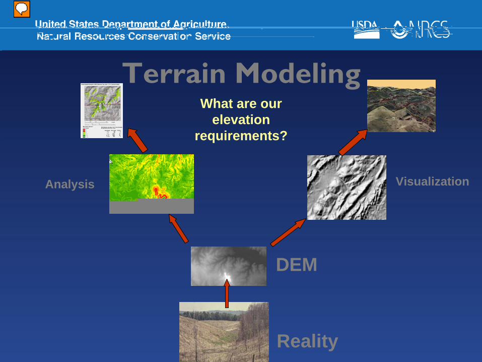
Terrain Modeling
Analysis Visualization
DEM
Reality
What are our elevation
requirements?
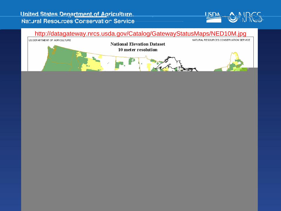
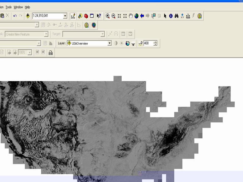
http://datagateway.nrcs.usda.gov/Catalog/GatewayStatusMaps/NED10M.jpg
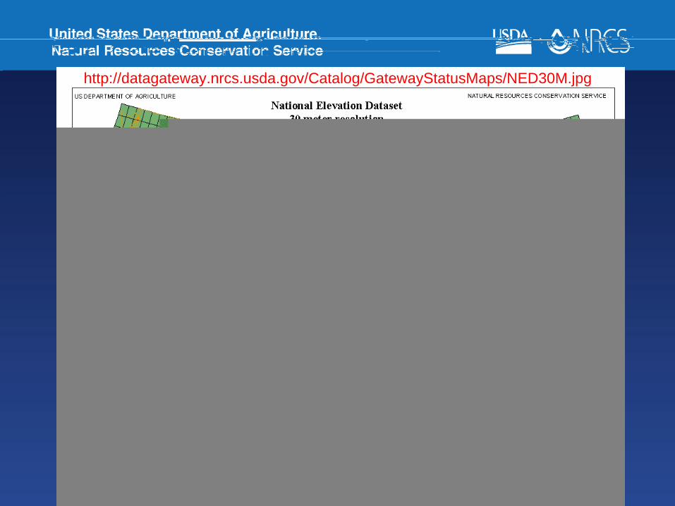
http://datagateway.nrcs.usda.gov/Catalog/GatewayStatusMaps/NED30M.jpg
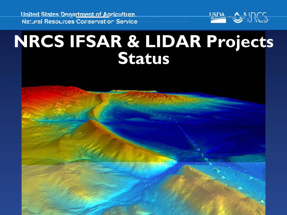
NRCS IFSAR & LIDAR Projects Status
http://datagateway.nrcs.usda.gov
Current Data
CA
OR
AZ
TX
WY
SD
OK
Texas (166 tiles):- Currently under
review at NCGC
Minnesota (24 tiles):-Due 31-Jan-08-Current Issue with re-flights
Due 15-Mar-08-No current Issues
South Dakota
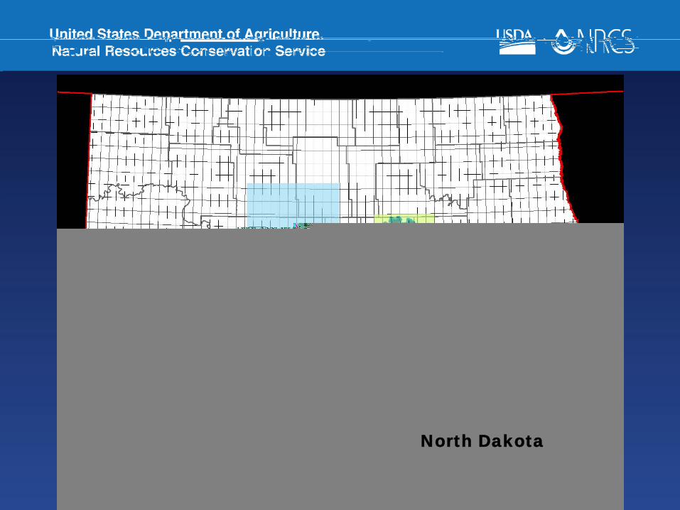
North Dakota
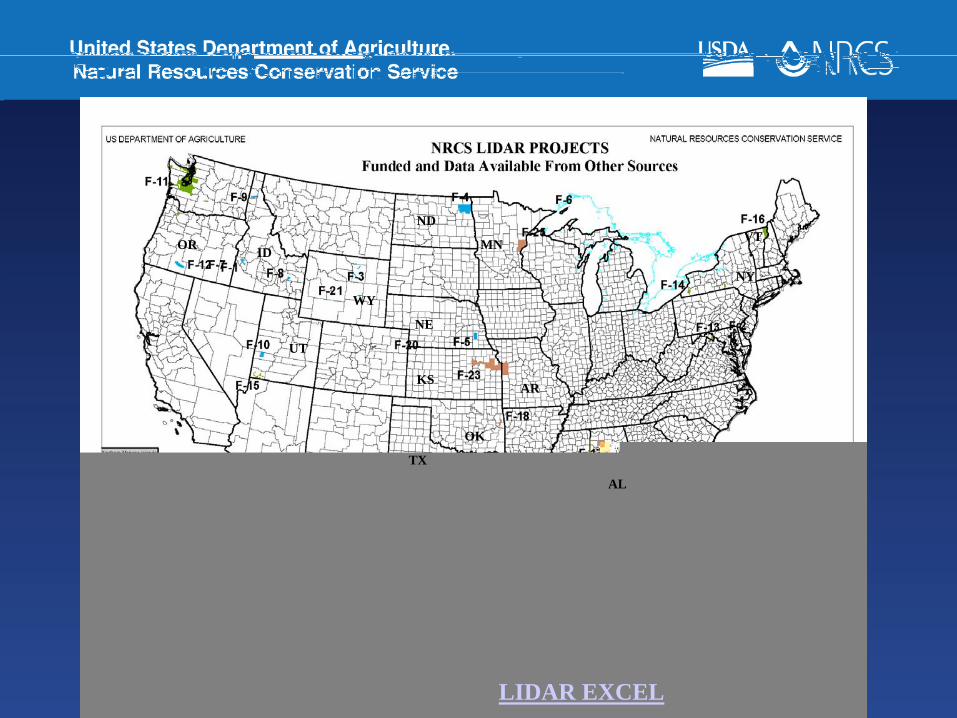
LIDAR EXCEL
TX
OK
KS
AL
AR
NY
VTND
NE
MN
WY
UT
IDOR
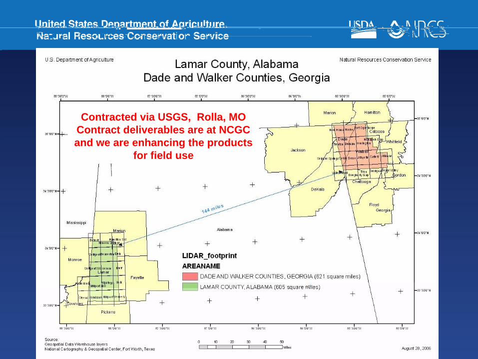
Contracted via USGS, Rolla, MO Contract deliverables are at NCGC and we are enhancing the products
for field use

NED 30m and 10m data available on the Gateway
IFSAR data (DTM & DSM)available to NRCS & FSA in geotiff format on the Gateway
LIDAR data is not availableon the Gateway
Potential Gateway LIDAR projects are Sallisaw, OK & Essex, VT for inclusion into NED
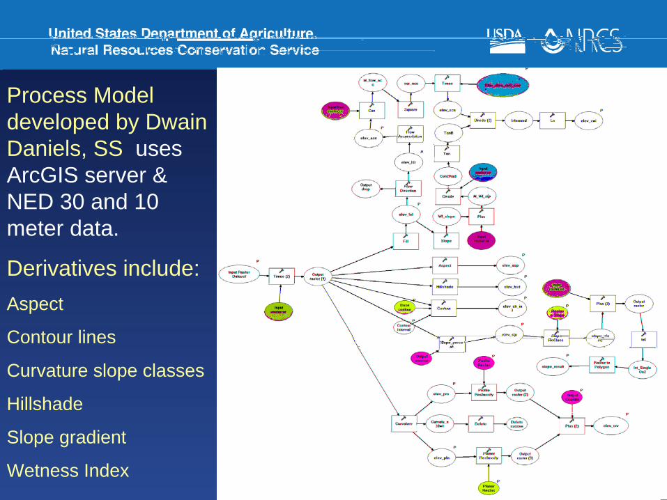
Process Model developed by Dwain Daniels, SS uses ArcGIS server & NED 30 and 10 meter data.
Derivatives include:Aspect
Contour lines
Curvature slope classes
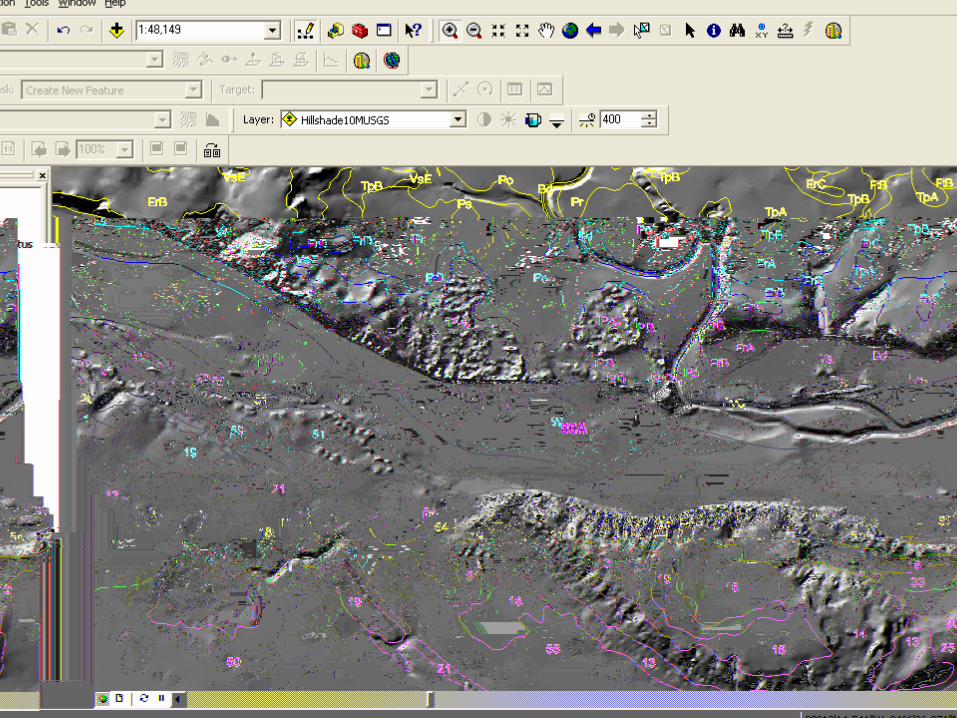
Hillshade
Slope gradient
Wetness Index
ArcGIS Server Implementation for creating derivatives from NED 30 and 10 meter data.
NRCS plans to incorporate higher resolution grid data from IFSAR (5 meter) and LIDAR (<5 meter)
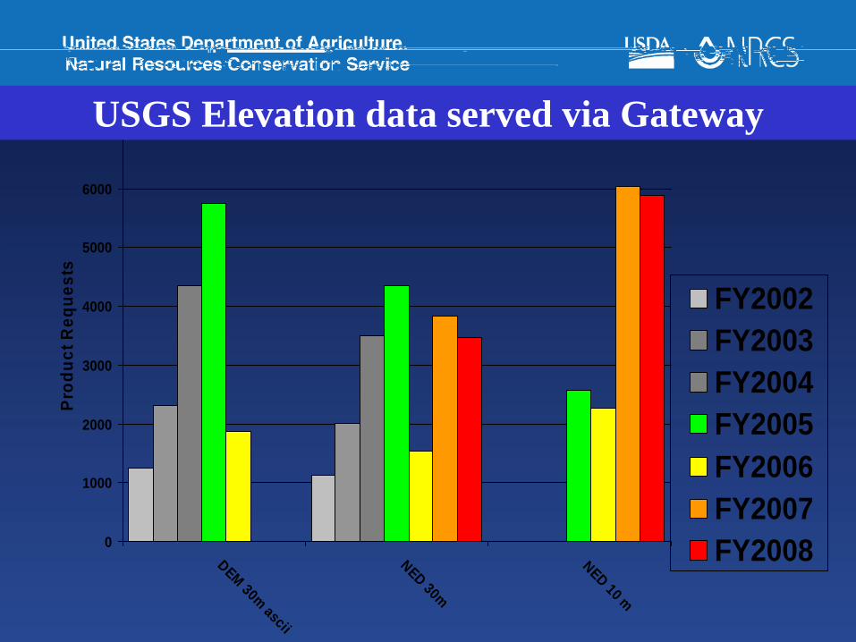
0
1000
2000
3000
4000
5000
6000
7000
DEM 30m ascii
NED 30m
NED 10 m
Prod
uct R
eque
sts
FY2002FY2003FY2004FY2005FY2006FY2007FY2008
USGS Elevation data served via Gateway
Issues• It is important for NRCS to have true business
requirements before buying elevation data.
• We need case studies from all business areas to show how elevation can make business operations more efficient and effective.
• Elevation data is not plug and play. Processing, Procedures, Models, Derivatives, Analysis and Interpretation is needed. It is not an exact science. Lots of R&D, trial & error.
USGS LiDAR ConferenceRuston, VA
• Center for LiDAR Information Coordination and Knowledge (CLICK)
• USGS LiDAR Conference, May 21-22nd 2008 at the USGS Headquarters in Reston, VA
• Potential dataset at state, federal, commercial and local agencies
• Partnership strategies• Web page: http://lidar.cr.usgs.gov
For More InformationContact
Steve Nechero at 817817--509509--33663366Email: Email: [email protected]@ftw.usda.gov
National Cartography & Geospatial CenterNational Cartography & Geospatial Center
NCGC Home Page - http://www.ncgc.nrcs.usda.gov
NRCS Remote Sensing
Obtaining Satellite Imagery

USDA Satellite Imagery Archive• The Foreign Agriculture Service (FAS)
– Repository and manager of the USDA Satellite Imagery Archive
– A cost-sharing agreement among the various subscribers including NRCS
– Imagery is for USDA use only– Partners can use imagery if a cooperative
agreement with NRCS is in place.• The Archive contains Limited SPOT• National georectified Landsat, AWiFS, and
AVHRR (USGS)
USGS-EROS Data Center (EDC) Best of the US
• National, cloud-free, orthorectified, Landsat 7 imagery.
• Available for ftp download
Microsoft Excel Worksheet
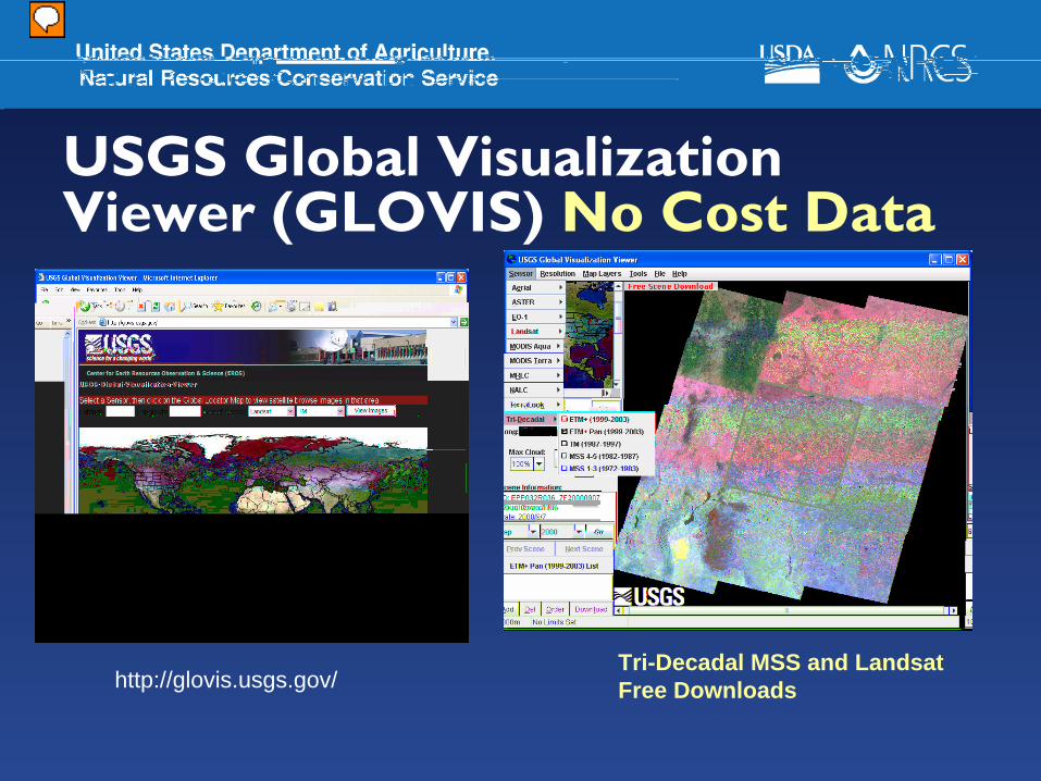
USGS Global Visualization Viewer (GLOVIS) No Cost Data
http://glovis.usgs.gov/Tri-Decadal MSS and LandsatFree Downloads
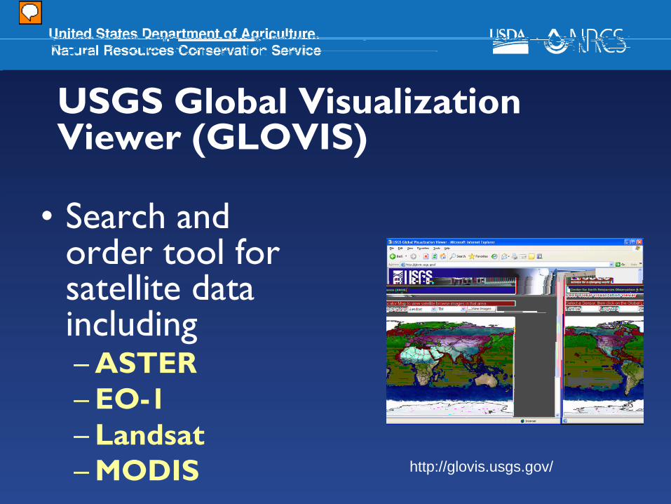
USGS Global Visualization Viewer (GLOVIS)
• Search and order tool for satellite data including– ASTER– EO-1– Landsat– MODIS http://glovis.usgs.gov/
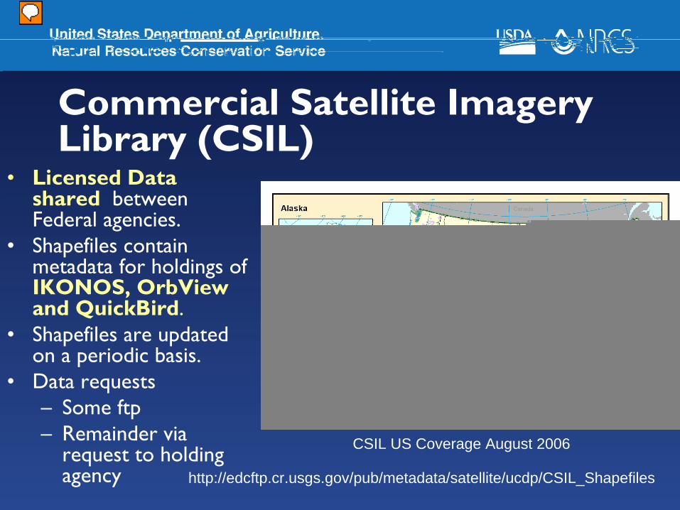
Commercial Satellite Imagery Library (CSIL)
• Licensed Data shared between Federal agencies.
• Shapefiles contain metadata for holdings of IKONOS, OrbView and QuickBird.
• Shapefiles are updated on a periodic basis.
• Data requests– Some ftp– Remainder via
request to holding agency http://edcftp.cr.usgs.gov/pub/metadata/satellite/ucdp/CSIL_Shapefiles
CSIL US Coverage August 2006
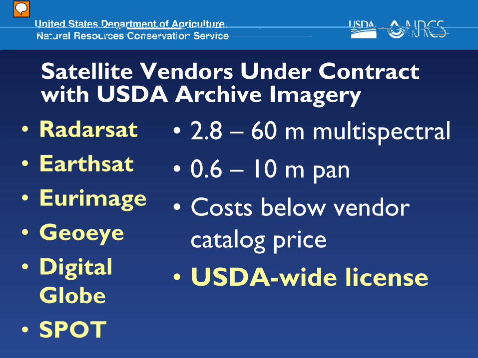
Satellite Vendors Under Contract with USDA Archive Imagery
• Radarsat• Earthsat• Eurimage• Geoeye• Digital
Globe• SPOT
• 2.8 – 60 m multispectral• 0.6 – 10 m pan• Costs below vendor
catalog price• USDA-wide license
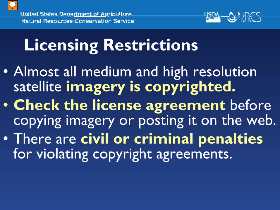
Licensing Restrictions• Almost all medium and high resolution
satellite imagery is copyrighted.• Check the license agreement before
copying imagery or posting it on the web.• There are civil or criminal penalties
for violating copyright agreements.
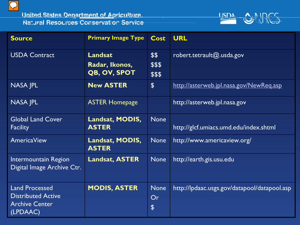
[email protected]$$$$$$$$
LandsatRadar, Ikonos, QB, OV, SPOT
USDA Contract
http://lpdaac.usgs.gov/datapool/datapool.aspNoneOr$
MODIS, ASTERLand Processed Distributed Active Archive Center (LPDAAC)
http://earth.gis.usu.eduNoneLandsat, ASTERIntermountain Region Digital Image Archive Ctr.
http://www.americaview.org/NoneLandsat, MODIS, ASTER
AmericaView
http://glcf.umiacs.umd.edu/index.shtmlNoneLandsat, MODIS,
ASTERGlobal Land Cover Facility
http://asterweb.jpl.nasa.govASTER HomepageNASA JPL
http://asterweb.jpl.nasa.gov/NewReq.asp$New ASTERNASA JPL
URLCostPrimary Image TypeSource
For Additional InformationContact
Dorsey Plunk, at 817817--509509--33483348 Email: Email: [email protected]@ftw.usda.gov
National Cartography & Geospatial CenterNational Cartography & Geospatial Center
NCGC Home Page - http://www.ncgc.nrcs.usda.gov
NAIP 2008 OverviewPartnership Opportunities for USDA-NRCS
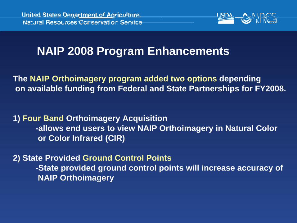
NAIP 2008 Program Enhancements
The NAIP Orthoimagery program added two options dependingon available funding from Federal and State Partnerships for FY2008.
1) Four Band Orthoimagery Acquisition -allows end users to view NAIP Orthoimagery in Natural Coloror Color Infrared (CIR)
2) State Provided Ground Control Points-State provided ground control points will increase accuracy ofNAIP Orthoimagery
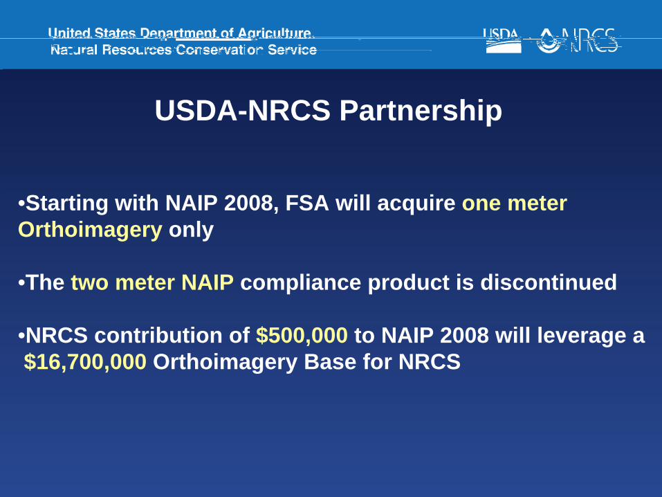
USDA-NRCS Partnership
•Starting with NAIP 2008, FSA will acquire one meter Orthoimagery only
•The two meter NAIP compliance product is discontinued
•NRCS contribution of $500,000 to NAIP 2008 will leverage a$16,700,000 Orthoimagery Base for NRCS
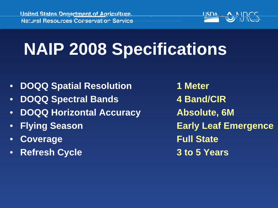
NAIP 2008 Specifications
• DOQQ Spatial Resolution 1 Meter• DOQQ Spectral Bands 4 Band/CIR• DOQQ Horizontal Accuracy Absolute, 6M• Flying Season Early Leaf Emergence• Coverage Full State• Refresh Cycle 3 to 5 Years
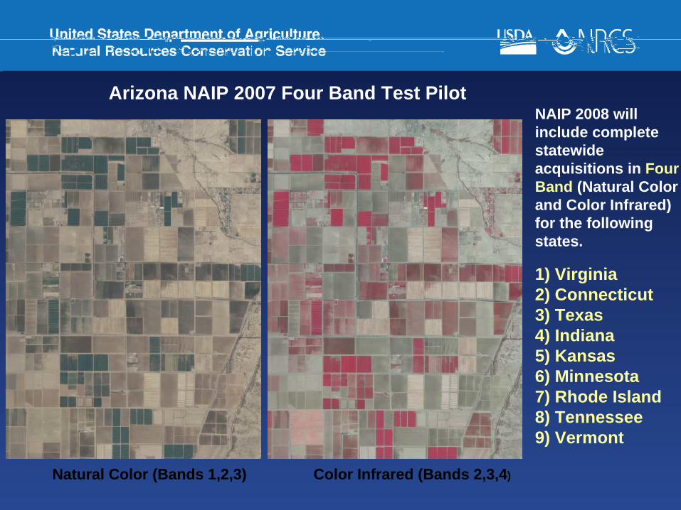
Arizona NAIP 2007 Four Band Test PilotNAIP 2008 will include complete statewide acquisitions in Four Band (Natural Color and Color Infrared) for the following states.
1) Virginia2) Connecticut3) Texas4) Indiana5) Kansas6) Minnesota7) Rhode Island8) Tennessee9) Vermont
Natural Color (Bands 1,2,3) Color Infrared (Bands 2,3,4)
NHVT
MARI
CTNY
WIMN
IA
INVA
NCTN
KS
OK
TX
IDSD
KY
OHPA
NM
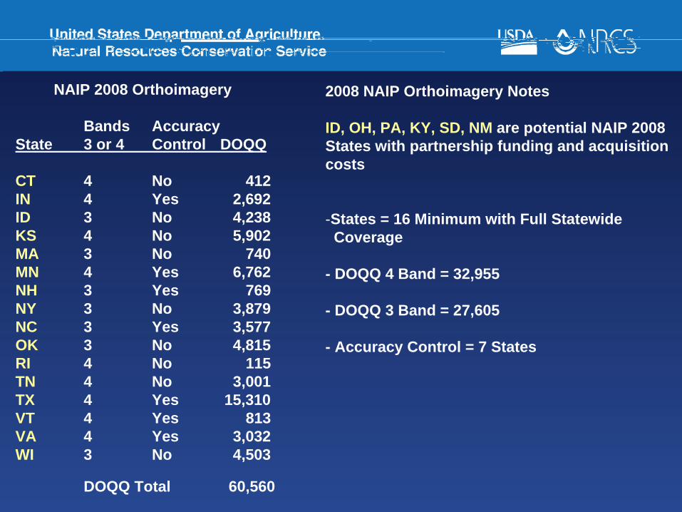
NAIP 2008 Orthoimagery
Bands AccuracyState 3 or 4 Control DOQQ
CT 4 No 412IN 4 Yes 2,692ID 3 No 4,238KS 4 No 5,902MA 3 No 740MN 4 Yes 6,762NH 3 Yes 769NY 3 No 3,879NC 3 Yes 3,577OK 3 No 4,815RI 4 No 115TN 4 No 3,001TX 4 Yes 15,310VT 4 Yes 813VA 4 Yes 3,032WI 3 No 4,503
DOQQ Total 60,560
2008 NAIP Orthoimagery Notes
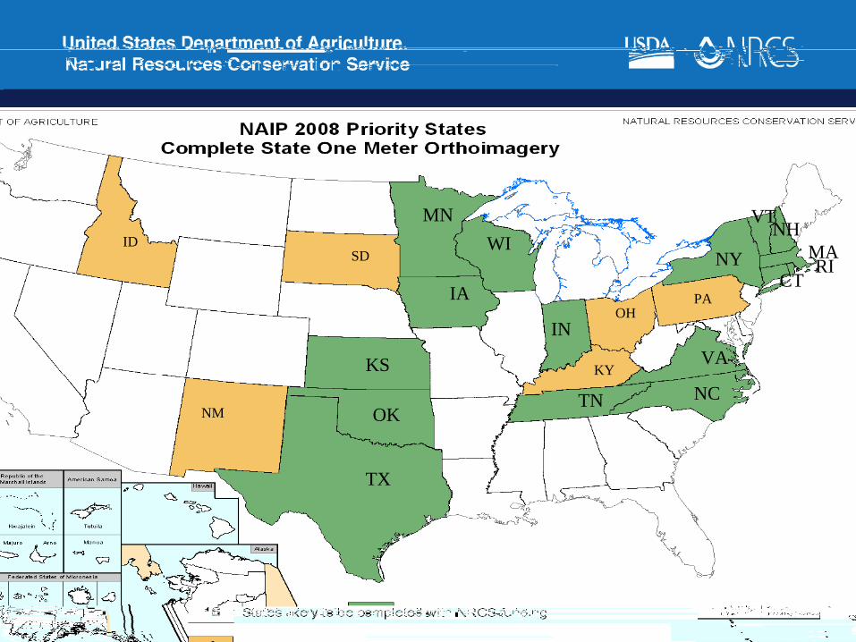
ID, OH, PA, KY, SD, NM are potential NAIP 2008 States with partnership funding and acquisition costs
-States = 16 Minimum with Full StatewideCoverage
- DOQQ 4 Band = 32,955
- DOQQ 3 Band = 27,605
- Accuracy Control = 7 States
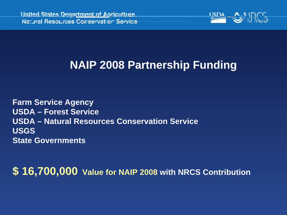
NAIP 2008 Partnership Funding
Farm Service AgencyUSDA – Forest ServiceUSDA – Natural Resources Conservation ServiceUSGS State Governments
$ 16,700,000 Value for NAIP 2008 with NRCS Contribution
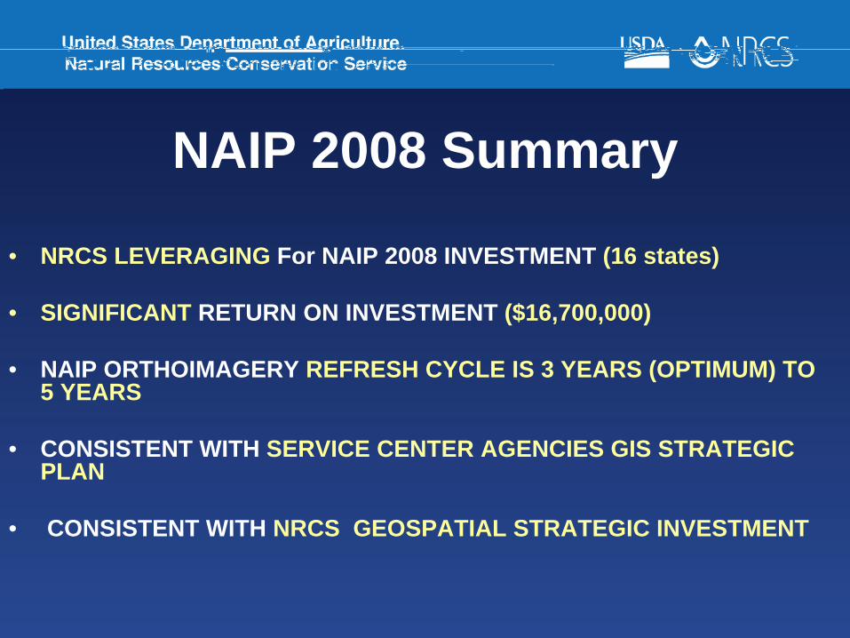
NAIP 2008 Summary
• NRCS LEVERAGING For NAIP 2008 INVESTMENT (16 states)
• SIGNIFICANT RETURN ON INVESTMENT ($16,700,000)
• NAIP ORTHOIMAGERY REFRESH CYCLE IS 3 YEARS (OPTIMUM) TO 5 YEARS
• CONSISTENT WITH SERVICE CENTER AGENCIES GIS STRATEGIC PLAN
• CONSISTENT WITH NRCS GEOSPATIAL STRATEGIC INVESTMENT
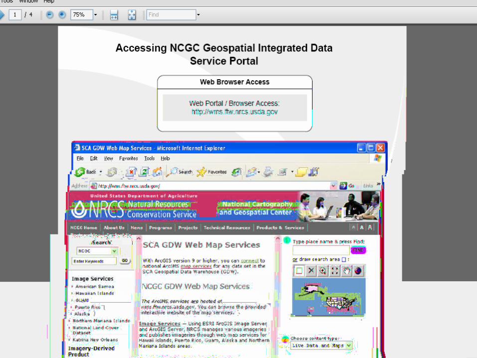
NCGC Geospatial WMS Soil Survey Support
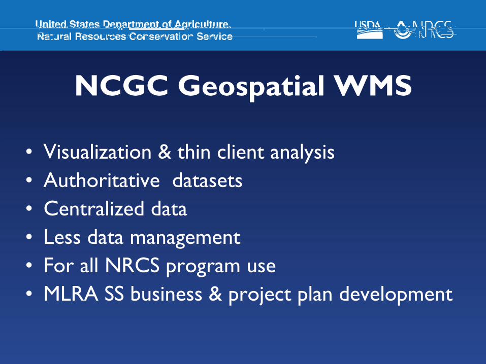
NCGC Geospatial WMS
• Visualization & thin client analysis• Authoritative datasets• Centralized data• Less data management• For all NRCS program use• MLRA SS business & project plan development
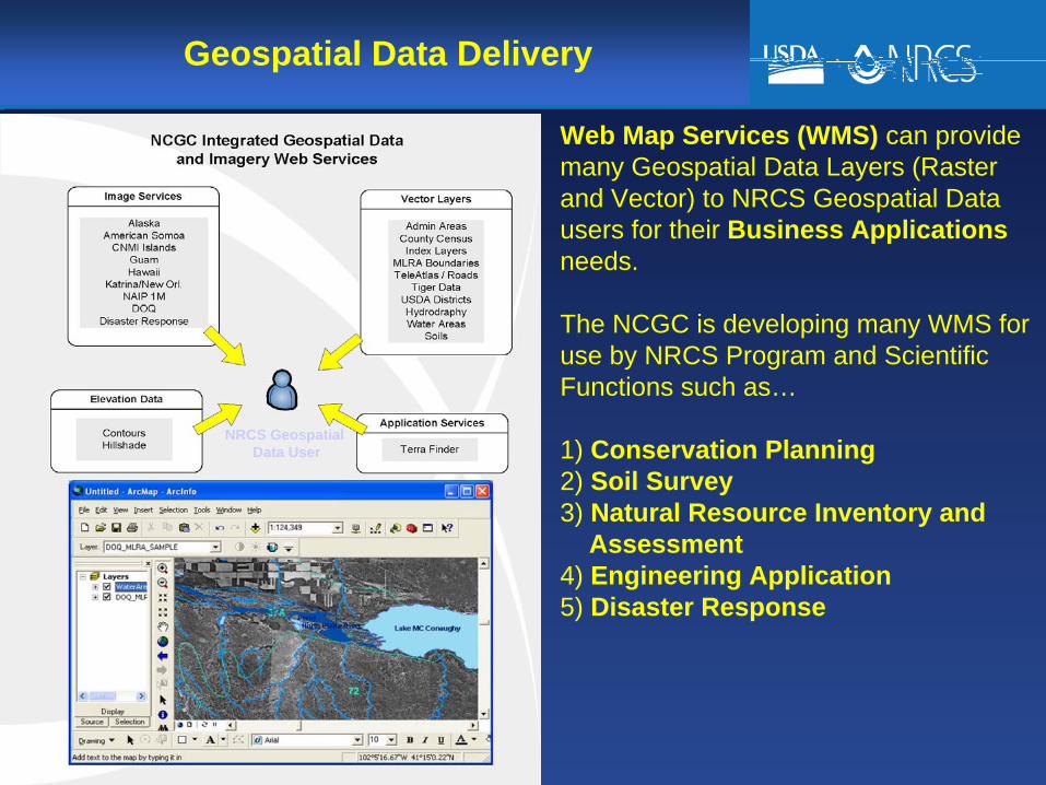
Geospatial Data Delivery
Web Map Services (WMS) can provide many Geospatial Data Layers (Raster and Vector) to NRCS Geospatial Data users for their Business Applicationsneeds.
The NCGC is developing many WMS for use by NRCS Program and Scientific Functions such as…
1) Conservation Planning2) Soil Survey3) Natural Resource Inventory and
Assessment4) Engineering Application5) Disaster Response
NRCS Geospatial Data User
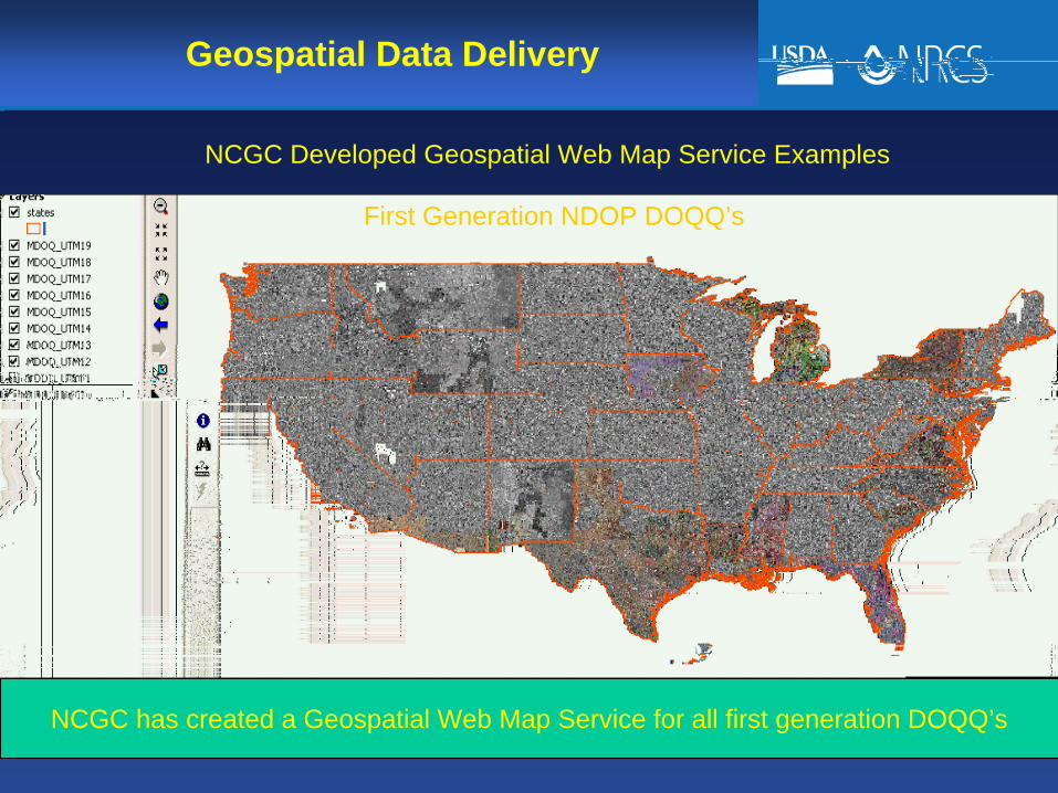
Geospatial Data Delivery
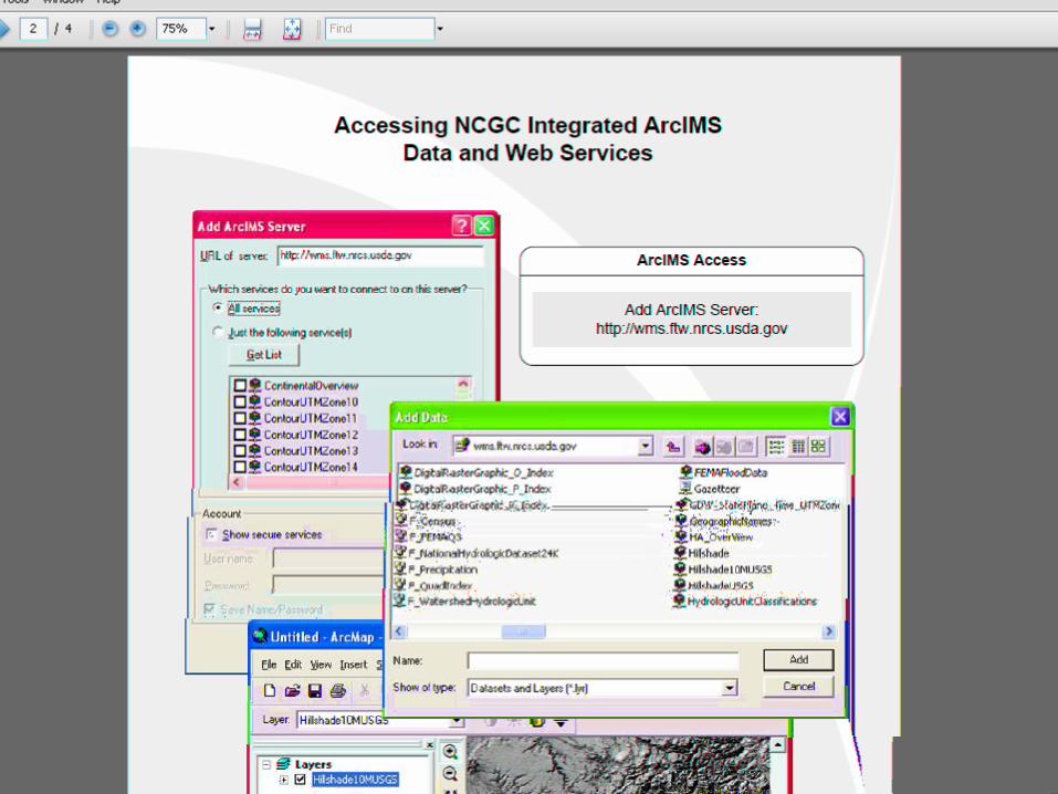
NCGC Developed Geospatial Web Map Service Examples
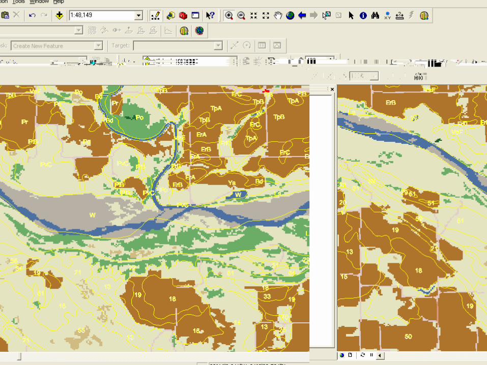
First Generation NDOP DOQQ’s
NCGC has created a Geospatial Web Map Service for all first generation DOQQ’s

Geospatial Data DeliveryCurrently Available NCGC Web Map Services – SE Texas
The NCGC will have a variety of Orthoimagery WMS layers available for agency use.
1) NDOP First Generation (Leaf-Off, Used as base for development of SSURGO).2) NAIP One Meter DOQ’s (Leaf-On)3) High Resolution Orthoimagery (Satellite, Disaster Response, State Data such as Hawaii, Florida, West
Virginia, New Jersey, Indiana, Oregon etc..)4) Color Infrared (CIR)
NDOP 1996, CIR 1 Meter, Leaf Off NAIP 2004, CIR 1 Meter, Leaf On USGS/DHS 2006, NC .5 Meter, Leaf Off
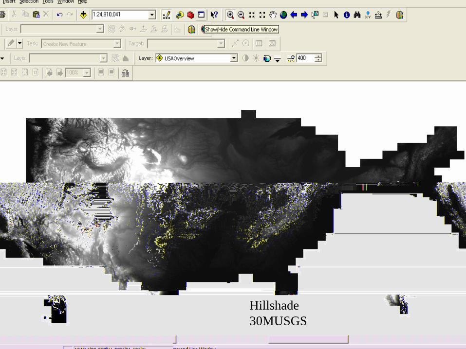
Hillshade 30MUSGS
NCGC Soil Survey Support Summary
• Geospatial Data• Geospatial Technology• Geospatial Services
Thank You
Sam Brown, Soil Geodatabases Team LeaderSam Brown, Soil Geodatabases Team Leader
[email protected]@ftw.usda.gov
817817--509509--34013401NCGC Home Page - http://www.ncgc.nrcs.usda.gov
Questions?