Embed Size (px)
Citation preview
Nodal Land Seismic Safety SurveySAFE Land, March 2014 forum, Brisbane
Part 1 Learnings from a 2013 nodal land 3D seismic survey - Neil Millar
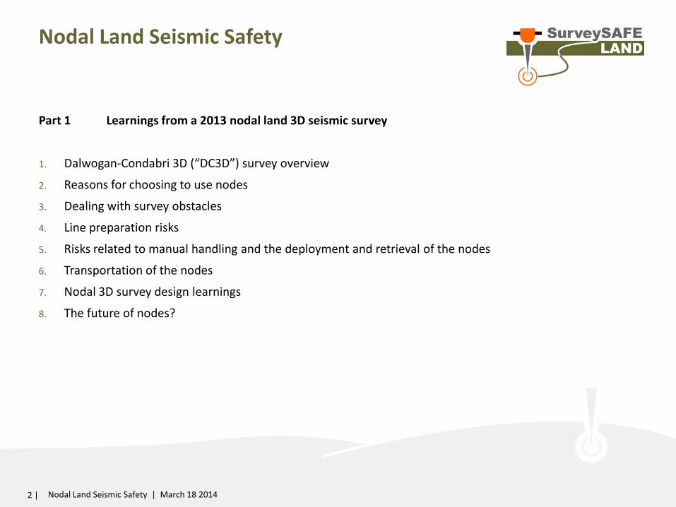
Nodal Land Seismic Safety
Part 1 Learnings from a 2013 nodal land 3D seismic survey
1. Dalwogan-Condabri 3D (“DC3D”) survey overview
2. Reasons for choosing to use nodes
3. Dealing with survey obstacles
4. Line preparation risks
5. Risks related to manual handling and the deployment and retrieval of the nodes
6. Transportation of the nodes
7. Nodal 3D survey design learnings
8. The future of nodes?
2 | Nodal Land Seismic Safety | March 18 2014
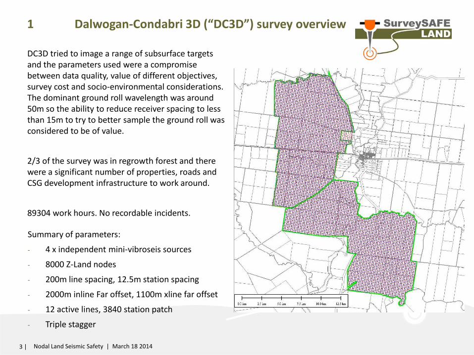
1 Dalwogan-Condabri 3D (“DC3D”) survey overview
Summary of parameters:
- 4 x independent mini-vibroseis sources
- 8000 Z-Land nodes
- 200m line spacing, 12.5m station spacing
- 2000m inline Far offset, 1100m xline far offset
- 12 active lines, 3840 station patch
- Triple stagger
3 | Nodal Land Seismic Safety | March 18 2014
INSERT MAP of survey Show s-lines, r-lines,
DC3D tried to image a range of subsurface targets and the parameters used were a compromise between data quality, value of different objectives, survey cost and socio-environmental considerations. The dominant ground roll wavelength was around 50m so the ability to reduce receiver spacing to less than 15m to try to better sample the ground roll was considered to be of value.
2/3 of the survey was in regrowth forest and there were a significant number of properties, roads and CSG development infrastructure to work around.
89304 work hours. No recordable incidents.
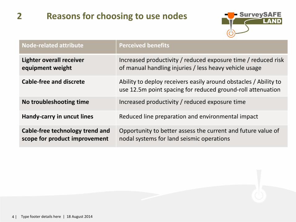
2 Reasons for choosing to use nodes
4 | Type footer details here | 18 August 2014
Node-related attribute Perceived benefits
Lighter overall receiver equipment weight
Increased productivity / reduced exposure time / reduced risk of manual handling injuries / less heavy vehicle usage
Cable-free and discrete Ability to deploy receivers easily around obstacles / Ability to use 12.5m point spacing for reduced ground-roll attenuation
No troubleshooting time Increased productivity / reduced exposure time
Handy-carry in uncut lines Reduced line preparation and environmental impact
Cable-free technology trend and scope for product improvement
Opportunity to better assess the current and future value of nodal systems for land seismic operations
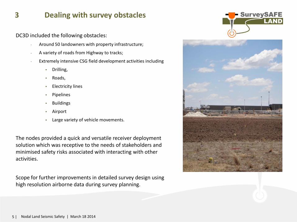
3 Dealing with survey obstacles
5 | Nodal Land Seismic Safety | March 18 2014
DC3D included the following obstacles: - Around 50 landowners with property infrastructure;
- A variety of roads from Highway to tracks;
- Extremely intensive CSG field development activities including
• Drilling,
• Roads,
• Electricity lines
• Pipelines
• Buildings
• Airport
• Large variety of vehicle movements.
The nodes provided a quick and versatile receiver deployment solution which was receptive to the needs of stakeholders and minimised safety risks associated with interacting with other activities.
Scope for further improvements in detailed survey design using high resolution airborne data during survey planning.
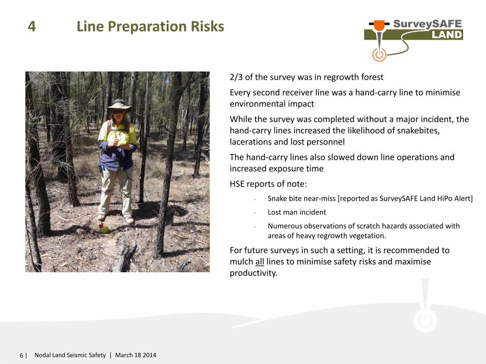
4 Line Preparation Risks
2/3 of the survey was in regrowth forest
Every second receiver line was a hand-carry line to minimise environmental impact
While the survey was completed without a major incident, the hand-carry lines increased the likelihood of snakebites, lacerations and lost personnel
The hand-carry lines also slowed down line operations and increased exposure time
HSE reports of note: - Snake bite near-miss [reported as SurveySAFE Land HiPo Alert]
- Lost man incident
- Numerous observations of scratch hazards associated with areas of heavy regrowth vegetation.
For future surveys in such a setting, it is recommended to mulch all lines to minimise safety risks and maximise productivity.
6 | Nodal Land Seismic Safety | March 18 2014
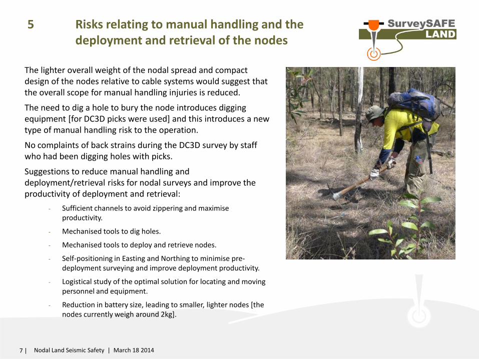
5 Risks relating to manual handling and the deployment and retrieval of the nodes
The lighter overall weight of the nodal spread and compact design of the nodes relative to cable systems would suggest that the overall scope for manual handling injuries is reduced.
The need to dig a hole to bury the node introduces digging equipment [for DC3D picks were used] and this introduces a new type of manual handling risk to the operation.
No complaints of back strains during the DC3D survey by staff who had been digging holes with picks.
Suggestions to reduce manual handling and deployment/retrieval risks for nodal surveys and improve the productivity of deployment and retrieval:
- Sufficient channels to avoid zippering and maximise productivity.
- Mechanised tools to dig holes.
- Mechanised tools to deploy and retrieve nodes.
- Self-positioning in Easting and Northing to minimise pre-deployment surveying and improve deployment productivity.
- Logistical study of the optimal solution for locating and moving personnel and equipment.
- Reduction in battery size, leading to smaller, lighter nodes [the nodes currently weigh around 2kg].
7 | Nodal Land Seismic Safety | March 18 2014
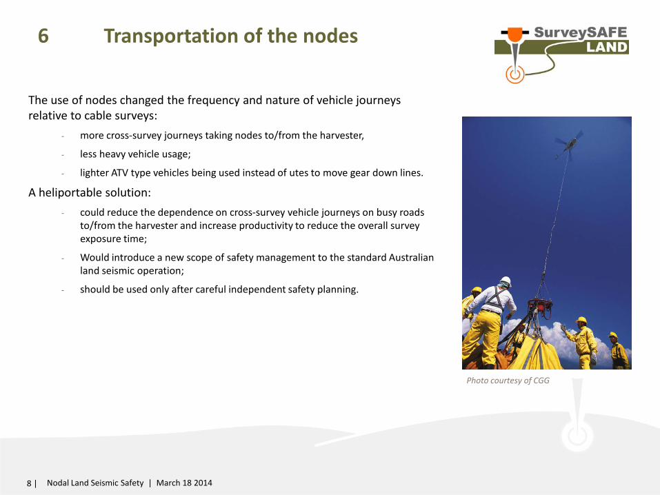
6 Transportation of the nodes
The use of nodes changed the frequency and nature of vehicle journeys relative to cable surveys:
- more cross-survey journeys taking nodes to/from the harvester,
- less heavy vehicle usage;
- lighter ATV type vehicles being used instead of utes to move gear down lines.
A heliportable solution: - could reduce the dependence on cross-survey vehicle journeys on busy roads
to/from the harvester and increase productivity to reduce the overall survey exposure time;
- Would introduce a new scope of safety management to the standard Australian land seismic operation;
- should be used only after careful independent safety planning.
8 | Nodal Land Seismic Safety | March 18 2014
Photo courtesy of CGG
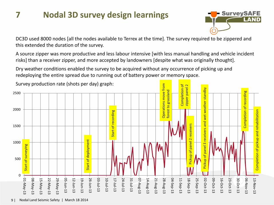
7 Nodal 3D survey design learnings
DC3D used 8000 nodes [all the nodes available to Terrex at the time]. The survey required to be zippered and this extended the duration of the survey.
A source zipper was more productive and less labour intensive [with less manual handling and vehicle incident risks] than a receiver zipper, and more accepted by landowners [despite what was originally thought].
Dry weather conditions enabled the survey to be acquired without any occurrence of picking up and redeploying the entire spread due to running out of battery power or memory space.
Survey production rate (shots per day) graph:
9 | Nodal Land Seismic Safety | March 18 2014
0
500
1000
1500
2000
2500
01-May-13
08-May-13
15-May-13
22-May-13
29-May-13
05-Jun-13
12-Jun-13
19-Jun-13
26-Jun-13
03-Jul-13
10-Jul-13
17-Jul-13
24-Jul-13
31-Jul-13
07-Aug-13
14-Aug-13
21-Aug-13
28-Aug-13
04-Sep-13
11-Sep-13
18-Sep-13
25-Sep-13
02-Oct-13
09-Oct-13
16-Oct-13
23-Oct-13
30-Oct-13
06-Nov-13
13-Nov-13
Star
t of s
urve
ying
Star
t of d
eplo
ymen
t
Star
t of r
ecor
ding
Ope
ratio
ns m
ove
from
fo
rest
to g
rass
land
Com
plet
ion
of
zippe
r pan
el 2
Pi
ckup
of p
anel
2 re
ceiv
ers
Pick
up o
f pan
el 3
rece
iver
s an
d w
et w
eath
er st
andb
y
Com
plet
ion
of re
cord
ing
Com
plet
ion
of p
icku
p an
d re
habi
litat
ion
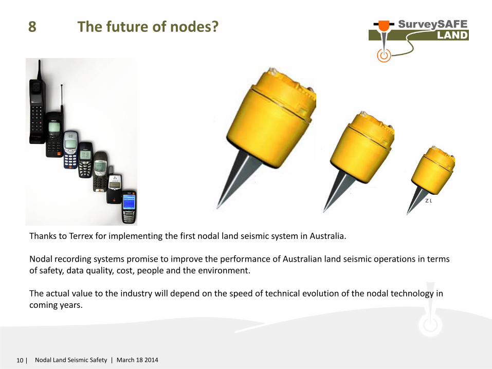
8 The future of nodes?
10 | Nodal Land Seismic Safety | March 18 2014
Thanks to Terrex for implementing the first nodal land seismic system in Australia. Nodal recording systems promise to improve the performance of Australian land seismic operations in terms of safety, data quality, cost, people and the environment. The actual value to the industry will depend on the speed of technical evolution of the nodal technology in coming years.

Thank you