Embed Size (px)
DESCRIPTION
NOAA CoastWatch Program (NESDIS/ORA). Satellite Ocean Remote Sensing Products and Potential Applications to the Chesapeake Bay. Shawna Karlson SP Systems, Inc. NOAA CoastWatch Program. About Established in 1987 in response to 2 significant events: - PowerPoint PPT Presentation
Citation preview
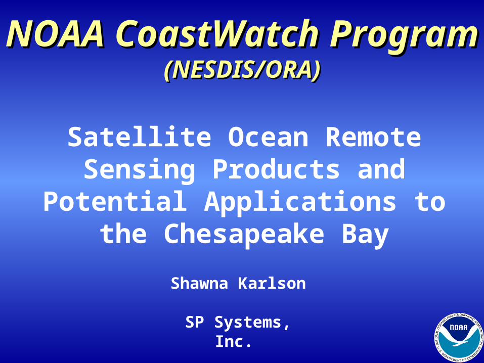
NOAANOAA CoastWatchCoastWatch ProgramProgram(NESDIS/ORA)(NESDIS/ORA)
Satellite Ocean Remote Sensing Products and
Potential Applications to the Chesapeake Bay
Shawna Karlson
SP Systems, Inc.
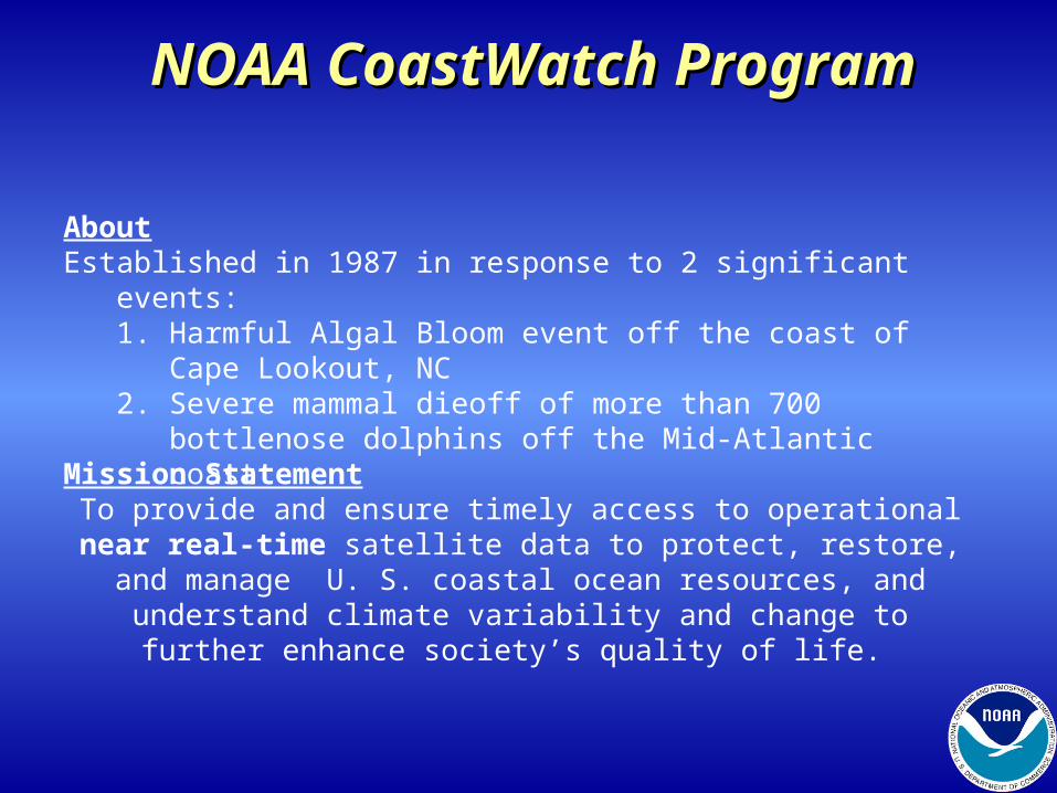
About Established in 1987 in response to 2 significant events:
1. Harmful Algal Bloom event off the coast of Cape Lookout, NC2. Severe mammal dieoff of more than 700 bottlenose dolphins
off the Mid-Atlantic coast
NOAANOAA CoastWatchCoastWatch ProgramProgram
Mission StatementTo provide and ensure timely access to operational near real-time satellite data to protect, restore, and manage U. S. coastal ocean resources, and understand climate variability and change to further
enhance society’s quality of life.
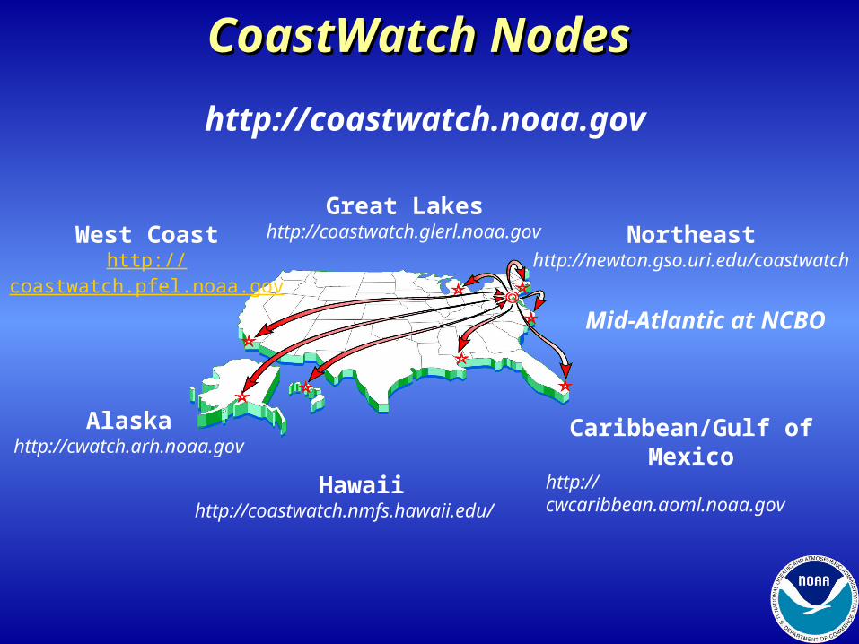
http://coastwatch.noaa.gov
West Coasthttp://coastwatch.pfel.noaa.gov
Alaskahttp://cwatch.arh.noaa.gov
Hawaiihttp://coastwatch.nmfs.hawaii.edu/
Caribbean/Gulf of Mexicohttp://cwcaribbean.aoml.noaa.gov
Northeasthttp://newton.gso.uri.edu/coastwatch
Great Lakeshttp://coastwatch.glerl.noaa.gov
CoastWatch NodesCoastWatch Nodes
Mid-Atlantic at NCBO
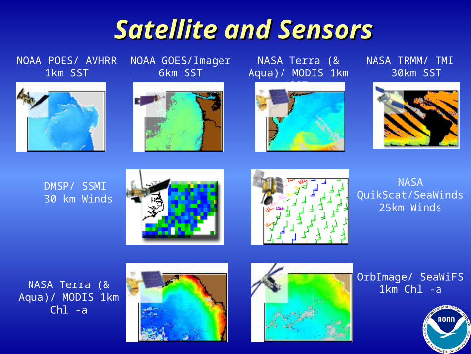
Satellite and SensorsSatellite and SensorsNOAA POES/ AVHRR
1km SSTNOAA GOES/Imager
6km SSTNASA Terra (& Aqua)/
MODIS 1km SSTNASA TRMM/ TMI
30km SST
NASA Terra (& Aqua)/ MODIS 1km Chl -a
OrbImage/ SeaWiFS 1km Chl -a
DMSP/ SSMI 30 km Winds
NASA QuikScat/SeaWinds
25km Winds
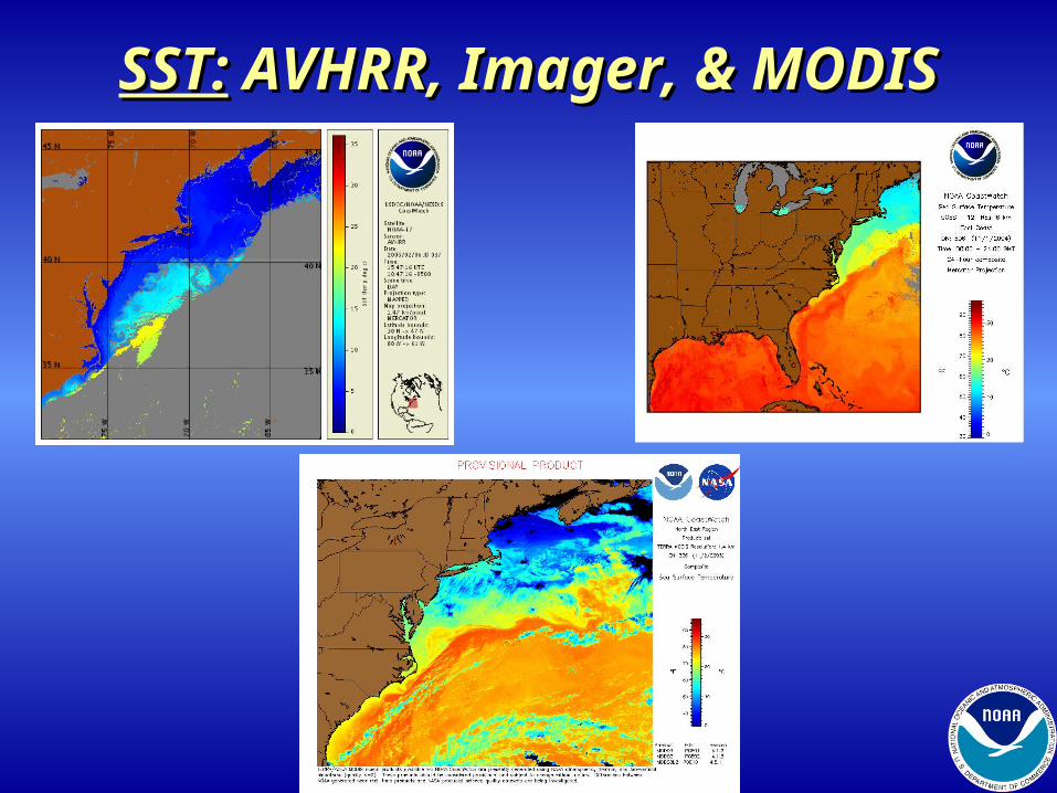
SST:SST: AVHRR, Imager, & MODIS AVHRR, Imager, & MODIS
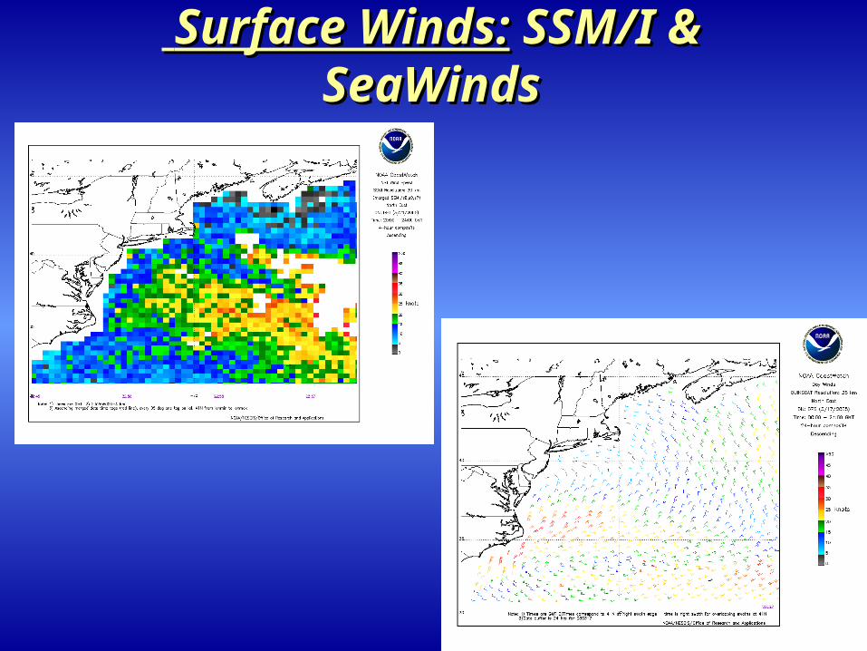
Surface Winds:Surface Winds: SSM/I & SSM/I & SeaWindsSeaWinds
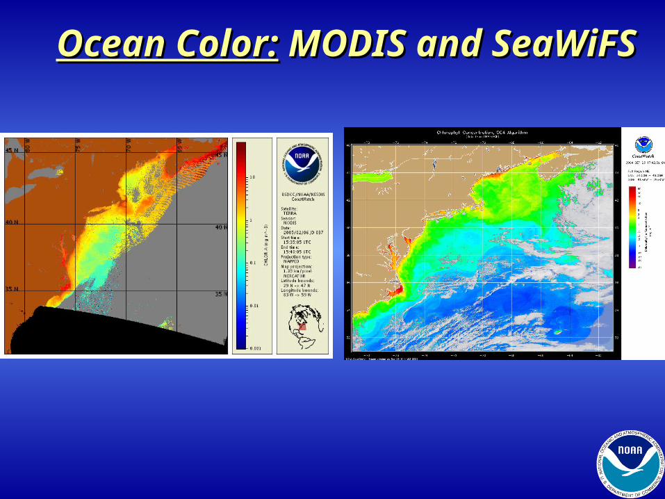
Ocean Color:Ocean Color: MODIS and MODIS and SeaWiFSSeaWiFS
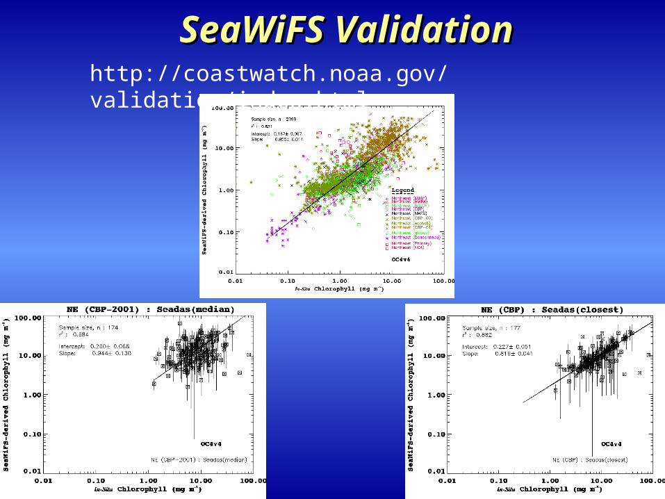
SeaWiFS ValidationSeaWiFS Validationhttp://coastwatch.noaa.gov/validation/index.html
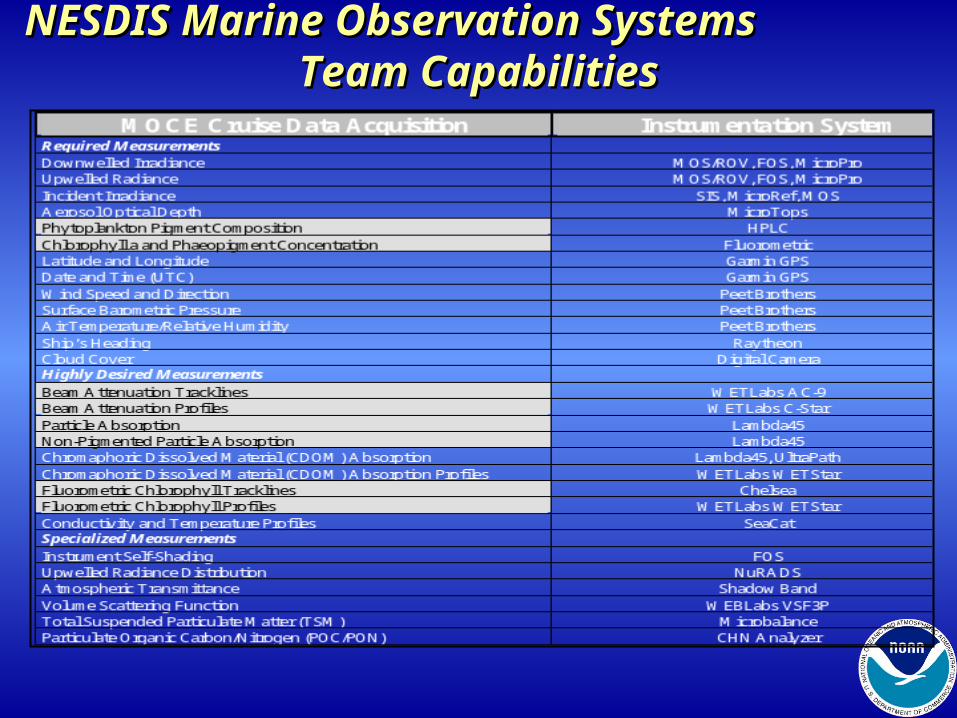
NESDIS Marine Observation Systems NESDIS Marine Observation Systems Team Capabilities Team Capabilities
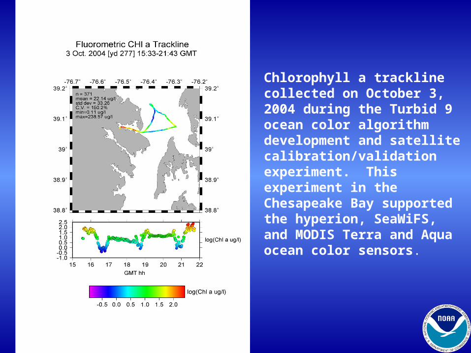
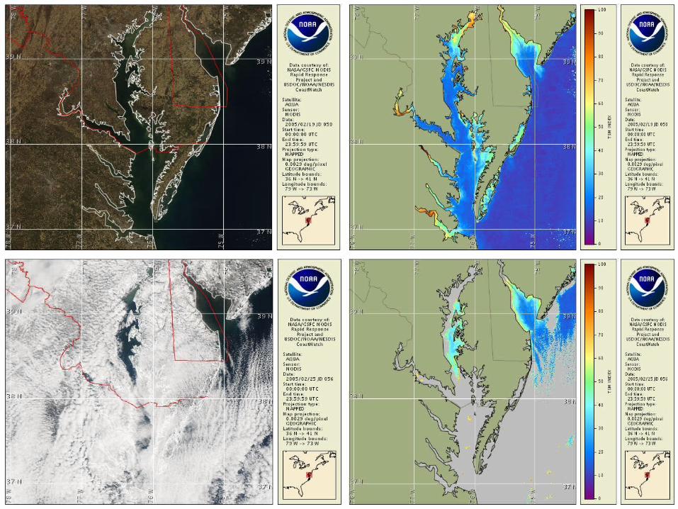
Chlorophyll a trackline collected on October 3, 2004 during the Turbid 9 ocean color algorithm development and satellite calibration/validation experiment. This experiment in the Chesapeake Bay supported the hyperion, SeaWiFS, and MODIS Terra and Aqua ocean color sensors.
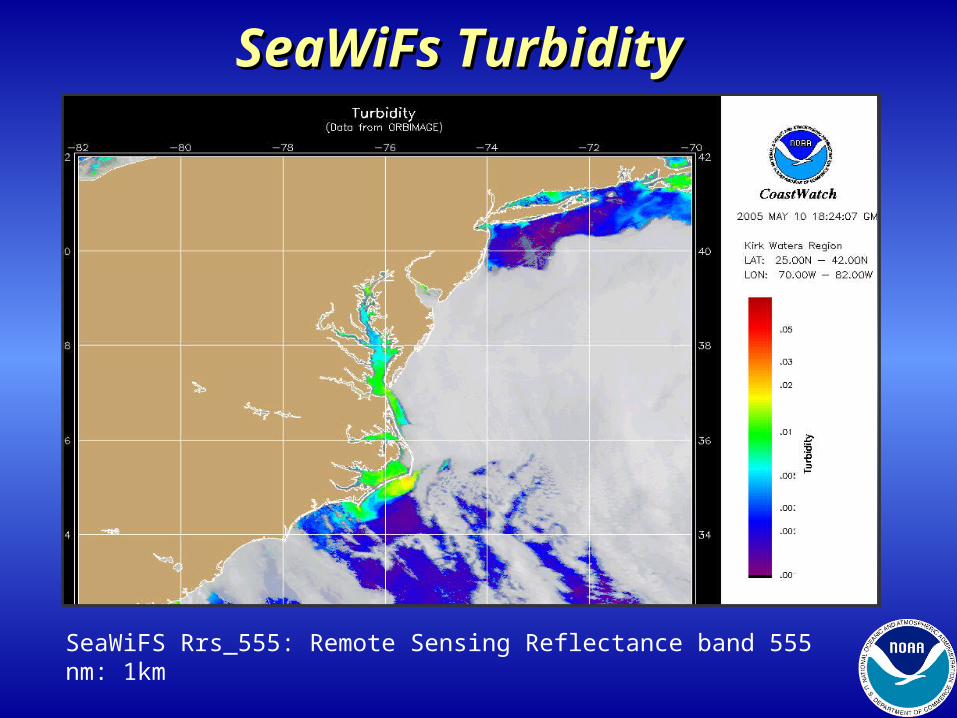
SeaWiFs TurbiditySeaWiFs Turbidity
SeaWiFS Rrs_555: Remote Sensing Reflectance band 555 nm: 1km
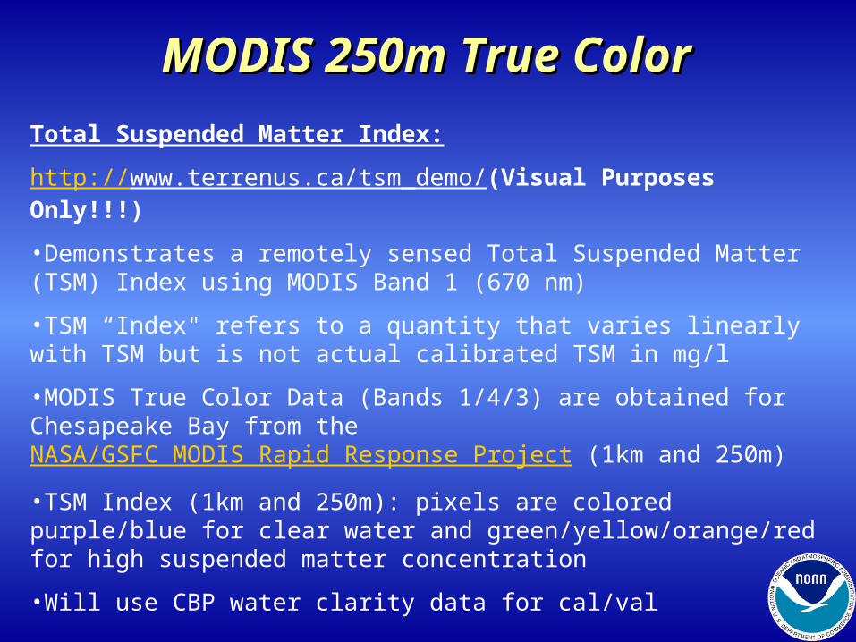
MODIS 250m True ColorMODIS 250m True Color
Total Suspended Matter Index:
http://www.terrenus.ca/tsm_demo/(Visual Purposes Only!!!)
•Demonstrates a remotely sensed Total Suspended Matter (TSM) Index using MODIS Band 1 (670 nm)
•TSM “Index" refers to a quantity that varies linearly with TSM but is not actual calibrated TSM in mg/l
•MODIS True Color Data (Bands 1/4/3) are obtained for Chesapeake Bay from the NASA/GSFC MODIS Rapid Response Project (1km and 250m)
•TSM Index (1km and 250m): pixels are colored purple/blue for clear water and green/yellow/orange/red for high suspended matter concentration
•Will use CBP water clarity data for cal/val
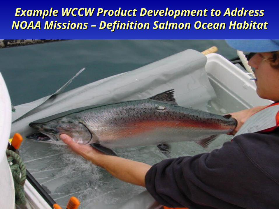
Example WCCW Product Development to Example WCCW Product Development to Address NOAA Missions – Definition Salmon Address NOAA Missions – Definition Salmon
Ocean HabitatOcean Habitat
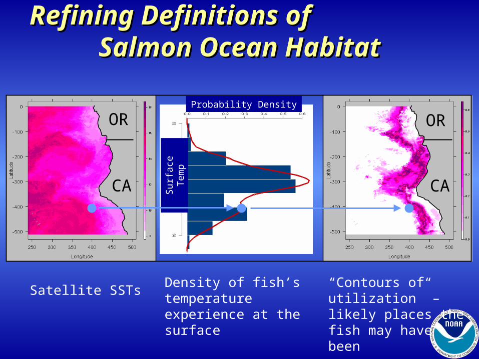
Refining Definitions of Refining Definitions of Salmon Ocean Habitat Salmon Ocean Habitat
Satellite SSTs
OR OR
CA CA
Density of fish’s temperature experience at the surface
“Contours of utilization” – likely places the fish may have been
Probability Density
Sur
face
Tem
p
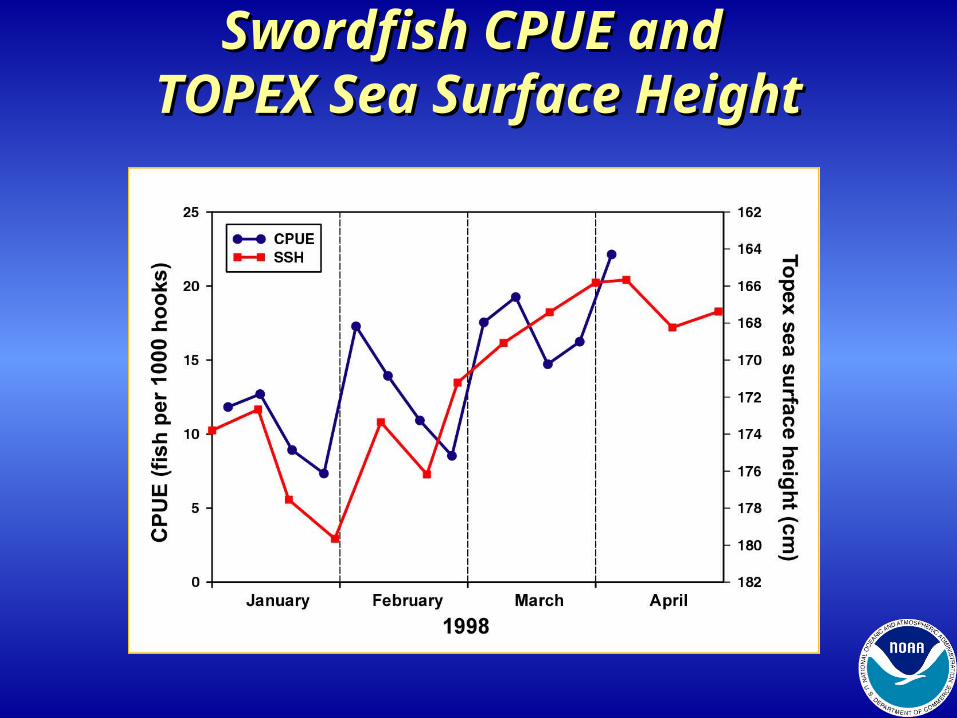
Swordfish CPUE and Swordfish CPUE and TOPEX Sea Surface HeightTOPEX Sea Surface Height
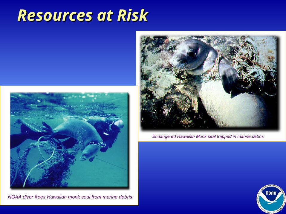
Resources at RiskResources at Risk
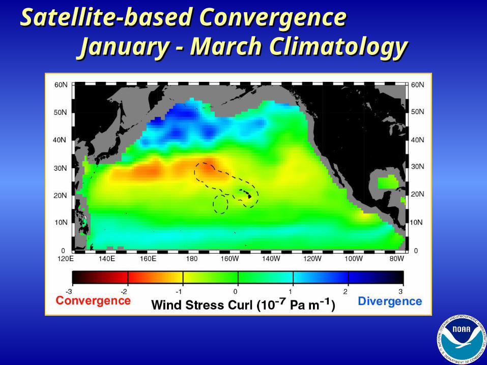
Satellite-based Convergence Satellite-based Convergence January - March Climatology January - March Climatology
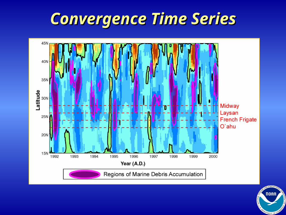
Convergence Time SeriesConvergence Time Series
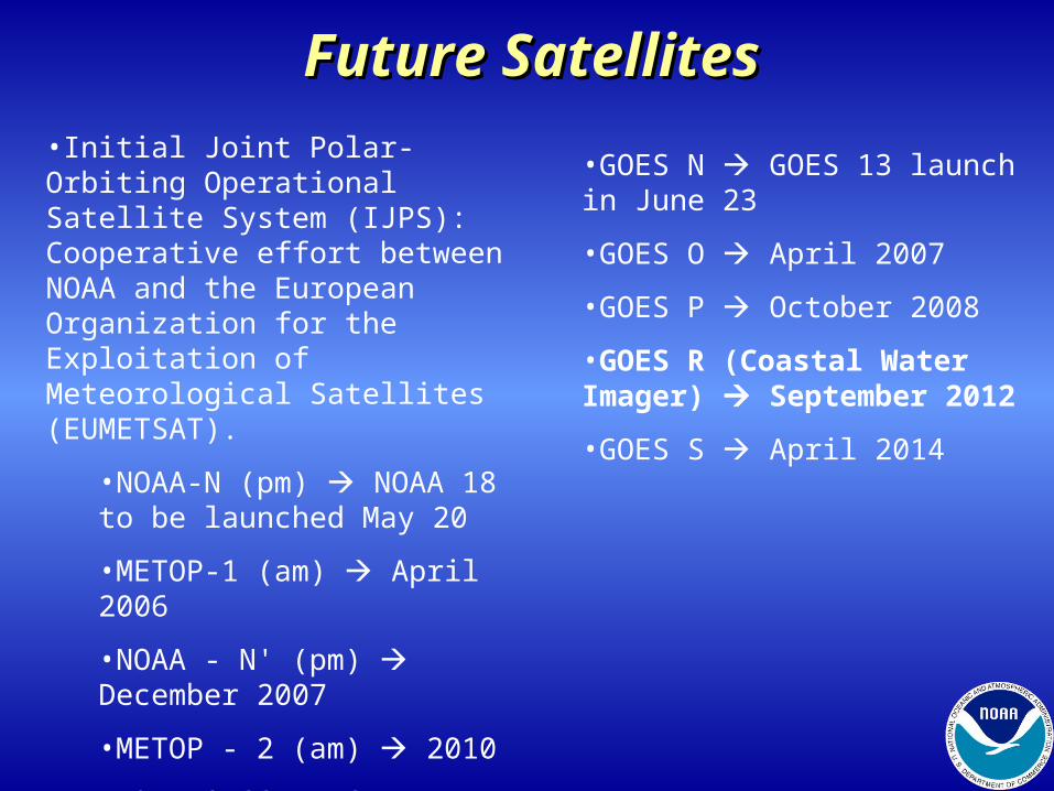
Future SatellitesFuture Satellites•Initial Joint Polar-Orbiting Operational Satellite System (IJPS): Cooperative effort between NOAA and the European Organization for the Exploitation of Meteorological Satellites (EUMETSAT).
•NOAA-N (pm) NOAA 18 to be launched May 20
•METOP-1 (am) April 2006
•NOAA - N' (pm) December 2007
•METOP - 2 (am) 2010
•NPP & NPOESS (DoC, DoD, NASA) 2012
•GOES N GOES 13 launch in June 23
•GOES O April 2007
•GOES P October 2008
•GOES R (Coastal Water Imager) September 2012
•GOES S April 2014
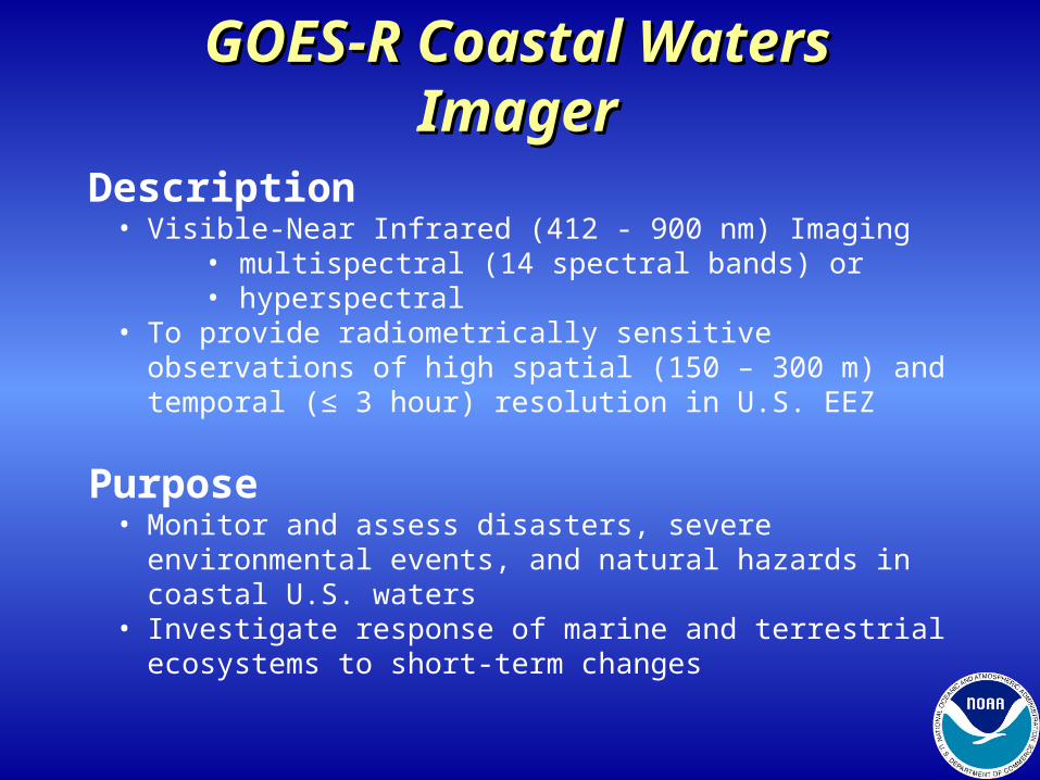
GOES-R Coastal Waters GOES-R Coastal Waters ImagerImager
Description• Visible-Near Infrared (412 - 900 nm) Imaging
• multispectral (14 spectral bands) or• hyperspectral
• To provide radiometrically sensitive observations of high spatial (150 – 300 m) and temporal (≤ 3 hour) resolution in U.S. EEZ
Purpose• Monitor and assess disasters, severe environmental events,
and natural hazards in coastal U.S. waters• Investigate response of marine and terrestrial ecosystems to
short-term changes
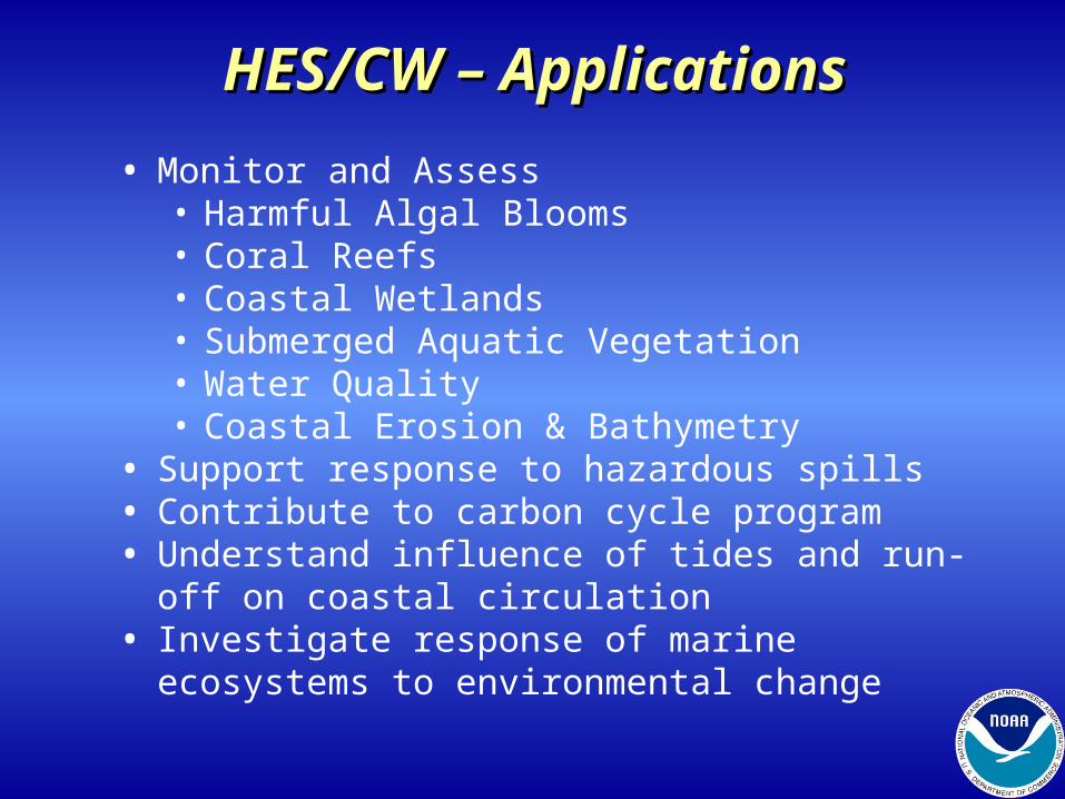
HES/CW – ApplicationsHES/CW – Applications
• Monitor and Assess• Harmful Algal Blooms• Coral Reefs• Coastal Wetlands• Submerged Aquatic Vegetation• Water Quality• Coastal Erosion & Bathymetry
• Support response to hazardous spills• Contribute to carbon cycle program • Understand influence of tides and run-off on coastal
circulation • Investigate response of marine ecosystems to
environmental change
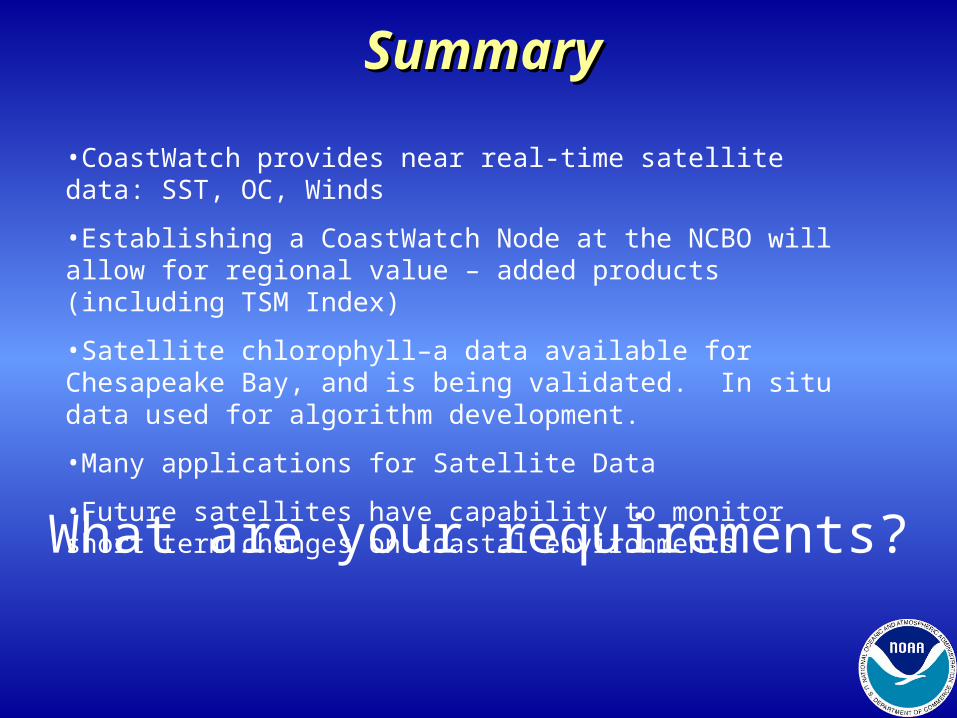
SummarySummary
•CoastWatch provides near real-time satellite data: SST, OC, Winds
•Establishing a CoastWatch Node at the NCBO will allow for regional value – added products (including TSM Index)
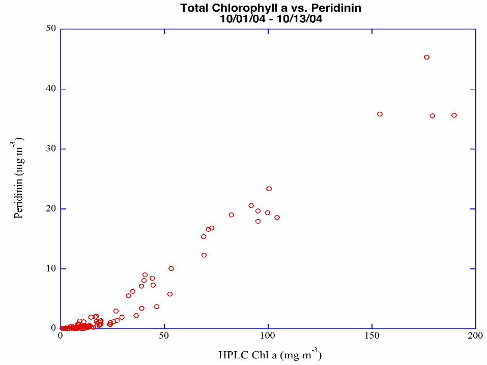
•Satellite chlorophyll–a data available for Chesapeake Bay, and is being validated. In situ data used for algorithm development.
•Many applications for Satellite Data
•Future satellites have capability to monitor short term changes on coastal environments
What are your requirements?