Embed Size (px)
Citation preview

NEW JERSEY MAPS AND MAPPING
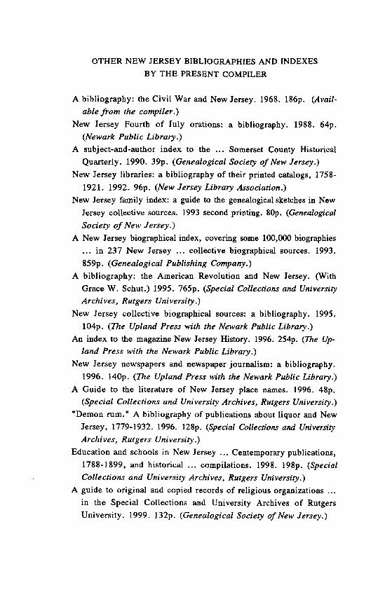
OTHER NEW JERSEY BIBLIOGRAPHIES AND INDEXES
BY THE PRESENT COMPILER
A bibliography: the Civil War and New Jersey. 1968. 186p. (Avail-
able from the compiler.)
New Jersey Fourth of July orations: a bibliography. 1988. 64p.
(Newark Public Library.)
A subject-and-author index to the ... Somerset County Historical
Quarterly. 1990. 39p. (Genealogical Society of New Jersey.)
New Jersey libraries: a bibliography of their printed catalogs, 1758-
1921. 1992. 96p. (New Jersey Library Association.)
New Jersey family index: a guide to the genealogical sketches in New
Jersey collective sources. 1993 second printing. 80p. (Genealogical
Society of New Jersey.)
• New Jersey biographical index, covering some 100,000 biographies
... in 237 New Jersey ... collective biographical sources. 1993.
859p. (Genealogical Publishing Company.)
• bibliography: the American Revolution and New Jersey. (With
Grace W. Schut.) 1995. 765p. (Special Collections and University
Archives, Rutgers University.)
New Jersey collective biographical sources: a bibliography. 1995.
104p. (The Upland Press with the Newark Public Library.)
An index to the magazine New Jersey History. 1996. 254p. (The Up-
land Press with the Newark Public Library.)
New Jersey newspapers and newspaper journalism: a bibliography.
1996. 140p. (The Upland Press with the Newark Public Library.)
A Guide to the literature of New Jersey place names. 1996. 48p.
(Special Collections and University Archives, Rutgers University.)
"Demon rum." A bibliography of publications about liquor and New
Jersey, 1779-1932. 1996. 128p. (Special Collections and University
Archives, Rutgers University.)
Education and schools in New Jersey ... Centemporary publications,
1788-1899, and historical ... compilations. 1998. 198p. (Special
Collections and University Archives, Rutgers University.)
A guide to original and copied records of religious organizations ...
in the Special Collections and University Archives of Rutgers
University. 1999. 132p. (Genealogical Society of New Jersey.)
A Guide to Literature about
NEW JERSEY MAPS AND MAPPING
Bibliographies and Finding Aids, Documents, and Monographic
Writings, etc.
Compiled by
DONALD ARLEIGH SINCLAIR
NEW BRUNSWICK, N.J., 2002
RUTGERS UNIVERSITY
SPECIAL COLLECTIONS AND
UNIVERSITY ARCHIVES
INTRODUCTION
Txis is a bibliography of writings and compilations about New Jersey maps and mapping. It is not a listing of maps.
No part of New Jersey is without map coverage of some kind—large-scale or small-scale, early or modern, printed or manuscript, topo-graphical, geological, whatever. There are thousands of them. The would-be user's need is to learn what maps exist, and where they can be seen. This compilation will be useful to that end.
Recorded here are 307 writings about maps—books, articles, analytics, lists, and other compilations, a few of them unpublished. Two-thirds of these relate to New Jersey entirely. The others are selected items which deal with larger areas but include useful or important New Jersey content. Some pertain to bordering territory such as the adjacent Delaware and Hudson rivers, or Manhattan Island, New York, and Philadelphia.
The Libraries
The entry for each of the separate items includes coded names (see below) of one or more libraries which possess copies of it. In the pre-paration of this bibliography six libraries (marked with asterisk) have been used chiefly, but others holding copies of certain publications are known, and have been duly credited.
DLC Library of Congress, Washington, D.C. NHi New-York Historical Society, New York City. NN New York Public Library, New York City.* Nj New Jersey State Library, Trenton, N.J.*
NjHi New Jersey Historical Society, Newark, N.J.* NjHo Free Public Library, Hoboken, N.J. NjJ Free Public Library, Jersey City, N.J. NjMo Joint Free Public Library of Morristown and Morris
E
Township, Morristown, N.J. NjN Free Public Library, Newark, N.J.* NjP Princeton University Library, Princeton, N.J.* NjR Rutgers University Library, New Brunswick, N.J.*t NjT Free Public Library, Trenton, N.J. PHi Historical Society of Pennsylvania, Philadelphia. PP Free Public Library of Philadelphia. PPL Library Company of Philadelphia.
'Most of the NjR items are in the Alexander Library, usually the Special
Collections and University Archives there. A few are in other parts of the Rutgers
system, such as Library of Science and Medicine, and Dana Library (Newark).
6
NEW JERSEY MAPS AND MAPPING
1. ALLAN, ALICE R. "Robert Erskine of Ringwood. [By] Alice R. Allan. " Appalachian Mountain Club. New York Chapter. In the Hudson Highlands. New York, 1945. p.62-65. illus., plate.
Ringwood ironmaster and Revolutionary War mapmaker.
2. AMERICAN GEOGRAPHICAL SOCIETY. Index to maps in books and periodicals. Map Department, American Geographical Society ... Boston, Mass.: G. K. Hall & Co., 1968. lOv. DLC NN NjP NjR
New Jersey: v.7, p. 102-109. Also "First Supplement" (1971), p.358; "Second Supplement" (1976), p.335;
"Third Supplement" (1987), p.383.
3. ANDERSON, RICHARD R. "... Wetlands mapping in New Jersey. A pilot study showed that biological discrimination techniques using color and color-infrared photos could be applied." Photogrammetric Engineering. v.39, 1973, p.353-358. illus.
At head of title: Dr. Richard R. Anderson, the American University; Dr. Frank J. Wobber, Earth Satellite Corp., Washington, D.C....
4. [ANKENBRAND, FRANK] b. 1905. "A bibliography of Vineland maps, published, and originals, in the possession of the Vineland Historical Society." Vineland Historical Magazine. v.23, no.4, Oct. 1938, p. 134-140.
Introduction (p.134) signed "F.A., Jr." Arranged by date, 1851-1940.
S. ARGOSY BOOK STORES, INC., New York. ... New Jersey books, maps, prints. New York, N.Y.: Argosy Book Stores, inc. [1973]. 20p. (Catalogue 608) NjR
Dealer's catalog. The maps are among 271 items recorded.
8 MAPS AND MAPPING [ 6 - 10 1
6. ASHER, GEORG MICHAEL, d.1905. A list of the maps and charts of New-Netherland, and of the views of New-Amsterdam ! by G. M. Asher. Being a supplement to his Bibliographical essay on New-Netherland. Amsterdam: Frederik Muller; New-York: Ch. B. Norton, 1855. 22,231). fold. map. (His A bibliographical and historical essay on the Dutch books and pamphlets relating to New-Netherland. Amsterdam, 1854-1867. pt.[21) NN NjHi NjP NjR
7. ATLANTIC COUNTY HISTORICAL SOCIETY. Guide to the library ... Prepared under the direction of Mrs. Elizabeth Ehrhardt, librarian. [Somers
Point, N.J.] 1986. 1p.1.,53,[1]p. Nj NjR
"Compiled and Edited by Frederic M. Cramer and Barbara Koedel. "—p.53. Describes material of all kinds—about three-quarters (p.4-35) manuscripts.
Virtually all pertains to Atlantic County. Contents include: "Atlases" (p.38); "Maps" (p.39).
8. AUGUSTYN, ROBERT. "Maps in the making of Manhattan. By Robert Augustyn and Paul Cohen." The Magazine Antiques. v. 148, 1995. p.336-347
incl. col. maps.
Although New Jersey is not discussed in the article, it is visible marginally in most of the sixteen accompanying map facsimiles (1614-1900).
9. BARKER, HAROLD J. "A brief history of some New Jersey maps." New Jersey Academy of Science. Bulletin. v.10 (1965), no. 1, p.26.
Abstract of a paper.
10. BARKER, HAROLD J. ... Mapping digest for New Jersey. By Harold J. Barker, Jr., topographic engineer ... Trenton, N.J.: Department of Con-
servation and Economic Development, Division of Resource Development, Bu-
reau of Geology and Topography, 1965. viip., 1 leaf, 65,[5]p. incl. map, tables. NN NjHi NjP
At head of title: Bulletin 66. "For several years this Bureau produced an eleven-page publication titled
Sources of Information for New Jersey Engineers and Land Surveyors, compil-
ed by Robert G. Blanchard, who retired from the position of Topographic Engineer in 1956. This booklet is an expansion of Mr. Blanchard's work.
[ I1 - 14 ] MAPS AND MAPPING 9
"A brief history of some New Jersey maps, 1654-1964": p.1-4. "List of New Jersey maps": p.49-65. "... devoted to a listing of New
Jersey maps and charts which are produced by various State and Federal agencies ... "
11. BARKER, HAROLD J. [Same: "second edition"] ... Mapping digest for
New Jersey. DLC Nj NjHi
Same title and description as no.9 (preceding). "Second edition" added on P. [ii].
12. BARKER, HAROLD J. [Same: 19901 ... Mapping digest for New Jersey. By Harold J. Barker, Jr. Trenton, NJ: New Jersey Department of Environmental Protection, Division of Water Resources, Geological Survey, 1990. 2p.1.,30p. incl. tables., diagr. map (on cover) (At head of title: New Jersey Geological Survey. Geological Survey report GSR 23) Nj NjP NjR
Letterpress on covers. "New Jersey maps and topographic surveys [1656-1987]": p.1-3.
"References": p.16-17. "Sources of New Jersey maps and geodetic information": p.18-28.
13. BECKER, RONALD LEONARD, b. 1950. "The Charles S. Hartman col-
lection. By Ronald L. Becker." Journal of the Rutgers University Libraries. v.42, 1980, p.[98]-99.
"This important research collection [in NjR] consists of approximately 25-30,000 early deeds, maps and surveys of Cumberland County and parts of [ad-jacent areas] ... together with Hartman's own detailed maps of the region based on information from primary source materials dating from 1700. "
14. BECKER, RONALD LEONARD, b. 1950. "Lithographic views of New Jersey cities. By Ronald L. Becker. " Journal of the Rutgers University Libraries. v.42, 1980, p.[100]-102 incl. facsim.
Panoramic maps. Aerial views published between late nineteenth century and 1926.
10 MAPS AND MAPPING [ 15 - 19 ]
15. BEERS, COMSTOCK & CLINE, New York, N.Y. County atlas. If a suf-ficient number of subscriptions can be procured to warrant the enterprise the undersigned purpose to publish an atlas of this county, containing—A map of the state of New Jersey, showing, in their proper relations, all the counties, chief cities, railroads, etc.... Separate plans, on large scale, of each township, town and village in the county ... The whole to make a volume 13 by 15 1-2, substantially bound, with cloth sides and leather back ... Being strictly local, the work will be published only for subscribers, and sold at ten dollars per copy.
[Signed] Beers, Comstock & Cline, map publishers ... New York [1872?] broadside. 6 x 10cm. NjR
16. BEERS (F. W.) AND COMPANY, New York, N.Y. County atlas. If a sufficient number of subscriptions can be procured to warrant the enterprise, the undersigned purpose to publish an atlas of Warren County, N.J., contain-ing—A map of the United States. A map of the state of New Jersey, showing in their proper relations all the counties, chief cities, railroads, etc. ... Separate plans, on a large scale, of each town and village in the county, showing the location of each dwelling, store or public building, designated by name ... The
whole to make a volume 13 by 15 1/2 substantially bound, with cloth sides and leather back ... Being strictly local, the work will be published for subscribers only, at twelve dollars per copy. [Signed] F. W. Beers & Co.... New York
[1872?] broadside. 6.5 x 10.2cm. NjR
17. BERGEN COUNTY, N.J. COUNTY CLERK'S OFFICE. Index of maps filed in county clerk's office, Bergen County, New Jersey, to March 25, 1929. James W. Mercer, county clerk. [Hackensack, N.J., 1929] cover-title,[260]p.
Nj
18. BISBEE, HENRY HAROLD, 1906-1994. The island of Burlington: three hundred years of maps of the city of Burlington and Burlington Township. By Henry H. Bisbee. [Burlington, N.J.: Printed at Heidelberg Press, inc., c19771 cover-title,19,[l]p. incl. maps. Nj NjHi NjR
"Tom Cook, Publisher. " Facsimiles of thirteen maps, 1677-1976, with historical and descriptive
annotation.
19. BISBEE, HENRY HAROLD, 1906-1994. "List of maps." In his Sign
posts: place names in history of Burlington County, New Jersey. Willingboro,
[ 20 - 24 ] MAPS AND MAPPING 11
N.J. [c1971] p.271-280.
20. BLUE, WILLIAM H. Full name and geographic index to the D. Stanton Hammond Hunterdon Co., NJ, land owner maps. Compiled by William H. Blue ... Seattle, Wash., 1983. 1p.1.,45p. incl. maps. NjHi NjR
"Copyright 1983 by the Genealogical Society of New Jersey, 1983." Ham-mond's eight hand-drawn Hunterdon County maps were published earlier (1970's and 1980's) by the Society.
21. BOARD OF GENERAL PROPRIETORS OF THE EASTERN DIVISION OF NEW JERSEY. Bi-centennial celebration of the Board of American Proprie-tors of East New Jersey. At Perth Amboy, Tuesday, November 25, 1884. New-ark, N.J.: Press of the Advertiser printing house, 1885. 82p. incl. map. fold. map. NjP NjR
"Prof. Cook's explanatory statements and maps": p.[45]-55. Title in contents-list: "Statements, with exhibition of maps, explanatory of
the location and boundaries of East New Jersey, by Prof. George H. Cook, Surveyor-General ... "
22. DOWSER, EDWARD ALBERT, 1845-1910. "The Geodetic Survey of New Jersey. By Prof. Edward A. Bowser ... assistant in the United States Coast and Geodetic Survey." New Jersey. Geological Survey. Final report of the State Geologist. v.l (Trenton, N.J., 1888), p.10-38.
"The following is a list of the titles of the sheets, with their numbers": P.9.
23. BROWN, ELIZABETH STOW, 1860-1948. "An examination of old maps of northern New Jersey, with reference to the identification of the Nutley area and Washington's route across it, and to the boundary dispute between Newark and Acquackanonk. By Elizabeth Stow Brown. " New Jersey Historical Society. Proceedings. 3d ser., v.4, 1901/1905, p.[65]-74.
24. BROWN, ELIZABETH STOW, 1860-1948. [Same: reprint] An examina-tion of old maps of northern New Jersey, with reference to the identification of the Nutley area, and Washington's route across it, and to the boundary dispute between Newark and Acquackanonk. By Elizabeth Stow Brown. Paterson, N.J.:
12 MAPS AND MAPPING [ 25 - 29 ]
The Press Printing and Publishing Co., 1907. 12p. DLC NN Nj NjHi NjR
"One hundred copies Reprinted from Proceedings of the New Jersey His-torical Society. Third Series, Vol. IV., January, 1907."
25. BROWN UNIVERSITY. JOHN CARTER BROWN LIBRARY. A mapp of New Jersey in America. By John Seller and William Fisher, London, 1677. A note on the facsimile issued by the John Carter Brown Library, Brown University ... Providence, R.I., 1958. [4]p. NjR
Caption title.
26. BURDEN, PHILIP D. The mapping of North America: a list of printed maps, 1511-1670. By Philip D. Burden. [Rickmansworth: Raleigh Publications, c1996] 4p.l.,iii-xxxiv,568p. illus. incl. maps (part col.) NN NjR
Bibliography: p.551-556. An impressive volume recording 410 printed maps, each with a facsimile
and full annotation. Although there are few specific references to it, many of the maps include New Jersey or a portion of it, usually without much detail.
27. CAMPBELL, TONY, b.1937? Claes Jansz. Visscher: a hundred maps de-scribed. By Tony Campbell ... London: The Map Collectors' Circle, 1968. 24p. 30 maps. (Map Collectors' series. no.46) NjP
28. CAMPBELL, TONY, b.1937? "The Jansson-Visscher maps of New Eng-land. By Tony Campbell. " In Tooley, R. V. The Mapping of America. London, 1980 and reprints. p.279-294.
Jan Jansson and Nicolas Jansz Visscher. "Strictly speaking ... [the series] covers far more than this, including New
York, New Jersey, Maryland and part of Virginia. "
29. CAMPBELL, TONY, b. 1937? New light on the Jansson-Visscher maps of New England. By Tony Campbell ... London: The Map Collectors' Circle, 1965. 20p. 24 maps. (Map collectors' series. no.24) NjP
For a small addendum, see Map Collectors' Series, no. 34 (1967), p. 13.
[ 30 - 33 ] MAPS AND MAPPING 13
30. [CAPE MAY COUNTY, N.J. PLANNING BOARD?] Official county map for Cape May County ... [Cape May, N.J., 1981 ?1 16,[1] leaves. NjR
Caption title. Contents: "Abstract from the New Jersey County and Regional Planning
Enabling Act" (leaves 1-5); "Definitions and requirements" (leaves 5-7); "List of projects shown as reserved on the official county map [of Cape May County]" (leaves 8-13); "Review procedure" (leaves 14-[17]).
Mimeographed.
31. CARLUCCI, APRIL. A directory of map collections in New Jersey. By April Carlucci, April 1980. [Newark, N.J.?] Published in association with the Government Documents Association of New Jersey, c1980. cover-title,21
leaves incl. map. Nj NjHi NjN NjR
Descriptions and other details concerning twenty-eight New Jersey map repositories: libraries, government agencies, and commercial bodies. In most of them an emphasis on New Jersey maps is apparent.
"Originally compiled during research for a graduate seminar in special librarianship at the ... State University of New York at Albany, in 1975, the entries have been updated and revised as of April, 1980 ... The twelve largest collections were visited ... Questionnaires were sent to the remaining col-lections. This revision is based on responses to new questionnaires."
Mimeographed.
32. CARRIGAN, PHILIP HADLEY, b. 1928. Index of flood maps prepared by the U.S. Geological Survey. By P. H. Carrigan, Jr. Reston, Va.: U.S. Geo-logical Survey, 1974. v leaves, 332p. (Water-Resources Investigations 57-
73) NjP
Cover-title:... Index of flood maps prepared by the U.S. Geological Survey through 1973 ...
"USGS-WRD-74-024. PB-233 988." "Distributed by: NTIS, National Technical Information Service, U.S. De-
partment of Commerce. " "New Jersey (compiled 03/08/74)": p.185-191.
33. CHINARD, GILBERT, b.1881. "The Berthier manuscripts: new records
of the French army in the American Revolution. By Gilbert Chinard. " Princeton
14 MAPS AND MAPPING [ 34 - 36 ]
University Library Chronicle. v.1, no. 1, Nov. 1939, p.3-[8].
A recent acquisition of the Princeton University Library. Louis-Alexandre Berthier, Rochambeau's cartographer.
34. CLARK, DAVID SANDERS. Index to maps of the American Revolution in books and periodicals, illustrating the Revolutionary War and other events of the period 1763-1789. By David Sanders Clark. Washington, D.C., 1969. xii,
288p. DLC Nj NjHi NjN NjP NjR
"Because this is an index, not a cartobibliography, no attempt has been made to describe individual maps in minute detail. Entries are brief, intended mainly to tell the reader in a line or two what the map is about, how big it is, and in what book or periodical he can find it."
"New Jersey": p.74-85 (nos. 16005-16590). There are also pertinent items in other classifications, e.g., "Hudson River Highlands," 'The Middle States," "New York City and vicinity," and "Philadelphia and vicinity."
Mimeographed.
35. CLARK, DAVID SANDERS. [Same: 1974] Index to maps of the Ameri-can Revolution in books and periodicals, illustrating the Revolutionary War and other events of the period 1763-1789. By David Sanders Clark ... Westport, Conn.; London, England: Greenwood Press [1974] xiv,2,3-301p., 1 leaf.
DLC NN Nj NjHi NjR
"This is a T. N. Dupuy Associates Book." "New Jersey": p.73-86 (nos. 16005-16590). Pertinent items in other classi-
fications: "The Middle States" (p.35-38); "New York City and vicinity" (p.40-53); "Hudson River Highlands" (p.68-73); "Philadelphia and vicinity"
(p. 86-95). "Subject and name index": 189-233. New Jersey: p.215.
36. CLARK, GEORGE A. "The official county map." Cape May Geographic Society. Annual Bulletin. no.21, June 1967, p.9-11.
Signed (p.11): George A. Clark. About the planning and development of Cape May County's official map.
[ 37 - 411 MAPS AND MAPPING 15
37. CLAUSSEN, MARTIN PAUL, b.1914. Descriptive catalog of maps published by Congress 1817-1843. Compiled by Martin P. Claussen and Her-man R. Friis. Washington, D.C., 1941. xiii,104p. NN NjP NjR
"... a catalog of the 503 maps [in] ... volumes 1 to 429 of the `Congres-sional Series,' the volumes containing the documents published by the ...
Congresses. " New Jersey: index (p.94) contains 12 references.
38. COBB, DAVID A., b. 1945. Guide to U.S. map resources. Compiled by David A. Cobb, Map and Geography Round Table, American Library Associa-tion ... Chicago and London: American Library Association, 1986. xvi,196p. DLC Nj NjR
"New Jersey": p.93-96 (nos.548-565).
39. COBB, DAVID A., b.1945. [Same: 19901 Guide to U.S. map resources. Second edition. Compiled by David A. Cobb, Map and Geography Round Table, American Library Association ... Chicago and London: American Li-brary Association, 1990. xvi,495p. DLC Nj NjR
"New Jersey": p.200-205 (nos.575-589).
40. COHEN, PAUL E. Manhattan in maps, 1527-1995. [By] Paul E. Cohen and Robert T. Augustyn. New York: Rizoth [1997] 164p. front., illus. (col. maps) DLC NN NjR
"Select bibliography": p.161. Both manuscript and printed maps, reproduced in color, with full docu-
mentation. Some of the older ones include New Jersey or parts of it.
41. [CRAIG, ROBERT WILLIAM] b. 1953. Local maps of mid-19th-century New Jersey. [n.p., 1997] [13] leaves. NjR
Caption title. A bibliography, the entries arranged by county. "Draft. " A preliminary text.
16 MAPS AND MAPPING [ 42 - 45 ]
42. CUMMING, WILLIAM PATTERSON, 1900-1989. ... British maps of colonial America ... Chicago & London: The University of Chicago Press [ 1974] xii,114p. illus. (incl. maps) (The Kenneth Nebenzahl, Jr., lectures in the history of cartography at the Newberry Library) Nj NjHi NjP NjR
At head of title: William P. Cumming. "Published for the Hermon Dunlap Smith Center for the History of Car-
tography, The Newberry Library." "Mapping the northern British colonies": p.21-37. Included: "The middle
colonies: New Jersey, Pennsylvania, New York" (p.21-26). "Charting the coast": p.38-56. Included: "John Seller" (p.39). "The cartography of conflict": p.57-74. Revolutionary War (p.64-74), in-
cluding: "The Hudson River campaign" (p.68), "The New Jersey-Pennsylva-nia campaign" (p.68-70), "Claude Joseph Sauthier" (p.72-74).
"Notes": p.85-101.
43. DAVIS, WILLIAM MORRIS, 1850-1934. "The topographic map of New
Jersey." Science. v.12, 1888, p.206-207.
Although the reference is to a recently published Geological Survey map which "has the railroads and a small number of towns, and indicates the to-pography with great nicety," this short article deals with the Survey's maps
collectively.
44. DE COSTA, BENJAMIN FRANKLIN, 1831-1904. "Cabo de Arenas; or, The place of Sandy Hook in the old cartography. By the Rev. B. F. De Costa, D.D., of New York City." New England Historical and Genealogical Register. v.39, 1885, p.[146]-160 incl map.
Concerns names for present Sandy Hook which appear on early maps, 1527-1705.
45. DE COSTA, BENJAMIN FRANKLIN, 1831-1904. [Same: reprint] Cabo de Arenas; or, The place of Sandy Hook in the old cartography, as indicated in the map of Alonzo Chaves ... By B. F. De Costa ... New York [Boston: Press of David Clapp and Son] 1885. 16p. front. (map) NN NjR (missing 1993)
"Reprinted from the New England Historical and Genealogical Register."
[ 46 - 50 ] MAPS AND MAPPING 17
46. DELAWARE VALLEY COUNCIL. Guide to planning materials for the Delaware Valley. Philadelphia, Pa.: Published by Delaware Valley Council, c1961. vi ,240leaves. NjR
"Maps": leaves 196-198.
47. DOCUMENTS INDEX. Guide to USGS geologic and hydrologic maps. 1992 edition. Edited by Laurie Andriot. Production staff: Donna Andriot, Jay Andriot. McLean, Va.: Documents Index [c1992] 4p.1.,3-1061p. NjP NjR
Area index: p.637-798 ("New Jersey," p.735-736). Cumulative to date. First published 1983, with 1984 supplement and cumu-
lations in 1986, 1988, 1990, and 1992. Superseded by Guide to USGS Publications, 1996 Edition.
48. DOCUMENTS INDEX. Guide to USGS publications, 1996 edition. Edited by Laurie Andriot ... Manassas, Va.: Documents Index [1996] Sp.1.,5-1336p. NjP NjR
"Part I: Geologic and hydrologic maps": p. [ 1 ]-566. "Area index": p.[717]-963. New Jersey, p.863-865.
49. DOCUMENTS INDEX. Guide to U.S. government maps. Geologic and hydrologic maps. Preliminary edition ... McLean, Va.: Documents Index, 1975. 4p.1.,3-432p. NjP NjR
Classes: coal investigations maps; geophysical investigations maps; geologic quadrangle maps; hydrologic investigations atlases; miscellaneous geologic investigations maps; Missouri basin studies maps; miscellaneous field studies maps; special maps (monographs); mineral investigations resource maps; oil and gas investigations charts; oil and gas investigations maps; mineral pre-liminary strategic maps. With area ("New Jersey," p.300-301), subject, and coordinate indexes.
The 1975 preliminary edition is "the first in a series of Guides ... covering the geologic and hydrologic maps published by the U.S. Geological Survey [ 1879] through December 1974."
50. DOCUMENTS INDEX. Guide to U.S. government maps. Geologic and hydrologic maps. Preliminary edition (updated through August 1976) By Laurie
18 MAPS AND MAPPING [ 51- 541
Andriot [and] Donna Andriot. McLean, Va.: Documents Index, 1977. 5p.l.,3-703p. incl. maps. Nj
"This volume updates the first preliminary edition published in 1975 ... Work will begin in 1977 and continue until completed on a final edition."
"Area index": New Jersey, p.479-482.
51. DOCUMENTS INDEX. Guide to U.S. government maps. Geologic and hydrologic maps. Preliminary edition (updated through December 1977) By Laurie Andriot. McLean, Va.: Documents Index, 1978. [576]p. Nj NjR
Various pagings. "This volume updates the second preliminary edition published in 1977."
52. DOCUMENTS INDEX. Guide to U.S. government maps. Location index. Reprinted from the National Atlas of the United States of America. Political or administrative units (civil divisions), cities and towns, physiographic and cultural features. McLean, Va.: Documents Index, 1975. 3p.1.,309p. NjP
"... reprint of the index section of the National Atlas of the United States of America, published by the U.S. Geological Survey in 1970. "
Entries, in a single alphabet, include names of numerous New Jersey local-ities.
53. DOMBROSKI, DANIEL R. ... Index of New Jersey geologic maps. By Daniel R. Dombroski, Jr. Trenton, NJ: Department of Environmental Protec-tion, Division of Water Resources, Geological Survey, 1990. 2p.1.,31p. incl. map. (At head of title: New Jersey Geological Survey. Geological Survey re-port GSR 24) Nj NjP NjR
Bibliography: p.23-31. "This index lists geologic maps and publications containing geologic maps
for New Jersey ... " Letterpress on covers.
54. DUNLAP, ARTHUR RAY, b. 1906. "Toponymy of the Delaware Valley as revealed by an early seventeenth-century Dutch map. By A. R. Dunlap and C. A. Weslager." Archeological Society of New Jersey. Bulletin. no. 15/16, Nov. 1958, p.1-13.
( 55 - 59 ] MAPS AND MAPPING 19
An anonymous manuscript map in the Library of Congress: Caerte vande Svydt Rivier in Niew: nederland.
Accompanying the article is a folded facsimile reproduction of the map. Some Delaware Valley place names.
55. ERLING, PAUL A. "The first printed map of the Swedish colony on the Delaware. By Paul A. Erling (Kenneth Nebenzahl inc.)." The Map Collector. no.42, 1988, p.39 incl. map.
A 1696 printing of the map (reproduced here) by Peter Lindhestrom, i.e., Lindestr6m. Shows both sides of the Delaware.
56. FERNOW, BERTHOLD, 1837-1908. "New Netherland, or The Dutch in North America. By Berthold Fernow, keeper of the historical records, state of New York." Winsor, Justin, ed. Narrative and critical history of America. Boston and New York, 1884-1889. v.4, p.[395]-442. illus., maps.
Maps: p.432-438. An essay, with some map facsimiles. Includes further
annotation by the editor (Winsor).
57. FRANKLIN MAPS, King of Prussia, Pa., etc. ... Local catalog ... King of Prussia, Pa.; Marlton, N.J. [1991] [7] leaves. NjR
Dealer's catalog. "Local street and road maps for New Jersey": leaves [3-4].
58. [GABRIELAN, RANDALL A.] b.1943. "Maps of Middletown." Middle-town Township Historical Society. Newsletter. v.2, no.2, April 1986, p.[2-3]; no.3, June 1986, p.3-[4]; no.4, Aug. 1986, p.[3-4] incl. maps.
"This survey of Middletown maps is an overview, keyed to the Society's exhibit. "
59. [GARRISON, HAZEL SHIELDS] "Cartography of Pennsylvania before 1800." Pennsylvania Magazine of History and Biography. v.59, 1935, p.255-283.
Signed (p.283): Hazel Shields Garrison.
20 MAPS AND MAPPING [ 60 - 64 ]
Many of the maps include adjacent parts of New Jersey, notably the Del-aware River area.
60. [GARRISON, HAZEL SHIELDS] "The Joshua Fisher chart of Delaware Bay." Pennsylvania Magazine of History and Biography. v.59, 1935, p.181-182.
The Chart of Delaware Bay, "presumably first published in 1756. " For authorship see table of contents (p.iii).
61. GILBERT, KAREN. "NJLA map workshop at Princeton: introduction. By Karen Gilbert." Special Libraries Association. Geography and Map Division.
Bulletin. no. 81, Sept. 1970, p.20-21.
62. GIPSON, LAWRENCE HENRY, b. 1880. Lewis Evans. By Lawrence Henry Gipson. To which is added Evans' A brief account of Pennsylvania, to-gether with facsimiles of his Geographical, historical, political, philosophical, and mechanical essays, numbers I and II, wherein the author sets forth an anal-ysis of a General map of the Middle British colonies [etc.] ... Also facsimiles of Evans' maps. Philadelphia: The Historical Society of Pennsylvania, 1939. 8p.1.,246p. incl. 5 maps (4 fold.) DLC NN NjR PHi
"The mapping of the Middle Atlantic Region": p.[15]-29. "... Lewis Evans' Analysis, numbers I and II": p.[139]-219.
63. GOETSCHIUS, HOWARD B. "Maps and their making. By H. B. Goet-schius." Bergen County Historical Society. Papers and Proceedings. no.5/6, 1908/1910, p.[55]-60.
The author's experiences with maps, chiefly of Bergen County.
64. GORDON, THOMAS, 1778-1848. Proposal for publishing by subscription a map of the state of New-Jersey, with part of the adjoining states. Compiled under the patronage of the legislature of said state. By Thomas Gordon. [Tren-ton, N.J., 1828] broadside. 32 x 20.8cm. NjR
Space for subscribers' names, with a choice, "Portable" or "On Rollers."
[ 65 - 66 ] MAPS AND MAPPING 21
65. GRAMETBAUR, AGNES B. Annotated bibliography and index of atlases and maps of New Jersey, 1800 to 1949. By Agnes B. Grametbaur ... [New Brunswick, N.J.] 1953. 3v. (lp.l.,iii-iv,1540 [i.e.,1541] leaves) NjN NjR (copies: NN NjHi NjP)
Typescript. A careful detailed record covering in 2,513 entries "all pertinent maps of
the Army Map Service, Corps of Engineers of the War Department, the New Jersey Geological Survey, and the United States Geological Survey; maps from many geographical, historical, and commercial atlases, and State and Federal documents; and numerous miscellaneous maps on file in about twenty libraries in the New York metropolitan area and the Library of Congress." Included are maps published both separately and in reports, bulletins, etc., of governmental agencies, among the latter being the State Agricultural Exper-iment Station and Rutgers University Bureau of Mineral Research. Post route maps, coast and harbor charts, aerial and mosaic photographs are not cover-ed.
The compiler, connected in 1947-1949 with the Rutgers University Depart-ment of Geology, was aided by a grant from the University's Research Coun-cil. Ironically, because of difficulties in scheduling and time limitations during the final stage of her work, the Rutgers University Library's map collection was not recorded fully. The other twenty-seven locations whose holdings are represented (essentially complete, it is believed) include, besides libraries, a few official agencies, e.g., New Jersey State Highway Department, New Jersey Weather Bureau, etc.
66. GREENVILLE, N.J. CITIZENS' ASSOCIATION. Citizens of Greenville be not deceived by the misrepresentations of parties who would lead you to believe in the disinterested motives of the Map Commissioners, appointed by an act of the Legislature (and at their own solicitation) to rule over you; an act which ignores and repudiates your right to self government, by withholding from you the privilege of voting for the men who are to control your property. They impose taxes upon you for the opening of streets, which benefit only those holding property along the line of the streets opened. Attend the meeting of the Citisens' Association at Schriener's Hotel ... April 6th, 1870. And examine the so-called map made by the commissioners < or their agents, > at a cost of $10,000 ... [Jersey City? N.J., 1870] broadside. 48.4 x 30.6cm. NjR
22 MAPS AND MAPPING [ 67 - 71 ]
67. GUTHORN, PETER JAY, b. 1916. American maps and map makers of the Revolution. By Peter J. Guthorn. Monmouth Beach, N.J.: Philip Freneau Press, 1966. 48p. incl. maps, facsims. DLC NN Nj NjHi NjJ NjMo NjN NjP NjR PHi PP
Manuscript and printed maps.
The index (p.41-48) includes names of over 120 New Jersey places and some pertinent names of people.
68. GUTHORN, PETER JAY, b. 1916. British maps of the American Revolu-tion. By Peter J. Guthorn. Monmouth Beach, N.J.: Philip Freneau Press, 1972. 79p. illus. (incl. maps) DLC Nj NjHi NjN NjP NjR
Manuscript and printed maps. The index (p.71-79) contains many New Jersey names.
69. GUTHORN, PETER JAY, b.1916. "Eighteenth century shore and harbour charts printed in America. By Peter J. Guthorn. " The Map Collector. no. 12, Sept. 1980, p.25-31 incl. maps, facsims.
70. GUTHORN, PETER JAY, b. 1916. "A Hessian map from the American Revolution; its origin and purpose. By Peter J. Guthorn. " Quarterly Journal of the Library of Congress. v.33, 1976, p.218-231. illus. (incl.maps)
A map of New Jersey with adjacent areas of Pennsylvania, New York, and Maryland.
71. GUTHORN, PETER JAY, b. 1916. John Hills, assistant engineer. [By] Peter J. Guthorn. Brielle, N.J.: Portolan Press [1976] 3p.1.,58p. Nj NjHi NjR
British army mapmaker. Included (p.27-44) are fully annotated lists of his extant maps, largely in
manuscript. Of fifty-two from the Revolution, nearly all are of New Jersey localities.
Published in connection with the Portolan Press facsimile printing, by Guthom, of John Hills' Collection of Plan's &c. &c. &c. in the Province of New Jersey (1976).
[ 72 - 77 ] MAPS AND MAPPING 23
72. GUTHORN, PETER JAY, b.1916. "Military mapping during the Amer-ican Revolution. By Peter Guthorn. " The Map Collector. no.2, March 1978,
p.8-20 incl. maps.
New Jersey content: Erskine, DeWitt, etc.
73. GUTHORN, PETER JAY, b.1916. "Revolutionary War mapmakers. [By] Peter J. Guthorn. " Prologue: the Journal of the National Archives. v.9, no. 3,
Fall 1977, p.171-177 incl. maps.
New Jersey content: p.173 et seq.
74. GUTHORN, PETER JAY, b. 1916. "The role of New Jersey in British strategy as demonstrated by maps. [By] Peter J. Guthorn ... " New Jersey
History Symposium. 4th, Trenton, 1972. New Jersey in the American Revo-
lution IL p.52-68 incl. maps.
75. GUTHORN, PETER JAY, b.1916. "Some notable New Jersey maps of
the Dutch colonial period. [By] Peter J. Guthorn ... " New Jersey Historical So-
ciety. Proceedings. v.80, 1962, p.[102]-110. maps.
Reprint in NN.
76. GUTHORN, PETER JAY, b. 1916. United States coastal charts, 1783-1861. By Peter J. Guthorn. Exton, Pa.: Schiffer Publishing Ltd. [cl984]
224p. incl. maps, facsims. DLC NjR
"Illustrative chart descriptions": p.[25]-[214]-. Reproductions, full descrip-tions, historical and bibliographical notes.
New Jersey: p.58, 67-81, 89, 94.
77. HALSEY, SUSAN D. "New Jersey's first map comes home after 375
years. By Susan D. Halsey." New Jersey Outdoors. v.18, no.2 (i.e., no. 3),
Feb. 1991, p.[49]-51. illus. (incl. port., map)
Map of New Jersey and surrounding waters prepared 1614-15 by Cornelius
Hendricks, a Dutch ship's captain.
24 MAPS AND MAPPING [ 78 - 82 ]
78. HAMMOND, DANIEL STANTON, 1887-1982. "Robert Erskine's maps for Washington—an integration project. By D. Stanton Hammond." Bergen County Historical Society. Revolutionary War Round Table papers, 1960. p.103-106.
79. HASKELL, DANIEL CARL, b.1883, ed. "Manhattan maps—a co-op-erative list edited by Daniel C. Haskell, assistant bibliographer of the New York Public Library." New York Public Library. Bulletin. v.34, 1930, p.241-256, continued serially through p.725-742.
Many of the maps include adjacent parts of New Jersey.
80. HASKELL, DANIEL CARL, b.1883, ed. [Same: reprint] Manhattan maps, a co-operative list. Edited by Daniel C. Haskell ... New York: The New York Public Library, 1931. 128p. maps (incl. front.) DLC NN NjR
"Reprinted from the Bulletin of the New York Public Library of April-May & July-October 1930."
81. HEARTMAN, CHARLES FREDERICK, 1883-1953. A collection of maps, printed and in manuscript, issued prior to 1795, relating to North America, including some extraordinary Revolutionary War maps. Offered at auction sale through Charles F. Heartman, Metuchen, New Jersey. [Metuchen, N.J., 193 1] 3p.1.,72p. NjHi NjP
Letterpress on covers. At head of cover-title: Auction 223 ... Sale January 10, 1931. Detailed descriptions of 161 maps, a number of which pertain specifically
to New Jersey, its localities, or events (e.g., Battle of Monmouth), and others of partial New Jersey content.
82. HEUSSER, ALBERT HENRY, 1886-1929. "The forgotten general. By Albert H. Heusser, Paterson, New Jersey." Americana. v.20, 1926, p.465-518, continued serially through v.22, 1928, p.1-41. plates, ports., map, facsims.
Robert Erskine (1735-1780), geographer and surveyor-general to the Army of the United States during the Revolution.
"`A list of the rough draughts of surveys by Robert Erskine, F.R.S., geogr. A.U.S. and assistants, begun A.D. 1778'": v.22, p.34-41. This "itemized
[ 83 - 86 ] MAPS AND MAPPING 25
summary of Erskine's Maps, is in the main a copy of his own autograph in-dex, preserved at the New York Historical Society, together with the major portion of the maps themselves ... " About 185 maps (surveys) listed, roughly fifty being of New Jersey localities.
83. HEUSSER, ALBERT HENRY, 1886-1929. [Same: reprint] The forgotten general: Robert Erskine, F.R.S. (1735-1780) geographer and surveyor general to the Army of the United States of America. By Albert H. Heusser ... Pat-erson, N.J.: The Benjamin Franklin Press [c1928] 1p.l.,v-ixp., 1 leaf, 216p. plates, ports., map, facsims. DLC Nj NjHi NjP NjR
"`The Forgotten General,' as first published, appeared in the pages of `Americana,' (American Historical Society, New York City) The sheets which comprise this volume are reprints from the very restricted edition of this periodical ... "
tv 'A list of the rough draughts of surveys by Robert Erskine ...' ": p. 194-201.
84. HEUSSER, ALBERT HENRY, 1886-1929. [Same: reprint, 1966] George Washington's map maker: a biography of Robert Erskine. By Albert H. Heus-ser. Edited with an introduction by Hubert G. Schmidt. New Brunswick, N.J.: Rutgers University Press [c1966] xix,268p. plates, maps, facsims. DLC Nj NjHi NjP NjR
"A list of the rough draughts of surveys by Robert Erskine ... ": p.[249]-256.
85. HOLCOMB, RICHMOND CRANSTON, b.1874. "The early Dutch maps of upper Delaware Valley. By Captain Richmond C. Holcomb ... " New Jersey Historical Society. Proceedings. new ser., v.11, 1926, p.18-45.
86. HOOD, JOHN, b. 1831. Index of titles of corporations chartered under general and special laws by the Legislature of New Jersey, between the years 1693 and 1869, inclusive; giving the dates of acts of incorporation and the several supplements thereto, with a reference to the pages of the pamphlet laws. By John Hood. Trenton, N.J.: Printed at the True American office, 1870. 178,[1]p. DLC NjHi NjR
Classified by type of corporation, e.g., "Railroad companies" (p. 123-144); "Turnpike road companies" (p.155-173).
26 MAPS AND MAPPING [ 87 - 89 ]
Files formerly in the Secretary of State's office, subsequently transferred to the State Archives, include maps of routes laid out by the turnpike and railroad companies.
87. HOOD, JOHN, b.1831. [Same: 1871] Index of titles of corporations chartered under general and special laws by the Legislature of New Jersey, be-
tween the years 1693 and 1870, inclusive; giving the dates of acts of incorpo-ration and the several supplements thereto, with a reference to the pages of the pamphlet laws. By John Hood. Trenton, N.J.: Printed at the True American of-fice, 1871. 196, [ 1 ]p. NN Nj Nj Hi NjR
"Railroad companies" (p.137-161); "Turnpike road companies" (p. 172-191).
88. HUDSON COUNTY, N.J. BOARD OF COMMISSIONERS OF LAND RECORDS. Index of the maps filed in the record offices of Hudson County, New Jersey, established and issued by "The Board of Commissioners of Land Records of Hudson County, N.J.," appointed under the act of the Legislature, entitled, "An act to establish the use of local indexes for public records relating to land in certain counties in this state," approved March 29th, A.D. 1888; in pursuance of the supplement to the said act, approved March 27th, A.D. 1889. John W. Heck, clerk. Emile Steger, John Kelly, John A. McGrath, commis-
sioners. Jersey City: Jersey City Printing Co. [1889] [210]p. NjJ
Preface dated May 1st, A.D. 1889. "Maps on file in the Register's office of Hudson County, N.J.": p.[1-157].
"Principal maps recorded in books of deeds and mortgages in the Regis-ter's office of Hudson County, N.J.": p.[159-164].
"Principal maps on file in Bergen County affecting lands in Hudson County, N.J.": p.[165-167].
"Maps on file in the surrogate's office of Hudson County, N.J.": p.[168- 1711.
"Maps recorded in the Orphan's Court record of Hudson County, N.J.": p.[172].
"Block map index": p.[173-194]. "Alphabetical index of maps": p.[195-210].
89. HUNTON, GAIL. Monmouth County historic sites inventory: summary report. Office of New Jersey Heritage, Monmouth County Park System, Mon-
[ 90 - 94 ] MAPS AND MAPPING 27
mouth County Historical Association. Prepared by Gail Hunton and James C. McCabe, 1980-1984. [Lincroft, N.J.: Monmouth County Park System, 1986 ?1 [3] leaves, 367(i.e.,375)p. illus. (incl. maps) NjHi NjR
Bibliography: p.354-367. "Maps, atlases, and views": p.361-362.
90. HUNTON, GAIL. [Same: 1990] Monmouth County historic sites inven-tory: summary report. Office of New Jersey Heritage, Monmouth County Park System, Monmouth County Historical Association. Prepared by Gail Hunton and James C. McCabe, 1980-1984. [Lincroft, N.J.: Monmouth County Park System] 1990. [4] leaves, 367(i.e.,375)p. illus. (incl. maps) NjR
" 1990 reprinting. " Bibliography: p.354-367. "Maps, atlases, and views": p.361-362.
91. JERSEY CITY, N.J. FREE PUBLIC LIBRARY. Books and pamphlets relating to Jersey City, contained in the Free Public Library of Jersey City. Jersey City, N.J.: Free Public Library, 1930. 1p.1.,41p. Nj NjHi NjJ NjN NjR
"Atlases and maps": p.37-38.
92. JOLLY, DAVID C., 1944-1993. Maps of America in periodicals before 1800. Compiled and edited by David C. Jolly ... Brookline, Mass.: David C. Jolly, 1989. viii,120p. DLC NjP NjR
"References cited or consulted": p.29-32. The "Index by geographical region" (p.109-111) lists thirteen entries for
New Jersey and its localities. Note also Delaware Bay, Hudson Bay, Hudson River. Mud Island and Red Bank are entered under Pennsylvania.
93. KERR, WILLIAM THOMAS, b.1939. "... John Reid's Mapp of Rariton River: a controversy revived." New Jersey History. v.91, 1973, p.186-188 incl. facsim.
At head of title: William T. Kerr.
94. [KERR, WILLIAM THOMAS] b.1939. Worksheets: New Jersey in print- ed maps to 1800 ... [Trenton, N.J.] 1977. [2],209,[4],24,2 leaves. Nj NjHi
28 MAPS AND MAPPING [ 95-99 ]
NjR
"List of sources cited and consulted": leaves [210-212]. "The information on these sheets has been extracted almost entirely from
the published sources cited and not from the maps themselves." Each of the descriptions (from 1617) includes, when available, names of cartographer and engraver, title, size, scale, imprint information, and various notes.
Photocopy of typescript.
95. KLINEFELTER, WALTER, b. 1899. ... Lewis Evans and his maps. [By]
Walter Klinefelter. Philadelphia: The American Philosophical Society, 1971. 65p. incl. map. (American Philosophical Society. Transactions. new series,
v.61, part 7) Nj NjP NjR
96. KOCH, JOYCE T. A preliminary guide to the manuscript maps of New Jersey in the Rutgers University Libraries [i.e., Special Collections and Uni-versity Archives]. Compiled by Joyce T. Koch. [New Brunswick, N.J.] 1975.
[1],iv,[270] leaves. NjR
Separate maps only, state and local. Not included are maps which form part of personal and family papers, etc.
Typescript.
97. KOHLIN, HARALD. "First maps of Delaware, a Swedish colony in North America. By Harald K6hhn, Stockholm." Imago Mundi. v.5, 1948, p.78-
80 Incl. maps.
98. KRAFT, HERBERT CLEMENS, b. 1927. The Dutch, the Indians, and the quest for copper: Pahaquarry and the Old Mine Road. By Herbert C. Kraft. South Orange, NJ.: Seton Hall University Museum, 1996. xxiii,183p. illus.
(incl. maps) NjR
"References cited": p.[1591-174. "Evidence from the early maps [1756-1836]": p.138-146. The Old Mine
Road.
99. KROESSLER, JEFFREY A. A guide to historical map resources for greater New York. [By] Jeffrey A. Kroessler ... Chicago: Speculum Orbis Press, 1988. 6p.1.,56p. illus. (incl. maps) (Map and Geography Round
[ 100 - 1031 MAPS AND MAPPING 29
Table of the American Library Association. Occasional publication no.2) NjHi NJ NjR
"Bibliographical aids": p.53-56. Descriptions of map holdings in 49 libraries, including five in New Jersey:
Jersey City (p.17-18); Newark (p.23-24); New Jersey Historical Society (p.24-25); Princeton University, Firestone and Geology libraries (p.53-56); also Port Authority of New York and New Jersey.
100. KUMMEL, HENRY BARNARD, 1867-1945. "Geographical work of the
New Jersey Geological Survey. By Henry B. Kfimmel ... " International Geo-graphic Congress. Report. 8th, 1904. Washington, 1905. p.752-756.
101. LEWIS, JOSEPH VOLNEY, 1869-1969. ... The geology of New Jersey. A summary to accompany the Geological Map (1910-1912) on the scale of 1: 250,000, or approximately 4 miles to 1 inch. By J. Volney Lewis and Henry B. Kiimmel. Union Hill, N.J.: Dispatch Printing Company, 1915. 146p. illus. (incl. diagrs., maps) maps (1 fold.) (New Jersey. Geological Survey of New Jersey. Bulletin 14) NN NjHi NjR
At head of title: Geological Survey of New Jersey. Henry B. Kummel, state geologist ...
"Revised and rewritten by Henry B. Kummel" and republished 1940 as Bulletin 50.
102. LUNNY, ROBERT MILLER, 1907-1989. Early maps of North America. [By] Robert M. Lunny. Newark, N.J.: The New Jersey Historical Society, 1961. 48p. incl. maps. DLC NN Nj NjHi NjP NjR
A general account but with particular attention to New Jersey associations. "Check list of an exhibition: Early maps of North America, December 12,
1961-January 20, 1962 at the New Jersey Historical Society": p.47-48.
103. McGIVERN, KATHERINE. A guide to the map collection of the Bergen County Historical Society. [By] Katherine McGivern ... [New Brunswick, N.J.] 1993. [21] leaves. NjR
Record of 63 maps (including copies) and atlases, nearly all of Bergen County. In four lists: chronological, geographic, historical, and atlases.
30 MAPS AND MAPPING [ 104 - 1081
Project for a Rutgers University class on manuscripts and archives. Computer printout.
104. MAPS OF ANTIQUITY, Montclair, N.J. ... Catalog no. 1. Montclair, N.J. [1990?] cover-title,[36]p. incl. maps, facsims. NjR
Dealer's catalog of maps and some pictorial items, many extracted from atlases and other publications.
Contents include: "Mid-Atlantic states" (p.[2-4]); "Maps of Essex County" (p.[4-7]); "Scenes of Morris County" (p.[8-9]).
105. MAPS OF ANTIQUITY, Montclair, N.J. ... Catalog 3. Montclair, N.J., [1990+] cover-title,[20]p. illus. (incl. maps) NjR
"Jersey shore maps": p.[201. Includes a few other New Jersey maps. New Jersey prints: p.[16-201. Letterpress on covers.
106. MAPS OF ANTIQUITY, Montclair, N.J. ... Catalog no. 4. Montclair, N.J. [1991?] cover-title,[16]p. illus. (incl. maps) NjR
Dealer's catalog of "hard to find historical maps and prints of New Jersey," offering 216 items, many extracted from atlases and other publications.
Letterpress on covers.
107. MAPS OF ANTIQUITY, Montclair, N.J. ... Catalog no. 5. Montclair, N.J. [1992?] cover-title,[24]p. illus. (incl. maps) NjR
Dealer's catalog, describing 221 maps and prints, part extracted from atlases and other publications.
New Jersey: p.[7-12]. Letterpress on covers.
108. MAPS OF ANTIQUITY, Montclair, N.J. ... Catalog no. 6. Montclair, N.J. [1993?] cover-title,28p. illus. (incl. maps) NjR
Dealer's catalog, describing 225 maps and prints, part extracted from atlases and other publications. Includes (p.7-11) many pertaining to New Jersey.
[ 109 - 113 ] MAPS AND MAPPING 31
Letterpress on covers.
109. MAPS OF ANTIQUITY, Montclair, N.J. ... Catalog 7 ... Montclair, N.J. [1994] [8]p. NjR
Dealer's catalog of maps and pictorial items, many extracted from atlases, and other publications. About two-thirds relate to New Jersey and its locali-ties.
110. MAPS OF ANTIQUITY, Montclair, N.J. ... A unique catalog of antique maps of New Jersey. Montclair, N.J. [1991?] [8]p. incl. maps. (Catalog no. 2) Nj R
Dealer's catalog listing state and local maps of various kinds, 1775-1960.
"Most of the nineteenth century maps in this catalog are from atlases ... " (note of Lynn Vigeant, proprietor). Included are some New Jersey pictorial engravings.
111. MARTIN, DANIEL STROBEL, 1842-1925. Geological map of New York City and vicinity, by Daniel S. Martin. Notes and explanations. [n.p., 1888?1 14p. NjR
Caption title. "The following notes upon the map—as to what it claims and what it does
not claim, and the principles and methods of its construction—are offered for the guidance of those who use it. Some of the points treated of are designed mainly for professional geologists, and others ... for the general student or instructor. "
112. MARVIN, HARRY. "Penny Hill. By Harry Marvin and Charles S. Boyer ... " New Jersey Historical Society. Proceedings. v.52, 1934, p.174-177. map.
On a 1778 British Army map. Identified here as Mount Laurel.
113. MEEKER, SHARON. Every-name index for the Atlas of Morris Co., New Jersey, [published by] F. W. Beers, A. D. Ellis, G. G. Soule, 1868 ... compiled by Sharon Meeker. Budd Lake, N.J.: Legacy, of America, 1994. [1],iv,107 leaves. NjHi NjR
32 MAPS AND MAPPING [ 114-118 ]
Letterpress on covers.
114. MEEKER, SHARON. Every-name index for the Atlas of Somerset Co., New Jersey. [Published by] Beers, Comstock & Cline, 1873. Compiled by Sharon Meeker. Budd Lake, N.J.: Legacy, of America, 1995 [i.e., 1996 ?1.. [1],iv,68leaves. NjR
Letterpress on covers.
115. MERCER COUNTY, N.J. PLANNING DIVISION. ... Mercer County maps & publications. [Trenton, N.J.] 1987. [2],9 leaves. NjR
At head of title: 1987.
116. METZ, ROBERT. "Geologic mapping and petrography of the Raritan formation and the Old Bridge sand member (Magothy formation) between Riverside and Pennsauken, New Jersey. [By] Robert Metz, Department of Earth and Planetary Environments, Kean College of New Jersey ... " New Jersey Academy of Science. Bulletin. v.30 (1985), p.77-81.
117. MEYER, ERNEST LUDOLPH, 1828-1902. Now in the hands of the en-graver, and will be published before the 1st of January, 1879: Map of Elizabeth Town, N.J., at the time of the Revolutionary War, 1775-1783, showing that part of the borough and town of Elizabeth which is now the site of the city of Elizabeth, by Ernest L. Meyer, C.E. ... Elizabeth, N.J., 1879 [i.e., 1878] [4]p. NjR
118. MICHIGAN. UNIVERSITY. WILLIAM L. CLEMENTS LIBRARY. British headquarters maps and sketches used by Sir Henry Clinton while in command of the British forces operating in North America during the War for Independence, 1775-1782. A descriptive list of the original manuscripts and printed documents now preserved in the William L. Clements Library at the University of Michigan. By Randolph G. Adams. Ann Arbor: The William L. Clements Library, 1928. vi, 144p. front. (port.) DLC NN Nj NjHi NjP
NjR PHi PPL
"New York and New Jersey": p.63-67 (nos.204-214). "New Jersey": p.67-75 (nos.215-245). "New Jersey and Pennsylvania": p.75-77 (nos.246-249).
[ 119 -1221 MAPS AND MAPPING 33
119. MICHIGAN. UNIVERSITY. WILLIAM L. CLEMENTS LIBRARY. An exhibition of maps engraved within the present limits of the United States mostly prior to 1800. Ann Arbor: The William L. Clements Library, 1933. 15p. incl. maps. NjR
Among the twenty-five items exhibited are about eight associated in some way with New Jersey.
120. MICHIGAN. UNIVERSITY. WILLIAM L. CLEMENTS LIBRARY. Guide to the manuscript maps in the William L. Clements Library. Compiled by Christian Brun. Ann Arbor: The University of Michigan, 1959. xiii,209p.
maps. DLC NN NjP NjR
Detailed descriptions, thoroughly annotated. "The largest group of manuscript maps came from the papers of Sir Henry
Clinton, who commanded the British forces in the American Revolution ...
The majority of these were listed in British Headquarters Maps and Sketches Used by Sir Henry Clinton ... compiled by the late Randolph G. Adams ...
A number of manuscript Clinton maps not included in the above List have
been added ... and ... certain revisions have been made in the descriptions." New Jersey: p.111-124 (nos.467-471, 473-522).
121. MICHIGAN. UNIVERSITY. WILLIAM L. CLEMENTS LIBRARY. Research catalog of maps of America to 1860 in the William L. Clements Library, University of Michigan, Ann Arbor, Michigan. Edited by Douglas W. Marshall ... Boston, Mass.: G. K. Hall & Co., 1972. 4v. DLC NN Nj NjHi
NjP NjR
"... Here are described separate maps printed and manuscript, as well as maps of America in atlases and printed books. This definitive catalog su-persedes ... Randolph G. Adams' British Headquarters Maps and Sketches ... (1928), and Christian Bnm's Guide to the Manuscript Maps in the William L. Clements Library (1959)."
New Jersey: v.4, p.22-31. New Jersey maps also under other headings, e.g., "New York and New Jersey" (p.70-71); "Princeton" (p.200-201); "Eliza-beth Town, N.J. " (v.3, p.204).
122. MILLER, GEORGE JULIUS, 1895-1974. "The printing of the Eliza-
bethtown bill in chancery." Board of General Proprietors of the Eastern Di-
34 MAPS AND MAPPING [ 123 -126 ]
vision of New Jersey. Pamphlet series ("Addresses before the Board of Pro-prietors of the Eastern Division of New Jersey"). no.l. Perth Amboy, N.J., 1942. p.[11-20 incl. maps, facsim.
"The maps": p.10-12. "Three large Maps, done with copper-plates [by Lewis Evans]."
The bill was published 1747 to support the Proprietors' title claim for the Elizabethtown tract.
123. MILLER, PAULINE (SHIREY) b. 1918. "A new discovery: the 1614/ 1616 map of New Jersey by surveyor Cornelius Hendricks." Shore Heritage (Ocean County Cultural & Heritage Commission). v. 10, no. 3, Fall 1988, p.l-2 incl. map.
Signed: Pauline S. Miller.
124. MINARD, JAMES P. "Color aerial photographs facilitate geologic mapping on the Atlantic Coastal Plains of New Jersey. [By] James P. Minard, geologist U.S. Geological Survey ..." Photogrammetric Engineering. v.26, 1960, p.112-116. illus. (incl. map)
125. MOAK, JEFFERSON M. ... Bibliography of Delaware and New Jersey maps and atlases. [By] Jefferson M. Moak ... Philadelphia, Pa.: The Chestnut Hill Almanac, 1987. [7],43,[14] leaves. NjP
Describes 215 maps and atlases, 1849-1967, some 120 of them published by the Sanborn Map Company or (in several cases) Franklin Survey Com-pany. Their holders are identified—"the three major [and two other] Phila-delphia repositories. A later effort will probably be made to survey those cartographic materials in other repositories ..."
"This bibliography does not pretend to encompass all of the atlases and maps of Delaware and New Jersey. It was commissioned solely as a refer-ence tool for architectural historians. Thus, only those maps and atlases showing land ownership and/or the existence of buildings are included."
126. MOFFAT, RILEY MOORE, b. 1947. Map index to topographic quad-rangles of the United States, 1882-1940. By Riley Moore Moffat, map librarian, Brigham Young University. Foreword by Mary Larsgaard. A graphic bibliog-raphy of out-of-print topographic maps published from 1882 to 1940 in the
[ 127 - 1291 MAPS AND MAPPING 35
15-, 30-, and 60-minute series for all states except Alaska. [Santa Cruz, Cal.: Western Association of Map Libraries, c1986] xvi,[84]p. front., 52 maps. (Western Association of Map Libraries. Occasional paper no. 10) DLC NjR
"Areas of pre-1940 7.5' topographic maps not indexed in this work": p.xv-xvi. "New Jersey: northeast from New Brunswick 1933-1939."
"New Jersey": p.31.1 and preceding map. Lists 64 maps.
127. MORRISON, NOAH FARNHAM, Elizabeth, N.J. ... Books, pamphlets, and maps relating to the Middle States, for sale by Noah Farnham Morrison ... Elizabeth, New Jersey ... Flemington, N.J.: Moreau & Moreau, printers [ 1927] 110p. NjR
At head of title: Catalog T. Dealer's catalog. "New Jersey": p.2-38 (nos. 10-1079). Includes maps.
128. NATIONAL RESEARCH COUNCIL. Catalogue of small-scale geologic maps useful for broader regional studies (with chief emphasis on modem maps) (preliminary edition). (Exhibit A of Appendix L, Annual Report of Division) April 22, 1933. Prepared under the auspices of the Committee on Techtonics, Division of Geology and Geography, National Research Council of the United States of America, by Walter H. Bucher and a staff of contributors. Wash-ington, D.C.: National Research Council, 1933. 1p.l.,vi,132p. NjP
"New Jersey": p.72. Mimeographed.
129. NATURAL AND HISTORIC RESOURCE ASSOCIATES. ... History, land ownership, and laws, including a survey of maps prior to 1840. By Natural and Historic Resource Associates ... Report series editor, Dennis F. Polis. Newark, Del.: College of Marine Studies, University of Delaware, 1973. 2p.l.,iii-viip., leaf viii, [1] leaf, 294p. incl. maps. (Delaware Bay report series, volume 2) NjP
Delaware and New Jersey areas. "Survey of maps of the Delaware Bay region prior to 1840": p.[219]-275. "This volume was compiled under the direction of Eleanor Webster
Winsor. "—leaf viii.
36 MAPS AND MAPPING [ 130 -1351
130. NEBENZAHL, KENNETH, b. 1927. A bibliography of printed battle plans of the American Revolution, 1775-1795. [By] Kenneth Nebenzahl. Chi-cago and London: The University of Chicago Press [c1975] xiv,159p. DLC Nj NjHi NjP NjR
"The war in the Middle Colonies": p.63-94. Included: "New York cam-paign July-November 1776" (p.64-77); "New Jersey campaign November 1776-January 1777" (p.77-79); "Philadelphia campaign August 1777-June 1780" (p.79-89); "Final engagements in the North, March 1778-June 1780" (p.89-94). Much New Jersey content.
131. NEROD, FELIX. ... List of New Jersey maps and atlases ... Lake Alfred, Fla. [198—?] [14] leaves. NjR
Caption title. Dealer's catalog. Reproduced from typewritten copy.
132. NEROD, FELIX. Nerod's New Jersey catalog # Final [i.e., Final number]. [Lake Alfred, Fla., 1985] cover-title,[57] leaves. Nj
"List of New Jersey maps and atlases": leaves [33-46]. Dealer's catalog. Part typescript, part reproduction from typewritten copy.
133. NEW JERSEY. BOARD OF EQUALIZATION OF TAXES. Tax map specifications. Adopted by the Board of Equalization of Taxes of New Jersey, September 16, 1913. [Trenton, N.J., 1913] [4]p. NN
Caption title.
134. NEW JERSEY. BUREAU OF GEOLOGY AND TOPOGRAPHY. ...
Atlas of aerial photography and satellite imagery. By David P. Harper, senior geologist. Trenton, N.J.: Bureau of Geology and Topography, 1977. 2p.1., 42p. incl. maps. Nj
135. NEW JERSEY. BUREAU OF GEOLOGY AND TOPOGRAPHY. Sources of information for New Jersey engineers. Compiled by Robert G. Blanchard, topographic engineer, Bureau of Geology and Topography, N.J.
[ 136 - 1391 MAPS AND MAPPING 37
Department of Conservation and Economic Development ... September, 1949 (1952 revision) ... [Trenton, N.J., 1952] [11] leaves incl. maps. Nj
"Maps": leaf [2]. "Riparian surveys": leaf [4]. Mimeographed.
136. NEW JERSEY. BUREAU OF GEOLOGY AND TOPOGRAPHY. [Same: 1958] ... Sources of information for New Jersey engineers and land surveyors. Compiled by Robert G. Blanchard, topographic engineer, Bureau of Geology and Topography. October 1946; revised November 1958 ... [Trenton, N.J., 1958] cover-title,1 l leaves. Nj
At head of title: Department of Conservation and Economic Development ... Division of Planning and Development ...
Contents include: "Riparian surveys" (leaf 4); "Maps" (leaves 4-6); "Charts of coastal waters" (leaves 9-10).
Mimeographed.
137. NEW JERSEY. DEPARTMENT OF COMMUNITY AFFAIRS. ... Pub-lications directory. A bibliography of periodicals, publications, legislation and maps available from the New Jersey Department of Community Affairs ... 1970, 1972, 1975, 1981. [Trenton, N.J.] 1970-1981. Nj (1972) NjR (1970, 1972, 1975, 1981)
At head of title: December, 1972[-July 1981]. "Maps": 1970, p.23-24; 1972, p.23-24; 1975, p.19-20; 1981, p.18.
138. NEW JERSEY. DEPARTMENT OF COMMUNITY AFFAIRS. Pub-lications of the New Jersey Department of Community Affairs ... [Trenton, N.J., 1968] [1],25 leaves. NjR
Maps: leaves 23-24.
139. NEW JERSEY. DEPARTMENT OF CONSERVATION. ... Maps and geologic folios published by the state of New Jersey. Trenton, N.J.: Department of Conservation, Division of Forestry, Geology, Parks and Historic Sites [ 1945] [4]p. (incl. maps) NjR
38 MAPS AND MAPPING [ 140 - 144 ]
Caption title.
140. NEW JERSEY. DEPARTMENT OF CONSERVATION AND DEVEL-OPMENT. ... Maps and geologic folios published by the state of New Jersey. Trenton, N.J.: Department of Conservation and Development, Division of Geol-ogy and Topography [1933] [4]p. (incl. maps) NjR
Caption title.
141. NEW JERSEY. DEPARTMENT OF CONSERVATION AND DEVEL-OPMENT. ... Work of the New Jersey Geodetic Control Survey. [Trenton, N.J.] Division of Geology and Topography, 1938. 14p., 50 leaves incl. maps, plans, tables, diagrs. fold. map. (Its Bulletin 46, Geological series) DLC Nj NjR
142. NEW JERSEY. DEPARTMENT OF CONSERVATION AND ECO-NOMIC DEVELOPMENT. ... Publications of the N.J. Bureau of Geology and Topography ... [Trenton, N.J., 1959] [16]p. incl. map. NjR
At head of title: State of New Jersey, Department of Conservation and Economic Development. Salvatore A. Bontempo, commissioner.
"Publications available ... consist of: Reports of the State Geologist, Annual Reports, Bulletins ... Order from: State Geologist ..."
"... Maps of the N.J. Bureau of Geology and Topography...": p.[16-12].
143. NEW JERSEY. DEPARTMENT OF CONSERVATION AND ECO-NOMIC DEVELOPMENT. [Same: 1961] ... Publications of the N.J. Bureau of Geology and Topography ... [Trenton, N.J., 19611 [16]p. incl. map. NjR
At head of title: State of New Jersey, Department of Conservation and Economic Development.
"Publications available ... consist of Reports of the State Geologist, Annual Reports, Bulletins, Geologic Report Series, Mimeographed Pamphlets ... Order from: State Geologist ... "
"... Maps of the N.J. Bureau of Geology and Topography ... Order from: State Geologist ... ": p.[16-12] (beginning on reverse end of the pamphlet).
144. NEW JERSEY. DEPARTMENT OF CONSERVATION AND ECO- NOMIC DEVELOPMENT. [Same: 1969?] ... Publications of the N.J. Bureau
[ 145 - 1481 MAPS AND MAPPING 39
of Geology and Topography ... [Trenton, N.J., 1969 ?1 [16]p. incl. map. NjR
At head of title: State of New Jersey, Department of Conservation and Economic Development. Robert A. Roe, commissioner.
"Publications available ... ,consist of Reports of the State Geologist, Bulle-tins, Geologic Report Series, Publications ... Order from: Bureau of Geology
"... Maps of the N.J. Bureau of Geology and Topography ...": p.[16-10] (beginning on reverse end of the pamphlet).
145. NEW JERSEY. DEPARTMENT OF ENVIRONMENTAL PROTEC-TION. ... List of maps and publications available over the counter from Bureau of Geology and Topography ... Trenton, N.J.: State of New Jersey, Department of Environmental Protection [1975?] 1p.l.,9p. incl. maps. Nj
Maps: p.5-7. Mimeographed.
146. NEW JERSEY. DEPARTMENT OF ENVIRONMENTAL PROTEC-TION. [Same: 1979] ... List of maps and publications available over the counter from Bureau of Geology and Topography ... Effective Jan.-1979 ... Trenton, N.J.: State of New Jersey, Department of Environmental Protection [1979] 1p.1.,13p. incl. maps. Nj
Maps: p.8-[11]. Mimeographed.
147. NEW JERSEY. DEPARTMENT OF ENVIRONMENTAL PROTEC-TION. New Jersey Geological Survey price list ... [Trenton, N.J.] State of New Jersey, Department of Environmental Protection, 1983. cover-title,28p. Nj
"... a catalogue of maps and publications available for sale ... " "Maps, aerial photographs, and satellite imagery": p.10-21.
148. NEW JERSEY. DEPARTMENT OF ENVIRONMENTAL PROTEC-TION. [Same: 1987] Price list. New Jersey Geological Survey ... [Trenton, N.J.] Department of Environmental Protection, Division of Water Resources
40 MAPS AND MAPPING [ 149 -1521
[1987] cover-title, 1 leaf, 35p. incl. maps. Nj
New Jersey and U.S. geological survey maps: p.11-28. Letterpress on front cover.
149. NEW JERSEY. DEPARTMENT OF ENVIRONMENTAL PROTEC-TION. [Same: 1988] Price list. New Jersey Geological Survey ... [Trenton, N.J.] Department of Environmental Protection, Division of Water Resources [1988] cover-title, 1 leaf, 35p. incl. maps. Nj
New Jersey and U.S. geological survey maps: p.12-27. Letterpress on front cover.
150. NEW JERSEY. DEPARTMENT OF ENVIRONMENTAL PROTEC-TION. [Same: 1990] Price list. New Jersey Geological Survey ... [Trenton, N.J.] Department of Environmental Protection, 1990. cover-title, 1 leaf, 42p. incl. maps. Nj
New Jersey and U.S. geological survey maps: p.16-34. Letterpress on front cover.
151. NEW JERSEY. DEPARTMENT OF ENVIRONMENTAL PROTEC-
TION. RESOURCES INTERPRETIVE SERVICE. Publication list, New Jer-sey Department of Environmental Protection. January 1986. [Trenton, N.J.] 1986. cover-title, [1] leaf, 82p. NjN
"... a listing of all publications developed and published by the New Jersey Department of Environmental Protection ... [It] is divided into sections cor-responding to the operating divisions of NJDEP. "
Books, pamphlets, leaflets, some maps, dating from the 1970's, part priced for sale.
"Division of Parks and Forestry": p.25-55. Includes some maps.
152. NEW JERSEY. DEPARTMENT OF STATE. Corporations of New Jer-sey. List of certificates to December 31, 1911. Compiled by the secretary of state. Trenton, N.J.: MacCrellish & Quigley, state printers, 1914. 855p. Nj NjN NjP NjR
[ 153 -1571 MAPS AND MAPPING 41
A key to incorporation papers, surveys, agreements, maps, deeds, leases, mortgages, etc. (including copies)—itemized in some cases—of business, so-cial, and other organizations, at this time on file in the Secretary of State's office.
"List of corporations in existence December 31st, 1911": p.5-777. Such reports apparently were published each year, 1888-1918, some of
them cumulative: 1846/1888, 1846/1894, 1895/1899, 1915/1916.
153. [NEW JERSEY. DEPARTMENT OF TRANSPORTATION] Maps on file at the Department of Transportation. [Trenton, N.J., 1971?] 3,2 leaves. NjR
Caption title. Photocopy of typescript. Informal descriptions of New Jersey maps, part being copies.
154. NEW JERSEY. DEPARTMENT OF TRANSPORTATION. BUREAU OF DATA RESOURCES. ... Maps, materials and services available to the
public ... Trenton, N.J. [1974] [4]p. incl. maps. Nj
Price list chiefly of maps "drafted prior to July 1974."
155. NEW JERSEY. DEPARTMENT OF TRANSPORTATION. BUREAU OF DATA RESOURCES. [Same: 19771 ... Maps, materials and services available to the public ... [Trenton, N.J.] New Jersey Department of Trans-portation, 1977. [8]p. incl. maps. Nj
Price list chiefly of maps, "revised as of July 1976."
156. NEW JERSEY. DIVISION OF STATE AND REGIONAL PLANNING. Maps from orbit. [Trenton, N.J.] State of New Jersey, Department of Com-munity Affairs, Division of State and Regional Planning [ 1978] [4]p. incl. map. Nj
"The Trenton-Princeton-New Brunswick corridor in central New Jersey is depicted here in a computer printout based on satellite data."
157. NEW JERSEY. ENGINEERING AND RAILROAD TAX BUREAU. ...
Revised statutes relating to preparation of tax maps. As amended to April 14,
42 MAPS AND MAPPING [ 156-1611
1959. [Trenton, N.J., 1961] 2p.1.,7p. NjR
At head of title: State of New Jersey, Department of the Treasury, Di-vision of Taxation, Engineering and Railroad Tax Bureau.
Dated on cover: April 1961. Mimeographed.
158. NEW JERSEY. ENGINEERING AND RAILROAD TAX BUREAU. Tax map specifications. April 1961. [Trenton, N.J.] Engineering and Railroad Tax Bureau, Division of Taxation, Department of the Treasury, State of New Jersey [1961] cover-title, 2 leaves, 12p. NjR
Mimeographed.
159. NEW JERSEY. ENGINEERING AND RAILROAD TAX BUREAU. Tax map suggested standards. April 1961. [Trenton, N.J.] Engineering and Railroad Tax Bureau, Division of Taxation, Department of the Treasury, State of New Jersey [1961] cover-title, 15p. maps. NjR
Mimeographed.
160. NEW JERSEY. GEOLOGICAL SURVEY. Annual report of the State Geologist. 1854-1909. Trenton, N.J., etc., 1854-1909. 49v. illus., maps. Nj NjHi (1854-1855, 1864, 1866, 1869-1876, 1879-1895, 1897-1909) NjP (1854-1856) NjR (1854-1856, 1869-1870, 1873-1875, 1878-1896, 1898-1909)
Title varies: 1854-1856, Annual report of the Geological Survey; 1863, Report of Professor George H. Cook, upon the Geological Survey of New Jersey; 1864-1865, Annual report of Prof. Geo. H. Cook, State Geologist; 1866, Annual report on the Geological Survey.
None issued for 1857-1862, 1868. Under various titles, most volumes contain reports on the Survey's topo-
graphical work, and the U.S. Coast and Geodetic Survey for New Jersey.
161. NEW JERSEY. GEOLOGICAL SURVEY. ... Catalogue of the Centen-nial exhibit of the Geological Survey of New Jersey ... [Trenton, N.J.: Printed by John L. Murphy, 1876] 83,[1]p. NN Nj NjHi NjP NjR
At head of title: International Exhibition, Philadelphia, 1876.
( 162 - 1661 MAPS AND MAPPING 43
Published also in: New Jersey. State Centennial Board. Report ... on the Centennial Exhibition ... (Trenton, 1877), p.[217]-304.
"Maps": p.79-80.
162. NEW JERSEY. GEOLOGICAL SURVEY. ... Dear Sir:—In order to meet the constantly increasing demand for the sheets comprising The Atlas of New Jersey, the Board of Managers of the Geological Survey have decided to allow them to be sold at the cost of paper and printing, for the uniform price of 25 cents per sheet ... [New Brunswick, N.J.? 1889] broadside. 23.9 x 14.9cm. NjR
At head of title: Geological Survey of New Jersey. New Brunswick, N.J., October 10, 1889.
Signed: Wm. M. Force, Secretary. Includes a list of the twenty maps.
163. NEW JERSEY. GEOLOGICAL SURVEY. [Descriptions of eight geo-logical maps produced by the Survey.] Annual report of the State Geologist. 1867. p.10-12.
"Much time and money has been spent in preparing the colored maps" (four of which are focused on iron and zinc mines).
164. NEW JERSEY. GEOLOGICAL SURVEY. "Geographic surveys—geo-detic and topographic. " Annual report of the State Geologist. 1885. p.8-35. illus., map, tables.
165. NEW JERSEY. GEOLOGICAL SURVEY. "Geographic surveys—geo-detic and topographic. " Annual report of the State Geologist. 1886. p.8-69. maps.
"Geodetic surveys": p.8-34. "Topographic Survey": p.34-69.
166. NEW JERSEY. GEOLOGICAL SURVEY. "Historical notes on the geo-logical surveys of New Jersey." Annual report of the State Geologist. 1885. p. 152-209.
"Topographical surveying": p. 185-204. Mapmaking, etc.
44 MAPS AND MAPPING [ 167 - 173 ]
167. [NEW JERSEY. GEOLOGICAL SURVEY?] Index of New Jersey Geo-logical Survey reports up to 1918. [Trenton? N.J., 1943 ?1 8v. NjHi NjR
Binder's title. Maps: v.5, leaves [159-171]. Typescript.
168. NEW JERSEY. GEOLOGICAL SURVEY. "Map of New Jersey—eco-nomic geology." Annual report of the State Geologist. 1879. p.12-17.
169. NEW JERSEY. GEOLOGICAL SURVEY. "Map of the surface for-mations." Annual report of the State Geologist. 1897. p.3-22. (Part I. Surface geology. Report of progress, 1897, by Rollin D. Salisbury)
170. NEW JERSEY. GEOLOGICAL SURVEY. Maps and publications price list. 1985, 1987-1988, 1990, 1992, 1995. Trenton, N.J.: Department of Environmental Protection and Energy, Division of Science and Research, 1985-1995. Nj (1987-1988, 1990, 1992, 1995) NjP (1987-1988, 1990, 1992) NjR (1985)
Title varies: 1985-1990, Price list. Publisher varies: 1985-1988, Department of Environmental Protection,
Division of Water Resources; 1990, Department of Environmental Protection.
171. NEW JERSEY. GEOLOGICAL SURVEY. "On the construction of a topographical map of the state, and the aid furnished by the U.S. Coast Survey in preparing for it." Annual report of the State Geologist. 1875. p.13-16.
172. NEW JERSEY. GEOLOGICAL SURVEY. "Report of the Topographical Department. " ... Annual report of the Geological Survey of ... New Jersey, for the year ... 1st, 1854, p.[99]-103 (New Brunswick ed.: p.[96]-100); 2d, 1855, p.[19]-52; 3d, 1856, p. [71 ]-79. Trenton and New Brunswick, N.J., 1855; Tren-ton 1856-1857. 3v. Nj (1-3) NjHi (1-2) NjR (1-3)
Title for 1854: Report of Egbert L. Viele, topographical engineer.
173. NEW JERSEY. GEOLOGICAL SURVEY. "Report on a survey of the boundary line between New Jersey and New York, made in July and August, 1874. George H. Cook, state geologist. Annual report of the State Geologist.
[ 174 - 1791 MAPS AND MAPPING 45
1874. p.[69]-115.
174. NEW JERSEY. GEOLOGICAL SURVEY. [Same: reprint] ... Report on a survey of the boundary line between New Jersey and New York, made in July and August, 1874. George H. Cook, state geologist. New Brunswick, N.J.: Terhune & Van Anglen's press, 1874. 48p. front. (fold. map) NjP NjR
At head of title: Geological Survey of New Jersey. Written and submitted by Cook. Cf. p.[3], 48.
175. NEW JERSEY. GEOLOGICAL SURVEY. ... A summary of the work of the Geological Survey of New Jersey, with a subject index to its reports. By Henry B. Kummel. Trenton, N.J.: MacCrellish & Quigley, state printers, 1903. 27p. Nj NjHi NjN NjR
At head of title: The Geological Survey of New Jersey ...
"Topographic work": p.13-15. "List of maps in the reports": p.23-27. "... all the important maps pub-
lished in connection with the Reports of the Survey ... "
176. NEW JERSEY. GEOLOGICAL SURVEY. "Topographical maps." An-nual report of the State Geologist. 1879. p.10-11.
177. NEW JERSEY. GEOLOGICAL SURVEY. "Topographic Survey." An-nual report of the State Geologist. 1887. p.11-19.
Signed: C.C.V. [i.e., Cornelius C. Vermeule]. "The main work of the Geological Survey during the year 1887 has been
given to the completion of the Topographical Survey and maps of the State."—p.7.
The introduction to the 1888 report (p.7-10) describes the Topographical Survey's accomplishments and includes, p.9, a list of the twenty maps comprising the Atlas of New Jersey.
178. NEW JERSEY. GEOLOGICAL SURVEY. "Topographical surveys." Annual report of the State Geologist. 1881. p.11-19.
179. NEW JERSEY. GEOLOGICAL SURVEY. "The United States Coast and Geodetic Survey of New Jersey." Annual report of the State Geologist.
46 MAPS AND MAPPING [ 180 - 1841
1881. p.8-10.
180. NEW JERSEY. GEOLOGICAL SURVEY. "United States Geodetic Sur-vey of New Jersey." Annual report of the State Geologist. 1879. p.8-9.
181. NEW JERSEY. LAWS, STATUTES, ETC. Chapter 175. An act pro-viding for the preparation and use of maps for purposes of taxation in all taxing districts. [Trenton, 1913] 4p. NN
Caption title. Approved April 1st, 1913.
182. NEW JERSEY. LEGISLATURE. ... An act relative to the map of New-Jersey. Whereas by a resolution of the Council and General Assembly of this state, passed March 7, 1828, the Governor was authorised, on the part of this state, to subscribe for one hundred and twenty-five copies of the Map of New-Jersey, constructed by Thomas Gordon, and he having delivered the same to the treasurer of this state ... [act provides for payment to Gordon and distribution of the maps] [n.p., 1830?] broadside. 32.7 x 20.8cm. NjR
At head of title: State of New-Jersey.
183. NEW JERSEY. LEGISLATURE. GENERAL ASSEMBLY. ... An act relative to the field book and maps of the partition of the common lands in the township of Bergen, made by the commissioners appointed by an act passed De-cember seventh, seventeen hundred and sixty-three ... [n.p., 18481 2p. NjR
Caption title. At head of title: Assembly—no. 110. State of New Jersey. "By an act of the Legislature approved March 3, 1848, the Field Book and
Maps on file in the Clerk's office of Bergen County were required to be filed in the office of the Clerk of Hudson County ..."—C. H. Winfield, History of the Land Titles of Hudson County (1872), p.24.
In Winfield's History of the Land Titles is a full copy of the Field Book.
184. NEW JERSEY. LEGISLATURE. GENERAL ASSEMBLY. ... An act to provide for the establishment of true meridian lines and of standard measures for surveyor's chains, and to regulate the practice and define the duties of land
surveyors. [n.p., 1858] 3p. 33.7 x 21cm. NjR
[ 184a - 188 ] MAPS AND MAPPING 47
Caption title. At head of title: Assembly—no. 154. State of New Jersey.
184a. NEW JERSEY LEGISLATURE. GENERAL ASSEMBLY. COMMIT-TEE ON THE GEOLOGICAL SURVEY. Report of the committee of the General Assembly in relation to the geological survey of the state. Reported March 11, 1857, and ordered to be printed. Trenton: Printed at the "True American" office, 1857. 13p. NjR
Signed (p. 13) by Robert C. Bacot and Jacob Herbert. "Topographical Department": p.6.
185. NEW JERSEY. LEGISLATURE. SENATE. ... An act supplementary to an act entitled "An act authorizing the appointment of commissioners to lay out and map streets, avenues, and squares, in the part of Bergen township south of the Morris canal, in Hudson county," approved March sixteenth, eighteen hundred and fifty-seven. [n.p., 18581 2p. NjR
Caption title. At head of title: Senate.—no.86. State of New Jersey.
186. NEW JERSEY. LEGISLATURE. SENATE. ... A joint resolution pro-viding for publishing a third edition of Gordon's map of New Jersey ... [n.p., 1847] 2p. NjR
Caption title. At head of title: Senate. State of New Jersey. Joint resolution—no.5.
187. NEW JERSEY. OFFICE OF COASTAL ZONE MANAGEMENT. Summary of September 1978 mapping workshop. Trenton, N.J.: Department of Environmental Protection, Division of Marine Services, Office of Coastal Zone Management, 1978. 2p.1.,48p. Nj
"DEP/PCZM quarterly status on maps": p.18-33. Reproduced from typewritten copy.
188. NEW JERSEY. OFFICE OF ENVIRONMENTAL ANALYSIS. Index: lands subject to investigation for areas now or formerly below mean high water. Prepared for the Natural Resource Council by State of New Jersey, Department
48 MAPS AND MAPPING [ 189 -1921
of Environmental Protection, Office of Environmental Analysis ... [Trenton, N.J.] 1979. [103] leaves. Nj
Largely maps.
189. NEW JERSEY. STATE MUSEUM. Maps and the world today: an exhi-bition at the New Jersey State Museum from February 14 to March 28, 1943. Catalogue. [Trenton, N.J.: New Jersey State Museum, Department of Con-servation and Development, 19431 34p. NN NjHi NjP NjR
"Jerseyana": p.18-21 (nos.74-95). "New Jersey Geological Survey": p.25-26 (nos.133-136). Other New Jersey items: nos. 71, 150, 152, 158, 194, 195.
190. NEW JERSEY. STATE PLANNING BOARD. Maps and charts pre-pared by the New Jersey State Planning Board, 1934 to 1942. Revised to October 1, 1942. Compiled by Walter E. Brennfleck. [Trenton, N.J., 1942]
[50] leaves. Nj
Various pagings. Listed by subject—e.g., agriculture, defense, education, erosion, etc.
Mimeographed.
191. NEW JERSEY. STATE PLANNING BOARD. ... Maps, factual data, and other reference material available at the New Jersey State Planning Board ... [Trenton, N.J.] New Jersey State Planning Board, 1938. [2],12,[1] leaves.
DLC Nj
Mimeographed.
192. NEW JERSEY. STATE PLANNING BOARD. ... A preliminary report upon planning surveys and planning studies for the state of New Jersey made by the New Jersey State Planning Board. Trenton: New Jersey State Planning
Board, 1937. vii,124, [ 1]p. illus. (incl. diagrs. , tables) maps (part fold.)
tables (part fold.) NjR
At head of title: Second annual report of progress. "The use of air maps": p.66-67. "Tax map deficiencies": p.98-99.
[ 193 - 1961 MAPS AND MAPPING 49
"Status of state planning surveys and studies as of January, 1937": p.111-124. In tabular form, part headed "Maps and Charts" (in two parts, "Pub-lished" and "Additional Maps in File)."
193. NEW JERSEY HISTORICAL SOCIETY. The following indexes provide access to the Roome-Lamscha-Harrison collection of survey maps in the library of the New Jersey Historical Society. Five access categories are provided: Accession number, Identification, County, Location, Date of map ... The Roome-Lamscha-Harrison collection ... spans, primarily, the 1840's through the 1950's ... [Signed] Sarah Collins, Evelyn Seeger. September 1989. [Newark,
N.J., 1989?] [87] leaves. NjHi
Various numberings. Mostly of Morris and Passaic counties.
194. NEW YORK PUBLIC LIBRARY. RESEARCH LIBRARIES. ... Dic-tionary-catalog of the Map Division ... Boston, Mass.: G. K. Hall & Co., 1971. 10v. DLC NN NjP NjR
At head of title: The New York Public Library. Astor, Lenox & Tilden Foundations. The Research Libraries.
New Jersey: v.6, p.828-846. Many other New Jersey entries under place names, e.g., Middlesex County; Morristown; Delaware Bay, etc.
195. NEWARK, N.J. FREE PUBLIC LIBRARY. "List of the more important maps, groups of photographs and other data in the city plan exhibit." The New-arker. v.2, 1912/1913, p.[215]-219.
Annotated.
196. PATTON (ALFRED B.) INC., Doylestown, Pa. Maps for business, school, home, recreation, & travel ... Doylestown, Pa. [1985] 5,[3]p. incl. map. NjR
Dealer's catalog. "New Jersey street and road maps published or distributed by Alfred B.
Patton, Inc.": p.4-5.
50 MAPS AND MAPPING [ 197 - 200 ]
197. PERINCHIEF, ELIZABETH MARREN. History of cemeteries in Bur- lington County, New Jersey, 1687-1975. By Elizabeth M. Perinchief ... [Mt. Holly, N.J.: The author, 1977 (cl976)] [276]p. illus. (incl. maps) Nj NjR
Various pagings. Bibliography: p.[245-248].
"Veterans' graves registration for Burlington County cemeteries": p.[249-254]. "These maps are on file at the Burlington County Clerk's office. They are copied as entered. There are errors in names and many cemeteries were not included. The grave plotting was a W.P.A. Project c. 1935-38."
Reproduced from typewritten copy.
198. PERINCHIEF, ELIZABETH MARREN. [Same: 2d ed.] History of cemeteries in Burlington County, New Jersey, 1687-1975. By Elizabeth Marren Perinchief ... [Mt. Holly, N.J.: The author, 1978] 3p.1.,iiii,206p. illus. (incl. maps) NjHi
"Second revised edition, 1978."
"Research for this treatise was made possible through a grant from The New Jersey Historical Commission."
Bibliography: p. 199-200. "Veterans' graves registration for Burlington County cemeteries": p.184-
186. "These maps are on file at the Burlington County Clerk's Office. They are copied as entered. There are errors in names and many cemeteries were not included. "
199. PRINCETON UNIVERSITY. BUREAU OF URBAN RESEARCH. In-ventory of selected data maps on Princeton ... Princeton, 1953.
Not seen. Citation is based on a reference in the 1955 revised edition (see following entry).
200. PRINCETON UNIVERSITY. BUREAU OF URBAN RESEARCH. Se-lected data maps on Princeton. Revised edition, June 1955. A descriptive list
of selected published and unpublished maps presenting data on Princeton bor-ough, Princeton Township, and combined borough and township, and Mercer County maps including special data on the Princeton area. Prepared by Gerald Breese, director, Bureau of Urban Research, Princeton University, Princeton, New Jersey. [Princeton, N.J., 1955] cover-title,iv,19,[1] leaves. NjP
[ 201 - 203 ] MAPS AND MAPPING 51
"This publication is a revision and enlargement of the earlier (May 1953) Inventory of Selected Data Maps on Princeton ..."
A classified arrangement. Mimeographed.
201. PRINCETON UNIVERSITY. LIBRARY. New Jersey road maps of the 18th century. Princeton, N.J.: Princeton University Library, 1964. [48]p. (chiefly maps) DLC NN NHi Nj NjHi NjN NjP NjR
Contents: (1) John Dalley's "Map of the road from Trenton to Amboy,"
1745 (p.[7-11]); (2) Azariah Dunham's "Map of the division between the counties of Middlesex & Somerset," 1766 (p.[13-21]); (3) L. A. Berthier's "Route of the French army across New Jersey, August 1781" (P.[23-37]); (4) "The main road from Philadelphia to New York" (p.[38-47]), from S. S.
Moore's Traveller's Directory (1804). "With the exception of Berthier's maps of the French Army's march across
the State by a more circuitous route, they all depict the main road linking
New York to Philadelphia." Considerable annotation.
202. PRINCETON UNIVERSITY. LIBRARY. [Same: 19701 New Jersey
road maps of the 18th century. Princeton, N.J.: Princeton University Library,
1964 [i.e., 1970] [48]p. (chiefly maps) Nj NjHi NjN NjP NjR
"Second printing with corrections." Reissued, apparently without change: "Third printing, 1981. " "Published
by the Friends of the Princeton University Library ..." Nj NjHi NjJ NjP NjR
203. PRINCETON UNIVERSITY. LIBRARY. New Jersey, 1664-1864. An exhibition of books, manuscripts, maps and pictures illustrating the first two centuries of the history of the state. Princeton University Library, May-September 1964. Catalogue compiled by staff of Department of Rare Books and Special Collections. [Princeton, N.J.] Princeton University Library, 1964. [3],60 (i.e.,71) leaves incl. maps, facsims. NjHi NjP
Fully annotated descriptions of 147 publications, manuscripts, prints, etc.
Typescript. Never published.
52 MAPS AND MAPPING [ 204 - 207 ]
204. PUGLIA, FRANK C. "Robert Erskine." The Crossroads. v.14, no.3,
Dec. 1976, p.[1]-4. illus. (incl. map, facsims.)
205. RAITZ, KARL B. A preliminary list of topographic maps illustrating aspects of the cultural geography of the United States. Edited by Karl B. Raitz and John Fraser Hart. Minneapolis, Minn.: University of Minnesota Department
of Geography, c1970. 3p.1.,55p. NjR
"New Jersey": p.32-33. Six maps listed, with detailed analyses.
206. RANSOM, JAMES MAXWELL, b. 1912. Bergen County; a bibliography of historical books, pamphlets and maps, and certain other items pertaining thereto. Compiled by J. M. Ransom. [North Hackensack, N.J.] Published by Bergen County Historical Society, 1960. 3p.1.,28p. NHi NN Nj NjHi NjJ NjN NjP NjR
"It was decided to list all items referring to the entire Old Bergen County area, thus including present Hudson and Passaic Counties. "
"Maps": p.20-24 (nos.309-368).
207. RICE, HOWARD CROSBY, 1904-1981, ed. The American campaigns of Rochambeau's army, 1780, 1781, 1782, 1783. Translated and edited by Howard C. Rice, Jr., and Anne S. K. Brown ... Princeton, N.J.: Princeton University Press; Providence, R.I.: Brown University Press, 1972. 2v. illus. (incl. ports., map) plates (part col.) incl. ports., maps (part fold.) diagrs., facsims. DLC NN Nj NjHi NjMo NjP NjR
Contents: v.1, The journals of Clermont-Crevecoeur, Verger, and Berthier; v.2, The itineraries; maps and views.
"Maps and views": v.2, p.[109]-204. Colored facsims. of 177 largely manuscript maps, most by Louis-Alexandre Berthier in 1781-1782; preceded (p. 123-204) by "descriptive notes" concerning each.
New Jersey localities in maps 50-57, 65-71, 138-140: Pompton (i.e., Pompton Plains), Whippany, Morristown, Bullion's Tavern (Liberty Corner), Somerset Courthouse (Millstone), Princeton, Maidenhead (Lawrenceville), Trenton, etc.
Enlarged copies of maps 49-55 are included in Princeton University Library, New Jersey Road Maps of the 18th Century (no. 186-187), p. [23-37].
[ 208 - 2111 MAPS AND MAPPING 53
208. RICE, HOWARD CROSBY, 1904-1981. "Rochambeau's army in New Jersey: the cartographic record. [By] Howard C. Rice, Jr." New Jersey History
Symposium. 4th, Trenton, 1972. New Jersey in the American Revolution. p.70-82 incl. maps.
209. RICHARDS, HORACE GARDINER, 1906-1984. A book of maps of Cape May [i.e., Cape May County], 1610-1878. Compiled and annotated by Horace G. Richards. Cape May, N.J.: Cape May Geographic Society, 1954. 28p. incl. maps. fold. map. NN NjHi NjR
Annotations for the 28 maps: p.3-7.
210. RINGWOOD, N.J. PUBLIC LIBRARY. Ringwood historical documents collection on microfiche. Ringwood, N.J., 1978. [2],25 leaves. NjR
Caption title. An item-by-item inventory keyed to the microfiche copy of three col-
lections relating generally to Ringwood (or vicinity) and the Hewitt family. First is the Ringwood Manor House collection, manuscript items listed by date 1770-1861 (several earlier), including Robert Erskine letters and Hewitt family papers. The Parmee collection (also at the Manor House) is a miscel-lany which includes many newspaper and magazine articles, largely 1930-1968, some pamphlets, plays and stories by Miss S. C. Hewitt, etc. The Ringwood Public Library collection is another miscellany, composed of newspaper articles, newspapers, periodicals, reports, pamphlets, pictures, maps, typescripts, etc., most from the 1930's through 1976.
Prepared 1977 for the Library by Elbertus Prol, Ringwood Manor cur-ator.
Photocopy of typescript.
211. RISTOW, WALTER. WILLIAM, b. 1908. American maps and map-makers: commercial cartography in the nineteenth century. [By] Walter W. Ristow. Detroit: Wayne State University Press, 1985. 488p. (incl. ports., maps, facsims.) DLC NHi NN Nj NjP NjR
"Early state maps: The Middle States": p. 103-120. Includes New Jersey. Other pertinent chapters. "Second Printing, October 1986." NjR
54 MAPS AND MAPPING [ 212 - 2161
212. RISTOW, WALTER WILLIAM, b.1908. "Augustine Herrman's map of Virginia and Maryland. By Walter W. Ristow ..." In his A la carte. Selected papers on maps and atlases. Washington, 1972. p.96-101. illus. (port., map, facsim. )
"Reprinted from the August 1960 issue of the Library of Congress Quarterly Journal of Current Acquisitions."
The map (1673) includes the southern part of New Jersey.
213. RISTOW, WALTER WILLIAM, b. 1908. "Christopher Colles, early American engineer and cartographer. By Walter W. Ristow." In Colles, Christopher. A survey of the roads of the United States of America, 1789. Cambridge, Mass., 1961. p.[1]-116. illus. (incl. maps, facsims.)
"Part Two. Facsimile of Christopher Colles' Survey of the Roads of the United States of America, 1789": p.[117]-203. New Jersey: maps 40-50 (p. 154-167). Indexes to Part Two: p.[205]-223.
See also no.215.
214. RISTOW, WALTER WILLIAM, b. 1908. "The Ebeling-Sotzmann Atlas von Nordamerika. By Walter W. Ristow. " The Map Collector. no. 14, March 1981, p.2-9 incl. port., maps.
With (p.4) reproduction of Daniel F. Sotzmann's 1797 New Jersey map.
215. RISTOW, WALTER WILLIAM, b. 1908. "Eliza Colles, America's first female map engraver. By Walter W. Ristow." The Map Collector. no.10, March 1980, p.14-17 incl. port., maps.
She engraved several of the maps in her father Christopher Colles' A Survey of the Roads of the United States of America, 1789. See also no. 213.
216. RISTOW, WALTER WILLIAM, b. 1908. Maps of the American Revo-lution / a preliminary survey. [By] Walter W. Ristow ... ['Toronto, 1973] 20p. incl. maps. NjHi
Caption title. Offprint from The Canadian Cartographer, v.10, no.l, June 1973, p.1-
20.
[ 217 - 2191 MAPS AND MAPPING 55
"This paper was originally published in The Quarterly Journal of the Library of Congress, July 1971 [v.28, p.196-2151."
217. RISTOW, WALTER WILLIAM, b. 1908. "Simeon De Witt, pioneer American cartographer." Kartengeschichte und Kartenbearbeitung. Festschrift zum 80. Geburtstag von Wilhelm Bonacker, ed. by Karl-Heinz Meine. Bad
Godesberg: Kirschbaum Verlag [1968]. p.103-114.
Not seen.
218. RUTGERS UNIVERSITY. LIBRARIES. SPECIAL COLLECTIONS AND UNIVERSITY ARCHIVES. Atlases of New Jersey municipalities in Spe-cial Collections and University Archives: a preliminary checklist ... October
1996. [New Brunswick, N.J.] 1996. [14] leaves. NjR
Prepared by Albert C. King. This compilation is "intended as a finding aid for use in the New Jersey
Room, not as a published catalog. To speed the compilation process, entries
were taken directly from Agnes B. Grametbaur's Annotated bibliography and index of atlases and maps of New Jersey (1953) when possible [see no.65];
the remainder were composed in a similar style. Regardless of the source of description, however, pagination statements and plate counts have not been
included. " Computer printout.
219. RUTGERS UNIVERSITY. LIBRARIES. SPECIAL COLLECTIONS AND UNIVERSITY ARCHIVES. Conserved maps (flat and hanging) not list-
ed in Guide to New Jersey Maps in Special Collections ... March 1995. [New Brunswick, N.J.] 1995. [18] leaves. NjR
"Draft. " "Most of the maps described in this finding aid were conserved from 1989
to 1995 ... The remaining maps listed were conserved during a 1990-1991 project ... As conservation work on these maps was completed after publi-cation of the Guide to New Jersey Maps in Special Collections and Archives, Rutgers University Libraries (New Brunswick: The Libraries, 1986), none of these maps appear in that source. "
Prepared by Albert C. King. Computer printout.
56 MAPS AND MAPPING [ 220 - 223 ]
220. RUTGERS UNIVERSITY. LIBRARIES. SPECIAL COLLECTIONS AND UNIVERSITY ARCHIVES. Guide to New Jersey maps in Special Col-lections and Archives, Rutgers University Libraries. By April Carlucci. First edition. New Brunswick, N.J.: Rutgers University Libraries, Rutgers, the State University of New Jersey, 1986. 3p.l.,vii,955,[1]p. Nj NjHi NjN NjP NjR
"Funded in part by the New Jersey Committee for the Humanities." "The collection as described here consists of 1,690 map titles. The ma-
jority of these are printed maps, although there are some manuscript maps cataloged in this Guide. However, the bulk of the Department's manuscript map collection is not included in the Guide at this time."
"The Guide consists of a register, or listing, of all map records, presented in a hierarchical/alphabetical order, and five indexes to the register. "
221. SALEM COUNTY HISTORICAL SOCIETY, SALEM, N.J. ... Histo-rical and genealogical catalogue, containing inventories of documents, surveys, maps, manuscripts, deeds, genealogies, and microfilms in the library of Salem County Historical Society. Salem, N.J., 1964. cover-title, 1 leaf, 67p. (incl. inside of back cover) illus. (The Society's Publications, v.3, no.2) Nj NjHi
NjN NjR
"The classification and filing of the documents and papers, as well as the typing and indexing of this booklet, have been accomplished by Miss Jose-phine Jaquett, the librarian of the Society. "—p. [ 1].
"Surveys in possession of Salem County Historical Society" (1675-1819): p.2-6
"Survey maps - in possession of Salem County Historical Society": p.6-9. "Maps in possession of Salem County Historical Society": p.53-56. A considerable part of the material described concerns Salem County, to
a lesser extent other South Jersey localities.
222. SALTER, EDWIN, 1824-1888. "Ancient maps and charts." In his A his-tory of Monmouth and Ocean counties. Bayonne, N.J., 1890. p. 124-128.
223. SANBORN MAP COMPANY. Catalogue of insurance maps published by the Sanborn Map Company ... New York: Sanborn Map Company, 1902.
Not seen. From R. P. Hoehn, Union List of Sanborn Fire Insurance Maps.
[ 224 - 228 ] MAPS AND MAPPING 57
224. SANBORN MAP COMPANY. Catalogue of insurance maps published by the Sanborn Map Company, 1939. New York: Sanborn Map Company, 1939.
Not seen. From R. Philip Hoehn, Union List of Sanborn Fire Insurance Maps.
225. SANBORN MAP COMPANY. Catalogue of insurance maps published by Sanborn Map Company ... New York, 1950. [IA]-16A,342p. illus. (part col.) NjN
"New Jersey": p.77-92. Described in R. Philip Hoehn, Union List of Sanborn Fire Insurance Maps,
as published 1949.
226. SANBORN MAP COMPANY. General index, Sanborn maps, Paterson, New Jersey. Volumes 1 to 3 inclusive. New York: Published by Sanborn Map Company, 1928. 60p. Nj
An index of localities and streets. With this is bound: "Specials" (caption title); p.151-176. Index of busi-
nesses, etc.
227. SARAPPO, ARLENE. ... A-mapping we will go! Written by: Arlene Sarappo. Edited by: John T. Cunningham. Illustrated by: Bill Canfield. Pro-duction: Marjorie Rankin. Andover, N.J.: Afton Publishing Co., c1982. 63,[1]p. illus. (incl. maps.). NjR
At head of title: New Jersey map skills. An instructional publication for New Jersey children.
228. SASS, KENNETH R. ... Directory of New Jersey aerial photography. Prepared as a project of the New Jersey State Mapping Advisory Committee by Ken Sass. Trenton, NJ: New Jersey Department of Environmental Protection and Energy, Division of Science and Research, Geological Survey, 1992. 1p.1.,17p. (At head of title: New Jersey Geological Survey. Geological Survey report 30) Nj NjR
58 MAPS AND MAPPING [ 229 - 234 ]
229. SCHWARTZ, SEYMOUR I., b.1928. The mapping of America. [By] Seymour I. Schwartz and Ralph E. Ehrenberg. New York: Harry N. Abrams, inc. [1980] 363p. illus. (incl. maps, part col.) NjHi NjP NjR
Index: p.356-362. For New Jersey see index, p.360.
230. [SCOTT, AUSTIN] 1848-1922. ... Blazing the way to final victory: Washington's order of 29 August 1781. Read before the Club 20 May 1920. Published on the fiftieth anniversary of the founding of the Club, 16 December 1920. [New Brunswick, N.J., 1920] 10,[1]p. front. (fold. facsim.) (New Brunswick Historical Club. Publications. [no.] 5) Nj NjHi NjN NjP NjR
Signed: Austin Scott. Washington's order (original in NjR manuscript collection) to Simeon
DeWitt, geographer of the American army, directing him to map the road southward from New Brunswick, in preparation for the march to Yorktown.
231. SCOTT, AUSTIN, 1848-1922. [Same] "Blazing the way to final victory
—1781. [By] Austin Scott ... " Rutgers Alumni Quarterly. v.7, no. 1, Oct. 1920,
p. [ 1]-9. facsim.
232. SCOTT, AUSTIN, 1848-1922. [Same] "Blazing the way to final victory
—1781. [By] Austin Scott ... " New Jersey Historical Society. Proceedings. new
ser., v.6, 1921, p.[1]-10.
"Address delivered before the ... Society at its annual meeting in Newark, Oct. 27, 1920.'
233. SHELLEY, MICHAEL H. "The American Revolution: a selective, an-notated bibliogrophy of 18th century maps in the collections of the Library of Congress. Compiled by Michael H. Shelley." Special Libraries Association. Geography and Map Division. Bulletin. no.102, Dec. 1975, p.34-41.
Twenty-nine maps described, including some which pertain to New Jersey
(no. 4); Monmouth (no.20); Trenton (no.25); Trenton and Princeton (no.26); and other pertinent items.
234. SKEMER, DON C. New Jersey historic map portfolio. Edited by Don C. Skemer. Introduction by John T. Cunningham. [n.p.] Afton Publishing Co.
[ 235 - 238 ] MAPS AND MAPPING 59
[c1983] iv,11p. incl. maps. NjHi
A pamphlet intended to accompany the portfolio. Contains Don Skemer's historical analyses of the ten component maps.
235. SMITH, MURPHY D. "Realms of gold": a catalog of maps in the li-brary of the American Philosophical Society. [By] Murphy D. Smith. Philadel-phia: American Philosophical Society, 1991. xxiii,599p. (Memoirs of the American Philosophical Society, v. 195) NjP NjR
"Printed maps": p.77-469. ("New Jersey," p.276-284 [nos. 858-894]). See "New Jersey" in the detailed index (p.566) for other pertinent maps.
236. SMITH, SAMUEL STELLE, 1904-1989. A map of Monmouth County New Jersey during the American Revolution, 1775-81. Monmouth Beach, N.J.,
c1959. 5,[1] leaves. NjR
Caption title.
Signed: Sam Smith. Concerns his 1959 published map of the above title (with slight variation),
"based on 7 maps made between 1781 and 1800." A thorough discussion of the map, its origins (seven source maps), historical setting and other details.
Mimeographed.
237. SNYDER, JOHN PARR, b. 1926. "The Erskine-DeWitt maps: coverage and quality for the Revolution. By John P. Snyder." Surveying and Mapping. v.39, 1979, p.33-48 incl. maps, facsims.
238. SNYDER, JOHN PARR, b. 1926. ... The mapping of New Jersey in the American Revolution. [By] John P. Snyder. [Trenton, N.J.] New Jersey Histo-rical Commission [ 1975] 32p. incl. maps. (New Jersey's Revolutionary experience. no.2) DLC Nj NjHi NjJ NjMo NjN NjP NjR
"For further reading": p.29-32.
Letterpress on covers. "Mapping before the Revolution": p.5-7. "Mapping immediately after the Revolution": p.27. Deals considerably with Robert Erskine, Simeon DeWitt, and John Hills.
60 MAPS AND MAPPING [ 239 - 242 ]
239. SNYDER, JOHN PARR, b. 1926. The mapping of New Jersey: the men and the art. [By] John P. Snyder. New Brunswick, N.J.: Rutgers University Press [c1973] xiv,234p., 2 leaves. illus. (incl. maps, ports.) DLC Nj NjHi NjN NjP NjR
"Notes": p.205-213. Bibliography: p.215-219. "State and county maps and atlases before 1910 [from 1664]": p. 175-180.
"New Jersey sheet maps." Arranged by year, each with name of author or surveyor, publisher and place, and scale.
"Current county maps and atlases": p.181-184. By county. "New Jersey Geological Survey maps": p.185-189. Numbered 1-42, with
titles and dates of reprints—as many as nine each. "U.S. Geological Survey maps of New Jersey": p. 191-198. Part listed by
number, part by index-map designations. "Historical New Jersey map collections": p.203-204.
240. SOMERSET COUNTY, N.J. PLANNING BOARD. ... Maps & publi-
cations. Somerville. N.J. [1991?] [6]p. (folder) NjR
At head of title: Somerset County Planning Board.
241. SPECIAL LIBRARIES ASSOCIATION. Map collections in the United States and Canada: a directory. Marie Cleckner Goodman, chairman, Map Re-sources Committee, Geography and Map Division. New York: Special Libraries Association, 1954. 1p.1., 170p. fold. map. DLC NN NjHi NjP NjR
"New Jersey": p.91-94 (nos.303-315).
242. SPECIAL LIBRARIES ASSOCIATION. [Same: 1970] Map collections in the United States and Canada: a directory. Second edition. Compiled by the Directory Revision Committee, David K. Carrington chairman. A project of the Geography and Map Division, Special Libraries Association. New York [Spe-cial Libraries Association] 1970. xiii,159p. incl. map. DLC Nj NjHi NjP
NjR
"New Jersey": p.74-77 (nos.329-343).
[ 243 - 246 ] MAPS AND MAPPING 61
243. SPECIAL LIBRARIES ASSOCIATION. [Same: 19781 Map collections
in the United States and Canada: a directory. Third edition. Compiled by David K. Carrington and Richard W. Stephenson. A project of the Geography and Map Division, Special Libraries Association. New York [Special Libraries As-sociation] 1978. ix,230p. incl. front. (map) DLC NjHi NjP NjR
"New Jersey": p.105-110 (nos.388-406).
244. SPECIAL LIBRARIES ASSOCIATION. [Same: 1985] Map collections in the United States and Canada, 4th edition. A directory. David K. Carrington and Richard W. Stephenson, editors. New York: Special Libraries Association [c1985] 4p.1., 178,[2]p. DLC NjP NjR
"New Jersey": p.74-77 (nos.409-426).
245. SPEER, PETER T. The searchers' guide to records of real estate, Essex County, N.J., compiled by Peter T. Speer, Newark, N.J. ... Newark, N.J.: L. J. Hardham, printer and bookbinder, 1889. 123p. DLC NjHi
Detailed lists of record libers and maps. "List of maps recorded in the Essex Co. Register's office": p.57-101. In
three series. "Maps on file in the Surrogate's office": p. 102-113. Numbered pages 122-123 are without other printing.
246. SPIELMANN & BRUSH, HOBOKEN, N.J. Certified copies of orig-inal maps of Hudson County, New Jersey, filed in the register's office and elsewhere, together with certified copy of general index of all maps on file in register's office, previous to April 25th, 1881, and important notes and infor-mation regarding the same. Vol. I. Hoboken, N.J.: Published by Spielman &
Brush, civil engineers, 1882. 1 leaf, fold. map, 14 leaves, 76p. [i.e., 76 leaves] (37 double maps) 68cm. NjHi (not found 1996) NjR
Contents include: "General index of maps filed in the register's office,
Hudson Co., N.J. Published with additional notes by Spielman & Brush, Hoboken, N.J." (12 leaves); "Appendix B. Notes by Spielman & Brush. In regard to the commissioners' field book and maps of the township of Bergen, 1764" [`Index to field book ...'] (2 leaves).
62 MAPS AND MAPPING [ 247 - 250 ]
247. SPIELMANN & BRUSH, HOBOKEN, N.J. Index to the Hudson County maps, filed in the Register's office, 1840 to 1881, and to the Commis-sioners' field book, 1764. Published with additional notes by Spielman &
Brush, civil engineers, Hoboken, N.J. [West Hoboken, N.J.: A. E. Gregory, printer] 1881. 4p.1.,[5]-88p., 2 leaves, 95-130p. NjHo NjJ
248. SPIELMANN & BRUSH, HOBOKEN, N.J. Prospectus ... Hoboken,
N.J., 1882. broadside. 28.4 x 22.5cm. NjR
"In accordance with our circulars of February 10th and May 14th 1881, we have now completed the publication of Certified Copies of 38 Original Property Maps of Hudson County, N.J., together with a General Index of all maps filed in the Register's office previous to April 25th 1881. These maps will be delivered in a Portfolio at the subscription Price of $15 ... We have
the gratification of knowing that we have received 112 bona fide subscriptions
... We ... have printed ... only 200 copies of these maps. "To those who have not taken advantage of the subscription, we are pre-
pared to sell for $25 our Atlas bound in one volume ... "
"Dated ... Hoboken, January 20th, 1882." Signed: Spielman & Brush,
Civil Engineers ...
The broadside is attached to NjR copy of the atlas, Certified copies of Original Maps of Hudson County (1882).
249. STARK, PETER LeROY, b. 1953. A cartobibliography of separately published U.S. Geological Survey special maps and river surveys. By Peter L. Stark, map librarian, University of Oregon. Foreword by Riley Moore Moffat. [Madison, Wis.: A. R. Editions, inc., 1989 (c1990)] xxii,336,[l]p. incl. maps. (Western Association of Map Libraries. Occasional paper no.12) DLC
NjR
"Edited and produced for the Western Association of Map Libraries by Stanley D. Stevens."
"New Jersey": p. 171-172 (nos. NJ-1 through NJ-10, plus cross references to several other categories pertinent to New Jersey).
250. STEVENS, HENRY NEWTON, 1855-1930. Comparative cartography. By Henry Stevens and Roland Tree ... London: Map Collectors' Circle, 1967. 12,[303]-363p. (Map Collectors' series. no.39) NjP
[ 251- 2551 MAPS AND MAPPING 63
251. STEVENS, HENRY NEWTON, 1855-1930. "Comparative cartography. By Henry Stevens and Roland Tree. " In Tooley, R. V. The mapping of Amer-ica. London, 1980 and reprints. p.49-107.
"New Jersey": p.72-73 (nos.36-38). Faden and Seller maps.
252. STEVENS, HENRY NEWTON, 1855-1930. Lewis Evans his map of the middle British colonies in America. A comparative account of eighteen different editions published between 1755 and 1814, together with some notes descriptive of his earlier map of 1749, the whole illustrated by twenty-four facsimiles of titles and maps. Third edition (being a reissue of the second) with some addi-tional notes on a second edition of the map of 1749 published in 1752, recently brought to light (with a facsimile of the same) By Henry N. Stevens ... Lon-don: Henry Stevens, Son and Stiles, 1924. 2p.1.,4,xi,58p. fold. maps. NN
NjP NjR
Includes title-page of the second edition, London, 1920. Previous editions: 1905 and 1920 (republished 1971 in facsimile: NjHi).
253. STEWART, EDWARD A. "Robert Erskine. By Edward A. Stewart." Bergen County Historical Society. Revolutionary War Round Table papers, 1960. p.83-102.
254. STOKES, ISAAC NEWTON PHELPS, 1867-1944. The iconography of Manhattan Island, 1498-1909. Compiled from original sovrces and illvstrated by photo-intaglio reprodvctions of important maps, plans, views and docvments in pvblic and private collections, by 1. N. Phelps Stokes. New York: R. H. Dodd, 1915-1928. 6v. fronts., illus., plates, ports., maps, plans, facsims. DLC NN NjHi (v.1) NjP NjR
Includes reproductions, descriptive and historical details concerning several early maps of (or including) New Jersey.
Examples in v.1: N. J. Visscher maps (p. 143-152); "A mapp of New Jar-sey < the Seller map > ... c. 1664" (p.213-214); "A mapp of New Jersey in America <the Seller-Fisher map> ... 1676" (p.214-215).
Republished in facsimile 1967 by Arno Press, New York.
255. TROLL, CLAIRE (KOCH) 1926-1995. "Robert Erskine and the Hudson River obstructions. By Claire K. Tholl. " North Jersey Highlander. v.5, no.2,
64 MAPS AND MAPPING [ 256 - 260 ]
Summer 1969, p.16-35. illus. (incl. map, diagr.)
"References": p. 35.
256. THOLL, CLAIRE (KOCH) 1926-1995. Robert Erskine, geographer and surveyor-general to the American army, 1777. [By] Claire K. Tholl. Newfound-land, N.J.: North Jersey Highlands Historical Society [c1970] 1p.1.,9p. illus.
(incl. map) Nj NjHi NjR
257. THOMAS, MILTON HALSEY, 1903-1977. "Princeton in 1874: a bird's
eye view. By M. Halsey Thomas." Princeton History. no. 1, 1971, p.[72]-[78].
fold. plate.
A panoramic map.
258. TOOLEY, RONALD VERE, 1898-1986. The mapping of America. [By] R. V. Tooley, with an index compiled by Douglas Matthews. [London] Holland Press Cartographica [1980] xi,[1],519p. (Holland Press Cartographica. v.2)
DLC NjR
"Second Impression" (1985); "Third Impression" (1988). Index: p.509-519. See page and plate references under "New Jersey"
(p.515); "Delaware Bay" and "Delaware River" (p.511); "Hudson's River" (p.513); "New Albion" (p.515); "New Sweden" (p.516).
See also Campbell, Tony; Stevens, Henry Newton.
259. TOOLEY, RONALD VERE, 1898-1986. Printed maps of America. Part I[-IV]. By R. V. Tooley ... London: The Map Collectors' Circle, 1971[-1974]. 4 parts. maps. (Map Collectors' series. no.68-69, 80, 96) NjP
Records a large number of maps and atlases, through the nineteenth cen-tury, arranged alphabetically by names of cartographers, etc. Many New Jer-
sey items.
260. [TRAVER, CLAYTON L.] "Early Trenton imprints and maps. Com-piled by Clayton L. Traver. " Trenton Historical Society. A history of Trenton,
1679-1929. Princeton, 1929. v.2, p.1041-[1049].
"Maps of Trenton": p.1047-[1049].
[ 261 - 265 ] MAPS AND MAPPING 65
261. TRAVER, CLAYTON L. [Same: reprint] Early Trenton imprints and maps. Compiled by Clayton L. Traver ... [Princeton, N.J., 1929] cover-title, 1041-1048,[1]p. NjHi NjR
"Reprinted from A history of Trenton, 1679-1929. "
262. TRENTON, N.J. DIVISION OF PLANNING. Publications and maps of Trenton and Mercer County, in the city planning library. December 1962. [Trenton, N.J.] Division of Planning, Department of Planning and Devel-opment, city of Trenton, 1962. cover-title, [1],23 leaves. Nj NjT
Short-title entries. Mimeographed.
263. UNION LIST OF SANBORN FIRE INSURANCE MAPS held by insti-tutions in the United States and Canada ... Foreword by Walter W. Ristow. [Santa Cruz, Cal.] Western Association of Map Libraries [c1976-c1977] 2v. (Western Association of Map Libraries. Occasional papers no.2-3) NjP NjR
Bibliography: v.2, p.200-201. Vol. 1 (xvii,178p.) compiled by R. Philip Hoehn; v.2 (xv,201p.) by
William S. Peterson-Hunt and Evelyn L. Woodruff. Contents: v.1, Alabama to Missouri; v.2, Montana to Wyoming; Canada
and Mexico. "Supplement and corrigenda to Volume 1": v.2, p.179-199. "New Jersey": v.2, p.16-26.
See also the Sanborn Map Company's 16-page Description and Utilization of the Sanborn Map (New York, c1960) in NjHi.
264. U.S. FISH AND WILDLIFE SERVICE. Catalogue for New Jersey na-tional wetlands inventory maps. January 1985. Newton Comer, Mass.: U.S. Department of the Interior Fish and Wildlife Service, Northeast Region, 1985. cover-title, [9] leaves (largely maps) Nj
265. U.S. GEOLOGICAL SURVEY. Index to topographic maps of New Jersey. Order maps by names printed in black and by series designation. All maps shown on this index are distributed by the Geological Survey. Reston, Va., 1978. map. 68 x 55.5cm. (fold. to 28 x 23cm.) Nj NjR
66 MAPS AND MAPPING [ 266 - 269 ]
Printed text (4p.) on verso. Dated May 1978. "The number of published maps shown on this index is 184."
266. U.S. GEOLOGICAL SURVEY. List of Geological Survey geologic and water-supply reports and maps for Pennsylvania and New Jersey. February 1983. [Reston, Va.] U.S. Department of the Interior, 1983. cover-title,52p. Nj
"Maps, charts, and atlases": p.31-51.
267. U.S. GEOLOGICAL SURVEY. [Same: 1988] List of U.S. Geological Survey geologic and water-supply reports and maps for Pennsylvania and New Jersey. August 1988. [Reston, Va.] U.S. Department of the Interior, 1988. cover-title,ii,239p. maps (on cover) NN Nj NjP NjR
"Maps, charts, and atlases": p.83-104.
268. U.S. GEOLOGICAL SURVEY. ... New Jersey catalog of topographic
and other published maps ... [Reston, Va.] Published and distributed by United States Geological Survey national mapping program, 1989. cover-title, 12p.
Nj NjR
"Companion publication to the New Jersey Index to topographic and other Map Coverage. "
"The Catalogue lists alphabetically, grouped by map type and scale, the names, dates, and prices of all available maps. The lists include published Topographic maps, State maps, Satellite Image maps, United States maps, and World maps. In addition to published maps, the Catalog lists products avail-able from the National Cartographic Information Center (NCIC) including Or-thophotoquads and Land Use and Land Cover map products. Also shown in this Catalog is a list of map reference libraries located in New Jersey and the commercial map dealers from whom maps may be purchased."
269. U.S. GEOLOGICAL SURVEY. ... New Jersey index to topographic and other map coverage published and distributed by United States Geological Survey, National Mapping Program. [Reston, Va.: U.S. Department of the Inte-rior, Geological Survey, 1984] 1p.1.,19p. illus. (incl. maps) part col. Nj
Letterpress on covers.
[ 270 - 274 ] MAPS AND MAPPING 67
"This index is designed to inform map users of the various series of maps produced and distributed by the U.S. Geological Survey ..."
270. U.S. GEOLOGICAL SURVEY. [Same: 1991] ... New Jersey index to
topographic and other map coverage. Published and distributed by United States Geological Survey national mapping program. [Reston, Va., 1991] cover-title,19p. incl. col. maps. Nj NjR
"This index is designed to inform map users of the various series of maps produced and distributed by the U.S. Geological Survey, and to assist users in selecting and purchasing maps. The index identifies quadrangle areas by reference code, map name, and scale ... "
271. U.S. GEOLOGICAL SURVEY. New Jersey 7.5-minute quadrangle
names. Reston, Va., 1989. col. map. 63.5 x 47.5cm. (fold. to 21.2 x
20.3cm.) NjR
272. U.S. GEOLOGICAL SURVEY. Selected literature on water-resources investigations in New Jersey by the U.S. Geological Survey, through 1986.
Compiled by F. L. Schaefer ... West Trenton, N.J., 1987. iii,45p. incl. map. (U.S. Geological Survey. Open-file report 87-7767) DLC Nj NjP
Maps: p.21-24, 29-30.
273. U.S. HYDROGRAPHIC OFFICE. ... Catalogue of charts and plans is-sued to vessels of the United States Navy on the U.S. Atlantic Station. Pub-lished by the Hydrographic Office under the authority of the Secretary of the Navy. Washington: Government Printing Office, 1912. 124p. fold. map.
NjP
"Portfolio no. 5. East coast of the United States, New York to Charleston, including Delaware and Chesapeake bays": p.39-45. Includes Hudson River, Delaware Bay, and coastal areas such as "Sandy Hook to Barnegat Inlet."
274. U.S. LIBRARY OF CONGRESS. Books maps and prints relating to New Sweden. Tercentenary commemorating the first settlement of the Swedes and the Finns on the Delaware, 1638-1938. On exhibition at the Library of Congress, Washington, 1938. [Washington: U.S. Government Printing Office, 19381 2p.1.,51p. ports. (incl. front.) DLC NjP NjR
68 MAPS AND MAPPING [ 275 - 279 ]
275. U.S. LIBRARY OF CONGRESS. Library of Congress catalog, a cumu-lative list of works represented by Library of Congress printed cards: maps and atlases. 1953[-1955]. Washington: The Library of Congress, 1954-1956. 3v. NN NjP
Many New Jersey maps, atlases, etc., scattered through.
276. U.S. LIBRARY OF CONGRESS. GEOGRAPHY AND MAP DIVI-SION. ... The bibliography of cartography ... Boston, Mass.: G. K. Hall & Co., 1973. 5v. DLC NN NjP
At head of title: The Library of Congress Geography and Map Division. Contents of v.4 include: New Jersey (p.153-155); Newark (p.166); Prince-
ton (p.433).
277. U.S. LIBRARY OF CONGRESS. GEOGRAPHY AND MAP DIVI-
SION. [Same: supplement] ... The bibliography of cartography. First sup-
plement ... Boston, Mass.: G. K. Hall & Co., 1980. 2v. DLC NN NjP
At head of title: The Library of Congress Geography and Map Division.
278. U.S. LIBRARY OF CONGRESS. GEOGRAPHY AND MAP DIVI-SION. Fire insurance maps in the Library of Congress: plans of North Amer-ican cities and towns produced by the Sanborn Map Company. A checklist com-piled by the Reference and Bibliography Section, Geography and Map Division. Introduction by Walter W. Ristow. Washington: Library of Congress, 1981.
xiv,773p. incl. front. (facsim.) illus. (incl. maps, part col.; port.) DLC Nj
NjP NjR
"Fire insurance maps of New Jersey": p.377-398.
279. U.S. LIBRARY OF CONGRESS. GEOGRAPHY AND MAP DIVI-SION. Land ownership maps. A checklist of nineteenth century United States county maps in the Library of Congress. Compiled by Richard W. Stephenson, Geography and Map Division, Reference Department. Washington: Library of Congress, 1967. xxv,86p. illus. (incl. maps) DLC NN Nj NjHi NjR
"New Jersey": p.24-26 (nos.437-469).
[ 280 - 283 ] MAPS AND MAPPING 69
280. U.S. LIBRARY OF CONGRESS. GEOGRAPHY AND MAP DIVI-SION. A list of geographical atlases in the Library of Congress ... with
bibliographical notes (a continuation of four volumes by Philip Lee Phillips). Compiled by Clara Egli LeGear, Geography and Map Division, Library of Con-gress. Washington [Government Printing Office] 1958-1974, 1992. v.5-9. DLC Nj NjHi (v.5, 7) NjP NjR
Contents: v.5, Titles 5325-7623; v.6, Titles 7624-10254; v.7, Titles 10255- 18435; v.8, Index to volume 7; v.9, Comprehensive author list.
Published: v.5, 1958; v.6, 1963; v.7, 1973; v.8, 1974; v.9, 1992. Title varies: v.5-6, "... Clara Egli LeGear, Map Division ... "
"New Jersey": v.7, p.475-486 (nos. 15668-15810).
281. U.S. LIBRARY OF CONGRESS. GEOGRAPHY AND MAP DIVI-SION. Maps and charts of North America and the West Indies, 1750-1789. A guide to the collections in the Library of Congress. Compiled by John R. Sellers and Patricia Molen Van Ee. Washington: Library of Congress, 1981. vi,495p. Incl. maps. DLC Nj NjR
"New Jersey": p.266-276 (nos. 1237-1293). Both printed and manuscript.
282. U.S. LIBRARY OF CONGRESS. GEOGRAPHY AND MAP DIVI-
SION. Panoramic maps of Anglo-American cities: a checklist of maps in the collections of the Library of Congress, Geography and Map Division. Compiled by John R. Hebert. Washington: Library of Congress, 1974. v,118p. illus. (incl. port.) DLC Nj NjP NjR
"New Jersey": p.55-57 (nos.500-531). Publication dates: 1865, 1881-1926.
283. U.S. LIBRARY OF CONGRESS. GEOGRAPHY AND MAP DIVI-SION. [Same: 1981] Panoramic maps of cities in the United States and Canada. A checklist of maps in the collections of the Library of Congress, Geography and Map Division. Second edition. Compiled by John R. H6bert; revised by Patrick E. Dempsey. Washington: Library of Congress, 1984. v,181p. illus. DLC Nj NjR
"New Jersey": p.82-84 (nos.500-531).
70 MAPS AND MAPPING [ 284 - 287 ]
284. U.S. LIBRARY OF CONGRESS. GEOGRAPHY AND MAP DIVI-SION. Railroad maps of the United States. A selective annotated bibliography of original 19th-century maps in the Geography and Map Division of the Li-brary of Congress. Compiled by Andrew M. Modelski. Washington: Library of Congress, 1975. v,112p. incl. maps. DLC Nj NjHi NjP NjR
"New Jersey": p.51 (nos.255-257). "Individual railroad lines": p.58-101. New York and Erie Railroad (nos.
481-483); Northern Railroad of New Jersey (503); Paterson and Dover Rail-road (513); Paterson, Passaic and Rutherford Electric Railway (514); Penn-
sylvania Railroad (516-521).
285. U.S. LIBRARY OF CONGRESS. GEOGRAPHY AND MAP DIVI-SION. Ward maps of United States cities: a selective checklist of pre-1900 maps in the Library of Congress. Compiled by Michael H. Shelley, Geography and Map Division. Washington: Library of Congress, 1975. v,24p. DLC Nj
NjP NjR
"Jersey City, N.J. ": p.12 (nos. 107-110). "Newark, N.J. ": p.18 (nos.165-170).
286. U.S. LIBRARY OF CONGRESS. MAP DIVISION. Aviation cartog-raphy: a historico-bibliographic study of aeronautical charts. By Walter W. Ris-tow. Second edition (revised and enlarged). Washington: Map Division, Refer-ence Department, Library of Congress, 1960. 4p.1.,245p. NN NjHi
Foreign as well as American publications. First edition published in 1956.
287. U.S. LIBRARY OF CONGRESS. MAP DIVISION ... A list of geo-graphical atlases in the Library of Congress, with bibliographical notes. Com-piled under the direction of Philip Lee Phillips ... chief, Division of Maps and Charts ... Washington: Government Printing Office, 1909-1920. 4v. DLC NN Nj NjHi NjP NjR
At head of title: Library of Congress. Contents: v.1, Atlases; v.2, Author list, index; v.3-4, Titles 3266-5324. Published: v.1-2, 1909; v.3, 1914; v.4, 1920.
[ 288 - 2911 MAPS AND MAPPING 71
"New Jersey" (state and local): v.1, p.889-898 (nos.2141-2200); v.3, p.541-542 (nos.3833-3837); v.4, p.365-367 (nos.4914-4920).
Vols. 1-2 paged continuously.
288. U.S. LIBRARY OF CONGRESS. MAP DIVISION ... A list of maps
of America in the Library of Congress, preceded by a list of works relating to cartography. By P. Lee Phillips ... chief of the Division of Maps and Charts. Washington: Government Printing Office, 1901. 1137p. NN Nj NjHi NjP NjR
At head of title: Library of Congress, Division of Maps and Charts. Alphabetical by place. "New Jersey": p.480-493. A good many additional
New Jersey maps are listed under names of counties and various other local-
ities. Reprinted 1967 by Burt Franklin, New York; same year by Theatrum Orbis
Terrarum, Amsterdam (NN).
289. U.S. LIBRARY OF CONGRESS. MAP DIVISION. Maps showing ex-plorers' routes, trails & early roads in the United States: an annotated list. Compiled by Richard S. Ladd. Washington: Map Division, Reference Depart-ment, Library of Congress, 1962. vi,137p. fold. map. DLC NjHi NjR
Index: 122-137. For New Jersey see p. 131 (eleven entries cited).
290. U.S. LIBRARY OF CONGRESS. MAP DIVISION. ... Noteworthy
maps no. 3. Accessions for the fiscal year ending June 30, 1928, with ac-knowledgment of sources of gifts, exchanges, and transfers. Compiled by Lawrence Martin and Clare Egli of the staff of the Division of Maps. Washington: United States Government Printing Office, 1930. v,33p. DLC NjR
At head of title: Library of Congress, Division of Maps. "New Jersey": p.6. Three early maps. Other maps with New Jersey associations.
291. U.S. LIBRARY OF CONGRESS. MAP DIVISION. United States at-lases. A list of national, state, county, city, and regional atlases in the Library of Congress. Compiled by Clara Egli Le Gear, Division of Maps. Washington:
The Library of Congress, Reference Department, 1950-1953. 2v. DLC NN
72 MAPS AND MAPPING [ 292 - 294 ]
NjHi NjR
Title of v.2: United States atlases. A catalog of national, state, county, city, and regional atlases in the Library of Congress and cooperating libraries ... Compiled by Clara Egli Le Gear ... Contents: "atlases received in the Library of Congress since July 1949, as well as those in other libraries. "
"All those which were in the Library before 1920 are also registered in Philip Lee Phillips' List of Geographical Atlases in the Library of Congress"
(4v., 1909-1920). "New Jersey": v.1, p.203-211 (nos. L2305-L2395a); v.2, p. 142-144 (nos.
L5607-L5647).
292. U.S. NATIONAL ARCHIVES. Guide to cartographic records in the Na-tional Archives. Washington: The National Archives, National Archives and Records Service, General Services Administration, 1971. xi,444p. DLC Nj
NjHi NjP NjR
Index: p.279-444 ("New Jersey," p.379; 11 entries).
293. U.S. NATIONAL ARCHIVES. ... Pre-federal maps in the National Archives: an annotated list. Compiled by Patrick D. McLaughlin. Washington: The National Archives, National Archives and Records Service, General Serv-ices Administration, 1971. ix,42p. (Special list no.26) DLC Nj
Letterpress on covers. "New Jersey": p.26-27. Other maps of New Jersey interest are among
those (p.13-22) "encompassing two or more Colonies or States," etc.
294. UNIVERSITY PUBLICATIONS OF AMERICA. ... Fire insurance maps from the Sanborn Map Company archives: late 19th century to 1990: New Jersey. An alphabetical list of the communities of this state represented in this collection with reel numbers indicated ... Bethesda, Md.: University Publica-tions of America, c1992. [9] leaves. NjR
At head of title: Research collections in urban history and urban studies ... Typescript "filmed at the beginning of each reel"—i.e., the twenty-four
reels containing reproductions of the Sanborn company's New Jersey maps (not in the Library of Congress). "A microfilm project of University Publi-cations of America, an imprint of CIS."
[ 295 - 300 ] MAPS AND MAPPING 73
295. VERMEULE, CORNELIUS CLARKSON, 1858-1950. "Physical de-scription of New Jersey. By C. Clarkson Vermeule ..." New Jersey. Geological
Survey. Final report of the State Geologist. v.1. Trenton, 1888. p.39-199 incl.
maps.
296. VIELE, EGBERT LUDOVICUS, 1825-1902. "Topographical survey of New Jersey. By Egbert L. Viele." American Geographical and Statistical Socie-
ty. Bulletin. v.2, 1857, p.229-241.
297. WALSH, JIM, b. 1951. Maps contained in the publications of the Amer-
ican Bibliography, 1639-1819: an index and checklist. By Jim Walsh. Metuch-en, N.J., & London: The Scarecrow Press, inc., 1988. xv,367p. DLC NjHi
NjR
... an index and checklist of all map separates and maps contained in
books which are part of the American Bibliography ... (i.e., the Evans
Bibliography, 1639-1800 and the Shaw/Shoemaker Bibliography, 1801-1819)
... Entries ... are arranged by the numbers used in the Evans and Shaw/
Shoemaker bibliographies." The index contains forty-seven page references for New Jersey and its lo-
calities: Elizabethtown (1); New Jersey (43); Princeton (1); Trenton (1); Woodbridge (1); also Delaware Bay (8), Delaware River (5), and Hudson
River (1).
298. WENMAN, LOIS M. "The map collection of the Newark Public Library. By Lois M. Wenman. " American Library Association. Committee on
Public Documents. Public Documents. Chicago, 1936. p. 100-106.
299. WESLAGER, CLINTON ALFRED, b.1909. "Dutch maps and geo-graphical names." In his Dutch explorers, traders and settlers in the Delaware Valley, 1609-1664 ... in collaboration with A. R. Dunlap. Philadelphia [c1961]
and 1965. p.215-232.
"Second printing-1965. "
300. WHEAT, JAMES CLEMENTS. Maps and charts published in America before 1800: a bibliography. By James Clements Wheat and Christian F. Brun. New Haven and London: Yale University Press, 1969. xxii,215p. incl. front.
(col. map) DLC NN Nj NjHi NjN NjP NjR
74 MAPS AND MAPPING [ 301 - 304 ]
"New Jersey": p.85-88. Detailed entries. Revised edition published 1978 (CtY NN) and 1985 (CtY DLC MWA NjR)
by the Holland Press, London.
301. WHITEHEAD, WILLIAM ADEE, 1810-1884. East Jersey under the proprietary governments: a narrative of events connected with the settlement
and progress of the province, until the surrender of the government to the crown in 1703. Drawn principally from original sources. By William A. White-head ... Second edition revised and enlarged. Newark, N.J.: Martin R. Dennis, 1875. viii,[2],486p. front. (map) illus. (incl. facsims.) fold. maps. DLC NjHi NjR
"Maps of East Jersey": p.163-164. Not found in the first edition (1846). It relates to John Reid's 1686 Mapp of Rariton River Milstone River South River Raway River Bound brook Green brook & Cedar brook, of which a fac-simile is inserted before page 163.
302. WIDMER, KEMBLE, b. 1913. "Topographic and geologic mapping in New Jersey. [By] Kemble Widmer, Bureau of Geology and Topography, New Jersey Department of Conservation and Economic Development ... " Subitzky, Seymour, ed. Geology of Selected Areas in New Jersey and Eastern Penn-sylvania and Guidebook of Excursions. New Brunswick, N.J. [0969]. p.48-50.
303. WILLIAM PATERSON COLLEGE OF NEW JERSEY. Map compen-dium of New Jersey. Researched and compiled by: Frank J Panny, environmen-tal technician. Prepared and directed by: Jorge Gentilini, associate professor of art. Graphics by Steve Frengillo, Art Department ... Wayne, N.J.: William Paterson College, 1981 (cl979) 25,[1]p. incl. map. NN NjR
"A project sponsored by: the School of Arts & Communications and the School of Science, with the assistance of a grant under: CETA/LEAP, Com-prehensive Education Training Act, Local Employment Action Program, of Bergen County, New Jersey."
Classified lists of New Jersey maps published by federal and state agencies.
304. WINFIELD, CHARLES HARDENBURG, 1829-1898. History of the land titles of Hudson County, N.J., 1609-1871. By Charles H. Winfield ...
New York: Wynkoop & Hallenbeck, printers, 1872. xi,443p. incl. maps, fac-
[ 305 - 306 ] MAPS AND MAPPING 75
sins. fold. maps. DLC Nj NjHi NjP NjR PHi
Published by order of the Hudson County Board of Chosen Freeholders. "The Field-Book, which is the foundation of this volume, comprises the
boundaries of the old township of Bergen [present Hudson County] and of the several lots therein patented to individuals, and of the common lands allotted and partitioned by the Commission of 1764. It is the manuscript record of a survey ... "
305. WINSER, BEATRICE, 1888-1947. "Making maps available." American Library Association. Bulletin. v. 10, 1916, p.245-248.
Concerns maps in the Newark Public Library, their cataloging and care. Not seen. Description from Library of Congress Bibliography of Cartog-
raphy.
306. [WROTH,. LAWRENCE COUNSELMAN] 1884-1970. "Joshua Fisher's `Chart of Delaware Bay and River.'" Pennsylvania Magazine of History and Bi-
ography. v.74, 1950, p.90-109.
Signed (p. 109): Lawrence C. Wroth.
NOT SEEN
NEW JERSEY. DEPARTMENT OF TRANSPORTATION. BUREAU OF CARTOGRAPHY AND GRAPHICS. New Jersey maps, materials and serv-ices available to the public, 1977. Nj
U.S. AIR FORCE. USAF catalog of aeronautical charts and aeronautical information publications, 1960. 110p. (Barker 1990, p. 17.)
U.S. COAST AND GEODETIC SURVEY. Catalog of nautical and aeronauti-cal charts. NjP (STR 9172.915, Engineering libr.)
INDEX
References are to entry numbers, not pages.
Acquackanonk, 23, 24 An Act Providing for the Preparation
and Use of Maps for Purposes of Taxation, 181
An Act Relative to the Field Book and Maps ... in the Township of Ber-gen, 183
An Act Relative to the Map of New-Jersey, 182
An Act Supplementary to an Act, 185 An Act to Provide for the Establish-
ment of True Meridian Lines, 184 Adams, Randolph G., 118, 120, 121 Aerial photography, 134, 147, 228,
286 Aeronautical charts, 286 Agricultural Experiment Station (N.J.),
65 Allan, Alice R., 1 A-Mapping We Will Go! 227 American Bibliography, 297 The American Campaigns of Rocham-
beau's Army, 207 American Geographical Society, 2 American Library Association, 38, 39 American Maps and Map Makers of
the Revolution, 67 American Maps and Mapmakers, 211 American Philosophical Society, 235 "The American Revolution: a Selec-
tive, Annotated Bibliography of 18th Century Maps," 233
Anderson, Richard R., 3 Andriot, Donna, 47, 50
Jay, 47 Laurie, 47, 48, 50, 51
Ankenbrand, Frank, 4 Annotated Bibliography and Index of
Atlases and Maps of New Jersey,
65 Annual Report of the State Geologist,
160 Argosy Book Stores, 5 Army Map Service (U.S.), 65 Asher, Georg Michael, 6 Atlantic County, 7 Atlantic County Historical Society, 7 Atlas of Aerial Photography, 134 Atlas of Morris County, 113 Atlas of New Jersey, 162 Atlas of Somerset County, 114 Atlases, 7, 15, 16, 49, 65, 89-91, 103,
106, 108-110, 113, 114, 125, 131, 132, 134, 162, 218, 239, 259, 246-248, 275, 280, 287, 291
Atlases of New Jersey Municipalities in Special Collections, 218
Augustyn, Robert, 8, 40 Aviation Cartography, 286
Bacot, Robert C., 184a Barker, Harold J., 9-12 Becker, Ronald Leonard, 13, 14 Beers, Comstock & Cline, 15, 114 Beers (F. W.) and Company, New
York, 16, 113 Bergen County, 17, 63, 88, 103, 206 Bergen County Historical Society, 103 Bergen Township, see Hudson County Berthier, Louis-Alexandre, 33, 201,
202,207 The Bibliography of Cartography, 276,
277 Bibliography of Delaware and New
Jersey Maps and Atlases, 125 A Bibliography of Printed Battle Plans,
130 Bi-centennial Celebration of the Board
77
INDEX
of American Proprietors, 21 Bisbee, Henry Harold, 18, 19 Blanchard, Robert G., 10 -12, 135, 136 Blazing the Way to Final Victory, 230-
232 Blue, William H., 20 Board of Equalization of Taxes (N.J.),
133 Board of General Proprietors of the
Eastern Division of New Jersey, 21, 122
A Book of Maps of Cape May, 209 Books Maps and Prints Relating to
New Sweden, 274 Boundary
East New Jersey, 21 New Jersey-New York, 173, 174
Bowser, Edward Albert, 22 Boyer, Charles S., 112 Breese, Gerald, 200 Brennfleck, Walter E., 190 A Brief Account of Pennsylvania, 62 British army maps, 68, 71, 74, 112,
118, 120 British Headquarters Maps and
Sketches, 118 British Maps of Colonial America, 42 British Maps of the American Revolu-
tion, 68 Brown, Anne S. K., 207
Elizabeth Stow, 23, 24 Brown (John Carter) Library, 25 Brown University, see Brown (John
Carter) Library Brun, Christian F., 120, 121, 300 Bucher, Walter H., 128 Burden, Philip D., 26 Bureau of Data Resources (N.J.), 154,
155 Bureau of Geology and Topography
(N.J.), 10-12, 134-136, 142-146 Burlington, 18 Burlington County, 19, 197, 198. See
also Burlington; Burlington Island; Mount Laurel
Burlington Island, 18
Cabo de Arenas, 44, 45 Campbell, Tony, 27-29 Canfield, Bill, 227 Cape May County, 30, 36, 209
Planning Board, 30 Carlucci, April, 31, 220 Carrigan, Philip Hadley, 32 Carrington, David K., 242-244 A Cartobibliography, 249 Catalogue for New Jersey National
Wetlands Inventory Maps, 264 Catalogue of Insurance Maps, 223-225 Catalogue of Small-Scale Geologic
Maps, 128 Catalogue of the Centennial Exhibit of
the Geological Survey of New Jersey, 161
Cemeteries: Burlington County, 197, 198
Centennial Exhibition (1876), Philadel-phia, 161
Certified Copies of Original Maps of Hudson County, 246, 248
Chart of Delaware Bay and River, 60, 306
Chaves, Alonzo, 45 Chinard, Gilbert, 33 "Christopher Colles, Early American
Engineer and Cartographer," 213 Citizens of Greenville Be Not De-
ceived, 66 Claes Jansz. Visscher, 27 Clark, David Sanders, 34, 35
George A., 36 Claussen, Martin Paul, 37 Clements (William L.) Library, 118-
121 Clinton, Sir Henry, 118, 120 Coast and Geodetic Survey (U.S.), 22,
78
INDEX
160, 164, 165, 171, 179 Coastal charts, 42, 76, 136, 273 Cobb, David A., 38, 39 Cohen, Paul E., 8, 40 A Collection of Maps, Printed and in
Manuscript, 81 A Collection of Plan's &c. &c. &c. in
the Province of New Jersey, 71 Colles, Christopher, 213, 215
Eliza., 215 Collins, Sarah, 193 Comparative Cartography, 250, 251 Congress (U.S.), 37 Conserved Maps, 219 Cook, George H., 21, 173, 174
Tom, 18 Corporations of New Jersey, 152 Corps of Engineers (U.S.), 65 County atlases, 15, 16, 239
Atlantic County, 7 Bergen County, 103 Monmouth County, 89, 90 Morris County, 113 Somerset County, 114 Warren County, 16
County maps, 239 Craig, Robert William, 41 Cramer, Frederic M., 7 Cultural geography, 205 Cumberland County, 13. See also
Vineland Cumming, William Patterson, 42 Cunningham, John T., 227, 234
Dalley, John, 201, 202 Data resources, 154, 155 Davis, William Morris, 43 Dealers' catalogs, 5, 57, 104-110,
127, 131, 132, 196 De Costa, Benjamin Franklin, 44, 45 Delaware, 97, 125, 129 Delaware Bay, 60, 92, 129, 194, 258,
273, 297, 306
Delaware River, 55, 59, 258, 274, 297,306
Delaware Valley, 46, 54, 85, 299 Delaware Valley Council, 46 Dempsey, Patrick E., 283 Department of Community Affairs
(N.J.), 137, 138 Department of Conservation and De-
velopment (N.J.), 139-141 Department of Conservation and Eco-
nomic Development (N.J.), 142- 144
Department of Environmental Protec- tion (N.J.), 145-151, 170
Department of State (N.J.), 152 Department of the Interior (U.S.), 264 Department of Transportation (N.J.),
153-155 Descriptive Catalog of Maps Published
by Congress, 37 De Witt, Simeon, 72, 217, 230, 231,
237,238 Dictionary Catalog of the Map Divi-
sion, 194 A Directory of Map Collections in New
Jersey, 31 Directory of New Jersey Aerial Pho-
tography, 228 Division of Forestry, Geology, Parks
and Historic Sites (N.J.), 139 Division of Geology and Topography
(N.J.), 140, 141 Division of Parks and Forestry (N.J.),
151 Division of Science and Research
(N.J.), 170 Division of State and Regional Plan-
ning (N.J.), 156 Division of Water Resources (N.J.),
170 Documents Index, 47-52 Dombroski, Daniel R., 53 Dunham, Azariah, 201, 202
79
INDEX
Dunlap, Arthur Ray, 54, 299 Dutch maps, 6, 54, 56, 75, 77, 85,
123,299 The Dutch, the Indians, and the Quest
for Copper, 98
Early Maps of North America, 102 Early Trenton Imprints and Maps, 260,
261 East Jersey, 21, 122, 301 East Jersey under the Proprietary Gov-
ernments, 301 Ebeling, Christoph Daniel, 214 Economic geology, 168 Egli, Clara, see Le Gear, Clara Egli Ehrenberg, Ralph E., 229 Ehrhardt, Elizabeth, 7 Elizabeth, 117, 121, 297 Elizabethtown Bill in Chancery, 122 Ellis, A. D., 107 Engineering and Railroad Tax Bureau
(N.J.), 157-159 Erling, Paul A., 55 Erskine, Robert, 1, 72, 78, 82-84,
204, 210, 237, 238, 253, 255, 256 Essex County, 23, 24, 104, 245. See
also Newark; Nutley Evans, Lewis, 62, 95, 122, 252 Every-Name Index for the Atlas of
Morris Co., 113 Every-name Index for the Atlas of Som-
erset Co., 114 An Examination of Old Maps of Nor-
thern New Jersey, 23, 24 An Exhibition of Maps Engraved within
the Present Limits of the United States, 119
Exhibitions, 21, 58, 102, 119, 161, 189, 195, 203, 274
Faden, William, 251 Fernow, Berthold, 56 Fire insurance maps, 223-226, 278,
294 Fire Insurance Maps from the Sanborn
Map Company, 294 Fire Insurance Maps in the Library of
Congress, 278 Fish and Wildlife Service (U.S.), 264 Fisher, Joshua, 60, 306
William, 25, 254 Flood maps, 32 Force, William M., 162 The Forgotten General, 82, 83 Franklin Maps (dealer), 57 Franklin Survey Company, 125 French Army maps, 33, 201, 202,
192, 207, 208 Frengillo, Steve, 303 Friis, Herman R., 37 Full Name and Geographic Index to
the D. Stanton Hammond ... Maps, 20
Gabrielan, Randall A., 58 Garrison, Hazel Shields, 59, 60 Genealogical Society of New Jersey,
20 General Assembly (N.J.), 183-184a General Index, Sanborn Maps, 226 Gentilini, Jorge, 303 Geodetic Control Survey (N.J.), 141 Geodetic Survey (N.J.), 22, 164, 165 Geodetic Survey (U.S.), 180 Geographical, Historical, Political,
Philosophical, and Mechanical Es- says, 62
Geologic mapping, 116, 124 Geological Map of New York City and
Vicinity, 111 Geological maps, 47-51, 53, 65, 101,
111, 116, 124, 128, 139, 140, 147-150, 160-168, 170-180, 189, 228, 239
Geological Survey (N.J.), 12, 22, 43, 53, 65, 100, 101, 147-151, 160-
80
INDEX
180, 184a, 189, 200, 228, 239, 295
Geological Survey (U.S.), 32, 49, 52, 65, 124, 148-150, 239, 249, 265-272
Geology, 142-144, 266, 267. See also Bureau of Geology and Topography (N.J.)
The Geology of New Jersey, 101 George Washington's Map Maker, 84 Gilbert, Karen, 61 Gipson, Lawrence Henry, 62 Goetschius, Howard B., 63 Goodman, Marie Cleckner, 241 Gordon, Thomas, 64, 182, 186 Government Documents Association of
New Jersey, 31 Grametbaur, Agnes B., 65, 218 Greenville, N.J. Citizens' Association,
66 Guide to Cartographic Records in the
National Archives, 292 A Guide to Historical Map Resources
for Greater New York, 99 Guide to New Jersey Maps in Special
Collections and Archives, 219, 220 Guide to Planning Materials for the
Delaware Valley, 46 Guide to the Manuscript Maps in the
William L. Clements Library, 120 A Guide to the Map Collection of the
Bergen County Historical Society, 103
Guide to U.S. Government Maps, 49-52
Guide to U.S. Map Resources, 38, 39 Guide to USGS Geologic and Hydro-
logic Maps, 47 Guide to USGS Publications, 48 Guthorn, Peter Jay, 67-76
Halsey, Susan D., 77 Hammond, Daniel Stanton, 20, 78
Harbour charts, 69 Harper, David P., 134 Hart, John Fraser, 205 Hartman, Charles S., 13 Haskell, Daniel Carl, 79, 80 Heartman, Charles Frederick, 81 Hebert, John R., 282, 283 Heck, John W., 88 Hendricks, Cornelius, 77, 123 Herbert, Jacob, 184a Herrman, Augustine, 212 Hessian map, 70 Heusser, Albert Henry, 82-84 Hewitt, S. C., 210
family, 210 Hills, John, 71, 238 "Historical Notes on the Geological
Surveys of New Jersey," 166 History, Land Ownership, and Laws,
Including a Survey of Maps Prior to 1840, 129
History of Cemeteries in Burlington County, 197, 198
History of the Land Titles of Hudson County, 183, 304
Hoehn, R. Philip, 262, 263 Holcomb, Richmond Cranston, 85 Hood, John, 86, 87 Hudson County, 88, 183, 185, 206,
246-248, 304 Board of Commissioners of Land
Records, 88 see also Greenville; Jersey City
Hudson River, 34, 35, 42, 92, 255, 258,273
Hunterdon County, 20 Hunton, Gail, 89, 90 Hydrographic Office (U.S.), 273 Hydrologic maps, 47-51
The Iconography of Manhattan Island, 254
Index of Flood Maps, 32
81
INDEX
Index of Maps Filed in County Clerk's Office, Bergen County, 17
Index of New Jersey Geologic Maps, 53
Index of New Jersey Geological Survey Reports, 167
Index of the Maps Filed in the Record Offices of Hudson County, 88
Index of Titles of Corporations, 86, 87 Index to Maps in Books and Periodi-
cals, 2 Index to Maps of the American Revolu-
tion in Books and Periodicals, 34, 35
Index to the Hudson County Maps, 247 Index to Topographic Maps of New
Jersey, 265 Insurance maps, see Fire insurance
maps Inventory of Selected Data Maps on
Princeton, 199 The Island of Burlington, 18
Janson, Jan: "The Jansson-Visscher Maps," 28, 29
Jaquett, Josephine, 221 Jersey City, 91, 285
Free Public Library, 91 see also Greenville
Jersey shore, 105 John Hills, Assistant Engineer, 71 A Joint Resolution Providing for Pub-
lishing ... Gordon's Map of New Jersey, 186
Jolly, David C., 92
Kelly, John, 88 Kerr, William Thomas, 93, 94 King, Albert C., 218, 219 Kleinfelter, Walter, 95 Koch, Joyce T., 96 Koedel, Barbara, 7 Kohlin, Harald, 97
Kraft, Herbert Clemens, 98 Kroessler, Jeffrey A., 99 Kummel, Henry Barnard, 100, 101,
175
Ladd, Richard S., 289 Land Ownership Maps, 279 Lands Subject to Investigation, 188 Larsgaard, Mary, 126 Lawrenceville, 207 Laws, Statutes, etc. (N.J.), 181 Le Gear, Clara Egli, 280, 290, 291 Legislature (N.J.), 182. See also
General Assembly (N.J.); Senate (N.J.)
Lewis, Joseph Volney, 101 Lewis Evans, 62 Lewis Evans and His Maps, 95 Lewis Evans His Map of the Middle
British Colonies, 252 Liberty Corner, 207 Library of Congress (U.S.), 65, 233,
274-291 Library of Congress Catalog, 275 Lindestrom, Peter, 55 A List of Geographical Atlases in the
Library of Congress, 280, 287 List of Geological Survey Geologic and
Water-Supply Reports, 266 List of Maps and Publications Avail-
able over the Counter, 145, 146 A List of Maps of America in the Li-
brary of Congress, 288 List of New Jersey Maps and Atlases,
131 A List of the Maps and Charts of New-
Netherland, 6 List of U.S. Geological Survey Geo-
logic and Water-Supply Reports and Maps, 267
Lithographic views, see Panoramic maps
Local Maps of Mid-19th-Century New
82
INDEX
Jersey, 41 Lunny, Robert Miller, 102
McCabe, James C., 89, 90 McGivern, Katherine, 103 McGrath, John A., 88 McLaughlin, Patrick D., 293 "Making Maps Available," 305 Manhattan in Maps, 1527-1995, 40 Manhattan Island, The Iconography of,
254 Manhattan maps, 8, 40, 79, 80, 254.
See also New York City Manuscript maps, 4, 7, 13, 17, 20,
33, 54, 67, 68, 70-72, 74, 78, 81- 84, 86-88, 96, 118, 120, 121, 152, 193, 197, 198, 201, 202, 207, 208, 220, 221, 230-232, 237, 245-248, 266-268, 281, 304
Map Bibliography, 65 Map collections, 31, 38, 39, 99, 103,
235, 239, 241-244, 298 Map Collections in the United States
and Canada, 241-244 Map Compendium of New Jersey, 303 Map Index to Topographic Quadran-
gles of the United States, 126 A Map of Monmouth County, 236 "Map of the Surface Formations," 169 A Mapp of New Jersey in America, 25 Mapp of Rariton River, 93, 301 Mapping Digest for New Jersey, 10,
11 The Mapping of America, 229, 258 The Mapping of New Jersey in the
American Revolution, 238 The Mapping of New Jersey: the Men
and the Art, 239 The Mapping of North America, 26 Maps and Charts of North America
and the West Indies, 281 Maps and Charts Prepared by the New
Jersey State Planning Board, 190
Maps and Charts Published in America before 1800, 300
Maps and Geologic Folios Published by the State of New Jersey, 139, 140
Maps and Publications Price List, 170 Maps and the World Today, 189 Maps Contained in the Publications of
the American Bibliography, 297 Maps, Factual Data, and Other Refer-
ence Material, 191 Maps for Business, School, Home,
Recreation, & Travel, 196 Maps from Orbit, 156 Maps of America in Periodicals, 92 Maps of Antiquity (dealer), 104-110 Maps of the American Revolution, 216 Maps on File at the Department of
Transportation, 153 Maps Showing Explorers' Routes, 289 Marshall, Douglas W., 121 Martin, Daniel Strobel, 111
Lawrence, 290 Marvin, Harry, 112 Matthews, Douglas, 258 Meeker, Sharon, 113, 114 Mercer, James W., 17 Mercer County, 115, 200, 262
Planning Division, 115 see also Lawrenceville; Princeton;
Trenton Mercer County Maps & Publications,
115 Metz, Robert, 116 Meyer, Ernest Ludolph, 117 Michigan, University of, see Clements
(William L.) Library Middle States, 127, 211 Middlesex County, 201. See also Perth
Amboy; Woodbridge Middletown Township, 58 Military maps, 33, 71, 72, 74, 78,
82-84, 112, 130, 202, 230-233
83
INDEX
Miller, George Julius, 122 Pauline (Shirey), 123
Millstone, 207 Minard, James P., 124 Mines, 163 Moak, Jefferson M., 125 Modelski, Andrew M., 284 Moffat, Riley Moore, 126, 249 Monmouth County, 89, 90, 222, 236.
See also Middletown Township; Sandy Hook
Monmouth County Historic Sites Inven-tory, 89, 90
Moore, S. S., 201, 202 Morris County, 104, 113, 193. See
also Morristown; Pompton Plains; Whippany
Morrison, Noah Farnham, 127 Morristown, 207 Mount Laurel, 112
National Archives (U.S.), 292, 293 National Atlas of the United States of
America, 52 National Research Council, 128 Natural and Historic Resource Associ-
ates, 129 Natural Resource Council, 188 Navy (U.S.), 273 Nebenzahl, Kenneth, 130 Nerod, Felix, 131, 132 Nerod's New Jersey Catalog, 132 New Albion, 258 New Brunswick Historical Club, 230 New Jersey Books, Maps, Prints, 5 New Jersey Catalog of Topographic
and Other Published Maps, 268 New Jersey Geological Survey Price
List, 147 New Jersey Historic Map Portfolio,
234 New Jersey Historical Society, 102,
193
New Jersey in Printed Maps to 1800, 94
New Jersey Index to Topographic and Other Map Coverage, 268-270
New Jersey Library Association, 61 New Jersey Map Skills, 227 New Jersey Road Maps of the 18th
Century, 201, 202, 207 New Jersey 7.5-Minute Quadrangle
Names, 271 New Jersey, 1664-1864. An Exhibition,
203 New Jersey State Mapping Advisory
Committee, 228 New Netherland, 6, 56 New Sweden, 55, 97, 258, 274 New York City, 8, 34, 35, 40, 73, 99,
104, 111, 118, 121, 201, 202, 254
Public Library, 194 New York State (and colony), 28, 42,
130,273 boundary, 173, 174 see also Manhattan; New York
City Newark, 23, 24, 195, 276, 285
Free Public Library, 195, 298, 305 North Jersey, 23, 24 Noteworthy Maps No. 3, 290 Nutley, 23, 24
Ocean County, 222 Office of Coastal Zone Management
(N.J.), 187 Office of Environmental Analysis
(N.J.), 188 Official County Map for Cape May
County, 30 Old Mine Road, 98
Pahaquarry, 98 Panny, Frank J, 303 Panoramic maps, 14, 257, 282, 283
84
INDEX
Panoramic Maps of Anglo-American Cities, 282
Panoramic Maps of Cities in the United States and Canada, 283
Parmee collection, 210 Passaic, see Acquackanonk Passaic County, 193, 206. See also
Acquackanonk; Ringwood Patton (Alfred B.) Inc., 196 Pennsylvania, 42, 59, 62, 266, 267.
See also Delaware River; Phila- delphia
Penny Hill, 112 Perinchief, Elizabeth Marren, 197,
198 Periodicals, maps in, 2, 34, 35, 92 Perth Amboy, 201 Peterson-Hunt, William S., 263 Philadelphia, 34, 35, 201, 202
Centennial Exhibition (1876), 161 Phillips, Philip Lee, 280, 287, 288,
291 Photography, 3, 124. See also Aerial
photography Pictorial maps, see Panoramic maps Planning, 30, 46, 115, 190-192, 240,
262 Polis, Dennis F., 129 Pompton Plains, 207 Pre-Federal Maps in the National Ar-
chives, 293 A Preliminary Guide to the Manuscript
Maps of New Jersey, 96 A Preliminary List of Topographic
Maps, 205 A Preliminary Report upon Planning
Surveys, 192 Princeton, 121, 1993, 200, 207, 257,
276,297 Princeton University
Bureau of Urban Research, 199, 200
Library, 33, 201-203
Printed Maps of America, 259 Prints, 105-108, 110 Prol, Elbertus, 210 Proposal for Publishing by Subscrip-
tion a Map of the State, 64 Proprietors of East Jersey, see Board
of General Proprietors of the Eastern Division of New Jersey
Publications and Maps of Trenton and Mercer County, 262
Publications Directory, 137 Puglia, Frank C., 204
Railroad Maps of the United States, 284
Railroads, 43, 86, 87, 284 Raitz, Karl B., 205 Rankin, Marjorie, 227 Ransom, James Maxwell, 206 Raritan formation, 116 Raritan River, 93, 301 "Realms of Gold": a Catalog of Maps
in the Library of the American Philosophical Society, 235
Reid, John: Mapp of Rariton River, 93,301
Report on a Survey of the Boundary Line, 173, 174
Research Catalog of Maps of America to 1860, 121
Revised Statutes Relating to Prepar-ation of Tax Maps, 157
Revolutionary War, 1, 23, 24, 33-35, 42, 67, 67, 68, 70-74, 78, 81-84, 112, 117, 118, 120, 122, 130, 201, 202, 204, 207, 208, 215, 230-233, 236-238, 253, 255, 256
"Revolutionary War Mapmakers," 73
Rice, Howard Crosby, 207, 208 Richards, Horace Gardiner, 209 Ringwood, 1, 210
Public Library, 210
85
INDEX
Ringwood Historical Documents Col-lection on Microfiche, 210
Riparian surveys, 135, 136 Ristow, Walter William, 211-217,
263, 278, 286 Road maps, 201, 202, 207, 213, 215 Robert Erskine, Geographer and Sur-
veyor-General, 256 "Rochambeau's Army in New Jersey,"
208 Rochambeau's Army, The American
Campaigns of, 207 Roome-Lamscha-Harrison collection,
193 Rutgers University
Bureau of Mineral Research, 65 Department of Geology, 65 Libraries, 13, 14, 65, 96. Special Collections and University
Archives, 13, 96, 218-220
Salem County, 221 Salem County Historical Society, 221 Salisbury, Rollin D., 169 Salter, Edwin, 222 Sanborn Map Company, 125, 223-226,
263, 278, 294 Sandy Hook, 44, 45 Sarappo, Arlene, 227 Sass, Kenneth R., 228 Satellite imagery, 134, 156, 268 Sauthier, Claude Joseph, 42 Schaefer, F. L., 272 Schmidt, Hubert G., 84 Schwartz, Seymour I., 229 Scott, Austin, 230-232 The Searchers' Guide to Records of
Real Estate, 245 Seashore, 105 Seeger, Evelyn, 193 Selected Data Maps on Princeton, 200 Selected Literature on Water-Resources
Investigations, 272
Seller, John, 25, 42, 251, 254 Sellers, John R., 281 Senate (N.J.), 185, 186 Shelley, Michael H., 233, 285 Shore charts, 69 Sign Posts, 19 Skemer, Don C., 234 Smith, Murphy D., 235
Samuel Stelle, 236 Snyder, John Parr, 237-239 Somerset County, 114, 201
Planning Board, 240 see also Liberty Corner; Millstone
Sotzmann, Daniel Friedrich, 214 Soule, G. G., 113 Sources of Information for New Jersey
Engineers, 135 Sources of Information for New Jersey
Engineers and Land Surveyors, 10, 136
South Jersey, 13, 221 Special Libraries Association, 241-244 Speer, Peter T., 245 Spielmann & Brush, Hoboken, 246-
248 Stark, Peter LeRoy, 249 State Centennial Board (N.J.), 161 State Geologist (N.J.), 160 State Highway Department (N.J.), 65 State Museum (N.J.), 189 State Planning Board (N.J.), 190-192 Steger, Emile, 88 Stephenson, Richard W., 243, 244,
279 Stevens, Henry Newton, 250-252
Stanley D., 249 Stewart, Edward A., 253 Stokes, Isaac Newton Phelps, 254 Summary of September 1978 Mapping
Workshop, 187 A Summary of the Work of the Geo-
logical Survey, 175 Surface formations, 169
86
INDEX
Survey of the Roads of the United States of America, 1789, 213, 215
Surveying, 184 Sussex County, 98 Swedish colony on the Delaware, see
New Sweden
Tax Map Specifications, 133, 158 Tax Map Suggested Standards, 159 Tax maps, 133, 157-159, 181 Tholl, Claire (Koch), 255, 256 Thomas, Milton Halsey, 257 Tooley, Ronald Vere, 258, 259 "Topographic and Geologic Mapping
in New Jersey," 302 Topographic maps, 43, 126, 160, 164-
166, 171, 172, 175-178, 205, 265, 268-270, 296, 302
Topographic quadrangles, 126 Topographical survey, 12, 160, 164-
166, 170, 177, 178, 296 "Toponymy of the Delaware Valley,"
54 Traveller's Directory, 201, 202 Traver, Clayton L., 260, 261 Tree, Roland, 250, 251 Trenton, 201, 207, 260-262, 297
Division of Planning, 262 Turnpikes, 86, 87
Union County, see Elizabeth Union List of Sanborn Fire Insurance
Maps, 263 United States Atlases, 291 United States Coastal Charts, 76 University Publications of America,
294
Van Ee, Patricia Molen, 281
Vermeule, Cornelius Clarkson, 177, 295
Viele, Egbert L., 172, 296 Vigeant, Lynn, 110 Vineland, 4 Vineland Historical Society, 4 Visscher, Claes Jansz (or Nicolas
Jansz), 27-29, 254
Walsh, Jim, 297 War Department (U.S.), 65 Ward Maps of United States Cities,
285 Warren County, 16, 98. See also
Pahaquarry Water-supply maps, 266, 272 Wenman, Lois M., 298 Weslager, Clinton Alfred, 54,
299 Western Association of Map Libraries,
126, 249, 263 Wetlands maps, 3, 264 Wheat, James Clements, 300 Whippany, 207 Whitehead, William Adee, 301 Widmer, Kemble, 302 William Paterson College of New Jer-
sey, 303 Winfield, Charles Hardenburg, 183,
304 Winser, Beatrice, 305 Winsor, Eleanor Webster, 129
Justin, 56 Wobber, Frank J., 3 Woodbridge, 297 Woodruff, Evelyn L., 263 Work of the New Jersey Geodetic
Control Survey, 141 Wroth, Lawrence Counselman, 306
87
![Texture Mapping - cs.ucr.educraigs/courses/2018-fall-cs... · Environment maps Bump maps Opacity maps Animation. Lookup re ectances in image Image source: [1, 2] Texture mapping in](https://img.pdfslide.us/doc/110x75/6112d4a792f8da74a83c4408/texture-mapping-csucredu-craigscourses2018-fall-cs-environment-maps-bump.jpg)


![enTaxr [ nj ] - Tax Maps of New Jersey](https://img.pdfslide.us/doc/110x75/56816105550346895dd04971/entaxr-nj-tax-maps-of-new-jersey.jpg)