Embed Size (px)
Citation preview
Introducing Earth
Chapter Eight: Mapping Earth
• 8.1 Maps
• 8.2 Topographic Maps
• 8.3 Bathymetric Maps
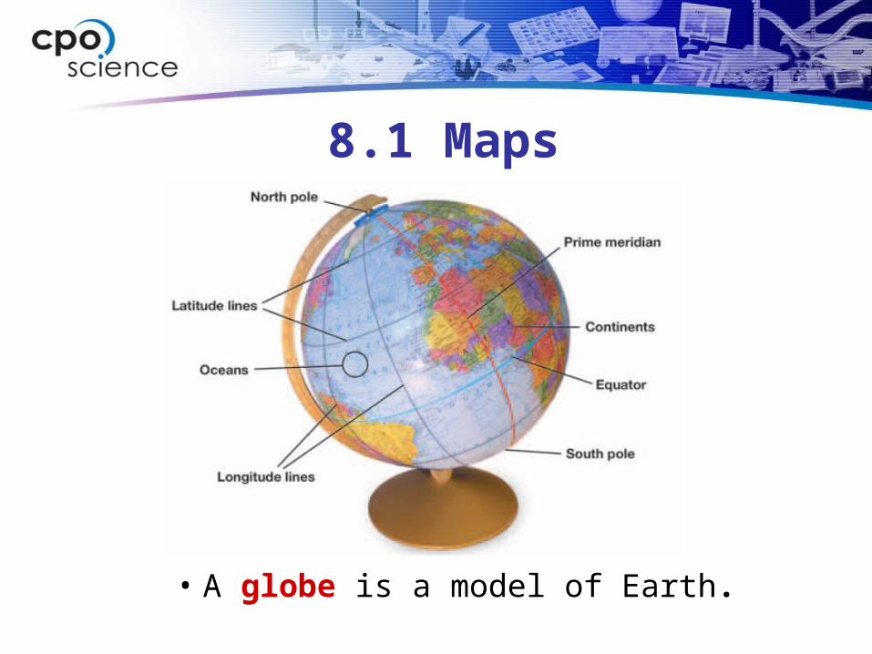
8.1 Maps
• A globe is a model of Earth.
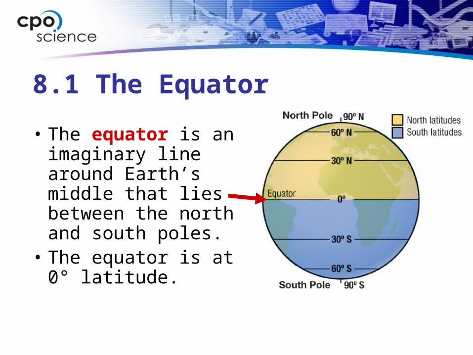
8.1 The Equator
• The equator is an imaginary line around Earth’s middle that lies between the north and south poles.
• The equator is at 0° latitude.
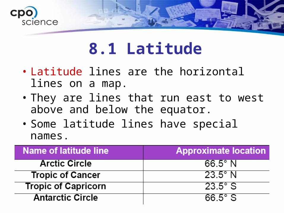
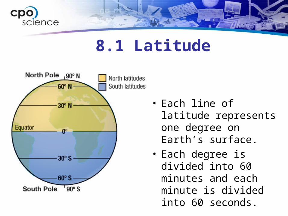
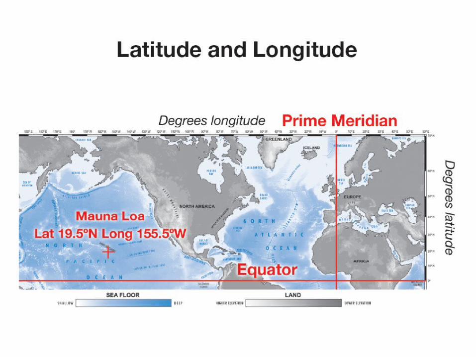
8.1 Latitude
• Latitude lines are the horizontal lines on a map.
• They are lines that run east to west above and below the equator.
• Some latitude lines have special names.
8.1 Latitude
• Each line of latitude represents one degree on Earth’s surface.
• Each degree is divided into 60 minutes and each minute is divided into 60 seconds.
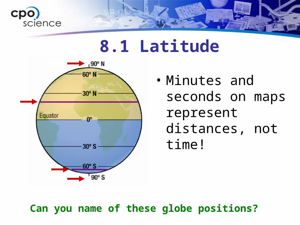
8.1 Latitude
• Minutes and seconds on maps represent distances, not time!
Can you name of these globe positions?
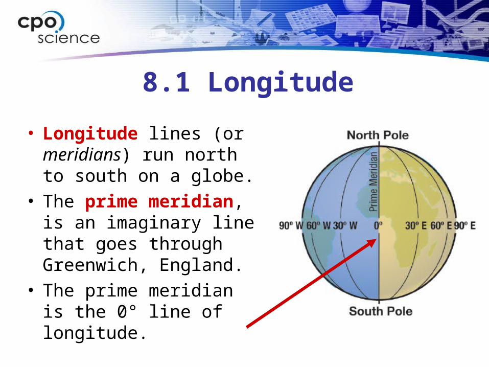
8.1 Longitude
• Longitude lines (or meridians) run north to south on a globe.
• The prime meridian, is an imaginary line that goes through Greenwich, England.
• The prime meridian is the 0° line of longitude.
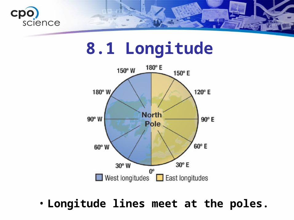
8.1 Longitude
• Longitude lines meet at the poles.
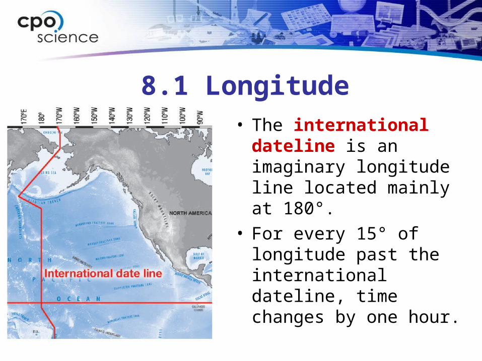
8.1 Longitude• The international
dateline is an imaginary longitude line located mainly at 180°.
• For every 15° of longitude past the international dateline, time changes by one hour.
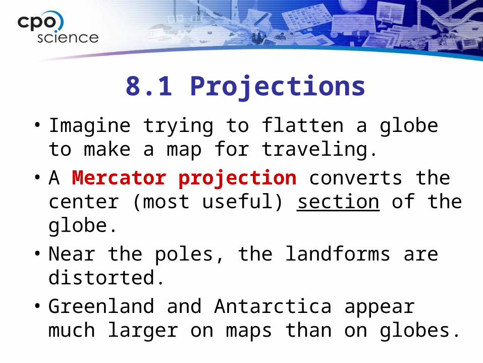
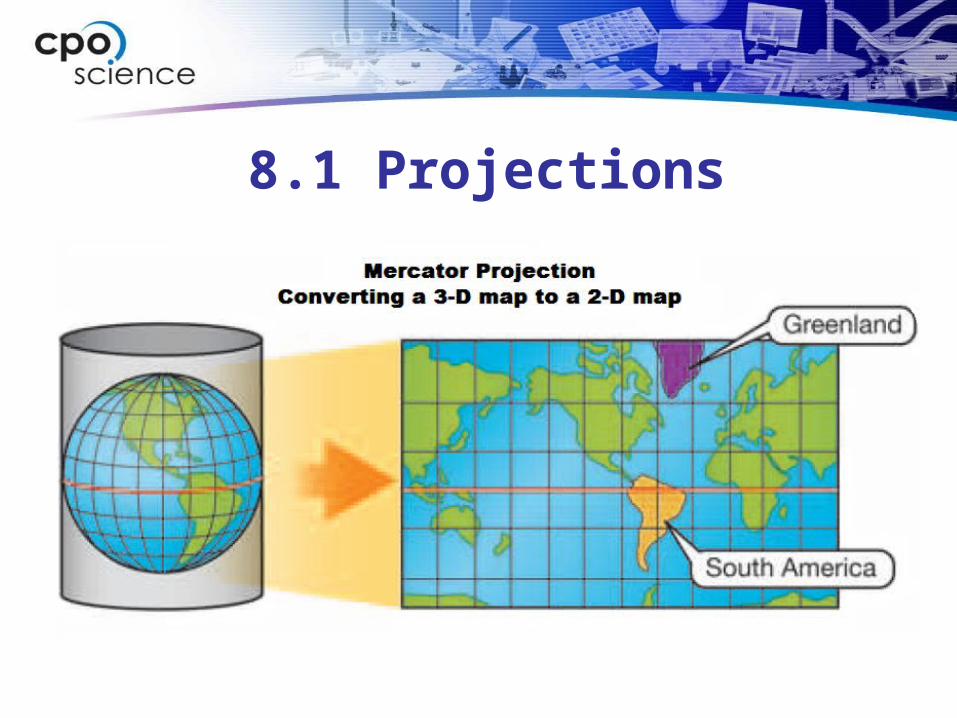
8.1 Projections• Imagine trying to flatten a globe to make a
map for traveling.
• A Mercator projection converts the center (most useful) section of the globe.
• Near the poles, the landforms are distorted.
• Greenland and Antarctica appear much larger on maps than on globes.
8.1 Projections

8.1 Features of maps
• On maps, there is usually a symbol that indicates direction—north, south, east, and west.
8.1 Features of maps
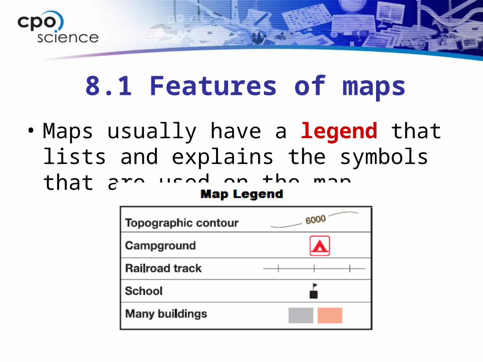
• Maps usually have a legend that lists and explains the symbols that are used on the map.
8.1 Features of maps
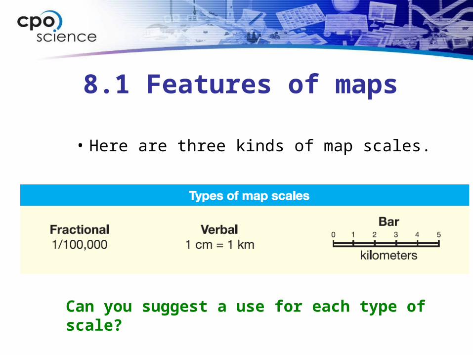
• Here are three kinds of map scales.
Can you suggest a use for each type of scale?
8.1 Features of maps
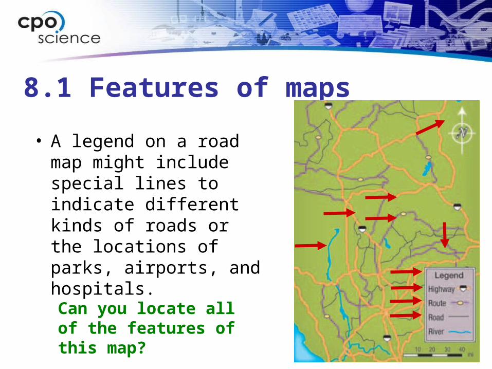
• A legend on a road map might include special lines to indicate different kinds of roads or the locations of parks, airports, and hospitals.
Can you locate all of the features of this map?