Embed Size (px)
Citation preview
2/17/2009 1
Name of the Presentation
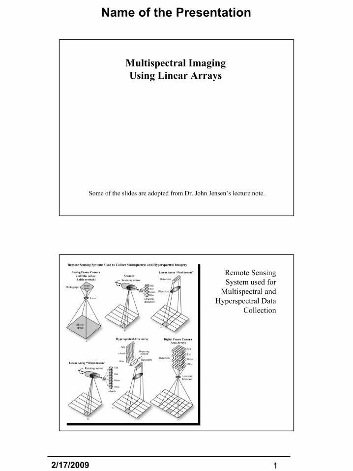
Multispectral Imaging Using Linear Arrays
Some of the slides are adopted from Dr. John Jensen’s lecture note.
Remote Sensing System used for
Multispectral and Hyperspectral Data
Collection
2/17/2009 2
Name of the Presentation
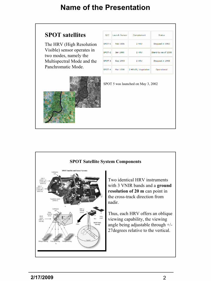
SPOT satellites
SPOT 5 was launched on May 3, 2002
The HRV (High Resolution Visible) sensor operates in two modes, namely the Multispectral Mode and the Panchromatic Mode.
Two identical HRV instruments with 3 VNIR bands and a ground resolution of 20 m can point in the cross-track direction from nadir.
Thus, each HRV offers an oblique viewing capability, the viewing angle being adjustable through +/-27degrees relative to the vertical.
SPOT Satellite System Components
2/17/2009 3
Name of the Presentation
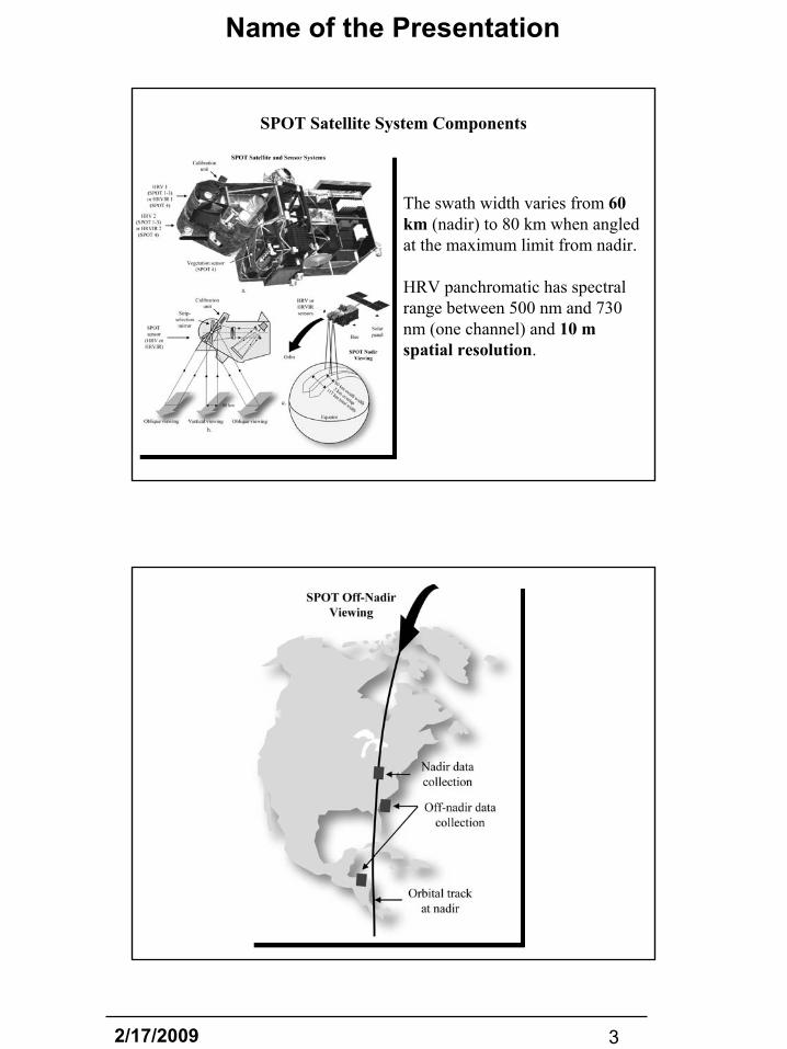
The swath width varies from 60 km (nadir) to 80 km when angled at the maximum limit from nadir.
HRV panchromatic has spectral range between 500 nm and 730 nm (one channel) and 10 mspatial resolution.
SPOT Satellite System Components
2/17/2009 4
Name of the Presentation
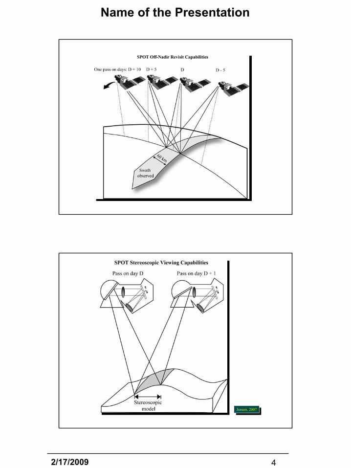
Jensen, 2007Jensen, 2007

2/17/2009 5
Name of the Presentation
Geographic Coverage of the SPOT HRV and Landsat Geographic Coverage of the SPOT HRV and Landsat Thematic Thematic MapperMapper (TM) Remote Sensing Systems(TM) Remote Sensing Systems
SPOT-4 VEGETATION
The VEGETATION Programme is developed jointly by France, the European Commission, Belgium, Italy and Sweden. The first satellite component was launched onboard SPOT 4, while the second instrument was launched onboard SPOT 5.
The VEGETATION Programme is conceived to allow daily monitoring of terrestrial vegetation cover at regional to globalscales.
2/17/2009 6
Name of the Presentation
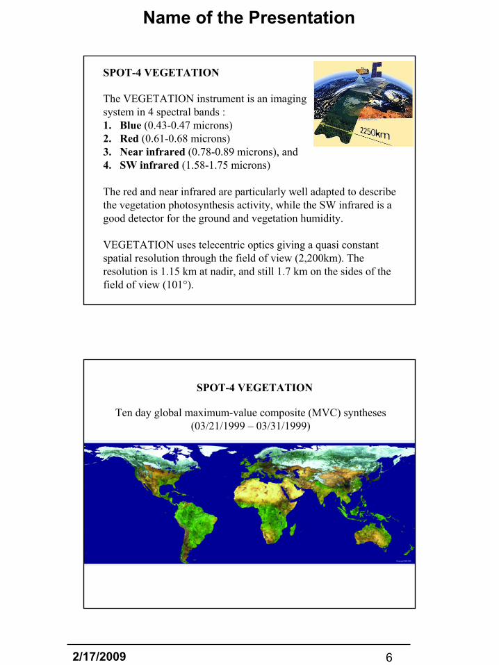
SPOT-4 VEGETATION
The VEGETATION instrument is an imaging system in 4 spectral bands : 1. Blue (0.43-0.47 microns) 2. Red (0.61-0.68 microns)3. Near infrared (0.78-0.89 microns), and 4. SW infrared (1.58-1.75 microns)
The red and near infrared are particularly well adapted to describe the vegetation photosynthesis activity, while the SW infrared is a good detector for the ground and vegetation humidity.
VEGETATION uses telecentric optics giving a quasi constant spatial resolution through the field of view (2,200km). The resolution is 1.15 km at nadir, and still 1.7 km on the sides of the field of view (101°).
SPOT-4 VEGETATION
Ten day global maximum-value composite (MVC) syntheses (03/21/1999 – 03/31/1999)

2/17/2009 7
Name of the Presentation
SPOT-4 VEGETATION
The free VGT products on syntheses are offered on 10 possible regions of interest.
SPOT-4 VEGETATION
Ten day global maximum-value composite (MVC) syntheses (03/21/1999 – 03/31/1999)
2/17/2009 8
Name of the Presentation
SPOT-4 VEGETATION
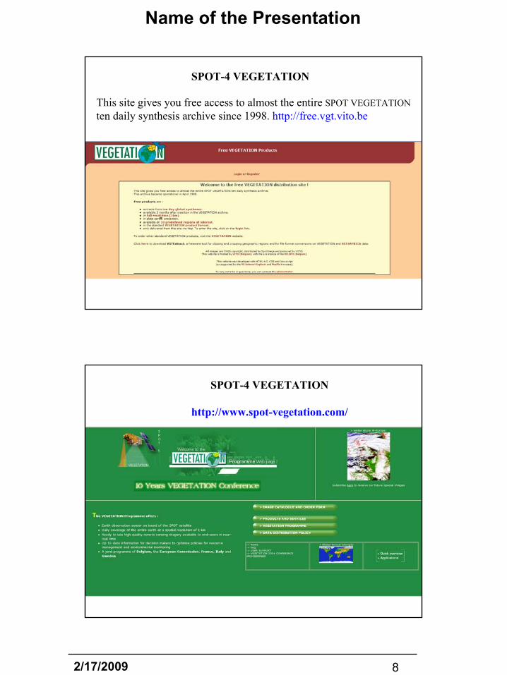
This site gives you free access to almost the entire SPOT VEGETATIONten daily synthesis archive since 1998. http://free.vgt.vito.be
SPOT-4 VEGETATION
http://www.spot-vegetation.com/
2/17/2009 9
Name of the Presentation
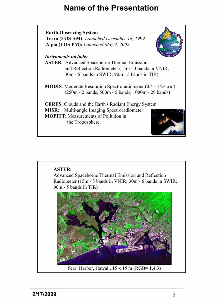
Instruments include:ASTER: Advanced Spaceborne Thermal Emission
and Reflection Radiometer (15m - 3 bands in VNIR;30m - 6 bands in SWIR; 90m - 5 bands in TIR)
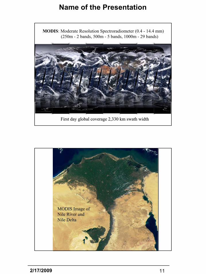
MODIS: Moderate Resolution Spectroradiometer (0.4 - 14.4 µm)(250m - 2 bands, 500m - 5 bands, 1000m - 29 bands)
CERES: Clouds and the Earth's Radiant Energy SystemMISR: Multi-angle Imaging SpectroradiometerMOPITT: Measurements of Pollution in
the Troposphere.
Earth Observing System Terra (EOS AM): Launched December 18, 1999Aqua (EOS PM): Launched May 4, 2002
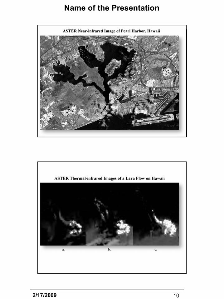
ASTER: Advanced Spaceborne Thermal Emission and Reflection Radiometer (15m - 3 bands in VNIR; 30m - 6 bands in SWIR; 90m - 5 bands in TIR)
Pearl Harbor, Hawaii, 15 x 15 m (RGB= 1,4,3)
2/17/2009 10
Name of the Presentation
2/17/2009 11
Name of the Presentation
MODIS: Moderate Resolution Spectroradiometer (0.4 - 14.4 mm)(250m - 2 bands, 500m - 5 bands, 1000m - 29 bands)
First day global coverage 2,330 km swath widthFirst day global coverage 2,330 km swath width
MODIS Image ofNile River and Nile Delta
2/17/2009 12
Name of the Presentation
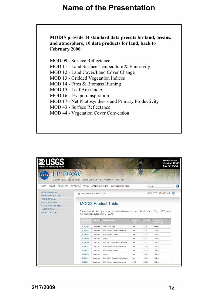
MODIS provide 44 standard data precuts for land, oceans, and atmosphere, 10 data products for land, back to February 2000.
MOD 09 - Surface Reflectance MOD 11 - Land Surface Temperature & EmissivityMOD 12 - Land Cover/Land Cover Change MOD 13 - Gridded Vegetation IndicesMOD 14 - Fires & Biomass Burning MOD 15 - Leaf Area IndexMOD 16 – EvapotranspirationMOD 17 - Net Photosynthesis and Primary Productivity MOD 43 - Surface Reflectance MOD 44 - Vegetation Cover Conversion
MODIS Data Products
2/17/2009 13
Name of the Presentation
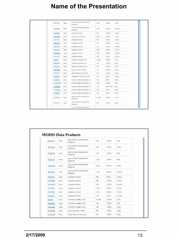
MODIS Data Products
MODIS Data Products
2/17/2009 14
Name of the Presentation
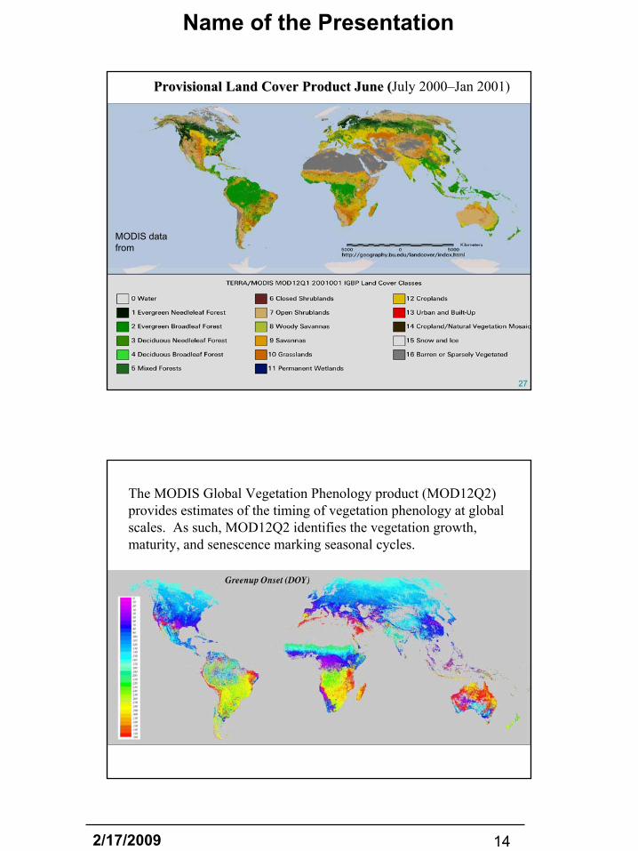
Provisional Land Cover Product June (Provisional Land Cover Product June (July 2000–Jan 2001)
MODIS data from
2727
The MODIS Global Vegetation Phenology product (MOD12Q2) provides estimates of the timing of vegetation phenology at global scales. As such, MOD12Q2 identifies the vegetation growth, maturity, and senescence marking seasonal cycles.
2/17/2009 15
Name of the Presentation
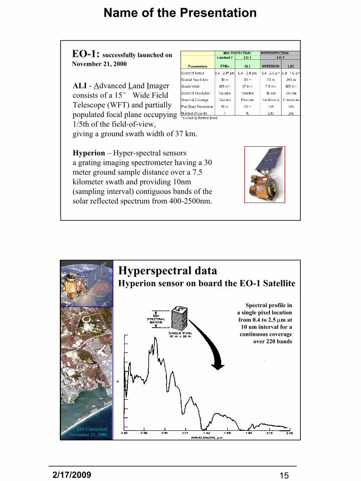
EO-1: successfully launched on November 21, 2000
ALI - Advanced Land Imager consists of a 15° Wide Field Telescope (WFT) and partially populated focal plane occupying 1/5th of the field-of-view, giving a ground swath width of 37 km.
Hyperion – Hyper-spectral sensorsa grating imaging spectrometer having a 30 meter ground sample distance over a 7.5 kilometer swath and providing 10nm (sampling interval) contiguous bands of the solar reflected spectrum from 400-2500nm.
Hyperspectral dataHyperion sensor on board the EO-1 Satellite
Spectral profile in a single pixel location from 0.4 to 2.5 µm at 10 nm interval for a continuous coverage
over 220 bands
EO-1 launched November 21, 2000
2/17/2009 16
Name of the Presentation
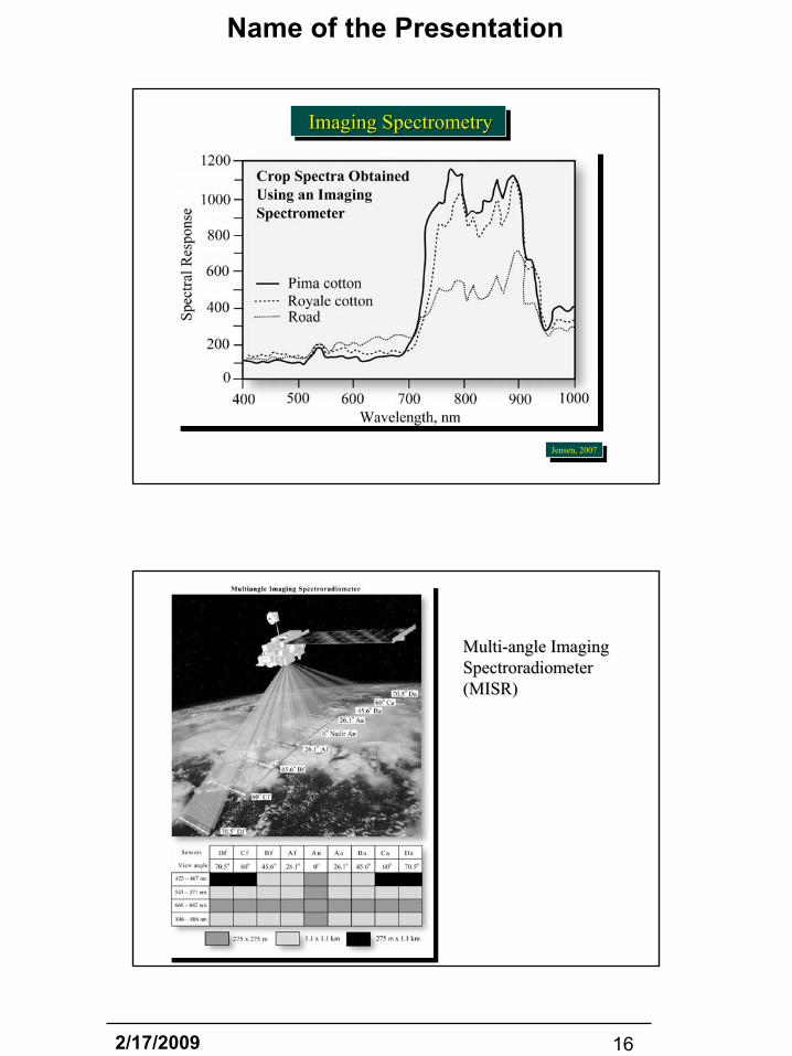
Imaging SpectrometryImaging SpectrometryImaging Spectrometry
Jensen, 2007Jensen, 2007
MultiMulti--angle Imaging angle Imaging SpectroradiometerSpectroradiometer(MISR)(MISR)

2/17/2009 17
Name of the Presentation
2/17/2009 18
Name of the Presentation
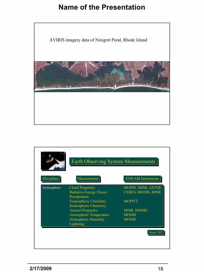
AVIRIS imagery data of Ninigret Pond, Rhode Island
DisciplineDisciplineDiscipline EOS-AM InstrumentsEOSEOS--AM InstrumentsAM InstrumentsMeasurementMeasurementMeasurement
Atmosphere Cloud Properties MODIS, MISR, ASTERRadiative Energy Fluxes CERES, MODIS, MISRPrecipitationTropospheric Chemistry MOPITTStratospheric ChemistryAerosol Properties MISR, MODISAtmospheric Temperature MODISAtmospheric Humidity MODISLightning
AtmosphereAtmosphere Cloud Properties Cloud Properties MODIS, MISR, ASTERMODIS, MISR, ASTERRadiativeRadiative Energy FluxesEnergy Fluxes CERES, MODIS, MISRCERES, MODIS, MISRPrecipitationPrecipitationTroposphericTropospheric ChemistryChemistry MOPITTMOPITTStratospheric ChemistryStratospheric ChemistryAerosol PropertiesAerosol Properties MISR, MODISMISR, MODISAtmospheric TemperatureAtmospheric Temperature MODISMODISAtmospheric HumidityAtmospheric Humidity MODISMODISLightningLightning
Earth Observing System MeasurementsEarth Observing System MeasurementsEarth Observing System Measurements
Jensen, 2007Jensen, 2007Jensen, 2007

2/17/2009 19
Name of the Presentation
DisciplineDisciplineDiscipline EOS-AM InstrumentsEOSEOS--AM InstrumentsAM InstrumentsMeasurementMeasurementMeasurement
Land Land Cover/Land Use Change MODIS, MISR, ASTERVegetation Dynamics MODIS, MISR, ASTERSurface Temperature MODIS, ASTERFire Occurrence MODIS, ASTERVolcanic Effects MODIS, MISR, ASTERSurface Wetness
LandLand Land Cover/Land Use ChangeLand Cover/Land Use Change MODIS, MISR, ASTERMODIS, MISR, ASTERVegetation DynamicsVegetation Dynamics MODIS, MISR, ASTERMODIS, MISR, ASTERSurface TemperatureSurface Temperature MODIS, ASTERMODIS, ASTERFire OccurrenceFire Occurrence MODIS, ASTERMODIS, ASTERVolcanic EffectsVolcanic Effects MODIS, MISR, ASTERMODIS, MISR, ASTERSurface WetnessSurface Wetness
Earth Observing System MeasurementsEarth Observing System MeasurementsEarth Observing System Measurements
Jensen, 2007Jensen, 2007Jensen, 2007
DisciplineDisciplineDiscipline EOS-AM InstrumentsEOSEOS--AM InstrumentsAM InstrumentsMeasurementMeasurementMeasurement
Ocean Surface Temperature MODISPhytoplankton MODIS, MISRDissolved Organic Matter MODIS, MISRSurface Wind FieldsOcean Surface Topography
OceanOcean Surface TemperatureSurface Temperature MODISMODISPhytoplankton Phytoplankton MODIS, MISRMODIS, MISRDissolved Organic MatterDissolved Organic Matter MODIS, MISRMODIS, MISRSurface Wind FieldsSurface Wind FieldsOcean Surface TopographyOcean Surface Topography
Cryosphere Land Ice Change ASTERSea Ice MODIS, ASTERSnow Cover MODIS, ASTER
CryosphereCryosphere Land Ice ChangeLand Ice Change ASTERASTERSea IceSea Ice MODIS, ASTERMODIS, ASTERSnow CoverSnow Cover MODIS, ASTERMODIS, ASTER
Solar Radiation Total Solar RadiationUltraviolet Spectral Irradiance
Solar RadiationSolar Radiation Total Solar RadiationTotal Solar RadiationUltraviolet Spectral IrradianceUltraviolet Spectral Irradiance
Earth Observing System MeasurementsEarth Observing System MeasurementsEarth Observing System Measurements


![RIAMCO Rhode Island Archival and Manuscript Collections Online [your name]](https://img.pdfslide.us/doc/110x75/56649e855503460f94b86ffc/riamco-rhode-island-archival-and-manuscript-collections-online-your-name.jpg)