Embed Size (px)
Citation preview
University of Belgrade – Faculty of Forestry
Multi-criteria decision analysis and GIS modeling for soil erosion vulnerability
in the Toplica River Watershed
Tijana Vulevic, Nada Dragovic, Boris RadicUniversity of Belgrade, Faculty of Forestry, Belgrade, Serbia
Soil Erosion Modelling, JRC Ispra, 20-21-22 March 2017
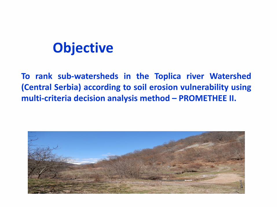
To rank sub-watersheds in the Toplica river Watershed(Central Serbia) according to soil erosion vulnerability usingmulti-criteria decision analysis method – PROMETHEE II.
Objective
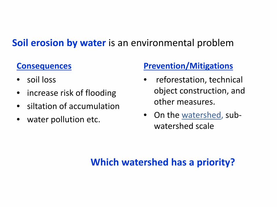
Soil erosion by water is an environmental problem
Consequences• soil loss • increase risk of flooding• siltation of accumulation • water pollution etc.
Prevention/Mitigations• reforestation, technical
object construction, and other measures.
• On the watershed, sub-watershed scale
Which watershed has a priority?
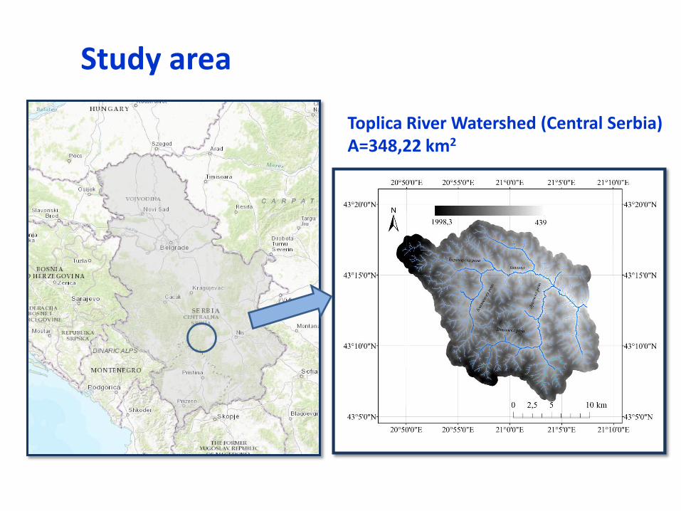
Study area
Toplica River Watershed (Central Serbia)A=348,22 km2
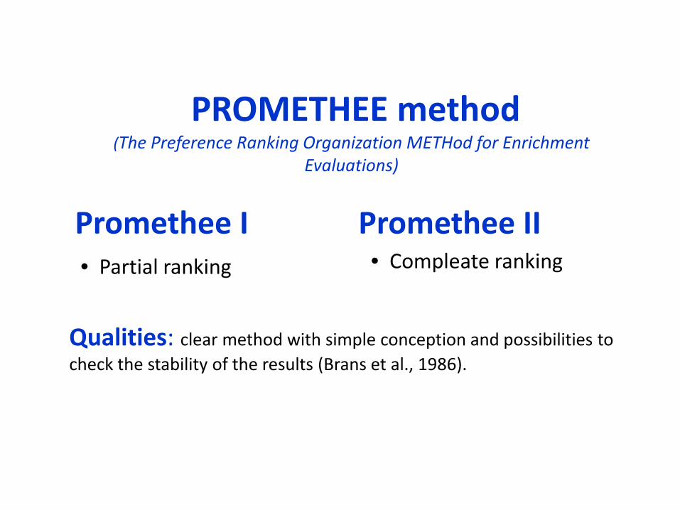
PROMETHEE method(The Preference Ranking Organization METHod for Enrichment
Evaluations)
Promethee I• Partial ranking
Promethee II• Compleate ranking
Qualities: clear method with simple conception and possibilities to check the stability of the results (Brans et al., 1986).
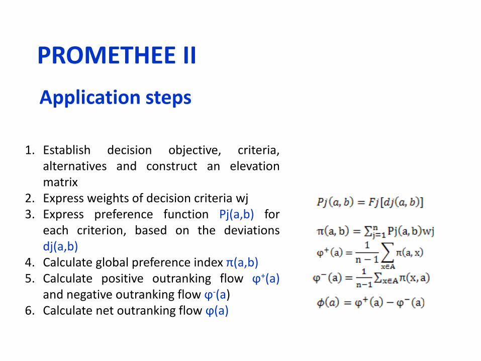
Application steps
1. Establish decision objective, criteria,alternatives and construct an elevationmatrix
2. Express weights of decision criteria wj3. Express preference function Pj(a,b) for
each criterion, based on the deviationsdj(a,b)
4. Calculate global preference index π(a,b)5. Calculate positive outranking flow ϕ+(a)
and negative outranking flow ϕ-(a)6. Calculate net outranking flow ϕ(a)
PROMETHEE II
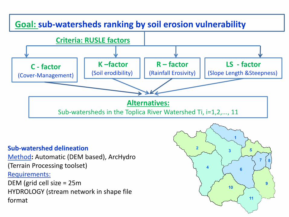
Goal: sub-watersheds ranking by soil erosion vulnerability
C - factor(Cover-Management)
K –factor(Soil erodibility)
R – factor(Rainfall Erosivity)
LS - factor (Slope Length &Steepness)
Sub-watershed delineationMethod: Automatic (DEM based), ArcHydro (Terrain Processing toolset)Requirements:DEM (grid cell size = 25mHYDROLOGY (stream network in shape file format
Alternatives: Sub-watersheds in the Toplica River Watershed Ti, i=1,2,..., 11
Criteria: RUSLE factors
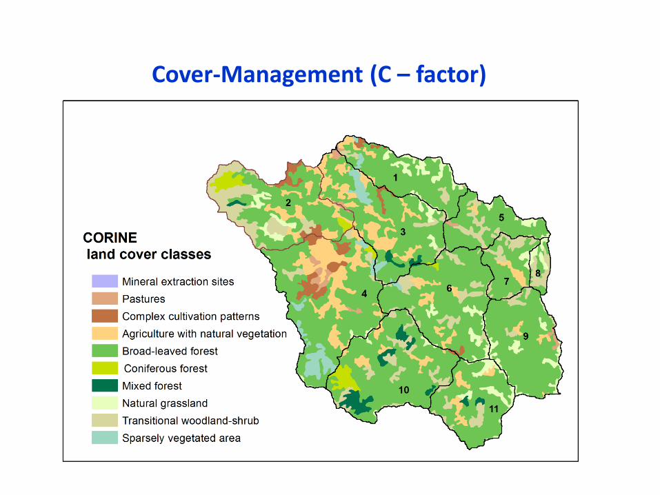
Cover-Management (C – factor)
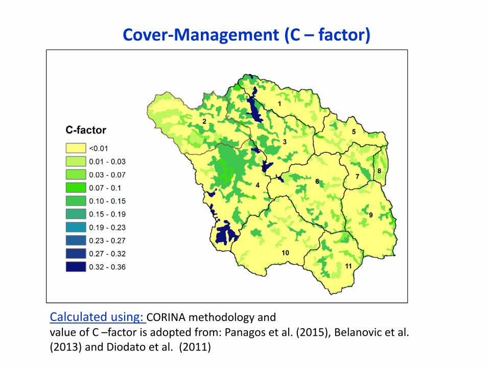
Cover-Management (C – factor)
Calculated using: CORINA methodology andvalue of C –factor is adopted from: Panagos et al. (2015), Belanovic et al. (2013) and Diodato et al. (2011)
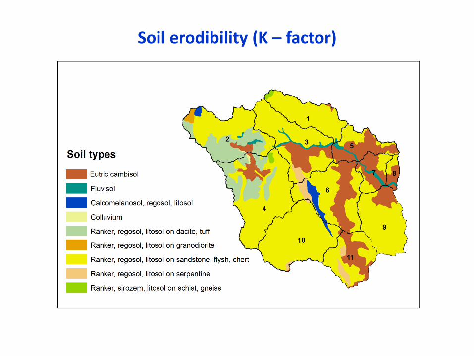
Soil erodibility (K – factor)
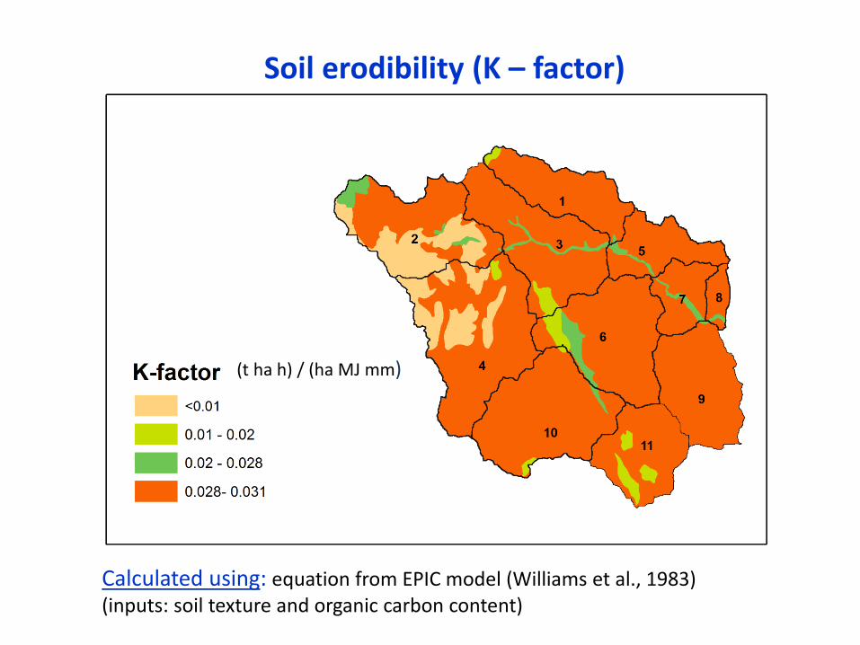
Soil erodibility (K – factor)
Calculated using: equation from EPIC model (Williams et al., 1983) (inputs: soil texture and organic carbon content)
(t ha h) / (ha MJ mm)
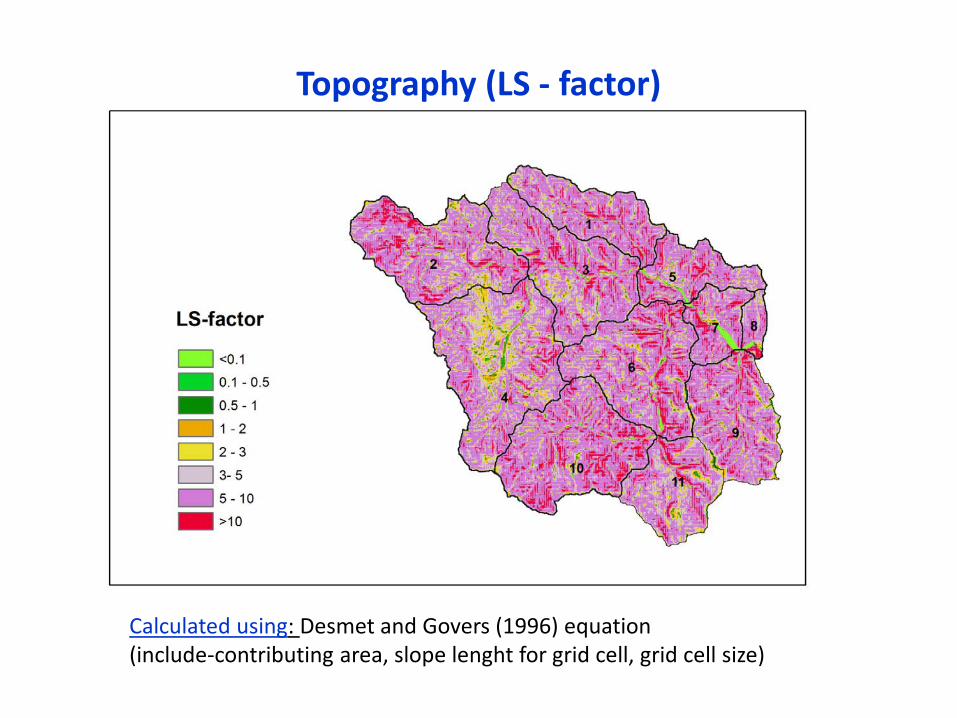
Topography (LS - factor)
Calculated using: Desmet and Govers (1996) equation(include-contributing area, slope lenght for grid cell, grid cell size)
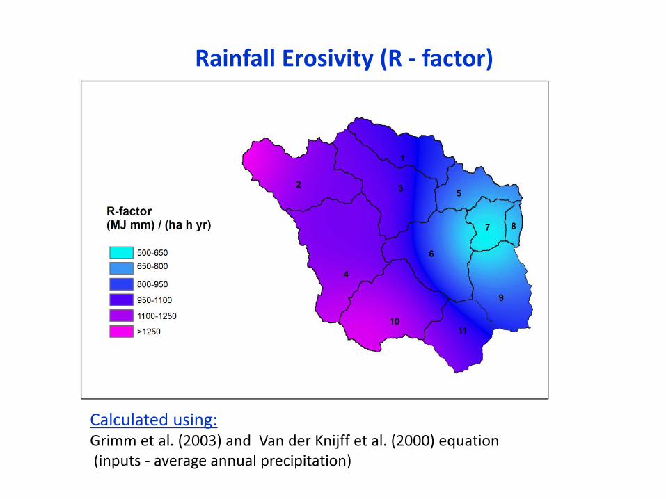
Rainfall Erosivity (R - factor)
Calculated using:Grimm et al. (2003) and Van der Knijff et al. (2000) equation(inputs - average annual precipitation)
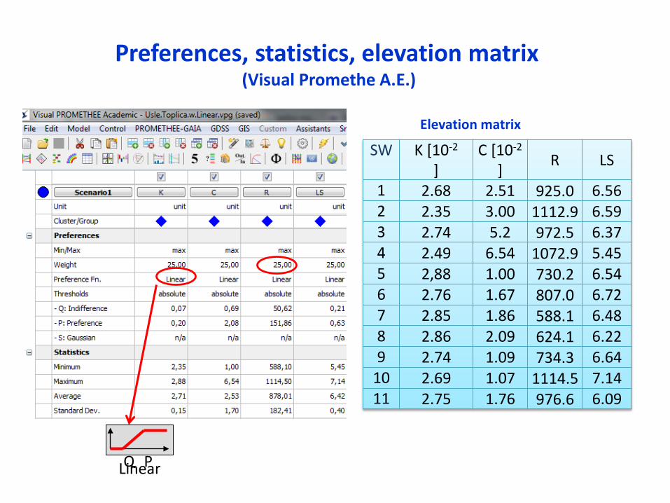
Preferences, statistics, elevation matrix(Visual Promethe A.E.)
LinearQ P
SW K [10-2
]C [10-2
] R LS
1 2.68 2.51 925.0 6.562 2.35 3.00 1112.9 6.593 2.74 5.2 972.5 6.374 2.49 6.54 1072.9 5.455 2,88 1.00 730.2 6.546 2.76 1.67 807.0 6.727 2.85 1.86 588.1 6.488 2.86 2.09 624.1 6.229 2.74 1.09 734.3 6.64
10 2.69 1.07 1114.5 7.1411 2.75 1.76 976.6 6.09
Elevation matrix
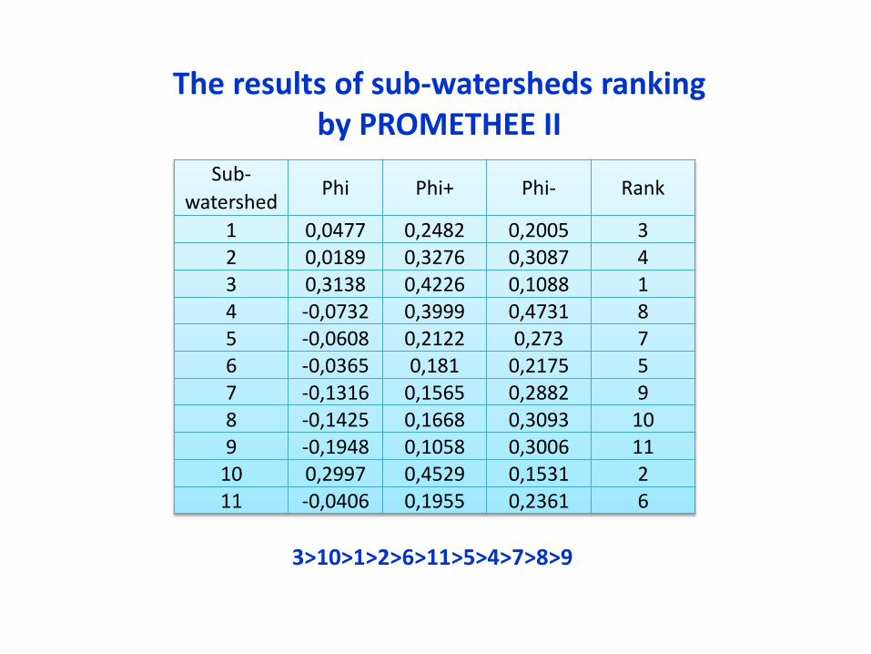
Sub-watershed
Phi Phi+ Phi- Rank
1 0,0477 0,2482 0,2005 32 0,0189 0,3276 0,3087 43 0,3138 0,4226 0,1088 14 -0,0732 0,3999 0,4731 85 -0,0608 0,2122 0,273 76 -0,0365 0,181 0,2175 57 -0,1316 0,1565 0,2882 98 -0,1425 0,1668 0,3093 109 -0,1948 0,1058 0,3006 11
10 0,2997 0,4529 0,1531 211 -0,0406 0,1955 0,2361 6
The results of sub-watersheds ranking by PROMETHEE II
3>10>1>2>6>11>5>4>7>8>9
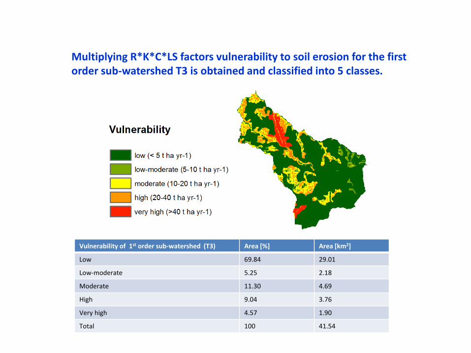
Multiplying R*K*C*LS factors vulnerability to soil erosion for the first order sub-watershed T3 is obtained and classified into 5 classes.
Vulnerability of 1st order sub-watershed (T3) Area [%] Area [km2]
Low 69.84 29.01
Low-moderate 5.25 2.18
Moderate 11.30 4.69
High 9.04 3.76
Very high 4.57 1.90
Total 100 41.54
Consclusions
Based on the results, we can conclude that:
PROMETHEE II outranking method provides a complete ranking of sub-watersheds according to soil erosion vulnerability
Considered criteria were: land cover, rainfall, soil erodibility and topography Using ArcHydro and ArcMap sub-watersheds are generated, layers are
produced as well as inputs for evaluation matrix Mapping erosion vulnerability using GIS enabled identification of conservation
priority area. Next step should be: estimate the influence (weights) of RUSLE factors on soil
erosion for every sub-watershed and sensitivity analysis of the results of ranking via PROMETHEE method

Thank you