Embed Size (px)
Citation preview
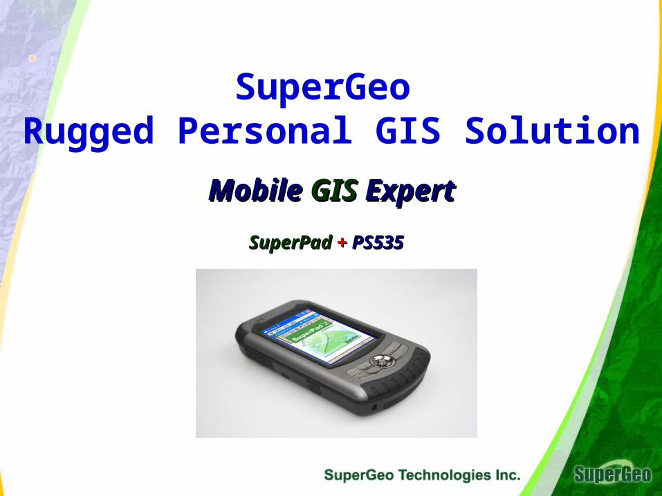
SuperGeo Rugged Personal GIS Solution
Mobile Mobile GIS GIS ExpertExpert SuperPad SuperPad ++ PS535 PS535

Agenda
1.1. Why Mobile GISExpert - PS 535 GIS PlusWhy Mobile GISExpert - PS 535 GIS Plus
2.2. Introduction to Mobile GISExpertIntroduction to Mobile GISExpert
3.3. ComparisonComparison
4.4. PS 535 and GETACPS 535 and GETAC
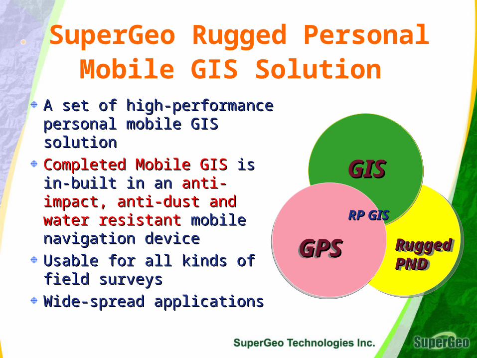
SuperGeo Rugged Personal Mobile GIS Solution
A set of high-performance A set of high-performance personal mobile GIS solutionpersonal mobile GIS solution
Completed Mobile GISCompleted Mobile GIS is in- is in-built in an built in an anti-impact, anti-anti-impact, anti-dust and water resistant dust and water resistant mobile navigation devicemobile navigation device
Usable for all kinds of field Usable for all kinds of field surveyssurveys
Wide-spread applicationsWide-spread applications
Rugged Rugged PNDPNDRugged Rugged PNDPND
GISGISGISGIS
GPSGPSGPSGPS
RP GISRP GIS
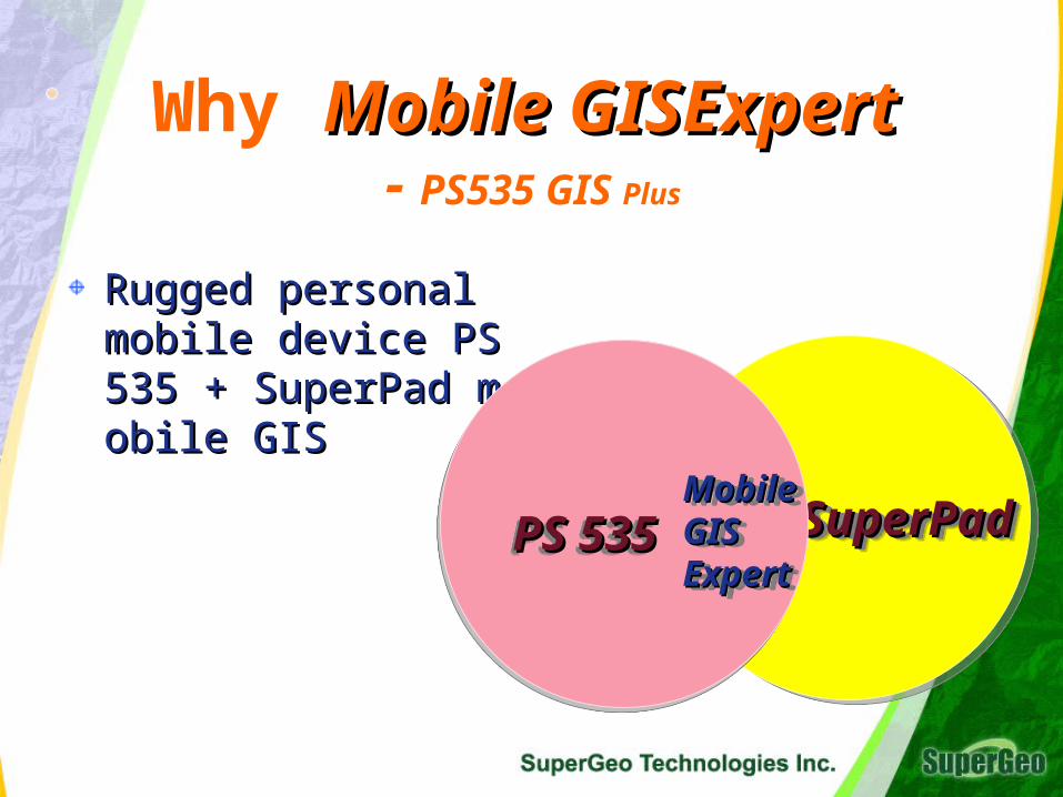
Why Mobile GISExpertMobile GISExpert - PS535 GIS Plus
Rugged personal mobRugged personal mobile device PS 535 + Sile device PS 535 + SuperPad mobile GIS uperPad mobile GIS
SuperPadSuperPadSuperPadSuperPadPS 535PS 535PS 535PS 535Mobile Mobile GIS GIS ExpertExpert
Mobile Mobile GIS GIS ExpertExpert
PositioningPositioningPositioningPositioning
RuggedRuggedRuggedRugged
StabilityStabilityStabilityStability
AccuracyAccuracyAccuracyAccuracy Navigation Navigation Navigation Navigation
PortablePortablePortablePortable
HighHighSensitivitySensitivity
HighHighSensitivitySensitivity
Internet Internet Internet Internet GISGIS
NewGISGIS New
Mobile GISExpertMobile GISExpert
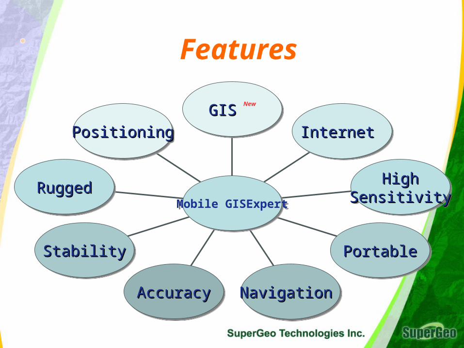
Features
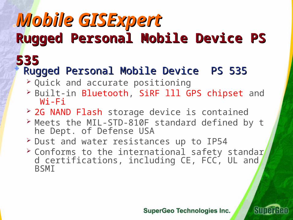
Mobile GISExpertMobile GISExpert Rugged Personal Mobile Device PS 535Rugged Personal Mobile Device PS 535
Rugged Personal Mobile Device PS 535Rugged Personal Mobile Device PS 535 Quick and accurate positioning Built-in Bluetooth, SiRF lll GPS chipset and Wi-Fi 2G NAND Flash storage device is contained Meets the MIL-STD-810F standard defined by the D
ept. of Defense USA Dust and water resistances up to IP54 Conforms to the international safety standard certific
ations, including CE, FCC, UL and BSMI
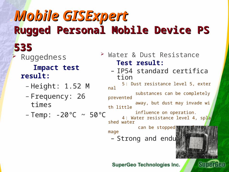
Mobile GISExpertMobile GISExpert Rugged Personal Mobile Device PS 535Rugged Personal Mobile Device PS 535
Ruggedness Impact test result:
– Height: 1.52 M
– Frequency: 26 times
– Temp: -20 ~ 50℃ ℃
Water & Dust Resistance Test result:
– IP54 standard certification 5: Dust resistance level 5, external substances can be completely prevented away, but dust may invade with little influence on operation. 4:Water resistance level 4, splashed wat
er can be stopped away from damage
– Strong and endurable
Mobile GISExpertMobile GISExpert SuperPad Mobile GISSuperPad Mobile GIS
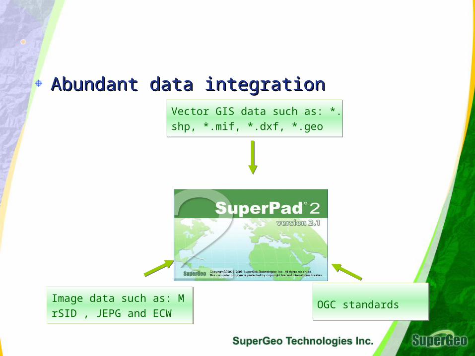
Abundant data integrationAbundant data integrationVector GIS data such as: *.shp, *.m
if, *.dxf, *.geo
Vector GIS data such as: *.shp, *.m
if, *.dxf, *.geo
Image data such as: MrSID ,
JEPG and ECW
Image data such as: MrSID ,
JEPG and ECWOGC standardsOGC standards
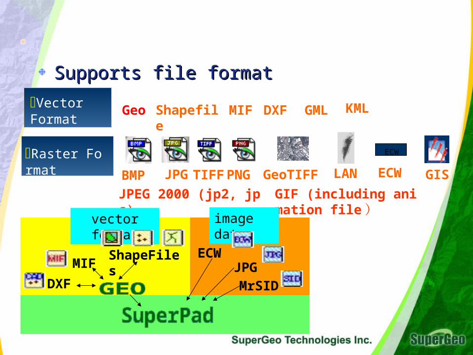
Supports file formatSupports file format
Vector Format
Raster Format
Shapefile MIF DXF
BMP JPG GISTIFF PNG GeoTIFF LAN ECW
ECW
Geo GML
JPEG 2000 (jp2, jpc) GIF (including animation file )
ShapeFiles
DXF
ECWMIF
MrSID
vector format image data
JPG
KML
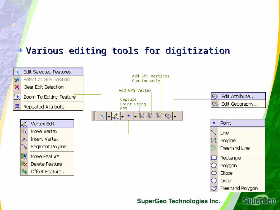
Various editing tools for digitization Various editing tools for digitization
Capture Point Using GPS
Add GPS Vertex
Add GPS Vertices Continuously
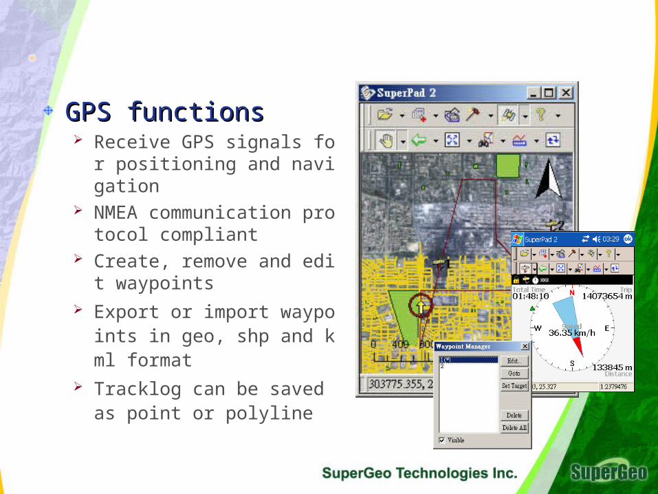
GPS functionsGPS functions Receive GPS signals for posit
ioning and navigation NMEA communication protoc
ol compliant Create, remove and edit wayp
oints Export or import waypoints in
geo, shp and kml format Tracklog can be saved as poi
nt or polyline
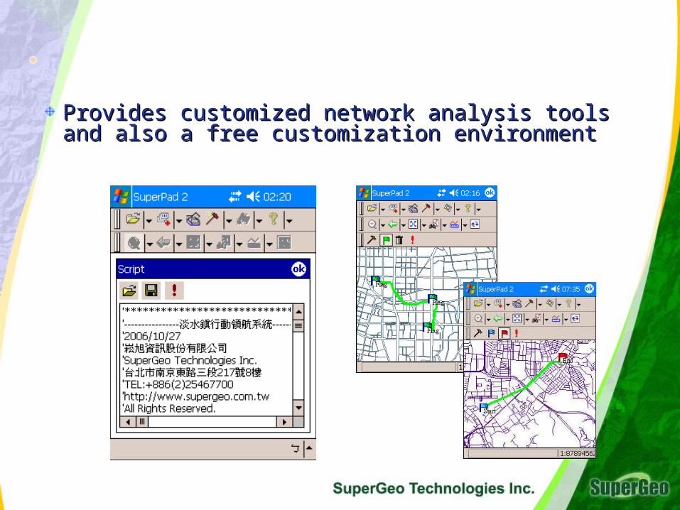
Provides customized network analysis toolsProvides customized network analysis tools and and also a free customization environmentalso a free customization environment
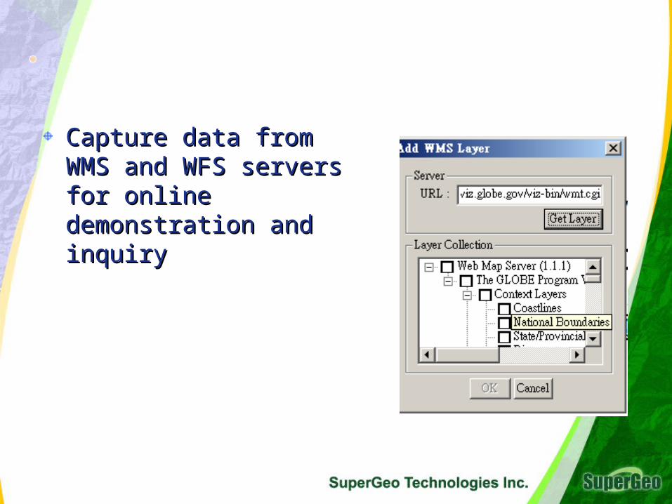
Capture data from WMS Capture data from WMS and WFS servers for online and WFS servers for online demonstration and inquirydemonstration and inquiry
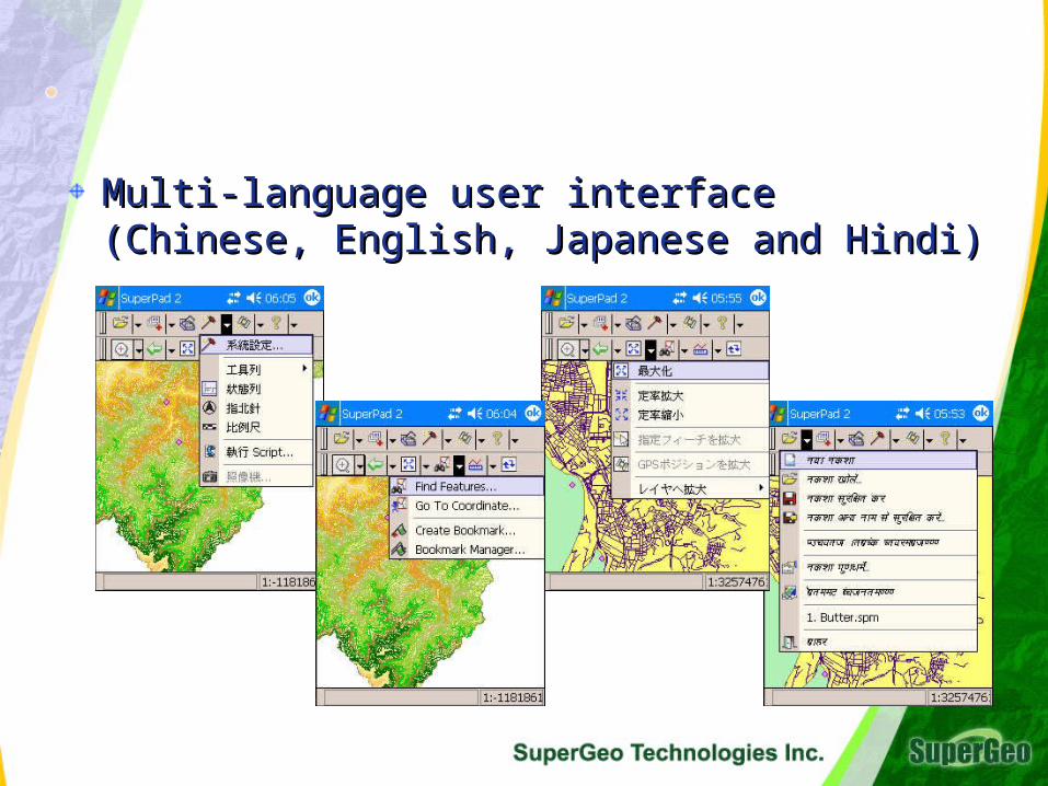
Multi-language user interface (Chinese, English, Multi-language user interface (Chinese, English, Japanese and Hindi)Japanese and Hindi)
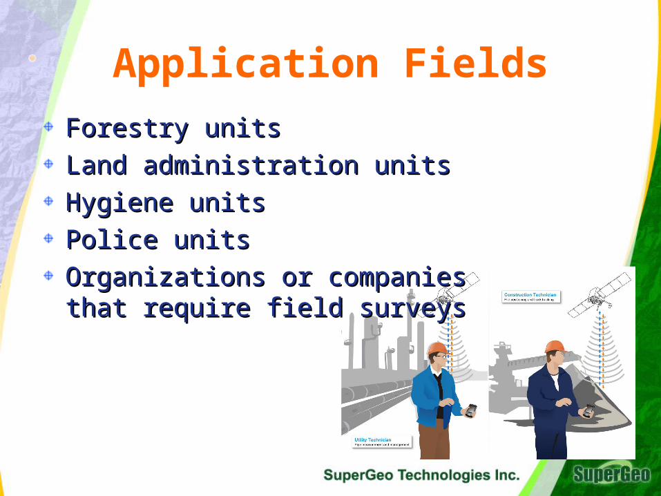
Application Fields
Forestry unitsForestry units
Land administration unitsLand administration units
Hygiene units Hygiene units
Police unitsPolice units
Organizations or companies Organizations or companies that require field surveysthat require field surveys
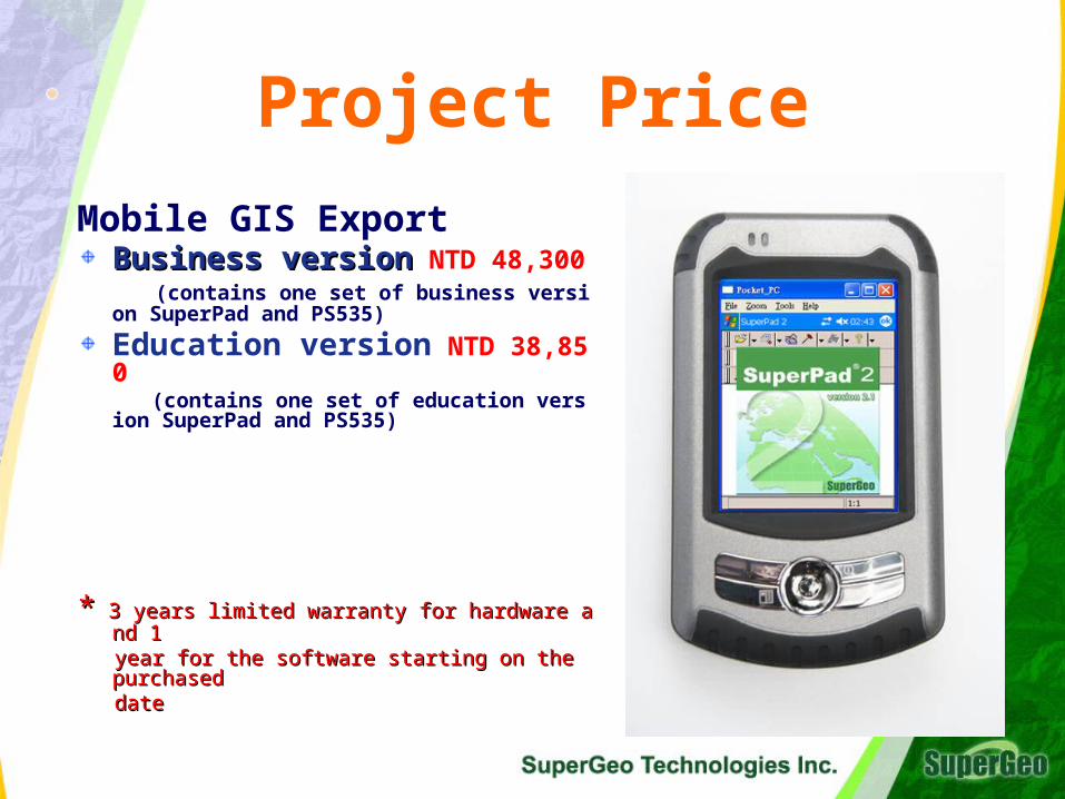
Project Price
Mobile GIS Export
Business versionBusiness version NTD 48,300 (contains one set of business version Sup
erPad and PS535)
Education version NTD 38,850 (contains one set of education version Su
perPad and PS535)
** 3 years limited warranty for hardware and 1 3 years limited warranty for hardware and 1 year for the software starting on the purchased year for the software starting on the purchased datedate
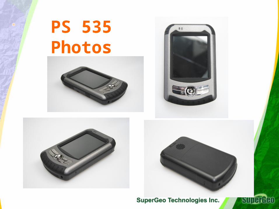
PS 535 Photos
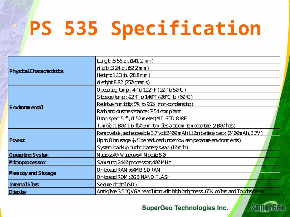
PS 535 SpecificationLength: 5.56 in. (141.2 mm)Width: 3.24 in. (82.2 mm)Height: 1.13 in. (28.8 mm)Weight: 8.82 (250 grams)
Operating temp: -4° to 122° F(-20° to 50°C)Storage temp: -22°F to 140°F(-20°C to +60°C) Relative humidity: 5% to 95% (non-condensing)Rain and dust resistance: IP54 compliantDrop spec: 5 ft., (1.52 meter) MIL-STD 810FTumble: 1,000 1.6 ft./0.5 m tumbles at room temperature (2,000 hits)
Removable, rechargeable 3.7 volt 2400 mAh Li Ion battery pack (2400mAh, 3.7V)Up to 8 hr usage (will be reduced under low-temperature environments)System backup during battery swap (10 min)
Operating System Microsoft® Windows® Mobile 5.0
Microprocessor Samsung 2440 processor, 400 MHz
On-board RAM: 64MB SDRAMOn-board ROM: 2GB NAND FLASH
Internal Slots Secure digital (SD)
Display Anti-glare 3.5" QVGA resolution with high brightness, 65K colors and Touchscreen
Environmental
Memory and Storage
Physical Characteristics
Power
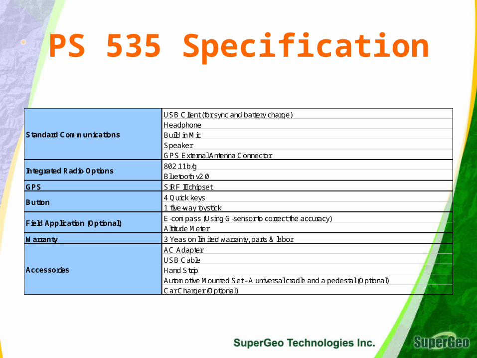
PS 535 Specification
USB Client (for sync and battery charge)HeadphoneBuild in Mic SpeakerGPS External Antenna Connector
802.11b/g Bluetooth v2.0
GPS SiRF III chipset
4 Quick keys1 five-way joystick
E-compass (Using G-sensor to correct the accuracy)Altitude Meter
Warranty 3 Yeas on limited warranty, parts & labor
AC AdapterUSB CableHand StripAutomotive Mounted Set - A universal cradle and a pedestal (Optional)Car Charger (Optional)
Accessories
Button
Integrated Radio Options
Standard Communications
Field Application (Optional)
About GETACEstablished in 1989 as a joint stock company by MiTAC gEstablished in 1989 as a joint stock company by MiTAC group and General Electronic Company US roup and General Electronic Company US Develops and produces rugged computersDevelops and produces rugged computersIn 2002, went public in TaiwanIn 2002, went public in TaiwanIn 2005, Common Wealth magazine ranked it 62nd from In 2005, Common Wealth magazine ranked it 62nd from 1000 major domestic manufacturers and 10th in the com1000 major domestic manufacturers and 10th in the computer system industryputer system industryBetween 2003 and 2005, the profit growing rate has reacBetween 2003 and 2005, the profit growing rate has reached 615% hed 615% In 2006, was ranked the 30th on Taiwan High TechnologIn 2006, was ranked the 30th on Taiwan High Technology Fast 50 given by Deloitte & Touchey Fast 50 given by Deloitte & ToucheIn 2007, cooperated with SuperGeo Technologies Inc. to In 2007, cooperated with SuperGeo Technologies Inc. to release the Mobile GISExpert – PS 535 GIS-Plusrelease the Mobile GISExpert – PS 535 GIS-Plus

Thank you!