Embed Size (px)
Citation preview
presented by: Mr. DJEDOUBOUM Emmanuel Ambroise and Mr. BRAHIM ABDERAMANE YACINE
E-mail: [email protected]/[email protected] 10 -14 November ,2014/Johannesburg
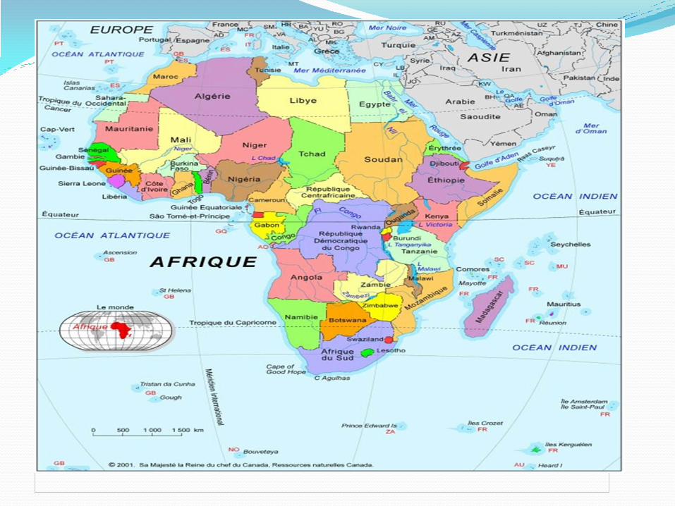
REPUBLIC OF CHAD
Ministry of Oil ,Mines and Energy
I. INTRODUCTION
Chad is a landlocked country located in the heart of Africa, between 7 °
and 24 ° N, 13 ° and 24 ° east longitude. It has an area of 1,284,000
km2 and extends from north to south and 1900 km from east to west
over 900km. It shares borders with Libya, Sudan, Niger, Nigeria,
Cameroon and the Central African Republic. The major part of the
country is in the form of a plain altitude between 290-320 m.
Depression located SW of Faya Largeau, which represents the lowest
point of the country, is about 120 m below the level of Lake Chad
located in the approximate odds of 280 m. The Chad has three
mountain ranges: the stage of Ouddaï east on the border with Sudan
which altitudes vary between 500 and 1000 m, the central massif
(Guera), which rises to 1600 m and the Tibesti north including several
peaks over 3,000 m, and whose peak reaches 3415 m Emi Koussi.
Fifth African country area (1.284.000km2), filled with 11,274,106
inhabitants according to the last population census in 2009 and with a
mineral potential not yet developed, Chad remains to date a virgin
area.
II. GEOLIGICAL BAKGROUND The Chad is between the Congolese craton south, the West African
craton in the west and the Nile Craton northeast. The geology
consists of two main geological units: Precambrian crystalline
basement and sedimentary cover.
The oldest rocks (granitoid) and Precambrian metamorphic rocks are
found on the outskirts of two bowls: one of Erdis, which is an
extension of the Libyan Kufra basin, and Lake Chad. They suffered
major orogenic events (Pan late Proterozoic: 600/650 Ma).
The Chadian space can be partitioned into ten groups, from north to south. Mayo Kebbi is located south-west of the country, on the border
with Cameroon. It is a region consisting of previously developed land
and pleated that extend into Cameroon hills. Land recognized are
varied, and folded sedimentary, metamorphic and igneous
Proterozoic and Archean. This is probably the most explored and
best known geologically region.
The Guéra or Massif Central is a blunting of eroded base which forms a
massive hill between N'Djamena and Abeche. The crystalline rocks, in
particular, are poorly understood.
Salamat, opposite the Central African Republic, is a very moist and rich
in plant area. As for the north, the difficulties of access to the region's
geology explain that remains the subject of many questions.
Here is some brief geological settings Chad
III.RESSOURCES OF URANIUM Uranium mineral resources of Chad are distributed in several ways
throughout the territory: In the late 1940, the mapping showed the
presence of uranium and thorium index of the most developers are in
BET North and in Mayo Kebbi West and South.
Most of these indices are associated with alkaline granites, leuco
granites or syenites of Protorozoïque. There are other
indications of thorium in sedimentary environment in relation to
deposits from ancient regolith overhaul.
Clues uranium "primary" include
in the Tibesti, north Aouzou towards Yedri, ten uranium
occurrences identified in the granitic basement fractures
in Enneri Miski, south of Tibesti, an index located in
southeastern Zouar; Finally, in the Mayo Kebbi West, madazang or surveys have to recognize the presence of pitchblende, coffinite of silicates, U-Pb. The exploration minéralisation attribute this to an overlapping area shaer zones Units Néoprotorozoïque. Clues to Thorium and sedimentary uranium are reported in the Paleocene cover: In the Cambro-Ordovician conglomerate regions Boubao, Wadi Baku (near fada);
At the base of the Ordovician sandstones on the periphery of the Tibesti;
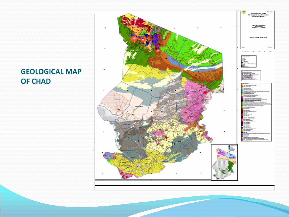
GEOLOGICAL MAP OF CHAD
A.URANIUM OF MADAGZANG
The deposit Madagzang (Léré,Mayo Kebbi West) is best known
because it has been the subject of previous studies by UNDP and the
IAEA (International Atomic Energy Agency) between 1970s and 1980s
these studies were supplemented by exploration Chad Mining Services
Limited. The Chad Mining Services Company has completed over 170
vertical wells,22 trenches and a dozen drilling inclined concentrations
vary from one well to another the greatest value is in the order of
4000ppm in wells and is 50 to 100 ppm in surface during the mapping.
The deposit is estimated at 8,000,000 tons.
a. Methodology: CMS works are performed from 2007 to 2010 as follows:
• Airborne (airbone survey);
• The mapping (mapping);
• Utilization spectrometer hand and Probe
• Drilling and trenching;
• The sampling;
• Log drilling and log trenches;
• Entering data into the SABLE software
IV.EXPLORATION PROSPECTS
Guera at the Centre of the country, has a potential still unclear,
alkaline granitic (attributed to the Pan African)
Added to this is the entire province of BET(Borkou-Ennedi-Tibesti)
presents a potential whatsoever in base with differentiated granites,
or in training coverage, just outside the Tibesti. In particular,
continental clastic formations interspersed Paleozoic paleo-fracture
subméridiennes presents comparable to that of the region of the Air
in Niger characteristics.
From the above uranium in Chad is not explored in its entirety, it
necessary to deploy the means to highlight the areas of indices
which we have just discussed to better understand the subject of this
deposit very helpful as energy.
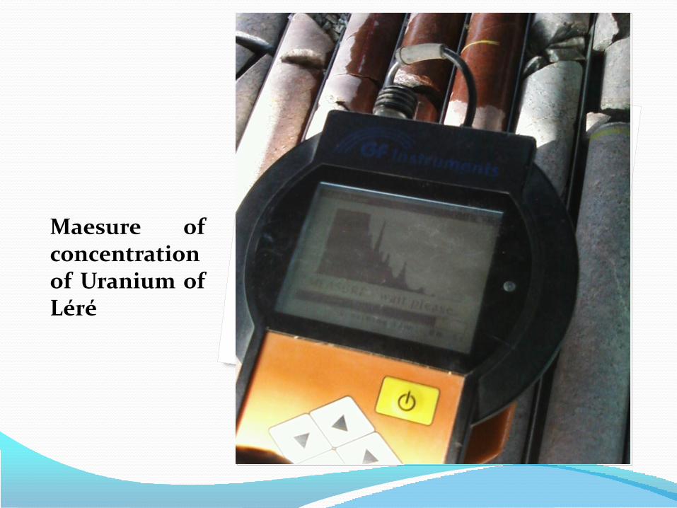
Maesure of concentration of Uranium of Léré
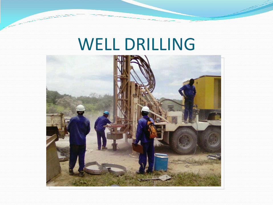
WELL DRILLING
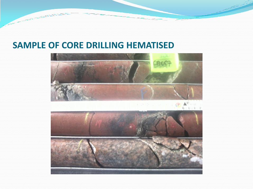
SAMPLE OF CORE DRILLING HEMATISED
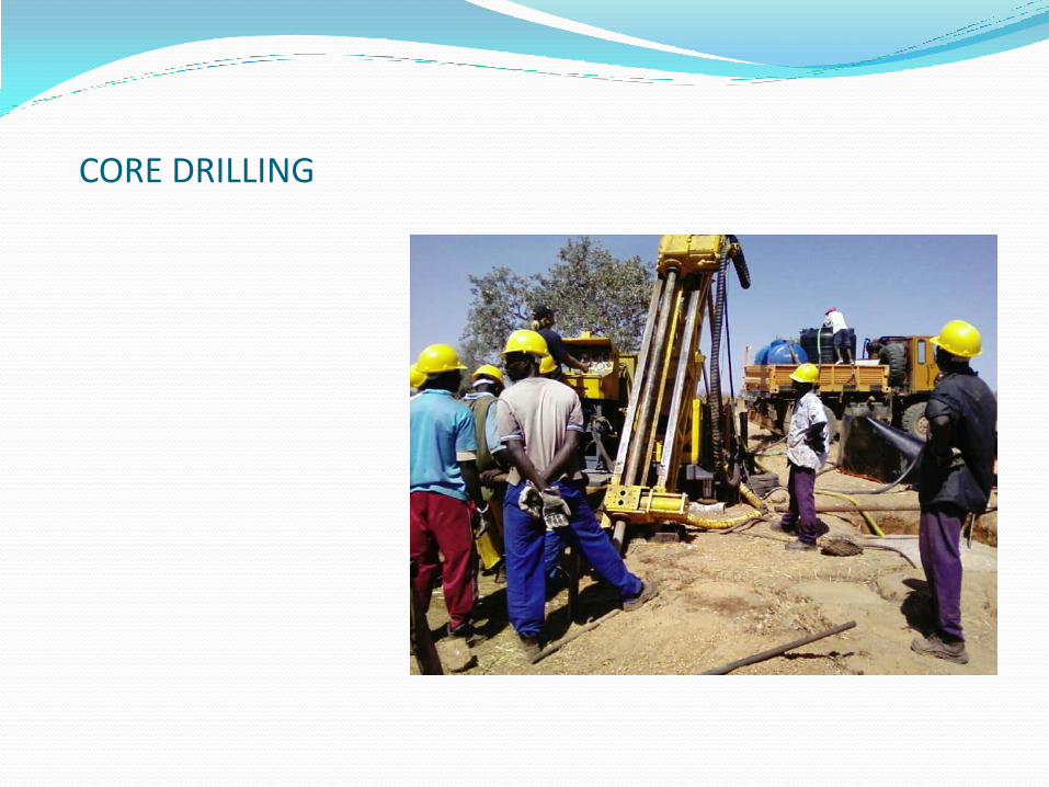
CORE DRILLING
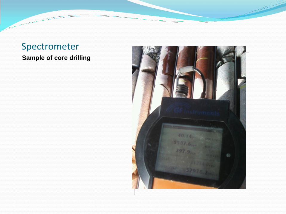
Spectrometer Sample of core drilling
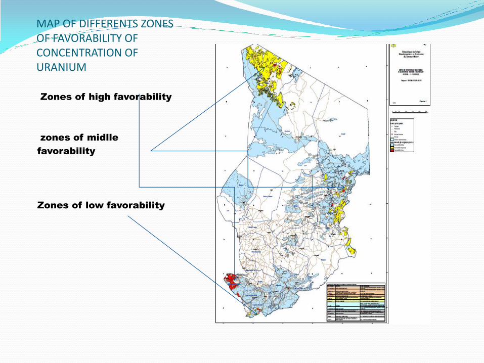
MAP OF DIFFERENTS ZONES OF FAVORABILITY OF CONCENTRATION OF URANIUM Zones of high favorability
zones of midlle
favorability
Zones of low favorability
V. CONCLUSION In conclusion we can say that the Republic of Chad is a relatively landlocked territory without easy access to the sea; it is important to target the development of areas of the Massif Central; Borkou-Ennedi-Tibesti to evaluate all of the reserves and this area of uranium developer little known in our country.

THANK YOU FOR YOUR ATTENTION!!!