Embed Size (px)
Citation preview
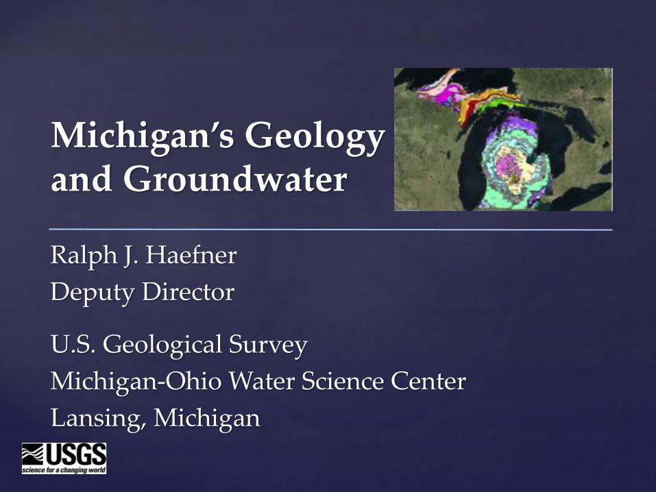
Michigan’s Geology and Groundwater
Ralph J. HaefnerDeputy Director
U.S. Geological SurveyMichigan-Ohio Water Science CenterLansing, Michigan
§ About the USGS§ Geology 101§ Michigan’s geology
§ Bedrock geology
§ Glacial geology
§ Understanding groundwater§ Porosity and permeability
§ Baseflow
§ Monitoring
Outline
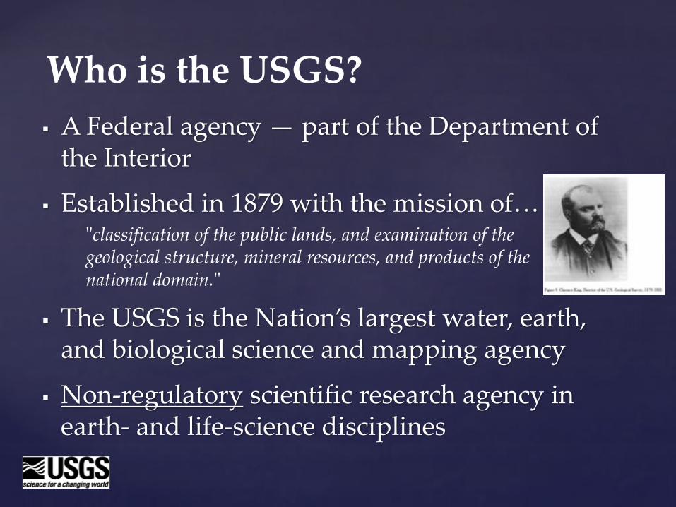
§ A Federal agency — part of the Department of the Interior
§ Established in 1879 with the mission of…
§ The USGS is the Nation’s largest water, earth, and biological science and mapping agency
§ Non-regulatory scientific research agency in earth- and life-science disciplines
Who is the USGS?
"classification of the public lands, and examination of the geological structure, mineral resources, and products of the national domain."
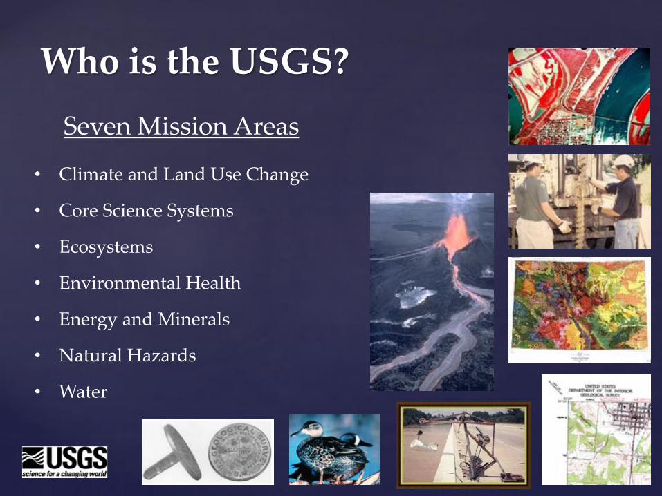
Seven Mission Areas
Who is the USGS?
• Climate and Land Use Change
• Core Science Systems
• Ecosystems
• Environmental Health
• Energy and Minerals
• Natural Hazards
• Water
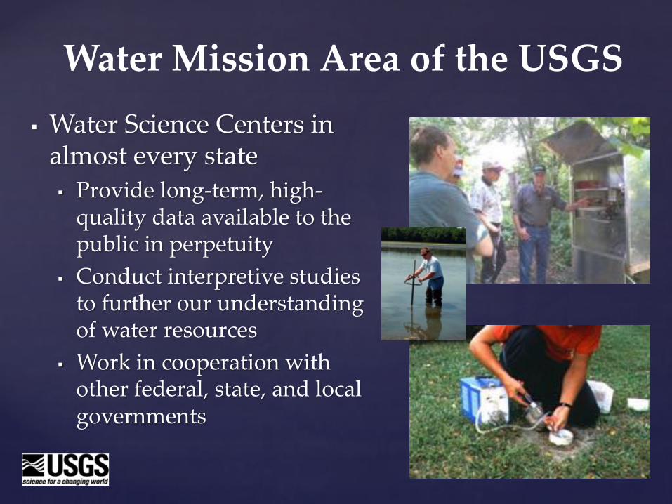
§ Water Science Centers in almost every state§ Provide long-term, high-
quality data available to the public in perpetuity
§ Conduct interpretive studies to further our understanding of water resources
§ Work in cooperation with other federal, state, and local governments
Water Mission Area of the USGS
§ Geology is the study of the earth including aspects of § Physics and chemistry§ Astronomy§ Meteorology§ Biology§ Hydrology
Geology 101
(…it’s more than just rocks!)
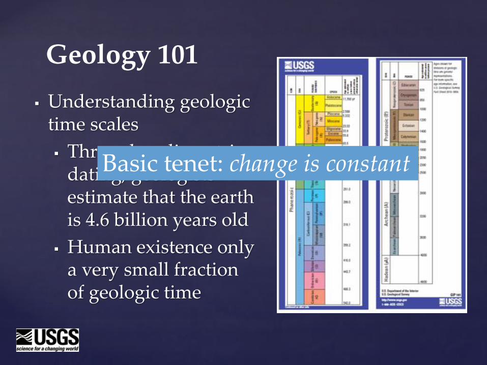
§ Understanding geologic time scales§ Through radiometric
dating, geologists estimate that the earth is 4.6 billion years old
§ Human existence only a very small fraction of geologic time
Geology 101
Basic tenet: change is constant
Geology 101
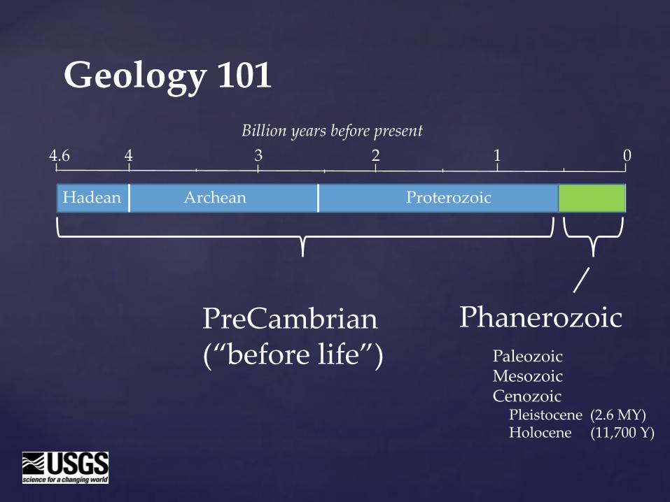
PreCambrian(“before life”)
PhanerozoicPaleozoicMesozoicCenozoic
Pleistocene (2.6 MY)Holocene (11,700 Y)
Hadean Archean Proterozoic
4.6 4 3 2 1 0Billion years before present
§ Bedrock is the solid rock that underlies loose deposits such as soil or alluvium
§ The bedrock geology of Michigan is quite complex and includes igneous, metamorphic, and sedimentary rocks, the surface of which have been significantly altered by glaciers
Bedrock geology
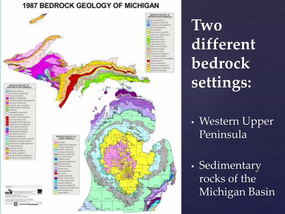
Two different bedrock settings:
§ Western Upper Peninsula
§ Sedimentary rocks of the Michigan Basin
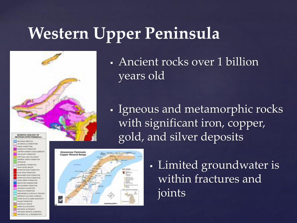
§ Ancient rocks over 1 billion years old
§ Igneous and metamorphic rocks with significant iron, copper, gold, and silver deposits
Western Upper Peninsula
§ Limited groundwater is within fractures and joints
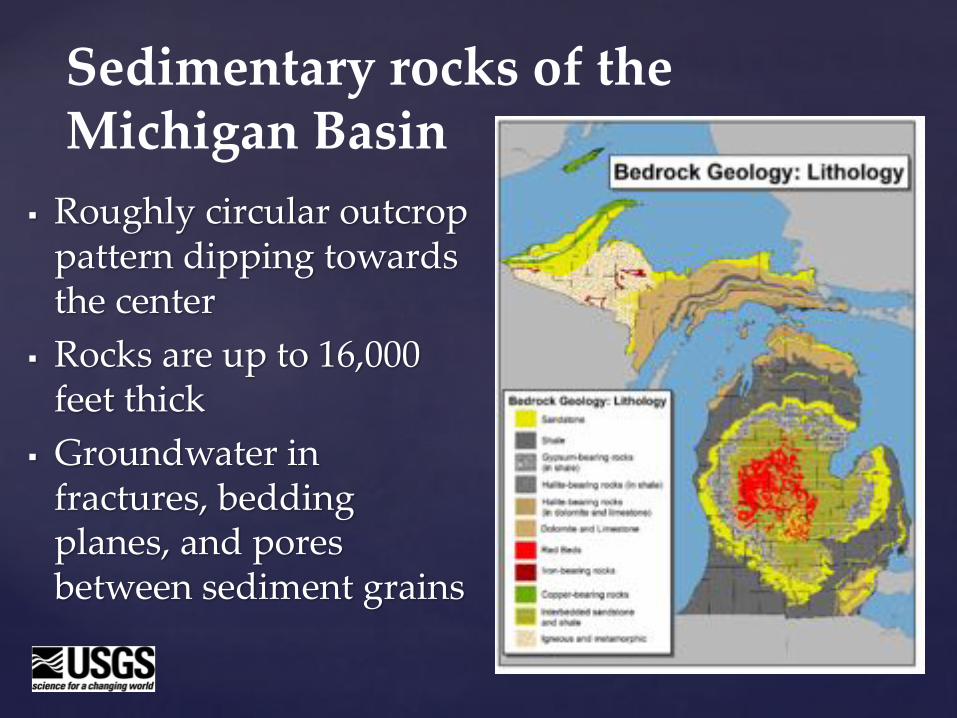
§ Roughly circular outcrop pattern dipping towards the center
§ Rocks are up to 16,000 feet thick
§ Groundwater in fractures, bedding planes, and pores between sediment grains
Sedimentary rocks of the Michigan Basin
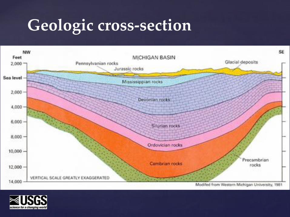
Geologic cross-section
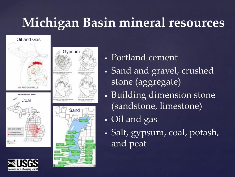
§ Portland cement§ Sand and gravel, crushed
stone (aggregate)§ Building dimension stone
(sandstone, limestone)§ Oil and gas§ Salt, gypsum, coal, potash,
and peat
Michigan Basin mineral resourcesOil and Gas
Gypsum
Coal
Sand
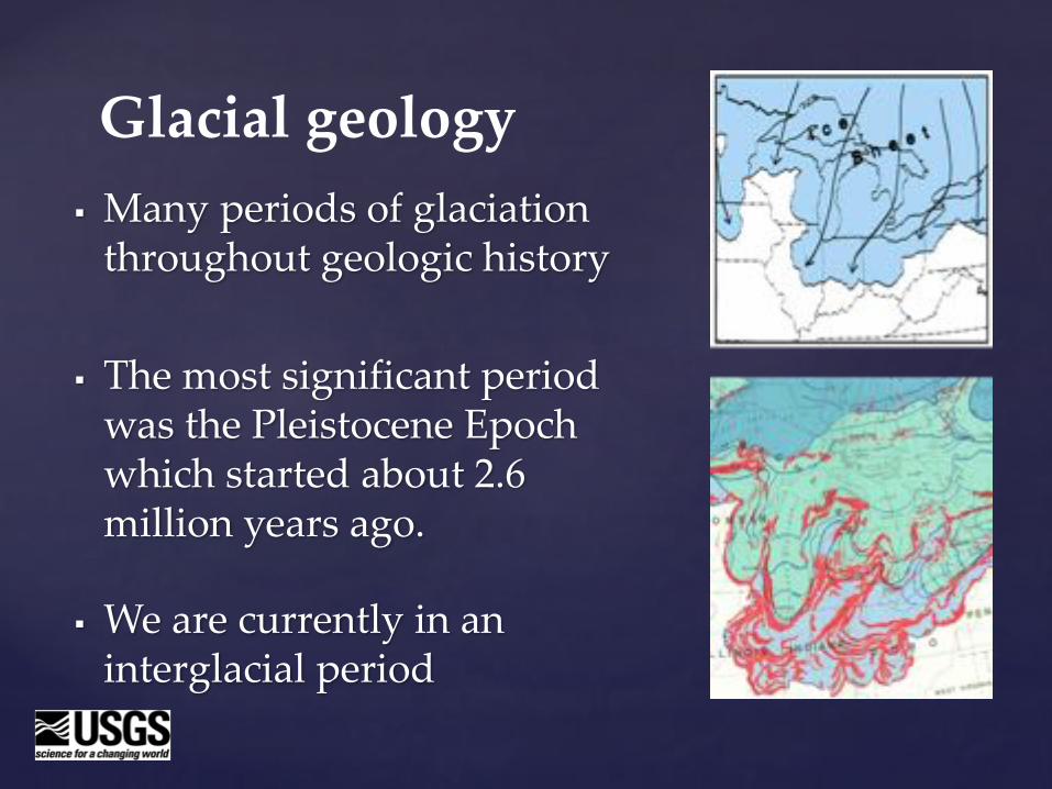
§ Many periods of glaciation throughout geologic history
§ The most significant period was the Pleistocene Epoch which started about 2.6 million years ago.
§ We are currently in an interglacial period
Glacial geology
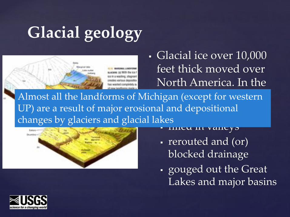
§ Glacial ice over 10,000 feet thick moved over North America. In the process, glaciers§ leveled hills§ filled in valleys§ rerouted and (or)
blocked drainage§ gouged out the Great
Lakes and major basins
Glacial geology
Almost all the landforms of Michigan (except for western UP) are a result of major erosional and depositional changes by glaciers and glacial lakes
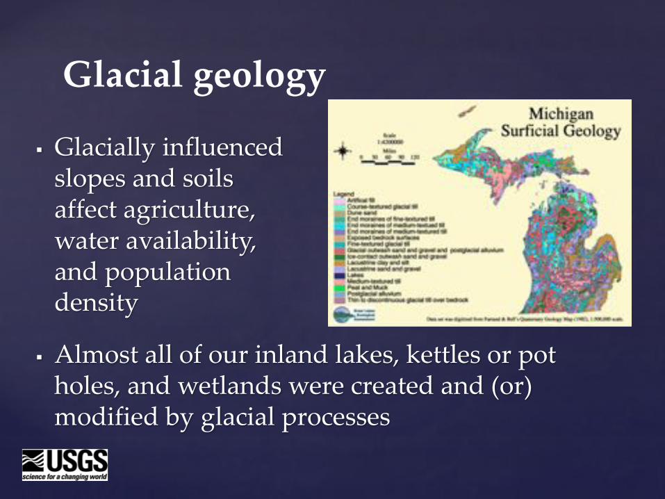
§ Glacially influenced slopes and soils affect agriculture, water availability, and population density
Glacial geology
§ Almost all of our inland lakes, kettles or pot holes, and wetlands were created and (or) modified by glacial processes
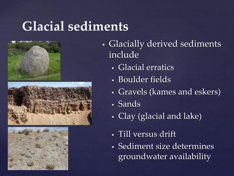
§ Glacially derived sediments include§ Glacial erratics§ Boulder fields§ Gravels (kames and eskers)§ Sands§ Clay (glacial and lake)
§ Till versus drift§ Sediment size determines
groundwater availability
Glacial sediments
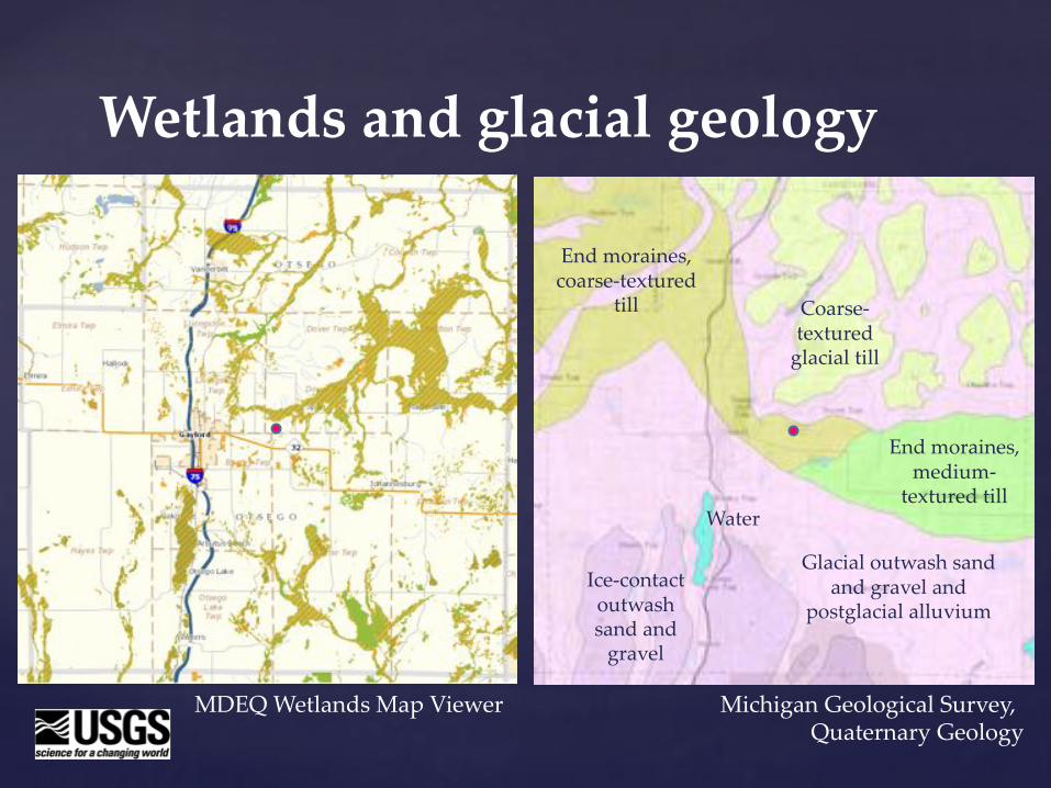
Wetlands and glacial geology
Water
Glacial outwash sand and gravel and
postglacial alluviumIce-contact outwash sand and
gravel
Coarse-textured
glacial till
End moraines, medium-
textured till
End moraines, coarse-textured
till
MDEQ Wetlands Map Viewer Michigan Geological Survey, Quaternary Geology
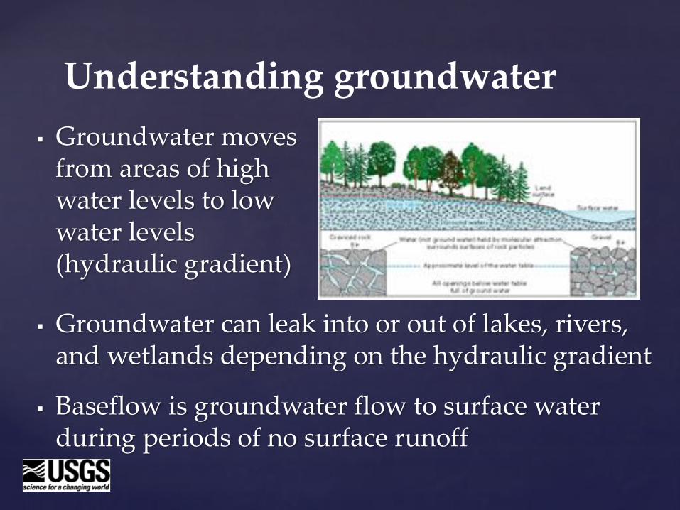
§ Groundwater can leak into or out of lakes, rivers, and wetlands depending on the hydraulic gradient
§ Baseflow is groundwater flow to surface water during periods of no surface runoff
Understanding groundwater§ Groundwater moves
from areas of high water levels to low water levels (hydraulic gradient)
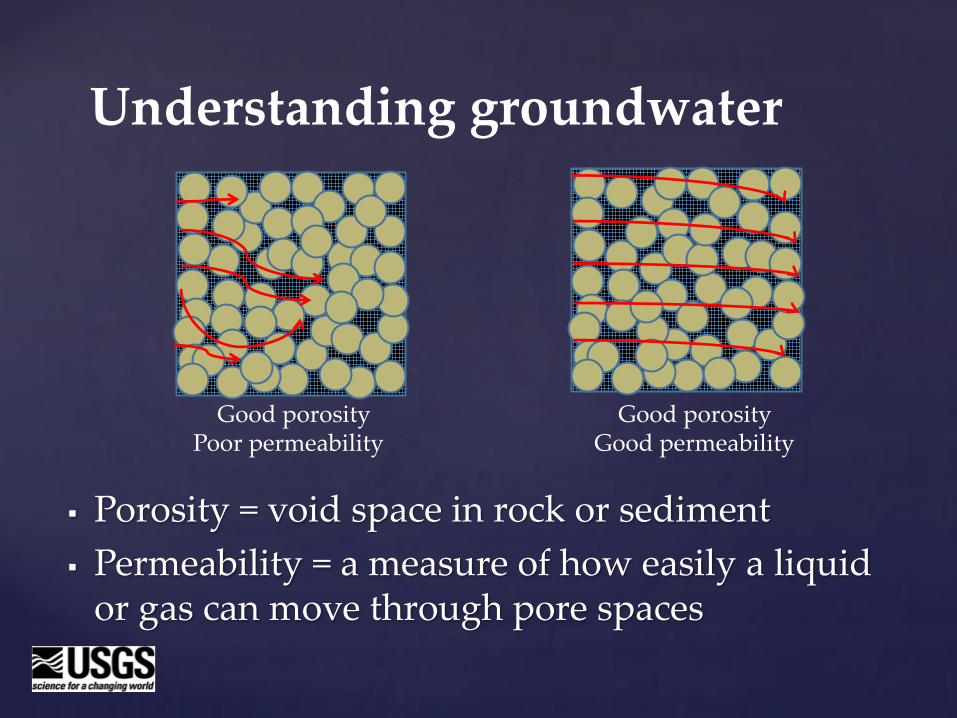
§ Porosity = void space in rock or sediment§ Permeability = a measure of how easily a liquid
or gas can move through pore spaces
Understanding groundwater
Good porosity Good porosityPoor permeability Good permeability

How do we monitor groundwater?
§ Water levels and water-chemistry samples are obtained through wells
§ Many different drilling technologies and well configurations are available
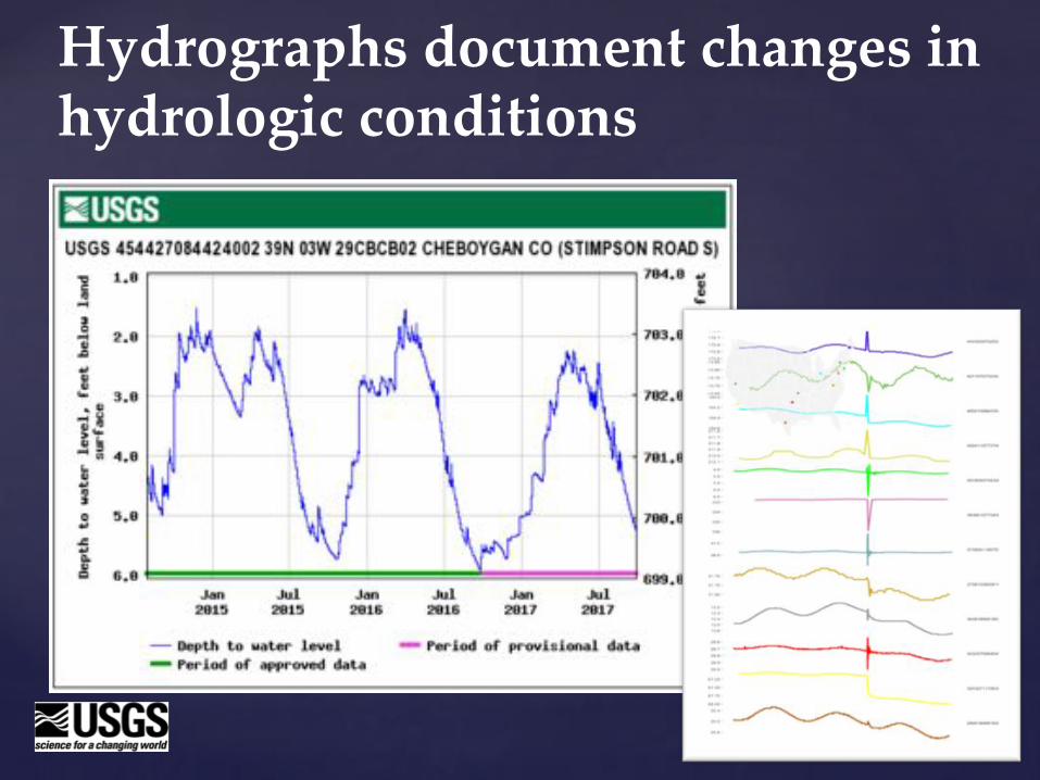
Hydrographs document changes in hydrologic conditions
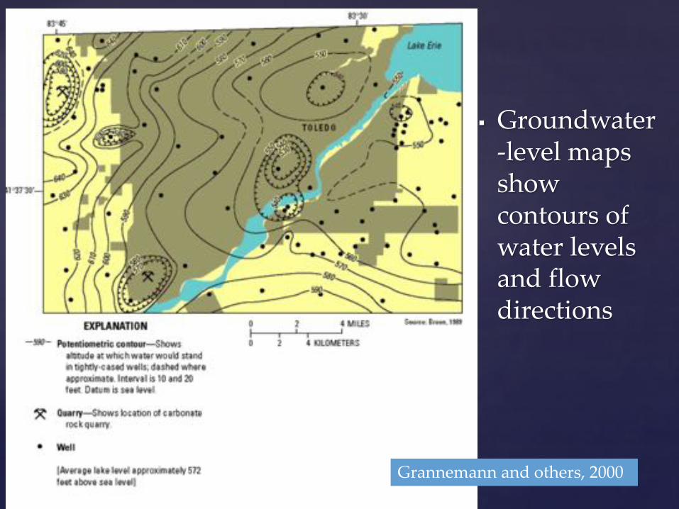
§ Groundwater-level maps show contours of water levels and flow directions
Grannemann and others, 2000
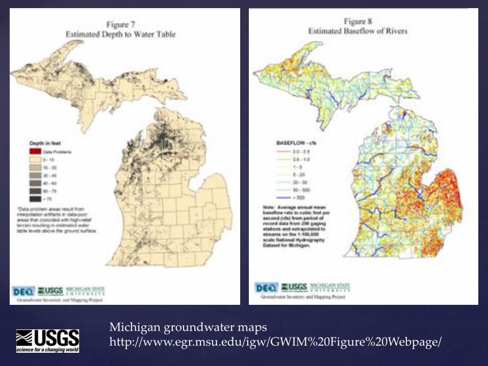
Michigan groundwater mapshttp://www.egr.msu.edu/igw/GWIM%20Figure%20Webpage/
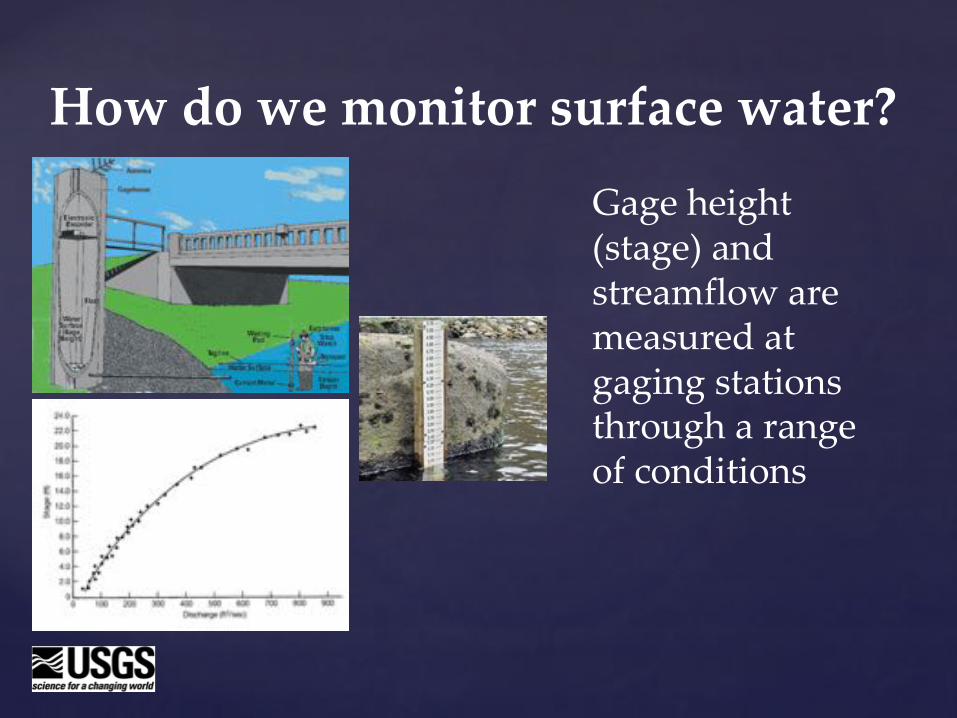
How do we monitor surface water?
Gage height (stage) and streamflow are measured at gaging stations through a range of conditions

USGS National Water Information System (NWIS) Data
Streamflow
Groundwater levels
https://waterdata.usgs.gov/nwis
§ Bedrock geology varies across Michigan
§ Glacial processes helped define the location and character of land forms, soils, lakes, streams, and wetlands
Bringing it all together
§ Groundwater availability in bedrock is typically limited to fractures, joints, and bedding planes
§ Groundwater availability in glacial sediments is typically limited by sediment size
§ Groundwater constantly interacts with water in wetlands and maintains baseflow to streams
Bringing it all together
Ralph J. Haefner
U.S. Geological SurveyMichigan-Ohio Water Science Center
(517) [email protected]
Contact