Embed Size (px)
Citation preview
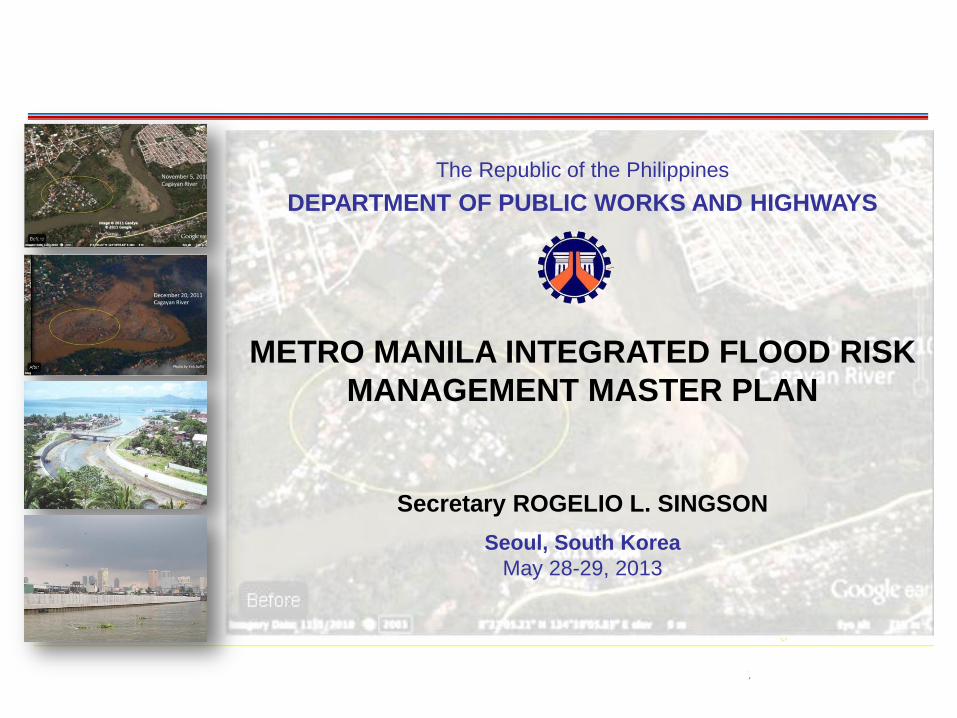
The Republic of the Philippines
DEPARTMENT OF PUBLIC WORKS AND HIGHWAYS
METRO MANILA INTEGRATED FLOOD RISK
MANAGEMENT MASTER PLAN
Seoul, South Korea
May 28-29, 2013
1
Secretary ROGELIO L. SINGSON
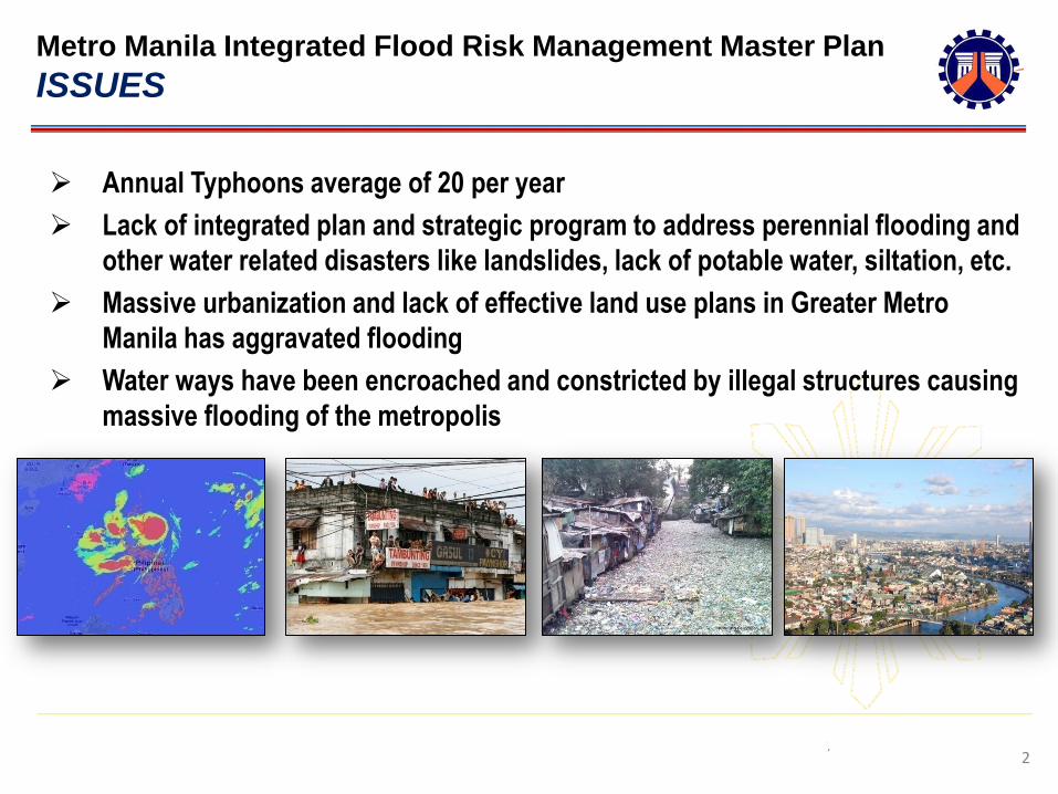
Metro Manila Integrated Flood Risk Management Master Plan
ISSUES
2
Annual Typhoons average of 20 per year
Lack of integrated plan and strategic program to address perennial flooding and
other water related disasters like landslides, lack of potable water, siltation, etc.
Massive urbanization and lack of effective land use plans in Greater Metro
Manila has aggravated flooding
Water ways have been encroached and constricted by illegal structures causing
massive flooding of the metropolis
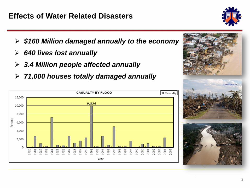
Effects of Water Related Disasters
3
$160 Million damaged annually to the economy
640 lives lost annually
3.4 Million people affected annually
71,000 houses totally damaged annually

Policy Directions and Programs Philippine Development Plan 2011-2016
4
Preparation of Flood Control Master Plan for Major River Basins;
Prioritize the construction of flood control structures in highly vulnerable areas
particularly in Metro Manila and urban areas;
Apply CCA and DRRM strategies in the planning and design of flood management;
Increase local government and community awareness and participation;
Pasig-Marikina River Channel
Improvement Project Mt. Pinatubo Hazard Urgent Mitigation Project
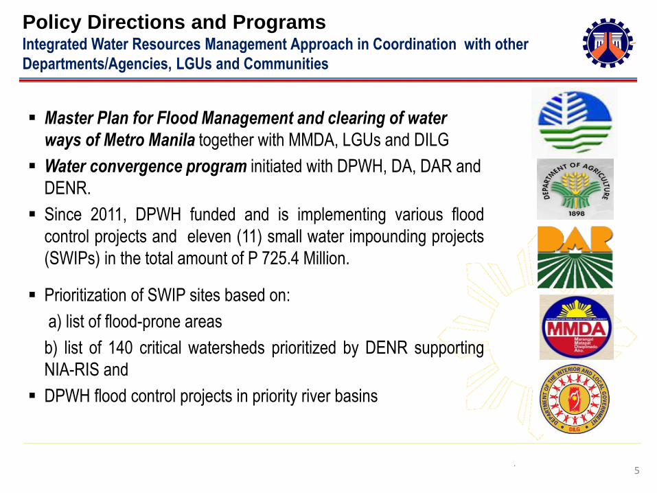
Policy Directions and Programs Integrated Water Resources Management Approach in Coordination with other
Departments/Agencies, LGUs and Communities
5
Master Plan for Flood Management and clearing of water
ways of Metro Manila together with MMDA, LGUs and DILG
Water convergence program initiated with DPWH, DA, DAR and
DENR.
Since 2011, DPWH funded and is implementing various flood
control projects and eleven (11) small water impounding projects
(SWIPs) in the total amount of P 725.4 Million.
Prioritization of SWIP sites based on:
a) list of flood-prone areas
b) list of 140 critical watersheds prioritized by DENR supporting
NIA-RIS and
DPWH flood control projects in priority river basins
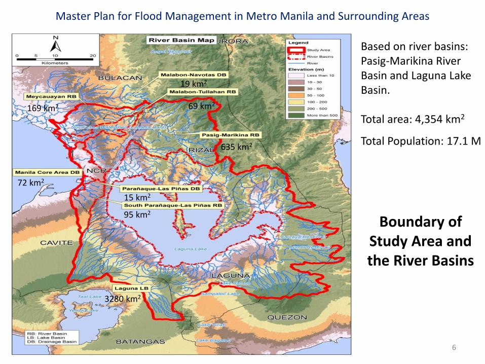
Boundary of Study Area and the River Basins
Based on river basins: Pasig-Marikina River Basin and Laguna Lake Basin. Total area: 4,354 km2
Total Population: 17.1 M 635 km2
72 km2
69 km2 169 km2
3280 km2
95 km2
15 km2
19 km2
6
Master Plan for Flood Management in Metro Manila and Surrounding Areas

7
Three Major Flooding Occurrence: (1) Huge volume of
water coming from Sierra Madre
(2) Drainage capacity constraints in core area of Metro Manila
(3) Low lying communities around Manila Bay & Laguna Lake
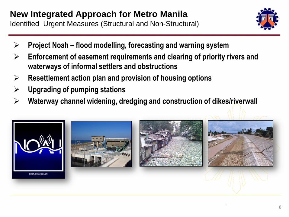
New Integrated Approach for Metro Manila Identified Urgent Measures (Structural and Non-Structural)
8
Project Noah – flood modelling, forecasting and warning system
Enforcement of easement requirements and clearing of priority rivers and
waterways of informal settlers and obstructions
Resettlement action plan and provision of housing options
Upgrading of pumping stations
Waterway channel widening, dredging and construction of dikes/riverwall
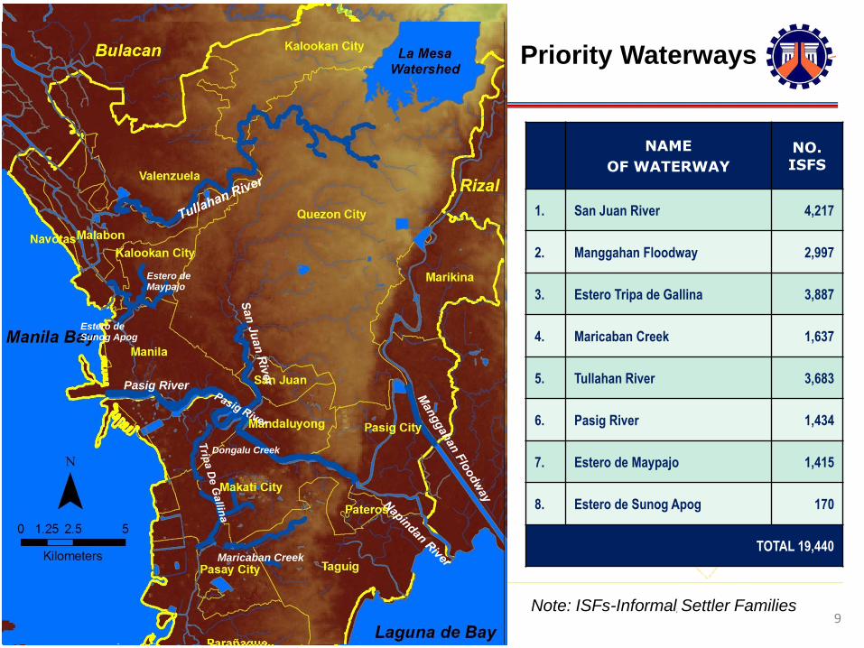
Priority Waterways
9
NAME
OF WATERWAY
NO. ISFS
1. San Juan River 4,217
2. Manggahan Floodway 2,997
3. Estero Tripa de Gallina 3,887
4. Maricaban Creek 1,637
5. Tullahan River 3,683
6. Pasig River 1,434
7. Estero de Maypajo 1,415
8. Estero de Sunog Apog 170
TOTAL 19,440
Dongalu Creek
Pasig River
Maricaban Creek
Estero de Maypajo
Estero de Sunog Apog
Note: ISFs-Informal Settler Families
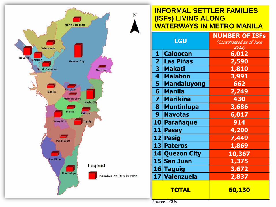
Source: LGUs
LGU NUMBER OF ISFs
(Consolidated as of June 2012)
1 Caloocan 6,012
2 Las Piñas 2,590 3 Makati 1,810 4 Malabon 3,991
5 Mandaluyong 662
6 Manila 2,249
7 Marikina 430
8 Muntinlupa 3,686
9 Navotas 6,017
10 Parañaque 914
11 Pasay 4,200
12 Pasig 7,449
13 Pateros 1,869
14 Quezon City 10,367 15 San Juan 1,375
16 Taguig 3,672
17 Valenzuela 2,837
TOTAL 60,130
INFORMAL SETTLER FAMILIES (ISFs) LIVING ALONG WATERWAYS IN METRO MANILA
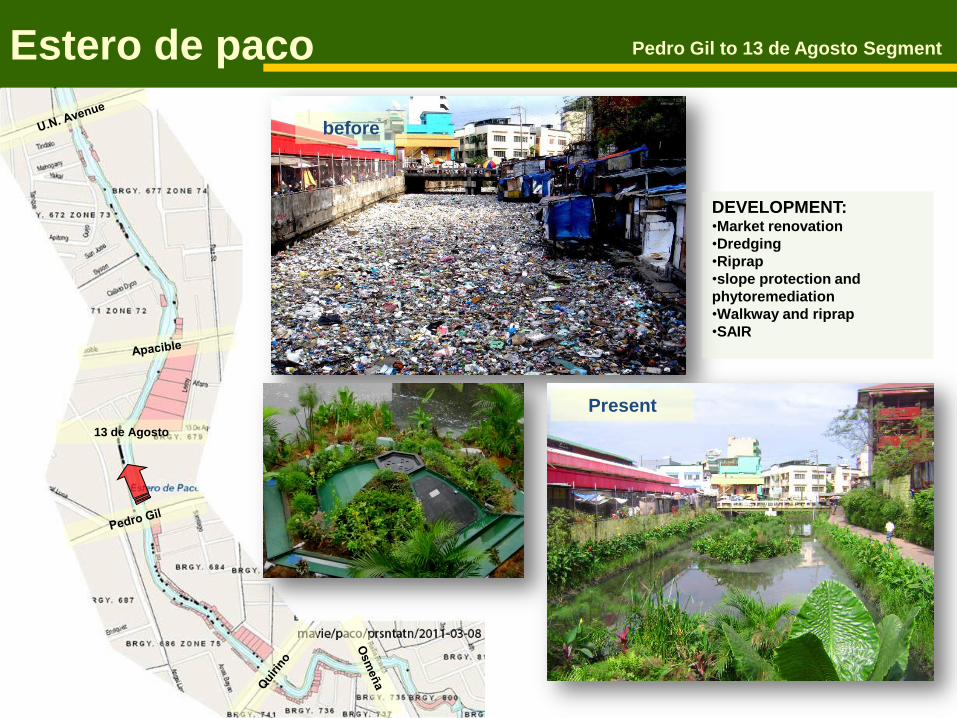
13 de Agosto
Estero de paco Pedro Gil to 13 de Agosto Segment
before
DEVELOPMENT: •Market renovation
•Dredging
•Riprap
•slope protection and
phytoremediation
•Walkway and riprap
•SAIR
Present
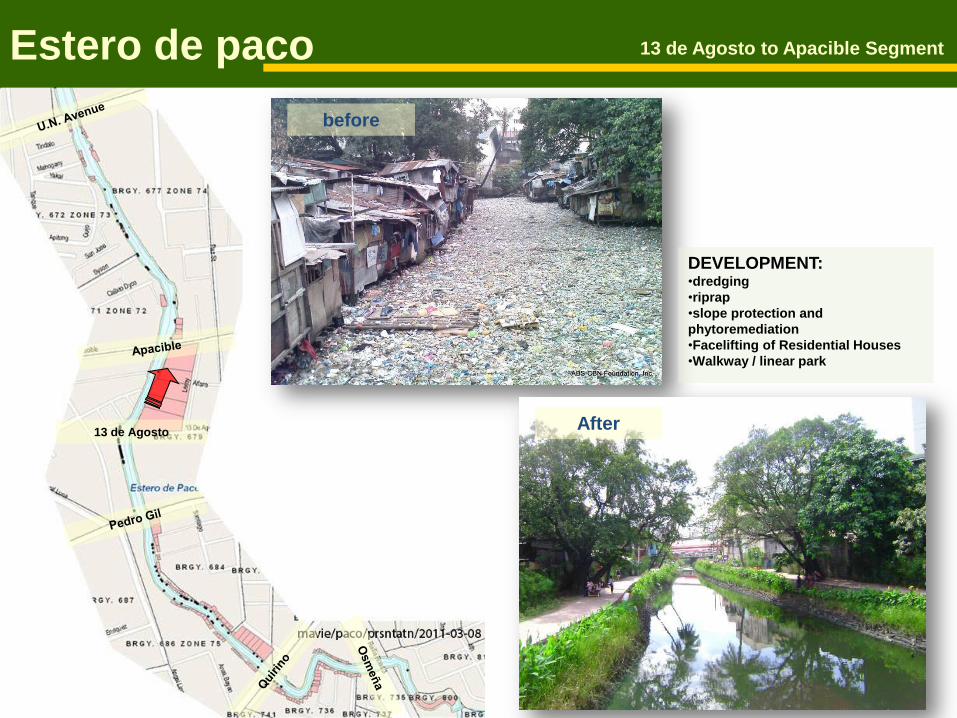
13 de Agosto
Estero de paco 13 de Agosto to Apacible Segment
before
After
DEVELOPMENT: •dredging
•riprap
•slope protection and
phytoremediation
•Facelifting of Residential Houses
•Walkway / linear park

13 de Agosto
Estero de paco Apacible to UN Ave. Segment
before
Present
DEVELOPMENT: •dredging
•riprap
•slope protection and phytoremediation
•Facelifting of Residential Houses
•Walkway/Linear Park

New Integrated Approach for Metro Manila
Long Term Measures
14
Construction of flood control dam upstream
Use of natural flood plains near waterways
Land use ordinances
Strict enforcement of waterway easement laws
Increase local government and community awareness and participation

The Republic of the Philippines
DEPARTMENT OF PUBLIC WORKS AND HIGHWAYS
THANK YOU !!!
15