Embed Size (px)
Citation preview

WOODLAWNCEM
VENICEH.S.
LOS ANGELESNATL CEM
CENTURYCITY
HOSPITAL
BROTMANMEDICAL CENTER
UNIVERSITYHIGH SCHOOL
SANTA MONICAHIGH SCHOOL
SANTA MONICACITY COLLEGE
BEVERLY HILLSMED CEN
SANTA MONICA HOSPITAL
JAPANESE INSTITUTEOF SAWTELLE
ST JOHNSHOSPITAL
Santa MonicaBeach State Park
42nd District
41st District
53rd District
W SUNSET BLVD
MONTA
NA AVE
7TH ST
SAN VICENTE BLVD
OCEAN AVE
20TH ST
N B
EV
ER
LY G
LEN
BLV
D
W SUNSET BLVD
SANTA MONICAAIRPORT
47th District
W PICO BLVD
OVER
LAND
AVE
S SEPULVEDA BLVD
PICO BLVD
CU
LVER
BLV
D
WILSHIRE BLVD
S BUNDY DR
ROSE AVE
S R
OB
ER
TS
ON
BLV
D
WESTW
OO
D BLVD
OCEAN PARK BLVD
MO
TOR AVE
S CEN
TINELA AVE
S B
EV
ER
LY G
LEN
BLV
D
MANNING AVE
4TH ST
BE
VE
RW
IL DR
PACIFIC
AVE
NEILSON WAY
BEVERLY BLVD
BEETHO
VEN ST
CATTARAUGUS AVE
PLAYA ST
GAT
EW
AY B
LVD
OPARK BLVD
ALLE
NF
OR
D A
VE
N VENICE BLVD
S BUN
DY AVE
W SLAUSON AV
N BEVERLY DR
NS
EP
ULV
ED
AB
LVD
NB
EV
ER
LYDR
P a c i f i c
O c e a n
UNIV OF CALIFORNIA
LOS ANGELES
PENMARGC
TOPANGASTATEPARK
PALISADESPARK
WILL ROGERSSTATE BEACH
SANTA MONICASTATE BEACH
BEVERLYGARDENSPARK
PENMARPLAYGROUND
CLOVERPARK
VETERANSMEM PARK
LINDBERGPARK
MAR VISTAPARK
STONERPLAYGROUND
LOS AMIGOSPARK
PALMSPARK
WESTENDPARK
OAKWOODREC CENTER
JOSLYNPARK
CULVERSLAUSONPARK
STEWART STREETPARK
TELEFSONPARK
MARYHOTCHKISSPARK
EL MARINOPARK
1
1
187
10
10
405
405
Cityof
Los Angeles
Santa Monica
Beverly Hills
Culver City
WestHollywood
LaderaHeights
Sawtelle Blvd
Idaho Ave
Moore St
Zanja St
Neosho A
ve
Mitchell A
ve
Nebraska Ave
East Blvd
Walnut Ave
Albright Ave
Airport A
ve
Marcasel Ave
Colby Ave
Marine C
t
Bledsoe Ave
Venice Blvd
Short
Ave
Federal Ave
Iowa A
ve
National Blvd
Inglewood Blvd
Matteson Ave
McConnell
Ave
Del R
ey Ave36
37
59
41
38
71
54
63
61
67
53
44
72
42
55
40
56
68
60585749
39
51
47
50
69
52
46
45
48
43
L o s A n g e l e sC o u n t y
VenturaCounty
Pacific Ocean
0 0.5 1 2
Miles
Assembly District 53North Part
Map 1 of 4
MappedArea
Legend
Assembly Boundary
State Boundary
County Boundary
City Boundary
Major Highway
Other Highway
Other Road
Railroad
Outside District
Major Landmarks
Institutions

EL CAMINOCOLLEGE
HAWTHORNEHOSPITAL
AVIATIONHIGH SCHOOL
MIRA COSTAHIGH SCHOOL
INGLEWOOD PARKCEMETERY
WESTCHESTERHIGH SCHOOL
SAINT BERNARDHIGH SCHOOL
DANIELFREEMANHOSPITAL
CENTINELA HOSPITALMEDICAL CEN
NORTHROPINSTITUTEOF TECHN
DANIEL FREEMANMARINA HOSPITAL
ROBERT F KENNEDY HOSPITAL
LOS ANGELESCOLLEGE AIRCRAFT
1
1
4242
90
107
105
105
405
405
DOCKWEILERSTATE BEACH
ALONDRAPARK
MANHATTANSTATE BEACH POLLIWOG
PARK
DEL AIREPARK
RECREATIONPARK
DEL REYLAGOONPARK
GLEN ANDERSONPARK
VALLEY PARK
LENNOXPARK
MARINE AVENUEPARK
LIVE OAKPARK
BURTON CHASEPARK
PERRY PARK
MCMASTERPARK
CARL NIELSEN\PARK
LIBRARYPARK
HILL TOPPARK
GUENSER PARK
SIMINSKIPARK
GLEN ALLAPARK
JANE ADDAMSPARK
SAND DUNEPARK
MANHATTANVILLAGEPARK
WILLIAMGREENPARK
ALONDRA PARK GC
LOYOLAMARYMOUNT
UNIV
WESTCHESTERGC
LOS ANGELESAIR FORCEBASE
THE LAKES ATEL SEGUNDO
GC
UNIV OFWEST LOS ANGELES
THE GREAT WESTERN FORUM
Lincoln Blvd
Inglewood A
ve
Westchester Pky
Marine Ave
W Century BlvdAirp
ort B
lvd
Artesia Blvd
S A
viation Blvd
W 116th St
Southern
Pacific
RR
Isis Ave
W El Segundo Blvd
N A
viation Blvd
S W
estern Ave
Crenshaw
Blvd
W 166th St
W Artesia Blvd
LOS ANGELES INTL AIRPORT
HAWTHORNE AIRPORT
PR
AIR
IE A
VE
S W
ES
TE
RN
AV
E
VA
N N
ES
S A
VE
ING
LEW
OO
D A
VE
WE
ST
ER
N A
VE
VA
N N
ES
S A
VE
W ROSECRANS AVE
W EL SEGUNDO BLVD
CU
LVER
BLV
D
MANHATTAN BEACH BLVD
PERSH
ING
DR
OC
EA
N D
R
S P
RA
IRIE
AV
E
WESTCHESTER PKWY
120TH ST
ROSECRANS AVE
S LA
CIE
NE
GA
BLV
D
N B
RE
A A
VE
S S
EP
ULV
ED
A B
LVD
W FLORENCE AVE
W JEFFERSON BLVD
NA
SH
ST
N AR
DM
OR
E AVE
E FLORENCE AVE
W MANCHESTER AVE
W CENTINELA AVE
E ARBOR VITAE ST
WASHINGTON BLVD
S A
VIA
TIO
N B
LVD
VIS
TA D
EL M
AR
LN
VIS
TA D
EL M
AR
BLV
D
27TH ST
S LA T
IJERA B
LVD
PACIFIC
AVE
N M
AR
KE
T S
T
E IMPERIAL HWY
10TH
PL
S C
RE
NS
HA
W B
LVD
47th District
48th District
51st District53rd
District
P a c i f i c
O c e a n
Inglewood
HawthorneEl Segundo
Gardena
Manhattan Beach
Torrance
Lawndale
Lennox
RedondoBeach
Del Aire
AlondraPark
CulverCity
LaderaHeights
Marina del Rey
Los Angeles
Westmont
WestAthens
HermosaBeach
View Park-Windsor Hi
36
37
59
41
38
71
54
63
61
67
53
44
72
42
55
40
56
68
60585749
39
51
47
50
69
52
46
45
48
43
L o s A n g e l e sC o u n t y
VenturaCounty
Pacific Ocean
0 0.5 1 2
Miles
Assembly District 53Central Part
Map 2 of 4
MappedArea
Legend
Assembly Boundary
State Boundary
County Boundary
City Boundary
Major Highway
Other Highway
Other Road
Railroad
Outside District
Major Landmarks
Institutions

WESTHIGH SCHOOL
EL CAMINOCOLLEGE
NORTHHIGH SCHOOL
HAWTHORNEHOSPITAL
LENNOX HIGH SCHOOL
GARDENAHIGH SCHOOL
AVIATIONHIGH SCHOOL
HAWTHORNEHIGH SCHOOL
AMISOUTH BAY
HOSPITAL
REDONDO BEACHHIGH SCHOOL
BISHOP MONTGOMERYHIGH SCHOOL
ROBERT F KENNEDY HOSPITAL
L A COUNTYHARBOR-UCLAMED CEN
ROOSEVELTMEMORIAL PARK(CEM)
LITTLE COMPANYOF MARY HOSPITAL
ALONDRAPARK
COLUMBIAREG PARK
REDONDOSTATEBEACH
CHARLES WILSONPARK
POLLIWOGPARK
ENTRADEROPARK
DOMINGUEZPARK
EL NIDOPARK
DEL AIREPARK
ALTA VISTAPARK
VETERNSPARK
TORRANCEPARK
LA ROMERIAPARK
DELTHORNEPARK
GLEN ANDERSONPARK
MARINE AVENUEPARK
PERRYPARK
MCMASTERPARK GUENSER
PARK
PARADISEPARK
ALONDRAPARK
EUCALYPTUSPARK
NORMANDALEREC CENTER
ROGERS ANDERSONPARK
WILDERNESSPARK
FREEMANPARK
VINCENTPARK
LACARRETERAPARK
MANHATTANVILLAGE PARK
WILLIAM GREENPARK
SAM LEVI PARK
CAL STATE UNIV
DOMINGUEZ HILLS
ALONDRAPARK GCIn
gle
wood A
ve
Marine Ave
Electric St
Artesia Blvd
S A
via
tion B
lvd
W 116th St
Southern
Pacific
RR
S V
an N
ess A
ve
Isis
Ave
N A
via
tion B
lvd
Cre
nshaw
Blv
d
W 166th St
W Artesia Blvd
55thDistrict
E DEL AMO BLVD
LOS ANGELES INTLAIRPORT
HAWTHORNE AIRPORT
53rd District
51st District52nd
District
48th District
S M
AIN
ST
MA
IN S
T
VA
N N
ES
S A
VE
WE
ST
ER
N A
VE
AN
ZA
AV
E
TORRANCE BLVD
S S
AN
PE
DR
O S
T
SEPULVEDA BLVDM
AP
LE
AV
E
MANHATTAN BEACH BLVD
E 223RD ST
120TH ST
E CARSON ST
W 223RD ST
MA
DR
ON
A A
VE
E VICTORIA STGRANT AVE
RIPLEY A
VE
E IMPERIAL HWYS
CATA
LIN
A A
VE
NA
SH
ST
PR
OS
PE
CT
AV
E
ANITA ST
S W
ES
TE
RN
AV
E
S V
AN
NE
SS
AV
E
CAM
INO
REAL
PALOS VERDES BLVD
ROSECRANS AVE
N C
EN
TR
AL A
VE
W COMPTON BLVD
PR
AR
IE A
VE
E REDONDO BEACH BLVD
S A
VIA
TIO
N B
LVD
CE
NT
RA
L A
VE
CA
BR
ILLO
AV
E
S P
RA
IRIE
AV
E
S A
VA
LO
N B
LVD
S IN
GLE
WO
OD
AV
E
ALONDRA BLVD
AR
LIN
GTO
N A
VE
S C
RE
NS
HA
W B
LVD
HA
RB
OR
DR
Carson
Los Angeles
Torrance
Gardena
Hawthorne
Redondo Beach
ComptonLawndale
WillowbrookEl SegundoDelAire
AlondraPark
ManhattanBeach
West Compton
WestAthens
WestCarson
Inglewood
HermosaBeach
Lennox Westmont
0 0.3 0.6 0.9 1.2
Miles
36
37
59
41
38
71
54
63
61
67
53
44
72
42
55
40
56
68
60585749
39
51
47
50
69
52
46
45
48
43
L o s A n g e l e sC o u n t y
VenturaCounty
Pacific Ocean
0 0.5 1 2
Miles
Assembly District 53Southcentral Part
Map 3 of 4
MappedArea
Legend
Assembly Boundary
State Boundary
County Boundary
City Boundary
Major Highway
Other Highway
Other Road
Railroad
Outside District
Major Landmarks
Institutions
1
9191
107
213
405
405
105
105
110
110

55
SOUTHH.S.
MARYMOUNTCOLLEGE
LASUENHIGH SCHOOL
BANNINGHIGH SCHOOL
BAYHARBORHOSPITAL
NARBONNEHIGH SCHOOL
SAN PEDROH.S.
J F COOPERHIGH SCHOOL
SAN PEDROPENINSULA HOSP
HARBOR VIEWMEMORIALPARK
ROLLING HILLSHIGH SCHOOL
LOS ANGELESHARBOR COLLEGE
KAISER HOSPITAL
TORRANCEMEDICAL CENT
GREEN HILLSMEMORIALPARK CEM
MARY STAR OF THE SEAHIGH SCHOOL
54th District
ZAMPERINI
FIELD
55th District
53rd District
HAWTHORNE B
LVD
CR
EN
SH
AW
BLV
D
FIG
UE
RO
A S
T
W 9TH ST
W 25TH ST
235TH ST
PACIFIC COAST HIGHWAY
PALOS VER
DES D
R E
N G
AF
FE
Y S
T
S PA
CIF
IC A
VE
PALOS VERDES DR S
MA
IN S
T
VE
RM
ON
T A
VE
CREST RD
NO
RM
AN
DIE
AV
E
S G
AF
FE
Y S
T
W PASEO MAR
WILM
ING
TON
BLV
D
E SEPULVEDA BLVD
SEPULVEDA BLVD
LOMITA BLVD
WIL
MIN
GTO
N A
VEA
NZ
A A
VE
25TH ST
AIRPORT DR
E ANAHEIM ST
ANAHEIM ST
JOHNS G
IBSO
N BLV
D
PALO
S V
ER
DE
S B
LVD
S H
AR
BO
R B
LVD
N PALOS VERDES DR W
POINT FERMINPARK
PECKPARK
KEN MALLOYHARBOR REG
PARK
ROYAL PALMSSTATE BEACH
SOUTH COASTBOTANIC GARDEN
ANGELSGATEPARK
BANNINGPARK
LELANDPARK
LADERA LINDAPARK
AVERILLPARK
LOMITAPARK
BREAPARK
HIGHRIDGEPARK
DE PORTOLAPARK
EASTVIEWPARK
GENERALSCOTTPARK
WALTERIAPARK
RYANPARK
HARBOR CITYREC CENTER
CARRIAGECRESTPARK
REDONDOSTATEBEACH
HARBORHIGHLANDSPARK
ERNIE J HOWLETTPARK
ALTA LOMAPARK
DAPPLE GRAYPARK
MARTINGALETRAILHEAD PARK
PALOS VERDES GC
ROLLING HILLS CC
HARBOR PARKMUN GC
FED CORR INSTTERMINAL ISLAND
PALOS VERDESSHORES GC
110
110
1
1
107
213
213 110
47
Los Angeles
Torrance
Rancho Palos Verdes
Carson
Lomita
Rolling Hills
Rolling Hills Estates
Palos Verdes Estates
WestCarson
Rolling HillsEstates
San Pedro
TerminalIsland
Wilmington
P a c i f i cO
c e a n
W Anaheim St
Figueroa S
tW Water St
Alam
eda
St
Palos Verdes Dr
S W
estern Ave
Fulm
ar Ave
Canal S
t
Market P
l
E Harry Bridges Blvd
Rolling H
ills Rd
36
37
59
41
38
71
54
63
61
6753
44
72
42
55
40
56
68
60585749
39
51
47
50
69
52
46
45
48
43
L o s A n g e l e sC o u n t y
VenturaCounty
Pacific Ocean
0 0.5 1 2
Miles
Assembly District 53South Part
Map 4 of 4
MappedArea
Legend
Assembly Boundary
State Boundary
County Boundary
City Boundary
Major Highway
Other Highway
Other Road
Railroad
Outside District
Major Landmarks
Institutions
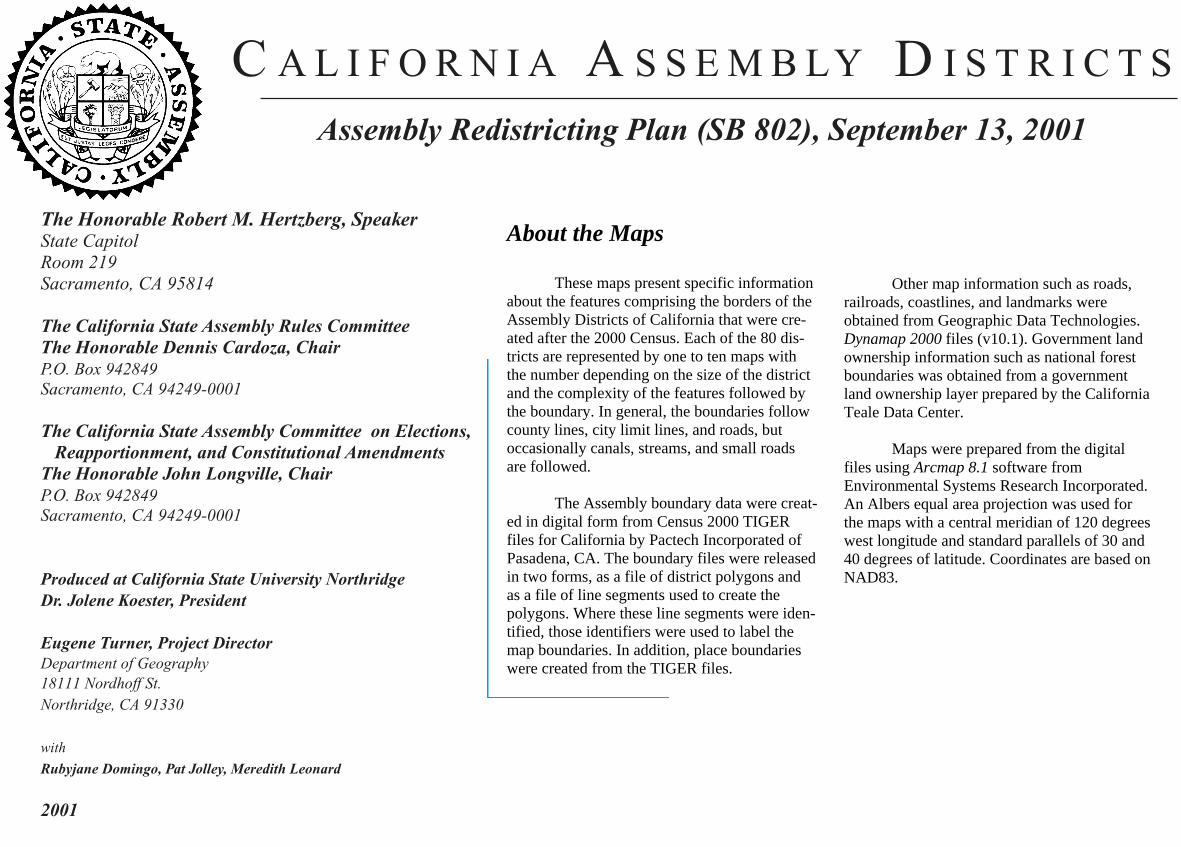
C A L I F O R N I A A S S E M B LY D I S T R I C T S
Assembly Redistricting Plan (SB 802), September 13, 2001
The Honorable Robert M. Hertzberg, SpeakerState CapitolRoom 219Sacramento, CA 95814
The California State Assembly Rules CommitteeThe Honorable Dennis Cardoza, ChairP.O. Box 942849Sacramento, CA 94249-0001
The California State Assembly Committee on Elections, Reapportionment, and Constitutional AmendmentsThe Honorable John Longville, ChairP.O. Box 942849Sacramento, CA 94249-0001
Produced at California State University NorthridgeDr. Jolene Koester, President
Eugene Turner, Project DirectorDepartment of Geography18111 Nordhoff St.Northridge, CA 91330
with
Rubyjane Domingo, Pat Jolley, Meredith Leonard
2001
About the Maps
These maps present specific informationabout the features comprising the borders of theAssembly Districts of California that were cre-ated after the 2000 Census. Each of the 80 dis-tricts are represented by one to ten maps withthe number depending on the size of the districtand the complexity of the features followed bythe boundary. In general, the boundaries followcounty lines, city limit lines, and roads, butoccasionally canals, streams, and small roadsare followed.
The Assembly boundary data were creat-ed in digital form from Census 2000 TIGERfiles for California by Pactech Incorporated ofPasadena, CA. The boundary files were releasedin two forms, as a file of district polygons andas a file of line segments used to create thepolygons. Where these line segments were iden-tified, those identifiers were used to label themap boundaries. In addition, place boundarieswere created from the TIGER files.
Other map information such as roads,railroads, coastlines, and landmarks wereobtained from Geographic Data Technologies.Dynamap 2000 files (v10.1). Government landownership information such as national forestboundaries was obtained from a governmentland ownership layer prepared by the CaliforniaTeale Data Center.
Maps were prepared from the digitalfiles using Arcmap 8.1 software fromEnvironmental Systems Research Incorporated.An Albers equal area projection was used forthe maps with a central meridian of 120 degreeswest longitude and standard parallels of 30 and40 degrees of latitude. Coordinates are based onNAD83.