Embed Size (px)
Citation preview
LiDAR Damage Assessment for Disaster Relief Efforts in Urban AreasGeospatial World Forum – Crisis Management using 3D Rotterdam, 13 – 16 May, 2013
Susan Parks, Ben D. Kamphaus & Thomas Bahr*
The information contained in this document pertains to software products and services that are subject to the controls of the Export Administration Regulations (EAR). The recipient is responsible for ensuring compliance to all applicable U.S. Export Control laws and regulations.
Background Information
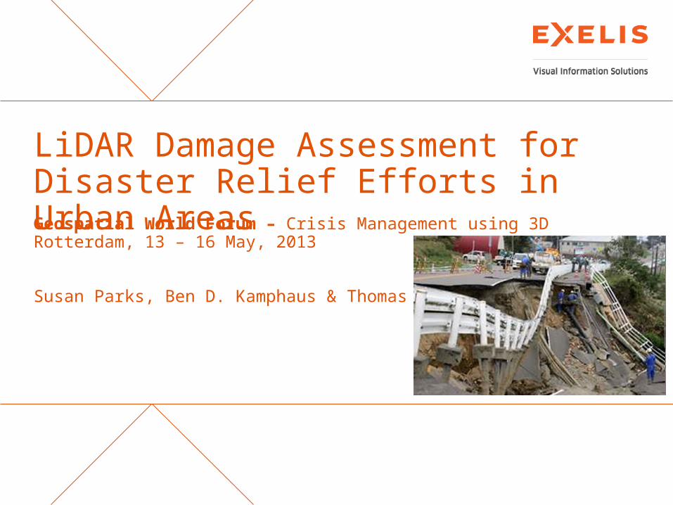
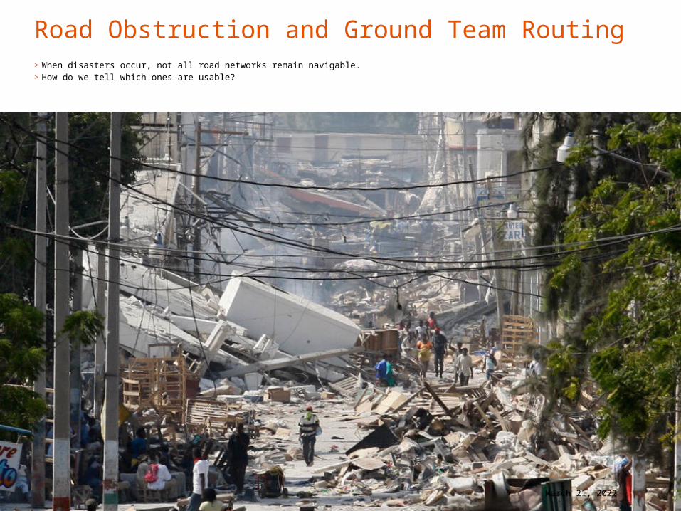
>A magnitude 7.0 earthquake struck Haiti on January 12, 2010.
>Quake epicenter was 15 miles WSW of Port-Au-Prince (18.443°N, 72.571°W).
>212,000 killed>300,000 injured>1.2 million displaced>Over 30 % of the buildings in
Port-au-Prince were destroyed or damaged. Imagery and LiDAR data courtesy of the RIT Haiti Mission for
the World Bank (January 21-27, 2010).
2LiDAR Damage Assessment for Disaster Relief Efforts in Urban Areas April 18, 2023
Objectives and Resources
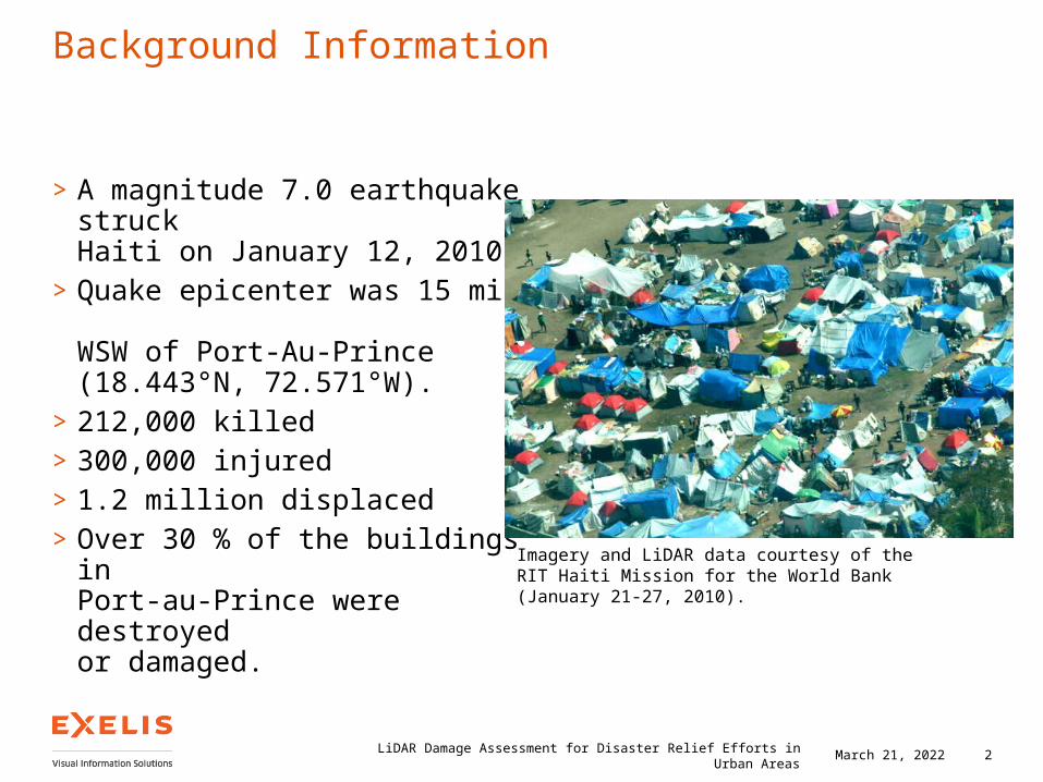
Objectives> Inventory buildings and
assess building damage.>Locate refugees in need of aid.>Locate areas to land ground teams.>Locate ways to route ground teams
to refugee camps.Resources>DigitalGlobe Worldview-2 Scene
from after event.>LiDAR coverage of Port-au-Prince
from RIT/World Bank project.>ENVI, ENVI LiDAR, and ArcGIS®
3LiDAR Damage Assessment for Disaster Relief Efforts in Urban Areas April 18, 2023
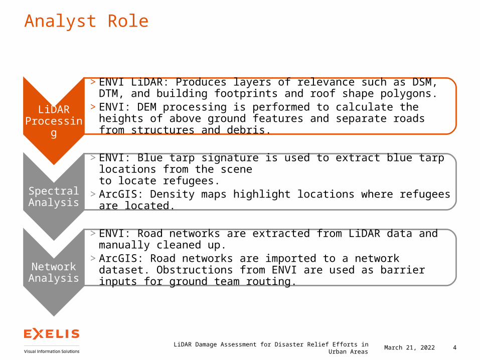
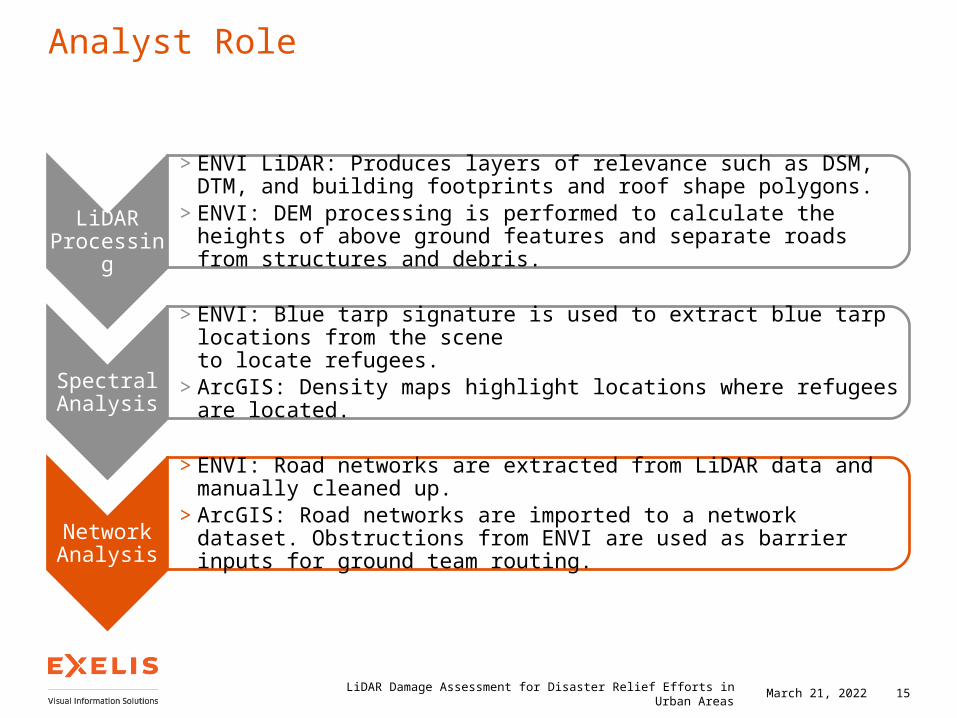
Analyst Role
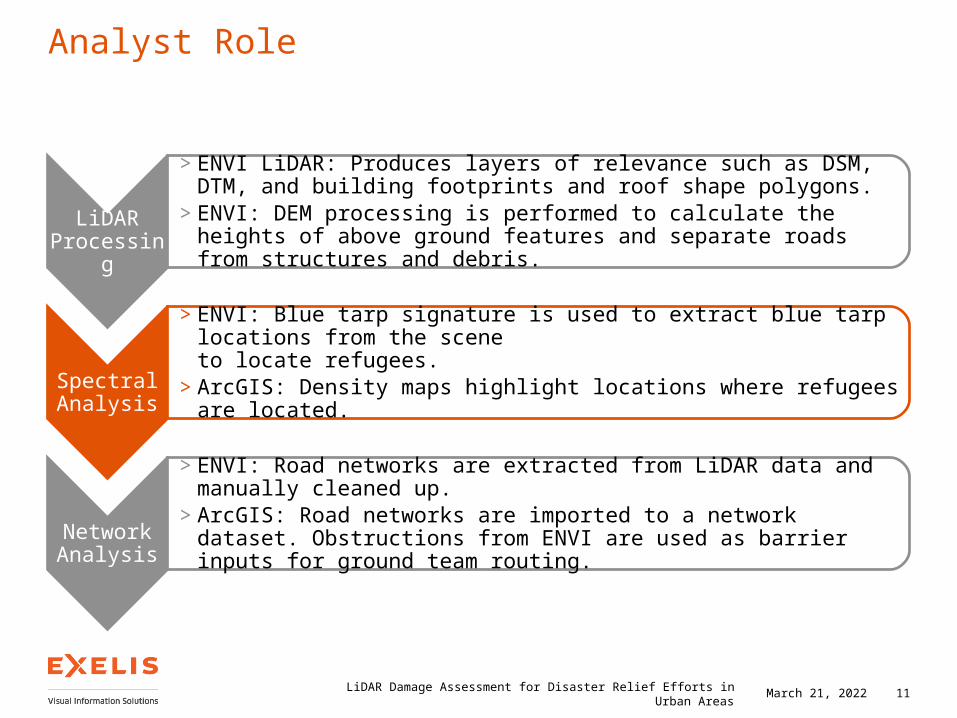
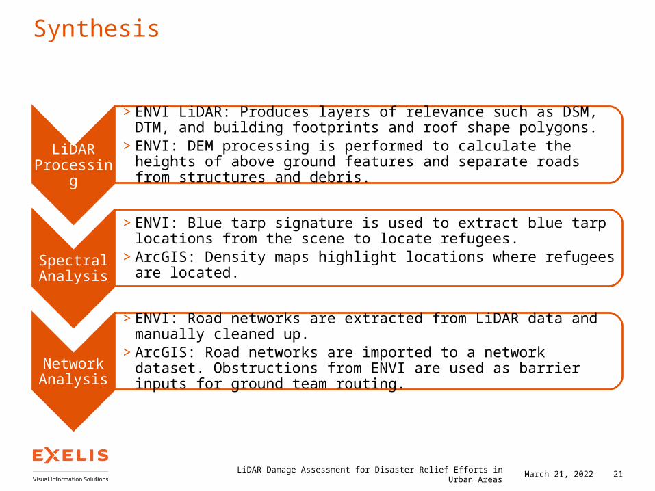
LiDAR Processing
> ENVI LiDAR: Produces layers of relevance such as DSM, DTM, and building footprints and roof shape polygons.
> ENVI: DEM processing is performed to calculate the heights of above ground features and separate roads from structures and debris.
Spectral Analysis
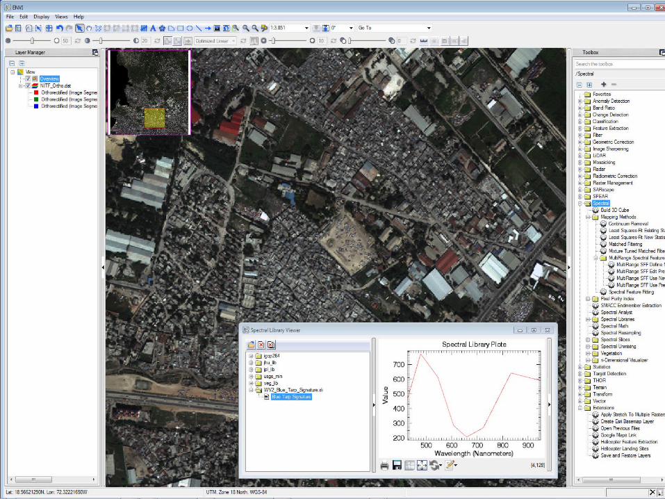
> ENVI: Blue tarp signature is used to extract blue tarp locations from the scene to locate refugees.
> ArcGIS: Density maps highlight locations where refugees are located.
Network Analysis
> ENVI: Road networks are extracted from LiDAR data and manually cleaned up.> ArcGIS: Road networks are imported to a network dataset. Obstructions from
ENVI are used as barrier inputs for ground team routing.
LiDAR Damage Assessment for Disaster Relief Efforts in Urban Areas 4April 18, 2023
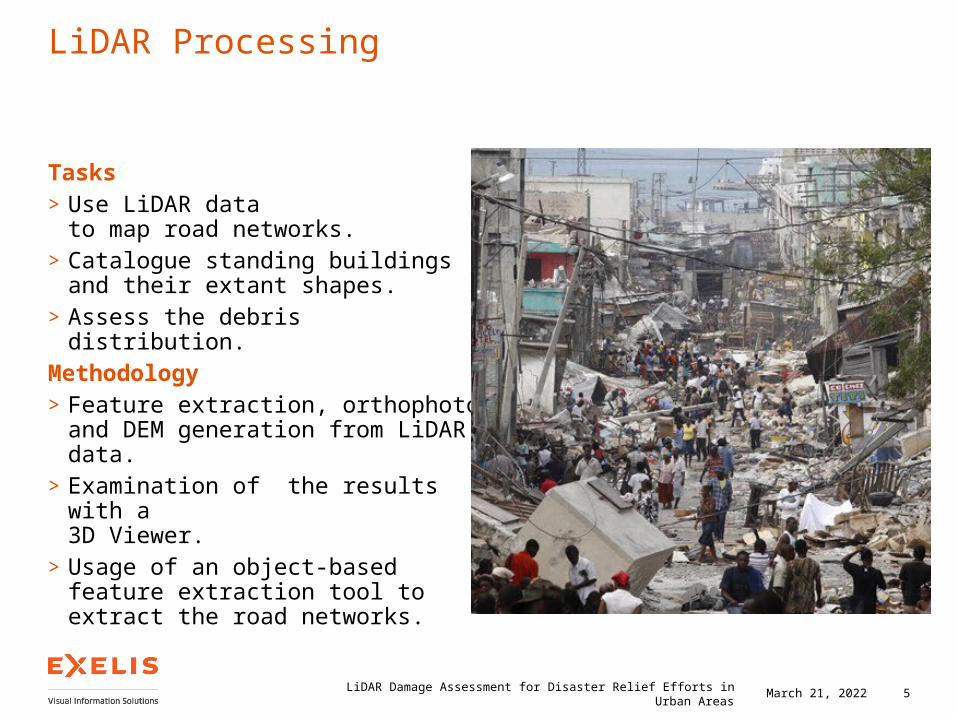
LiDAR Processing
Tasks>Use LiDAR data
to map road networks.>Catalogue standing buildings
and their extant shapes.>Assess the debris distribution.Methodology>Feature extraction, orthophoto and
DEM generation from LiDAR data.>Examination of the results with a
3D Viewer.>Usage of an object-based feature
extraction tool to extract the road networks.
5LiDAR Damage Assessment for Disaster Relief Efforts in Urban Areas April 18, 2023
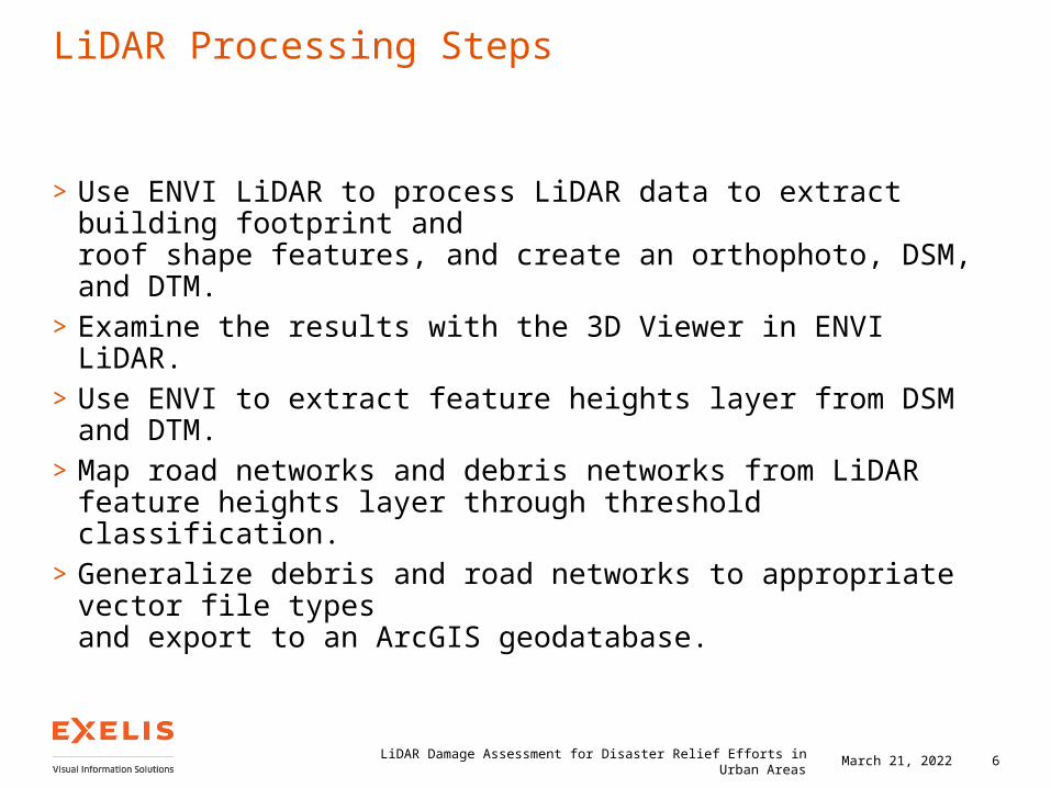
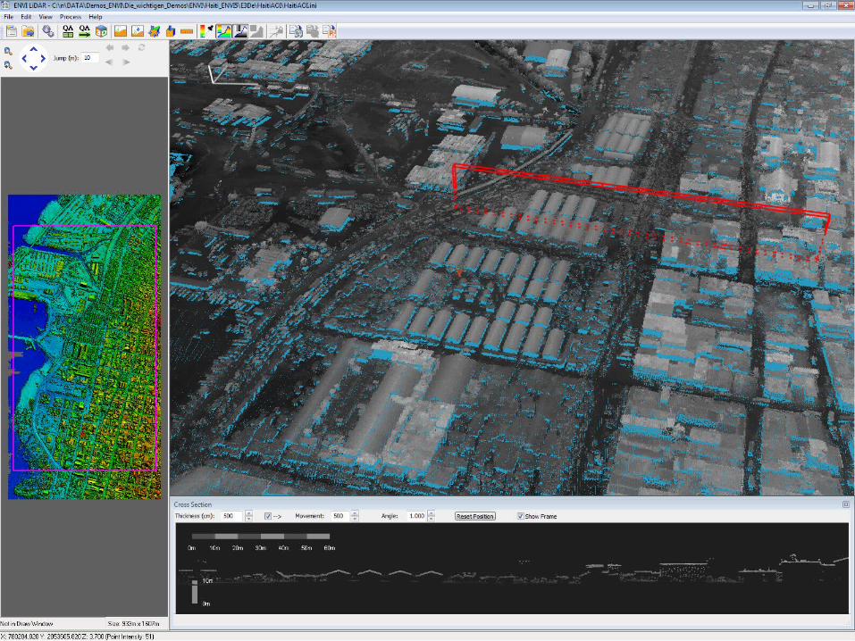
LiDAR Processing Steps
>Use ENVI LiDAR to process LiDAR data to extract building footprint and roof shape features, and create an orthophoto, DSM, and DTM.
>Examine the results with the 3D Viewer in ENVI LiDAR.>Use ENVI to extract feature heights layer from DSM and DTM.>Map road networks and debris networks from LiDAR feature heights layer
through threshold classification.>Generalize debris and road networks to appropriate vector file types
and export to an ArcGIS geodatabase.
LiDAR Damage Assessment for Disaster Relief Efforts in Urban Areas 6April 18, 2023
7LiDAR Damage Assessment for Disaster Relief Efforts in Urban Areas April 18, 2023
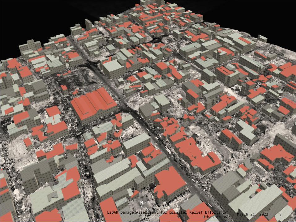
8LiDAR Damage Assessment for Disaster Relief Efforts in Urban Areas April 18, 2023
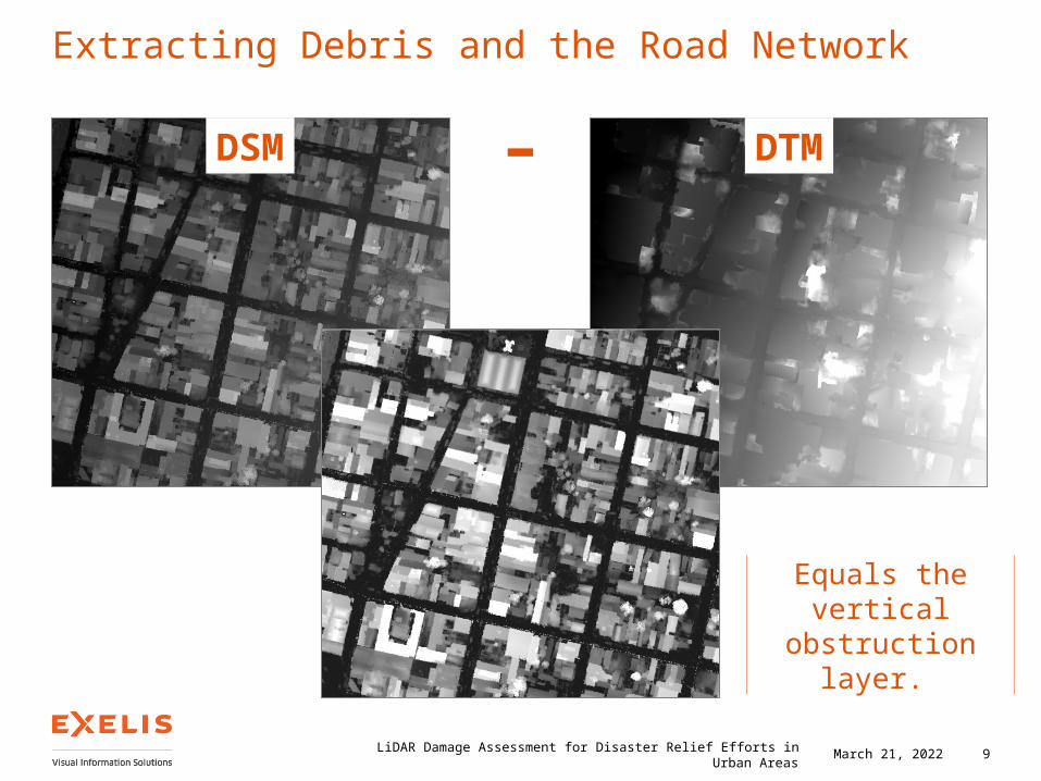
Extracting Debris and the Road Network
LiDAR Damage Assessment for Disaster Relief Efforts in Urban Areas 9
DSM – DTM
Equals the vertical obstruction layer.
April 18, 2023
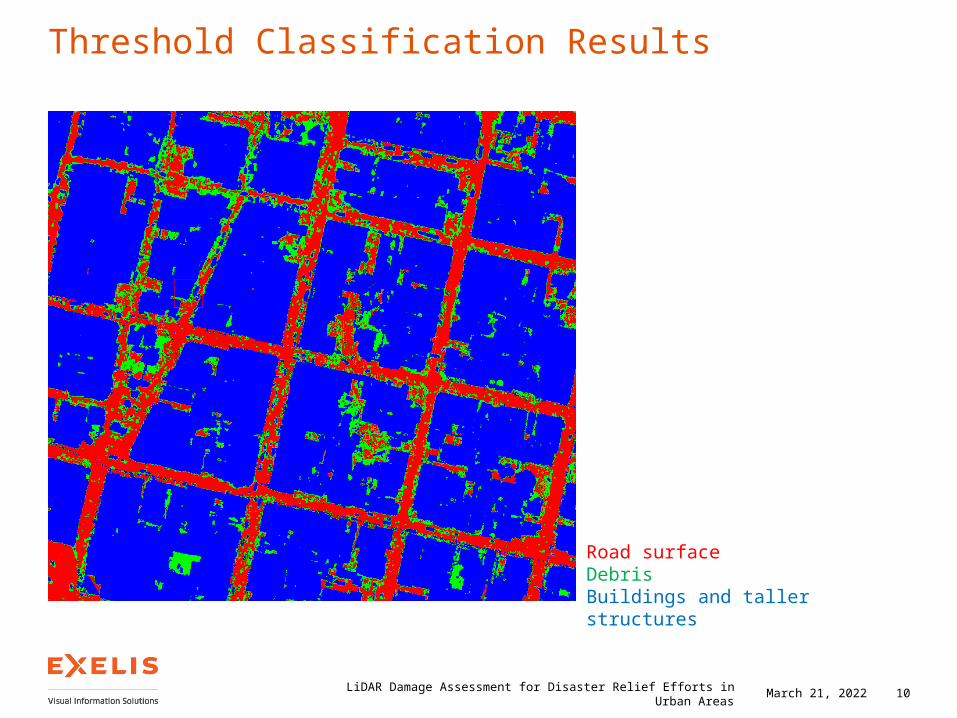
Threshold Classification Results
LiDAR Damage Assessment for Disaster Relief Efforts in Urban Areas 10
Road surfaceDebrisBuildings and taller structures
April 18, 2023
Analyst Role
LiDAR Processing
> ENVI LiDAR: Produces layers of relevance such as DSM, DTM, and building footprints and roof shape polygons.
> ENVI: DEM processing is performed to calculate the heights of above ground features and separate roads from structures and debris.
Spectral Analysis
> ENVI: Blue tarp signature is used to extract blue tarp locations from the scene to locate refugees.
> ArcGIS: Density maps highlight locations where refugees are located.
Network Analysis
> ENVI: Road networks are extracted from LiDAR data and manually cleaned up.> ArcGIS: Road networks are imported to a network dataset. Obstructions from
ENVI are used as barrier inputs for ground team routing.
LiDAR Damage Assessment for Disaster Relief Efforts in Urban Areas 11April 18, 2023
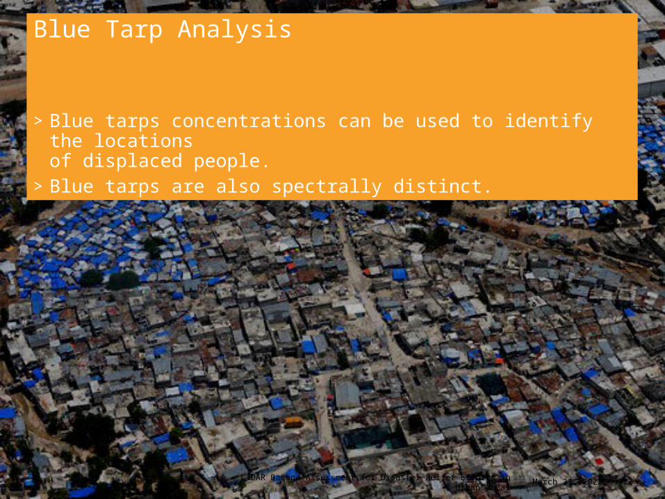
Blue Tarp Analysis
>Blue tarps concentrations can be used to identify the locations of displaced people.
>Blue tarps are also spectrally distinct.
12LiDAR Damage Assessment for Disaster Relief Efforts in Urban Areas April 18, 2023
13LiDAR Damage Assessment for Disaster Relief Efforts in Urban Areas April 18, 2023
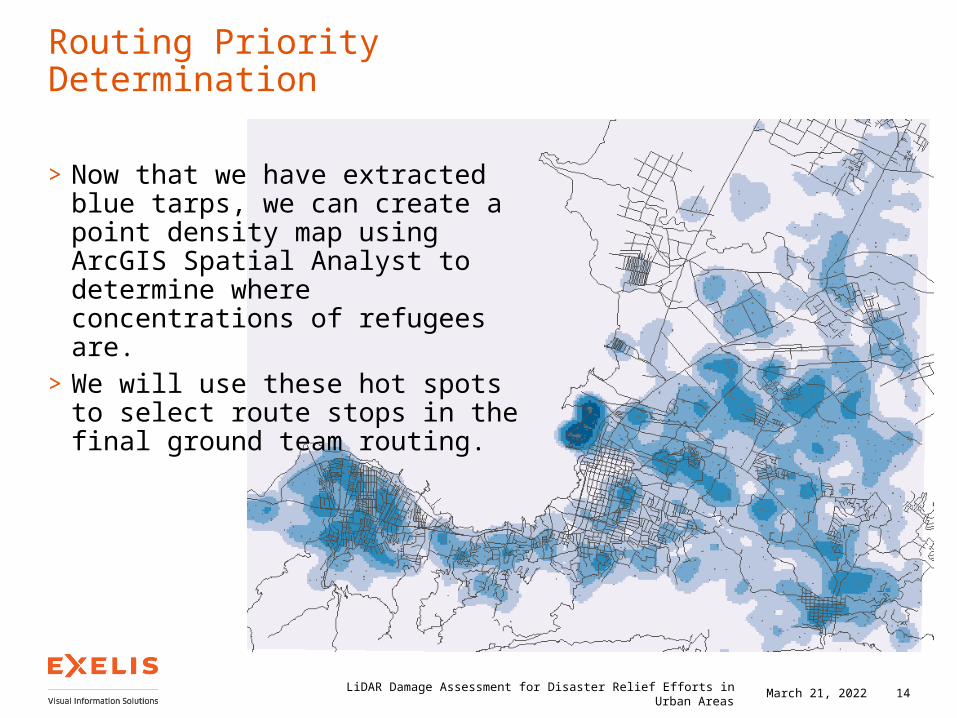
Routing Priority Determination
>Now that we have extracted blue tarps, we can create a point density map using ArcGIS Spatial Analyst to determine where concentrations of refugees are.
>We will use these hot spots to select route stops in the final ground team routing.
14LiDAR Damage Assessment for Disaster Relief Efforts in Urban Areas April 18, 2023
Analyst Role
LiDAR Processing
> ENVI LiDAR: Produces layers of relevance such as DSM, DTM, and building footprints and roof shape polygons.
> ENVI: DEM processing is performed to calculate the heights of above ground features and separate roads from structures and debris.
Spectral Analysis
> ENVI: Blue tarp signature is used to extract blue tarp locations from the scene to locate refugees.
> ArcGIS: Density maps highlight locations where refugees are located.
Network Analysis
> ENVI: Road networks are extracted from LiDAR data and manually cleaned up.> ArcGIS: Road networks are imported to a network dataset. Obstructions from
ENVI are used as barrier inputs for ground team routing.
LiDAR Damage Assessment for Disaster Relief Efforts in Urban Areas 15April 18, 2023
Road Obstruction and Ground Team Routing>When disasters occur, not all road networks remain navigable. >How do we tell which ones are usable?
LiDAR Damage Assessment for Disaster Relief Efforts in Urban Areas 16April 18, 2023
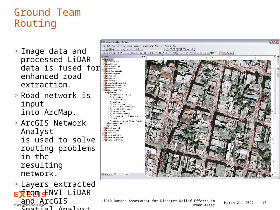
Ground Team Routing
> Image data and processed LiDAR data is fused for enhanced road extraction.
>Road network is input into ArcMap.
>ArcGIS Network Analyst is used to solve routing problems in the resulting network.
>Layers extracted from ENVI LiDAR and ArcGIS Spatial Analyst can provide additional routing context.
17LiDAR Damage Assessment for Disaster Relief Efforts in Urban Areas April 18, 2023
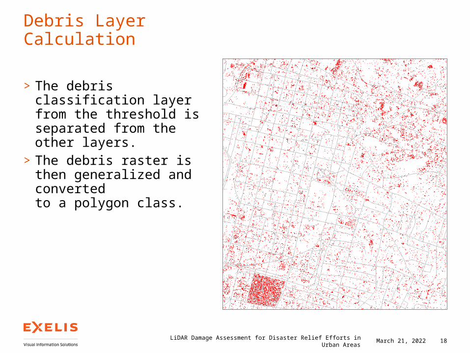
Debris Layer Calculation
>The debris classification layer from the threshold is separated from the other layers.
>The debris raster is then generalized and converted to a polygon class.
18LiDAR Damage Assessment for Disaster Relief Efforts in Urban Areas April 18, 2023
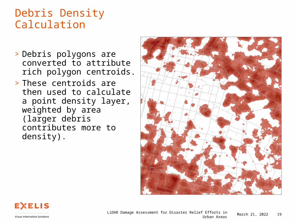
>Debris polygons are converted to attribute rich polygon centroids.
>These centroids are then used to calculate a point density layer, weighted by area (larger debris contributes more to density).
19LiDAR Damage Assessment for Disaster Relief Efforts in Urban Areas April 18, 2023
Debris Density Calculation
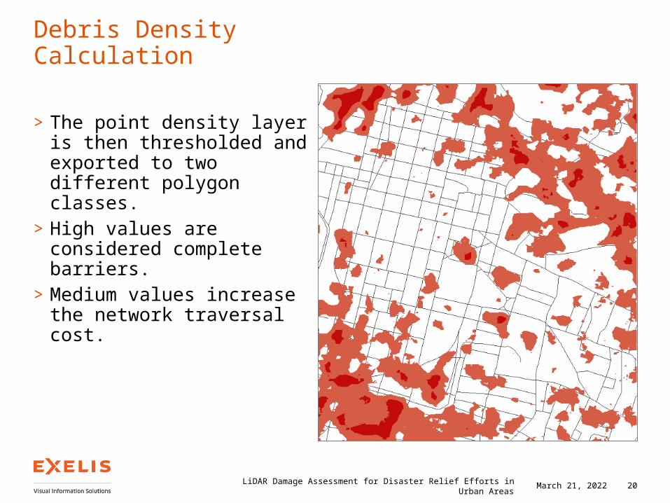
>The point density layer is then thresholded and exported to two different polygon classes.
>High values are considered complete barriers.
>Medium values increase the network traversal cost.
20LiDAR Damage Assessment for Disaster Relief Efforts in Urban Areas April 18, 2023
Debris Density Calculation
Synthesis
LiDAR Processing
> ENVI LiDAR: Produces layers of relevance such as DSM, DTM, and building footprints and roof shape polygons.
> ENVI: DEM processing is performed to calculate the heights of above ground features and separate roads from structures and debris.
Spectral Analysis
> ENVI: Blue tarp signature is used to extract blue tarp locations from the scene to locate refugees.
> ArcGIS: Density maps highlight locations where refugees are located.
Network Analysis
> ENVI: Road networks are extracted from LiDAR data and manually cleaned up.> ArcGIS: Road networks are imported to a network dataset. Obstructions from
ENVI are used as barrier inputs for ground team routing.
LiDAR Damage Assessment for Disaster Relief Efforts in Urban Areas 21April 18, 2023
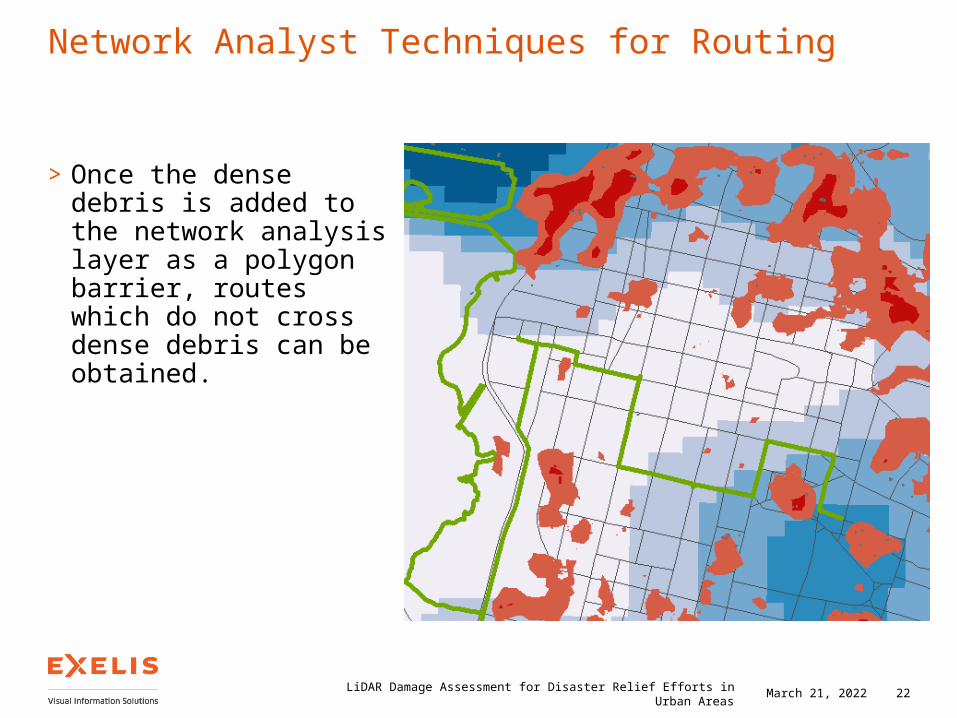
Network Analyst Techniques for Routing
>Once the dense debris is added to the network analysis layer as a polygon barrier, routes which do not cross dense debris can be obtained.
LiDAR Damage Assessment for Disaster Relief Efforts in Urban Areas 22April 18, 2023
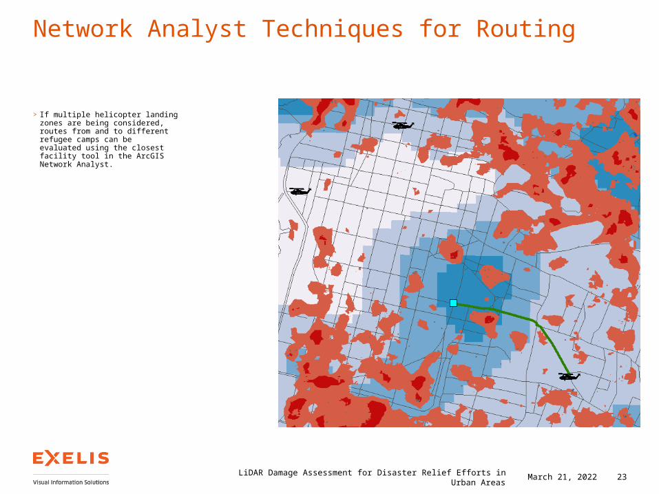
Network Analyst Techniques for Routing
> If multiple helicopter landing zones are being considered, routes from and to different refugee camps can be evaluated using the closest facility tool in the ArcGISNetwork Analyst.
LiDAR Damage Assessment for Disaster Relief Efforts in Urban Areas 23April 18, 2023
Summary
> LiDAR is becoming a critical component of disaster relief planning.
> Imagery combined with LiDAR data can be used as inputs to support emergency response to crises like earthquakes.
> Inputs from LiDAR processed with ENVI LiDAR can be used in ArcGIS Network Analyst to provide real world constraints when solving mission routing problems.
> LiDAR can help emergency responders inventory buildings, land ground teams, find passable routes, and otherwise support crisis response efforts.
24LiDAR Damage Assessment for Disaster Relief Efforts in Urban Areas April 18, 2023

Questions & Discussion
Visit us to find out more about Exelis VIS
www.exelisvis.de
www.facebook.com/ExelisVIS
www.twitter.com/exelisvis
www.YouTube.com/User/ExelisVIS
ENVI and IDL are trademarks of Exelis, Inc. All other marks are the property of their respective owners. ©2012, all rights reserved. Exelis Visual Information Solutions, Inc.


![Commercial Geiger Mode LiDAR - ASPRS4]-slides.pdf · Commercial Geiger Mode LiDAR Mark E. Romano Geospatial Product Manager ASPRS 2015 | 2 Geiger-mode (GmAPD) LiDAR sensor Built …](https://img.pdfslide.us/doc/110x75/5b7aec7b7f8b9a483c8d25e6/commercial-geiger-mode-lidar-4-slidespdf-commercial-geiger-mode-lidar-mark.jpg)