Embed Size (px)
Citation preview
Kineton Neighbourhood Development Plan
1
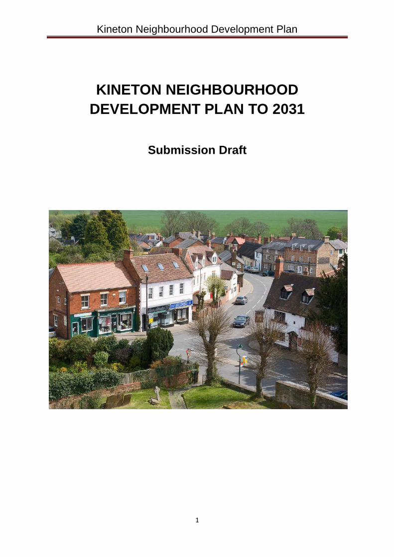
KINETON NEIGHBOURHOOD
DEVELOPMENT PLAN TO 2031
Submission Draft
Kineton Neighbourhood Development Plan
2
Contents
1. Introduction p 3
2. The Neighbourhood Development Plan p 6
3. Kineton - History and Future p 7
4. Kineton - Vision Statement p12
5. Policies for Kineton p16
Appendices
App 1 – Kineton Housing Needs Survey p46
App 2 – Equality and Diversity Assessment p50
App 3 – Sustainable Urban Drainage p51
Maps
Kineton Parish Boundary p 5
Settlement Boundary p53
Potential Development Sites p54
The Natural Environment p55
Development Constraints p56
Kineton Neighbourhood Development Plan
3
1. Introduction
1.1 The Neighbourhood Development Plan aims to make Kineton (including Little Kineton) and the parish of Kineton an even better place to be, now and for future generations. The Plan will cover a 17 year time period and may be subject to review during the lifetime of it. It covers the period 2015 to 2031, the same as Stratford on Avon District Council’s Core Strategy
1.
1.2 The Neighbourhood Development Plan process enables communities to better shape the place they work and live, to inform how development takes place and help influence the type, quality and location of that development, ensuring that change brings with it local benefit.
1.3 The community of Kineton has a strong history of taking local decision making into its own hands. In 2003 the Kineton Village Plan2 was ratified by the Parish Council and was one of the first in the country to be written. It set out a vision and action plan for how the parish wished to see itself develop.
1.4 Neighbourhood planning now provides an opportunity for the community to have a real say over local decision making, to achieve its long-standing goals through the planning system and address the challenges and opportunities facing the future vitality of the parish.
1.5 The Neighbourhood Development Plan is based on extensive research and influenced by robust engagement with the local community3. In the lead up to the referendum, decision makers should consider this to be an important reference point and give it weight as a material consideration in any development planning decisions. When the Plan is made it will have very significant weight in the determination of planning applications.
The Neighbourhood Development Plan Vision for Kineton
1.6 As detailed in the Kineton Village Plan (2003) the community wants Kineton Parish to continue to thrive as a vibrant and distinctive village, to continue to respect and reflect the views of its community, to evolve and expand whilst retaining its unique and distinctive character and to provide an outstanding quality of life for current and future generations of residents.
1.7 The Parish Council will do this by:
Encouraging a thriving and prosperous community that delivers a high quality of life for all its residents
Promoting a distinctive and flourishing local economy that exhibits vitality and dynamism
Supporting measured, proportionate, timely and sustainable development to meet local requirement
Endorsing policies that have a positive effect on the environment, including those that remove or minimise flood risk, mitigate climate change and reduce our carbon footprint
1 Submitted to the Secretary of State on the 30
th September 2014
2 Currently being reviewed in parallel with the Kineton Neighbourhood Development Plan 3 Please refer to submitted Consultation Document
Kineton Neighbourhood Development Plan
4
Maintaining the high quality natural environment with its protected wildlife interests
1.8 Objectives are:
Delivery of a housing growth strategy tailored to the needs and within the context of Kineton Parish
Sensitive development which protects and enriches the landscape and built setting
Sustaining and improving excellent local facilities particularly those in the village centre for existing and new residents
Strengthening and supporting economic activity
Seek on-going improvements to transport and parking, to utility infrastructure and to digital connectivity
Prioritise local distinctiveness in every element of change and growth
Protect greenspace, the landscape and support nature conservation
Involve local people on an ongoing basis in the process of plan-making, monitoring and delivery of development
Kineton Neighbourhood Development Plan
5
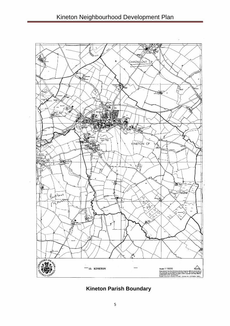
Kineton Parish Boundary
Kineton Neighbourhood Development Plan
6
2. The Neighbourhood Development Plan
2.1 A Neighbourhood Development Plan is a new element in the planning process,
established under the Government’s Localism Act. This became law in April
2012, and aims to give local people more say in the future of where they live.
Once approved under the local referendum, this Neighbourhood Plan will be
adopted by Stratford-on-Avon District Council (SDC) as the plan which must be
used in law to determine planning applications in Kineton. The Neighbourhood
Plan will become part of the Development Plan alongside SDC’s Core Strategy.
For Kineton, this is a great opportunity for people living in the village to decide
how the village should evolve in the years to 2031. The Plan contains the vision
for Kineton that was developed through consultation with the village, and sets out
clear planning policies to support this vision.
2.2 This Neighbourhood Development Plan is in general conformity with the existing
strategic local plan4, and takes account of Stratford-on-Avon District Council’s
Emerging Core Strategy (the Proposed Submission Version Core Strategy
published in June 20145). It looks for the village to develop through steady but
moderate growth, meeting the housing needs of the community while at the same
time preserving the landscape and heritage and considering the infrastructure
needed to support development.
2.3 A Neighbourhood Plan must have appropriate regard to the National Planning Policy Framework (the NPPF) and related advice. The Stratford-on-Avon District Design Guide and the Landscape Sensitivity Study 2011 also provide essential guidance.
2.4 The area covered by the Neighbourhood Plan is the Parish of Kineton. On the 20th May 2013, Stratford-on-Avon District Council approved Kineton Parish Council as an appropriate qualifying body to submit a Neighbourhood Plan, and also approved the area to be covered by the Plan as the Parish of Kineton. A map of the parish with the boundary marked is shown on page 5 opposite.
4 Including associated saved policies 5 Subject to review following the Inspector’s Interim Report published on the 19th of March 2015
Kineton Neighbourhood Development Plan
7
3 Kineton – History and Future
History
3.1 The first recorded mention of Kineton, spelt Cynton, is in a Saxon Charter of
AD969. In 1227 it was granted a Market Charter and two years later, a Charter
for Fairs. Kineton’s role as an important administrative centre can be traced back
to 1160 where, following the reorganisation of local government by Henry II, it
gained an important role by being the centre of the Kineton Hundred.
3.2 Kineton’s relationship with the English Civil War Battle of Edgehill in 1642 is well
documented. Today the battlefield lies mostly within the restricted area of
Defence Munitions (DM) Kineton (owned by the Ministry of Defence) although a
monument commemorating the battle and those who died can be found on the
Banbury Road, about a mile outside the village.
3.3 The village is located approximately 5 miles south east of Wellesbourne and 10
miles north east of Shipston-on-Stour. Located to the east and south east is the
restricted area of DM Kineton. About 2 miles to the north is former RAF Gaydon,
which is now a vehicle testing ground and motor vehicle research and
development centre for Jaguar Landrover and Aston Martin.
3.4 By the time of the 2011 Census, the population of Kineton was about 2,300, an
increase of nearly 16% since 1981. The number of dwellings has increased by
39% during that time and the village now comprises of about 1,000 dwellings.
3.5 Kineton has a small area of influence due to the relatively limited range of shops
and services it provides. There are only a small number of villages close by which
look to Kineton as their local service centre because Shipston and Wellesbourne
exert a larger commercial and retail influence. The exception is in relation to
secondary education as it has a High School which draws pupils over a wide
area, from Wellesbourne to the west, Banbury to the south and Southam to the
east.
3.6 It is not possible to give an accurate picture of travel to work patterns for the
village of Kineton because the major employment source at the Gaydon Site is in
Kineton Ward and skews the available data. However, the 2001 Census showed
that 31% of its employed residents also work in the Ward, while 18% work in
Warwick/Leamington and only 8% in Stratford upon Avon. The influence of the
Gaydon Site is even more dominant in terms of where people live who work in
Kineton Ward, with only 35% being resident in Stratford District.
3.7 The household survey6 carried out in 2008 for the Retail Study showed that
Stratford upon Avon is used by 34% of residents in the Wellesbourne and
Kineton area for their main food shopping compared to 25% who go to
6 Prepared by Colliers CRE June 2008 for Stratford-on-Avon District Council
Kineton Neighbourhood Development Plan
8
Leamington/Warwick and 8% to Wellesbourne. For non-food shopping the main
destinations are Stratford upon Avon (45%), Leamington (18%) and Banbury
(17%).
Future Development Issues
3.8 The River Dene is the main water course in the area although there are other un-
named tributaries. There is a significant risk of pluvial and fluvial flooding7 in the
Dene Valley, putting property at risk in the village. Measures to improve the
capacity of the river channel and reduce flooding commenced in 20148. The
ecological quality of the River Dene within the Kineton area has been categorised
as poor9 primarily due to sewer overflows and road drainage. Plans to stop
sewer discharges into the river are being taken by Severn Trent. There are
significant capacity constraints at Kineton Wastewater Treatment Works10 and in
the network at Kineton, the impact of any future growth upon the foul sewer
system is expected to be addressed by Severn Trent following a detailed survey
of their system.
3.9 Situated on the north bank of the River Dene is the site of the Scheduled
Monument of King John’s Castle11. The site features the earthwork remains of a
Motte and Bailey Castle which now is open to the public and forms important
amenity open space. Additional amenity and recreational green space can be
found within Little Kineton.
3.10 Kineton published a Village Plan in 2003. It encourages appropriate new
employment opportunities and emphasises that infill and redevelopment
proposals should be sensitive to the character of the area. The need for better
facilities for children is identified. The retention of village shops and other
services through the planning process is one of the key actions.
3.11 The capacity of transport infrastructure, including roads and public transport,
is a key concern for Kineton. Heavy goods traffic which passes through Kineton is
constrained at Gaydon, but the advisory signs appear to be ignored. Parking in
the village is considered by many to be a problem. A parking survey will be
undertaken to establish if this is fact or whether it is people saying they cannot
park near enough to shops. Public Transport between Kineton and various towns
is limited. It does not help people who need to get to work. Improvements in this
area are to be considered.
7 Please refer to Environment Agency Surface Water Flood Map 8 Relevant landowners were contacted and reminded of their riparian duty to keep the watercourse clear. The outcome of this, and appropriate escalation to Warwickshire County Council, is subject to ongoing monitoring by the PC 9 Please refer to the ‘Green Infrastructure Study’ prepared for SDC by UE Associates of Cheltenham, August 2011 Page 55 Paragraph 9.1.3 10 Paragraph 6.5.9 SDC Proposed Submission Core Strategy – June 2014 11 Classified as a ‘Local Wildlife Site’ on the 26th of September 2013
Kineton Neighbourhood Development Plan
9
3.12 The scale of sustainable development in Kineton, whilst needing to comply
with final figures12 determined by the Emerging SDC Core Strategy, should reflect
the comparatively modest provision of shops and services. Any new
developments should include pedestrian and cycle links to the schools and
shops. Opportunities should be taken to limit the impact of vehicles in the village,
through the use of traffic management measures and improvements to
pedestrian and cycle links, and to encourage accessibility to the rural areas
through public transport links.
3.13 The Conservation Areas and historic character of Kineton and Little Kineton
are important local features which offer distinctiveness. Infill and redevelopment
proposals should be sensitive to this. The established role of the existing centre
should be maintained. Particular attention needs to be given to enhancing the
role of the village centre so that it provides an attractive focus of services,
facilities and activities for the local community. The retention and provision of
small-scale shopping and other commercial uses will be encouraged, along with
projects to enhance its appearance.
3.14 There are significant constraints13 affecting large areas of land on the edge of
the village. The southern edge is bordered by the Dene Valley but due to the
steep valley is not adversely affected by flood risk in this immediate location. In
addition, the Battle of Edgehill Historic Battlefield lies to the south and south east
of the village. These constraints make development to the south and south east
unsuitable allowing a green space to be retained.
3.15 The landscape surrounding Kineton is described as being highly sensitive to
commercial development14 with areas of High Landscape sensitivity bounding the
majority of the village to the north, south and east. There is no additional land for
employment proposed in Kineton15
, it is important to retain the already
established industrial estates in the village and existing levels of employment in
the area. In addition, within the surrounding rural areas employment proposals
should seek to meet the needs of small businesses and support the continuing
employment use of successful local employment sites, supporting the
intensification of use within existing site boundaries where appropriate.
3.16 Development proposals and other initiatives and projects in and around
Kineton will be expected to contribute to the achievement of the principles set out
in the Plan where it is appropriate and reasonable to do so.
12 Following the adoption of the SDC Core Strategy, any change to projected numbers will be given careful consideration 13 Paragraph 4.4.5 SDC Proposed Submission Core Strategy June 2014 14
The Landscape Sensitivity Study 2011 (LSS) prepared by White Consultants for Stratford-on-Avon District Council included a LSS for Kineton. 15 Over and above that already in existence or secured through planning consents
Kineton Neighbourhood Development Plan
10
3.17 When considering development proposals and other initiatives relating to
Kineton, significant weight will be given to the following core principles:
(a) Environmental
Protect the proposed Area of Restraint16 to the south of the existing
settlement boundary, in order to preserve the River Dene and the open nature
of the landscape in this area and maintain the ‘green wedge’ between Kineton
and Little Kineton.
Recognise and protect the importance of the King John’s Castle site as an
important multifunctional area for biodiversity, recreation and archaeological
significance.
Increase access to the River Dene Valley between Bridge Street and King
John’s Mound while also enhancing biodiversity in the area.
Preserve the historic character of the Conservation Areas particularly that of
the Market Square.
Ensure that all new housing is adequately serviced and water quality in the
Dean is not adversely affected17.
(b) Social
Support the replacement or major refurbishment of Kineton High School, the
improvement of access for transport and the improvement of onsite parking.
Ensure appropriate play spaces for children and young people to meet the
standard set out in Policy CS.24 Healthy Communities.
Create circular walking routes to the north of Kineton leading from within the
settlement out into the wider countryside.
Create additional cycle links that connect to established routes, including
National Cycle, Network Route 48 and routes found to the north-west and
south-east of the village.
(c) Economic
Retain the established industrial estate at Brookhampton Lane and support
the proposed development of business units on Land East of Southam Road18
Maintain the existing level of shops in the village centre and support the
provision of new retail outlets.
Promote the enhanced broadband speeds19 that are being installed in
Kineton, thereby improving ‘homeworking' and small business opportunities
within the parish.
(d) Infrastructure
Alleviate long term traffic issues.
16 As identified in SDC’s Emerging Core Strategy 17 Refer to Consultation response from Natural England dated 19th February 2015 (142103 Kineton NP)
18 Application Reference 12/02069/OUT 19 Policy CS.25 Paragraph F SDC Proposed Submission Core Strategy June 2014

Kineton Neighbourhood Development Plan
11
Minimise traffic impacts in the centre of the village by the construction of a link
road around the north of Kineton between Warwick Road and Southam Road.
Alleviate the congestion caused by parking in the centre of the village.
Kineton Neighbourhood Development Plan
12
4 Kineton Vision Statement
4.1 Kineton will be a desirable place to live, being a sustainable rural community
where people feel fully involved and supported in their work, life and play.
The environment, community services, economic growth, cultural development
and infrastructure of the neighbourhood will be valued, protected and enhanced
for future generations.
Vision Statement - EDUCATION
4.2 To create a good or better quality of education and cultural developments within
the schools, playgroups and other organisations, such as the library, clubs and
societies, so that all people within the Kineton neighbourhood area can make the
most of their work, life and play.
Vision Statement - HEALTH
4.3 Protect, sustain and improve the health facilities in the village to ensure that
standards of medical care are good or better with the establishment of a health
centre, a pharmacy and a rapid response team that can bring prompt emergency
care to all people living in the neighbourhood area.
Vision Statement - HOUSING
4.4 The expansion of housing within Kineton would be in keeping with the rural
character of the village. Any new housing would be in smaller developments with
an appropriate density of houses. The mix of housing to be built would be
compatible with the economic and diverse social needs of Kineton and
surrounding area. Provision would be required for ‘green spaces’ in and around
the new properties and local stone/brick should be used in their construction.
Inappropriate in-filling (i.e. development which does not comply with Policies D1-
D10 of this Plan) within existing developments in the village should be avoided.
The sustainability of any new development will be of critical importance and,
given the recognised limitations of the current infrastructure, new housing
developments must ensure adequate measures are in place to address additional
pressures placed on village infrastructure. The provision of housing should meet
the identified local needs of the neighbourhood area.
Vision Statement - BUSINESS/SERVICES
4.5 The retention and consolidation of the existing businesses and services in the
village will be essential for the sustainable development of Kineton.
Encouragement of employment opportunities, including ‘Homeworking’, will be a
key consideration in building a sustainable and viable future. The maintenance of
a superfast broadband network will be essential. The current retail and service
outlets should be supported and encouraged to develop. This would include the
educational establishments and doctors’ surgeries. An over-riding factor in any
Kineton Neighbourhood Development Plan
13
successful and sustainable development of businesses and services would be
the resolution of traffic and parking issues within the village.
Vision Statement - CONSERVATION
4.6 The historic centre of Kineton retains a significant number of historic buildings, a
high proportion of which are “listed”; the pattern and character define the village’s
origin as a mediaeval market town. The importance of safeguarding this heritage
was recognised in 1969 by the designation of the historic core as a Conservation
Area [refer to Development Constraints Map]. The historic core of Little Kineton
was designated as a Conservation Area in 1991 [refer to Development
Constraints Map].
4.7 The character of each Conservation Area is very different. The Kineton
Conservation Area is urban in character; its buildings fronting the principal streets
and market square creating a sense of enclosure with few gaps or open spaces,
apart from the centrally located churchyard. The character of Little Kineton, on
the other hand, is open textured with old buildings in groups around a large
Green.
4.8 The Neighbourhood Development Plan will continue to protect and, where
possible, enhance the character of both Conservation Areas. It will correct the
deficiencies in the current designated areas by better protecting the setting of
buildings within each Area, by recommending adjustments to boundaries where
appropriate and by encouraging Article 4 directions to control alterations to non-
listed buildings which, nevertheless, make a significant contribution to the
character of each Area. It will also recommend controls to retain significant
historic boundary treatments [walls, hedges etc.] and paving. Where possible
non-conforming treatments which would detract from the character of the Area
[modern colour-stained fencing, concrete panels etc.] will be addressed through
the consideration of planning applications.
4.9 The setting of the Conservation Areas should be protected by ensuring that
development utilises the most appropriate materials and is of a sensitive scale
and design which respects the existing character of the area. This will also assist
in the preservation of the wider setting of the village. Important green spaces and
areas of high landscape sensitivity will be protected and development will not be
allowed to climb Pittern Hill, in order to safeguard the setting of the village.
4.10 An Area of Restraint will be proposed to protect the open space between Little
Kineton and Kineton, including the River Dene corridor.
Vision Statement - LEISURE
4.11 Leisure embraces a wide range of activities from sedentary hobbies to sport
and fitness regimes. Kineton is fortunate to have a variety of leisure opportunities
Kineton Neighbourhood Development Plan
14
already in place. Soccer, cricket and bowls are played at Kineton Sports and
Social Club; Kineton High School is a Specialist Sports College with playing
fields, all weather floodlit pitch, gymnasium, tennis courts and outdoor swimming
pool and Pittern Hill Stables has a large indoor riding school and cross-country
course. Kineton is the home of the Warwickshire Hunt and has possibly the
earliest purpose-built stables [1839] within the Little Kineton Conservation Area.
4.12 Despite the existing provision of leisure facilities within the village, there is an
identified need for more playing fields for junior football and mini football, and
additional tennis courts. There is no safe defined area for skateboarding. The
school facilities are not available to the general public during school hours and
are not easily accessible out of hours. The Plan would seek to create easier
public access to the sports facilities on the school’s premises. Walking, with or
without a dog, is almost certainly the most popular fitness activity and yet existing
off road footpaths radiate from the village and are not joined up. The
Neighbourhood Development Plan would seek to create more circular routes for
pedestrians and create more cycle routes that connect with established routes.
Vision Statement - TOURISM
4.13 Kineton has an opportunity to improve its potential as a base for visitors to
explore the surrounding areas of historic and cultural interest. Transport links by
car are excellent [10 minutes from Junction 12 of the M40]. Stratford-upon-Avon
and Warwick, both sites of international importance, are accessible in less than
30 minutes.
4.14 Closer to Kineton is Compton Verney, a Grade I listed country house which is
the home of a nationally important art gallery. The English Heritage registered
Edgehill Civil War battlefield, the boundary of which adjoins the south-eastern
edge of the village lies to the east. The National Trust properties of Charlecote,
Upton House and Farnborough are all within a 20 minute drive and the National
Motor Museum at Gaydon is even closer.
4.15 Most tourists will continue to stay in Stratford upon Avon and Warwick and the
lack of hotel accommodation in Kineton means that overnight stays are unlikely in
any significant numbers. There is however a potential to encourage day visitors
and more B-&-Bs would encourage overnight stays. For day visitors, additional
cafés, tea-shops and/or restaurants need to be encouraged.
Vision Statement - TRANSPORT
4.16 Kineton should have an integrated and sustainable transport system serving
the needs of the community. This will be delivered through working with the
relevant authority to address public transport, parking, pedestrian and cyclist
safety.
Kineton Neighbourhood Development Plan
15
Vision Statement - INFRASTRUCTURE
4.17 Kineton should have utility infrastructures capable of sustaining new
development and improving the condition for existing residents. The capacity of
sewers and sewer treatment works should be increased to ensure it has capacity for
the future including the separation of highway drainage from the foul network.
Kineton should have a high quality communication infrastructure to enable more
homeworking and reduce the need to travel. Kineton will work closely and with
determination with appropriate authorities to divert most traffic from the village centre
via a link road between Warwick Road and Southam Road.
Kineton Neighbourhood Development Plan
16
5 Neighbourhood Plan: Policies
5.1 Housing
Strategic Objective
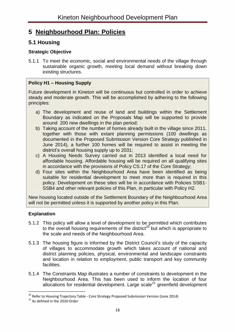
5.1.1 To meet the economic, social and environmental needs of the village through sustainable organic growth, meeting local demand without breaking down existing structures.
Policy H1 – Housing Supply
Future development in Kineton will be continuous but controlled in order to achieve steady and moderate growth. This will be accomplished by adhering to the following principles:
a) The development and reuse of land and buildings within the Settlement Boundary as indicated on the Proposals Map will be supported to provide around 200 new dwellings in the plan period;
b) Taking account of the number of homes already built in the village since 2011, together with those with extant planning permissions (100 dwellings as documented in the Proposed Submission Version Core Strategy published in June 2014), a further 100 homes will be required to assist in meeting the district’s overall housing supply up to 2031;
c) A Housing Needs Survey carried out in 2013 identified a local need for affordable housing. Affordable housing will be required on all qualifying sites in accordance with the provisions of Policy CS.17 of the Core Strategy;
d) Four sites within the Neighbourhood Area have been identified as being suitable for residential development to meet more than is required in this policy. Development on these sites will be in accordance with Policies SSB1-SSB4 and other relevant policies of this Plan, in particular with Policy H2.
New housing located outside of the Settlement Boundary of the Neighbourhood Area will not be permitted unless it is supported by another policy in this Plan.
Explanation
5.1.2 This policy will allow a level of development to be permitted which contributes to the overall housing requirements of the district20 but which is appropriate to the scale and needs of the Neighbourhood Area.
5.1.3 The housing figure is informed by the District Council’s study of the capacity of villages to accommodate growth which takes account of national and district planning policies, physical, environmental and landscape constraints and location in relation to employment, public transport and key community facilities.
5.1.4 The Constraints Map illustrates a number of constraints to development in the Neighbourhood Area. This has been used to inform the location of four allocations for residential development. Large scale21 greenfield development
20 Refer to Housing Trajectory Table - Core Strategy Proposed Submission Version (June 2014) 21 As defined in the 2010 Order
Kineton Neighbourhood Development Plan
17
which could harm the landscape and the special environment of Kineton will not normally be acceptable. However, in order to accommodate the level of housing need required in the Neighbourhood Area, two greenfield sites have been identified. The other two sites utilise previously used (currently waste) sites.
5.1.5 This Plan concludes22 that larger numbers of new dwellings cannot be accommodated within the village without substantial harm to the existing infrastructure and services. In addition, more than moderate growth would prejudice the achievement of sustainable development, including using resources wisely and moving to a low carbon economy, as specified by the National Planning Policy Framework in paragraph 7.
5.1.6 In addition to the housing allocations outlined in this Plan, small windfall developments on land within the Settlement Boundary will provide for its housing needs without significant damage to its character. This pattern of gradual and piecemeal development will ensure new dwellings contribute to the attractive appearance and character of Kineton and its sense of community.
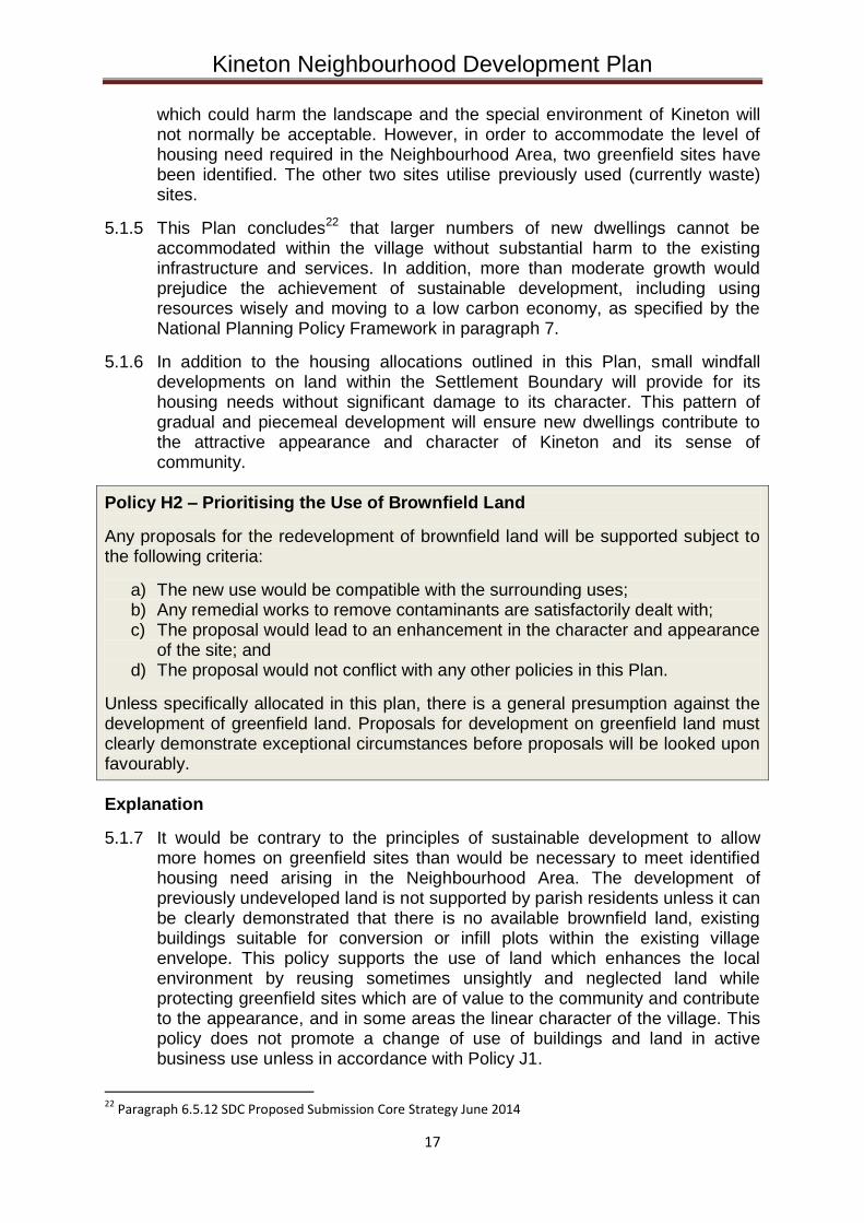
Policy H2 – Prioritising the Use of Brownfield Land
Any proposals for the redevelopment of brownfield land will be supported subject to the following criteria:
a) The new use would be compatible with the surrounding uses; b) Any remedial works to remove contaminants are satisfactorily dealt with; c) The proposal would lead to an enhancement in the character and appearance
of the site; and d) The proposal would not conflict with any other policies in this Plan.
Unless specifically allocated in this plan, there is a general presumption against the development of greenfield land. Proposals for development on greenfield land must clearly demonstrate exceptional circumstances before proposals will be looked upon favourably.
Explanation
5.1.7 It would be contrary to the principles of sustainable development to allow more homes on greenfield sites than would be necessary to meet identified housing need arising in the Neighbourhood Area. The development of previously undeveloped land is not supported by parish residents unless it can be clearly demonstrated that there is no available brownfield land, existing buildings suitable for conversion or infill plots within the existing village envelope. This policy supports the use of land which enhances the local environment by reusing sometimes unsightly and neglected land while protecting greenfield sites which are of value to the community and contribute to the appearance, and in some areas the linear character of the village. This policy does not promote a change of use of buildings and land in active business use unless in accordance with Policy J1.
22 Paragraph 6.5.12 SDC Proposed Submission Core Strategy June 2014
Kineton Neighbourhood Development Plan
18
5.1.8 It is recognised that in order to achieve affordable housing to meet the needs of people with a specific local connection, it may be necessary to accept development of land not available for open market housing which consequently attracts a lower land value, provided such land is in a sustainable location which will not have a harmful impact on the countryside and complies with Policy H2.
5.1.9 Brownfield or previously developed lands are defined in Annex 2 of the NPPF. It specifically excludes garden land and agricultural land. There is no presumption that the whole of any such sites would be suitable for development. This would need to be proven through the planning application process.
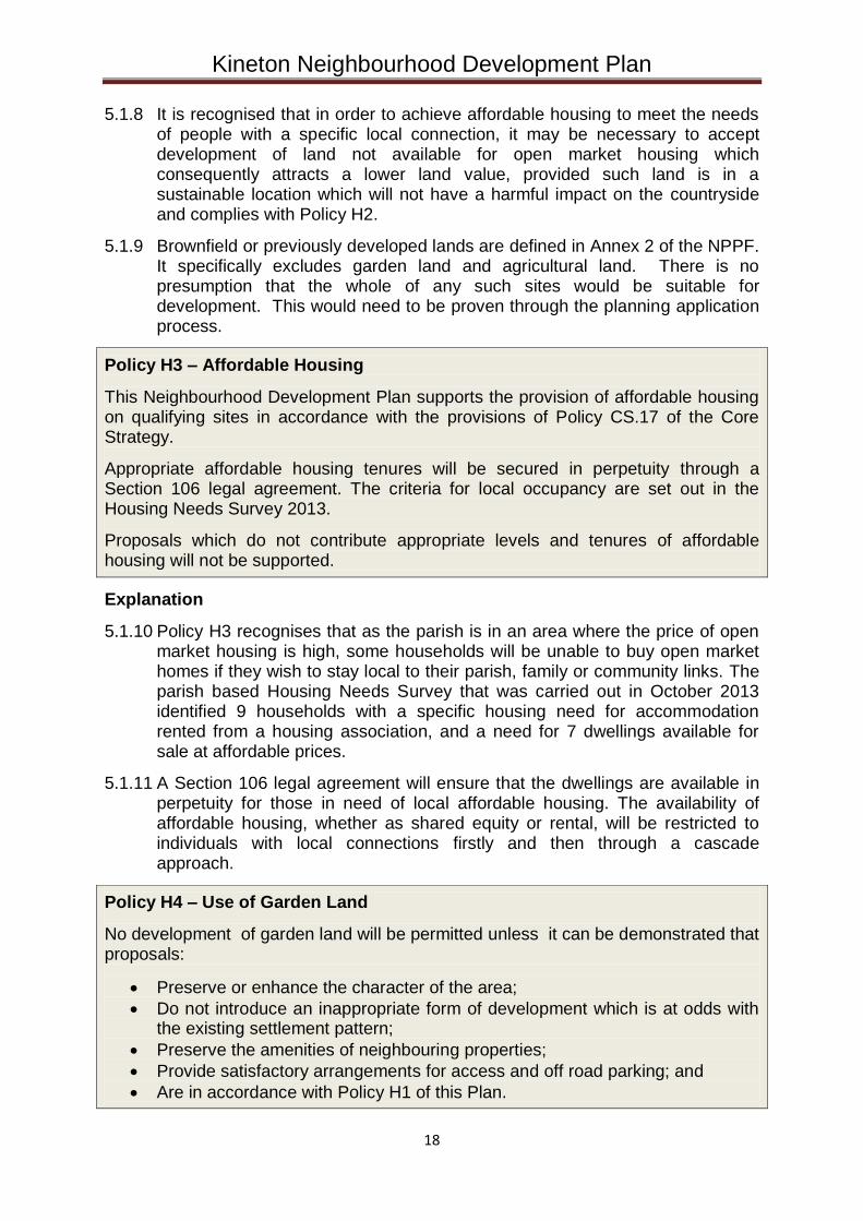
Policy H3 – Affordable Housing
This Neighbourhood Development Plan supports the provision of affordable housing on qualifying sites in accordance with the provisions of Policy CS.17 of the Core Strategy.
Appropriate affordable housing tenures will be secured in perpetuity through a Section 106 legal agreement. The criteria for local occupancy are set out in the Housing Needs Survey 2013.
Proposals which do not contribute appropriate levels and tenures of affordable housing will not be supported.
Explanation
5.1.10 Policy H3 recognises that as the parish is in an area where the price of open market housing is high, some households will be unable to buy open market homes if they wish to stay local to their parish, family or community links. The parish based Housing Needs Survey that was carried out in October 2013 identified 9 households with a specific housing need for accommodation rented from a housing association, and a need for 7 dwellings available for sale at affordable prices.
5.1.11 A Section 106 legal agreement will ensure that the dwellings are available in perpetuity for those in need of local affordable housing. The availability of affordable housing, whether as shared equity or rental, will be restricted to individuals with local connections firstly and then through a cascade approach.
Policy H4 – Use of Garden Land
No development of garden land will be permitted unless it can be demonstrated that proposals:
Preserve or enhance the character of the area;
Do not introduce an inappropriate form of development which is at odds with the existing settlement pattern;
Preserve the amenities of neighbouring properties;
Provide satisfactory arrangements for access and off road parking; and
Are in accordance with Policy H1 of this Plan.
Kineton Neighbourhood Development Plan
19
Explanation
5.1.12 Development within the garden of existing houses can lead to inappropriate development with regard to neighbouring properties and poor means of access. Unless an adequate land area is available or can be assembled and demonstrated to be accessible and sustainable, without causing detrimental harm to the amenity of neighbouring dwellings or to the character of the area, then development will be resisted.
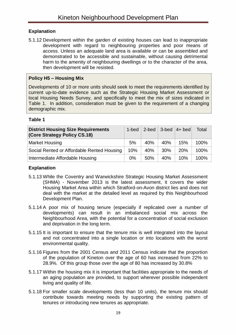
Policy H5 – Housing Mix
Developments of 10 or more units should seek to meet the requirements identified by current up-to-date evidence such as the Strategic Housing Market Assessment or local Housing Needs Survey, and specifically to meet the mix of sizes indicated in Table 1. In addition, consideration must be given to the requirement of a changing demographic mix.
Table 1
District Housing Size Requirements (Core Strategy Policy CS.18)
1-bed 2-bed 3-bed 4+ bed Total
Market Housing 5% 40% 40% 15% 100%
Social Rented or Affordable Rented Housing 10% 40% 30% 20% 100%
Intermediate Affordable Housing 0% 50% 40% 10% 100%
Explanation
5.1.13 While the Coventry and Warwickshire Strategic Housing Market Assessment (SHMA) - November 2013 is the latest assessment, it covers the wider Housing Market Area within which Stratford-on-Avon district lies and does not deal with the market at the detailed level as required by this Neighbourhood Development Plan.
5.1.14 A poor mix of housing tenure (especially if replicated over a number of developments) can result in an imbalanced social mix across the Neighbourhood Area, with the potential for a concentration of social exclusion and deprivation in the long term.
5.1.15 It is important to ensure that the tenure mix is well integrated into the layout and not concentrated into a single location or into locations with the worst environmental quality.
5.1.16 Figures from the 2001 Census and 2011 Census indicate that the proportion of the population of Kineton over the age of 60 has increased from 22% to 28.9%. Of this group those over the age of 80 has increased by 30.8%
5.1.17 Within the housing mix it is important that facilities appropriate to the needs of an aging population are provided, to support wherever possible independent living and quality of life.
5.1.18 For smaller scale developments (less than 10 units), the tenure mix should contribute towards meeting needs by supporting the existing pattern of tenures or introducing new tenures as appropriate.
Kineton Neighbourhood Development Plan
20
Explanation
5.1.19 Stratford-on-Avon District Council is currently preparing its Core Strategy which will govern the spatial vision for new housing in the district uto 2031. Stage 1 of the Examination in Public is now complete. The Inspector’s interim conclusions on the stage 1 examination were published on 18 March 2015.
5.1.20 The Inspector instructed the District Council to undertake more work on certain aspects of the Core Strategy thereby halting its progress towards adoption. The overall housing figure for the district is expected to rise but at the time of writing this Plan the increase is unknown. Equally, the proportion of any increase which will be allocated to Kineton as a Main Rural Centre is unknown.
5.1.21 It is for this reason that this Plan has identified 2 potential sites as ‘Safeguarded Land’ which will be protected from development until such times as a specific, evidence based need for housing arises. If such a need is established then the sites will be released for housing development in order of appearance, depending on the level of need.
Policy H6 – Safeguarded Land
This Plan supports the safeguarding of land at the following locations as shown on the Proposals Map for potential future development:
H6a – Land west of Southam Road H6b – Land east of Lighthorne Road
The above sites will only be released during the plan period if it can be demonstrated through the submission of evidence that there is an identified local housing need for their early release.
Development on these sites will only be permitted providing the following requirements are met:
a) A high quality design utilising the most up to date technologies in building construction and renewable energy technology;
b) An appropriate site layout which will facilitate a roadway linking both sites, with an intention to form a link road between Southam Road and Lighthorne Road, and onward through to Warwick Road;
c) A high quality landscape led layout which takes account of the sensitive landscape in which the site is located;
d) A sensitive external lighting scheme designed to minimise light pollution; e) Safe access and egress from the local highway network; f) Use of a high quality pallet of external materials which have regard to the
sensitive rural location; g) Green travel measures are provided throughout the lifetime of the
development including enhanced links with existing public transport; and h) Sites from Policies SSB1-4 within this Plan have been brought forward for
development.
All development proposals must comply with other policies outlined in this Plan.
Kineton Neighbourhood Development Plan
21
5.2 Jobs
Strategic Objective
5.2.1 One of the three roles in achieving sustainable development is the economic role (NPPF, paragraph 7). Contributing to building a strong, responsive and competitive economy, by ensuring that sufficient land of the right type is available in the right places and at the right time to support growth and innovation; and by identifying and coordinating development requirements, including the provision of infrastructure is pivotal to achieving this role.
5.2.2 This Neighbourhood Development Plan seeks to provide the local policy framework to deliver this role by encouraging opportunities for the development of local employment and preserving what local employment opportunities there are.
Policy J1 –Employment Sites
In the interests of developing a sustainable community and in the light of a rapidly increasing population, proposals for new employment sites consistent with other policies in this Plan and which support the growth of local employment will be encouraged.
Proposals for the change of use or redevelopment of land or premises identified for or currently in employment use will not be permitted unless:
a) There is a sufficient supply of sites for a range of employment uses to meet both immediate and longer term requirements over the Plan period; and
b) The applicant can demonstrate that the site/premises is no longer capable of meeting employment needs; or
c) Development of the site for other appropriate uses will facilitate the relocation of an existing business to a more suitable site; or
d) Unacceptable environmental problems are associated with the current use of the site and the proposal will remove them; or
e) The site is located in the village centre and the proposed use will contribute to the vitality and viability of the centre or forms part of a regeneration project
Explanation
5.2.3 Where local employment can be increased without adverse impact on infrastructure, landscape or amenity, this will benefit the environment by reducing car travel outside the village and offer employment opportunities across all age groups.
Policy J2 – Home Working
All new dwellings must include space to support home-working, with flexible space adaptable to a home office, and incorporate cabling to support broadband.
Proposals for small scale mixed use development (new build or conversion), comprising of workspace and living space will be supported subject to the following criteria:
Kineton Neighbourhood Development Plan
22
a) Suitable independent access to both uses; b) An appropriate level of off road parking to serve both uses; c) Independent service facilities (e.g. kitchen, toilet etc.) for the workspace which
do not rely on the living space; d) Be in locations which are reasonably accessible to local service facilities and
amenities without the use of private motorised transport ; e) In the case of conversions, the building should be of a permanent and
substantial construction, structurally sound and capable of conversion without major rebuilding or extension;
f) An adequate residential curtilage without having a detrimental impact on the building and its rural setting; and
g) Secure arrangements in place via a planning condition, to tie the two elements together to prevent future separation
Explanation
5.2.4 Already, a significant number of parish residents are self-employed or work from home. This Plan aims to encourage this. Self-employment helps the viability of the local economy and home working reduces outward commuting and unnecessary private car journeys. Mixed use schemes where an occupier can work and live within the same planning unit has the benefit of removing the necessity to travel to work and therefore such schemes are a relatively sustainable form of development that would otherwise not be supported in rural locations.
Kineton Neighbourhood Development Plan
23
5.3 Design
Strategic Objective
5.3.1 Paragraph 58 of the National Planning Policy Framework states that Neighbourhood Development Plans “…should develop robust and comprehensive policies that set out the quality of development that will be expected for the area”.
5.3.2 This Plan seeks to achieve this objective through the implementation of the following policies.
Policy D1 – Design and Character
All development in rural areas should be well designed and inclusive, in keeping and scale with its location, and sensitive to the character of the countryside and local distinctiveness.
Developments that do not demonstrate high standards of design will be resisted.
Explanation
5.3.3 Whilst individual design is often a subjective matter, how a development functions, the creation of an interesting and diverse development and making sure it is clear and logical provides a solid foundation for creating a strong sense of place.
Policy D2 – Responding to Local Character
All development proposals must demonstrate how local character has been taken into account during the conception and evolution of a design in accordance with the following principles:
a) Be compatible with the distinctive character of the area, respecting the local settlement pattern, building styles and materials whilst taking a positive approach to innovative, contemporary designs that are sensitive to their setting. Existing open green spaces within the settlement should be retained.
b) Be of a density and scale that is in keeping with the character of the surrounding development and landscape;
c) Preserve and enhance heritage assets including listed buildings and the designated Conservation Areas;
d) Protect and enhance landscape and biodiversity by incorporating landscaping consistent with Warwickshire Landscape Guidelines;
e) Conserve views to and from higher slopes, skylines and sweeping views across the landscape;
f) Have regard to the impact on tranquillity, including dark skies; g) Not increase the likelihood of surface water flooding within the village or
exacerbate foul drainage capacity problems; and h) Be preceded by an appropriate archaeological survey to ascertain the
implications of development on below ground heritage assets.
Proposals that do not positively contribute to local character will be resisted.
Kineton Neighbourhood Development Plan
24
Explanation
5.3.4 It is important to ensure that local character is preserved and where appropriate enhanced. New development that is at odds with a distinctive local character can be harmful so will be treated cautiously.
5.3.5 The purpose of this policy is to manage development so that the most appropriate design is found for the site having regard to local character to ensure that all developments are of high quality and reflect the character of the areas around them in spatial layout, scale, materials, design and landscape terms.
5.3.6 New developments which protect the character of the historic built environment and improve the quality of life through good design which is in sympathy with the special character of the area will be looked upon favourably.
5.3.7 The preservation of local distinctiveness and character requires that the appropriate density for new housing should in every case result in a development that is in character with the local surrounding area. It is also important that future development should ensure that the mass of building relates proportionally to the plot size.
5.3.8 Noise and activity arising from developments in the countryside together with lighting can have an adverse effect on tranquillity and dark skies. CPRE has issued a Statement on Tranquillity and Dark Skies with the objective of maintaining or improving the existing level of tranquillity. The recommendations within this statement are endorsed by this Plan.
5.3.9 This policy is not intended to impose a particular architectural style or stifle innovation, originality or innovative design through unsubstantiated requirements to conform to certain development forms or styles.
Policy D3 - Use of Design Codes and Master Planning
All proposals for large-scale development will be expected to demonstrate design rationale through the appropriate use of design codes (SDC District Design Guide April 2001) and master planning.
All large-scale housing developments (10 or more dwellings) should be accompanied by a master plan (for outline applications) or a contextual plan (for detailed applications) which demonstrates how the development integrates into the existing community by encouraging social cohesion and how it delivers the necessary infrastructure to support the development. The master plan/contextual plan must take account of recent and potential future development in the area so as to provide a degree of future-proofing. The plan must include consideration of means to ameliorate the additional demand that the development would place on the highway system, through a Transport Assessment, and on services such as schools and medical facilities, as well as the need to provide public open space and environmental improvements.
Development will not be supported if detrimental impacts on existing village/Neighbourhood Area infrastructure are found.
Kineton Neighbourhood Development Plan
25
Explanation
5.3.10 It is important to the residents that all future development is of high quality and reflects the character of these areas in spatial layout, scale, materials, design and landscape.
5.3.11 A design code is a set of illustrated design rules and requirements, which instruct and advise on the physical development of a site or area. The graphic and written components of the code are detailed and precise, and build upon a design vision such as a master plan or other design and development framework for a site or area. It serves as a quality benchmark for the whole development, but need not be overly prescriptive.
5.3.12 The threshold for large-scale development is 10 or more dwellings or 1,000 sqm or more of non-residential floor space.
5.3.13 Use of the Design Guide will also be encouraged for smaller scale developments particularly where there is a particular sensitivity affecting the site.
Policy D4 – Replacement Dwellings
Proposals for replacement dwellings must respect the character and appearance of the locality. Particular importance is placed on sensitive sites such as those within conservation areas or affecting the setting of listed buildings.
Replacement dwellings must be of an appropriate scale so as not to be too dominant (e.g. overbearing on neighbouring uses / properties or the street scene) or adversely affect the amenity of neighbouring uses.
Proposals will be expected to demonstrate how a replacement is more sustainable in the longer term than refurbishment, alteration or extension to the existing building. In this respect all replacement dwellings must meet at least Level 5 of the Code for Sustainable Homes. In the event of the Code for Sustainable Homes being withdrawn during the term of this Plan then the replacement dwellings should be constructed to standards which exceed the relevant Building Regulations in force at the time of construction.
Proposals will be expected to demonstrate that protected species will not be harmed as a result of the proposals.
This policy will only apply to lawful dwellings and does not apply to caravans or mobile homes.
Explanation
5.3.14 This policy is designed to facilitate the renewal of the existing housing stock with appropriate replacements. It is not intended to overly restrict people’s freedom and expression of interest in design and layout. In this respect, all new replacement dwellings will be expected to enhance design and create a more sustainable living environment in the longer term.

Kineton Neighbourhood Development Plan
26
Policy D5 - Designing Out Crime
All development proposals will be expected, where necessary, to demonstrate how the design has been influenced by the need to plan positively to reduce crime and the fear of crime and how this will be achieved.
Proposals which fail to satisfactorily create a safe and secure environment will not be supported.
The advice of a Police Architectural Liaison representative should be sought for all developments of 10 or more dwellings.
Explanation
5.3.15 The Government places great importance on creating safe and accessible environments where crime and disorder, and the fear of crime, do not undermine quality of life or community cohesion (paragraph 58 of the National Planning Policy Framework). There are many recommendations on how to design out crime.
5.3.16 CABE's comprehensive ‘Safer Places’ paper identifies seven key characteristics that create a safe community. All development proposals will be required to demonstrate how these characteristics have been incorporated into the proposed design.
1) Access and movement: places with well-defined routes, spaces and entrances that provide for convenient movement without compromising security
2) Structure: places that are structured so that different uses do not cause conflict
3) Surveillance: places where all publicly accessible spaces are overlooked 4) Ownership: places that promote a sense of ownership, respect, territorial
responsibility and community 5) Physical protection: places that include necessary, well-designed security
features 6) Activity: places where the level of human activity is appropriate to the location
and creates a reduced risk of crime and a sense of safety at all times 7) Management and maintenance: places that are designed with management
and maintenance in mind, to discourage crime in the present and the future.
Policy D6 – Reuse of Buildings
The conversion of redundant buildings built of traditional materials and of architectural merit to housing, permanent business space or residential tourist accommodation will be accepted provided the development:
a) Does not have an unacceptable impact on the visual and landscape amenity of the area, particularly conservation areas and listed buildings;
b) Does not have an unacceptable impact on neighbours’ amenity; c) Does not cause harm to nature conservation interests; d) Benefits from a safe and convenient access to the site or a satisfactory
access can be created;
Kineton Neighbourhood Development Plan
27
e) The building is genuinely capable of being converted without significant modification, rebuilding (including foundations and walls) or extension; and
f) Ancillary and/or proposed outbuildings and boundary treatments are in keeping with the character and setting of the original building.
Such applications will be expected to demonstrate compliance with the above criteria through the submission of supporting documentation such as ecological surveys and structural engineer’s surveys.
Explanation
5.3.17 If sensitively converted the reuse of redundant buildings can have a positive impact on the amenity of the area and create a sustainable form of development without any additional harm to the landscape.
5.3.18 The reuse of redundant agricultural buildings can also be of benefit to the sustainability of farms and other rural businesses particularly when creating ongoing revenue through holiday lettings.
Policy D7 – Environmental Sustainability
All new development should demonstrate that it has taken account of best practices to achieve high levels of sustainability and safety through design and layout.
Appropriate measures to deal with climate change should be demonstrated together with the use of sustainable drainage systems.
Explanation
5.3.19 New dwellings must be designed to be environmentally sustainable in construction and in use. This includes building in the ability to recycle water collection. Any features, including solar panels and heat pumps, must be designed to avoid harm to the appearance of the building and the street scene. If a building is listed or within the conservation area then equipment specifically designed and sited to meet the conservation / listed buildings criteria will be required.
5.3.20 Any new buildings should contribute to the achievement of sustainable development. Consequently it is important to reduce the environmental impact of new development and the energy costs to new occupiers. Works to improve the performance of traditional buildings should be compatible with their building technology.
5.3.21 It is important that in all cases steps are taken to minimise any noise from equipment in order to protect neighbours’ amenity. All parking and driveway areas will be designed with permeable surfaces to reduce surface water run-off.
Policy D8 – Parking Provision
All new development must include adequate provision for off-road parking for residents and visitors. Dwellings comprising two or more bedrooms must provide off-road spaces for at least two cars (excluding garages but including car ports).
Kineton Neighbourhood Development Plan
28
Additionally, dwellings must provide secure storage space for cycles.
Non-residential developments must provide adequate parking in accordance with the County Council’s adopted standards.
New developments must develop easy pedestrian and cycle routes into the village centre and to schools.
Explanation
5.3.22 The Census confirms a very high level of vehicle ownership in Kineton. This reflects the lack of public transport adequate to support routine travel to work outside the village. Parking outside schools at pick up and drop off times causes congestion, blocks roads and affects pedestrian movements. Measures to reduce this by providing improved pedestrian and cycle routes is essential. Furthermore, on-street parking hinders shop deliveries and the Post Office sorting office traffic. Measures to improve pedestrian access to the village shops are also essential.
Policy D9 – Effective and Efficient Use of Land
All development proposals must demonstrate an effective and efficient use of land. The effective use of land can assist in delivering sustainable development in the following ways:
a) Density which is designed to enhance the character and quality of the local area, commensurate with a viable scheme and infrastructure capacity;
b) Giving priority to reusing previously developed land over greenfield land; c) Bringing empty properties back into use
The built-up areas should appear to emerge gradually from the surrounding countryside, with higher density and building heights located towards the village centre, and lower density and building heights on the periphery of the built-up area boundaries
Explanation
5.3.23 Paragraph 47 of the National Planning Policy Framework encourages a local approach to housing density to reflect local circumstances.
5.3.24 While there is no rigid design density set for the Neighbourhood Area, in all cases development will be expected to respond to local character. Higher densities close to the village centre where there is a high level of accessibility may be acceptable whereas lower densities will be more appropriate on the periphery of the village. Densities would not normally be above 25-30 dwellings per hectare.
5.3.25 The heights of new buildings should have regard to the context of the individual site and the surrounding area. Building heights may increase nearer the village centre but in contrast, heights should be lower towards the edge of the village to assist in the assimilation of new development into the surrounding countryside/landscape.
Kineton Neighbourhood Development Plan
29
5.3.26 High quality design will enhance amenity through housing density levels that also secure adequate internal and external space, dwelling mix, privacy and sunlight and daylight to meet the requirements of future occupiers.
Policy D10 – Heritage Assets
Proposals which cause harm to the special historic or architectural fabric and interest of listed buildings and scheduled monuments and their settings will be resisted.
Proposals, including changes of use, which enable the appropriate and sensitive repair and reuse of listed buildings, will be supported.
All proposals must as a minimum preserve the important physical fabric, appearance, scale and settings of listed buildings and scheduled monuments.
Development which would harm or fail to preserve or enhance the character or appearance of the Neighbourhood Area’s two conservation areas will be resisted. This includes development outside the boundary of each Conservation Area which, by virtue of its design, scale or materials would nevertheless have a negative impact on the character and setting of each area.
Any development within or immediately adjacent to the registered battlefield site should be designed to minimise impact on the battlefield in terms of design, scale and materials and of views across the battlefield from Kineton and Little Kineton.
Explanation
5.3.27 The preservation of valuable heritage assets is of paramount importance to this Neighbourhood Development Plan.
5.3.28 The Kineton and Little Kineton Conservation Areas are specifically defined and protected because of their special architectural and historic character and interest. Great weight should be placed on the need to preserve or enhance the conservation areas, including the preservation of green spaces, boundary walls, trees, hedges and fences and other features which contribute positively to the character and setting of each area.
5.3.29 The Battle of Edgehill 1642 was the first significant battle of the Civil War. It is of national historic and landscape significance and is included on the Battlefields Register prepared by English Heritage. The Neighbourhood Plan seeks to protect these significant heritage assets.
Kineton Neighbourhood Development Plan
30
5.4 Environment
Strategic Objective
5.4.1 To seek opportunities for landscape, recreational and ecological gain whilst minimising the environmental impact of new development. This will be achieved through the following principles:
Protecting and enhancing the village’s green spaces;
Protecting, enhancing and conserving the landscape and views;
Protecting and enhancing the historic environment of the settlement of Kineton Village and the Parish;
Conserving and enhancing biodiversity;
Preserving high quality agricultural land;
Reducing harm to the environment by seeking to minimise pollution; and
Locating development in order to avoid increasing pollution from traffic congestion.
5.4.2 The natural beauty of the area around the settlement of Kineton is derived from the geology, vegetation and historic land use. New development must conform to past forms and patterns, mass, scale, and building materials although the function of buildings can be modern.
5.4.3 The policies in the Kineton Neighbourhood Development Plan conform to the
National Planning Policy Framework, which states that planning should contribute to, protect and enhance the natural environment. This includes protecting valued landscapes, geological conservation interests, minimising impacts on biodiversity, providing net gains in biodiversity where possible and establishing coherent ecological networks that are more resilient to current and future pressures. Reference has been made to reports from the Council for the Preservation of Rural England (CPRE) concerning the countryside especially regarding tranquillity and dark skies policy.
5.4.4 The National Planning Policy Framework defines the environmental dimension of sustainability as “contributing to protecting and enhancing our natural, built and historic environment; and, as part of this, helping to improve biodiversity, use natural resources prudently, minimise waste and pollution, and mitigate and adapt to climate change including moving to a low carbon economy.”
5.4.5 These principles are adopted and form part of the evidence base of this Plan. Features of the natural environment are shown on both the Development Constraints and Natural Environment Maps.
Policy E1 – Agricultural Land
Development proposals which would result in the complete or partial loss of the best and most versatile agricultural land (defined as land in grades 1 2 and 3a of the Agricultural Land Classification) will not be permitted unless there are exceptional circumstances that outweigh the loss.
Kineton Neighbourhood Development Plan
31
Explanation
5.4.6 Agricultural land is an essential part of the landscape of Kineton as well as providing local employment and food security for the nation. In addition the beauty of the landscape around Kineton consists of the combination of hills and agricultural land. In many fields adjoining the settlement, the ancient pattern of ridge and furrow is well preserved. This historic landscape feature is greatly valued and must be protected.
Policy E2 – Landscapes, Vistas and Skylines
Development proposals should ensure that all prominent views of the landscape and important vistas and skylines are maintained and safeguarded, particularly where they relate to historic assets, existing landmark buildings, ‘gateway’ sites and settlement boundaries.
All large scale development proposals should demonstrate, through the submission of a landscape led design, that they preserve the landscape, vistas and skylines and where possible enhance these important attributes of the Neighbourhood Area.
Explanation
5.4.7 Communication masts, pylons, wind turbines, or other structures such as solar panel farms which are highly visible will not be permitted if they would have an adverse impact on the character of the landscape and the built environment of the settlement. Highly visible skyline building of houses will not be permitted.
5.4.8 Preservation of the unbroken skylines of the surrounding hills to the northwest, north, east and south is an important objective in any new development. Skyline housing on original footprints (old farms etc.) will be required to comply with original sight lines, and other new skyline structures will not be permitted.
5.4.9 Important aspects of the Kineton landscape can be seen in areas such as the land between Kineton and Little Kineton from Bridge Street to King John’s Mound; the battle field site to the south of Banbury Road; the land along the banks of the River Dene from Banbury Road to King John’s Mound; the land to the north of Glosters Green alongside the old railway line between the Southam Road and Lighthorne Road; the land to the north of the Banbury Road between the Kineton High School and Walton Fields.
5.4.10 The land to the north and east of Walton Fields and any land to the north of existing Banbury Road properties will be protected from future building. The Landscape Sensitivity Study 2011 states that under no circumstances should there be any development to the north of the new housing estate (Walton Fields) to ensure that the settlement edge is stepped and well below the minor ridge top.
5.4.11 The green areas of land deep within the settlement and on the edge of the settlement boundary, as shown on the Natural Environment Map, are important features of Kineton and characterise the village. These pieces of open land bring the countryside close, and afford views across fields to the
Kineton Neighbourhood Development Plan
32
skyline formed by the surrounding hills to the northwest, north, east and south of the settlement. They should enable an excellent system of paths to give residents and visitors easy access to the countryside. They act as wildlife habitats and wildlife corridors.
Policy E3 – Minimising Pollution
All development will be required to demonstrate, through a written supporting statement, how measures to minimise the impact of pollution have been considered.
Proposals which would give rise to unacceptable levels of air, light, noise or water pollution will be resisted.
Explanation
5.4.12 Paragraph 120 of the NPPF clearly sets out, in broad terms, that pollution is a material planning consideration. Pollution can and does have detrimental impacts on the environment and human health. In the absence of a robust plan policy, both the quality of life of local residents and the ecology of the area would be compromised.
5.4.13 This Neighbourhood Development Plan is particularly concerned with light pollution and the impact of development on the tranquillity of the Neighbourhood Area.
5.4.14 The Neighbourhood Development Plan will follow the recommendations of the Council for the Preservation of Rural England (CPRE) to minimise noise generation. Helipads or airstrips for powered gliders, microlites etc. will only be permitted within the Neighbourhood Area where they do not give rise to unacceptable levels of noise pollution.
5.4.15 The CPRE has stated “The tranquillity of the English countryside is one of its most important qualities. Tranquillity is important for our mental and physical well-being. It improves our quality of life. It is also critical to rural economies because it’s one of the main reasons why people head out of towns and cities to ‘get away from it all’. But getting away from it all is becoming harder and harder to do. Aircraft, cars, roads and building developments are all eroding the tranquillity that means so much to all of us.”
5.4.16 The roads through the centre of Kineton produce significant noise and air pollution, and new developments should not generate significant additional traffic. The bowl shape of the Dene Valley makes the village particularly vulnerable to reverberating sound which is transferred to other residential areas.
Policy E4 – Renewable and Low Carbon Energy Generation
Development proposals relating to the production of renewable energy will be supported providing they can be satisfactorily integrated into the character and appearance of the village and its environs.
Proposals which fail to preserve or enhance the established character and appearance of the local area will be resisted.

Kineton Neighbourhood Development Plan
33
Explanation
5.4.17 The benefits of renewable energy generation through processes such as biomass, ground source and air source heat pumps, hydroelectric, wind and thermal capture are all well-documented. This Neighbourhood Development Plan seeks to encourage rather than stifle opportunities to establish the generation of renewal energy in appropriate locations where the benefits of such projects clearly outweigh any harm.
Policy E5 – Streamside Development
Development proposals on the defined flood plain as per the Environment Agency Surface Water Flood Map within the Neighbourhood Area must clearly demonstrate by means of a hydrological survey that it would not increase flooding to houses and property lower down the valley.
If necessary, proposals must include full details of any ameliorating infrastructure such as appropriate SuDS features to mitigate any impact.
Explanation
5.4.18 The Liassic clay bowl which underlies Kineton is likely to respond particularly badly to climate change. The clay bakes into an impermeable surface across which the increased rainfall will flow rapidly without percolating into the top soil. The rapid sheet wash will flow into the River Dene causing flash flooding in some areas, in addition to the identified flood risk areas next to the River Dene.
5.4.19 Unless carefully sited and constructed, new housing and related hard surfaces will inevitably tend to exacerbate the flooding problems. Riverside vegetation should be protected as important natural habitat adding to the biodiversity of the village.
Policy E6 – Trees and Hedgerows
All new development will be expected to protect mature healthy trees and hedges. Where this is not possible, new trees and hedges should be planted to replace those lost.
All new developments should incorporate the planting of appropriate native trees and hedges in their plans.
Large-scale developments will need to demonstrate they have been landscape led in order to avoid retrofitting of poor quality or token landscaping
Explanation
5.4.20 New developments must not cramp the root run of established trees or require lopping to a degree that would materially hinder the future growth of the tree. Established hedgerows should be preserved unless there are exceptional agricultural reasons justifying their removal.
Kineton Neighbourhood Development Plan
34
5.4.21 Trees in the conservation area are legally protected. Historically significant fragments of ancient hedgerow still exist within or close to the settlement which should be protected and enhanced to preserve biodiversity in the village. Hedgerows are important wildlife corridors connecting pastures around the settlement. They are significant features in the landscape, an important element in views largely unaltered for centuries.
Policy E7 – Flooding and Surface Water Drainage
Development within Flood Zones 1 and 2 must demonstrate that it will not reduce the capacity and capability of the functional flood plain. Water compatible uses within Flood Zone 3 may be acceptable in certain circumstances but other forms of development will be strictly resisted.
All development proposals must incorporate suitable and sustainable means of drainage where site conditions are favourable. Where site conditions are proven to be unfavourable or unfeasible, an alternative drainage solution will need to be agreed by the council and the relevant water authority. The re-use and recycling of water within developments will be encouraged.
Proposals which do not satisfactorily demonstrate secure arrangements for the prevention of fluvial and pluvial flooding will not be supported.
Explanation
5.4.22 This Neighbourhood Development Plan supports measures to increase the capacity of the River Dene where it passes the village to the south to ensure houses at risk of flooding have their risk reduced.
5.4.23 There are areas on the road network where water ponds are putting pedestrians at risk of being soaked. The County Council will be asked to rectify these problems.
Policy E8 – Foul Drainage
All development proposals must demonstrate that there are or will be adequate water supply and water treatment facilities in place to serve the whole development.
Proposals that would result in an unacceptable risk to the quality and / or quantity of a water body or water bodies will not be permitted.
Proposals to expedite the improvement and upgrade the existing foul drainage network in the village will be supported. All developments will be expected to demonstrate that there are suitable and satisfactory arrangements in place to deal with foul water.
Explanation
5.4.24 Local planning authorities have a general responsibility not to compromise the achievement of United Kingdom compliance with the Water Framework Directive (WFD42) (Directive 2000/60/EC). All surface water bodies need to achieve “good ecological status” by 2015. The Localism Act 2011 enables the
Kineton Neighbourhood Development Plan
35
UK government to require local authorities to pay if their inaction resulted in a failure to meet WFD requirements. The Localism Act 2011 also requires local planning authorities to co-operate on cross-boundary planning issues including the provision of water supply infrastructure, water quality, water supply and enhancement of the natural environment.
5.4.25 The effective management of waste water is considered critical in the pursuit of sustainable development and communities. It reduces the impact flooding can have on the community, maintains water quality and quantity and helps to enhance local amenity and biodiversity through the provision of green infrastructure.
5.4.26 Effective water management also reduces the movement of water and sewage thereby reducing energy requirements. The Parish Council will continue to work with Warwickshire County Council as lead local flood authority, the District Council, the Environment Agency and Severn Trent Water to achieve compliance with the WFD and aim to provide sufficient water to meet local needs.
Policy E9 – Neighbourhood Area Biodiversity Action Plan
A Biodiversity Action Plan shall be prepared for the Neighbourhood Area in consultation with key stakeholders and the public.
All proposals should take account of the Local Biodiversity Action Plan and show what effect, if any, they will have on local biodiversity. Where development involves a loss of biodiversity or habitat, appropriate habitat should be created in mitigation.
Explanation
5.4.27 The Local Biodiversity Action Plan (LBAP) provides a neighbourhood level response to the Government’s National Action Plans for threatened habitats species and will sit alongside Warwickshire County Councils LBAP, which is currently under review.
5.4.28 The LBAP contributes to national targets wherever these are relevant to the neighbourhood area but also sets local targets.
5.4.29 The LBAP contains action plans for all our local habitats (woodlands, wetlands, grasslands, etc.) and many of our threatened and declining local species.
5.4.30 The plan will have clear measurable targets and assemble the local people and local organisations that are ideally placed to deliver the necessary action.
5.4.31 The LBAP will provide a strategy for action in two parts. Firstly, it will set out the strategic framework and main courses of action, and secondly, it will contain the detailed actions required for priority habitats and species in the neighbourhood area.
Kineton Neighbourhood Development Plan
36
5.5 Infrastructure
Strategic Objective
5.5.1 To ensure that as Kineton grows proper account is taken in considering any development of existing resource limitations, in particular sewerage, foul water systems and land drainage run off schemes, but also power, broadband and road traffic congestion.
Policy IN1 – Infrastructure Criteria
All new developments within the Neighbourhood Area, must not adversely impact the existing infrastructure.
All new developments must be sustainable and where practical self-sufficient.
Developments of 5 or more dwellings must demonstrate:
a) A hydrological survey has been carried out and a satisfactory Sustainable Urban Drainage scheme has been adopted which demonstrates that the development will not increase the likelihood of surface water flooding in the village;
b) An agreement is in place with Severn Trent Water that sufficient treatment capacity is available and good connections can be made to the main sewer;
c) Telecommunication connection to new properties will be by fibre optic cabling;
d) A high standard of energy efficiency measures is incorporated in the design of the proposed dwellings;
e) Provision is made for off road parking for at least 2 cars; and f) All proposed path and driveway areas incorporate permeable surface
materials.
Explanation
5.5.2 All new developments must not exacerbate the already unsatisfactory foul water drainage system in Kineton which, for the majority of existing dwellings, is already at capacity and causes occasional unpleasant and unhygienic overspills.
5.5.3 This policy aims to ensure that development does not make this unsatisfactory situation worse by requiring that appropriate mitigation measures are in place in a timely manner. Consideration should be given to the retention of land which can be used to slow down the flow of surface water and the creation of containment ponds.
5.5.4 Flood risk management is the responsibility of the Environment Agency and the Lead Local Flood Authority (Warwickshire County Council). In the future, developers will be required to meet the national and local guidelines for Sustainable Drainage Systems (SUDS) as set out by SUDS Approval Bodies (SABs). An explanation of Sustainable Drainage Systems is given in Appendix 3.
Kineton Neighbourhood Development Plan
37
Policy IN2 - Community Facilities
Existing community facilities play an important role in maintaining a strong, healthy and vibrant community. The loss of existing community facilities will be resisted unless it can be demonstrated that the facility is no longer viable or that the facility is no longer in active use and has no prospect of being brought back into use.
Proposals which enhance and improve existing community facilities will be supported.
New community facilities will be encouraged providing they are compatible with existing neighbouring uses.
Explanation
5.5.5 There is a presumption in favour of retaining existing community facilities which support a strong, healthy, vibrant and cohesive community. Such facilities will be protected from inappropriate forms of development which may cause harm either directly or indirectly through new development, redevelopment or changes of use.
5.5.6 Community venues such as leisure facilities, libraries, meeting rooms and
civic buildings play a particularly important role in bringing together the community and preventing social isolation. This is especially important in vulnerable groups such as the elderly.
5.5.7 School playing fields and sports facilities will be protected against loss or encroachment.
5.5.8 Any proposal which results in the loss of, or harm, to an existing community facility will be expected to demonstrate how that loss is mitigated i.e. through betterment or replacement.
5.5.9 Examples of community facilities include shops and local businesses, community halls and churches, education, health centres and dispensaries, children’s play areas and playing fields.
Policy IN3 - Encouraging Safe Walking and Cycling
All new development must demonstrate how walking and cycling opportunities have been prioritised. The Neighbourhood Area has a wealth of public routes which should be protected, enhanced, expanded and positively utilised in all new development. Proposals which either adversely affect existing walking and cycling routes or fail to encourage appropriate new walking and cycling opportunities will be resisted.
Explanation
5.5.10 In order to encourage walking and cycling, new development must play its part in creating new recreational paths and safe cycle routes. Paths and routes should be direct, functional and link to the existing extensive network of rights of way within the Neighbourhood Area. This Plan is fully supportive of the work of Sustrans within the Neighbourhood Area.
Kineton Neighbourhood Development Plan
38
5.5.11 Research shows a direct correlation between vehicle speeds and the severity of accidents involving pedestrian and cyclists. Walking and cycling can be made safer and prioritised by reducing the speed limit in the village centre and residential areas to 20mph and 10mph past schools at drop off and pick up times.
5.5.12 Public routes include rivers, footpaths, bridleways and cycle ways. Public routes are an intrinsic component of what defines sustainable development.
5.5.13 Public routes should be protected and where possible enhanced and improved. New development should demonstrate how it utilises public routes to achieve sustainability. No new development should reduce the amenity currently enjoyed by the ‘public route users’ either physically or visually.
Policy IN4 - Protecting and Enhancing Existing Green Open Spaces
Existing green open spaces will be protected and enhanced in order to ensure a suitable quantum and quality of recreational space is available for the residents of, and visitors to the Neighbourhood Area.
Local Green Space designations will be used to ensure that important local pockets of green space as identified in the Development Constraints Map, whether private or public, will be protected from inappropriate development.
Proposals which result in the loss or partial loss of Local Green Space will not be supported.
Explanation
5.5.14 The minimum ratio of green space to population as set out in the Draft Core Strategy should be applied to all new developments in such a way as to correct any shortfall across the parish within the next 10 years, and to comply with Natural England’s Greenspace Standard recommendations.
5.5.15 Safeguarding existing green open spaces within the Settlement Area will ensure the delivery of a green corridor along both sides of these important arterial public routes.
5.5.16 In accordance with paragraph 76 of the National Planning Policy Framework local communities through their neighbourhood plans can identify for special protection green areas of particular importance. By designating land as Local Green Space local communities will be able to rule out new development other than in very special circumstances.
5.5.17 The green areas identified are considered important spaces within the Settlement Area worthy of such protection.
Policy IN5 – Highway Safety and Transport
All new development will be expected to demonstrate that:
a) The safety of all roads users will not be compromised; b) There will be no demonstrable adverse impact on the capacity and operation
of the local highway network;
Kineton Neighbourhood Development Plan
39
c) There is adequate off road parking to serve the development in accordance with Policy D8;
d) There is safe access, egress and appropriate visibility to serve the development; and
e) Existing on-street parking problems are not exacerbated by the development.
Proposals which fail to demonstrate the above will not be supported.
In recognition of existing on-street parking problems in the village centre, any proposals which seek to increase the opportunity for off-road parking in or adjacent to the village centre will be supported. In addition a link road between Warwick Road and Southam Road will be pursued.
Explanation
5.5.18 Kineton has for many years been impacted by a confluence of vehicle routes that has caused serious vehicular congestion and safety issues. There are five primary vehicle routes that lead into Kineton Parish. Two of these routes require passing over former old narrow railway bridges. The width restrictions caused by these bridges is a major safety concern to the Parish.
5.5.19 There also exists within the settlement a variety of narrow roads with one major route having an acute 90 degree angle turn.
5.5.20 Traffic problems are further exacerbated by substantial on-street parking by residents. There is little or no off street parking and there is limited opportunity to create new additional spaces away from the village streets. The width of the roads in the village centre with on-street parking already creates issues for vehicles both delivering and passing through.
5.5.21 One unique major problem faced by Kineton is the number of school coaches from Kineton High School which pass through the centre of the village twice a day throughout the school term with each bus undertaking four passages through the village daily. When this is multiplied by the average number of coaches (12) the impact of the coaches is substantial and creates major congestion.
5.5.22 Any new development should recognise the increase in vehicles attempting to negotiate the narrow restricted current road infrastructure. Routes to and from both secondary and primary schools require improved road infrastructure and provision should be required for adequate footpaths and cycle ways.
5.5.23 Surveys for the potential of a one-way system in Manor Lane, Kineton and in Little Kineton should be conducted to ease the traffic congestion before any new development is permitted.
5.5.24 The construction of a link road joining Warwick Road to Southam Road, will be actively promoted to provide some relief to the centre of the village. The safety of all road users is paramount. Applicants will be expected to demonstrate that safety is not compromised through their development proposals.
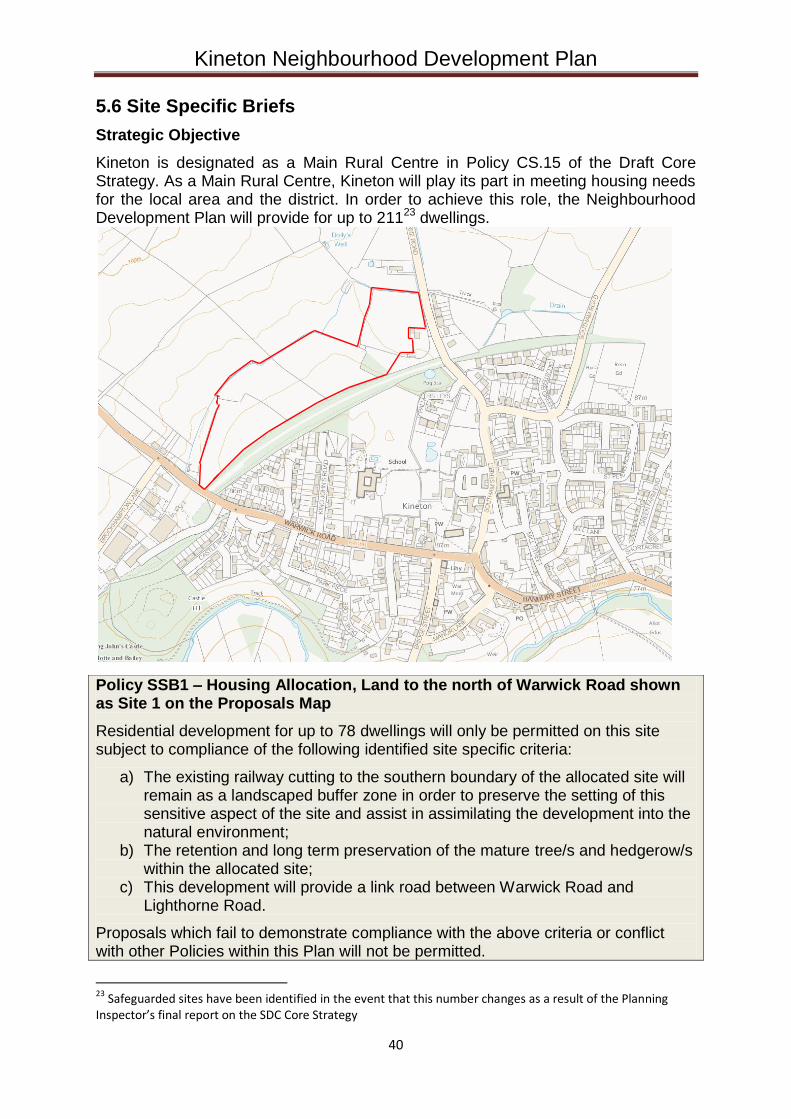
Kineton Neighbourhood Development Plan
40
5.6 Site Specific Briefs
Strategic Objective
Kineton is designated as a Main Rural Centre in Policy CS.15 of the Draft Core Strategy. As a Main Rural Centre, Kineton will play its part in meeting housing needs for the local area and the district. In order to achieve this role, the Neighbourhood Development Plan will provide for up to 21123 dwellings.
Policy SSB1 – Housing Allocation, Land to the north of Warwick Road shown as Site 1 on the Proposals Map
Residential development for up to 78 dwellings will only be permitted on this site subject to compliance of the following identified site specific criteria:
a) The existing railway cutting to the southern boundary of the allocated site will remain as a landscaped buffer zone in order to preserve the setting of this sensitive aspect of the site and assist in assimilating the development into the natural environment;
b) The retention and long term preservation of the mature tree/s and hedgerow/s within the allocated site;
c) This development will provide a link road between Warwick Road and Lighthorne Road.
Proposals which fail to demonstrate compliance with the above criteria or conflict with other Policies within this Plan will not be permitted.
23 Safeguarded sites have been identified in the event that this number changes as a result of the Planning Inspector’s final report on the SDC Core Strategy
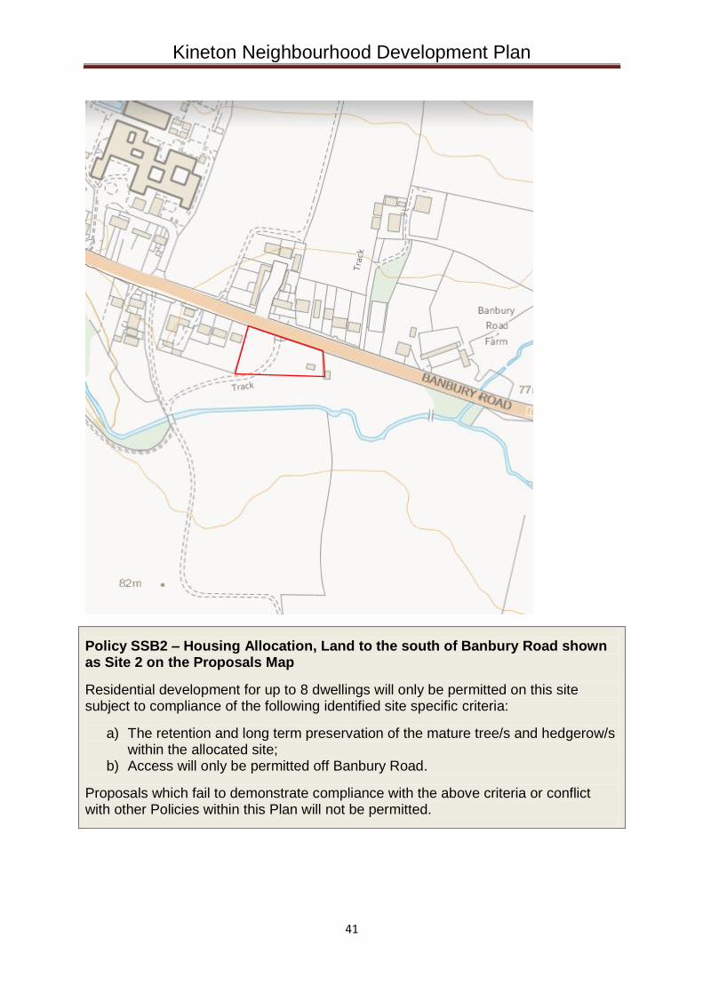
Kineton Neighbourhood Development Plan
41
Policy SSB2 – Housing Allocation, Land to the south of Banbury Road shown as Site 2 on the Proposals Map
Residential development for up to 8 dwellings will only be permitted on this site subject to compliance of the following identified site specific criteria:
a) The retention and long term preservation of the mature tree/s and hedgerow/s within the allocated site;
b) Access will only be permitted off Banbury Road.
Proposals which fail to demonstrate compliance with the above criteria or conflict with other Policies within this Plan will not be permitted.
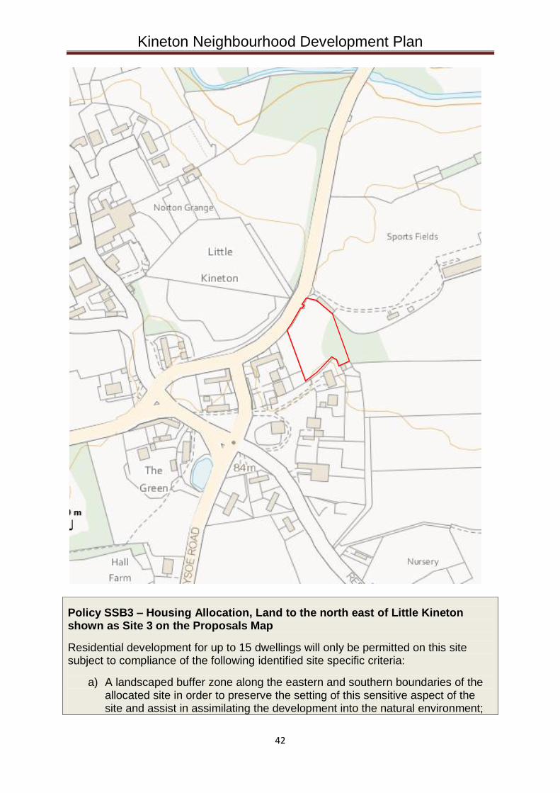
Kineton Neighbourhood Development Plan
42
Policy SSB3 – Housing Allocation, Land to the north east of Little Kineton shown as Site 3 on the Proposals Map
Residential development for up to 15 dwellings will only be permitted on this site subject to compliance of the following identified site specific criteria:
a) A landscaped buffer zone along the eastern and southern boundaries of the allocated site in order to preserve the setting of this sensitive aspect of the site and assist in assimilating the development into the natural environment;
Kineton Neighbourhood Development Plan
43
b) The retention and long term preservation of the mature tree/s and hedgerow/s within the allocated site;
c) Access will only be permitted off Bridge Street, Little Kineton; d) Development will not be permitted to extend onto the battlefield site.
Proposals which fail to demonstrate compliance with the above criteria or conflict with other Policies within this Plan will not be permitted.
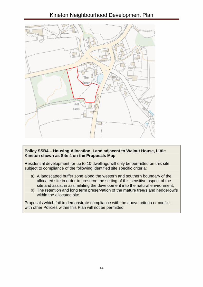
Kineton Neighbourhood Development Plan
44
Policy SSB4 – Housing Allocation, Land adjacent to Walnut House, Little Kineton shown as Site 4 on the Proposals Map
Residential development for up to 10 dwellings will only be permitted on this site subject to compliance of the following identified site specific criteria:
a) A landscaped buffer zone along the western and southern boundary of the allocated site in order to preserve the setting of this sensitive aspect of the site and assist in assimilating the development into the natural environment;
b) The retention and long term preservation of the mature tree/s and hedgerow/s within the allocated site.
Proposals which fail to demonstrate compliance with the above criteria or conflict with other Policies within this Plan will not be permitted.
Kineton Neighbourhood Development Plan
45
Thank you to the residents of Kineton for your valuable feedback and
comments over the last few years; and to the team of volunteers who have
worked tirelessly to put this Plan together.