Embed Size (px)
Citation preview
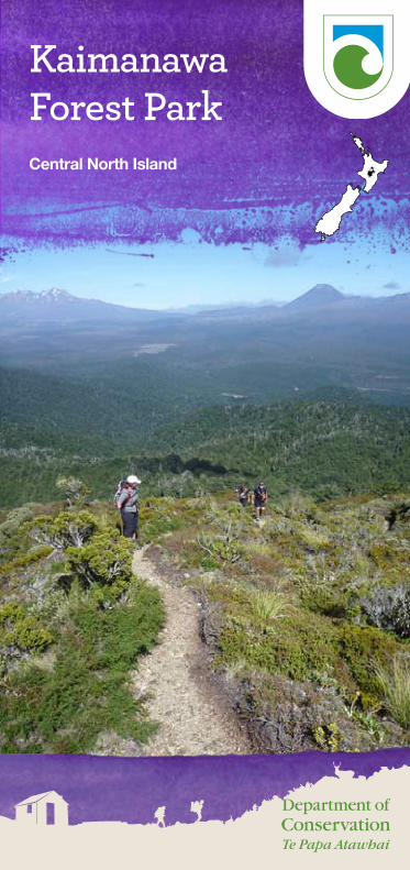
KaimanawaForest ParkCentral North Island
1
ContentsWelcome to Kaimanawa Forest Park 1
Natural history 1
Access 5
Safety 6
Other activities 8
Accomodation 9
Walking and tramping 12
Tracks and marked routes 13
From Clements Mill and Taharua Roads 13From Kiko Road 15From Kaimanawa Road 16From Waipākihi Road 17From the Desert Road summit 18
Short walks and bike rides 19
From Kiko Road 19From Kaimanawa Road 19From Tree Trunk Gorge Road 21
Further information 21
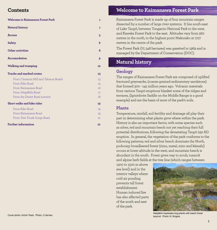
Welcome to Kaimanawa Forest ParkKaimanawa Forest Park is made up of four mountain ranges dissected by a number of large river systems. It lies south-east of Lake Taupō, between Tongariro National Park to the west, and Kaweka Forest Park to the east. Altitudes vary from 560 metres in the north, to the highest point Makorako at 1727 metres in the centre of the park. The Forest Park (77, 348 hectares) was gazetted in 1969 and is managed by the Department of Conservation (DOC).
Natural history
GeologyThe ranges of Kaimanawa Forest Park are composed of uplifted fractured greywacke, (coarse-grained sedimentary sandstone) that formed 300 - 145 million years ago. Volcanic materials from various Taupō eruptions blanket some of the ridges and terraces, (Ignimbrite Saddle on the Middle Range is a good example) and are the basis of most of the park’s soils.
Plants Temperature, rainfall, soil fertility and drainage all play their part in determining what plants grow where within the park. History is also an important factor, with some species such as silver, red and mountain beech not yet reaching their full potential distributions, following the devastating Taupō 232 AD eruption. In general, the vegetation of the park conforms to the following patterns; red and silver beech dominate the North, podocarp broadleaved forest (rimu, mataī, miro and kāmahi) occurs at lower altitude in the west, and mountain beech is abundant in the south. Forest gives way to scrub, tussock and alpine herb fields at the tree line (which ranges between 1300 to 1500 m above sea level) and in the interior valleys where cold air ponding prevents tall forest establishment. Human induced fire has also affected parts of the south and east of the park.
1
Cover photo: Urchin Track. Photo: J Carman.Waipākihi headwater bog plants with beech forest beyond. Photo: N. Singers.
2 3
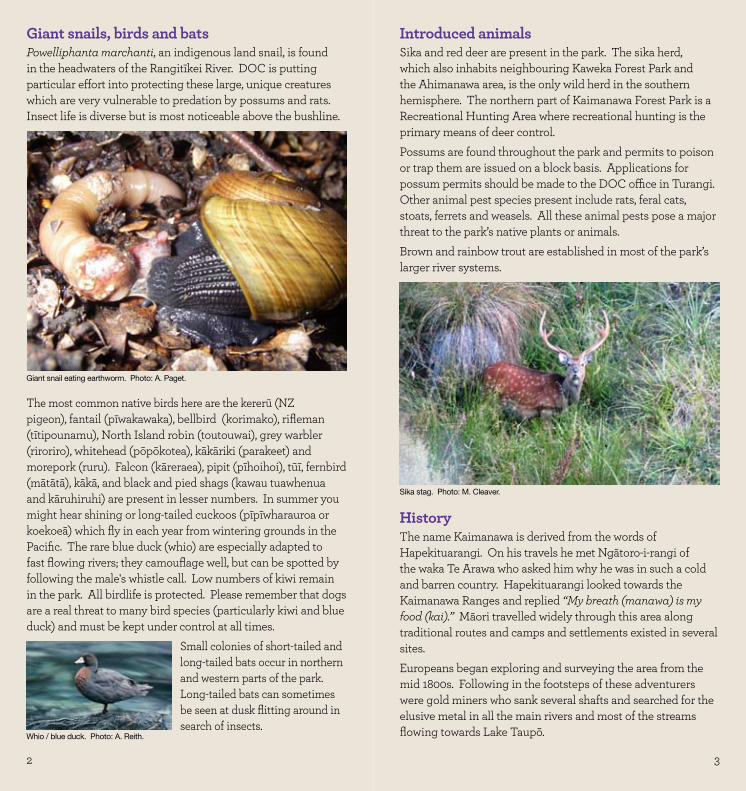
Giant snails, birds and batsPowelliphanta marchanti, an indigenous land snail, is found in the headwaters of the Rangitīkei River. DOC is putting particular effort into protecting these large, unique creatures which are very vulnerable to predation by possums and rats. Insect life is diverse but is most noticeable above the bushline.
The most common native birds here are the kererū (NZ pigeon), fantail (pīwakawaka), bellbird (korimako), rifleman (tītipounamu), North Island robin (toutouwai), grey warbler (riroriro), whitehead (pōpōkotea), kākāriki (parakeet) and morepork (ruru). Falcon (kāreraea), pipit (pīhoihoi), tūī, fernbird (mātātā), kākā, and black and pied shags (kawau tuawhenua and kāruhiruhi) are present in lesser numbers. In summer you might hear shining or long-tailed cuckoos (pīpīwharauroa or koekoeā) which fly in each year from wintering grounds in the Pacific. The rare blue duck (whio) are especially adapted to fast flowing rivers; they camouflage well, but can be spotted by following the male's whistle call. Low numbers of kiwi remain in the park. All birdlife is protected. Please remember that dogs are a real threat to many bird species (particularly kiwi and blue duck) and must be kept under control at all times.
Small colonies of short-tailed and long-tailed bats occur in northern and western parts of the park. Long-tailed bats can sometimes be seen at dusk flitting around in search of insects.
Introduced animalsSika and red deer are present in the park. The sika herd, which also inhabits neighbouring Kaweka Forest Park and the Ahimanawa area, is the only wild herd in the southern hemisphere. The northern part of Kaimanawa Forest Park is a Recreational Hunting Area where recreational hunting is the primary means of deer control.Possums are found throughout the park and permits to poison or trap them are issued on a block basis. Applications for possum permits should be made to the DOC office in Turangi. Other animal pest species present include rats, feral cats, stoats, ferrets and weasels. All these animal pests pose a major threat to the park’s native plants or animals.Brown and rainbow trout are established in most of the park’s larger river systems.
HistoryThe name Kaimanawa is derived from the words of Hapekituarangi. On his travels he met Ngātoro-i-rangi of the waka Te Arawa who asked him why he was in such a cold and barren country. Hapekituarangi looked towards the Kaimanawa Ranges and replied “My breath (manawa) is my food (kai).” Māori travelled widely through this area along traditional routes and camps and settlements existed in several sites. Europeans began exploring and surveying the area from the mid 1800s. Following in the footsteps of these adventurers were gold miners who sank several shafts and searched for the elusive metal in all the main rivers and most of the streams flowing towards Lake Taupō.
Giant snail eating earthworm. Photo: A. Paget.
Whio / blue duck. Photo: A. Reith.
Sika stag. Photo: M. Cleaver.
4 5
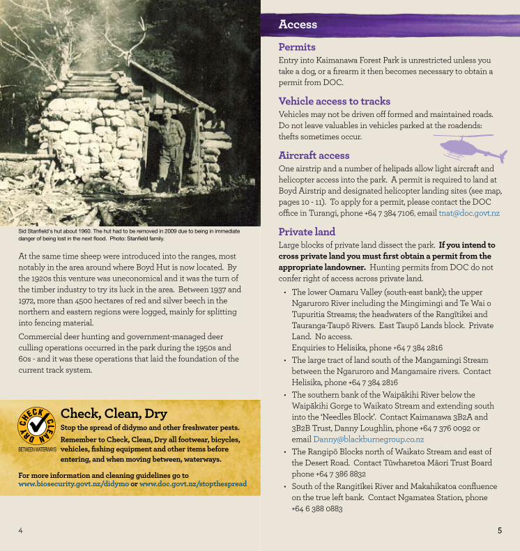
At the same time sheep were introduced into the ranges, most notably in the area around where Boyd Hut is now located. By the 1920s this venture was uneconomical and it was the turn of the timber industry to try its luck in the area. Between 1937 and 1972, more than 4500 hectares of red and silver beech in the northern and eastern regions were logged, mainly for splitting into fencing material. Commercial deer hunting and government-managed deer culling operations occurred in the park during the 1950s and 60s - and it was these operations that laid the foundation of the current track system.
Check, Clean, DryStop the spread of didymo and other freshwater pests.Remember to Check, Clean, Dry all footwear, bicycles, vehicles, fishing equipment and other items before entering, and when moving between, waterways.
For more information and cleaning guidelines go to www.biosecurity.govt.nz/didymo or www.doc.govt.nz/stopthespread
DRY C
HECK CLEAN
BETWEEN WATERWAYS
Access
PermitsEntry into Kaimanawa Forest Park is unrestricted unless you take a dog, or a firearm it then becomes necessary to obtain a permit from DOC.
Vehicle access to tracksVehicles may not be driven off formed and maintained roads. Do not leave valuables in vehicles parked at the roadends: thefts sometimes occur.
Aircraft accessOne airstrip and a number of helipads allow light aircraft and helicopter access into the park. A permit is required to land at Boyd Airstrip and designated helicopter landing sites (see map, pages 10 - 11). To apply for a permit, please contact the DOC office in Turangi, phone +64 7 384 7106, email [email protected]
Private landLarge blocks of private land dissect the park. If you intend to cross private land you must first obtain a permit from the appropriate landowner. Hunting permits from DOC do not confer right of access across private land.
The lower Oamaru Valley (south-east bank); the upper •Ngaruroro River including the Mingimingi and Te Wai o Tupuritia Streams; the headwaters of the Rangītikei and Tauranga-Taupō Rivers. East Taupō Lands block. Private Land. No access. Enquiries to Helisika, phone +64 7 384 2816The large tract of land south of the Mangamingi Stream •between the Ngaruroro and Mangamaire rivers. Contact Helisika, phone +64 7 384 2816The southern bank of the Waipākihi River below the •Waipākihi Gorge to Waikato Stream and extending south into the ‘Needles Block’. Contact Kaimanawa 3B2A and 3B2B Trust, Danny Loughlin, phone +64 7 376 0092 or email [email protected] The Rangipō Blocks north of Waikato Stream and east of •the Desert Road. Contact Tūwharetoa Māori Trust Board phone +64 7 386 8832South of the Rangitīkei River and Makahikatoa confluence •on the true left bank. Contact Ngamatea Station, phone +64 6 388 0883
Sid Stanfield's hut about 1960. The hut had to be removed in 2009 due to being in immediate danger of being lost in the next flood. Photo: Stanfield family.
5
6 7
Safety
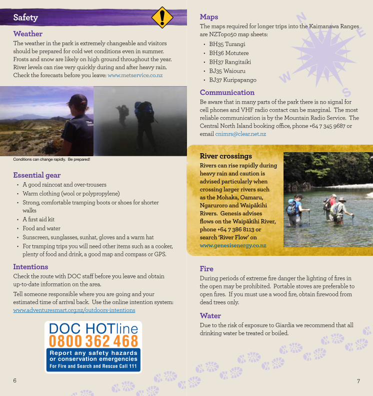
WeatherThe weather in the park is extremely changeable and visitors should be prepared for cold wet conditions even in summer. Frosts and snow are likely on high ground throughout the year. River levels can rise very quickly during and after heavy rain. Check the forecasts before you leave: www.metservice.co.nz
MapsThe maps required for longer trips into the Kaimanawa Ranges are NZTopo50 map sheets:
BH35 Turangi•BH36 Motutere•BH37 Rangitaiki•BJ35 Waiouru•BJ37 Kuripapango•
CommunicationBe aware that in many parts of the park there is no signal for cell phones and VHF radio contact can be marginal. The most reliable communication is by the Mountain Radio Service. The Central North Island booking office, phone +64 7 345 9687 or email [email protected]
River crossingsRivers can rise rapidly during heavy rain and caution is advised particularly when crossing larger rivers such as the Mohaka, Oamaru, Ngaruroro and Waipākihi Rivers. Genesis advises flows on the Waipākihi River, phone +64 7 386 8113 or search ‘River Flow’ on www.genesisenergy.co.nz
FireDuring periods of extreme fire danger the lighting of fires in the open may be prohibited. Portable stoves are preferable to open fires. If you must use a wood fire, obtain firewood from dead trees only.
WaterDue to the risk of exposure to Giardia we recommend that all drinking water be treated or boiled.
Conditions can change rapidly. Be prepared!
Essential gear A good raincoat and over-trousers•Warm clothing (wool or polypropylene)•Strong, comfortable tramping boots or shoes for shorter •walksA first aid kit•Food and water•Sunscreen, sunglasses, sunhat, gloves and a warm hat•For tramping trips you will need other items such as a cooker, •plenty of food and drink, a good map and compass or GPS.
IntentionsCheck the route with DOC staff before you leave and obtain up-to-date information on the area. Tell someone responsible where you are going and your estimated time of arrival back. Use the online intention system: www.adventuresmart.org.nz/outdoors-intentions
8 9
Other activities
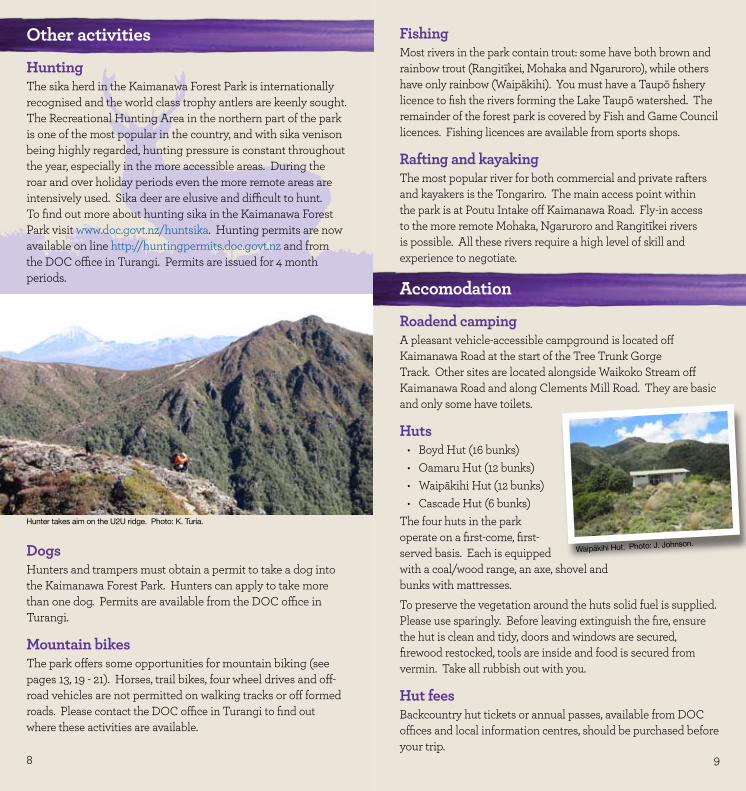
HuntingThe sika herd in the Kaimanawa Forest Park is internationally recognised and the world class trophy antlers are keenly sought. The Recreational Hunting Area in the northern part of the park is one of the most popular in the country, and with sika venison being highly regarded, hunting pressure is constant throughout the year, especially in the more accessible areas. During the roar and over holiday periods even the more remote areas are intensively used. Sika deer are elusive and difficult to hunt. To find out more about hunting sika in the Kaimanawa Forest Park visit www.doc.govt.nz/huntsika. Hunting permits are now available on line http://huntingpermits.doc.govt.nz and from the DOC office in Turangi. Permits are issued for 4 month periods.
DogsHunters and trampers must obtain a permit to take a dog into the Kaimanawa Forest Park. Hunters can apply to take more than one dog. Permits are available from the DOC office in Turangi.
Mountain bikesThe park offers some opportunities for mountain biking (see pages 13, 19 - 21). Horses, trail bikes, four wheel drives and off-road vehicles are not permitted on walking tracks or off formed roads. Please contact the DOC office in Turangi to find out where these activities are available.
FishingMost rivers in the park contain trout: some have both brown and rainbow trout (Rangitīkei, Mohaka and Ngaruroro), while others have only rainbow (Waipākihi). You must have a Taupō fishery licence to fish the rivers forming the Lake Taupō watershed. The remainder of the forest park is covered by Fish and Game Council licences. Fishing licences are available from sports shops.
Rafting and kayakingThe most popular river for both commercial and private rafters and kayakers is the Tongariro. The main access point within the park is at Poutu Intake off Kaimanawa Road. Fly-in access to the more remote Mohaka, Ngaruroro and Rangitīkei rivers is possible. All these rivers require a high level of skill and experience to negotiate.
Accomodation
Roadend campingA pleasant vehicle-accessible campground is located off Kaimanawa Road at the start of the Tree Trunk Gorge Track. Other sites are located alongside Waikoko Stream off Kaimanawa Road and along Clements Mill Road. They are basic and only some have toilets.
Huts Boyd Hut (16 bunks)•Oamaru Hut (12 bunks)•Waipākihi Hut (12 bunks)•Cascade Hut (6 bunks)•
The four huts in the park operate on a first-come, first-served basis. Each is equipped with a coal/wood range, an axe, shovel and bunks with mattresses.To preserve the vegetation around the huts solid fuel is supplied. Please use sparingly. Before leaving extinguish the fire, ensure the hut is clean and tidy, doors and windows are secured, firewood restocked, tools are inside and food is secured from vermin. Take all rubbish out with you.
Hut feesBackcountry hut tickets or annual passes, available from DOC offices and local information centres, should be purchased before your trip.
Waipākihi Hut. Photo: J. Johnson.
Hunter takes aim on the U2U ridge. Photo: K. Turia.
10 11
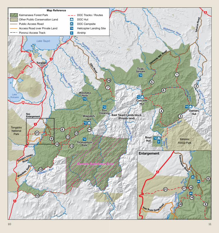
Kaimanawa Forest Park
Other Public Conservation Land
Public Access Road
Access Road over Private Land
Poronui Access Track
DOC Tracks / Routes
DOC Hut
DOC Campsite
Helicopter Landing Site
Airstrip
Map Reference
Turangi
Lake Taupō
Lake Rotoaira
TongariroNational
Park
Waipākihi Roa
d
Rangipō Intake
Road
SeeEnlargement
Tongariro River
Waiotaka River
Waim
arino River
Tauranga - Taupō River
Waipākihi River
WaipākihiHut
47
46
41
1
1
1
Kiko Road
21
16
15
14
13
1211
10
9
8
7
12
KawekaForest Park
Tree Trunk Gorge Roa
d
Kaim
anawa Road
Enlargement
Waitahanui River
Taharua River
Kaipō River
Oamaru Rive
r
Ngaruroro
River
Tong
arir
o
Riv
er
Rangitīkei River
Mangam
aire River
Clements Mill
Road
Taha
rua
Roa
d
CascadeHut
OamaruHut
BoydHut
5
1
20
21
19
1817
6
5
4
3
2
1
8
9
Remote Experience Zone
Tiraki Stream
Waiotaka River
Pox Clearing
Thunderbolt Tops
East Taupō Lands block(Private land)
12 13
Walking and tramping
Track standardsTracks described in this booklet are classified as follows:
Short walks: are well formed for up to an hour’s easy walking with few if any steps. They may be suitable for people with limited mobility. Walking tracks: are well defined reasonably easy extended walks for up to a full-day return. Major water courses are bridged and track entrances and junctions are sign posted. Tramping tracks: generally follow the lie of the land with an unformed surface. They are marked with directional markers, poles or cairns. Tracks are suitable for backcountry visitors with moderate to high level backcountry skills and experience. Major watercourse bridges may be 3-wire crossings. Routes: are unformed and may have a rough surface. Routes are suitable only for people with high level backcountry navigation and river-crossing skills and experience. Marking with cairns, poles or triangle markers is provided. Mountain biking: The mountain bike grading system was developed in liaison with key stakeholders;
Grade 2: Mostly flat with some gentle climbs on smooth track with easily avoidable obstacles such as rocks and potholes.Grade 3: Steep slopes and/or avoidable obstacles possibly on narrow track and/or with poor traction. There may be exposure at the tracks outside edge.Grade 5: Technically challenging. Giant climbs, narrow track and numerous hazards including dangerous drop-offs, sharp corners and difficult obstacles. Expect walking and possibly bike carrying.
Track timesThe times listed in the following section are considered feasible for a moderately fit person carrying a normal amount of equipment. They do not include stopping times.
Tracks and marked routes
From Clements Mill and Taharua RoadsRoad access: 27 km east of Taupō. Turn right off State Highway 5 (Napier-Taupō Road) into Taharua Road. After 9.5 km either turn right onto Clements Mill Road (21 km to the road end) or continue to the end of Taharua Road (10 km).
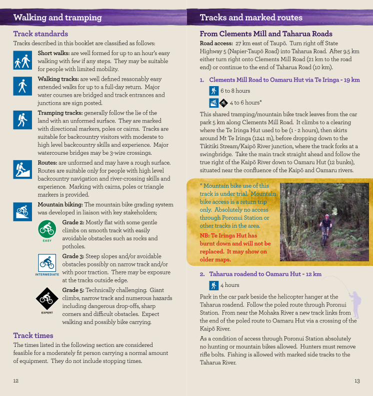
1. Clements Mill Road to Oamaru Hut via Te Iringa - 19 km6 to 8 hours
4 to 6 hours*
This shared tramping/mountain bike track leaves from the car park 5 km along Clements Mill Road. It climbs to a clearing where the Te Iringa Hut used to be (1 - 2 hours), then skirts around Mt Te Iringa (1241 m), before dropping down to the Tikitiki Stream/Kaipō River junction, where the track forks at a swingbridge. Take the main track straight ahead and follow the true right of the Kaipō River down to Oamaru Hut (12 bunks), situated near the confluence of the Kaipō and Oamaru rivers.
* Mountain bike use of this track is under trial. Mountain bike access is a return trip only. Absolutely no access through Poronui Station or other tracks in the area.NB: Te Iringa Hut has burnt down and will not be replaced. It may show on older maps.
2. Taharua roadend to Oamaru Hut - 12 km
4 hours
Park in the car park beside the helicopter hanger at the Taharua roadend. Follow the poled route through Poronui Station. From near the Mohaka River a new track links from the end of the poled route to Oamaru Hut via a crossing of the Kaipō River. As a condition of access through Poronui Station absolutely no hunting or mountain bikes allowed. Hunters must remove rifle bolts. Fishing is allowed with marked side tracks to the Taharua River.
EASY
INTERMEDIATE
EXPERT
EXPERT
14 15
3. Oamaru Hut to Boyd Hut - 16 km 4 to 6 hours
From Oamaru Hut the track follows the true left bank of the Oamaru River before crossing the headwaters and following the Waitawhero Stream up to a saddle. At this point the track emerges at the forest edge of the upper Ngaruroro. Across the valley the Boyd airstrip can be seen. Boyd Hut is obscured by beech forest behind the airstrip.
4. Boyd Hut to Cascade Hut via Maungaorangi - 18 km8 to 10 hours
This strenuous track from Boyd Hut follows the track over Waitawhero Saddle towards Oamaru Hut. Near the confluence of the Waitawhero and Oamaru streams the route turns left onto a long, steep ridge up Maungaorangi. On the tops the route is marked with poles. It then descends to Te Waiotupuritia Saddle and on down to Cascade Hut. A map and compass are essential. GPS are recommended.
5. Cascade Hut to Clements Mill Road end (Hinemaiaia Track) - 12 km
4 to 5 hours
The track follows the open river flats of the Tauranga-Taupō River downstream before climbing away from the river up a prominent beech-covered ridge. The track drops back down to the Clements Mill roadend following the Hinemaiaia Stream and its tributaries.
6. Upper Kaipō Valley Route (Kaipō Track) - 11.5 km6 to 9 hours
A marked route runs from the swingbridge on the Te Iringa/Oamaru Track (see 1) to Cascade Hut. In the upper reaches of the Kaipō River there are numerous river crossings and log jams to negotiate, so be aware that this is a time-consuming section. The track then climbs to a ridge just south of Kaipō Saddle. Descend off the ridge to Cascade Stream and the track junction. The right-hand track heads downstream for another 30 minutes to Cascade Hut.
From Kiko RoadKiko Road turns off State Highway 1, 10 km north of Turangi. Kiko Road runs 17 km through the privately owned Lake Taupō Forest to the park boundary.
7. Ngāpuketūrua Hunting Access - 9 km4 to 5 hours
This track once led from Kiko Road over Ngāpuketūrua to Cascade hut, but now access ends at the park boundary, about 5.5 km from Kiko Road. The first section of this track is well-benched and graded, but after about 30 minutes it begins to climb steeply through beech forest giving access to good hunting country below the Ngāpuketūrua bush line.
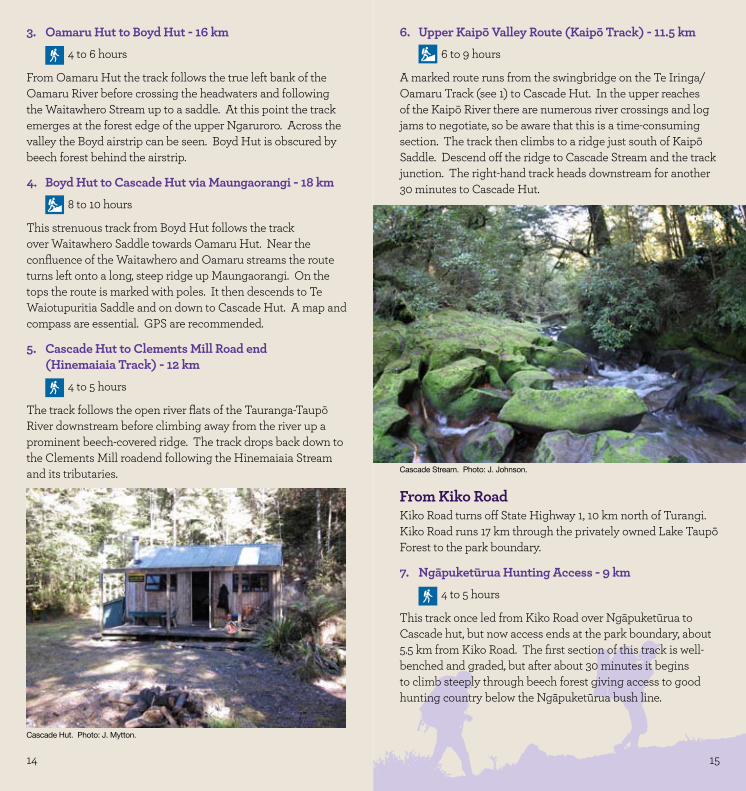
Cascade Hut. Photo: J. Mytton.
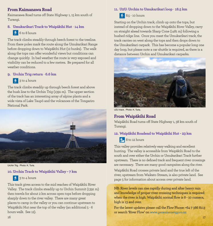
Cascade Stream. Photo: J. Johnson.
15
16 17
From Kaimanawa RoadKaimanawa Road turns off State Highway 1, 15 km south of Turangi.
8. Umukarikari Track to Waipākihi Hut - 14 km6 to 8 hours
The track climbs steadily through beech forest to the treeline. From there poles mark the route along the Umukarikari Range before dropping down to Waipākihi Hut (12 bunks). The walk along the tops can offer wonderful views but conditions can change quickly. In bad weather the route is very exposed and visibility can be reduced to a few metres. Be prepared for all weather conditions.
9. Urchin Trig return - 6.6 km3 to 4 hours
The track climbs steadily up through beech forest and above the bush line to the Urchin Trig (1391 m). The upper section of the track has an interesting array of alpine plants and a wide vista of Lake Taupō and the volcanoes of the Tongariro National Park.
11. U2U: Urchin to Umukarikari loop - 18.5 km8.5 - 10 hours
Starting on the Urchin track, climb up onto the tops, but instead of dropping down to the Waipākihi River Valley, carry on straight ahead towards Sharp Cone (1481 m) following a bushed ridge line. Once you meet the Umukarikari track, the track carries on west along the tops and then drops down to the Umukarikari carpark. This has become a popular long one day loop, but please note a car shuttle is required, as there is a distance between Urchin and Umukarikari carparks.
10. Urchin Track to Waipākihi Valley - 7 km3 to 4 hours
This track gives access to the mid reaches of Waipākihi River Valley. The track climbs steadily up to Urchin Summit (1391 m) then travels for about 2 km across open tops before dropping sharply down to the river valley. There are many great places to camp in the valley or you can continue upstream to Waipākihi Hut near the top of the valley (an additional 5 - 6 hours walk. See 12).
From Waipākihi RoadWaipākihi Road turns off State Highway 1, 38 km south of Turangi.
12. Waipākihi Roadend to Waipākihi Hut - 23 km8 to 12 hours
This valley provides relatively easy walking and excellent hunting. The valley is accessible from Waipākihi Road to the south and over either the Urchin or Umukarikari Track further upstream. There is no defined track and frequent river crossings are necessary. There are many good campsites along the river. Waipākihi Road crosses private land and the true left of the river, upstream from Waikato Stream, is also private land. See page 5 for information about access over private land.
NB: River levels can rise rapidly during and after heavy rain and knowledge of proper river crossing techniques is required when the river is high. Waipākihi normal flow is 8 - 10 cumecs, high is 13 and over. For the latest updates please call the Flow Phone: +64 7 386 8113 or search ‘River Flow’ on www.genesisenergy.co.nz
17
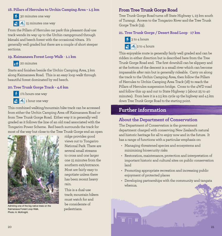
Urchin Trig. Photo: K. Turia.
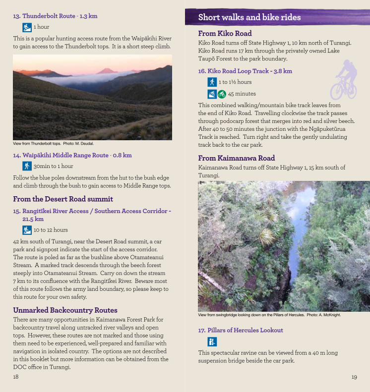
U2U track. Photo: K. Turia.
18 19
14. Waipākihi Middle Range Route - 0.8 km30min to 1 hour
Follow the blue poles downstream from the hut to the bush edge and climb through the bush to gain access to Middle Range tops.
From the Desert Road summit15. Rangitīkei River Access / Southern Access Corridor -
21.5 km10 to 12 hours
42 km south of Turangi, near the Desert Road summit, a car park and signpost indicate the start of the access corridor. The route is poled as far as the bushline above Otamateanui Stream. A marked track descends through the beech forest steeply into Otamateanui Stream. Carry on down the stream 7 km to its confluence with the Rangitīkei River. Beware most of this route follows the army land boundary, so please keep to this route for your own safety.
Unmarked Backcountry RoutesThere are many opportunities in Kaimanawa Forest Park for backcountry travel along untracked river valleys and open tops. However, these routes are not marked and those using them need to be experienced, well-prepared and familiar with navigation in isolated country. The options are not described in this booklet but more information can be obtained from the DOC office in Turangi.
13. Thunderbolt Route - 1.3 km1 hour
This is a popular hunting access route from the Waipākihi River to gain access to the Thunderbolt tops. It is a short steep climb.
Short walks and bike rides
From Kiko RoadKiko Road turns off State Highway 1, 10 km north of Turangi.Kiko Road runs 17 km through the privately owned Lake Taupō Forest to the park boundary.
16. Kiko Road Loop Track - 3.8 km1 to 1½ hours
45 minutes
This combined walking/mountain bike track leaves from the end of Kiko Road. Travelling clockwise the track passes through podocarp forest that merges into red and silver beech. After 40 to 50 minutes the junction with the Ngāpuketūrua Track is reached. Turn right and take the gently undulating track back to the car park.
From Kaimanawa RoadKaimanawa Road turns off State Highway 1, 15 km south of Turangi.
17. Pillars of Hercules Lookout
This spectacular ravine can be viewed from a 40 m long suspension bridge beside the car park.
EASY
View from Thunderbolt tops. Photo: M. Deudal.
View from swingbridge looking down on the Pillars of Hercules. Photo: A. McKnight.
20 21
18. Pillars of Hercules to Urchin Camping Area - 1.5 km30 minutes one way
15 minutes one way
From the Pillars of Hercules car park this pleasant dual-use track wends its way up to the Urchin campground through kāmahi and beech forest with the occasional tōtara. It’s generally well graded but there are a couple of short steeper sections.
19. Kaimanawa Forest Loop Walk - 1.1 km20 minutes
Starts and finishes beside the Urchin Camping Area, 3 km along Kaimanawa Road. This is an easy loop walk through beautiful forest dominated by red beech.
20. Tree Trunk Gorge Track - 4.6 km1½ hours one way
1 hour one way
This combined walking/mountain bike track can be accessed from either the Urchin Camping Area off Kaimanawa Road or from Tree Trunk Gorge Road. Either way it is generally well graded as it follows the line of an old road associated with the Tongariro Power Scheme. Red beech surrounds the track for most of the way but close to the Tree Trunk Gorge end an open
ridge provides good views out to Tongariro National Park. There are several small streams to cross and one larger one 15 minutes from the southern exit/entrance. Most are fairly easy to negotiate unless there has been recent heavy rain. This is a dual-use track; mountain bikers must watch for and be considerate of pedestrians.
From Tree Trunk Gorge RoadTree Trunk Gorge Road turns off State Highway 1, 23 km south of Turangi. Access to the Tongariro River and the Tree Trunk Gorge Track (19).
21. Tree Trunk Gorge / Desert Road Loop - 17 km3 to 4 hours
2 to 4 hours
This enjoyable route is generally fairly well graded and can be ridden in either direction but is described here from the Tree Trunk Gorge Road end. The first downhill can be slippery and at the bottom of the descent is a small river which can become impassable after rain but is generally rideable. Carry on along the track to the Urchin Camping Area, then follow the Pillars of Hercules to Urchin Camping Area Track (18) to reach the Pillars of Hercules suspension bridge. Cross to the 4WD road and follow this up and out to State Highway 1 (about 25 to 40 minutes). From here it is a 2.5 km cycle up the highway and 4.5 km down Tree Trunk Gorge Road to the starting point.
Further information
About the Department of ConservationThe Department of Conservation is the government department charged with conserving New Zealand’s natural and historic heritage for all to enjoy now and in the future. It has a range of functions with a particular emphasis on:
Managing threatened species and ecosystems and •minimising biosecurity risksRestoration, maintenance, protection and interpretation of •important historic and cultural sites on public conservation landPromoting appropriate recreation and increasing public •enjoyment of protected placesDeveloping partnerships with the community and tangata •whenua.
INTERMEDIATE
INTERMEDIATE
INTERMEDIATE
Admiring one of the big native trees on the Kaimanawa Forest Loop Walk. Photo: A. McKnight.
21
22
Published byDepartment of ConservationTaupō-nui-ā-Tia Area OfficePrivate Bag 2Turangi 3353New ZealandAugust 2012
Protect plants and animals•Remove rubbish•Bury toilet waste•Keep streams and lakes clean•Take care with fires•Camp carefully•Keep to the track•Consider others•Respect cultural heritage•
Enjoy your visit and Toitu te whenua / leave the land undisturbed
Contacts:Department of ConservationTaupō-nui-ā-Tia Area OfficeTuranga PlacePrivate Bag 2Turangi 3353Phone: +64 7 384 7106Email: [email protected]
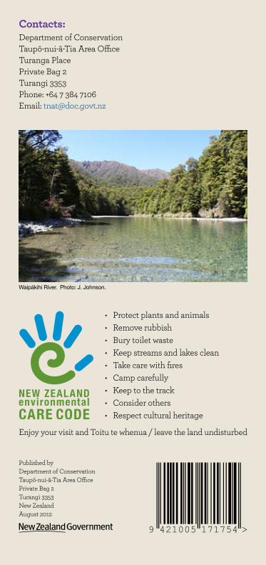
Waipākihi River. Photo: J. Johnson.
9 421005 171754 >