Embed Size (px)
Citation preview
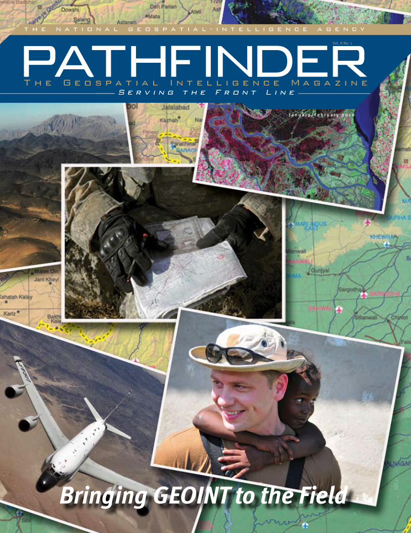
J a n u a r y / F e b r u a r y 2 0 1 0
Vol. 8 No. 1
Bringing GEOINT to the Field
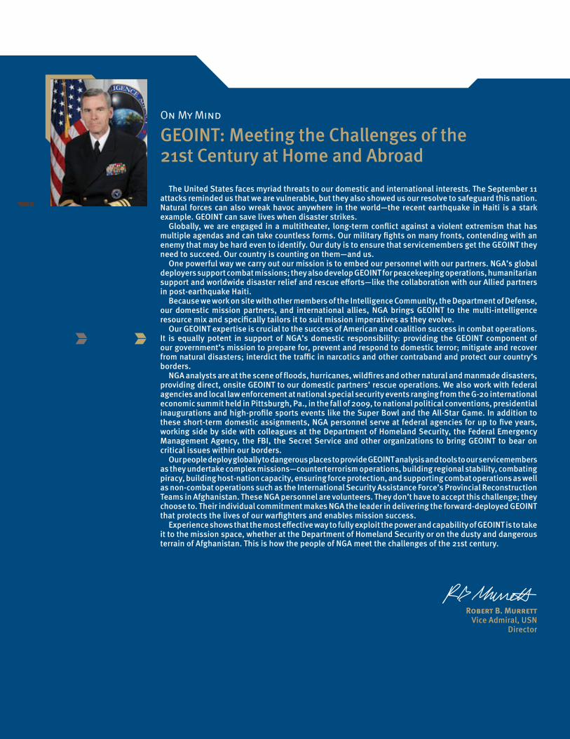
On My Mind
GEOINT: Meeting the Challenges of the 21st Century at Home and Abroad
The United States faces myriad threats to our domestic and international interests. The September 11 attacks reminded us that we are vulnerable, but they also showed us our resolve to safeguard this nation. Natural forces can also wreak havoc anywhere in the world—the recent earthquake in Haiti is a stark example. GEOINT can save lives when disaster strikes.
Globally, we are engaged in a multitheater, long-term conflict against a violent extremism that has multiple agendas and can take countless forms. Our military fights on many fronts, contending with an enemy that may be hard even to identify. Our duty is to ensure that servicemembers get the GEOINT they need to succeed. Our country is counting on them—and us.
One powerful way we carry out our mission is to embed our personnel with our partners. NGA’s global deployers support combat missions; they also develop GEOINT for peacekeeping operations, humanitarian support and worldwide disaster relief and rescue efforts—like the collaboration with our Allied partners in post-earthquake Haiti.
Because we work on site with other members of the Intelligence Community, the Department of Defense, our domestic mission partners, and international allies, NGA brings GEOINT to the multi-intelligence resource mix and specifically tailors it to suit mission imperatives as they evolve.
Our GEOINT expertise is crucial to the success of American and coalition success in combat operations. It is equally potent in support of NGA’s domestic responsibility: providing the GEOINT component of our government’s mission to prepare for, prevent and respond to domestic terror; mitigate and recover from natural disasters; interdict the traffic in narcotics and other contraband and protect our country’s borders.
NGA analysts are at the scene of floods, hurricanes, wildfires and other natural and manmade disasters, providing direct, onsite GEOINT to our domestic partners’ rescue operations. We also work with federal agencies and local law enforcement at national special security events ranging from the G-20 international economic summit held in Pittsburgh, Pa., in the fall of 2009, to national political conventions, presidential inaugurations and high-profile sports events like the Super Bowl and the All-Star Game. In addition to these short-term domestic assignments, NGA personnel serve at federal agencies for up to five years, working side by side with colleagues at the Department of Homeland Security, the Federal Emergency Management Agency, the FBI, the Secret Service and other organizations to bring GEOINT to bear on critical issues within our borders.
Our people deploy globally to dangerous places to provide GEOINT analysis and tools to our servicemembers as they undertake complex missions—counterterrorism operations, building regional stability, combating piracy, building host-nation capacity, ensuring force protection, and supporting combat operations as well as non-combat operations such as the International Security Assistance Force’s Provincial Reconstruction Teams in Afghanistan. These NGA personnel are volunteers. They don’t have to accept this challenge; they choose to. Their individual commitment makes NGA the leader in delivering the forward-deployed GEOINT that protects the lives of our warfighters and enables mission success.
Experience shows that the most effective way to fully exploit the power and capability of GEOINT is to take it to the mission space, whether at the Department of Homeland Security or on the dusty and dangerous terrain of Afghanistan. This is how the people of NGA meet the challenges of the 21st century.
Robert B. Murrett Vice Admiral, USN
Director
Contents2 Letter to Our Readers
3 Up Front: Deployers Impress Army Intelligence Officer
4 Up Front: NGA Supports Haiti Earthquake Recovery Efforts
›› F E A T U R E S
5 Agency Aids Agribusiness Development in Afghanistan
6 GEOINT Modernization Improves Sinai Observers’ Operations
8 Analysts Deploy for SOUTHCOM Missions
10 Shiprider Analysts Serve at Sea
12 G-20 Summit Security Draws on GEOINT
14 Psychological Services Program Addresses Deployers’ Concerns
16 NGA Family Puts Deployment First
›› D E P A R T M E N T S
18 Viewpoint: Human Terrain Analysis Seeks Deeper Cultural Comprehension
20 Partnerships: Visiting Scientists Enrich Agency’s Research
22 Our Heritage: Forward Deployed and Out in the Bush
Pathfinder ›› January/February 2010 ›› Vol.8 No. 1
On the CoverIn today’s global climate, deployers are often associated with uniformed men and women, preparing for combat along the turbulent frontlines of Iraq or Afghanistan. But behind the scenes, both in theater and beyond, another type of deployer exists—civilian men and women who represent a work force committed to its mission of providing geospatial intelligence around the world. Whether in support of the warfighter or humanitarian missions in Haiti and elsewhere, NGA deployed personnel represent the best of the best, facing the toughest issues of an operational environment and providing indispensable expertise to ensure mission success. When the mission calls, NGA’s deployers stand ready. Photos courtesy of DOD. Landsat imagery courtesy of NASA Goddard Space Flight Center and U.S. Geological Survey. Background map by NGA. Cover design by Richard Hardwick.
More to the Story?The online Classified Pathfinder, which is accessible by members of the Intelligence Community, may in-clude additional information and expanded sections of some Pathfinder articles. The Classified Pathfinder provides a forum for reading and discussing topics at the level of “Unclassified//For Official Use Only” and higher. For information, please contact the Classified Pathfinder editor, Muridith Winder, at (301) 227-7370.
18
1
Path
finde
r ›› J
anua
ry/F
ebru
ary
2010
8
12 18
2
Path
finde
r ›› J
anua
ry/F
ebru
ary
2010
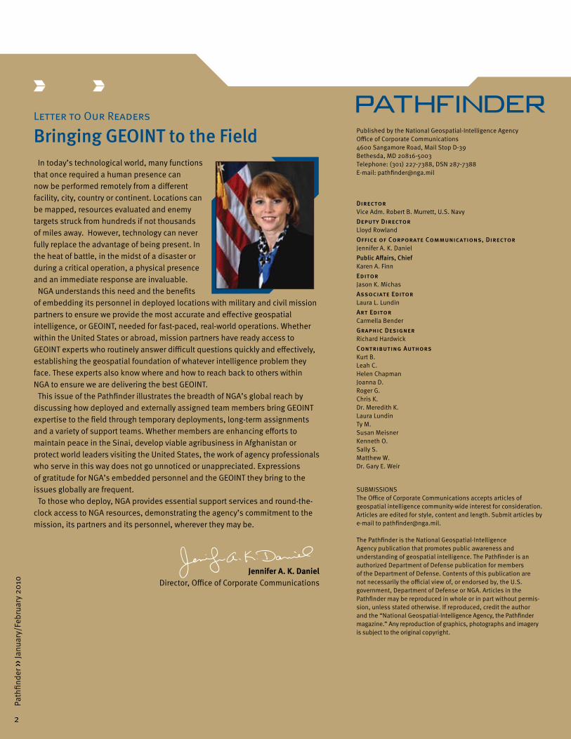
Letter to Our Readers
Bringing GEOINT to the FieldIn today’s technological world, many functions
that once required a human presence can now be performed remotely from a different facility, city, country or continent. Locations can be mapped, resources evaluated and enemy targets struck from hundreds if not thousands of miles away. However, technology can never fully replace the advantage of being present. In the heat of battle, in the midst of a disaster or during a critical operation, a physical presence and an immediate response are invaluable.
NGA understands this need and the benefits of embedding its personnel in deployed locations with military and civil mission partners to ensure we provide the most accurate and effective geospatial intelligence, or GEOINT, needed for fast-paced, real-world operations. Whether within the United States or abroad, mission partners have ready access to GEOINT experts who routinely answer difficult questions quickly and effectively, establishing the geospatial foundation of whatever intelligence problem they face. These experts also know where and how to reach back to others within NGA to ensure we are delivering the best GEOINT.
This issue of the Pathfinder illustrates the breadth of NGA’s global reach by discussing how deployed and externally assigned team members bring GEOINT expertise to the field through temporary deployments, long-term assignments and a variety of support teams. Whether members are enhancing efforts to maintain peace in the Sinai, develop viable agribusiness in Afghanistan or protect world leaders visiting the United States, the work of agency professionals who serve in this way does not go unnoticed or unappreciated. Expressions of gratitude for NGA’s embedded personnel and the GEOINT they bring to the issues globally are frequent.
To those who deploy, NGA provides essential support services and round-the-clock access to NGA resources, demonstrating the agency’s commitment to the mission, its partners and its personnel, wherever they may be.
Jennifer A. K. Daniel Director, Office of Corporate Communications
2
Path
finde
r ›› N
ovem
ber/
Dec
embe
r 200
9
Published by the National Geospatial-Intelligence AgencyOffice of Corporate Communications4600 Sangamore Road, Mail Stop D-39Bethesda, MD 20816-5003Telephone: (301) 227-7388, DSN 287-7388E-mail: [email protected]
DirectorVice Adm. Robert B. Murrett, U.S. NavyDeputy DirectorLloyd RowlandOffice of Corporate Communications, DirectorJennifer A. K. DanielPublic Affairs, ChiefKaren A. FinnEditorJason K. MichasAssociate EditorLaura L. LundinArt EditorCarmella BenderGraphic Designer Richard HardwickContributing AuthorsKurt B.Leah C.Helen ChapmanJoanna D.Roger G.Chris K.Dr. Meredith K. Laura LundinTy M.Susan MeisnerKenneth O.Sally S.Matthew W.Dr. Gary E. Weir
SUBMISSIONSThe Office of Corporate Communications accepts articles of geospatial intelligence community-wide interest for consideration. Articles are edited for style, content and length. Submit articles by e-mail to [email protected].
The Pathfinder is the National Geospatial-Intelligence Agency publication that promotes public awareness and understanding of geospatial intelligence. The Pathfinder is an authorized Department of Defense publication for members of the Department of Defense. Contents of this publication are not necessarily the official view of, or endorsed by, the U.S. government, Department of Defense or NGA. Articles in the Pathfinder may be reproduced in whole or in part without permis-sion, unless stated otherwise. If reproduced, credit the author and the “National Geospatial-Intelligence Agency, the Pathfinder magazine.” Any reproduction of graphics, photographs and imagery is subject to the original copyright.
2
Path
finde
r ›› J
anua
ry/F
ebru
ary
2010
3
Path
finde
r ›› J
anua
ry/F
ebru
ary
2010
Up Front
Deployers Impress Army Intelligence OfficerBy Matthew W.
The National Geospatial-Intelligence Agency has a long history of providing the best geospatial support to U.S. and allied forces across the globe. It is always welcome to hear about the efforts and exploits of the agency’s deployed personnel from a mission partner’s perspective. That is the story I’d like to tell: NGA’s support to my unit before I joined NGA.
As a U.S. Army intelligence officer in Iraq, I was as-signed as the collection manager for Multi-National Division–Baghdad from 2006 to 2008. During my tour, I relied heavily on the NGA deployers not only for the cus-tom geospatial intelligence products they provided, but also for their diverse expertise in the intelligence field. Through their detailed knowledge of my area of operation and mission, NGA deployers often anticipated my needs for maps and imagery and provided finished products to support key tactical operations. Their efforts allowed me to concentrate on the tasking and management of the other intelligence disciplines.
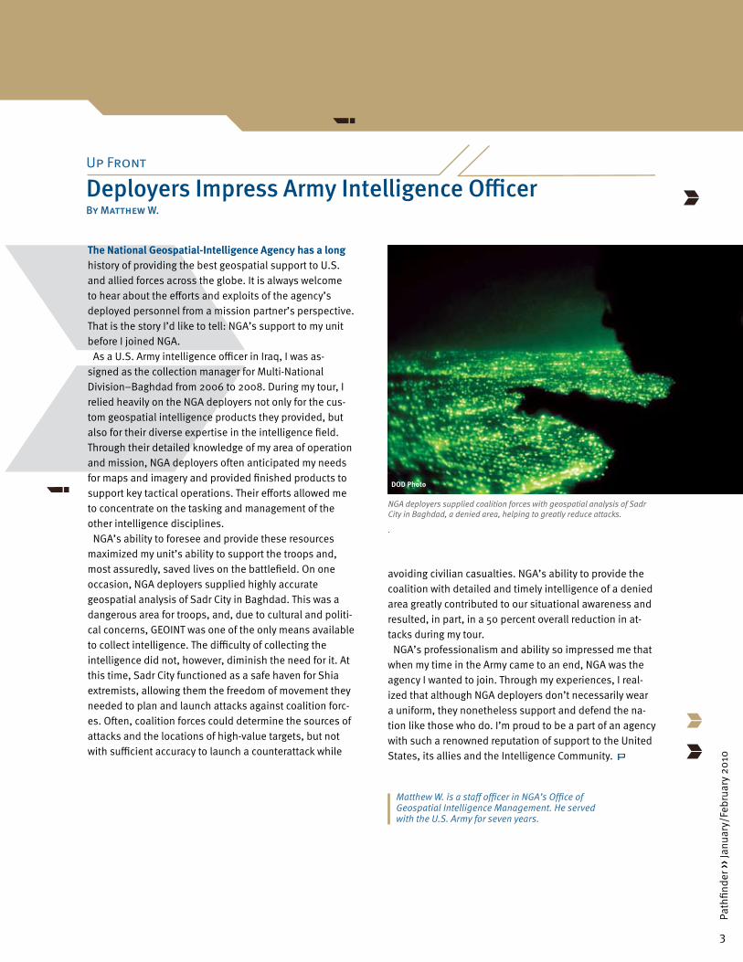
NGA’s ability to foresee and provide these resources maximized my unit’s ability to support the troops and, most assuredly, saved lives on the battlefield. On one occasion, NGA deployers supplied highly accurate geospatial analysis of Sadr City in Baghdad. This was a dangerous area for troops, and, due to cultural and politi-cal concerns, GEOINT was one of the only means available to collect intelligence. The difficulty of collecting the intelligence did not, however, diminish the need for it. At this time, Sadr City functioned as a safe haven for Shia extremists, allowing them the freedom of movement they needed to plan and launch attacks against coalition forc-es. Often, coalition forces could determine the sources of attacks and the locations of high-value targets, but not with sufficient accuracy to launch a counterattack while
avoiding civilian casualties. NGA’s ability to provide the coalition with detailed and timely intelligence of a denied area greatly contributed to our situational awareness and resulted, in part, in a 50 percent overall reduction in at-tacks during my tour.
NGA’s professionalism and ability so impressed me that when my time in the Army came to an end, NGA was the agency I wanted to join. Through my experiences, I real-ized that although NGA deployers don’t necessarily wear a uniform, they nonetheless support and defend the na-tion like those who do. I’m proud to be a part of an agency with such a renowned reputation of support to the United States, its allies and the Intelligence Community.
3
Path
finde
r ›› J
anua
ry/F
ebru
ary
2010
Matthew W. is a staff officer in NGA’s Office of Geospatial Intelligence Management. He served with the U.S. Army for seven years.
NGA deployers supplied coalition forces with geospatial analysis of Sadr City in Baghdad, a denied area, helping to greatly reduce attacks.
.
DOD Photo
4
Path
finde
r ›› J
anua
ry/F
ebru
ary
2010
4
Path
finde
r ›› J
anua
ry/F
ebru
ary
2010
NGA Supports Haiti Earthquake Recovery EffortsBy Susan Meisner
Up Front
Susan Meisner is a public affairs officer in the Office of Corporate Communications.
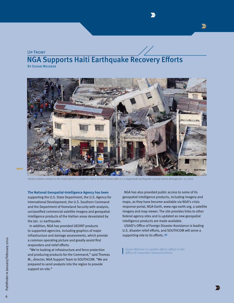
Haitian citizens remain in the street afraid or unable to return to their homes after a 7.0 magnitude earthquake caused severe damage Jan. 12, 2010.
The National Geospatial-Intelligence Agency has been supporting the U.S. State Department, the U.S. Agency for International Development, the U.S. Southern Command and the Department of Homeland Security with analysis, unclassified commercial satellite imagery and geospatial intelligence products of the Haitian areas devastated by the Jan. 12 earthquake.
In addition, NGA has provided GEOINT products to supported agencies, including graphics of major infrastructure and damage assessments, which provide a common operating picture and greatly assist first responders and relief efforts.
“We’re looking at infrastructure and force protection and producing products for the Command,” said Thomas M., director, NGA Support Team to SOUTHCOM. “We are prepared to send analysts into the region to provide support on-site.”
NGA has also provided public access to some of its geospatial intelligence products, including imagery and maps, as they have become available via NGA’s crisis response portal, NGA-Earth, www.nga-earth.org, a satellite imagery and map viewer. The site provides links to other federal agency sites and is updated as new geospatial intelligence products are made available.
USAID’s Office of Foreign Disaster Assistance is leading U.S. disaster relief efforts, and SOUTHCOM will serve a supporting role to its efforts.
DOD Photo

5
Path
finde
r ›› J
anua
ry/F
ebru
ary
2010
The National Geospatial-Intelligence Agency deployers in Afghanistan are supporting the U.S. military Agribusiness Development Teams’ mission to expand reconstruction efforts in the country with an eye toward providing farmers an alternative to joining insurgents. With roughly 85 percent of the nation’s inhabitants being farmers, ADT soldiers assist with many projects aimed at stabilizing and furthering Afghanistan’s reemerging agribusiness sector. In coordination with the Ministries of Agriculture, Irrigation and Livestock, these U.S. Army National Guard units from multiple U.S. states train and advise Afghan universities, provincial ministries and local farmers, focusing on infrastructure areas such as production, storage, processing and education.
After becoming aware of the ADTs and their mission in Afghanistan, the NGA Data Management Team, located at Bagram Airfield, Afghanistan, offered its GEOINT services. The NGA team began learning about the ADTs, focusing on two with members from the Kentucky and Kansas National Guard units located in Bagram and Forwarding Operating Base Mehtar Lam, respectively. Initial ADT GEOINT inquiries included, “There is a soldier in Kentucky that wants to come over … and be a liaison to the GIS [geographic information system] resource in country, but we need a legitimate reason as to why we need this position and how it can benefit us” and “How do I provide layer edits back to NGA, and is there a focal point for geospatial coordination in country?”
Addressing such GEOINT inquiries aligns with the NGA team’s role to support the National System for Geospatial Intelligence community in Afghanistan. The team’s goal is to make GEOINT discoverable, accessible, interoperable, maintainable and sustainable for NSG partners, including the unanticipated user. To accomplish this goal, the DMT focuses on integration, data operations and workflow management.
GEOINT integration efforts with the Kentucky and Kansas ADTs first involved visiting their sites to learn about them. By physically observing the ADTs in their operational environments, DMT members understood the network connectivity issues, classification environment, embedded ADT GEOINT analysis experience, current data holdings, software and hardware configurations and desired output products.
Agency Aids Agribusiness Development in AfghanistanBy Chris K.
After completing these site visits, the DMT supplied unclassified GEOINT data on external hard drives containing both imagery and vector data for ADTs to use as foundation data for generating their products. One example of a Kansas ADT-created GEOINT product depicts a breakdown of crop plots within a planned demonstration farm in Mehtar Lam region. The underlying imagery used, from the Army’s airborne Buckeye platform, was delivered via hard drive. The demonstration crops and GEOINT product help teach local farmers about a variety of growing methods and enable them to try different techniques in their own fields.
In addition to providing data via hard drives, the DMT briefed the ADTs about GEOINT capabilities available in country and documented the current network and connectivity issues associated with accessing these capabilities. Also, the DMT gathered ADT GEOINT data requirements such as currency, resolution, formats and classification, all of which will aid in the development of GEOINT workflow processes for ADTs and other NSG community partners.
Continued GEOINT collaboration with the ADTs and other reconstruction efforts will become an increasingly important activity in Afghanistan. By stabilizing the agriculture industry and enabling farmers to not only survive but eventually profit, officials hope to give military-age Afghan men viable skills solving Afghanistan’s infrastructure needs rather than fighting alongside anti-government forces.
5
Path
finde
r ›› J
anua
ry/F
ebru
ary
2010
DOD Photo
Kentucky National Guardsmen serving with an Agribusiness Development Team assist villagers taking soil samples in Afghanistan. NGA deployers are helping ADTs to stabilize the country’s reemerging agribusiness sector.
Chris K. is a member of the NGA Support Team at U.S. Joint Forces Command. He recently deployed to Afghanistan as a data manager.
6
Path
finde
r ›› J
anua
ry/F
ebru
ary
2010
Organizations routinely identify areas in which they can improve their effectiveness. For the Multinational Force and Observers, one area of improvement was geospatial intelligence. A memorandum of agreement with the National Geospatial-Intelligence Agency and short-term deployments by NGA analysts have provided these needed improvements.
Established in 1981 with the signing of the Protocol to the 1979 Egyptian–Israeli Treaty of Peace, the MFO is an international, non-UN organization responsible for peacekeeping in the Sinai. The mission of the force is to observe, report and verify Egypt and Israel’s compliance with the provisions of the treaty, ensure freedom of navigation through the Strait of Tiran and prevent treaty violations.
The MFO has dutifully satisfied its mission for more than 28 years despite having maps of the Sinai Peninsula created in the early 1970s and being prohibited from using GPS when recording an observation of a potential treaty violation. In addition to the outdated maps, each participating nation’s troops rotate every six months to a year, taking with them institutional knowledge that is often not well documented.
GEOINT Modernization Improves Sinai Observers’ OperationsBy Kenneth O.
Starting with a 2000 MOA with the then National Imagery and Mapping Agency and subsequent MOA extensions in 2007 and 2009 with NGA, the agency produced 39 new 1:100,000 scale Topographic Line Maps covering the Sinai and provided the MFO with the corresponding digital data. Additionally, NGA provided the force with technical guidance on the purchase of appropriate geographic information systems to use the softcopy data. To ensure the success of this new GEOINT capability, NGA deployed a GEOINT analyst on two 30-day rotations to MFO North Camp to train MFO on the use of their new GIS software and digital data.
With the technical guidance and training of the deployed analyst and the new NGA mapping data, the MFO was able to address the force’s incomplete situational awareness picture of the past. The force produced four new, MFO-specific maps that depicted the entire Sinai and the three MFO operational areas. These maps included peace treaty zone boundaries, all MFO deployed locations, resupply routes and unexploded ordnance areas. Additionally, the MFO produced road atlases that included all the information found on the
6
Path
finde
r ›› J
anua
ry/F
ebru
ary
2010

7
Path
finde
r ›› J
anua
ry/F
ebru
ary
2010
situational awareness maps and information about MFO-specific speed limits, radio frequency usage, radio report points and emergency contacts.
These new products proved significant during the spring of 2007 when a team of civilian observers conducting their biweekly road mission encountered a flooded road. Because the new situational awareness products had not been produced yet and its maps did not show any other roads in the area, the team was forced to either backtrack 100 miles or cross the flooded road. The team chose to cross the road and completed its mission successfully. However, once the new products were provided, the team realized that the flooded road was surrounded by areas of unexploded ordnance that could have washed onto the road during the flood. Additionally, the new maps showed that much shorter alternative routes had been available to the team.
In March 2008, the deployed NGA analyst assigned to MFO North Camp demonstrated the utility of the GIS software and new mapping data during a real-life situation involving an overturned MFO resupply vehicle in a remote location. The report received by the Force Operations Center included a geographic coordinate and the name of the route on which the vehicle was traveling. Unfortunately, the name did not match any
routes familiar to the FOC. The battalion responsible for patrolling that area had recently changed the route names, and the new names had not yet reached the FOC.
Using the geographic coordinate to locate the resupply vehicle also presented challenges because the force did not maintain a centralized index of its maps. Typically in such situations, once maps of the area were located, they would be taped together and photocopied to produce a complete map of the crash location. This could take up to an hour to complete, slowing medevac operations.
The onsite NGA analyst input the geographic coordinate directly into the GIS software and identified the location of the crash. Using the new NGA digital TLMs, the analyst produced a custom map of the crash location and provided copies for the medevac teams – all within 10 minutes. Both the driver and navigator in the resupply vehicle sustained only minor injuries due in part to the rapid reaction enabled by the deployed GEOINT analyst.
According to Maj. Gen. K. Narve Ludvigsen, MFO Force Commander, “[NGA] was able to bring the MFO substantially into a new era of mapping technology.” Now the MFO is “much better equipped to accurately locate military equipment, conduct expeditious search and rescue, and provide better security for MFO movements throughout the Sinai.”
7
Path
finde
r ›› J
anua
ry/F
ebru
ary
2010
Kenneth O. is a geospatial intelligence analyst in the Office of Central and Southwest Asia.
Deployed NGA analysts provided GEOINT training to Multinational Force and Observers peacekeepers in the Sinai Peninsula.
Photo by Getty Images
8
Path
finde
r ›› J
anua
ry/F
ebru
ary
2010
The National Geospatial-Intelligence Agency Support Team at the U.S. Southern Command is actively engaged in the real-world operations of its mission partners by embedding deployed analysts with U.S. troops and providing the critical geospatial intelligence, or GEOINT, critical for mission success.
In the past year, the support team has provided GEOINT for 10 short-notice intelligence, surveillance and recon-naissance operations for countries in SOUTHCOM’s area of responsibility.
“More and more, we are asked to provide GEOINT sup-port to our partners,” said Thomas M., director of the SOUTHCOM NST. “Once they realize the true power of GEOINT to help solve their intelligence challenges, they can’t get enough.”
Analysts assigned to the NST have been deployed for a variety of missions ranging from search-and-rescue op-erations to technology expertise and are routinely deploy-ing at the request of the command for operations and exercises as an integrated GEOINT partner. One example of this integrated approach is demonstrated by NGA per-sonnel working to support ISR operations and exercises for U.S. embassies and the multiservice, multiagency Tactical Analysis Teams stationed with them, increasing the amount of analysis and number of products provided.
Using a Beechcraft B-200 King Air aircraft equipped with an electro-optical and infrared sensor, GEOINT analysts receive softcopy data from various missions and perform
Analysts Deploy for SOUTHCOM Missions
analysis on laptop computers provided by NGA’s Expedi-tionary Operations Directorate. The captured GEOINT data includes EO and IR full-motion video and still photos from a digital framing camera.
For one recent mission, which consisted of two days of flight operations over 26 areas, the analysts examined more than three hours of video and more than 1,600 still images. As a result, NGA’s analysts produced 34 images and seven geospatial products within hours after data de-livery and quickly disseminated the final products to the TAT and analysts at SOUTHCOM headquarters as well as to U.S. Embassy staff for eventual release to the host nation.
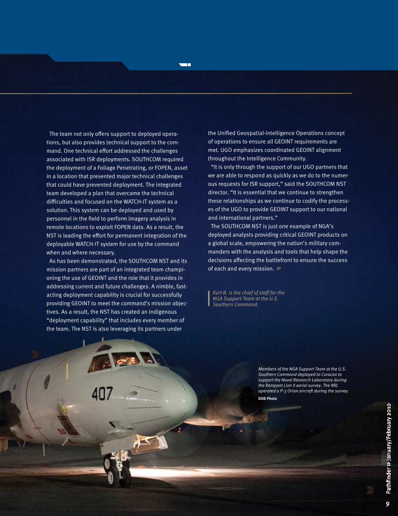
In January 2009, team members deployed to the island of Curacao to support the Naval Research Laboratory’s P-3 collection aircraft during the Rampant Lion II aerial survey. This mission focused on mapping and imaging the north and west coasts of Colombia and resulted in more than 1.8 terabytes of data.
NGA, SOUTHCOM, the Naval Oceanographic Office and several military elements analyzed and exploited the collected data. This collaboration enhanced the understanding of the terrain and coastal areas and will be used to conduct riverine studies and create 3- to 10-meter digital elevation models that were previously limited to 30 meters.
By Kurt B.
8
Path
finde
r ›› J
anua
ry/F
ebru
ary
2010
8
Path
finde
r ›› J
anua
ry/F
ebru
ary
2010
8
Path
finde
r ›› J
anua
ry/F
ebru
ary
2010
8
Path
finde
r ›› J
anua
ry/F
ebru
ary
2010
9
Path
finde
r ›› J
anua
ry/F
ebru
ary
2010
the Unified Geospatial-Intelligence Operations concept of operations to ensure all GEOINT requirements are met. UGO emphasizes coordinated GEOINT alignment throughout the Intelligence Community.
“It is only through the support of our UGO partners that we are able to respond as quickly as we do to the numer-ous requests for ISR support,” said the SOUTHCOM NST director. “It is essential that we continue to strengthen these relationships as we continue to codify the process-es of the UGO to provide GEOINT support to our national and international partners.”
The SOUTHCOM NST is just one example of NGA’s deployed analysts providing critical GEOINT products on a global scale, empowering the nation’s military com-manders with the analysis and tools that help shape the decisions affecting the battlefront to ensure the success of each and every mission.
Kurt B. is the chief of staff for the NGA Support Team at the U.S. Southern Command.
Members of the NGA Support Team at the U.S. Southern Command deployed to Curacao to support the Naval Research Laboratory during the Rampant Lion II aerial survey. The NRL operated a P-3 Orion aircraft during the survey.
DOD Photo
The team not only offers support to deployed opera-tions, but also provides technical support to the com-mand. One technical effort addressed the challenges associated with ISR deployments. SOUTHCOM required the deployment of a Foliage Penetrating, or FOPEN, asset in a location that presented major technical challenges that could have prevented deployment. The integrated team developed a plan that overcame the technical difficulties and focused on the WATCH-IT system as a solution. This system can be deployed and used by personnel in the field to perform imagery analysis in remote locations to exploit FOPEN data. As a result, the NST is leading the effort for permanent integration of the deployable WATCH-IT system for use by the command when and where necessary.
As has been demonstrated, the SOUTHCOM NST and its mission partners are part of an integrated team champi-oning the use of GEOINT and the role that it provides in addressing current and future challenges. A nimble, fast-acting deployment capability is crucial for successfully providing GEOINT to meet the command’s mission objec-tives. As a result, the NST has created an indigenous “deployment capability” that includes every member of the team. The NST is also leveraging its partners under
9
Path
finde
r ›› J
anua
ry/F
ebru
ary
2010
9
Path
finde
r ›› J
anua
ry/F
ebru
ary
2010
9
Path
finde
r ›› J
anua
ry/F
ebru
ary
2010
9
Path
finde
r ›› J
anua
ry/F
ebru
ary
2010
10
Path
finde
r ›› J
anua
ry/F
ebru
ary
2010
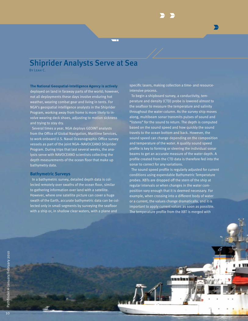
The National Geospatial-Intelligence Agency is actively deployed on land in faraway parts of the world; however, not all deployments these days involve enduring hot weather, wearing combat gear and living in tents. For NGA’s geospatial intelligence analysts in the Shiprider Program, working away from home is more likely to in-volve wearing deck shoes, adjusting to motion sickness and trying to stay dry.
Several times a year, NGA deploys GEOINT analysts from the Office of Global Navigation, Maritime Services, to work onboard U.S. Naval Oceanographic Office survey vessels as part of the joint NGA–NAVOCEANO Shiprider Program. During trips that last several weeks, the ana-lysts serve with NAVOCEANO scientists collecting the depth measurements of the ocean floor that make up bathymetry data.
Bathymetric SurveysIn a bathymetric survey, detailed depth data is col-
lected remotely over swaths of the ocean floor, similar to gathering information over land with a satellite. However, where one satellite picture can cover a huge swath of the Earth, accurate bathymetric data can be col-lected only in small segments by surveying the seafloor with a ship or, in shallow clear waters, with a plane and
Shiprider Analysts Serve at SeaBy Leah C.
specific lasers, making collection a time- and resource-intensive process.
To begin a shipboard survey, a conductivity, tem-perature and density (CTD) probe is lowered almost to the seafloor to measure the temperature and salinity throughout the water column. As the survey ship moves along, multibeam sonar transmits pulses of sound and “listens” for the sound to return. The depth is computed based on the sound speed and how quickly the sound travels to the ocean bottom and back. However, the sound speed can change depending on the composition and temperature of the water. A quality sound speed profile is key to forming or steering the individual sonar beams to get an accurate measure of the water depth. A profile created from the CTD data is therefore fed into the sonar to correct for any variations.
The sound speed profile is regularly adjusted for current conditions using expendable Bathymetric Temperature probes. XBTs are dropped off the stern of the ship at regular intervals or when changes in the water com-position vary enough that it is deemed necessary. For example, when crossing into a different body of water or a current, the values change dramatically, and it is important to apply current values as soon as possible. The temperature profile from the XBT is merged with
10
Path
finde
r ›› J
anua
ry/F
ebru
ary
2010
11
Path
finde
r ›› J
anua
ry/F
ebru
ary
2010
the salinities calculated from the CTDs to generate a new sound speed profile, which is then used until the next XBT is dropped. Other data is collected about cur-rents and bioluminescence. Collection of the data also depends on many factors that the surveyors must take into account. NGA shipriders participate throughout all aspects of these surveys.
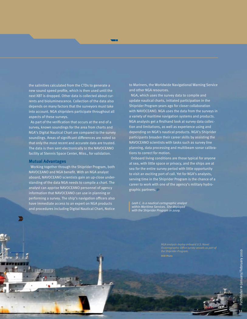
As part of the verification that occurs at the end of a survey, known soundings for the area from charts and NGA’s Digital Nautical Chart are compared to the survey soundings. Areas of significant differences are noted so that only the most recent and accurate data are trusted. The data is then sent electronically to the NAVOCEANO facility at Stennis Space Center, Miss., for validation.
Mutual AdvantagesWorking together through the Shiprider Program, both
NAVOCEANO and NGA benefit. With an NGA analyst aboard, NAVOCEANO scientists gain an up-close under-standing of the data NGA needs to compile a chart. The analyst can apprise NAVOCEANO personnel of agency information that NAVOCEANO can use in planning or performing a survey. The ship’s navigation officers also have immediate access to an expert on NGA products and procedures including Digital Nautical Chart, Notice
11
Path
finde
r ›› J
anua
ry/F
ebru
ary
2010
to Mariners, the Worldwide Navigational Warning Service and other NGA resources.
NGA, which uses the survey data to compile and update nautical charts, initiated participation in the Shiprider Program years ago for closer collaboration with NAVOCEANO. NGA uses the data from the surveys in a variety of maritime navigation systems and products. NGA analysts get a firsthand look at survey data collec-tion and limitations, as well as experience using and depending on NGA’s nautical products. NGA’s Shiprider participants broaden their career skills by assisting the NAVOCEANO scientists with tasks such as survey line planning, data processing and multibeam sonar calibra-tions to correct for motion.
Onboard living conditions are those typical for anyone at sea, with little space or privacy, and the ships are at sea for the entire survey period with little opportunity to visit an exciting port of call. Yet for NGA’s analysts, serving time in the Shiprider Program is the chance of a career to work with one of the agency’s military hydro-graphic partners.
Leah C. is a nautical cartographic analyst within Maritime Services. She deployed with the Shiprider Program in 2009.
NGA analysts deploy onboard U.S. Naval Oceanographic Office survey vessels as part of the Shiprider Program.
DOD Photo

12
Path
finde
r ›› J
anua
ry/F
ebru
ary
2010
When world leaders met at the G-20 Summit in Pittsburgh, Pa., on Sept. 24 and 25, 2009, to discuss global economic issues, the National Geospatial-Intelligence Agency, at the request of the U.S. Secret Service, deployed onsite to serve with other government organizations protecting the leaders from harm. The summit’s designation as a National Security Special Event required NGA’s geospatial intelligence for situational awareness and event planning at the David L. Lawrence Convention Center, the site of the summit.
Known as the G-20 Summit, the Group of Twenty was established in 1999 to regularly convene leaders to discuss worldwide economic issues. While the Pittsburgh summit’s participants discussed recovery from the current global economic and financial crisis, the summit’s security officials harnessed the power of GEOINT developed by NGA’s Office of the Americas
G-20 Summit Security Draws on GEOINTBy Ty M.
and the Department of Homeland Security’s Critical Infrastructure Division.
Eleven analysts and other NGA personnel deployed to five command posts throughout the mid-Atlantic region. The geographically dispersed locations included the Federal Emergency Management Agency Emergency Operations Center, the U.S. Secret Service Protective Intelligence Command Center, the FBI Joint Operations Center, the Multi-Agency Command Center and the Tactical Operations Center, a multiagency crisis response post.
Most command posts were staffed by two analysts, each working an average of 13-hour days to ensure that government mission partners received GEOINT prior to and during the event. Analysts employed a full array of NGA software and services to produce mission-specific products. Products included large-scale graphics of the security zones
12
Path
finde
r ›› J
anua
ry/F
ebru
ary
2010
13
Path
finde
r ›› J
anua
ry/F
ebru
ary
2010

13
Path
finde
r ›› J
anua
ry/F
ebru
ary
2010
and restrictions associated with the G-20 Summit, shape files of the approved protestor march routes and commercial imagery shots of the events. The products were distributed to mission partners to aid in planning.
NGA supplied each command center with a GEOINT-based common operating picture that incorporated situational awareness information and allowed for near-real time event monitoring and tracking. Analysts input event information obtained through the monitoring of event logs, radio callouts and video feeds into NGA’s Palanterra™ Web system, which creates an exportable layer file that can be overlaid and viewed by applications such as Google Earth™. This product increased the situational awareness of security and emergency response personnel and encouraged collaborative decision making on critical issues.
Just as the Pittsburgh G-20 Summit leaders collaborated on how to progress toward a sound and sustainable recovery from the global financial and economic crisis, NGA and its deployed personnel collaborated with federal, state and local mission partners responsible for securing the summit. This important international meeting highlighted the power of GEOINT to visualize the intelligence needed to ensure national and homeland security.
Ty M. is a geospatial intelligence analyst in the Office of the Americas.
David L. Lawrence Convention Center
Photo by Gateway Clipper/VisitPittsburgh
12
Path
finde
r ›› J
anua
ry/F
ebru
ary
2010
13
Path
finde
r ›› J
anua
ry/F
ebru
ary
2010
14
Path
finde
r ›› J
anua
ry/F
ebru
ary
2010
In the past six years, the National Geospatial-Intelligence Agency’s commitment to providing cutting-edge geospatial intelligence support to its mission partners in the field has resulted in exponential growth in the size of the NGA deployer cadre. This change has been accompanied by increased awareness of the unique strains faced by deployers and their family members as a result of their time spent deployed in war-torn, crisis-affected, or underdeveloped locales.
Given the potentially significant nature of these strains, NGA developed the Deployment Psychological Services Program in the fall of 2008 to provide consultation, screening and support services to personnel before, during and after deployment abroad.
Most deployers may never require such services, but the agency’s commitment to its deployed personnel demands that these services be available for those who may need them. The DPSP parallels deployment screening programs in place at other Intelligence
Psychological Services Program Addresses Deployers’ ConcernsBy Dr. Meredith K.
Community agencies and addresses relevant combatant command policies regarding psychological fitness for deployment and disqualifying psychiatric conditions.
The DPSP screening entails completion of a brief screening questionnaire prior to an individual semi-structured interview with a licensed clinical psychologist prior to each deployment and within 30 days of the deployer’s return stateside. This individual contact before and after each deployment distinguishes the NGA program from others in the IC and reflects the agency’s commitment to mitigating and monitoring the personal and professional effects of deployment. An additional follow-up is conducted via pencil and paper screening within four to six months of the deployer’s return. The screening interviews tend to focus on issues related to emotional adjustment, medication status, family adjustment, personal stressors and any psychiatric, trauma, brain injury or substance use history.
Together, this information is considered in the context of the length and type of assignment, the location of the assignment, and the prevailing combatant command policies regarding psychological suitability in order to generate a recommendation regarding psychological readiness. In response to concerns about deployer privacy, the confidential screening process is designed to comply with prevailing legal and professional standards regarding the collection, management and storage of personal information. These safeguards have contributed to high levels of employee engagement in the screening process, as sessions often move beyond the clinical basics already mentioned to include frank discussions of personal challenges, professional frustrations, parenting issues and family concerns.
The screening sessions provide employees with the time and opportunity to identify, discuss and brainstorm any issues or concerns that may impact their personal or familial adjustment over the course of the deployment cycle.
“The predeployment screening gave me the chance to discuss personal, family and job-related concerns that I’ve not previously shared with anyone in the workplace. I’m very thankful I had the opportunity to discuss
14
Path
finde
r ›› J
anua
ry/F
ebru
ary
2010
15
Path
finde
r ›› J
anua
ry/F
ebru
ary
2010
Photo by Getty Images
15
Path
finde
r ›› J
anua
ry/F
ebru
ary
2010
and resolve these concerns prior to leaving for my deployment—it gave me such peace of mind,” said one first-time NGA deployer.
While the DPSP screening focuses on the deployers’ readiness to enter into and succeed in a given assignment based on their personal and psychological attributes, the program is also uniquely positioned to provide a full range of coordinated consultation, research and training services. The DPSP’s consultative efforts are designed to optimize deployer functioning in theater, minimize or mitigate personal and family strain, and increase organizational awareness of the psychological impact of deployment, reintegration and redeployment on employee well-being, productivity and satisfaction. In support of these goals, DPSP staff has developed and distributed educational materials to deployers, met with supervisors to brainstorm solutions for managing deployment-related challenges, provided support as needed to family members and deployers before, during and after deployment, and facilitated referrals to appropriate internal and external providers for ongoing care or counseling, such as the agency’s Employee Assistance Program. DPSP staff also meet quarterly with psychologists engaged in similar work across the IC to discuss emerging trends and research, identify shared problems and innovative solutions, and anticipate upcoming challenges.
“The inclusion of the pre- and post-deployment psychological debriefs has added another positive element to the support tools NGA provides to the deployers. It has given us another outlet to discuss and work through issues that may not have previously been available and may not have been uncovered,” said a veteran agency deployer. “The addition of this program
14
Path
finde
r ›› J
anua
ry/F
ebru
ary
2010
15
Path
finde
r ›› J
anua
ry/F
ebru
ary
2010
shows that NGA goes beyond the basic care and feeding of their deployer personnel and shows they really care about their people!”
The DPSP is also devoting time and attention to the collection of data regarding the personal and professional impact of deployment on civilian deployers to expand the limited research regarding the civilian deployment experience. These pilot research projects will provide much-needed information on the attributes of high-performing deployers; the type and severity of stressors commonly encountered before, during and after deployment; the impact of these stressors on the physical and emotional well-being of deployers; and the relationship between deployment, job satisfaction and job burnout. These projects will provide critical information regarding civilian deployment that will inform the delivery of deployer support services and will enhance the development and dissemination of training for employees and managers on caring for deployers.
The advantages of deployments, which place the agency front and center with its mission partners, can be obtained no other way. Consequently, the rigors and challenges faced by deployers must be addressed effectively. The DPSP’s commitment to deployer issues and the program’s ongoing research into the effects of deployments demonstrate NGA’s concern for its deployed personnel.
“I had the opportunity to discuss and resolve these
concerns prior to leaving for my deployment—it gave me such
peace of mind.”
Dr. Meredith K. is a clinical psychologist in the Security and Installation Operations Directorate.
16
Path
finde
r ›› J
anua
ry/F
ebru
ary
2010
NGA Family Puts Deployment FirstBy Helen Chapman and Laura Lundin
The National Geospatial-Intelligence Agency’s Volunteer Deployment Team program provides an essential intelligence skill set to the warfighter while also providing significant opportunities for professional and personal growth to those analysts who deploy.
According to NGA’s Expeditionary Operations office, “The NGA deployment program is a collaborative effort to improve upon the already-successful deployer process and increase the effectiveness of the deployed analytic work-force in their mission to bring GEOINT directly to the warfighter.”
Working in the operational environment while supporting the warfighter provides qualified NGA personnel an opportunity to use their expertise in a fast-paced, collaborative atmosphere supporting some of the toughest intelligence issues. The experience not only proves valuable to the warfighter but to the individual deployers themselves. For two such analysts, the benefits of these opportunities have far outweighed their expectations.
Chuck and Adrienne A., a married couple, have both deployed several times as part of NGA’s program. For them, deploying has become as much a part of their work lives as driving to work is for most of NGA’s employees.
For Chuck, who has deployed four times in as many years, the sense of duty to country has played a major role in his participation in the program. “Someday I will be able to tell my kids that I helped make a difference—that I made an important contribution to the safety of the men and women who serve in our armed forces protecting our country,” said Chuck.
Chuck began his career with NGA as a contractor before joining the government ranks as an analyst. He volunteered for deployment as soon as he qualified for the program, and the opportunity to deploy is one he believes all analysts should pursue.
As Chuck points out, “Military commanders make decisions, but NGA’s deployed analysts play an important part,” he said. “We show them the GEOINT, the HUMINT [human intelligence], SIGINT [signals
intelligence] and any other INT we can collaborate with, and often that visual piece can make a critical difference in what course they may choose to take.”
Deployed analysts offer an invaluable service to the warfighter by providing near-real-time operational support to military commanders in the field. Through this experience, analysts learn firsthand how their analysis and products affect the outcome of various situations and how they can improve analytical support to the mission. They also provide decisive feedback to NGA that can be used for strategic planning and future operations.
Additionally, deploying provides opportunities for professional growth. In Chuck’s case, he began his government career as an analyst. Within a few years, he had been promoted to a branch chief and now serves as a deputy division chief. Chuck strongly attributes his success to the analytical, personal and professional development gained through his deployment experiences.
In addition to the professional and pay incentives the deployment program offers, Chuck states that it is the personal benefits and the sense of purpose that drive him back to volunteering. “It is one thing to believe in what you do when you are sitting in the office back in D.C.,” said Chuck, “but when you see it up close, when you are right there with our nation’s bravest, using your critical thinking on the fly, using all your training and abilities to deliver a product that is needed right now, it is tremendously satisfying.”
“I never fully understood the impact that my analysis had and the critical role the NGA mission plays in the Intelligence Community until I was in the field,” said Adrienne. Like her husband, Adrienne champions the deployment experience for qualified NGA personnel and believes her own deployment experience allowed her to achieve greater professional and personal potential.
“Intelligence is truly a collaborative effort in the field, and NGA’s products are highly valued by our troops,” said Adrienne. As an analyst, “you totally exceed the expectations you have for yourself. You
16
Path
finde
r ›› J
anua
ry/F
ebru
ary
2010
17
Path
finde
r ›› J
anua
ry/F
ebru
ary
2010
17
Path
finde
r ›› J
anua
ry/F
ebru
ary
2010
work in a high-stress, difficult situation, and you will find the best you have to offer. You will be more creative, quicker on your feet, and you will constantly amaze yourself at what you can do.”
The time a deployed NGA member spends in field can vary from four to 12 months, depending on the mission support needed, and can include locations worldwide, not just Iraq and Afghanistan.
16
Path
finde
r ›› J
anua
ry/F
ebru
ary
2010
17
Path
finde
r ›› J
anua
ry/F
ebru
ary
2010
Helen Chapman and Laura Lundin are public affairs officers in the Office of Corporate Communications.
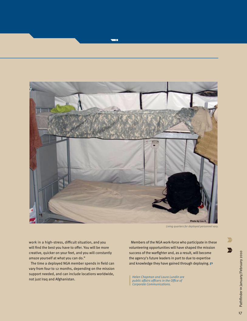
Living quarters for deployed personnel vary.
Members of the NGA work-force who participate in these volunteering opportunities will have shaped the mission success of the warfighter and, as a result, will become the agency’s future leaders in part to due to expertise and knowledge they have gained through deploying.
Photo by Lou H.
18
Path
finde
r ›› J
anua
ry/F
ebru
ary
2010
Some eyewitness commentaries from the past have a disturbingly contemporary feel. Even over time we can sense human nature at work, recognizing and understanding behaviors and reconstructing motives from past circumstances. Regardless of time or place, the human aspect of any crisis seems to speak to us as loudly as its physical context rendered on maps and in imagery. That human aspect can help us understand conflicts and find possible solutions over time through an understanding of the people and cultures involved. In many cases, we can feel the density and sheer weight of the past resisting change, while at the same time we immediately realize that an understanding of the local culture may reveal the best ways to introduce innovation and social alternatives. If we achieve truly effective cultural understanding, we become part of that heritage, acquiring a virtual citizenship we never really lose. Intelligence analysts have long sought and frequently achieved that status. Thus, the quest to recognize and appreciate the value of the human terrain is not new.
Success in conflict has always required this kind of knowledge. The only female regional expert and analyst with the British in the Near East before and during World War I wrote the following presently familiar lines postwar, as she helped define modern Iraq:
Human Terrain Analysis Seeks Deeper Cultural ComprehensionBy Sally S. and Dr. Gary E. Weir
Gertrude Bell sent these words back to England from the defunct Ottoman Empire on March 14, 1920. Bell was the first woman to graduate with a degree in history from Oxford University. She brought her expertise in near
It’s a problem here how to get into touch with the Shiahs, not the tribal people in the country; we’re on intimate terms with all of them, but the grimly devout citizens of the holy towns and more especially the leaders of religious opinion, the Mujtahids, who can loose and bind with a word … in an atmosphere which reeks of antiquity and is so thick with the dust of ages that you can’t see through it … Chief among them are a family called Sadr, possibly more distinguished for religious learning than any other family in the whole Shiah world ….
Viewpoint
eastern history, language and culture into British Army intelligence in the early years of World War I.
A colleague of T.E. Lawrence, later Lawrence of Arabia, Bell found work as a highly valued, resident regional expert who had literally experienced her account on foot. She taught herself Persian and first travelled to Iran in 1892. She walked and rode camels through Iran, visited Jerusalem in 1897, knew Syria well, and with the advent of war joined the Arab Bureau.
Largely a collection of scholars and archaeologists led by reserve Lt. Cmdr. D.G. Hogarth, Royal Navy, of Oxford University, the bureau worked covertly for army intelligence. These men and women possessed the local knowledge of geography, language, culture, religion and tribal politics that the leadership of the Army lacked—what we might now call an appreciation of human terrain.
Unlike Lawrence, Bell avoided battle and through sheer diplomacy and force of will introduced herself to many of the most important native regional leaders of the day and won the right to move among them as a consultant and an influential member of the British administration. In 1917, when the British took Baghdad, she became secretary to Sir Percy Cox, the appointed British Commissioner. Bell contributed to the composition of Iraq from the remnants of the old Ottoman regions of Mosul, Baghdad and Basra and earned the title Khatun, or fine lady, from many of the regional leaders and village people. Her knowledge enabled her to remain British, while becoming as immersed as possible in Arab culture. While British Iraq contained a volatile mix of tribes, tensions and divisions, her cultural knowledge enabled the British to exercise extensive control over the region. An increasingly influential figure, Bell wrote to her father in 1921 that “I had a well-spent morning at the office making out the southern desert frontier of Iraq.” She had a profound and largely positive effect, which many in the region still remember.
Human terrain analysis obviously served an important purpose for Bell and the British in the Great War. More recently, various contemporary special forces

19
Path
finde
r ›› J
anua
ry/F
ebru
ary
2010
management, systems engineering and contracting support to the pilot project, which will, in turn, inform the requirements for NGA’s future enterprise architecture. The Source Operations and Management Directorate will look to the pilot project as an opportunity to develop further the regional analyst occupation and to generate strategies for meeting additional data priorities. The Joint Operations Integration Office is also actively supporting the collaboration, focusing on requirements coordination, programmatic support for enterprise development and collaborative outreach to Intelligence Community partners and subject matter experts.
As human terrain emphasizes the practical significance of cultural knowledge, so too will the success of this time-honored analytical skill at the agency depend on the support from every aspect of the NGA community and its culture. Gertrude Bell would certainly have recognized the importance of human terrain, its vital role in resolving conflict and the need to elevate an understanding of the human environment to the same status as the desire to appreciate the physical environment affecting any conflict. The Human Terrain Analysis Pilot Project will help NGA attain these goals and bring an eternal skill to bear against contemporary threats.
Sally S. is the Analysis and Production Directorate lead for NGA’s Human Terrain Analysis Pilot Project and the tradecraft executive for NGA’s Office of Counterterrorism.
Dr. Gary E. Weir is the NGA historian.
A human terrain team speaks with an Afghan villager. Drawing from current practitioners, NGA has embarked on a Human Terrain Analysis Pilot Project to complement the agency’s existing geospatial intelligence capability.
contingents have already acquired experience with analytic methodologies, drawing upon a variety of academic disciplines, operational lessons learned and multiple intelligence and data sources related to local cultures and social norms. In addition, NGA’s Geospatial Preparation of the Environment, published in June 2006, provided the analytic framework to include this type of analysis in the development of the agency’s geospatial intelligence products. Seemingly the agency lacked only an initiative that would integrate all of these elements into a unified human terrain capability at the enterprise level. Such an endeavor would naturally illuminate a number of architectural, infrastructure, data management and training challenges. NGA has now addressed this need.
Drawing first upon the experience and lessons learned from current practitioners of human terrain analysis, NGA has embarked upon a Human Terrain Analysis Pilot Project to understand what it will take to develop an analytic tradecraft that complements the agency’s existing GEOINT capability. The Human Terrain Analysis Pilot Project initiated this process by documenting workflows, defining requirements, assessing tools and techniques and building and evaluating a prototype capability to acquire, manipulate, store, analyze and create human terrain data and products. This effort must also identify ways to permit the expansion of human terrain analysis across the NGA enterprise. Improving architectural speed and agility as well as human analytical capability will play a critical role in meeting this challenge.
Human terrain analysis must evolve as a collective effort. A collaborative approach will help ensure that this capability matures in alignment with NGA’s strategic intent and in concert with the capabilities and expectations of NGA’s partners.
Initially, implementation of the pilot recommendations will begin by employing the InnoVision Directorate’s Geospatial-Intelligence Advancement Testbed to provide a risk-tolerant environment for the evaluation of new tools and methods. The NGA College will work with tradecraft officers and experts in analytical methods from the Analysis and Production Directorate and Source Operations and Management Directorate to identify and address training shortfalls in the analyst curriculum. The Acquisition Directorate will provide program
DOD photo
20
Path
finde
r ›› J
anua
ry/F
ebru
ary
2010
Collaboration between the National Geospatial-Intelligence Agency and its mission partners provides fresh ideas and leverages diverse experiences, as NGA’s deployed and externally assigned personnel consistently demonstrate. Programs that allow partners to “deploy” to NGA facilities also capitalize on the value of collaboration.
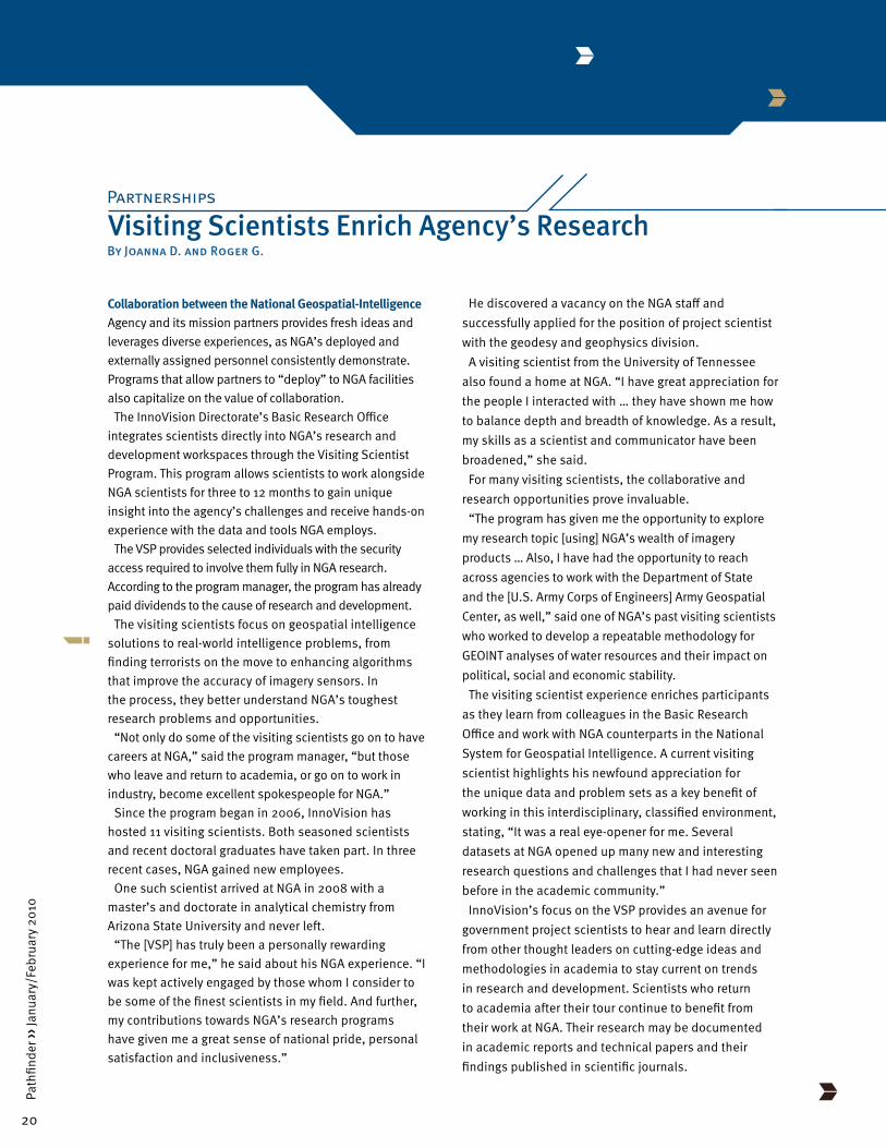
The InnoVision Directorate’s Basic Research Office integrates scientists directly into NGA’s research and development workspaces through the Visiting Scientist Program. This program allows scientists to work alongside NGA scientists for three to 12 months to gain unique insight into the agency’s challenges and receive hands-on experience with the data and tools NGA employs.
The VSP provides selected individuals with the security access required to involve them fully in NGA research. According to the program manager, the program has already paid dividends to the cause of research and development.
The visiting scientists focus on geospatial intelligence solutions to real-world intelligence problems, from finding terrorists on the move to enhancing algorithms that improve the accuracy of imagery sensors. In the process, they better understand NGA’s toughest research problems and opportunities.
“Not only do some of the visiting scientists go on to have careers at NGA,” said the program manager, “but those who leave and return to academia, or go on to work in industry, become excellent spokespeople for NGA.”
Since the program began in 2006, InnoVision has hosted 11 visiting scientists. Both seasoned scientists and recent doctoral graduates have taken part. In three recent cases, NGA gained new employees.
One such scientist arrived at NGA in 2008 with a master’s and doctorate in analytical chemistry from Arizona State University and never left.
“The [VSP] has truly been a personally rewarding experience for me,” he said about his NGA experience. “I was kept actively engaged by those whom I consider to be some of the finest scientists in my field. And further, my contributions towards NGA’s research programs have given me a great sense of national pride, personal satisfaction and inclusiveness.”
Visiting Scientists Enrich Agency’s ResearchPartnerships
By Joanna D. and Roger G.
He discovered a vacancy on the NGA staff and successfully applied for the position of project scientist with the geodesy and geophysics division.
A visiting scientist from the University of Tennessee also found a home at NGA. “I have great appreciation for the people I interacted with … they have shown me how to balance depth and breadth of knowledge. As a result, my skills as a scientist and communicator have been broadened,” she said.
For many visiting scientists, the collaborative and research opportunities prove invaluable.
“The program has given me the opportunity to explore my research topic [using] NGA’s wealth of imagery products … Also, I have had the opportunity to reach across agencies to work with the Department of State and the [U.S. Army Corps of Engineers] Army Geospatial Center, as well,” said one of NGA’s past visiting scientists who worked to develop a repeatable methodology for GEOINT analyses of water resources and their impact on political, social and economic stability.
The visiting scientist experience enriches participants as they learn from colleagues in the Basic Research Office and work with NGA counterparts in the National System for Geospatial Intelligence. A current visiting scientist highlights his newfound appreciation for the unique data and problem sets as a key benefit of working in this interdisciplinary, classified environment, stating, “It was a real eye-opener for me. Several datasets at NGA opened up many new and interesting research questions and challenges that I had never seen before in the academic community.”
InnoVision’s focus on the VSP provides an avenue for government project scientists to hear and learn directly from other thought leaders on cutting-edge ideas and methodologies in academia to stay current on trends in research and development. Scientists who return to academia after their tour continue to benefit from their work at NGA. Their research may be documented in academic reports and technical papers and their findings published in scientific journals.
21
Path
finde
r ›› J
anua
ry/F
ebru
ary
2010
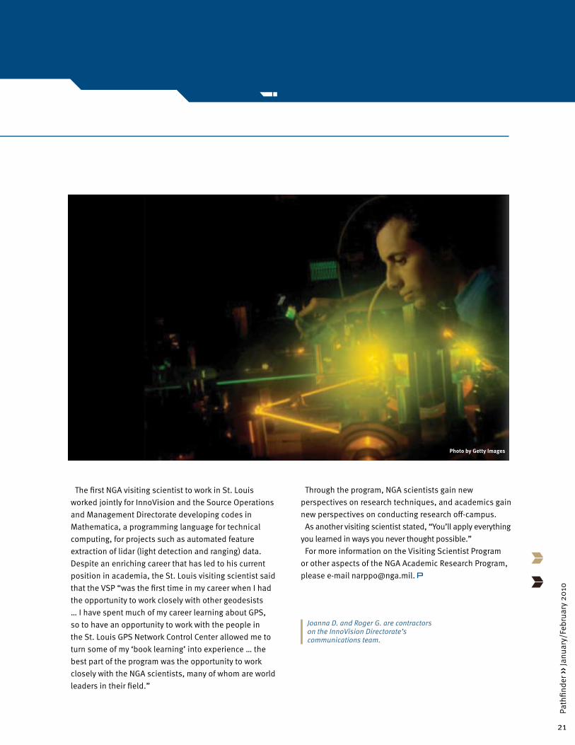
The first NGA visiting scientist to work in St. Louis worked jointly for InnoVision and the Source Operations and Management Directorate developing codes in Mathematica, a programming language for technical computing, for projects such as automated feature extraction of lidar (light detection and ranging) data. Despite an enriching career that has led to his current position in academia, the St. Louis visiting scientist said that the VSP “was the first time in my career when I had the opportunity to work closely with other geodesists … I have spent much of my career learning about GPS, so to have an opportunity to work with the people in the St. Louis GPS Network Control Center allowed me to turn some of my ‘book learning’ into experience … the best part of the program was the opportunity to work closely with the NGA scientists, many of whom are world leaders in their field.”
Through the program, NGA scientists gain new perspectives on research techniques, and academics gain new perspectives on conducting research off-campus.
As another visiting scientist stated, “You’ll apply everything you learned in ways you never thought possible.”
For more information on the Visiting Scientist Program or other aspects of the NGA Academic Research Program, please e-mail [email protected].
Joanna D. and Roger G. are contractors on the InnoVision Directorate’s communications team.
Photo by Getty Images
22
Path
finde
r ›› J
anua
ry/F
ebru
ary
2010
Deployers from NGA stationed with coalition forces in Afghanistan, Iraq or elsewhere bring with them the support of the entire agency, extensive preparation for the task at hand and their own talent and initiative. The latter two qualities largely define deployers as individuals who refuse to accept a setback and regularly find the necessary solution. They have to get the job done.
Difficult situations frequently call forth talent and initiative even if we occasionally doubt we possess those qualities. Imagine yourself on a very different front line working on a ship sunk up to its deck in the Rufiji Delta in East Africa about 200 miles south of Dar es Salaam. You and your colleagues spend days helping the crew dismantle the ship’s guns for use on shore. The heat of the overhead sun in July 1915 burns your skin, and the deck of the German cruiser S.M.S. Königsberg supports your partially submerged feet as you prepare those guns to join the forces of Colonel Paul von Lettow-Vorbeck, who would emerge from the conflict as the only German commander of World War I never defeated in the field. Tough, determined and never one to shrink from a battle, he did not surrender Germany’s position in colonial Africa until Nov. 25, 1918, 14 days after the armistice ending the war in Europe.
Von Lettow-Vorbeck, his officers and the colonial government that supported them became the ultimate deployers for the German armed forces in the Great War. The colonel had passed his 44th birthday in Africa when the war started in Europe, and before the conflict ended, he would lead the British the length of German East Africa, modern-day Tanzania, from Uganda to the Zambezi, through multiple engagements, without ever getting caught. Trained as a German field officer, he distained guerrilla warfare and sought open battle, but he carefully taught his askaris, or native soldiers, bush warfare and imposed discipline through his European officers and noncommissioned officers.
With the Royal Navy superior at sea, German Army units and the East African colonial administration found themselves thrown back upon their own resources to accomplish an essential mission: occupying as much of the enemy’s resources and personnel as possible. Von
Our Heritage
Forward Deployed and Out in the BushBy Dr. Gary E. Weir
Lettow-Vorbeck determined he would do just that, while at the same time drawing the British ever deeper into Africa to defend their interests.
The colonel frequently viewed the German colonial administration in East Africa as superfluous. However, like our deployers armed with reachback capability, he could hardly have survived without it. Early in the war, the British destroyed the wireless station in Togoland, colonial Germany’s only long-range link with the homeland. This communications base could broadcast directly to Nauen, about 24 miles west of Berlin. Losing this transmitter isolated the Germans further but did not discourage von Lettow-Vorbeck. As a German officer, he saw the decisions reached by forces in the field as most important and took the war to the British as often as possible. The German colonial governor, Heinrich Schnee, believed in the economic, social and religious ambitions and benefits of well-managed colonization. These two perspectives seemed completely opposed, but von Lettow-Vorbeck’s campaigns derived a great deal from the funds, supplies and recruitment activity contributed by Schnee’s administration.
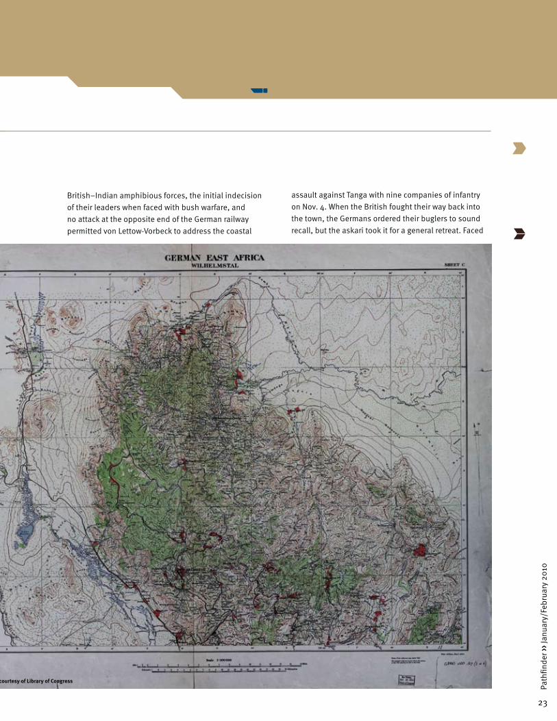
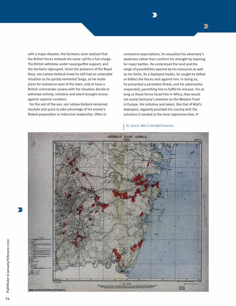
The colonel’s talent and initiative came to the fore almost immediately in 1914 and in contrast to the slow adaptation of the British and Indian forces to the war in German East Africa. The British initially focused on plans for an amphibious landing against the coastal town of Tanga at one end of the German railway while von Lettow-Vorbeck preoccupied himself with the other end, fearing a British movement across the border with British East Africa near Mount Kilimanjaro. The time spent at sea by the Map courtesy of Library of Congress
23
Path
finde
r ›› J
anua
ry/F
ebru
ary
2010
British–Indian amphibious forces, the initial indecision of their leaders when faced with bush warfare, and no attack at the opposite end of the German railway permitted von Lettow-Vorbeck to address the coastal
assault against Tanga with nine companies of infantry on Nov. 4. When the British fought their way back into the town, the Germans ordered their buglers to sound recall, but the askari took it for a general retreat. Faced
Map courtesy of Library of Congress
24
Path
finde
r ›› J
anua
ry/F
ebru
ary
2010
Dr. Gary E. Weir is the NGA historian.
with a major disaster, the Germans soon realized that the British forces mistook the same call for a full charge. The British withdrew under naval gunfire support, and the Germans regrouped. Given the presence of the Royal Navy, von Lettow-Vorbeck knew he still had an untenable situation as he quickly reentered Tanga, so he made plans for resistance west of the town, only to have a British commander uneasy with the situation decide to withdraw entirely. Initiative and talent brought victory against superior numbers.
For the rest of the war, von Lettow-Vorbeck remained resolute and quick to take advantage of his enemy’s flawed preparation or indecisive leadership. Often in
Map courtesy of Library of Congress
contrast to expectations, he assaulted his adversary’s weakness rather than confront his strength by massing for major battles. He understood the land and the range of possibilities opened by his resources as well as his limits. As a deployed leader, he sought to defeat or deflect the forces sent against him. In doing so, he presented a persistent threat, and his adversaries responded, permitting him to fulfill his mission. For as long as those forces faced him in Africa, they would not assist Germany’s enemies on the Western Front in Europe. His initiative and talent, like that of NGA’s deployers, regularly provided his country with the solutions it needed at the most opportune time.

25
Path
finde
r ›› J
anua
ry/F
ebru
ary
2010

26
Path
finde
r ›› J
anua
ry/F
ebru
ary
2010
www.nga.mil