Embed Size (px)
DESCRIPTION
Introduction To Geographical Data and TEISS Maps. Angelique Luedeker, ITEP/TAMS Center. Homework Discussion. Are there any questions on the homework?. GIS Definitions. - PowerPoint PPT Presentation
Citation preview
1
Introduction To Geographical Data
and TEISS MapsAngelique Luedeker,
ITEP/TAMS Center

2
Homework Discussion
Are there any questions on the homework?
3
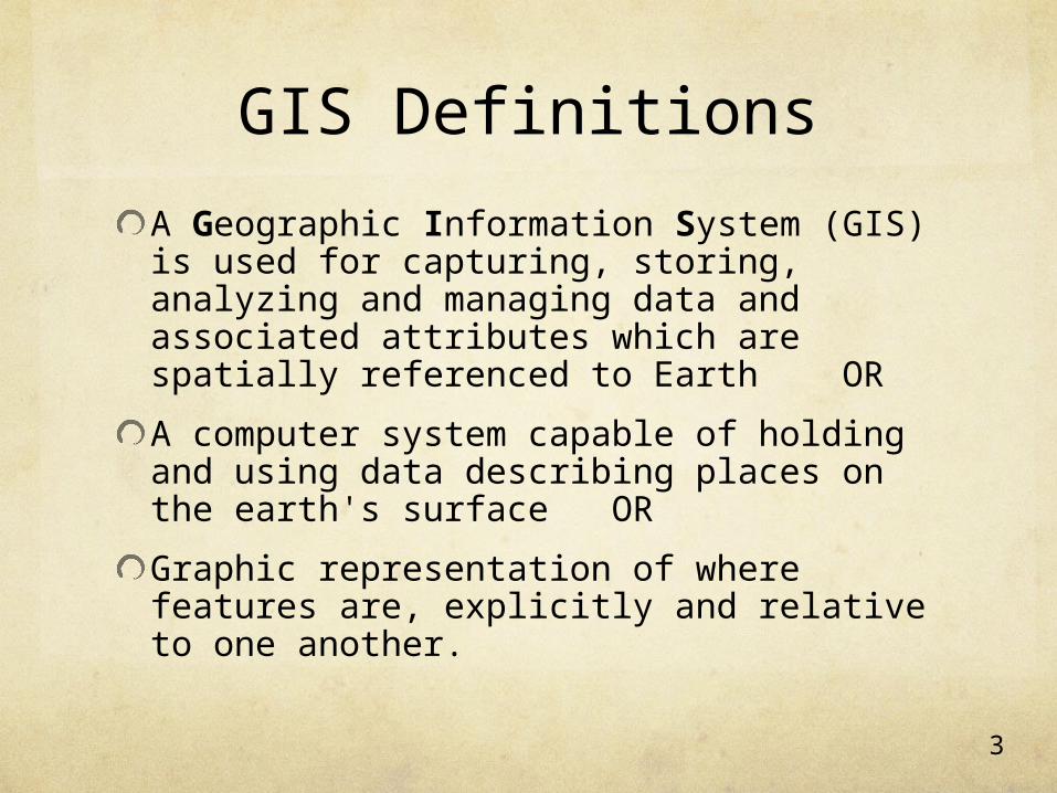
GIS Definitions
A Geographic Information System (GIS) is used for capturing, storing, analyzing and managing data and associated attributes which are spatially referenced to Earth OR
A computer system capable of holding and using data describing places on the earth's surface OR
Graphic representation of where features are, explicitly and relative to one another.
4
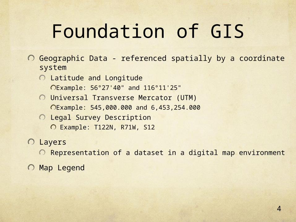
Foundation of GISGeographic Data - referenced spatially by a coordinate system
Latitude and Longitude Example: 56°27'40" and 116°11'25"
Universal Transverse Mercator (UTM)Example: 545,000.000 and 6,453,254.000
Legal Survey Description Example: T122N, R71W, S12
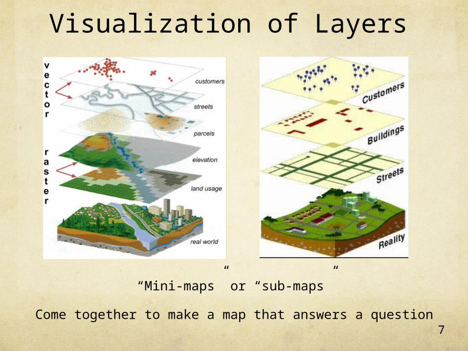
Layers Representation of a dataset in a digital map environment
Map Legend
5
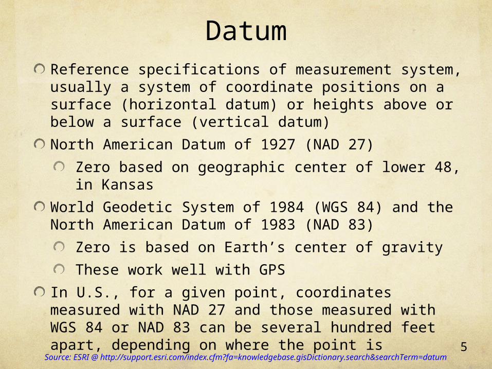
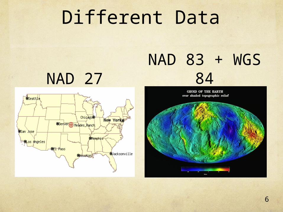
DatumReference specifications of measurement system, usually a system of coordinate positions on a surface (horizontal datum) or heights above or below a surface (vertical datum)
North American Datum of 1927 (NAD 27)
Zero based on geographic center of lower 48, in Kansas
World Geodetic System of 1984 (WGS 84) and the North American Datum of 1983 (NAD 83)
Zero is based on Earth’s center of gravity
These work well with GPS
In U.S., for a given point, coordinates measured with NAD 27 and those measured with WGS 84 or NAD 83 can be several hundred feet apart, depending on where the point isSource: ESRI @ http://support.esri.com/index.cfm?fa=knowledgebase.gisDictionary.search&searchTerm=datum
6
Different Data
NAD 27NAD 83 + WGS
84
7
Visualization of Layers
“Mini-maps” or “sub-maps”
Come together to make a map that answers a question

8
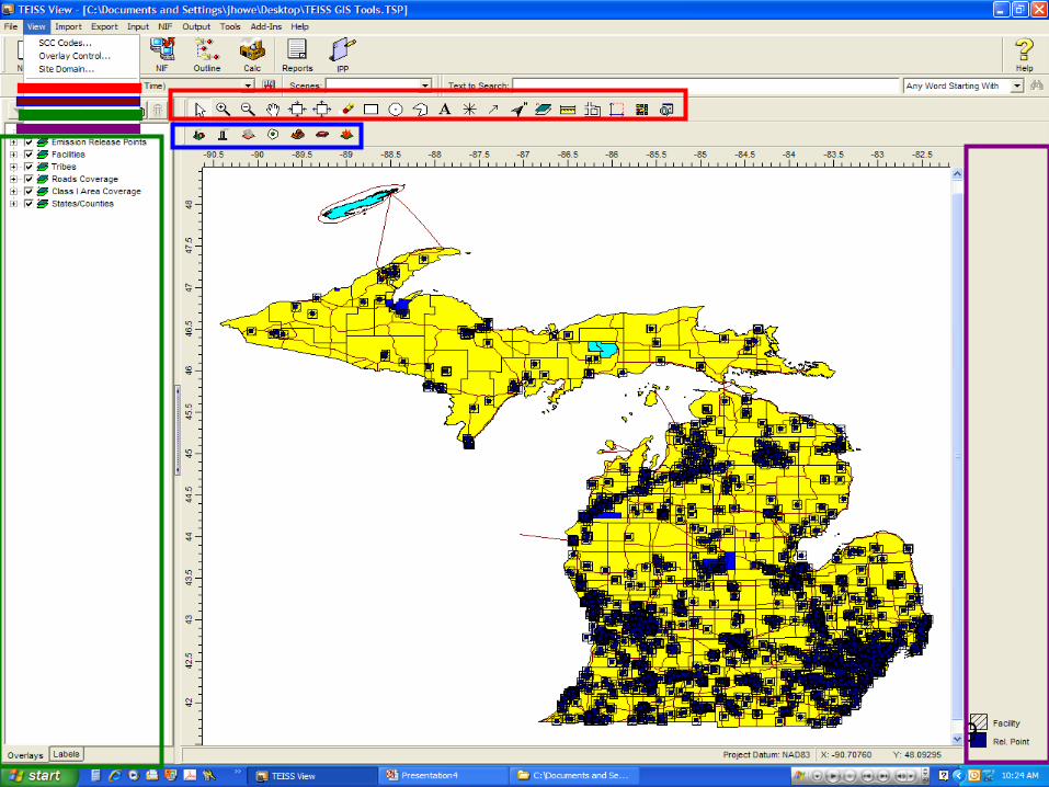
TEISS Map Interface
What are the different toolbars?
How do you display or hide layers?
How do you display or hide labels?
How do you customize the appearance of layers?
How do you customize the appearance of labels?
How do you import a map?
How do you export a map?
9
10
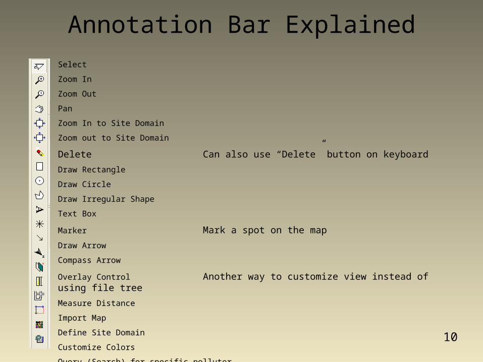
Select
Zoom In
Zoom Out
Pan
Zoom In to Site Domain
Zoom out to Site Domain
Delete Can also use “Delete” button on keyboard
Draw Rectangle
Draw Circle
Draw Irregular Shape
Text Box
Marker Mark a spot on the map
Draw Arrow
Compass Arrow
Overlay Control Another way to customize view instead of using file tree
Measure Distance
Import Map
Define Site Domain
Customize Colors
Query (Search) for specific polluter
Annotation Bar Explained

11Click and drag to move the layers (or use Click and drag to move the layers (or use
arrows)arrows)
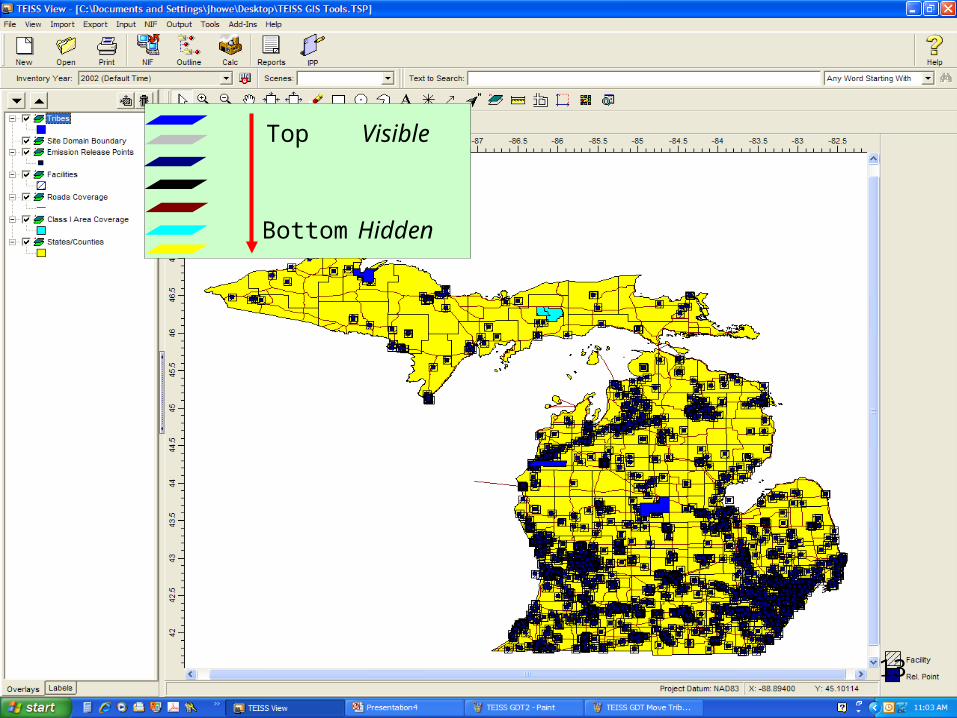
Working with Layers
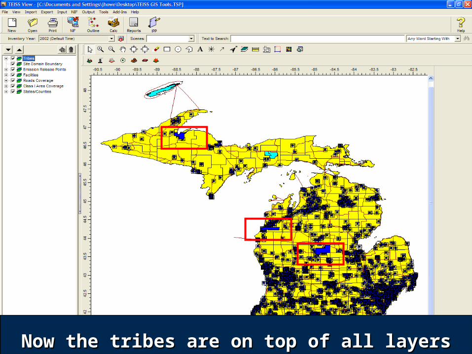
12Now the tribes are on top of all layersNow the tribes are on top of all layers
13
Top Visible
Bottom Hidden
14
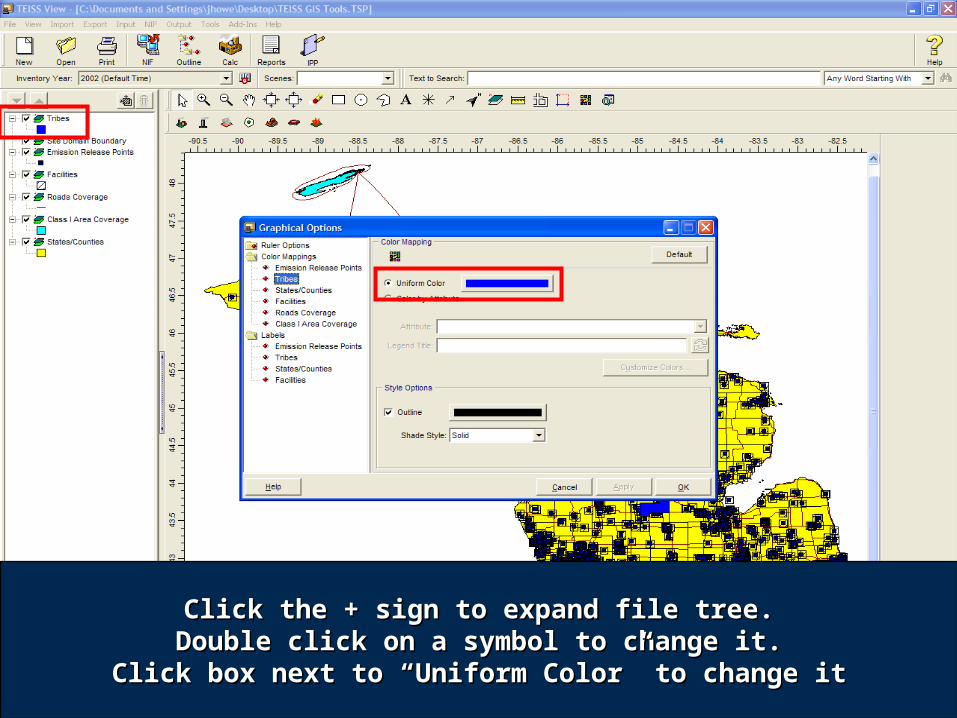
Click the + sign to expand file tree.Click the + sign to expand file tree.Double click on a symbol to change it.Double click on a symbol to change it.
Click box next to “Uniform Color” to change itClick box next to “Uniform Color” to change it

15Click on the color to change itClick on the color to change it

16Click on Drop Down box to change Shade StyleClick on Drop Down box to change Shade Style
to 75% transparent, then click “OK” buttonto 75% transparent, then click “OK” button
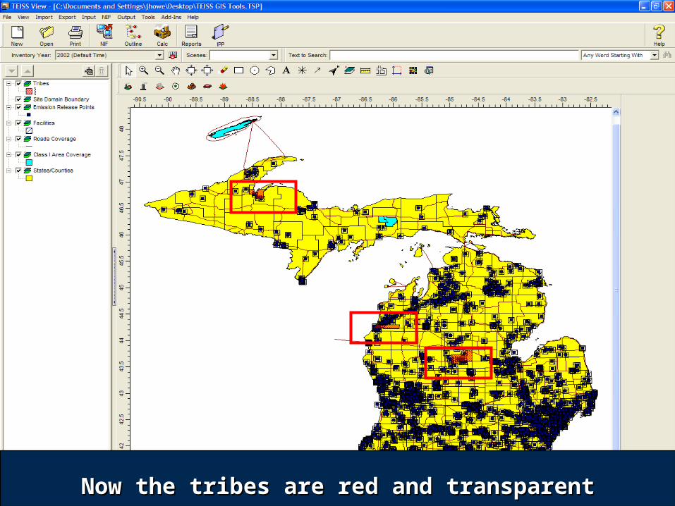
17Now the tribes are red and transparentNow the tribes are red and transparent
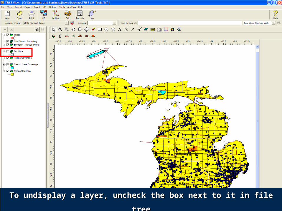
18To undisplay a layer, uncheck the box next to it in file treeTo undisplay a layer, uncheck the box next to it in file tree
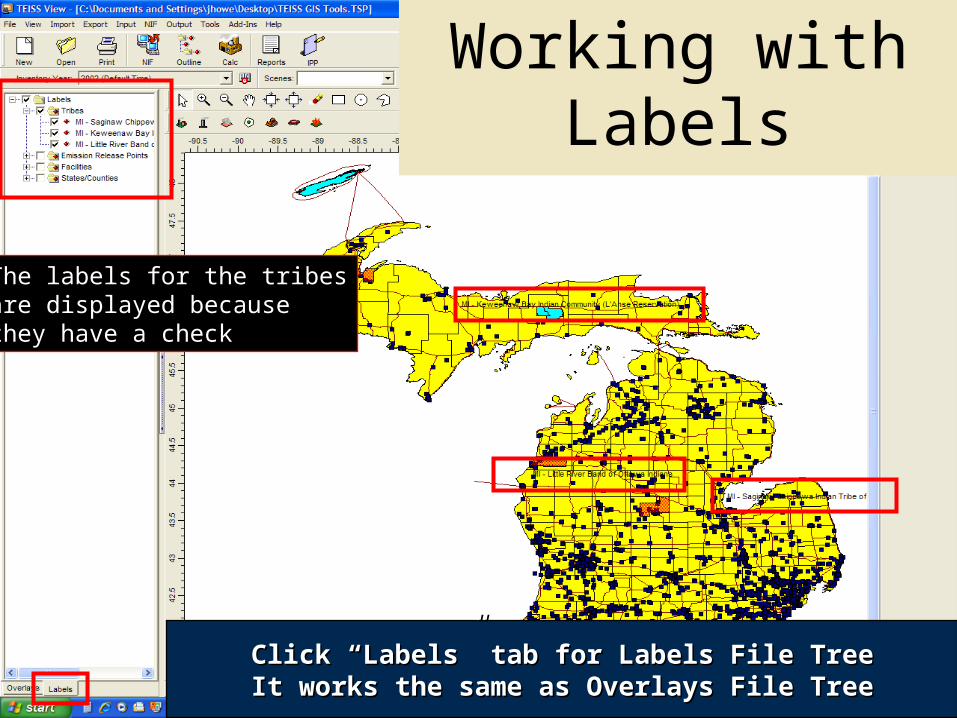
19Click “Labels” tab for Labels File TreeClick “Labels” tab for Labels File TreeIt works the same as Overlays File TreeIt works the same as Overlays File Tree
The labels for the tribesare displayed becausethey have a check
Working with Labels
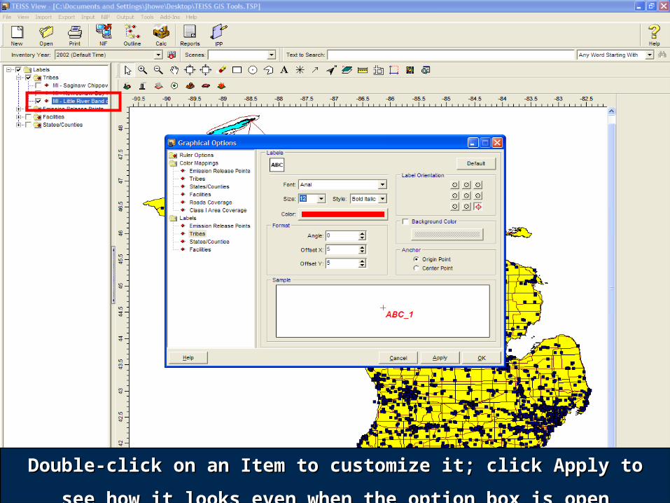
20Double-click on an Item to customize it; click Apply to see Double-click on an Item to customize it; click Apply to see
how it looks even when the option box is openhow it looks even when the option box is open
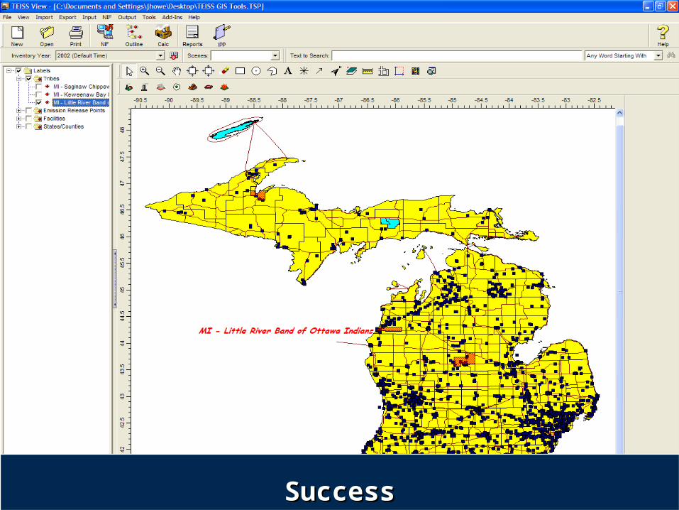
21SuccessSuccess
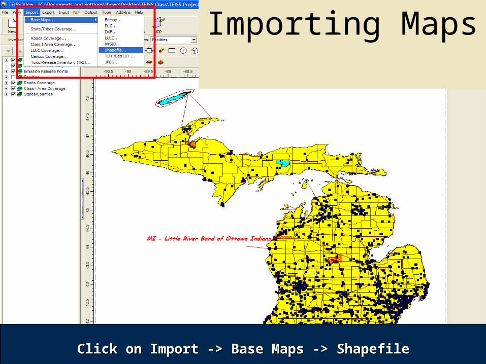
22Click on Import -> Base Maps -> ShapefileClick on Import -> Base Maps -> Shapefile
Importing Maps
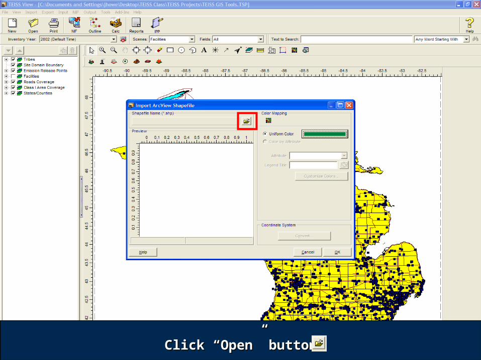
23Click “Open” buttonClick “Open” button
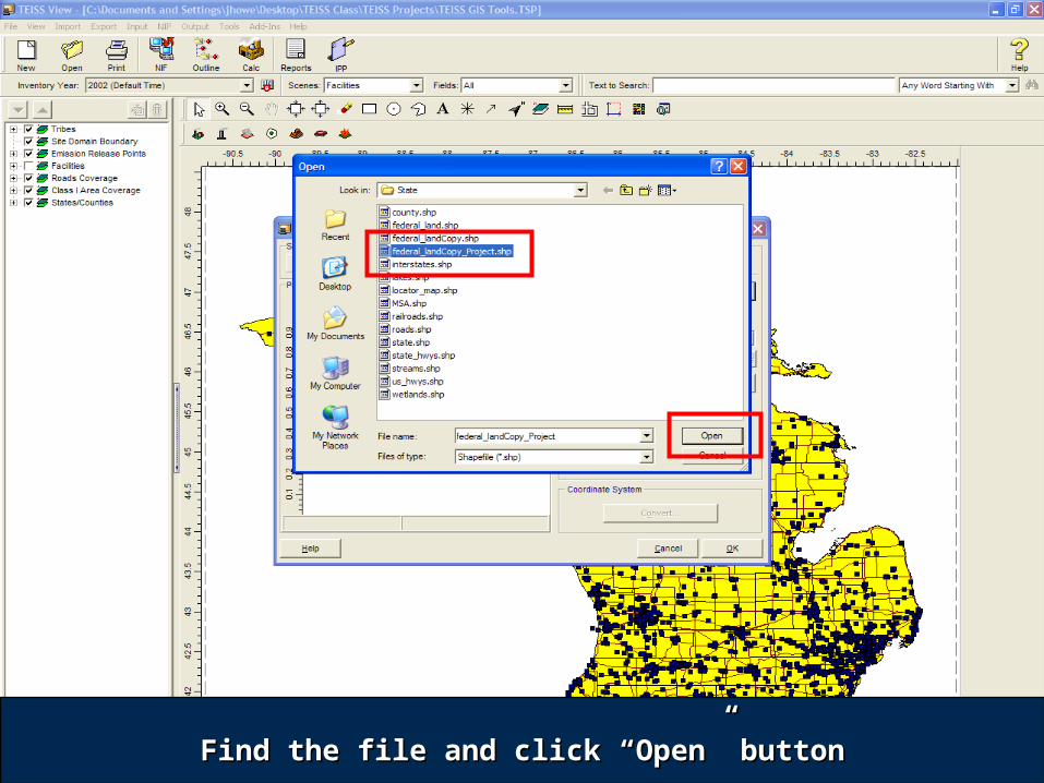
24Find the file and click “Open” buttonFind the file and click “Open” button
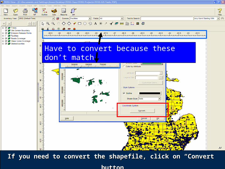
25If you need to convert the shapefile, click on “Convert” If you need to convert the shapefile, click on “Convert”
buttonbutton
Have to convert because these don’t matchHave to convert because these don’t match
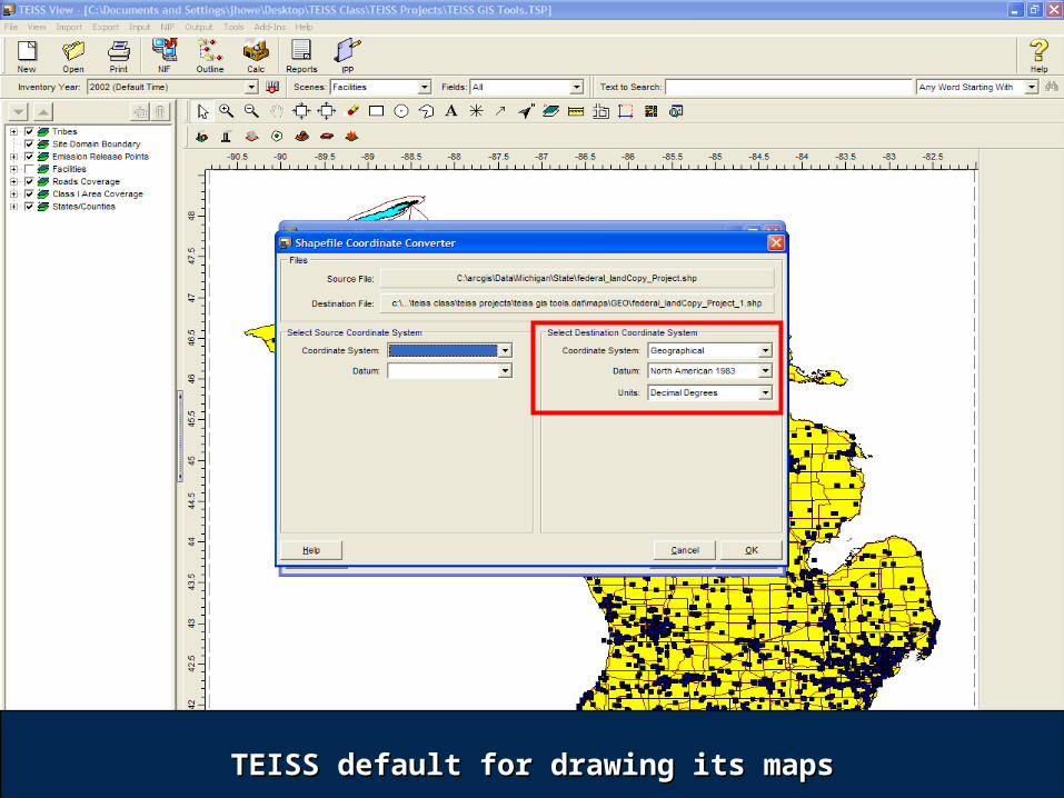
26TEISS default for drawing its mapsTEISS default for drawing its maps

27
Input your shapefile’s coordinate system parameters in here.Input your shapefile’s coordinate system parameters in here.The boxes will change depending on what you have to enter.The boxes will change depending on what you have to enter.
Then click the “OK” buttonThen click the “OK” button
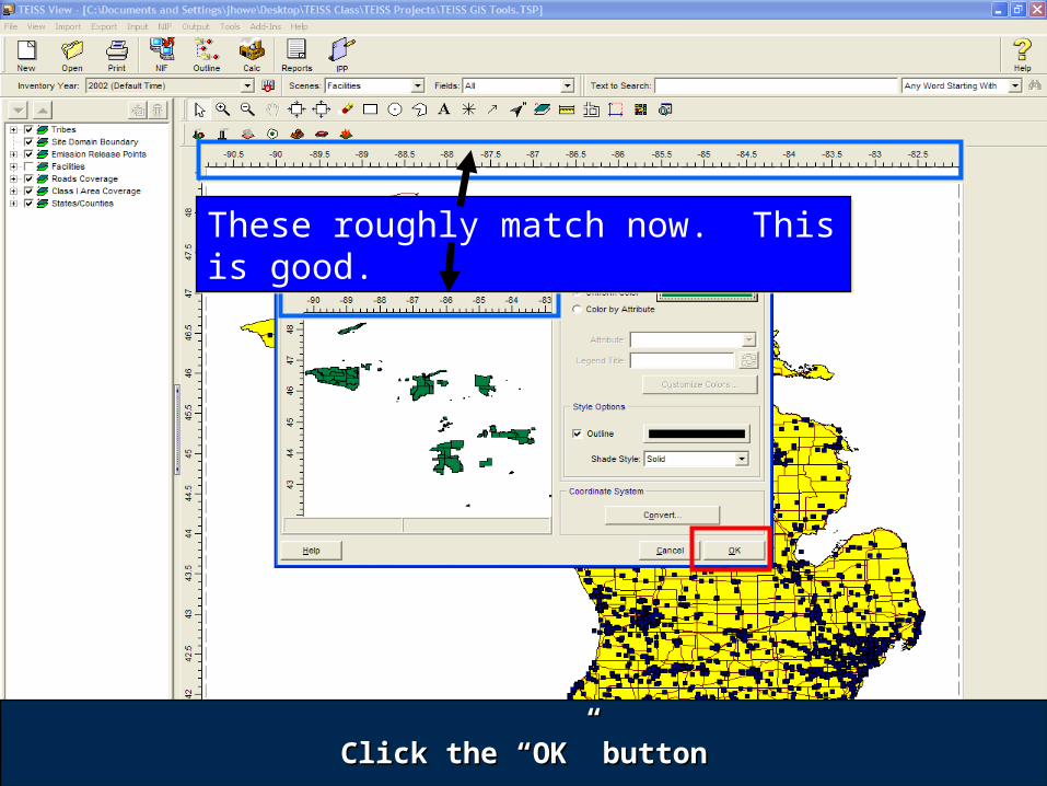
28Click the “OK” buttonClick the “OK” button
These roughly match now. This is good.These roughly match now. This is good.
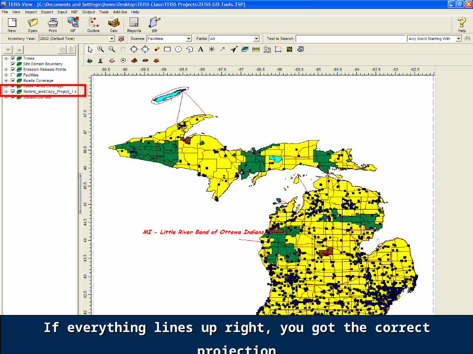
29If everything lines up right, you got the correct projectionIf everything lines up right, you got the correct projection
30
Tips on Modifying the TEISS Map Interface
There is not an “Undo” button
When you click on the Apply button or the OK button, you have already saved the change to the map
If you make changes you do not like and want to go back to the defaults, there is a Default button for each layer
31
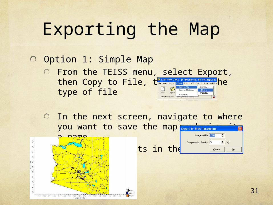
Exporting the Map
Option 1: Simple MapFrom the TEISS menu, select Export, then Copy to File, then select the type of file
In the next screen, navigate to where you want to save the map and give it a name
Leave the defaults in the next screen
32
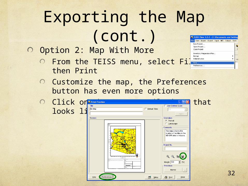
Exporting the Map (cont.)
Option 2: Map With MoreFrom the TEISS menu, select File, then Print
Customize the map, the Preferences button has even more options
Click on the Save to File icon that looks like a computer disk
33
Exporting the Map (cont.)
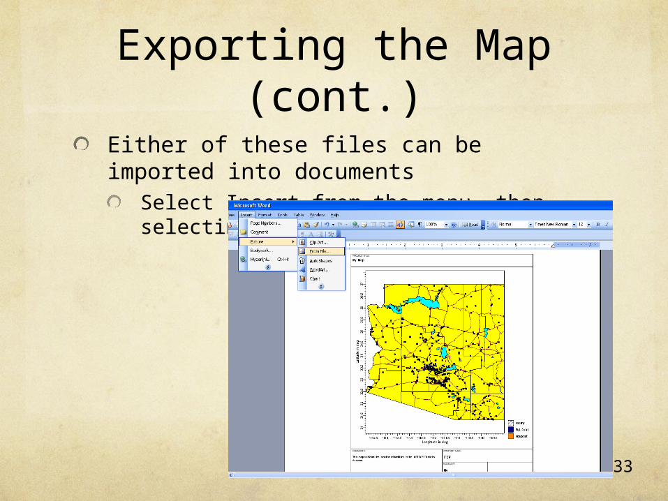
Either of these files can be imported into documents
Select Insert from the menu, then selecting Picture, From File
34
Homework due in 5 days:
Modify the TEISS map to how you want it to look for your QAPP and written EI report
Export the map
Include the map in the Introduction of your EI
Complete the point source section of your Level 4 EI
If you are continuing to the next workshop, this section becomes part of the off reservation section of your Level 1, 2, or 3 EI
Email your EI to the instructors