Embed Size (px)
Citation preview

INSTITUTO DOM LUIZ 2009 REPORT

[GENERAL INDICATORS]
GENERAL INDICATORS
Scope IDL is a research institute that studies, in quantitative fashion, most of the important components of the Earth System. It combines analytical studies, data analysis, observational activities and modeling. The targets correspond to a wide range of processes going from the structure of the deep Earth, surface processes, atmospheric processes and natural hazards at or near the Earth surface. IDL aims to be a national nucleus of scientific activities and an educational platform of high-level research and teaching, thereby attracting the brightest students in the field, and providing a stable base for European partnership in major research initiatives in these areas.
General Objectives The ultimate goal of IDL is to develop physics based tools to study Earth processes. These tools combine theoretical approaches, numerical and physical modeling, and a range of applications that go from the global scale earth processes to local scale environmental problems. IDL focuses on Solid Earth Sciences and Atmosphere and Climate Physics. IDL is committed to Earth’s monitoring, playing a role in some of the global geophysical and geodetic networks.
IDL research activity is combined with an active commitment to conduct post-graduate and graduate teaching. We actively promote the interaction between students and research. IDL maintains a number of laboratory facilities at Lisbon University, here including a cluster for numerical modeling, an experimental tectonics lab, a rock magnetic lab, mobile arrays of seismic sensors (for deep sea surveys and land operations), and a series of high quality instruments (e.g. gravity meter, magnetometers, resistivity sounds, meteorological stations, GPS). We commit ourselves to maintain the needed skills to develop geophysical instrumentation as a key characteristic of our research strategy.
Main Achievements in 2009 ATMOSPHERE PHYSICS: Two new results, on the impact of shear and curvature effects on gravity wave drag, and on the analytical theory for momentum deposition in sheared flow, respectively.
REPRESENTATION OF SURFACE PROCESSES: A new parameterization of snow processes for atmospheric models was developed. A second set of developments, linked to the surface albedo in the presence of snow, and snow horizontal heterogeneity is now under final tests for adoption by ECMWF.
CLIMATE CHANGE: A new drought index was developed
and its results analyzed with focus on the European continent. The major 6 droughts of the ERA-40 45 year period are correctly identified and almost perfectly ranked in strength. New results were obtained on the co-evolution of the land surface and atmosphere large continental scales.
MODELING OF LARGE SCALE TECTONIC PROCESSES: The combination of physical and numerical modeling achieved some important results on a series of topics: (i) the role of thin elastic cores in the lithosphere and large-scale patterns of shortening; (ii) Fold first or fault first in the compressional deformation of the lithosphere; (iii) subduction initiation at passive margins in 2D and 3D. Significant advances were also obtained in what concerns modeling of the Nubian-Iberian plate boundary.
NATURAL HAZARDS: Paleoseismological studies in Algarve where a new active fault was characterized, and on the Vilariça, Ponsul and Messejana faults. Geophysical modeling of the Vidigueira fault. Revision of historical and instrumental seismicity for Lisbon and analysis of building characteristics. Seismic hazard assessment for São Miguel Island (Azores). Modeling of Coulomb failure stress transfer related to historical earthquakes. New tsunami inundation studies for the Portuguese coasts. A set of new GPS studies were made to address volcanic unrest in the Fogo/Congro volcanic system (Azores)
GEOPHYSICAL AND GEOLOGICAL CHARACTERIZATION OF KEY NATURAL LABORATORIES: study of seismicity in Cape Verde, and the Mid-Atlantic Ridge, south of the Azores. New interpretation for the SW branch of the Ibero-Armorican Arc. Modeling to test contradictory interpretations of the Gulf of Cadiz tectonics, particularly the interference between major dextral strike-slips, Horseshoe thrust fault and the Gulf of Cadiz Accretionary Wedge.
GEOPHYSICAL SOFTWARE: New free geophysical software (EM34-2D and Inv2DVLF) was distributed, being used by more than thirty international institutions (mainly universities). New software tools for Storm Surge warning system. New design of the Portuguese Tsunami Warning System.
INSTRUMENTATION IMPROVMENTS: Video monitoring system to evaluate coastal effects induced by extreme storms. New technology for experimental rheology, based on the use of polymer jackets. New GNSS methodology to study the statistical properties of spatial and temporal distribution of tropospheric Precipitable Water.
GEOLOGICAL GIS DATABASES: GIS Database developed by IDL was provided to SHARE project for integration in the larger scale European database. The Geologic Map of Madeira Island was integrated in a GIS, in cooperation with local authorities.
PUBLICATIONS AND ISI RANKING: We published in 2009 approximately 110 articles in major Earth Sciences

[GENERAL INDICATORS]
journals.
Internal Organization IDL organization relies on a Scientific Council, grouping all researchers, which are organized into 10 research groups, each one led by a senior researcher, appointed by the Director.
Research Group leaders form a Coordination Board that meets on a regularly basis, headed by the Director, directly elected by the Scientific Council.
Administration and Management is done by IDL Direction Board, also elected by the Scientific Council. Research Lines and Research Group leaders are chosen by the Director.
A part of the geophysical monitoring operation is conducted within the Geophysical Institute of the University of Lisbon. The present Director of both IDL and IGIDL is Jorge Miguel Miranda.
Integrative activities GLOBAL CHANGE AND SOCIETAL RISKS: A set of initiatives fostered the cooperation between several research groups within IDL and also the cooperation at national and international level. Among them we must emphasize the importance of the integrated risk studies conducted for the Portuguese Civil Protection, focused in the Algarve and Lisbon areas, and including seismic and tsunami warning studies. IDL also promoted the development of the NEAMTWS UNESCO initiative cooperating with the Portuguese Meteorological Institute for the development of early warning routines. Another important initiative concerned the continued effort on the digitization of historical geophysical records, an important asset for the study of long term climatic changes. This dataset has paramount importance for climate change studies, includes information for meteorology, earth magnetism and earthquakes, and covers the Portuguese territory (at that time) in several continents.
GEOPHYSICS AND TECTONOPHYSICS: The combination of physical and numerical modeling progressed on a series of research topics (e.g. Global Tectonic Processes, SW Iberian margin). Combination of experimental tectonics with rock magnetic methods allowed new insights in dyke emplacement dynamics. Rock magnetic methods were also developed to address the identification of tsunami deposits in specific geological environments.
EARTH OBSERVATION AND GEODYNAMICS: Most research and observational initiatives of IDL have been focused on the different boundaries of the Nubian plate: Azores Triple Junction; Iberian Margin; East African Rift. A set of new permanent GNSS stations was installed and regional studies were developed with a combination of active and passive seismic studies, integration of INSAR and GNSS approaches. The use of Earth Observation techniques for climate research
progressed also in the framework of GEOLAND and by the use of GNSS delays to indirectly monitor atmospheric parameters.
METEOROLOGY AND CLIMATE RESEARCH: Most of the present effort is directed towards the development of the new generation of numerical climate models for Europe (EC-Earth), gathering physical, chemical and biological parameterizations. Such an effort, with already very promising results in what concerns the modeling of snow processes, asks for the combination of complementary skills on theoretical work, intensive computer techniques for large dataset processing and operational experience. Significant results are expected on a 3-year time frame.
Outreach MEDIA: The presence of IDL and IDL's researchers on the Portuguese media was constant during the year of 2009. This took the form of interviews or scientific statements and addressed mainly climate change, geo and coastal hazards and earth observation themes. The newspapers where the presence of IDL was most relevant are Público, Expresso, Diário de Noticias and Visão, the media with the largest impact in Portugal. Several TV participations must also be emphasized. IDL webpage has been continuously updated including topics of public interest.
TSUNAMIS INFO ON THE WEB: Production of tsunami awareness materials in Portuguese to be used in the Mozambique - collaboration between the India Ocean rim to establish their own Tsunami Early Warning System (IOTWS) and the North East Atlantic and Mediterranean Tsunami Early Warning System (NEAMTWS); these materials are implemented in the TSUNAMI INFO webpage of IDL.
WEATHER FORECAST ON THE WEB: IDL maintains several numerical models used for weateher forecast (http://www.weather.ul.pt/) including high resolution grids for Madeira and Azores. These models, mainly developed for research and post-graduate training, have increased their public impact.
TIDE GAUGE FORECAST ON THE WEB: The web page of tide gauge prediction for all Portuguese harbors has been maintained, with growing public interest.
CLIMATE AND SEISMIC DATA ON THE WEB: IGIDL webpage freely disseminates climate and seismological data obtained by IDL networks. After 2008 the Annals of the Institute that compile geophysical information since 1853 are also openly available through internet.
UNESCO TSUNAMI WARNING SYSTEM: A set of invited talks were held in the Brasil and the Caribean Islands to promote the development of the UNESCO tsunami warning system (Baptista M.A. (2009). Tsunamis-Sistemas de Alerta no Atlântico. Defencil (V Congresso Internacional em Defesa Civil, São Paulo, Brasil, Novembro de 2009); Baptista, M.A. (2009). The 1755 TeleTsunami; Implementation of the PtTWS (Portuguese
[GENERAL INDICATORS]
TWS – NEAMTWS region); IV Plenary The 1755 TeleTsunami, Implementation of the PtTWS (Portuguese TWS – NEAMTWS region). IV Plenary Session of the Intergovernemental Coordination Group of the Caribean Region - ICG Caribe , IOC-UNESCO, Fort de France, Martinique, França, Junho 2009).
TRAINING COURSES ON METEOROLOGY FOR YACHTIES: Carlos Camara started a series of training courses for Yachtsmen, prepared in cooperation with the Portuguese Association of Cruises.
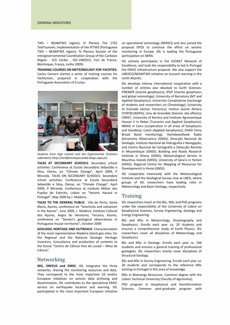
Students from high schools visit the Experimental Tectonics Laboratory (http://serdiferenteporumdia.blogs.sapo.pt).
TALKS AT SECONDARY SCHOOLS: Secondary school activities: Conference at Escola Secundária Sebastião e Silva, Oeiras, on “Climate Change”, April 2009, P Miranda. TALKS ON SECONDARY SCHOOLS: Secondary school activities: Conference at Escola Secundária Sebastião e Silva, Oeiras, on “Climate Change”, April 2009, P Miranda. Conference at Instituto Militar dos Pupilos do Exército, Lisbon on “Seismic Hazard in Portugal”, May 2009 by J. Madeira.
TALKS TO THE GENERAL PUBLIC: Vila do Porto, Santa Maria, Azores, conference on “Seismicity and volcanism in the Azores”, June 2009, J. Madeira; Instituto Cultural dos Açores, Angra do Heroísmo, Terceira, Azores, conference on “Darwin’s geological observations in Portuguese insular territories”, October 2009.
GEOLOGIC HERITAGE AND OUTREACH: Characterization of the most representative Madeira Island geo-sites, for the Regional and the National Geologic Heritage Inventory. Consultancy and production of contents to the future “Centro de Ciência Viva do Lousal – Mina de Ciência”.
Networking IRIS, ORFEUS and EMSC: IDL integrates the three networks, sharing the monitoring resources and data. They correspond to the most important US and/or European initiatives on seismic data archiving and dissemination. IDL contributes to the operational EMSC service on earthquake location and warning. IDL participated in the most important European initiative
on operational seismology (NERIES) and also joined the proposal EPOS to continue the effort on seismic monitoring in Europe. IDL is leading the Portuguese participation on NERA.
IDL actively participates in the ESONET Network of Excellence, and took the responsibility to led in Portugal the EMSO infrastructure proposal. We also support the UNESCO/NEAMTWS initiative on tsunami warning in the north Atlantic.
IDL develops intense international cooperation with a number of entities also devoted to Earth Sciences: IFREMER (marine geophysics); IPGP (marine geophysics and global seismology); University of Barcelona (MT and Applied Geophysics); University Complutense (exchange of students and researchers on Climatology); University of Granada (Active Tectonics); Institut Jaume Almera (TOPOEUROPA); Univ de Grenoble (Seismic site effects); CNRST, University of Kenitra and Institute Agronomique Hassan V in Rabat (Tsunamis and Applied Geophysics); NRIAG in Cairo (cooperation in all areas of Geophysics and Geodesy); Czech (Applied Geophysics); DAAD (Very Broad Band monitoring); Hartebeesthoek Radio Astronomy Observatory (GNSS); Direcção Nacional de Geologia, Instituto Nacional de Hidrografia e Navegação, and Centro Nacional de Cartografia e Detecção Remota in Mozambique (GNSS); Building and Roads Research Institute in Ghana (GNSS); Meteorological Service in Mauritius Islands (GNSS); University of Sana’a in Yemen (GNSS); Regional Centre for Mapping of Resources for Development) in Kenia (GNSS).
IDL cooperates intensively with the Meteorological Institute and the Geological Survey now at LNEG, where groups of IDL researchers have leading roles in Meteorology and Basin Geology, respectively.
Training IDL researchers teach at the BSc, MSc and PhD programs under the responsibility of the University of Lisbon on Geophysical Sciences, Survey Engineering, Geology and Energy Engineering.
BSc and MSc in Meteorology, Oceanography and Geophysics: Enrolls each year ca. 20 students and ensures a comprehensive study of Earth Physics. IDL researchers cover all disciplines of Meteorology and Geophysics.
BSc and MSc in Geology: Enrolls each year ca. 100 students and ensures a general training of professional geologists. IDL researchers mainly cover disciplines of Structural Geology.
BSc and MSc in Survey Engineering. Enrolls each year ca. 30 students and corresponds to the reference MSc existing in Portugal in this area of knowledge.
MSc in Bioenergy Resources. Common degree with the Lisbon Technical University (Faculty of Agronomy).
PhD program in Geophysical and Geoinformation Sciences. Common post-graduate program with

[GENERAL INDICATORS]
presently 24 students from Portugal and abroad.
PhD program in Geology. Post graduate program from the Department of Geology, where IDL researchers are mainly concerned with structural geology topics.
BasinMaster: After 2009 IDL joined as associated member the BasinMaster consortium, which joins some of the most relevant earth science schools in Europe.
Organization of International Events Workshop at Gulbenkian Foundation, following the conclusion of IMPACT project: "Past, Present and Future Health Impacts of Extreme Events in Portugal". 25-26 May 2009.
Workshop on Seismicity and Earthquake Engineering in the Extended Mediterranean Region (RELEMR). Initiative from UNESCO and USGS. FLAD Auditorium, 26-29 October 2009.
Second International Seminar on Prediction of Earthquakes, Lisbon, Portugal – 29-30 April, 2009.
4th MedCLIVAR workshop entitled “Feedbacks of the Mediterranean Dynamics in the Global Climate System” that took place in Sesimbra, Portugal, 28-30 September 2009.
Technical Studies IDL promotes the cooperation with national authorities, municipalities and utility operators, in what concerns geo-hazards assessment (seismic, tsunami, volcanic), renewal energy resources (wind, water), climate change scenarios and regional climate impact of large infrastructures. During 2008 several new studies were initiated, in particular tsunami impact modeling under contract of the Portuguese Civil Protection Authority (ANPC) and the Municipality of Lisbon.
Future Objectives IDL begins now the second five-year period of the lab implementation. It has shown a sustainable increase in most of research indicators, integration between the different research groups and development of new trends, attracting some competitive researchers in Earth Sciences from Portugal and abroad.
In the forthcoming years we will:
(i) Increase of the effort concerning modeling of Earth Processes and the interactions between atmospheric, lithospheric and oceanic sub-systems. This objective will be also coordinated with training initiatives and post-graduation curriculum development;
(ii) Participation in the efforts of the scientific community in three of the main societal concerns: climate change, natural hazards and energy. The role of IDL will be focused o scientific issues and cooperation with external groups devoted to sociological research will be increased;
(iii) Development of tools for the dissemination of research results and for the availability of quality scientific information for the media and the people. Most of the topics that are the focus of IDL are of great public concern and the constant presence in the media needs the development of better support materials and the promotion of research as the only sustainable way for the advancement of society;
(iv) To establish a research environment where geoscientists are able to address theory, computer simulation, field observation and quantitative monitoring of fundamental Earth processes, we need to combine an active commitment on postgraduate and graduate teaching, and to merge students in research activities.

[CLIMATOLOGY AND CLIMATE CHANGE]
CLIMATOLOGY AND CLIMATE CHANGE
Objectives
The study of significant changes in relevant surface climatic variables (e.g. maximum and minimum temperatures, precipitation monthly averages and daily extremes);
Assessment of major teleconnections (e.g. the North Atlantic Oscillation, the Scandinavian pattern or the Eastern Atlantic pattern) to characterize changes in the European climate.
Development of tools to diagnostic the atmospheric circulation: circulation weather types (daily), cut-off low systems (COLs) and storm-tracking (several days), blocking events (up to 3 weeks).
Development of statistical models and predictability studies at the monthly-seasonal range in the Atlantic-European region.
Evaluation of different types of weather driven natural hazards: floods, droughts, landslides and heat waves. This objective and the corresponding achievements and output will be included in the Global Change and Societal Risks Research Line.
Assessment of the impact of volcanoes, solar storms and variability on the Earth’s magnetic field and climate. This objective and the corresponding achievements and output will be included in the Global Change and Societal Risks Research Line.
Within the framework of future warming scenarios projecting increases in the risk of more frequent heat waves and severity of rainfall extremes in regions of mid-high latitudes, it is of major importance to investigate the link of extreme events to atmospheric weather conditions. The research group has acquired a large experience in this topic, due to the enormous effort made in developing objective automatic methods to diagnose specific weather systems, such as weather types, extratropical cyclones and storm-tracks, blocking anticyclones, cut-off lows. The research group of Climatology and Climate Change is integrated in the Global Change and Societal Risks research line of the CGUL-IDL.
Achievements COOPERATIVE RESEARCH: We have been publishing the majority of attained results in specialized literature (SCI journals) related to natural hazards, meteorology, climatology, hydrology and solar variability. During 2009 the group published 18 papers in SCI literature. Most of the research results were obtained within the framework of national projects (funded by FCT, Gulbenkian, CRUP, etc), but equally European projects (e.g. CIRCE, MedCLIVAR, LANDSAF, etc). Furthermore, a
significant amount of this research corresponds to active collaborations with researchers from other groups within IDL and also with other national and international centers and institutions.
NEW PROJECTS: The group has secured several new projects namely an important participation in the large European project FUME dealing with wildfires and 5 new projects funded by FCT. Overall these projects assure a combined funding in excess of 500.000 Euros to IDL for the coming 3 years.
CONFERENCE: Project IMPACTE finished and results related with the impacts of extreme temperatures in mortality (and morbility) and regional climate change scenarios for Portugal were presented at an international conference held in May 2009 at the Gulbenkian Foundation.
ATMOSPHERE EDITORIAL PANEL: Ricardo Trigo was invited to be part of the Editorial panel of the new journal ATMOPSHERE (MDPI Publishing, Switzerland)
PAGEOPH EDITORIAL PANEL: Since early 2009 Raquel Nieto has joined the Editorial panel of the journal Pure and Applied Geophysics (Springer).
Selected Publications Castanheira, J. M., Liberato, M. L. R., de la Torre, L., Graf, H.-F., DaCamara, C. C., (2009) Baroclinic Rossby wave forcing and barotropic Rossby wave response to stratospheric vortex variability. J Atmos Sci. 66, 902-914.
Castanheira, J. M., Añel J. A., Marques C. A. F., Antuña J. C., Liberato M. L. R., de la Torre L., Gimeno L. (2009) Increase of upper tro posphere/lower stratosphere wave baroclinicity during the second half of the 20th century. Atmos. Chem. Phys., 9, 9143–9153.
Demuzere M., Trigo R.M., Vila-Guerau de Arellano J., van Lipzig N.P.N. (2009) "The impact of weather and atmospheric circulation on O3 and PM10 levels at a rural mid-latitude site". Atmospheric Chemistry and Physics, 9, 2695-2714
Gouveia C., Trigo R.M., DaCamara C.C (2009) "Drought and Vegetation Stress Monitoring in Portugal using Satellite Data". Natural Hazards and Earth System Sciences, 9, 1-11
Miranda PMA, Tome AR (2009). Spatial structure of the evolution of surface temperature (1951-2004). Climatic Change, 93, 269-284, DOI 10.1007/s10584-008-9540-8.
Queralt S., Hernández E., Barriopedro D., Gallego D., Ribera P., Casanova C. (2009): North Atlantic Oscillation influence and weather types associated with winter total and extreme precipitation events in Spain. Atmospheric Research, 94, 675-683.
Roig F.A., Barriopedro D., García-Herrera R., Patón Dominguez D., Monge S. (2009): North Atlantic Oscillation signatures in western Iberian tree-rings. Geografiska Annaler, 91 A (2), 141-157.
Trigo R.M., Barriopedro D., Gouveia C.C., Obregón A., Bissolli P., Kennedy J.J., Parker D.E. (2009): Iberia, [in

[CLIMATOLOGY AND CLIMATE CHANGE]
State of the Climate in 2008. Peterson C. and Baringer M.O. Eds.]. Bulletin of the American Meteorological Society, 90 (8), S1-S196
Trigo, R.M., Ramos A., Nogueira P., Santos F.D., Garcia-Herrera R., Gouveia C. and Santo F.E. (2010) "The impact of the 2003 heatwave in Portugal: diagnostics and modelling of excessive mortality", Environmental Science & Policy, 12. 844-854.
Trigo R.M., Vaquero J.M, Alcoforado M.J., Barriendos M., Taborda J., Garcia-Herrera R., Luterbacher J. (2009) "Iberia in 1816, the year without a summer" International Journal of Climatology, 29, 99-115. DOI: 10.1002/joc.1693
Trigo R.M., Barriopedro D., Gouveia C.C., Obregón A., Bissolli P., Kennedy J.J., Parker D.E. (2009): Iberia, [in State of the Climate in 2008. Peterson C. and Baringer M.O. Eds.] Bulletin of the American Meteorological Society, 90 (8), S1-S196
Wang L., Chen W., Zhou W., Chan J.C.L., Barriopedro D., Huang R. (2009): Effect of the climate shift around mid 1970's on the relationship between wintertime Ural blocking circulation and East Asian climate. International Journal of Climatology, doi: 10.1002/joc.1876.
Wheeler D., García-Herrera R., Vaquero J.M, Chenoweth M. and Mock C.J. (2009) “Reconstructing the trajectory the August 1680 Hurricane from contemporary records” Bulletin of the American Meteorological Society 90, 971-978.
Willis D.M., Vaquero J.M, Stephenson F.R. (2009) “Early observation of the aurora australis: Chile 1640” Astronomy & Geophysics 50(5), 20-24.
Master thesis Pedro Miguel Ribeiro de Sousa “Caracterização espácio-temporal das condições de seca na bacia do Mediterrâneo durante o século XX” (2009, MSc Thesis, Supervisor: Ricardo Trigo)
Nádia Salvação “Impact of Circulation Weather Types in the study of Landslides in the Northern Lisbon region”. (2009, MSc Thesis, Supervisor: Ricardo Trigo)
João Miguel Barbosa Botelho de Sousa “Previsão Sazonal de Índices de seca com modelos de Markov”. (2009, MSc Thesis,Supervisor: Carlos Pires)
Raquel Alexandra Pratas Marujo“MOS – Model Output Statistics –Aplicação a Previsões MM5 de curto prazo em Portugal Continental” (2009, MSc Thesis, Supervisor: Carlos Pires).
Future Research The team will continue broadening its multi-disciplinary character, which ranges from proxy-based climate reconstructions to modern assimilated remote sensing output, but always with a main endeavor related to weather driven natural hazards and mid-latitude climate variability. The group intends to maintain the strong
inter-disciplinary approach that has been characteristic in the last few years, by increasing the cooperation with the Land-climate and Atmospheric Modeling groups within the framework of the large European projects (e.g. LANDSAF, EC-Earth consortium) and also with other groups located outside IDL.
Furthermore, the expertise of the group in exploring historical datasets, together with the recent approval of different FCT funded projects, which embrace topics such as the exploration of natural proxies (e.g., MEDIATIC) and the analysis of General Circulation Models (GCMs) simulations for the last centuries/millennium (e.g., ENAC) and future climate scenarios (e.g., AMIC) provides a unique opportunity of merging observational and modeling studies. These projects involve a new emerging research topic and, together with other international projects and partnerships, they ensure funding, the share of expertise in data acquisition and modeling, the intensification of links with other research teams inside and outside IDL as well as the availability of positions for PhD and post-doc students. In this sense, the research group is making a large effort to self-adapt and invest in order to increase data storage and share facilities.
Satellite derived analysis: The Climatology group is growing its activity in areas that require a strong component of remote sensing. In particular we are interested in the development of satellite-based tools to monitor long-lasting drought events (Iberia, Iraq, USA, Australia), but equally to evaluate burned areas (Iberia and Mediterranean). In this respect, Dr. Celia Gouveia spent 2 months in Zarogoza (at CSIC) with Dr. Sergio Vicente Serrano to learn how to handle their large satellite datasets and specialized software. Several papers related with this “new” area of research within the group have been submitted, with one published (Gouveia et al., 2009) and another in press (Gouveia et al., 2010).
20th Century Reanalysis: As the team has been involved in the development of the recently released re-analyses for the 20th century through a digitization project funded by FCT, the applicability of automatic algorithms to diagnose weather systems (which require daily gridded data sets of enough spatial resolution) is now possible and arises as one of the principal objectives within the near future. The recent maximum of daily precipitation observed on the 18 February 2008 was analyzed in a recent paper (Fragoso et al., 2010) and put into a much longer context (since 1865) due to newly digitized data.
Long-term modeling studies: GCMs and paleoclimate proxy-based reconstructions provide a powerful tool to place the observed recent trends into a broader temporal context and to investigate the responses to external forcing factors. The research group has recently made extensible the applicability of objective techniques of weather system identification to different data sets such as state-of-the-art General Circulation

[CLIMATOLOGY AND CLIMATE CHANGE]
Model (GCM) simulations (Barriopedro et al., 2010a, 2010b). On the other hand, recent research of the team has also significantly focused on the development of proxy-based climate reconstructions and the role of the decadal and centennial sun’s variability in the climate system (e.g. Vaquero et al., 2010, Ribeiro et al., 2010).
Statistical Forecasting Models: The group is developing statistical forecasting model capacities namely to predict river flow and periods and intensity of droughts (e.g. Gamis-Fortis et al., 2010) as an attempt to cope partially with the relative low number of studies within IDL regarding surface hydrology and river system. Development of methods of non-Gaussian statistical modeling for climatic diagnostics and inverse problems in climate-related problems are also assessed (e.g. Bocquet, et al. 2010).

[APPLIED AND ENVIRONMENTAL GEOPHYSICS]
APPLIED AND ENVIRONMENTAL GEOPHYSICS
Objectives Applied Geophysics is an important topic of research in IDL, mainly due to the impact of groundwater and environmental issues in human activities. The activity of the group is divided mainly in three areas: field work and data interpretation, software development and design and construction of instrumentation.
The main objectives of the group are:
To develop geophysical methods for environmental, hydrogeological and structural (geological) studies;
To develop electromagnetic methods for aquifer characterization and groundwater monitoring;
To develop specific software for interpretation of electromagnetic data acquired in isotropic and anisotropic media;
To develop algorithms for joint interpretation of different type of geophysical data (DC/TEM; gravity/AMT, DC/MT, seismic/DC);
To design and construct geophysical instrumentation for marine magnetotellurics;
To apply magnetic rock properties to environmental and more regional and global geological studies.
To establish cooperation with industry;
To maintain the already large international collaboration.
Achievements ANTARTICA PROGRAM: During the last year the group worked in projects related to the use of geophysical methods in hydrogeology and environment. The group has been supporting the Portuguese participation on Antarctica program (project PERMANTAR). A member of the group (Ivo Bernardo) has participated in the 2009 expedition to Deception Island.
GROUNDWATER RESEARCH: The group supervised the project HYDROARID (closed in 2009) which aimed to evaluate the groundwater potential of Santiago Island in Cape Verde. The group participated in several surveys carried out in Portugal, Spain and Cabo Verde.
GEOPHYSICAL INVERSE PROBLEMS: Two computer programs (EM34-2D and Inv2DVLF) for inversion of geophysical data developed in the last years were spread all over the world. There are more than thirty researchers of international institutions (mainly universities) using such programs. A new program, allowing the joint inversion of several EM data was developed in collaboration with Dr. John Triantafilis (The University of New South Wales, Sydney, Australia). Several new developments have been achieved in what concern 1-D and 2-D modeling (and inversion) of MT
data assuming anisotropic media. This work was developed in collaboration with Josef Pek (from Czech Republic). The group starts spreading the code developed for joint inversion of resistivity and gravity data collected in basins. A program for joint inversion of DC and TDEM data assuming Quasi-2D models and using smooth constraints was developed in collaboration with Dr. Hesham (now at Lancastre University, U.K.).
COOPERATION WITH THE PRIVATE SECTOR: During 2008 the group worked started and closed the project “electrical characterization of the main geological formation in Portugal continental” under a private contract with EDP-LABELEC Company.
Selected Publications Carreira, P.M., Marques, J.M., Pina, A., Mota Gomes, A., Fernandes, P.A.G. and Monteiro Santos, FA, 2009. Groundwater assessment at Santiago Island (Cabo Verde): a multidisciplinary approach to a recurring source of water supply. Water Resour Manage, DOI 10.1007/s11269-009-9489-z.
Figueiras, J. Gonçalves, M.A., Mateus, A., Marques, F.O., Monteiro Santos, F.A. and Mota, R. 2009. Initial stages of pollutants dispersion around municipal waste disposal facilities: a case study in Northern Portugal. Int. J. Environment and Waste Management, v. 4, 3/4, 341-365.DOI: 10.1504/IJEWM.2009.027401
Font E., Ernesto M., P.M.F. Silva, Correia P.B. and M.A.L. Nascimento (2009). Paleomagnetism, Rock magnetism and AMS study of the Cabo Magmatic Province, NE Brazil. Geophysical Journal International, doi: 10.1111/j.1365-246X.2009.04333.x.
Wannamaker, P. E., T. G. Caldwell, G. R. Jiracek, V. Maris, G. J. Hill, Y. Ogawa, H. M. Bibby, S. L. Bennie & W. Heise (2009) Fluid and deformation regime of an advancing subduction system at Marlborough, New Zealand, nature, doi:10.1038/nature08204.
Hill, G. J., T.G. Caldwell, W. Heise, D.G. Chertkoff, H.M. Bibby, M.K. Burgess, J.P. Cull & R.A.F. Cas (2009) Distribution of melt beneath Mount St Helens and Mount Adams inferred from magnetotelluric data, Nature Geoscience, 2, 785 – 789.
Ingham, M. R., H. M. Bibby, W. Heise, K. A. Jones, P. Cairns, S. Dravitzki, S. L. Bennie, T. G. Caldwell & Y. Ogawa (2009) A magnetotelluric study of Mount Ruapehu volcano, New Zealand, Geophys. J. Int., 179, 887–904.
Khalil M A and Fernando M. Santos, Influence of Degree of Saturation in the Electric Resistivity–Hydraulic Conductivity Relationship (). Surveys in Geophysics. 2009,(DOI10.1007/s10712-009-9072-4).
Khalil MA, Fernando A. Monteiro Santos, Sameh M. Moustafa, and Usama M. Saad. Mapping water seepage from Nasser Lake (Egypt) using VLF-EM method - A case study. Journal of Geophysics and Engineering, 6 (2009), 101-110.doi:10.1088/1742-2132/6/2/001.

[APPLIED AND ENVIRONMENTAL GEOPHYSICS]
Khalil Mohamed A., Mahfooz Hafez, Fernando Monteiro Santos, E. Ramalo, Hany Salah , Gad El-Qady. An approach to estimate porosity and groundwater salinity of shallow aquifers using GPR and VES surveys. Accepted in Journal of Near surface geophysics. (ID: nsg-2009-0384).
Khalil, Mohamed A., Abbas Mohamed Abbas, Fernando S. Monteiro, Hany Salah, and Usama Masoud. VLF-EM study for archeological Investigation of the Labyrinth mortuary temple complex at Hawara area, Egypt. Near surface geophysics, (in press)
Massoud, U., El Qady, G., Metwaly, M., Monteiro Santos, F.A., 2009. Delineation of shallow subsurface structure by azimuthal sounding and joint inversion of VES-TEM data: case study near Lake Qaroun, El Fayoum, Egypt. Pure appl. geophys., 166, 701-719, doi: 10.1007/s00024-009-0463-8
Massoud, U., Monteiro Santos, F.A., El Qady, G., Atya, M. and Soliman, M., 2009. Identification of the shallow subsurface succession and investigation of the seawater invasion to the Quaternary aquifer at the northern part of El Qaa plain, Southern Sinai, Egypt by transient electromagnetic data. Geophysical Prospecting, doi:10.1111/j.1365-2478.2009.00804
Massoud, Usama, Monteiro Santos, FA; Khalil, Mohamed; Taha, Ayman; Abbas, Abbas, 2009. Estimation Of Aquifer Hydraulic Parameters From Surface Geophysical Measurements: A Case Study Of The Upper Cretaceous Aquifer, Central Sinai, Egypt, Hydrogeology Journal (accepted)
Monteiro Santos FA, El-Kliouby, H. 2009. Comparative study of local versus global methods for 1-D joint inversion of DC and TDEM data, Near Surface Geophysics, 6, 390-400.
Monteiro Santos FA, Hector Perea, Usama A. Massoud, João P. Plancha, Jorge Marques, and João Cabral, 2009. Using tensorial electrical resistivity survey to locate fault systems. J. Geophys. Eng., (accepted).
Ramalho, E., Carvalho, J., Barbosa, S. and Monteiro Santos, F.A., 2009. Using geophysical methods to characterize an abandoned uranium mining site, Portugal. Journal of Applied Geophysics, 67, 14-33.
Sultan, A.S., Mansour, S.A., Monteiro Santos, F.A. and Helaly, A.S., 2009. Geophysical exploration for gold and associated minerals, case study: Wadi El Beida area, South Eastern Desert, Egypt. J. Geophys. Eng., 6, 345-356. DOI: 10.1088/1742-2132/6/4/002.
Sultan, A.S., Mekhemer, H.M. and Monteiro Santos, F.A., 2009. Groundwater exploration and evaluation by using geophysical interpretation (case study: Al Qantara East, North Western Sinai, Egypt). Arab. J. Geosci., DOI 10.1007/s12517-008-0028-7.
Sultan, A.S., Mekhemer, H.M., Monteiro Santos, F.A., Abd Alla, M. 2009. Geophysical measurements for subsurface mapping and groundwater exploration at the central part of the Sinai Peninsula, Egypt. The Arabian Journal for Science and Engimneering, 34, 1A, 103-108.
Sultan, A.S., Mohameden, M.I. and Monteiro Santos, FA, 2009. Hydrogeophysical study of the El Qaa Plain, Sinai, Egypt.Bull Eng Geol Environ, 68, 525-537.doi: 10.107/s10064-009-0216-z
Sultan, A.S., Monterio Santos, F.A., Helaly, A.S., 2009. Integrated geophysical interpretation for the area located at the eastern part of Ismailia Canal, Great Cairo, Egypt, Arab J. Geosci. DOI 10.1007/s1217-009-0085-6.
Triantafilis J, Monteiro Santos FA 2009. 2-dimensional soil and vadose zone representation using an EM38 and EM34 and a laterally constrained inversion model. Australian Journal of Soil Research, 47, in press.
Wannamaker, P. E., T. G. Caldwell, G. R. Jiracek, V. Maris, G. J. Hill, Y. Ogawa, H. M. Bibby, S. L. Bennie & W. Heise (2009) Fluid and deformation regime of an advancing subduction system at Marlborough, New Zealand, nature, doi:10.1038/nature08204.
PhD and Master thesis Filipe J. Santos Ferreira Adão (2009) Análise 2-D e 3-D de Dados Magnetotelúricos do Sudoeste Ibérico Usando o Tensor de Fase; MSc Geophysical Sciences, University of Lisbon,
Sofia Alexandra Correia Lopes (2009) Evolução da fracturação e da interacção sólido-fluido de rochas ígneas em ambientes de circulação hidrotermal; MSc Geophysical Sciences, University of Lisbon,
Patrícia Represas (2009) Joint inversion of resistivity and gravity data; PhD thesis in Geophysical Sciences, University of Lisbon.
Future Research Soils and groundwater are important resources for a sustained development. These systems have been object of increasing environmental pressure due to the enormous expansion of industrial and agricultural activities. Agricultural and industrial activities consume the most part of the water but aquifers are also used as major source of water in several regions of our country and abroad. All these activities originated problems of excessive leaching of nutrients and pesticides, soil salinization and depletion of aquifers.
The uppermost part of the subsurface has been also used as repository for municipal and industrial waste. Therefore, there is a great need to improve the understanding of the shallow subsurface and groundwater systems. As the subsurface is difficult to be directly observed, methods are needed to investigate its physical and hydrogeological properties indirectly. Geophysical methods offer a means of addressing this problem in a non-invasive and cheaper way. Electromagnetic (EM) and resistivity (DC) methods are the most adequate tools for such research. In the next years the group will continue devoting special attention to 1) the estimation of hydrogeological parameters like

[APPLIED AND ENVIRONMENTAL GEOPHYSICS]
porosity, water content and flow velocity, as well as, their spatial and temporal variations, using exploration geophysical methods and 2) to the development of interpretative algorithms focused in the joint inversion of data collected by different EM methods (AMT-DC; TEM-DC and EM-SP). These investigations will be carry out in the scope of national projects and international cooperation.
Another focus of research will be the investigation of deep geothermal sources using MT measurements. Geothermal energy is an indigenous, renewable resource that can provide long-term, reliable base load electricity generation, with less environmental impact and lower development costs than almost all other sources of energy. The MT method allows exploring deeper structures than are attainable with the electric and other electro-magnetic techniques and therefore can provide valuable information on the shape, size, depth and other important characteristics of deep geological structures that could constitute a geothermal reservoir. The advantage of the method is that it can be used to define deeper structures than are not attainable with the electric and other electro-magnetic techniques. A project to support this research was submitted (and approved) to FCT.
Field work conducted during 2008 will provide a considerable sample collection for which important problematic could be investigated in our laboratory such as the Triassic-Jurassic and the Cretaceous-Tertiary boundaries. On the long view, we plan to apply our knowledge in rock magnetism to the area of petroleum by testing new multidisciplinary approaches for the localization and extraction of oil-rich geological strata.

[COASTAL HAZARDS AND WARNING SYSTEMS]
COSTAL HAZARDS AND WARNING SYSTEMS
Objectives The main objectives of the group are:
To study sea level change through the time series of Cascais tide gauge, integrated with the news digital data, to achieve new results about the sea level rise evaluation, precise tide modeling, storm surge monitoring, and to contribute to the Portuguese coastal hazard studies.
To develop and demonstrate on-line tools for reliable predictions of the morphological impact of marine storm events in support of civil protection mitigation strategies
To study the coastal response to projected climate change scenarios, including sea level change and wave climate changes, specially the shifts in the direction of predominant winds;
To develop innovative observational methods to quantify beach changes at different spatial and temporal scales;
To develop and demonstrate on-line tools for reliable predictions of the morphological impact of marine storm events in support of civil protection mitigation strategies
To develop a Coastal-Hazard GIS for Portuguese coast in order to classify different hazard levels derived from sea level rise, tsunamis, storm surges and coastal erosion.
To use the Coastal-Hazard GIS to generate risk scenarios in order to estimate the impacts and consequences on a coastal destructive event.
To improve the calculations on current tsunami velocities and upgrade of tsunami vulnerability model for buildings (the present model only takes into account inundation flow depths).
Achievements SOFTWARE DEVELOPMENT: Development of software for storm surge warning system, based in on-line information of the national tide gauges (Cascais and Lagos) and precise tide models, with warnings email sending for national institutions of civil protection. Computation of new precise prediction tide models for Cascais, Lagos and Lisbon tide gauges, with the precision greater than 5 cm and 5 minutes.
DISSEMINATION AND OUTREACH: A web page of tide gauge prediction for all Portuguese tide ports, and precise models for the most important ports, has been published and kept for public consulting, namely for the scientific community, with an average of 50 visits per day in the last year of 2009. Implementation of Tsunami info page at the IDL website with educational materials
for Portuguese speaking countries
COASTAL MONITORING: Development of an operational video monitoring system to evaluate morphological impacts and coastal risk induced by extreme storms;
COASTAL CHANGE PROCESSES: Understanding long-term evolution and variability of major drivers of coastal change: relative and absolute sea level and wave climate. Improve the understanding of coastal response to climate variability and projected climate change scenarios at a regional level.
Inundation mapping for Huelva (synthetic fault: Horseshoe Fault). Adapted from Lima et al. (2009).
TSUNAMI RESEARCH: Modeling tsunami current velocity: application to South Portuguese coast, within an agreement with the Portuguese Civil Protection. Evaluation of tsunami inundation areas using variable Manning coefficients to better parameterize the numerical models being used for inundation. Design of the optimal offshore tsunami detection network.
Selected Publications Roger J., S. Allgeyer, H. Hébert, M.A. Baptista, A. Loevenbruck, F. Schindelé (2009). The 1755 Lisbon Tsunami in Guadeloupe Archipelago: Source Sensitivity and Investigation of Resonance Effects. The Open Oceanography Journal, 2009.
Omira R, M. A. Baptista, J. M. Miranda, E. A. Toto, C. Catita, J. Catalao. Tsunami vulnerability assessment of Casablanca-Morocco using numerical modelling and GIS tools. Natural Hazards. DOI 10.1007/s11069-009-9454-4
Omira, Baptista MA, Matias L, Miranda JM, Catita C, Carrilho F and Toto E (2009). Design of a Sea-level Tsunami Detection Network for the Gulf of Cadiz. Nat. Hazards Earth Syst. Sci., 9, 1327?1338, 2009.
Kaabouben F, Baptista M.A., Iben Brahim A., El Mouraouah A, and Toto A (2009) On the Moroccan tsunami catalogue. Nat. Hazards Earth Syst. Sci., 9,
Baptista, MA; Miranda JM; Mendes-Victor, LA; et al. (2009). Evaluation of the 1755 Earthquake Source Using

[COASTAL HAZARDS AND WARNING SYSTEMS]
Tsunami Modeling. "1755 LISBON EARTHQUAKE: REVISITED" Volume: 7 Pages: 425-432.
Baptista, MA; Miranda JM. (2009). Revision of the Portuguese catalog of tsunamis. NATURAL HAZARDS AND EARTH SYSTEM SCIENCES Volume: 9 Issue: 1 Pages: 25-42.
Fatela, F., J. Moreno, F. Moreno, M.F. Araújo, T. Valente, C. Antunes, R. Taborda, C. Andrade and T. Drago. Enviremental constrains of foraminiferal assemblages distribution across a brackish tidal marsh (Caminha, NW Portugal). Marine Micropaleontology Journal, MARMIC-01245, Vol. 7(1-2), 70-88.
Taborda R, Freire P, Silva A, Andrade C, Freitas MC (2009) Origin and Evolution of Tagus Estuarine Beaches. JOURNAL OF COASTAL RESEARCH Volume: 1 Special Issue: Sp. Iss. 56 Pages: 213-217 Published: 2009
Antunes C, Taborda R (2009). Sea Level at Cascais Tide Gauge: Data, Analysis and Results. JOURNAL OF COASTAL RESEARCH Volume: 1 Special Issue: Sp. Iss. 56 Pages: 218-222 Published: 2009.
Antunes, C. and R. Taborda. Sea level at Cascais Tide Gauge: Data, Analysis and Results. Journal of Coastal Research, SI 56, Proceedings of the 10th International Coastal Symposium, 218-222. Lisbon, Portugal.
Larangeiro SHCD, Taborda RPM, Oliveira FSBF (2009) Sediment Transport in the Coastal Zone: An Intercomparison between Numerical Estimates and Field Measurements. JOURNAL OF COASTAL RESEARCH Volume: 2 Special Issue: Sp. Iss. 56 Pages: 986-990 Published: 2009
Fatela F, Moreno J, Moreno F, M. F. Araújo, T. Valente, C. Antunes, R. Taborda, C. Andrade, T. Drago (2009). Environmental constraints of foraminiferal assemblages distribution across a brackish tidal marsh (Caminha, NW Portugal). MARINE MICROPALEONTOLOGY Volume: 70 Issue: 1-2 Pages: 70-88 Published: JAN 10 2009
Freire P, Ferreira O, Taborda R, et al.(2009). Morphodynamics of Fetch-Limited Beaches in Contrasting Environments. JOURNAL OF COASTAL RESEARCH Volume: 1 Special Issue: Sp. Iss. 56 Pages: 183-187 Published: 2009
Silva AN, Taborda R, Catalao J (2009). DTM Extraction Using Video-monitoring Techniques: Application to a Fetch limited Beach. JOURNAL OF COASTAL RESEARCH Volume: 1 Special Issue: Sp. Iss. 56 Pages: 203-207 Published: 2009
Carvalho J, Torres L, Castro R, Dias R, Mendes-Victor L (2009). Seismic velocities and geotechnical data applied to the soil microzoning of western Algarve, Portugal. JOURNAL OF APPLIED GEOPHYSICS, Volume: 68, Issue: 2, Pages: 249-258, Published: JUN 2009.
Ribeiro A, Mendes-Victor LA, Matias L, P. Terrinha, J. Cabral and N. Zitellini (2009). The 1755 Lisbon Earthquake: A Review and the Proposal for a Tsunami Early Warning System in the Gulf of Cadiz. PORTUGAL. 1755 LISBON EARTHQUAKE: REVISITED. Book Series:
GEOTECHNICAL, GEOLOGICAL AND EARTHQUAKE ENGINEERING Volume: 7 Pages: 411-423 Published: 2009.
Constantino R, Caspar MB, Tata-Regala J, et al. Clam dredging effects and subsequent recovery of benthic communities at different depth ranges. MARINE ENVIRONMENTAL RESEARCH, Volume: 67, Issue: 2 Pages: 89-99 Published: MAR 2009.
Master thesis Maria Margarida Tarrio Agreiro Bezerra – MSc – Relação entre o clima de agitação marítima e aspectos da morfologia costeira, na costa rochosa do Algarve central (Galé a Olhos de Água), 2009, University of Algarve.
Future Research Final Implementation of a regional node of NEAMTWS in Portugal (cooperation with the seismological group of IDL, the Meteorological Institute and the Hydrographic Institute);
Participation in the Global Tsunami Warning System - IOC- UNESCO and collaboration with all other areas: Indian/Pacific/Caribbe. Production of educational materials in Portuguese language for use: in Mozambique (cooperation with Indian Ocean TWS) and for Portugal (in the framework of NEAMTWS).
Study of the impact of teletsunamis (generated in the NEA area) in the Caribbean Islands, namely Martinique and Guadeloupe; study of resonance effects in these areas, in collaboration with Commissariat a L'Energie Atomique, France.
Extension of the coastal dynamics research scope, which presently has be essentially focused on open sandy coasts, to other environments such as embayed beaches and coastal lagoons projects MADyCOS, Baybeach, Dynlet).
Develop operational predictive tools in support of emergency response to storm events.
Understand coastal response to climate change.
Development of standards and benchmarks for the preparation of coastal hazard maps;
Development of GIS tools to integrate hazard assessment and mitigation in coastal areas. This topic is becoming increasingly important for most of the research projects and also to support outreach.
Strengthening of the cooperation with the Spanish and the Morocco institutions for the scientific cooperation concerning coastal hazards in the Gulf of Cadiz. On going PhD supervision and regular change of researchers.
Establishment of the European seafloor monitoring infrastructure (EMSO).

[SEISMOLOGY AND EARTH TOMOGRAPHY
SEISMOLOGY AND SEISMIC TOMOGRAPHY
Objectives Seismological and in particular seismic tomographies are key approaches in solid earth sciences as they allow indirect probing of deep earth processes. IDL manages fixed and mobile observational means and cooperates with national and international institutions to design, operate, process and analyze passive and active seismic operations. The main objectives of the group are:
1. Seismicity analysis, earthquake sources and related seismogenic processes. Evaluation of lithospheric stress and seismic strain. Comparison with lithospheric thin-sheet modelling. Contribution to the integrated strain mapping of the Nubia-Eurasia plate boundary.
2. Cartography of the main inner earth discontinuities using joint inversion of PS and SP receiver functions.
3. Development of different scales 3D tomographic models for the crust and lithosphere, using distinct approaches based on body and surface waves.
4. Evaluation of seismic anisotropy at crustal and lithospheric scales, through shear-wave splitting measurement, their connection with the tomographic models and its correlation with crustal stress and mantle plastic deformation.
5. Correlation between multi-scale results and integration in anisotropic 3D models and relationship with the geodynamic environment, either at local, regional or global scales.
6. To maintain and develop Ocean Bottom Seismometers for long-term recording, both short- and long-period.
Achievements NEW PASSIVE SEISMIC STUDY IN THE GULF OF CADIZ: In 2008 the 24 broadband OBS and the GEOSTAR deep-sea platform were recovered, after near 11 months continuous recording in the Gulf of Cadiz. This corresponds to the largest passive seismic operation conducted in this segment of the plate boundary. Data recorded are beiing processed and interpreted by two PhD projects started in 2009.
INVESTIGATION OF ACTIVE SOURCES THAT CAN GENERATE GREAT EARTHQUAKES AND TSUNAMIS: Work continued along complementary directions: i) the structure and nature of the crust in SW Iberia; ii) the modelling of active compression along profiles using a finite-element code; iii) modelling of the active compression using a thin-sheet approach; iv) the tectonic and stratigraphic interpretation of MCS data and detailed bathymetry. These activities are developed in collaboration with other national and international
groups groups and they are coordinated with two other IDL Research Groups (RG-LVT-50019-3387 Geohazards and Warning Systems, RG-LVT-50019-3587 Sedimentary Basins). A better understanding of the structures that may generate destructive earthquakes and tsunamis have contributed to the definition of the configuration and threshold parameters for the Portuguese Tsunami Warning System under installation at the Instituto de Meteorologia.
INVESTIGATION OF OCEAN ISLAND STRUCTURE IN THE ATLANTIC AZORES: Azores deep seismic structure has been analysed using P and S receiver functions joint analysis. Estimates of the absolute velocities and of the Vp to Vs ratio point out to a crust, beneath the Azores Plateau, thicker than observed in previous studies. The challenging finding is a reduction of the S-wave velocity of several percent, relative to a standard velocity, in a depth interval from 460 to 500 km, revealing the presence of an anomalous structure in the transition zone beneath the Azores. A manuscript “Stratification of the Earth beneath the Azores from P and S receiver functions” by Silveira, Vinnik, Stutzmann, Farra, Kiselev and Morais, was submitted to be published in EPSL. Using local seismic tomography the previous derived crustal seismic structure model beneath Faial-Pico islands was horizontally extended, using data collected between 1998-2008; simultaneously, the first tomographic model of Terceira Island was derived, though limited to the central part of the island.
INVESTIGATION OF OCEAN ISLAND STRUCTURE IN THE ATLANTIC CAPE VERDE: Characterization of the local and regional seismicity of the Cape Verde region is now underway. The preliminary results revealed that the background seismic activity in the Archipelago and surrounding area is low, with only a very few events recorded by the complete network. However, two clusters of earthquakes were detected close to the Brava Island, one to the NW and a second one, more active, to the SW. The Brava and nearby Fogo Islands are known for their recent volcanic activity (last eruption in Fogo was in April 1995) and earthquake swarms and so we infer that the recorded seismic activity may be also triggered by magma flow. Cross-correlation of about 10 months of ambient seismic noise allowed us to compute short-period surface-wave group-velocity measurements on interstation paths. These measurements will be used to construct maps of Rayleigh wave group and phase velocity lateral variations at different periods.
DEEP STRUCTURE IN SW IBERIA: Isotropic structure beneath Iberia is being determined by joint inversion of S and P receiver functions. Preliminary results revealed a high-velocity mantle lid and an underlying low-velocity zone (LVZ) has been detected. The lid is unexpectedly thin: the boundary between the lid and the LVZ is found at a depth of ~60 km. Those results have been presented at the AGU fall meeting in San Francisco (14-18 December 2010). Preliminary results of azimuthal

[SEISMOLOGY AND EARTH TOMOGRAPHY
anisotropy analysis indicate that a strong anisotropy (~5%) is localized in a depth range from ~50 km to ~120 km. Most of this range corresponds to the LVZ (asthenosphere). The fast direction of anisotropy (90 deg) corresponds to present-day or recent mantle flow. Cross-correlation of about 24 months of ambient seismic noise recorded at some of the network stations allowed us to compute short-period surface-wave group-velocity measurements on inter-station paths. We used these measurements to construct maps of Rayleigh wave group and phase velocity lateral variations at different periods. The preliminary tomographic images thus obtained reveal a good correlation between the main velocity anomalies and the principal geological units on the western Iberian Peninsula. Within the Iberian Massif smaller scale perturbations in the group velocities are consistent with the transition between tectonic units composing the massif.
Selected Publications Aslanian, D., Maryline Moulin, Jean-Louis Olivet, Patrick Unternehr, Luis Matias, François Bache, Marina Rabineau, Hervé Nouzé, Frauke Klingelheofer, Isabelle Contrucci, Cinthia Labails (2009). Brazilian and African passive margins of the Central Segment of the South Atlantic Ocean: Kinematic constraints, Tectonophysics, 468, 98-112.
Dusunur, D., Javier Escartin, Violaine Combier, Tim Seher, Wayne Crawford, Mathilde Cannat, Satish C. Singh, Luis M. Matias and Jorge M. Miranda (2009). Seismological constraints on the thermal structure along the Lucky Strike segment (Mid-Atlantic Ridge) and interaction of tectonic and magmatic processes around the magma chamber, Marine Geophysical Researches, 30(2), 105-120.
Jaffal, M., Frauke Klingelhoefer, Luis Matias, Fernando Teixeira, Mostafa Amrhar (2009). Crustal structure of the NW Moroccan margin from deep seismic data (SISMAR Cruise), C. R. Geoscience, 341, pp 495–503.
Neves, M.C., P. Terrinha, A. Afilhado, M. Moulin, L. Matias, F. Rosas (2009). Response of a multi-domain continental margin to compression: Study from seismic reflection-refraction and numerical modelling in the Tagus Abyssal Plain, Tectonophysics, 468, 113-130.
Omira, R., Baptista, M.A., L. Matias, J. M. Miranda, C. Catita, F. Carrilho, and E. Toto (2009). Design of a Sea-level Tsunami Detection Network for the Gulf of Cadiz, Nat. Hazards Earth Syst. Sci., 9, 1327–1338.
Ribeiro, A., Mendes-Victor, L.A., Matias, L., Terrinha, P., Cabral, J. and Zitellini, N. (2009). The 1755 Lisbon Earthquake: A Review and the Proposal for a Tsunami Early Warning System in the Gulf of Cadiz, in: L.A. Mendes-Victor et al. (eds.), The 1755 Lisbon Earthquake: Revisited, Geotechnical, Geological and Earthquake Engineering 7, Springer, pp 411-423.
Rosas, F.M., J.C. Duarte, P. Terrinha, V. Valadares, L.
Matias (2009). Morphotectonic characterization of major bathymetric lineaments in Gulf of Cadiz (Africa-Iberia plate boundary): Insights from analogue modelling experiments, Marine Geology, 261 (1-4), pp 33-47.
Terrinha, P., L. Matias, J. Vicente, J. Duarte, J. Luís, L. Pinheiro, N. Lourenço , S. Diez, F. Rosas, V. Magalhães, V. Valadares, N. Zitellini, C. Roque, L. Mendes Víctor, and MATESPRO Team (2009). Morphotectonics and strain partitioning at the Iberia–Africa plate boundary from multibeam and seismic reflection data, Marine Geology 267, 156-174.
Zitellini, N., E. Gràcia, L. Matias, P. Terrinha, M.A. Abreu, G. DeAlteriis, J.P. Henriet, J.J. Dañobeitia, D.G. Masson, T. Mulder, R. Ramella, L. Somoza, S. Diez (2009). The quest for the Africa–Eurasia plate boundary west of the Strait of Gibraltar, Earth and Planetary Science Letters, 280, 13–50.
Master thesis João Paulo Plancha da Silva, "Detecção de hidrocarbonetos em reservatórios através de técnicas AVO de processamento sísmico", MSc thesis on Geophysical Sciences.
Daniela Paula Vieira Alves, “Processamento de dados sísmicos de modo a acentuar as reflexões na camada de água”, MSc thesis on Geophysical Sciences.
Joana Rosa Nunes, Estudo do ruído sísmico no arquipélago de Cabo Verde, MSc thesis on Geophysical Sciences.
Future Research To improve our understanding on two diverse geological environments, hotspots (Azores and Cape Verde) and collision zones (Nubia-Eurasia).
1. Deep structure of the Cape Verde swell by obtaining a 3-D anisotropic model that can reveal both crustal and mantle dynamics beneath the Cape Verde swell. To achieve this purpose, we intend to combine seismic, gravimetric, magnetic and geochemical observations through cooperation with other IDL and international groups. A study of the seismic structure of the crust in the seismogenic areas of Cape Verde is pursued, first by determination of an optimal 1D crustal model and latter by a 3D model. The recorded seismicity during the 2007-2008 seismic campaign will be analysed in terms of waveform cross-correlation, stress indicators such as single and composed focal mechanism or shear-wave splitting, and integrated in seismic structure image obtained;
2. In the Azores plateau, besides expanding the already developed tomographic models or determining new models, namely in the areas of the Central Group (Faial, Pico, Terceira, São Jorge islands). Efforts are to be made in correlating the images obtained from different seismic methods (local earthquake tomography,

[SEISMOLOGY AND EARTH TOMOGRAPHY
receiver functions, ambient noise and surface waves tomography), including the analysis of stress indicators provided by focal mechanisms or seismic anisotropy. Simultaneously, joint inversion of seismic and gravimetric data is yet to be performed, through cooperation with other IDL and international groups;
3. Link between surface/shallow processes and deep/lithospheric/mantle structures in western Iberia and Cadiz Gulf by mapping velocities, main deep boundaries, as well as constraining the frozen directions of flow (in the mantle lithosphere) and the present-day or recent flow (at a larger depth).
4. Use long-term recording at the ocean-bottom to better characterize the seismic strain release in the Azores and Gulf of Cadiz areas.
5. Extend the group expertise in body-wave and surface wave tomography (from active sources) to the analysis of recorded noise at different scales. Primary areas of investigation will be the SW Iberia and the Gulf of Cadiz.
6. Investigate the noise sources in land and ocean-bottom broadband sensors and its relationships with meteorological and oceanographic sources, and also relate them to the instrument design properties (for OBS).
7. Explore the use of deep-ocean hydrophone recordings to investigate mammal vocalizations (in collaboration with National and International groups).
8. Continue the active participation in integrated studies with other IDL groups and at the International level. The main areas for integrated action are: Seismic Hazard, Structure of the crust and upper mantle, Seismotectonics, Early Warning, Seismic Methods, Stress and Strain in the Lithosphere, Deep Ocean Instrumentation.
9. To understand the relation between shallow and deep structures and their lateral extension under Western Iberia, integrated studies over a wide range of scales must be conducted, each involving different but complementary methods (e.g. EARTHScope or TOPOEUROPE programs). A 2 years seismic BB campaign will be starting in 2010, in close cooperation with the Spanish TOPOIBERIA program, to achieve a dense coverage of Portugal. This will allow imaging the Crustal, Lithospheric and Astenospheric seismic structures at several scales and simultaneously achieve an integrated understanding of the mechanisms driving deformation in western Iberia by coupling numerical models of mantle convection and numerical models of lithosphere-scale processes.
10. To better understand the dynamics of the volcanic systems, knowledge of the physical properties of the host rocks as a function of the extrinsic conditions of stress state pressure, fluid interaction and temperature as well as texture, cracking and porosity, is needed. At the Azores and Cape Verde archipelago, volcanic monitoring has been highly concentrated in studying the phenomena which occur at both regional and local
scales.
It is important to characterize the microstructure evolution of magmatic rocks under stress, temperature and fluid interaction, as well as to identify thresholds in behavior, from crack development to final rock failure. temperature and fluid circulation. It is planned to collect high quality information concerning the behavior of the compressional (P) and shear (S) wave velocities, volumetric strain, elastic modulus and acoustic emissions (AE). Ultrasonic tomography, using similar techniques of the "traditional" seismic tomography, will be applied to rock specimens in a laboratory environment.

[DYNAMICS OF GEOLOGICAL MODELING]
DYNAMICS OF GEOLOGICAL PROCESSES
Objectives The group objectives for 2009 were:
Completion of the TEAMINT project – this includes all isotopic dating of sampled granites, all AMS of sampled granites and the Foum Zguid dyke, and palaeomagnetism of some granites, and S. Jorge, Faial and Terceira Islands (Azores).
Data compilation and analysis, and manuscript writing related to the experimental work carried out in the ETH-Zurich during 2007/2008.
Analogue and numerical modeling of large scale tectonics: (i) thin elastic cores in the lithosphere and large-scale patterns of shortening; (ii) Fold first or fault first in the compressional deformation of the lithosphere; (iii) Subduction initiation at passive margins in 2D and 3D (longer term project); (iv) Transform faulting orthogonal to the rift in 3D (longer term project).
Analogue and numerical modeling of folding of elastic layers with dependence on strain rate.
Kinematic evolution of the NA-Africa plate boundary after chron 33, between Hayes fracture zone and the Azores. This will complete the determination of the boundary conditions which led to the development of Azores spreading axis.
Study of the deep structure of a segment of the Mid-Atlantic Ridge and the relationship between tectonics and hydrothermal processes.
Achievements MAGMA FLOW IN DYKES: We could not finish isotopic dating of granites in the framework of TEAMINT, because the lab carrying out dating (Université Paris-Sud) was not allowed to date rock samples by 40Ar/39Ar due to lack of governmental authorization to use radioactive products. However, we managed to improve the present knowledge on magma flow in dykes, and the effects that exsolution and metassomatic processes may have on AMS (2 papers submitted in 2010). In order to better study AMS in dykes, we started a new collaboration with Ann Hirt, ETH-Zurich.
VOLCANOTECTONIC PROCESSES: We improved the present knowledge of the volcanotectonic evolution of the Azores Plateau by studying several of its islands (work in progress). Regarding Portugal mainland, we presented a new interpretation for the SW branch of the Ibero-Armorican Arc based on new structural data (1 paper published in Tectonics). We concluded the processing and interpretation of passive seismic data from the Mid-Atlantic Ridge, related with the Dusunur et al (2009) paper and centered in the non-transform
inter-segment zone. This effort is also connected with the ESONET/EMSO initiatives.
COPPER AND POLYMER JACKETS: (1 paper submitted in 2009), a fundamental research because copper is stronger than the soft halite (Hl) and therefore interferes with the mechanical evaluation of Hl; (ii) true Hl rheology by using soft polymer jackets (1 paper to be submitted in 2010), a fundamental research because Hl is the main constituent of rocks that serve for hydrocarbon and nuclear waste storage; (iii) synthetic aggregate of 70% Hl and 30% calcite (Cc) (paper in press), in order to better understand the rheological behavior of two phase aggregates; (v) synthetic aggregates of 80% Hl and 20% fine or coarse Muscovite (Mus) (2 papers to be submitted in 2010), in order to understand the effects of platy minerals in the rheology of composite aggregates; (vi) synthetic aggregates of 50% Hl, 30% Cc and 20% fine Mus (1 paper to be submitted in 2010), in order to better understand the rheological behaviour of three phase aggregates; (vii) synthetic aggregates of 70% fine Cc and 30% coarse Cc (to be submitted in 2010), in order to better understand the rheological behavior of porphyritic rocks, in particular S-C mylonites; (viii) shear strain localization (submitted in 2009), a critical process for the understanding of deformation at lithospheric and millimeter scales. In the words of Karato (2008), plate tectonics would not exist without shear strain localization.
MODELING OF LARGE SCALE TECTONICS: (i) thin elastic cores in the lithosphere and large-scale patterns of shortening was successfully completed with a paper in EPSL; (ii) Fold first or fault first in the compressional deformation of the lithosphere (long-term project, with numerical modeling being carried out in collaboration with Boris Kaus in the ETH-Zürich); (iii) Subduction initiation at passive margins in 2D and 3D (long-term project, in collaboration with Taras Gerya and Marina Armann in the ETH-Zürich) had its first success with publication of a paper in JGR; (iv) Transform faulting orthogonal to the rift in 3D (long-term project, in collaboration with Taras Gerya in the ETH-Zürich).
MODELING OF FOLDING/UNFOLDING OF ELASTIC LAYERS with dependence on strain rate – the analogue experiments are completed, but the numerical simulations are still under construction (in collaboration with Yuri Podladchikov and Dani Schmid in the PGP-Oslo). TECTONICS OF SINAI: Preliminary studies of tectonic processes within the Sinai Peninsula, combining potential field methods (Rabeh et al., 2009) and GNSS observations (Rayan et al., in press).
MAGNETIC FABRICS IN PLUTONIC ROCKS: detailed quantitative study focused on magmatic fabrics in plutonic rocks including the anisotropy of magnetic susceptibility and microstructural methods.

[DYNAMICS OF GEOLOGICAL MODELING]
Selected Publications Baptista, MA; Miranda JM. (2009). Revision of the Portuguese catalog of tsunamis. Natural Hazards And Earth System Sciences 9, 25-42.
Baptista, MA; Miranda JM; MENDES-VICTOR, LA; et al. (2009). Evaluation of the 1755 Earthquake Source Using Tsunami Modeling. "1755 LISBON EARTHQUAKE: REVISITED" Volume: 7 Pages: 425-432.
Dusunur, D; Escartin, J; Combier, V; Seher, T; Crawford, W; Cannat, M; Singh, SC; Matias LM; Miranda, JM (2009). Seismological constraints on the thermal structure along the Lucky Strike segment (Mid-Atlantic Ridge) and interaction of tectonic and magmatic processes around the magma chamber. Marine Geophysical Researches Volume: 30 Issue: 2 Pages: 105-120.
Figueiras, J., Gonçalves, M.A., Mateus, A., Marques, F. O., Monteiro Santos, F., Mota, R., 2009. Initial stages of pollutants dispersion around municipal waste disposal facilities; a case study in northern Portugal. International Journal of Environment and Waste Management 4, 341-365.
Font, E., Ernesto, M., Silva, P.F., Correia, P.B., Nascimento, M.A.L., 2009. Palaeomagnetism, rock magnetism and AMS of the Cabo Magmatic Province, NE Brazil, and the opening of South Atlantic. Geophysical Journal International 179, 905-922.
Lima VV, Miranda JM, Baptista MA, Catalão J, Gonzalez M, Olabarrieta M, Alvarez-Gomez A, Carreno E. Impact of a 1755-like Tsunami in Huelva, Spain, Accepted by NHESS.
Marques, F.O., 2009. Reply to Discussion by G.I. Alsop and R.E. Holdsworth of “Sheath fold development with viscosity contrast: Analogue experiments in bulk simple shear” by Marques et al., Journal of Structural Geology 31, 218-219.
Marques, F.O., Burg, J.-P., Lechmann, S. M., Schmalholz, S. M., 2009. Fluid-assisted particulate flow of turbidites at very low temperature: A key to tight folding in a submarine Variscan foreland basin of SW Europe. Tectonics, in press.
Marques, F.O., Podladchikov, Y.Y., 2009. A thin elastic core can control large-scale patterns of lithosphere shortening. Earth and Planetary Science Letters 277, 80-85.
Marques, FO, 2009. Comment on "Deep structure, recent deformation and analog modeling of the Gulf of Cadiz accretionary wedge: Implications for the 1755 Lisbon earthquake", by Gutscher et al. 2009. Tectonophysics, in press.
Marques, FO, Burlini, L, Burg, J.-P., 2009. Rheology and microstructure of synthetic halite/calcite porphyritic aggregates in torsion. Journal of Structural Geology, in press.
Navarro, A., Lourenço, N., Chorowics, J., Miranda, J.M.,
Catalão, J., 2009. Analysis of geometry of volcanoes and faults in Terceira Island (Azores): Evidence for reactivation tectonics at the EUR/AFR plate boundary in the Azores triple junction. Tectonophysics Volume: 465 Issue: 1-4 Pages: 98-113.
Nikolaeva, K., Gerya, T., Marques, F.O., 2009. Subduction initiation at passive margins: numerical modelling. Journal of Geophysical Research – Solid Earth, in press.
Omira R, Baptista MA, Matias L, Miranda JM, Catita C, Carrilho F and Toto E (2009). Design of a Sea-level Tsunami Detection Network for the Gulf of Cadiz. Nat. Hazards Earth Syst. Sci., 9, 1327–1338, 2009.
Rabeh T, Bedair S, Miranda M, Carvalho J, Khalil A (2009). Subsurface Structures and Hydrogeologic Aquifers at the Western Side of Lake Nasser, Southwestern Desert, Egypt. Journal Of Environmental And Engineering Geophysics, Volume: 14, Issue: 2, Pages: 87-95.
Rabeh T, Miranda M and Hvozdara M (2009). Strong earthquakes associated with high amplitude daily geomagnetic variations. Natural Hazards DOI: 10.1007/s11069-009-9449-1
Rabeh T; Miranda JM; Carvalho, J; et al. (2009). Interpretation case study of the Sahl El Qaa area, southern Sinai Peninsula, Egypt. Geophysical Prospecting 57, 447-459.
Rayan A, Fernandes RMS, Khalil HA, Mahmoud S, Miranda JM, Tealab, A. Evaluation of the crustal deformations in Lake Nasser (Egypt) region derived from 8 years of GPS campaign observations. Journal of Geodynamics (in press).
Pereira, M.F., Chichorro, M., Williams, I.S., Silva, J.B., Fernandez, C., Diaz-Azpiroz, M., Apraiz, A., Castro, A., 2009. Variscan intra-orogenic extensional tectonics in the Ossa-Morena Zone (Évora–Aracena–Lora del Rýo metamorphic belt, SW Iberian Massif): SHRIMP zircon U–Th–Pb geochronology. In: Murphy, J. B., Keppie, J. D. & Hynes, A. J. (eds) Ancient Orogens and Modern Analogues. Geological Society, London, Special Publications, 327, 215–237. Doi: 10.1144/SP327.11.
Pereira, M.F., Silva, J.B., Chichorro, M., 2009. Comment on “Geodynamic evolution of the SW Europe Variscides” by António Ribeiro et al.. Tectonics 28, doi:10.1029 /2008TC002430.
Pereira, M. F., Silva, J. B., Ribeiro, C., 2009. The role of bedding in the formation of fault–fold structures, Portalegre-Esperança transpressional shear zone, SW Iberia. In: Geological Journal 44, 1–15. Published online in Wiley InterScience (www.interscience.wiley.com) DOI: 10.1002/gj.1200.
Hrouda, F. Faryad, S.H, Chlupacova, M., Jerabek, P., Kratinova, Z. (2009). Determination of field-independent and field-dependent components of anisotropy of susceptibility through standard AMS measurement in variable low fields II: An example from the ultramafic body and host granulitic rocks at Bory in the

[DYNAMICS OF GEOLOGICAL MODELING]
Moldanubian Zone of eastern Moravia, Czech Republic. Tectonophysics 466, 123–134.
Lemiale, V., H.B. Muhlhaus, C. Mériaux, L. Moresi and L. Hudkinson, 2009, Rate Effects in dense granular materials: linear instability analysis and the fall of granular columns, submitted to International Journal for Numerical and Analytical Methods in Geomechanics.
Monaghan, J.J., C. Mériaux, H. Huppert and J.M. Monaghan, 2009, High-Reynolds-number gravity currents along V-shaped valleys, in press the European Journal of Mech. - B/Fluids, doi:10.1016/j.euromechflu.2009.05.005.
Monaghan, J.J., C. Mériaux, H. Huppert and J. Mansour, 2009, Particulate gravity currents along V-shaped valleys, in press in JFM.
Owen, P.J., P.W. Cleary and C. Mériaux, 2009, Quasi-static fall of planar granular columns: comparison of 2D and 3D discrete element modelling with laboratory experiments, in press in Geomechanics and Geoengineering an International Journal.
Závada, P., Kratinová, Z., Kusbach, V. and Schulmann, K., 2009. Internal fabric development in complex lava domes. Tectonophysics 466(1-2), 101-113, doi:10.1016/ j.tecto.2008.07.005.

[ATMOSPHERIC AND CLIMATE MODELING]
ATMOSPHERIC AND CLIMATE MODELING
Objectives This group works on numerical modeling applied to meteorology and climate problems. It aims to contribute for (1) the study of physical processes in the climate system, (2) numerical model development; and (3) application of numerical models in climate studies;
Historically the group developed expertise on mesoscale modelling applied to idealized flow problems, using models written at IDL. In recent years the work evolved towards international community models, with full physics, namely MesoNH and WRF, allowing for a wider range of applications and for some interaction with regional end users including the industry. In 2008, the group has also expanded its interest into global modeling, through the new EC-Earth consortium for climate modeling. This evolution of the group, in close collaboration with the IDL group on Land Surface processes, is allowing for a much stronger involvement into the international climate modelling community, and will lead to a larger impact of IDL research. In climate change research, mesoscale and regional circulation studies must be seen in the context of global circulation constraints, which further justifies the need for a multi-scale modelling group, well supported by international collaborations.
Model development at IDL has been focusing on 3 areas:
1) Boundary layer processes, e.g. turbulence and convection, related with the development of the new EDMF scheme, currently implemented at ECMWF (IFS) and MesoNH models. A collaborative effort has been started in 2008, through the PhD project of J Martins (2008-2011), in collaboration with the atmospheric modeling group at NASA/JPL, leading to an increased interest in the new remote sensing techniques applied to boundary layer retrievals.
2) Surface processes, with emphasis on seasonal snow and lake modelling. Development, in close collaboration with P Viterbo from the Surface Processes group and with G Balsamo from ECMWF, of a new version of the ECMWF surface model HTESSEL has progressed significantly in 2009, leading to significant contributions to the ECMWF global model by the IDL group.
3) The IDL atmospheric modeling group also aims to be able to contribute to more theoretical developments in dynamical meteorology, based on analytical and simplified numerical models, such as NH3D. This includes the line of work on gravity wave drag problems and is starting to address problems of orographic precipitation and thermally forced circulations.
Achievements NEW RESULTS ON GRAVITY WAVE DRAG: Two important results, the first concerning an evaluation of the impact of shear and curvature effects on gravity wave drag (Miranda et al 2009), the second proposing a new analytical theory for momentum deposition in sheared flow (Teixeira and Miranda 2009), were published in leading journals. The details were already described in last year's report (with the papers in press).
NEW RESULTS ON BOUNDARY LAYER PROCESSES: An extension of the classical theory by Hunt and co-authors on stratified flow over hills was published (Argain et al 2009) improving the fit of the model to observations through a better estimation of the friction velocity. Methods developed at IDL for mountain wave studies, using assymptotic techniques, were applied to the study of the geometry of bubbles in foams (Teixeira & Teixeira 2009).
NEW RESULTS ON SURFACE PROCESSES: The PhD project of Emanuel Dutra has led to a contribution to the Snowmip intercomparison study (Rutter et al 2009) and to three Technical reports from ECMWF related with new developments of the IFS/HTESSEL code, namely its snow scheme and the representation of sub-grid scale lakes.
POLAR YEAR: The group was also involved in the Portuguese Committee for the Polar Year participating in the Permantar project with snow modelling in the Antarctic islands.
Selecte Publications Argaín JL, Miranda PMA, Teixeira MAC (2009) Estimation of the friction velocity in stably stratified boundary-layer flows over hills; Boundary Layer Meteorology, 130, 15-28. IF=2.81
Miranda PMA, Tome AR (2009). Spatial structure of the evolution of surface temperature (1951-2004). Climatic Change, 93, 269-284, DOI 10.1007/s10584-008-9540-8. IF=3.20
Miranda PMA, Martins JPA, Teixeira MAC (2009) Assessing wind profile effects on the global atmospheric torque; Quarterly Journal of the Royal Meteorological Society, 135, 807-814. IF=2.05
Rutter N, Essery R, Pomeroy J, Altimir N, Andreadis K, Baker I, Barr A, Bartlett P, Boone A, Deng H, Douville H, Dutra E, Elder K, Ellis C, Feng X, Gelfan A, Goodbody A, Gusev Y, Gustafsson D, Hellstrom R, Hirabayashi Y, Hirota T, Jonas T, Koren V, Kuragina A, Lettenmaier A, Li W-P, Luce C, Martin E, Nasonova O, Pumpanen J, Pyles RD, Samuelsson P, Sandells M, Schadler G, Shmakin A, Smirnova TG, Stahli M, Stockli R, Strasser U, Su H, Suzuki K, Takata K, Tanaka K, Thompson E, Vesala T, Viterbo P, Wiltshire A, Xia K, Xue Y, Yamazaki T, 2009, Evaluation of forest snow processes models (SnowMIP2), J. Geophys. Res., 114, D06111, doi:10.1029/2008JD011063. IF=3.15
Teixeira MAC, Miranda PMA (2009) On the momentum
fluxes associated with mountain waves in directionally sheared flows; Journal of the Atmospheric Sciences, 66, 3419-3433. IF=2.99
Teixeira MAC, Teixeira PIC (2009) Contact angle of a hemispherical bubble: an analytical approach; Journal of Colloid and Interface Science, 338, 193-200. IF=2.44.
Master Thesis Nogueira M., Estudo de brisas e depressões térmicas: aplicação à Península Ibérica. (MSc on Geophysical Sciences).
Future Research 1 - Organize the Portuguese contribution to EC-Earth, guaranteeing a share of the EC-Earth ensemble climate simulations due for the IPCC AR5 (2013) (Project AMIC, Government Contract).
2 - Develop a regional climate modeling capability, building on experience gathered by the group with the WRF model system. (RE-WRITE, AMIC).
3 - Continue the development of theoretical contributions to dynamical meteorology, focusing on orographic processes leading to drag and precipitation and turbulence and convection studies. (AWARE, EDWARD)
4 - Consolidate the collaboration with international partners, namely ECMWF and NASA, in the development of climate models. (SWAP, AMIC)
5 - Strengthen the collaboration with the agronomy community and the industry in land surface modeling and regional climate applications (FUTUREOLIVE, PINUS, VITISAC)
6 - Strengthen links with the sustainable energy sector and the engineering community (AMIC, CIBLE).

[EARTH OBSERVATION AND SPACE GEODESY]
EARTH OBSERVATION AND SPACE GEODESY
Objectives The objectives of the group are:
GNSS: Use of Space-Geodetic techniques for geodynamics studies. We continue to concentrate at three main locations: Azores, Ibero-Maghreb, and East Africa. Studies dealing with the application of GPS for crustal deformation monitoring, with the analysis of continuous and episodic GPS data for the Portugal mainland.
GPS-Meteorology: Analysis of precipitable water vapor in for the Macaronesia. Study of the application of zenith delay estimates to the analysis of satellite altimetry data.
Reference Frames: Direct support to EUREF (European Reference France) and AFREF (African Reference Frame) activities is pursued.
GNSS for Early Warning. Processing of High-Rate / Real-Time GPS data. Integration of geodetic solutions in Early Warning Systems for Hazard Monitoring, in particular for Tsunamis Early Warning Systems (TWES).
Gravity, Geoid and sea-level: Continue to work on geoid estimation, improving the methods and the solutions. Monitoring the relative and absolute sea level rise evaluation in west cost of Iberian Peninsula, considering tide gauge observation, tectonic information from GPS permanent stations and pos-glacier isostatic readjustment models. Develop applications based on precise tide models and meteorological correction models to determine in real-time super-elevations on Cascais Tide Gauge due to storm surges or any other phenomena, such as tsunamis.
INSAR. Study statistical properties of atmosphere InSAR signatures. The Weather Research and Forecasting (WRF) numerical model will be used to derive synthetic interferograms of the atmospheric screen with the same acquisition parameters (time and satellite track) as real SAR interferograms. Develop algorithms and software tools for the modelling and correction of atmospheric artefacts in SAR interferograms to be used in geodetic and earth monitoring applications. A second important issue which will be investigated is the merging of time series of SAR interferograms, corrected for atmospheric artifacts, acquired along ascending and descending orbits. The aim is to effectively extract useful information on the terrain deformations due to human activity and geological phenomena such as landslides, earthquakes, subsidence, sinkholes, etc.. TerraSAR-X and ENVISAT data will be used on this study.
Sensor Fusion: The main objective is to take advantage of the synergism between GPS and INSAR to perform better measurements of crustal deformation during the
interseismic interval between large earthquakes. GPS providing long-term stability, good resolution of horizontal motions and broad scale control on rates and patterns of deformation, and INSAR providing high spatial resolution and high spatial sensitivity to vertical motions.
Land use and Change Detection: Development of methodologies to extract large scale geographical information from very high resolution (VHR) satellite images in order to produce and update geographic information to be used in the processing chain of municipal plans
Achievements GNSS DATABASES: Full reprocessing of GPS data (global and regional sites) was completed for IDL stations, using a consistent set of models, orbits and coordinates for the period 1999-2009.
GEODETIC MONITORING OF VOLCANIC SYSTEMS: Application of GPS to study volcanic unrest in the Fogo/Congro area (S. Miguel, Azores).
TROPOSPHERIC PRECIPITABLE WATER: A methodology was developed to study the statistical properties of spatial and temporal distribution of tropospheric Precipitable Water (PW) density. The methodology relies on the merging of GPS and InSAR measurements and on forecasts of a Numerical Wheather Model (WRF). This methodology could be used to mitigate atmospheric artifacts in geodesic applications of SAR interferometry.
MERGE OF INSAR AND GNSS DATA: A further methodology was developed to merge InSAR and GPS measurements of terrain deformations in areas affected by tectonic and volcanic activity, subsidence and landslides phenomena. The methodology can merge InSAR measurements acquired along different orbits and electromagnetic frequencies.
Selected Publications Lima V. V., J. M. Miranda, M. A. Baptista, J. Catalao, M. Gonzalez, L. Otero, M. Olabarrieta,J. A. Alvarez-Gomez, and E. Carreno, 2009. Impact of a 1755-like tsunami in Huelva, Spain. Nat. Hazards Earth Syst. Sci., 9, 1–10, 2009
Omira, R., Baptista, M. A., Miranda, J. M., Toto, E., Catita, C., Catalão, J., 2009. Tsunami vulnerability assessment of Casablanca-Morocco using numerical modelling and GIS tools. Nat Hazards, DOI:10.1007/s11069-009-9454-4..
Silva, AN; Taborda, R; Catalao, J, Freire, P., 2009. DTM Extraction Using Video-monitoring Techniques: Application to a Fetch limited Beach. Journal of Coastal research, Vol.1, Sp. Iss. 56, 203-207, 10th International Coastal Symposium (ICS 2009), Date: APR 13-18, 2009 Lisbon
Catalão, J., Sevilla, M.J.. Mapping the geoid for Iberia

[EARTH OBSERVATION AND SPACE GEODESY]
and the Macaronesian Islands using multisensor gravity data and the GRACE geopotential model. Journal of Geodynamics, doi:10.1016/j.jog.2009.03.001
Navarro, A., J. Chorowicz, J. M. Miranda and J. Catalão (2008), “Analysis of geometry of volcanoes and faults in Terceira Island (Azores): Evidences for reactivation tectonics at EUR/AFR plate boundary in the Azores triple junction”. Techtonophysics.
PhD and Master thesis Pedro José Santos Da Costa Benevides, “Aplicação da Interferometria Radar no estudo de deslizamentos de terra na região de Lisboa”, 2009.
António Neves Trota (2009) Crustal Deformation Studies in S. Miguel and Terceira Islands (Azores). Volcanic Unrest Evaluation in Fogo/Congro Area (S. Miguel)). Ph.D. Thesis (Geologia, especialidade de Geodesia), Universidade dos Açores.
Daniela Maria Barbosa Morujão (2009) Resolução instantânea da ambiguidade de fase no posicionamento cinemático preciso com os sistemas globais de navegação por satélite). Ph.D. Thesis (Ciências Geofísicas e da Geoinformação (Engenharia Geográfica)), Universidade de Lisboa.
João Paulo Fonseca Ferreira, "CAMPO DE VELOCIDADES SECULARES DE MOÇAMBIQUE", Mestrado em Engenharia Geográfica, Rui Manuel da Silva Fernandes, Faculdade de Ciências e Tecnologia da Universidade de Coimbra, Setembro 2009
André Garcia Vieira de Sá, "INFLUÊNCIA DA TROPOSFERA NO CÁLCULO DAS ALTITUDES ELPSOIDAIS: CASO DE ESTUDO DO MONTE KILIMANJARO", Mestrado em Engenharia Geográfica, Rui Manuel da Silva Fernandes, Faculdade de Ciências e Tecnologia da Universidade de Coimbra, Setembro 2009.
Future Research 1. Temporal evolution of the PW properties will be investigated by temporal series of SAR images acquired in C and X frequency bands, MERIS radiometer images and GPS measurements acquired over the same area.
2. Mass movements in the Lisbon region will be studied using TerraSAR-X interferometric SAR images acquired within the proposal GEO0473 ‘‘Landslide detection in the Lisbon area by means of TerraSAR interferometric data’’.
3. The problem of automatic detection of coastline and generally of the border of water-filled areas will be investigated by means of optical and SAR images. The extension of areas previously covered by water, e.g. due to a flood events, will studied by inspecting the interferometric coherence.
4. GNSS. Use of Space-Geodetic techniques for geodynamics studies. We continue to concentrate at three main locations: Macaronesia, Ibero-Maghreb, and East Africa. Studies dealing with the application of GPS
for crustal deformation monitoring, with the analysis of continuous and episodic GPS data for the Portugal mainland.
5. GPS-Meteorology. Analysis of precipitable water vapor in for the Macaronesia. Study of the application of zenith delay estimates to the analysis of satellite altimetry data.
6. Studies dealing with the application of GPS for to the study of glacial isostatic adjustment and sea level monitoring
7. To use space-geodetic techniques for geodynamics studies, mainly in the Nubian plate boundaries. Position and velocity solutions derived from geodetic ob servations (e.g., GNSS - Global Navigation Satellite Systems; InSAR) are analyzed and combined with other geo-data solutions in order to understand the present-day kinematics of several plate boundaries and the partition of deformation. We are concentrating at three main locations: Azores, Ibero-Maghreb, and East Africa.
8. To improve available reference frames. Space-Geodetic systems, in particular GNSS stations, are the basis today to implement and materialize reference systems at national, continental and global scales. Direct support to EUREF (European Reference France) and AFREF (African Reference Frame) activities is pursued.
9. Land use and Change Detection. Development of methodologies to extract large scale geographical information from very high resolution (VHR) satellite images in order to produce and update geographic information to be used in the processing chain of municipal plans (project GEOSAT - PTDC/GEO/64826/2006). The main objectives are production of intermediate cartographic products regularly updated with satellite images, to be used as the basis for the analysis processes and intervention in municipalities; Evaluation of the level of cartographic and thematic generalization to update already existing information and development of methodologies for change detection.
10 Remote characterization of the superficial properties of the sea bottom by applying Angular Response Analysis (ARA) to multibeam data (project BottBaS: funding from The Portuguese Task Group for the Extension of the Continental Shelf-EMEPC and in collaboration with Prof. Luciano Fonseca from the Intergovernmental Oceanographic Commission - IOC). The main objective of this project is to apply the ARA to a specific area (south-southwest Algarve) in order to evaluate the capabilities and limitations of ARA; 11. Validation of coastal altimetry data with in-situ tide gauge observations along the west Iberian coast , in the framework of project COASTALT;
12. Development and application of new methodological approaches for the analysis of extreme sea-levels from tide gauge records;
13. Comparison of significant wave height (SWH) retrievals from radar altimetry with a hydrodynamic

[EARTH OBSERVATION AND SPACE GEODESY]
model for the North East Atlantic;
14. Assessment of trends in global sea surface temperature;
15. Comparison and integration of tide gauge, satellite altimetry and GPS measurements for the description of coastal sea-level variability;
16. Assessment of the influence of the North Atlantic Oscillation in sea-level and wave data in the North East Atlantic from satellite altimetry;
17. Adaptive image processing methods aiming the extraction of urban data from very-high resolution optical imagery for cartographic high scales of representation, in the framework of project GEOSAT.

[SEISMIC AND VOLCANIC HAZARDS]
SEISMIC AND VOLCANIC HAZARDS
Objectives The Research Group is interested on the characterization of seismotectonics, volcanic and related hazards in areas with distinct geodynamic settings, with emphasis on the Portuguese mainland territory (W Iberia margin) and the Ibero-Maghrebian diffuse transpressive plate boundary between Nubia and Iberia; the Azores archipelago, on a triple junction setting, and other Macaronesian volcanic archipelagos (Madeira, Cape Verde) located in oceanic intraplate domain; some new study areas are envisaged, as the Alboran and other Mediterranean domains, and Colombia.
The main objectives of the group are:
1) to constrain the seismogenic potential of active faults in mainland Portugal and the Azores islands and characterize their seismic cycle using modern techniques in Active Tectonics and Paleoseismology, for providing a complementary earthquake data set to complete the historical and instrumental earthquake catalogues using geological information;
2) to predict ground motions due to strong earthquakes and the potential damage on built structures, based on the seismic attenuation laws, physical characterization of the shallower geological formations, identification of potential site effects, and buildings response, in order to develop seismic scenarios for cities in Portugal mainland and Azores;
3) to characterize vertical motions of the crust in the Plio-Quaternary, based upon geological and geomorphologic references (raised marine and fluvial terraces, river incision) as proxys of land uplift, for building a comprehensive neotectonic evolution of West-Iberia Atlantic margin and of the Atlantic islands;
4) to characterize volcanotectonics, volcanostratigraphy and volcanic related hazards of the Macaronesia (Azores, Madeira, Canary and Cape Verde archipelagos) in the regional geodynamic framework;
5) to continue searching for evidences of past and of potential or nucleating collapses of volcanic edifices, as potential sources for major tsunamis;
6) to continue developing a complete seismotectonic and volcanotectonic database for the National and European scientific community, local authorities, land-use planners, and Civil Protection agents, to assure reliable assessment of regional seismic and volcanic hazards.
Achievements TECTONICS AND PALEOSEISMOLOGY OF ALGARVE: in
the scope of PhD thesis of Paula Figueiredo; trenching for paleoseismic study of the S.Marcos-Quarteira fault system was performed at two sites, and a new active fault was characterized; further fault reconnaissance and characterization of raised marine terraces were performed. Studies were also focused on other structures: the Vilariça fault, for locating sites for paleoseismic trenchimg, the Ponsul and the Messejana faults; geometry and activity of Vidigueira-Moura and Alqueva faults (SE Portugal) were modeled and geophysical prospection of Vidigueira fault was performed.
ACTIVE STRUCTURES WITH EARTHQUAKE AND TSUNAMI POTENTIAL: Interpretation of seismic reflection profiles in the “Bajo Segura” zone (NE East Betic Shear Zone; Spain) was performed for searching for active structures. New collaborations with researchers from UB and CMIMA-CSIC (Spain) and INVEMAR and UNC (Colombia) were promoted.
GEOLOGICAL GIS DATABASE: Project “Seismotectonics GIS Database for Mainland Portugal” was concluded, with introduction of further neotectonic data and seismological information. Cooperation with FP7 SHARE European project started. The GIS Database developed by IDL was provided to SHARE project for integration in the larger scale database that is being developed.
NEOTECTONIC STUDIES OF THE AZORES: in the scope of one MSc thesis (Ana Rita Hipólito) and one PhD thesis (Rita Lúcio Carmo). Concerning characterization of volcanotectonics, volcanostratigraphy and volcanic hazard of the Azores and of other Macaronesian volcanic archipelagos, team members participated in field campaigns in the islands of Maio and Santiago (Cape Verde) for sampling dykes systems to study AMS in the aim of CV-Plume project (PTDC/CTE-GIN/64330/2006).
GEOLOGIC HERITAGE AND OUTREACH: Fieldwork, as well as definition of geological frameworks, were performed in order to identify and characterize the most representative Madeira Island geosites, for the Regional and the National Geologic Heritage Inventory. Related work included scientific consultancy and production of contents to the future science museum “Centro de Ciência Viva do Lousal – Mina de Ciência”.
GEOLOGICAL CARTOGRAPHY: Office work comprised geological cartography production: the Geologic Map of Madeira Island (2 sheets in 1:50.000 scale) was digitized and integrated in a GIS in collaboration with the Secretaria Regional do Ambiente e Recursos Naturais (Região Autónoma da Madeira) and the Art Work was made in the IGeoE. Laboratory treatment of rock samples collected in Cape Verde, Azores and Morocco was also performed. Field campaigns were performed in Bou Azzer El Graara, Morocco, to study the Late Neoproterozoic volcanism.
SEISMIC HAZARD STUDIES: In the aim of European project NERIES, ambient vibrations recorded in array, at Angra do Heroísmo, São Sebastião (Terceira Island,

[SEISMIC AND VOLCANIC HAZARDS]
Azores), Benavente and Poceirão (Lower Tagus Valley) were processed using the software developed in this project and Vs profiles and Vs30 were estimate for each site. These parameters enable the site classification according to the European Code (EC8).
HISTORICAL SEISMICITY: Revision of historical and instrumental seismicity was performed for assessing seismic hazard for Lisbon. Analysis of building characteristics (INE data) were performed to be implemented on the damage scenarios estimation for this town. All the data were integrated in a GIS. These studies were developed under project “Risks Evaluation in Lisbon City” (funded by QREN). Studies for hazard assessment of São Miguel Island (Azores) are being developed. The work on the definition of damage scenarios in Ponta Delgada is still in progress. Modeling of Coulomb failure stress transfer related to historical earthquakes in NE Iberian Peninsula was performed and results published in Journal of Geodynamics. The macrosiesmic field of the 1531 earthquake, near Lisbon, is under revision, and the macroseismic field of the 1909 Benavente earthquake was reviewed and results submitted for publishing in Journal of Seismology. The earthquake of 5 July 1930, in the S of the Iberian Peninsula, has been investigated using old seismograph records and the focal mechanism was calculated.
COOPERATION WITH OTHER RG: Work was accomplished in cooperation with Research Groups RG-LVT-50019-3386 (geophysical prospecting of active faults), RG-LVT-50019-3388 (active faults and the seismicity database for the Portuguese territory; GIS Seismotectonics Database), RG-LVT-50019-3389 (analogue modeling of active faulting), and RG-LVT-50019-3429 (active tectonics characterization through the use of space-geodetic techniques for geodynamics studies).
Selected Publications Batlló, J. (2009). Influence of G. Grablovitz in Spain: instruments and scientific correspondence, Annals of Geophysics, vol. 52, num. 6, 699-707.
Batlló, J. (2009). Scientists and scientific associations in Catalonia (Spain) in the early XXth century: manuscript vs. published research in earth sciences, Annals of Geophysics, vol. 52, num. 6, 573-582.
Brum da Silveira, A., Cabral, J., Perea, H. and Ribeiro, A. (2009): Evidence for coupled reverse and normal faulting reactivation in a compressive stress regime. An example: The Vidigueira-Moura and Alqueva faults. Tectonophysics. 474, 184-199. doi:10.1016/j.tecto.2009.04.013.
Monteiro Santos, F.A., Perea, H., Massoud, U.A., Plancha, J.P., Marques, J. and Cabral, J. (2009): Using tensorial electrical survey to locate fault systems. Journal of Geophysics and Engeneering, 6, 390-400. doi:10.1088/1742-2132/6/4/007.
Mourão, C.; Mata, J.; Doucelance R.; Madeira, J.; Brum
da Silveira A.; Silva, L.C. & Moreira, M. (2009) Quaternary extrusive calcio-carbonatite volcanism in Brava Island (Cape Verde). Journal of African Earth Sciences. doi: 10.1016/j.afrearsci. 2009.06.003
Perea, H. (2009): The catalan seismic crisis (1427 and 1428): Geological sources and earthquake triggering. Journal of Geodynamics, 47, 259-270. doi:10.1016/j.jog.2009.01.002.
Ribeiro A, Mendes-Victor LA, Matias L, P. Terrinha, J. Cabral, N. Zitellini (2009). The 1755 Lisbon Earthquake: A Review and the Proposal for a Tsunami Early Warning System in the Gulf of Cadiz. Portugal. The 1755 Lisbon Earthquake: Revisited, Geotechnical, Geological and Earthquake Engineering Book Series, 7, Springer Science+Business Media B.V. 2009, ISBN: 978-1-4020-8608-3; e-ISBN: 978-1-4020-8609-0, pp. 411-423
San-Payo, M., I.M. Almeida, P. Teves-Costa and C.S. Oliveira (2009). Contribution to the damage interpretation during the 1775 Lisbon earthquake. In: L.A. Mendes-Victor, C.S. Oliveira, J. Azevedo, A. Ribeiro (eds.), The 1755 Lisbon Earthquake: Revisited, Geotechnical, Geological and Earthquake Engineering, 7, Springer Science+Business Media B.V. 2009, ISBN: 978-1-4020-8608-3; e-ISBN: 978-1-4020-8609-0, pp. 297-308.
Master thesis Ana Rita Hipólito (2009): Geologia estrutural da ilha Graciosa – Enquadramento no âmbito da geodinâmica da junção tripla dos Açores. MScThesis, Azores University. Supervisors: José Madeira and João Luís Gaspar.
Ressurreição, R. J.(2009): Estudos de Neotectónica na Falha de Carcavai (Algarve): Contribuição Para a Caracterização desta Estrutura e de Paleossismitos Prováveis Associados. MSc Thesis, Faculdade de Ciências da Universidade de Lisboa. Supervisor: J. Cabral.
Rodrigues, I (2009): O Estabelecimento de Cenários Sísmicos Para a Região do Algarve com Base em Metodologias Probabilísticas. MSc Thesis, Faculdade de Ciências da Universidade de Lisboa. Supervisor: P. Teves-Costa.
Future Research Future research will continue focusing on the major objectives of this Research Group. Accordingly, the following tasks are foreseen.
Continue paleoseismological studies in SW Algarve (S.Teotónio-Aljezur_Sinceira fault system) and perform new paleoseismological research in the Vilariça fault (Trás-os-Montes, NE Portugal) the Vila Franca de Xira fault (Lower Tejo Basin, Portugal) and the Vidigueira-Moura fault, under project Paleoseismological Studies in Mainland Portugal (PTDC/CTE-GIN/66283/2006, FCT).
Implement cooperation with FP7 SHARE – Seismic Hazard Harmonization in Europe, through the inclusion

[SEISMIC AND VOLCANIC HAZARDS]
in a broader database of the data compiled in project Seismotectonics GIS Database for Mainland Portugal (Project POCI/CTE-GIN/58250/2004).
Perform collaborative research with researchers from Instituto Superior Técnico (Portugal), with the objective of identifying and characterizing the active branch of the Lower Tejo Valley fault system using LiDAR.
Perform neotectonic and active tectonic studies in the Vidigueira-Moura basin (Alentejo, SE Portugal), and the Badajoz basin (Spain), in the scope of project “Morfologia tectónica en la cuenca del Guadiana” (Universidad Complutense de Madrid, project MCI, Spain).
Perform collaborative research on the neotectonics of the southern margin of the Central System around the border between Portugal and Spain, in the scope of Portugal and Spain Bilateral Action project “Caracterização das estruturas neotectónicas (Miocénico superior – Actualidade) do bordo sul do Sistema Central (fronteira entre Portugal e Espanha), with Universidad Complutense de Madrid.
Analyze the seismic reflection data acquired during two marine geology campaigns performed in the Mediterranean sea and the Alboran sea for searching active structures with potential to generate large earthquakes and tsunamis (EVENT project, MEC, Spain).
Perform collaborative research on active tectonics of the Santa Marta fault (NE Colombia) aiming to determine its geomorphologic characteristics of Quaternary activity and localize places to perform future paleoseismological studies with researchers from INVEMAR (Colombia).
Contribution to the geological mapping of Atlantic islands will continue. The following works are expected in 2010: a) pre-print processing, printing and public presentation of the Geological Map of Madeira Island (2 sheets at the 1:50.000 scale); b) pre-print processing and printing of the Geological Map of Fogo island, Cape Verde (1 sheet at the 1:50.000 scale); c) pre-print processing and printing of the Geological Map of Brava island, Cape Verde (1 sheet at the 1:25.000 scale); d) digital processing of the Geological Map of Santa Luzia island and Branco and Raso islets, Cape Verde (1 sheet at the 1:20.000 scale); e) beginning of the digital processing of the geological map of Boavista island, Cape Verde.
Conclusion of the tasks related to the proposal and description of sites of interest for the Geological Heritage of Madeira island and collaboration with the universities of Azores and Minho in the geological heritage sites of the Azores islands in the scope of project “Identificação, Caracterização e Conservação do Património Geológico: uma Estratégia de Geoconservação para Portugal” (PTDC/CTE-GEX/64966/2006, FCT).
Continue the supervision of the PhD Thesis of Rita Lúcio Carmo on the neotectonics and paleoseismology of São
Miguel Island (Azores) and carry on further neotectonic and paleoseismic research in the Azores islands, with emphasis on the islands of Terceira and São Jorge.
Damage scenarios for Ponta Delgada will be estimated and the corresponding seismic hazard will be assessed. This work is included in a PhD research plan.
Studies conducting to the definition of seismic scenarios (including site effects) for the city of Lisbon will continue. A survey on building characteristics will be performed, in order to complement the data for damage scenarios estimation. These studies will be developed in the aim of the national project “Risks Evaluation in Lisbon City” (Project funded by QREN).During 2010 we intent to start the site characterization for all the seismic stations composing the Portuguese seismic network, in collaboration with the Portuguese Meteorology Institute, IM. Vs profiles will be estimated for several sites and Vs30 will be estimated for all geological formations at 1:1000000 scale.
Analyzes of historic seismicity in western Iberia will pursue, including earthquakes registered instrumentally before 1960 and macroseismic records. This includes analysis of the 10 September 1919 earthquakes in the SW of the Iberian Peninsula, and revision of the Portuguese macroseismicity in the period 1900-1947 (IM data). Determination of the focal parameters of the historical earthquakes will be attempted. Recovery and analysis of old geophysics data, documents and instruments will be performed. Analyzes of the seismic series of Algarve earthquake (December 17th 2009, offshore SW Portugal) with the scope to relate the aftershocks with the stress distribution after the main shock.

[SEDIMENTARY BASINS]
SEDIMENTARY BASINS
Objectives Sedimentary Basins are a key area to understand the complex interplay of processes that govern the evolution of the Earth. Besides the surface geological manifestations of the shallow Earth dynamics (e.g. subsidence, syn-sedimentary tectonics, sedimentary deposition, erosion), the processes occurring on the margins are also critically linked to the internal dynamics of our planet (e.g. mantle heterogeneities, lower crust flow anisotropies). Although much progress has been made over the last few years in understanding the deformation, and particularly the kinematics, of continental lithosphere, it is generally acknowledged by the Earth science community that a lot remains to be done concerning a more comprehensive knowledge of the physics by which the continental lithosphere deforms, especially with regard to the role of the lower crust and underlying mantle. Moreover, the main scientific goals of this fundamental research are directly linked with economical interests, since the continents and their margins hold most of Earth’s recoverable natural resources (e.g. oil exploration/exploitation, fish resources, ores exploration/exploitation), the access to which poses several highly actual and up to the date societal/environmental problems (e.g. pollution, and global and climate changes, origin of the life).
The research in the group has covered several topics: (i) source to sink sedimentary processes, (ii) rifting processes: from mantle to Earth surface, (iii) analogue and numerical modeling of critical geological structures at different scales, (iv) lithospheric plate kinematics, (v) field geology and (vi) rock kinematics using magnetic fabrics.
One of the forces of this group is an interdisciplinary approach benefiting from different combined methodologies and existent expertise to address the complexity of scientific problems concerning sedimentary basins (e.g. wide-angle and multi-channel seismic processing and interpretation, sequence stratigraphy, large-scale kinematic reconstructions, analogue modeling, numerical modeling, geomorphology, structural geology, backstripping and gravity modeling).
Achievements During 2009, the Sedimentary Basin Group has been involved in different research activities, according to the main objectives established for this group.
STUDIED MARGINS (6 international papers): In particular on the Brazilian margin and west Iberian margin (WIM); about the structure of the lithosphere and the processes occurring during the formation of the margin: i) geodynamic constraints on the initial evolution of the
Santos basin (kinematic plate modeling); ii) continuity of known inland crustal/shallow mantle velocity profiles and main crustal scale faults, to the proximal margin (wide-angle modeling); iii) structure of the transitional zone up to the oceanic crust (wide-angle modeling); iv) passive behavior of faults (and other tabular anisotropies) lying in the hanging wall of reverse-reactivated normal faults of variable (flat-ramp-flat or convex-concave) geometry (in collab. with the RG8 (H. Perea)) and propagation of extension along a rifted margin, as a function of a varying crustal rheological stratigraphy, with analogue modelling; and v) combined backstripping and gravity modeling techniques have been applied along the conjgate margins of West Iberia and Newfoundland to determine the geometry of the rift margin and put constraints on the long-term mechanical structure of the lithopshere.
Numerical and analogue coupled approaches are projected to 2010. Study of the rifting processes using a new finite-difference based, Lagrangian-Eulerian numerical modeling approach. The method allows arbitrarily large strain, enabling the simultaneous simulation of mantle convection and localized strain (faults) in the mantle lithosphere, crust and sediments. The current research focus on the general conditions under which conjugate margins asymmetries may develop, and model the West Iberia-Newfoundland conjugate margins.
GULF OF CADIZ (4 international papers): Better constrain the Nature of the crust, to improve the relationship between the morphology in this area and the rheological behaviour of the crust and the mantle, to realize a detailed classification of seismogenic structures: Gulf of Cadiz and Lisbon. In view of the recent proposals regarding the main large scale structures accounting for the Iberia-Nubia plate boundary in the Gulf of Cadiz domain (SWIM faults of Zitellini et al., 2009), analogue and numerical modeling was carried out to test such assumptions, through analyzing in detail the specific mechanics of interference between major dextral strike-slips (SWIM faults) and: i) the Horseshoe (thrust) fault; ii) the Gulf of Cadiz Accretionary Wedge deformation front (in this second case the work done so far was restricted to analogue modeling). Image processing software was developed for analogue modeling, in the framework of project SWIMGLO. We will also use the adaptive image processing methods aiming the extraction of urban data from very-high resolution optical imagery for cartographic high scales of representation, in the framework of project GEOSAT.
Also in the Gulf of Cadiz the origin of high depth (>4000m) kilometric scale giant scours was investigated, through a detail parameterization of its morphology, and by proposing a new model for its formation, encompassing the interplay between fluid dynamics and tectonics.
SEDIMENTARY PROCESSES: results on carbonate oil

[SEDIMENTARY BASINS]
reservoirs, the role of carbonate tuffs as a climate indicator, its relation with tectonics and sea level change.
Selected Publications Alves, T.M., Cartwright, J. & Davies, R. J., (2009). Faulting of Salt-withdrawal basins during early halokinesis : effects on the paleogene rio doce canyon system (Esperito Santo Basin, Brazil). AAPG Bulletin 93(5): 617-652.
Alves, T.M., Moita, C., Cunha, T., Ullnaess, M., Myklebust, R., Monteiro, J. H., Manupella, G., (2009). Diachronous Evolution of Late Jurassic-Cretaceous Continental Rifting in the Northeast Atlantic (West Iberian Margin). Tectonics, 28 (4), art. no. TC4003, doi:10.1029/2008TC002337. (IF2007=2.398, Cited : 0).
Aslanian, D., Moulin, M., Olivet, J.-L., Unternehr, P., Bache, F., Contrucci, I., Klingelhoefer, F., Labails, C., Matias, L., Nouzé, H. & Rabineau, M., (2009). Brazilian and African passive margins of the Central Segment of the South Atlantic Ocean: kinematic constraints, Tectonophysics (Special Issue: role of magmatism), 468: 98-112, doi:10.1016/j.tecto.2008.12.016. (IF2008=1.677, Cited : 3).
Gailler, A., Klingelhoefer, F., Olivet, J.-L., Aslanian, D., the Sardinia scientific party (between them Moulin, M.), and technical OBS team, (2009). Crustal structure of a young margin pair: new results across the Liguro-Provencal Basin from wide-angle seismic tomography, Earth Planetary Science Letters, 286: 333-345, doi:10.1016/j.epsl.2009.07.001 (IF2008: 3.955, Cited: 0)
Gutscher, M-A.; Dominguez, S.; Pascal, G.; Babonneau, N.; Mulder, T.; Bartolome, R., Rosas, F., Terrinha P. (2009) - Tectonic shortening and gravitational spreading in the Gulf of Cadiz accretionary wedge: observations from multi-beam bathymetry and seismic profiling. Marine and Petroleum Geology, 26: 647-659, doi:10.1016/j.marpetgeo.2007.11.008. (IF2008=1,358, Cited : 2).
Labails, C., Olivet, J.-L., and the “Dakhla group, (2009). Crustal Structure of the SW-Morrocan margin (Dakhla experiment). Part B - the tectonic heritage Tectonophysics (Special Issue: role of magmatism), 468: 83-97, doi:10.1016/j.tecto.2008.08.028. (IF2008=1.677, Cited : 1).
Miranda, R., Valadares, V., Terrinha, P., Mata, J., do Rosa´ rio Azevedo, M.,Gaspar, M., Kullberg, J.C. & Ribeiro, C., (2009). Age constraints on the Late Cretaceous alkaline magmatism on the West Iberian Margin, Cretaceous Research, 1-12, doi:10.1016/j.cretres.2008.11.002. (IF2007 : 0.938, Cited : 0).
Navarro, A., N. Lourenço, J. Chorowicz, J.M. Miranda, J. Catalão, (2009). Analysis of geometry of volcanoes and faults in Terceira Island (Azores): Evidence for reactivation tectonics at the EUR/AFR plate boundary in the Azores triple junction, Tectonophysics, 465, Issues 1-
4, 20 : 98-113, doi:10.1016/j.tecto.2008.10.020. (IF2008=1. 677, Cited : 1).
Neves, M.C. & R. G. M. Neves (2009). Flexure and seismicity across the ocean–continent transition in the Gulf of Cadiz. Journal of Geodynamics, Vol. 47, Issues 2-3: 119-129, doi:10.1016/j.jog.2008.07.002 (IF2008 = 1.692, Cited : 1)
Neves, M.C., Paiva, L.T., Luis, J. (2009). Software for slip-tendency analysis in 3D: A plug-in for Coulomb, Computers and Geosciences, vol. 35 12: 2345-2352, doi:10.1016/j.cageo.2009.03.008. (IF2008 : 1.188, Cited : 0)
Neves, M.C., Terrinha, P., Afilhado, A., Moulin, M., Matias, L. & Rosas, F, (2009). Response of a multi-domain continental margin to compression: study from seismic reflection - refraction and numerical modelling in the Tagus Abyssal Plain, Tectonophysics (Special Issue: role of magmatism), 468: 113-130, doi:10.1016/j.tecto.2008.05.008. (IF2008=1.677, Cited : 2).
Rosas, F.M., J. Duarte, P. Terrinha, V. Valadares, L. Matias (2009) - Morphotectonic characterization of major bathymetric lineaments in NW Gulf of Cadiz (Africa-Iberia plate boundary): insights from analogue modelling experiments. Marine Geology, 261: 33-47, doi:10.1016/j.margeo.2008.08.002. (IF2008=2.1 Cited : 1)
Terrinha, P., Matias, L., Vicente, J., Duarte, J., Luís, J., Pinheiro, L., Lourenço, N., Diez, S., Rosas, F., Magalhães, V., Valadares, V., Zitellini, N., Mendes Víctor, L. and MATESPRO Team, (2009) Morphotectonics and Strain Partitioning at the Iberia-Africa plate boundary from multibeam and seismic reflection data, Marine Geology, vol. 267, issue 3-4 : 156-174, doi:10.1016/ j.margeo.2009.09.012. (IF2008=2.1 Cited : 1).
Zitellini, N., E. Gràcia, L. Matias, P. Terrinha, M.A. Abreu, G. DeAlteriis, J.P. Henriet, J.J. Dañobeitia, D.G. Masson, T. Mulder, R. Ramella, L. Somoza, S. Diez, (2009). The quest for the Africa–Eurasia plate boundary west of the Strait of Gibraltar, Earth and Planetary Science Letters, Volume 280, Issues 1-4, 15 : 13-50, doi:10.1016 /j.epsl.2008.12.005. (IF2008: 3.955, Cited: 4).
Master Thesis Luís Batista, Cartografia da Deformação Tectónica de Idade Pliocénica é Quaternária na Planície Abissal do Tejo, Talude e Plataforma Continental Adjacentes com Base na Interpretação de Perfis Sísmicos de Reflexão e Batimetria Multifeixe, tese de Mestrado em Geologia do Ambiente, Riscos Geológicos e Ordenamento do Território, sept. 2009.
Ana Rita G. B. Branco Fernandes, Controlo estrutural e evolução tectónica dos diapiros salíferos na Bacia Lusitânica, tese de Mestrado em Geologia, Especialização em Geologia Estrutural, Oct. 2009.

[SEDIMENTARY BASINS]
Future Research We will strengthen our laboratory-based research in upgrading our analogue modelling laboratory to a European standard and will develop the work related to numerical modelling with the integration of M.C. Neves (Univ. Algarve) since Jan. 2010. Close collaboration with other specialists from foreign institutions is also projected (in fact already in progress), namely with Thorsten Nagel (Univ. Bonn - Germany) and Jacques Malavieille (Univ. of Montpellier - France), besides Soren B. Nielsen and Kenni D. Petersen (Univ. Aarhus – Denmark) and Marta Perez-Gussinyé (Royal Holloway - Univ. London – UK) and with Sebastien Rohais (IFP – France).
Interests in the West Iberian Margin (WIM) are:
i) The TECTAP project. TECTAP is under final phase, and we planned to publish the results obtained in the scope of this project (chrono-stratigraphy – structure of the plateform using Pre-Stack Depth Migration and wide angle – magnetism – gravity, isostasy, subsidence.
ii) The collaboration with EMEPC. We plan to publish the South Galiza Margin wide-angle and reflection studies and modelling on the IB-02 profile, and extend the wide angle studies seaward across the OCT.
iii) The Late Cretaceous Alkaline Magmatism of the West Iberian Margin. We plan to publish the results of Pb isotopic data and chemical mineralogy collected in collaboration with the Univ. Vrije (Netherland) and Centro de Geologia.
iv) The SAGRES project. We submitted the project to Petrobras, in collaboration with University of Coimbra, Centro de Geologia (Lisboa) and Ifremer, to characterize the Geodynamic Evolution of the West Iberian Margin using tectono-sedimentary record, heat flow and kinematic reconstructions.
v) The RIMMAS (RI-fted MA-rgins AS-symetries) Project. We plan to submit a new FCT project in collaboration with GXT seismic data, to study the asymmetries of conjugate margins in terms of the sediment and crustal structures, and the role of low-angle detachments during their formation. This study will combine observations (e.g. outcrops, seismic and well data) and the results from numerical modelling.
vi) We intend to pursue the coupled analogue-numerical modelling of diachronic rifting, as a function of a varying crustal rheology (varying thickness of a middle-crust ductile layer); of the passive behaviour of faults/tabular anisotropies in the hanging wall of (flat-ramp-flat or convex-concave) thrusts as a function of, not only its footwall geometry, but also of the original (angular) position of the considered anisotropies. We intend to continue to do so in close collaboration with RG8 group. Moreover we will initiate the coupled numerical counterpart of such a modeling.
Regarding the research in the Iberia-Nubia plate boundary (Gulf of area), and specifically considering the
several on-going funded projects (e.g. ALMOND project, TOPOMED project and the new SWIMGLO Project), we envisage the following activities:
i) Improve the numerical models concerning the mechanics of interference between the Horseshoe fault and the SWIM dextral strike-slips, based on an accuracy upgrade of the rheological constraints arising from the new (NEAREST) refraction seismics data.
ii) Publication of the results concerning the modelling of the Iberia-Nubia plate boundary in the Gulf of Cadiz domain: 1. interference between major dextral strike-slips (SWIM faults) and the Horseshoe (thrust) fault; 2. Interference between the same wrench faults and the front of the Gulf of Cadiz Accretionary Wedge.
iii) Publication of the results concerning the origin of high depth (>4000m) kilometric scale giant scours.
iv) The prolongation of the SWIM faults to the west is linked to the SWIMGLO project
During 2011, in the scope of our relation with oil industry, we will process the seismic reflection and refraction data acquired during the SANBA experiment, scheduled in Nov. 2010. We are also in contact with Petrobras and GDF-Suez about the Equatorial Ocean. We hope to concretize these projects, in order to continue our work integrating margin formation, kinematic, basin subsidence modelling and paleogeograhy (sedimentology and field work).

[CONFERENCE ORGANIZATION]
LAND CLIMATE INTERACTIONS
Objectives This group works on modeling and general studies of observational campaigns, of land surface processes and its interaction with climate. It contributes to: (1) The study of physical processes at the interface surface-vegetation-atmosphere; (2) Numerical modeling and data assimilation development; (3) Remote sensing estimates of surface related parameters and links to low frequency atmospheric variability. Historically, the group developed expertise in development of parameterization of land surface processes for earth system models. Although this work initially addressed needs of atmospheric models used for numerical weather prediction, the focus gradually moved to seasonal variability, climate and earth system models, and the role of the land surface in modulating low frequency variability. The work is performed in close cooperation with the Atmospheric and Climate Modeling Group. The modelling activities are based on close collaboration with ECMWF and an active participation in the EC-EARTH consortium for climate modeling, while the remote sensing activities, mostly shaped by the leadership of the Land SAF consortium, are based on collaboration with EUMETSAT.
The main objectives of the group are:
1. To study hydrological as well as atmospheric problems on time scales ranging from the diurnal cycle to seasonal, interannual, decadal fluctuations and climate. Developed models and analysis addresses a range of spatial scales, from the mesoscale to regional, synoptic and continental scales.
2. To focus on cold processes hydrology (seasonal snow) and lakes. Considerable development occurred in both aspects, in close collaboration with Gianpaolo Balsamo of ECMWF, resulting in a new version of the ECMWF model and will continue in the future.
3. In addition, the group invested, over the previous 10 years on development of methods to estimate parameters at the land-atmosphere interface based on land surface parameters at the surface, inc. the surface radiative balance, vegetation properties, and fire disturbances, The group was actively involved in the setup and in the current work of the LSA SAF, with close collaboration with EUMETSAT and other portuguese Universities (UTAD, ISA).
4. Finally, there is a growing body of work, closely linked with the Climate and Climate Change Group, on the interplay between land surface disturbances (e.g., drought, fire disturbances) and climate variability, in particular the large scale circulation regimes.
2009 Achievements REPRESENTATION OF SURFACE PROCESSES IN CLIMATE/EARTH-SYSTEM MODELS: Results presented here and in the next paragraph, are part of the PhD Project of E. Dutra (2008-2011), focused on the development of the HTESSEL land surface model, in collaboration with G. Balsamo at ECMWF. A new parameterization of snow processes for atmospheric models was developed: Initial elements, linked to the seasonal evolution of snow density and the consideration of snow liquid water, with a more physically based treatment of melting and refreezing, are already part of the ECMWF forecast model and EC-EARTH, reducing large model temperature errors in the cold seasons, over North America and Eurasia. The impact is mainly due to better insulating properties of the snow mantle due to a more realistic snow density seasonal evolution. A second set of developments, linked to the surface albedo in the presence of snow, and snow horizontal heterogeneity is now under final tests for adoption by ECMWF. Both sets of modifications show beneficial impacts on the hydrology of northern basins, linked to a delayed onset of melting. The representation of the model hydrology was improved with the introduction of the lake model FLAKE in the EMWF model (see description in the Atmosphere and Climate Group) with contrasting impacts on tropical and high latitude lakes.
A NEW INDEX FOR DROUGHT INDEX, BASED ON ERA-40 RESULTS: A new drought index, based on the soil moisture output of the HTESSEL land surface model when forced by ERA-40 fluxes and meteorology, was developed and its results analyzed for the whole ERA-40 record, with a focus on the European continent. The major 6 droughts of the ERA-40 45 year period are correctly identified and almost perfectly ranked in strength.
DEVELOPMENT OF A FORCING DATA FOR HYDROLOGICAL MODELLING FOR THE 2ND HALF OF THE XX CENTURY: Results presented here are part of the PhD Project of S. Gomes (2008-2012), developed in the context of the EU Project WATCH. A global forcing database for hydrological models serving different purposes has been developed for 1958-2001, based on bias-corrected ERA-40 data. The dataset will be extended to the entire XX century, and the methodology will be applied to the output of climate models for the XXI century. All 3 datasets will force a family of hydrological models, providing an ensemble of simulations characterizing the hydrology of the XX and XXI century and its uncertainty.
LINK OF LOW FREQUENCY CLIMATE VARIABILITY AND VEGETATION DYNAMICS DURING THE LAST 30 YEARS: Results presented here are part of the PhD thesis of C. Gouveia (finished in 2009). Remote sensing data (vegetation dynanmica and stress, drought) and atmospheric circulation patterns were analysed. Results show a co-evolution of the land surface and atmosphere

with the atmospheric large continental scales conditioning the seasonal evolution of soil moisture and vegetation.
Selected Publications Castanheira, J.M., Liberato, M.L.R., de la Torre, L., Graf, H.-F., DaCamara, C.C., 2009: “Baroclinic Rossby wave forcing and barotropic Rossby wave response to stratospheric vortex variability. J Atmos Sci. (accepted).
Gouveia C., Trigo R.M., DaCamara C.C (2009) " Drought and Vegetation Stress Monitoring in Portugal using Satellite Data" Natural Hazards Earth System Sciences
Trigo, I. F., C. C. DaCamara, P. Viterbo, J.-L. Roujean, F. Olesen, C. Barroso, F. Camacho-de Coca, D. Carrer, S. C. Freitas, J. García-Haro, B. Geiger, F. Gellens-Meulenberghs, N. Ghilain, J. Meliá, L. Pessanha, N. Siljamo, and A. Arboleda, 2009: The Satellite Application Facility on Land Surface Analysis. Int. J. Remote Sens., accepted.
Freitas, S. C., I. F. Trigo, and J. M. Bioucas-Dias, F. Göttsche, 2009: Quantifying the Uncertainty of Land Surface Temperature Retrievals from SEVIRI/Meteosat. IEEE Trans. Geosci. Remote Sens., IEEE Trans. Geosci. Remote Sens., in press.
Peres, L.F., DaCamara, C.C., Trigo, I. F., Freitas, S.C., 2009: Synergistic use of the two-temperature and the split-window methods for land-surface temperature retrieval. Int. J. Remote Sens., accepted.
Balsamo G, Viterbo P, Beljaars A, van den Hurk B, Hirschi M, Betts AK, Scipal K (2009). A Revised Hydrology for the ECMWF Model: Verification from Field Site to Terrestrial Water Storage and Impact in the Integrated Forecast System. JOURNAL OF HYDROMETEOROLOGY, Volume: 10, Issue: 3, Pages: 623-643, Published: JUN 2009.
Drusch M, Scipal K, de Rosnay P, Balsamo G, Andersson E, Bougeault P, Viterbo P (2009). Towards a Kalman Filter based soil moisture analysis system for the operational ECMWF Integrated Forecast System. GEOPHYSICAL RESEARCH LETTERS, Volume: 36, Article Number: L10401, Published: MAY 19 2009.
Grant O. M., Tronina L., Cochicho Ramalho J., Kurz Besson C., Lobo-do-Vale R., Santos Pereira J., Jones H. G. and Chaves M. M. Thermal imaging as an indicator of physiological stress of Quercus suber L. trees under extreme drought. New Phytologist (Submitted).
V. Cachorro, A. Berjón, C. Toledano, S. Mogo, N. Prats, A. de Frutos, J. Vilaplana, M. Sorribas, B. de la Morena, J. Gröbner, N. Laulainen. Detailed Aerosol Optical Depth Intercomparison between Brewer and Li-Cor 1800 Spectroradiometers and a Cimel Sun Photometer. Journal of Atmospheric and Oceanic Technology. Vol.26, Issue 8, pp.1558-1571, 2009.
E. Rodríguez, V. Cachorro, C. Toledano, A. Berjón, S. Mogo, E. Montilla, B. Torres, S. Blindheim, A. de Frutos, M. Gausa, K. Stebel. Characterization of Sub-Arctic Aerosols at ALOMAR (69 N,16 E) using Sun Photometer
Measurements (2002-2007). CURRENT PROBLEMS IN ATMOSPHERIC RADIATION (IRS 2008): Proceedings of the International Radiation Symposium (IRC/IAMAS). Volume 1100, pp. 197-200, doi:10.1063/1.3116948, March 11, 2009.
Future Research 1. Contribute to the EC-EARTH developments. Work will focus fist on completing development, testing and publish results on the snow parameterization. Its impact on current and future climate will be analysed together with ETHZ and will strenghten the IDL role on EC-EARTH.
2. Participation on the CMIP5 for IPCC AR5, the next report on climate changes, to be issued in 2013. IDL participation will have a global compoent (EC-EARTH simulations) and a regional compoent, forced by the global simuilations). IDL participation on the global component is coordinated by EC-EARTH: Assignments were distributed and IDL will participate in the decadal integrations and the time slice experiment.
3. Hydrology of the XX and XXI century, on regional to global scales. Apart from providng the forcing, in the context of EU FP6 WATCH, IDL will run one simulation with HTESSEL and several alternative formulations perturbing the forcing, providing a spread on results related to the forcing datasets uncertainty.
4. Further develop the Land SAF to provide global estimates of the diurnal cycle of surface radiative fluxes and land surface temperature, based on remote sensing. This will be an unprecedented effort at the global scale. This will be done as part of EU FP7 geoland-2 project, and hopefully will constitute a prototype for a future GMES Global land service.
5. A series of training events on remote sensing on land surface processes will be organized with target public graduate students from African Portuguese speaking Countries. This will be co-organized with EUMETSAT and CPTEC (Brazil).

[CONFERENCE ORGANIZATION]
INTERNAL AND EXTERNAL SERVICES
Meteorological Station at the Botanic Garden (Lisbon).
Lisbon Climate Station The climate and meteorological stations installed at the Botanic Garden in Lisbon is the oldest station continuously operating in Portugal and Western Europe. It is observed 7*24 since 1853 and its data are openly available. It is the reference station for most long term climatic studies, and an ex-libris of Instituto Dom Luiz.
Cluster IDL owns a 198 core cluster: a Dell blade Xeon CPUs at 2.7GHz and about 30Tb of disk space. While the new system has increased our computing facilities by a factor of 10, an extra effort was made to enlarge the system, with the acquisition of extra XX cores. The cluster was upgraded as a key factor for the participation of IDL in the “club” of climate simulation, within the EC-Earth initiative. The clusters run the ROCKS cluster distribution of Linux, including a simple batch queuing system (PBS/Torque) and MPI libraries.
Rock Magnetics Laboratory The Rock Magnetics Laboratory comprehends a set of instruments: Magnetometer JR6, Alternating Magnetic Field Demagnetizer, Anhysteretic Magnetizer, Magnetic Susceptibility Meter, Furnace Apparatus CS23, Minispin, Portable Rock Magnetometer Magnetometer, Molspin Inc Flux magnetometer, MAG-01H from Bartington and a Thermal Demagnetizer home built.
Applied Geophysics Laboratory The Lab comprehends a set of field instruments: two magnetotelluric stations in the frequency range 8000Hz to 4000s. Two magnetometer (3-components fluxgate). Resistivity meter and IP system. Lacoste-Romberg gravity meter. Scalar Magnetometer (GSM). A HP unit for resistivity and capacity measurements on samples. Several data loggers used in EM monitoring. Most of the present effort is directed towards the development of MT seafloor sensors.
Portable Seismic Stations IDL operates and maintains a mobile short period network of HATHOR 3 (LEAS) seismic stations that can record different sensors, 1 Hz Lenhartz LE-3D, 2 Hz CTS, 4.5 Hz 3C geophones. Acquisition is based upon a 24 bits converter and, at 100 Hz, the dynamic range equals 18 bits. These stations have been used in several seismic experiments. This array is being upgraded within the SANBA initiative leaded by IFREMER/IDL under contract of PETROBRAS.
Experimental Tectonics Lab IDL operates a facility for physical modeling. The lab is presently equipped with simple shear rigs, an automated pure shear rig, analogue and computer controlled stepping motors for a wide range of strain rates, and a variety of image acquisition equipment.
Seismic Network The ULISSEIS (University of Lisbon Seismic Network) is one of the Portuguese components of the networks of seismic monitoring known as "very broad band". ULISSEIS was launched in 2001. Its main target is to serve the seismological community with high quality broad band seismic data for all kinds of scientific tasks. Another important goal is to contribute to fill, at least, some of the VBB network gaps in Western Europe, in cooperation with other FDSN members. The network in now accessible in real time through IRIS, and integrated into the national seismological network.
GNSS Network IDL is responsible for the installation and data management (acquisition, storage and processing) of the network of Continuous Operating Reference Stations installed around the world. Most of the stations were installed in the framework of the FCT or international projects (e.g. IOC-UNESCO) and in cooperation with the major partners. IDL integrates AFREF. Most of the effort is concentrated on the different segments of Nubia plate boundary (Azores, Iberia, Eastern Africa, South Africa, and Morocco).

[SERVICES]
OBS array We developed internally an array of SP OBS instruments that have been used in a number of international operations. Most of these instruments were built within a Contract with EMEPC and used for both active and passive operations. Currently there are 12 instruments ready and a new set of 4 OBB funded by FCT-Infrastructure Program are now being assembled. International compromises regarding the OBS array concern the monitoring of the Mid-Atlantic Ridge (MoMAR and related initiatives) and the cooperation in EMEPC active MCS profiles.
Library and historical archive IDL owns an important archive of data and observations made in Portugal and overseas since 1853. These data are progressively being digitized and made available through the internet but are an important resource for science history groups. During 2008 the major effort of data digitization was finished under SIGN project and now the institute annals are available through internet.
LNEG Marine Geology The Department of Marine Geology of the INETI has an infrastructure for information management, seismic data processing and seismic interpretation based on 1 server and 4 workstations that run a suite of Openworks and DecisionSpace software applications from Landmark Corporation. A part of Research Group 10 of Instituto Dom Luiz is here installed under a Cooperation Agreement.
ACESSIBILITY All resources existing at IDL are freely accessed by the scientific community and data are freely distributed.
[CONFERENCE ORGANIZATION]
CONFERENCE ORGANIZATION
EGU GENERAL ASSEMBLY Ricardo Trigo served as Convener on the session “Wildfires-Weather-Climate” at the General Assembly of the European Geophysical Union, Austria, 20-24 April 2009.
Rui Fernandes served as Convener of the Session "Geodetic Studies in Africa", EGU General Assembly, Vienna, April 2009.
J Batlló, served as co-convener of the session SM2.3 “Earthquakes of the past in historical documents and early instrumental recordings”.
AGU FALL MEETING Rui Fernandes served as co-convener of the session "Plate Motion and Plate Boundaries I", AGU Fall Meeting, San Francisco, Dezembro 2009.
ImpactE WORKSHOP Ricardo Trigo co-organized the ImpactE International Conference on "Past, Present and Future Health Impacts of Extreme Events in Portugal" 25-26 May 2009, Calouste Gulbenkian Foundation
MedCLIVAR WORKSHOP Ricardo Trigo co-organized the 4th MedCLIVAR workshop entitled “Feedbacks of the Mediterranean Dynamics in the Global Climate System” that took place in Sesimbra, Portugal, 28-30 September 2009.
10th International Coastal Symposium Rui Taborda served as Scientific Committee member of the 10th International Coastal Symposium, Lisbon, Portugal, 2009.
UBESCO RELEMR Luis Matias co-organized the Workshop on Seismicity and Earthquake Engineering in the Extended Mediterranean Region. Initiative from UNESCO and USGS. FLAD Auditorium, 26-29 October 2009.
Second International Seminar on Prediction of Earthquakes, Lisbon, Portugal – 29-30 April, 2009.
Ec-EARTH LISBON WORKSHOP IDL organized the workshop of the EC-Earth consortium held in Lisbon in January 2009.
APMG 2009 - 6.º Simpósio de Meteorologia e Geofísica da APMG, Caparica, Hotel Meliá. Capuchos, 16 a 18 de Março de 2009
Co-chair, Atmospheric Effects, The Institute of Navigation 2009 National Technical Meeting, 26-28 Janeiro, Anaheim, California
Co-chair, Atmospheric Effects Session, 13th IAIN World Congress, 27-30 Outubro, Stockholm, Suécia
Conferência Nacional de Cartografia e Geodesia (CNCG 2009), 7-8 May, Caldas da Rainha, Scientific Commmitee and Co-Chair
2º Encontro Nacional de Geodesia Aplicada, 12-13 Outubro, Laboratório Nacional de Engenharia Civil, Scientific Commitee

[INDUSTRY CONTRACTS]
Applied Geophysics Our expertise in applied geophysics, mainly in electromagnetic methods, allowed us to celebrate contracts with industry and public services, mainly related with groundwater detection and geoelectrical terrain characterization. In 2009 the group celebrated contracts with:
LABELEC/EDP for geoelectrical site characterization;
MARTINFER for geothermal evaluation in Cape Verde (the work will be carried out in 2010); [PI: Fernando Santos]
New Geophysical Instruments Our expertise in electromagnetic instrumentation allowed us to celebrate a contract (with EMEPC) for the design and construction of marine MT instrumentation. This work will be finished in 2010. [PI: Fernando Santos]
Small Hydroelectric Systems A contract with the main electrical company (EDP) made an evaluation of mesoscale forecasts for small hydroelectric systems. [PI: Pedro Miranda]
Climate Change A contract with the main forest company (Portucel/Soporcel) made an evaluation of climate change fields applied to forest productivity using an ensemble of available model results. [PI: Pedro Miranda]
TandemX-Africa Project TandemX-Africa, an international cooperation with DLR (Deutschen Zentrums für Luft- und Raumfahrt ), the German Space Agency, to measure two GNSS kinematic tracks in Africa (Dar Es Salaam-Luanda and Conakry-N’Djamena) *PI: Rui Fernandes+.
Nigerian GNSS Network Project NIGNET, Nigerian GNSS Network, to implement the new reference network for Nigeria in collaboration with OSGoF (Office of Survey General of Federation of Nigeria) by establishing a network of 9 GNSS CORS systems and the Centre of Control and Analysis. [PI: Rui Fernandes]
Deep Structure of Santos Basin Contract between Petrobras - Ifremer-IDL and IUEM about the study of the deep structures of the Santos Basin (signed Dec. 2009 – mission scheduled for Nov. 2010).
LANDSAF The Land Surface Analysis Satellite Applications Facility,
co-financed by EUMETSAT, current phase (Continuous Development and Operations Phase) 2007-2012.
Atlantis Hugo Matias has a participation in the PROJECT ATLANTIS (FCUL/PETROBRAS) as a Consultant and training for Seismic Interpretation and basin modeling.

[INTERNATIONAL COOPERATION]
European Research Projects MedCLIVAR (Funded by European Science Foundation until 2011) and endorsed by WMO. Ricardo Trigo seats at the Steering Committee of MedCLIVAR. This group has published a Book in 2006 (ELSEVIER) and his planning a second version to be published in 2011 (Imperial College Press).
CIRCE (Funded by FP7 until 2011). CIRCE aims at developing for the first time an assessment of the climate change impacts in the Mediterranean area. A monographic issue dealing with changes of climatic extremes in the Mediterranean is currently being produced, with manuscripts submitted during January-February 2010.
FUME (Funded by FP7 until 2013) FUME deals with extreme forest fires under climate, social and economic changes in Europe, the Mediterranean and other fire-affected areas of the world (started in January 2010).
NEAREST:
TRANSFER:
NERIES:
ESONET/EMSO:
MICORE: Morphological Impacts and COastal Risks induced by Extreme storm events. ENV.2007.1.3.1.1 European Union.
TOPO-EUROPE:
Bilateral Agreements 1) UK [Climatic Research Unit (Dr. Tim Osborn, Dr. Clare Goodess), Kings College (Dr. Bruce Malamud), UK Met-Office - Hadley Centre (Dr. Rob Allen), ECMWF (Dr. Dick Dee)],
2) Spain [Universities of Extremadura (Prof.. José A. García, Dra Maricruz Gallego), Ourense (Prof. Luis Gimeno), Complutense (Prof. Ricardo Garcia-Herrera, Prof. Fidel Gonzalez-Rouco), Granada (Prof. Yolanda Diez, Dr. Sonia Fortis), Jaen (Prof. David Pozo-Vazquez), Tarragona (Prof. Manola Brunet)],
3) USA [NOAA (Dr. Gil Compo), IEDRO (Dr. Rick Crouthamel)],
4) Italy [Univ. Salento (Prof. Piero Lionello)]
5) Switzerland [Univ. Bern (Dr. Juerg Luterbacher, Dr. Elena Xoplaki)].
6) France [Laboratoire de Météorologie Dynamique – IPSL (Dr. Olivier Talagrand); CEREA, Joint Laboratory _Ecole des Ponts ParisTech and EDF R&D (Dr. Marc Bocquet)].
7) Belgium [Institut Royal Météorologique de Belgique, Dr. Stéphane Vannitsem].
GR2
1) the group has carried out several MT studies in SW
Iberia with the University of Barcelona and
Granada;
2) the group has collaborated with the Geophysical
Institute of the Sciences Academy of Czech
Republic in the study of new methods for inversion
of MT data collected in anisotropic media;
3) the group has collaborated with scientists of the
National Institute of Astronomy and Geophysics in
Cairo in hydrogeophysics domain;
4) the group has collaboration with others groups in
France, Brazil, Morocco, Tunisia, Australia and
Argentina;
1) In the scope of the different collaborations the
group was visited by researches from Spain (Jaume
Pous, Farida Hanna), Czech Republic (Vaclav Cerv),
Tunisia (Mohamed Fethi). Members of the group
visited Tunisia (P. Represas, R. Gonçalves), Spain (R.
Gonçalves, F. Santos), France (E. Font and M.
Moreira).
NEAMTWS IDL actively participates in UNESCO-NEAMTWS, having organized one of the key sessions in Lisbon, in cooperation with the Meteorological Institute.
Cooperation with the Center for Tsunami Research/PMEL (NOAA) in Seattle USA. This cooperation had 3 main goals: i) the transfer of knowledge about tsunami sources offshore Iberia that may impact USA East coast, namely 1755.11.01 tsunami like events; ii) evaluation of the methodology developed by PMEL for the fast generation of tsunami inundation scenarios at specific points along the coast (COMMIT and SIFT applications), iii) evaluation of the possibility of the use of the new generation of DART Buoys, developed by PMEL (NOAA) for installation offshore Iberia (in the framework of the TWS implementation in Portugal).
Cooperation with JRC- ISPRA and Instituto de Meteorologia for the implemantation of the Portuguese tsunami scenario database and installation at Instituto de Meteorologia of the TAT - tsunami analysis tool to be used in the Portuguese Tsunami Warning System.
Cooperation with IODP Community: Participation in the Workshop Series on ”Ocean Drilling for Seismic Hazard in European Geosystems" with presentation of an invited talk: Tsunami Hazards in the NEA (North East Atlantic) region, by M A Baptista, Sweden August 2008.
The cooperation in several EU projects from FP6 and FP7 (NEAREST, TRANSFER, ESONET, etc...) makes this a reference research group for tsunami research, with close cooperation with UBO (M A Gutscher), ISMAR (Nevio Zitellini), Univ. Bologna (Stefano Tinti) and NOAA (Vasily Titov). A number of international high level researchers have visited IDL (e.g. AB Rabinovich; V Titov; N Zitellini) and cooperative actions are being actively organized, mainly centered on the assessment of tsunami risk in the Northern Atlantic.

[INTERNATIONAL COOPERATION]
Participation in the “Red Iberoamericana en Teledetección Aplicada a la Prevención de Riesgos Geológicos Litorales”.
Cooperation with leading European research teams on coastal hazards within MICORE -EU project - Morphological Impacts and COastal Risks induced by Extreme storm events. ENV.2007.1.3.1.1 European Union.
The Seismology and Earth Tomography team has been working with researchers in different international institutes. Among the most important ones we can mention:
1. Participation in OBS deployments in SW Iberia and the Azores in collaboration with other IDL and international groups, namely from France and Germany.
2. Participation in land broadband monitoring programs, in SW Iberia, the Azores and Cape Verde
3. Participation in EUROCORES and EUROMARGINS Programs from ESF
4. Cooperation with other research labs from France, Spain, Italy, Germany and Russia, with short visits of researchers in Portugal and abroad.
5. Active participation in bi-lateral projects and multi-lateral projects funded by the EC.
6. The Research Group actively participates in UNESCO-NEAMTWS activities, working groups and task teams aiming to the establishment of the Portuguese Tsunami Warning System based at IM, the National Authority for Earthquake Monitoring.
7. Cooperation with JRC-ISPRA and GFZ (Potsdam) for development of the Portuguese Seismic Network and for the implementation of the Portuguese tsunami scenario database and installation at the Instituto de Meteorologia of the TAT - tsunami analysis tool to be used in the Portuguese Tsunami Warning System.
8. Participation in several EU projects from FP6 and FP7 (NEAREST, ESONET, EMSO, GO) fostering to cooperating with leading European research groups: UBO/IUEM (France), IFREMER (France), AWI (Germany), ISMAR (Italy), INGV (Italy), CMIMA (Spain)
The paper by Rutter et al (2009) was part of the SNOWMIP2 international project.
All the PhD students of this group spent part of their time abroad as part of their projects: E Dutra, visited ETH in Zurich (joint supervision P Miranda, C Schar ETH, 3 months). J Martins visited Caltech (joint supervision PM, J Teixeira NASA, 3 months). J Alves visietd Hamburg (I Oceanography, sup PM and N Serra, 1 month). R Tomé visited RISO and Uppsala funded by a Marie-Currie training program (4 months). S Cardoso spent most of its time at NCAR (joint supervision PM, A Gettelman, 10 months). A new collaborative PhD was setup for M Nogueira (started on October 2009) with Duke University (joint supervision with A Barros). P Soares was a visiting researcher at Universidade Federal do Rio Grande do Sul, Brasil. The group was actively involved in
the EC-Earth consortium for climate modeling.
The Group maintained intense cooperation with international research institutions, in particular the Institute for Space Sciences, ICE/CSIC, Barcelona, Spain; The Canary GNSS Centre; several groups in Africa (Mozambique, Angola, Tanzania, Congo).
The Research Group maintains a high level of international cooperation in the fields of seismic risk, active tectonics, paleoseismology and volcanology. It is an active partner of NERIES European initiative (P Costa) and maintains close links with the Moroccan scientific community (J Madeira) and Spanish and Colombian researchers (J. Cabral and H. Perea). Cooperation with FP7 SHARE – Seismic Hazard Harmonization in Europe, was started. The main objective is to provide a seismic hazard model for the Euro-Meditarrenean region and to establish new standards in Probabilistic Seismic Hazard Assessment practice, through close cooperation of leading European researchers.
The Group has worked in collaboration with Marrakech University (Morocco) under co-direction of a PhD thesis and in volcanostratigraphic studies in the Anti-Atlas (Bou Azzer area) (co-supervision of a PhD thesis (Lalla Aicha Karroum) at Marrakech University by José Madeira and N. Youbi entitled: “Volcanologie physique des pépérites du Maroc. Exemples d’application dans le Néoprotérozoïque terminal (PIII) de la boutonnière de Bou Azzer El Graara, le Permien de la région des Rehamna et le Trias-Jurassique de la Province Magmatique de l’Atlantique Central du Maroc”. In the scope of other collaborations the group was visited by Moroccan researchers (Nasrrddine Youbi; M. Bensallah).
Cooperation with other researchers from: France (Univ Rennes : TOPOAFRICA project, IUEM : Sanba project & ALMOND project, Montpellier : ALMOND project), Italy (SMAR-CNR : TOPOMED, NEAREST projects); Germany (AWI - BGR : MoBaMaSis project, Geomar: TECTAP project), Holland (Univ of Delft : GALP Subsalt Proposal), Denmark (Univ. Aarhus), Spain (Univ. Barcelona : TOPOMED, NEAREST projects)and Brazil (UERJ : Monica Heilbron, Univ. de Brasilia : José Soares : SANBA project).
Emanuel Dutra is a PhD student co-supervised by Pedro Miranda (CGUL/IDL/UL), Pedro Viterbo (CGUL/IDL) and Christopher Schaer (ETH Zurich).
Close research links, with frequent visits, with ECMWF, on land surface modelling.
Participation on the EC-EARTH, European consortium on climate modelling.
Close research links with EUMETSAT, linked to the Land SAF R&D activities and training on remote sensing.
Participation on SNOWMIP2, an international effort, participated by more than 20 groups worldwide, to jointly validate snow models against a set of observation results.