Embed Size (px)
Citation preview
May 2009
City of San Antonio P lann ing and Development Serv ices Department
I N G R A M H I L L S N E I G H B O R H O O D P L A N
Ingram Hi l l s Neighborhood & City of San Antonio Planning and Development Ser v ices Department Neighborhood Planning and Urban Des ign Sect ion
2
I n g r a m H i l l s N e i g h b o r h o o d P l a n
Acknowledgements
Mayor
Phil Hardberger
City Council Officials
Mary Alice P. Cisneros, District 1
Sheila D. McNeil, District 2
Jennifer V. Ramos, District 3
Philip A. Cortez, District 4
Lourdes Galvan, District 5
Delicia Herrera, District 6
Justin Rodriguez, District 7
Diane G. Cibrian, District 8
Louis E. Rowe, District 9
John G. Clamp, District 10
Planning Commission
Cecilia G. Garcia, Chair
Amelia (Amy) E. Hartman, Vice Chair
Jose R. Limon, Chair Pro Tem
Lynda Billa Burke
Dr. Sherry Chao-Hrenek
John Friesenhahn
Christopher Michael Lindhorst
Marcello Diego Martinez
Andrea (Andi) F. Rodriguez
City of San Antonio
Planning and Development Services Department
Roderick J. Sanchez, AICP, CBO, Director
Patrick B. Howard, AICP, Assistant Director
Nina Nixon-Mendez, AICP, Planning Manager
Andrea Gilles, Sr. Management Analyst
R. John Osten, Sr. Project Planner
Rebecca Paskos, Sr. Planner
Michael Taylor, AICP, Sr. Planner
Gary Edenburn, Sr. Planner
Loretta Olison, Sr. Planner
Sidra Maldonado, Planner
Lauren Edlund, Planner
Brad Smilgin, Planner
Tyler Sorrells, AICP, Planner
Preston Trinkle, GIS Analyst
Technical Committee
Public Works Department
Byron Acevado, EIT, Storm Water Engineering
K.M. Rahman (Milton), EIT, Storm Water Engineering
Martin Hernandez, Storm Water Engineering
Christina De La Cruz, Traffic Engineering
Marc A. Courchesne, Traffic Engineering
Capital Improvements Management Services
John Wolters
Parks and Recreation Department
Brandon Ross, AICP
VIA Transit
Abigail Kinnison, AICP
Bexar County Infrastructure Services
Arturo Villarreal , Jr., P.E., C.F.M., Flood Control
3
I n g r a m H i l l s N e i g h b o r h o o d P l a n
Ingram Hills Planning Team
Diane Duesterhoeft, Chair
Suzanne Buhrer, Co-Chair
Joan Price
Cookie Hak
JoAnn Bowman
Gary Bacon
Richard Brogan
Pete Araiza
Mike Phillips
Max Bowman
Steve Martinez
James Ruggs
Joey Prado
Donald D. Varella
Juan Prado
Pete Cantu
Jan Harrison
Special Thanks
Araiza family for their warm hospitality
Public Meeting Attendees
Catherine Varella
Donald D. Varella
Oscar G. Sandoval
John Thompson
Pedro Villarreal
Hector J. Trejo
Refugio Ybarra
Max Bowman
Jo Ann Bowman
Gwen Westrup
James Ruggs Mary Watson Manlio D. Cavallini George Block Robert Rivera Carmen Dennis Belinda Marr Orlando F. Solis Jesse Mancillas Don Kline Sr. Ricard Fuster Clarence T. Wendell Blanche Rihn David Kelly Vivian Reynosa Garth Dennis Jesus Elias JoAnn Torres Marc Ross Richard Menchaca John Kelly Vera Billingsley Nicak Mirales Robert Gonzales Lisette F. Duran Jose J. Guadina Gabe Castillo John Paco Lianne Duran Diana P. Martinez Ronald Wheaton Elena Guajardo Tom Bailey Martha Sanderson Alfonso Garcia
4
I n g r a m H i l l s N e i g h b o r h o o d P l a n
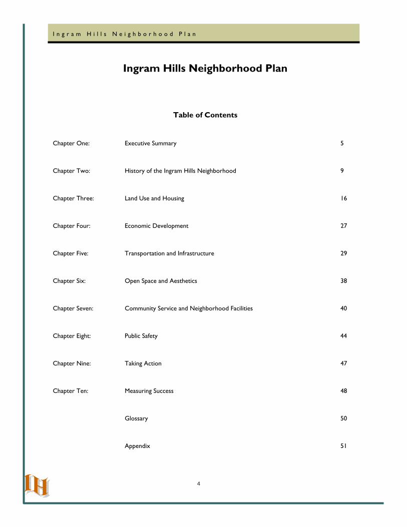
Ingram Hills Neighborhood Plan
Table of Contents
Chapter One: Executive Summary 5
Chapter Two: History of the Ingram Hills Neighborhood 9
Chapter Three: Land Use and Housing 16
Chapter Four: Economic Development 27
Chapter Five: Transportation and Infrastructure 29
Chapter Six: Open Space and Aesthetics 38
Chapter Seven: Community Service and Neighborhood Facilities 40
Chapter Eight: Public Safety 44
Chapter Nine: Taking Action 47
Chapter Ten: Measuring Success 48
Glossary 50
Appendix 51
5
I n g r a m H i l l s N e i g h b o r h o o d P l a n
Chapter One:
Executive Summary
Neighborhood Based Planning
Developed by neighbors, businesses, community groups and other interested groups, the Ingram Hills
Neighborhood Plan is based on the Community Building and Neighborhood Planning (CBNP) Program, approved by City Council in October 1998, and amended February 2001. This plan serves as an update to the original
Ingram Hills Neighborhood Plan that was adopted by City Council on June 4, 1992.
The Ingram Hills Neighborhood was selected for master planning services through a competitive application
process. The plan update committee had drafted updates to the plan’s text in 2006-2007. In October 2008, a Planning Team was organized to begin work on the land use plan element. Seven Planning Team meetings were
held between October and March. The plan text was reformatted per the CBNP process to reflect goals, objectives and action steps for each plan chapter. A neighborhood open house was held on March 2, 2009 to
provide an opportunity for all property owners and interested citizens to comment on the draft plan. Fifty-eight persons in attendance.
Community Outreach included direct mailings, flyers, press release, and the neighborhood association. Meeting notices were mailed to recorded lot owners and targeted stakeholders. The meeting was also advertised in the
neighborhood association’s newsletter.
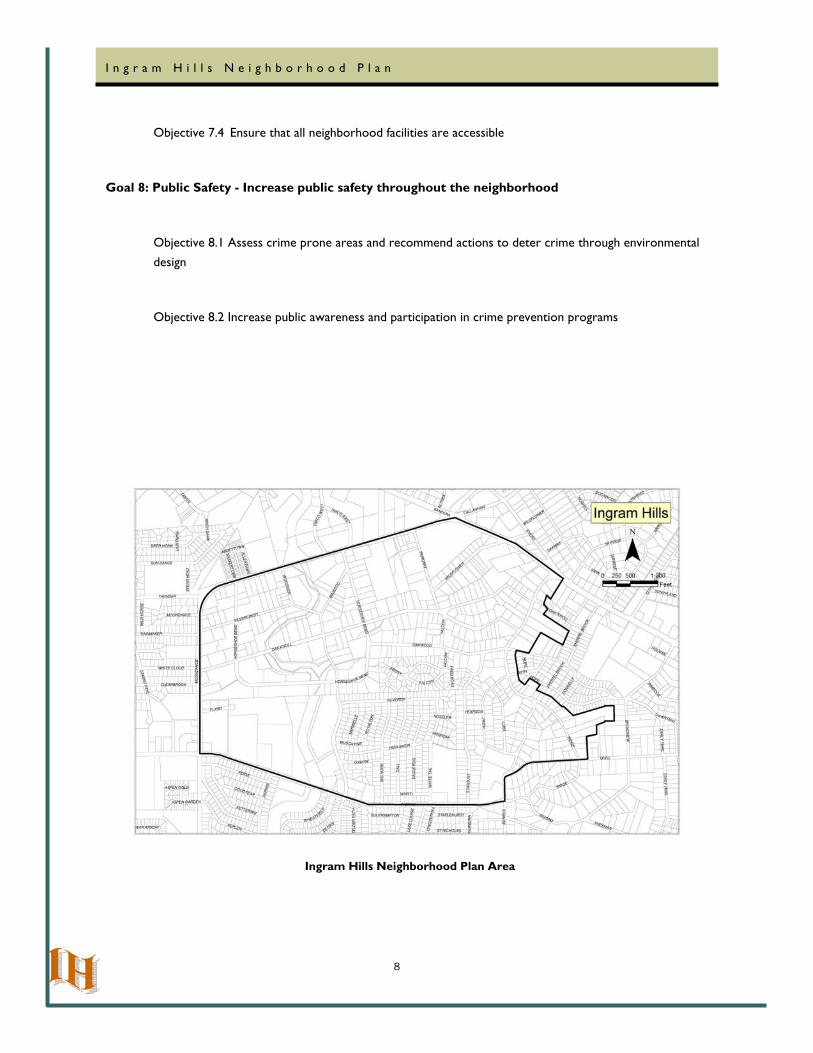
Planning Area Characteristics
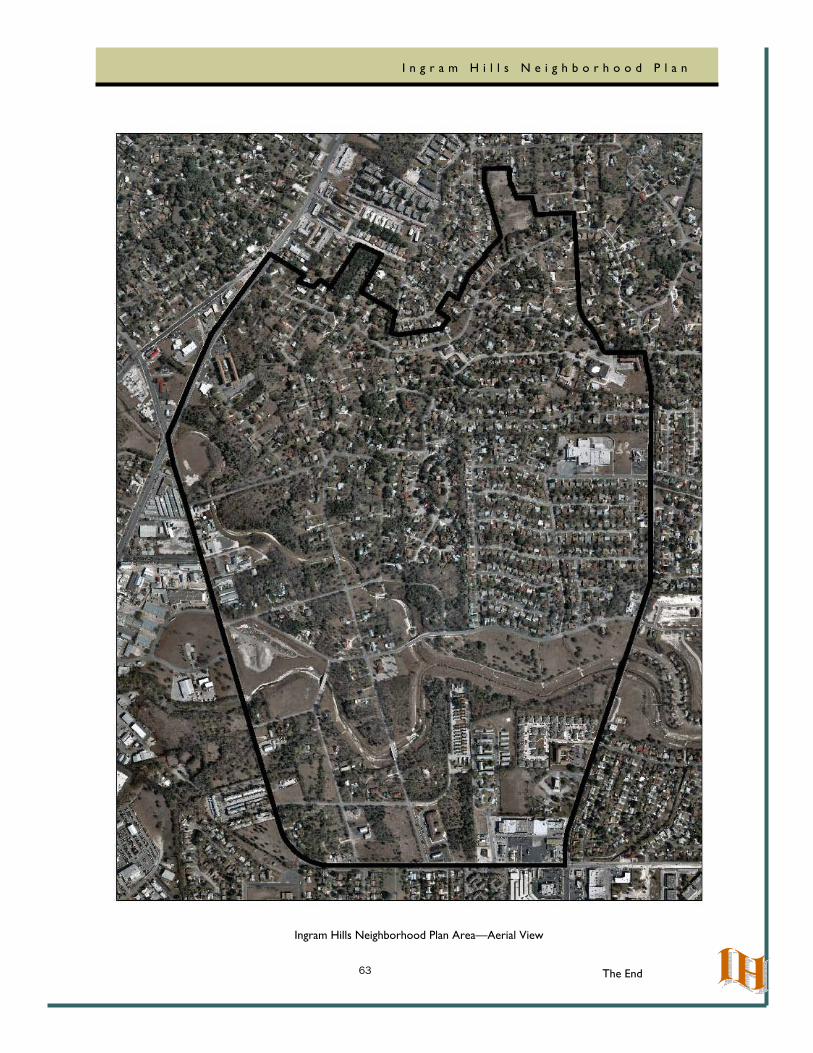
The 0.9905 square mile planning area is generally bound by Bandera Road on the north, the properties fronting Benrus Boulevard and Ridge Road on the east, Ingram Road and Quill Road on the south, and Callaghan Road on
the west. This area has a total property value of $100 million. According to 2000 US Census data, Census Tract 1805.01 contained a total of 5,231 persons (See Appendix A for population characteristics). The majority of the planning area falls within the Ingram Hills Neighborhood Association boundary. A small portion of the planning
area falls within the Woodlawn Hills Neighborhood Association along Benrus and Ridge.
Recognition by the City of San Antonio
The Ingram Hills Neighborhood Plan is forwarded to the Planning Commission for recommendation. The Planning Commission reviews the document to ensure the plan is inclusive, consistent with city policies and an accurate
6
I n g r a m H i l l s N e i g h b o r h o o d P l a n
reflection of the neighborhood’s values. After Planning Commission recommendation, the plan is presented to City Council for adoption as a component of the City’s Master Plan. An approved plan is used by elected officials, city departments, boards and commissions as a guide for decision making. Key projects may be selected from the
plan to be included in the Annual Improvement Project Report. This report is recommended to City Council as a part of the budget process, although there is no guarantee of funding.
Consistency with Other Plans
The Ingram Hills Neighborhood Plan is consistent with the recommendations found in the 1997 Master Plan and
the 1978 Major Thoroughfare Plan (as amended). The plan also supports the following Master Plan Goal:
Neighborhoods, Goal 2: Strengthen the use of the Neighborhood Planning Process and Neighborhood Plans.
Plan Contents
The Plan Summary reviews the neighborhood’s goals and objectives for community improvement. Each of the following chapters of the plan (Land Use/Housing, Economic Development, Transportation/Infrastructure, Open
Space/Aesthetics, Community Services and Public Safety) contain goals, objectives, and action steps, lead partners, proposed partnerships, and proposed funding sources to achieve the neighborhood’s desired vision. The Taking
Action and Measuring Success chapters describe the process of plan implementation and provide indicators that the neighborhood will use to judge progress toward the neighborhood’s goals.
Plan Summary
Goal 1: Housing – Preserve and enhance the neighborhood’s housing stock
Objective 1.1 Improve the quality and condition of housing within the neighborhood
Goal 2: Land Use – Maintain and preserve the large lot character of the neighborhood, keep existing medium and high density residential uses to provide a housing mix, and discourage incompatible development
Objective 2.1 Monitor zoning changes and Board of Adjustment variances and special exceptions
Objective 2.2 Monitor construction work in Neighborhood Conservation District
7
I n g r a m H i l l s N e i g h b o r h o o d P l a n
Goal 3: Economic Development - Support a healthy mix of commercial uses that serve the needs of the neighborhood
Objective 3.1 Continue to encourage area businesses to increase their participation in neighborhood
activity.
Goal 4: Transportation - Create a safe and attractive transportation system for motorists, pedestrians, bicyclists, and bus riders
Objective 4.1 Expand and enhance the pedestrian circulation system
Objective 4.2 Make traffic and street improvements to the street system to enhance transportation safety
Objective 4.3 Coordinate with VIA Metropolitan Transit to enhance bus ridership
Goal 5: Drainage - Assess storm water management and determine appropriate mitigation to improve safety and alleviate draining problems
Objective 5.1 Request that Public Works or CIMS verify efficiency of drainage infrastructure
Goal 6: Open Space/Aesthetics - Maintain and enhance open space and community aesthetics
Objective 6.1 Encourage and promote continued support of and participation in IHNA and COSA clean-up activities
Objective 6.2 Increase open space throughout neighborhood
Goal 7: Community Service/Facilities - Cultivate support for Community Service and the improvement of Neighborhood Facilities
Objective 7.1 Encourage neighborhood participation in the development of facilities for the Ingram Hills
Park and other future park and green space projects
Objective 7.2 Network with adjoining neighborhood associations to leverage public support for community projects
Objective 7.3 Partner with schools to improve educational attainment
8
I n g r a m H i l l s N e i g h b o r h o o d P l a n
Objective 7.4 Ensure that all neighborhood facilities are accessible
Goal 8: Public Safety - Increase public safety throughout the neighborhood
Objective 8.1 Assess crime prone areas and recommend actions to deter crime through environmental
design
Objective 8.2 Increase public awareness and participation in crime prevention programs
Ingram Hills Neighborhood Plan Area
9
I n g r a m H i l l s N e i g h b o r h o o d P l a n
Chapter Two:
History of the Ingram Hills Planning Area
Organized in January 1988, the Ingram Hills Neighborhood Association (herein after “IHNA”) is a duly registered,
non-profit, incorporated, voluntary neighborhood association with established By-Laws. The IHNA is bounded by Ingram Road and Quill Road on the south, Callaghan Road on the west, Bandera Road on the north, and Benrus
Boulevard and Ridge Road on the east. IHNA was formerly known as the Woodlawn Hills Neighborhood Action Association (WHNAA). The Certificate of Amendment, issued by the Texas Secretary of State on February 24,
1997, serves as legal validation of the change of name.
IHNA’s Board of Directors is comprised of five (5) Elected Officers: President, Vice-President, Secretary, Treasurer, and Historian; and eleven (11) Appointed Committee Chairpersons: Land Use/Zoning/Planning, Anti-
Graffiti, Cellular on Patrol, Code Compliance, Adopt-A-Shelter, Newsletter, Fund Raiser, Neighborhood Clean-Ups, Special Events, Membership, and Telephone Help Line. An annual election is held each November at a
scheduled and publicly announced general meeting.
IHNA membership has no required fee and is open to neighborhood/area residents and property/business owners. All IHNA funds are derived from fund raising endeavors, newsletter sponsorships, and personal donations. IHNA
promotes membership awareness of neighborhood/general area/community-at-large proposals/happenings/events and Association’s endeavors and activities by outreach efforts such as:
• IHNA monthly meetings on the first Monday of each month;
• Publishing and distributing monthly newsletters;
• Establishing an IHNA Telephone “Help Line” Program;
• Instituting a neighborhood Cellular on Patrol Program;
• Increasing participation in neighborhood zoning and planning efforts;
• Working with the City of San Antonio (COSA) to become the city’s third Neighborhood
Conservation District (NCD);
• Promoting civic engagement and discussion on community issues
Upon its organization, monthly meetings were held in neighborhood homes and area offices. Work groups formed
to put forth efforts for the betterment of the neighborhood. Through these efforts, the need for protection and action to address neighborhood concerns was recognized. and the District 7 City Council member was contacted
to obtain assistance.
On March 16, 1989, in coordination with the City of San Antonio (COSA) Planning Department, the IHNA held its
10
I n g r a m H i l l s N e i g h b o r h o o d P l a n
first required public meeting to discuss the development of a neighborhood plan. The association objectives were to:
1) Research particular areas of concern, develop goals, recommendations, and action plans and,
2) Inform the residents and COSA decision makers regarding major issues.
Subsequently, a seventeen member Planning Committee comprised of neighborhood residents, property owners, businesses, and institutional representatives was formed and approved by the Director of Planning. The Planning
Committee was instrumental in formulating short and long term strategies to improve the neighborhood, prioritizing projects to carry out strategies, and in conducting second and third public meetings (May 8, 1991 and
November 20, 1991 respectively) to solicit additional feedback from area residents. The IHNA Master Plan was passed and approved by the City of San Antonio (COSA) Planning Commission on May 27, 1992 (Resolution No. 92-95-03). The neighborhood plan was recognized, passed and approved by COSA City Council on June 4, 1992
(Resolution No. 92-24-20).
In 1994 the Association became the Ingram Hills Neighborhood Association (IHNA). Today approximately 900 members belong to the IHNA.
It is of particular note that IHNA remains a free voluntary neighborhood association open to all who reside, own
property, or own businesses in the neighborhood with no dues collected from our members. The IHNA budget comes from its own fundraising events.
The IHNA holds regular meetings the first Monday of each month, and distributes a monthly newsletter informing Association Members of neighborhood concerns, events, and meetings.
Early History of Ingram Hills
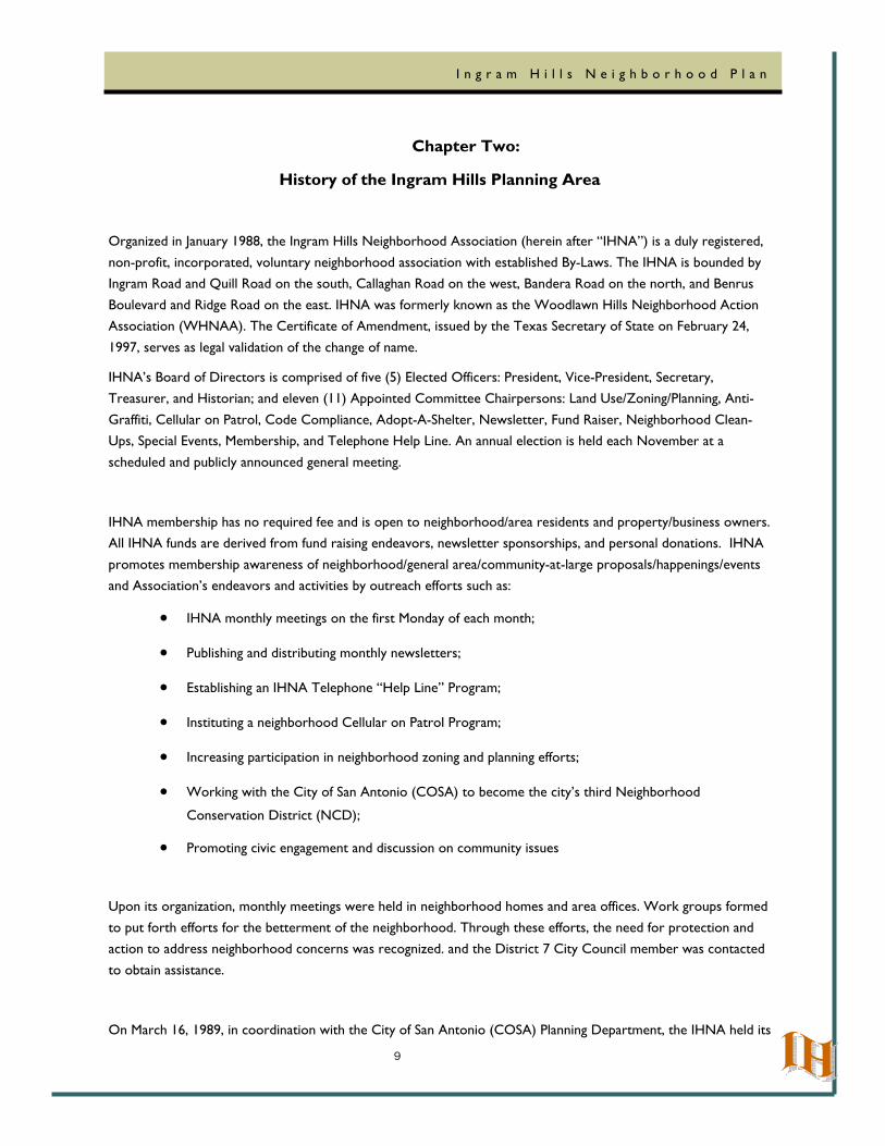
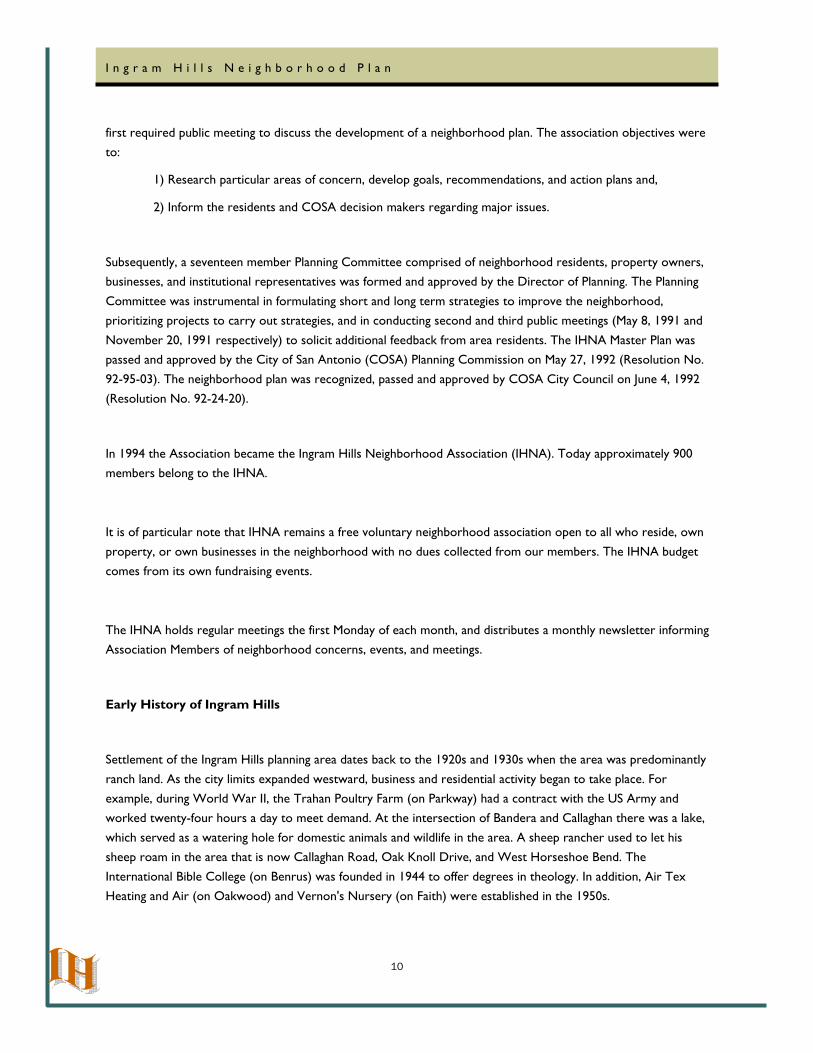
Settlement of the Ingram Hills planning area dates back to the 1920s and 1930s when the area was predominantly
ranch land. As the city limits expanded westward, business and residential activity began to take place. For example, during World War II, the Trahan Poultry Farm (on Parkway) had a contract with the US Army and worked twenty-four hours a day to meet demand. At the intersection of Bandera and Callaghan there was a lake,
which served as a watering hole for domestic animals and wildlife in the area. A sheep rancher used to let his sheep roam in the area that is now Callaghan Road, Oak Knoll Drive, and West Horseshoe Bend. The
International Bible College (on Benrus) was founded in 1944 to offer degrees in theology. In addition, Air Tex Heating and Air (on Oakwood) and Vernon's Nursery (on Faith) were established in the 1950s.
11
I n g r a m H i l l s N e i g h b o r h o o d P l a n
Trahan Turkey Farm
Trahan Site—1951
12
I n g r a m H i l l s N e i g h b o r h o o d P l a n
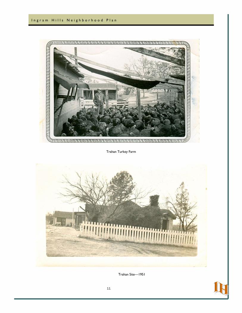
In September 1952, the City of San Antonio annexed an 80 square mile area including the Woodlawn Hills/Ingram Hills area (Ordinance No. 18115). Many historic homes in the neighborhood were built well before the 1950s and
city annexation and expansion with the accompanying services accelerated development in the neighborhood with many families buying large lots and building homes. That trend continued into the early 1970s when the Federal
Emergency Management Agency (FEMA) imposed restrictions which halted new development on East Horseshoe Bend, South Horseshoe Bend, Oak Knoll Drive, Silvercrest Drive, Majestic Drive and Woodside Drive.
Vernon’s Nursery, established in the 1950s, was the only commercial business on the interior of the planning area until it declared bankruptcy in 2005. Vernon’s coexisted well with the Ingram Hills Neighborhood. With six acres
of beautifully landscaped land, an aviary of exotic birds, and a small parking area, it was a park for locals, a local attraction, and a quiet small business, that the neighborhood will miss. The Vernon’s property is zoned residential,
and is currently platted as one-half acre lots.
The late 1970s and 1980s saw the development of the Thunderbird Village, where lot sizes range from 8,000 to 10,000 square feet. In the 1980s the Falcon Drive, Ebony Drive, and Lura Lane area was developed.
Trahan Site—Modern Day
13
I n g r a m H i l l s N e i g h b o r h o o d P l a n
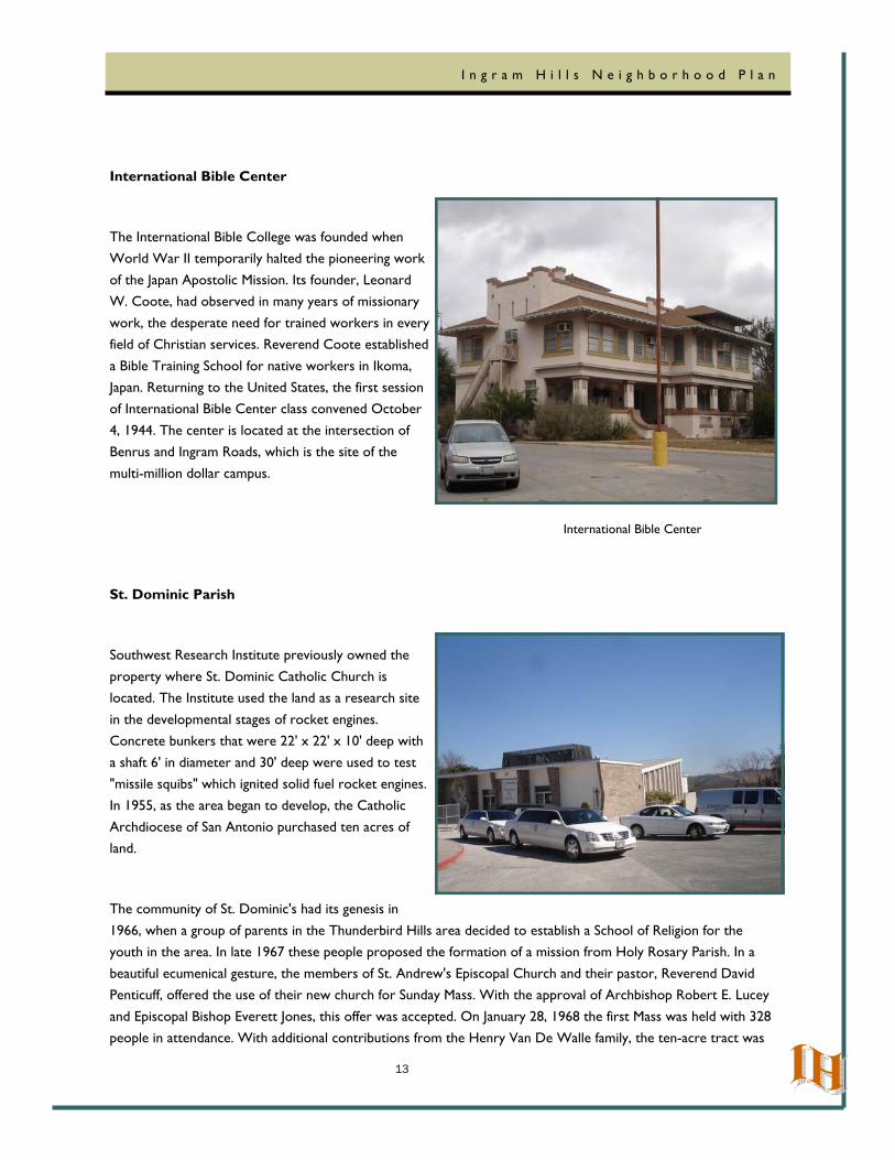
International Bible Center
The International Bible College was founded when World War II temporarily halted the pioneering work
of the Japan Apostolic Mission. Its founder, Leonard W. Coote, had observed in many years of missionary
work, the desperate need for trained workers in every field of Christian services. Reverend Coote established
a Bible Training School for native workers in Ikoma, Japan. Returning to the United States, the first session of International Bible Center class convened October
4, 1944. The center is located at the intersection of Benrus and Ingram Roads, which is the site of the
multi-million dollar campus.
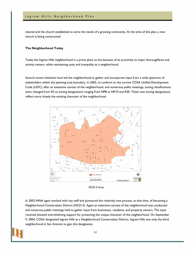
St. Dominic Parish
Southwest Research Institute previously owned the
property where St. Dominic Catholic Church is located. The Institute used the land as a research site
in the developmental stages of rocket engines. Concrete bunkers that were 22' x 22' x 10' deep with
a shaft 6' in diameter and 30' deep were used to test "missile squibs" which ignited solid fuel rocket engines.
In 1955, as the area began to develop, the Catholic Archdiocese of San Antonio purchased ten acres of land.
The community of St. Dominic's had its genesis in
1966, when a group of parents in the Thunderbird Hills area decided to establish a School of Religion for the youth in the area. In late 1967 these people proposed the formation of a mission from Holy Rosary Parish. In a
beautiful ecumenical gesture, the members of St. Andrew's Episcopal Church and their pastor, Reverend David Penticuff, offered the use of their new church for Sunday Mass. With the approval of Archbishop Robert E. Lucey
and Episcopal Bishop Everett Jones, this offer was accepted. On January 28, 1968 the first Mass was held with 328 people in attendance. With additional contributions from the Henry Van De Walle family, the ten-acre tract was
International Bible Center
14
I n g r a m H i l l s N e i g h b o r h o o d P l a n
cleared and the church established to serve the needs of a growing community. At the time of this plan, a new church is being constructed.
The Neighborhood Today
Today the Ingram Hills neighborhood is a prime place to live because of its proximity to major thoroughfares and activity centers, while maintaining unity and tranquility as a neighborhood.
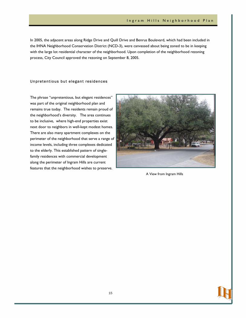
Several recent initiatives have led the neighborhood to gather and incorporate input from a wide spectrum of
stakeholders within the planning area boundary. In 2002, to conform to the current COSA Unified Development Code (UDC), after an extensive canvass of the neighborhood, and numerous public meetings, zoning classifications were changed from R5 to zoning designations ranging from NP8 to NP10 and R20. These new zoning designations
reflect more closely the existing character of the neighborhood.
In 2003 IHNA again worked with city staff and pioneered the relatively new process, at that time, of becoming a
Neighborhood Conservation District (NCD-3). Again an extensive canvass of the neighborhood was conducted and numerous public meetings held to gather input from businesses, residents, and property owners. The input
received showed overwhelming support for protecting the unique character of the neighborhood. On September 9, 2004, COSA designated Ingram Hills as a Neighborhood Conservation District. Ingram Hills was only the third neighborhood in San Antonio to gain this designation.
NCD-3 Area
15
I n g r a m H i l l s N e i g h b o r h o o d P l a n
In 2005, the adjacent areas along Ridge Drive and Quill Drive and Benrus Boulevard, which had been included in the IHNA Neighborhood Conservation District (NCD-3), were canvassed about being zoned to be in keeping with the large lot residential character of the neighborhood. Upon completion of the neighborhood rezoning
process, City Council approved the rezoning on September 8, 2005.
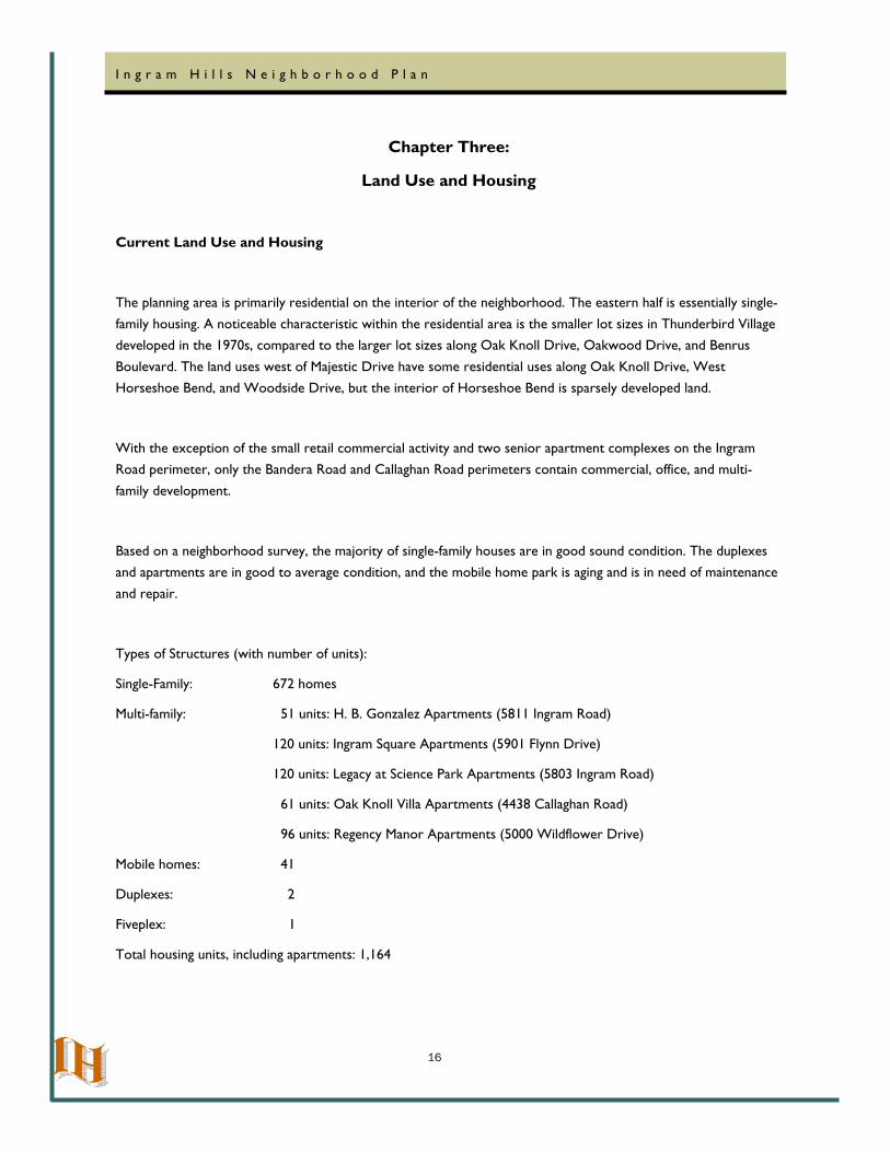
Unpretent ious but e legant res idences
The phrase “unpretentious, but elegant residences”
was part of the original neighborhood plan and remains true today. The residents remain proud of
the neighborhood’s diversity. The area continues to be inclusive, where high-end properties exist next door to neighbors in well-kept modest homes.
There are also many apartment complexes on the perimeter of the neighborhood that serve a range of
income levels, including three complexes dedicated to the elderly. This established pattern of single-
family residences with commercial development along the perimeter of Ingram Hills are current
features that the neighborhood wishes to preserve.
A View from Ingram Hills
16
I n g r a m H i l l s N e i g h b o r h o o d P l a n
Chapter Three:
Land Use and Housing
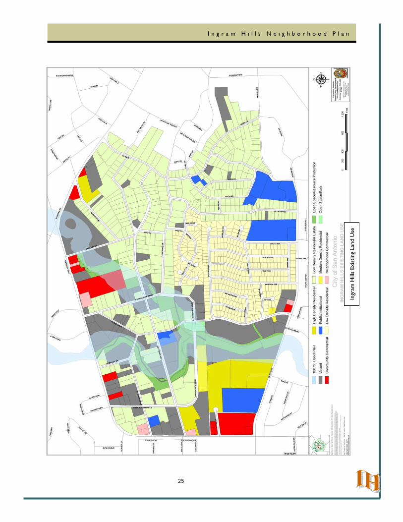
Current Land Use and Housing
The planning area is primarily residential on the interior of the neighborhood. The eastern half is essentially single-
family housing. A noticeable characteristic within the residential area is the smaller lot sizes in Thunderbird Village developed in the 1970s, compared to the larger lot sizes along Oak Knoll Drive, Oakwood Drive, and Benrus
Boulevard. The land uses west of Majestic Drive have some residential uses along Oak Knoll Drive, West Horseshoe Bend, and Woodside Drive, but the interior of Horseshoe Bend is sparsely developed land.
With the exception of the small retail commercial activity and two senior apartment complexes on the Ingram Road perimeter, only the Bandera Road and Callaghan Road perimeters contain commercial, office, and multi-
family development.
Based on a neighborhood survey, the majority of single-family houses are in good sound condition. The duplexes and apartments are in good to average condition, and the mobile home park is aging and is in need of maintenance
and repair.
Types of Structures (with number of units):
Single-Family: 672 homes
Multi-family: 51 units: H. B. Gonzalez Apartments (5811 Ingram Road)
120 units: Ingram Square Apartments (5901 Flynn Drive)
120 units: Legacy at Science Park Apartments (5803 Ingram Road)
61 units: Oak Knoll Villa Apartments (4438 Callaghan Road)
96 units: Regency Manor Apartments (5000 Wildflower Drive)
Mobile homes: 41
Duplexes: 2
Fiveplex: 1
Total housing units, including apartments: 1,164
17
I n g r a m H i l l s N e i g h b o r h o o d P l a n
Land Use Classifications—Table 1
18
I n g r a m H i l l s N e i g h b o r h o o d P l a n
19
I n g r a m H i l l s N e i g h b o r h o o d P l a n
20
I n g r a m H i l l s N e i g h b o r h o o d P l a n
21
I n g r a m H i l l s N e i g h b o r h o o d P l a n
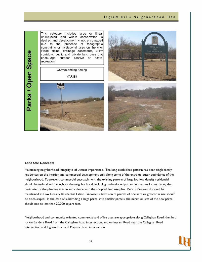
Land Use Concepts
Maintaining neighborhood integrity is of utmost importance. The long established pattern has been single-family
residences on the interior and commercial development only along some of the extreme outer boundaries of the neighborhood. To prevent commercial encroachment, the existing pattern of large lot, low density residential
should be maintained throughout the neighborhood, including undeveloped parcels in the interior and along the perimeter of the planning area in accordance with the adopted land use plan. Benrus Boulevard should be
maintained as Low Density Residential Estate. Likewise, subdivision of parcels of one acre or greater in size should be discouraged. In the case of subdividing a large parcel into smaller parcels, the minimum size of the new parcel
should not be less than 20,000 square feet.
Neighborhood and community oriented commercial and office uses are appropriate along Callaghan Road; the first
lot on Bandera Road from the Callaghan Road intersection; and on Ingram Road near the Callaghan Road intersection and Ingram Road and Majestic Road intersection.
22
I n g r a m H i l l s N e i g h b o r h o o d P l a n
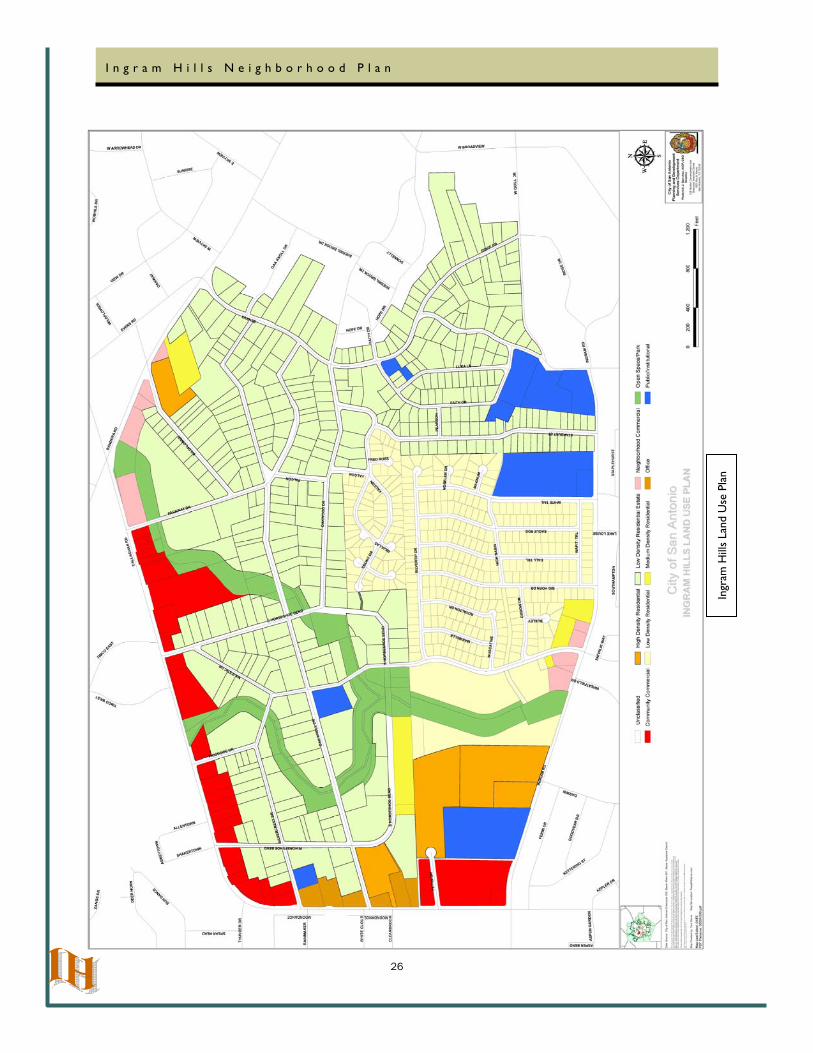
Land Use Plan
The land use plan identifies the preferred land development pattern for the Ingram Hills Neighborhood planning
area. The location of different land uses is based on existing uses, community discussions and policies from the City’s Master Plan. Each land use classification is described in Table 1.
After City Council approval of the Ingram Hills Neighborhood Plan, the Planning and Development Services Department will consult the Land Use Plan as a guide for developing staff recommendations on individual zoning
cases. A comprehensive plan shall not constitute zoning regulations or establishing zoning district boundaries.
Goal 1: Housing – Preserve and enhance the neighborhood’s housing stock
Objective 1.1 Improve the quality and condition of housing within the neighborhood
1.1.1 Continue to promote and educate residents of programs available to assist owner-occupied households in upgrading existing properties and/or in purchasing/
constructing new homes in the neighborhood
Lead: Land Use/Housing Committee
Timeline: Short-Long
Partnerships: Housing and Neighborhood Services
Funding: current programs, First Time Home Buyers Club, Down Payment Assistance Program
1.1.2 Continue to request that neighborhood home/property owners maintain homes/properties in compliance with city codes
Lead: Land Use/Housing Committee
Timeline: Short-Long
Partnerships: Code Compliance, Housing and Neighborhood Services
Funding: current programs
1.1.3 Promote the dissemination of information of COSA codes and regulations and compliance to home and property owners, e.g., letters, flyers, newsletters
Lead: Land Use/Housing Committee
Timeline: Short-Long
Partnerships: Code Compliance, Housing and Neighborhood Services

23
I n g r a m H i l l s N e i g h b o r h o o d P l a n
Funding: current programs
1.1.4 Promote future development of homes to reflect the current trend of single-family residences, in accordance with NCD-3 guidelines
Lead: Land Use/Housing Committee
Timeline: Short-Long
Partnerships: Code Compliance
Funding: current programs
1.1.5 Work to ensure that the property formerly occupied by Vernon’s Nursery (see
Chapter 2) will be developed as residential lots of at least one half acre in keeping with the existing character of the neighborhood
Lead: Land Use /Housing Committee
Timeline: Short – Mid (1-5 years)
Partnerships: Planning and Development Services
Funding: N/A
Goal 2: Land Use – Maintain and preserve the large lot character of the neighborhood, keep existing medium and high density residential uses to provide a housing mix, and discourage incompatible development
Objective 2.1 Monitor zoning changes and Board of Adjustment variances and special exceptions
2.1.1 Attend public hearings to express neighborhood’s concerns and position
regarding the case.
Lead: Land Use /Housing Committee
Timeline: On-going
Partnerships: Planning and Development Services
Funding Sources: existing programs
Objective 2.2 Monitor construction work in Neighborhood Conservation District
2.2.1 Report Neighborhood Conservation District violations to 311 and the Planning
24
I n g r a m H i l l s N e i g h b o r h o o d P l a n
and Development Services Department
Lead: Land Use /Housing Committee
Timeline: On-going
Partnerships: Planning and Development Services
Funding Sources: existing programs
Home Buyers’ Club
The Housing and Neighborhood Services Department (HNSD) coordinates this program. The Homebuyers’ Club Program addresses important questions about homeownership and home financing and more. The HNSD
Homebuyers’ Club Program is a structured consumer education program, which covers the entire home buying process in an 8 hour in-depth training . The Homebuyers’ Club Program is free of charge and open to the general
public.
Homeownership Incentive Program
The Homeownership Incentive Program (HIP) assists eligible persons who are buying a new or existing home within the city limits of San Antonio. Buyers must have a stable employment, good credit and able to afford a mortgage payment. If you do not have good credit, you may qualify for a mortgage by working with HNSD’s Housing Loan Officer. HIP funds may cover the required down payment, closing costs and prepaid interest of
your home purchase.
25
I n g r a m H i l l s N e i g h b o r h o o d P l a n
Ingr
am H
ills
Exist
ing
Land
Use
26
I n g r a m H i l l s N e i g h b o r h o o d P l a n
Ingr
am H
ills
Land
Use
Pla
n
27
I n g r a m H i l l s N e i g h b o r h o o d P l a n
Chapter Four:
Economic Development
The commercial activity of the neighborhood is dotted along the perimeter of the planning area. Callaghan Square,
at the corner of Ingram and Callaghan Roads, contains a mix of office, retail, food, and service—including professional—businesses. Along Callaghan there are thirteen businesses: five food establishments, one dental office, one auto repossession/sales business, and six involve light industrial activities. On Ingram Road, there are
five businesses: three retail, one office, and one food establishment.
There is commercial development along Ingram, Callaghan, and Bandera Roads immediately outside the planning area, providing additional consumer goods and services.
The neighborhood has a working relationship with area business managers and professionals in dealing with problems such as: noise from business activities, litter in the parking lots and along the area streets, and vandalism
of property.
Goal 3: Economic Development - Support a healthy mix of commercial uses that serve the needs of the neighborhood
Objective 3.1 Continue to encourage area businesses to increase their participation in neighborhood activity
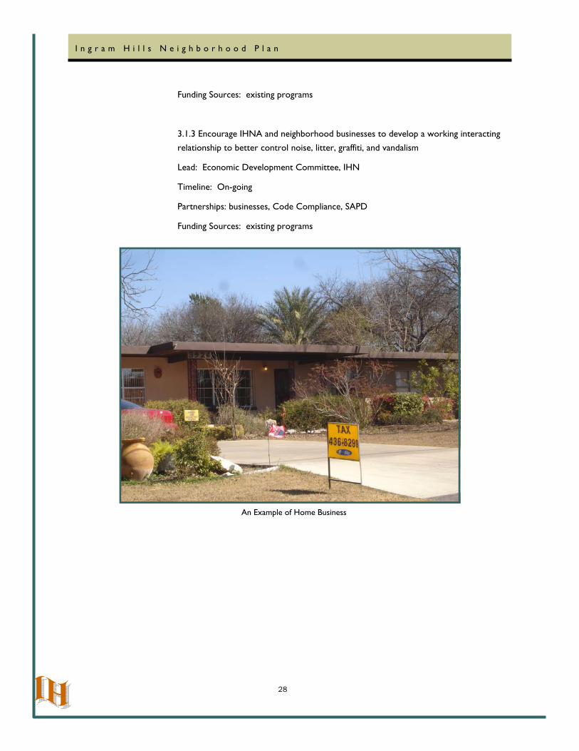
3.1.1 Allow use of Home Occupation for professional services (e.g. accounting office) as
long as the residential character is maintained
Lead: Land Use/Housing Committee
Timeline: On-going
Partnerships: Planning and Development Services
Funding Sources: Existing programs
3.1.2 Develop commercial district design guidelines for Callaghan Road to promote
architectural design in compliance with NCD-3
Lead: Economic Development Committee, Land Use/Housing Committee.
Timeline: On-going
Partnerships: Planning and Development Services
28
I n g r a m H i l l s N e i g h b o r h o o d P l a n
Funding Sources: existing programs
3.1.3 Encourage IHNA and neighborhood businesses to develop a working interacting
relationship to better control noise, litter, graffiti, and vandalism
Lead: Economic Development Committee, IHN
Timeline: On-going
Partnerships: businesses, Code Compliance, SAPD
Funding Sources: existing programs
An Example of Home Business
29
I n g r a m H i l l s N e i g h b o r h o o d P l a n
Chapter 5: Transportation and Infrastructure
Road and Vehicular Circulation: Exterior Streets
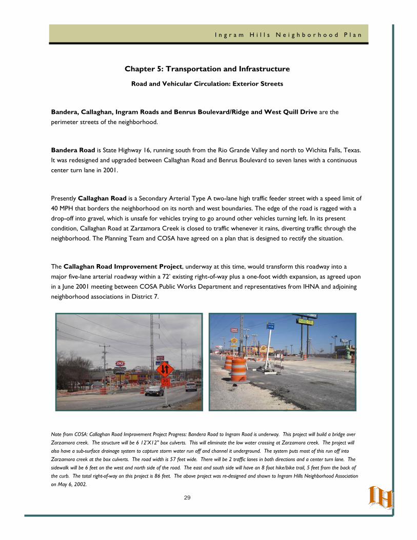
Bandera, Callaghan, Ingram Roads and Benrus Boulevard/Ridge and West Quill Drive are the perimeter streets of the neighborhood.
Bandera Road is State Highway 16, running south from the Rio Grande Valley and north to Wichita Falls, Texas. It was redesigned and upgraded between Callaghan Road and Benrus Boulevard to seven lanes with a continuous
center turn lane in 2001.
Presently Callaghan Road is a Secondary Arterial Type A two-lane high traffic feeder street with a speed limit of 40 MPH that borders the neighborhood on its north and west boundaries. The edge of the road is ragged with a
drop-off into gravel, which is unsafe for vehicles trying to go around other vehicles turning left. In its present condition, Callaghan Road at Zarzamora Creek is closed to traffic whenever it rains, diverting traffic through the neighborhood. The Planning Team and COSA have agreed on a plan that is designed to rectify the situation.
The Callaghan Road Improvement Project, underway at this time, would transform this roadway into a
major five-lane arterial roadway within a 72’ existing right-of-way plus a one-foot width expansion, as agreed upon in a June 2001 meeting between COSA Public Works Department and representatives from IHNA and adjoining
neighborhood associations in District 7.
Note from COSA: Callaghan Road Improvement Project Progress: Bandera Road to Ingram Road is underway. This project will build a bridge over Zarzamora creek. The structure will be 6 12'X12" box culverts. This will eliminate the low water crossing at Zarzamora creek. The project will also have a sub-surface drainage system to capture storm water run off and channel it underground. The system puts most of this run off into Zarzamora creek at the box culverts. The road width is 57 feet wide. There will be 2 traffic lanes in both directions and a center turn lane. The sidewalk will be 6 feet on the west and north side of the road. The east and south side will have an 8 foot hike/bike trail, 5 feet from the back of the curb. The total right-of-way on this project is 86 feet. The above project was re-designed and shown to Ingram Hills Neighborhood Association on May 6, 2002.
30
I n g r a m H i l l s N e i g h b o r h o o d P l a n
Ingram Road and West Quill Drive are Secondary Arterial Type B in the City’s Master Thoroughfare Plan. The improvement plans were completed in 1995. To date, the design recommended by the Ingram Hills Neighborhood has not been implemented. The Planning Team continues to recommend that Ingram Road be
striped with a continuous center turn lane from White Tail Drive to Benrus Boulevard to be consistent with improvements from Callaghan Road to White Tail Drive.
Note from COSA: There was a Bike lane project on Ingram road from Callaghan to Benrus, which was completed in approximately May of 2008. This project placed new striping for a 5 foot bike lane with no road construction. The pavement width varies but is too narrow to have a center turn lane from White Tail to Benrus. A street reconstruction project along with a funding source would be required to accomplish this goal.
Benrus Boulevard and Ridge Drive have major drainage, surface, and utility pole problems. All along Benrus Boulevard and Ridge Drive, there are scars where potholes have been repeatedly covered or previous work under
the street has left uneven patchwork. They are narrow streets with sharp curves and dangerous intersections; traffic on these streets generally travels too fast for the present conditions. There are also power poles that are
now too close to the traffic lane and need to be moved farther away from the street. At many places, the streets act as dams that seal off drainage, causing flooding of property and homes.
The Planning Team recommends that Benrus Boulevard and Ridge Drive be completely and thoughtfully
reconstructed with neighborhood input to resolve all these major problems.
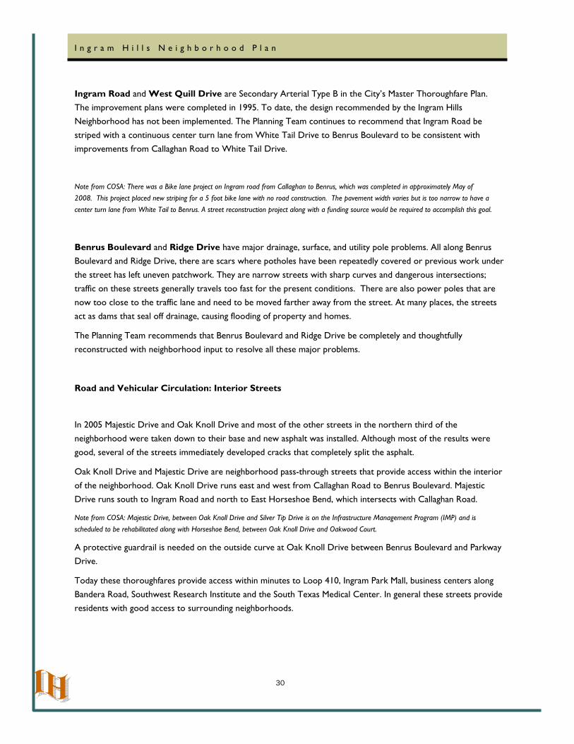
Road and Vehicular Circulation: Interior Streets
In 2005 Majestic Drive and Oak Knoll Drive and most of the other streets in the northern third of the neighborhood were taken down to their base and new asphalt was installed. Although most of the results were
good, several of the streets immediately developed cracks that completely split the asphalt.
Oak Knoll Drive and Majestic Drive are neighborhood pass-through streets that provide access within the interior
of the neighborhood. Oak Knoll Drive runs east and west from Callaghan Road to Benrus Boulevard. Majestic Drive runs south to Ingram Road and north to East Horseshoe Bend, which intersects with Callaghan Road.
Note from COSA: Majestic Drive, between Oak Knoll Drive and Silver Tip Drive is on the Infrastructure Management Program (IMP) and is scheduled to be rehabilitated along with Horseshoe Bend, between Oak Knoll Drive and Oakwood Court.
A protective guardrail is needed on the outside curve at Oak Knoll Drive between Benrus Boulevard and Parkway
Drive.
Today these thoroughfares provide access within minutes to Loop 410, Ingram Park Mall, business centers along
Bandera Road, Southwest Research Institute and the South Texas Medical Center. In general these streets provide residents with good access to surrounding neighborhoods.
31
I n g r a m H i l l s N e i g h b o r h o o d P l a n
Aside from the pass-through streets, the traffic circulation on the perimeter of the neighborhood is a desirable feature, providing the interior area with unity and tranquility as a neighborhood, and preserving the established country-like character and integrity of the planning area.
The connection of South Horseshoe Bend and East Horseshoe Bend between Majestic Drive and Oakwood Drive
was closed temporarily in 1989 and has never been re-opened, despite continual IHNA efforts to get the connection re-opened. The closed connection has become overgrown and has become a health and safety hazard
to the area, as well as an area that invites criminal activity. The Planning Team strongly recommends the re-opening of this connection, and the repair of drainage in this vicinity. Even though this road is closed to the traffic,
this area is currently being developed with single family residences.
Pedestrian Traffic
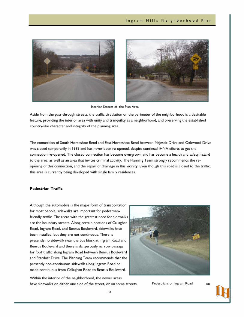
Although the automobile is the major form of transportation
for most people, sidewalks are important for pedestrian-friendly traffic. The areas with the greatest need for sidewalks
are the boundary streets. Along certain portions of Callaghan Road, Ingram Road, and Benrus Boulevard, sidewalks have
been installed, but they are not continuous. There is presently no sidewalk near the bus kiosk at Ingram Road and Benrus Boulevard and there is dangerously narrow passage
for foot traffic along Ingram Road between Benrus Boulevard and Stardust Drive. The Planning Team recommends that the
presently non-continuous sidewalk along Ingram Road be made continuous from Callaghan Road to Benrus Boulevard.
Within the interior of the neighborhood, the newer areas have sidewalks on either one side of the street, or on some streets, on
Interior Streets of the Plan Area
Pedestrians on Ingram Road
32
I n g r a m H i l l s N e i g h b o r h o o d P l a n
both sides for part of the street. The older areas have no sidewalks, but it is not of major concern to residents in these areas. The recent re-design of Callaghan Road, as agreed upon by IHNA and COSA, specifies a sidewalk only on the north side of Callaghan Road.
Mass Transit
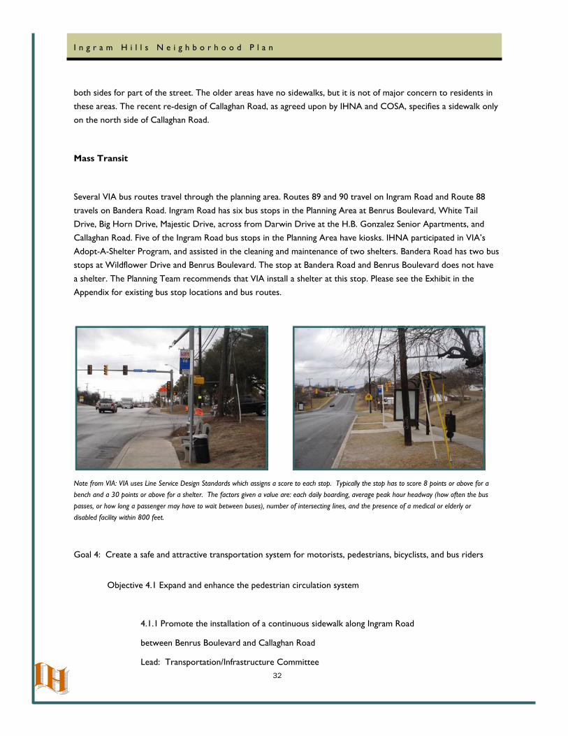
Several VIA bus routes travel through the planning area. Routes 89 and 90 travel on Ingram Road and Route 88
travels on Bandera Road. Ingram Road has six bus stops in the Planning Area at Benrus Boulevard, White Tail Drive, Big Horn Drive, Majestic Drive, across from Darwin Drive at the H.B. Gonzalez Senior Apartments, and
Callaghan Road. Five of the Ingram Road bus stops in the Planning Area have kiosks. IHNA participated in VIA’s Adopt-A-Shelter Program, and assisted in the cleaning and maintenance of two shelters. Bandera Road has two bus stops at Wildflower Drive and Benrus Boulevard. The stop at Bandera Road and Benrus Boulevard does not have
a shelter. The Planning Team recommends that VIA install a shelter at this stop. Please see the Exhibit in the Appendix for existing bus stop locations and bus routes.
Note from VIA: VIA uses Line Service Design Standards which assigns a score to each stop. Typically the stop has to score 8 points or above for a bench and a 30 points or above for a shelter. The factors given a value are: each daily boarding, average peak hour headway (how often the bus passes, or how long a passenger may have to wait between buses), number of intersecting lines, and the presence of a medical or elderly or disabled facility within 800 feet.
Goal 4: Create a safe and attractive transportation system for motorists, pedestrians, bicyclists, and bus riders
Objective 4.1 Expand and enhance the pedestrian circulation system
4.1.1 Promote the installation of a continuous sidewalk along Ingram Road
between Benrus Boulevard and Callaghan Road Lead: Transportation/Infrastructure Committee
33
I n g r a m H i l l s N e i g h b o r h o o d P l a n
Time Frame: Short - Mid
Partnerships: Public Works, CIMS
Funding Sources: Bond, Neighborhood Accessibility and Mobility Fund, CIP
Objective 4.2 Make traffic and street improvements to the street system to enhance transportation safety
4.2.1 Advocate for re-opening the overgrown connection between Majestic Drive and South Horseshoe Bend to East Horseshoe Bend and Oakwood Drive, which has been “temporarily”
closed since 1989
Lead: Transportation/Infrastructure Committee
Time Frame: Mid-Long
Partnerships: Public Works, CIMS
Funding Sources: Bond, CIP, Property Owners
4.2.2 Promote the reconstruction of Benrus Boulevard between Bandera Road and Ingram Road
which will include repositioning the utility poles further away from the street and installation of sidewalks, curbs and gutters
Lead: Transportation/Infrastructure Committee
Time Frame: Mid-Long
Partnerships: Public Works, CIMS
Funding Sources: Bond, CIP
4.2.3 Encourage edge pavement striping and sealed shoulders on Oak Knoll Drive, and re-construct Majestic Drive from East Horseshoe Bend to Oak Knoll Drive and continue on to the
north end of Tributary ‘A’ creek bridge crossing
Lead: Transportation/Infrastructure Committee
Time Frame: Short-Mid
Partnerships: Public Works
Funding Sources: General Funds for Road Maintenance
4.2.4 Promote the re-construction of Oak Knoll Drive from Benrus Boulevard to Callaghan
Road
Lead: Transportation/Infrastructure Committee
34
I n g r a m H i l l s N e i g h b o r h o o d P l a n
Time Frame: Mid-Long
Partnerships: Public Works, CIMS
Funding Sources: Bond, CIP
4.2.5 Work with the Public Works Department to seal cracks in asphalt street surfaces
throughout the neighborhood
Lead: Transportation/Infrastructure Committee
Time Frame: Short-Mid
Partnerships: Public Works
Funding Sources: General Funds for Road Maintenance
Objective 4.3 Coordinate with VIA Metropolitan Transit to enhance bus ridership
4.3.1 Encourage the installation of a shelter at the bus stop at Bandera Road and Benrus Boulevard
Lead: Transportation/Infrastructure Committee
Time Frame: Short-Mid
Partnerships: VIA
Funding Sources: VIA, FTA, Advanced Transportation District
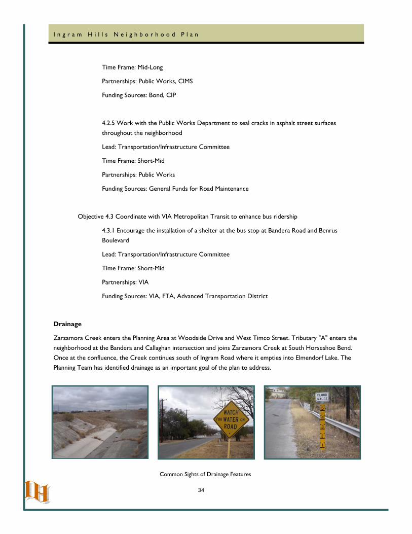
Drainage
Zarzamora Creek enters the Planning Area at Woodside Drive and West Timco Street. Tributary "A" enters the
neighborhood at the Bandera and Callaghan intersection and joins Zarzamora Creek at South Horseshoe Bend. Once at the confluence, the Creek continues south of Ingram Road where it empties into Elmendorf Lake. The
Planning Team has identified drainage as an important goal of the plan to address.
Common Sights of Drainage Features
35
I n g r a m H i l l s N e i g h b o r h o o d P l a n
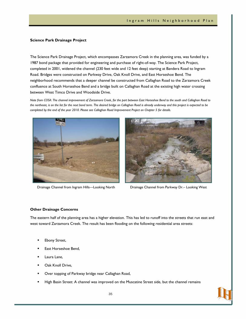
Science Park Drainage Project
The Science Park Drainage Project, which encompasses Zarzamora Creek in the planning area, was funded by a
1987 bond package that provided for engineering and purchase of right-of-way. The Science Park Project, completed in 2001, widened the channel (230 feet wide and 12 feet deep) starting at Bandera Road to Ingram
Road. Bridges were constructed on Parkway Drive, Oak Knoll Drive, and East Horseshoe Bend. The neighborhood recommends that a deeper channel be constructed from Callaghan Road to the Zarzamora Creek
confluence at South Horseshoe Bend and a bridge built on Callaghan Road at the existing high water crossing between West Timco Drive and Woodside Drive.
Note from COSA: The channel improvement of Zarzamora Creek, for the part between East Horseshoe Bend to the south and Callaghan Road to the northeast, is on the list for the next bond term. The desired bridge on Callaghan Road is already underway and this project is expected to be completed by the end of the year 2010. Please see Callaghan Road Improvement Project on Chapter 5 for details.
Other Drainage Concerns
The eastern half of the planning area has a higher elevation. This has led to runoff into the streets that run east and west toward Zarzamora Creek. The result has been flooding on the following residential area streets:
Ebony Street,
East Horseshoe Bend,
Laura Lane,
Oak Knoll Drive,
Over topping of Parkway bridge near Callaghan Road,
High Basin Street: A channel was improved on the Muscatine Street side, but the channel remains
Drainage Channel from Ingram Hills—Looking North Drainage Channel from Parkway Dr.– Looking West
36
I n g r a m H i l l s N e i g h b o r h o o d P l a n
unimproved on the Oxbow Street side, potentially contributing to foundation damage and soil erosion in residents’ back yards.
Note from COSA: City of San Antonio Storm Water officials have examined the area and found out that the channel on the Oxbow side is posing no adverse impact to the surroundings and causing no erosion. However, staff recommends cleaning the channel more frequently than currently scheduled. Over topping of Parkway Bridge near Callaghan Road will be corrected during Callaghan Road Improvements Project.
Another drainage concern is in the northwestern part of the planning area between Silvercrest Drive, West Horseshoe Bend, and Callaghan Road. The area immediately north of Callaghan Road is of higher elevation. The
runoff comes down Thunder Drive across Callaghan Road, into the planning area, adding to an already dangerous situation. This runoff crosses West Horseshoe Bend and flows across Silvercrest Drive into Zarzamora Creek.
Note form COSA: After the completion of Callaghan Road Improvement Project, most of this drainage problem will be solved by new ditches and culverts which will be placed along Callaghan Road. There will be a small natural runoff for the portion of land between Callaghan Road and Silvercrest Drive. The low crossing on Silvercrest Drive can be improved by a small (4’ x 3’) box channelization.
Majestic Drive and Oak Knoll Drive are residential through streets. Many of the streets act as dams that seal off drainage that had caused flooding of property and homes.
Goal 5: Drainage - Assess storm water management and determine appropriate mitigation to improve safety and alleviate draining problems
Objective 5.1 Request that Public Works or CIMS verify efficiency of drainage infrastructure
5.1.1 Appoint a neighborhood association Transportation/Infrastructure committee to be the
liaison between neighborhood and City government and staff to address drainage concerns
Lead: Transportation/Infrastructure Committee
Time Frame: Short
Partnerships: Public Works, Storm Water Division
Funding Sources: N/A
5.1.2 Encourage the study and improvement of a deeper channel that needs to be
constructed from Callaghan Road to the Zarzamora Creek confluence at South Horseshoe Bend and a bridge built on Callaghan Road at the existing high water crossing between West Timco
Drive and Woodside Drive
Lead: Transportation/Infrastructure Committee
37
I n g r a m H i l l s N e i g h b o r h o o d P l a n
Time Frame: Short-Long
Partnerships: Public Works, Storm Water Division, CIMS
Funding Sources: CIP, Bond
5.1.3 Encourage the study and improvement of secondary drainage problems, especially the
Oxbow Secondary Channel—as promised. Eliminate other drainage problems at Callaghan Road, Ebony Drive, Lura Lane, Oak Knoll Drive, Parkway Drive, and Wildflower Drive
Lead: Transportation/Infrastructure Committee
Time Frame: Short-Long
Partnerships: Public Works, Storm Water Division, CIMS
Funding Sources: CIP, Bond
38
I n g r a m H i l l s N e i g h b o r h o o d P l a n
Chapter Six: Open Space/Aesthetics
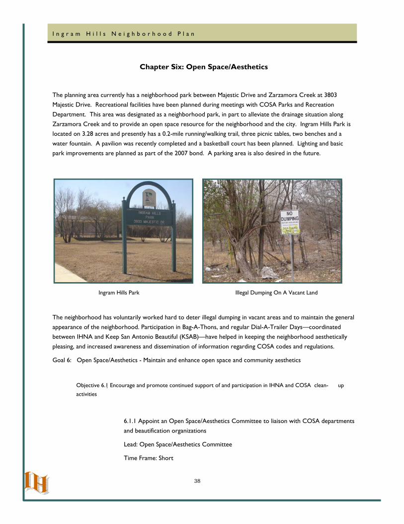
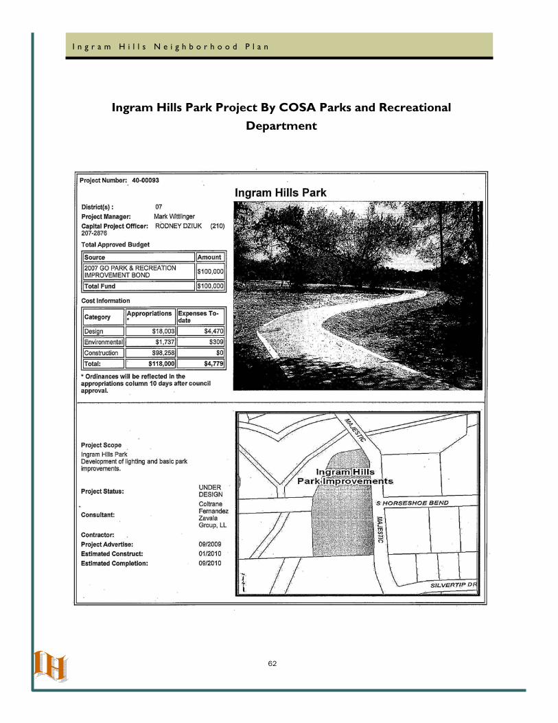
The planning area currently has a neighborhood park between Majestic Drive and Zarzamora Creek at 3803 Majestic Drive. Recreational facilities have been planned during meetings with COSA Parks and Recreation
Department. This area was designated as a neighborhood park, in part to alleviate the drainage situation along Zarzamora Creek and to provide an open space resource for the neighborhood and the city. Ingram Hills Park is located on 3.28 acres and presently has a 0.2-mile running/walking trail, three picnic tables, two benches and a
water fountain. A pavilion was recently completed and a basketball court has been planned. Lighting and basic park improvements are planned as part of the 2007 bond. A parking area is also desired in the future.
The neighborhood has voluntarily worked hard to deter illegal dumping in vacant areas and to maintain the general
appearance of the neighborhood. Participation in Bag-A-Thons, and regular Dial-A-Trailer Days—coordinated between IHNA and Keep San Antonio Beautiful (KSAB)—have helped in keeping the neighborhood aesthetically
pleasing, and increased awareness and dissemination of information regarding COSA codes and regulations.
Goal 6: Open Space/Aesthetics - Maintain and enhance open space and community aesthetics
Objective 6.1 Encourage and promote continued support of and participation in IHNA and COSA clean- up activities
6.1.1 Appoint an Open Space/Aesthetics Committee to liaison with COSA departments and beautification organizations
Lead: Open Space/Aesthetics Committee
Time Frame: Short
Ingram Hills Park Illegal Dumping On A Vacant Land
39
I n g r a m H i l l s N e i g h b o r h o o d P l a n
Partnerships: Code Compliance Division, Housing and Neighborhood Services, Keep San Antonio Beautiful, Public Works Graffiti Wipeout
Funding Sources: Current programs
Objective 6.2 Increase Open Space throughout neighborhood
6.2.1 Actively pursue additional properties for preservation of area green space to complement the Ingram Hills Park, and potential linear park along the Zarzamora
Creek channel and its tributaries between Callaghan and Ingram Roads, and between Bandera Road and Majestic Drive.
Lead: Open Space/Aesthetics Committee
Time Frame: Short-Mid
Partnerships: Parks and Recreation Department
Funding Sources: Bond, CIP, Texas Parks and Wildlife
Objective 6.3 Encourage and promote NCD-3 landscaping regulations
6.3.1 The neighborhood strongly supports the goals of the Tree and Landscaping Ordinances, in an effort to maintain the large expanses of green space and tree cover
throughout the neighborhood. Property owners are encouraged to adhere to the
Recommended Tree/Planting list, per the UDC
Lead: Open Space/Aesthetics Committee
Time Frame: Short
Partnerships: COSA Neighborhood Planning and Urban Design Section
Funding Sources: Existing Programs
40
I n g r a m H i l l s N e i g h b o r h o o d P l a n
Chapter Seven: Community Service and Neighborhood Facilities
The Ingram Hills neighborhood has a number of public and private facilities serving its residents. The public facilities provide barrier-free access for all people, including those with disabilities.
Public Schools
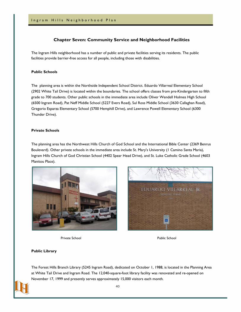
The planning area is within the Northside Independent School District. Eduardo Villarreal Elementary School
(2902 White Tail Drive) is located within the boundaries. The school offers classes from pre-Kindergarten to fifth grade to 700 students. Other public schools in the immediate area include Oliver Wendell Holmes High School (6500 Ingram Road), Pat Neff Middle School (5227 Evers Road), Sul Ross Middle School (3630 Callaghan Road),
Gregorio Esparza Elementary School (5700 Hemphill Drive), and Lawrence Powell Elementary School (6300 Thunder Drive).
Private Schools
The planning area has the Northwest Hills Church of God School and the International Bible Center (2369 Benrus Boulevard). Other private schools in the immediate area include St. Mary's University (1 Camino Santa Maria),
Ingram Hills Church of God Christian School (4402 Spear Head Drive), and St. Luke Catholic Grade School (4603 Manitou Place).
Public Library
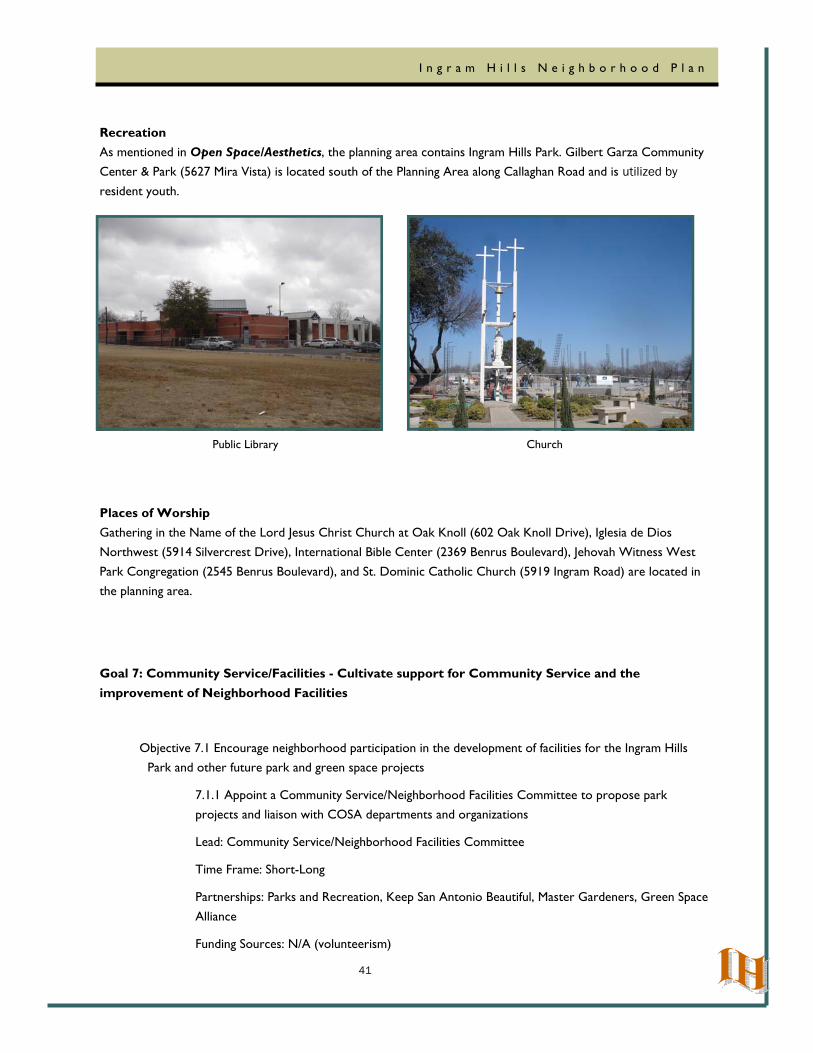
The Forest Hills Branch Library (5245 Ingram Road), dedicated on October 1, 1988, is located in the Planning Area at White Tail Drive and Ingram Road. The 12,040-square-foot library facility was renovated and re-opened on
November 17, 1999 and presently serves approximately 15,000 visitors each month.
Private School Public School
41
I n g r a m H i l l s N e i g h b o r h o o d P l a n
Recreation As mentioned in Open Space/Aesthetics, the planning area contains Ingram Hills Park. Gilbert Garza Community Center & Park (5627 Mira Vista) is located south of the Planning Area along Callaghan Road and is utilized by
resident youth.
Places of Worship Gathering in the Name of the Lord Jesus Christ Church at Oak Knoll (602 Oak Knoll Drive), Iglesia de Dios Northwest (5914 Silvercrest Drive), International Bible Center (2369 Benrus Boulevard), Jehovah Witness West
Park Congregation (2545 Benrus Boulevard), and St. Dominic Catholic Church (5919 Ingram Road) are located in the planning area.
Goal 7: Community Service/Facilities - Cultivate support for Community Service and the improvement of Neighborhood Facilities
Objective 7.1 Encourage neighborhood participation in the development of facilities for the Ingram Hills Park and other future park and green space projects
7.1.1 Appoint a Community Service/Neighborhood Facilities Committee to propose park projects and liaison with COSA departments and organizations
Lead: Community Service/Neighborhood Facilities Committee
Time Frame: Short-Long
Partnerships: Parks and Recreation, Keep San Antonio Beautiful, Master Gardeners, Green Space
Alliance
Funding Sources: N/A (volunteerism)
Public Library Church
42
I n g r a m H i l l s N e i g h b o r h o o d P l a n
Objective 7.2 Network with adjoining neighborhood associations to leverage public support for community projects
7.2.1. Uphold our written interaction agreements with the surrounding area neighborhood
associations
Lead: Community Service/Neighborhood Facilities Committee
Time Frame: Short
Partnerships: Woodlawn Hills, Thunderbird Hills, Culebra Park, Loma Park, Loma Terrace,
Third World, and Northwest Alliance
Funding Sources: N/A (volunteerism)
Objective 7.3 Partner with schools to improve educational attainment.
7.3.1 Continue to support and coordinate with the Northside Independent School District in programming that increases the use of their facilities after hours
Lead: Community Service/Neighborhood Facilities Committee
Time Frame: Short-Long
Partnerships: NISD
Funding Sources: school district
7.3.2 Continue to provide information about neighborhood facility hours, social services, daycare, private schools, community education classes, youth/adult programs, and activities of
places of worship, through its newsletter
Lead: Community Service/Neighborhood Facilities Committee
Time Frame: Short-Long
Partnerships: Ingram Hills Neighborhood Association, Council District 7 office
Funding: private contributions
7.3.3 Develop a network of volunteers to participate in area schools involving mentorship or
tutorial programs
Lead: Community Service/Neighborhood Facilities Committee
43
I n g r a m H i l l s N e i g h b o r h o o d P l a n
Time Frame: Short-Long
Partnerships: Ingram Hills Neighborhood Association, NISD, private schools
Funding: N/A (volunteerism)
7.3.4 Support incentives to residents to help curb the school dropout rate
Lead: Community Service/Neighborhood Facilities Committee
Time Frame: Short-Long
Partnerships: NISD
Funding: N/A (volunteerism)
Objective 7.4 Ensure that all neighborhood facilities are accessible
7.4.1 Promote and encourage the installation of barrier free ramps to improve the accessibility of neighborhood facilities to all ages including those with disabilities
Lead: Community Service/Neighborhood Facilities Committee
Time Frame: Short-Long
Partnerships: Public Works ADA Office, Parks and Recreation, Library
Funding: CIP, Bond, Neighborhood Accessibility and Mobility
44
I n g r a m H i l l s N e i g h b o r h o o d P l a n
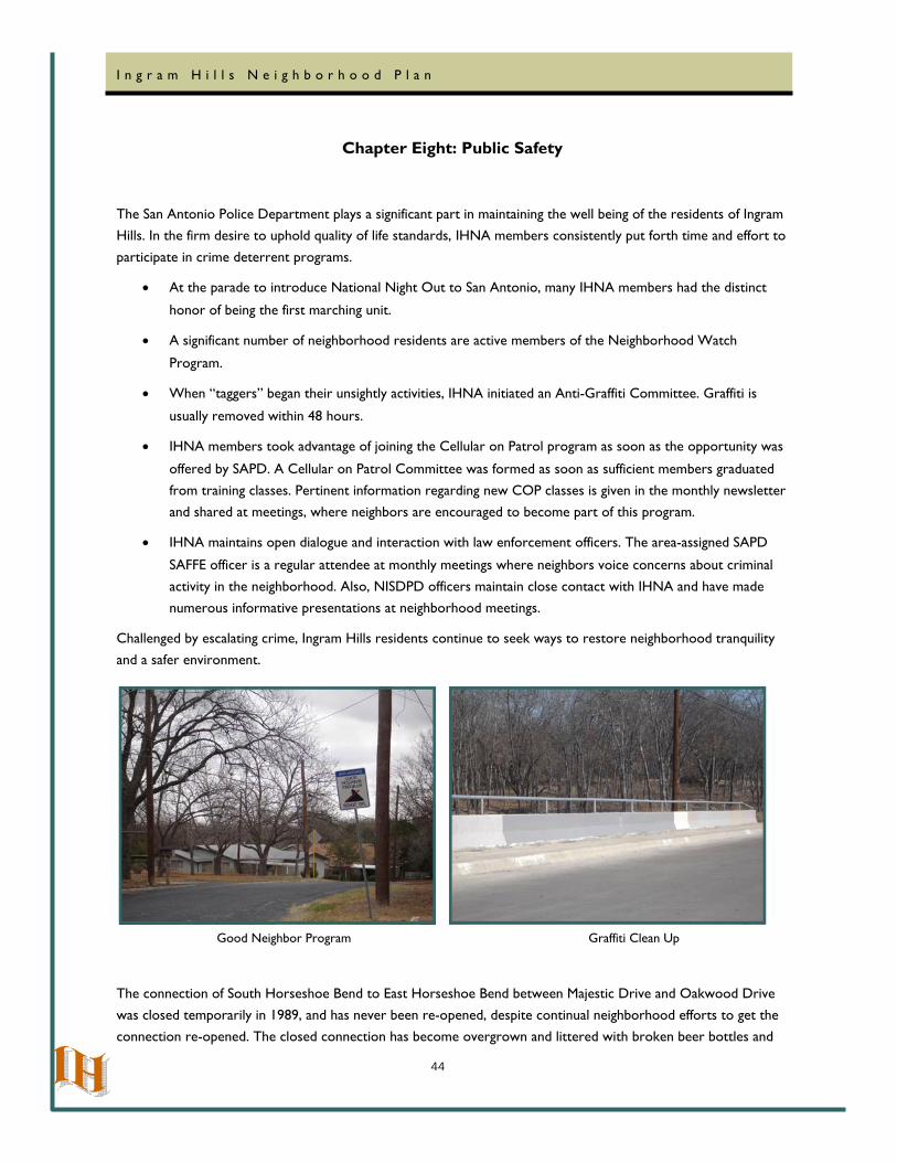
Chapter Eight: Public Safety
The San Antonio Police Department plays a significant part in maintaining the well being of the residents of Ingram Hills. In the firm desire to uphold quality of life standards, IHNA members consistently put forth time and effort to
participate in crime deterrent programs.
• At the parade to introduce National Night Out to San Antonio, many IHNA members had the distinct
honor of being the first marching unit.
• A significant number of neighborhood residents are active members of the Neighborhood Watch
Program.
• When “taggers” began their unsightly activities, IHNA initiated an Anti-Graffiti Committee. Graffiti is
usually removed within 48 hours.
• IHNA members took advantage of joining the Cellular on Patrol program as soon as the opportunity was
offered by SAPD. A Cellular on Patrol Committee was formed as soon as sufficient members graduated
from training classes. Pertinent information regarding new COP classes is given in the monthly newsletter and shared at meetings, where neighbors are encouraged to become part of this program.
• IHNA maintains open dialogue and interaction with law enforcement officers. The area-assigned SAPD
SAFFE officer is a regular attendee at monthly meetings where neighbors voice concerns about criminal
activity in the neighborhood. Also, NISDPD officers maintain close contact with IHNA and have made numerous informative presentations at neighborhood meetings.
Challenged by escalating crime, Ingram Hills residents continue to seek ways to restore neighborhood tranquility and a safer environment.
The connection of South Horseshoe Bend to East Horseshoe Bend between Majestic Drive and Oakwood Drive
was closed temporarily in 1989, and has never been re-opened, despite continual neighborhood efforts to get the connection re-opened. The closed connection has become overgrown and littered with broken beer bottles and
Good Neighbor Program Graffiti Clean Up
45
I n g r a m H i l l s N e i g h b o r h o o d P l a n
other debris, indicating alcohol consumption and criminal activities are occurring in this area. It is a health and safety hazard to the neighborhood. Even though this road is closed to the traffic, this area is currently being developed with single family residences. The neighborhood recommends that this connection be re-opened.
Though the problem is not as dominant in the planning area as in other parts of the city, drugs and gangs are of concern to many of the neighbors. Gang violence is becoming more widespread, more complex to combat, and
children can be pressured at school and in the neighborhood to become a part of an organized and recognized group. Thus, more guidance and education is desired throughout the neighborhood.
Inadequate street lighting and vacant land in close proximity to homes and apartments is a safety concern for
neighborhood residents. IHNA has had success in street light placement along isolated areas. Sufficient street lighting systematically placed throughout the neighborhood will enhance the appearance of the neighborhood at night, and help to deter crime.
Goal 8: Public Safety - Increase public safety throughout the neighborhood
Objective 8.1 Assess crime prone areas and recommend actions to deter crime through environmental
design
8.1.1 Advocate for re-opening the overgrown connection between Majestic Drive and South Horseshoe Bend to East Horseshoe Bend and Oakwood Drive, which has been “temporarily” closed since 1989
Lead: Public Safety Committee
Time Frame: Short - Mid
Partnerships: District 7 Council office, Subdivision section, Planning and Development Services; Public Works, CIMS
Funding: Bond, Neighborhood Accessibility and Mobility Fund, CIP
Objective 8.2 Increase public awareness and participation in crime prevention programs
8.2.1 Increase neighborhood participation in the existing IHNA Cellular on Patrol and Anti-
Graffiti Committees
Lead: Public Safety Committee
Time Frame: Short - Mid
Partnerships: SAPD, SAFFE officer
46
I n g r a m H i l l s N e i g h b o r h o o d P l a n
Funding: current programs
8.2.2 Increase the number and the support of neighborhood crime watch programs
Lead: Public Safety Committee
Time Frame: Short - Mid
Partnerships: SAPD, SAFFE officer
Funding: current programs
8.2.3 Continue support and interaction with our San Antonio Police Department-San Antonio
Fear Free Environment (SAPD-SAFFE) officer
Lead: Public Safety Committee
Time Frame: Short - Mid
Partnerships: SAPD, SAFFE officer
Funding: current programs
8.2.4 Educate residents on drug abuse prevention, crime prevention, and gang identification
Lead: Public Safety Committee
Time Frame: Short - Mid
Partnerships: SAPD, SAFFE officer
Funding: current programs
47
I n g r a m H i l l s N e i g h b o r h o o d P l a n
Chapter Nine: Taking Action
The Ingram Hills Neighborhood is comprised of people who are concerned about their neighborhood. With the completion of the planning process, the effectiveness of a plan largely depends on the degree of commitment on
the part of the neighborhood in carrying it out. Even though the neighborhood has put forth a great deal of time and effort, the real work has just begun. Implementing a plan requires continuous vigilance, and involvement by the
neighborhood. In Table 2, the plans’ Action Steps are organized by Time Frame.
Action Item Responsibility Timeframe Status
Create Ingram Hills Plan Update Neighborhood, City Immediate
Conduct a survey of properties with suspected code compliance violations
Neighborhood Immediate
Organize community efforts to monitor graffiti van-dalism and tagging activity
Neighborhood, City Ongoing
Use neighborhood resources, such as newsletter, to keep residents and business owners informed about the activities, events and programs in the neighbor-hood
Neighborhood
Ongoing
Monitor all the Zoning and Board of Adjustment variance activities in the plan area and participate in the decision making process
Neighborhood, City
Ongoing to long
Keep close contact with the City departments re-garding the needs of the neighborhood and ongoing and future projects, such as linear park, drainage and road improvements
Neighborhood, City
Ongoing
Educate and train Ingram Hills residents and stake-holders about Neighborhood Conservation District (NCD-3) design standards
Neighborhood
Ongoing
Encourage to create commercial component of the existing NCD-3 standards
Neighborhood, City Mid to long
Monitor all the new and proposed developments in the plan area
Neighborhood Ongoing to long
Identify dilapidated and vacant properties in the neighborhood and hold property owners account-
City
Mid
Table 2
48
I n g r a m H i l l s N e i g h b o r h o o d P l a n
Chapter Ten: Measuring Our Success
Indicators are an important part of the neighborhood plan and are created to help the neighborhood track
progress in meeting the Ingram Hills Action Plan. It is recommended that the indicators be tracked to help quantitatively measure the success over time.
Indicator 1: Improve Infrastructure in planning area
Baseline: Linear feet of sidewalk coverage along Ingram Road
Desired Future Outcome: Increase by 15% every 2 years
Data Source: Public Works Department
Frequency of Review: Annually
Indicator 2: Increase number of educational programs regarding community concerns provided by Neighborhood Association and other groups in the planning area
Baseline: Number of educational programs offered to the community each month
Desired Future Outcome: Maintain at least one educational program offered every month
Data Source: Community Feedback
Frequency of Review: Annually
Indicator 3: Increased communication between the neighborhood association and the residents
Baseline: Frequency of newsletters, meetings, and informational sessions.
Desired Future Outcome: Maintain monthly newsletters to residents
Data Source: Community Feedback
Frequency of Review: Annually
Indicator 4: Increase acreage of parks and open space
Baseline: Current acreage of park space in the neighborhood
Desired Future Outcome: Increase by 1 acre every 2 years
Data Source: Parks and Recreation Department, Public Works Storm Water
Frequency of Review: Annually
49
I n g r a m H i l l s N e i g h b o r h o o d P l a n
Indicator 5: Increase in Cellular on Patrol membership Baseline: Current number of COP participants
Desired Future Outcome: Increase by 5% per year Data Source: Community Survey, SAPD
Frequency of Review: Annually
Indicator 6: Number of Violent Crimes in the area in 2008 Baseline: Number of Violent Crimes in the area in 2008
Desired Future Outcome: Decrease number of violent crimes annually
Data Source: SAPD
Frequency of Review: Annually
50
I n g r a m H i l l s N e i g h b o r h o o d P l a n
Glossary
CBNP: Community Building and Neighborhood Planning
CIMS: Capital Improvements Management Services
CIP: Capital Improvements Project
COP: Cellular On Patrol
COSA: City of San Antonio
Flood Zone “A” and “AE”: Areas with 1% and 26 % annual chance of flooding over the life of a 30-year
mortgage.
Flood Zone “AO”: River or stream flood hazard areas.
FTA: Federal Transit Administration
HNSD: Housing and Neighborhood Services Department
HIP: Homeownership Incentive Program
IHNA: Ingram Hills Neighborhood Association
NCD: Neighborhood Conservation District
NISD: Northside Independent School District
NISDPD: Northside Independent School District Police Department
SAPD: San Antonio Police Department
SAPD-SAFFE: San Antonio Police Department - San Antonio Fear Free Environment Unit
UDC: Unified Development Code
VIA Metropolitan Transit: Transit Authority
WHNAA: Woodlawn Hills Neighborhood Action Association
51
I n g r a m H i l l s N e i g h b o r h o o d P l a n
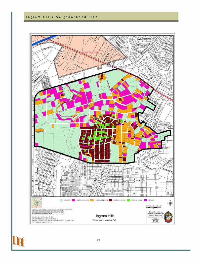
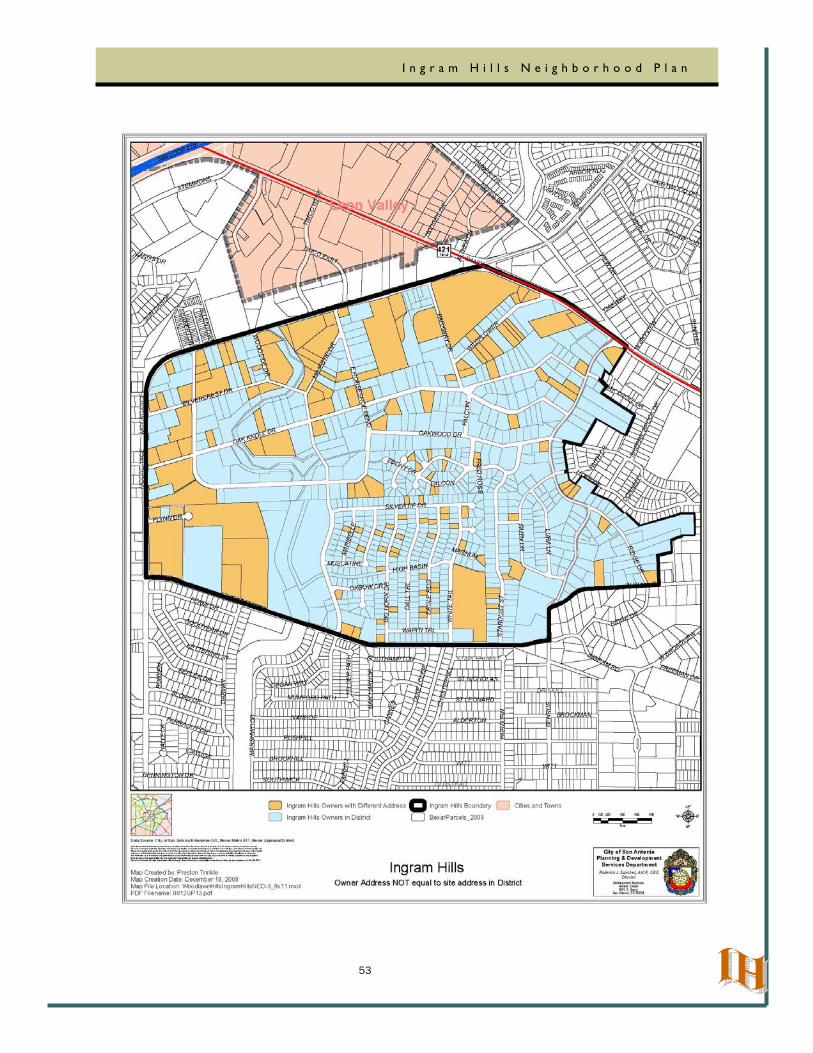
Appendix
The documents on the following pages were utilized extensively during this planning process.
52
I n g r a m H i l l s N e i g h b o r h o o d P l a n
53
I n g r a m H i l l s N e i g h b o r h o o d P l a n
54
I n g r a m H i l l s N e i g h b o r h o o d P l a n

55
I n g r a m H i l l s N e i g h b o r h o o d P l a n
56
I n g r a m H i l l s N e i g h b o r h o o d P l a n
57
I n g r a m H i l l s N e i g h b o r h o o d P l a n
Ingr
am H
ills
Tra
ffic
58
I n g r a m H i l l s N e i g h b o r h o o d P l a n
59
I n g r a m H i l l s N e i g h b o r h o o d P l a n
60
I n g r a m H i l l s N e i g h b o r h o o d P l a n
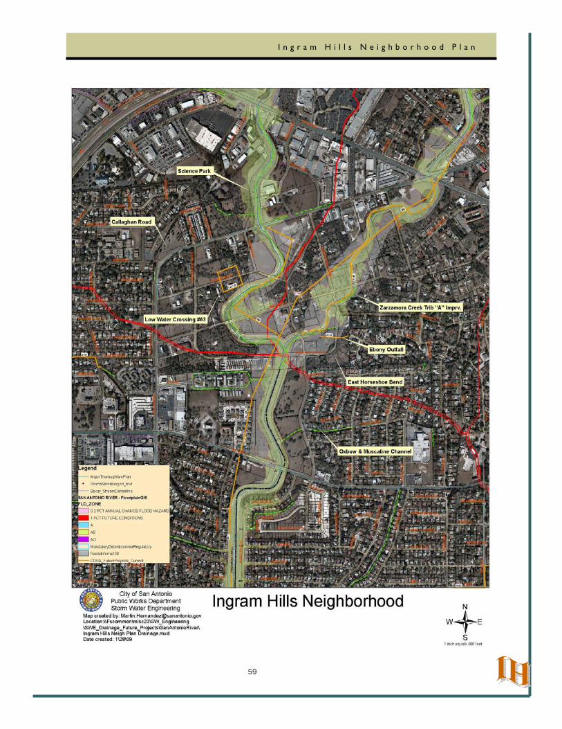
Ingram Hills Neighborhood Storm Water Projects
Improvement Projects Completed
Science Park LOMR Project Est. Costs : $9,307,000
Consisted of Channel Improvements for the 100yr flows were provided for the limits from Bandera Road to Ingram Road in Zarzamora Creek. Channel improvements for Zarzamora Creek main channel and tributary were provided by this project.
Culebra 58F Phase I Project Est. Costs : $ 6,304,997
Culebra 58F, Phase I – Acme Rd upstream to Culebra Channel improvements of Zarzamora Creek from Acme to Culebra for 100-year flood capacity.
Future Projects (Funded)
Callaghan Road Project Est. Costs : $ 3,120,284
Callaghan Road: Farragut to Ingram. Callaghan has two low water crossings that need to be upgraded to all weather crossings. Callaghan is a Secondary Arterial Type A (86’) street with an average daily traffic of 20,770. The existing low water crossings flood during minimal rainfall events. There was a drowning at the Farragut LWC in September 2000. The Hemphill LWC is adjacent to Sul Ross Middle School and Esparza Elementary
Callaghan Road Project Est. Costs : $ 3,145,855
Callaghan Road: Hemphill to Farrgut. Callaghan has two low water crossings that need to be upgraded to all weather crossings. Callaghan is a Secondary Arterial Type A (86’) street with an average daily traffic of 20,770. The existing low water crossings flood during minimal rainfall events. There was a drowning at the Farragut LWC in September 2000. The Hemphill LWC is adjacent to Sul Ross Middle School and Esparza Elementary
Culebra 58F Phase II Project Est. Costs : $ 10,687,000
Culebra 58F, Phase II B - Laven to upstream of Culebra Reconstruct Zarzamora Creek from Laven to 1,600 feet upstream of Culebra to 100-year flood capacity. Project includes upgrading the Culebra Road crossing.
61
I n g r a m H i l l s N e i g h b o r h o o d P l a n
Future Projects (Unfunded)
LWC#63 Project Est. Costs : $ 190,000
Low Water Crossing needs Bridge/Culvert Improvements with possible advanced warning signals. Associated street reconstruction to include curbs, sidewalks, and driveway approaches is incorporated into the project.
East Horseshoe Bend Project Est. Costs : $ 0.00
Improvements not being considered at this time by streets. This site has not been identified for drainage improvments.
Oxbow & Muscatine Channel Project Est. Costs : $ 190,000
This project would concrete the remaining portion of the existing channel. Please note that the providing the remaining portion of the concrete would not provide conveyance improvements. The channel is adequate to convey the existing flows through the channel.
Ebony Outfall Project Est. Costs : $ 180,000
This project entails constructing an earthen channel from Ebony to Zaramora Creek to help alleviate drainage problems in the area.
Zarzamora Creek Trib “A” Imprv. Project Est. Costs : $ 9,850,000
Zarzamora Creek Trib A - Channel restoration (Majestic to Bandera) to reduce the 1% floodplain. This will include the bridge crossing improvements at street locations:
Parkway Drive: Est. Cost (Bridge Only) $ 900,000
Oak Knoll: Est. Cost (Bridge Only) $ 1,400,000
Horseshoe St.: Est. Cost (Bridge Only) $ 1,000,000
62
I n g r a m H i l l s N e i g h b o r h o o d P l a n
Ingram Hills Park Project By COSA Parks and Recreational Department
63
I n g r a m H i l l s N e i g h b o r h o o d P l a n
The End
Ingram Hills Neighborhood Plan Area—Aerial View
.Ingram Hills Neighborhood Plan~ SG: 05-21-09 Item No. P-3.
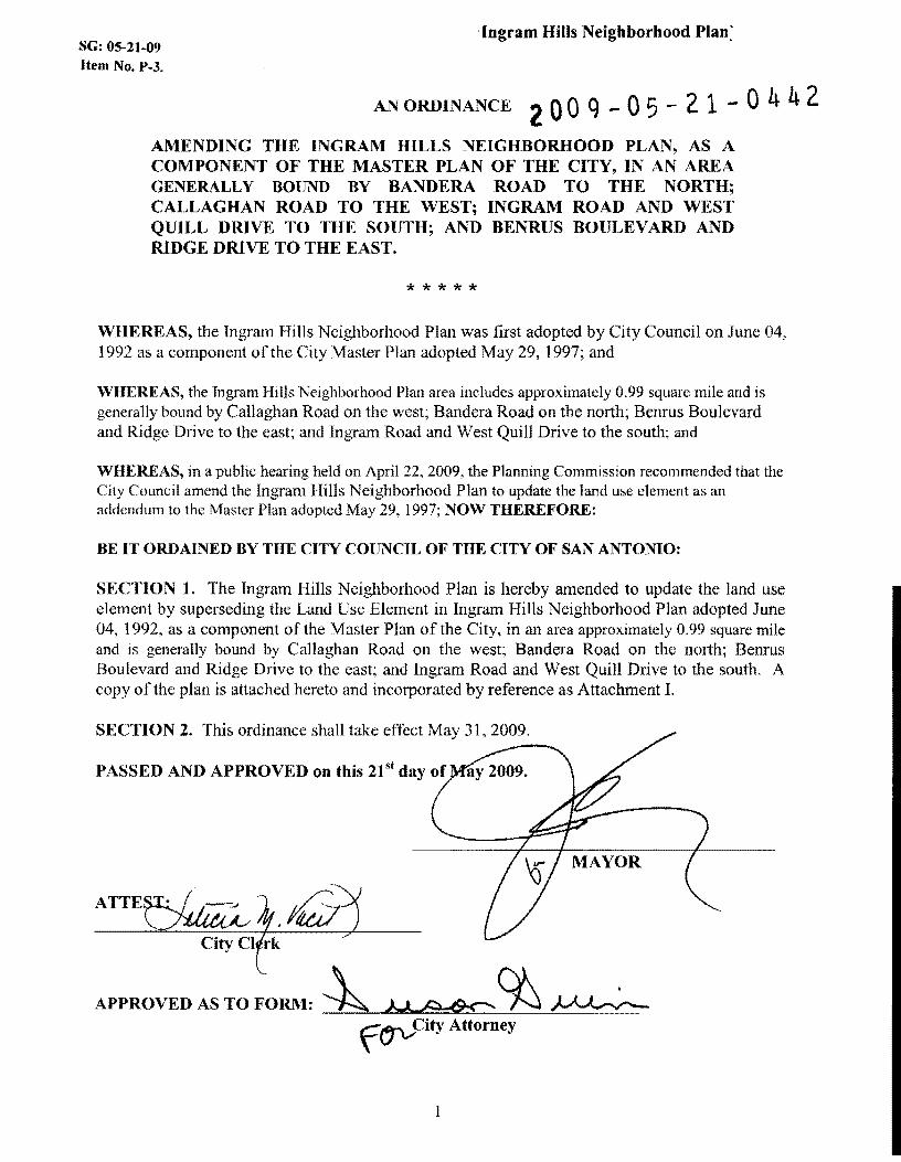
AN ORDINANCE 2 0 0 q - 05 - 2 1 - 0 4 4 2 AMENDING THE INGRAM HILLS NEIGHBORHOOD PLAN, AS A COMPONENT OF THE MASTER PLAN OF THE CITY, IN AN AREA GENERALLY BOUND BY BANDERA ROAD TO THE NORTH; CALLAGHAN ROAD TO THE WEST; INGRAM ROAD AND WEST QUILL DRIVE TO THE SOUTH; AND BENRUS BOULEVARD AND RIDGE DRIVE TO THE EAST.
*****
WHEREAS, the Ingram Hills Neighborhood Plan was first adopted by City Council on June 04, 1992 as a component ofthc City Master Plan adopted May 29, 1997; and
WHEREAS, the Ingram I-Iills Neighborhood Plan area ineludes approximately 0.99 square mile and is generally bound by Callaghan Road on the west; Bandera Road on the north; Benrus Boulevard and Ridge Drive to the east; and Ingram Road and West Quill Drive to the south; and
WHEREAS, in a public hearing held on April 22, 2009, the Planning Commission recommended that the City Council amend the Ingram Hills Neighborhood Plan to update the land use element as an addendum to the Master Plan adopted May 29, 1997; NOW THEREFORE:
BE IT ORDAINED BY THE CITY COUNCIL OF THE CITY OF SAN ANTONIO:
SECTION 1. The Ingram Hills Neighborhood Plan is hereby amended to update the land use element by superseding the Land Use Element in Ingram Hills Neighborhood Plan adopted June 04, 1992, as a component of the Master Plan of the City, in an area approximately 0.99 square mile and is generally bound by Callaghan Road on the west; Bandera Road on the north; Benrus Boulevard and Ridge Drive to the east; and Ingram Road and West Quill Drive to the south. A copy of the plan is attached hereto and incorporated by reference as Attachment I.
SECTION 2. This ordinance shall take effect May 31,2009.
PASSED AND APPROVED on this 21 st day of
ATTE~
City CI rk
APPROVED AS TO FORM: ~MA-6=%~ f(.1'VCity Attorney