Embed Size (px)
Citation preview

In The Matter Of:Eco-Site, Inc. and T-Mobile Northeast, LLC application
for a Certificate of Environmental Compatibility
Public Hearing
November 16, 2017
BCT Reporting LLC
PO Box 1774
Bristol, CT 06010
860.302.1876
Original File 17-11-16 - Part 01.txt
Min-U-Script®

1
1 STATE OF CONNECTICUT
2 CONNECTICUT SITING COUNCIL
3
4
5 Docket No. 476
6 Eco-Site, Inc. and T-Mobile Northeast, LLC
7 application for a Certificate of Environmental
8 Compatibility and Public Need for the
9 construction, maintenance, and operation of a
10 telecommunications facility located at 248 Hall
11 Hill Road, Somers, Connecticut
12
13
14 Public Hearing held at the Somers Town Hall,
15 600 Main Street, Somers, Connecticut, on Thursday,
16 November 16, 2017, beginning at 3 p.m.
17
18
19
20 H e l d B e f o r e:
21 ROBERT STEIN, Chairman
22
23
24
25
2
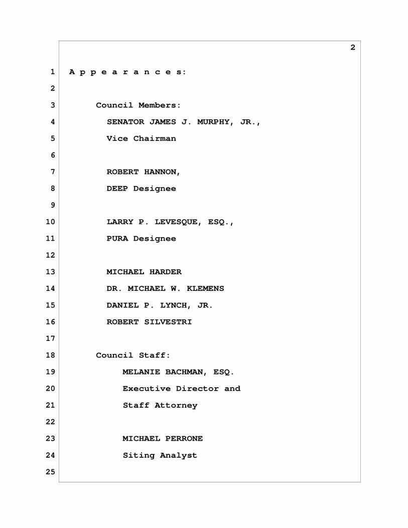
1 A p p e a r a n c e s:
2
3 Council Members:
4 SENATOR JAMES J. MURPHY, JR.,
5 Vice Chairman
6
7 ROBERT HANNON,
8 DEEP Designee
9
10 LARRY P. LEVESQUE, ESQ.,
11 PURA Designee
12
13 MICHAEL HARDER
14 DR. MICHAEL W. KLEMENS
15 DANIEL P. LYNCH, JR.
16 ROBERT SILVESTRI
17
18 Council Staff:
19 MELANIE BACHMAN, ESQ.
20 Executive Director and
21 Staff Attorney
22
23 MICHAEL PERRONE
24 Siting Analyst
25
3
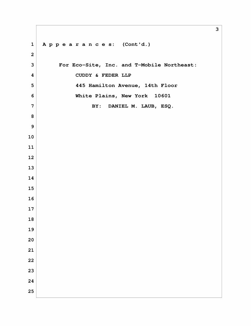
1 A p p e a r a n c e s: (Cont'd.)
2
3 For Eco-Site, Inc. and T-Mobile Northeast:
4 CUDDY & FEDER LLP
5 445 Hamilton Avenue, 14th Floor
6 White Plains, New York 10601
7 BY: DANIEL M. LAUB, ESQ.
8
9
10
11
12
13
14
15
16
17
18
19
20
21
22
23
24
25

4
1 THE CHAIRMAN: Good afternoon, ladies
2 and gentlemen. I'd like to call to order this
3 meeting of the Connecticut Siting Council today,
4 Thursday, November 16, 2017, at approximately 3
5 p.m. My name is Robin Stein. I'm Chairman of the
6 Connecticut Siting Council.
7 Other members of the Council present
8 are Senator James Murphy, our Vice Chairman;
9 Mr. Hannon, our designee from the Department of
10 Energy and Environmental Protection; Mr. Levesque,
11 designee from the Public Utilities Regulatory
12 Authority; Mr. Silvestri; Mr. Lynch; Mr. Harder;
13 and Dr. Klemens.
14 Members of the staff present are our
15 Staff Attorney Melanie Bachman, who's also
16 executive director; and Mr. Perrone, our siting
17 analyst.
18 This hearing is held pursuant to the
19 provisions of Title 16 of the Connecticut General
20 Statutes and of the Uniform Administrative
21 Procedure Act upon an application from Eco-Site,
22 Inc. and T-Mobile Northeast, LLC for a Certificate
23 of Environmental Compatibility and Public Need for
24 the construction, maintenance, and operation of a
25 telecommunications facility located at 248 Hall

5
1 Hill Road, Somers, Connecticut. This application
2 was received by the Council on July 20, 2017.
3 As a reminder to all, off-the-record
4 communication with a member of the Council, or a
5 member of the Council's staff, upon the merits of
6 this application is prohibited by law.
7 The party to the proceeding is the
8 applicant, Eco-Site, Inc. and T-Mobile Northeast
9 with Attorney Laub representing from Cuddy &
10 Feder.
11 We will proceed in accordance with the
12 prepared agenda, copies of which are available at
13 the table in the back. Also available here are
14 copies of the Council's Citizens Guide to Siting
15 Council Procedures.
16 At the end of this afternoon's
17 evidentiary session, we will recess and resume
18 again at 6:30 for the public comment session. The
19 public comment session will be reserved for the
20 public to make brief oral statements into the
21 record. I wish to note for those who are here,
22 and for the benefit of your friends and neighbors
23 who are unable to join us for the public comment
24 session, that you or they may send written
25 statements to the Council within 30 days of the
6
1 date hereof, and such written statements will be
2 given the same weight as if spoken at the hearing.
3 A verbatim transcript will be made of
4 this hearing and deposited with the Town Clerk's
5 Office in Somers for the convenience of the
6 public.
7 And we'll start. I believe we have a
8 member from the fire service. I don't know if I
9 will pronounce it right.
10 DOUGLAS RACICOT: That's okay. My name
11 is Doug Racicot.
12 THE CHAIRMAN: And if you could spell
13 your last name for the --
14 DOUGLAS RACICOT: For the record,
15 R-A-C-I-C-O-T. I am the operations director of
16 the Regional 911 Public Safety Answering Point
17 located in Tolland. We are the PSAP for the Town
18 of Somers. We also dispatch fire and EMS for the
19 Town of Somers.
20 And we have requested, if the tower is
21 approved, through some communication with Attorney
22 Laub yesterday, if we have the ability to
23 co-locate at that facility upon construction so we
24 may more adequately provide public safety radio
25 communications to the Town of Somers and the
7
1 surrounding towns we provide service to.
2 THE CHAIRMAN: Thank you very much.
3 DOUGLAS RACICOT: Thank you, sir.
4 THE CHAIRMAN: The applicant has
5 submitted a motion for protective order, dated
6 November 9, 2017, related to the disclosure of the
7 monthly rent and financial terms contained within
8 the lease agreement.
9 The Chair will entertain a motion.
10 MR. LYNCH: So moved.
11 DR. KLEMENS: Second.
12 THE CHAIRMAN: Motion and second.
13 All those in favor, signify by saying
14 aye.
15 THE COUNCIL: Aye.
16 THE CHAIRMAN: Opposed? Abstention?
17 (No response.)
18 THE CHAIRMAN: Motion carries.
19 I wish to call your attention to those
20 items shown on the hearing program marked as Roman
21 Numeral I-D, Items 1 through 66.
22 Does the applicant have any objection
23 to the items that the Council has administratively
24 noticed?
25 MR. LAUB: No objection, Mr. Chairman.
8
1 THE CHAIRMAN: Thank you.
2 Accordingly, the Council hereby
3 administratively notices these existing documents,
4 statements and comments.
5 (Administrative Notice Items I-D-1
6 through I-D-66: Noted for the record.)
7 THE CHAIRMAN: Now, Attorney Laub, will
8 you present your panel for the purposes of taking
9 the oath? And if you want to introduce them
10 first?
11 MR. LAUB: Certainly, Mr. Chairman.
12 I'll introduce them, and then ask that they stand
13 to be sworn.
14 To my far left, and to your far right,
15 is Mr. Matthew Allen from Saratoga Associates as
16 our visual consultant. To his immediate right is
17 Mr. Chris Bond from CBRE, who is from our
18 environmental review team who will be able to
19 speak on the wetland question out there. To my
20 immediate left is Mr. Chuck Bruttomesso with
21 Airosmith Development, who is the site acquisition
22 consulting firm for this project. To my immediate
23 right is Mr. Steve Ruzzo with Eco-Site. Mr. Scott
24 Heffernan is to his right, from Centerline
25 Communications, who can speak to the radio
9
1 frequency questions regarding this docket. And
2 then to his far right, and to your far left, is
3 Mr. AJ DeSantis, our project engineer.
4 I would ask at this time that they
5 stand and be sworn.
6 M A T T H E W W. A L L E N,
7 C H R I S T O P H E R S. B O N D,
8 C H U C K B R U T T O M E S S O,
9 A J D e S A N T I S, III,
10 S C O T T H E F F E R N A N,
11 S T E V E R U Z Z O,
12 called as witnesses, being first duly sworn
13 by Ms. Bachman, were examined and testified
14 on their oaths as follows:
15 MS. BACHMAN: Thank you.
16 THE CHAIRMAN: We will continue with
17 verification of the exhibits that you've
18 submitted.
19 MR. LAUB: Certainly. Under agenda
20 Item II-B, exhibits for identification include
21 II-B-1, the application for a Certificate of
22 Environmental Compatibility submitted by the
23 applicants, including the bulk file exhibits so
24 noted. Item II-B-2 is the responses to Siting
25 Council interrogatories submitted as part of this
10
1 docket proceeding. II-B-3 is an Eco-Site and
2 T-Mobile's sign posting affidavit and photographs,
3 dated November 2nd. II-B-4 is the witnesses'
4 resumes and professional biographies which we
5 submitted as part of our hearing information.
6 Finally, II-B-5 is a Late-Filed, but was a
7 clarification regarding the backup power that
8 T-Mobile would deploy at the site, and that is
9 dated November 15, 2017.
10 DIRECT EXAMINATION
11 MR. LAUB: I would ask at this time,
12 starting with Mr. Allen, did you prepare and/or
13 supervise, and are you otherwise familiar with the
14 materials so noted that I just described?
15 THE WITNESS (Allen): I am.
16 MR. LAUB: Mr. Bond?
17 THE WITNESS (Bond): I am.
18 MR. LAUB: Actually, could you just
19 make sure you turn on the microphone?
20 THE WITNESS (Bond): I am.
21 MR. LAUB: And Mr. Bruttomesso?
22 THE WITNESS (Bruttomesso): I am.
23 MR. LAUB: Mr. Ruzzo?
24 THE WITNESS (Ruzzo): I am.
25 MR. LAUB: Mr. Heffernan?
11
1 THE WITNESS (Heffernan): I am.
2 MR. LAUB: Mr. DeSantis?
3 THE WITNESS (DeSantis): I am.
4 MR. LAUB: And do you have at this time
5 any corrections or clarifications that you'd like
6 to note for the Council?
7 THE WITNESS (Allen): I have no
8 changes.
9 THE WITNESS (Bond): I have no changes.
10 THE WITNESS (Bruttomesso): I have no
11 changes.
12 MR. LAUB: Actually, I do have one
13 change. On page 27 of the application it turns
14 out the tower foundation cost is not -- we listed
15 it as zero, so it's 100,000. It was 1-0-0, comma,
16 0-0, so there was one zero that was missing.
17 Mr. Ruzzo, do you have any corrections
18 or clarifications at this time?
19 THE WITNESS (Ruzzo): No, I don't.
20 MR. LAUB: Mr. Heffernan?
21 THE WITNESS (Heffernan): No changes.
22 MR. LAUB: Mr. DeSantis?
23 THE WITNESS (DeSantis): Yes. The only
24 change that I would like to bring to the board's
25 attention would be in regards to the area of
12
1 disturbance, as it was questioned on the site
2 visit this afternoon. The question came in as far
3 as what was the total area of disturbance and how
4 that was calculated. The calculation was based on
5 the 12 foot gravel access, plus a 3 foot utility
6 trench. Multiplying that out by the length of the
7 access drive and adding in the square footage of
8 the 100 by 100 lease area, the approximate total
9 area of disturbance is 27,000 square feet, which
10 corresponds to about .62 acres.
11 MR. LAUB: And with those corrections,
12 I'd like to note, starting with Mr. Allen, do you
13 believe that the materials are true and accurate
14 to the best of your belief?
15 THE WITNESS (Allen): Yes, they are.
16 MR. LAUB: Mr. Bond?
17 THE WITNESS (Bond): Yes, they are.
18 MR. LAUB: Mr. Bruttomesso?
19 THE WITNESS (Bruttomesso): Yes, they
20 are.
21 MR. LAUB: Mr. Ruzzo?
22 THE WITNESS (Ruzzo): Yes, they are.
23 MR. LAUB: Mr. Heffernan?
24 THE WITNESS (Heffernan): Yes.
25 MR. LAUB: Mr. DeSantis?
13
1 THE WITNESS (DeSantis): Yes.
2 MR. LAUB: And do you adopt them as
3 your sworn testimony today?
4 THE WITNESS (Allen): I do.
5 THE WITNESS (Bond): I do.
6 THE WITNESS (Bruttomesso): I do.
7 THE WITNESS (Ruzzo) I do.
8 THE WITNESS (Heffernan): I do
9 THE WITNESS (DeSantis): I do.
10 MR. LAUB: And with that, Mr. Chairman,
11 I'd ask that they be entered into the record as
12 full exhibits?
13 THE CHAIRMAN: I guess since you're the
14 only party, unless you have an objection, your
15 exhibits are admitted.
16 (Applicants' Exhibits II-B-1 through
17 II-B-5: Received in evidence - described in
18 index.)
19 THE CHAIRMAN: We'll now begin with
20 cross-examination by staff, Mr. Perrone.
21 MR. PERRONE: Thank you, Mr. Chairman.
22 CROSS-EXAMINATION
23 MR. LAUB: I'd like to get started with
24 one possible technical correction. On page 18 of
25 the application there is discussion about the
14
1 northern long-eared bat, NLEB. In the center of
2 the page it has "NLEP." Did the applicants intend
3 "NLEB"?
4 MR. LAUB: NLEB was intended.
5 MR. PERRONE: And one other possible
6 technical correction. In the sign affidavit it
7 depicts the evidentiary hearing beginning at 3:30.
8 Is that correct?
9 THE WITNESS (DeSantis): The sign does
10 depict 3:30 p.m.
11 MR. PERRONE: And that was not correct,
12 it says 3:30 right now?
13 THE WITNESS (DeSantis): It does,
14 correct.
15 MR. PERRONE: Did the applicants fly a
16 balloon today?
17 THE WITNESS (Allen): Yes, we did.
18 MR. PERRONE: What was the diameter of
19 the balloon?
20 THE WITNESS (Allen): The diameter was
21 approximately 3 feet.
22 MR. PERRONE: And what was the string
23 length, in other words, the height to the bottom
24 of the balloon?
25 THE WITNESS (Allen): The string length

15
1 was 180 feet to the bottom of the balloon.
2 MR. PERRONE: So the top of the balloon
3 would be about 183?
4 THE WITNESS (Allen): That is correct.
5 MR. PERRONE: Which, for visual
6 analysis purposes, would you say that's
7 conservative?
8 THE WITNESS (Allen): Yes.
9 MR. PERRONE: What color was the
10 balloon?
11 THE WITNESS (Allen): The balloon was
12 red.
13 MR. PERRONE: Could you describe the
14 weather conditions during the field review?
15 THE WITNESS (Allen): Sure. The
16 balloon was put up about 7 o'clock this morning, a
17 few minutes before. The weather was overcast and
18 relatively calm from about 7 until 9 o'clock.
19 Between 9 and approximately 10:30, a weather front
20 came through with rain and wind, at which case the
21 balloon was blown down quite a bit. About 10:30
22 the rain dissipated, and by 11 o'clock the winds
23 calmed and remained calm for the rest of the
24 balloon float.
25 MR. PERRONE: So during the Council's
16
1 field review, did the balloon reach its full
2 height?
3 THE WITNESS (Allen): During the
4 Council's field visit the balloon was very close
5 to full height, yes.
6 MR. PERRONE: And finally, if you could
7 provide the hours of the balloon flight, start and
8 end?
9 THE WITNESS (Allen): Yes. The balloon
10 was put up a few minutes before 7 a.m. this
11 morning, and will remain aloft until 4 p.m. this
12 afternoon.
13 MR. LYNCH: Would you speak up a little
14 louder? Your voice isn't carrying down here.
15 THE WITNESS (Allen): Oh, I'm sorry.
16 Yes, the balloon was put up a little
17 bit before 7 a.m. this morning, and it will remain
18 aloft until 4 p.m. today.
19 MR. PERRONE: In the Council's
20 interrogatories the applicant was asked about a
21 search ring, and the coordinates were provided.
22 But just for the reader to explain generally, is
23 the center of the search ring approximately
24 located at the Northern Correctional Institute?
25 THE WITNESS (Bruttomesso): Yes.
17
1 MR. PERRONE: And given that the search
2 ring has a half-mile radius, is the proposed tower
3 actually located outside of your search ring?
4 THE WITNESS (Bruttomesso): It's
5 slightly outside, yes, sir.
6 MR. PERRONE: In terms of tower
7 co-location, is it correct to say that on November
8 15th Tolland County Mutual Aid, the public safety
9 answering point for Somers, requested space on the
10 tower for emergency services antennas?
11 MR. LAUB: Mr. Perrone, yes. An email
12 was sent to my attention requesting that. And I
13 did speak with the Tolland County Mutual Aid
14 immediately after receiving that, and then
15 conferenced with Eco-Site to confirm that they
16 would be willing to work with Mutual Aid in order
17 to see if they could accommodate them on the
18 tower.
19 MR. PERRONE: The request in the letter
20 mentioned the antennas, cabling, and a shelter or
21 cabinet?
22 MR. LAUB: Correct. There were some
23 details provided, but it's going to be -- there's
24 going to have to be some further discussions about
25 exact details and the ways that their equipment

18
1 can be accommodated.
2 MR. PERRONE: But it is under review by
3 the applicants?
4 MR. LAUB: Yes.
5 MR. PERRONE: And page 33 of the
6 application notes that the tower would have a gray
7 finish. Just to be more precise, would that be a
8 galvanized steel finish?
9 THE WITNESS (DeSantis): Yes, it would.
10 MR. PERRONE: Turning to the response
11 to Council Interrogatory 32, is it correct to say
12 that the in-building signal threshold for
13 commercial it's a stronger signal strength than
14 for residential?
15 THE WITNESS (Heffernan): That is
16 correct.
17 MR. PERRONE: And why is that?
18 THE WITNESS (Heffernan): Typically the
19 makeup of structures used for commercial purposes
20 have much more attenuation for the radio signal to
21 transmit through say corrugated metal, concrete,
22 steel, things like that, as opposed to a wood
23 structure which a typical residence would be.
24 MR. PERRONE: And I see in the response
25 to Number 33, the existing signal strength ranges

19
1 from -91, which is basically the commercial level,
2 to -97. So is your target level -91 or better?
3 THE WITNESS (Heffernan): The overall
4 target to the edge of our footprint is -97, the
5 indoor residential coverage. However, we do try
6 to maximize as much in-building commercial
7 coverage as possible. A lot of what is in this
8 area, there are a lot of residences that we are
9 trying to target with this site. So the -97 would
10 be the minimum design threshold.
11 MR. PERRONE: And in response to Number
12 34, it mentions average dropped call rates
13 exceeding 2 percent. Is 2 percent or less a
14 target?
15 THE WITNESS (Heffernan): 2 percent or
16 less is an industry standard and has been for a
17 long time for standard dropped call rates.
18 T-Mobile in this market really strives to be less
19 than 1 percent on the dropped call rate.
20 MR. PERRONE: Is it correct to say that
21 the coverage plots and areas and distances were
22 all based on 2100 megahertz?
23 THE WITNESS (Heffernan): That is
24 correct.
25 MR. PERRONE: Is it fair to say that

20
1 that would be conservative because you would get a
2 smaller coverage area than 700?
3 THE WITNESS (Heffernan): That is
4 correct.
5 MR. PERRONE: Would the proposed
6 facility provide coverage to the Northern
7 Correctional Institute, or is that facility too
8 far to the north?
9 THE WITNESS (Heffernan): The Northern
10 Correctional facility is pretty much at the
11 boundary where existing coverage and potential
12 coverage from the site would end up matching up
13 with each other at pretty common signal levels.
14 So you may have an instance where you're getting a
15 handover point at the facility.
16 MR. PERRONE: And one last minor detail
17 in the RF. There's a DeLorme, D-E-L-O-R-M-E, map
18 in the application after the coverage plots, and
19 it was revised in the interrogatories. I didn't
20 see a legend or header on the top. Does that
21 basically just depict the proposed site and the
22 existing adjacent sites?
23 THE WITNESS (Heffernan): Correct. The
24 DeLorme map that was provided was to show the
25 existing on-air T-Mobile sites, as well as the
21
1 center of the search ring. This is something
2 that's produced at the very beginning of the
3 search process, and it's just a part of the
4 record.
5 MR. PERRONE: All right. And I
6 understand that the tower, besides the panel
7 antennas, there's a microwave dish proposed.
8 Would that dish have this tower communicate with
9 another adjacent tower?
10 THE WITNESS (Heffernan): That is
11 correct.
12 MR. PERRONE: If you have the site
13 number on the other tower, that will be great.
14 THE WITNESS (Heffernan): As of right
15 now we don't. Typically that would be designed by
16 the transport group at a later date.
17 MR. PERRONE: Okay. Moving on to the
18 response to Council Interrogatory Number 60, it
19 notes that there's attached correspondence from
20 the State Historic Preservation Office. I did not
21 see the attachment. Does the applicant have that
22 document in hand, or perhaps could it be read into
23 the record?
24 MR. LAUB: I'll have to double check,
25 Mr. Perrone. I thought that was included.

22
1 MR. PERRONE: Okay.
2 MR. LAUB: If not, we'll have to make a
3 supplemental submission.
4 MR. PERRONE: Okay. And as far as
5 wildlife, is it correct to say that the proposed
6 project would not be located within the shaded
7 area of DEEP's Natural Diversity Data Base?
8 THE WITNESS (Bond): It would not be
9 located within those shaded areas.
10 MR. PERRONE: Only if you have this
11 handy, do you know the distance to the NDDB area
12 at its closest point?
13 THE WITNESS (Bond): I do not have that
14 exact measurement.
15 MR. PERRONE: And in response to
16 Council Interrogatory Number 51, the applicants
17 note that no important bird areas are located in
18 Tolland County. Did you look at bordering
19 Hartford County as well?
20 THE WITNESS (Bond): No, just Tolland
21 County.
22 MR. PERRONE: I understand there was a
23 wetland report letter, but if you could reference
24 the drawing Z2? Could you approximate the closest
25 distance from the limits of construction to the
23
1 wetlands?
2 THE WITNESS (Bond): I can't
3 approximate the exact distance, but if you
4 reference attachment 6, it shows the map of the
5 delineated area where the wetland is. And before
6 that map there's a statement just saying that no
7 wetlands will be impacted by the construction.
8 MR. PERRONE: I understand that there
9 would not be any direct impacts. Would it be
10 correct to say that the proposed E&S controls
11 would protect against indirect impacts?
12 THE WITNESS (DeSantis): That is
13 correct.
14 MR. PERRONE: And I understand that the
15 proposed project is located in FEMA Zone X, an
16 area outside of the 100 and 500 year flood zones.
17 So just to be precise, is that the unshaded zone
18 X?
19 MR. LAUB: Which drawing are you
20 looking at, Mr. Perrone?
21 MR. PERRONE: I'm just asking generally
22 in response to Council Interrogatory 59.
23 THE WITNESS (Bond): I actually have
24 the FEMA map in front of me. And according to the
25 map, it's not located within the shaded area.
24
1 MR. PERRONE: Okay. Great.
2 Regarding cut and fill, turning to the
3 response to Council Interrogatory Number 7, the
4 projected amount of cut is 39 cubic yards, and the
5 amount of fill is 9 cubic yards. So would your 30
6 cubic yards of net cut, would that be hauled away
7 from the site?
8 THE WITNESS (DeSantis): Yes, it would.
9 MR. PERRONE: And the fill, that would
10 come from the site itself?
11 THE WITNESS (DeSantis): That is
12 correct.
13 MR. PERRONE: In response to Council
14 Interrogatory Number 19, I understand that there's
15 prime farmland soils on the subject property. But
16 is the compound and/or the access drive located
17 within the prime farmland soils?
18 MR. LAUB: Yes, I believe they are,
19 Mr. Perrone.
20 MR. PERRONE: In their entirety?
21 MR. LAUB: I'm not sure about the
22 entirety, but I know that the compound is. I'm
23 not sure about all of the access drive. I did
24 take a look at the USDA maps. I don't recall if
25 it was all there, if the entire access drive was

25
1 in prime farmland soil.
2 MR. PERRONE: Okay. So if you could
3 estimate the disturbance? Would it be just the
4 size of the compound itself, or the whole lease
5 area?
6 MR. LAUB: Yes, that was the area. The
7 .37 of an acre is what we were estimating what was
8 from the USDA mapping.
9 MR. PERRONE: Because if you had 100 by
10 100, or 10,000 square feet, would that be a little
11 less than a quarter of an acre, .23?
12 MR. LAUB: I believe that calculation
13 is correct, yes.
14 MR. PERRONE: Okay. And I understand
15 the disturbance numbers were revised. So would
16 that include tree clearing area?
17 THE WITNESS (DeSantis): Yes, the
18 figure that I gave previously of 27,000 square
19 feet would include the area of trees to
20 be removed.
21 MR. PERRONE: And would the tree stumps
22 be removed within your tree clearing area?
23 THE WITNESS (DeSantis): Yes, they
24 would.
25 MR. PERRONE: And with the wooded areas
26
1 around the proposed compound, is it correct to say
2 that no landscaping is proposed at this time?
3 THE WITNESS (DeSantis): That is
4 correct.
5 MR. PERRONE: And I understand there
6 was some discussion on the noise topic. Just to
7 be precise, would the proposed project comply with
8 the DEEP noise control standards at the property
9 boundaries?
10 THE WITNESS (DeSantis): Yes, it would.
11 MR. PERRONE: And lastly, I was looking
12 at the backup power exhibit. Would the generator
13 have an exerciser to operate it periodically for
14 maintenance purposes?
15 MR. LAUB: We double checked. We
16 anticipated that question. We double checked with
17 T-Mobile today, actually. We don't believe it
18 does, but we're going to confirm with the
19 manufacturer for any specifications just to make
20 sure. We don't believe it does because of the
21 fuel source, but it may be one thing where it may
22 be tested periodically just to make sure it's
23 operational. So that's what we want to double
24 check. Because I don't think it's -- it's
25 dissimilar from a diesel generator which would
27
1 have to be operated once a week generally.
2 MR. PERRONE: And if it does have that
3 capability, would you see if it could possibly --
4 if this project is approved -- if the testing
5 hours could be during daylight time?
6 MR. LAUB: It certainly would be during
7 daylight hours, if necessary.
8 MR. PERRONE: And one last item on the
9 backup power. On the specification sheet, part
10 number 4, it appears that you could use your
11 on-site batteries, or you could have your own
12 dedicated battery for starting. Is that right?
13 MR. LAUB: Yes, that's correct.
14 MR. PERRONE: Okay.
15 MR. LAUB: And it can use the cell site
16 battery as a starting -- yes.
17 MR. PERRONE: Have you considered which
18 one, or not yet?
19 THE WITNESS (Ruzzo): What was the
20 question again, explain --
21 MR. LAUB: Batteries that are dedicated
22 to the actual unit versus the cell site batteries
23 that are backup batteries to the facility in
24 general. So which ones --
25 THE WITNESS (Ruzzo): I think they're
28
1 the same.
2 MR. LAUB: Do you have extra batteries
3 is the question.
4 THE WITNESS (Ruzzo): Yes.
5 MR. LAUB: So we don't know the answer
6 whether there's going to be extra batteries for
7 the APU.
8 Is that the question, basically, if
9 there's going to be extra batteries singularly
10 dedicated to the APU?
11 MR. PERRONE: Correct. Exactly.
12 MR. LAUB: I don't think we're clear on
13 that at this point yet. It's still -- it is very
14 new in this market. It's new to being deployed.
15 So I apologize that it's not entirely clear, but
16 it is something that's being deployed, so we're
17 still getting final details.
18 MR. PERRONE: Okay. And if this
19 project is approved, could the final generator
20 details be included in a development and
21 management plan?
22 MR. LAUB: Yes.
23 MR. PERRONE: Thank you very much.
24 That's all I have.
25 THE CHAIRMAN: Thank you.

29
1 We'll now proceed with questions from
2 the Council.
3 Senator Murphy.
4 SENATOR MURPHY: Thank you,
5 Mr. Chairman. I only have a few items.
6 We've heard the discussion about the
7 mutual aid and working with them. Just to button
8 it down, if it can be worked out, is the intention
9 of the applicant to allow them to go on with no
10 charge for the Tolland County Mutual Aid?
11 THE WITNESS (Ruzzo): We've considered
12 that, yes. We haven't seen all the details yet,
13 so once --
14 SENATOR MURPHY: My question is, if it
15 can be worked out reasonably, is your intention --
16 THE WITNESS (Ruzzo): If it can be
17 worked out reasonably, yes.
18 SENATOR MURPHY: On the propagations --
19 Mr. Heffernan, it's long time no see. Good to see
20 you back.
21 In looking at the propagations, it just
22 struck me that there's an awful lot of duplication
23 to the west on this proposed tower site. And the
24 response to the interrogatories, and what have
25 you, indicates that you have no sectors that are
30
1 really in jeopardy adjacent to this proposed site.
2 Wouldn't the site more to the east have
3 been a better site and provide greater coverage in
4 the overall picture for the applicant?
5 THE WITNESS (Heffernan): Just so that
6 I have this clear, you're wondering if a site to
7 the east would be a better fit?
8 SENATOR MURPHY: Yes.
9 THE WITNESS (Heffernan): Well, any
10 time the search ring is deployed, obviously we
11 have to look at usable candidates, and there's a
12 lot of different layers that go into what gets
13 decided upon as the ultimate candidate. The
14 initial search ring was put in to provide coverage
15 along the 186 corridor just north of 190, but to
16 really hit a lot of those residential areas out
17 there, you can tell just by where the actual star
18 on the search map was that we are really trying to
19 provide that in-building coverage to the
20 customers.
21 Now, once the search is deployed and we
22 start looking at usable candidates, we then have
23 to make a decision based upon using the best
24 candidate that's available to us that will provide
25 either 100 percent of the coverage or a majority

31
1 of the coverage to the intended target area, but
2 we also factor in issues such as setback
3 requirements, zoning requirements, wetlands,
4 everything that the other --
5 SENATOR MURPHY: Along 186 that was the
6 primary purpose?
7 THE WITNESS (Heffernan): 186 and the
8 residential areas right around there heading up
9 towards the correctional facility.
10 SENATOR MURPHY: Where are the
11 businesses on 186, because one of your other
12 answers says both businesses and residences?
13 THE WITNESS (Heffernan): Right. We do
14 design the sites for any type of small business
15 structure or residential structure within that
16 area. That is why we do show the two different
17 coverage thresholds on here. The initial target
18 for dwellings in this area, as we all know, is
19 primarily made up of residences. And based upon
20 where we know the existing T-Mobile customers
21 reside and where we do lack any coverage on
22 targeting these residential areas, while the site
23 didn't fall exactly in the center of the search
24 map, it was approved as an RF candidate because it
25 did provide coverage to a majority of the intended

32
1 search area, as well as the targeted residences to
2 the north of the facility.
3 SENATOR MURPHY: In that regard -- this
4 is just an observation from someone who kind of
5 fumbles through these things, and what have you --
6 but the various maps, and what have you, that are
7 provided in this application, such as the DeLorme
8 map -- the propagation maps are okay -- but on the
9 site search maps, and what have you, north is
10 always in a different direction. And when you go
11 to compare one with the other as to where you are
12 looking, and what have you, it takes quite a while
13 to put them together. Between the three of them,
14 north, it turns out, is in three different
15 directions, which is not so much of a problem if
16 you've earmarked which is north on these various
17 maps and make it easy, but in each case there's no
18 delineation. And it's just a suggestion to make
19 things easier in that regard.
20 And on the question in the
21 interrogatory about the height of the tower, it's
22 180 feet. But the question as to whether or not
23 increasing it by 10 percent depends upon who comes
24 along. But what is the current plan by the
25 applicant as far as the foundation, the strength
33
1 of the foundation? Is it 180, or is it for a
2 tower that could be increased about 180 feet,
3 which I think really was the crux of the question
4 being asked?
5 THE WITNESS (Ruzzo): Okay. The
6 current plan that we have as our lead tenant,
7 T-Mobile, and their need, was 180 feet, and that's
8 what we would have designed it for.
9 SENATOR MURPHY: That takes care of you
10 guys?
11 THE WITNESS (Ruzzo): Currently, yes.
12 SENATOR MURPHY: Okay.
13 THE WITNESS (Ruzzo): Although Verizon
14 has expressed interest, and they, I believe,
15 accepted the tower at its current max height so
16 they --
17 SENATOR MURPHY: So they would go
18 underneath you?
19 THE WITNESS (Ruzzo): So they would
20 understand, correct, that T-Mobile currently
21 occupies the top area, and that they would need to
22 take the next area down. That's the general
23 understanding, correct.
24 SENATOR MURPHY: Okay. But my question
25 really is, is the base of the tower where you put
34
1 it up, should this be approved, going to be strong
2 enough to permit the increase without you having
3 to strengthen it or do something?
4 THE WITNESS (Ruzzo): Without a
5 structural modification of the foundation?
6 SENATOR MURPHY: Correct.
7 THE WITNESS (Ruzzo): There was no plan
8 at that point, but that can certainly be --
9 SENATOR MURPHY: The answer to that
10 question tells me a lot.
11 THE WITNESS (Ruzzo): Right. But that
12 can definitely be taken into consideration, you
13 know, if we were approved, for any modification up
14 to a certain height. We generally would like to
15 keep it under 200 feet.
16 SENATOR MURPHY: I understand that.
17 THE WITNESS (Ruzzo): Okay. But 10
18 percent, we would definitely make accommodations,
19 if needed, to -- you know, obviously from the
20 standpoint, a development cost standpoint, it
21 would be best to put that in the ground at the
22 initial phase rather than at a future time.
23 SENATOR MURPHY: Okay. That will show
24 up in your D&M plan?
25 THE WITNESS (Ruzzo): Yes.
35
1 SENATOR MURPHY: Okay. I have nothing
2 else, Mr. Chairman, at this point.
3 THE CHAIRMAN: Thank you.
4 Mr. Harder?
5 MR. HARDER: Yes. Thank you,
6 Mr. Chairman.
7 Just a couple of questions. Mr.
8 DeSantis, you and I had a conversation on the
9 site -- I just want to get that on the record --
10 concerning the access road as it gets to the
11 actual site. It's presently proposed for I think
12 the west side. And we talked about -- my question
13 was, was there a technical reason or something
14 that dictates that that's where it has to go, or
15 could you enter the site from the north side, and
16 to the extent it makes any difference, increase
17 the distance between any disturbance and the
18 wetland area? Does that present any technical
19 difficulty, or any other issues that would state
20 that you should not do that?
21 THE WITNESS (DeSantis): No. As
22 discussed on site, I think that is a viable
23 consideration. Certainly if we were to -- looking
24 at sheet Z3 of the drawings, if that last portion
25 of the access road were to be located to the

36
1 north, there would be some design changes that
2 would need to be implemented, but nothing -- I
3 don't believe it would be a gating issue.
4 For example, the location of the
5 utility transformer and the telco boxes, those
6 were located at the end of the access drive. The
7 design was put as such to get it off of the open
8 farm area, out of the farmers field, and in back
9 tucked away into the back of the site, but
10 certainly we can consider that.
11 MR. HARDER: You could still get it off
12 the field, I assume?
13 THE WITNESS (DeSantis): Certainly.
14 MR. HARDER: And maintain the proposed
15 location of the lease area and the fence area?
16 THE WITNESS (DeSantis): Correct, yes.
17 MR. HARDER: Just, I guess, kind of a
18 detail regarding the location, distances. If you
19 look at page 25 of the first section, it talks
20 about Section D, Somers Inland Wetlands
21 Watercourses Regulations. It talks about the dry
22 ditch and the only area where there's any hydric
23 soils is near the seasonal on-site pond, a short
24 distance from the pond.
25 And then it says, "The lease area is
37
1 located over 200 feet from this area."
2 But if you look at any of the drawings,
3 or at least some of the drawings, and by the scale
4 presented, for example, on drawing EC3, the lease
5 area appears to be, I would say, definitely less
6 than 100 feet from the wetland anyway.
7 So maybe I'm misreading that narrative
8 on page 25, but I'm not sure what was intended to
9 refer to over 200 feet from the area. The lease
10 area is definitely not 200 -- at least by that
11 drawing anyway -- is not over 200 feet from the
12 wetland.
13 THE WITNESS (DeSantis): So, if I may
14 clarify? On sheet Z -- it appears on Z2, and more
15 clearly on sheet Z2C. There is an area that is
16 shaded, and that was obtained from the inland
17 wetlands soils from the Somers, Connecticut GIS
18 database, and that may be the area that is in
19 question here. The wetland delineation that was
20 completed shows that the wetland is the seasonal
21 dry pond to the southwest.
22 MR. HARDER: So what you're saying is
23 that the last indication you mentioned was that
24 the dry pond area is the, I guess, the
25 northeasterly extent of the wetland. Is that

38
1 correct?
2 THE WITNESS (DeSantis): Northwesterly,
3 I believe.
4 MR. HARDER: What's the closest wetland
5 area to the lease area? I guess that's the
6 question.
7 THE WITNESS (DeSantis): That would be
8 the pond area, I believe, to the southwest of the
9 site.
10 MR. HARDER: And what's that distance?
11 THE WITNESS (DeSantis): I don't have
12 that. I can certainly provide that.
13 MR. HARDER: Okay.
14 THE WITNESS (Bond): So the wetland
15 area, again, that's referenced in attachment 6.
16 The only area where hydric soils were identified,
17 and thus wetlands, was that, again, the seasonal
18 pond and the small area just to the north of that.
19 MR. LAUB: Do you know the distance?
20 THE WITNESS (Bond): I don't know the
21 exact distance, but again, it's referenced in
22 attachment 6, if you'd like to take a look.
23 MR. HARDER: So it seems like some of
24 the drawings, anyway, are not consistent with some
25 of the other drawings. There's some that show

39
1 kind of a linear depiction of the wetland area,
2 which I thought was between -- the extent of that
3 was between the dry pond and the lease area, but
4 you're saying that the dry pond is the closest
5 extent on that wetland area?
6 THE WITNESS (Bond): No. What I'm
7 saying is the dry pond highlighted in blue on that
8 attachment, that was the area that was depicted as
9 the wetland. The area that parallels the access
10 road was considered dry and not the wetland area.
11 MR. HARDER: Okay.
12 MR. LAUB: Maybe, Mr. Harder, if I can
13 clarify?
14 Mr. DeSantis, on sheet Z2C, there
15 are -- I think the question is because there's two
16 sort of amorphous shapes, one is sort of striped,
17 and one is sort of a darker gray, where did that
18 information come from for your drawings?
19 THE WITNESS (DeSantis): The striped
20 area is obtained from the Somers, Connecticut GIS
21 database.
22 MR. LAUB: As potential wetland soils?
23 THE WITNESS (DeSantis): As identified
24 as potential wetland soils, correct.
25 MR. LAUB: And then the gray, the

40
1 darker gray, is that also from the GIS?
2 THE WITNESS (DeSantis): That is also
3 obtained from the GIS.
4 MR. LAUB: So it didn't include the
5 data from Mr. Bond's report?
6 THE WITNESS (DeSantis): That is
7 correct.
8 MR. LAUB: Does that help clarify, Mr.
9 Harder, somewhat?
10 MR. HARDER: Possibly. But part of the
11 problem is at the same time you're talking -- I
12 apologize -- I've been looking at some of these
13 maps, including Exhibit A, Tab 6, which I thought
14 depicts a wetland area extending a fair part of
15 the distance between the pond and the lease area,
16 similar to drawing number EC3 or ZD, I guess.
17 Okay. Although, it doesn't -- there's no wording,
18 but by the little icons it seems to indicate
19 there's a wetland area, and by that scale it's
20 less than 100 feet. I mean, I think, rather than
21 beating it to death, if you can clarify it and
22 make sure you double check these drawings because
23 it seems like there's inconsistencies.
24 MR. LAUB: Just so I understand, so are
25 you looking at the road as the lease area or
41
1 that --
2 MR. HARDER: No, I'm looking at that
3 100 by 100 roughly that's cut out of the woods.
4 MR. LAUB: Okay.
5 MR. HARDER: And as it's shown now, the
6 access road, that comes into the wooded area or
7 the cleared area on the drawing ZD or EC3, the new
8 edge of the wooded area after it's cleared by that
9 scale is less than 100 feet.
10 MR. LAUB: So we'll get that clarified
11 for the record.
12 MR. HARDER: Okay. The only other
13 question -- and this may display my technical
14 ignorance -- but is it technically feasible to use
15 a pole where the antennas are incorporated in the
16 pole and not visible; and if so, would you
17 consider that?
18 THE WITNESS (Heffernan):
19 Technologically could it happen? Yes. There are
20 many reasons why that doesn't happen. The first
21 off would be the fact that T-Mobile does broadcast
22 on different frequency bands in different areas.
23 So the ability to be able to broadcast over
24 several different frequency bands both now and in
25 the future that's going to be required, typically
42
1 requires the use of separate antennas. The
2 separate antennas will get better performance at
3 different frequency bands. Additionally, a lot of
4 the radios these days are being put up near the
5 antennas, whether they're RRUs, remote radio
6 units, or active antennas that have the radios
7 built into the back of the antennas themselves.
8 One of the big downfalls with
9 internally mounted antennas is that there's no air
10 exchange. So you run into a lot of problems with
11 these units overheating because they can't
12 dissipate heat, as well as the space to actually
13 contain the radios themselves. When you try to
14 keep things slim and aesthetically pleasing with
15 the internal mount solution, you're really trying
16 to stuff a lot of equipment in there. You have
17 remote radios, you have fiber demarc boxes, you
18 have coaxial cables, the antennas themselves.
19 So there is a lot of equipment which
20 really would require it to be a much wider
21 structure. Typically carriers tend to stay away
22 from those, especially in areas where you have
23 more of a rural environment and you're trying to
24 provide a much bigger footprint. Typically the
25 amount of equipment and the size of the radios are

43
1 probably going to be a little bit bigger just
2 because typically they're higher powered than
3 comparing it to other small cell or a very small
4 capacity driven solution that you might get in a
5 dense urban area. So while the answer to your
6 question is yes, technically it can be done, it's
7 not a good practice from a performance standpoint.
8 Another downside of that is that
9 antennas internally mounted typically limit them
10 to one antenna per sector at each antenna level.
11 So if T-Mobile were to be approved at 175 feet,
12 for them to put additional antennas, they would
13 either have to go higher or lower by 10 feet. So
14 it really takes up a lot of space, and it limits
15 the ability to co-locate on that facility. So
16 there really are a lot of downfalls to providing
17 that.
18 The internal mount these days are
19 typically done on the much smaller sites where
20 they have less equipment. They're really used for
21 those small pocket capacity offloads. They're not
22 so much in the macro footprint site design.
23 MR. HARDER: Okay. Thank you. I
24 actually remembered I had one other question, or
25 two related questions on the visibility analysis.
44
1 On Figure 4b, which is the proposed --
2 or the simulated condition, it indicates there's
3 the location of the tower behind the intervening
4 vegetation. Is the intervening vegetation
5 intended to mean that single tree in the
6 foreground, so that if that tree were not there,
7 you could still see the tower over the tops of the
8 trees in the background, or would it be hidden by
9 the trees in the background?
10 THE WITNESS (Allen): I understand the
11 question. And I just drove out to that location
12 to confirm the simulation this afternoon. No,
13 there's a grove of pine trees behind that single
14 tree that would block the balloon. I did find the
15 location about 200 feet away from here where the
16 balloon was peeking up above the trees forming a
17 very small footprint area. But no, to answer your
18 question, that one tree is not blocking the view
19 from this specific spot or the immediate vicinity.
20 However, there is a very small spot of visibility
21 about 100 to 150 feet away from where this photo
22 was taken.
23 MR. HARDER: Thank you. The other
24 question was on Figure 10B, which, if you look by
25 the table, it lists all these figures and whether
45
1 it's yes or no visibility or not. Figure 10B was
2 listed as a yes, and it's a simulated condition.
3 And unless my eyes are completely shot, I don't
4 see a tower.
5 THE WITNESS (Allen): I don't think
6 it's your eyes. My eyes are probably about the
7 same. Let me check.
8 THE WITNESS (Ruzzo): If you look on
9 the fold at the halfway point, you see the tip of
10 a gray --
11 MR. HARDER: Right above that --
12 THE WITNESS (Ruzzo): Yes, the tip of
13 the tower on top of the pine.
14 THE WITNESS (Allen): Yes. I believe,
15 if my memory serves me correctly, in working on
16 this on my computer screen, if you zoom in, you
17 can see a little bit of the tower. So rather than
18 calling this a no visibility --
19 MR. HARDER: It didn't have that
20 helpful huge arrow.
21 THE WITNESS (Allen): That wasn't out
22 there when we were in the field, that's correct.
23 MR. HARDER: All right. That's all I
24 have. Thank you.
25 THE CHAIRMAN: Mr. Silvestri.

46
1 MR. SILVESTRI: Thank you,
2 Mr. Chairman. I want to just go back to the
3 generator that you're proposing. The first
4 question I have, is there natural gas available to
5 use instead of propane?
6 MR. LAUB: We asked about that. We
7 don't believe there's any natural gas available in
8 the area.
9 MR. SILVESTRI: Then regarding the
10 propane tank, that will be above ground as opposed
11 to underground?
12 MR. LAUB: Yes, that will be above
13 ground.
14 MR. SILVESTRI: And we had the question
15 before about testing, and you mentioned you're
16 going to be looking into that to see how it would
17 be tested. But would you have personnel on site
18 testing it, or would it be a remote testing?
19 MR. LAUB: Typically our understanding
20 is that there's ability to do remote testing when
21 it cycles on. You know, for example, with diesel
22 generators, it typically cycles on once a week on
23 its own, but it's monitored remotely. So we're
24 checking to see. Presumably if it does have to
25 exercise, it would be done remotely or some

47
1 automatic mechanism on the generator -- on the
2 APU.
3 MR. SILVESTRI: Then for refueling, I
4 would think that you'd have -- the access road
5 that's being proposed would be the road to bring
6 in a propane truck to refuel the tank. Is that
7 correct?
8 MR. LAUB: Correct.
9 MR. SILVESTRI: If I could turn your
10 attention to the supplemental submission that you
11 have regarding the backup power on November 15th.
12 A question on page 2 under the heading 6, Ordering
13 Information. What is a "2.5 gallon jug of special
14 oil for PowerGen 7500"?
15 MR. LAUB: I don't think any of us
16 quite know that at this point, but we can find out
17 for you.
18 MR. SILVESTRI: And again, the reason
19 I'm asking, it says "Required for EPA emissions,"
20 so I'm trying to put that in context with, okay,
21 we're going to be burning propane, but what do we
22 need a special oil for. Okay.
23 All right. If I could turn your
24 attention to Tab 5, Section C, and the heading on
25 it is "Land." It states that "No trees will be
48
1 removed in order to construct the compound or the
2 new access drive." Yet, we saw under Tab 6 with
3 the colored aerial photo that the compound is
4 within a treed area. When we walked it today,
5 it's within a treed area. Is Tab 5 incorrect?
6 MR. LAUB: Tab 5 is incorrect.
7 MR. SILVESTRI: Then a clarification on
8 Tab 3 where we have the general facility
9 description. It comments that access will be
10 provided starting at the location of an old farm
11 access gate. That's where the sign was today.
12 MR. LAUB: Correct.
13 MR. SILVESTRI: Then it mentions over a
14 gravel access drive, but the gravel access drive
15 is going to be constructed. Is that correct?
16 MR. LAUB: Correct. It's the proposed
17 gravel access drive, not existing.
18 MR. SILVESTRI: Right. That's the
19 clarification I need. Okay.
20 Regarding the site, did you have any
21 discussion with the town as to whether the town
22 had a town-owned parcel that could be suitable for
23 a location of the cell tower?
24 MR. LAUB: As part of the municipal
25 consultation, Mr. Bruttomesso and I met with town
49
1 staff, and we discussed this property, and we
2 asked them if there were any other alternatives,
3 town owned or not, that they could think of, and
4 there was nothing forthcoming. They said they
5 would sort of double check and make sure if
6 anything did come up. I said please let us know.
7 And there was never any indication that they had
8 sites that that felt they should suggest to us.
9 MR. SILVESTRI: Thank you.
10 This one I want to differ slightly from
11 Senator Murphy's question, and I'm going to
12 reference Tab 1, the colored on-air maps of
13 existing and proposed coverage.
14 The question I have for you: Would the
15 proposed cell tower actually be better located to
16 the west of Route 186 to afford better coverage in
17 the areas between 186 and Route 220?
18 THE WITNESS (Heffernan): The answer to
19 the question is, I don't know if I can give you a
20 direct yes or no. It would be obviously candidate
21 dependent. We would have to review on that. The
22 initial search ring at the center of the search
23 area was to the west, as you're pointing out. And
24 again, part of that was because we wanted to cover
25 the 186 corridor but also those residential areas

50
1 that are in that immediate vicinity. However,
2 that does bring up other complications with in
3 residential areas putting a facility in somebody's
4 backyard, smaller than some of the farm parcels,
5 and some of the existing larger parcels.
6 So as to whether or not we could
7 provide adequate coverage, to say no I'd be lying
8 to you because I haven't done an analysis on any
9 of the candidates over there. The way it would
10 work from an RF standpoint is the site acquisition
11 or the development team would go out and scrub for
12 any usable lots within that area. Once they come
13 to our attention, they say, okay, this is
14 something that would meet setback requirements,
15 basically the whole list of requirements for the
16 site to be a viable solution. We then look at it
17 from a coverage standpoint. So that process would
18 have to happen.
19 So I guess the answer is, and I hate to
20 say this, maybe, only because there weren't any
21 viable candidates that were brought into our
22 attention to provide that analysis on, outside of
23 the initial location of where that center of the
24 ring was put, and that was done from a purely
25 theoretical standpoint knowing that here's the

51
1 radius that we're trying to cover and roughly the
2 area and the objectives that we're trying to hit
3 with the site.
4 MR. SILVESTRI: So let's assume you
5 have the cell tower being approved. How do you
6 then go and optimize adjacent cell sites to obtain
7 maximum coverage of the area?
8 THE WITNESS (Heffernan): Well, we try
9 to do that initially through proper site design.
10 But in areas like this, especially this happens a
11 lot in areas like New England where a lot of your
12 areas are very terrain challenged. So from an RF
13 standpoint, we have in a vacuum we look at an area
14 and say, all right, the perfect circle or a
15 square, whatever that perfect coverage looks like,
16 we know that we're most likely never going to get
17 100 percent of what we're trying to get out of
18 every one of these candidates.
19 So what we'll do is we'll modify the
20 azimuth that we intend to point at, the type of
21 antenna that we use, and we'll incorporate it and
22 make sure it's integrated with the surrounding
23 sites so that it doesn't cause performance issues.
24 That's something that we can do on the performance
25 side.
52
1 The only thing that we can't compensate
2 for are areas where there's no coverage. So if we
3 have one site, and then it falls well below the
4 design threshold, and then there's another site,
5 our only solution for that would be an additional
6 site in the middle there. The other areas where
7 we have overlapping coverage, we can look at
8 moving azimuths on different antennas so that one
9 site can cover maybe a little bit of a different
10 area to be able to use that useable coverage to
11 the best of our ability. And that's typically
12 done -- it's done more so in dense urban areas
13 where you have a clustering of sites on top of
14 each other, but there are ways to make that
15 happen.
16 MR. SILVESTRI: Okay. Thank you.
17 Should the tower be approved, what's
18 your experience with painting it, if you will,
19 perhaps two colors so it doesn't stand out at this
20 bright galvanized tower? I'm familiar with towers
21 that are painted two color, if you will. The
22 lower part might be a brownish to blend in with
23 existing trees, and the upper part might be a
24 somewhat blue color to try to blend in with the
25 sky. What's your feelings on that?
53
1 THE WITNESS (Ruzzo): We definitely
2 have painted portions of the tower, especially,
3 you know, up against tree backgrounds, you know,
4 the bottom portion. We actually tend to find that
5 the galvanized surface typically handles more days
6 better than the blue would. Because on a gray day
7 the blue actually stands out more than the
8 galvanized reflective surface does on a clear day.
9 Some say that's a matter of opinion, but that's
10 been typically the case.
11 THE WITNESS (Allen): If I could add to
12 that? What I found in my career with the two-tone
13 painting, you have to remember that when you're
14 looking at a cell tower, depending on your
15 location, you're seeing different elevations. So
16 you obviously, when you paint half at a particular
17 elevation below, which is a darker color, to match
18 the vegetation above, which is a lighter color to
19 match the sky, depending on where you are
20 standing, that elevation may not be exactly at the
21 tree line. So you're never going to match that
22 perfectly except for the one study location. So
23 it's going to look odd if you do that.
24 Secondly, as far as a blue or that type
25 of color to represent sky, I've never found a blue
54
1 that looks natural when put on a structure.
2 Particularly looking at things like water towers
3 that have been intentionally painted blue to match
4 with the sky, they rarely look natural. They
5 always look odd. Generally, when seeing something
6 against the sky, a gray is the most neutral color
7 which, when you're talking about a galvanized
8 structure, tends to be a pretty good selection for
9 taller structures.
10 MR. SILVESTRI: Okay. Thank you.
11 Stay on visual for the time being, if
12 you will. And I'd like to refer to Figures 6
13 alpha and 6 bravo, 6A and B. This is VP4. And
14 I'm curious as to what location on Old Farm Road
15 where the picture was taken.
16 THE WITNESS (Allen): There is a photo
17 location map provided as Figure 2.
18 MR. SILVESTRI: I'm trying to track it
19 down to an address, or at least close to an
20 address.
21 THE WITNESS (Allen): I don't have the
22 address. Again, that's a place I just visited
23 this afternoon. Old Farm Road takes a 90 degree
24 turn to the south if you're driving easterly on
25 it. It's about the center point of that 90 degree

55
1 curve.
2 THE WITNESS (Ruzzo): There's a mailbox
3 with number 8 on it as well.
4 MR. SILVESTRI: Then a similar question
5 for Figures 13 alpha and 13 bravo. This is VP11.
6 What location on High Meadow Crossing?
7 THE WITNESS (Allen): I have it. I'm
8 sorry. What was your question?
9 MR. SILVESTRI: VP11 is the rendering
10 I'm looking at. What location on High Meadow
11 Crossing were those taken from?
12 THE WITNESS (Allen): That is taken on
13 High Meadow Crossing it looks like about 100 yards
14 to the north of the intersection of George Wood
15 Road.
16 MR. SILVESTRI: North of George Wood.
17 Okay. Thank you.
18 And did I hear before that you're not
19 proposing to screen the compound at all?
20 THE WITNESS (DeSantis): That is
21 correct.
22 MR. SILVESTRI: Regarding the location,
23 proposed location, how did you determine that
24 proposed location on the site?
25 THE WITNESS (DeSantis): The site, as
56
1 we experienced today during the site visit, is
2 generally flat. So throughout the site design
3 process it was communicated to us from the
4 underlying property owner that the current open
5 field area is used for farming activities, and to
6 the most extent possible we'd like it to remain
7 that way. So tucking the compound into the tree
8 area and limiting the access drive close to the
9 existing growth allowed the maximum useable area
10 of the farming area.
11 MR. SILVESTRI: All right. So a
12 follow-up question for you. Could the proposed
13 tower -- where we parked today -- could the
14 proposed tower be located closer to the barn on
15 the other side of the tree line, such that where
16 we parked, you'd go behind the barn and there's
17 the tower?
18 THE WITNESS (DeSantis): I'm just
19 thinking that through in my head. I think it is
20 something of a consideration. From a design
21 standpoint, certainly it is achievable, something
22 that we would have to discuss.
23 MR. SILVESTRI: Why I was looking at
24 it, that potential position would give you a much
25 shorter run from the street for access and power,

57
1 or whatever else that you might need, which is why
2 I posed the question.
3 THE WITNESS (DeSantis): Certainly.
4 MR. SILVESTRI: Let's talk about power.
5 You have power poles that are located across the
6 street on Hall Hill Road. You're proposing that
7 you would be underground feeding to the site. But
8 how are you going to get across the street?
9 THE WITNESS (DeSantis): That's
10 correct. The current proposal would be to have
11 underground alongside of the access drive. To
12 cross the street there's two ways that it can be
13 done, either an underground across the public
14 right-of-way, or set a pole on our side of the
15 street and span an aerial, and then transition to
16 underground at the beginning of the access drive
17 and go back to the site.
18 MR. SILVESTRI: Has there been any
19 discussion maybe with Eversource as to which one
20 would be more feasible or more likely to happen?
21 THE WITNESS (DeSantis): Not to my
22 knowledge.
23 MR. SILVESTRI: I'm going to change
24 gears, and I want to talk about the wetlands part
25 of it. I need some clarification. We mentioned
58
1 before drawing Z2C contains the inland wetlands
2 soil designations from Somers, and Tab 6 contains
3 the CBRE wetlands delineation letter and an aerial
4 map by Bagdon Environmental.
5 The first question I have is, who did
6 the actual delineation?
7 THE WITNESS (Bond): Bagdon
8 Environmental, and that was on December 7th.
9 MR. SILVESTRI: Bagdon identified on
10 that map photos and have a whole bunch of numbers.
11 The photos weren't included in the report. Do you
12 know what the photos were of?
13 THE WITNESS (Bond): I believe the
14 photos were of the individual locations where the
15 soil tests were conducted.
16 MR. SILVESTRI: So were soil pit
17 samples actually extracted from those areas and
18 analyzed?
19 THE WITNESS (Bond): As part of the
20 wetland delineation process, yes.
21 MR. SILVESTRI: Did they provide you
22 with data sheets?
23 THE WITNESS (Bond): I don't have them
24 on me at the time.
25 MR. SILVESTRI: Because they weren't in
59
1 the filing either, which is where I was leading
2 with my question. And a related one, was any
3 ecological study performed on the ditch or on the
4 pond?
5 THE WITNESS (Bond): As far as I know,
6 no.
7 MR. SILVESTRI: One last topic for you.
8 What do you foresee for the future of cell towers?
9 Are we still going to be putting cell towers up
10 all over, or are things like distributed antenna
11 systems or LTE Direct device-to-device
12 technologies, would these be replacing cell towers
13 any time soon?
14 THE WITNESS (Heffernan): Well, I guess
15 right now that's up to a lot of personal opinion.
16 My opinion is no, cell towers aren't going
17 anywhere in the foreseeable future. If you
18 remember, 20 years ago everyone thought that ten
19 years from that point everybody would be using
20 satellite phones. It's not technologically
21 feasible in many areas.
22 When you look at a solution such as
23 distributed antenna systems, small cells, towers,
24 they all kind of go in the bag of RF design
25 tricks. And you have to look at what the scenario
60
1 is and what the individual solution is for that
2 area. When you get into very rural areas where
3 you're trying to cover a very large footprint, and
4 maybe you don't have the density of either
5 residences or office buildings to really justify
6 the small cell approach, the way a carrier would
7 typically want to build up that area would be to
8 put up a tower because you cover a very large
9 area. You cover a lot of areas that might not
10 even have utility poles, and things like that,
11 state parks. So the ability to cover and
12 establish an initial footprint is typically going
13 to be done by traditional towers.
14 The DAS and the small cell, those are
15 really augmentations of existing networks where,
16 if you get into an urban area, you already have
17 that existing footprint, but now because of either
18 interference on the system or an overload of
19 capacity in a given area, that's a great design
20 solution to really target a very specific area.
21 But to really -- to try to push that into an area
22 such as this where you have a lot of area that's
23 uncovered to a given signal strength level, to try
24 to design a DAS system or a small cell system that
25 would be able to provide coverage to the entire
61
1 footprint that you're trying to cover, as well as
2 to hit the secondary streets, a lot of the lateral
3 coverage off of the main roads that may be the
4 only areas that have utility poles or fiber or
5 utilities needed to back all these, I think towers
6 and DAS systems will, you know, be the design
7 solutions for a good long time. I don't think --
8 there's so much area that just doesn't even have
9 initial footprint coverage that to really start
10 trying to push small cells into those areas is
11 kind of putting the cart before the horse.
12 MR. SILVESTRI: I appreciate that.
13 What I'm hearing is that rural is definitely
14 different from urban.
15 THE WITNESS (Heffernan): Definitely,
16 yes.
17 MR. SILVESTRI: Thank you.
18 Thank you, Mr. Chairman.
19 THE CHAIRMAN: Thank you.
20 Mr. Hannon.
21 MR. HANNON: Thank you, Mr. Chairman.
22 I have a limited number of questions.
23 I asked a couple of questions out in
24 the field. I just want to get them for the
25 record. The topography that was used in the maps,

62
1 I guess EC2 and EC3, I believe, were those field
2 done, or was it aerial?
3 THE WITNESS (DeSantis): Those were
4 conducted -- those were collected by a surveyor,
5 so they are field conditions as obtained from a
6 Connecticut surveyor.
7 MR. HANNON: Another question I asked
8 out in the field was related to the ditch. And I
9 was asking if any testing was done there to
10 determine wetland soils associated with the ditch.
11 THE WITNESS (DeSantis): Infinigy has
12 not completed a wetland delineation. I would
13 defer down to CBRE.
14 THE WITNESS (Bond): Yes, there were
15 areas along that ditch adjacent to the access road
16 that were tested.
17 MR. HANNON: And the results were?
18 THE WITNESS (Bond): They were not
19 wetland areas.
20 MR. HANNON: Okay. One of the
21 questions I had was already answered, and that was
22 my Where's Waldo question, and that was map 10B.
23 So thank you for the answer there.
24 In terms of what's laid out for erosion
25 sedimentation control, I do have a question.

63
1 Looking at the site, it may not necessarily be
2 required, but along the southern and western side
3 of the gravel drive you're proposing, would you
4 consider putting in something like silt socks or
5 straw wattles rather than a silt fence? It's just
6 an added measure of protection between a potential
7 area that can transmit water. It's just a little
8 bit safer, and it picks up a greater degree of
9 particles.
10 THE WITNESS (DeSantis): Certainly.
11 MR. HANNON: And then my last
12 question -- this one is for Mr. DeSantis because
13 you're the one that raised it -- I'd like you to
14 clarify. You were talking about how you
15 calculated the area on the site that was going to
16 be disturbed, and this goes directly to the map
17 Z6, and I realized that the driveway section is
18 not to scale. However, I'm having a hard time
19 reading what's on this detail and your explanation
20 in terms of how you calculate the width of the
21 road. It's a typical 12 foot wide gravel drive,
22 but with the swale and the 2 to 1 slope, you also
23 have a note saying the "Ditches shall have a
24 one-foot flat bottom with rip-rap installed in
25 heavy erosion area." So it looks as though there
64
1 are a number of variables that come into play.
2 So based on your explanation, I believe
3 it was 12 foot wide gravel drive and 3 feet on
4 each side, but I'm not sure that I agree with the
5 swales only being 3 feet wide. So can you
6 explain, please?
7 THE WITNESS (DeSantis): Certainly.
8 For clarification, detail 2, sheet Z6, is a
9 typical detail. The site characteristics at this
10 location, it is generally flat. Swales, rip-rap
11 on swales are typically used for slopes where
12 water will need to be channeled and drained;
13 whereas, in this instance I don't believe that
14 would be the case.
15 So I would stand behind my statement of
16 the 12 foot wide gravel drive and the 3 foot
17 utility trench, and then obviously placing that
18 back as part of my area of disturbance
19 calculation, whereas I don't think the swales
20 along the side of the drive would be utilized.
21 MR. HANNON: Thank you. That clarified
22 it. I have no further questions.
23 THE CHAIRMAN: Dr. Klemens?
24 DR. KLEMENS: Thank you, Mr. Chairman.
25 Mr. Silvestri began to unpackage a lot of my
65
1 questions, which I'm going to continue.
2 So, as I understand it, looking at
3 attachment 6, which is the documentation of the
4 wetland, I see a page report from Mr. Bond. I see
5 a map provided by the person who actually
6 delineated, Bagdon. And we have resolved the fact
7 that the photographs are not in the record, and
8 we've resolved the fact that Bagdon was in fact
9 the people that did the delineation.
10 And then we have a series of maps, one
11 of them that -- the first one, which does show the
12 woods, and the other two, which I don't really
13 understand why they're even in the wetland tab --
14 or your CV I understand why -- but why we have a
15 picture of the tower in that.
16 So I'm seeing basically, at best, three
17 to four pages explaining the wetlands on the site.
18 Did Bagdon give you a proper wetland report?
19 THE WITNESS (Bond): This is the
20 current information that I have at this time.
21 This was the delineation that we were given. I
22 can check to see if there are --
23 DR. KLEMENS: The delineation you were
24 given. This is your letter?
25 THE WITNESS (Bond): Right.

66
1 DR. KLEMENS: This is all you've got?
2 THE WITNESS (Bond): This is what I
3 have on me right now. But if there's additional
4 information, we can certainly include that.
5 DR. KLEMENS: I'm just trying to
6 understand how we got to this point. You have no
7 idea how many auger holes were dug, or how deep?
8 THE WITNESS (Bond): The locations are
9 on the map on attachment 6.
10 DR. KLEMENS: That's where the photos
11 are?
12 THE WITNESS (Bond): Uh-huh.
13 DR. KLEMENS: Those equate to auger
14 holes?
15 THE WITNESS (Bond): Yes.
16 DR. KLEMENS: So those are the areas
17 where augering was done?
18 THE WITNESS (Bond): Yes.
19 DR. KLEMENS: The yellow dots only?
20 THE WITNESS (Bond): Yes.
21 DR. KLEMENS: And yet, you have
22 concluded that none of the area on the Somers GIS
23 wetland soil map are wetlands?
24 THE WITNESS (Bond): Based on the
25 wetland delineation, yes.

67
1 DR. KLEMENS: But there's a huge area
2 from the pond. If you look at this and look at
3 the Bagdon -- at the pond, there's this huge area
4 that Somers has classified as wetland soils.
5 There are no yellow dots in that. So going back
6 to the question that Mr. Harder asked you about
7 the proximity of the proposed tower to the
8 wetlands, there were no augering done in a lot of
9 the areas. Is that correct?
10 THE WITNESS (Bond): Yes, the
11 information provided is all I have.
12 DR. KLEMENS: So where you have the
13 words written out "dry soil" in what ostensibly is
14 shown on the "Somers" -- Somers, excuse me. I
15 worked in New York, and they call it "Somers" --
16 Somers, on the Somers map where you have the words
17 "dry soil," you have no proof that in fact it is
18 dry soil. There is no auger boring in that spot.
19 THE WITNESS (Bond): Again, based off
20 the delineation done by Bagdon Environmental,
21 there were no wetlands indicated. That's all --
22 DR. KLEMENS: The delineations were the
23 yellow dots on the map. Correct, sir?
24 THE WITNESS (Bond): I believe so, yes.
25 DR. KLEMENS: So a large area that you
68
1 have calling dry soil, or maybe Bagdon is calling
2 dry soil, there's no data to support that?
3 THE WITNESS (Bond): I can follow up
4 and submit additional information.
5 DR. KLEMENS: I don't know that we need
6 that. I'm just trying to get -- I mean, that's up
7 to the Chairman.
8 What did we say the land use history of
9 the forest that we were in was, I mean, recently,
10 the last 20 years where the compound is going?
11 THE WITNESS (Bruttomesso): The
12 property was acquired from -- the property owner
13 unfortunately passed away a few years ago, but
14 Debra inherited it about three to five years ago.
15 Her father owned it in 1960. That land, I
16 presume, was farmland.
17 DR. KLEMENS: Thank you. It was
18 farmland.
19 How deep, when you till farmland, do
20 you go into the soil, or the plot, roughly?
21 THE WITNESS (Bruttomesso): I don't
22 have that answer, sir.
23 DR. KLEMENS: I can't tell you. The
24 executive director will hit me.
25 Okay. If that area -- and we define
69
1 wetland soils basically how? How are wetland
2 soils defined?
3 THE WITNESS (Bond): As not well
4 drained.
5 DR. KLEMENS: But are there
6 characteristics of the soils, signatures?
7 THE WITNESS (Bond): There are, but I
8 cannot list them off right now.
9 DR. KLEMENS: Are generally wetland
10 soils characterized by iron nodules from anaerobic
11 conditions by inundation, which is one of the key
12 when you look at wetland soils. Correct?
13 THE WITNESS (Bond): I would say that's
14 correct.
15 DR. KLEMENS: So, if you're disturbing,
16 let's say for arguments sake, the top, let's say
17 foot of soil through plowing, even if it's a
18 wetland, would you expect to see those signatures
19 left or not?
20 THE WITNESS (Bond): I'm not really
21 following the question. Can you repeat it?
22 DR. KLEMENS: If the top layer of soil
23 in a wetland, which is characterized by clay
24 mottling, iron nodules, from basically anaerobic
25 lack of oxygen conditions, if that wetland soil,
70
1 you run a plow through it, would you expect those
2 signatures to remain?
3 THE WITNESS (Bond): I can't really say
4 for sure.
5 DR. KLEMENS: So might it not be
6 reasonable before one discounts the fact that this
7 is -- going back to Mr. Harder's question -- that
8 this is not a wetland, might not the answer lie
9 not in the conventional depth of an auger, but may
10 have to go deeper and do deeper pits to get below
11 the plow line?
12 THE WITNESS (Bond): If necessary, yes.
13 DR. KLEMENS: So I'm just trying to
14 get -- because I'm looking at that map, that soils
15 map. I mean, I understand that GIS soils maps are
16 just that, they're approximations. But what you
17 have in the record of where the wetlands are
18 versus what the town has in their GIS, the
19 dissonance is so great, I'm trying to look for a
20 reason why you're categorizing this as not being a
21 wetland. And I think I'm understanding -- and
22 please correct me if I'm wrong -- two things.
23 Firstly, a lot of the area was already augered to
24 look at, judging by the yellow dots. Correct?
25 THE WITNESS (Bond): The delineation
71
1 was conducted just to see if any wetlands were
2 being impacted by the lease area and the access
3 road.
4 DR. KLEMENS: All right. I'm not going
5 to pursue this. But I think that, going back to
6 Mr. Harder's question, I would think that there's
7 a good -- we should consider the possibility that
8 the wetlands are larger than maybe what is being
9 shown.
10 You were also asked by Mr. Silvestri,
11 no biological evaluation was done by this dry
12 pond, the seasonal pond. Would that conceivably
13 be -- could that be a vernal pool?
14 THE WITNESS (Bond): It potentially
15 could but, as stated before, it won't be impacted.
16 DR. KLEMENS: Let's go into that in a
17 minute. So we don't know if it's a vernal pool or
18 not because the studies weren't done, and I
19 understand the delineation was done in December.
20 Are you aware of the way the Council and generally
21 people look at the impacts to vernal pools in
22 regard to the terrestrial habitat surrounding the
23 pools?
24 THE WITNESS (Bond): I'm not familiar.
25 DR. KLEMENS: All right. I don't know
72
1 if I can go any further with this. There's
2 nothing more I can say. We don't know if it's a
3 vernal pool, and we don't know what to do about
4 the potential impacts to vernal pool species by
5 the proposed tower.
6 MR. LAUB: I think your points are well
7 taken, Dr. Klemens, and we will pursue with both
8 CBRE and Bagdon to follow up with sufficient
9 information for the record.
10 DR. KLEMENS: I'll leave that really up
11 to my colleagues, if they want to do that.
12 And I'm just trying to understand. At
13 the very beginning -- we're going back to the
14 disturbance, Mr. DeSantis -- and I'm trying to
15 understand when you opened up and started making a
16 correction, were you in fact correcting
17 Interrogatory 19, because Interrogatory 19, we're
18 talking about 0.37 of an acre? Are we now talking
19 about 0.62 of an acre? That's the figure you
20 gave. Are you in fact correcting Interrogatory
21 Number 19?
22 THE WITNESS (DeSantis): It was not my
23 intention to correct Interrogatory Number 19. My
24 total square footage calculation was for the
25 overall project.

73
1 DR. KLEMENS: I see. So the facility
2 in its entirety refers to the compound only, not
3 the driveway. This is what I'm trying to -- I'm
4 trying to understand this. I'm trying to
5 understand how much disturbance is there.
6 THE WITNESS (DeSantis): The overall
7 project development, including the 1,125 foot
8 access drive and the 10,000 square foot compound,
9 sum totals to approximately 27,000 square feet .62
10 acres.
11 MR. LAUB: I think A19 was trying to
12 respond to the soils, the farmland soils, trying
13 to compare the USDA mapping, not the entire area
14 of disturbance.
15 DR. KLEMENS: Okay. I get it now. So
16 basically you stand by that figure for the USDA
17 soils?
18 MR. LAUB: We can double check that --
19 DR. KLEMENS: No, I'm trying to
20 understand.
21 MR. LAUB: -- but I think that was sort
22 of the approach. It was the entire area of
23 disturbance for the entire like gravel access
24 drive and the compound.
25 DR. KLEMENS: So it's 0.37 of an acre
74
1 of agricultural soils, .62 of an acre overall
2 total disturbance?
3 MR. LAUB: Correct.
4 DR. KLEMENS: Okay. Thank you for that
5 clarification. I have no other questions. Thank
6 you.
7 THE CHAIRMAN: Mr. Levesque?
8 MR. LEVESQUE: Mr. Allen, on your
9 visual resource assessment, Tab 7, page 1, do you
10 have it?
11 THE WITNESS (Allen): I do.
12 MR. LEVESQUE: And then on your
13 landscape setting paragraph you called the
14 property, you described it as 34 acres. I just
15 want to clarify the size of the parcel first.
16 THE WITNESS (Allen): That's what the
17 report says, yes.
18 MR. LEVESQUE: Now, take a look at the
19 assessor's map that you used for -- that the
20 application used for abutter's map Z2E. I can't
21 read the acreage that the assessor used.
22 THE WITNESS (Allen): I don't have that
23 document in front of me. If one of my
24 colleagues could --
25 MR. LEVESQUE: The print is too small
75
1 or faded to see. Maybe -- you probably won't be
2 able to see it anyway. But it comes up because
3 the application summary calls it a 38 and a half
4 acre parcel, not 34.
5 THE WITNESS (Allen): Okay. That is
6 possible. I believe I got my number from
7 measuring data that I got from the state GIS
8 database, so it could be a plus or minus factor.
9 MR. LEVESQUE: Do you want to submit
10 something later that's more accurate?
11 MR. LAUB: We'll clarify and resolve
12 that.
13 MR. LEVESQUE: Mr. Allen, since your
14 firm is the -- was there a title search done for
15 the property by anybody?
16 THE WITNESS (Allen): I can't speak to
17 that. If any of my colleagues can --
18 THE WITNESS (Bruttomesso): There was a
19 title search.
20 MR. LEVESQUE: Are there any existing
21 easements located on the subject parcel?
22 THE WITNESS (Bruttomesso): At this
23 time I can't recall if there was existing
24 easements. I don't think there was. We usually
25 have to take care of them. But I don't recall the
76
1 title search, reading the whole title. It was
2 just confirming ownership.
3 MR. LEVESQUE: Okay. Because you're
4 using that, you want a new easement.
5 THE WITNESS (Bruttomesso): Right.
6 MR. LEVESQUE: And you want to see if
7 they cross any others or anybody has any to share.
8 THE WITNESS (Bruttomesso): Again, I'm
9 not a lawyer, but the attorney at the title
10 company would make sure that we addressed that
11 when we got the lease signed. So I think they
12 would have told me or made me aware of any issues
13 like that.
14 MR. LEVESQUE: It sounds like you don't
15 know.
16 Do you know if there's any voluntary
17 farmland preservation easements on the property,
18 if you know?
19 MR. LAUB: The owner confirmed that
20 they didn't convey any interest in the farmland
21 to, you know, for example, the Department of
22 Agriculture, but they have taken advantage of the
23 tax program which may have to be altered if this
24 site is approved.
25 MR. LEVESQUE: Okay. I don't have

77
1 anymore questions. Thank you.
2 THE CHAIRMAN: Mr. Lynch?
3 MR. LYNCH: Let me start with
4 Mr. Heffernan. The first thing. I wouldn't let
5 the inmates at Northern know they can't use their
6 smuggled in cell phones.
7 I don't know if this applies to
8 T-Mobile or not, but I know we're close to the
9 border of the Commonwealth and you may -- your
10 frequency may be too high to cause any type of
11 transfer interference. Am I correct in that, or
12 how does that work?
13 THE WITNESS (Heffernan): You are
14 correct. With the frequency bands that T-Mobile
15 would be transmitting here, there isn't any
16 concern with interfering outside of their licensed
17 area for these frequencies. Any time that the
18 carriers do transmit close to the borders, they do
19 contours and they do determine the level of signal
20 that would be projected over the border to keep
21 that within federal limits. But, as you said,
22 where the site is geographically, the levels from
23 this particular location would not exceed the
24 allowable limits over the state line. And
25 T-Mobile does have licenses in Massachusetts as

78
1 well --
2 MR. LYNCH: That was where I was going.
3 THE WITNESS (Heffernan): -- so they do
4 coordinate that.
5 MR. LYNCH: How does that transfer take
6 place from Connecticut to the commonwealth?
7 THE WITNESS (Heffernan): Well, from a
8 technology standpoint, we just work with the
9 different switches and allow the handovers to
10 happen between the individual sites themselves.
11 So that's just handover resources between the two
12 different systems. However, in looking at the
13 frequencies themselves for any of the border
14 sites, whether it be a state border or a country,
15 you know, if we were looking at sites up on the
16 Canadian border or Mexican border, we do have to
17 account for any of the signals that will transmit
18 over those borders. And typically we'll
19 coordinate with whoever that licensed entity is
20 above that.
21 So let's say if AT&T owned a set of
22 licenses, we would run contours and just ensure
23 that we are not causing an undue interference
24 above the allowable limit in Massachusetts. And
25 that is something that's taken seriously from a
79
1 frequency standpoint.
2 MR. LYNCH: I thought I remembered that
3 from a few years back.
4 In answering a couple questions from I
5 think Senator Murphy and Mr. Silvestri, you kept
6 referring to residential coverage. Now, I know
7 over the past few years things have evolved from
8 providing road coverage to delivering services at
9 residences or commercial places, establishments,
10 you know, such as the phone as well as data and
11 streaming, and so on.
12 How much of that change has taken place
13 with T-Mobile's coverage?
14 THE WITNESS (Heffernan): There's been
15 a lot of change on that. T-Mobile customers have
16 been pushing for more and more ability to use
17 their phone indoors. We're finding that a lot of
18 customers don't even have landline phones anymore,
19 so they're using these devices for their sole
20 purpose of communicating voice. Many are using it
21 as a Wi-Fi hot spot, especially the folks that
22 have the unlimited data plans. So there's no need
23 to really have another Wi-Fi solution, you know,
24 whether it's Comcast or a cable provider, when you
25 have an unlimited data plan.

80
1 So a lot of the customers are switching
2 to the bigger smart phones, they're getting the
3 cellular service on their iPads and tablets, and
4 things like that, so they really don't even have
5 to go through an auxiliary Wi-Fi for it. They can
6 just use their devices right off the T-Mobile
7 network themselves. And those are really where a
8 lot of the complaints come from, you know, they're
9 getting poor streaming video, they're not able to
10 establish proper data sessions, they're getting a
11 lot of retransmissions on their data sessions,
12 which really leads to poor customer service, and
13 it goes downhill from there. But the trend is
14 that customers want to be able to use their phone
15 in either their residence, in their place of
16 employment, and it's not just in the car anymore.
17 MR. LYNCH: So would it be safe to say
18 that your priority now at T-Mobile, or any other
19 carrier, is to deliver that service to the
20 residential home or to the business that may be in
21 that area?
22 THE WITNESS (Heffernan): That's
23 correct. And we would dictate what that lowest
24 minimum design threshold would be based upon the
25 makeup of the surroundings. In an area like this
81
1 where you're primarily made up of residences, our
2 lowest minimum design threshold would be the -97,
3 which is the in-building residents. If we were to
4 get into downtown Hartford, downtown Boston, those
5 thresholds do shrink accordingly.
6 MR. LYNCH: Understood. If public
7 safety were to come onto the tower, I'm assuming
8 they come on with either a whip or a dish of some
9 type, maybe for microwave, what location on the
10 pole would they have to -- on the tower, rather,
11 would they have to go to not cause interference
12 with your separation?
13 THE WITNESS (Heffernan): That's the
14 million dollar question. The answer is we could
15 work with them to make sure that there is proper
16 isolation between the systems. However, for us to
17 really give an answer on that, we would need to
18 look at the systems that they're putting up there,
19 what are they putting up for frequency bands, what
20 are they putting up for antennas, where are those
21 antennas going to be located. And we've done this
22 on numerous sites. So the answer is, I can't give
23 you an exact separation of what would be needed
24 without doing that full analysis.
25 MR. LYNCH: You gave me the answer I
82
1 was looking for that you would do an analysis with
2 them.
3 THE WITNESS (Heffernan): Correct.
4 MR. LYNCH: So both systems would work
5 properly?
6 THE WITNESS (Heffernan): Yes. And
7 T-Mobile wants to ensure that obviously they're
8 not interfering with public safety, and they
9 obviously don't want public safety interfering
10 with their equipment as well.
11 MR. LYNCH: Now, my last question is
12 actually to go back to the backup power propane
13 tanks. And a little information is dangerous. I
14 had in my office last week the gas and oil people
15 from Connecticut, and I learned more about propane
16 than I ever wanted to know. And they were
17 saying -- and you're using the small commercial
18 propane facility -- but they were saying that they
19 have to be located within a certain distance from
20 a structure or a facility, you know, and depending
21 on the size of the tank. And as I look at Z3,
22 your detailed site layout, it looks like where the
23 propane tank is going to be placed is actually
24 right next to everything. There's no separation
25 of 25 feet, or whatever it is, that they look for
83
1 on the propane regulations.
2 THE WITNESS (DeSantis): So if I may
3 comment to that, I believe the question, the
4 separation requirements from the NFPA are based on
5 the volume of the propane cylinder.
6 MR. LYNCH: That's correct. That's
7 what they said, yes.
8 THE WITNESS (DeSantis): Correct. And
9 based on the sizing of the volume of said tank,
10 that distance varies. We are not --
11 MR. LYNCH: So what you're saying then
12 is that your 120 gallon tank is within a safe
13 limit?
14 THE WITNESS (DeSantis): This exact
15 depiction was done prior to the concept of the APU
16 being deployed at this site. So the physical
17 location of the generator or the propane tank --
18 really the propane tank is the controlling design
19 element because that has that setback
20 requirement -- may have to be altered. Do I
21 believe that it could fit within this compound?
22 Certainly.
23 MR. LYNCH: All right. And what would
24 that approximate setback be from the structures?
25 THE WITNESS (DeSantis): So based on
84
1 the 120 gallon tank size, using a certain valve
2 that is shipped with these, the setback distance
3 can be reduced to 5 feet or, if not, it's a 10
4 foot setback.
5 MR. LYNCH: The other thing that came
6 up that I never realized, but propane freezes.
7 And if you're in the middle of winter and you have
8 a blizzard or something and it's a cold day, could
9 the propane be -- what do you do to insulate the
10 propane tank, I guess, so the propane doesn't
11 freeze?
12 THE WITNESS (DeSantis): Ultimately, I
13 would defer to the propane tank suppliers and the
14 propane delivery companies, but typically it is a
15 prolonged exposure to a very cold climate. In all
16 my years of doing this, I have not seen excessive
17 freezing of propane tanks. There are other
18 implementations that can be used to prevent it,
19 but generally in this general location it's not of
20 real concern. If we were in a much colder
21 climate, it would be a bigger design
22 consideration.
23 MR. LYNCH: This group is sending me
24 more information on propane, so at a later date we
25 may bring this up again.

85
1 Thank you very much, Mr. Chairman.
2 THE CHAIRMAN: Thank you.
3 Go ahead, Dr. Klemens.
4 DR. KLEMENS: Thank you, Mr. Chairman.
5 Just to short circuit Late-Files and
6 trying to figure out the whole wetland issue, I'm
7 going to ask, I guess, Mr. Laub, or whoever, as I
8 think there's a question that we have a vernal
9 pool there, and vernal pool species you have
10 extensive upland habitat use far beyond the vernal
11 pool, would the applicant agree to a construction
12 restriction from February 15th to April 15th to
13 ensure that there are no impacts to those vernal
14 pool species?
15 MR. LAUB: Absolutely, Dr. Klemens.
16 DR. KLEMENS: Thank you.
17 Thank you, Mr. Chairman.
18 THE CHAIRMAN: Thank you.
19 I just want to say, I mean, there are a
20 number of people on this panel that certainly
21 should know by now that the Council, among the
22 many things that we're concerned with, are things
23 such as wetlands and vernal pools. And to not --
24 I think Dr. Klemens may have given you the best
25 news yet of the evening. But to not have someone
86
1 here who did the actual delineation and is
2 knowledgeable about that subject I think does
3 yourselves a disservice. So I'm disappointed,
4 given your experience, that you would not have
5 provided -- particularly when you -- maybe that
6 was your mistake -- provided this GIS delineation,
7 and then, you know, which we all agree is not --
8 we know it's not accurate -- and then to not be
9 better prepared to deal with that, I think is
10 frankly a disappointment. But, as I said, I think
11 Dr. Klemens may have -- we do realize there appear
12 to be no direct impacts.
13 MR. LAUB: I understand, Mr. Chairman.
14 I appreciate your candor. I fully understood.
15 THE CHAIRMAN: Can you get us the SHPO
16 letter? Can you get it emailed to us before we
17 break this evening?
18 MR. LAUB: I believe I can, yes.
19 THE CHAIRMAN: Okay. It would be
20 appreciated. Okay. We're going to break now, and
21 we're going to resume the deliberations with the
22 public hearing at 6:30.
23 (Whereupon, the witnesses were excused,
24 and the above proceedings were adjourned at 4:45
25 p.m.)

87
1 CERTIFICATE
2 I hereby certify that the foregoing 86 pages
3 are a complete and accurate computer-aided
4 transcription of my original stenotype notes taken
5 of the Public Hearing in Re: DOCKET NO. 476,
6 ECO-SITE, INC. AND T-MOBILE NORTHEAST, LLC
7 APPLICATION FOR A CERTIFICATE OF ENVIRONMENTAL
8 COMPATIBILITY AND PUBLIC NEED FOR THE
9 CONSTRUCTION, MAINTENANCE, AND OPERATION OF A
10 TELECOMMUNICATIONS FACILITY LOCATED AT 248 HALL
11 HILL ROAD, SOMERS, CONNECTICUT, which was held
12 before ROBERT STEIN, Chairman, at the Somers Town
13 Hall, 600 Main Street, Somers, Connecticut, on
14 November 16, 2017.
15
16
17
18 -----------------------------
19 Lisa L. Warner, L.S.R., 061
20 Court Reporter
21
22
23
24
25

88
1 I N D E X
2 WITNESSES MATTHEW W. ALLEN PAGE 9
3 CHRISTOPHER S. BOND
4 CHUCK BRUTTOMESSO
5 AJ DeSANTIS, III
6 SCOTT HEFFERNAN
7 STEVE RUZZO
8 EXAMINERS:
9 Mr. Laub (Direct) 10
10 Mr. Perrone (Start of cross) 13
11 Senator Murphy
12 Mr. Harder
13 Mr. Silvestri
14 Mr. Hannon
15 Dr. Klemens
16 Mr. Levesque
17 Mr. Lynch
18
19 APPLICANT'S EXHIBITS
20 (Received in evidence)
21 EXHIBIT DESCRIPTION PAGE
22 II-B-1 Application for a Certificate of 13
23 Environmental Compatibility and Public
24 Need filed by Eco-Site, Inc. and
25 T-Mobile Northeast, LLC, received

89
1 I n d e x: (Cont'd)
2
3 II-B-1 - Continued
4 July 20, 2017, and attachments and bulk
5 file exhibits including:
6 a. Town of Somers Plan of Conservation
7 and Development
8 b. Town of Somers Zoning Regulations
9 c. Town of Somers Zoning Map
10 d. Town of Somers Inland Wetlands and
11 Watercourses Regulations
12 e. Technical Report
13 II-B-2 Eco-Site and T-Mobile's responses to 13
14 Siting Council Interrogatories, Set 1,
15 dated November 9, 2017
16 II-B-3 Eco-Site and T-Mobile's sign posting 13
17 affidavit and photographs,
18 dated November 2, 2017
19 II-B-4 Witnesses resumes/professional
20 biographies: 13
21 a. Matthew W. Allen
22 b. Christopher S. Bond
23 c. Chuck Bruttomesso
24 d. AJ DeSantis III
25
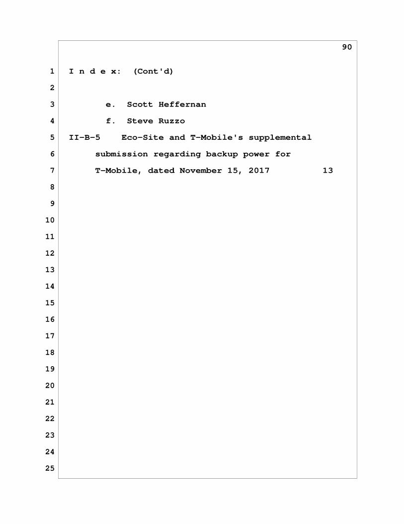
90
1 I n d e x: (Cont'd)
2
3 e. Scott Heffernan
4 f. Steve Ruzzo
5 II-B-5 Eco-Site and T-Mobile's supplemental
6 submission regarding backup power for
7 T-Mobile, dated November 15, 2017 13
8
9
10
11
12
13
14
15
16
17
18
19
20
21
22
23
24
25