Embed Size (px)
Citation preview

APPLICATION TO THE
CONNECTICUT SITING COUNCIL
FOR A
CERTIFICATE OF ENVIRONMENTAL COMPATIBILITY AND PUBLIC NEED
FOR THE
Sherwood Substation 6 New Creek Road
Westport, Connecticut
December 29, 2009
Submitted by:
The Connecticut Light & Power Company 107 Selden Street Berlin, CT 06037
Volume I of II

The Connecticut Light and Power Company
Sherwood Substation
Volume I, Application
TABLE OF CONTENTS
CSC APPLICATION GUIDELINES CHECKLIST ........................................... i A. SUMMARY DESCRIPTION AND PROJECT LOCATION ............... A-1
A.1. Municipal Participation During The Consultation Process ....................................................... A-4 B. PURPOSE OF THE APPLICATION .......................................................B-1 C. STATUTORY AUTHORITY FOR APPLICATION ............................ C-1 D. LEGAL NAME AND ADDRESS OF APPLICANT .............................. D-1 E. APPLICANT CONTACTS ........................................................................E-1 F. DESCRIPTION OF FACILITY ................................................................ F-1
F.1. Estimated Cost of the Project .................................................................................................... F-4 F.2. Facility Service Life .................................................................................................................. F-4
G. NEED FOR FACILITY ............................................................................ G-1 G.1. System Alternatives .................................................................................................................. G-8
G.1.1 Absence of Expansion Options at Existing Substations.................................................... G-8 G.1.2 Other Alternatives ........................................................................................................... G-11 G.1.2.1 Distributed Generation .................................................................................................... G-11 G.1.2.2 Demand Response ........................................................................................................... G-12 G.1.2.3 Conservation and Load Management Programs ............................................................. G-14 G.1.2.4 Summary of Other Alternatives ...................................................................................... G-14
G.2 Conclusion .............................................................................................................................. G-15 H. EXISTING CONDITIONS ....................................................................... H-1
H.1. Existing Development ............................................................................................................... H-1 H.2. Site Access ................................................................................................................................ H-5 H.3. Wetlands and Watercourses ...................................................................................................... H-5 H.4. Vegetation and Wildlife ............................................................................................................ H-6 H.5. Rare, Threatened, and Endangered Species .............................................................................. H-7 H.6. Water Supply Areas .................................................................................................................. H-8 H.7. Scenic Areas .............................................................................................................................. H-8 H.8. Historic and Archaeological Resources .................................................................................... H-8 H.9. Natural Resources ................................................................................................................... H-10 H.10. Floodplain Areas ..................................................................................................................... H-10 H.11. Recreational Areas .................................................................................................................. H-10 H.12. Seismic Areas .......................................................................................................................... H-11 H.13. Noise ....................................................................................................................................... H-11 H.14. Lighting ................................................................................................................................... H-11 H.15. Coastal Zone Management Areas ........................................................................................... H-12 H.16. Other Surrounding Features .................................................................................................... H-12
I. ALTERNATIVE SITES EVALUATED .................................................... I-1 I.1. 6 New Creek Road (the Property) .............................................................................................. I-3

The Connecticut Light and Power Company
Sherwood Substation
I.2. Terminus of Post Office Lane (between I-95 and Metro-North Railroad) ................................ I-4 I.3. Interstate Right-of-Way, north of Sherwood Island Connector ................................................. I-5 I.4. West of existing Sasco Creek Substation ................................................................................... I-5 I.5. Saugatuck Avenue at Exit 17, south side of I-95 ....................................................................... I-6 I.6. Wooded Lot across from #247 Greens Farms Road .................................................................. I-7 I.7. Summary of Alternate Site Analysis .......................................................................................... I-7
J. SAFETY AND RELIABILITY INFORMATION .................................. J-1 K. EFFECTS ON THE ENVIRONMENT ................................................... K-1
K.1. Public Health and Safety ........................................................................................................... K-1 K.2. Local, State and Federal Land Use Plans .................................................................................. K-1 K.3. Existing and Future Development ............................................................................................. K-3 K.4. Roads ......................................................................................................................................... K-3 K.5. Wetlands ................................................................................................................................... K-4 K.6. Wildlife and Vegetation ............................................................................................................ K-5
K.6.1. Rare, Threatened, and Endangered Species ...................................................................... K-5 K.7. Water Supply Areas .................................................................................................................. K-6 K.8. Historic and Archaeological Resources .................................................................................... K-6 K.9. Noise ......................................................................................................................................... K-6 K.10. Floodplains ................................................................................................................................ K-7 K.11. Seismic Areas ............................................................................................................................ K-7 K.12. Lighting ..................................................................................................................................... K-7 K.13. Natural Resources ..................................................................................................................... K-7 K.14. Coastal Zone Management Areas ............................................................................................. K-8 K.15. Other Surrounding Features .................................................................................................... K-11
L. MITIGATION MEASURES .....................................................................L-1 L.1 Pre-Construction Considerations .............................................................................................. L-1 L.2 Construction-Related Activities ................................................................................................ L-1 L.3 Post-Construction Features ....................................................................................................... L-2 L.4 Construction Sequencing .......................................................................................................... L-4
M. HEALTH AND SAFETY ......................................................................... M-1 M.1 Electric and Magnetic Fields .................................................................................................... M-1 M.2 Site Security ........................................................................................................................... M-13
M.2.1 Energy Facility Security ................................................................................................. M-13 M.3 Traffic Considerations and Hours of Operation ..................................................................... M-14
N. PROJECT SCHEDULE ............................................................................ N-1 O. GOVERNMENT APPROVALS OBTAINED ........................................ O-1 P. BULK FILING OF MUNICIPAL DOCUMENTS .................................. P-1 Q. ADMINISTRATIVE NOTICE, PUBLIC AND ABUTTERS NOTICE,
SERVICE AND OTHER FILING REQUIREMENTS ......................... Q-1 Q.1 Administrative Notice ............................................................................................................... Q-1 Q.2 Pre-Application Process (Conn. Gen. Stat. § 16-50l(e)) ........................................................... Q-3 Q.3 Application Filing Fees (Conn. Gen. Stat. § 16-50v-la) ........................................................... Q-3 Q.4 Proof of Service (Conn. Gen. Stat. § 16-50l(b)) ....................................................................... Q-3

The Connecticut Light and Power Company
Sherwood Substation
Q.5 Public Notices (Conn. Gen. Stat. § 16-50l(b)) .......................................................................... Q-4 Q.6 Notice to Owners of Property Abutting Substation Site ........................................................... Q-5
R. OTHER RELEVANT INFORMATION ................................................. R-1 R.1 Public Outreach ......................................................................................................................... R-1 R.2 Exemption from CEAB Mandatory RFP Process ..................................................................... R-2
List of Figures
Figure A-1 Site Location Map, USGS .............................................................................................. A-2 Figure A-2 Site Location Map, Aerial ............................................................................................... A-3 Figure F-1 Substation Location ........................................................................................................ F-2 Figure G-1 Existing Westport Area Substation System .................................................................... G-3 Figure G-2 Future Westport Area Substation System ....................................................................... G-4 Figure H-1 Existing Conditions Map ................................................................................................ H-2 Figure H-2 Nearest Residences ......................................................................................................... H-4 Figure H-3 Surrounding Features .................................................................................................... H-14 Figure I-1 Alternative Sites Evaluated ...............................................................................................I-2 Figure K-1 Proposed Conditions Map ............................................................................................... K-2 Figure M-1 Locations of Magnetic Field Calculations ..................................................................... M-3 Figure M-2 Magnetic Field Profile ................................................................................................... M-5 Figure M-3 Magnetic Field Profile ................................................................................................... M-6 Figure M-4 Magnetic Field Profile ................................................................................................... M-7 Figure M-5 Magnetic Field Profile ................................................................................................... M-8
List of Tables
Table G-1 August 2, 2005 Outage Summary ................................................................................... G-2 Table G-2 Estimated Peak Electric Demand in MVA ..................................................................... G-6 Table G-3 Area Substation Load and Capacity in MVA-2012 ........................................................ G-7 Table G-4 System Alternative Summary Table ............................................................................. G-11 Table G-5 CL&P Demand Response - Westport ........................................................................... G-12 Table G-6 Approved EG Projects .................................................................................................. G-13 Table G-7 CL&P Energy Efficiency .............................................................................................. G-14 Table H-1 Non-Residential Features within Two Miles of the Property in Westport .................... H-13 Table I-1 Sherwood Substation Site Alternatives Analysis Matrix ..................................................I-9 Table M-1 Existing Magnetic Fields in 2009 .................................................................................. M-4 Table M-2 Projected Magnetic Field Levels in 2017 .................................................................... M-11 Table O-1 Permits Applicable to the Sherwood Substation Project ................................................ O-4
List of Exhibits
See Volume II, Exhibits
The Connecticut Light and Power Company
Sherwood Substation i
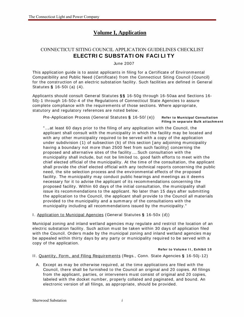
Volume I, Application
CONNECTICUT SITING COUNCIL APPLICATION GUIDELINES CHECKLIST ELECTRIC SUBSTATION FACILITY
June 2007
This application guide is to assist applicants in filing for a Certificate of Environmental Compatibility and Public Need (Certificate) from the Connecticut Siting Council (Council) for the construction of an electric substation facility. Such facilities are defined in General Statutes § 16-50i (a) (4).
Applicants should consult General Statutes §§ 16-50g through 16-50aa and Sections 16-50j-1 through 16-50z-4 of the Regulations of Connecticut State Agencies to assure complete compliance with the requirements of those sections. Where appropriate, statutory and regulatory references are noted below.
Pre-Application Process (General Statutes § 16-50l (e)) Refer to Municipal Consultation Filing in separate Bulk attachment
"….at least 60 days prior to the filing of any application with the Council, the applicant shall consult with the municipality in which the facility may be located and with any other municipality required to be served with a copy of the application under subdivision (1) of subsection (b) of this section [any adjoining municipality having a boundary not more than 2500 feet from such facility] concerning the proposed and alternative sites of the facility…..Such consultation with the municipality shall include, but not be limited to, good faith efforts to meet with the chief elected official of the municipality. At the time of the consultation, the applicant shall provide the chief elected official with any technical reports concerning the public need, the site selection process and the environmental effects of the proposed facility. The municipality may conduct public hearings and meetings as it deems necessary for it to advise the applicant of its recommendations concerning the proposed facility. Within 60 days of the initial consultation, the municipality shall issue its recommendations to the applicant. No later than 15 days after submitting the application to the Council, the applicant shall provide to the Council all materials provided to the municipality and a summary of the consultations with the municipality including all recommendations issued by the municipality."
I. Application to Municipal Agencies (General Statutes § 16-50x (d))
Municipal zoning and inland wetland agencies may regulate and restrict the location of an electric substation facility. Such action must be taken within 30 days of application filed with the Council. Orders made by the municipal zoning and inland wetland agencies may be appealed within thirty days by any party or municipality required to be served with a copy of the application.
Refer to Volume II, Exhibit 10
II. Quantity, Form, and Filing Requirements (Regs., Conn. State Agencies § 16-50j-12)
A. Except as may be otherwise required, at the time applications are filed with the Council, there shall be furnished to the Council an original and 20 copies. All filings from the applicant, parties, or interveners must consist of original and 20 copies, labeled with the docket number, properly collated and paginated, and bound. An electronic version of all filings, as appropriate, should be provided.

The Connecticut Light and Power Company
Sherwood Substation ii
Refer to Volumes I and II of this CSC Filing
B. Bulk filing should be provided of not less than four (4) copies of the applicable town zoning and Inland wetlands regulations (including a map showing the location of inland wetlands if relevant) and plan of development and any other publicly available material in support of the application.
Refer to Volumes I and II of this CSC Filing
C. Applications filed for the purpose of any proceeding before the Council shall be printed or typewritten on paper cut or folded to letter size, 8 1/2 by 11 inches. Width of margins shall be not less than one inch. The impression shall be on only one side of the papers, unless printed, and shall be double spaced, except that quotations in excess of five typewritten lines shall be single spaced and indented. Mimeographed, multigraphed, photoduplicated, or the like copies will be accepted as typewritten, provided all copies are clear and permanently legible. In accordance with the State Solid Waste Management Plan, all filings should be submitted on recyclable paper, primarily regular weight white office paper. Applicants should avoid using heavy stock paper, colored paper, and metal or plastic binders and separators.
Refer to Volumes I and II of this CSC Filing
D. Every original shall be signed by the applicant or by one or more attorneys in their individual names on behalf of the applicant. All applications shall be filed at the office of the Council, 136 Main Street, Suite 401, New Britain, Connecticut 06051. Service of all documents and other papers filed as applications, briefs, and exhibits, but not limited to those categories, shall be by personal delivery or by first class mail to the Council and all parties and interveners to the proceeding, unless service has been waived.
Refer to Volumes I and II of this CSC Filing
E. Any exhibits, sworn written testimony, data, models, illustrations, and all other materials that the applicant deems necessary or desirable to support the granting of the application shall be attached to the application. In addition, annexed materials shall include such exhibits, sworn written testimony, and other data that any statute or regulations may require. The applicant may request that administrative notice be taken of and refer in the application to portions of other Council docket records and generic hearings or statements prepared by the Council as a result of generic hearings.
Refer to Volumes I and II of this CSC Filing
F. Applicants may present material in a sequence and format most appropriate for the particular proposal. To allow timely Council review, include with the application a copy of this form with page references for each item required in Section VII below.
Included Herein
G. Potential applicants are urged to carefully review General Statutes §§ 16-50l(e), 16-50i and 16a-7c to determine whether the proposed project falls within the Connecticut Energy Advisory Board (CEAB) "request-for-proposal" process.
Pursuant to Conn. Gen. Stats. § 16-50l (a) (2), this project is exempt from the mandatory RFP process. See Volume I, Section R.2

The Connecticut Light and Power Company
Sherwood Substation iii
III. Application Filing Fees (Regs., Conn. State Agencies § 16-50v-la)
The filing fee for an application is determined by the following schedule:
Estimated Construction Cost Fee
Up to $5,000,000 0.05% or $1,000.00, whichever is greater; Above $5,000,000 0.1% or $25,000.00, whichever is less.
All application fees shall be paid to the Council at the time an application is filed with the Council. Additional assessments may be made for expenses in excess of the filing fee. Fees in excess of the Council’s actual costs will be refunded to the applicant.
See Volume I, Section Q.1 Filing Fees accompany CSC Application
IV. Proof of Service (General Statutes § 16-50l (b))
Each application shall be accompanied by proof of service of such application on:
See Volume I, Section Q.4
A. The chief elected official, the zoning commission, planning commission, the planning and zoning commissions, and the conservation and wetlands commissions of the site municipality and any adjoining municipality having a boundary not more than 2500 feet from the facility;
B. The regional planning agency that encompasses the site municipality;
C. The State Attorney General;
D. Each member of the Legislature in whose district the facility is proposed;
E. Any federal agency, department, commission or instrumentality which has jurisdiction over the proposed facility; and
F. The state departments of environmental protection, public health, public utility control, economic and community development, and transportation; the council on environmental quality; the State Historic Preservation Officer and the office of policy and management.
V. Public Notice (General Statutes § 16-50l (b))
Notice of the application shall be published at least twice prior to the filing of the application in a newspaper having general circulation in the site municipality or municipalities. The notice shall state the name of the applicant, the date of filing, and a summary of the application. The notice must be published in not less than ten point type.
See Volume I, Section Q.5
VI. Notice to Abutting Landowners (General Statutes § 16-50l (b))
Notice of the application shall be sent by certified or registered mail to all abutting landowners of the proposed and alternative sites of the facility. Notice shall be sent at the same time that notice of the application is given to the general public.
See Volume I, Section Q.6
The application shall be accompanied by an affidavit of notice to all abutting landowners and an affidavit of publication each time notice of application is published.
See Volume II, Exhibit 9

The Connecticut Light and Power Company
Sherwood Substation iv
The Council also advises each applicant that at least ten business days prior to the public hearing such applicant should erect and maintain in a legible condition a sign not less than six feet by four feet upon the site at the entrance to the property from a public road where such facility is to be located. The sign shall set forth the name of the applicant, the type of facility, the public hearing date, and contact information for the Council (Web site and phone number).
Example:
PUBLIC NOTICE:
CL&P has filed an application with the Connecticut Siting Council (Council) for construction of an electric substation facility on this site. The Council will hold a public hearing on March 27, 2004 at the Newington Town Hall Auditorium at 3 and 7 p.m. A copy of the application can be reviewed at the town hall or at the Council offices in New Britain, CT. For more information, please contact the Council by telephone at 860-827-2935, electronically at www.ct.gov/csc, or by mail at 10 Franklin Square, New Britain, Connecticut 06051.
VII. Contents of Application (General Statutes § 16-50l (a) (1) and Regulations § 16-50j-74)
An application for a Certificate for the construction of an electric substation facility should include or be accompanied by the following:
A. An executive summary of the first page of the application with the address of the facility. A brief description and the location of the proposed facility, including an artist’s rendering and/or narrative describing its appearance.
See Volume I, Section A
1. A statement of the purpose for which the application is being made.
See Volume I, Section B
2. A statement describing the statutory authority for such application.
See Volume I, Section C
3. The exact legal name of each person seeking the authorization or relief and the address or principal place of business of each such person. If any applicant is a corporation, trust association, or other organized group, it shall also give the state under the laws of which it was created or organized.
See Volume I, Section D
4. The name, title, address, and telephone number of the attorney or other person to whom correspondence or communications in regard to the application are to be addressed. Notice, orders, and other papers may be served upon the person so named, and such service shall be deemed to be service to the applicant.
See Volume I, Section E
B. A description of the proposed facility including:
See Volume I, Section F 1. Access roads and utility services; 2. Special design features; 3. The following list should be included where applicable; a. Itemized estimated costs; b. Comparative costs of alternatives considered; c. Facility service life; d. Bus and specifications; e. Overhead take-off design, appearance, and heights, if any;

The Connecticut Light and Power Company
Sherwood Substation v
f. Length of interconnections to transmission and distribution; g. Initial and design voltages and capacities; h. Rights-of-way and access-way acquisition; i. Transmission connections and distribution feeders; and j. Service area;
C. A statement and full explanation of why the proposed facility is needed and how the facility would conform to a long-range plan for the expansion of the electric power grid serving the state and interconnected utility systems that would serve the public need for adequate, reliable, and economic service, including:
See Volume I, Section G
1. A description and documentation of the existing system and its limitations;
2. Justification for the proposed in-service date;
3. The estimated length of time the existing system is judged to be adequate with and without the proposed facility;
4. Identification of system alternatives with the advantages and disadvantages of each;
and
5. If applicable, identification of the facility in the forecast of loads and resources pursuant to General Statutes § 16-50r.
D. A statement of the benefits expected from the proposed facility with as much specific information as is practicable.
See Volume I, Section G
E. A description of the named sites, including:
1. The most recent U.S.G.S. topographic quadrangle map (scale 1 inch = 2,000 feet) marked to show the site of the facility and any significant changes within a one mile radius of the site;
See Volume I, Sections A and H
2. A map (scale not less than 1 inch = 200 feet) of the lot or tract on which the facility is proposed to be located showing the acreage and dimensions of such site, the name and location of adjoining public roads or the nearest public road, and the names of abutting owners and the portions of their lands abutting the site;
See Volume I, Section H, and Volume II, Exhibit 1
3. A site plan (scale not less than 1 inch = 40 feet) showing the proposed facility, set back radius, existing and proposed contour elevations, 100 year flood zones, waterways, wetlands, and all associated equipment and structures on the site;
See Volume I, Section H, and Volume II, Exhibit 1
a. Settled areas; b. Schools and daycare centers; c. Hospitals; d. Group homes; e. Forests and parks f. Recreational areas; g. Seismic areas; h. Scenic areas; i. Historic areas;

The Connecticut Light and Power Company
Sherwood Substation vi
j. Areas of geologic or archaeological interest; k. Areas regulated under the Inland Wetlands and Watercourses Act; l. Areas regulated under the Tidal Wetlands Act and Coastal Zone Management Act; m. Public water supplies; n. Hunting or wildlife management areas; and o. Existing transmission lines within one mile of the site.
4. Where relevant, a terrain profile showing the proposed facility and access road with existing and proposed grades; and See Volume II, Exhibit 1
5. The most recent aerial photograph (scale not less than 1 inch = 1,000 feet) showing the proposed site, access roads, and all abutting properties.
See Volume I, Section A and H
F. A justification for selection of the proposed site including a comparison with alternative sites which are environmentally, technically, and economically practicable. Include enough information for a complete comparison between the proposed site and any alternative site contemplated. See Volume I, Section I
G. Safety and reliability information, including:
1. Provisions for emergency operations and shutdowns; and
2. Fire suppression technology. See Volume I, Section J
H. A description of the effect that the proposed facility would have on the environment, ecology, and scenic, historic, and recreational values, including effects on:
See Volume I, Section K
1. Public health and safety; 2. Local, state, and federal land use plans; 3. Existing and future development; 4. Roads; 5. Wetlands; 6. Wildlife and vegetation, including rare and endangered species, and species of
special concern, with documentation by the Department of Environmental Protection Natural Diversity Data Base;
7. Water supply areas; 8. Archaeological and historic resources, with documentation by the State Historic
Preservation Officer; and 9. Other environmental concerns identified by the applicant, the Council, or any public
agency.
I. Sight line graphs to the named sites from visually impacted areas such as residential developments, recreational areas, and historic sites;
J. A statement explaining mitigation measures for the proposed facility including:
See Volume I, Section L
1. Construction techniques designed specifically to minimize adverse effects on natural areas and sensitive areas;
2. Special routing or design features made specifically to avoid or minimize adverse effects on natural areas and sensitive areas;
3. Establishment of vegetation proposed near residential, recreational, and scenic areas; and

The Connecticut Light and Power Company
Sherwood Substation vii
4. Methods for preservation of vegetation for wildlife habitat and screening.
K. Justification that the location of the proposed facility would not pose an undue safety or health hazard to persons or property at the site of the proposed facility including:
See Volume I, Section M
1. Measurements of existing electric and magnetic fields (EMF) at site boundaries, and at boundaries of adjacent schools, daycare facilities, playgrounds, and hospitals, with extrapolated calculations of exposure levels during expected normal and peak normal line loading;
2. Calculations of expected EMF levels at the above-listed locations that would occur during normal and peak normal operation of the facility; and
3. A statement describing consistency with the Council’s "Best Management Practices for Electric and Magnetic Fields," as amended.
L. A schedule of the proposed program for right-of-way or property acquisition, construction, rehabilitation, testing, and operation. See Volume I, Section N M. A statement of estimated costs for site acquisition, construction, and equipment for a facility at the various proposed sites of the facility, including all candidates referred to in the application; See Volume I, Section F.1
N. Such information as any department or agency of the State exercising environmental controls may, by regulation, require including: See Volumes I and II
1. A listing of any federal, State, regional, district, and municipal agencies, including but not limited to the Federal Aviation Administration; State Historic Preservation Officer; State Department of Environmental Protection; and local conservation, inland wetland, and planning and zoning commissions with which reviews were conducted concerning the facility, including a copy of any agency position or decision with respect to the facility; and See Volume I, Section O
2. The most recent conservation, inland wetland, zoning, and plan of development documents of the municipality, including a description of the zoning classification of the site and surrounding areas, and a narrative summary of the consistency of the project with the Town’s regulations and plans. See Volume I, Sections H and K, and
Bulk Filing
O. Such information the applicant may consider relevant. See Volume I, Section R
P. Description of proposed site clearing for access road and compound including type of vegetation scheduled for removal and quantity of trees greater than six inches diameter at breast height and involvement with wetlands;
See Volume I, Section K, and Volume II, Exhibit 1 Proposed for Development & Management Plan Submission

The Connecticut Light and Power Company
Sherwood Substation viii
VIII. Procedures
A. The Council will review and may reject the application within 30 days if it fails to comply with specific data or exhibit requirements or if the applicant fails to promptly correct deficiencies. (Regs., Conn. State Agencies §§ 16-50l-4 through 16-50l-5)
B. The Council and any party or intervener to the proceeding may file exhibits and interrogatories requesting supplemental or explanatory materials. All filings will be subject to cross-examination and the Council’s discretion for admission into the record. (General Statutes § 16-50o)
C. A public hearing must be held at a location selected by the Council in the county in which the facility is proposed, with one session held after 6:30 p.m. for the convenience of the public. If the proposed facility is to be located in more than one county, the Council shall fix the location for at least one public hearing session in whichever county it deems appropriate, provided that the Council may hold hearing sessions in more than one county. The Council’s record must remain open for 30 days after the close of the hearing. (General Statutes § 16-50n (f))
D. The Council must render a decision within 180 days of receipt of an application, extendible by 180 days upon consent of applicant. (General Statutes § 16-50p)
______________________________________
**PLEASE NOTE THAT THIS GUIDE IS NO SUBSTITUTION FOR OBTAINING ADVICE FROM LEGAL COUNSEL. IN THE EVENT OF ANY CONFLICT BETWEEN THIS GUIDE AND THE ACTUAL STATUTES AND REGULATIONS, THE STATUTES AND REGULATIONS SHALL GOVERN.**

The Connecticut Light and Power Company
Sherwood Substation A-1
A. SUMMARY DESCRIPTION AND PROJECT LOCATION
The Applicant, The Connecticut Light and Power Company (“CL&P”), seeks to construct
a new bulk power 115-kilovolt (“kV”) to 13.8-kV substation (the “Sherwood Substation” or
“Substation”) on CL&P property located at 6 New Creek Road in Westport, Connecticut (the
“Property” or “Site”). The Sherwood Substation would improve reliability and add needed
distribution delivery-system capacity to serve the growing electric power demands in the Greens
Farms section and immediately adjacent portions of the southeast area of Westport. In addition,
the Sherwood Substation would eliminate the need for temporary equipment now in use.
The current system configuration of existing substations will not meet the Town’s
growing electric demand and future reliability needs. Currently, the electric load in town is
served by two distribution substations in Westport and by three bulk transmission power
substations, two in Westport and one in Weston. Growing peak demands are straining the
capacity of these substations. The addition of a new bulk power substation in Westport would
create a more robust and reliable system that would serve the growing needs of the Town while
effectively alleviating loads on the existing substations.
The Substation would be located on a 2.56-acre parcel (6 New Creek Road) identified by
the Westport Assessor’s Office on Map G06, as Lot 5. CL&P acquired the Property in 2008 for
the specific purpose of building a substation. The Property’s location is identified on a United
States Geological Survey (“USGS”) and aerial photograph provided as Figure A-1 (Site
Location Map, USGS) and Figure A-2 (Site Location Map, Aerial), respectively. The Property
lies immediately south of existing overhead transmission circuits and an active railroad in the
southern portion of Westport and is currently occupied by a single-family dwelling.

Figure A-1: Site Location Map, USGS
Proposed Substation Location6 New Creek RoadWestport, Connecticut
Base Map Source: U.S.G.S. Quad: Sherwood Point, CT (1971)
1,000 0 1,000500Feet
Approximate CL&P Property Boundary
Westport, Connecticut
Vanasse Hangen Brustlin, Inc.Transportation Land Development Environmental Services
.

Approximate CL&P Property BoundaryExisting Transmission Line Corridor
New Cree
k Road
§̈¦95
Figure A-2: Site Location Map, Aerial
Base Map Source: 2006 color aerial photograph with 1 foot resolution
150 0 15075Feet
Vanasse Hangen Brustlin, Inc.Transportation Land Development Environmental Services
.Proposed Substation Location6 New Creek RoadWestport, Connecticut
Westport, Connecticut
The Connecticut Light and Power Company
Sherwood Substation A-4
Prior to and during the municipal consultation process, CL&P consulted with the Town
of Westport Chief Elected Official (“CEO”) and other town officials and personnel to present an
overview of the Project, answer questions, and provide a point of contact to obtain additional
information. As part of the location approval and MCF processes, CL&P presented Project
information to the Town of Westport Conservation Commission and the Westport Planning and
Zoning Commission in June and November, 2009.
This Project was identified in the Connecticut Siting Council Review of the Connecticut
Electrical Utilities Ten-Year Forecast of Loads and Resources, published in 2007, 2008 and again in
2009 (by reference to the 2008 report). The proposed Project plan received technical approval from
ISO-NE (New England’s Independent System Operator) on December 12, 2008.
CL&P has designed the Substation in a manner that minimizes the potential
environmental and visual effects to the greatest extent practicable and has incorporated measures
to ensure the protection of existing resources during construction and operation of the Substation
facilities.
A.1. Municipal Participation During The Consultation Process
On many occasions over the past eighteen months, CL&P has consulted with Town of
Westport officials, including First Selectman Gordon F. Joseloff, regarding the electric service
provided by CL&P to the Westport community and CL&P’s desire to improve the reliability of
that service. CL&P has also met with the Westport Planning and Zoning Commission,
Conservation Commission, Architectural Review Board, Greens Farms Academy, and Greens
Farms Association to discuss the Project.

The Connecticut Light and Power Company
Sherwood Substation A-5
As explained in detail in the remainder of this submission, the Sherwood Substation will:
• address a need for additional distribution system capacity and increased reliability in the Town of Westport by establishing a new, strategically positioned bulk-power source;
• comply with regional planning and reliability standards and Northeast Utilities’
transmission planning guidelines;
• occupy a property purchased by CL&P for this specific use that is immediately adjacent to an existing electric transmission corridor, providing direct interconnection to an existing transmission line;
• be consistent with applicable public health and safety requirements, standards and
codes;
• be constructed in compliance with the standards of the National Electrical Safety Code, the Connecticut Department of Public Utility Control, and good utility practice;
• be consistent with local, State and federal land use plans;
• be designed to avoid effects on existing wetlands and watercourses on the
Property;
• be designed to minimize effects on existing wildlife, vegetation, and rare, threatened and endangered species habitat;
• not result in any adverse effects on public water supplies;
• be strategically located and designed to minimize visual impacts to surrounding
areas;
• have no adverse effect on historic, cultural and/or archaeological resources;
• be designed to minimize earthwork and soil disturbance during construction, including development of appropriate plans to stabilize and restore affected areas;
• not be located within a floodplain;
• comply with applicable State noise regulations; and,
• have no significant permanent adverse effects on the environment.

The Connecticut Light and Power Company
Sherwood Substation B-1
B. PURPOSE OF THE APPLICATION
CL&P is applying to the Connecticut Siting Council (“CSC” or the “Council”) for a
Certificate of Environmental Compatibility and Public Need (“Certificate”) for the Sherwood
Substation project (the “Project”). The purpose of this Project is to increase electric distribution
system capacity and improve reliability in the Town of Westport by establishing a new bulk-
power substation in the Greens Farms section of town. The current system configuration of
existing substations will not meet the Town’s growing electric demand and future reliability
needs.

The Connecticut Light and Power Company
Sherwood Substation C-1
C. STATUTORY AUTHORITY FOR APPLICATION
CL&P is applying to the Council pursuant to Section 16-50g et seq. of the General
Statutes of Connecticut.
This filing includes information concerning the Applicant, existing conditions at the
Property, and the proposed conditions for construction of the Substation, including:
• its location and design;
• the various alternatives considered to date and the process by which the Property
was identified and selected;
• the need for its construction and operation;
• its potential effects on the environment; and
• mitigation measures proposed by CL&P.

The Connecticut Light and Power Company
Sherwood Substation D-1
D. LEGAL NAME AND ADDRESS OF APPLICANT
The Connecticut Light and Power Company (a specially chartered Connecticut corporation) 107 Selden Street Berlin, CT 06037 Mailing Address: CL&P P.O. Box 270 Hartford, CT 06141-0270 Telephone: (860) 665-5000 Internet Address: Northeast Utilities Transmission website www.transmission-nu.com

The Connecticut Light and Power Company
Sherwood Substation E-1
E. APPLICANT CONTACTS
Correspondence and other communications with regard to the Sherwood Substation
should be addressed to, and notices, orders and other papers should be served upon, the
following:
Mr. John R. Morissette, Manager Transmission Siting and Permitting Northeast Utilities Service Company P.O. Box 270 Hartford, CT 06141-0270 Telephone: (860) 665-2036 E-mail address: [email protected]
Mr. Chris Swan, Director Municipal Relations Siting and Permitting Northeast Utilities Service Company 9 Tindall Avenue Norwalk, CT 06851 Telephone: (203) 845-3421 E-mail address: [email protected]
Mr. Kris Aberg, Project Manager Northeast Utilities Service Company P.O. Box 270 Hartford, CT 06141-0270 Telephone: (860) 665-6733 E-mail address: [email protected]
Duncan MacKay, Esq. Jeffery Cochran, Esq. Legal Department Northeast Utilities Service Company P.O. Box 270 Hartford, CT 06141-0270 Telephone: (860) 665-3495 E-mail address: [email protected] E-mail address: [email protected] Marianne Barbino Dubuque, Esq. and Robert S. Golden, Jr., Esq Carmody & Torrance LLP 50 Leavenworth Street P.O. Box 1110 Waterbury, CT 06721-1110 Telephone: (203) 573-1200 E-mail addresses: [email protected] [email protected]

The Connecticut Light and Power Company
Sherwood Substation F-1
F. DESCRIPTION OF FACILITY
The Property was acquired in 2008 for the purpose of building a bulk power substation.
The 2.56-acre Property consists of a residential house parcel located at 6 New Creek Road. The
Property is identified by the Westport Assessor’s Office on Map G06, as Lot 5.
The Substation would be accessible from New Creek Road and would be located to the
south of the existing overhead transmission line and railroad corridor. Two 115-kV circuits
(#1130 & #1890) exist within this corridor (see Figure F-1, Substation Location). The
Substation would occupy an irregularly shaped area of 21,370+ square feet (measuring
approximately 137 feet by 160 feet at its longest dimensions) to be covered with a trap rock
surface and secured by a seven-foot high chain link fence topped with one foot of barbed wire
(three strands). The Property would accommodate the construction and operation of the
Substation while allowing adequate space for extensive landscaping.
At present, the 1130 and 1890 circuits are routed west to east with respect to the Property.
The centerline of the 1890 circuit is approximately 35 feet to the north of the Property’s
northerly border and the centerline of the 1130 circuit is approximately 100 feet to the north of
the Property’s northerly border. The existing 1890 circuit would be rerouted into the Substation.
The segment of the existing 1890 circuit to the east of the Property would be renamed the 1578
circuit; the remaining segment of the existing circuit to the west of the Property would remain
the 1890 circuit.

!(d!(d
!(d
!(d
!(d
!(d
!(d
!(d
!(d!(d
1130 Circuit
1578 Circuit
1890 Circuit
New Cree
k Road
Terminal Structures
§̈¦95
*Base Map Source: 2006 color aerial photograph with 1 foot resolution
Legend!d( Existing Line Support Structures!d( Proposed Line Support Structures
Existing Transmission CircuitProposed Interconnecting Circuit
Proposed Substation LocationApproximate Property Boundary
100 0 10050Feet
Figure F-1: Substation Location
.Vanasse Hangen Brustlin, Inc.Transportation Land Development Environmental Services

The Connecticut Light and Power Company
Sherwood Substation F-3
Connecting the Substation to the existing 1890 circuit requires the installation of two new
steel monopoles, similar in height to the transmission structures currently occupying the
transmission line corridor. The interconnections between the Substation and the new
transmission line poles would be accomplished by installing two new line-terminal structures
(approximately 50 feet in height) within the Substation. The Substation would also be outfitted
with a circuit breaker, seven disconnect switches, five circuit switchers and two 60-Megavolt-
Ampere (MVA) power transformers that would step down the voltage from 115 kV to 13.8 kV.
A third transformer position would be provided to accommodate a temporary, mobile
transformer for emergency conditions.
Four metal switchgear enclosures, each approximately 21 feet long, 14 feet wide and 14
feet high, would be installed to provide the switching equipment, relaying and control equipment
as well as the battery and charger associated with the distribution equipment. In addition to the
switchgear enclosures, a metal control enclosure, approximately 48 feet long by 14 feet wide by
14 feet high, would be installed at the east end of the Substation. This enclosure would be
designed to house the protective relaying and control equipment as well as the battery and
charger associated with the transmission equipment. A new, approximately 15-foot wide access
drive originating from New Creek Road to the Substation would be established in the eastern
portion of the Property. The existing residential driveway would be used during construction
and ultimately eliminated and its associated pavement removed. The existing residence located
on the Property would also be removed as part of the Project.
Technical specifications and related information are presented in Volume II, Exhibit 1
(Site Plan Drawings).

The Connecticut Light and Power Company
Sherwood Substation F-4
Development of the Substation requires protective relay system changes within the
existing control enclosures at Norwalk Harbor, Glenbrook, and Sasco Creek Substations. These
upgrades are required for the safe and proper operation of the Substation. A fiber optic cable
would be installed between the Substation and the two new transmission line structures.
F.1. Estimated Cost of the Project
The estimated cost for the siting, design, and construction of the Substation and
supporting infrastructure is approximately $19,800,000.
F.2. Facility Service Life
The Substation equipment and supporting infrastructure would have a service life of
approximately 40 years and would be capable of capacity increases during this time.