Embed Size (px)
Citation preview
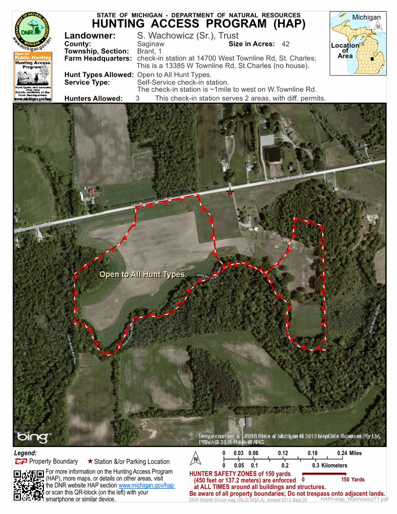
STATE OF MICHIGAN - DEPARTMENT OF NATURAL RESOURCES Michigan
LocationofArea
0 0.06 0.12 0.18 0.240.03 Miles0 0.1 0.2 0.30.05 Kilometers
Service Type:
N
N
Legend:
Landowner:
Hunt Types Allowed:
Size in Acres: 42
This check-in station serves 2 areas, with diff. permits.
Open to All Hunt Types.
3
S. Wachowicz (Sr.), Trust
check-in station at 14700 West Townline Rd, St. Charles;This is a 13385 W Townline Rd, St.Charles (no house).Self-Service check-in station.The check-in station is ~1mile to west on W.Townline Rd.
Property Boundary Station &/or Parking Location_̂
HUNTING ACCESS PROGRAM (HAP)
HAPf-map_WachowiczT1.pdf
Brant, 1Township, Section:County: Saginaw
0 150 YardsHUNTER SAFETY ZONES of 150 yards (450 feet or 137.2 meters) are enforced at ALL TIMES around all buildings and structures.Be aware of all property boundaries; Do not trespass onto adjacent lands.
www.mich ig an.gov /dnr
DNR-Wildlife Divion map (WLD/ MS/LA), revised 2013 Sept.30
Farm Headquarters:
For more information on the Hunting Access Program(HAP), more maps, or details on other areas, visitthe DNR website HAP section or scan this QR-block (on the left) with your smartphone or similar device.
www.michigan.gov/hap
Hunters Allowed: