Embed Size (px)
Citation preview
Prepared for:City of Raleigh Parks and Recreation
Prepared by:Lappas + Havener, PA
November 8 2010
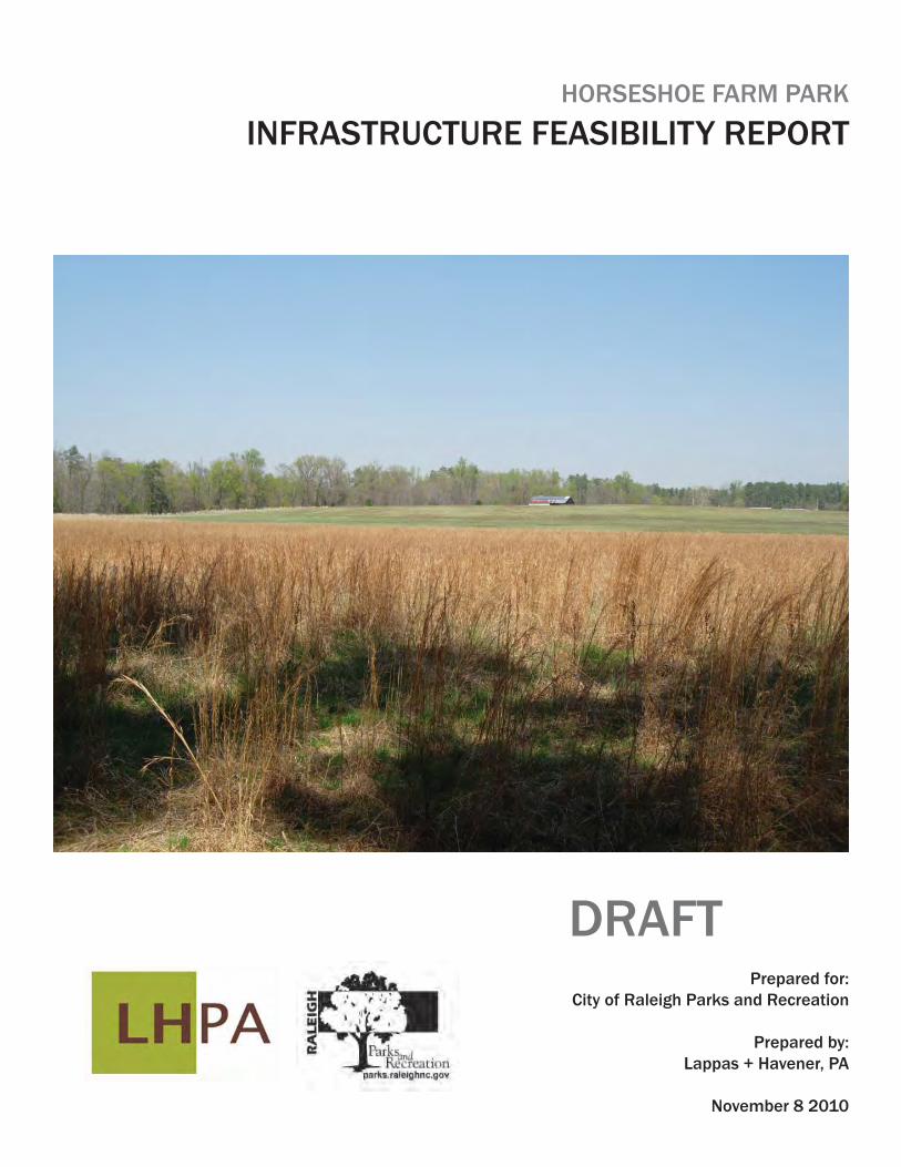
HORSESHOE FARM PARK
INFRASTRUCTURE FEASIBILITY REPORT
DRAFT
2INFRASTRUCTURE FEASIBILITY REPORT HORSESHOE FARM PARK
Design Team:
Lappas + Havener, PA Prime Design Consultant
Mulkey Engineers and Consultants Civil Engineering
Biohabitats Ecological Consultant
Consider Design, PA Renewable Energy Systems
Integrated Water Strategies Water Recycling Consultant
Frank Harmon Architect PA Architecture
Prepared for:City of Raleigh Parks and Recreation Department
3HORSESHOE FARM PARK INFRASTRUCTURE FEASIBILITY REPORT
Executive Summary 5
Site Systems: Opportunities and Constraints
Habitat and Natural Systems 7Roads and Access 11Potable Water and Stormwater Systems 12Waste Water and Water Recycling 16Architectural Resources 20Renewable Energy 23Required Permits 26
Appendices
Aerial PhotographMaster Plan Mission StatementPhase I Vision StatementSustainable PrinciplesExhibitsSoils MapFlow Accumulation DiagramNatural AnalysisSite AnalysisSite PhotographsArchitectural Structures and Analysis
TABLE OF CONTENTS
4INFRASTRUCTURE FEASIBILITY REPORT HORSESHOE FARM PARK
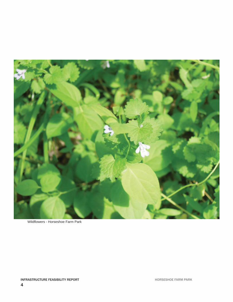
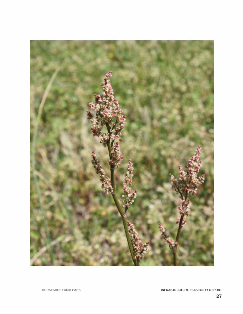
Wildfl owers - Horseshoe Farm Park
5HORSESHOE FARM PARK INFRASTRUCTURE FEASIBILITY REPORT
EXECUTIVE SUMMARY
Horseshoe Farm Park is a 146-acre oxbow sited on the Neuse River in Raleigh, North Carolina. The park has been designated a “Signifi cant Natural Heritage Area” by the State of North Carolina. The park contains a variety of habitats and ecosystems with a rich and diverse plant and animal communities. Signifi cant studies have been con-ducted and a wealth of information has been collected on the park. This report brings this knowledge forward by providing a more in depth look at both the natural systems and the built systems, tailored to the park’s vision statement and sustainable principles and goals.
The infrastructure report is a document which attempts to collect, assemble and pres-ent the site’s opportunities and constraints. The goal of this report is to assist current and future park designers and city offi cials in making well-informed decisions based on the report and the park’s sustainable principles. The report, while not all-inclusive, pro-vides valuable information regarding the park’s built and natural systems. The report identifi es the park’s possibilities in terms of meeting its sustainable goals and rec-ognizing the need for further study and data. The park’s goal of providing a potential building system is achievable but will require additional information in particular to the water system and electrical system analysis. The infrastructure report also provides an analysis of the park’s natural habitat and lays the ground work for the natural resource management plan.
In summary, Horsefarm Park is a jewel in the City of Raleigh Parks and Recreation Department. It contains a wealth of unique plant and animal habitats some of which are only found here in North Carolina. The Infrastructure Report is a blueprint on how to provide access to this unique environment while conserving its diversity. The Infra-structure Report examines six key areas - Habitat Protection & Natural Systems, Roads & Access, Potable Water & Stormwater Systems, Waste Water & Water Recycling, Architectural Resources and Renewable Energy. Each system is reviewed in terms of its existing condition, opportunities and constraints with an emphasis on sustainability, The balance of human interaction and habitat conservation is expressed in the parks’s vision statement and articulated in the systems provided in this document. The goal of conserving the park’s natural systems and habitats for next generation is a corner stone to the overall park’s vision.
6INFRASTRUCTURE FEASIBILITY REPORT HORSESHOE FARM PARK
Hab
itat Z
ones
det
erm
ined
by
WH
ZAT
7HORSESHOE FARM PARK INFRASTRUCTURE FEASIBILITY REPORT
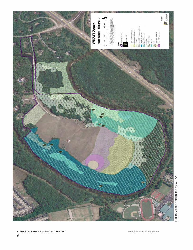
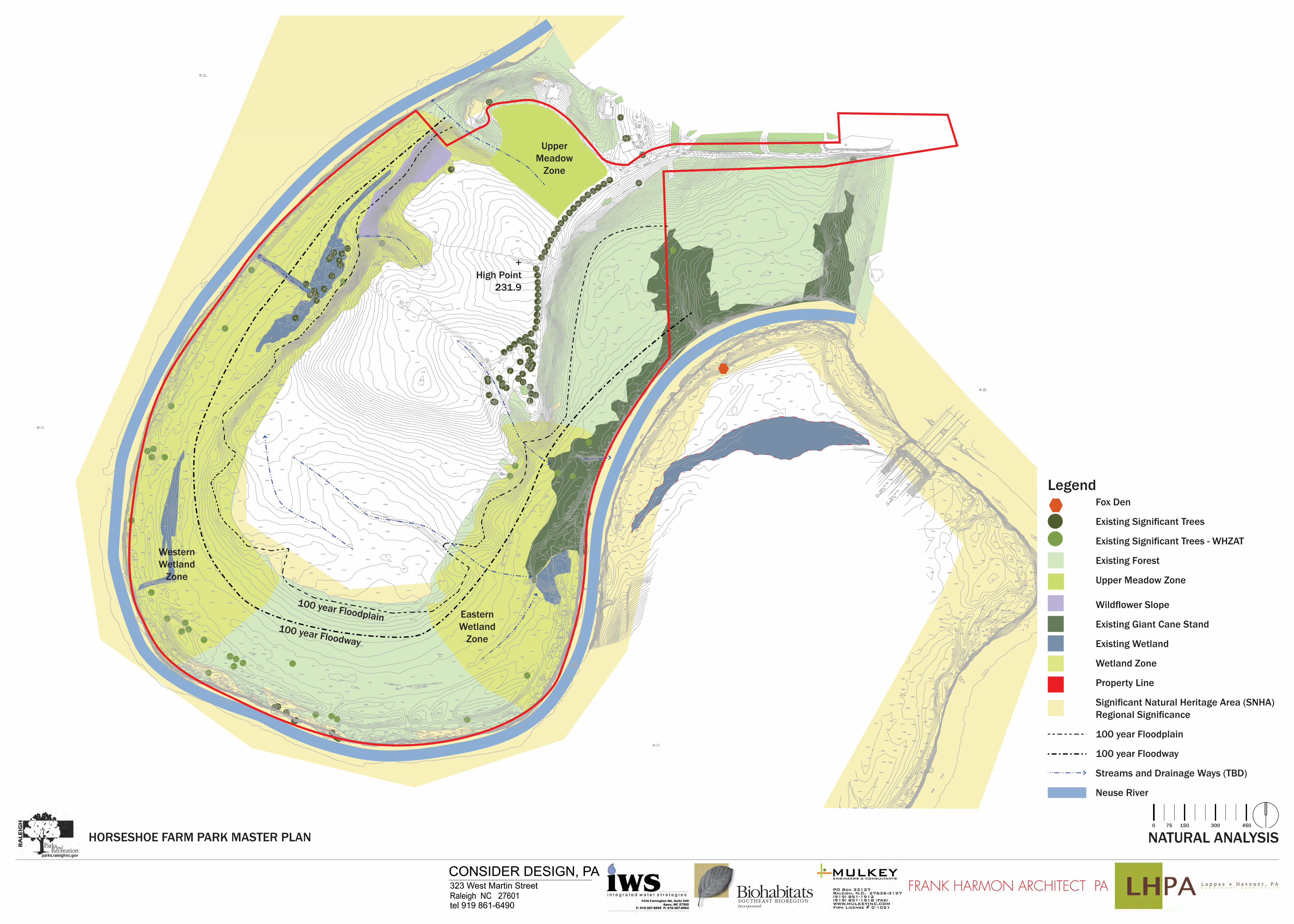
Site Ecology
A study for the siting of the new Park begins with the Horseshoe Farm site itself, as the environment within which infrastructure development will take place. The Wildlife Habitat Zones Advisory Team (WHZAT), composed of ecologists, biologists, and park professionals, analyzed the site to determine the suitablity of various zones of the site for a variety of development types, such as roads, parking, buildings, and trails. Their recommendations are listed below.
Guidelines for Site Development from the WHZAT report:
All construction practices at Horseshoe Farm Park, both major and minor, must be 1. sensitive to the natural resources on site including but not limited to various plant spe-cies, breeding/migratory birds, aquatic buffers and peak amphibian movement peri-ods, etc. Staff and consultants should monitor and work closely with the consultant and contractor to ensure compliance with protection measures.
Protect heritage trees: Avoid creating trails or other park development within their 2. critical root zones (1.25 feet for every inch of dbh).
Preserve the wildfl ower slope feature in the Signifi cant Natural Heritage Area 3. (SNHA). This area contains high-quality native woodland fl owers including bloodroot (Sanguinaria Canadensis) and yellow corydalis (Corydalis fl avula), which is the only known occurrence in Wake County. Public trails on the slope should be avoided. This area could have limited access for resource professionals and educators.
Public access should include marked hiking trails and river access for canoeing and 4. fi shing.
There should be no trail bisecting the two wetlands in the Western Wetland Zone. A 5. location with water access should be created at the largest wetland for educators and special programs.
Cluster any recreation infrastructure to a concentrated 25 percent developed area 6. within each wetland buffer, to allow at least 75% of the buffer area to remain undis-turbed.
HABITAT AND NATURAL SYSTEMS
8INFRASTRUCTURE FEASIBILITY REPORT HORSESHOE FARM PARK
Public should be able to observe this wetland from boardwalk or upland viewing area.7.
In the Eastern Wetland Zone, public trails should be routed away from the wetland to 8. maintain the focus on preservation.
A trail should access Zone 4 (Upper Meadow) directly from the parking lot and be ADA 9. compliant.
Trails in Zone 5 (Giant Cane zone) should be developed with direct routes, rather than 10. meandering, to minimize the area disturbed.
Provision of river access for canoeing and fi shing will likely impact the Giant Cane, but 11. impact should be minimized to the extent possible.
In Zone 6 (Lower Field), the WHZAT recommends a moderate amount of maintained 12. trails to balance the needs of wildlife with opportunities for passive recreation and edu-cation. Trails should be designed along a periphery to reduce human impacts to wildlife species using this zone. Trails bisecting the area should be minimized, as trails cutting through the interior of this zone will open up the area to edge predators, invasives, and other human impacts, and may ultimately reduce the diversity of birds and other wildlife using this zone.
Existing Plant Communities at Horseshoe Farm
ForestPiedmont Levee ForestThis community type comprises approximately 80-90% of the existing forest area on site. Dominant canopy species include sycamore (Platanus occidentalis), river birch (Betula nigra), sweetgum (Liquidambar styracifl ua), red maple (Acer rubrum), bitternut hickory (Carya cordiformis), American beech (Fagus grandifolia), American elm (Ulmus americana) and willow oak (Quercus phellos). Subcanopy species include box elder (Acer negundo), red maple, ironwood (Carpinus caroliniana), fl owering dogwood (Cornus fl orida) and American holly (Ilex opaca).
Mixed Pine ForestThe dominant canopy species is loblolly pine (Pinus taeda). At a much lower frequency various hardwoods occur, including sweetgum and red maple in the canopy and hop horn-beam (Ostrya virginiana) and American holly in the sub-canopy.
HABITAT AND NATURAL SYSTEMS
9HORSESHOE FARM PARK INFRASTRUCTURE FEASIBILITY REPORT
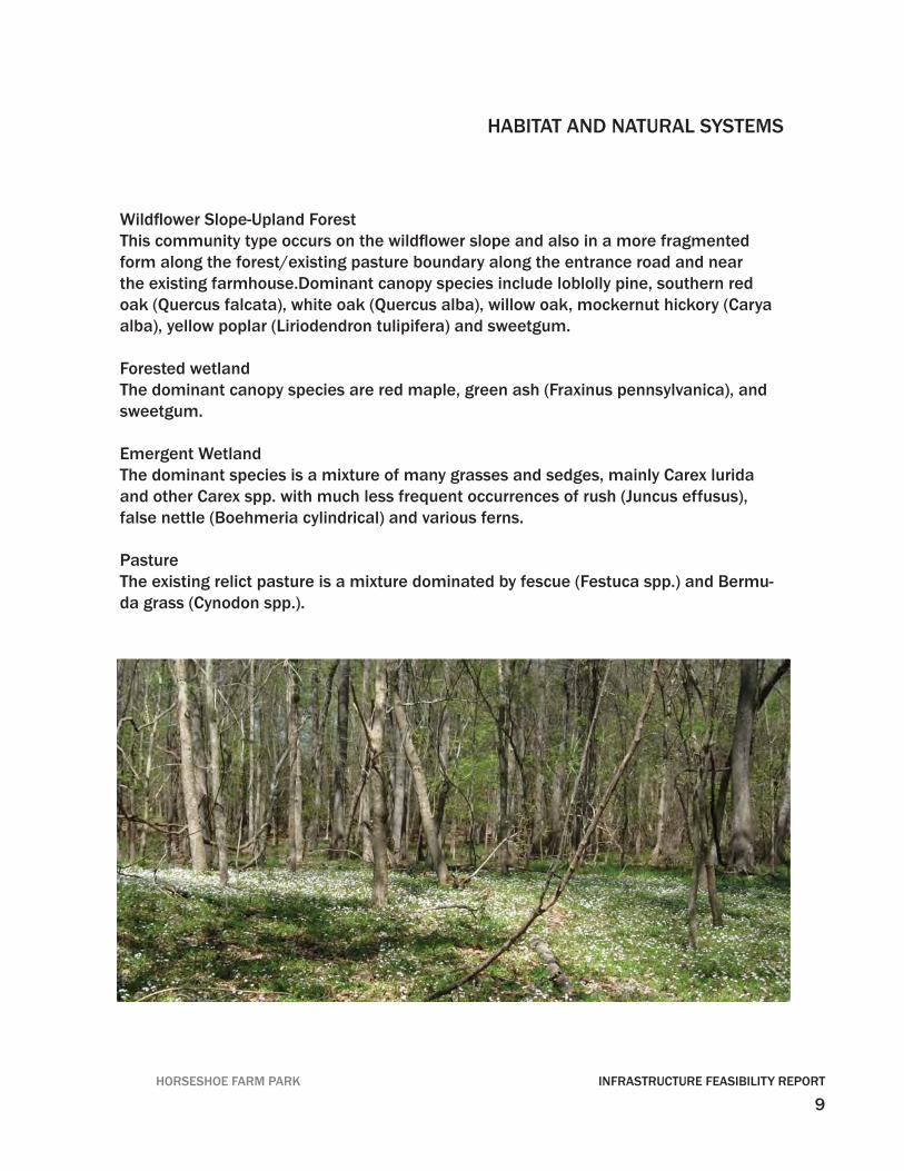
Wildfl ower Slope-Upland ForestThis community type occurs on the wildfl ower slope and also in a more fragmented form along the forest/existing pasture boundary along the entrance road and near the existing farmhouse.Dominant canopy species include loblolly pine, southern red oak (Quercus falcata), white oak (Quercus alba), willow oak, mockernut hickory (Carya alba), yellow poplar (Liriodendron tulipifera) and sweetgum.
Forested wetlandThe dominant canopy species are red maple, green ash (Fraxinus pennsylvanica), and sweetgum.
Emergent WetlandThe dominant species is a mixture of many grasses and sedges, mainly Carex lurida and other Carex spp. with much less frequent occurrences of rush (Juncus effusus), false nettle (Boehmeria cylindrical) and various ferns.
PastureThe existing relict pasture is a mixture dominated by fescue (Festuca spp.) and Bermu-da grass (Cynodon spp.).
HABITAT AND NATURAL SYSTEMS
10INFRASTRUCTURE FEASIBILITY REPORT HORSESHOE FARM PARK
ROADS AND ACCESS
Roads and Site Access
Ligon Mill RoadLigon Mill Road is owned and maintained by the North Carolina Department of Trans-portation. Since Horseshoe Farm Road currently ties into Ligon Mill Road, no Driveway Permit will be required. Additional widening along Ligon Mill Road may be required, but will be based on the traffi c generation projected by the fi nal site plan. Once the site plan is fi nalized, including any buildings and parking lots, this information will be pre-sented to Reid Elmore, the District Engineer.
In the unlikely event road widening is recommended, the most likely scenario will require a left turn lane to be installed for the northbound drivers along Ligon Mill Road, along with the appropriate approach and departure tapers.
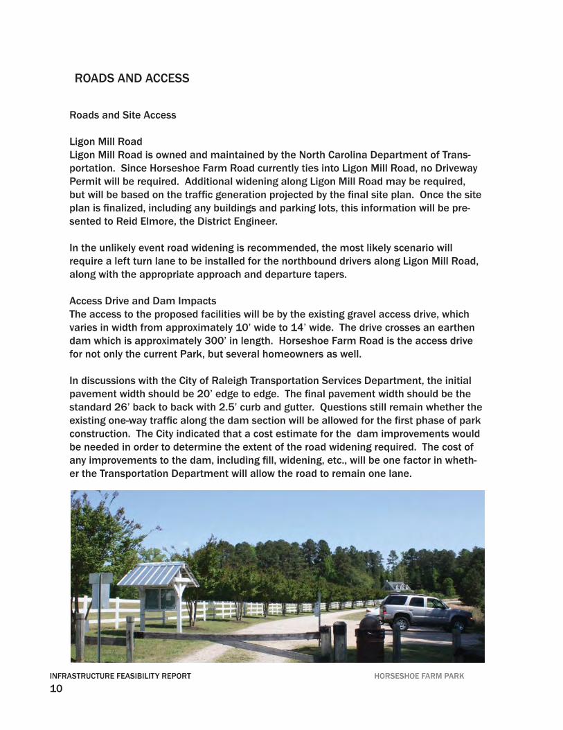
Access Drive and Dam ImpactsThe access to the proposed facilities will be by the existing gravel access drive, which varies in width from approximately 10’ wide to 14’ wide. The drive crosses an earthen dam which is approximately 300’ in length. Horseshoe Farm Road is the access drive for not only the current Park, but several homeowners as well.
In discussions with the City of Raleigh Transportation Services Department, the initial pavement width should be 20’ edge to edge. The fi nal pavement width should be the standard 26’ back to back with 2.5’ curb and gutter. Questions still remain whether the existing one-way traffi c along the dam section will be allowed for the fi rst phase of park construction. The City indicated that a cost estimate for the dam improvements would be needed in order to determine the extent of the road widening required. The cost of any improvements to the dam, including fi ll, widening, etc., will be one factor in wheth-er the Transportation Department will allow the road to remain one lane.
11HORSESHOE FARM PARK INFRASTRUCTURE FEASIBILITY REPORT
ROADS AND ACCESS
Dam Study and Review of Geotechnical Report
From review of the Geotechnical Report provided by Froehling and Robertson, dated Au-gust 26, 2010, it appears the existing dam is in satisfactory condition and suitable for the proposed construction. The recommended improvements include installing a toe drain system to prevent seepage from degrading the downstream embankment, and improving the support of the existing spillway pipe.
During review of the Report and after discussions with the Geotechnical Engineer, it ap-pears the only remaining factor will be to determine whether the existing primary riser and spillway pipe are adequate to safely pass the design storm events, and whether the secondary (emergency) spillway can accommodate the largest storm events.
Typically, a pond of this size and capacity will have a primary riser structure with dimen-sions of approximately 6’ x 6’ at a minimum; the barrel size would normally be ap-proximately 36” in diameter. The emergency spillway is also of concern, as one would expect to see an armored depression with a width of at least 20 feet. In this case, the pond has only one 15” pipe running underneath a driveway to pass the largest storm events. If this 15” pipe is overwhelmed by the fl ow of water escaping the pond, the dam will overtop its crest. Water that spills over the crest of the dam can quickly erode the embankment by the fast-moving water, creating gullies along the downstream side. The gullies can increase in depth, undermining the stability until the dam is fully breached.
It is the Engineer’s recommendation that a full hydrologic study be performed to de-termine if the existing primary and emergency spillway are adequate to safely pass the 1-year through the 100-year storm events. The study should also provide the peak elevations during each storm event, the point at which the dam is overtopped, and the fl owrate of water through the primary and secondary spillways. In addition, any recom-mended improvements to the riser and barrel structure should be provided, as well as the emergency spillway.
It is understood that the cost to improve the spillway structures can be signifi cant due to the potential need to drain the pond to construct a new riser structure. However, it may be possible to improve the secondary spillway only, allowing the primary spillway to remain. This should also be investigated in the hydrologic study.
12INFRASTRUCTURE FEASIBILITY REPORT HORSESHOE FARM PARK
Potable Water Supply
Per the mandate from the Raleigh City Council, no public utilities (sanitary sewer or domestic waterlines) are to be extended to the site. For potable water supply, the only feasible alternative is a water supply well.
Two wells currently exist on the site: one located south of the entrance drive approxi-mately 85’ west of Ligon Mill Road, and one located within the white picket fence at the existing farm house. To determine the existing well information, the well covers were re-moved to locate the typical well tag. In both instances, the well tags were missing. In ad-dition, the Wake County Department of Environmental Services was contacted to deter-mine if any records existed. After speaking with Kathy Williams and Kathy Jordan, it was verifi ed that no records exist for this site. From the discussions, the representative stated Wake County did not begin keeping records until the end of the last decade. If the exist-ing wells are to be used, additional tests will be required to confi rm the adequacy of the yield and chemical analysis. The yield can be confi rmed by performing a 24-hour draw-down test by a registered contractor utilizing the methods as prescribed in 15A NCAC 02C .0110. In addition, a registered water sampler must obtain water samples for testing as directed by Wake County Department of Environmental Health to ensure adequate water quality.
If it is determined that the existing wells are not feasible due to poor water quality, inad-equate supply, location (the existing wells are not in the nearby vicinity of the proposed facilities), new well(s) may be drilled. Drilling a well to meet a certain capacity may require a “trial and error” approach, as the yield/capacity for a given well may not provide enough water for the program, in which case additional wells may be required. Each well must be installed by registered contractors, and meet the requirements of the Wake County Department of Health as well as the North Carolina Administrative Code. Since the well will be considered a “public” water supply, the well must comply with 15A NCAC 18C “Rules Governing Public Water Systems.”
Unfortunately, the Engineer cannot provide a recommendation to the lowest cost alterna-tive with any degree of certainty. Each alternative (attempt to re-use the existing wells or drill a new well) has an unknown cost assocaited with it. If re-using the existing well is preferred and assuming the well is adequate, there would be signifi cant cost to lay the
POTABLE WATER AND STORMWATER SYSTEMS

13HORSESHOE FARM PARK INFRASTRUCTURE FEASIBILITY REPORT
POTABLE WATER AND STORMWATER SYSTEMS
approximately 1,250 feet of copper tubing to the future site. With a new pump capable of overcoming the friction losses in the long run of pipe and the copper tube itself, we estimate the cost to be approximately $13,000.00. Assuming a new well is drilled in close proximity to the future use, the cost to install long runs of copper tubing can be avoided. As noted below, a new well can run from $6,000.00 to more than $20,000.00, this would make a new well more economical in the more typical well situation.
In general, the following separations from the water supply well must be provided; other provisions may be applicable:
Sanitary sewage disposal system (<3,000 gpd fl ow): 100 feetSanitary sewage disposal system (>3,000 gpd fl ow): 200 feetBuildings, permanent structures, etc.: 100 feetCultivated areas to which chemicals are applied: 100 feetSurface water: 100 feetCemetery: 300 feetAny potential source of pollution: 100 feet
In order to estimate the depth, yield, and cost of a new water supply well, several con-tractors familiar with the area were contacted, who are typically the best source of information. At least one contractor was aware of the existing wells on the site, but did not know of the existing well information. In this area, the general consensus was that it would likely be a “rock well,” or a well that derives much of its yield through rock fi ssures. The depth of the well could range from 300 feet to over 1,000 feet, with the yield ranging from 0.5 gal/minute to 100 gal/minute. For the most simple well, the cost would be in the $6,000-$7,000 range. However, the depth of the well is a primary factor in cost, which could increase the total to $20,000. It was agreed among all of the Con-tractors interviewed that it was diffi cult to predict the depth or yield of a potential well site with any degree of certainty.
14INFRASTRUCTURE FEASIBILITY REPORT HORSESHOE FARM PARK
The approximate unit price costs from the Contractors are as follows:
Casing $8/lfGrout (up to 20’) $350Grout (up to 100’) $2,000Drilling $10/lfPump system (estimate: 1 hp) $2,250
Water supply wells are not typically utilized for fi re-fi ghting means, due to the substantial cost to adapt them to this purpose. Typical fi re fl ow demands range from 1,000 – 3,000 gallons per minute, which dwarfs the domestic water demand for the proposed project for an entire day. For a water supply well to meet fi re fl ow demands, a hydropneumatic tank can be installed to supplement the water supply well yield. The hydropneumatic tank stores a variable amount of water, which is pressurized by air. In addition to the tank, the waterline pipes would have to be increased in size from the projected 1”-2” copper services, to 6”-8” ductile iron water mains. The cost of the larger pipes and hydro-pneumatic tank generally render this option cost-prohibitive for most sites including this one.
Stormwater Management
Stormwater permitting will be through the City of Raleigh Conservation Engineering De-partment. According to the City’s stormwater rules, the post development runoff cannot exceed pre-development runoff by more than 10% for the 2-year, 24-hour storm event. As a project goal, it was discussed that in order to keep with the sustainable nature of the site, the post-development fl ow should be detained and release the fl ow at the pre-development levels.
In addition, Total Nitrogen cannot exceed 3.6 lbs/ac/year for the post-development site. This can be accomplished through treatment by a Best Management Practice (BMP) or through a “buydown” paid to the North Carolina Ecosystem Enhancement Program (NCEEP). Due to the large area of the parcel and the relatively small amount of impervi-ous surface that will be proposed, the Total Nitrogen export from the site post-develop-ment will likely be less than the 3.6 lbs/ac/year threshold, even without treatment. This would negate the code requirement for stormwater treatment. In the event the threshold is exceeded, however, a project goal discussed during the sustainability design charettes would be to avoid the “buydown” alternative, and instead focus on managing the pollut-ants by way of BMP’s.
POTABLE WATER AND STORMWATER SYSTEMS
15HORSESHOE FARM PARK INFRASTRUCTURE FEASIBILITY REPORT
Potential BMP devices for consideration include grass swales, wet detention ponds, and bioretention areas, otherwise known as “rain gardens.” Each BMP is discussed below, including advantages and disadvantages of each.
Grass swales are long (100’ minimum), mildly sloped areas that convey stormwater runoff which promote infi ltration and groundwater recharge. No peak runoff attenuation is provided, and little Total Nitrogen removal credit is given. The main advantage to a grass swale is the low cost of installation and maintenance.
Wet detention ponds provide peak attenuation by detaining the runoff during a storm, and discharging it over a 2-5 day period. In addition, a moderate amount of Total Nitro-gen credit is achieved. The cost is more signifi cant than a grassed swale, but is very cost effective for the benefi t it provides. Drawbacks include the visual appearance from park visitors. While every effort can be made to incorporate aesthetic plants, ponds have a natural way of growing undesirable plants, which can become invasive, i.e., cattails. Though ponds are designed with suffi cient depth to prevent stagnant water that harbor mosquito breeding, tall grasses around the perimeter that are not maintained present small patches of water where mosquitoes can reproduce. Most importantly, wet deten-tion ponds by defi nition hold water that can pose a potential hazard to children or oth-ers that happen to enter. Fences, sometimes thought of as unsightly, can be erected to mitigate this danger, but can be overcome by climbing. Wet detention ponds must be supplemented by a level spreader at the downstream end of the outlet device. This is to promote “sheet fl ow” prior to entering the nearby Neuse River Riparian Buffer.
Bioretention areas are quickly becoming the best strategy for treating stormwater run-off. Each area is designed to hold 6-12” of water for a maximum period of 24 hours. Water is absorbed in specially designed soils that promote infi ltration. At the bottom, underdrains are installed to ensure that the soil does not remain saturated. There are a variety of appealing plants that can be incorporated into the mulch bed to enhance the appearance. Total Nitrogen credit is maximized by this BMP, though peak stormwater attenuation is only moderate due to the maximum of 12” of ponded water. In this case, peak attenuation is a secondary concern because of the relatively small increase in pro-posed impervious area. In addition, small bioretention areas can be located through the site to treat the water from a specifi c building or parking lot, yet remain cost effective. On the other hand, wet detention ponds are best suited to capture the runoff from the entire project to aid in its effi ciency.
16INFRASTRUCTURE FEASIBILITY REPORT HORSESHOE FARM PARK
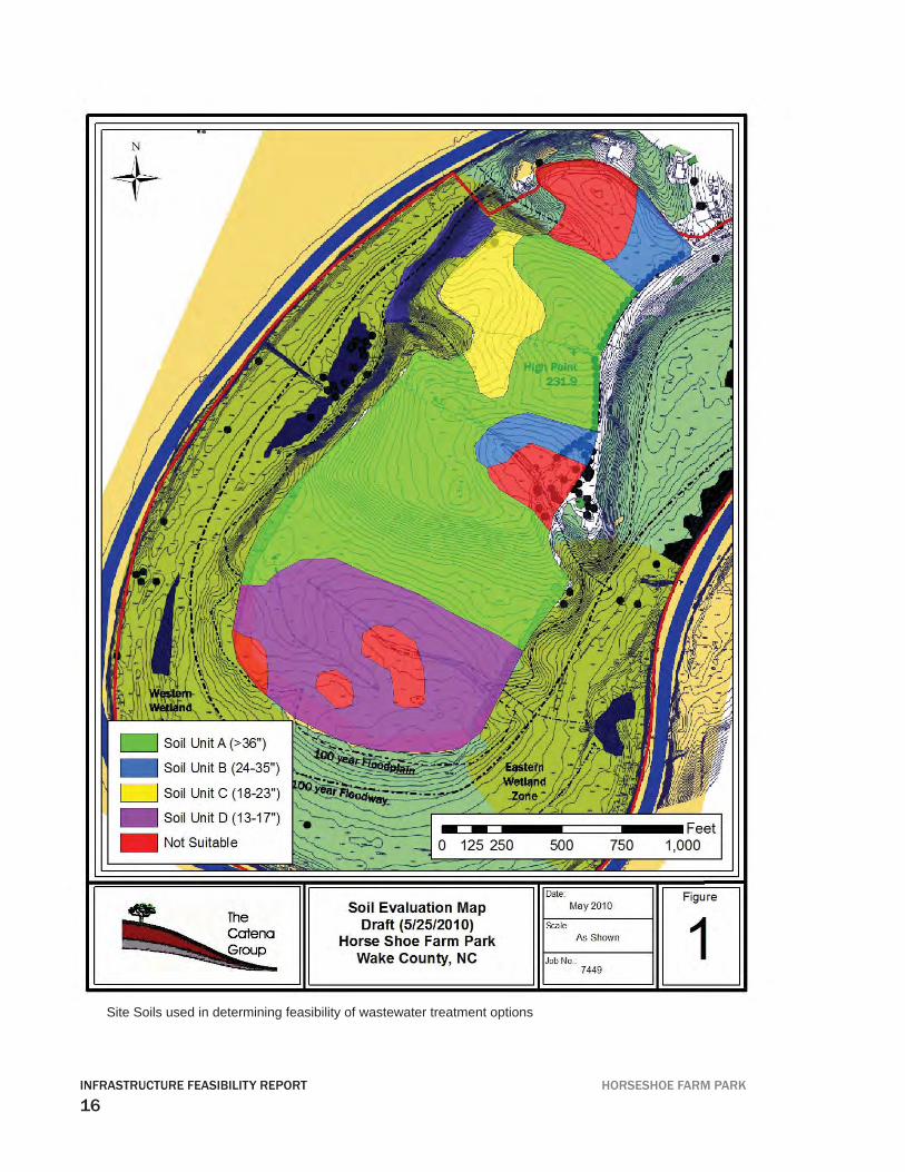
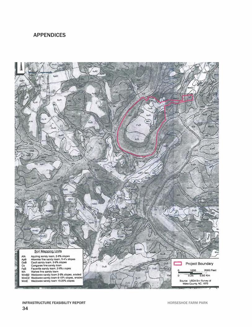
Site Soils used in determining feasibility of wastewater treatment options
17HORSESHOE FARM PARK INFRASTRUCTURE FEASIBILITY REPORT
WASTEWATER AND WATER RECYCLING
Overview Wastewater management options for the Horseshoe Park site were evaluated based on site conditions, available technologies and overall project goals. Options include: (1) reclaimed water systems , (2) a subsurface disposal system and (3) composting toilets. The three technical options were evaluated based on the following criteria: regulatory and site requirements, maintenance required, potential for pollution of ground or surface wa-ter, cost, environmental education potential, and fl exibility for project phasing (table 1). The site will accommodate any of the three technologies. A Reclaimed Water System is recommended based on its relative ease of application to both the site and project goals towards water quality protection and green technologies.
Composting Toilets, though cost affordable, are not recommended for this project based on the high maintenance required to keep them operating properly. For instance: if maintenance is not performed on a rigorous schedule associated nuisance odors within the building will make for a rather rank atmosphere for visitors. In addition, composting works most effectively when inputs are steady and liquid is controlled carefully. Since the facilities will likely experience periods of peak use followed by low use, the inputs will likely be erratic. Also, a standard septic fi eld and repair area are required to manage the liquid portion of the waste stream from the composting chamber which are unnecessary with Reclaimed Water Systems.
The Subsurface Disposal System and the Reclaimed Water System offer the best man-agement options. A large portion of the site is suitable for the Subsurface Disposal System (Included Preliminary Soil and Site Evaluation, June 1, 2010). However, the Reclaimed Water System though more expensive than the Subsurface Disposal System is recommended since it will minimize water pollution and provide high quality reuse water for irrigation or toilet fl ush. Green infrastructure, like nature, also allows the site to be developed in phases on a relaxed schedule that requires less initial capital outlay. It also allows for less restrictive setbacks, and the system can be located most anywhere on site for easy planning and project layout. Simply put, the Reclaimed Water System mimics nature’s time tested method of fi ltration in its green infrastructure design. Plants and bacteria within a balanced design recreate the same effortless process that existed millions of years before humans ever realized that too much waste could be a problem. In addition the Reclaimed Water System using green infrastructure design offers the oppor-
18INFRASTRUCTURE FEASIBILITY REPORT HORSESHOE FARM PARK
tunity to draw educational parallels between the natural ecosystems of the site and those designed ecosystems of the Reclaimed Water System.
The cost of the two options will be more clearly defi ned as the restroom facilities are lo-cated relative to the soils. For example, if the wastewater must be pumped to a Disposal System due to elevation limitations or the desire for increased function, the pump can be used even more effi ciently as it does double duty for treatment and irrigation as a part of a Reclaimed Water System with an even more competitive cost comparison.
The increased function that a pump will provide to a Subsurface Disposal System is desirable with an estimated volume fl ow of wastewater of 1000 gallons per day (gpd). A disposal system operating without a pump must function by gravity and thus ideally dis-tribute the 1000 gallons evenly among the disposal fi eld lines. Most Subsurface Disposal Systems do not distribute wastewater evenly throughout the associated disposal fi eld. This lack of equal distribution is only critical when the soils are limiting and/or the vol-ume of wastewater, such as 1000 gpd creates equal wastewater distribution challenges.
Table 1: Estimated Cost of Wastewater Disposal vs Reclaimed Water System
System Type Estimated CostGravity Fed Subsurface Disposal System $17,000.00Pump to Gravity Subsurface Disposal System $28,000.00Reclaimed Water System $50,000.00
Summary
The Reclaimed Water System is the preferred option since the goals of the project include environmental and green infrastructure aspects. The cost of the system will vary based on the features desired such as toilet fl ush and aesthetic design. If a pump is not needed to meet the needs of the Subsurface Disposal System, the system may be phased based on the project time line. However, this will add signifi cantly to the total cost due to the need for redundant components such as tanks and fi lters. Composting toilets may be an option for remote installations with expected minimal use, such as trails.
WASTEWATER AND WATER RECYCLING
19HORSESHOE FARM PARK INFRASTRUCTURE FEASIBILITY REPORT
20INFRASTRUCTURE FEASIBILITY REPORT HORSESHOE FARM PARK
[Storage Barn]
Pole Barn
21HORSESHOE FARM PARK INFRASTRUCTURE FEASIBILITY REPORT
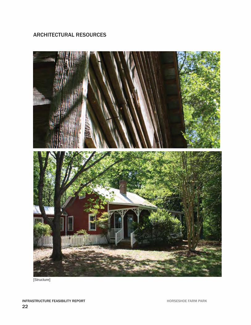
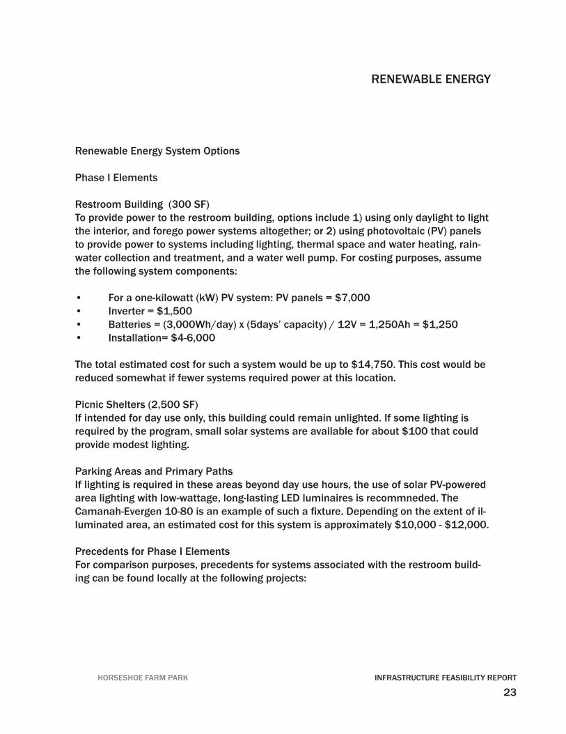
Existing Buildings:
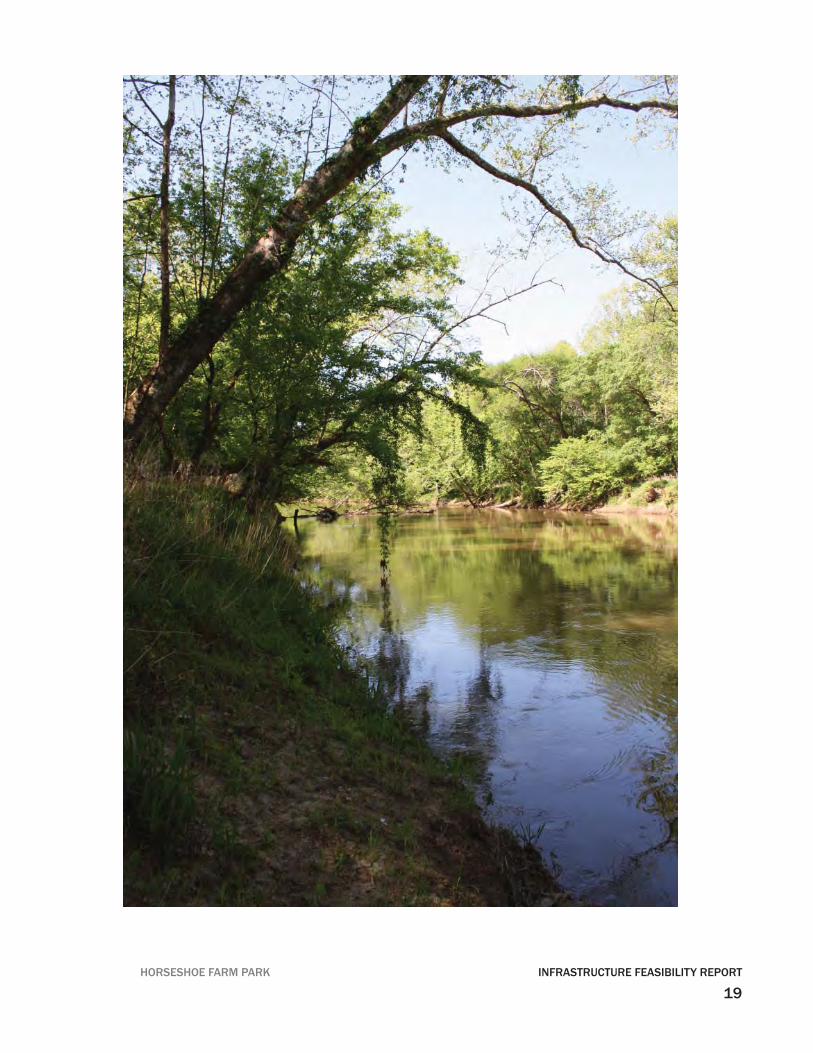
Pole Barn StructureThe pole barn was destroyed by fi re in October 2010.
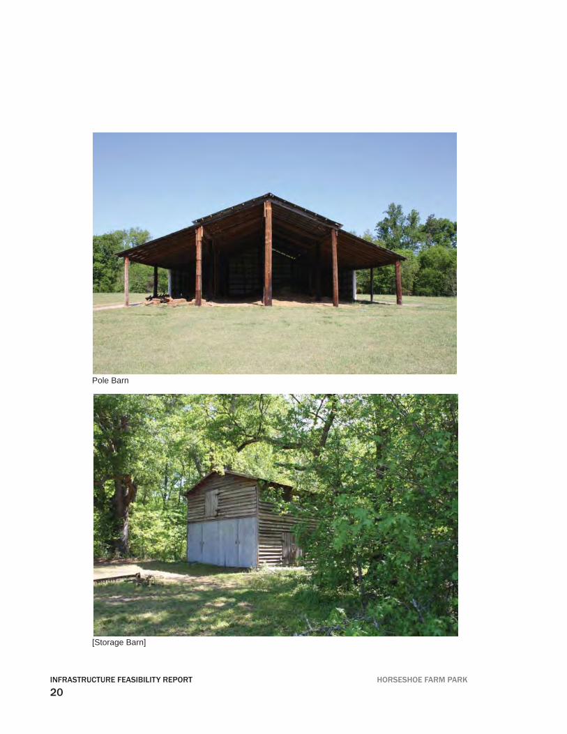
Other Wood Barn StructureThis structure, which appears to be in fair condition from the outside, may also be used for storage.
Proposed buildings:
Picnic Shelters and Restroom StrucuturesThe picnic shelters are proposed as an open air canopy, providing shelter from rain and sun, that will accommodate approximately 75-100 people. It will cover about 1,500 square feet and have a roof area of 2,500 square feet. The shelters may be combined with the 300 square-foot restroom facility, which will contain 2 water closets and one lavatory for each male and female room. Strategies for sustainability in the construc-tion of these facilities include siting, vegetative shading, local materials, daylighting, solar night lighting, passive solar heating, natural ventilation, renewable energy supply, rainwater collection, green roof and innovative waste water treatment. The cost for the picnic shelters are estimated at about $100 per square foot, and the restroom facil-ity’s probable cost is about $150/sf.
Environmental Education / Arts CenterEnvisioned as the primary park destination, this building will serve as the main point of orientation for visitors, and as a model of sustainable design practice in the City of Raleigh. The approximately 6,500 square-foot building will include exhibit space, a multi-purpose meeting space, a resource library, offi ce, restrooms, storage, and an associated picnic shelter for 50 people. As an assembly building without sprinkler fi re protection, occupancy will be limited to 300 people. Parking required for the facility will be one space per 200 SF, or about 33 spaces, of which two must be handicap-acccessible.
Strategies to be considered for sustainable design of the Center are siting, porches, vegetative shading, exterior circulation, local materials, daylighting, solar night light-ing, passive solar heating, natural ventilation, renewable energy supply (photovoltaic panels), rainwater collection, green roof and innovative waste water treatment. The preliminary estimate of cost for the center is $200-250 per square foot.
ARCHITECTURAL RESOURCES
22INFRASTRUCTURE FEASIBILITY REPORT HORSESHOE FARM PARK
ARCHITECTURAL RESOURCES
[Structure]
23HORSESHOE FARM PARK INFRASTRUCTURE FEASIBILITY REPORT
Renewable Energy System Options
Phase I Elements
Restroom Building (300 SF) To provide power to the restroom building, options include 1) using only daylight to light the interior, and forego power systems altogether; or 2) using photovoltaic (PV) panels to provide power to systems including lighting, thermal space and water heating, rain-water collection and treatment, and a water well pump. For costing purposes, assume the following system components:
• For a one-kilowatt (kW) PV system: PV panels = $7,000• Inverter = $1,500• Batteries = (3,000Wh/day) x (5days’ capacity) / 12V = 1,250Ah = $1,250• Installation= $4-6,000
The total estimated cost for such a system would be up to $14,750. This cost would be reduced somewhat if fewer systems required power at this location.
Picnic Shelters (2,500 SF)If intended for day use only, this building could remain unlighted. If some lighting is required by the program, small solar systems are available for about $100 that could provide modest lighting.
Parking Areas and Primary PathsIf lighting is required in these areas beyond day use hours, the use of solar PV-powered area lighting with low-wattage, long-lasting LED luminaires is recommneded. The Camanah-Evergen 10-80 is an example of such a fi xture. Depending on the extent of il-luminated area, an estimated cost for this system is approximately $10,000 - $12,000.
Precedents for Phase I ElementsFor comparison purposes, precedents for systems associated with the restroom build-ing can be found locally at the following projects:
RENEWABLE ENERGY
24INFRASTRUCTURE FEASIBILITY REPORT HORSESHOE FARM PARK
American Tobacco Trail, Durham NC• simplest version• zero energy – zero water• no running water• no electricity• no heating• pit toilets
White Deer Park, Garner, NC• 500 SF restroom building• utility electric• running water• rainwater collection• has solar thermal hot water/radiant heating• radiant heating cost = $7,000• approx 600Wconnected load (+3000W electric water heater)• approx 2 kWh / sf / year consumption• 1,000 kWh annual total or 3 kWh per day
Phase II: Environmental Education + Arts Center (6500 sf)
To power lighting, cooling, and other systems for this building, the solar PV system re-quired may range from 10 to 50 kW, depending on the amount of conditioned space. The cost for the system may thus range from $120,000 to $530,000. For all PV systems, it is important that they be sited where they will not be shaded. They may be mounted on rooftops or on poles in an open fi eld.
RENEWABLE ENERGY
25HORSESHOE FARM PARK INFRASTRUCTURE FEASIBILITY REPORT
Precedents for systems comparable in size to the Education and Arts Center can be seen at the following local projects:
Prairie Ridge, Raleigh, NC• open air classroom ~ 1000 SF• uses passive solar and shading strategies• small conditioned offi ce space• toilets with potable water and rainwater• approx 900W+1200W connected load• approx 4.5 kWh / sf / year consumption• 4,500 kWh annual total• 5.2 kW PV array• renewable energy production of approx 8,320 kWh / year
Walnut Creek, Raleigh, NC• 10 kWh / sf / year• 50,000 kWh / year total consumption• photovoltaic = 50 kW = $ 350,000• batteries = $ 80,000• install = $ 100,000
RENEWABLE ENERGY
26INFRASTRUCTURE FEASIBILITY REPORT HORSESHOE FARM PARK
Permits
A summary of the required permits as they relate to the civil engineering scope of work and the related agency is as follows:
Site Plan Review City of Raleigh
Infrastructure Construction Plan City of Raleigh
Grading/Erosion Control NCDENR(Following NCDENR approval) City of Raleigh
Ligon Mill Road NCDOT(As needed for road widening)
Well Construction Permit Wake County DES
Tree Conservation Area City of Raleigh
Building Permit City of Raleigh
Reclaimed Water System Division of Water QualityAquifer Protection
PERMITS
27HORSESHOE FARM PARK INFRASTRUCTURE FEASIBILITY REPORT
28INFRASTRUCTURE FEASIBILITY REPORT HORSESHOE FARM PARK
APPENDICES
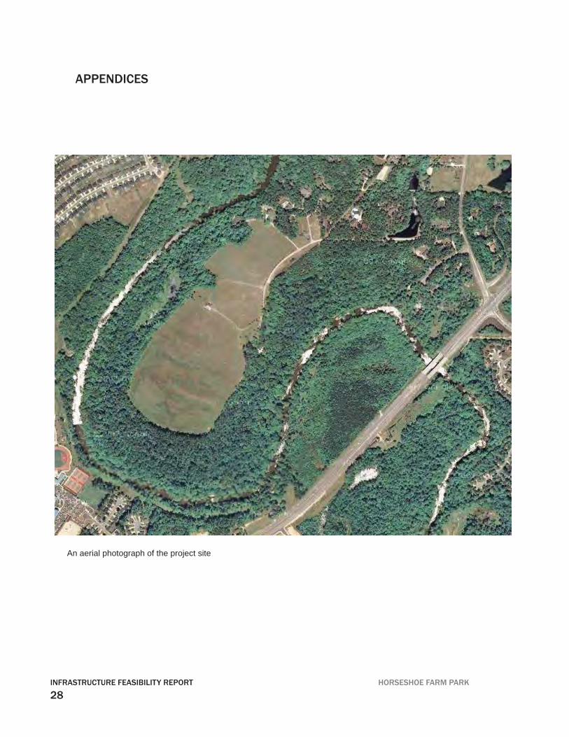
An aerial photograph of the project site
29HORSESHOE FARM PARK INFRASTRUCTURE FEASIBILITY REPORT
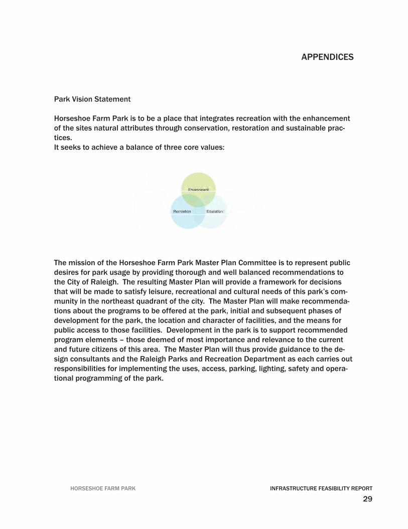
Park Vision Statement
Horseshoe Farm Park is to be a place that integrates recreation with the enhancement of the sites natural attributes through conservation, restoration and sustainable prac-tices.It seeks to achieve a balance of three core values:
The mission of the Horseshoe Farm Park Master Plan Committee is to represent public desires for park usage by providing thorough and well balanced recommendations to the City of Raleigh. The resulting Master Plan will provide a framework for decisions that will be made to satisfy leisure, recreational and cultural needs of this park’s com-munity in the northeast quadrant of the city. The Master Plan will make recommenda-tions about the programs to be offered at the park, initial and subsequent phases of development for the park, the location and character of facilities, and the means for public access to those facilities. Development in the park is to support recommended program elements – those deemed of most importance and relevance to the current and future citizens of this area. The Master Plan will thus provide guidance to the de-sign consultants and the Raleigh Parks and Recreation Department as each carries out responsibilities for implementing the uses, access, parking, lighting, safety and opera-tional programming of the park.
APPENDICES
30INFRASTRUCTURE FEASIBILITY REPORT HORSESHOE FARM PARK
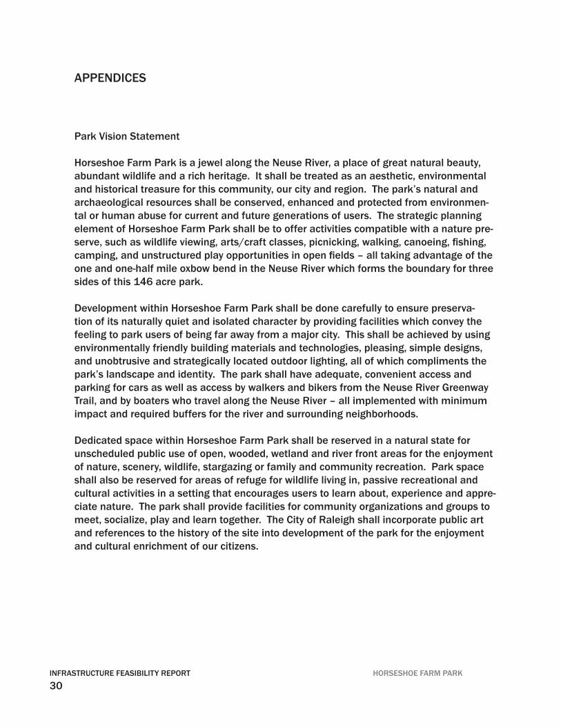
Park Vision Statement
Horseshoe Farm Park is a jewel along the Neuse River, a place of great natural beauty, abundant wildlife and a rich heritage. It shall be treated as an aesthetic, environmental and historical treasure for this community, our city and region. The park’s natural and archaeological resources shall be conserved, enhanced and protected from environmen-tal or human abuse for current and future generations of users. The strategic planning element of Horseshoe Farm Park shall be to offer activities compatible with a nature pre-serve, such as wildlife viewing, arts/craft classes, picnicking, walking, canoeing, fi shing, camping, and unstructured play opportunities in open fi elds – all taking advantage of the one and one-half mile oxbow bend in the Neuse River which forms the boundary for three sides of this 146 acre park.
Development within Horseshoe Farm Park shall be done carefully to ensure preserva-tion of its naturally quiet and isolated character by providing facilities which convey the feeling to park users of being far away from a major city. This shall be achieved by using environmentally friendly building materials and technologies, pleasing, simple designs, and unobtrusive and strategically located outdoor lighting, all of which compliments the park’s landscape and identity. The park shall have adequate, convenient access and parking for cars as well as access by walkers and bikers from the Neuse River Greenway Trail, and by boaters who travel along the Neuse River – all implemented with minimum impact and required buffers for the river and surrounding neighborhoods.
Dedicated space within Horseshoe Farm Park shall be reserved in a natural state for unscheduled public use of open, wooded, wetland and river front areas for the enjoyment of nature, scenery, wildlife, stargazing or family and community recreation. Park space shall also be reserved for areas of refuge for wildlife living in, passive recreational and cultural activities in a setting that encourages users to learn about, experience and appre-ciate nature. The park shall provide facilities for community organizations and groups to meet, socialize, play and learn together. The City of Raleigh shall incorporate public art and references to the history of the site into development of the park for the enjoyment and cultural enrichment of our citizens.
APPENDICES
31HORSESHOE FARM PARK INFRASTRUCTURE FEASIBILITY REPORT
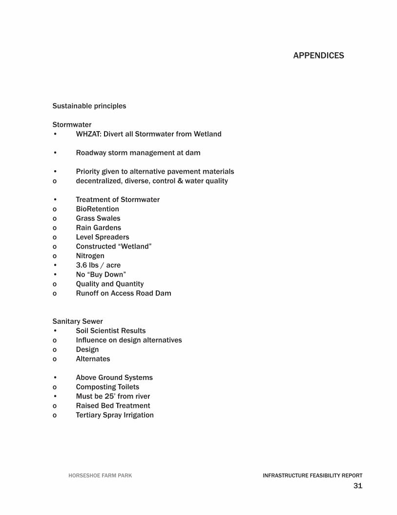
Sustainable principles
Stormwater• WHZAT: Divert all Stormwater from Wetland
• Roadway storm management at dam
• Priority given to alternative pavement materials o decentralized, diverse, control & water quality
• Treatment of Stormwatero BioRetentiono Grass Swaleso Rain Gardenso Level Spreaderso Constructed “Wetland”o Nitrogen • 3.6 lbs / acre• No “Buy Down”o Quality and Quantityo Runoff on Access Road Dam
Sanitary Sewer• Soil Scientist Resultso Infl uence on design alternativeso Designo Alternates
• Above Ground Systemso Composting Toilets• Must be 25’ from rivero Raised Bed Treatmento Tertiary Spray Irrigation
APPENDICES
32INFRASTRUCTURE FEASIBILITY REPORT HORSESHOE FARM PARK
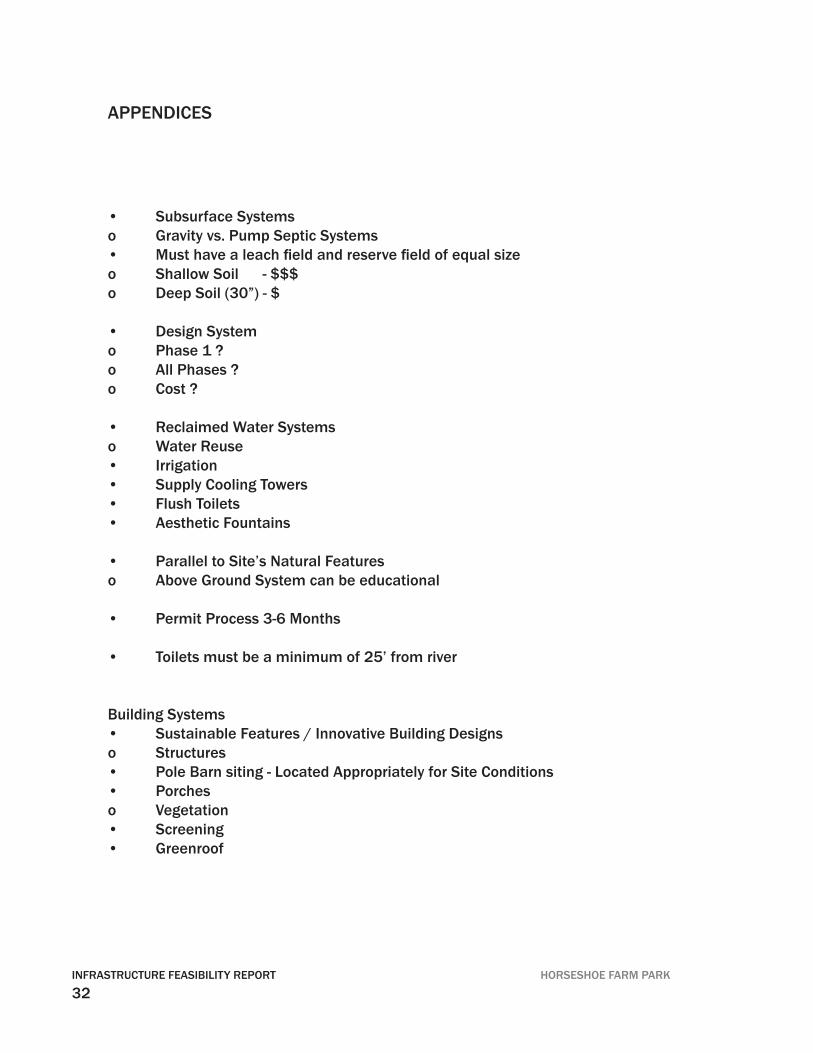
• Subsurface Systemso Gravity vs. Pump Septic Systems• Must have a leach fi eld and reserve fi eld of equal sizeo Shallow Soil - $$$o Deep Soil (30”) - $
• Design Systemo Phase 1 ?o All Phases ?o Cost ?
• Reclaimed Water Systemso Water Reuse• Irrigation• Supply Cooling Towers• Flush Toilets• Aesthetic Fountains
• Parallel to Site’s Natural Featureso Above Ground System can be educational
• Permit Process 3-6 Months
• Toilets must be a minimum of 25’ from river
Building Systems• Sustainable Features / Innovative Building Designso Structures• Pole Barn siting - Located Appropriately for Site Conditions• Porcheso Vegetation• Screening• Greenroof
APPENDICES
33HORSESHOE FARM PARK INFRASTRUCTURE FEASIBILITY REPORT
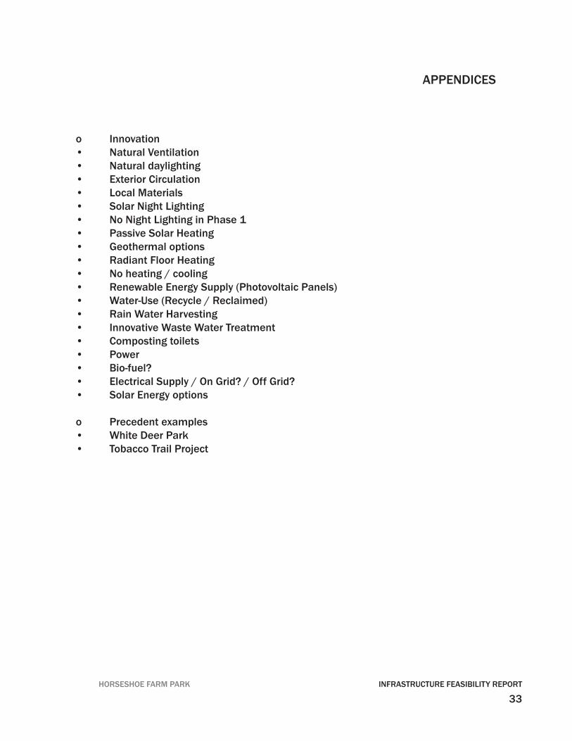
o Innovation• Natural Ventilation• Natural daylighting• Exterior Circulation• Local Materials• Solar Night Lighting• No Night Lighting in Phase 1• Passive Solar Heating• Geothermal options• Radiant Floor Heating• No heating / cooling• Renewable Energy Supply (Photovoltaic Panels)• Water-Use (Recycle / Reclaimed)• Rain Water Harvesting• Innovative Waste Water Treatment• Composting toilets• Power• Bio-fuel?• Electrical Supply / On Grid? / Off Grid?• Solar Energy options
o Precedent examples• White Deer Park• Tobacco Trail Project
APPENDICES
34INFRASTRUCTURE FEASIBILITY REPORT HORSESHOE FARM PARK
APPENDICES
35HORSESHOE FARM PARK INFRASTRUCTURE FEASIBILITY REPORT
APPENDICES
NATURAL ANALYSISHORSESHOE FARM PARK MASTER PLAN0 75 150 300 450
Fox Den
Existing Signifi cant Trees
Existing Signifi cant Trees - WHZAT
Existing Forest
Upper Meadow Zone
Wildfl ower Slope
Existing Giant Cane Stand
Existing Wetland
Wetland Zone
Property Line
Signifi cant Natural Heritage Area (SNHA) Regional Signifi cance
100 year Floodplain
100 year Floodway
Streams and Drainage Ways (TBD)
Neuse River
EasternWetland
Zone
UpperMeadow
Zone
+High Point
231.9
100 year Floodway
100 year Floodplain
WesternWetland
Zone
Legend
SITE ANALYSISHORSESHOE FARM PARK MASTER PLAN0 75 150 300 450
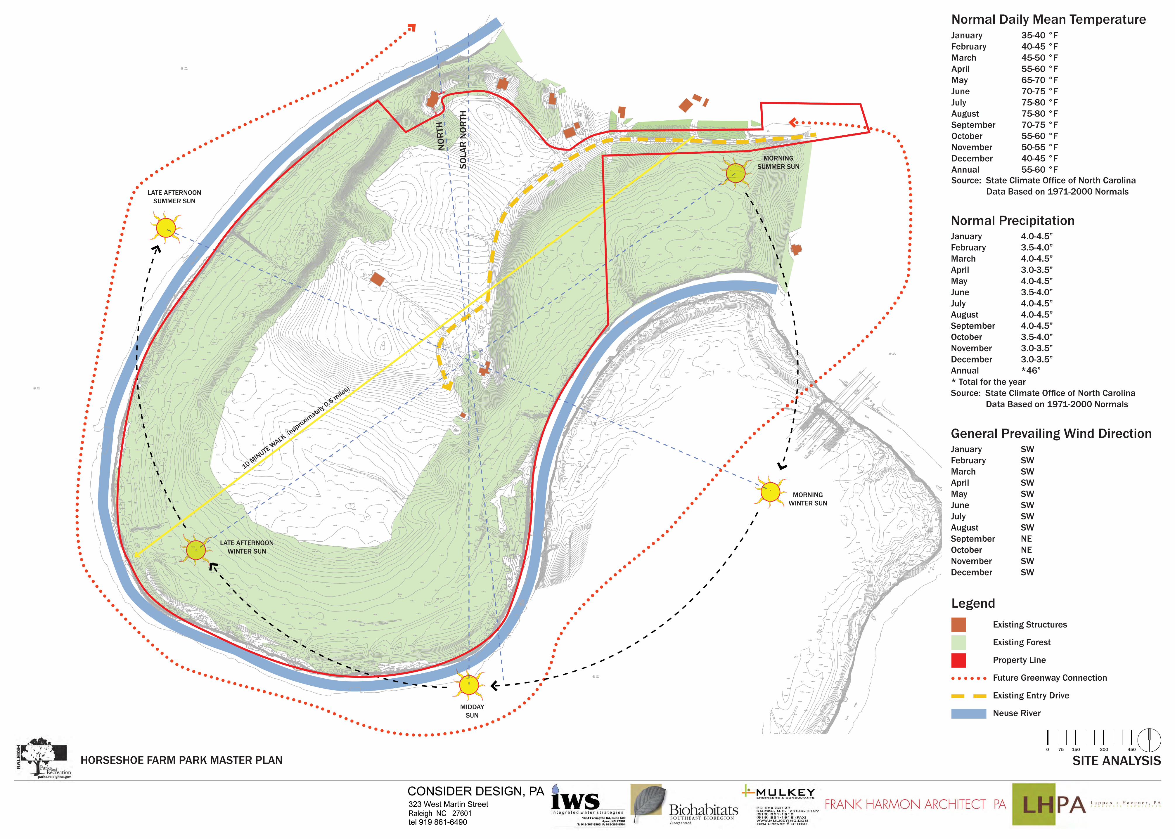
January 35-40 °F February 40-45 °F March 45-50 °F April 55-60 °F May 65-70 °F June 70-75 °F July 75-80 °F August 75-80 °F September 70-75 °F October 55-60 °F November 50-55 °F December 40-45 °F Annual 55-60 °F Source: State Climate Offi ce of North Carolina Data Based on 1971-2000 Normals
Normal Daily Mean Temperature
January 4.0-4.5”February 3.5-4.0”March 4.0-4.5”April 3.0-3.5”May 4.0-4.5”June 3.5-4.0”July 4.0-4.5”August 4.0-4.5”September 4.0-4.5”October 3.5-4.0”November 3.0-3.5”December 3.0-3.5”Annual *46”
January SWFebruary SWMarch SWApril SWMay SWJune SWJuly SWAugust SWSeptember NEOctober NENovember SWDecember SW
Existing Structures
Existing Forest
Property Line
Future Greenway Connection
Existing Entry Drive
Neuse River
* Total for the year Source: State Climate Offi ce of North Carolina Data Based on 1971-2000 Normals
Normal Precipitation
General Prevailing Wind Direction
Legend
SO
LAR
NO
RTH
LATE AFTERNOONWINTER SUN
10 MINUTE W
ALK (approxim
ately 0.5 m
iles)
MORNINGWINTER SUN
MORNINGSUMMER SUN
LATE AFTERNOONSUMMER SUN
MIDDAYSUN
NO
RTH
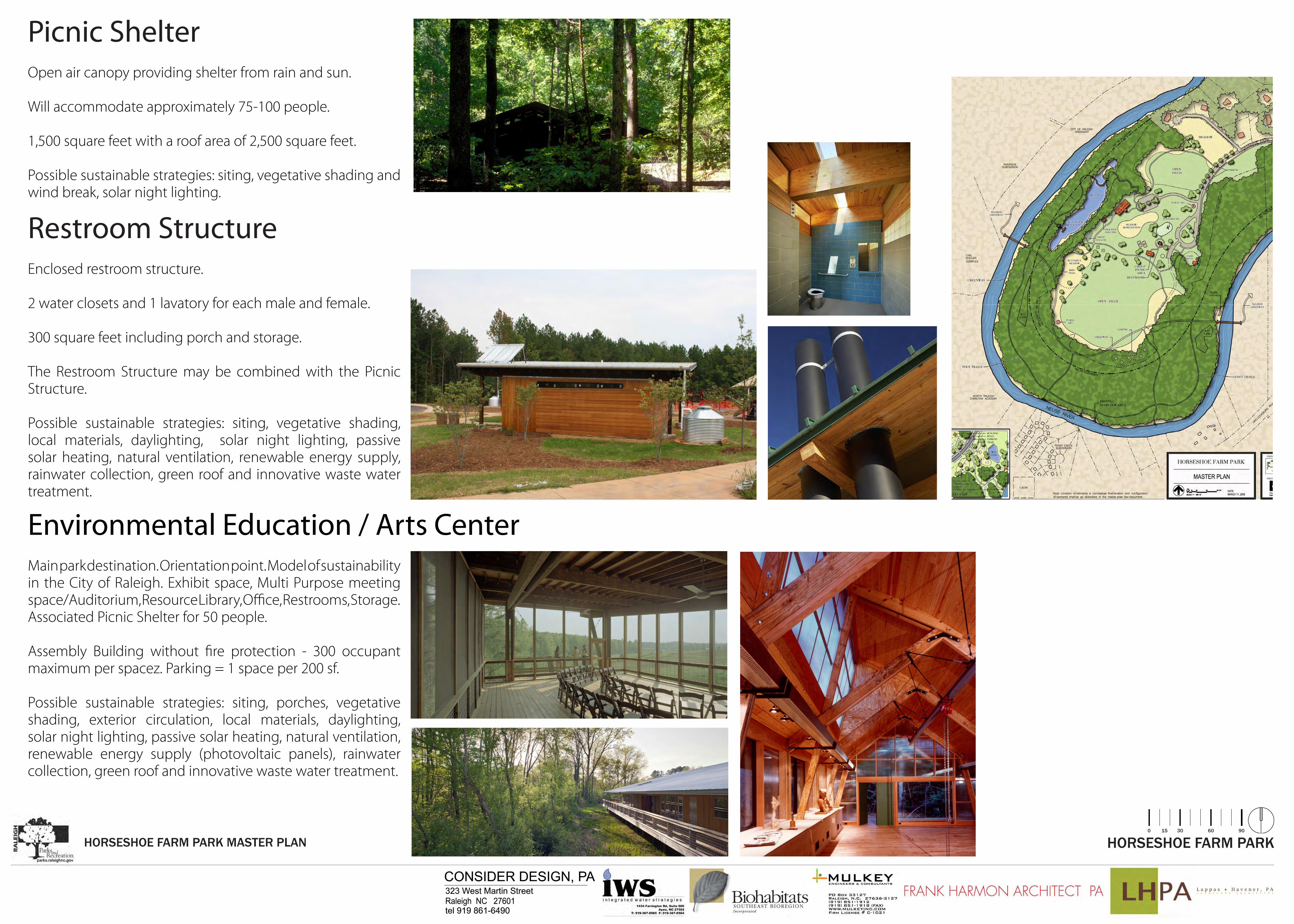
Open air canopy providing shelter from rain and sun.
Will accommodate approximately 75-100 people.
1,500 square feet with a roof area of 2,500 square feet.
Possible sustainable strategies: siting, vegetative shading and wind break, solar night lighting.
Picnic Shelter
HORSESHOE FARM PARKHORSESHOE FARM PARK MASTER PLAN0 15 30 60 90
Enclosed restroom structure.
2 water closets and 1 lavatory for each male and female.
300 square feet including porch and storage.
The Restroom Structure may be combined with the Picnic Structure.
Possible sustainable strategies: siting, vegetative shading, local materials, daylighting, solar night lighting, passive solar heating, natural ventilation, renewable energy supply, rainwater collection, green roof and innovative waste water treatment.
Restroom Structure
Main park destination. Orientation point. Model of sustainability in the City of Raleigh. Exhibit space, Multi Purpose meeting space/Auditorium, Resource Library, Office, Restrooms, Storage. Associated Picnic Shelter for 50 people.
Assembly Building without fire protection - 300 occupant maximum per spacez. Parking = 1 space per 200 sf.
Possible sustainable strategies: siting, porches, vegetative shading, exterior circulation, local materials, daylighting, solar night lighting, passive solar heating, natural ventilation, renewable energy supply (photovoltaic panels), rainwater collection, green roof and innovative waste water treatment.
Environmental Education / Arts Center
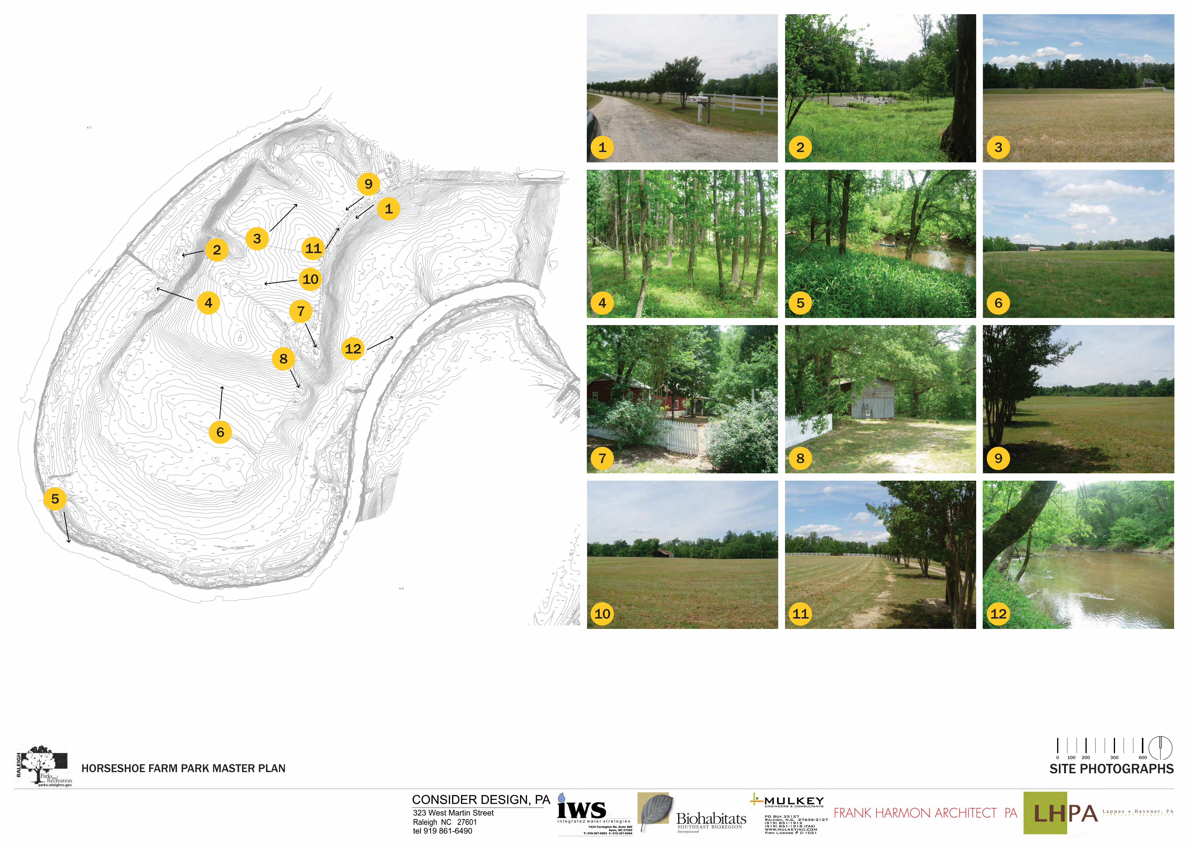
SITE PHOTOGRAPHSHORSESHOE FARM PARK MASTER PLAN0 100 200 300 600
1
1
2
10
5
447
8
7
10
2
5
8
11
11
3
6
6
3
9
9
12
12


![POULTRY FARM MANUAL of Poultry...[POULTRY FARM MANUAL] Infrastructure Plan 10 SECTION - 2 INFRASTRUCTURE PLAN The demand for modern poultry infrastructure in India is fuelled by an](https://img.pdfslide.us/doc/110x75/5e24cb871b313832201e2d41/poultry-farm-of-poultry-poultry-farm-manual-infrastructure-plan-10-section.jpg)


![POULTRY FARM MANUAL - Famunera · [POULTRY FARM MANUAL] Infrastructure Plan 10 SECTION - 2 INFRASTRUCTURE PLAN The demand for modern poultry infrastructure in India is fuelled by](https://img.pdfslide.us/doc/110x75/5e7ef05a3033952c31203b8f/poultry-farm-manual-famunera-poultry-farm-manual-infrastructure-plan-10-section.jpg)