Embed Size (px)
Citation preview
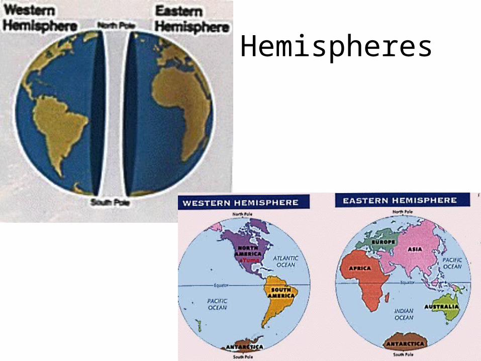
Hemispheres
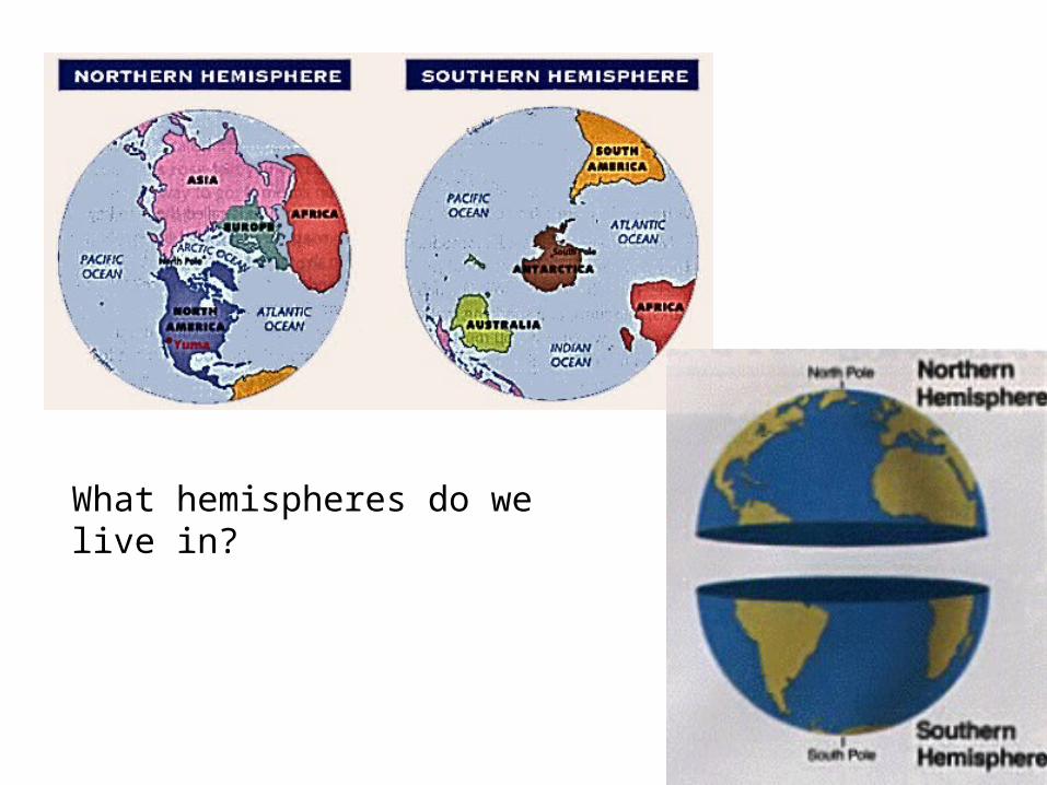
What hemispheres do we live in?

Latitude and Longitude
• To find an exact place on a map or on Earth, you need crossing lines that create an intersection.
• coordinates
• grid system– known as the latitude and longitude grid

Latitude and Longitude
• Places can be exactly located using coordinates and plotting them on a “grid”.
• latitude and longitude
• Measured in degrees, minutes and seconds
(360° 60' 60")

Horizontal like rungs on a ladder Long, tall vertical lines

Latitude• Also called “parallels”• horizontal “rings” that circle around the globe.• They are equal distances apart.
1° degree of latitude = 65 miles or 111 km
• Go from 0° to 90° north (North Pole)
0° to 90° south (South Pole)


Longitude• Also called meridians.• Meridians meet at the poles.• They are measured from zero or prime
meridian.• Lines are measured going
east from 0° to 180° west from 0° to 180°
• Distances between longitude lines are NOT equal.– At equator one degree equals 111 km (65 miles)– At 45°, one degree equals 79 km ( 49 miles) – At the North pole, one degree equals ZERO km!


Where/what is this line on the ground??

The Prime Meridian
• Located at the Royal Observatory in Greenwich, England
• 0 degrees longitude• Runs through countries such as … (this is
where you look them up on the globe or map)
• Where on earth is 0° latitude and 0° longitude located?


UTM
• Some of the advantages of UTM coordinates include...• Square grids • East-West units of measure are the same as North-
South units • Decimal based, no fussing with minutes and seconds. • Coordinates translate directly to distances on the
ground. • Coordinate precision is easily understood. No need to
wonder what distance a tenth of a second of longitude represents.
• It's easy to abbreviate coordinates when working in a small area.

Map Scale
• Maps are not drawn to the same scale as the world (duh)
• There has to be an amount of reduction in size• Ratio of the distance between two points on the
map compared to the actual ground distanceMap Scale = Map Distance
Earth Distance
map distance : ground distance
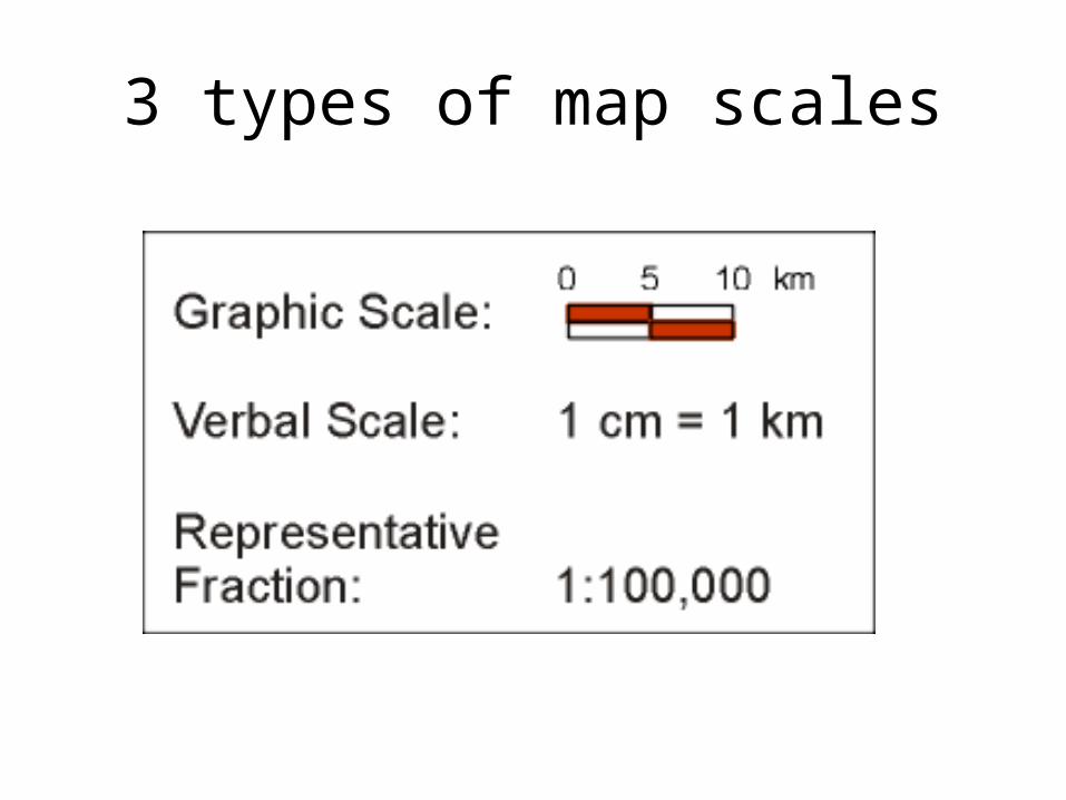
3 types of map scales


• 1: 24000 map scale
• 1 inch on the map = 24,000 inches on the ground!
• 24,000 inches = 2000 feet

• 1:100,000 scale
• 1 cm = 100,000 cm
• or 1 kilometer on the surface.

A map of the world has a scale of1: 46,000,000 !!!!

U.S.A. Map would have a scale of1: 5,000,000

• A map of Illinois
would have a scale of
1: 500,000
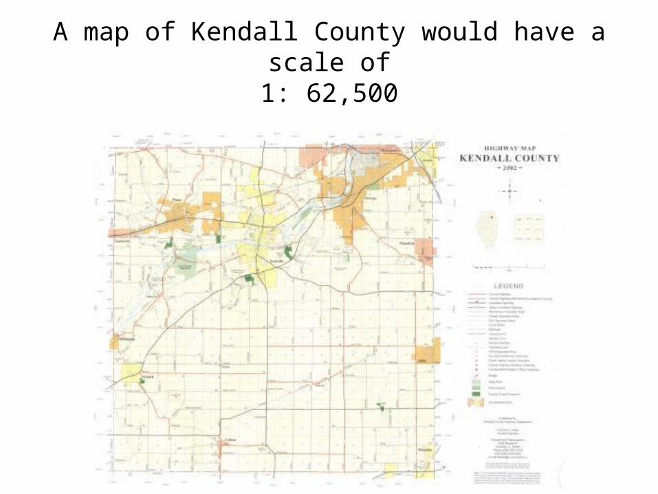
A map of Kendall County would have a scale of1: 62,500

Oswego town map would have a scale of1: 1000

Large –scale map
• Shows a small area with a lot of detail.
• Good for urban areas, towns, streets or hiking.
• Example: 1:10,000
• Large enough to see details
Small-scale map
• Shows a LARGE area with very little detail.
• Good for world maps or large regions such as North America.
• Example: 1:1,000,000
• Too small to see details