Embed Size (px)
Citation preview
Geospatial Cyber Security
Russ HolderVice-President
Complex Systems Engineering and IntegrationIntergraph Government Solutions
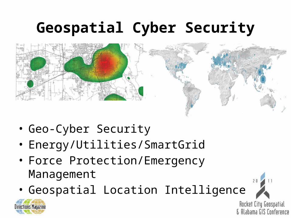
Geospatial Cyber Security
• Geo-Cyber Security• Energy/Utilities/SmartGrid• Force Protection/Emergency Management• Geospatial Location Intelligence
Geo-Cyber Security
• Traditional virtual network maps vs. geo-enabled maps
• Physical locations of Cyber assets and sources of attack are important for the Common Operating Picture (COP)
• Offensive and defensive cyber analysis• Risk assessments• Cyber forensics
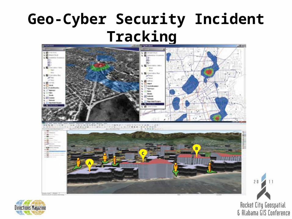
Geo-Cyber Security Incident Tracking
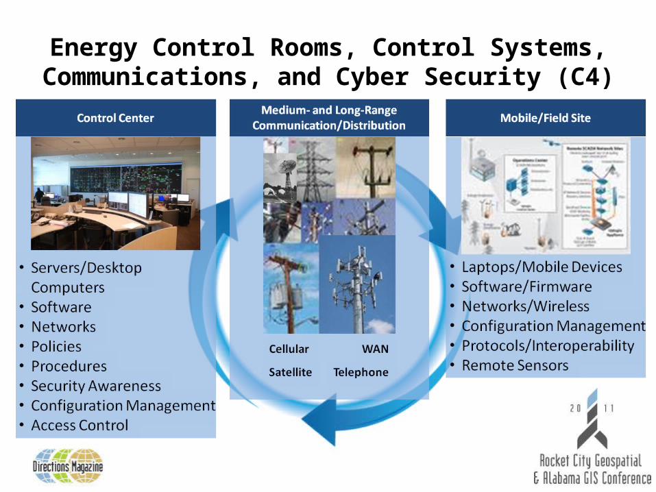
Energy Control Rooms, Control Systems, Communications, and Cyber Security (C4)
Energy/Utility/Smart Grid Geo-Cyber Issues
• SmartGrid and Control System assets are Geospatially distributed
• Smart Grid assets can be tracked/displayed on a map now; near-real time asset tracking on a map is TBR
• The “Smart Grid” is not “Cyber Smart” yet• Open standards and modern communications
technology are needed for increased interoperability• Engineering Control systems are different than
Corporate IT systems
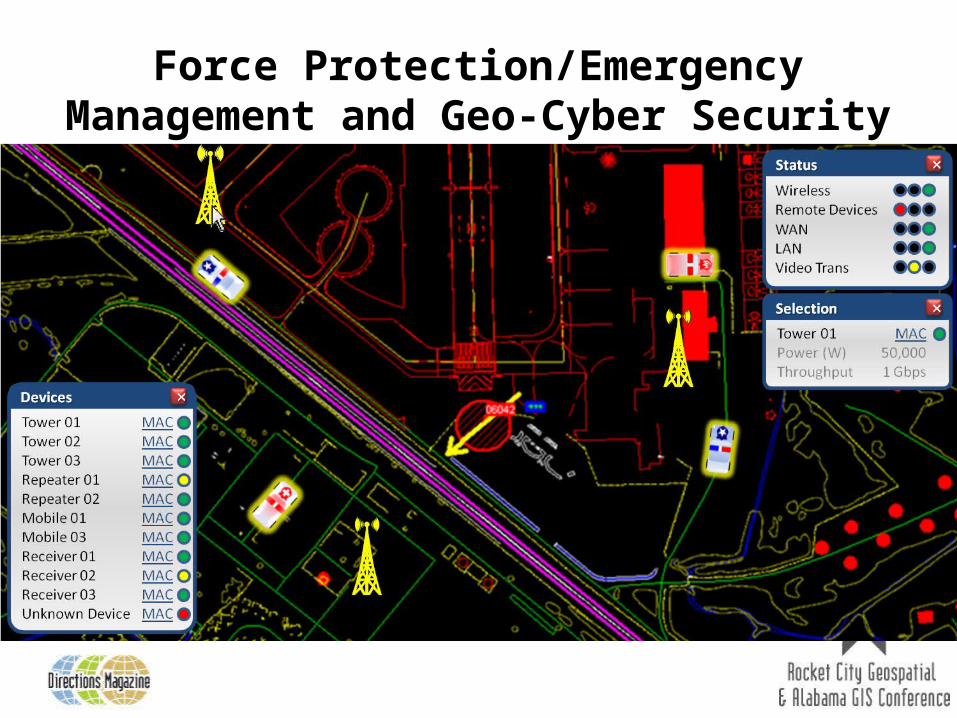
Force Protection/Emergency Management and Geo-Cyber Security
Force Protection/Emergency Management and Geo-Cyber Issues
• Many of these systems are proprietary, web/data base applications with no Geospatial capability
• For those applications with Geospatial capability, many Geo-enabled features can be integrated:• Location based services for fixed and mobile
assets • Near-real time Geo-position/status updates
• Mobile asset Geo-Cyber example
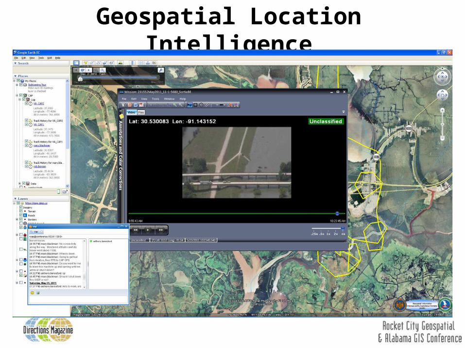
Geospatial Location Intelligence
Geospatial Location Intelligence
• Geospatial Information Interoperability Exploitation Portable (GIIEP) program
• Provide “Blue Force Tracking” like capability for air/ground/marine/space assets
• Geo-enabled collaboration capabilities such as white boarding, graphics dissemination, data distribution, chat, video and Common Operational Picture (COP)
• Cyber-certified (ATO and CON) application and supports PDA’s, SmartPhones and new technologies such as iPad & Android Pad.