Embed Size (px)
Citation preview
ESRI 380 New York St., Redlands, CA 92373-8100 USA • TEL 909-793-2853 • FAX 909-793-5953 • E-MAIL [email protected] • WEB www.esri.com
Geospatial Computer-Aided DispatchAn ESRI ® White Paper • December 2007

Copyright © 2007 ESRIAll rights reserved.Printed in the United States of America.
The information contained in this document is the exclusive property of ESRI. This work is protected under United Statescopyright law and other international copyright treaties and conventions. No part of this work may be reproduced ortransmitted in any form or by any means, electronic or mechanical, including photocopying and recording, or by anyinformation storage or retrieval system, except as expressly permitted in writing by ESRI. All requests should be sent toAttention: Contracts and Legal Services Manager, ESRI, 380 New York Street, Redlands, CA 92373-8100 USA.
The information contained in this document is subject to change without notice.
ESRI, the ESRI globe logo, www.esri.com, and @esri.com are trademarks, registered trademarks, or service marks of ESRIin the United States, the European Community, or certain other jurisdictions. Other companies and products mentionedherein may be trademarks or registered trademarks of their respective trademark owners.

J-9699
ESRI White Paper i
Geospatial Computer-AidedDispatch
An ESRI White Paper
Contents Page
Executive Summary .............................................................................. 1
Introduction........................................................................................... 1
CAD Design and Architecture Overview ............................................. 2E-911 Interface................................................................................ 2Business Logic Engine.................................................................... 2Workflow Engine............................................................................ 3CAD Geofile ................................................................................... 3Provisioning Database .................................................................... 3User Interface.................................................................................. 3Records Management System Interface.......................................... 4
Geospatial CAD Features and Functionality ........................................ 4
Feature Class Attributes........................................................................ 6
Dynamic Map Client Functionality ...................................................... 11
Situational Awareness Functionality .................................................... 12
Real-Time Location Tracking ............................................................... 16
Conclusion ............................................................................................ 19
J-9699
ESRI White Paper
Geospatial Computer-AidedDispatch
Executive Summary The primary mission of public safety is to respond to emergency events toprotect life and property. Many communities are growing in terms ofpopulation and geographic area. Many are also exposed to increasedhazards associated with industry, crime, and proximity to natural riskssuch as wildfires, earthquakes, flooding, and severe weather. Increasedexposure means emergency response requests are more frequent, complex,and dangerous.
The complex demands for public safety require sophisticated, computerized systems tomanage the volume of information needed for a safe and effective response by our lawenforcement officers, firefighters, and emergency medical personnel. Today, a personrequiring help dials 911 and describes what help is needed, and within minutesemergency response teams will arrive.
A 911 emergency call system is composed of two technologies: enhanced 911 (E-911)and computer-aided dispatch (CAD). E-911 is a feature provided by the telephonecompany that allows the emergency dispatcher to identify the location of a caller whetherthe call is from a landline or wireless. E-911 provides the ability to identify a caller'slocation even if the call becomes disconnected.
CAD is a system that identifies the most appropriate and available resource required torespond to the 911 call. In addition, a CAD system manages resource status andinterfaces with a records management system to capture and retain incident data.
Geographic information system (GIS) technology is used to store and analyze spatiallyreferenced data. Most CAD applications require a database containing addresses andstreet information to accurately locate a 911 call. GIS technology can enhance CADfunctionality through advanced analytics and data visualization.
This white paper will discuss the value GIS provides to both E-911 and CAD systems,emphasizing the CAD portion of 911 response handling.
Introduction ESRI does not design or build CAD solutions. However, GIS integration with CAD iscertainly a value-added functionality that is increasingly becoming part of some CADsolution architectures. Many CAD providers in the market are building what has beencoined as the next generation CAD (NGCAD). Typically, NGCAD refers to a redesign ofCAD complete with a new architecture to support common services and standardinterfaces with other enterprise systems or between CAD applications.
Today, many local and county governments use GIS to identify streets, boundaries, taxinformation, and so forth. They are typically staffed with personnel who maintain thedata in the system to ensure accuracy. More than a typical map display on the dispatchconsole, a GIS integrated CAD system provides greater efficiency in maintaining streetand address data by interfacing and leveraging existing data. The mapping capabilities of

Geospatial Computer-Aided Dispatch
J- 9699
December 2007 2
GIS provide dispatchers with the ability to visualize the location of incidents and ofemergency and law enforcement units when an automatic vehicle location (AVL)solution is utilized. Dispatcher insight into the location of incidents and resourcesprovides greater efficiency in assigning the right resource to the right incident to reduceresponse times.
CAD Design andArchitecture
Overview
To better understand how GIS adds value to a CAD solution, we must first review thebasic design and information flow of a CAD system. At the highest level, every CADsolution has these primary system components: an E-911 interface, a server-basedbusiness logic engine, a server-based workflow engine, a geofile and provisioningdatabase, a user-client interface, and a records management interface.
The above diagram provides a generic CAD dataflow using a GIS foundation for the utilization of geoprocessed data in dispatching workflow andoperational (business) logic functions.
E-911 Interface E-911 routes call traffic to the public safety dispatch center responsible for thegeographic area where the call originated. E-911 provides CAD with location data so thatthe emergency dispatcher knows where to send resources without having to ask thecaller for the information. However, address verification is still required because the callmay be coming from a nearby location rather than the location of the emergency itself.
Business LogicEngine
Each CAD system is uniquely designed. However, each provides some sort of systematicprocessing of information based on a client-configurable or -specified algorithm, often

Geospatial Computer-Aided Dispatch
J-9699
ESRI White Paper 3
referred to as a business logic engine. GIS server technology can interface with a CADbusiness logic engine to consume geoprocessed data variables such as unit type, call type,beat, or response area parameters to handle specialized tasks, providing the dispatcherwith a unit recommendation to assign the most appropriate resource response.
Workflow Engine A CAD workflow appears fairly simple; a call comes in and a unit must be assigned torespond. However, CAD workflows are much more complicated. Every response unit hasan associated status based on its availability and location. Each CAD customer requires aconfigurable set of unit statuses within a CAD system. The more common ones are InService (Available), En Route, On the Scene, Out of Service, En Route to Hospital, or InPursuit. A GIS server technology interfaced with a CAD workflow engine helpsdispatchers manage unit assignments and availability when new emergency calls arereceived by graphically displaying unit status on a map.
CAD Geofile Today, there are up to three geofiles in the 911 call process: the Master Street AddressGuide (MSAG), CAD geofile, and a local or county GIS system. Each requiresmaintenance and support of essentially the same data, which is an inefficient use ofresources.
Processing speed and performance is paramount in the world of emergency dispatching.Knowing and verifying the location of an emergency are absolutely essential to ensurelaw enforcement or fire/rescue personnel arrive at the correct destination. Rather thanusing an MSAG, which is typically used to determine the 911 call location to route it tothe appropriate public safety answering point (PSAP), many CAD providers utilize aproprietary geofile to ensure a Five-9 high-availability operation rating and a one-secondresponse cycle. (A Five-9 availability rating means that a system is only allowedapproximately 5 minutes of downtime per year.) However, a proprietary geofile alsoposes some unique problems, including database updates as new streets and addresses areadded, with the community resulting in increased market pressure for CAD to utilizeexisting local or county GIS files that are more frequently maintained.
A GIS-centric MSAG and CAD geofile would ensure consistency and reduce the needfor multiple street and address data sources. In addition, a GIS/CAD-centric system withgood editing tools would provide the ability to update files more frequently, ensuringgreater location accuracy as well as providing a single authoritative source for street andaddress data accessible to authorized users.
ProvisioningDatabase
The provisioning database warehouses law enforcement and fire/rescue personnel rosters,dispatcher user details, fire apparatus, and police unit information as well as otherresource details.
User Interface The user interface (UI) is simply the method dispatchers use to enter data and interactwith the CAD system. Most CAD user interfaces utilize a command line, which is a fieldwithin the CAD UI where dispatchers essentially record information in shorthand. TheCAD system then interprets the shorthand codes and populates the appropriate tabularfields with full-length or detailed information. The typical CAD UI functions on two orthree separate monitors. The left monitor is often used for a map display or for looking upinformation. The center monitor is often used as the primary workspace, where incidentand call details are displayed. The center monitor is also where the command line is

Geospatial Computer-Aided Dispatch
J- 9699
December 2007 4
typically found. The right monitor is often used to display the call work queue and unitstatus information.
The above photo depicts a CAD user interface using two monitors. The left screen is workspace designed toallow dispatchers to enter incident data, verify unit status, identify available resources, and coordinate incidentassignments. The right screen is the map interface, designed to provide dispatchers with a visual reference ofincident and resource locations.
RecordsManagement System
Interface
A records management system is a repository for incident data acquired directly fromCAD or through a user interface. The records management system provides functionalityto query transactions for analysis and historical information. Users can access RMS dataand information remotely using a mobile data terminal. GIS can correlate spatiallyreferenced RMS records with new CAD incident data to provide situational awareness toresponse personnel. Information regarding premises with a history of repetitive incidentscan prepare responders to better manage the current situation they are about to enter.
Geospatial CADFeatures andFunctionality
This section is intended to provide insight into some key features CAD customers arelooking for in a geospatial CAD. Each of these features is written as a marketingrequirements statement, with the intention that they can be shared with either a CADprovider or customer to provide or enhance a vision for a geospatial CAD. The featuresand functions discussed here are not an inclusive list and do not represent all aspects of ageospatial CAD.
Entity Name Map
For example, if the street centerline features are stored in a table called STREETS,and the street name is stored in a column named FULLNAME, a configuration toolwill need to allow you to specify these names without having to change entity namesto match hard-coded names in the GIS system.

Geospatial Computer-Aided Dispatch
J-9699
ESRI White Paper 5
Functional Feature Classes
A features class (spatial layer) is a collection of geographic features with the samegeometry type (such as point, line, or polygon), the same attributes, and the samespatial reference.
A functional feature class is a feature class that has specific business logic developedto consume data from it. For example, applications that need to perform addressmatching services will need to require the presence of a street centerline and/oraddress point feature class in the geodatabase. Some feature classes are neverrequired and only support specific functionality if present. For example, the GISservice will need to support the existence of a hydrant feature class and allow clientsto search for a nearby, in-service fire hydrant. While this feature class is not requiredfor basic dispatching, it may be used to supplement dispatch functionality.
Geospatial CAD Functional FeatureClasses
• StreetCenterlines
• Addresses• City
Boundaries• ZIP Code
Boundaries• Area Code
Boundaries
• Hydrant Location Points• Alarm Location Points• Premise/Hazard Location Points• Common Place Location Points• Registrant Location Points• Critical Infrastructure Points• Police Station Location Points• Fire Station Location Points
• Incident Data• Premise History• Unit and
ResourceLocationTracking
• Risk Zones• Buffer Zones
• UnitRecommendations
• Unit Staging• Response Plans• Station Assignments• Mutual Aid Plans• Dynamic Coverage
Areas
PSAP Coverage Area
The above diagram provides an illustration of applying various functional GIS feature classes within a CAD business logic and workflowengine. Geographic data provides the ability to create new rules and automation for dispatching and emergency response.
Geospatial Computer-Aided Dispatch
J- 9699
December 2007 6
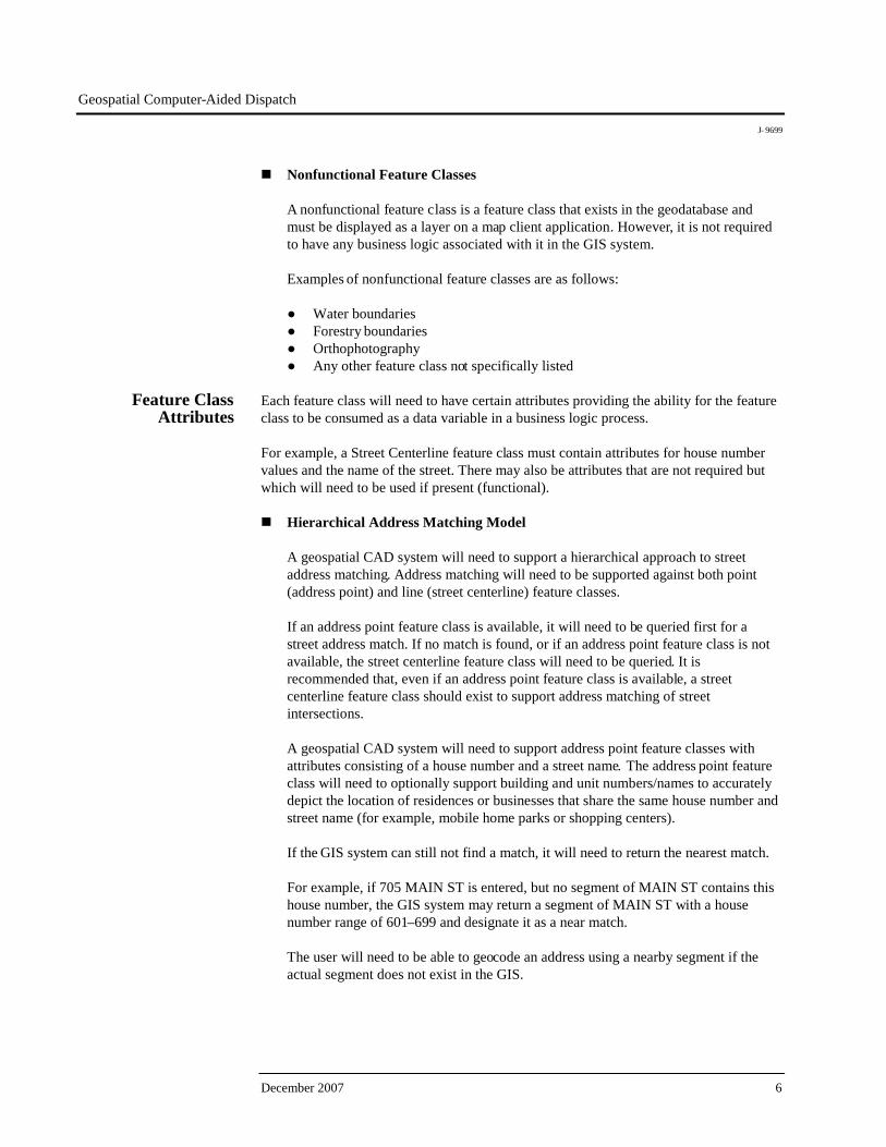
Nonfunctional Feature Classes
A nonfunctional feature class is a feature class that exists in the geodatabase andmust be displayed as a layer on a map client application. However, it is not requiredto have any business logic associated with it in the GIS system.
Examples of nonfunctional feature classes are as follows:
● Water boundaries● Forestry boundaries● Orthophotography● Any other feature class not specifically listed
Feature ClassAttributes
Each feature class will need to have certain attributes providing the ability for the featureclass to be consumed as a data variable in a business logic process.
For example, a Street Centerline feature class must contain attributes for house numbervalues and the name of the street. There may also be attributes that are not required butwhich will need to be used if present (functional).
Hierarchical Address Matching Model
A geospatial CAD system will need to support a hierarchical approach to streetaddress matching. Address matching will need to be supported against both point(address point) and line (street centerline) feature classes.
If an address point feature class is available, it will need to be queried first for astreet address match. If no match is found, or if an address point feature class is notavailable, the street centerline feature class will need to be queried. It isrecommended that, even if an address point feature class is available, a streetcenterline feature class should exist to support address matching of streetintersections.
A geospatial CAD system will need to support address point feature classes withattributes consisting of a house number and a street name. The address point featureclass will need to optionally support building and unit numbers/names to accuratelydepict the location of residences or businesses that share the same house number andstreet name (for example, mobile home parks or shopping centers).
If the GIS system can still not find a match, it will need to return the nearest match.
For example, if 705 MAIN ST is entered, but no segment of MAIN ST contains thishouse number, the GIS system may return a segment of MAIN ST with a housenumber range of 601–699 and designate it as a near match.
The user will need to be able to geocode an address using a nearby segment if theactual segment does not exist in the GIS.

Geospatial Computer-Aided Dispatch
J-9699
ESRI White Paper 7
Numeric, Alphanumeric, and Hyphenated House Numbering
A geospatial CAD system will need to support numeric, alphanumeric, andhyphenated house numbers as specified in the United States Postal Service PostalAddress Standards. However, to support geocoding of addresses using an addressrange, a segment side must use the same house number type for the low and highhouse number, and it is expected that all houses within the range adhere to the samehouse number type.
For example, the following situations do not need to be supported:
● Mixed types in the low/high address attributes
♦ Left low address = 12001♦ Left high address = 23N899
● Mixed types within the segment
♦ Left low address = 12001♦ Left high address = 12998
● Actual house number along this segment = 23-101
"In Front of Address"
A geospatial CAD will need to provide a way to geocode a location for an incidentthat occurs in the street using a parcel address. For example, "In front of 1990 CherryCircle" would be geocoded to a coordinate on the street segment directly in front ofthe parcel at 1990 Cherry Circle.
Street Names
Some data sources may have street names stored as a single attribute, while othersare parsed into as many as five attributes (prefix direction, prefix type, name, suffixtype, and suffix direction).
A geospatial CAD system will need to handle any combination of attributes inbetween. However, because of how the Soundex and address matching algorithmswork, it is desired that prefix attributes be stored in attribute fields separate from thestreet name. Prefix types are typically considered part of the street name. They areused almost exclusively in foreign language street names such as Calle Valdes andRue Bourbon.
However, by storing them in the same field as the street name, the system will needto produce several Soundex and address match results when only "Calle" or "Rue" isprovided as input. Prefix directions create the same problem.
Geospatial Computer-Aided Dispatch
J- 9699
December 2007 8
Cross Street Determination
A geospatial CAD system will need to provide a service to determine the crossstreets of any given street segment. This service will not only need to support theability of a user to get the cross streets for a particular segment but can also be usedto get a list of streets that intersect a particular street.
Street and Pseudo Intersections
A geospatial CAD system will need to support location matching using the names oftwo streets that intersect without the use of a junction or intersection feature class. Ageospatial CAD will need to also support "pseudo" intersections, where two streetsdo not actually meet but where the addressing schema aligns with block numbering.
Block Numbers
A geospatial CAD system will need to support address matching and geocoding oflocations entered as block numbers (for example, 100 BLK MAIN ST). A geospatialCAD system will need to geocode this address similar to how it would a housenumber (100 MAIN ST) but without the XY offsets applied to the segment ends andsides.
Common Place Matching
A geospatial CAD system will need to support matching point locations that haveaddress information associated with them (for example, common places such asbusinesses, schools, and other government buildings) by both name and address(reverse place matching).
Geocoding
A geospatial CAD system will need to support translating a verified location (streetaddress, intersection, named feature point) to a geographic coordinate. Reversegeocoding, or translating a coordinate to a street address, intersection, or namedfeature point, will need to also be supported.
Feature Attribute Queries
A geospatial CAD system will need to support querying features in any functionalfeature class by any functional attribute(s).
Feature Aliases
Most functional feature classes (such as street centerline and common place) willneed to support the use of Alternate Name Tables, allowing aliases to be defined on aper feature basis.

Geospatial Computer-Aided Dispatch
J-9699
ESRI White Paper 9
Spatial Queries
A geospatial CAD system will need to support querying features from functionalfeature classes within a specified radius of a specified coordinate. This feature willneed to be used for such things as previous incident searches, premise/hazardsearches, and determining the responding agency/beat/station.
Transportation Network Services
A geospatial CAD system will need to provide a service to calculate the shortest orquickest path between two or more points using the street network dataset. Drivingdirections will need to be included as part of the response as will estimated traveltime. Custom evaluators, such as peak and nonpeak travel costs; restrictions based onvehicle length, height, and weight; illegal turn restrictions; and turn penalties, can bedefined in the network dataset and taken into account while solving. Networkelements can be closed or opened in real time or at scheduled times. A geospatialCAD system will also need to be designed in such a way as to support intelligenttraffic systems so that real-time traffic data can be used to assess network travelcosts.
Complex Routing Support
A geospatial CAD system will need to provide the user with complex navigationrouting information to be displayed in a map client application.
Turn Penalty Modeling Support
A geospatial CAD system will need to provide the user with the ability to model turnpenalties associated with a particular route and display it in a map client application.
Sensory Data Interface Support
A geospatial CAD will need to support an open API-like interface with sensorydevices to collect the following data:
● Vehicle data
♦ Speed♦ Vehicle in motion♦ Warning systems (lights and sirens) activation
● Personal data
♦ Self-contained breathing apparatus air levels♦ Biostatistics

Geospatial Computer-Aided Dispatch
J- 9699
December 2007 10
● Devices
♦ Heat sensors♦ Toxic gas sensors♦ Video surveillance sensors
Meteorologics Support
Users often need to understand how weather may be impacting an incident. There areseveral situations beyond catastrophic weather situations warranting this feature. Forexample, weather has an effect on wildfires, the direction and speed of toxic gasclouds, and the usability of bridges/roadways that become dangerous at certain windspeeds. A geospatial CAD will need to support an open, API-like interface withmeteorologics applications to import weather data for a specific location and overlayit on a map.
Layer Management within Dynamic Map Client
A geospatial CAD will need to support an open, API-like interface to provide anymap client with data associated with spatial layers contained within the geodatabase.A geospatial CAD will need to also support the ability to define those layers andswitch between the views to prevent screen clutter.
Overlapping Jurisdictional Support
Many agencies have overlapping jurisdiction, where more than one agency may berequired to respond to a location for an incident. In addition, an agency may haveoverlapping jurisdictions within itself. For example, university campus police maybe the first to respond to a burglary on a college campus, but local police may also berequired to respond if an arrest were to occur. As such, a geospatial CAD will needto support the ability to have overlapping jurisdictions and to allow a dispatchingapplication to notify all responsible agencies.
Time-Dependent Polygons
Overlapping jurisdictions may also have a time element associated with them. Forexample, park police may be responsible for a community park or beach between thehours of 6:00 a.m. and 6:00 p.m., whereas local police are responsible for the other12 hours. As such, a geospatial CAD will need to support the ability to establishtime-dependent geopolygons.
X,Y Coordinate Projection Exposure
A geospatial CAD will need to support an API-like interface to expose x,ycoordinate projections to be used by any application.

Geospatial Computer-Aided Dispatch
J-9699
ESRI White Paper 11
Incident Location Data Store and Query
A geospatial CAD will need to support the ability to store and query incident dataassociated with a specific location in a records management system except wherebandwidth limitations exist in a mobile operating environment.
Dynamic Map ClientFunctionality
A dynamic map client is required to graphically display location data, as well as datacorresponding to locations, to the user. A dynamic map client could be a plug-and-playmodule and provide an API-like interface, providing the ability to share location datawith a host application.
Host CAD Application Interactions
The dynamic map client will need to be able to share data by populating the hostapplication's data entry forms and unique user interfaces such as Active Paper anddispatch command lines.
● The user will need to be able to point, click, or touch a point on the map client,and data associated with the location will need to be populated in the hostapplication user interface based on the host application's call for the data.
● The map client will need to support the ability for the host application topopulate new data associated with a location on the map through an API-likeinterface.
● Host applications performance will need to be free of adverse effects caused byinteracting with the dynamic map client.
Client User Interactions
The dynamic map client will need to support the ability for users to interact with thesystem through the use of a mouse, touch screen, key commands on a handhelddevice, voice activation, or pen-based technologies.
User-Selected Location Data Views
Geographic data is typically displayed as a digitized map or as an orthophotographyimage. The dynamic map client will need to provide users with the ability to select,deselect, or change their desired view of location data. View selections are meant fora later release of the solution but will need to include the following actions:
● Switch from a digitized map to an orthophotography (including oblique) view ofthe same location.
● Switch from an orthophotography view back to a digitized map view.
● Minimize the digitized map view to a smaller perspective and display hostedapplication data associated with a location in a secondary panel.

Geospatial Computer-Aided Dispatch
J- 9699
December 2007 12
● Apply either a static or dynamic dispatch command line interface on top of themap for data input and provide the ability to close out of the command linewhen completed.
● When data that is spatially displayed is selected, a "halo" window will appearwith base information including hyperlinks to the full data view.
Location Data Acquisition
Users require the ability to access location data through a map interface. Theacquired location data is to be used by a host application for specific processes. Thedynamic map client will need to provide the ability for a user to access location datathrough the utilization of the following drawing tools:
● Single point access● Multiple point access (ctrl + [Click])● Select by layer● Point-to-point line● Polygons● Circles● Ovals● Measured distance from a given point or current location● Measured radius from a given point or current location
Location Data Viewing
The dynamic map client will need to provide the ability to view and select dataassociated with a location through the following methods: mouse-over movement,point and click, pen devices, and touch screen access.
SituationalAwareness
Functionality
The dispatcher or first responder is a person who will be interfacing with the map clientto complete a specific task for a specific location or set of locations.
The dispatcher or first responder uses the map to obtain an awareness of responseboundaries and assigned areas, where they are located in a geographic area, where unitsfrom their agency or another agency are located within an area, where incident orresponse calls are occurring, automatic directions to those calls, detailed informationrelating to the calls, or detailed information relating to a specific location.
Single and Multiple Vehicle/Person Display
Geospatial CAD users will want to know their relative position and the position ofother users on a map. This would include direction of travel and where they havegone. The dynamic map client will need to provide the user with a flight followingawareness by displaying a solid arrow indicating direction of travel and a dashed lineindicating previous route.

Geospatial Computer-Aided Dispatch
J-9699
ESRI White Paper 13
Vehicle/Person Display Toggles
The geospatial CAD user and supervisors will want the ability to toggle on and offwhether or not their location is displayed and viewable by others. They may alsowant the ability to restrict the overall operational view to supervisor level and above.The map solution will need to provide a means to grant authority to specific users forthis feature.
Vehicle/Person Type Indicators
The geospatial CAD will need to support customization of icons and/or shapes torepresent different types of conveyance including vehicle, motorcycle, bicycle,walking, and mounted as required, and it will be based on the vehicle class of theresource.
Incoming Unit Flight Following
The geospatial CAD user will want to know the location of other vehicles respondingto the same location. As such, the dynamic map client will need to provide the abilityto identify incoming units that are off the map by an indication pointing to theincident they are responding to. The indication will need to support a user-definedcolor variant correlating to the distance from the incident.
Routing Indicators
The geospatial CAD user will need to be provided with the ability to applyindividual icons for each of the following:
● Start of route● End of route● Location icon● Incident● Caller location● "Barriers" and "Via" (intermediate) route points
Point-to-Point Directions
The geospatial CAD user will want the ability to search for and receive point-to-point directions. The dynamic map client will need to support the ability for the userto enter a starting location and ending location. The map client will need to thendetermine the route to take and provide the user with both textual information andgraphical information pertaining to route, estimated time of arrival, and distance.
Address Lookup
The geospatial CAD user will want the ability to search for and receive locationinformation for a given address or range of addresses. The dynamic map client willneed to support the ability for the user to enter an address or block of addresses. Themap client will need to then determine the location of the address and center the mapon that location.

Geospatial Computer-Aided Dispatch
J- 9699
December 2007 14
Common Place Searching
The geospatial CAD user will want the ability to search for and receive locationinformation for a common place. The dynamic map client will need to support theability for the user to enter a common place. The map client will need to thendetermine the location of the common place and center the map on that location.
Incident Display
The geospatial CAD user will want detailed information regarding the location, aswell as incident data, associated with a given location. The user will most commonlywant to know address data, street name, premise history, and incident detail (incidenttype, how many people are involved, when it was received, and hazardousconditions). The dynamic map client will need to support a host application interfaceto present nongeographic data on a map.
Traffic Volume Impact (traffic impact on response times)
The geospatial CAD user will want to be made aware of unique travel conditions thatmay impede a response. The dynamic map client will need to support an interface toalert the user to the impact traffic volumes may have on a route.
Environmental Response Factors
The geospatial CAD user will want to be made aware of unique weather conditionsthat may impede a response. The dynamic map client will need to support aninterface to alert the user to the impact weather may have on a route.
Wind Direction and Plume Modeling
An awareness of environmental factors is also essential in hazardous material andwildfire incidents. The dynamic map client will need to support an interface that ahost application capable of providing meteorological information can utilize topresent the impact weather may have on an incident. A geospatial CAD will need toprovide an automatic Wind Direction and Plume Notification feature.
Utility Company Availability
The geospatial CAD user often has to interact with utility companies as well as otherservices such as street or water departments. The dynamic map client will need tosupport an interface that a host application capable of providing location trackinginformation from an outside source can use.
Location Send
A geospatial CAD user is often busy with handling the demands of an incident andtherefore would gain an advantage by having the ability to send location informationto another user such as a person with a map-enabled handheld device, a vehicleequipped with a map client, or aircraft such as helicopters. The following arepotential situations:

Geospatial Computer-Aided Dispatch
J-9699
ESRI White Paper 15
● Location-specific concerns● Staging area● Command post identification● Mutual aid response (data share geodata for incidents)● Sending GPS coordinates to aviation units (fire and police)
Photo Attaching
A geospatial CAD user wants the ability to attach a photo and/or video file with thelocation information. A geospatial CAD will need to support the ability to attach adigital photo with corresponding location information for the purpose of sending ane-mail or message. The map is not required to use the location data.
Accident Sketching and Investigation
A geospatial CAD user wants to leverage location information in day-to-dayoperations such as
● Leveraging GPS technology within vehicle accident investigations
● Accident sketching using existing geospatial data
♦ Using map graphics as well as aerial photography♦ Using GPS technology to take measurements of the accident scene
A mobile client would make a request to the dynamic map client for an exportedimage of the current map extent to support the ability for a user to incorporatelocation information into a host field-based reporting application.
Crime Analysis Support
A crime investigator has the need to view information on a map to better investigateand solve crimes. For example, a field investigator responding to a murder sceneunderstands that the suspect is not out in the community being a model citizen.Therefore, the field investigator will want to be made aware of other incidentsoccurring in close proximity to the scene he or she is working. Location informationwill also need to be included such as providing premise history of selected locations,a map populated with registered offenders, locations of parolees, and knownlocations of previous suspects.
The dynamic map client will need to support an interface with a records managementsystem for the following activities:
● Ability to view other agency incidents and/or investigations
♦ Automated data sharing
● Crime analysis and correlation to dates aerial photos were taken
♦ Possible concealment locations
Geospatial Computer-Aided Dispatch
J- 9699
December 2007 16
● Seasonal view of the location
● Crime analysis units
♦ Requires access to the data♦ What-if analysis♦ Web-based density analysis
● Administrative
♦ Geodashboard (static and dynamic views)♦ Use of Crystal Reports® to create the data
Real-Time LocationTracking
The geospatial CAD location tracking system will need to supply the dynamic map clientwith real-time movement of vehicles, persons, or assets. The reporting system will alsoneed to provide real-time location tracking of stationary devices such as sensory andimage capturing devices at street intersections and places of interest.
Discrete I/O Reporting
The geospatial CAD location tracking system will need to support discrete I/Os toprovide telemetry tracking such as door-open status, rifle latch status, and lights/sirenstatus.
Vehicle/Person ID
The geospatial CAD location tracking system will need to extend services to providea host application with the unit ID, vehicle type, and the unit's GPS location to a mapclient monitoring the geographic area/boundary to which the ID is assigned.
Vehicle/Person Status Message
The geospatial CAD location tracking system will need to provide the active/inactivestatus of a vehicle/personal device.
Poll On Demand
The geospatial CAD location tracking system will need to receive Poll On Demandrequests from the host application and send a location report response back to thehost application.
Status Change Monitoring
When tracking a resource, the resources, whether a vehicle or person, will have anassociated status as determined by the work activity they are performing. Forexample, a resource may be en route, at a location, available, out of service, and soforth. The geospatial CAD location tracking system will need to support receiving aresources status change based on the host application status types. A geospatial CADwill need to provide the information to the host application.

Geospatial Computer-Aided Dispatch
J-9699
ESRI White Paper 17
Boundary Assignments
The geospatial CAD location tracking system will need to extend to a hostapplication the ability to determine a geographic boundary and/or limit of allregistered vehicular or personal devices.
Response Assignment Tracking
The geospatial CAD location system will need to support the ability for the hostapplication to apply response assignment associations to an individual or group ofvehicles/persons.
Location Display
The geospatial CAD location tracking system will need to support the followingdisplays:
● Single Vehicle/Person: Display information pertaining to an individualvehicle/person to include location identification, speed, and direction of travel
● Multi-Vehicle/Person: Display information for multiple vehicles/persons withina user-defined group or entire system to include individual locationidentification, speed, and direction of travel
● GPS Status: Display for identification as to whether or not an active GPS signalis being captured as determined by a configurable length of time from the lasttracking report (This will need to also include a time stamp of the last recordedlocation report.)
Location Tracking Data Formats
The geospatial CAD location tracking system will need to provide the following datawithin the dynamic map client as a tabular halo field attached to the respectivevehicle/person location.
● Date/Time● ID/Status● Call Sign● Incident/Assignment ID● Latitude/Longitude● Associated Address● Speed/Heading/Altitude● GPS Time (UTC)● Satellite Count● Reporting Source

Geospatial Computer-Aided Dispatch
J- 9699
December 2007 18
Location Tracking Administration
The geospatial CAD location tracking system will need to provide the ability for asystem administrator to modify vehicle and person attributes remotely to eliminatethe need for the device to be brought back to a central location.
Administrator User Interface
The geospatial CAD location tracking system will need to support both thick andthin client administration user interfaces.
Vehicular/Personal Devices Registration
The geospatial CAD location tracking system will need to support the access of ahost application vehicular/personal device registration file or provide a generic filewithin the system in the event a host file does not exist. The generic file will need toinclude data fields required to support the location tracking capabilities outlined inthis section.
Vehicle/Person Location Cloaking
The geospatial CAD location tracking system will need to support a systemadministrator's ability to determine vehicles/persons that will not be sent/displayedon the dynamic map client or host application. A geospatial CAD will only need toprovide authorized users with the ability to view cloaked locations.
Vehicle/Person Location Grouping
The geospatial CAD location tracking administration will need to support groupingresources in the following configurations to be used in application functions likemessaging and chat:
● Team of selected vehicles/persons● Jurisdictional boundaries● Unit/Person role (e.g., patrol, detective, supervisor)● Unit status (en route, in service, in staging, on standby, out of service)● Individual unit
Location Tracking Data Repository
Location tracking data will need to be retained within a records management systemand will need to contain location key indices to a centralized GIS service.
Route History
The geospatial CAD location tracking system will need to support the ability to playback a route of travel for registered devices within the following time intervals:
● Route playback—Determine route traveled within user-specified timeincrements.

Geospatial Computer-Aided Dispatch
J-9699
ESRI White Paper 19
● Boundary comparison—Determine when the vehicle/person left an assignedboundary and when they returned.
● Distance traveled—Determine the distance traveled in terms of feet/miles(meters/kilometers) within a user-defined time frame.
● Rate and speed of travel—Determine the rate/speed of the vehicle/person interms of miles per hour (kilometers/hour) for vehicular application andfeet/minute (meters/minute) for personal application.
Location Tracking Alerts
The geospatial CAD location tracking system will need to support the providing oflocation alerts to be displayed in the dynamic map client or to a host application.Style, method, and configuration of alerts will need to be determined by theapplication receiving the data.
GPS Failure (device dependent)
The geospatial CAD location tracking system will need to store and provide reportsfor any device's failure recognition capabilities.
Vehicle/Person Location Violations
The geospatial CAD location tracking system will need to provide the ability todetect and determine if a vehicle or person has violated either standard or user-configured location violation parameters and provide the alert to the dynamic mapclient or host application:
● Standard parameters
♦ Speeding (maximum speed by vehicle type)♦ Assigned beat/boundary crossing♦ Device disabling
Violation Logging
The geospatial CAD location tracking system will need to support violation loggingwithin a centralized records management system.
Conclusion Every CAD system requires a geographic database or geofile to ensure the right resourcesare directed to the right location. This white paper discussed the various geographic datasources utilized in the 911 dispatching process, a generic CAD system overview anddataflow, the geographic advantage of a spatial CAD, and the value GIS provides toemergency call management.
Emergency dispatching and response are inherently spatial. Obtaining an accuratelocation of a caller is essential whether the call originated through a landline orwirelessly. Dispatching resources that are closest to the incident requires knowing wherethe resources are located in relation to the emergency. GIS technology provides CAD

Geospatial Computer-Aided Dispatch
J- 9699
December 2007 20
applications with the ability to more accurately determine the location of E-911 calls inrelation to resources using AVL to reduce response times, increase responder safety, andenhance situational awareness.
Proprietary CAD mapping systems pose challenges in maintaining and reusing GIS data.In addition, spatial analytical functions using proprietary geofiles are limited. GIStechnology provides tools that improve data maintenance functions as well as analyticalcapabilities to enhance emergency dispatching workflows. Data visualization in thecontext of a map provides dispatchers with a more intuitive view of what is happening inthe community.

Australia www.esriaustralia.com.au
Belgium/Luxembourg www.esribelux.com
Bulgaria www.esribulgaria.com
Canada www.esricanada.com
Chile www.esri-chile.com
China (Beijing) www.esrichina-bj.cn
China (Hong Kong) www.esrichina-hk.com
Eastern Africa www.esriea.co.ke
Finland www.esri-finland.com
France www.esrifrance.fr
Germany/Switzerland www.esri-germany.de www.esri-suisse.ch
Hungary www.esrihu.hu
India www.esriindia.com
Indonesia www.esrisa.com.my
Italy www.esriitalia.it
Japan www.esrij.com
Korea www.esrikr.co.kr
Malaysia www.esrisa.com.my
Netherlands www.esrinl.com
Northeast Africa 202-516-7485
No. GS-35F-5086H
Printed in USA
ESRI International Offices
ESRI Regional Offices
Olympia 360-754-4727
St. Louis 636-949-6620
Minneapolis 651-454-0600
Philadelphia 610-644-3374
Boston 978-777-4543
Washington, D.C. 703-506-9515
Charlotte 704-541-9810
San Antonio 210-499-1044
Denver 303-449-7779
California 909-793-2853 ext. 1-1906
Poland www.esripolska.com.pl
Portugal www.esri-portugal.pt
Romania www.esriro.ro
Singapore www.esrisa.com
Spain www.esri-es.com
Sweden www.esri-sgroup.se
Thailand www.esrith.com
Turkey www.esriturkey.com.tr
United Kingdom www.esriuk.com
Venezuela www.esriven.com
1-800-GIS-XPRT (1-800-447-9778)
www.esri.com
Locate an ESRI value-added reseller near you at
www.esri.com/resellers
Outside the United States, contact your local ESRI distributor. For the number of your distributor, call ESRI at 909-793-2853, ext. 1-1235, or visit our Web site at
www.esri.com/distributors
For More Information
ESRI 380 New York Street Redlands, California 92373-8100 USA
Phone: 909-793-2853Fax: 909-793-5953 E-mail: [email protected]
For more than 35 years, ESRI has
been helping people make better
decisions through management
and analysis of geographic
information. A full-service GIS
company, ESRI offers a framework
for implementing GIS technology
and business logic in any
organization from personal GIS on
the desktop to enterprise-wide GIS
servers (including the Web) and
mobile devices. ESRI GIS solutions
are flexible and can be customized
to meet the needs of our users.