Embed Size (px)
Citation preview
From Satellite to Silo: The impact ofEGNOS on Precision Farming
Dr Sally Basker, Booz Allen HamiltonDr Javier Ventura-Traveset, ESA Toulouse
Mr Giorgio Solari, ESA BrusselsMr Richard Reed, LH Agro (UK) Ltd
1
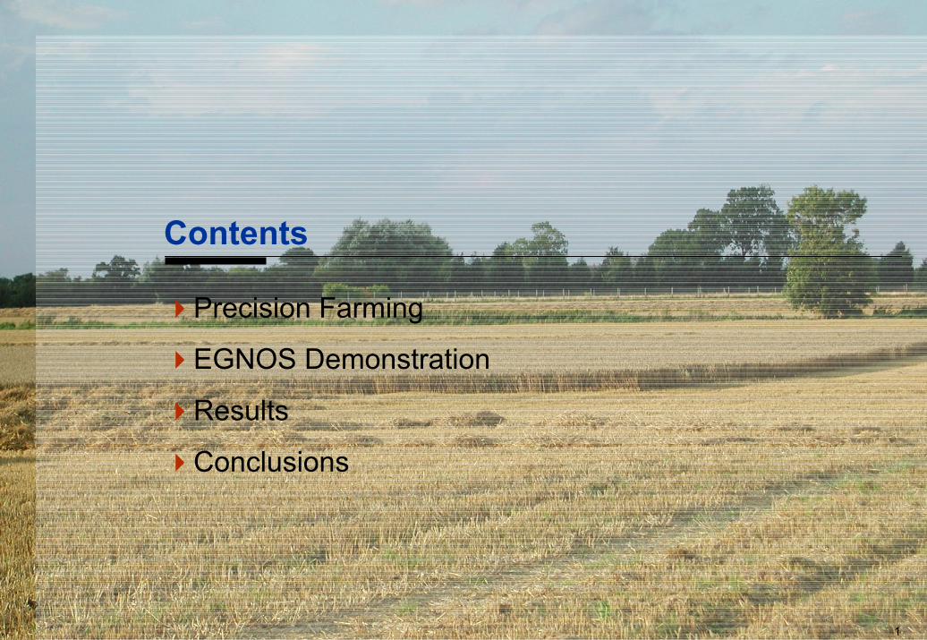
Contents
Precision Farming
EGNOS Demonstration
Results
Conclusions
2
Precision farming
Why is precision farming important in theagriculture sector?
Why use EGNOS for precision farming?
3Source: Racal Tracs. Professional Market Applications Report. GALA-RACAL-DD004, Issue 2, 5 May 2000
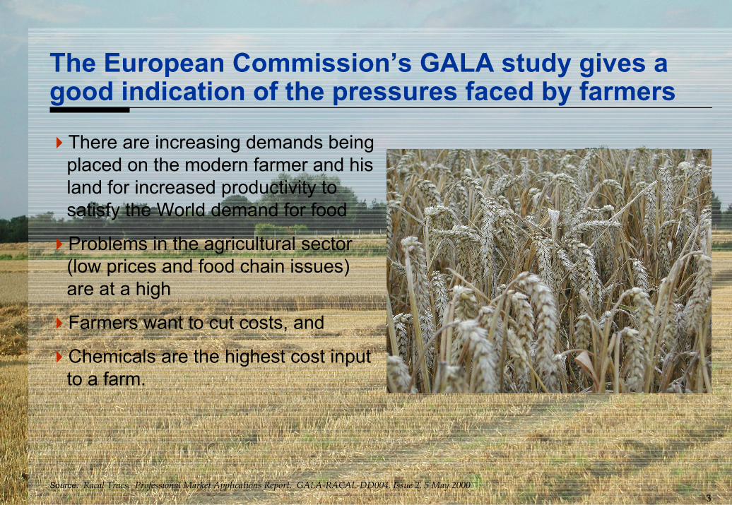
The European Commission’s GALA study gives agood indication of the pressures faced by farmers
There are increasing demands beingplaced on the modern farmer and hisland for increased productivity tosatisfy the World demand for food
Problems in the agricultural sector(low prices and food chain issues)are at a high
Farmers want to cut costs, and
Chemicals are the highest cost inputto a farm.
4
Source: Blackmore S. Developing the principles of precision farming. Proceedings of Agrotech 99, Barretos, Brazil 15-19 November 1999
Precision farming helps the farmer to manage arablevariability and to optimise the yield / cost ratio
Precision farming may be defined as "… the management ofarable variability to improve the economic benefit and reduceenvironmental impact”1
The farmer uses technology – variable rate applicationtechniques together with accurate positioning - to monitor andassess performance at a local or farm level
Custom prescription of farm chemicals are applied to smallareas in a field
The goal is not necessarily maximum yield, but may be tomaximise financial advantage while operating withinenvironmental constraints
5
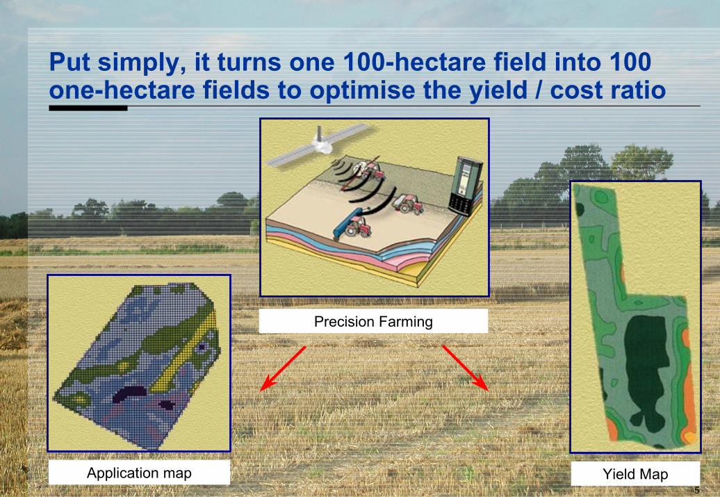
Put simply, it turns one 100-hectare field into 100one-hectare fields to optimise the yield / cost ratio
Yield MapApplication map
Precision Farming

6
Precision farming can deliver significant costsavings to larger farms ...
The European Commission’s GALAstudy identifies the benefits ofprecision farming– cost savings of around 28€ per
hectare per year, although farms needto be larger than 500 hectares tobenefit
– i.e. cost savings are in excess of 14k€per year
Source: Racal Tracs. Professional Market Applications Report. GALA-RACAL-DD004, Issue 2, 5 May 2000
7
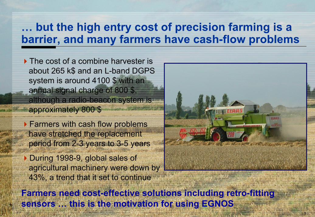
… but the high entry cost of precision farming is abarrier, and many farmers have cash-flow problems
The cost of a combine harvester isabout 265 k$ and an L-band DGPSsystem is around 4100 $ with anannual signal charge of 800 $,although a radio-beacon system isapproximately 800 $
Farmers with cash flow problemshave stretched the replacementperiod from 2-3 years to 3-5 years
During 1998-9, global sales ofagricultural machinery were down by43%, a trend that it set to continue
Farmers need cost-effective solutions including retro-fittingsensors … this is the motivation for using EGNOS
8
EGNOS will provide farmers with a new andcost-effective source of differential signals
EGNOS has distinct benefits over the current radiobeacon orcommercial systems– the EGNOS service covers all Europe wherever you can see the
geostationary satellites, this is distinctly better than the coverage providedby the marine radiobeacons
– the EGNOS service will be free of direct user charges, releasing users frompaying commercial licence fees and
– not needing a separate radio to receive differential corrections drives downthe cost of the user equipment – hand-held receivers that can trackEGNOS are now available and cost less than 300 €
Cutting the cost of the positioning technology from, say, 4100 €with an annual signal charge of 800 € to less than 500 € shouldextend the economic and ecological benefits available fromprecision farming to farmers with smaller farms
9
Demonstration
What did we do to demonstrate the benefits ofEGNOS?
10
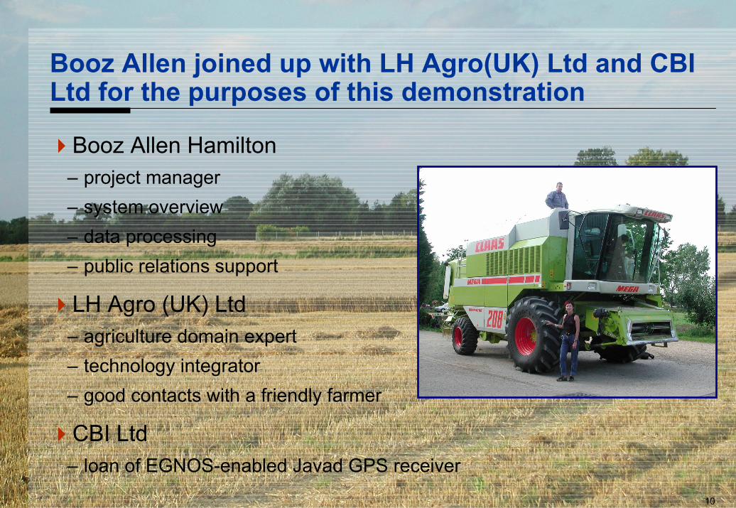
Booz Allen joined up with LH Agro(UK) Ltd and CBILtd for the purposes of this demonstration
Booz Allen Hamilton– project manager– system overview– data processing– public relations support
LH Agro (UK) Ltd– agriculture domain expert– technology integrator– good contacts with a friendly farmer
CBI Ltd– loan of EGNOS-enabled Javad GPS receiver
11
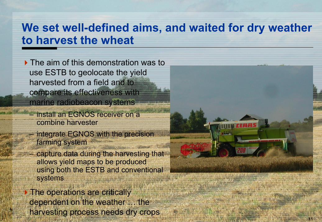
We set well-defined aims, and waited for dry weatherto harvest the wheat
The aim of this demonstration was touse ESTB to geolocate the yieldharvested from a field and tocompare its effectiveness withmarine radiobeacon systems– install an EGNOS receiver on a
combine harvester– integrate EGNOS with the precision
farming system– capture data during the harvesting that
allows yield maps to be producedusing both the ESTB and conventionalsystems
The operations are criticallydependent on the weather … theharvesting process needs dry crops
12
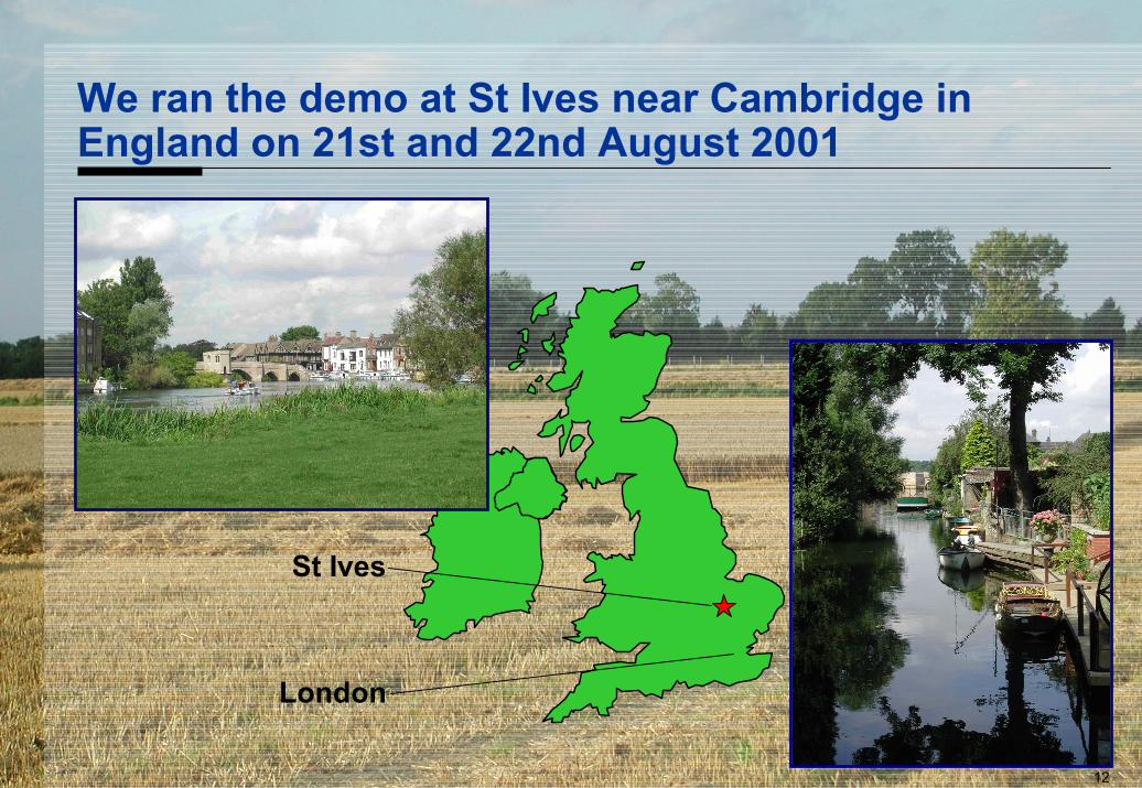
We ran the demo at St Ives near Cambridge inEngland on 21st and 22nd August 2001
St Ives
London
13
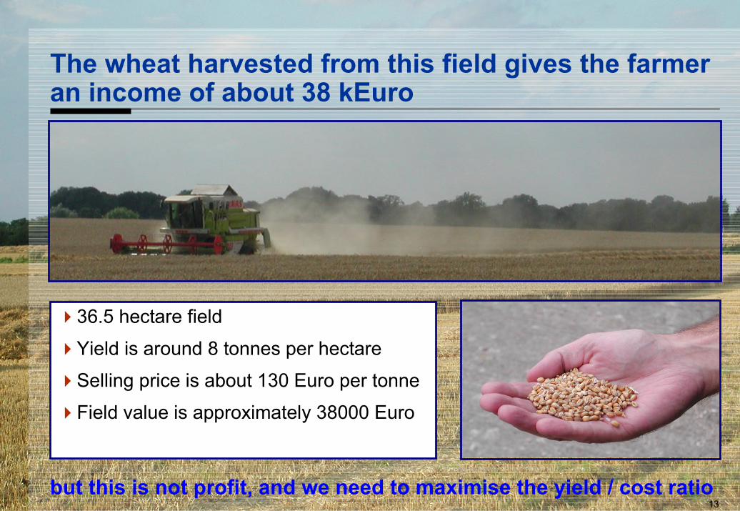
The wheat harvested from this field gives the farmeran income of about 38 kEuro
36.5 hectare fieldYield is around 8 tonnes per hectareSelling price is about 130 Euro per tonneField value is approximately 38000 Euro
but this is not profit, and we need to maximise the yield / cost ratio
14
Results
How well did ESTB perform?
15
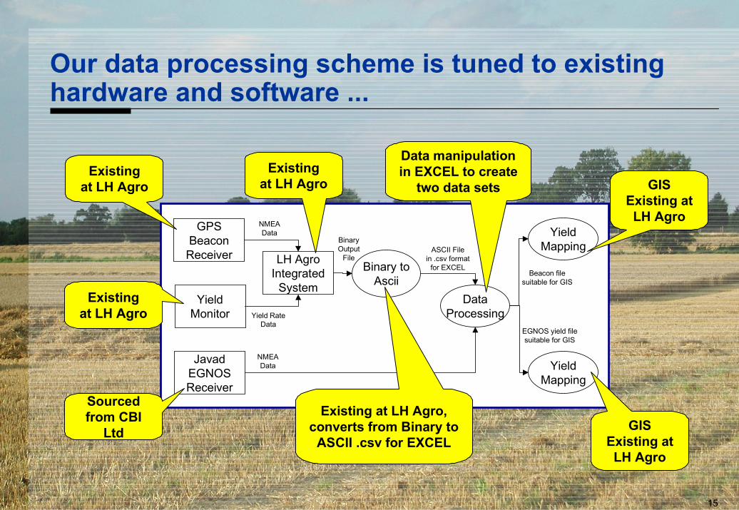
Our data processing scheme is tuned to existinghardware and software ...
GPSBeacon
Receiver
JavadEGNOSReceiver
YieldMonitor
LH AgroIntegrated
System
YieldMapping
Binary toAscii
DataProcessing
YieldMapping
NMEAData
NMEAData
Yield RateData
BinaryOutput
FileASCII File
in .csv formatfor EXCEL
Beacon filesuitable for GIS
EGNOS yield filesuitable for GIS
Existingat LH Agro
Existingat LH Agro
Sourcedfrom CBI
Ltd
Existingat LH Agro
Existing at LH Agro,converts from Binary to
ASCII .csv for EXCEL
Data manipulationin EXCEL to create
two data sets
GISExisting atLH Agro
GISExisting atLH Agro
16
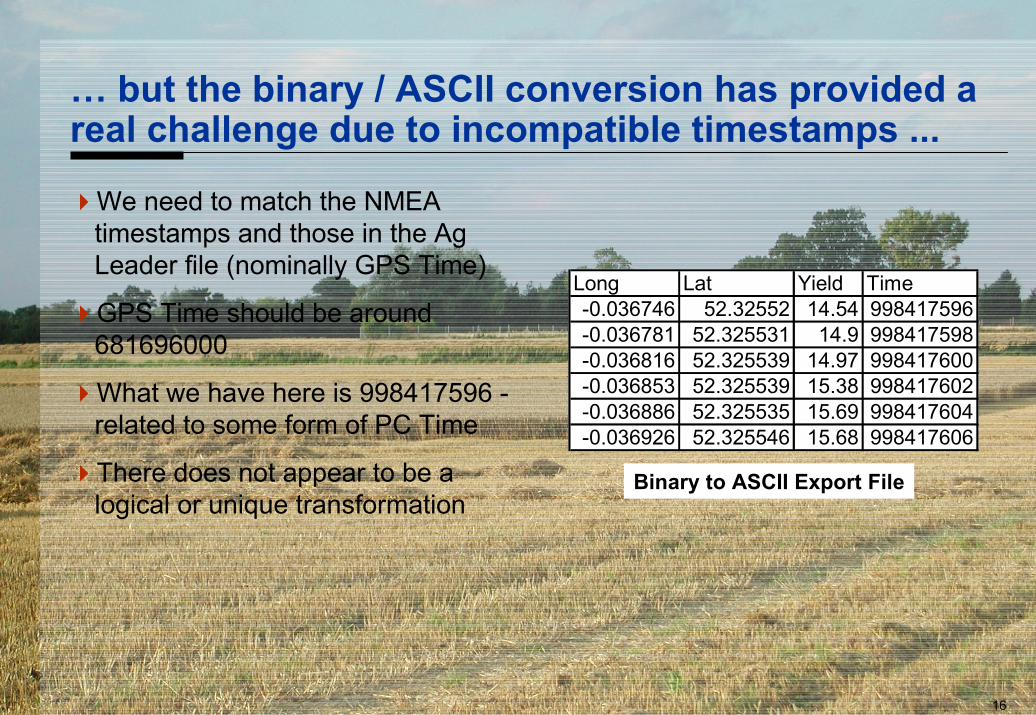
… but the binary / ASCII conversion has provided areal challenge due to incompatible timestamps ...
We need to match the NMEAtimestamps and those in the AgLeader file (nominally GPS Time)
GPS Time should be around681696000
What we have here is 998417596 -related to some form of PC Time
There does not appear to be alogical or unique transformation
Long Lat Yield Time-0.036746 52.32552 14.54 998417596-0.036781 52.325531 14.9 998417598-0.036816 52.325539 14.97 998417600-0.036853 52.325539 15.38 998417602-0.036886 52.325535 15.69 998417604-0.036926 52.325546 15.68 998417606
Binary to ASCII Export File
17
… and caused us to revisit our processing strategy
The farmer drove the combine harvester in straight lines
We determined the azimuth between successive points for boththe beacon and ESTB data to identify the lines
We then cross-correlated the beacon and ESTB data for elevenof the lines to find the “best fit” based on position differences asthe criteria
18
Expressing the results graphically shows a smallbias between the beacon and ESTB positions
52.3250
52.3252
52.3254
52.3256
52.3258
52.3260
52.3262
52.3264
52.3266
52.3268
52.3270
-0.045 -0.044 -0.043 -0.042 -0.041 -0.040 -0.039 -0.038 -0.037 -0.036
Latitude
Long
itude
BeaconESTB
Total data = 5795 seconds= 1 hour 36 minutes 35 seconds
50m420m
19
52.3250
52.3252
52.3254
52.3256
52.3258
52.3260
52.3262
52.3264
52.3266
52.3268
52.3270
-0.045 -0.044 -0.043 -0.042 -0.041 -0.040 -0.039 -0.038 -0.037 -0.036
Latitude (deg)
Long
itude
(deg
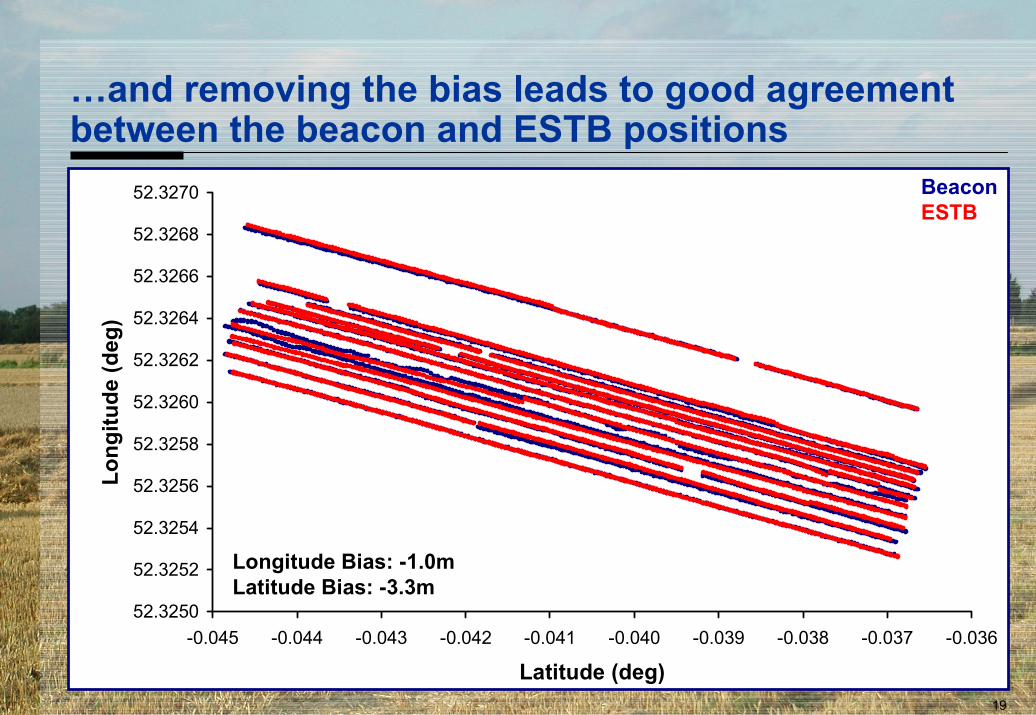
)…and removing the bias leads to good agreementbetween the beacon and ESTB positions
BeaconESTB
Longitude Bias: -1.0mLatitude Bias: -3.3m
20
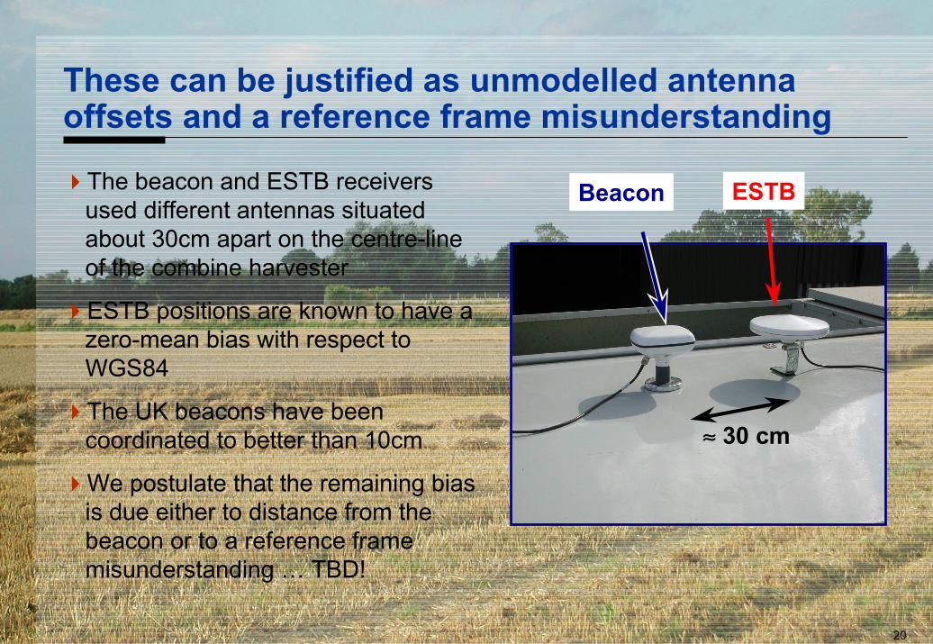
These can be justified as unmodelled antennaoffsets and a reference frame misunderstanding
The beacon and ESTB receiversused different antennas situatedabout 30cm apart on the centre-lineof the combine harvester
ESTB positions are known to have azero-mean bias with respect toWGS84
The UK beacons have beencoordinated to better than 10cm
We postulate that the remaining biasis due either to distance from thebeacon or to a reference framemisunderstanding … TBD!
≈≈≈≈ 30 cm
Beacon ESTB
21
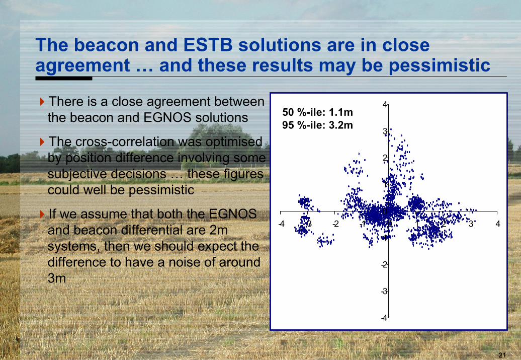
The beacon and ESTB solutions are in closeagreement … and these results may be pessimistic
-4
-3
-2
-1
0
1
2
3
4
-4 -3 -2 -1 0 1 2 3 4
50 %-ile: 1.1m95 %-ile: 3.2m
There is a close agreement betweenthe beacon and EGNOS solutions
The cross-correlation was optimisedby position difference involving somesubjective decisions … these figurescould well be pessimistic
If we assume that both the EGNOSand beacon differential are 2msystems, then we should expect thedifference to have a noise of around3m
22
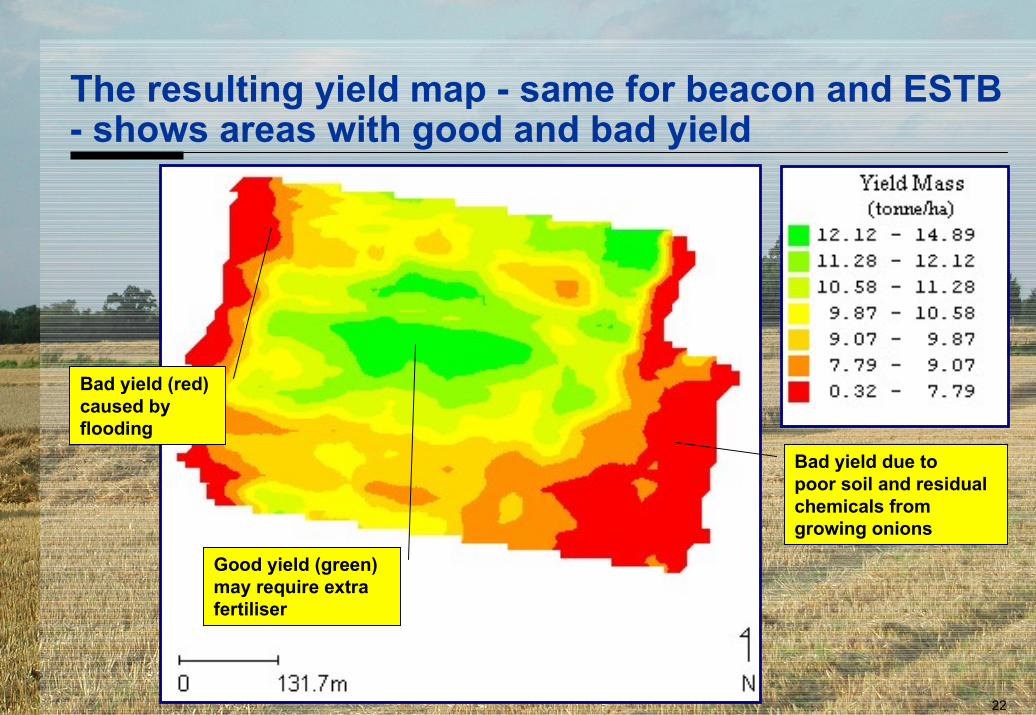
The resulting yield map - same for beacon and ESTB- shows areas with good and bad yield
Bad yield (red)caused byflooding
Bad yield due topoor soil and residualchemicals fromgrowing onions
Good yield (green)may require extrafertiliser
23
Conclusions
So what has EGNOS got to offer the precisionfarmer
24
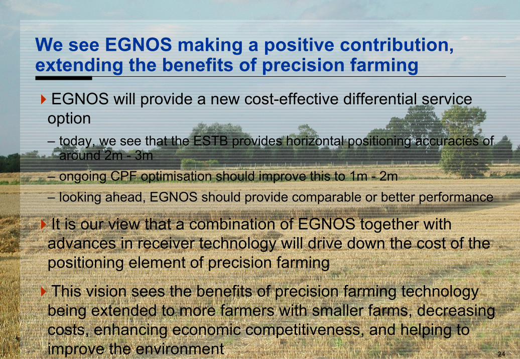
We see EGNOS making a positive contribution,extending the benefits of precision farming
EGNOS will provide a new cost-effective differential serviceoption– today, we see that the ESTB provides horizontal positioning accuracies of
around 2m - 3m– ongoing CPF optimisation should improve this to 1m - 2m– looking ahead, EGNOS should provide comparable or better performance
It is our view that a combination of EGNOS together withadvances in receiver technology will drive down the cost of thepositioning element of precision farming
This vision sees the benefits of precision farming technologybeing extended to more farmers with smaller farms, decreasingcosts, enhancing economic competitiveness, and helping toimprove the environment
Questions?