Embed Size (px)
Citation preview
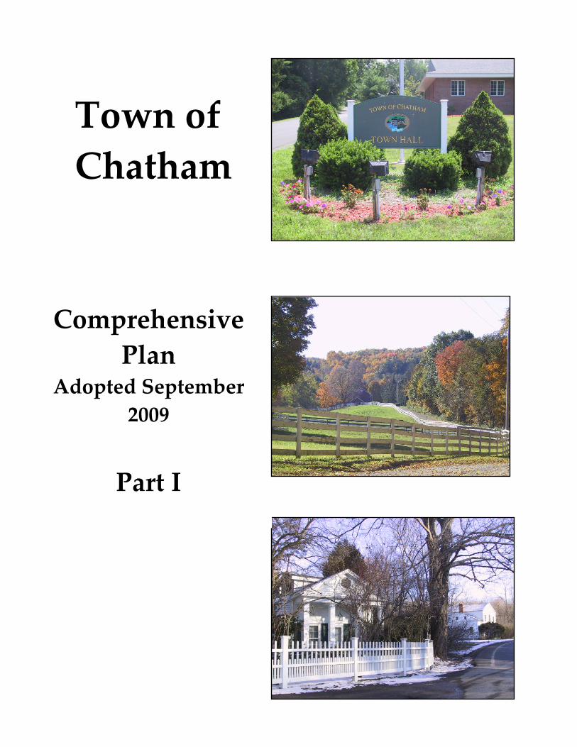
Town of Chatham
Comprehensive Plan
Adopted September 2009
Part I
2
Table of Contents Part I
Acknowledgements ...................................................................................................... 3
Introduction ................................................................................................................... 6
Vision Statement ......................................................................................................... 13
Goals and Recommended Strategies ........................................................................ 15
Rural Character .................................................................................................. 16 Economic Development .................................................................................... 37 Housing ............................................................................................................... 48 Infrastructure ...................................................................................................... 60 Recreation ............................................................................................................ 75 Arts ....................................................................................................................... 83 Historic Character .............................................................................................. 86 Farming ............................................................................................................... 93 Natural Resources ............................................................................................ 105
Sustaining and Implementing the Plan ................................................................. 117
Maps ............................................................................................................................ 128
See Part II (separate document) for all appendices referred to in Part I.
3
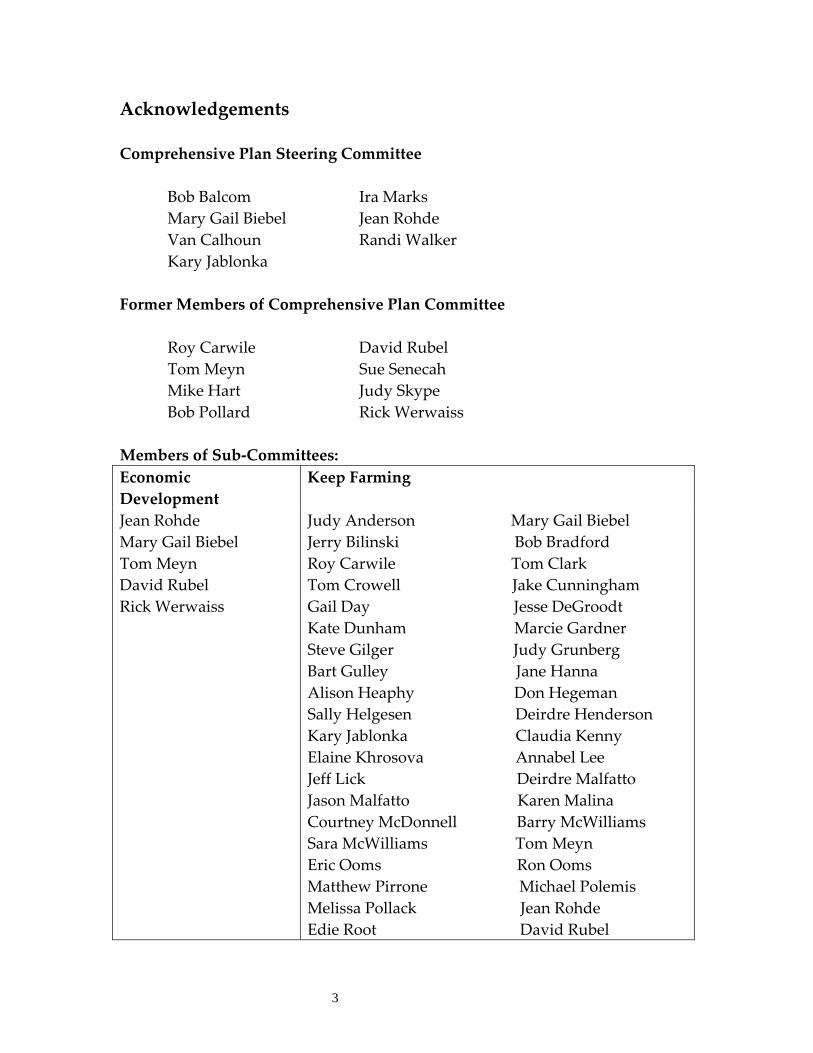
Acknowledgements Comprehensive Plan Steering Committee Bob Balcom Ira Marks Mary Gail Biebel Jean Rohde Van Calhoun Randi Walker Kary Jablonka Former Members of Comprehensive Plan Committee Roy Carwile David Rubel Tom Meyn Sue Senecah Mike Hart Judy Skype Bob Pollard Rick Werwaiss Members of Sub‐Committees: Economic Development
Keep Farming
Jean Rohde Mary Gail Biebel Tom Meyn David Rubel Rick Werwaiss
Judy Anderson Mary Gail Biebel Jerry Bilinski Bob Bradford Roy Carwile Tom Clark Tom Crowell Jake Cunningham Gail Day Jesse DeGroodt Kate Dunham Marcie Gardner Steve Gilger Judy Grunberg Bart Gulley Jane Hanna Alison Heaphy Don Hegeman Sally Helgesen Deirdre Henderson Kary Jablonka Claudia Kenny Elaine Khrosova Annabel Lee Jeff Lick Deirdre Malfatto Jason Malfatto Karen Malina Courtney McDonnell Barry McWilliams Sara McWilliams Tom Meyn Eric Ooms Ron Ooms Matthew Pirrone Michael Polemis Melissa Pollack Jean Rohde Edie Root David Rubel
4
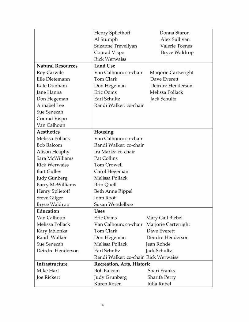
Henry Spliethoff Donna Staron Al Stumph Alex Sullivan Suzanne Trevellyan Valerie Toenes Conrad Vispo Bryce Waldrop Rick Werwaiss
Natural Resources Land UseRoy Carwile Elle Dietemann Kate Dunham Jane Hanna Don Hegeman Annabel Lee Sue Senecah Conrad Vispo Van Calhoun
Van Calhoun: co‐chair Marjorie Cartwright Tom Clark Dave Everett Don Hegeman Deirdre Henderson Eric Ooms Melissa Pollack Earl Schultz Jack Schultz Randi Walker: co‐chair
Aesthetics HousingMelissa Pollack Bob Balcom Alison Heaphy Sara McWilliams Rick Werwaiss Bart Gulley Judy Gunberg Barry McWilliams Henry Splietoff Steve Gilger Bryce Waldrop
Van Calhoun: co‐chair Randi Walker: co‐chair Ira Marks: co‐chair Pat Collins Tom Crowell Carol Hegeman Melissa Pollack Brin Quell Beth Anne Rippel John Root Susan Wendelboe
Education UsesVan Calhoun Melissa Pollack Kary Jablonka Randi Walker Sue Senecah Deirdre Henderson
Eric Ooms Mary Gail Biebel Van Calhoun: co‐chair Marjorie Cartwright Tom Clark Dave Everett Don Hegeman Deirdre Henderson Melissa Pollack Jean Rohde Earl Schultz Jack Schultz Randi Walker: co‐chair Rick Werwaiss
Infrastructure Recreation, Arts, HistoricMike Hart Joe Rickert
Bob Balcom Shari Franks Judy Grunberg Sharifa Perry Karen Rosen Julia Rubel
5
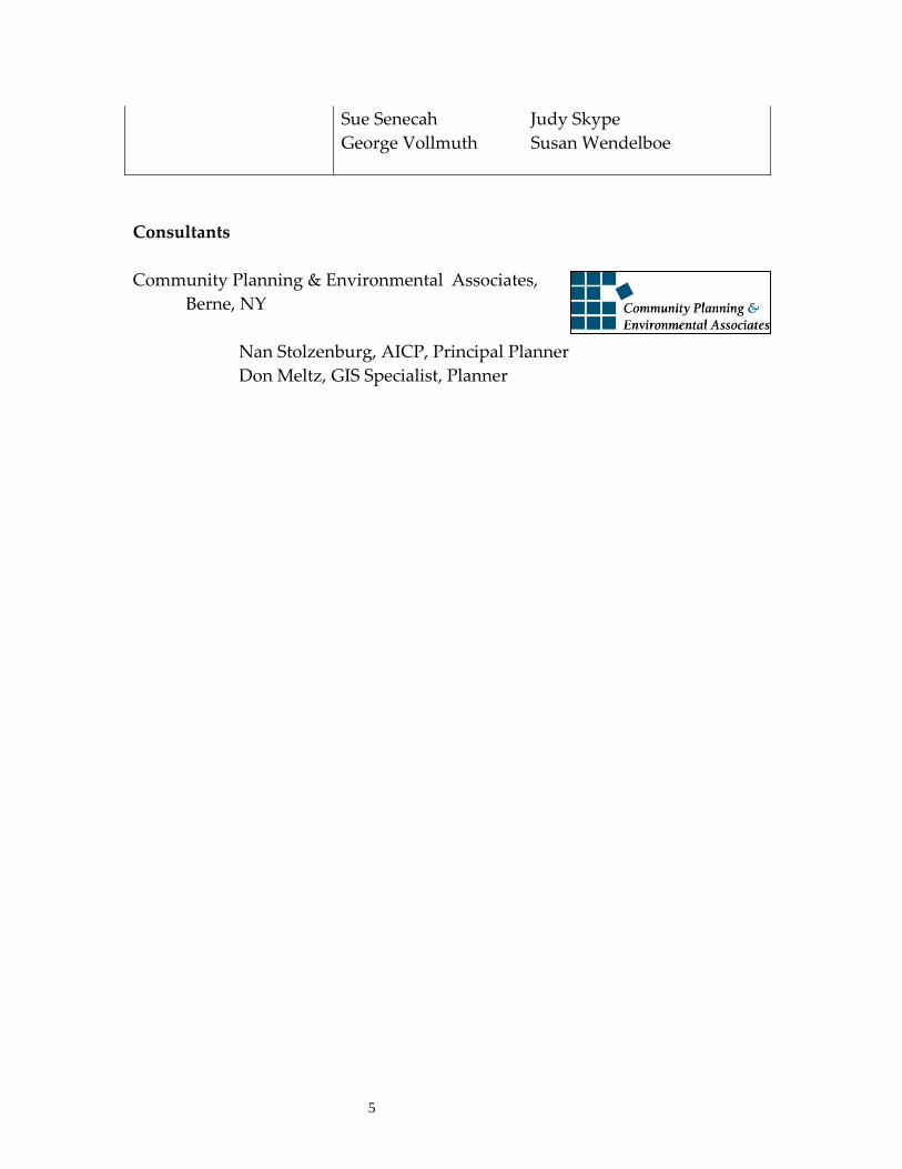
Sue Senecah Judy Skype George Vollmuth Susan Wendelboe
Consultants Community Planning & Environmental Associates, Berne, NY Nan Stolzenburg, AICP, Principal Planner Don Meltz, GIS Specialist, Planner
Introduction 6
Introduction What is a Comprehensive Plan? New York State considers adoption of a comprehensive plan to be a critical tool to promote the health, safety and general welfare of the people of the town and to consider the needs of the people. The Town of Chatham is authorized to develop and adopt a comprehensive plan by New York State Town Law Section 272‐a.
This Comprehensive Plan is an update of an earlier town plan written in 1972. This Plan carries forth much information from that earlier plan and generally confirms the general goals identified in 1972. However, this update contains new information and analysis, updated background information, and new strategies and tools which Chatham can use to help meet its long‐range goals.
It is important to note that this updated Comprehensive Plan is not a local law, and is not adopted as a local law. However, some of the goals of this Plan can be achieved through adoption or amendment of local laws. As with all local laws, any new or amended regulations will require public hearing(s), review by the county planning board, and an environmental review. Therefore, the Comprehensive Plan is a guide to the development of these other local laws.
The Plan was developed to cover a 15 year time period with an expectation that it will be reviewed and updated as necessary. However, it should be formally reviewed a minimum of every five to seven years to ensure that it remains a vital document to help guide Chatham in the future.
Implications of Having a Comprehensive Plan Once a comprehensive plan is adopted, there are several implications:
A comprehensive plan is the foundation upon which communities are built -- a roadmap to a municipality’s future. It is a written document, and developed at the grass-roots level. It identifies the goals, policies, and strategies that Chatham can put to work to guide future growth and development of the community.
The Plan covers a 15-year time period with an expectation that it be reviewed and updated every 5 years to keep it current.
Introduction
7
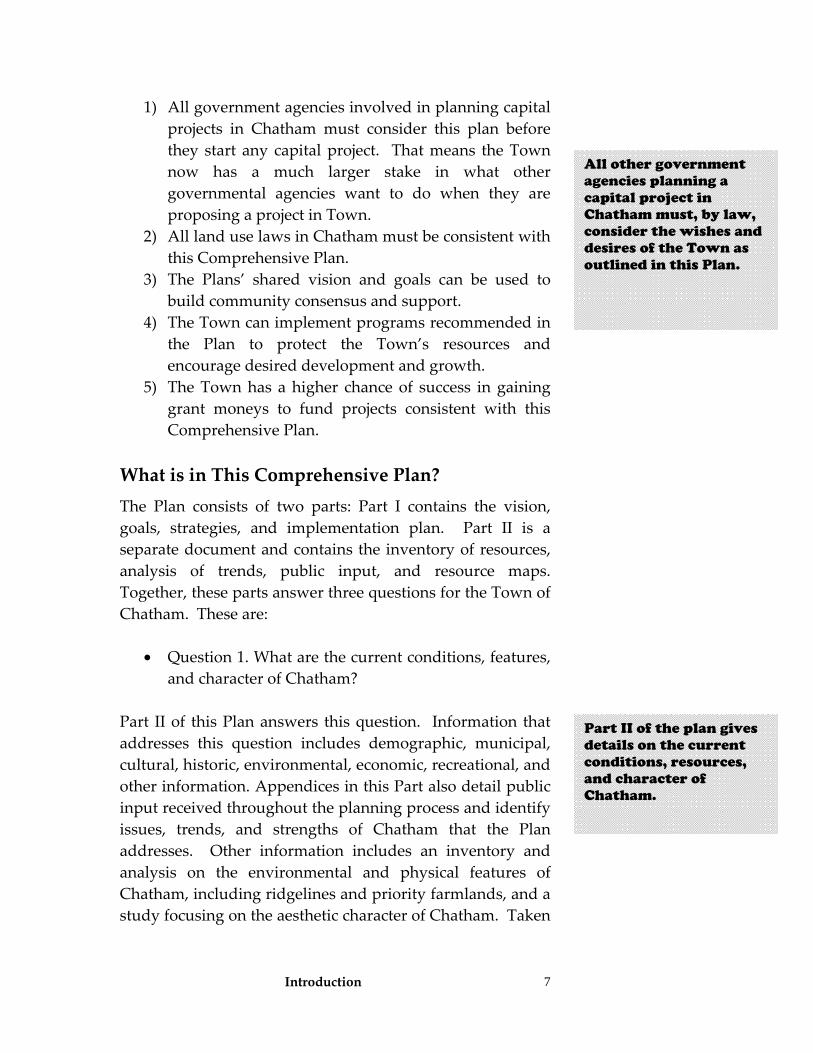
1) All government agencies involved in planning capital projects in Chatham must consider this plan before they start any capital project. That means the Town now has a much larger stake in what other governmental agencies want to do when they are proposing a project in Town.
2) All land use laws in Chatham must be consistent with this Comprehensive Plan.
3) The Plans’ shared vision and goals can be used to build community consensus and support.
4) The Town can implement programs recommended in the Plan to protect the Town’s resources and encourage desired development and growth.
5) The Town has a higher chance of success in gaining grant moneys to fund projects consistent with this Comprehensive Plan.
What is in This Comprehensive Plan? The Plan consists of two parts: Part I contains the vision, goals, strategies, and implementation plan. Part II is a separate document and contains the inventory of resources, analysis of trends, public input, and resource maps. Together, these parts answer three questions for the Town of Chatham. These are:
• Question 1. What are the current conditions, features, and character of Chatham?
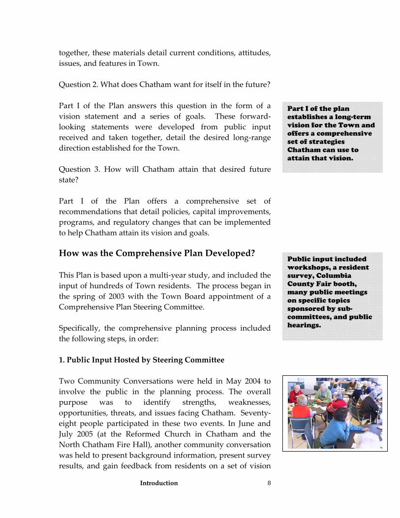
Part II of this Plan answers this question. Information that addresses this question includes demographic, municipal, cultural, historic, environmental, economic, recreational, and other information. Appendices in this Part also detail public input received throughout the planning process and identify issues, trends, and strengths of Chatham that the Plan addresses. Other information includes an inventory and analysis on the environmental and physical features of Chatham, including ridgelines and priority farmlands, and a study focusing on the aesthetic character of Chatham. Taken
All other government agencies planning a capital project in Chatham must, by law, consider the wishes and desires of the Town as outlined in this Plan.
Part II of the plan gives details on the current conditions, resources, and character of Chatham.
Introduction
8
together, these materials detail current conditions, attitudes, issues, and features in Town. Question 2. What does Chatham want for itself in the future? Part I of the Plan answers this question in the form of a vision statement and a series of goals. These forward‐looking statements were developed from public input received and taken together, detail the desired long‐range direction established for the Town. Question 3. How will Chatham attain that desired future state? Part I of the Plan offers a comprehensive set of recommendations that detail policies, capital improvements, programs, and regulatory changes that can be implemented to help Chatham attain its vision and goals.
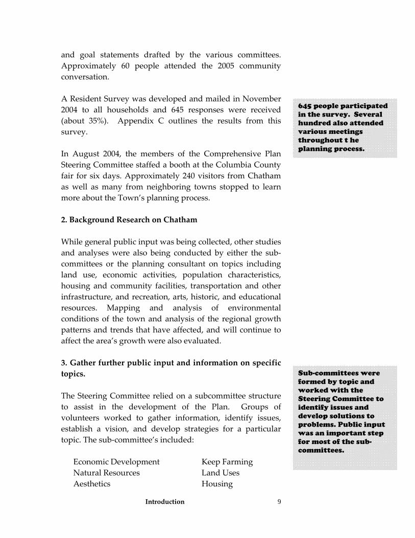
How was the Comprehensive Plan Developed? This Plan is based upon a multi‐year study, and included the input of hundreds of Town residents. The process began in the spring of 2003 with the Town Board appointment of a Comprehensive Plan Steering Committee. Specifically, the comprehensive planning process included the following steps, in order: 1. Public Input Hosted by Steering Committee Two Community Conversations were held in May 2004 to involve the public in the planning process. The overall purpose was to identify strengths, weaknesses, opportunities, threats, and issues facing Chatham. Seventy‐eight people participated in these two events. In June and July 2005 (at the Reformed Church in Chatham and the North Chatham Fire Hall), another community conversation was held to present background information, present survey results, and gain feedback from residents on a set of vision
Part I of the plan establishes a long-term vision for the Town and offers a comprehensive set of strategies Chatham can use to attain that vision.
Public input included workshops, a resident survey, Columbia County Fair booth, many public meetings on specific topics sponsored by sub-committees, and public hearings.
Introduction
9
and goal statements drafted by the various committees. Approximately 60 people attended the 2005 community conversation. A Resident Survey was developed and mailed in November 2004 to all households and 645 responses were received (about 35%). Appendix C outlines the results from this survey. In August 2004, the members of the Comprehensive Plan Steering Committee staffed a booth at the Columbia County fair for six days. Approximately 240 visitors from Chatham as well as many from neighboring towns stopped to learn more about the Town’s planning process. 2. Background Research on Chatham While general public input was being collected, other studies and analyses were also being conducted by either the sub‐committees or the planning consultant on topics including land use, economic activities, population characteristics, housing and community facilities, transportation and other infrastructure, and recreation, arts, historic, and educational resources. Mapping and analysis of environmental conditions of the town and analysis of the regional growth patterns and trends that have affected, and will continue to affect the area’s growth were also evaluated. 3. Gather further public input and information on specific topics. The Steering Committee relied on a subcommittee structure to assist in the development of the Plan. Groups of volunteers worked to gather information, identify issues, establish a vision, and develop strategies for a particular topic. The sub‐committee’s included:
Economic Development Keep Farming Natural Resources Land Uses Aesthetics Housing
645 people participated in the survey. Several hundred also attended various meetings throughout t he planning process.
Sub-committees were formed by topic and worked with the Steering Committee to identify issues and develop solutions to problems. Public input was an important step for most of the sub-committees.
Introduction
10
Uses Education Recreation, Arts, and History Infrastructure
Some sub‐committees established their own planning processes that included additional public input. These efforts included: Keep Farming The Keep Farming initiative was coordinated by a 25 –person committee who served as members of the Community Agricultural Partnership (CAP). Another 25 people served on teams that gathered data and made recommendations. Thirty Chatham farms participated in the study, representing about 80% of the agricultural activity in the Town. Four‐hundred and fifty citizens gave input regarding their buying habits and interest in local foods. A Farmers’ Forum was held in August, 2004, and a Community Agriculture Forum was held in November, 2004. Keep Farming recommendations were presented to the community on June 30, 2005. The Town Board created the Chatham Agricultural Partnership to provide oversight and guidance in enacting the recommendations. These recommendations are also included in this Plan to address agriculture. Recreation, Arts, History This sub‐committee held meetings and focus groups that were publicized and held at the Morris Memorial building. The members collected information on these resources by contacting community leaders of organizations and personally interviewing or requesting information from organizations. The sub‐committee developed a set of visions and strategies related to this topic.
The Keep Farming Team began its work as part of the Economic Development Team. In early 2004, the Town of Chatham was selected as one of two national pilot sites for the Glynwood Center’s Keep Farming Program, and Keep Farming Team also served as the Farming Team for the Comprehensive Plan.
Introduction
11
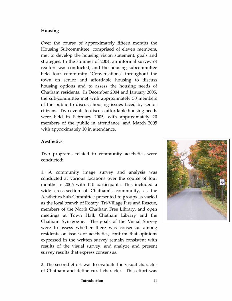
Housing Over the course of approximately fifteen months the Housing Subcommittee, comprised of eleven members, met to develop the housing vision statement, goals and strategies. In the summer of 2004, an informal survey of realtors was conducted, and the housing subcommittee held four community ʺConversationsʺ throughout the town on senior and affordable housing to discuss housing options and to assess the housing needs of Chatham residents. In December 2004 and January 2005, the sub‐committee met with approximately 50 members of the public to discuss housing issues faced by senior citizens. Two events to discuss affordable housing needs were held in February 2005, with approximately 20 members of the public in attendance, and March 2005 with approximately 10 in attendance. Aesthetics Two programs related to community aesthetics were conducted: 1. A community image survey and analysis was conducted at various locations over the course of four months in 2006 with 110 participants. This included a wide cross‐section of Chatham’s community, as the Aesthetics Sub‐Committee presented to groups as varied as the local branch of Rotary, Tri‐Village Fire and Rescue, members of the North Chatham Free Library, and open meetings at Town Hall, Chatham Library and the Chatham Synagogue. The goals of the Visual Survey were to assess whether there was consensus among residents on issues of aesthetics, confirm that opinions expressed in the written survey remain consistent with results of the visual survey, and analyze and present survey results that express consensus. 2. The second effort was to evaluate the visual character of Chatham and define rural character. This effort was
Introduction
12
included in the Keep Farming initiative. The group did a complete photographic inventory of Town focusing on roads, development and spatial organization in hamlets and in the countryside, and landscape features such as bridges, signs, and stone walls. This effort resulted in a visual identification of characteristics that were felt to define Chatham. See Appendix H for details. Land Uses and Zoning Over the course of approximately fifteen months the Land Use and Zoning Subcommittee, comprised of eleven members of the public, met to develop the land use and zoning vision statement, goals and strategies. A second sub‐committee concentrated solely on the land use table in the current zoning law. Members of the Uses subcommittee met extensively over the course of four months to develop recommended uses by zoning district. The subcommittee was comprised of fourteen members of the public.
4. Analyze information received from the public, maps, and other data collected about the Town. This step led to the development of a list of issues, trends, strengths, weaknesses, opportunities and threats that were to be addressed by the Plan. 5. Develop an overall vision statement and topic‐oriented vision statements. The vision statements were developed by the sub‐committees, reviewed by the public, and finalized by the Steering Committee after public input. They reflect the desired direction as articulated by the public. 6. Establish goals for each topic. Flowing from the vision statements, the goals were also developed by the sub‐committees, reviewed by the public at community conversations, and finalized by the Steering Committee. They offer more detail on accomplishments that must be met in order to attain the vision statement. Each topic area has multiple goals.
Introduction
13
7. Establish strategies, actions, and policies for each goal. For each goal, the sub‐committees developed a series of actions, strategies, policies, and programs needed to meet the goals and vision established earlier in the process. The Steering Committee reviewed and finalized the strategies and worked to unify them into this Plan. 8. Prioritize each of the strategies so that the Town Board has a plan of action to implement the plan. The Town Board’s role after adoption of the Comprehensive Plan is to ensure that it is implemented over time. In order to assist them with this task, the Steering Committee prioritized all the strategies and organized them so that the Town Board can efficiently begin to implement the Plan. (see Table pp.125)
Vision Statement 14
Vision Statement A vision statement is an important part of a comprehensive plan. It sets the overall tone and direction the plan is to take over the next 10 to 15 years. The overall vision established for Chatham is: Drawn by good soil for farming, plentiful waterpower, and a location at the seam between Dutch and English Colonial America, settlers came here before the Revolution. They established the communal roots that remain visibly present, guiding our enduring dedication to community, the land, and a deep, shared sense of stewardship. As a place where history, landscape, and community are tightly intertwined, the Town of Chatham is treasured by its residents. For over 250 years, Chatham has been distinguished by a special sense of place and the values that flow from its relationship to the land. With its historic settlement pattern of hamlets and farms connected by open space, woods, and streams, Chatham is noted for a singular vision that embraces the challenge and opportunity of change and an unwavering commitment to protecting our land and preserving our heritage. Our quality of life is defined by the prized attributes of rural character: active, sustainable agriculture; scenic beauty; cultural and historic richness; a healthy environment; diverse housing resources; and economic vibrancy provides a touchstone for community decision making.
Chatham’s Vision The vision statement emphasizes assets rather than needs. It reflects the ultimate picture of what Chatham wants to be in the future. It was developed from public input. An overall vision statement, as well as nine different topic-oriented vision statements is presented in this Plan. These topic-oriented statements are presented later in Part I of the Plan.
Goals and Strategies 15
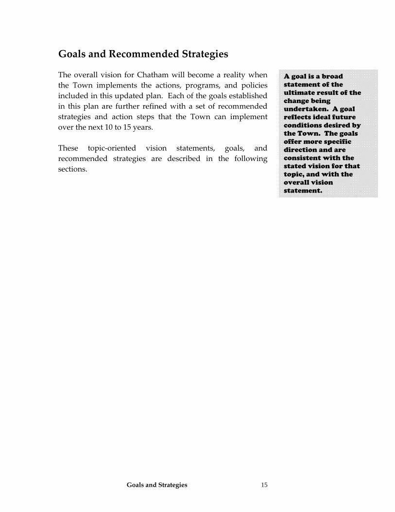
Goals and Recommended Strategies The overall vision for Chatham will become a reality when the Town implements the actions, programs, and policies included in this updated plan. Each of the goals established in this plan are further refined with a set of recommended strategies and action steps that the Town can implement over the next 10 to 15 years. These topic‐oriented vision statements, goals, and recommended strategies are described in the following sections.
A goal is a broad statement of the ultimate result of the change being undertaken. A goal reflects ideal future conditions desired by the Town. The goals offer more specific direction and are consistent with the stated vision for that topic, and with the overall vision statement.
Goals and Strategies: Rural Character 16
Rural Character
A Vision for Rural Character in Chatham
We value and protect the Town of Chatham’s rural character, which is distinguished by a well‐defined, traditional settlement pattern consisting of small hamlets surrounded by working farms, forests and open space. The Town has an extraordinary stock of historic buildings, many unpaved roads and scenic by‐ways, beautiful open views, hills and woodlands, streams and creeks and natural habitats that provide rich biodiversity. The hamlets and the natural and working landscape give the Town its unique rural quality and sense of place, shape its culture and community, help define its attractive quality of life, and contribute to its economic vitality. We are grateful for the forethought demonstrated by our Town in adopting its first comprehensive plan and zoning law over thirty years ago. We carry on the Town’s tradition of successful planning by recognizing the new challenges facing us and updating our zoning law to continue to preserve rural character, while balancing growth and protecting our quality of life. We identify locations appropriate for residential and commercial growth, and for open space, agriculture and environmental conservation. We minimize loss of farmland. We implement new land planning and zoning tools and update these tools on a regular basis. We accomplish this vision in a fiscally responsible manner that takes account of both current and future costs to our Town.
What is rural character? This term describes individual features or qualities of the human and natural landscape that when taken together, give an impression of the town as one that is ‘settled’ in a scattered or sparse manner and therefore is neither urban nor suburban. Chatham’s rural landscape
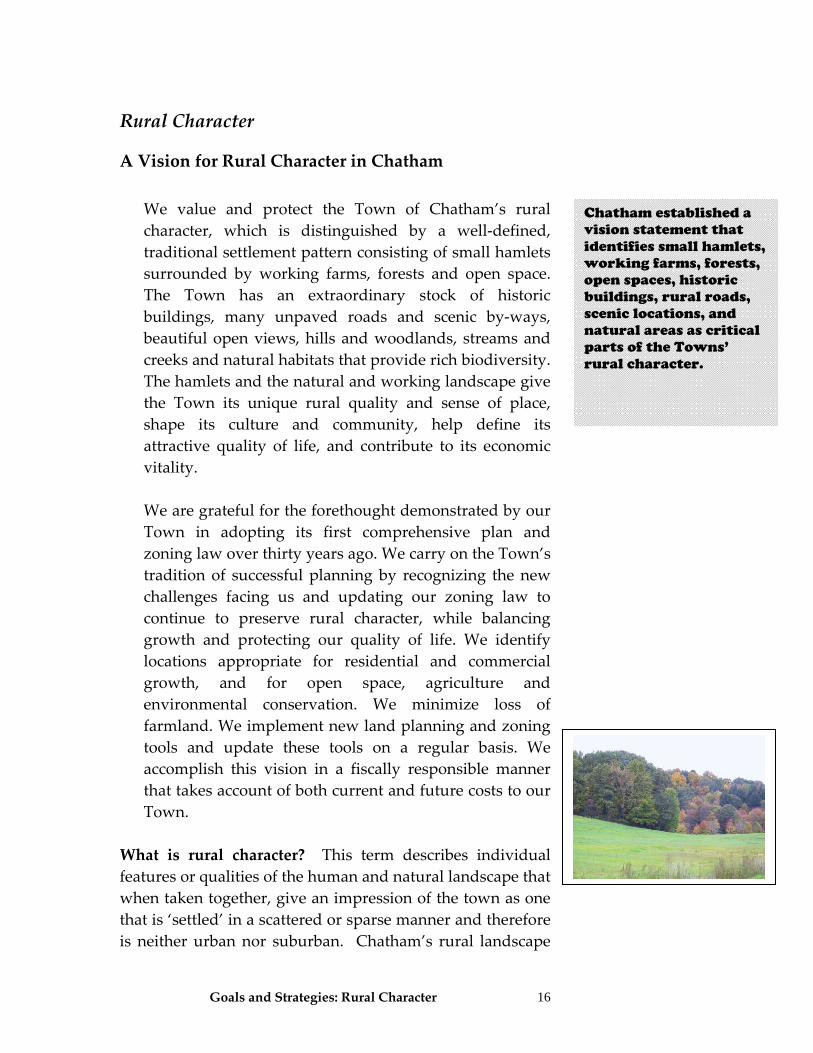
Chatham established a vision statement that identifies small hamlets, working farms, forests, open spaces, historic buildings, rural roads, scenic locations, and natural areas as critical parts of the Towns’ rural character.
Goals and Strategies: Rural Character
17
pattern is typically a patchwork of lands shaped by current or past ‘countryside’ economic activities such as agriculture, forestry, or low density residential uses, interspersed with open spaces left or reverting to a natural state. There are local concentrations of population and structures in hamlets or the Village of Chatham, but these are typically of limited size. The Village of Chatham is a typical rural village in that it is larger than hamlets and has a higher share of structures devoted fully or partially to commercial activity. Rural villages do not have an extensive street grid or transportation network and have a pedestrian scale limited to a few blocks in breadth. Hamlets typically have a fairly well defined border/buffer of undeveloped open spaces and agricultural lands. Our hamlets are typically located at key road crossings, near important civic structures such as places of worship, or adjacent to historically important natural features like streams. These areas have a diverse mix of lot size and architectural styles. Historic structures from various periods in the community’s life are present. Outside these population ‘centers’, residents typically occupy a range of residential types such as estates, farmsteads and more modest homes. Features of active or past agricultural activity are often present, including but not limited to: crop fields, hay fields, livestock pasture, corrals, orchards, farm buildings such as barns or silos, stone walls, windbreaks, hedgerows, or woodlots. Most of Chatham’s local roadways tend to be narrow and curvy with limited driveways or crossroads. Many rural roads are lined with trees, fences, or stone walls. Rural character also embodies a quality of life based upon traditional rural landscapes, activities, lifestyles, and aesthetic values. Rural areas are characterized by a balance between the natural environment and human uses with low‐density residential dwellings, farms, forests, mining areas, outdoor recreation and other open space activities and by
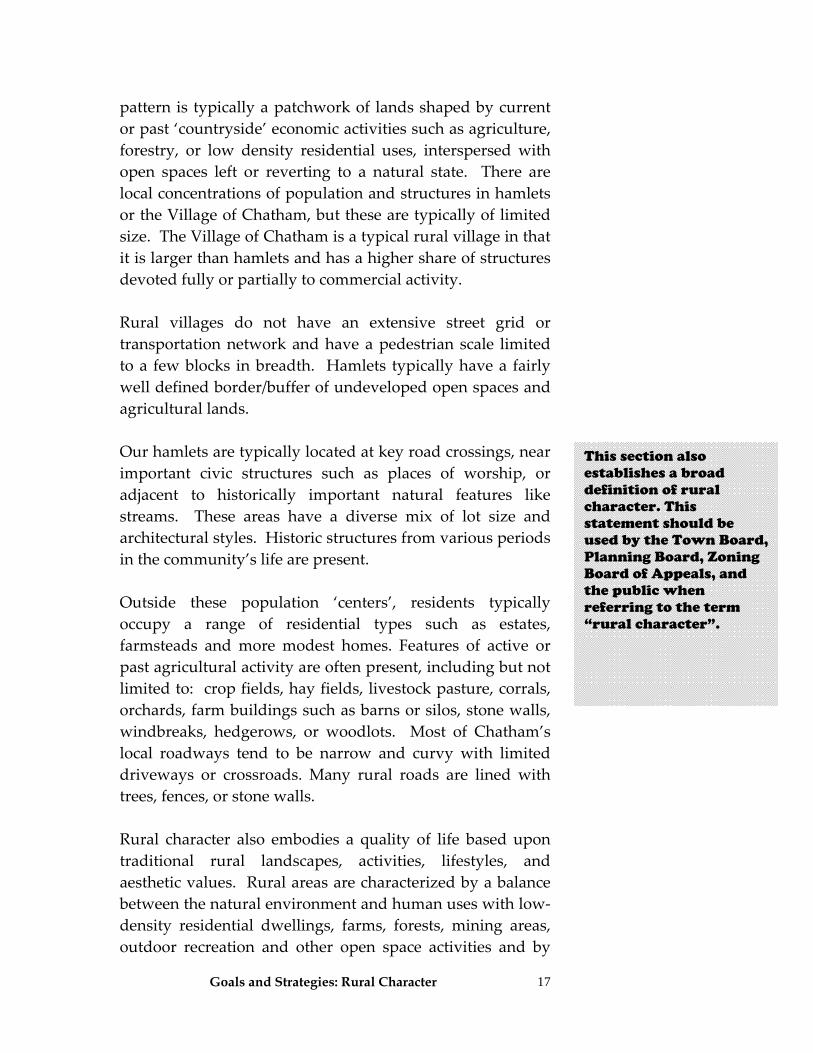
This section also establishes a broad definition of rural character. This statement should be used by the Town Board, Planning Board, Zoning Board of Appeals, and the public when referring to the term “rural character”.
Goals and Strategies: Rural Character
18
citizens who understand and value the nature of farming and the role it plays in our town. ʺRural characterʺ can be defined as the patterns of land use and development:
• In which open space, the natural landscape, and vegetation predominate over the built environment;
• That foster traditional rural lifestyles, rural‐based economies, and opportunities to both live and work in rural areas;
• That provide visual landscapes that are traditionally found in rural areas and communities;
• That are compatible with the use of the land by wildlife and for fish and wildlife habitat;
• That reduces sprawling, low‐density development; • That generally do not require extensive municipal
services; and • That is consistent with the protection of natural
surface water flows and ground water and surface water recharge and discharge areas.
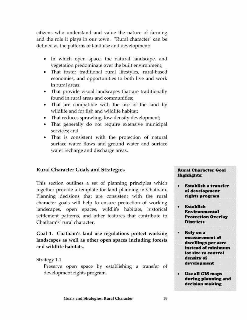
Rural Character Goals and Strategies This section outlines a set of planning principles which together provide a template for land planning in Chatham. Planning decisions that are consistent with the rural character goals will help to ensure protection of working landscapes, open spaces, wildlife habitats, historical settlement patterns, and other features that contribute to Chatham’s’ rural character. Goal 1. Chatham’s land use regulations protect working landscapes as well as other open spaces including forests and wildlife habitats.
Strategy 1.1 Preserve open space by establishing a transfer of
development rights program.
Rural Character Goal Highlights: • Establish a transfer
of development rights program
• Establish
Environmental Protection Overlay Districts
• Rely on a
measurement of dwellings per acre instead of minimum lot size to control density of development
• Use all GIS maps
during planning and decision making
Goals and Strategies: Rural Character
19
Strategy 1.2 Evaluate, designate and protect important resources,
including agricultural and historic areas by identifying and establishing Environmental Protection Overlay Districts (EPODs). Zoning district boundaries should match the locations of the resources being protected (See Conceptual Zoning Map found on town website, Comprehensive Plan, maps).
Overlays should protect sensitive environmental
resources including, but not limited to steep slopes, wetlands, streams, scenic views, ridge lines, flood plains, and wildlife resources.
Strategy 1.3 Ensure that the ZBA, Planning Board and Town Board
use the GIS maps and data included in this plan to assist in identification of these resources. Use of this data should be an important component of the permit review process. Identification and protection of sensitive environmental resources shall be an important part of any project review conducted by the ZBA, Planning Board or Town Board. These boards shall use the GIS maps and data as appropriate.
Strategy 1.4 De‐emphasize use of minimum lot sizes in zoning to
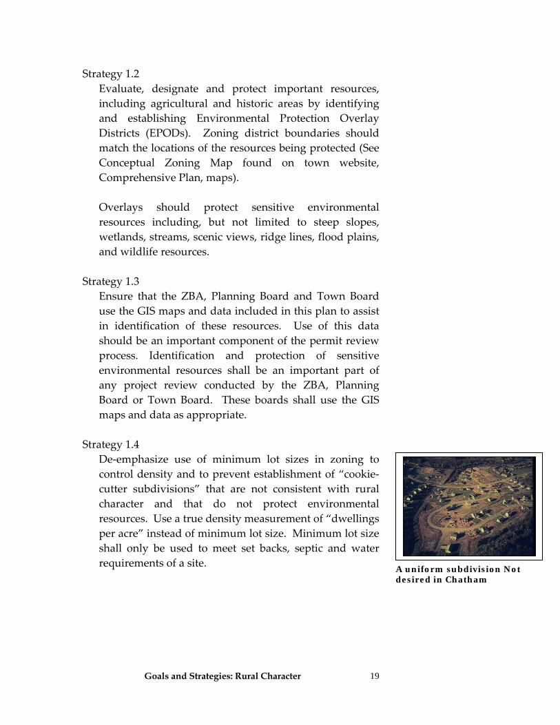
control density and to prevent establishment of “cookie‐cutter subdivisions” that are not consistent with rural character and that do not protect environmental resources. Use a true density measurement of “dwellings per acre” instead of minimum lot size. Minimum lot size shall only be used to meet set backs, septic and water requirements of a site.
A uniform subdivision Not desired in Chatham
Goals and Strategies: Rural Character
20
Strategy 1.5 Amend zoning to require calculation of density from net acreage rather than gross acreage, as is currently required. A parcels’ development potential should be calculated with a uniform formula (called an Environmental Control Formula) and should apply to all subdivisions, in all locations in Town. Lands within a parcel having some defined environmental sensitivity (e.g., wetlands, flood plains, steep slopes), or that is priority agricultural land, would have a reduced density, calculated from a set formula, to protect those resources. See Appendix E for additional details and an example application.
Strategy 1.6 Establish best management practices for timber
harvesting, as detailed by NYS DEC and other organizations for this purpose1. These could be applied through use of a timber harvesting permit process.
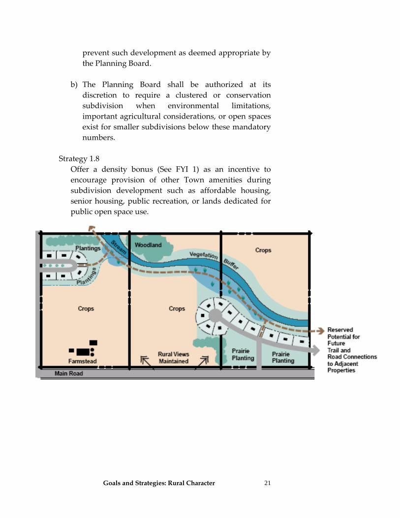
Strategy 1.7 As per the Conservation Subdivision Law of the Town of
Chatham, clustering or conservation subdivisions shall be required, when possible, for all major subdivisions or all subdivisions over three lots on parcels 50 acres or more to maximize open space protection during development. Clustered subdivisions shall seek to be designed with traditional neighborhoods having setbacks, building design, and siting of buildings consistent with Chatham’s hamlets.
a) Clustering or conservation subdivisions shall be
required for all major subdivisions or all subdivisions over three lots on parcels 50 acres or more. Allow waiver of this provision only when site characteristics
1 Refer to NYSDEC Timber Harvesting Guidelines, http://www.dec.state.ny.us/website/dlf/privland/privassist/bmp.html and A Municipal Official’s Guide to Forestry in New York State, produced by the New York Planning Federation, Department of Environmental Conservation and Empire State Forest Products Association for guidance.
Rural Character Goal Highlights: • Use net acreage to
calculate the development potential of a parcel instead of gross acreage
• Establish best
management practices for timber harvesting through a permit process
• Mandate use of
flexible subdivision methods to preserve open spaces
• Clustered
subdivisions should be designed in a traditional neighborhood style similar to our hamlets.
Rural Character Goal Highlights: • Require clustered or
conservation designs for all major subdivisions and for all subdivisions over 3 lots on parcels 50 acres or larger when conditions allow
• Offer a density bonus
as an incentive for providing desired public amenities
Goals and Strategies: Rural Character
21
prevent such development as deemed appropriate by the Planning Board.
b) The Planning Board shall be authorized at its
discretion to require a clustered or conservation subdivision when environmental limitations, important agricultural considerations, or open spaces exist for smaller subdivisions below these mandatory numbers.
Strategy 1.8 Offer a density bonus (See FYI 1) as an incentive to
encourage provision of other Town amenities during subdivision development such as affordable housing, senior housing, public recreation, or lands dedicated for public open space use.
Goals and Strategies: Rural Character
22
Strategy 1.9 For major subdivisions of any lot size, the Town shall consider requiring review by the appropriate state or county agency on well and septic system placement and full environmental evaluation of the parcel’s past usage. This strategy was a recommendation by the Environmental Director of the Columbia County Health Department.
Strategy 1.10
For proposed residential developments of 20 homes or more, the Planning Board shall, during project review, require a developer of a major site plan or subdivision to conduct a fiscal impact study to evaluate impacts on schools, infrastructure and other town expenses.
Rural Character Goal Highlights: • Consider requiring
County review of well and septic systems, and a parcel’s historical usage for major subdivisions
• Require developers
of large projects to conduct a fiscal impact analysis
• Establish a
residential and commercial development monitoring program and tie it to re-evaluation of the Town zoning policies.
• Institute growth
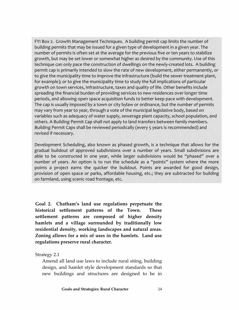
management techniques (See FYI 2) including building permit caps or development scheduling techniques
FYI Box 1. Incentive Zoning. Protection of open space and other resources may also be attained by offering incentives to a developer. The developer receives an economic incentive in the form of additional density while the community benefits because it receives amenities that it otherwise might not be able to provide its citizens. The incentive offered is also called a “density bonus.” Chatham should explore lowering density in the 3 acre and 5 acre zones to accomplish the goals of this plan and simultaneously, offer a density bonus for open space, agricultural, or provision of affordable housing. For example, if the density for the R‐2 area is changed from a minimum lot size of 5 acres to a density of 1 dwelling per 8 acres, an incentive can be offered whereby the developer could receive a density of 1 dwelling per 5 acres in exchange for permanent protection of 50% of the parcel. The advantage to this technique is that this is a positive tool and is at the option of the landowner/developer. The incentive would need to be attractive enough for someone to want to take advantage of it. Conversely, using a voluntary incentive means that the Town will risk having no one take advantage of it, and thus not receive any of the open space, environmental protection, or affordable housing benefits.
Goals and Strategies: Rural Character
23
Strategy 1.11 Consider growth management techniques to prevent unexpected residential and commercial land development spikes, and so that infrastructure and other municipal services can keep pace with new development.
a) Consider establishing a Development Monitoring and
Growth Threshold Program for residential and commercial development. Consider establishing a program that requires a Town Board review of zoning policies whenever an annual growth rate of 10 new homes, 20 new subdivisions (not to include minor lot line adjustments), or 10 site plan approvals for new commercial uses per year is exceeded. If this rate is exceeded, then the Town Board may re‐evaluate zoning and institute measures to bring the level of growth back to a sustainable level in keeping with the vision and goals of this Comprehensive Plan. The Town Board should closely monitor the number of subdivisions and building permits issued at least once a year.
b) As a result of its review of development rates and
trends, the Town may consider either building permit caps or development scheduling techniques (See FYI 2) to establish appropriate levels of development
Goals and Strategies: Rural Character
24
Goal 2. Chatham’s land use regulations perpetuate the historical settlement patterns of the Town. These settlement patterns are composed of higher density hamlets and a village surrounded by traditionally low residential density, working landscapes and natural areas. Zoning allows for a mix of uses in the hamlets. Land use regulations preserve rural character. Strategy 2.1 Amend all land use laws to include rural siting, building
design, and hamlet style development standards so that new buildings and structures are designed to be in
FYI Box 2. Growth Management Techniques. A building permit cap limits the number of building permits that may be issued for a given type of development in a given year. The number of permits is often set at the average for the previous five or ten years to stabilize growth, but may be set lower or somewhat higher as desired by the community. Use of this technique can only pace the construction of dwellings on the newly‐created lots. A building permit cap is primarily intended to slow the rate of new development, either permanently, or to give the municipality time to improve the infrastructure (build the sewer treatment plant, for example); or to give the municipality time to study the full implications of particular growth on town services, infrastructure, taxes and quality of life. Other benefits include spreading the financial burden of providing services to new residences over longer time periods, and allowing open space acquisition funds to better keep pace with development. The cap is usually imposed by a town or city bylaw or ordinance, but the number of permits may vary from year to year, through a vote of the municipal legislative body, based on variables such as adequacy of water supply, sewerage plant capacity, school population, and others. A Building Permit Cap shall not apply to land transfers between family members. Building Permit Caps shall be reviewed periodically (every 5 years is recommended) and revised if necessary. Development Scheduling, also known as phased growth, is a technique that allows for the gradual buildout of approved subdivisions over a number of years. Small subdivisions are able to be constructed in one year, while larger subdivisions would be “phased” over a number of years. An option is to run the schedule as a “points” system where the more points a project earns the quicker the buildout. Points are awarded for good design, provision of open space or parks, affordable housing, etc.; they are subtracted for building on farmland, using scenic road frontage, etc.
Goals and Strategies: Rural Character
25
keeping with the character of Chatham. Preserve rural character found in the non‐hamlet areas of town by emulating traditional development patterns found there through standards that ensure consistent layout, siting, building, and dimensions of structures. These proposed development standards are referred to elsewhere in this plan as the “rural siting and development standards”.
Amend Zoning (Section 180) to establish a set of rural
siting and development standards for new uses (see Appendix H) with the following principles:
a) It is recommended that these standards be mandatory
in all zoning districts. b) Establish siting, height, and scale standards for
residential and commercial accessory structures to ensure that these uses are consistent with the character of the Town.
c) As part of the siting standards for major subdivisions
or projects seeking site plan approval, establish development standards to prevent subdivision uniformity.
d) Consider developing recommended design, siting
and landscaping criteria for new hamlet development2.
e) When developing the siting and standards, use the
results of the community image survey (Appendix H) to identify design and siting elements that are preferred in Chatham.
f) Subdivision development shall ensure, when
practicable, that the following features are taken into consideration and incorporated into subdivision plats:
2 As reference see Building with Little Compton in Mind: A Handbook of Ideas and Resources, Town of Little Compton, Rhode Island (401-635-4400) for example handbook addressing residential building.
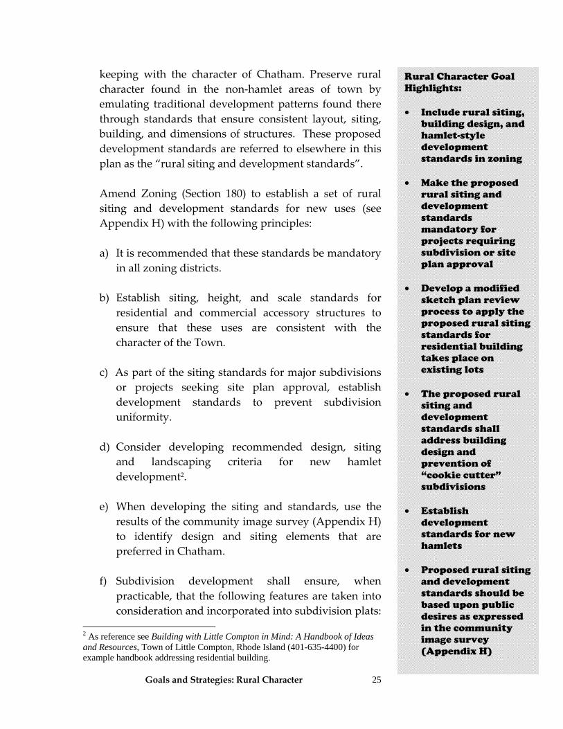
Rural Character Goal Highlights: • Include rural siting,
building design, and hamlet-style development standards in zoning
• Make the proposed
rural siting and development standards mandatory for projects requiring subdivision or site plan approval
• Develop a modified
sketch plan review process to apply the proposed rural siting standards for residential building takes place on existing lots
• The proposed rural
siting and development standards shall address building design and prevention of “cookie cutter” subdivisions
• Establish
development standards for new hamlets
• Proposed rural siting
and development standards should be based upon public desires as expressed in the community image survey (Appendix H)
Goals and Strategies: Rural Character
26
•Stone walls, mature trees, rock outcroppings •Roadside trees •Existing historic structures •Hillside siting instead of crestline siting •Siting house at the edge of a field instead of in the middle
•Siting away from a lake, stream or other water body instead of at the edge
•Avoid forest fragmentation •Driveways shall follow natural contours, be located along edges of fields or forests, preferably be of pervious surfaces, retain trees along the driveway edge, and have a narrower width than the road it accesses
Strategy 2.2
Amend zoning to give the Planning Board and Zoning Board of Appeals more definitions and direction on allowed and prohibited land uses.
Strategy 2.3 To ensure that newly built structures are consistent in scale and in keeping with the rural and historic character of the surrounding area, develop performance criteria for each district. The following performance criteria should be considered when developing zoning standards for the uses in each district:
• Adequate Public Facilities (APF) regulation • Limitations on building size and lot coverage,in
hamlets, as regulated by a Floor Area Ratio. • Standards for siting, lighting, parking and signage • Recommendations for landscaping and
infrastructure.
Strategy 2.4 Direct growth to existing or new hamlets, instead of
sprawling into the undeveloped portions of Chatham. Our preferred growth pattern is through both in‐fill
Rural Character Goal Highlights: • Use in-fill
development and expansion of existing hamlets to concentrate growth in those locations.
• Create distinct districts for each hamlet in order to promote new development that is consistent with the unique characteristics of each
• Extended hamlet
boundaries and creation of mixed-use cores for small business development in some of the larger hamlets can also meet the goals of the town
• The Town should
restrict future public water or sewer to hamlet areas
• Consider establishing
a new hamlet area
• Maintain hamlets as mixed use areas
• Ensure that land use
regulations are fine tuned to protect the characteristics of each hamlet
Goals and Strategies: Rural Character
27
development and possible establishment of a new hamlet (See Conceptual Zoning District map).
Establish separate zoning districts for each of the hamlets in Town and develop zoning standards that reflect the uniqueness of each including dimensions, styles, and uses. Involve local residents of each hamlet during development of new hamlet zoning. Alternative zoning concepts are illustrated on the Alternative Hamlet Zoning District Concept Map. This also shows each hamlet as unique zoning districts but has extended hamlet boundaries that could accommodate future growth as well as establishment of mixed‐use oriented cores for some hamlets. These cores would accommodate future mixed‐use growth and would encourage small, hamlet‐oriented businesses. Other hamlet oriented recommendations include:
a) Town policies shall discourage any future public
water and sewer infrastructure to the hamlets and any major conservation or cluster subdivisions that have been developed.
b) Consider changing zoning to allow development of a new hamlet (called Indian Brook) in the southeastern corner of Town (See Conceptual Zoning Map) and at Rayville.
c) Direct growth to the hamlets and areas adjacent to the Village by increasing allowable residential density, decreasing lot size, allowing for multi‐family housing and allowing for conversion of existing structures (i.e., out buildings) to residential, provided water and septic capacity are adequate.
d) Zoning should be modified to allow mixed uses in hamlets but only with development standards designed to ensure that they are compatible with the specific hamlet. In areas having a traditional main street style, allow conversion of an existing main street structure only for both mixed commercial and
Rural Character Goal Highlights: • Amend list of
allowed and prohibited land uses in zoning to match goals of this Plan.
• Develop siting and
development standards for zoning, site plan, and special use permits for each district to ensure that new uses are consistent with the character of the area
Goals and Strategies: Rural Character
28
residential uses. This would preserve traditional patterns and allow continuation of mixed use activities.
e) Each hamlet has its own unique character and new development patterns should respect and be consistent with the individual hamlet character. Ensure that land use regulations such as setbacks, lot sizes, etc. are fine‐tuned for each hamlet.
Strategy 2.5
It is recommended that commercial structures be subject to special use permit and site plan reviews to ensure their construction is in keeping with the rural and historic character. Detailed uses and performance criteria should be established for each zoning district. Below is a list of recommendations for general types of uses and performance. Amend zoning to include a more detailed use schedule consistent with this plan. The section below serves as a summary. a) For Hamlet Districts (Residential Development) Purpose of District: to provide areas in or adjacent to the existing hamlets with a housing density and development pattern normally found in small villages. In order to promote hamlet style development, new uses and accessory uses shall be subject to the proposed rural siting and development standards and be tailored for each hamlet area. Residential uses which could negatively impact the hamlet areas should be allowed only via a special use permit. These include, but are not limited to accessory dwellings, Elder Cottage Housing (ECHO), and multi‐unit residential dwellings, among others.
Rural Character Goal Highlights: • Uses in the Hamlet
Districts should follow the Rural Siting Guidelines and Development Standards and be of a size that are of similar scale to each existing hamlet areas.
• Permitted uses to
include single and two-family dwellings, accessory uses and home occupations.
• Some uses will need a
special permit to ensure they function adequately in a hamlet such as multi-unit dwellings, group homes, accessory dwellings, etc.
Goals and Strategies: Rural Character
29
Large‐scale, high intensity uses, and uses that store large quantities of hazardous chemicals, such as bulk storage facilities, warehouses, and drive‐in or drive‐thru businesses should be prohibited in this hamlet district. b) Hamlet Districts (Non‐Residential) Purpose: to accommodate, by special permit, limited commercial facilities to serve the hamlet in which they are located and the immediate surrounding areas. Mixed‐use cores may be desirable to accommodate non‐residential growth in hamlets in the future. It is recommended that all new non‐residential structures be subject to the proposed rural siting and development standards, site plan review and special use permits. It also is recommended that this district have siting criteria and size limitations for certain non‐residential uses to ensure that they are in keeping with the rural residential nature of this zoning district. Some appropriate non‐residential uses for hamlet areas include larger day‐care facilities, small scale retail or service commercial facilities, and public and essential service buildings. c) Rural Lands One (RL‐1) Purpose: to establish the lowest intensity of uses in Chatham, with a residential density of one dwelling per 10 acres. It is recommended that all uses, including major subdivisions, be subject to the proposed rural siting and development standards. Other standards should be established to reduce intensity of use, limit pollution (i.e., noise and discharge to air, water and soil), limit traffic and control excessive lighting. Large minimum acreage requirements should be developed for uses that could have potentially large impacts.
Rural Character Goal Highlights: • RL-1 permitted uses
should include single and two-family dwellings, agriculture and home occupations
• Some uses will need a special permit such as accessory dwellings, commercial forestry, recreation facilities, water storage facilities, recreational uses, etc.
• Minimum acreages
should be established for some uses
Rural Character Goal Highlights: • Commercial uses in
the Hamlet District s should follow the proposed rural siting and development sStandards and should allow for small scale commercial businesses, essential services, and day care facilities
• Accessory uses on
residential properties should have maximum sizes or lot coverages to reduce intensity of use
Goals and Strategies: Rural Character
30
Single‐family and two‐family dwellings, agricultural uses, and home occupations should be permitted uses. Pools and Ponds would require supplemental regulation3 Many uses should be permitted with a special permit to ensure that there is compatibility between the use and the surrounding rural lands. Some uses needing a special permit shall have minimum acreage requirements such as firearm ranges, camp grounds, Continuing Care Retirement Communities, museums, art galleries, performing art centers, houses of worship, and cemeteries. Uses that produce excessive noise, pollution, and heavy traffic, and require large parking lots and significant outdoor lighting should not be permitted. Large commercial facilities or significant businesses are not appropriate in this district. d) Rural Lands Two (RL‐2) Purpose: to protect the area containing the majority of farm lands in Chatham from incompatible uses which might destroy the agricultural environment of the area. It is recommended that all uses (subdivisions, permitted and special permit uses) be subject to the proposed rural siting and development standards. Principal permitted uses in this district should be farming and farm‐related agricultural activities and low density residential uses. Other types of uses should be permitted only in special instances when they do not interfere with agricultural activities, or where they cannot be accommodated in other areas of Chatham.
3 Supplemental regulations include Columbia County Department of Health requirements for pools and New York State Department of Environmental Conservation requirements for ponds.
Rural Character Goal Highlights: • RL-2 uses are
oriented towards farming, protecting farms, and low residential use
• All uses in this
district should be subject to the proposed rural siting and development standards
• RL-2 should have
similar uses as RL-1 but zoning should decrease the allowable footprint of development and have large minimum acreage requirements for some uses
Goals and Strategies: Rural Character
31
e) Rural Lands Three (RL‐3) Purpose: this district provides space for rural residences at a higher density where soils have good surface drainage characteristics and on‐site sewer systems would properly function. It is recommended that all uses (subdivisions, permitted and special permit uses) be subject to proposed rural siting and development standards. For uses with potentially large impacts on the surrounding residential area, it is recommended that large minimum acreage requirements be developed. The same permitted and permitted with special permit uses recommended in Rural Lands One (RL‐1) shall apply to this district with some additional restrictions such as limitations on lot coverage for buildings, prohibiting firearm ranges, and careful siting of buildings. Siting of public buildings shall depend on the nature of the public service and level of activity, and shall be required to provide a buffer with neighboring residences. f) Business Purpose: This district provides for commercial activities to supplement existing business areas in the town, and to serve those businesses that are highway oriented and/or that require large areas, such as farm equipment dealers. The retail businesses permitted in this district should serve local‐scale needs. Zoning should support businesses but include performance criteria to control large parking lots, large volumes of traffic, and environmental wastes (low air emissions and low volume of discharge to nearby water bodies). All businesses shall follow proposed rural siting and development standards. It is recommended that the total building footprint of commercial buildings
Rural Character Goal Highlights: • Business districts are
provided for to meet local-scale needs in retail as well as more highway oriented businesses
• Zoning should have
performance standards to control significant adverse impacts, encourage green energy alternatives, and require adherence to the proposed rural siting and development standards
• Building footprints
should be limited to 20,000 square feet in the B district to control scale.
• A wide variety of
business uses should be permitted by right or with a special use permit
Goals and Strategies: Rural Character
32
be limited to 20,000 ft2 in this district to ensure consistency and scale with surrounding rural character. Zoning should support commercial uses, but should also establish standards consistent with this plan. g) Industrial Purpose: this district provides locations for the establishment of small‐scale manufacturing and industry to provide employment opportunities and a broadening of the tax base in Chatham. The permitting of retail businesses in this district should serve local‐scale needs. The locations provide easy highway access points and do not conflict with major residential areas. Zoning should support businesses but should control large parking lots, large volumes of traffic, and environmental wastes (low air emissions and low volume of discharge to nearby water bodies). Zoning shall be amended to require preservation of the rural character of the area through use of proposed rural siting and development standards for all new development in this district. Zoning should also limit the square footage of buildings (inclusive of other buildings connected by adjoining walkways) in this district to 30,000 ft2 with the potential for an additional 10,000 ft2 for buildings that are designed to blend into the surrounding landscape or can not be seen from the road. Permitted uses shall include but not be limited to health club and public facilities for government function. Accessory uses, greenhouse, office, and retail sales or retail store shall be permitted if placed in a preexisting building or newly constructed building is less than 2000 ft2.
Rural Character Goal Highlights: • The industrial
district services small-scale manufacturing and industry
• Special zoning
requirements for this district should control negative impacts of large parking lots, large volumes of traffic and environmental wastes
• Zoning for this
district should limit the square footage of buildings to 20,000 sf. Larger sizes would be acceptable for buildings that can not be seen from the road
• A variety of uses are
recommended for this district.
Goals and Strategies: Rural Character
33
h) Farm Animals The Town acknowledges the importance of addressing allowances and restrictions for animals (both farm and domestic) across the different zoning districts and recognizes the value and integral role that keeping and raising of animals has played in our community, not only as a means of providing food and clothing but also for recreation and for enjoyment as pets. Therefore, it is recommended that future zoning address both farm and domestic animals, in a manner consistent with our rural heritage, in all districts in the town.
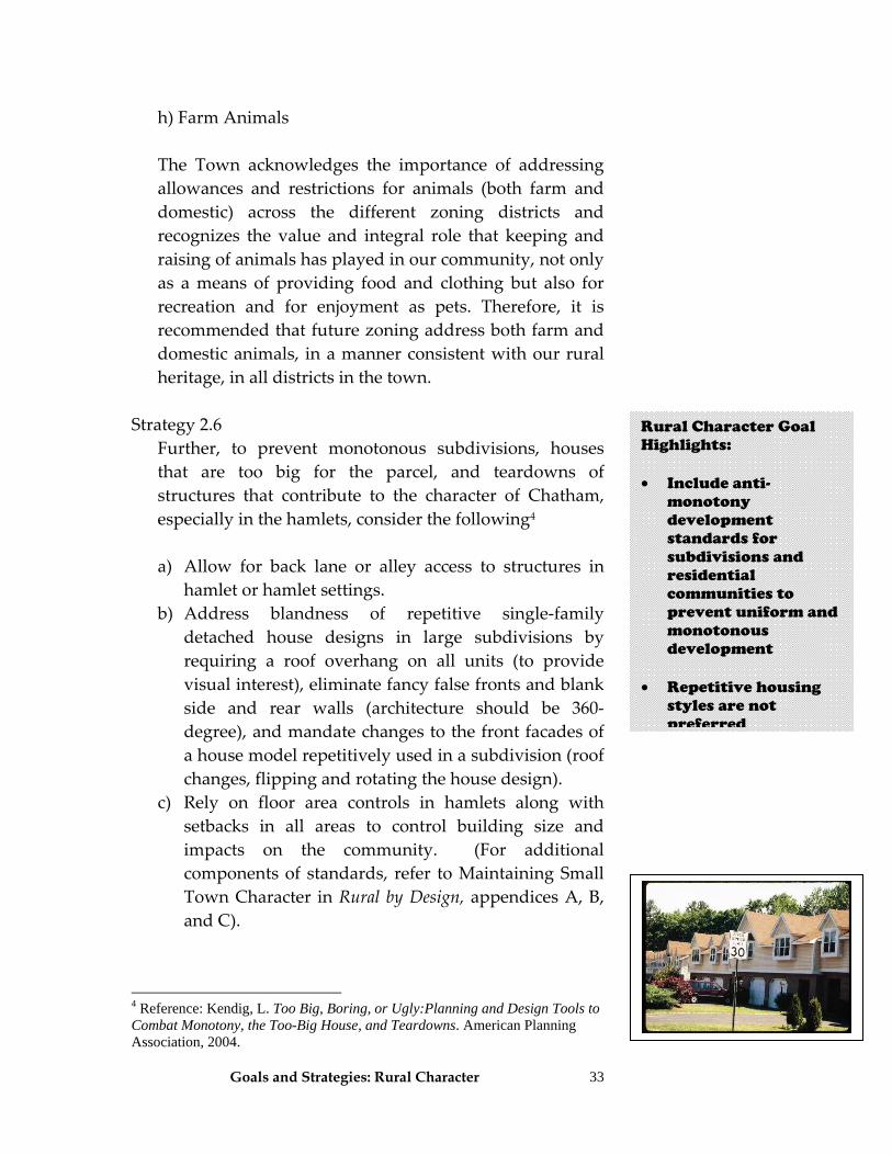
Strategy 2.6 Further, to prevent monotonous subdivisions, houses
that are too big for the parcel, and teardowns of structures that contribute to the character of Chatham, especially in the hamlets, consider the following4
a) Allow for back lane or alley access to structures in
hamlet or hamlet settings. b) Address blandness of repetitive single‐family
detached house designs in large subdivisions by requiring a roof overhang on all units (to provide visual interest), eliminate fancy false fronts and blank side and rear walls (architecture should be 360‐degree), and mandate changes to the front facades of a house model repetitively used in a subdivision (roof changes, flipping and rotating the house design).
c) Rely on floor area controls in hamlets along with setbacks in all areas to control building size and impacts on the community. (For additional components of standards, refer to Maintaining Small Town Character in Rural by Design, appendices A, B, and C).
4 Reference: Kendig, L. Too Big, Boring, or Ugly:Planning and Design Tools to Combat Monotony, the Too-Big House, and Teardowns. American Planning Association, 2004.
Rural Character Goal Highlights: • Include anti-
monotony development standards for subdivisions and residential communities to prevent uniform and monotonous development
• Repetitive housing styles are not preferred
Goals and Strategies: Rural Character
34
d) Creation of clear standards by a Town Board appointed Architectural and Historic Advisory Review Council.
e) The bulk, use, and density standards should be tailored to each hamlet in order to fine‐tune and capture the unique development patterns for each.
Strategy 2.7 Strengthen the subdivision law (Section 170) significantly
by adding in purpose statements, review procedures, and standards oriented to preserving rural character and natural features. Rural character and environmental protection need to take a more prominent role in the purposes and standards of the subdivision law.
a) Significantly expand the definition section of the
subdivision law. It shall include all the terms discussed in this plan such as impervious surface, open space, cluster, conservation subdivision, rural character, etc.
b) Add in additional purpose statements to reflect the goals established in this comprehensive plan, especially related to environmental protection and rural character.
c) Review the law to ensure it is not in conflict with new cluster and conservation subdivision guidelines or Rural Siting Standards, as recommended in this Plan.
d) Areas that need to be addressed in a more comprehensive manner include minimizing impervious surfaces, decreasing disturbances to creeks and streams (based on site‐specific stream characteristics), protecting important farmlands and farm soils, preventing erosion, protecting historic resources, and preserving scenic views and corridors and provisions for landscaping so that new development better acclimates with its surroundings.
Strategy 2.8 Significantly amend the site plan section of zoning. It
lacks proper procedures, standards, purpose statements
Rural Character Goal Highlights: • The Town
subdivision law needs to be amended to add purpose statements, review procedures and development standards oriented to preserving rural character and natural features so that this takes a more prominent role in the review process
Goals and Strategies: Rural Character
35
and performance expectations. Add in design standards and siting/layout standards oriented towards environmental protection and preservation of rural and historic character. Consider including a requirement for a sketch plan in site plan review procedures.
Strategy 2.9 Evaluate and change where needed, development
standards and expectations for lot size, dimensions, yards, and setbacks so that development is consistent with rural character (in the rural land districts) and with historic character (in the hamlet districts). (See also Economic Development and Historic Character goals.) Consider removing or being more flexible with side lines of new lots (Section 170‐17(B)). Strict adherence to right angles on lots may not mesh well with the use of a conservation subdivision.
Strategy 2.10 Existing natural landscapes should be protected as much
as possible. Further, in areas lacking landscaping, Chatham should require street tree planting and landscaping during new development. All new plantings should replicate the natural, existing landscape of the area.
Rural Character Goal Highlights: • Significantly amend
the site plan section of zoning
• Establish standards
so that new development is consistent with rural character of Chatham
• Natural landscapes
should be protected as much as possible and new street trees and landscaping should be provided for
• Establish use of a
building envelope in subdivision to protect open space
Goals and Strategies: Rural Character
36
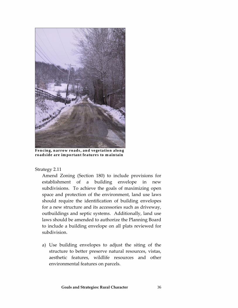
Fencing, narrow roads, and vegetation along roadside are important features to maintain Strategy 2.11 Amend Zoning (Section 180) to include provisions for
establishment of a building envelope in new subdivisions. To achieve the goals of maximizing open space and protection of the environment, land use laws should require the identification of building envelopes for a new structure and its accessories such as driveway, outbuildings and septic systems. Additionally, land use laws should be amended to authorize the Planning Board to include a building envelope on all plats reviewed for subdivision.
a) Use building envelopes to adjust the siting of the
structure to better preserve natural resources, vistas, aesthetic features, wildlife resources and other environmental features on parcels.
Goals and Strategies: Economic Development 37
Economic Development
A Vision for Chatham’s Economy The Town of Chatham has a thriving economy consistent with its rural character. The town understands that its quality of life is the critical factor in attracting and retaining desirable businesses and appropriately growing our local economy. Our policies and regulations acknowledge and support both our traditional and emerging agricultural sector as well as locally owned and operated businesses, Chatham’s artistic community, and the significant number of entrepreneurs in town including those who use technology to create employment. The commercial development that has taken place has been concentrated in and around the village, the hamlets, and in existing commercial areas. New businesses are designed to fit into the town’s aesthetic, and small, “one of a kind” businesses are the norm. As a result, their environmental impact has been kept low and their visual appeal is consistent with the town’s historic, rural character. Opportunity abounds. The town has partnered with surrounding municipalities and local business organizations to create a business friendly environment in which start‐ups are encouraged and people who want jobs in town can find them. Town‐wide high‐speed Internet access permits a high level of telecommuting, and other infrastructure improvements accommodate visitors drawn to Chatham’s singular charm. As a result of the strength and diversity of this economic activity, the town has stable finances. It benefits from several significant revenue streams and is not overly dependent on the property tax levy.
Economic Development Vision Chatham’s vision for economic development is centered on the philosophy that a high quality of life will be critical in attracting and retaining desirable businesses. Hamlets are the prime locations for commercial uses and Chatham desires new businesses to fit into the Town’s aesthetic and small town character. Future small businesses are desired to be focused on traditional and emerging agricultural businesses locally owned and operated businesses, and artistic and technology-oriented activities

Goals and Strategies: Economic Development
38
Goals and Strategies Goal 1. Chatham encourages the development of small‐scale retail and service businesses to diversify its tax base and provide a variety of job opportunities. These businesses are located in and around the Village of Chatham, the town’s hamlets, and its existing commercial areas; and are in keeping with our rural character. Chatham’s land use regulations support commercial development in designated locations that minimize adverse environmental and fiscal impacts on the community. Zoning allows for low impact businesses in the hamlets, discourages automobile dependency and strengthens community. Strategy 1.1 The town board should create an advisory board called
the Chatham Economic Partnership (CEP), modeled on the Chatham Agricultural Partnership. The mission of the CEP shall be to assist the Town Board with the implementation of the economic development strategies included in this Plan. Particular emphasis shall be given to businesses in the areas of local agriculture, tourism, retail, artisan manufacturing, and intellectual property. The CEP shall be available to commercial interests and function as a facilitator of appropriate economic development in the town.
Strategy 1.2 The town’s rural character is an important economic
asset and shall be the centerpiece to promote desirable economic development. Establish design standards to protect the town’s rural character. For business development in hamlets, the town board should revise town zoning to allow and encourage small‐scale businesses with development standards to ensure that these businesses are built and operated in a manner consistent with the environment, character, scale, style, and mixed‐use nature of the town’s hamlets.
Economic Development Goal Highlights: • Create an Economic
Development Advisory Board
• In hamlet districts,
revise zoning to allow and encourage small-scale businesses but ensure they are built to preserve the environment, character, scale, style, and mixed use nature
• Businesses should be
permitted through site plan and special use permit processes
Goals and Strategies: Economic Development
39
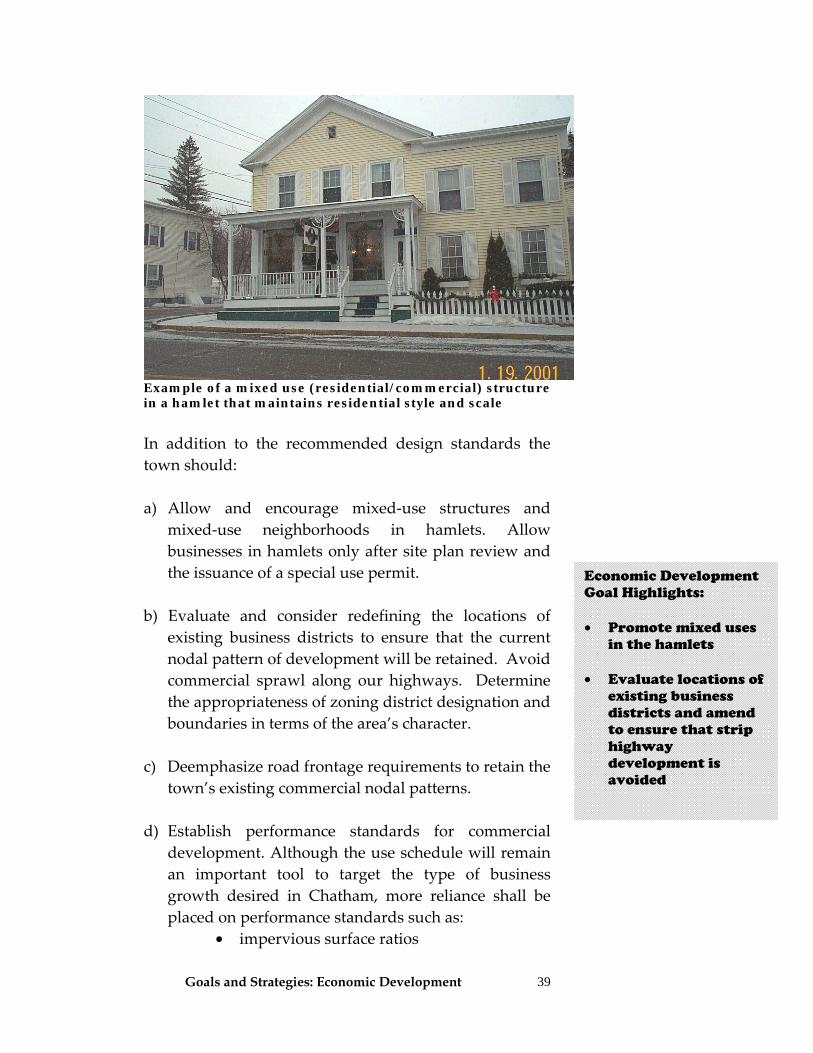
Example of a mixed use (residential/commercial) structure in a hamlet that maintains residential style and scale
In addition to the recommended design standards the town should:
a) Allow and encourage mixed‐use structures and mixed‐use neighborhoods in hamlets. Allow businesses in hamlets only after site plan review and the issuance of a special use permit.
b) Evaluate and consider redefining the locations of existing business districts to ensure that the current nodal pattern of development will be retained. Avoid commercial sprawl along our highways. Determine the appropriateness of zoning district designation and boundaries in terms of the area’s character.
c) Deemphasize road frontage requirements to retain the town’s existing commercial nodal patterns.
d) Establish performance standards for commercial development. Although the use schedule will remain an important tool to target the type of business growth desired in Chatham, more reliance shall be placed on performance standards such as:
• impervious surface ratios
Economic Development Goal Highlights: • Promote mixed uses
in the hamlets • Evaluate locations of
existing business districts and amend to ensure that strip highway development is avoided
Goals and Strategies: Economic Development
40
• open space ratios • floor area ratios • landscape ratios
e) Create standards for maximum commercial building
square footage, building and parking lot siting, lighting, landscaping and signage.
f) Review Village of Chatham zoning and work to have town zoning complement it.
g) Use zoning to encourage retail businesses that fill
community needs and that are in keeping with the town’s character.
h) In addition to the recommended design standards in
industrial districts, the town should:
1. Establish maximum sizes for buildings, an impervious surface coverage, and minimum set‐back standards.
2. Allow and encourage mixed‐use structures. 3. Evaluate and consider redefining the locations of
industrial districts to ensure that they are placed appropriately in the town.
4. Deemphasize road frontage requirements to retain the town’s existing commercial nodal patterns.
5. Evaluate and amend the industrial district permitted uses section in town zoning to define more specifically what is permissible so that the current vague terminology does not permit unwanted and inappropriate industrial development.
Strategy 1.3
In addition to the recommended design standards, the town should amend commercial zoning standards to strengthen controls related to parking, signage, and outdoor lighting. Amend zoning to:
Economic Development Goal Highlights: • Create new
development standards for parking lots and signs
Economic Development Goal Highlights: • Establish
performance standards for commercial development
• Create new zoning
standards for commercial building size, parking lots, lighting, landscaping and signage
• Review zoning use
schedule to ensure that it allows desired retail businesses and prohibits those not desired
• Establish standards
to control the maximum size of a structure
Goals and Strategies: Economic Development
41
a) Include aesthetics, public safety and drainage criteria in parking standards.
b) Add in more flexibility in determining parking lot size to prevent overbuilt parking lots. Give the Planning Board flexibility to plan for the particular use rather than relying on a rigid parking schedule.
c) Recognize that the siting of parking lots has an impact on the aesthetics of the development. The preferred location is to the side or rear of the principal structure. Amend zoning to allow the use of and possible incentive increases for underground parking.
d) Add outdoor lighting standards for commercial buildings and parking lots. Limit lighting fixtures to a maximum of 18 feet tall, and require full cut‐off (shielded) lights to prevent glare. (See Goal 5)
e) Add requirements for maintenance of parking lot screening and landscaping around parking lots.
f) Add in traffic access management tools for parking lots such as use of cross easements, shared parking lots, and rear access roads.
g) Encourage loading docks to be placed to the rear of buildings. Include screening and landscaping requirements to hide or buffer front loading docks.
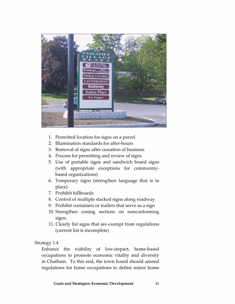
h) Decrease allowable heights and sizes of signs throughout the Town. Very tall or large signs are inconsistent with the rural and historic character of the town. Establish mandatory criteria to ensure that sign sizes, lighting, landscaping, and sign materials reflect the rural character of our Town. Develop a process that streamlines the permitting of signs during site review with some flexibility for new businesses.
i) Consider presenting sign standards in zoning through a table showing dimensions allowed in each district.
j) Prohibit internally lighted signs. k) To aid in proper sign development, consider adding
other sign standards in zoning including:
Goals and Strategies: Economic Development
42
1. Permitted location for signs on a parcel 2. Illumination standards for after‐hours 3. Removal of signs after cessation of business 4. Process for permitting and review of signs 5. Use of portable signs and sandwich board signs
(with appropriate exceptions for community‐based organizations)
6. Temporary signs (strengthen language that is in place)
7. Prohibit billboards 8. Control of multiple stacked signs along roadway 9. Prohibit containers or trailers that serve as a sign 10. Strengthen zoning sections on nonconforming
signs. 11. Clearly list signs that are exempt from regulations
(current list is incomplete) Strategy 1.4 Enhance the viability of low‐impact, home‐based
occupations to promote economic vitality and diversity in Chatham. To this end, the town board should amend regulations for home occupations to define minor home
Goals and Strategies: Economic Development
43
occupations (requiring no special permits), intermediate home occupations (requiring only site plan review), and major home occupations (requiring site plan review and special permits). The town board should further determine where in the town each of these classes of home occupations can occur.
Strategy 1.5 Remove Planned Business Development (PBD)
provisions so that town zoning may not be bypassed by large developments.
Strategy 1.6 Regulate the use of portable commercial storage units Strategy 1.7 Establish a committee to study, report, and develop
appropriate regulations for adult uses in Chatham. Goal 2. Chatham promotes and protects the viability of jobs that take advantage of its unique human, natural, and cultural resources—including its agriculture, recreation opportunities, historic sites, and arts community‐—without negatively impacting its rural character. To this end, the town board should:
Strategy 2.1 Implement land use management policies that support
the economic viability of farm operations. (See also Farming Strategies). Specifically: a) Ensure that zoning allows for a variety of agricultural
uses, and permits non‐farm uses on farms consistent with farming operations. Ensure that the zoning use schedule permits a wide range of agri‐businesses including bed and breakfasts, inns, pick‐your‐own businesses, farm stands, agricultural accessory uses such as veterinarians, equipment and supply dealers, feed milling, etc.
Economic Development Goal Highlights: • Zoning should allow
for a variety of home occupations
• Allow for minor
home occupations (requiring no special permits), intermediate home occupations (site plan review only) and major home occupations (both site plan and special use permits required)
• Remove the Planned
Business Development provisions
Economic Development Goal Highlights: • Support farms and
farming operations through farm-friendly zoning that allows a wide range of agri-businesses and accessory use
Goals and Strategies: Economic Development
44
b) Create standards that support farming as it is envisioned in the future, not just farming they way it has traditionally occurred.
c) To aid the Planning Board evaluate whether a proposed non‐farm business use or commercial building on an agricultural parcel is compatible with farming, they should consider whether:
1. The use will be of a nature, intensity, scope, size,
appearance, type and quantity conforming to the existing personal or agricultural structures.
2. New commercial buildings will be located in a way that minimizes significant adverse impact on future farm operations and expansion of agricultural uses, and does not interfere with current agricultural operations or displace farm storage, use, or functions.
3. The use is related to agriculture, forestry, or open spaces.
4. The business will be conducted primarily by persons who reside on the farm or members of the farm family or farm employees.
5. The use is subordinate to the farm operation. Subordination is based on the proportion of land and structures employed by the rural enterprise to those employed directly in the agricultural enterprise as well as the amount of time and resources the farmer diverts from the agricultural operation to the rural enterprise.
6. The proposed use is not excessively more valuable than existing structures so that it would make the subsequent sale of the farm to bona fide farmers impossible.
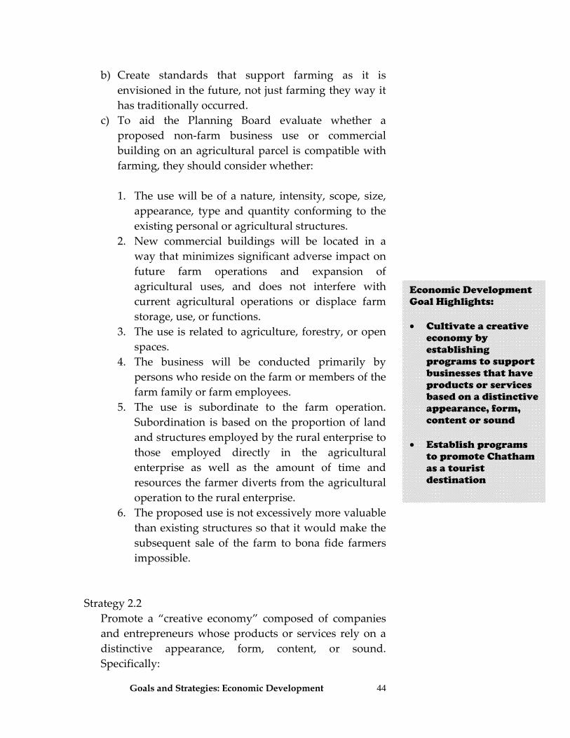
Strategy 2.2 Promote a “creative economy” composed of companies
and entrepreneurs whose products or services rely on a distinctive appearance, form, content, or sound. Specifically:
Economic Development Goal Highlights: • Cultivate a creative
economy by establishing programs to support businesses that have products or services based on a distinctive appearance, form, content or sound
• Establish programs
to promote Chatham as a tourist destination
Goals and Strategies: Economic Development
45
a) The CEP shall work with the County and other
communities to identify and cultivate such companies, support incubators, develop entrepreneur networks, support the implementation of relevant technologies, and identify sources of seed funding and other incentives.
b) The town board shall encourage development of low‐cost living and working spaces in all zoning districts.
Strategy 2.3 Develop a strategy to market Chatham more effectively,
including promoting the Town as a tourist destination. Specifically:
a) The CEP shall work with county tourism officials and
local tourism businesses to maximize the local impact of county marketing efforts. This effort should include the creation of a distinct marketing tag for Chatham.
b) The CEP shall work with surrounding communities to create a regional marketing effort based on the creative economy.
c) The CEP shall work with surrounding communities to create a regional tourism signage system to provide visitors with easy‐to‐read and understandable information.
d) The town board should create and promote safe and well‐defined walking and biking routes connecting the Village of Chatham to the rest of the town and surrounding areas.
Goal 3. Chatham promotes town‐wide acces.s to state‐of‐the art communications technology.
Strategy 3.1 The town shall work to establish itself as its own
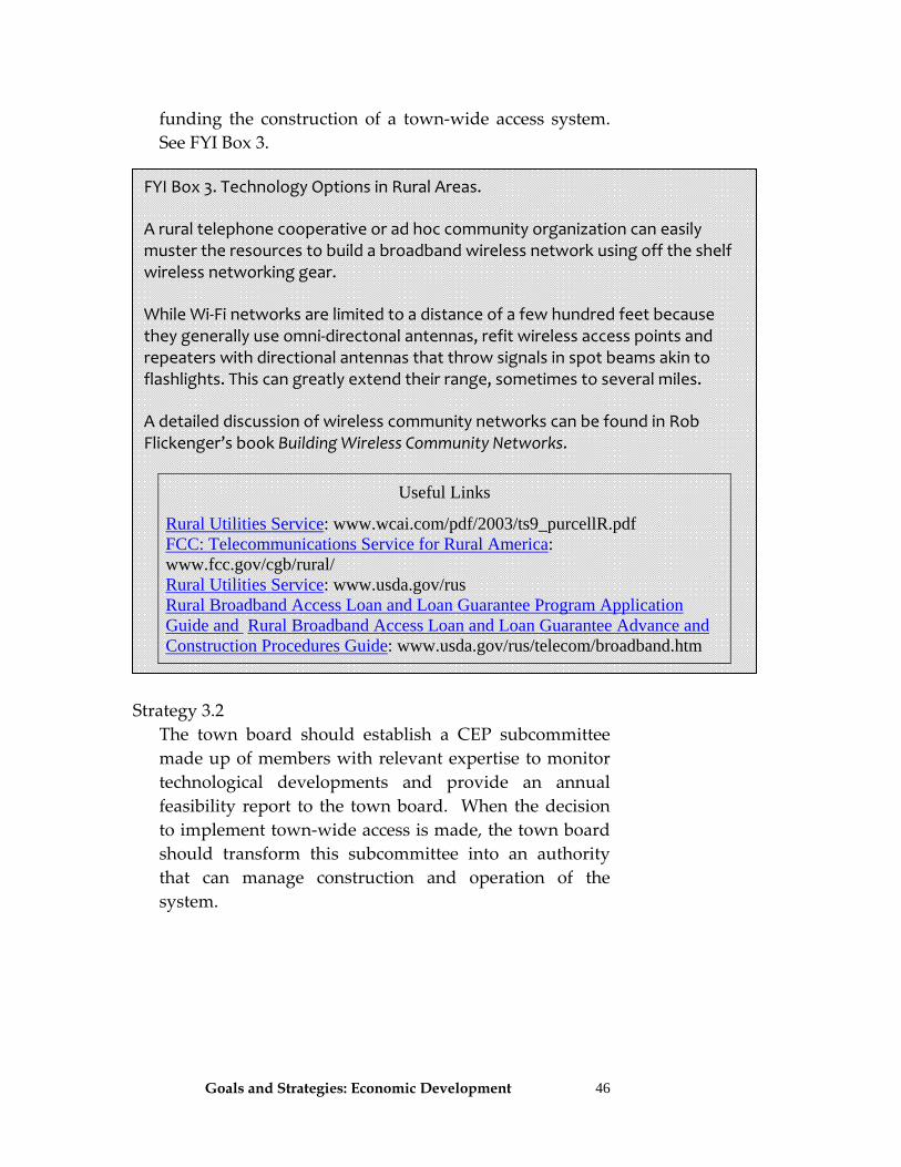
communications technology provider. When appropriate technology becomes available the town should consider
Goals and Strategies: Economic Development
46
funding the construction of a town‐wide access system. See FYI Box 3.
Strategy 3.2 The town board should establish a CEP subcommittee
made up of members with relevant expertise to monitor technological developments and provide an annual feasibility report to the town board. When the decision to implement town‐wide access is made, the town board should transform this subcommittee into an authority that can manage construction and operation of the system.
FYI Box 3. Technology Options in Rural Areas.
A rural telephone cooperative or ad hoc community organization can easily muster the resources to build a broadband wireless network using off the shelf wireless networking gear.
While Wi‐Fi networks are limited to a distance of a few hundred feet because they generally use omni‐directonal antennas, refit wireless access points and repeaters with directional antennas that throw signals in spot beams akin to flashlights. This can greatly extend their range, sometimes to several miles.
A detailed discussion of wireless community networks can be found in Rob Flickenger’s book Building Wireless Community Networks.
Useful Links
Rural Utilities Service: www.wcai.com/pdf/2003/ts9_purcellR.pdf FCC: Telecommunications Service for Rural America: www.fcc.gov/cgb/rural/ Rural Utilities Service: www.usda.gov/rus Rural Broadband Access Loan and Loan Guarantee Program Application Guide and Rural Broadband Access Loan and Loan Guarantee Advance and Construction Procedures Guide: www.usda.gov/rus/telecom/broadband.htm
Goals and Strategies: Economic Development
47
Goal 4. The town, through its CEP, actively partners with the Village of Chatham, surrounding communities, and local business organizations to achieve its economic development goals. Strategy 4.1 Work with the Village of Chatham to create a formal
town‐village working group. Strategy 4.2 Work with adjacent towns, beginning with New
Lebanon, in the Hudson River Greenway Scenic Byways program.
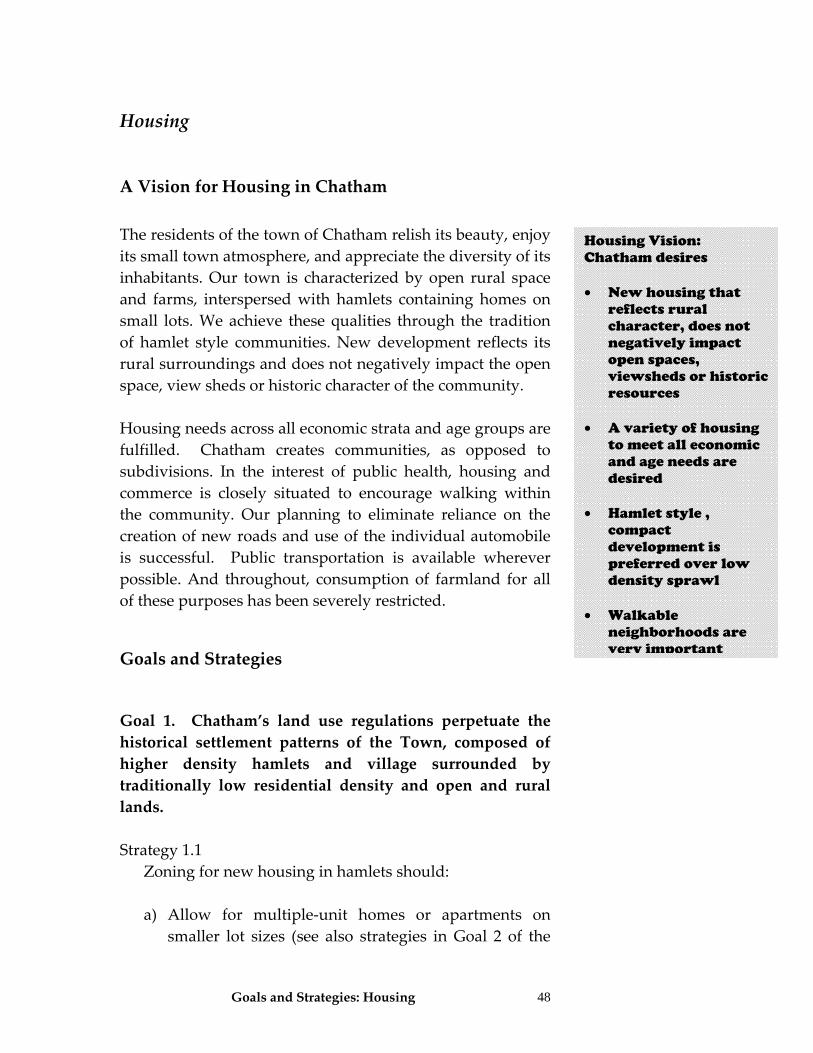
Goals and Strategies: Housing 48
Housing
A Vision for Housing in Chatham The residents of the town of Chatham relish its beauty, enjoy its small town atmosphere, and appreciate the diversity of its inhabitants. Our town is characterized by open rural space and farms, interspersed with hamlets containing homes on small lots. We achieve these qualities through the tradition of hamlet style communities. New development reflects its rural surroundings and does not negatively impact the open space, view sheds or historic character of the community. Housing needs across all economic strata and age groups are fulfilled. Chatham creates communities, as opposed to subdivisions. In the interest of public health, housing and commerce is closely situated to encourage walking within the community. Our planning to eliminate reliance on the creation of new roads and use of the individual automobile is successful. Public transportation is available wherever possible. And throughout, consumption of farmland for all of these purposes has been severely restricted. Goals and Strategies Goal 1. Chatham’s land use regulations perpetuate the historical settlement patterns of the Town, composed of higher density hamlets and village surrounded by traditionally low residential density and open and rural lands. Strategy 1.1 Zoning for new housing in hamlets should:
a) Allow for multiple‐unit homes or apartments on smaller lot sizes (see also strategies in Goal 2 of the
Housing Vision: Chatham desires • New housing that
reflects rural character, does not negatively impact open spaces, viewsheds or historic resources
• A variety of housing
to meet all economic and age needs are desired
• Hamlet style ,
compact development is preferred over low density sprawl
• Walkable
neighborhoods are very important
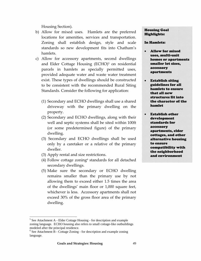
Goals and Strategies: Housing
49
Housing Section). b) Allow for mixed uses. Hamlets are the preferred
locations for amenities, services and transportation. Zoning shall establish design, style and scale standards so new development fits into Chatham’s hamlets.
c) Allow for accessory apartments, second dwellings and Elder Cottage Housing (ECHO)5 on residential parcels in hamlets as specially permitted uses, provided adequate water and waste water treatment exist. These types of dwellings should be constructed to be consistent with the recommended Rural Siting Standards. Consider the following for application:
(1) Secondary and ECHO dwellings shall use a shared
driveway with the primary dwelling on the property.
(2) Secondary and ECHO dwellings, along with their well and septic systems shall be sited within 100ft (or some predetermined figure) of the primary dwelling.
(3) Secondary and ECHO dwellings shall be used only by a caretaker or a relative of the primary dweller.
(3) Apply rental and size restrictions. (4) Follow cottage zoning6 standards for all detached
secondary dwellings. (5) Make sure the secondary or ECHO dwelling
remains smaller than the primary use by not allowing them to exceed either 1.5 times the area of the dwellings’ main floor or 1,000 square feet, whichever is less. Accessory apartments shall not exceed 30% of the gross floor area of the primary dwelling.
5 See Attachment A - Elder Cottage Housing - for description and example zoning language. ECHO housing also refers to small cottage-like outbuildings modeled after the principal residence. 6 See Attachment B - Cottage Zoning - for description and example zoning language.
Housing Goal Highlights: In Hamlets: • Allow for mixed
uses, multi-unit homes or apartments smaller lot sizes, accessory apartments
• Establish siting
guidelines for all hamlets to ensure that all new structures fit into the character of the hamlet
• Establish other
development standards for accessory apartments, elder cottages, and other alternative housing to ensure compatibility with the neighborhood and environment
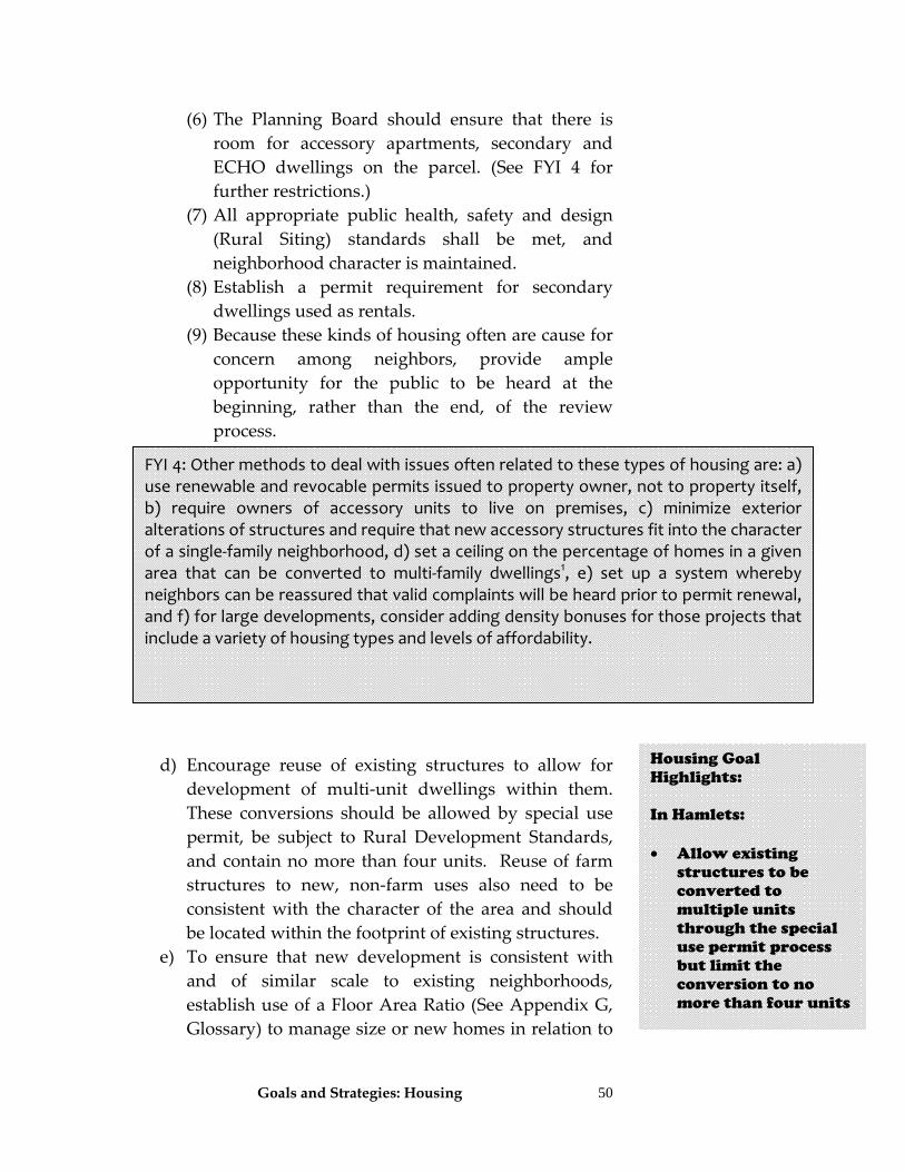
Goals and Strategies: Housing
50
(6) The Planning Board should ensure that there is room for accessory apartments, secondary and ECHO dwellings on the parcel. (See FYI 4 for further restrictions.)
(7) All appropriate public health, safety and design (Rural Siting) standards shall be met, and neighborhood character is maintained.
(8) Establish a permit requirement for secondary dwellings used as rentals.
(9) Because these kinds of housing often are cause for concern among neighbors, provide ample opportunity for the public to be heard at the beginning, rather than the end, of the review process.
d) Encourage reuse of existing structures to allow for development of multi‐unit dwellings within them. These conversions should be allowed by special use permit, be subject to Rural Development Standards, and contain no more than four units. Reuse of farm structures to new, non‐farm uses also need to be consistent with the character of the area and should be located within the footprint of existing structures.
e) To ensure that new development is consistent with and of similar scale to existing neighborhoods, establish use of a Floor Area Ratio (See Appendix G, Glossary) to manage size or new homes in relation to
Housing Goal Highlights: In Hamlets: • Allow existing
structures to be converted to multiple units through the special use permit process but limit the conversion to no more than four units
FYI 4: Other methods to deal with issues often related to these types of housing are: a) use renewable and revocable permits issued to property owner, not to property itself, b) require owners of accessory units to live on premises, c) minimize exterior alterations of structures and require that new accessory structures fit into the character of a single‐family neighborhood, d) set a ceiling on the percentage of homes in a given area that can be converted to multi‐family dwellings1, e) set up a system whereby neighbors can be reassured that valid complaints will be heard prior to permit renewal, and f) for large developments, consider adding density bonuses for those projects that include a variety of housing types and levels of affordability.
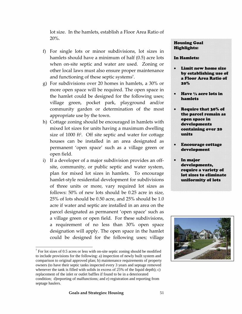
Goals and Strategies: Housing
51
lot size. In the hamlets, establish a Floor Area Ratio of 20%.
f) For single lots or minor subdivisions, lot sizes in hamlets should have a minimum of half (0.5) acre lots when on‐site septic and water are used. Zoning or other local laws must also ensure proper maintenance and functioning of these septic systems7.
g) For subdivisions over 20 homes in hamlets, a 30% or more open space will be required. The open space in the hamlet could be designed for the following uses; village green, pocket park, playground and/or community garden or determination of the most appropriate use by the town.
h) Cottage zoning should be encouraged in hamlets with mixed lot sizes for units having a maximum dwelling size of 1000 ft2. Off site septic and water for cottage houses can be installed in an area designated as permanent ‘open space’ such as a village green or open field.
i) If a developer of a major subdivision provides an off‐site, community, or public septic and water system, plan for mixed lot sizes in hamlets. To encourage hamlet‐style residential development for subdivisions of three units or more, vary required lot sizes as follows: 50% of new lots should be 0.25 acre in size, 25% of lots should be 0.50 acre, and 25% should be 1.0 acre if water and septic are installed in an area on the parcel designated as permanent ‘open space’ such as a village green or open field. For these subdivisions, a requirement of no less than 30% open space designation will apply. The open space in the hamlet could be designed for the following uses; village
7 For lot sizes of 0.5 acres or less with on-site septic zoning should be modified to include provisions for the following: a) inspection of newly built system and comparison to original approved plan; b) maintenance requirements of property owners (to have their septic tanks inspected every 3 years and septage removed whenever the tank is filled with solids in excess of 25% of the liquid depth); c) replacement of the inlet or outlet baffles if found to be in a deteriorated condition; d)reporting of malfunctions; and e) registration and reporting from septage haulers.
Housing Goal Highlights: In Hamlets: • Limit new home size
by establishing use of a Floor Area Ratio of 20%
• Have ½ acre lots in hamlets
• Require that 30% of
the parcel remain as open space in developments containing over 20 units
• Encourage cottage
development
• In major developments, require a variety of lot sizes to eliminate uniformity of lots
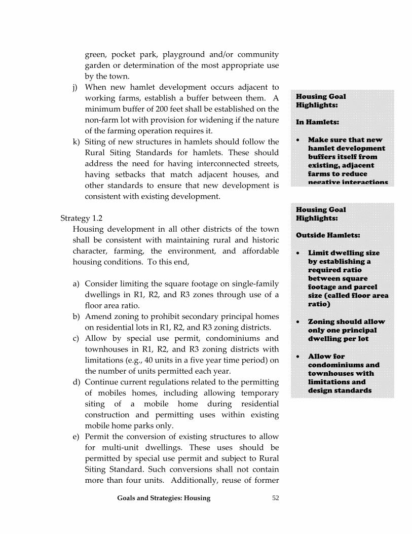
Goals and Strategies: Housing
52
green, pocket park, playground and/or community garden or determination of the most appropriate use by the town.
j) When new hamlet development occurs adjacent to working farms, establish a buffer between them. A minimum buffer of 200 feet shall be established on the non‐farm lot with provision for widening if the nature of the farming operation requires it.
k) Siting of new structures in hamlets should follow the Rural Siting Standards for hamlets. These should address the need for having interconnected streets, having setbacks that match adjacent houses, and other standards to ensure that new development is consistent with existing development.
Strategy 1.2 Housing development in all other districts of the town
shall be consistent with maintaining rural and historic character, farming, the environment, and affordable housing conditions. To this end,
a) Consider limiting the square footage on single‐family
dwellings in R1, R2, and R3 zones through use of a floor area ratio.
b) Amend zoning to prohibit secondary principal homes on residential lots in R1, R2, and R3 zoning districts.
c) Allow by special use permit, condominiums and townhouses in R1, R2, and R3 zoning districts with limitations (e.g., 40 units in a five year time period) on the number of units permitted each year.
d) Continue current regulations related to the permitting of mobiles homes, including allowing temporary siting of a mobile home during residential construction and permitting uses within existing mobile home parks only.
e) Permit the conversion of existing structures to allow for multi‐unit dwellings. These uses should be permitted by special use permit and subject to Rural Siting Standard. Such conversions shall not contain more than four units. Additionally, reuse of former
Housing Goal Highlights: In Hamlets: • Make sure that new
hamlet development buffers itself from existing, adjacent farms to reduce negative interactions
Housing Goal Highlights: Outside Hamlets: • Limit dwelling size
by establishing a required ratio between square footage and parcel size (called floor area ratio)
• Zoning should allow
only one principal dwelling per lot
• Allow for
condominiums and townhouses with limitations and design standards
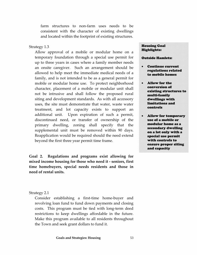
Goals and Strategies: Housing
53
farm structures to non‐farm uses needs to be consistent with the character of existing dwellings and located within the footprint of existing structures.
Strategy 1.3
Allow approval of a mobile or modular home on a temporary foundation through a special use permit for up to three years in cases where a family member needs an onsite caregiver. Such an arrangement should be allowed to help meet the immediate medical needs of a family, and is not intended to be as a general permit for mobile or modular home use. To protect neighborhood character, placement of a mobile or modular unit shall not be intrusive and shall follow the proposed rural siting and development standards. As with all accessory uses, the site must demonstrate that water, waste water treatment, and lot capacity exists to support an additional unit. Upon expiration of such a permit, discontinued need, or transfer of ownership of the primary dwelling, zoning shall specify that the supplemental unit must be removed within 90 days. Reapplication would be required should the need extend beyond the first three year permit time frame.
Goal 2. Regulations and programs exist allowing for mixed income housing for those who need it ‐ seniors, first time homebuyers, special needs residents and those in need of rental units. Strategy 2.1 Consider establishing a first‐time home‐buyer and
revolving loan fund to fund down payments and closing costs. This program must be tied with long‐term deed restrictions to keep dwellings affordable in the future. Make this program available to all residents throughout the Town and seek grant dollars to fund it.
Housing Goal Highlights: Outside Hamlets: • Continue current
regulations related to mobile homes
• Allow for the
conversion of existing structures to multi-family dwellings with limitations and controls
• Allow for temporary
use of a mobile or modular home as a secondary dwelling on a lot only with a special use permit with controls to ensure proper siting and capacity
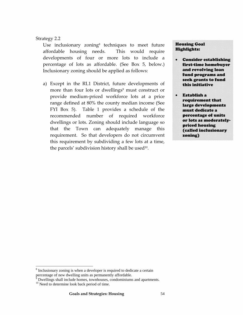
Goals and Strategies: Housing
54
Strategy 2.2 Use inclusionary zoning8 techniques to meet future
affordable housing needs. This would require developments of four or more lots to include a percentage of lots as affordable. (See Box 5, below.) Inclusionary zoning should be applied as follows:
a) Except in the RL1 District, future developments of
more than four lots or dwellings9 must construct or provide medium‐priced workforce lots at a price range defined at 80% the county median income (See FYI Box 5). Table 1 provides a schedule of the recommended number of required workforce dwellings or lots. Zoning should include language so that the Town can adequately manage this requirement. So that developers do not circumvent this requirement by subdividing a few lots at a time, the parcels’ subdivision history shall be used10.
8 Inclusionary zoning is when a developer is required to dedicate a certain percentage of new dwelling units as permanently affordable. 9 Dwellings shall include homes, townhouses, condominiums and apartments. 10 Need to determine look back period of time.
Housing Goal Highlights: • Consider establishing
first-time homebuyer and revolving loan fund programs and seek grants to fund this initiative
• Establish a
requirement that large developments must dedicate a percentage of units or lots as moderately-priced housing (called inclusionary zoning)
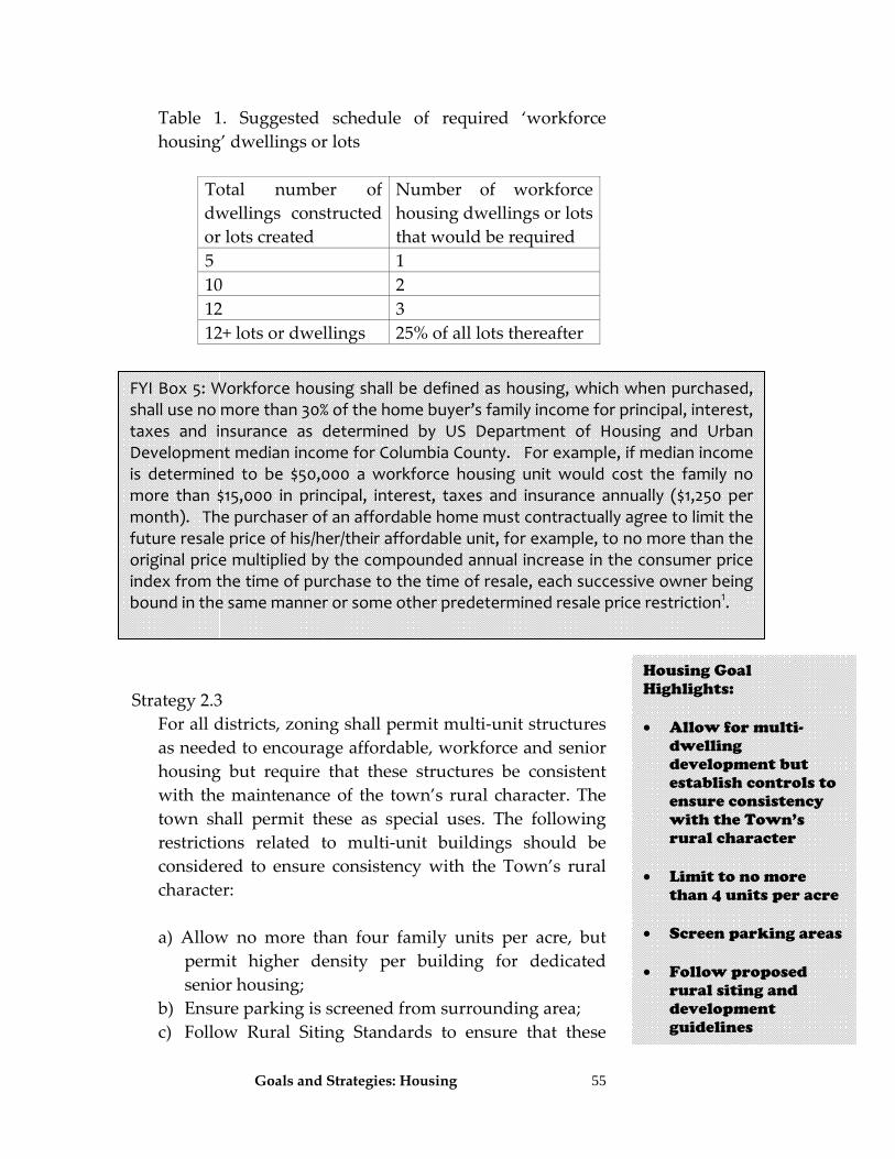
Goals and Strategies: Housing
55
Table 1. Suggested schedule of required ‘workforce housing’ dwellings or lots
Total number of dwellings constructed or lots created
Number of workforce housing dwellings or lots that would be required
5 1 10 2 12 3 12+ lots or dwellings 25% of all lots thereafter
Strategy 2.3 For all districts, zoning shall permit multi‐unit structures
as needed to encourage affordable, workforce and senior housing but require that these structures be consistent with the maintenance of the town’s rural character. The town shall permit these as special uses. The following restrictions related to multi‐unit buildings should be considered to ensure consistency with the Town’s rural character:
a) Allow no more than four family units per acre, but
permit higher density per building for dedicated senior housing;
b) Ensure parking is screened from surrounding area; c) Follow Rural Siting Standards to ensure that these
Housing Goal Highlights: • Allow for multi-
dwelling development but establish controls to ensure consistency with the Town’s rural character
• Limit to no more
than 4 units per acre • Screen parking areas • Follow proposed
rural siting and development guidelines
FYI Box 5: Workforce housing shall be defined as housing, which when purchased, shall use no more than 30% of the home buyer’s family income for principal, interest, taxes and insurance as determined by US Department of Housing and Urban Development median income for Columbia County. For example, if median income is determined to be $50,000 a workforce housing unit would cost the family no more than $15,000 in principal, interest, taxes and insurance annually ($1,250 per month). The purchaser of an affordable home must contractually agree to limit the future resale price of his/her/their affordable unit, for example, to no more than the original price multiplied by the compounded annual increase in the consumer price index from the time of purchase to the time of resale, each successive owner being bound in the same manner or some other predetermined resale price restriction1.
Goals and Strategies: Housing
56
units will not detract from neighborhoods; d) Provide ample opportunity for the public to be heard
at the beginning of the review process to help ensure that these developments are accepted and fit into the community;
e) Major developments shall have a mix of single and multi‐family dwellings with a minimum of 15% and maximum of 25% of all units as multi‐family;
f) Limit the number of acres per hamlet devoted to affordable, workplace and senior housing.
Strategy 2.4
The Town shall work with non‐profit housing organizations to establish programs that promote subsidized and market‐rate rental units. Collaborate with other nearby towns and local agencies to provide workforce housing county‐wide by partnering applications to federal and state agencies. Other agencies include Tri‐corner Community Development Corporation and Columbia County Housing Resources. Hire a grant developer/writer to find more creative ways to fund workforce housing.
Strategy 2.5 Consider having the Town and/or a nonprofit housing
organization act as the owner‐developer of workforce housing communities and purchase land to be developed for affordable housing11.
Strategy 2.6 Zoning should emphasize controlling development
capacity by density (dwellings per acre), instead of relying only on a minimum lot size. Minimum lot size is a poor standard to control the development capacity of an area. This will allow creation of smaller, more affordable lots at the same time that density of
11 A community land trust could be created to oversee the creation, maintenance and legalities of the workforce housing. See http://www.schumachersociety.org/clts.html for example of local Community Land Trust.
Housing Goal Highlights: • Limit the number of
multi-family dwellings allowed per acre
• Work cooperatively
with non-profit housing agencies to promote establishment of more affordable housing options
• Hire grant writer to
help fund workforce housing programs
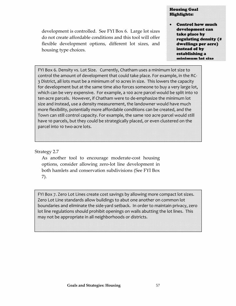
Goals and Strategies: Housing
57
development is controlled. See FYI Box 6. Large lot sizes do not create affordable conditions and this tool will offer flexible development options, different lot sizes, and housing type choices.
Strategy 2.7 As another tool to encourage moderate‐cost housing
options, consider allowing zero‐lot line development in both hamlets and conservation subdivisions (See FYI Box 7).
FYI Box 6. Density vs. Lot Size. Currently, Chatham uses a minimum lot size to control the amount of development that could take place. For example, in the RC‐3 District, all lots must be a minimum of 10 acres in size. This lowers the capacity for development but at the same time also forces someone to buy a very large lot, which can be very expensive. For example, a 100 acre parcel would be split into 10 ten‐acre parcels. However, if Chatham were to de‐emphasize the minimum lot size and instead, use a density measurement, the landowner would have much more flexibility, potentially more affordable conditions can be created, and the Town can still control capacity. For example, the same 100 acre parcel would still have 10 parcels, but they could be strategically placed, or even clustered on the parcel into 10 two‐acre lots.
FYI Box 7. Zero Lot Lines create cost savings by allowing more compact lot sizes. Zero Lot Line standards allow buildings to abut one another on common lot boundaries and eliminate the side‐yard setback. In order to maintain privacy, zero lot line regulations should prohibit openings on walls abutting the lot lines. This may not be appropriate in all neighborhoods or districts.
Housing Goal Highlights: • Control how much
development can take place by regulating density (# dwellings per acre) instead of by establishing a minimum lot size
Goals and Strategies: Housing
58
Goal 3. In response to census data indicating an increasing number of seniors within the township, smaller housing units are available for the diverse needs of this age group, including but not limited to the following: senior housing apartments, townhouses, accessory apartments, assisted housing facilities and Continuing Care Retirement Communities. Strategy 3.1
The use table included in zoning shall be clarified to allow a variety of senior housing types. All senior housing projects should be permitted through the special use process. The following types of senior housing should be specifically allowed:
a) Building or renovating structures to allow for senior
apartments, also known as “granny flats”, with or without support services. It is recommended that granny‐flats be permitted on a temporary basis (allowed in three‐year increments with option for renewal);
b) Group homes for unrelated senior resident occupants. c) Continuing Care Retirement Communities (CCRC). d) Multi‐unit dwellings.
Strategy 3.2 Zoning shall be written to include state law requirements for design and building of senior housing.
Strategy 3.3 Establish an “aging in place” program. Some of the components of this program could be:
a) Set up an advisory committee to formulate an aging in place blueprint.
b) Implement plans for transportation and street design in hamlets to accommodate seniors.
Housing Goal Highlights: • Expand zoning’s use
table to allow, by special use permit, group homes, continuing care retirement communities, multi-unit dwellings, and use of granny flats as alternatives for senior housing
• Zoning should include state law requirements related to senior housing
• Establish a program
to help seniors stay in their home as an alternative to nursing homes (age in place)
• Ensure that major
subdivisions have sidewalks, bike-friendly street designs, and open spaces for all residents
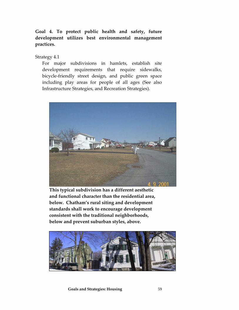
Goals and Strategies: Housing
59
Goal 4. To protect public health and safety, future development utilizes best environmental management practices. Strategy 4.1
For major subdivisions in hamlets, establish site development requirements that require sidewalks, bicycle‐friendly street design, and public green space including play areas for people of all ages (See also Infrastructure Strategies, and Recreation Strategies).
This typical subdivision has a different aesthetic and functional character than the residential area, below. Chatham’s rural siting and development standards shall work to encourage development consistent with the traditional neighborhoods, below and prevent suburban styles, above.
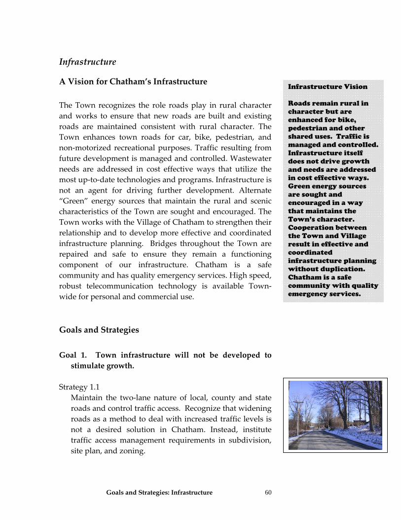
Goals and Strategies: Infrastructure 60
Infrastructure
A Vision for Chatham’s Infrastructure The Town recognizes the role roads play in rural character and works to ensure that new roads are built and existing roads are maintained consistent with rural character. The Town enhances town roads for car, bike, pedestrian, and non‐motorized recreational purposes. Traffic resulting from future development is managed and controlled. Wastewater needs are addressed in cost effective ways that utilize the most up‐to‐date technologies and programs. Infrastructure is not an agent for driving further development. Alternate “Green” energy sources that maintain the rural and scenic characteristics of the Town are sought and encouraged. The Town works with the Village of Chatham to strengthen their relationship and to develop more effective and coordinated infrastructure planning. Bridges throughout the Town are repaired and safe to ensure they remain a functioning component of our infrastructure. Chatham is a safe community and has quality emergency services. High speed, robust telecommunication technology is available Town‐wide for personal and commercial use. Goals and Strategies Goal 1. Town infrastructure will not be developed to stimulate growth.
Strategy 1.1 Maintain the two‐lane nature of local, county and state
roads and control traffic access. Recognize that widening roads as a method to deal with increased traffic levels is not a desired solution in Chatham. Instead, institute traffic access management requirements in subdivision, site plan, and zoning.
Infrastructure Vision Roads remain rural in character but are enhanced for bike, pedestrian and other shared uses. Traffic is managed and controlled. Infrastructure itself does not drive growth and needs are addressed in cost effective ways. Green energy sources are sought and encouraged in a way that maintains the Town’s character. Cooperation between the Town and Village result in effective and coordinated infrastructure planning without duplication. Chatham is a safe community with quality emergency services.
Goals and Strategies: Infrastructure
61
Strategy 1.2 Promote compact development to avoid unnecessary
development or extension of water and sewer lines. Focus public services in areas of Chatham such as hamlets, business districts, and in areas adjacent to the village.
a) Should public water or sewer systems be necessary in
the future, the Town shall ensure that such infrastructure is concentrated in hamlets, around the village and potentially in business nodes. It shall be a policy of the Town not to allow extension of these public services beyond these boundaries into agricultural areas.
b) When building water and sewer infrastructure, the systems shall not be designed and built with extensions as a goal.
Strategy 1.3 To ensure that growth matches infrastructure, consider
initiating an Adequate Public Facilities (APF) regulation. This is a town law that requires that there be proof that adequate infrastructure is in place prior to that development. Such regulations can require developers to wait until the necessary infrastructure to make the development safe, accessible and in compliance with health standards is in place. The net effect is typically to keep development more compact and contiguous to existing development, or to cause it to locate in nodes around other service providers. A basic set of APF controls requires that development shall be approved only if the Planning Board analyzes information provided by the developer and makes explicit findings that there is, or will be at the time of the actual development
a) An adequate supply of water to serve the needs of the
project, b) Adequate capacity to collect and treat wastewater
from the project,
Infrastructure Goal Highlights: • Roads remain rural
in design and maintenance
• Curb-cuts and
driveways are carefully planned for and regulated to control traffic
• Compact
development is promoted and extension of any future water or sewer lines is limited to hamlet areas
• Initiate an Adequate
Facilities regulation so that infrastructure is required to be in place prior to a development being permitted and built
Goals and Strategies: Infrastructure
62
c) Adequate road capacity to handle traffic to and from the project,
d) Adequate capacity in stormwater drainage to handle stormwater runoff from the project,
e) Adequate school facilities to handle the growth, and f) Adequate emergency services.
Strategy 1.4 Develop inter‐municipal agreements between Chatham
and neighboring towns to coordinate growth management efforts.
Goal 2. Any new water or sewer infrastructure utilizes the most up‐to‐date technology and management systems suitable for rural areas. Strategy 2.1 Should critical needs exist to more effectively manage on‐
site septic systems, Chatham shall explore alternate types of waste treatment systems to serve the Town instead of public sewers. Chatham shall consider all available water treatment options including decentralized management systems, constructed wetlands, small package plants, biological treatments, and other technologies that are available for its small community infrastructure needs.
Strategy 2.2 Consider enhancing effectiveness of on‐site septic
systems by developing a septic system maintenance law that includes a) Property owners should remove septage whenever
the tank is filled with solids in excess of 25% of the liquid depth;
b) Replacement of the inlet or outlet baffles, if found to be in a deteriorated condition;
c) Reporting of malfunctions; and d) Registration and reporting from septage haulers.
Infrastructure Goal Highlights: • Coordinate growth
management efforts between Chatham and its neighbors
• Should a need arise
to more effectively manage septic wastewater, the Town should explore all alternative treatments systems and not just public sewers
• To avoid costly
public systems in the future, develop a septic system maintenance law that requires property owners to have their septic tanks inspected and properly maintained
Goals and Strategies: Infrastructure
63
Goal 3. Construction of new, and maintenance of existing roads are consistent with low volume road designs and rural character.
Strategy 3.1 Where possible, minimize use of cul‐de‐sacs. Where
dead end roads are necessary, utilize T and Y ends instead of cul‐de‐sacs. For new development within hamlets, all new streets should be interconnected with no dead ends and they should use a grid or modified grid pattern.
Strategy 3.2 Change highway design standards to be consistent with
rural road standards including a decrease of pavement widths (no more than 20 feet of pavement), establishment of maximum grades (5%), and reducing the radius of cul‐de‐sacs (40 or 50’ maximum). Require that the “bulb” of cul‐de‐sacs be landscaped. Continue the current requirements for surface and subsurface construction standards. Section 164 of the Chatham Code (Road Specifications) and the Subdivision Law (Section 170) needs to be coordinated with each other and shall be amended to be consistent with rural road standards.
Strategy 3.3 Roads have a large and often negative impact on rural
character. In particular, Chatham should:
a) Encourage use of shared driveways. b) Establish a rural road classification system. Excellent
models can be found in the Cornell Local Roads Program (Classifying and Managing Low‐Volume Local Roads and the Manual: Guidelines for Rural Town and County Roads) or from the Dutchess County Design Guide for Rural Roads.
c) Include in zoning, subdivision, and site plan laws standards to require access management to control traffic congestion and maintain rural road character.
Infrastructure Goal Highlights: • Minimize use of cul-
de-sac type roads and establish new rural-oriented standards for their development
• New streets should
be interconnected • Make sure town
highway design standards are consistent with rural roads and not over-built or out of character for the Town
• Allow for use of
shared driveways under certain circumstances
Infrastructure Goal Highlights: • Establish a rural
road classification system using the Cornell Local Roads Program as a guideline
• Ensure that any
county or state roadwork is coordinated with this plan
• New roads should be
built sensitive to the context of Chatham’s character and that preserves historic, scenic, natural and other resources along roads
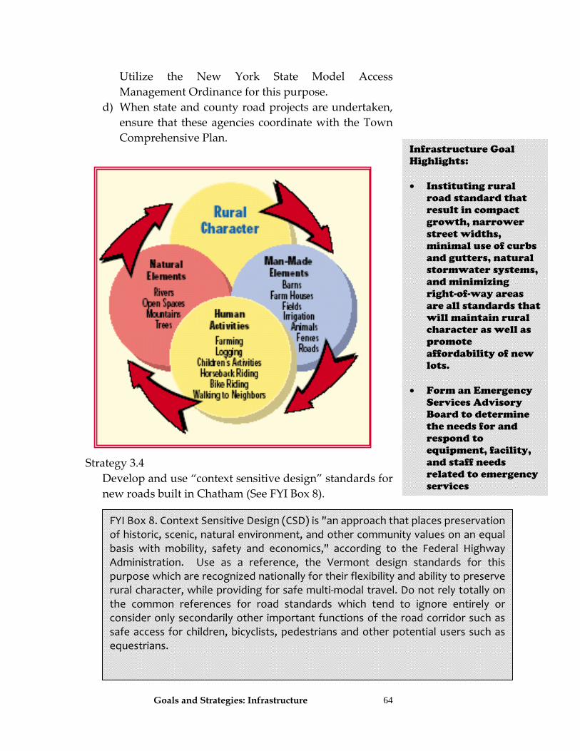
Goals and Strategies: Infrastructure
64
Utilize the New York State Model Access Management Ordinance for this purpose.
d) When state and county road projects are undertaken, ensure that these agencies coordinate with the Town Comprehensive Plan.
Strategy 3.4 Develop and use “context sensitive design” standards for
new roads built in Chatham (See FYI Box 8).
FYI Box 8. Context Sensitive Design (CSD) is "an approach that places preservation of historic, scenic, natural environment, and other community values on an equal basis with mobility, safety and economics," according to the Federal Highway Administration. Use as a reference, the Vermont design standards for this purpose which are recognized nationally for their flexibility and ability to preserve rural character, while providing for safe multi‐modal travel. Do not rely totally on the common references for road standards which tend to ignore entirely or consider only secondarily other important functions of the road corridor such as safe access for children, bicyclists, pedestrians and other potential users such as equestrians.
Infrastructure Goal Highlights: • Instituting rural
road standard that result in compact growth, narrower street widths, minimal use of curbs and gutters, natural stormwater systems, and minimizing right-of-way areas are all standards that will maintain rural character as well as promote affordability of new lots.
• Form an Emergency
Services Advisory Board to determine the needs for and respond to equipment, facility, and staff needs related to emergency services
Goals and Strategies: Infrastructure
65
Strategy 3.5 Subdivision review shall carefully evaluate driveway placement and culvert and drainage measures to ensure public safety.
Goal 4. Infrastructure planning incorporates the need to create or maintain affordable housing potential during new development. Strategy 4.112 Overbuilt roads and lot layouts that result in large,
sprawling public water and sewer services do not support affordable housing opportunities. Ensure that the town uses rural road standards and establish zoning and subdivision procedures to allow for the most compact growth feasible on each lot. A reduction of street‐width, cul‐de‐sac turnaround width, minimal use of curbs and gutters, allowing natural stormwater management systems, and use of easements or sidewalks/bike paths for utilities as an alternative to large right‐of‐ways are all infrastructure related reforms that influence affordability. (The current 50’ right‐of‐way requirement may be too large and 35’ to a maximum of 50’ is recommended.)
Goal 5. Emergency services have the necessary equipment and resources to effectively service the Town, and volunteer staffing is supported and enhanced. Strategy 5.1 The Town should form an Emergency Services Advisory
Board with members representing the various emergency service departments and the Town Board. The role of this advisory group is to determine the needs for and
12 See also the HUD publication: Affordable Housing Development Guidelines for State and Local Governments that is available from HUD for $15.00.
Infrastructure Goal Highlights: • Provide assistance to
emergency service providers and coordinate long-term planning for facilities, inventory and other needs
• Evaluate cost
effective methods of providing police services in the future
• Support aggressive
volunteer recruiting efforts
• Assist emergency
departments grant applications as needed
• Ensure that any
environmental review (SEQRA) is done to mitigate negative impacts on town services, including emergency services
Goals and Strategies: Infrastructure
66
respond to the additional equipment, facility and personnel needs to provide quality emergency services. This group shall evaluate the desirability and fiscal impacts of using regionalized services or paid staff to augment the volunteer system.
Strategy 5.2 The Town should encourage emergency service
providers to consider the vision and goals of the comprehensive plan when preparing their own long‐range plans for facilities and for their ability to provide services to a growing community. Chatham should also provide assistance to help those fire and emergency services providers coordinate long‐term planning for facilities, inventory and needs assessment. The Town and the newly created Emergency Advisory Board (above) could work collectively to establish an inventory and needs assessment for fire and emergency services. Emergency service facilities shall be allowable uses subject to site plan review.
Strategy 5.3 Recognize the future need for adequate police services
and evaluate cost effective methods of providing adequate police services.
Strategy 5.4
Support aggressive volunteer recruiting programs. a) Improve existing tax incentives for emergency service
volunteers. b) Work with the emergency departments to identify
other mechanisms to recruit and retain volunteers. Strategy 5.5 Assist emergency departments’ applications for FEMA
and other grants in order to expand and improve programs and initiatives.
Goals and Strategies: Infrastructure
67
Strategy 5.6 When reviewing a project subject to SEQRA ensure that
no negative impacts will be created on fire, ambulance, road, and other town services.
Goal 6. Public transportation opportunities are enhanced. Strategy 6.1 Currently, public transportation is available from
Chatham to Greenport shopping areas and health care providers by Columbia County on Tuesdays and Wednesdays and is available to all residents (is half‐price for senior citizens.) Work with Columbia County and the Healthcare Consortium to explore ways to expand this service to other locations in the town.
Goal 7. Chatham utilizes a Capital Improvement Plan to manage and process all capital expenditures related to infrastructure in town. Strategy 7.1 Initiate capital improvement planning. This is
accomplished through development of a Capital Improvement Plan (CIP). See FYI Box 9 below.
Infrastructure Goal Highlights: • Explore ways to
expand public transportation options
• Initiate a capital
improvement plan to identify and budget for all town capital expenses (staff, equipment, land, and facilities)
Goals and Strategies: Infrastructure
68
Goal 8. Impacts of increased traffic are minimized. Strategy 8.1 All new development throughout Town should use
traffic access management and traffic calming techniques. These are traffic volume restriction and speed reduction methods. Mechanisms appropriate to most of the rural roads in Chatham shall use, and be consistent with, the New York State Department of Transportation Highway Design Manual, Chapter 25 – Traffic Calming, Revision 33, August 31, 1998 or most current version. Traffic calming may not be applicable to every project proposed. Individual projects shall be assessed to determine if necessary and feasible. In order for traffic calming techniques to be applied by the Planning Board during the project review process, ensure that adopted local
FYI Box 9: A CIP is a multi‐year schedule that lays out a series of Town projects, facilities and large equipment, and their associated costs. Over the five‐year period considered by the CIP, the plan shows how the Town will maintain, expand or renovate facilities and services as needed to meet the demands of existing or new population. These documents are excellent planning and budgeting tools and are usually “rolling plans” where the plan is updated each year, dropping off the previous year and adding one more year at the end of the cycle. A capital budget is updated annually as part of the Town's regular budget process. It will show what projects are already on line, what projects will need funds in the current budget year, and what projects will be started in the current budget year. Coordinating the comprehensive capital budget with the operating budget should give Chatham more insight into long range planning. The information helps decision‐makers improve coordination of services for greater efficiency and assess short‐run financing requirements in the context of long‐run fiscal needs and constraints. It coordinates community planning, financial capacity and physical development. A capital improvements program is composed of two parts ‐‐ a capital budget and a capital program. The capital budget is the upcoming year's spending plan for capital items (tangible assets or projects that cost at least $10,000 and have a useful life of at least five years). The capital program is a plan for capital expenditures that extends five years beyond the capital budget. The Town should establish a formal CIP process, by adopting a resolution to create and empower a CIP committee.
Goals and Strategies: Infrastructure
69
highway standards incorporate and allow use of these techniques.
a) The main traffic access management tools are:
• Limit number of curb cuts permitted per parcel and reduce the number of curb cuts along a highway corridor. Allow for use of shared driveways, shared parking lots, and shared commercial access roads.
• Separate curb cuts and intersections. • Align driveways so they are opposite each other
or offset at least 125 feet. b) The main traffic calming and mitigation measures
that can be used are: • Speed limits • Access Restrictions (gated roads, physical
closures, legal orders) • Signs (standard, vehicle actuated) • Road Markings • Surface treatment; (rumble strips, bar markings) • Road narrowing’s (chicanes, islands, curb build‐
outs, chokers or neckdowns, footway extensions) • Reduced intersection radii (also are very
important to have when trying to maintain rural character)
• Streetscaping such as use of street furniture, lighting, and landscaping (especially street trees)
• Use of shoulders and sidewalks • Use of sidewalks (only in areas with more dense
development) • Surface textures (one portion of the roadway has a
different texture than others) or use of dirt roads • Modified intersections/channelization and higher
visibility crosswalks Strategy 8.2 The Planning Board shall be authorized to require peak
hour traffic studies when reviewing applications.
Infrastructure Goal Highlights: • Include traffic access
management and traffic calming measures in zoning to control the number and location of curb cuts onto roads in Chatham. This will serve to control traffic and reduce accidents.
Infrastructure Goal Highlights • Authorize the
Planning Board to require traffic studies for new development
• Form a bike and
pedestrian committee to identify roads that could be shared for pedestrian activities and plan for those road improvements
• Ensure that new
roads are designed, or existing roads are upgraded to accommodate bikes and pedestrians
Goals and Strategies: Infrastructure
70
Goal 9. Multi‐modal opportunities along state, county and town roads exist.
Strategy 9.1 Initiate a bicycle and pedestrian advisory committee to
identify specific roadways that could be used for bicycles and pedestrians and develop a plan for roadway improvements that are needed.
Strategy 9.2 Design new roadways, and upgrade existing roads to
accommodate bicyclists and pedestrians and other non‐motorized users. Ensure that the local subdivision and zoning law has standards that bring about improvements needed for shared use of roadways. Some of these standards include, but are not limited to:
a) On those roads with the lowest volume of traffic, a
shared roadway lane may be feasible. b) Have an outside travel lane with a width of 14 feet to
provide space for cars and bicyclists and pedestrians. c) Dedicate a portion of the roadway for exclusive use
by bicyclists and pedestrians with striping and/or signage.
d) Allow a portion of the roadway to the right of the edge strip to be designed for bicyclists and pedestrians.
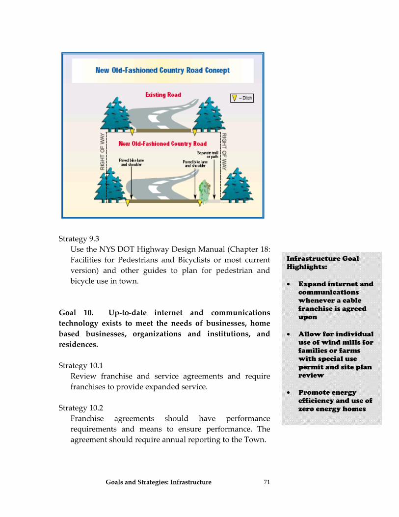
Goals and Strategies: Infrastructure
71
Strategy 9.3 Use the NYS DOT Highway Design Manual (Chapter 18:
Facilities for Pedestrians and Bicyclists or most current version) and other guides to plan for pedestrian and bicycle use in town.
Goal 10. Up‐to‐date internet and communications technology exists to meet the needs of businesses, home based businesses, organizations and institutions, and residences. Strategy 10.1 Review franchise and service agreements and require
franchises to provide expanded service. Strategy 10.2
Franchise agreements should have performance requirements and means to ensure performance. The agreement should require annual reporting to the Town.
Infrastructure Goal Highlights: • Expand internet and
communications whenever a cable franchise is agreed upon
• Allow for individual
use of wind mills for families or farms with special use permit and site plan review
• Promote energy
efficiency and use of zero energy homes
Goals and Strategies: Infrastructure
72
Goal 11. Native green energy sources are developed and utilized that are consistent with our rural and scenic goals. Strategy 11.1 Allow for usage of wind mills by special use permit and
with site plan review and establish standards for these uses that will protect the rural and scenic character of Chatham. Minimum setbacks, buffer distances, and host‐community agreements should be used as tools to protect rural character.
Strategy 11.2 Promote use of zero energy homes. Zoning and other
land use regulations shall not place barriers for building these types of structures. See FYI Box 10.
Strategy 11.3 Encourage use of and remove impediments to using
solar, green buildings, and small scale/micro‐hydro‐electric facilities.
a) Encourage the use of Leadership in Energy and
Environmental Design (LEED) standards for new development and redevelopment of buildings and
FYI Box 10: A Zero Energy Home combines state of the art, energy‐efficient construction and appliances with commercially available renewable energy systems such as solar water heating and electricity. This combination can result in zero energy consumption from the utility company. This concept could be implemented both in terms of incentives for new homes built or existing buildings retrofitted in subdivisions and in terms of seeking to recruit companies that build zero‐energy homes. The spin‐offs associated with this concept are many and include: solar panels, super insulation, wind power and many other emerging technologies around this topic. Initiatives at regional universities like Syracuse and Cornell are creating these technologies. Also utilize information from the United States Department of Energy, National Renewable Energy Laboratory and their northeast team member Steven Winter Associates in Norwalk, Connecticut (http://www/swinter.com/) for assistance.
Goals and Strategies: Infrastructure
73
sites in the town. Consider use of a density bonus to developers willing to undertake this. The LEED Green Building Rating System® is the national standard for developing high‐performance, sustainable buildings. Participation in LEED is voluntary. The standards have been developed by the U.S. Green Building Council through consensus by all members of the building industry. LEED standards address a variety of site design, building design and construction materials based on the long‐term sustainability of the community. LEED information could be provided through the Building Inspector and distributed as potential developers seek information regarding building in Chatham. The following is a list of categories that LEED standards consider:
• Erosion and sedimentation control • Site selection • Alternative transportation, public transportation
access • Alternative transportation, bicycle friendly • Alternative transportation, parking reductions • Reduced site disturbance, protect and restore open
space • Reduced site disturbance, maximize open space • Stormwater management, flow treatment and
reduction • Landscape and exterior design to reduce heat
islands, non‐roof and roof surfaces • Light pollution reduction
Strategy 11.4 Growing bio‐fuels may be an alternative farm crop that
could be profitable for local farmers. Strategy 11.5 Help promote other native green energy sources to
include, but not limited to methane, hydroelectric and bio‐fuels.
Infrastructure Goal Highlights: • Allow and remove
any impediments to people using solar, green buildings, and small scale micro-hydroelectric facilities
• Encourage use of
LEEDS energy standards
Infrastructure Goal Highlights: • Encourage farmers
to grow bio-fuels • Promote other native
energy sources
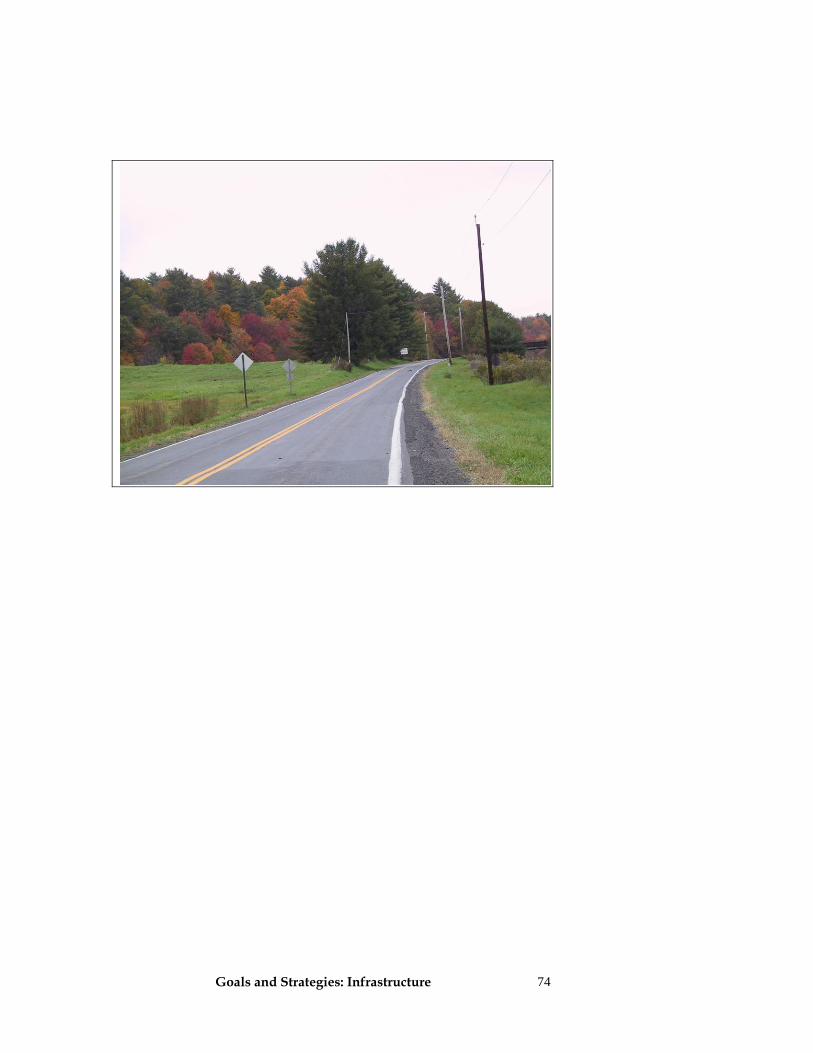
Goals and Strategies: Infrastructure
74
Goals and Strategies: Recreation 75
Recreation
A Vision for Recreation in Chatham The townspeople of Chatham are highly aware of and engaged in recreational activities. They make use of the many and diverse opportunities available within the town on a year‐round basis, such as: soccer, swimming, basketball, tennis, softball and gardening at Crellin Park; bird watching and hiking at the Powell Sanctuary and the Rutland Rail trail; fishing in the Kinderhook Creek and Sutherland Pond; cycling or jogging along our roadways and pathways; equestrian activities; and hunting on private lands. Our youngsters enjoy many recreational programs provided by The Crellin Morris Association, public schools and other public and private organizations. Residents also benefit from other regional opportunities available nearby such as golfing in Ghent and Kinderhook, skiing in the Berkshires and boating on area lakes, streams and rivers. We especially value the townʹs rural character and those recreational activities that allow them to appreciate Chathamʹs natural beauty. The recreational emphasis in Chatham compliments the townʹs rural character, minimizing any negative environmental impacts and, more importantly, promoting an appreciation of the land. Goals and Strategies Goal 1. Recreation in the Town encourages present and future generations to actively participate in indoor and outdoor activities for the benefit of their physical and emotional health. The Townʹs recreation programs provide high quality, active and passive recreation for all ages and abilities.
Recreation Vision Many diverse active and passive recreational opportunities exist for all ages. Residents value recreational activities associated with Chatham’s rural character and natural features. Recreational programs compliment our rural character, do not impact the environment, and promote an appreciation of the land.
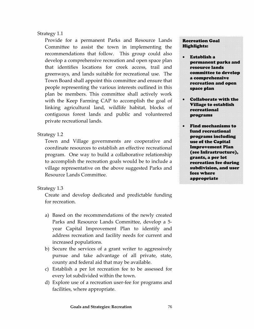
Goals and Strategies: Recreation
76
Strategy 1.1 Provide for a permanent Parks and Resource Lands
Committee to assist the town in implementing the recommendations that follow. This group could also develop a comprehensive recreation and open space plan that identifies locations for creek access, trail and greenways, and lands suitable for recreational use. The Town Board shall appoint this committee and ensure that people representing the various interests outlined in this plan be members. This committee shall actively work with the Keep Farming CAP to accomplish the goal of linking agricultural land, wildlife habitat, blocks of contiguous forest lands and public and volunteered private recreational lands.
Strategy 1.2 Town and Village governments are cooperative and
coordinate resources to establish an effective recreational program. One way to build a collaborative relationship to accomplish the recreation goals would be to include a village representative on the above suggested Parks and Resource Lands Committee.
Strategy 1.3 Create and develop dedicated and predictable funding
for recreation.
a) Based on the recommendations of the newly created Parks and Resource Lands Committee, develop a 5‐year Capital Improvement Plan to identify and address recreation and facility needs for current and increased populations.
b) Secure the services of a grant writer to aggressively pursue and take advantage of all private, state, county and federal aid that may be available.
c) Establish a per lot recreation fee to be assessed for every lot subdivided within the town.
d) Explore use of a recreation user‐fee for programs and facilities, where appropriate.
Recreation Goal Highlights: • Establish a
permanent parks and resource lands committee to develop a comprehensive recreation and open space plan
• Collaborate with the
Village to establish recreational programs
• Find mechanisms to
fund recreational programs including use of the Capital Improvement Plan (see Infrastructure), grants, a per lot recreation fee during subdivision, and user fees where appropriate
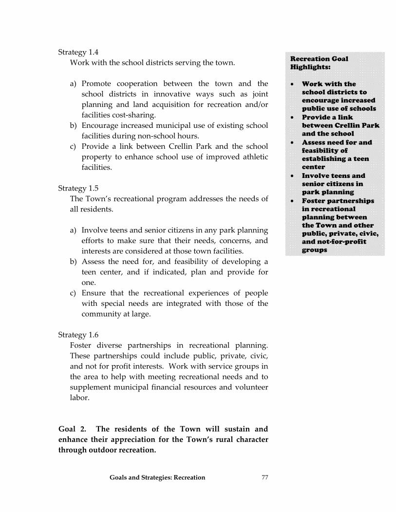
Goals and Strategies: Recreation
77
Strategy 1.4 Work with the school districts serving the town.
a) Promote cooperation between the town and the school districts in innovative ways such as joint planning and land acquisition for recreation and/or facilities cost‐sharing.
b) Encourage increased municipal use of existing school facilities during non‐school hours.
c) Provide a link between Crellin Park and the school property to enhance school use of improved athletic facilities.
Strategy 1.5 The Town’s recreational program addresses the needs of
all residents.
a) Involve teens and senior citizens in any park planning efforts to make sure that their needs, concerns, and interests are considered at those town facilities.
b) Assess the need for, and feasibility of developing a teen center, and if indicated, plan and provide for one.
c) Ensure that the recreational experiences of people with special needs are integrated with those of the community at large.
Strategy 1.6 Foster diverse partnerships in recreational planning.
These partnerships could include public, private, civic, and not for profit interests. Work with service groups in the area to help with meeting recreational needs and to supplement municipal financial resources and volunteer labor.
Goal 2. The residents of the Town will sustain and enhance their appreciation for the Town’s rural character through outdoor recreation.
Recreation Goal Highlights: • Work with the
school districts to encourage increased public use of schools
• Provide a link between Crellin Park and the school
• Assess need for and feasibility of establishing a teen center
• Involve teens and senior citizens in park planning
• Foster partnerships in recreational planning between the Town and other public, private, civic, and not-for-profit groups
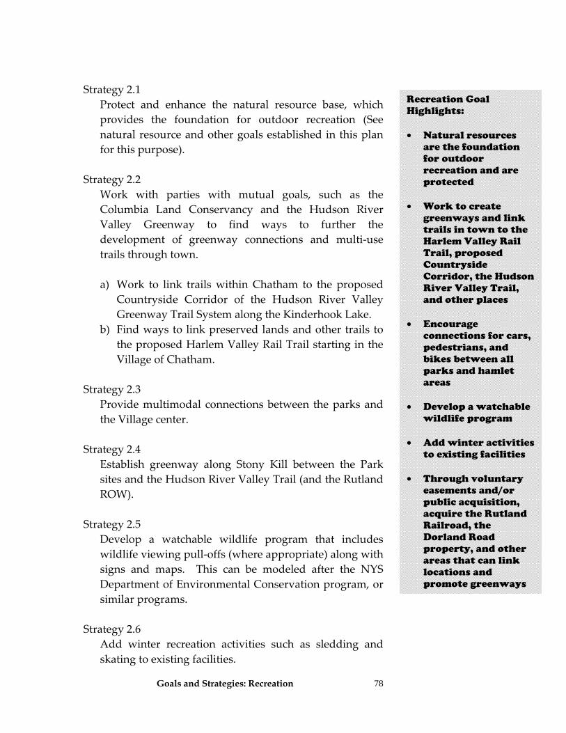
Goals and Strategies: Recreation
78
Strategy 2.1 Protect and enhance the natural resource base, which
provides the foundation for outdoor recreation (See natural resource and other goals established in this plan for this purpose).
Strategy 2.2 Work with parties with mutual goals, such as the
Columbia Land Conservancy and the Hudson River Valley Greenway to find ways to further the development of greenway connections and multi‐use trails through town.
a) Work to link trails within Chatham to the proposed
Countryside Corridor of the Hudson River Valley Greenway Trail System along the Kinderhook Lake.
b) Find ways to link preserved lands and other trails to the proposed Harlem Valley Rail Trail starting in the Village of Chatham.
Strategy 2.3 Provide multimodal connections between the parks and
the Village center. Strategy 2.4 Establish greenway along Stony Kill between the Park
sites and the Hudson River Valley Trail (and the Rutland ROW).
Strategy 2.5 Develop a watchable wildlife program that includes
wildlife viewing pull‐offs (where appropriate) along with signs and maps. This can be modeled after the NYS Department of Environmental Conservation program, or similar programs.
Strategy 2.6 Add winter recreation activities such as sledding and
skating to existing facilities.
Recreation Goal Highlights: • Natural resources
are the foundation for outdoor recreation and are protected
• Work to create
greenways and link trails in town to the Harlem Valley Rail Trail, proposed Countryside Corridor, the Hudson River Valley Trail, and other places
• Encourage
connections for cars, pedestrians, and bikes between all parks and hamlet areas
• Develop a watchable
wildlife program • Add winter activities
to existing facilities • Through voluntary
easements and/or public acquisition, acquire the Rutland Railroad, the Dorland Road property, and other areas that can link locations and promote greenways
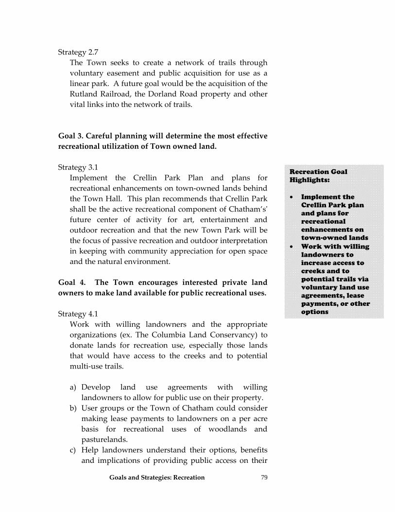
Goals and Strategies: Recreation
79
Strategy 2.7 The Town seeks to create a network of trails through
voluntary easement and public acquisition for use as a linear park. A future goal would be the acquisition of the Rutland Railroad, the Dorland Road property and other vital links into the network of trails.
Goal 3. Careful planning will determine the most effective recreational utilization of Town owned land. Strategy 3.1 Implement the Crellin Park Plan and plans for
recreational enhancements on town‐owned lands behind the Town Hall. This plan recommends that Crellin Park shall be the active recreational component of Chatham’sʹ future center of activity for art, entertainment and outdoor recreation and that the new Town Park will be the focus of passive recreation and outdoor interpretation in keeping with community appreciation for open space and the natural environment.
Goal 4. The Town encourages interested private land owners to make land available for public recreational uses. Strategy 4.1 Work with willing landowners and the appropriate
organizations (ex. The Columbia Land Conservancy) to donate lands for recreation use, especially those lands that would have access to the creeks and to potential multi‐use trails.
a) Develop land use agreements with willing
landowners to allow for public use on their property. b) User groups or the Town of Chatham could consider
making lease payments to landowners on a per acre basis for recreational uses of woodlands and pasturelands.
c) Help landowners understand their options, benefits and implications of providing public access on their
Recreation Goal Highlights: • Implement the
Crellin Park plan and plans for recreational enhancements on town-owned lands
• Work with willing landowners to increase access to creeks and to potential trails via voluntary land use agreements, lease payments, or other options
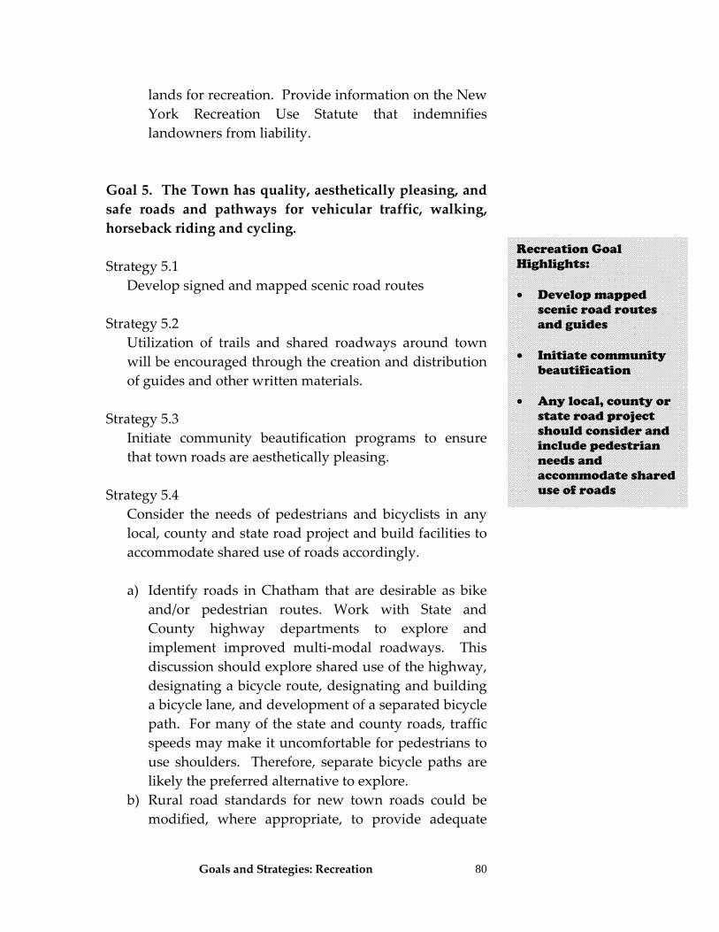
Goals and Strategies: Recreation
80
lands for recreation. Provide information on the New York Recreation Use Statute that indemnifies landowners from liability.
Goal 5. The Town has quality, aesthetically pleasing, and safe roads and pathways for vehicular traffic, walking, horseback riding and cycling. Strategy 5.1 Develop signed and mapped scenic road routes Strategy 5.2 Utilization of trails and shared roadways around town
will be encouraged through the creation and distribution of guides and other written materials.
Strategy 5.3 Initiate community beautification programs to ensure
that town roads are aesthetically pleasing. Strategy 5.4 Consider the needs of pedestrians and bicyclists in any
local, county and state road project and build facilities to accommodate shared use of roads accordingly.
a) Identify roads in Chatham that are desirable as bike
and/or pedestrian routes. Work with State and County highway departments to explore and implement improved multi‐modal roadways. This discussion should explore shared use of the highway, designating a bicycle route, designating and building a bicycle lane, and development of a separated bicycle path. For many of the state and county roads, traffic speeds may make it uncomfortable for pedestrians to use shoulders. Therefore, separate bicycle paths are likely the preferred alternative to explore.
b) Rural road standards for new town roads could be modified, where appropriate, to provide adequate
Recreation Goal Highlights: • Develop mapped
scenic road routes and guides
• Initiate community beautification
• Any local, county or
state road project should consider and include pedestrian needs and accommodate shared use of roads
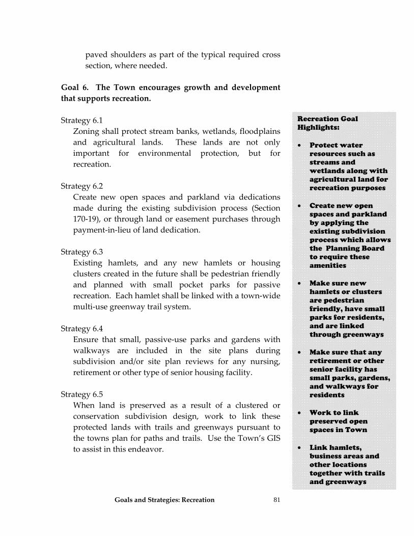
Goals and Strategies: Recreation
81
paved shoulders as part of the typical required cross section, where needed.
Goal 6. The Town encourages growth and development that supports recreation. Strategy 6.1 Zoning shall protect stream banks, wetlands, floodplains
and agricultural lands. These lands are not only important for environmental protection, but for recreation.
Strategy 6.2 Create new open spaces and parkland via dedications
made during the existing subdivision process (Section 170‐19), or through land or easement purchases through payment‐in‐lieu of land dedication.
Strategy 6.3 Existing hamlets, and any new hamlets or housing
clusters created in the future shall be pedestrian friendly and planned with small pocket parks for passive recreation. Each hamlet shall be linked with a town‐wide multi‐use greenway trail system.
Strategy 6.4 Ensure that small, passive‐use parks and gardens with
walkways are included in the site plans during subdivision and/or site plan reviews for any nursing, retirement or other type of senior housing facility.
Strategy 6.5 When land is preserved as a result of a clustered or
conservation subdivision design, work to link these protected lands with trails and greenways pursuant to the towns plan for paths and trails. Use the Town’s GIS to assist in this endeavor.
Recreation Goal Highlights: • Protect water
resources such as streams and wetlands along with agricultural land for recreation purposes
• Create new open
spaces and parkland by applying the existing subdivision process which allows the Planning Board to require these amenities
• Make sure new
hamlets or clusters are pedestrian friendly, have small parks for residents, and are linked through greenways
• Make sure that any
retirement or other senior facility has small parks, gardens, and walkways for residents
• Work to link
preserved open spaces in Town
• Link hamlets,
business areas and other locations together with trails and greenways
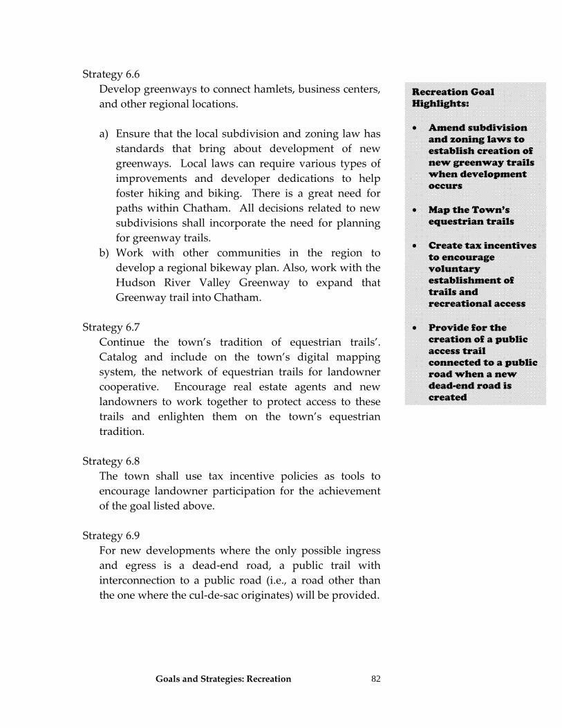
Goals and Strategies: Recreation
82
Strategy 6.6 Develop greenways to connect hamlets, business centers,
and other regional locations.
a) Ensure that the local subdivision and zoning law has standards that bring about development of new greenways. Local laws can require various types of improvements and developer dedications to help foster hiking and biking. There is a great need for paths within Chatham. All decisions related to new subdivisions shall incorporate the need for planning for greenway trails.
b) Work with other communities in the region to develop a regional bikeway plan. Also, work with the Hudson River Valley Greenway to expand that Greenway trail into Chatham.
Strategy 6.7 Continue the town’s tradition of equestrian trails’.
Catalog and include on the town’s digital mapping system, the network of equestrian trails for landowner cooperative. Encourage real estate agents and new landowners to work together to protect access to these trails and enlighten them on the town’s equestrian tradition.
Strategy 6.8 The town shall use tax incentive policies as tools to
encourage landowner participation for the achievement of the goal listed above.
Strategy 6.9 For new developments where the only possible ingress
and egress is a dead‐end road, a public trail with interconnection to a public road (i.e., a road other than the one where the cul‐de‐sac originates) will be provided.
Recreation Goal Highlights: • Amend subdivision
and zoning laws to establish creation of new greenway trails when development occurs
• Map the Town’s
equestrian trails • Create tax incentives
to encourage voluntary establishment of trails and recreational access
• Provide for the
creation of a public access trail connected to a public road when a new dead-end road is created
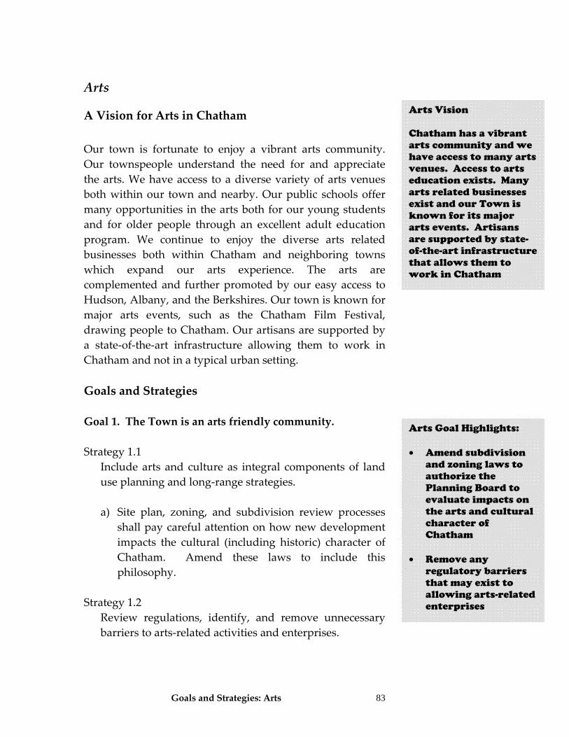
Goals and Strategies: Arts 83
Arts
A Vision for Arts in Chatham Our town is fortunate to enjoy a vibrant arts community. Our townspeople understand the need for and appreciate the arts. We have access to a diverse variety of arts venues both within our town and nearby. Our public schools offer many opportunities in the arts both for our young students and for older people through an excellent adult education program. We continue to enjoy the diverse arts related businesses both within Chatham and neighboring towns which expand our arts experience. The arts are complemented and further promoted by our easy access to Hudson, Albany, and the Berkshires. Our town is known for major arts events, such as the Chatham Film Festival, drawing people to Chatham. Our artisans are supported by a state‐of‐the‐art infrastructure allowing them to work in Chatham and not in a typical urban setting. Goals and Strategies Goal 1. The Town is an arts friendly community. Strategy 1.1 Include arts and culture as integral components of land
use planning and long‐range strategies.
a) Site plan, zoning, and subdivision review processes shall pay careful attention on how new development impacts the cultural (including historic) character of Chatham. Amend these laws to include this philosophy.
Strategy 1.2 Review regulations, identify, and remove unnecessary
barriers to arts‐related activities and enterprises.
Arts Vision Chatham has a vibrant arts community and we have access to many arts venues. Access to arts education exists. Many arts related businesses exist and our Town is known for its major arts events. Artisans are supported by state-of-the-art infrastructure that allows them to work in Chatham
Arts Goal Highlights: • Amend subdivision
and zoning laws to authorize the Planning Board to evaluate impacts on the arts and cultural character of Chatham
• Remove any regulatory barriers that may exist to allowing arts-related enterprises
Goals and Strategies: Arts
84
Strategy 1.3 Make cultural experiences accessible to the widest
possible public by removing economic, physical or other barriers to participation. Ensure that all public facilities are ADA (Americans with Disability Act) compliant.
Strategy 1.4 Develop programs that consider the interests and
diversity of the entire community. Strategy 1.5 Use marketing and signage to promote the arts and
culture to residents and visitors. Goal 2. Cooperation between the Town, local schools, private business owners, local artisans and arts related organizations creates quality opportunities for participating in and appreciating the arts. Strategy 2.1 Encourage non‐arts organizations, such as community
development groups, human services, and development organizations to sponsor arts and cultural venues, programs and events.
Strategy 2.2 Include artistic and cultural organizations, institutions
and businesses in any business recruitment and retention efforts in Chatham.
Strategy 2.3 Support development of a regional alliance with other
organizations to market and promote Chatham’s arts and cultural offerings.
Strategy 2.4 Support grant writing and actively seek funds for arts
and cultural programs.
Arts Goal Highlights: • Make sure that all
public facilities are compliant with the Americans with Disabilities Act
• Promote arts and culture through marketing and signage
• Encourage and
support non-arts organizations to sponsor art and cultural programs
• Support grant
writing and business recruitment programs that promote programs and economic development related to the arts
Goals and Strategies: Arts
85
Goal 3. The Town encourages growth and development that supports recreation, arts and our historical character. Strategy 3.1 Encourage non‐profit and private arts organizations to
work closely with historic preservation organizations to find ways to preserve historic structures for adaptive reuse in arts and culture.
Strategy 3.2 Promote transportation planning that increases access to
all locations in Chatham. Strategy 3.3 Establish a recreation and arts fee to be collected when
properties are developed. This fee must be dedicated to support recreational and arts activities in Chatham.
Goal 4. The arts programs within the Town provide high quality opportunities for education and cultural development for all ages. Strategy 4.1 The Town, Public Schools and other community
organizations collaborate to provide adequate facilities and after school programs for the arts.
Strategy 4.2 Assist in the development of partnerships that increases
exposure of students to arts and cultural activities. Strategy 4.3 The Town requires adequate parking for arts related
activities.
Arts Goal Highlights: • Encourage
collaboration between arts and historic preservation organizations to find ways to reuse old buildings for arts and cultural activities
• Establish a per lot fee when properties are subdivided to help fund recreation and arts programs in Town
• Collaborate with
schools and other organizations provide facilities and arts related programs
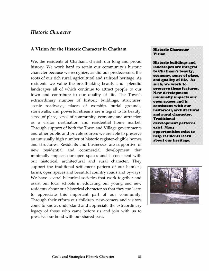
Goals and Strategies: Historic Character 86
Historic Character
A Vision for the Historic Character in Chatham We, the residents of Chatham, cherish our long and proud history. We work hard to retain our community’s historic character because we recognize, as did our predecessors, the roots of our rich rural, agricultural and railroad heritage. As residents we value the breathtaking beauty and splendid landscapes all of which continue to attract people to our town and contribute to our quality of life. The Town’s extraordinary number of historic buildings, structures, scenic roadways, places of worship, burial grounds, stonewalls, and powerful streams are integral to its beauty, sense of place, sense of community, economy and attraction as a visitor destination and residential home market. Through support of both the Town and Village governments and other public and private sources we are able to preserve an unusually high number of historic register‐eligible homes and structures. Residents and businesses are supportive of new residential and commercial development that minimally impacts our open spaces and is consistent with our historical, architectural and rural character. They support the traditional settlement pattern of our hamlets, farms, open spaces and beautiful country roads and byways. We have several historical societies that work together and assist our local schools in educating our young and new residents about our historical character so that they too learn to appreciate this important part of our community. Through their efforts our children, new‐comers and visitors come to know, understand and appreciate the extraordinary legacy of those who came before us and join with us to preserve our bond with our shared past.
Historic Character Vision Historic buildings and landscapes are integral to Chatham’s beauty, economy, sense of place, and quality of life. As such, we work to preserve these features. New development minimally impacts our open spaces and is consistent with our historical, architectural and rural character. Traditional development patterns exist. Many opportunities exist to help residents learn about our heritage.
Goals and Strategies: Historic Character
87
What is Historic Character? This term describes the individual or collective qualities and attributes of Chatham’s physical and visual landscape that embody or evoke the events, places, traditions, struggles, fashions, movements, and personalities of its past. Historic character also describes the unique architectural style and scale, including color, proportion, form, and architectural detail. Unique to each community, historic character provides a modern resident or visitor connections to the past life and narrative of the community as well as conveying its unique role within the regional context. However, the physical layout of the community, its landscape patterns, the pre‐automobile network of roads, and other elements also contribute strongly to Chatham’s historic character. Among these elements are active agricultural operations with low density residential development interspersed with denser population centers such as the hamlets and village, roads and windbreaks lined with old mature trees, stone walls, deep rural setbacks, and small/irregular field or pasture dimensions. Specifically, Chatham’s historic character is strengthened by the presence of historic farmhouses, barns and out‐buildings from the periods of its settlement by Dutch farmers in the 1700’s, its growth into an established farm community during the early 1800’s, the founding and expansion of Shaker settlements in and around New Lebanon from the end of the 18th through the first half of the 19th century, and its heyday as both a farm and commercial center under the influence of the railroads during the second half of the 19th century. Chatham’s historic character is also boosted by the presence of sites or qualities related to the following NY State and Federal Historic Register listed properties: Riders Mills Historic District, James Van Valkenburgh House, Taconic State Parkway, Spangler Bridge, Knollcroft, 303 Kinderhook Lane, John S. Williams House & Farm, Wilbor House, and Peck House.
Goals and Strategies: Historic Character
88
Goals and Strategies Goal 1. Growth and development is consistent with our historic character.
Strategy 1.1 Include historical character in the Site Plan review section
of Zoning. Significantly strengthen Section 180‐17 to specifically require that the Planning Board review proposals for compatibility with historical character of the neighborhood (especially in the hamlet), and provide standards for that review.
a) Create an Architectural and Historic Advisory
Review Council to act in an advisory capacity to the code and zoning enforcement officer, Planning Board, Zoning Board of Appeals, and Town Board. Similar in function to the Conservation Advisory Council (Section 134 of the Chatham Code), the town shall clearly define the role and procedures for this council.
b) Require exterior building design standards for
commercial uses to ensure they are consistent with the traditional and historical character of the area.
Strategy 1.2 Amend zoning dimension requirements for hamlets so
that lot sizes and setbacks match the historic development patterns in that hamlet. Hamlet development standards shall be different from that in the Rural Land districts.
Strategy 1.3 Amend zoning to allow for establishment of very long
setbacks and use of flag lots (as long as specific standards are met) to protect scenic or historic resources. See also
Historic Character Goal Highlights: • Amend the site plan
review law to include a process and standards that ensure new development is compatible with historic character of the area
• Create an
architecture and historic advisory council to act as an advisor to town staff and boards on these topics
• Establish exterior
building design standards for new commercial uses
• Amend zoning so
that hamlet lot sizes and dimensions match the historic patterns of each hamlet
Goals and Strategies: Historic Character
89
Housing subcommittee goals and strategies for discussion of Rural Siting Standards13.
Strategy 1.4
Consider historic character during subdivision review.
Strategy 1.5 For publicly funded projects that come before the
Planning Board, ZBA or Town Board, ensure that the Historic Preservation Field Services Bureau of the State Historic Preservation Office is involved in project review. This review process ensures that historic preservation is considered in the planning of publicly funded projects.
Strategy 1.6 Understand and use all State and federal laws that can
help Chatham protect historic resources. These include Section 106 of the National Historic Preservation Act of 1966 which directs federal agencies to consider historic resources in their project planning. New York State has a parallel law for state agencies in Section 14.09 of the State Preservation Act of 1980. In the future, should the Town enact a local historic district law, it should consider applying for Certified Local Government Status.
Strategy 1.7 Ensure that the impact on historic character, landscapes,
and structures is evaluated for all projects that are subject to SEQRA.
13 Refer to the following resources for Rural Standard Guidelines which shall be inclusive of hamlet structures, accessory apartments, secondary and ECHO dwellings and rural residential and details standards for siting and design guidelines. Additionally, see Land use subcommittee strategies. Resources: 1) Kendig, L. Too Big, Boring, or Ugly:Planning and Design Tools to Combat Monotony, the Too-Big House, and Teardowns. American Planning Association, 2004. 2) Stolzenburg, N. Town of Berne Hamlet Design Guidelines. Draft October 2003. 3) Town of Warwick: A Manual of Design Guidelines, 2002. 4) Arendt, R. Crossroads, Hamlet, Village, Town: Design Characteristics of Traditional Neighborhoods, Old and New. American Planning Association, 1999.
Historic Character Goal Highlights: • Allow for use of very
long setbacks and controlled use of flag lots to preserve scenic roads and historic landscapes
• Consider historic
character when subdividing
• Involve the State
Historic Preservation Office when publicly funded projects come for approval
• Use existing
applicable State and federal laws to help protect historic resources
• Apply for Certified
Local Government status should Chatham ever enact a local historic district law
• During any SEQRA
process, evaluate impacts of projects on our historic character
•
Goals and Strategies: Historic Character
90
Strategy 1.8 Encourage adaptive reuse of historic buildings to retain
historic character. Consider creation of a revolving restoration loan fund, building façade improvement grants, and tax incentives to assist owners in improving historic properties.
Strategy 1.9 Zoning should specifically allow conversion of buildings
to new uses as a specially permitted use, rather than promote demolition of existing buildings. Site plan review and special use permit review processes should ensure that historic character is retained when a structure is adaptively reused.
Strategy 1.10 Land use regulations should define a historic property as
a main structure, out‐buildings, stone walls, mill remnants, rail road beds, barns, etc.
Strategy 1.11 Add a new zoning section controlling demolition in the
Hamlet to not only help protect historic structures, but to ensure that no hazards, safety concerns, or aesthetic impacts to historic and other neighborhood resources result. This new language shall endeavor to preserve those structures listed or eligible for listing as a historic structure. Reference either an updated town historic inventory to identify the historic status of a structure. If such an inventory does not exist, establish a standard stating that demolition of any structure over 125 years would be reviewed by the Town. Demolition review shall also concentrate on safety, and shall require a special use permit for demolition when the structure is within 30 feet of an adjacent structure.
As an alternative, Chatham can consider adopting a local
historic district law that would require establishment of a historic review commission. The historic review commission could recommend and administer
Historic Character Goal Highlights: • Consider incentives
and incorporate land use regulatory methods that encourage reuse of historic buildings
• Define historic
structure in local land use laws
• Amend zoning to
establish controls on demolition in the hamlets
• Consider adopting a
local historic district law that establishes a historic review commission
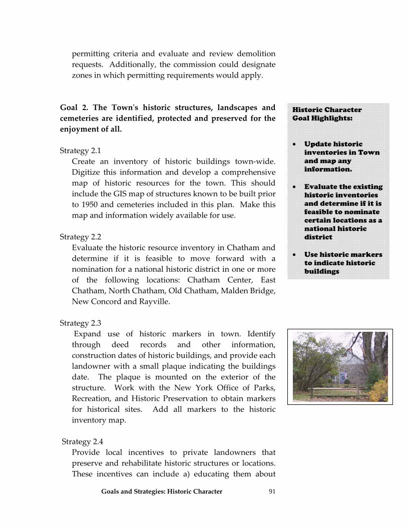
Goals and Strategies: Historic Character
91
permitting criteria and evaluate and review demolition requests. Additionally, the commission could designate zones in which permitting requirements would apply.
Goal 2. The Townʹs historic structures, landscapes and cemeteries are identified, protected and preserved for the enjoyment of all. Strategy 2.1 Create an inventory of historic buildings town‐wide.
Digitize this information and develop a comprehensive map of historic resources for the town. This should include the GIS map of structures known to be built prior to 1950 and cemeteries included in this plan. Make this map and information widely available for use.
Strategy 2.2 Evaluate the historic resource inventory in Chatham and
determine if it is feasible to move forward with a nomination for a national historic district in one or more of the following locations: Chatham Center, East Chatham, North Chatham, Old Chatham, Malden Bridge, New Concord and Rayville.
Strategy 2.3 Expand use of historic markers in town. Identify
through deed records and other information, construction dates of historic buildings, and provide each landowner with a small plaque indicating the buildings date. The plaque is mounted on the exterior of the structure. Work with the New York Office of Parks, Recreation, and Historic Preservation to obtain markers for historical sites. Add all markers to the historic inventory map.
Strategy 2.4 Provide local incentives to private landowners that
preserve and rehabilitate historic structures or locations. These incentives can include a) educating them about
Historic Character Goal Highlights: • Update historic
inventories in Town and map any information.
• Evaluate the existing
historic inventories and determine if it is feasible to nominate certain locations as a national historic district
• Use historic markers
to indicate historic buildings
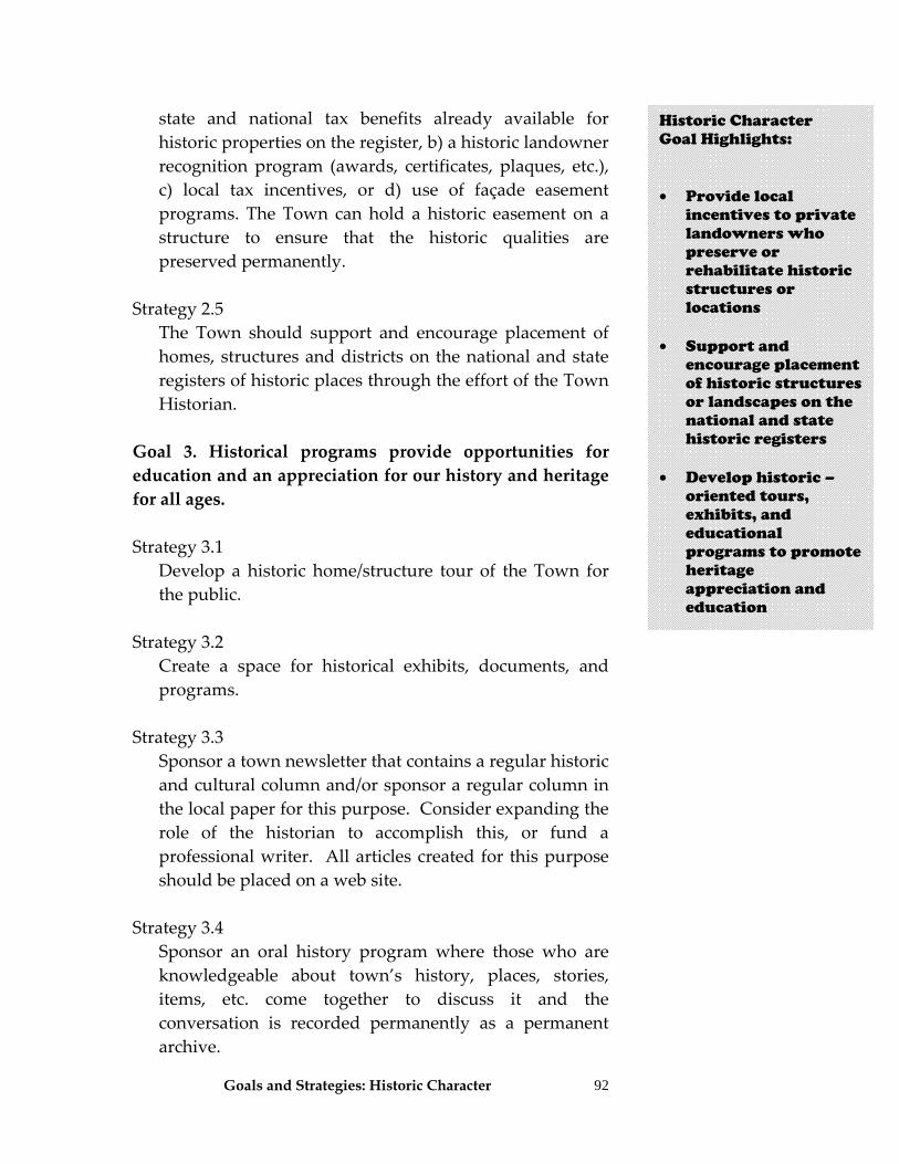
Goals and Strategies: Historic Character
92
state and national tax benefits already available for historic properties on the register, b) a historic landowner recognition program (awards, certificates, plaques, etc.), c) local tax incentives, or d) use of façade easement programs. The Town can hold a historic easement on a structure to ensure that the historic qualities are preserved permanently.
Strategy 2.5 The Town should support and encourage placement of
homes, structures and districts on the national and state registers of historic places through the effort of the Town Historian.
Goal 3. Historical programs provide opportunities for education and an appreciation for our history and heritage for all ages. Strategy 3.1 Develop a historic home/structure tour of the Town for
the public. Strategy 3.2 Create a space for historical exhibits, documents, and
programs. Strategy 3.3 Sponsor a town newsletter that contains a regular historic
and cultural column and/or sponsor a regular column in the local paper for this purpose. Consider expanding the role of the historian to accomplish this, or fund a professional writer. All articles created for this purpose should be placed on a web site.
Strategy 3.4 Sponsor an oral history program where those who are
knowledgeable about town’s history, places, stories, items, etc. come together to discuss it and the conversation is recorded permanently as a permanent archive.
Historic Character Goal Highlights: • Provide local
incentives to private landowners who preserve or rehabilitate historic structures or locations
• Support and
encourage placement of historic structures or landscapes on the national and state historic registers
• Develop historic –
oriented tours, exhibits, and educational programs to promote heritage appreciation and education
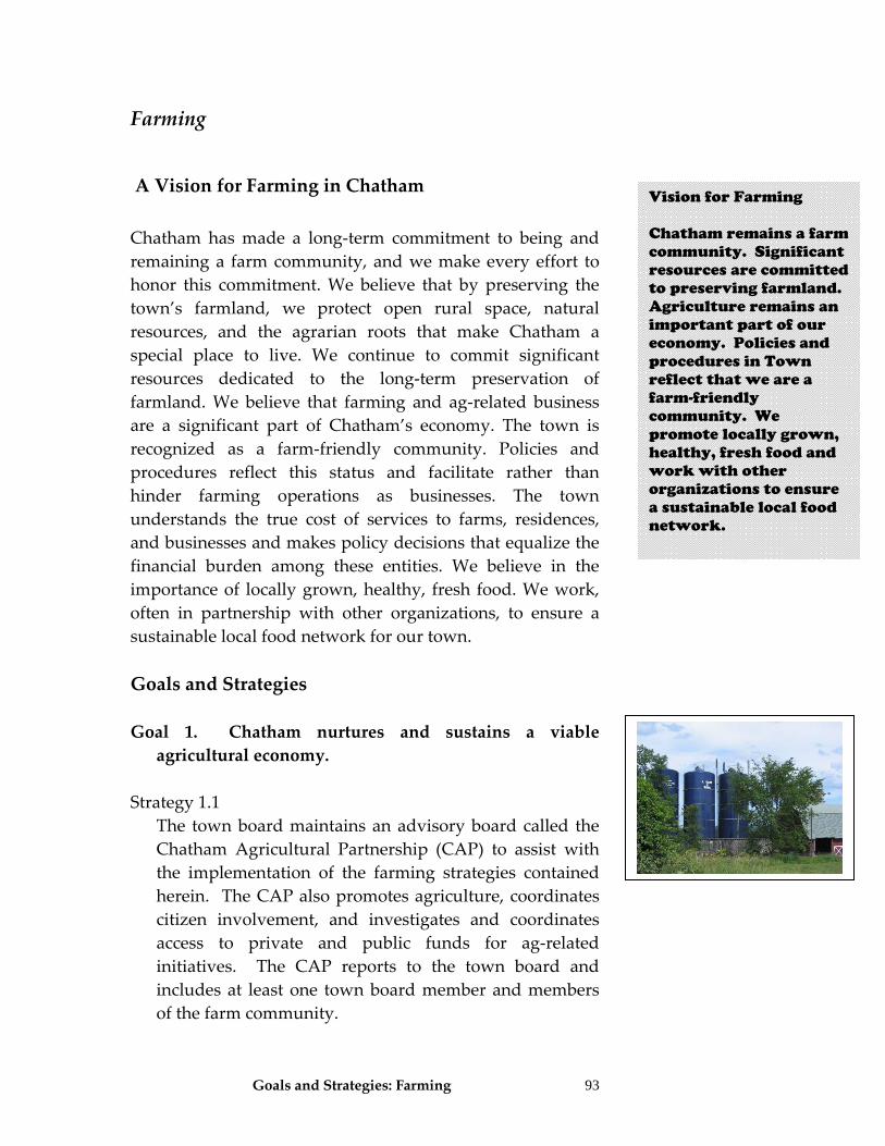
Goals and Strategies: Farming 93
Farming
A Vision for Farming in Chatham Chatham has made a long‐term commitment to being and remaining a farm community, and we make every effort to honor this commitment. We believe that by preserving the town’s farmland, we protect open rural space, natural resources, and the agrarian roots that make Chatham a special place to live. We continue to commit significant resources dedicated to the long‐term preservation of farmland. We believe that farming and ag‐related business are a significant part of Chatham’s economy. The town is recognized as a farm‐friendly community. Policies and procedures reflect this status and facilitate rather than hinder farming operations as businesses. The town understands the true cost of services to farms, residences, and businesses and makes policy decisions that equalize the financial burden among these entities. We believe in the importance of locally grown, healthy, fresh food. We work, often in partnership with other organizations, to ensure a sustainable local food network for our town. Goals and Strategies Goal 1. Chatham nurtures and sustains a viable agricultural economy.
Strategy 1.1
The town board maintains an advisory board called the Chatham Agricultural Partnership (CAP) to assist with the implementation of the farming strategies contained herein. The CAP also promotes agriculture, coordinates citizen involvement, and investigates and coordinates access to private and public funds for ag‐related initiatives. The CAP reports to the town board and includes at least one town board member and members of the farm community.
Vision for Farming Chatham remains a farm community. Significant resources are committed to preserving farmland. Agriculture remains an important part of our economy. Policies and procedures in Town reflect that we are a farm-friendly community. We promote locally grown, healthy, fresh food and work with other organizations to ensure a sustainable local food network.
Goals and Strategies: Natural Resources
94
Strategy 1.2 The CAP shall facilitate a mutually beneficial relationship between farmers and landowners to promote stability in the agricultural economy.
a) Disseminate a model lease, economic data, and other
relevant information on the Keep Farming website. b) Create mechanisms, including the website, to help
interested farmers and landowners find each other and enter into relationships that are mutually beneficial.
c) Promote agricultural assessments with landowners and farmers. Increase the number of farmers and landowners participating in the current ag assessment program and work to provide accurate information, methods, and techniques on the program requirements.
d) Promote ways to engage, educate, and recognize landowners on an ongoing basis to reinforce their understanding of and commitment to their role in the local farming community.
e) Encourage farmers to serve on the County Industrial Development Agency, the Chamber of Commerce, any local economic development committee that forms, as well as on various town boards and committees.
f) Provide easy linkage between the town website and the Keep Farming website and/or put some of the material on both sites.
g) 2/3’s of Chatham’s farmland is used for dairy farming, a sector at high risk. The town should strive to achieve a “zero net loss” of active farmland by providing assistance for those interested in transitioning into new types of farming and those interested in entering farming.
h) Look for opportunities to help farmers take advantage of diversifying their farming operations and catering to niche markets. The town shall support the development of small, niche farms.
Farming Goal Highlights: • Maintain the
Chatham Agricultural Partnership (CAP) to assist in implementing farm-related strategies
• CAP will be the
expert resource in Town for farmers and farmland owners for model leases, education on farming and farmland protection programs, farm diversification programs, studies, promotion of regional farmland programs, etc
• Strive for a zero net
loss policy of farmland (promote new if existing is lost)
Goals and Strategies: Natural Resources
95
i) Provide information on the website to help farmers seek assistance in diversification efforts.
j) The CAP could work with a) an interested dairy farmer; or b) someone interested in entering farming; or c) someone who owns a large tract of land who wishes to convert to agricultural use to secure funding for a feasibility study to determine the best way to convert the active farmland to a different, more economically healthy agricultural option.
k) Support the use of a Purchase of Development Rights (PDR) program to provide working capital for farming conversions and transitions. This includes a) supporting applications for state PDR funds in conjunction with individual farms and the Columbia Land Conservancy; and b) generating funds for a dedicated Farmland Preservation Fund at the town level.
l) Act with other towns in the Hudson Valley to promote a regional farming agenda and to enhance the town’s ability to impact issues such as farm policies, taxes, and enhanced funding for agricultural issues.
m) As part of regional activism, place a high priority on getting the State to apply agricultural exemptions to both land and buildings as long as the land is being farmed.
n) Leverage the capabilities of local organizations to act in areas of mutual interest.
o) Encourage town assessors to seek special training about the assessment of farm structures to ensure that farm building assessments are fair and accurate.
p) Investigate and consider establishing additional tax incentive programs for farms at the local and regional levels.
q) Implement land use management policies that support the economic viability of farm operations.
r) Review existing land use patterns and ensure that the NYS agricultural district designation is applicable to most working farmland.
Farming Goal Highlights: • Support Purchase of
Development Rights programs (PDR) and generate funds for a Farmland Preservation Fund in Town
• Work with the State
to apply agricultural exemptions to both land and building as long as the land is farmed
• Work to have Town
assessors receive special training in farm assessments
• Consider additional
local tax incentives for farmers
• Work with the
County to review NYS Ag District boundaries so that they apply to most working farmland in Chatham
Goals and Strategies: Natural Resources
96
s) Ensure that zoning is “farm friendly” and allows a variety of agricultural uses and permits other uses that are consistent with farming operations and meet the requirements of being in a NYS agricultural district. Use the NYS Agricultural and Markets guidelines to: 1. Ensure that definitions in land use regulations are
consistent with state guidelines. 2. Review and make any modifications needed to the
zoning use schedule. Ensure that the schedule is flexible and permits a wide range of farm‐related businesses, including bed and breakfasts, pick‐your‐own businesses, farm stands, and a variety of agri‐tourism operations.
3. Remove any barriers to farm operations, such as minimum acreages, as long as public health requirements are met.
4. Modify the site review plan procedures for farm‐related operations to align with the NYS model for ag site plans.
t) Ensure that zoning allows accessory uses to agriculture such as veterinarians, equipment and supply dealers, feed milling, etc.
u) Allow non‐farm businesses on a farm property that are compatible with farm businesses, based on the following considerations: 1. The use will be of a nature, intensity, scope, size,
appearance, type and quantity conforming to the existing personal or agricultural structures.
2. New commercial buildings will be located in a way that minimizes significant adverse impact on future operations and expansion of agricultural uses and does not interfere with current agricultural operations or displace farm storage, use, or functions. Whenever possible, new buildings shall be placed on or adjacent to the existing footprint.
Farming Goal Highlights: • Amend zoning so
that it is farm-friendly. This should include allowing a wide variety of uses related to agriculture, having definitions consistent with State guidelines, removal of barriers to farm operations, and adding a modified site plan review process similar to the NYS model
• Allow compatible
non-farm businesses on farm properties to help farms diversify
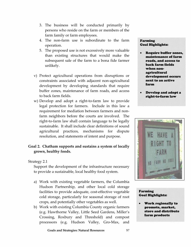
Goals and Strategies: Natural Resources
97
3. The business will be conducted primarily by persons who reside on the farm or members of the farm family or farm employees.
4. The non‐farm use is subordinate to the farm operation.
5. The proposed use is not excessively more valuable than existing structures that would make the subsequent sale of the farm to a bona fide farmer unlikely.
v) Protect agricultural operations from disruptions or constraints associated with adjacent non‐agricultural development by developing standards that require buffer zones, maintenance of farm roads, and access to back farm fields.
w) Develop and adopt a right‐to‐farm law to provide legal protection for farmers. Include in this law a requirement for mediation between farmers and non‐farm neighbors before the courts are involved. The right‐to‐farm law shall contain language to be legally sustainable. It shall include clear definitions of sound agricultural practices, mechanisms for dispute resolution, and statements of intent and purpose.
Goal 2. Chatham supports and sustains a system of locally grown, healthy foods.
Strategy 2.1 Support the development of the infrastructure necessary to provide a sustainable, local healthy food system.
a) Work with existing vegetable farmers, the Columbia
Hudson Partnership, and other local cold storage facilities to provide adequate, cost‐effective vegetable cold storage, particularly for seasonal storage of root crops, and potentially other vegetables as well.
b) Work with existing Columbia County organic farmers (e.g. Hawthorne Valley, Little Seed Gardens, Miller’s Crossing, Roxbury and Threshold) and compost processors (e.g. Hudson Valley, Gro‐Max, and
Farming Goal Highlights: • Require buffer zones,
maintenance of farm roads, and access to back farm fields when non-agricultural development occurs next to an active farm
• Develop and adopt a
right-to-farm law
Farming Goal Highlights: • Work regionally to
promote, market, store and distribute farm products
Goals and Strategies: Natural Resources
98
McEnroe) to ensure the availability of sufficient bulk compost for organic farming.
c) Support local food retail and distribution facilities through advertising and community education campaigns.
d) Continue to use the brand for “Chatham Grown” products.
e) Act with other towns in the Hudson Valley to help form partnerships that enhance the ability of Chatham farmers to store, package, market, and distribute local products more effectively.
Goal 3. Chatham is a “farm friendly” town.
Strategy 3.1 Work with the Town Board to establish an identity consistent with the town’s vision for agriculture.
a) The town to pass a declaration proclaiming that we
are a “farm friendly” community. b) The town to place signs on major entry points to
Chatham saying, “Welcome to Chatham: A Farm Friendly Community.”
c) Increase understanding of the town board, planning board, and ZBA on the range of farmland protection techniques that are available for their use.
d) Use the New York State Agricultural District designation that covers much of the town (8,371 acres) to protect farms and farming.
1. Promote agricultural assessments for all eligible
landowners. 2. Promote understanding of the requirements and
benefits of being an agricultural district with farmers, landowners, residents, and elected officials.
3. Review Agricultural District maps for the Town. Identify farm properties that should be included in the Agricultural District. Review farm protection measures available through inclusion in
Farming Goal Highlights: • Continue the
“Chatham Grown” products
• Provide training to
the Town Board, Planning Board and ZBA members on farmland protection techniques available
• More effectively use
the NYS Agricultural Districts program to protect our farms and farmlands by promoting ag assessments, promoting people’s understanding of the program, keeping the district maps up-to-date, and comply with all NYS Ag and Markets laws related to the Ag District program (25-aa)
Goals and Strategies: Natural Resources
99
an Agricultural District. Work with interested landowners to submit proposals to the county government and the county agricultural and farmland protection board.
4. The town shall review policies and make amendments where necessary to ensure compliance with relevant Ag and Market laws.
5. The Planning Board or ZBA shall carefully evaluate the impacts of any project being reviewed and subject to SEQRA in an agricultural district. This shall be done for any project within the agricultural district and within 500’ of the boundary of the district. Develop a review process for the Planning Board and/or ZBA to use to enhance their evaluation of projects and their impact on agriculture. Subdivisions proposed within 500 feet of working or active farmland and parcels which receive an agricultural exemption (as determined by town assessor), shall be required to provide an Agricultural Impact Statement (AIS), similar to those statements required by section 305(4)(b) of the Agricultural and Markets Law, Article 25AA and related sections. This would provide the Planning Board with additional information on the potential impacts of the proposed development on existing agricultural operations.
6. This review process could that include the following steps:
a) Determine the existing farming conditions to
ensure the proposed land uses do not conflict with these farming activities.
b) Ensure the proposal complies with the town’s comprehensive plan and zoning documents and is in accordance with other town laws regarding land development.
c) Assess any significant adverse impact, including:
Farming Goal Highlights: • The Planning Board
and ZBA shall carefully evaluate impacts of any project being reviewed on area farms
• Develop a review
process for the Planning Board and ZBA to use to help in their evaluation of impacts on agriculture
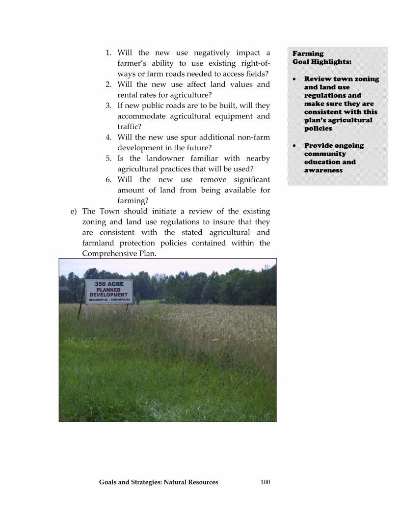
Goals and Strategies: Natural Resources
100
1. Will the new use negatively impact a farmer’s ability to use existing right‐of‐ways or farm roads needed to access fields?
2. Will the new use affect land values and rental rates for agriculture?
3. If new public roads are to be built, will they accommodate agricultural equipment and traffic?
4. Will the new use spur additional non‐farm development in the future?
5. Is the landowner familiar with nearby agricultural practices that will be used?
6. Will the new use remove significant amount of land from being available for farming?
e) The Town should initiate a review of the existing zoning and land use regulations to insure that they are consistent with the stated agricultural and farmland protection policies contained within the Comprehensive Plan.
Farming Goal Highlights: • Review town zoning
and land use regulations and make sure they are consistent with this plan’s agricultural policies
• Provide ongoing
community education and awareness
Goals and Strategies: Natural Resources
101
Goal 4. Community awareness of the importance of agriculture in Chatham is promoted.
Strategy 4.1 Provide ongoing community education and awareness.
a) Educate residents about cost of services and the value
of having land in farm production. b) Educate residents about the importance of agriculture
to the town’s economy. c) Building permits for ag districts shall include a
disclosure statement to be signed. d) Work with realtors to educate people moving to
Chatham about what living in an agricultural district means. Sellers of land, buyers of land, and real estate agents must be made aware of the disclosure requirements of AML Article 25‐AA, Section 310. The town shall ensure that this is done.
Goal 5. By protecting farmland, Chatham preserves property values, stabilizes property taxes, and maintains the attractiveness and unique rural character of the community.
Strategy 5.1 Preserve as much of the town’s remaining active farmland as possible through a multi‐pronged strategy:
a) Encourage voluntary conservation easements,
especially on parcels of land used for agriculture but not owned by farmers. Partner with the Columbia Land Conservancy and similar organizations to promote and support these efforts.
b) Partner with the Columbia Land Conservancy and similar organizations to encourage term easements as a way to an alternative way to conserve land.
c) Investigate and consider joining conservation easements (permanent or term) with a tax incentive.
d) The town shall create a long‐range Community Preservation Plan for the town that uses innovative
Farming Goal Highlights: • Encourage voluntary
use of conservation easements, especially those farmlands not owned by farmers
• Work with the
Columbia Land Conservancy
• Consider joining use
of conservation easements to protect farmlands with a local tax incentive
• Develop a PDR or
LDR (leased) with willing landowners to protect high priority farmlands
• Use GIS mapping to
monitor development patterns, and to identify critical farmlands
• Provide local
incentives to private landowners who preserve or rehabilitate historic structures or locations
Goals and Strategies: Natural Resources
102
land use management policies to keep agricultural land open and available for farming in the future while respecting the current landowner’s financial position and rights. The Plan shall use the Farmland Prioritization criteria and rankings developed by the Chatham Agricultural Partnership and included in this plan to prioritize requests for PDR or LDR funding.
e) Continue to use GIS mapping to identify and overlay prime agricultural soils, active farms, Agricultural Districts, zoning within farming areas, etc. Monitor county and local infrastructure plans and development patterns for possible impact to agriculture.
f) Develop a PDR or LDR program with willing landowners on lands identified by the Chatham Agricultural Partnership and included in this plan as being the highest priority land to preserve. The town shall create a PDR/LDR program where the non‐agricultural rights of important farmland are purchased from landowners on a voluntary basis by a non‐profit conservation organization such as the Columbia Land Conservancy or other similar organizations. Land preserved this way is permanently protected through deed restrictions. In addition to preserving land for agricultural use, a PDR program will offer other advantages, such as:
1. Be structured as long‐term installment purchases
to leverage PDR funds. 2. Be used to lease development rights in order to
provide short‐term protection while other conservation funds are sought.
3. Provide capital to farmers interested in expanding or converting their business operations in some way.
4. Provide capital to new farmers. 5. Protects farmland while keeping it in private
ownership and on the tax rolls.
Farming Goal Highlights: • Fund the PDR
program through bonds, real estate transfer tax, or grants
Goals and Strategies: Natural Resources
103
6. The PDR program could be funded through some type of bond and the monies could be used to seek matching funds. The town could submit a bond proposal to the public to generate funds specifically for the preservation of farmland, based on the criteria developed by the Chatham Keep Farming Land Team and incorporated into this comprehensive plan.
a. The Chatham Agricultural Partnership (CAP)
could be authorized to move the process forward, including seeking funds and contracting to complete a fiscal analysis. The town could contract with an entity that specializes in PDR bond financing to assist the town in the technical requirements of issuing a bond.
b. The monies generated through the bond referendum would be used principally for the purchase of developments rights (PDR) while keeping the leasing of development rights (LDR) as an option to help the town buy time and stabilize its farmland base while farmers expand, diversity, or transfer their operations.
c. The town shall petition the State to take actions consistent with those in the proposed Community Preservation Act that allow the town to create a 2% real estate transfer fee locally. This action requires the town to pass a local law and voter referendum to create a program where home buyers would pay a one‐time fee up to 2% of the purchase price above the median home value in Columbia County for the purpose of farmland protection. In the short‐term, the money generated by this fee could be leveraged to obtain state, federal, and private funds for a PDR program; in the long‐term the money could be used to fund the debt service on bond.
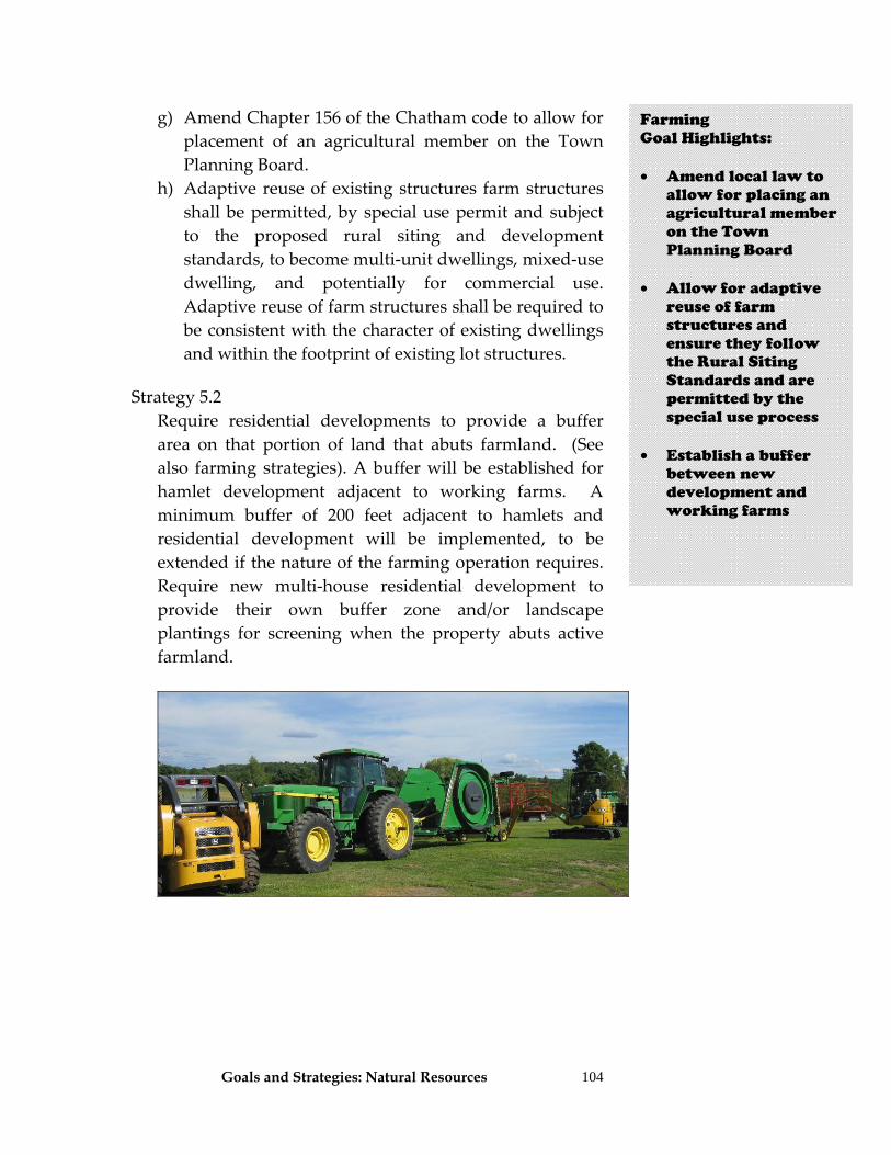
Goals and Strategies: Natural Resources
104
g) Amend Chapter 156 of the Chatham code to allow for placement of an agricultural member on the Town Planning Board.
h) Adaptive reuse of existing structures farm structures shall be permitted, by special use permit and subject to the proposed rural siting and development standards, to become multi‐unit dwellings, mixed‐use dwelling, and potentially for commercial use. Adaptive reuse of farm structures shall be required to be consistent with the character of existing dwellings and within the footprint of existing lot structures.
Strategy 5.2
Require residential developments to provide a buffer area on that portion of land that abuts farmland. (See also farming strategies). A buffer will be established for hamlet development adjacent to working farms. A minimum buffer of 200 feet adjacent to hamlets and residential development will be implemented, to be extended if the nature of the farming operation requires. Require new multi‐house residential development to provide their own buffer zone and/or landscape plantings for screening when the property abuts active farmland.
Farming Goal Highlights: • Amend local law to
allow for placing an agricultural member on the Town Planning Board
• Allow for adaptive
reuse of farm structures and ensure they follow the Rural Siting Standards and are permitted by the special use process
• Establish a buffer
between new development and working farms
Goals and Strategies: Natural Resources 105
Natural Resources
A Vision for Natural Resources in Chatham The Town of Chatham is rich in natural resources. Its residents and visitors respect and protect those natural resources: land, water, air, wildlife, rural character, scenic views, and its mineral, groundwater, and surface water rights. Those resources, in addition to Chatham’s people, are an essential part of why residents choose Chatham for their primary and secondary homes and are appreciated by those who visit here. Protection and wise management of those Natural Resources through preservation of natural habitats, careful management of land/water resources, and preservation of existing agricultural lands is a mandate for the Town and its residents. The Town and its Comprehensive Plan supports preservation of those resources and assure that they are considered in all other things it recommends. Goals and Strategies Goal 1. The Town of Chatham includes natural resource considerations, costs, and benefits in all of its policies, programs, and regulations. Strategy 1.1 A comprehensive State Environmental Quality Review
(SEQRA) process shall be undertaken for all actions subject to this review law.
a) Consider establishing a local Type I list of actions that
the Town feels are likely to have significant impacts on the community to be sure that they are subject to a comprehensive environmental review.
b) All board members shall receive training in SEQRA in order to maximize the effectiveness of this law.
Natural Resources Vision Chatham respects and protects its land, water, air, wildlife, rural character, scenic views, minerals, groundwater, and surface waters so that they remain an essential part of our Town. Protection and wise management of these resources is a mandate for the Town and its residents. Natural resources protection is considered in all aspects of Town decision making.
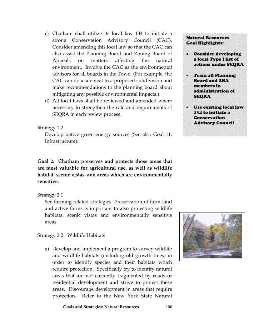
Goals and Strategies: Natural Resources
106
c) Chatham shall utilize its local law 134 to initiate a strong Conservation Advisory Council (CAC). Consider amending this local law so that the CAC can also assist the Planning Board and Zoning Board of Appeals on matters affecting the natural environment. Involve the CAC as the environmental advisors for all boards in the Town. (For example, the CAC can do a site visit to a proposed subdivision and make recommendations to the planning board about mitigating any possible environmental impacts.)
d) All local laws shall be reviewed and amended where necessary to strengthen the role and requirements of SEQRA in each review process.
Strategy 1.2 Develop native green energy sources (See also Goal 11,
Infrastructure). Goal 2. Chatham preserves and protects those areas that are most valuable for agricultural use, as well as wildlife habitat, scenic vistas, and areas which are environmentally sensitive. Strategy 2.1
See farming related strategies. Preservation of farm land and active farms is important to also protecting wildlife habitats, scenic vistas and environmentally sensitive areas.
Strategy 2.2 Wildlife Habitats
a) Develop and implement a program to survey wildlife and wildlife habitats (including old growth trees) in order to identify species and their habitats which require protection. Specifically try to identify natural areas that are not currently fragmented by roads or residential development and strive to protect these areas. Discourage development in areas that require protection. Refer to the New York State Natural
Natural Resources Goal Highlights: • Consider developing
a local Type I list of actions under SEQRA
• Train all Planning
Board and ZBA members in administration of SEQRA
• Use existing local law
134 to initiate a Conservation Advisory Council
Goals and Strategies: Natural Resources
107
Heritage Program definitions of rare and critical species and habitats for this purpose.
1. Participate in the wildlife inventory program such
as the one sponsored by Hudsonia. 2. The CAC (discussed above) shall take a lead role
in coordinating the inventory effort. This group shall involve the public in a significant way to complete this inventory. They shall also involve DEC and Natural Heritage staff and resources.
3. Map all inventoried resources on the town’s GIS and utilize this information during project review. (See all maps contained in Part II.)
b) During site plan review and subdivision development
review for projects throughout Town, map and seek to protect important wildlife habitats (as defined by New York State Natural Heritage Program or other similar programs.) Ensure that site plan, subdivision and other town laws authorize the Planning Board to review projects for effective site planning related to wildlife and wildlife habitats.
1. Maintain buffers between areas dominated by
human activities and important wildlife habitats. 2. Provide for parcels of land that are as large and
contiguous as possible and maintain connectivity between these sites to preserve wildlife habitats.
3. Minimize habitat alterations during construction and manage vegetation to enhance habitats to mimic natural features.
c) Provide special protection for smaller wetland
habitats including vernal pools that are important for avian, amphibian, and reptilian species as well as rare or threatened plants. Smaller wetlands would include all of those already regulated by the NYDEC as well as those regulated by EPA and Corps of Engineers wetlands regulations. They are usually classified according to their plant species, soils, and
Natural Resources Goal Highlights: • During site plan
review and subdivision processes, applicants shall map important wildlife habitats and require protection of those areas through buffers, siting, and minimize alterations
• Protect smaller
wetlands, including vernal pools
Natural Resources Goal Highlights: • Conduct a wildlife
and wildlife habitat survey and work to protect critical areas
• Participate in the
biodiversity inventory program sponsored by Hudsonia
• Have the CAC take a
lead role in coordinating wildlife inventory work
• Map all information
on the Town’s GIS
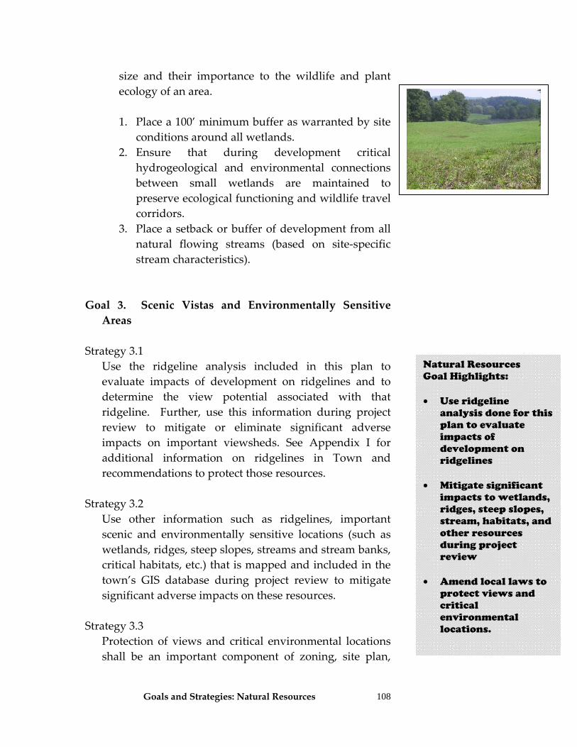
Goals and Strategies: Natural Resources
108
size and their importance to the wildlife and plant ecology of an area.
1. Place a 100’ minimum buffer as warranted by site
conditions around all wetlands. 2. Ensure that during development critical
hydrogeological and environmental connections between small wetlands are maintained to preserve ecological functioning and wildlife travel corridors.
3. Place a setback or buffer of development from all natural flowing streams (based on site‐specific stream characteristics).
Goal 3. Scenic Vistas and Environmentally Sensitive Areas
Strategy 3.1 Use the ridgeline analysis included in this plan to
evaluate impacts of development on ridgelines and to determine the view potential associated with that ridgeline. Further, use this information during project review to mitigate or eliminate significant adverse impacts on important viewsheds. See Appendix I for additional information on ridgelines in Town and recommendations to protect those resources.
Strategy 3.2 Use other information such as ridgelines, important
scenic and environmentally sensitive locations (such as wetlands, ridges, steep slopes, streams and stream banks, critical habitats, etc.) that is mapped and included in the town’s GIS database during project review to mitigate significant adverse impacts on these resources.
Strategy 3.3 Protection of views and critical environmental locations
shall be an important component of zoning, site plan,
Natural Resources Goal Highlights: • Use ridgeline
analysis done for this plan to evaluate impacts of development on ridgelines
• Mitigate significant impacts to wetlands, ridges, steep slopes, stream, habitats, and other resources during project review
• Amend local laws to
protect views and critical environmental locations.
Goals and Strategies: Natural Resources
109
and subdivision review processes. Develop other regulatory controls to protect critical scenic areas:
a) Consider use of a density bonus for those landowners/developers who voluntarily protect important views on their property.
c) All water bodies, streams, wetlands, and other critical environmental locations in Chatham shall be excluded from the land area used by an applicant in the calculation of permitted densities for construction. This is a net density approach. (See also and Appendix E).
d) During site plan review, applications shall be required to demonstrate the impact of proposed building and landscaping on neighboring properties. The Planning Board shall be authorized to place conditions on approvals to mitigate significant adverse impacts to viewsheds.
e) Clustering and/or conservation subdivision layouts shall be utilized to protect scenic views.
f.) It is recommended the Planning Board visit and view properties before any Planning Board decision is made regarding that property and area. This shall be incorporated into the review procedures of the Planning Board.
g) Amend zoning sign controls to more effectively regulate height, placement, lighting and landscaping of signs. Also consider adding design standards or guidelines for signs and billboards.
h) Incorporate natural vegetation and native plants during development to maintain and blend in with rural character and views.
i) Consider implementing alternative or flexible setbacks to protect viewsheds.
j) Consider establishing additional regulations for erosion and sediment control when building on slopes in excess of 15% or 20%.
k) Amend subdivision law to require establishment of building envelopes on the subdivision plat and use criteria designed to minimize visual impacts, prevent
Natural Resources Goal Highlights: • Local Laws can help
protect critical environmental locations by using density bonuses, net acreage, evaluation and mitigation of impacts to viewsheds, clustering, conservation subdivisions, sign controls, use of natural vegetation for landscaping, setback requirements, minimizing construction on steep slopes, and careful siting of structures and disturbance
Goals and Strategies: Natural Resources
110
erosion, promote fire prevention and safety, and preserve significant vegetation, if present. The envelope would include site disturbances of the structure, accessory structures, utilities, services, drainage areas and septic fields.
l) Consider the effects of “light pollution” from developments, especially those located high on ridges. All night lighting (dusk to dawn automatic) is probably unnecessary.
m) Identify and prioritize vistas and consider long and short views from public roads and places, historic character, use of underground wires, lighting standards, cell and wind tower placement, and views of ridgeline (see Ridgeline Identification maps) during project review.
Strategy 3.4 Chatham should consider other permanent ways to
preserve important locations and scenic views including fee simple purchases (land owned free and clear), easements and purchase of development rights programs or a leaseback arrangement where the land is purchased by the town from a willing landowner and then leased back, subject to certain restrictions for management of the scenic (or other) resources.
Strategy 3.5 Develop non‐regulatory programs to protect scenic
locations such as:
a) A Chatham Landscape Field Guide illustrating and describing the component parts of the towns rural landscape, developing an interpretive tour guide for local roads, and developing roadside viewing pull offs.
b) Develop a property owner’s guide that provides information to people who own land with scenic resources on how to make changes to their property in keeping with the visual character of the area. This
Natural Resources Goal Highlights: • Amend local laws to
control light pollution
• Identify and
prioritize scenic vistas and work to protect these areas when development occurs
• Establish other
permanent protections of critical resources through land purchases, use of easements, and development rights programs with willing owners
• Develop non-
regulatory programs to protect scenic locations
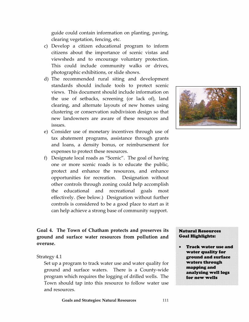
Goals and Strategies: Natural Resources
111
guide could contain information on planting, paving, clearing vegetation, fencing, etc.
c) Develop a citizen educational program to inform citizens about the importance of scenic vistas and viewsheds and to encourage voluntary protection. This could include community walks or drives, photographic exhibitions, or slide shows.
d) The recommended rural siting and development standards should include tools to protect scenic views. This document should include information on the use of setbacks, screening (or lack of), land clearing, and alternate layouts of new homes using clustering or conservation subdivision design so that new landowners are aware of these resources and issues.
e) Consider use of monetary incentives through use of tax abatement programs, assistance through grants and loans, a density bonus, or reimbursement for expenses to protect these resources.
f) Designate local roads as “Scenic”. The goal of having one or more scenic roads is to educate the public, protect and enhance the resources, and enhance opportunities for recreation. Designation without other controls through zoning could help accomplish the educational and recreational goals most effectively. (See below.) Designation without further controls is considered to be a good place to start as it can help achieve a strong base of community support.
Goal 4. The Town of Chatham protects and preserves its ground and surface water resources from pollution and overuse. Strategy 4.1 Set up a program to track water use and water quality for
ground and surface waters. There is a County‐wide program which requires the logging of drilled wells. The Town should tap into this resource to follow water use and resources.
Natural Resources Goal Highlights: • Track water use and
water quality for ground and surface waters through mapping and analyzing well logs for new wells
Goals and Strategies: Natural Resources
112
a) Consider having a local requirement for filing of well
logs so that information is readily available for water evaluations. Periodically obtain well logs that may be filed at the County to have that data available as well. When this data becomes available, it can be mapped and evaluated by a geologist or hydrogeologist to help you determine any ground or surface water issues that need to be incorporated into future planning. This is one of the easiest ways to obtain valuable information on ground water resources.
Strategy 4.2 Ensure that development meets DEC stormwater
discharge regulations and that town personnel are properly trained on an on‐going basis related to these regulations.
Strategy 4.3 It shall be a policy of the town to ensure that stormwater
runoff rate after development does not exceed the rate that existed prior to the site being developed. Maintain and strengthen drainage improvement language in the Subdivision law, as follows: Consider placing impervious surface limits, and building retention and detention ponds, swales, and infiltration devices. All site plans and major subdivisions shall incorporate soil erosion and sediment control programs.
Strategy 4.4 Consider implementing Low Impact Development (LID)
standards in subdivision and zoning to reduce the volume of runoff and improve water quality by preserving the natural hydrology of a site. Some of the methods of LID are:
a) Where soil permeability is minimal, or where lot sizes
are small, require driveways to be constructed of pervious materials (concrete pavers or crushed stone, for example) and recommend it in other areas.
Natural Resources Goal Highlights: • New development
must meet DEC stormwater discharge regulations and programs
• Minimize impacts of
stormwater discharges and institute local land use practices so that water runoff rate after development is not different from the rate that existed prior to disturbance
• Consider using Low
Impact Development standards in subdivision and zoning
Goals and Strategies: Natural Resources
113
b) Clarify existing zoning use of “lot occupancy total” and instead establish a maximum impervious surface ratio for new development (number of acres of impervious surface divided by the total site area). This usually ranges from 30 to 50%.
c) New road standards, adopted by the Town in a highway law, shall allow for construction of narrower roads (20 to 22 feet).
d) Utilize clustering or conservation subdivision design to keep floodplains and highly erodible areas free from development.
e) Apply setback standards to protect waterways from erosion and water‐quality degradation due to runoff caused by development.
h) Use cisterns for rainwater capture and reuse, and bio‐retention techniques.
Strategy 4.5 Provide educational materials on drainage and water
quality to all who seek a building permit for constructing a new home. Use the list already developed by DEC.
Strategy 4.6 Ensure that all highway personnel receive training on the
state and federal stormwater regulations as they are updated to minimize impact of road building and maintenance activities.
Strategy 4.7 Implement Best Management Practices as soon as
possible after road construction or maintenance activities (use hydro‐seeding or other approved methods) to re‐vegetate areas left bare. (See also strategies related to Infrastructure,)
Strategy 4.8 The Town Highway Department shall develop a plan,
subject to available funding, to remediate ditches in poor condition as these can contribute high levels of sedimentation to the towns’ waterways.
Natural Resources Goal Highlights: • Hand out educational
materials on drainage and water quality whenever a building permit is issued for new homes
• Implement best
management practices for new road construction or maintenance work
• Train highway
personnel about the state and federal stormwater regulations
Goals and Strategies: Natural Resources
114
Strategy 4.9 Encourage voluntary adoption of Best Management
Practices by farm operations and encourage participation in the federally sponsored Agricultural Environmental Management (AEM) program for farms.
Strategy 4.10 Ensure that reviewing boards are familiar with and
utilize the most recent version of the New York Standards and Specifications for Erosion and Sediment Control.
Strategy 4.11 During project review, provide applicants with a
stormwater pollution prevention plan checklist. This could be modeled after the sample provided in New York Standards and Specifications for Erosion and Sediment Control.
Strategy 4.12 Significantly strengthen site plan sections of zoning
related to site plan review so that standards and expectations for new development related to water quality are clearly detailed.
Strategy 4.13 Initiate a logging permit program. Strategy 4.14 Encourage people to take advantage of existing training
programs related to logging and timber programs. Strategy 4.15 Maintain current zoning regulations related to mining.
Natural Resources Goal Highlights: • Make management of
stormwater a critical action during any kind of development. Local laws should be amended to clarify all expectations and details for stormwater pollution prevention
• Initiate a logging
permit program • Maintain current
zoning regulations related to mining
Goals and Strategies: Natural Resources
115
Goal 5. Chatham is sensitive to and aware of local and regional air quality issues. Strategy 5.1 All actions subject to SEQRA shall be comprehensively
analyzed for impacts to air quality. Strategy 5.2 Adopt regulations that control outdoor furnaces. Strategy 5.3 Adopt prohibition to burn barrels. Goal 6. Chatham has regulations addressing outdoor lighting to limit its effects on neighboring properties and to reduce environmental glare from new commercial and residential building. Outdoor lights can have serious impacts to rural character and many people value dark skies. Strategy 6.1 Strengthen Outdoor Lighting, Section 180‐33(B). Develop
standards for outdoor lighting (e.g., sodium vapor) which limits lighting intensity and directs light downward to minimize glare.
Strategy 6.2 Create outdoor lighting standards specific to each of the
following: commercial, rural residential, and hamlet. Strategy 6.3 Reference use standards from professional lighting
associations such as International Dark‐Sky Association, New England Light Pollution Advisory Group, and Illumination Society of North America.
Strategy 6.4 Amend town code to address violations of over lighting
and strengthen zoning to ensure enforcement provisions are in place.
Natural Resources Goal Highlights: • Analyze project
impacts to air quality through the SEQR process
• Adopt outdoor
furnace regulations • Prohibit burn
barrels • Strengthen zoning’s
outdoor lighting controls to minimize light pollution
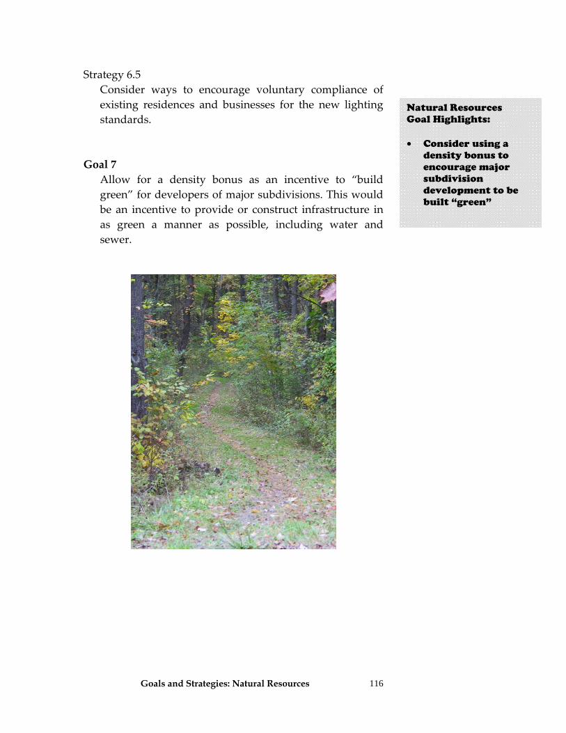
Goals and Strategies: Natural Resources
116
Strategy 6.5 Consider ways to encourage voluntary compliance of
existing residences and businesses for the new lighting standards.
Goal 7
Allow for a density bonus as an incentive to “build green” for developers of major subdivisions. This would be an incentive to provide or construct infrastructure in as green a manner as possible, including water and sewer.
Natural Resources Goal Highlights: • Consider using a
density bonus to encourage major subdivision development to be built “green”

Goals and Strategies: Implementing the Plan 117
Sustaining and Implementing the Plan This section outlines an action plan to implement the Comprehensive Plan’s recommendations over the next 10 to 15 years. To accomplish these tasks, leadership from the Town Board is critical, and it is that Board that has the ultimate responsibility to put this plan into action. Although the Town Board has the ultimate responsibility in implementing this plan, they will need assistance from various boards, agencies, and organizations for specific strategies recommended in the plan. The Town Board should begin implementation of the plan by establishing an annual “implementation work plan”. Some of the strategies recommended in this plan rely on other steps to be initiated before they can be successfully implemented. For example, grant or other funding should be in place first in order to fund an historic inventory. Another example would be that an inventory and analysis of viewsheds would need to be completed before a scenic view overlay district would be set up. Thus, certain strategies could be considered to be “enabling” for other strategies. These “enabling” strategies include those related to finding funding or funding sources, creation of committees and lining up the organizational structure to support plan implementation, inventory and analysis of resources in a more detailed manner, and initiation of other planning efforts such as the Capital Improvement Plan. The following goals and strategies offer additional insight, ideas, and steps that the Town Board can put to work to ensure that this plan is sustained and implemented over time.
Putting the Plan into Action • Provide ongoing
Town Board leadership
• Establish and annual
implementation work plan
• Some strategies need
to be done before others, such as finding funding or lining up committees to help
Goals and Strategies: Implementing the Plan
118
Goal 1. Chatham has well trained town officials that are supported with guidance documents and enforcement provisions to implement the Comprehensive Plan and local laws. Strategy 1.1 Evaluate, on an on‐going basis, the need for a full‐time
building code and zoning enforcement officer, whose duties include (for example) site inspections, and review of site layouts and the required development standards of the town law. The building code and enforcement officer will operate under the guidance and direction of town boards and councils.
Strategy 1.2 According to New York State Law, members of the
Zoning Board of Appeals, Planning Board require ongoing training. These groups, along with the Town Board as well as the building inspector shall be provided with on‐going training in new land use techniques, SEQRA, and legal procedures, and demonstrate established training requirements to remain on the board.
a) Consider adopting a local law requiring annual
training modeled after the NYS requirements. The Town Board shall establish minimum education training requirements.
Strategy 1.3 Have access to all relevant guidance documents available
for reference by the ZBA and Planning Board, especially those produced by the Department of Agriculture and Markets, Department of State, Department of Environmental Conservation, and the Town of Chatham.
Strategy 1.4 Amend zoning to provide the Planning Board and Town
Board with the authority to require performance bonds, escrow accounts, inspection fees and developer
Putting the Plan into Action • Consider the need for
a full-time building code and enforcement officer
• Provide for ongoing
training of Planning Board, ZBA, Town Board, and code enforcement officers in land use techniques, SEQR, etc.
• Have all documents
needed during project review (local laws, State guidelines, etc) available for use in Town Hall
• Amend zoning to
authorize performance bonds, escrow accounts, inspection fees, etc. so that applicants for development pay all costs associated with reviewing a project
Goals and Strategies: Implementing the Plan
119
agreements required for major subdivisions and non‐residential projects. Include a provision in local laws that require the developer to establish an escrow account so that the town can be reimbursed for costs related to review of a development. Similarly, zoning shall clearly authorize reviewing boards (Planning Board and Zoning Board of Appeals) to hire consultants and experts, which may be needed to complete a project review, the costs of which shall be borne by the developer.
Strategy 1.5 Develop and strengthen provisions for remedies for
failure to adhere to zoning ordinances and town laws. Goal 2. Enhance public participation. Strategy 2.1 To ensure adequate public participation, citizens shall
have electronic access to town documents (e.g., Comprehensive Plan, zoning regulations). Town codes shall be placed on a publicly accessible web site such as the Town of Chatham web site and ‘E‐Codes municipal codes on the internet’ (http://www.e‐codes.generalcode.com ) and updated in a timely fashion. All applications and related documents would be available for access on the Town web site.
Strategy 2.2 To aid in development of a review process having a high
level of public participation, require applicants to submit proposals electronically so that they can be posted on the town web site during the review process.
Strategy 2.3 Zoning shall include early public participation through a participatory design process. Zoning and subdivision laws shall be changed to require early community and public participation to have more substantial input early in a project review process and before decisions are
Putting the Plan into Action • Strengthen
violations, penalties and remedies in all local laws to enhance enforcement
• Make all town
documents available on the Town website, including applications before the ZBA or Planning Board
• Establish a public
participatory design process that goes beyond a simple hearing to involve the public in a positive manner early in the project review stage
Goals and Strategies: Implementing the Plan
120
made. It is critical that the reviewing board and applicant understand community concerns before detailed plans are submitted. This shall take place during the required sketch plan review process.
Goal 3. Chatham implements zoning that is consistent with the goals of the Comprehensive Plan. The Zoning Board of Appeals, and Planning and Town Boards use this comprehensive plan for interpretation and guidance during decision making. Chatham regularly updates its comprehensive plan. Strategy 3.1 Provide all board members (Town, Planning, and Zoning
Board of Appeals) with the current Comprehensive Plan and the town code.
Strategy 3.2 The Planning Board and Zoning Board of Appeals shall
conduct an annual review of the land use laws and make recommendations for potential changes to the Town Board.
Strategy 3.3 To ensure continuing relevance of the Comprehensive
Plan, the town shall adopt a local law requiring review of the Comprehensive Plan every five years and further the Town will make any required changes to local law reflecting the review. Additionally, the Town will conduct a town‐wide survey every 10‐years. The results of that review shall be completed and reported by the Town Board no later than 120 days following each five year anniversary of plan adoption. The Town Board shall develop an annual report on implementation progress for citizens.
Putting the Plan into Action • Provide all elected
and appointed officials with both the Town code and this plan
• The Planning Board
and ZBA shall make an annual review of the local land use laws and make recommendations on potential changes needed to improve them
• Review and update
this plan every five years and do another public survey every 10 years
• Develop an annual
report on progress made on this plan’s implementation to the public
• As a result of any
updates to this plan, make necessary changes to local laws
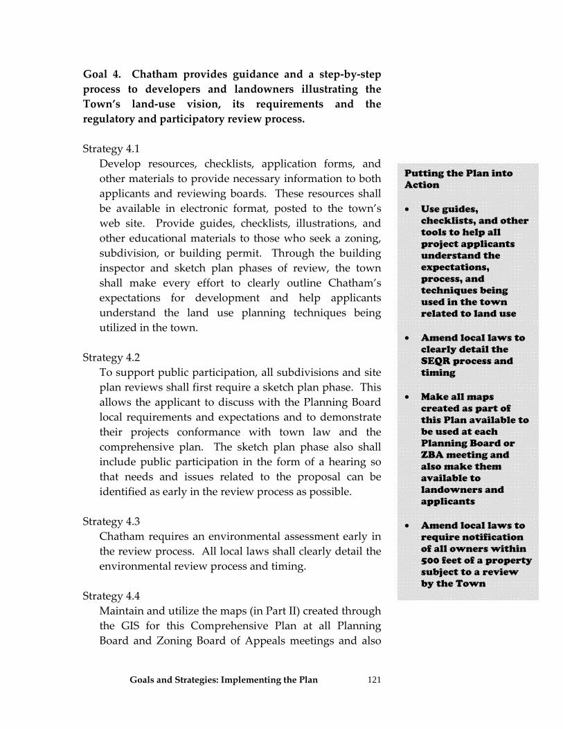
Goals and Strategies: Implementing the Plan
121
Goal 4. Chatham provides guidance and a step‐by‐step process to developers and landowners illustrating the Town’s land‐use vision, its requirements and the regulatory and participatory review process. Strategy 4.1
Develop resources, checklists, application forms, and other materials to provide necessary information to both applicants and reviewing boards. These resources shall be available in electronic format, posted to the town’s web site. Provide guides, checklists, illustrations, and other educational materials to those who seek a zoning, subdivision, or building permit. Through the building inspector and sketch plan phases of review, the town shall make every effort to clearly outline Chatham’s expectations for development and help applicants understand the land use planning techniques being utilized in the town.
Strategy 4.2 To support public participation, all subdivisions and site
plan reviews shall first require a sketch plan phase. This allows the applicant to discuss with the Planning Board local requirements and expectations and to demonstrate their projects conformance with town law and the comprehensive plan. The sketch plan phase also shall include public participation in the form of a hearing so that needs and issues related to the proposal can be identified as early in the review process as possible.
Strategy 4.3 Chatham requires an environmental assessment early in
the review process. All local laws shall clearly detail the environmental review process and timing.
Strategy 4.4 Maintain and utilize the maps (in Part II) created through
the GIS for this Comprehensive Plan at all Planning Board and Zoning Board of Appeals meetings and also
Putting the Plan into Action • Use guides,
checklists, and other tools to help all project applicants understand the expectations, process, and techniques being used in the town related to land use
• Amend local laws to clearly detail the SEQR process and timing
• Make all maps
created as part of this Plan available to be used at each Planning Board or ZBA meeting and also make them available to landowners and applicants
• Amend local laws to
require notification of all owners within 500 feet of a property subject to a review by the Town
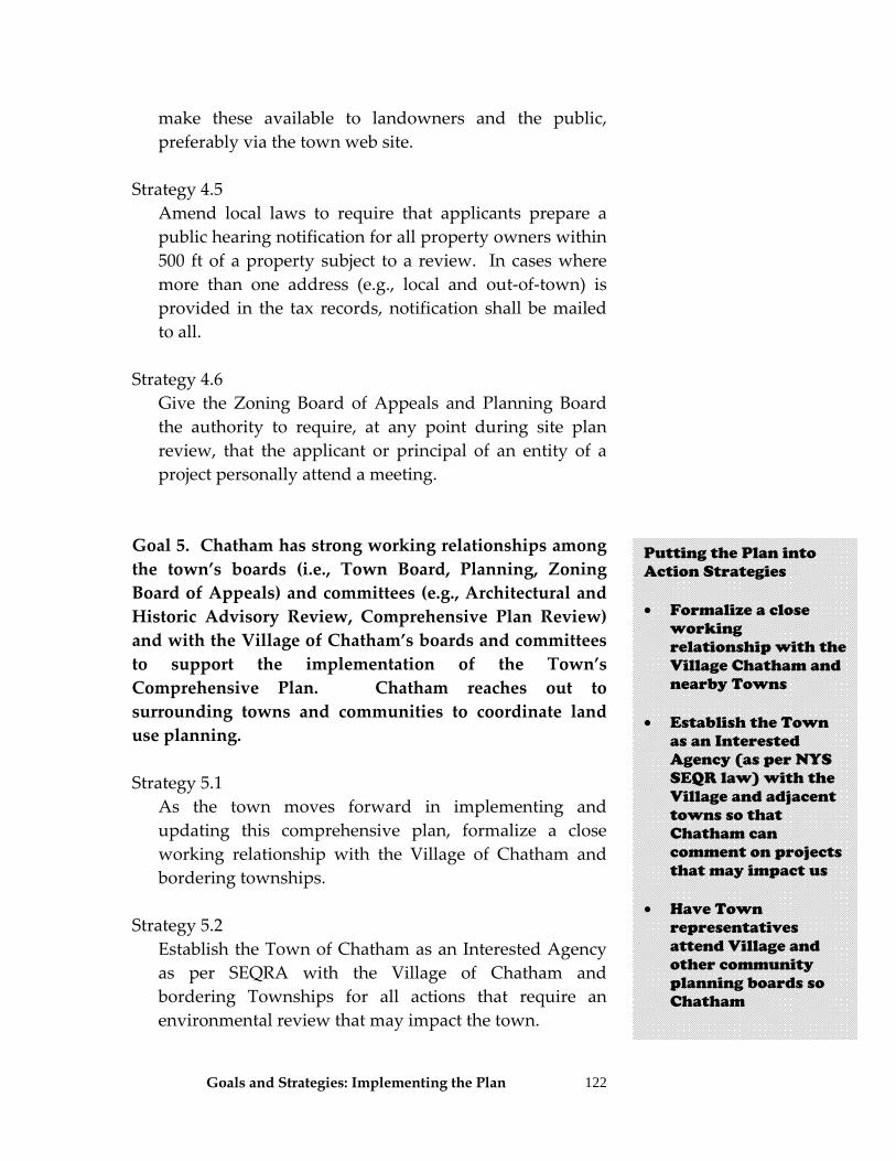
Goals and Strategies: Implementing the Plan
122
make these available to landowners and the public, preferably via the town web site.
Strategy 4.5 Amend local laws to require that applicants prepare a
public hearing notification for all property owners within 500 ft of a property subject to a review. In cases where more than one address (e.g., local and out‐of‐town) is provided in the tax records, notification shall be mailed to all.
Strategy 4.6 Give the Zoning Board of Appeals and Planning Board
the authority to require, at any point during site plan review, that the applicant or principal of an entity of a project personally attend a meeting.
Goal 5. Chatham has strong working relationships among the town’s boards (i.e., Town Board, Planning, Zoning Board of Appeals) and committees (e.g., Architectural and Historic Advisory Review, Comprehensive Plan Review) and with the Village of Chatham’s boards and committees to support the implementation of the Town’s Comprehensive Plan. Chatham reaches out to surrounding towns and communities to coordinate land use planning. Strategy 5.1 As the town moves forward in implementing and
updating this comprehensive plan, formalize a close working relationship with the Village of Chatham and bordering townships.
Strategy 5.2 Establish the Town of Chatham as an Interested Agency
as per SEQRA with the Village of Chatham and bordering Townships for all actions that require an environmental review that may impact the town.
Putting the Plan into Action Strategies • Formalize a close
working relationship with the Village Chatham and nearby Towns
• Establish the Town
as an Interested Agency (as per NYS SEQR law) with the Village and adjacent towns so that Chatham can comment on projects that may impact us
• Have Town
representatives attend Village and other community planning boards so Chatham
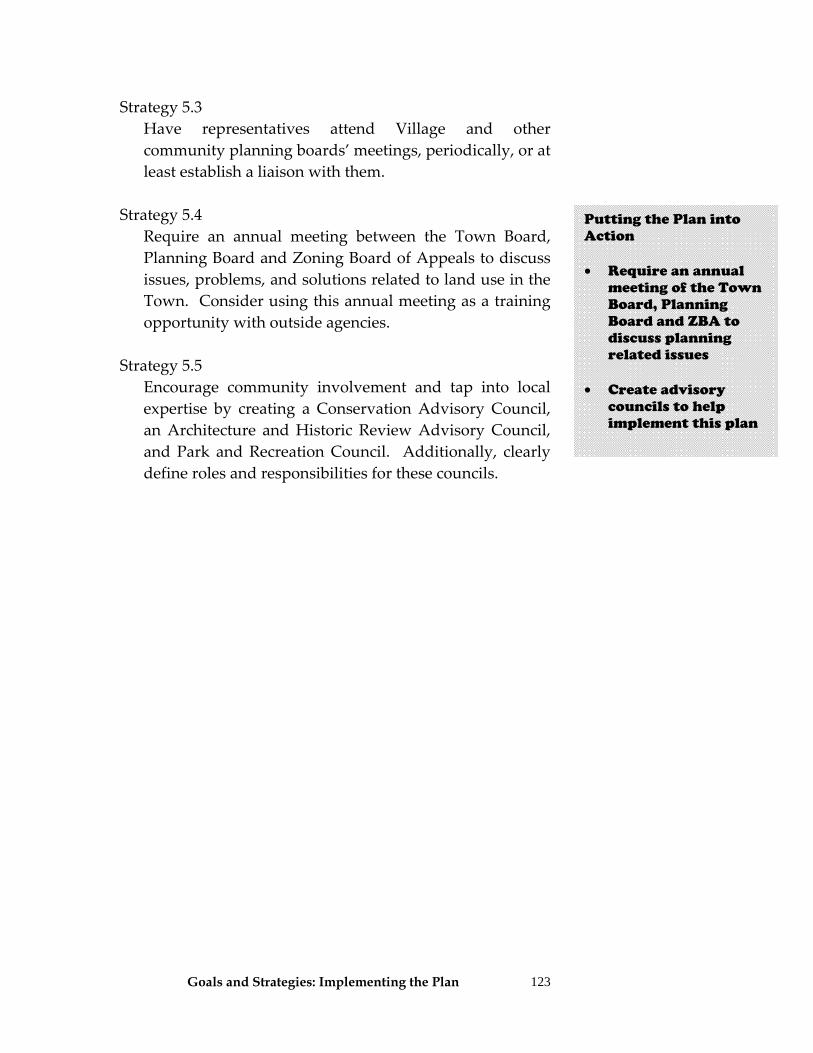
Goals and Strategies: Implementing the Plan
123
Strategy 5.3 Have representatives attend Village and other
community planning boards’ meetings, periodically, or at least establish a liaison with them.
Strategy 5.4 Require an annual meeting between the Town Board,
Planning Board and Zoning Board of Appeals to discuss issues, problems, and solutions related to land use in the Town. Consider using this annual meeting as a training opportunity with outside agencies.
Strategy 5.5 Encourage community involvement and tap into local
expertise by creating a Conservation Advisory Council, an Architecture and Historic Review Advisory Council, and Park and Recreation Council. Additionally, clearly define roles and responsibilities for these councils.
Putting the Plan into Action • Require an annual
meeting of the Town Board, Planning Board and ZBA to discuss planning related issues
• Create advisory
councils to help implement this plan
Goals and Strategies: Implementing the Plan
124
Prioritizing Strategies In addition to the “enabling” strategies and the sustaining strategies just listed above, it is important that the Town Board also have a tool to use to know which strategies in the Plan are of high priority. The following table is such a tool and shows high, medium, and low priority strategies. High priority strategies are those that should be implemented 1 to 3 years after plan adoption. Medium priority strategies are those that should be implemented 4 to 5 years after adoption. Low priority strategies are those that should be worked on after year 5. A note about “Rankings”: The table below has given each strategy a ranking on a scale of 1 to 5 by the Steering Committee, with 5 being the most important. The column labeled “Ranking” is simply the summation of all the rankings given to that strategy by the Steering Committee members. Thus, the higher the number, the more consensus there was among the Steering Committee that the strategy was of high priority. It is anticipated that the table below will serve as a checklist for the Town Board and their implementing committees to use during implementation.
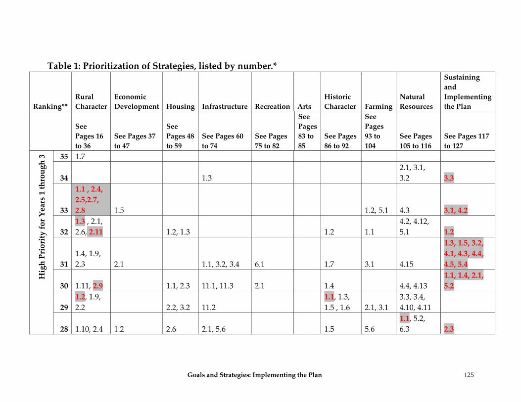
Goals and Strategies: Implementing the Plan 125
Table 1: Prioritization of Strategies, listed by number.*
Ranking** Rural Character
Economic Development Housing Infrastructure Recreation Arts
Historic Character Farming
Natural Resources
Sustaining and Implementing the Plan
See Pages 16 to 36
See Pages 37 to 47
See Pages 48 to 59
See Pages 60 to 74
See Pages 75 to 82
See Pages 83 to 85
See Pages 86 to 92
See Pages 93 to 104
See Pages 105 to 116
See Pages 117 to 127
High Priority for Years 1 through 3 35 1.7
34 1.3 2.1, 3.1, 3.2 3.3
33
1.1 , 2.4, 2.5,2.7, 2.8 1.5 1.2, 5.1 4.3 3.1, 4.2
32 1.3 , 2.1, 2.6, 2.11 1.2, 1.3 1.2 1.1
4.2, 4.12, 5.1 1.2
31 1.4, 1.9, 2.3 2.1 1.1, 3.2, 3.4 6.1 1.7 3.1 4.15
1.3, 1.5, 3.2, 4.1, 4.3, 4.4, 4.5, 5.4
30 1.11, 2.9 1.1, 2.3 11.1, 11.3 2.1 1.4 4.4, 4.13 1.1, 1.4, 2.1, 5.2
29 1.2, 1.9, 2.2 2.2, 3.2 11.2
1.1, 1.3, 1.5 , 1.6 2.1, 3.1
3.3, 3.4, 4.10, 4.11
28 1.10, 2.4 1.2 2.6 2.1, 5.6 1.5 5.6 1.1, 5.2, 6.3 2.3
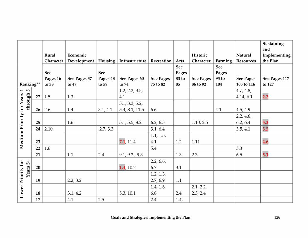
Goals and Strategies: Implementing the Plan
126
Ranking**
Rural Character
Economic Development Housing Infrastructure Recreation Arts
Historic Character Farming
Natural Resources
Sustaining and Implementing the Plan
See Pages 16 to 38
See Pages 37 to 47
See Pages 48 to 59
See Pages 60 to 74
See Pages 75 to 82
See Pages 83 to 85
See Pages 86 to 92
See Pages 93 to 104
See Pages 105 to 116
See Pages 117 to 127
Medium Priority for Years 4
through 5
27 1.5 1.3 1.2, 2.2, 3.5, 4.1
4.7, 4.8, 4.14, 6.1 2.2
26 2.6 1.4 3.1, 4.1 3.1, 3.3, 5.2, 5.4, 8.1, 11.5 6.6 4.1 4.5, 4.9
25 1.6 5.1, 5.5, 8.2 6.2, 6.3 1.10, 2.5 2.2, 4.6, 6.2, 6.4 5.3
24 2.10 2.7, 3.3 3.1, 6.4 3.5, 4.1 5.5
23 7.1, 11.4 1.1, 1.5, 4.1 1.2 1.11 4.6
22 1.6 5.4 5.3 21 1.1 2.4 9.1, 9.2 , 9.3 1.3 2.3 6.5 5.1
Lower Priority for
Years 5+
20 1.4, 10.2 2.2, 6.6, 6.7 3.1
19 2.2, 3.2 1.2, 1.3, 2.7, 6.9 1.1
18 3.1, 4.2 5.3, 10.1 1.4, 1.6, 6.8 2.4
2.1, 2.2, 2.3, 2.4
17 4.1 2.5 2.4 1.4,
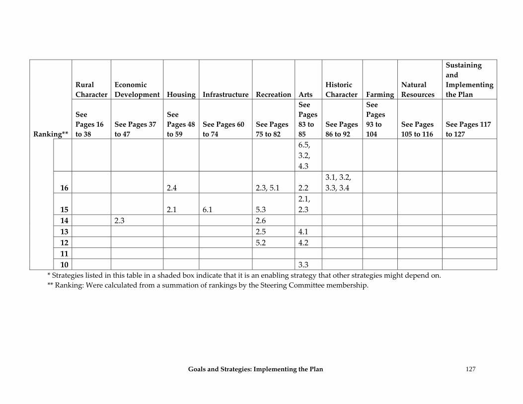
Goals and Strategies: Implementing the Plan
127
Ranking**
Rural Character
Economic Development Housing Infrastructure Recreation Arts
Historic Character Farming
Natural Resources
Sustaining and Implementing the Plan
See Pages 16 to 38
See Pages 37 to 47
See Pages 48 to 59
See Pages 60 to 74
See Pages 75 to 82
See Pages 83 to 85
See Pages 86 to 92
See Pages 93 to 104
See Pages 105 to 116
See Pages 117 to 127
6.5, 3.2, 4.3
16 2.4 2.3, 5.1 2.2 3.1, 3.2, 3.3, 3.4
15 2.1 6.1 5.3 2.1, 2.3
14 2.3 2.6 13 2.5 4.1 12 5.2 4.2 11 10 3.3
* Strategies listed in this table in a shaded box indicate that it is an enabling strategy that other strategies might depend on. ** Ranking: Were calculated from a summation of rankings by the Steering Committee membership.
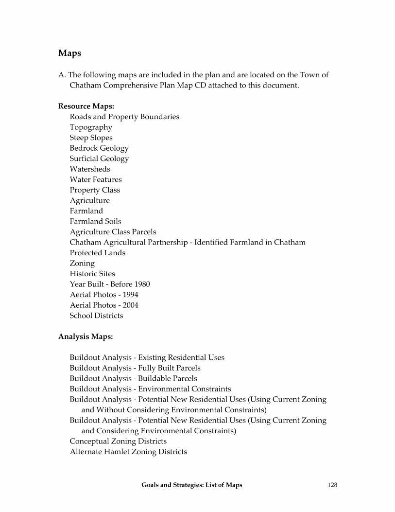
Goals and Strategies: List of Maps 128
Maps A. The following maps are included in the plan and are located on the Town of
Chatham Comprehensive Plan Map CD attached to this document. Resource Maps:
Roads and Property Boundaries Topography Steep Slopes Bedrock Geology Surficial Geology Watersheds Water Features Property Class Agriculture Farmland Farmland Soils Agriculture Class Parcels Chatham Agricultural Partnership ‐ Identified Farmland in Chatham Protected Lands Zoning Historic Sites Year Built ‐ Before 1980 Aerial Photos ‐ 1994 Aerial Photos ‐ 2004 School Districts
Analysis Maps:
Buildout Analysis ‐ Existing Residential Uses Buildout Analysis ‐ Fully Built Parcels Buildout Analysis ‐ Buildable Parcels Buildout Analysis ‐ Environmental Constraints Buildout Analysis ‐ Potential New Residential Uses (Using Current Zoning
and Without Considering Environmental Constraints) Buildout Analysis ‐ Potential New Residential Uses (Using Current Zoning
and Considering Environmental Constraints) Conceptual Zoning Districts Alternate Hamlet Zoning Districts
Goals and Strategies: List of Maps
129
Buildout Analysis Using Conceptual Zoning ‐ Potential New Residential Uses (Proposed Zoning without Considering Environmental Constraints)
Buildout Analysis Using Conceptual Zoning ‐ Potential New Residential Uses (Proposed Zoning Considering Environmental Constraints)
Buildout Analysis Using Conceptual Zoning ‐ Potential New Residential Uses (Proposed Zoning Using Environmental Control Formula)
Ranking for Prioritizing Agriculture Protection Efforts Draft Ridgeline Identification Ridgeline Aerial Photos Ridgeline Identification without Ranking