Embed Size (px)
Citation preview

A rkansas River Corridor
V I S I O N P L A N
Final Arkansas River Corridor Master Plan
Phase I Vision Plan August 2004
Prepared for:
Indian Nations Council of Governments 201 West 5th Street
Suite 600 Tulsa, Oklahoma 74103
Prepared by:
Carter & Burgess 5530 North Western Avenue
Oklahoma City, Oklahoma 73118 405.810.8254

Arkansas River 022413.001 Elements of Arkansas River Vision Plan 8/5/2004
rkansas River Corridor A V I S I O N P L A N Page 2 of 23
Carter & Burgess and the Indian Nations Council of Governments especially thanks the following people for their dedication to Tulsa County, its communities, and the Arkansas River Corridor Vision Plan:
Advisory Committee Chairs: Steering Committee Chairs: Don Walker, Arvest Bank Mayor Bill LaFortune, Tulsa Susan Neal, Tulsa City Councilor Commissioner Randi Miller, Tulsa County
Steve Turnbo and Jim Gipson of Schnake Turnbo and Frank, who were invaluable team members.
Purpose The intended purpose of this Vision Plan is to weave the ideas that are cooperatively supported by the community into a plan for the 42-mile river corridor. The elements of the Vision Plan will be tested for technical soundness in a subsequent phase of the Arkansas River Corridor Master Plan by others. That subsequent phase should examine the plan for fatal flaws that can drastically alter the intent and form of the plan. After that subsequent phase, either individual elements or entire phases of the river corridor will be implemented, depending upon their funding and complexity. The Vision Plan in general by its nature and scale, establishes the major framework in which future design consultant’s work will be undertaken. The key elements to the plan are shown on the accompanying graphic and are listed below. Refinement in subsequent phases will be required for each of the plan elements. When completed, the river improvements will be a complete, coherent, and vibrant system. Carter & Burgess was retained in November 2003 to provide these planning services to the Indian Nations Council of Governments. Their charge was:
To create a vision for the project area that would enhance the river and the citizens’ lives.
Engage in a public participation process to solicit consensus. Develop a Vision Plan that will be the basis for technical evaluation.
The work was undertaken in a series of efforts, each of which was based upon a series of public workshops and meetings to solicit and maintain consensus:
Base Mapping Inventory and Analysis Vision Plan Development
The overall process was funded locally through public and private partnerships, and was directed by INCOG. This process was largely completed by July 2004. Subsequent phases will be funded by multiple private and public sources, at the local, state, and federal levels.

Arkansas River 022413.001 Elements of Arkansas River Vision Plan 8/5/2004
rkansas River Corridor A V I S I O N P L A N Page 3 of 23
Design Process The design process began with mapping of existing conditions. An aerial photograph was provided by INCOG, and elements from past studies were included in the base information. Extensive site visits were performed throughout the corridor, with photography being the primary means of documentation. From the base map and the site visits, a site Inventory and Analysis was performed. The resulting graphics included 1 set of three Corridor Analysis plans and 1 set of three Transportation Analysis plans. These plans were presented during a series of 5 public information meetings throughout the river corridor, during which a survey regarding uses in the corridor was distributed. The input gathered from these meetings formed the programming basis for the development of the Vision Plan. The Vision Plan development began with a 3-day public workshop. Carter & Burgess brought a 3-person design team and worked on the master plan during the day. Each evening, the work products were displayed to the public, and feedback was gathered. Work ensued the next day, based upon the previous evening’s feedback. The work products from this 3-day workshop were then refined into the graphics that accompany this document. Due to the 8 public meetings that were held, the design process has been transparent to the public. That transparency has led to strong public consensus. The Vision Plan will be presented to the Advisory Committee in early August and to the INCOG Board of Directors on August 12, 2004 for adoption. Elements and Issues The Vision Plan can be separated into major elements and issues. The list below discusses the major elements:
Bridges/Crossings
The relatively infrequent crossings of the Arkansas River are important, both visually and functionally. They are major design elements within any view of the river, and are key points within the transportation network due to the funnel effect of the bridges. Land uses adjacent to the crossings and the river should be high-profile uses. For the majority of people in the region, these crossings will be their only interaction with the river.
Provide aesthetic bridge enhancements such as railing and column treatments on existing bridges. For future bridges such as the proposed Yale, Gilcrease and 41st street bridges, aesthetic enhancement should be a key consideration, but the proportions of the bridge structure should remain approximately the same as the existing bridges.
These enhancements should celebrate the connection of the communities across the
Arkansas River, serve as gateways, and assist in reinforcing the identity of the communities they serve.

Arkansas River 022413.001 Elements of Arkansas River Vision Plan 8/5/2004
rkansas River Corridor A V I S I O N P L A N Page 4 of 23
Workshop Sketch: Pedestrian Connections at Bridges
Make crossings more pedestrian friendly by increasing the separation from traffic to enhance the perceived safety of the walk. Optimally, these walks should be 10’ wide and separated from the vehicle travel lanes. If located on the same bridge deck, care should be taken with the height of the travel barrier, width of the walk, and the perceived safety of the crossing. Additionally, river overlooks can be included in the pedestrian links, particularly those facing toward the Tulsa downtown area, the Oklahoma Aquarium, or other major visual points of interest.
Natural Features as Resources Maintaining significant natural features intact (Turkey Mountain, Chandler Park,
Avery Drive, Bald Eagle habitat corridors, et. al.) is a key feature in the Vision Plan. There are obvious ecological benefits to both aquatic and riparian systems by keeping these features in situ. Further, the contrast between the urban fabric and this large green “thread” enhances the quality of life for the citizens of the Tulsa Metropolitan Area. Lastly, celebration of the farming and ranching heritage provides an historical connection to the past and a lasting sense of place.
Protect strategic portions of existing agricultural zones as open space provides visual relief, aids in maintaining the economic balance of the region, and can supply a perceived edge to the urban fabric. In the face of development pressures, this can be accomplished by using agricultural production easements and transfer of development rights.

Arkansas River 022413.001 Elements of Arkansas River Vision Plan 8/5/2004
rkansas River Corridor A V I S I O N P L A N Page 5 of 23
Workshop Sketch: Trail through Agricultural Area
Many of these agricultural zones can be located within the floodplain of the Arkansas River, where development would be curtailed by inundation concerns.
Low Water Dams
Seven additional low water dams are envisioned at strategic locations throughout the corridor as an essential feature of the river improvements. These should be treated as permanent structures that are viewed by many citizens of the Tulsa area, so aesthetic considerations are paramount.
The water bodies impounded by these in-stream dams are an aesthetic enhancement for adjacent properties and those areas with a view to the river.
The resultant water bodies have a positive environmental impact on the aquatic
environment. The staccato hydrology of the Arkansas River leaves the existing fish species with only limited places to retreat to during low water. These lakes would provide a greater variety of stable habitat during times of low water. (Indeed, the Zink Lake dam is a noted striped bass fishery.) Littoral shelves that extend along the water edges will enhance the habitat as well. Structures could be added to aid fish production, which in turn benefits predators such as the Bald Eagle (whose nesting sites are another significant natural feature of the Arkansas River Corridor).
Presently, the Arkansas River within the project boundaries is already a highly altered, unnatural habitat due to the staccato hydrology. Unaltered river hydrology rises and falls as a natural occurrence, but not on such a severe level as within the project boundaries. The impact on habitat potential is tremendous. One consideration during the design of the low water dams is the creation of aquatic habitat.

Arkansas River 022413.001 Elements of Arkansas River Vision Plan 8/5/2004
rkansas River Corridor A V I S I O N P L A N Page 6 of 23
Further, these lakes could provide consistent and reliable Least Tern habitat, which is an endangered species. This habitat can take the form of islands located at the tailwater end of the lake, which would form more consistent habitat through its more consistent water level.
The low water dams must be designed for fish passage. Relatively little is known
about fish migration within the Arkansas River, according to the USFWS and ODWC. In spite of that, common sense and past research on rivers points to this need.
The low water dams must also be designed to allow continuity of sediment transport.
To effectively accomplish this, a sediment transport study should be undertaken to accurately assess the amount of sediment passed through the river system, and whether that amount is increasing or decreasing.
The low water dams should be sited in such a way so they do not adversely impact
mixing zones and zones of recovery for existing wastewater treatment plants.
The low water dams should be sited with consideration of their impact on local drainage and flood impacts.
The Vision Plan proposes 7 low water dam locations. These locations have been
selected based upon aesthetic considerations, impacts upon WWTP mixing zones, and position relative to large tributary confluences. The USACE is preparing an updated hydrology and hydraulics model for the Arkansas River within the project limits, as of the date of this document. Each of the dams will be examined for hydraulic impacts upon flood event water surface elevations. Some of the dam locations may be altered or eliminated by this examination.
Multi-use Trails and Parks
The River Parks trails system provides a wonderful example of a well-loved recreational trail system. Extending the network along the entire river corridor and connecting to other area trails is important to the public.
The trails should be scaled appropriately for the intended use and context. Appropriate materials should be used, also in relation to the intended use and context (concrete, asphalt, pavers, crushed aggregate, etc.).
In areas of heavy trail usage, including the Pedestrian Bridge, a dual trail or a
widened trail should be considered adding trail capacity and providing for separation of conflicting trail uses.
The trails will traverse a wide variety of land uses. Care must be taken to screen
views from the trails that will detract from the recreational experience, provide security to adjacent property owners where needed, and integrate the trails into public spaces on the river.

Arkansas River 022413.001 Elements of Arkansas River Vision Plan 8/5/2004
rkansas River Corridor A V I S I O N P L A N Page 7 of 23
Workshop Sketch: Trail and Hillside Development
Workshop Sketch: Trail through Industrial Area

Arkansas River 022413.001 Elements of Arkansas River Vision Plan 8/5/2004
rkansas River Corridor A V I S I O N P L A N Page 8 of 23
The number of safe access points to the trail system and to the river corridor should be increased. Riverside Drive is of particular concern, since pedestrians have to cross a busy roadway to gain access to River Parks.
Trails and bike lanes should connect the river trails system to existing parks and
neighborhoods. These trails could utilize creek corridors where spatially feasible. The use of creek corridors for trails may also provide for grade-separated crossing of major roadways. Creek corridors in natural conditions are generally preferable to highly altered drainage ways. However, many of the creeks in proximity to the river have been channelized or otherwise made undesirable for people. Some potential creek corridors that provide opportunities for connections to adjacent neighborhoods and activity centers include Crow Creek, Joe Creek, Fred Creek, Haikey Creek and Cherry Creek, to name a few. Local judgment regarding the projected use of trails in such creek segments will have to be used.
All of the trail zones adjacent to the river should be allowed to function as riparian
wildlife corridors. Forested areas adjacent to the river’s edge should be left in place without significant trail interruption.
Several locations along the river offer many educational opportunities. In addition to
the ecological education opportunities, subjects such as water quality and the river system (channel, floodplain, sedimentation, etc) can be accommodated.
Designate old Route 51 (adjacent to the south/west side of the river in the area of
Keystone Dam) as a scenic bike trail and/or limited access seasonal road.
Lighting, where provided on the trails, should be dually served by both solar power and electrical grid.
Neighborhood-scale park features need to be incorporated with new trail extensions.
Such nodes can serve as trail heads as well, and should incorporate pavilions, parking, playscapes, and other amenities.
Turkey Mountain Urban Wilderness Area occupies one of the most prominent
locations along the river corridor and represents a unique opportunity for a substantial urban wilderness in close proximity to the heart of metropolitan Tulsa. The park should be expanded to the extent possible through the acquisition of adjacent undeveloped property and preserved in perpetuity as an urban wilderness/open space area, Development within the park should be limited to uses complementary to this great natural resource, such as hiking, equestrian trails and stables, environmental education and related uses.
Expand the Indian Springs sports complex in Broken Arrow and the Bixby sports
complex to provide major tournament-quality sports facilities. Also, consider providing a medium-size tournament-quality sports complex in the proximity of the planned Yale Bridge, on the east side.

Arkansas River 022413.001 Elements of Arkansas River Vision Plan 8/5/2004
rkansas River Corridor A V I S I O N P L A N Page 9 of 23
Workshop Sketch: Avery Drive Designated as a Parkway
Traffic Network and Gateways Designate Avery Drive as a scenic parkway, and provide an overlay district to govern
the appearance of the roadway. A bike lane or separate trail must also be included along the Avery Drive. This should also extend from the intersection with Highway 97 westward to the Keystone Dam area.
Overlay districts on major roadways paralleling the river should be considered, with the intent of preserving public views to the river and maintaining or enhancing the appearance of the river’s banks.
Provide traffic-calming elements along a newly designed and rebuilt Riverside Drive
between I-44 and 21st Street. These traffic calming elements are intended to aid in the movement of pedestrians and cyclists across Riverside Drive between River Parks and the neighborhoods and parking areas on the east side of Riverside.

Arkansas River 022413.001 Elements of Arkansas River Vision Plan 8/5/2004
rkansas River Corridor A V I S I O N P L A N Page 10 of 23
Workshop Sketch: Major Intersection Traffic Calming Concept
The major traffic-calming element would occur at major signaled intersections such as 21st and 31st. The minor element would occur midway between the major elements. The pieces of these traffic-calming elements include: Traffic signals at the major element locations Traffic tables at the major intersections, which consist of a raised portion of the
pavement level with the top of the curb. The entire intersection is raised with 6” ramps at the 3 sides of the intersection. Specialty pavement is used throughout the intersection that results in a change in wheel noise and sensation.
Crosswalks are designed with specialty pavement to make them stand out visually.
Safety islands, a minimum of 6’ in width. Connections to existing and planned trails and walks.

Arkansas River 022413.001 Elements of Arkansas River Vision Plan 8/5/2004
rkansas River Corridor A V I S I O N P L A N Page 11 of 23
Workshop Sketch: Minor Intersection Traffic Calming Concept
Extending 41st Street with a new bridge across the Arkansas River will help to further knit the east and west sides together. It will provide connectivity to future developments on the West Bank and will separate local from through traffic on the existing I-44 Arkansas River Bridge.
Extend Aspen Avenue southward to the river in Broken Arrow, to connect with the
river and provide for better access to the Broken Arrow Sports Complex and other potential activity centers.
Create a Riverside Drive West, extending southward from Southwest Boulevard to
71st Street and including Elwood Avenue. This will fill a gap in the transportation network and supply meaningful access to key properties on the west side of the River. Further, Riverside Drive (East) has a significant identity to most people, and that identity will transfer somewhat to a parallel road on the west side of the River.
Provide gateway treatments along major roadways that denote the edges of
particular districts. These gateway treatments can be architectural in nature, and will require site specific design. Locations for these gateways include: Denver and Riverside Boulder/21st and Riverside I-244 and the River Riverside at the I-44 overpass The proposed Yale Bridge crossing the river.

Arkansas River 022413.001 Elements of Arkansas River Vision Plan 8/5/2004
rkansas River Corridor A V I S I O N P L A N Page 12 of 23
Workshop Sketch: Buffer to Screen Future Uses
Adding a landscaped buffer treatment along I-244 provides a buffer for the planned residential areas, plus offers a great gateway going northward toward downtown Tulsa.
Provide a landscaped buffer treatment along both sides of 21st Street west of I-244 to
screen current and future land uses in this area.

Arkansas River 022413.001 Elements of Arkansas River Vision Plan 8/5/2004
rkansas River Corridor A V I S I O N P L A N Page 13 of 23
Workshop Sketch: Remove Riprap and Install Planted Terraces on Southwest Boulevard
Replace the sloped concrete pavement on Southwest Boulevard (a.k.a. Lawton Avenue) with terraced planting areas in the vicinity of the Tulsa Regional Medical Center. This will provide some visual relief and a better driving experience along a major artery leading into and out of the Tulsa downtown.
Community Development Opportunities Over the long term, maximize the effect of appropriate land uses along the river. If
the Arkansas River is viewed as a valuable public resource, then the land uses that line the shores have intrinsic value. The existing land uses should be examined on a “highest and best use” basis, given their location. Property rights must be respected, so this recommendation will be accomplished in the long-term, not the short-term.
Because of their obvious importance, the land uses adjacent to the river crossings
receive a great amount of emphasis in the Vision Plan. Because of this, the land uses at these intersections must be able to add to the urban vibrancy and commercial potential. That is particularly true of those close to the Tulsa downtown area.
One example of this is the potential redevelopment of the City of Tulsa Public Works Maintenance Facility. This occupies the southwest corner of 21st Street and the Arkansas River, a prominent location. Given the context of the location, an activity generator such as a new baseball stadium for the Tulsa Drillers or other major recreational or entertainment center would be ideal in this location, and would be catalyst for further redevelopment of the surrounding area.

Arkansas River 022413.001 Elements of Arkansas River Vision Plan 8/5/2004
rkansas River Corridor A V I S I O N P L A N Page 14 of 23
Another example of a desirable land use along the river at a major crossing occupies the west bank of the river at the 96th Street Bridge. The new Riverwalk Crossing development north of 96th Street and the Oklahoma Aquarium south of 96th Street are the beginnings of a retail/entertainment district that can connect to the proposed Creek Casino and the restaurants/retail nodes across the river via water taxi across a lake formed by a low water dam. The combination of setting, easy access, desirable destinations, and diversity of experiences will contribute to the success of this area. Vibrancy is achieved through such a mix of destination uses.
Promoting access to the water’s edge is important to the sense of place. People
should be able to reach the water’s edge whether it be in a continuous fashion such as boardwalks or promenades, or in an overlook fashion such as the overlooks by the Pedestrian Bridge or north of the 21st Street Bridge by the River’s Edge Café.
Promenades are a site-specific design solution, and are often a key element in riverside developments. Design Guidelines for the river corridor should address how promenades for retail/entertainment or mixed use developments front onto the river, in terms of spatial relationships to the river and to development, lighting, materials, and other design respects. Key design considerations are the uses that front onto the promenades, the view from and setting of the promenade, and the character or theme created by the improvements. Overlooks should be placed where grand views along the river corridor can be seen.
The refinery sites within the river corridor include the Sunoco refinery and the Sinclair
refinery. Since this plan contemplates possible land uses decades into the future, over time the owners of the refineries may choose to move or modify their presence at the current locations, creating the opportunity for strategic redevelopment opportunities for the uses of this land.
Should the Sunoco Refinery property become available, it could become light
industrial and research and development, taking advantage of the existing connections to transportation resources.
Should the Sinclair Refinery property become available, it would be a key
development site providing connection of east and west Tulsa. It could be a mixed-use site, which might include medium to higher density residential, plus a major development site on the west side, directly across from downtown.
Provide landscape buffers along the northern edge of the Sunoco Refinery site to
mask the current use and the future use.

Arkansas River 022413.001 Elements of Arkansas River Vision Plan 8/5/2004
rkansas River Corridor A V I S I O N P L A N Page 15 of 23
Workshop Sketch: Potential Loft Style Housing in the Redevelopment of PSO area
Workshop Sketch: Potential Redevelopment of PSO area and View Downstream toward
Proposed 41st Street Bridge
Plan for additional residential areas on the west bank to provide a housing base. This could be similar in character to the neighborhood between Riverside and Peoria, just across the river. Directly near the riverbank, outside the regulated floodplain area, higher density housing could be placed to take advantage of the riverfront location.
The AEP/PSO Tulsa power plant is currently a power generating facility, but the
potential for redevelopment exists in a similar fashion to the refinery sites. Once the facilities become obsolete for power generation, retain and redevelop the historic brick building (and keep the sign!) as the anchor of a mixed-use development.

Arkansas River 022413.001 Elements of Arkansas River Vision Plan 8/5/2004
rkansas River Corridor A V I S I O N P L A N Page 16 of 23
Workshop Sketch: Route 66 Bridge as a Festival Space
The old Route 66 Bridge can be used as a periodic Festival Space. The venue is unique, the views are desirable, and the programming for the festival already has a recognizable theme. A structural study will have to be performed to see if this proposal is feasible, and infrastructure such as electrical supply and water may have to be extended onto the bridge. This study should be addressed as part of the Route 66 Master Planning effort.
Festival Park, an icon for the Tulsa Metropolitan Area, is expanded southward to 21st Street and northward to the Oklahoma State University Osteopathic College campus. A larger, more functional amphitheater needs to be constructed to accommodate contemporary concert events. This will allow Festival Park to remain as a primary venue for Oktoberfest and other festivals. Further, Festival Park needs to incorporate neighborhood-scale park features so that this function is provided for nearby residential areas. The expansion of the Festival Park to 21st Street will require the relocation of existing uses in the area.
Development in the area near the Keystone Dam, the Keystone Ancient Forest
Preserve, and the surrounding eagle nesting areas should be environmentally sensitive in nature. This should include protecting tree canopy, including LEED (Leadership in Energy and Environmental Design) certified site development techniques such as dispersal of stormwater, breaking up building masses, and minimizing nighttime illumination. These are sustainable development principles that will result in a development footprint that will be in keeping with the surrounding ecologically significant lands. Large, intrusive development parcels have the potential of impacting the surrounding ecologically sensitive areas.

Arkansas River 022413.001 Elements of Arkansas River Vision Plan 8/5/2004
rkansas River Corridor A V I S I O N P L A N Page 17 of 23
Workshop Sketch: Mixed Use Redevelopment along Riverside north of Denver
Local, neighborhood scale bistros and eateries are desirable within discrete key areas along River Parks. An example of this would be an upgraded version of the existing River’s Edge Café. Such areas or ancillary parking should not encroach on the trail or the associated green space. Preferably, such opportunities would be restricted to where River Parks is widest, and the site is out of the floodplain.
Several existing neighborhoods create a desirable fabric adjacent to the Arkansas
River. An example is the area between Peoria and the river, from 15th Street to 41st Street. The public expressed a strong desire to preserve the nature and feel of these neighborhoods. Creation of localized higher density residential or neighborhood scale commercial opportunities along Riverside Drive is considered as part of the Vision Plan, if carefully and sensitively accomplished, at strategic locations, such as along Riverside Drive from 11th Street to Denver Avenue.

Arkansas River 022413.001 Elements of Arkansas River Vision Plan 8/5/2004
rkansas River Corridor A V I S I O N P L A N Page 18 of 23
Workshop Sketch: Potential Residential Redevelopment along Riverside
Workshop Sketch: Potential Residential Redevelopment along Riverside

Arkansas River 022413.001 Elements of Arkansas River Vision Plan 8/5/2004
rkansas River Corridor A V I S I O N P L A N Page 19 of 23
Crow Creek occupies a special location within the Arkansas River corridor. It is a significant natural feature connecting the vibrant Brookside District to the river corridor. Consider expanding Crow Creek as a water feature that is the centerpiece of a mixed-use, pedestrian-oriented urban district extending from Brookside to the river. This is an ideal project that could provide a model for future connections between other neighborhoods and activity centers to the Arkansas River along creek corridors.
Extending community connections to the river is important, for circulation as well as
providing a spine for a development corridor to reach the river. Examples of this include extending Main Street to the river in Sand Springs, and extending Aspen Avenue to the river in Broken Arrow.
Redevelopment should be market-driven primarily, with assistance from public
sources to address large public issues such as low-water dams and roadway extensions. Redevelopment of lesser-desirable areas should also use a market-driven approach with public assistance as appropriate.
A regional park on the west side of the river is needed to service the planned
residential areas as well as provide a new source of recreation fields for the entire Tulsa park system.
As a rule, the communities’ wastewater treatment plants (WWTP’s) are located on
the Arkansas River. While all of these plants are in conformance with state and federal regulations regarding operations and discharge, they are often not seen as a desirable land use. However, physics governing their location on the river requires their presence. All of the WWTP’s should be screened and incorporate odor control measures in order to minimize their perceived presence and negative impact on adjacent development, including the City of Tulsa’s Southside WWTP.
River Oriented Activities
The activities that take place on the impounded water bodies or lakes within the river add to the perception of vibrancy of the community. While it is beyond the purview of the public sector to program all such activities on the river, the public sector can assist events and programs by providing appropriate infrastructure and settings.
Rowing is an activity that is already proven to draw significant interest. Investigations regarding passing sediment through Zink Lake as well as the other impoundments should be conducted to insure that this activity can continue. Removal of existing sediment accumulations in Zink Lake should also be investigated, as the existing depth in Zink Lake is an impediment to holding large rowing events.
Kayaking needs to be preserved, as an activity, and the existing hydraulics in the
vicinity of the AEP/PSO Tulsa Power Plant need to be enhanced. Enhancements to this opportunity should include convenient and safe access to the river for kayakers; extending the length of the kayaking course; varying the experience of the course from Class 1 rapids to Class 5 rapids, with the potential to provide exits and looping from the exits to the beginning of the course.

Arkansas River 022413.001 Elements of Arkansas River Vision Plan 8/5/2004
rkansas River Corridor A V I S I O N P L A N Page 20 of 23
Small sailboats (i.e. Sunfish class as an example) can be allowed on lakes if sufficient length and depth can be maintained.
Motorboats, either inundated propeller type or airboat type, should be prohibited from
travel through the impoundments due to the noise and safety factors.
Fishing should be encouraged along the lakes with small unobtrusive docks and piers. These piers should be separated from trail traffic, as the trail users and anglers can cause conflicts. For example, the anglers who often populate the existing Pedestrian Bridge and their equipment can conflict with other trail users, and improvements need to be made to the structure to separate the users.
The existing conservation and habitat areas should be used as environmental
education opportunities. Interpretive signs, water quality monitoring stations, field plots and laboratories, birding blinds, and other facilities can expand the opportunity for people of all ages.
In order to bring the Vision Plan to fruition through the upcoming phases of study, design, and construction, cooperation between several agencies at the local, state, and federal levels will be needed. At the local level, Tulsa County and the city governments of Bixby, Broken Arrow, Jenks, Sand Springs and Tulsa will need to work together to move the projects forward. State agencies such as the Oklahoma Department of Environmental Quality will need to be engaged for permitting purposes. Federal agencies such as the USACE can be contacted and engaged for funding and permitting. Examples of specific tasks where interagency cooperation will be required include:
The local governments along the river corridor should adopt Regional River Corridor Design Guidelines in order to raise the quality and value of the entire river corridor, and make the development process more predictable.
Water release/sediment transmission control and other dam-related issues will require the cooperation of several local agencies.
An exit-enabling strategy for the refineries, which is a regional issue. Transfer of development rights to enable landowners to realize the value of their
property while maintaining desirable natural or agricultural character. Consistency of approach regarding riverfront development with USACE, Levee Districts,
and Local Governments Local funding matches that are required for grants or federal programs that benefit the
region. Lastly, projects should be prioritized upon the basis of funding, technical complexity, and interrelation to other projects. Also important to prioritization is the perception of the citizenry that progress is being made. As a general observation, people define progress as “built projects”, not necessarily just large design efforts. Projects should be spaced so that some progress is always evident throughout the corridor, and not concentrated in one area. In that fashion, public support can be maintained for the entire Vision Plan.
Examples of Projects for the Short Term (1 – 5 years) Creation of Design Guidelines for the entire river corridor Expand sports complexes in Bixby and Broken Arrow Bridge Enhancements

Arkansas River 022413.001 Elements of Arkansas River Vision Plan 8/5/2004
rkansas River Corridor A V I S I O N P L A N Page 21 of 23
Route 66 Bridge and infrastructure Landscape buffers at refineries Enhancement of kayaking area below Zink Lake dam at the AEP/PSO Tulsa Power
Plant Trail widening and/or dual trails from 21st to 71st Streets Terraced landscape and slope walls by I-244 river crossing, by Tulsa Regional
Medical Center Gateway treatments at I-44, Route 66, 21st Street, and the proposed Yale Bridge
including landscape buffers and perhaps architectonic monuments. Outdoor education at the OK Aquarium Extend trail system on both sides of the Arkansas River Extend pedestrian connection along Main Street in Sand Springs to the River Designate Avery Drive as Scenic Corridor Designate old Route 51 near Keystone Dam as a trail corridor Broken Arrow – Extend Aspen (145th E.Ave.) to the River
Examples of Projects for the Medium Term (5 - 10 years)
Riverside Drive improvements Retrofit Zink Lake for sediment continuity First series of low-water dams Major entertainment/recreational venues on west bank locations Expand River West Festival Park (River Parks)
Examples of Projects for the Longer Term (longer than 10 years)
Subsequent low-water dams Extension of 41st Street Redevelopment of major west bank industrial properties (e.g. refineries; AEP/PSO
Tulsa Power Plant) Creation of Riverside Drive West
Foreseen Challenges and Hurdles As with all major civic projects, there are challenges to consider. These challenges consist of technical issues, public relations, funding, and others. During the course of the Vision Plan development, several challenges became apparent and will need addressing in subsequent phases.
Consistent delineation, regulation, and control of the 100-year floodplain Constituent city governments felt the need for an updated hydraulics and hydrology model (H&H) long before this Vision Plan effort was commissioned. Recent development along the river corridor has also illustrated the need for a comprehensive re-delineation of the regulatory floodplain throughout the study area. As of the date of this document, the USACE is starting a detailed H&H study which can result in a regional delineation of the regulatory floodplain for the Arkansas River.
It would also aid river-oriented development if a common approach to addressing floodplain issues were adopted by the 5 municipal governments. This will aid the private sector by making the development process more predictable.
Arkansas River 022413.001 Elements of Arkansas River Vision Plan 8/5/2004
rkansas River Corridor A V I S I O N P L A N Page 22 of 23
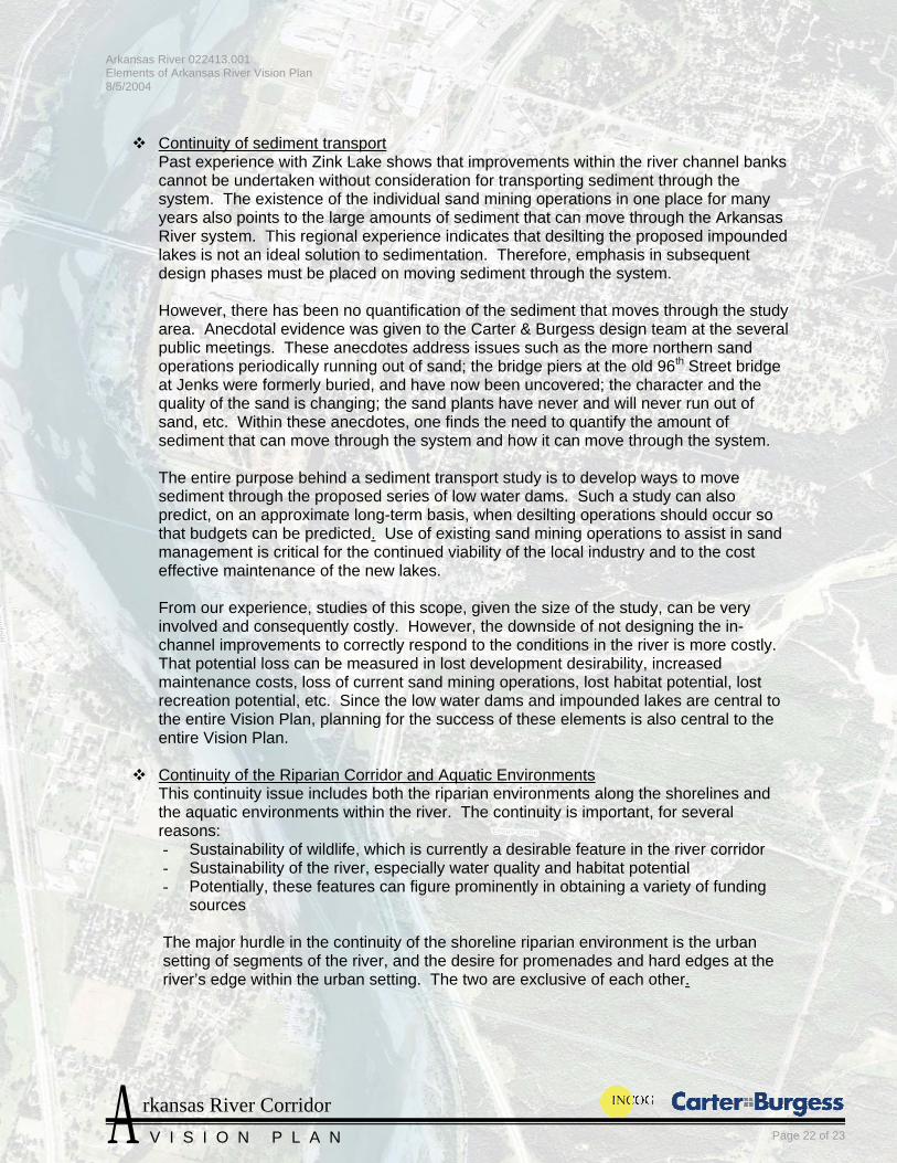
Continuity of sediment transport Past experience with Zink Lake shows that improvements within the river channel banks cannot be undertaken without consideration for transporting sediment through the system. The existence of the individual sand mining operations in one place for many years also points to the large amounts of sediment that can move through the Arkansas River system. This regional experience indicates that desilting the proposed impounded lakes is not an ideal solution to sedimentation. Therefore, emphasis in subsequent design phases must be placed on moving sediment through the system.
However, there has been no quantification of the sediment that moves through the study area. Anecdotal evidence was given to the Carter & Burgess design team at the several public meetings. These anecdotes address issues such as the more northern sand operations periodically running out of sand; the bridge piers at the old 96th Street bridge at Jenks were formerly buried, and have now been uncovered; the character and the quality of the sand is changing; the sand plants have never and will never run out of sand, etc. Within these anecdotes, one finds the need to quantify the amount of sediment that can move through the system and how it can move through the system.
The entire purpose behind a sediment transport study is to develop ways to move sediment through the proposed series of low water dams. Such a study can also predict, on an approximate long-term basis, when desilting operations should occur so that budgets can be predicted. Use of existing sand mining operations to assist in sand management is critical for the continued viability of the local industry and to the cost effective maintenance of the new lakes.
From our experience, studies of this scope, given the size of the study, can be very involved and consequently costly. However, the downside of not designing the in-channel improvements to correctly respond to the conditions in the river is more costly. That potential loss can be measured in lost development desirability, increased maintenance costs, loss of current sand mining operations, lost habitat potential, lost recreation potential, etc. Since the low water dams and impounded lakes are central to the entire Vision Plan, planning for the success of these elements is also central to the entire Vision Plan.
Continuity of the Riparian Corridor and Aquatic Environments
This continuity issue includes both the riparian environments along the shorelines and the aquatic environments within the river. The continuity is important, for several reasons: - Sustainability of wildlife, which is currently a desirable feature in the river corridor - Sustainability of the river, especially water quality and habitat potential - Potentially, these features can figure prominently in obtaining a variety of funding
sources The major hurdle in the continuity of the shoreline riparian environment is the urban setting of segments of the river, and the desire for promenades and hard edges at the river’s edge within the urban setting. The two are exclusive of each other.

Arkansas River 022413.001 Elements of Arkansas River Vision Plan 8/5/2004
rkansas River Corridor A V I S I O N P L A N Page 23 of 23
When reviewing the Vision Plan maps, the opportunities for hard edges are concentrated, particularly when one considers the amount of shoreline that remains in open space throughout the length of the project. Providing for the opportunity to build hard edges at the river is part of the vision, but only in select areas shown on the Vision Plan graphics. Open space areas adjacent to the river must include native plantings that are typical of indigenous riparian habitats. Also, islands within the river can provide riparian habitat (please refer to the Low Water Dam section earlier in this report).
Refineries The Sunoco and Sinclair refineries have been part of the west bank of the Arkansas River for many years. Long term, there is potential for the owners of the refineries to decide to close or move these facilities and undertake whatever remediation is required. However, it should be noted that the refinery owners are in sole control of that decision, and there has been no indication at present that this is a near-term possibility.
At the appropriate time, the constituent agencies in the Arkansas River Corridor should assist the refineries with a redevelopment strategy that is beneficial for all parties.
Admittedly, this is a long-term effort. When that time comes, we believe that the effort will be worthwhile to the entire metropolitan region in terms of quality of life, return on perception of “livability”, and increased vibrancy of the Tulsa city center. These in turn will lead to quality growth for the metropolitan area.
Maintenance of community engagement and support The Arkansas River Corridor improvements are a long-term effort and will be able to continue as long as there is public support for it. Maintaining community support should be a key element of subsequent phases. That effort should include public participation as an integral part of later design phases, maintenance of an advisory group and a steering committee, regular updates to the community at large, and other informational functions.
P:\022413.010 - Arkansas River\16 - Tests & Reports\Vision Plan Report 7-23-04.doc