Embed Size (px)
Citation preview
Australian UAV Pty Ltd ABN: 11162391871 Phone 1300 738 521
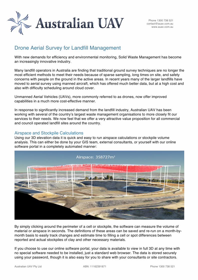
Drone Aerial Survey for Landfill Management With new demands for efficiency and environmental monitoring, Solid Waste Management has become an increasingly innovative industry. Many landfill operators in Australia are finding that traditional ground survey techniques are no longer the most efficient methods to meet their needs because of sparse sampling, long times on site, and safety concerns with people on the ground in the active areas. In recent years many of the larger landfills have moved to aerial survey using manned aircraft, which has offered much better data, but at a high cost and also with difficulty scheduling around cloud cover. Unmanned Aerial Vehicles (UAVs), more commonly referred to as drones, now offer improved capabilities in a much more cost-effective manner. In response to significantly increased demand from the landfill industry, Australian UAV has been working with several of the country’s largest waste management organisations to more closely fit our services to their needs. We now feel that we offer a very attractive value proposition for all commercial and council operated landfill sites around the country. Airspace and Stockpile Calculations Using our 3D elevation data it is quick and easy to run airspace calculations or stockpile volume analysis. This can either be done by your GIS team, external consultants, or yourself with our online software portal in a completely automated manner:
By simply clicking around the perimeter of a cell or stockpile, the software can measure the volume of material or airspace in seconds. The definitions of these areas can be saved and re-run on a month-by-month basis to easily track changes and estimate time to filling a cell or spot differences between reported and actual stockpiles of clay and other necessary materials. If you choose to use our online software portal, your data is available to view in full 3D at any time with no special software needed to be installed, just a standard web browser. The data is stored securely using your password, though it is also easy for you to share with your consultants or site contractors.
Phone 1300 738 521 [email protected]
www.auav.com.au
Australian UAV Pty Ltd ABN: 11162391871 Phone 1300 738 521
High-Resolution, High-Accuracy Survey. Fast Turnaround Fixed-wing aerial survey captures high-resolution photographic maps of the entire site at ~3.5cm resolution per pixel. When compared to the standard 15cm per pixel in manned aircraft surveys, this reveals more than four times the detail. In addition to their high resolution, these are more than just a traditional two-dimensional map, but also a full 3D elevation model of the site with vertical accuracy to ~5cm. This is a vast improvement over terrestrial survey techniques taking only sparse samples and interpolating across the site, missing all the details in between. We can generally deliver these results to you within 48 hours, either online or by a USB drive in the mail. One-off or Monthly Surveys We can perform a one-off survey, or organise to return on a regular monthly basis so you always have an up-to-date model of your site, and consistent data to more tightly manage your forward planning. We are able to offer significant cost savings for recurring work, knowing it is booked in to our calendar on an ongoing basis. Regular surveys can be of the entire site, or just your active cells. Australian UAV is happy to work closely with your existing site surveyors to ensure compatibility of data, coordinate systems and reporting. About Australian UAV Australian UAV is one of the country’s most experienced fixed-wing drone operators, with over 1900 flights for commercial and government clients since 2013, with offices across the country. We pride ourselves on our dedication to safety, professionalism and the reliable delivery of high-quality data. We understand that although we may get excited about the technology, our clients are focused on the data and results. We are leaders with regard to timely, repeatable and high-quality deliverables. Contact Us If you’re interested in discussing how our services might meet your needs, please phone us on 1300 738 521, email [email protected], or contact one of our state operators directly below. You can also find more information and view a short demonstration video online at www.auav.com.au, following the links to Client Industries and Waste Management.
VIC: James Rennie [email protected] 0497 070 576 NSW: Andrew Chapman [email protected] 0488 130 900 QLD: Michael Manning [email protected] 0412 392 674
SA: Grant Yates [email protected] 0428 430 259 TAS: Andy Nielsen [email protected] 0409 216 214 WA: Darryn Dow [email protected] 0458 272 114
Australian UAV Pty Ltd ABN: 11162391871 Phone 1300 738 521
Featured in Inside Waste Magazine:
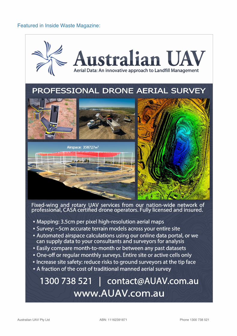
PROFESSIONAL DRONE AERIAL SURVEY