Embed Size (px)
Citation preview
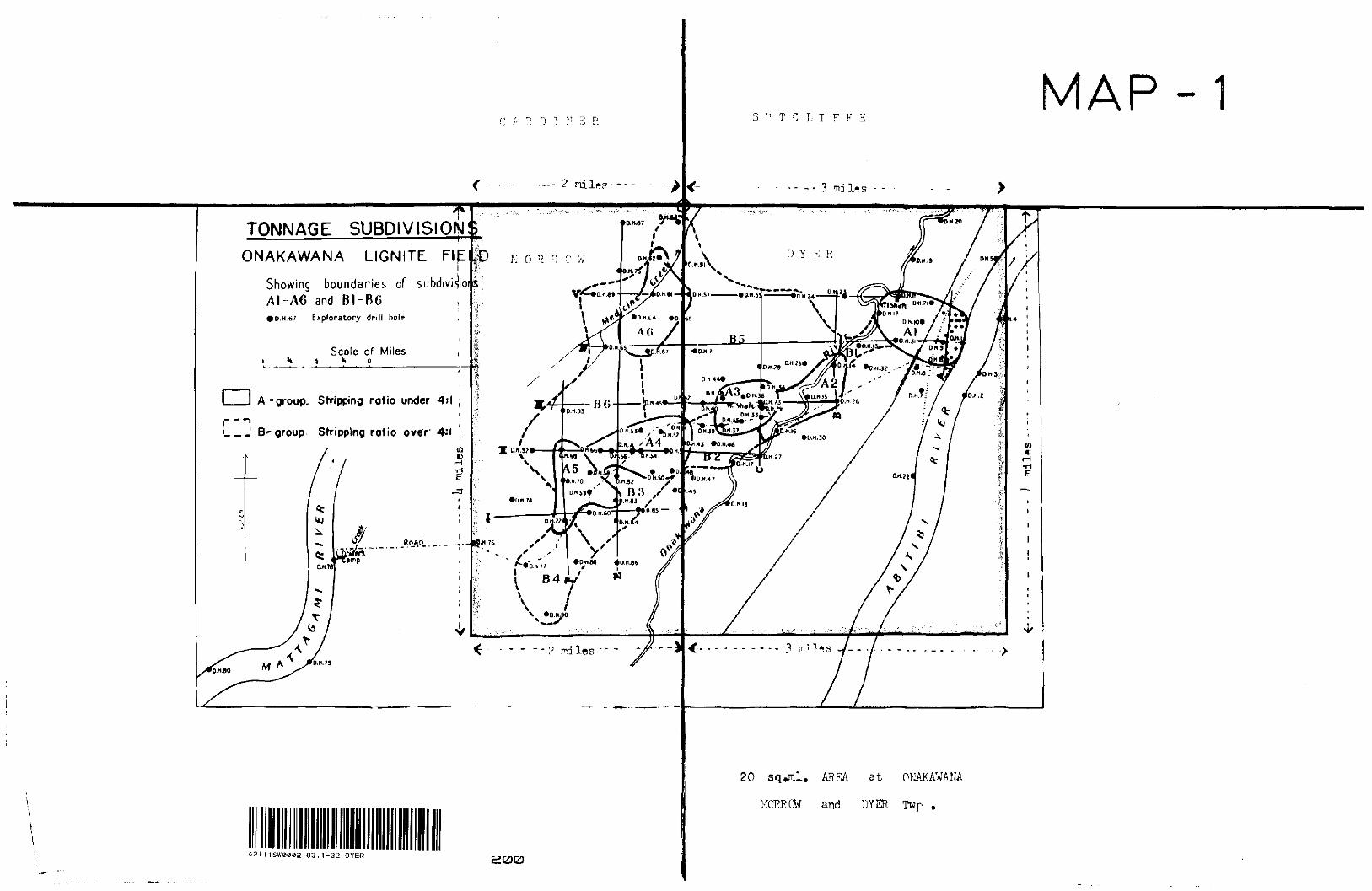
3 l' T G L T F F E
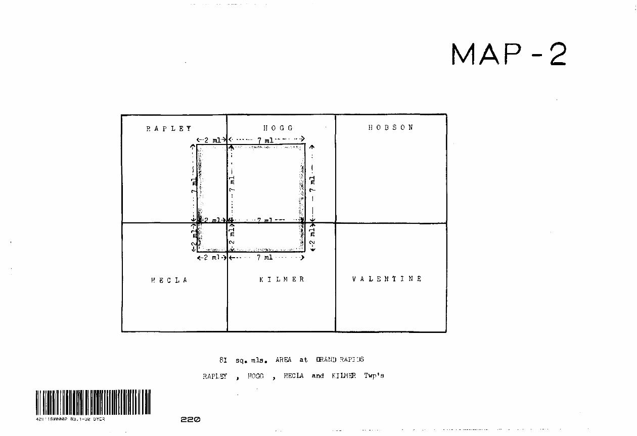
AP-
TONNAGE SUBDIVISION
ONAKAWANA LIGNITE FIEi
Showing boundaries of subdivigiAI-A6 and BI-B6• D, H b; Exploratory drill hole
Scale or Miles"k O
A-group. Stripping ratio under 4;l
..-J B-group Stripping ratio over 4-"i
QAt.-. -- -]-- IS-"' 76
v
20 sq^nl. AR2A at ONAKAWANA
MORRCW and DYER Twp .
03.1-32 DYER 200
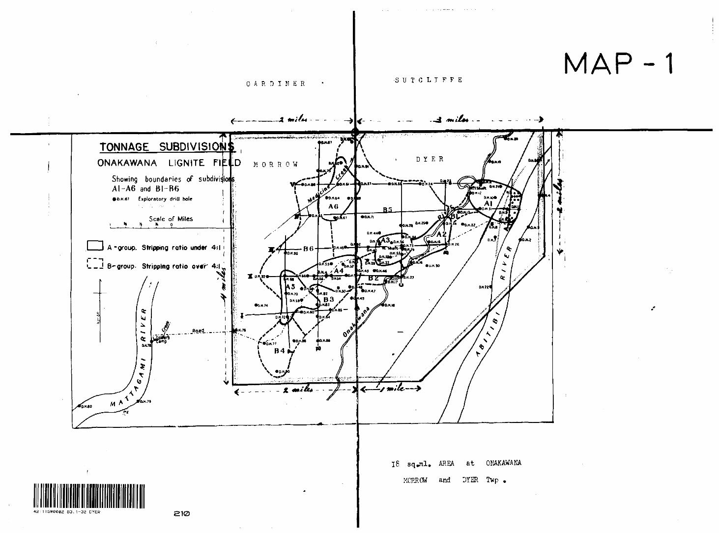
GARDINER
MAP-1•SUTCLIFFE
TONNAGE SUBDIVISIOHONAKAWANA LIGNITE Fl L
Showing boundaries of subdivii AI-A6 and BI-B6•D.M-6I Exploratory drill hole
Scale of Miles fc o
A-group. Stripping ratio under 4*1 i
L-J B^group. Stripping ratio ovtr" 4;l
Jjmp
D MORROW
l 1SW0C02 03. 1-32 DYER 210
16 sq^nl. AREA at ONAKAWANA
MCRRCW and DYER Twp .
033
OQOri '
19
3NIIM31VAH 3 W 1 I M
fO
3
fO
V 1 0 3 H
H 0 S 3 0 H
--W
3 H
ODOHl 3 T d V H
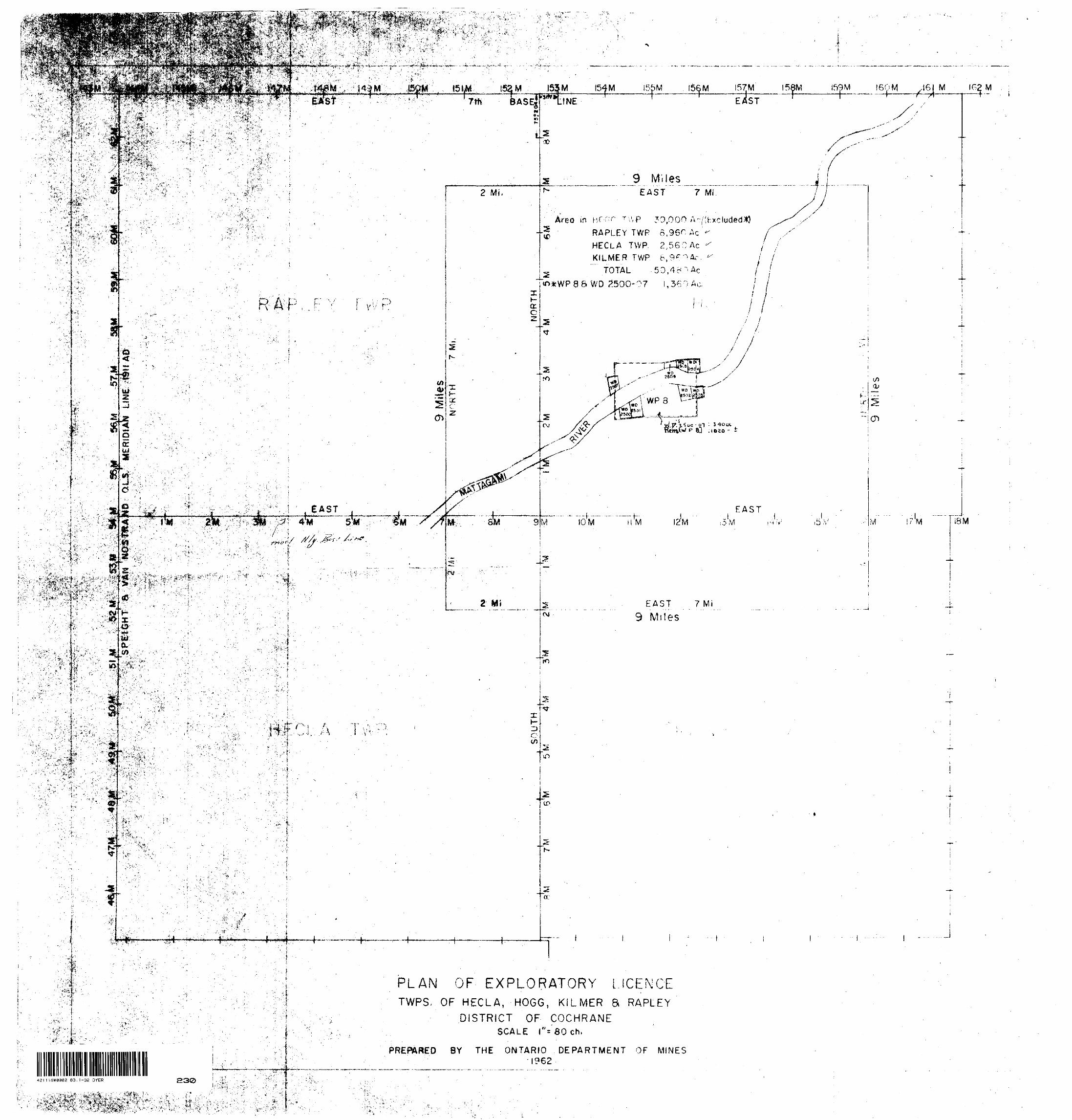
154 MASE|
O.
r-
i
THINE ' '
s 3D
RAPLEY TWP 6,96r Ac
HECLA TWP. 2,56 O AcKILMER TWP tV^'^Ar
TOTAL 50,4 e ^ctn*WP86WD ?.500-?7
-; .^^o^VM^H'i''* -"^.-^iS^v-,.';M -\ ^,v.''^
155M 156 M56 I57M 58MEAST
I59M 160 M' 16 IG2M
9 M'HesEAST 7 Mf
3Q
c,
\ WP3
EAST
12 M :3M
EAST 7 Mi
9 Miles
-i"a:
^*i
PLAN OF EXPLORATORY LICENCETWPS, OF HECLA, HOGG, KILMER S RAPLEY
DISTRICT OF COCHRANE SCALE f'
PREPARED BY THE ONTARIO DEPARTMENT OF MINES-1962
i/)Oi
S
! CTl
M I/M iBM
l
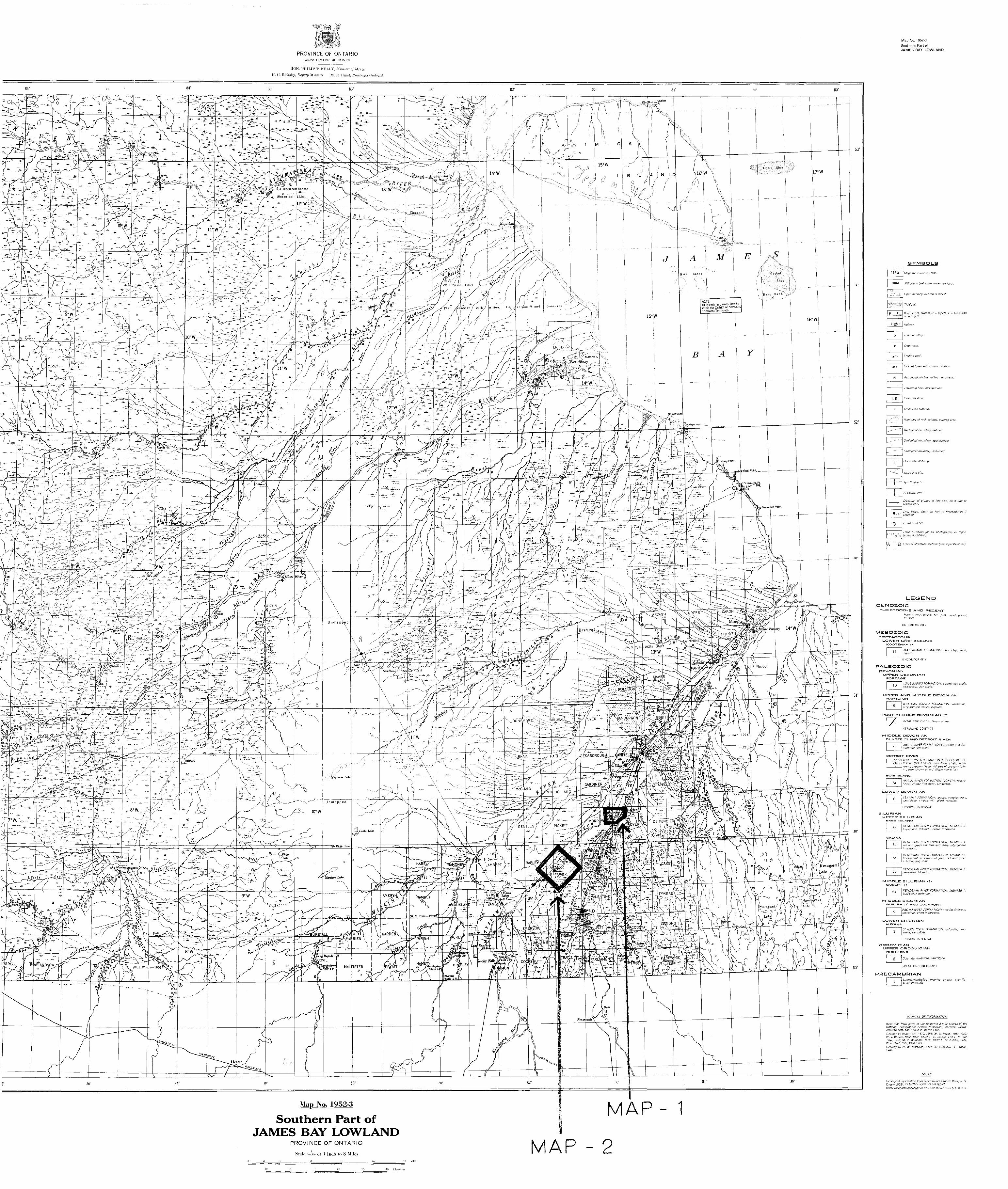
PROVINCE OF ONTARIODEPARTMENT OF MINES
HON. PHILIP T. KELLY, Minister of Mines
II. C. Iliekaby, Deputy Minister M. K. Hurst, Promncial Genlogixt
(W. S. Dyer-1-1928) GAB130 W
MAPMap No. 1952-3
Southern Part of JAMES BAY LOWLAND
PROVINCE OF ONTARIO
Scale wMBii or l Inch lo 8 Miles MAP - 2
Map No. 1952-3Southern Part of JAMES BAY LOWLAND
SYMBOLS
Altitude in feel above mean sea level.
River, creek, stream, H = rapids; F ^ falls, with
Boundary cf rock outcrop, outcrop area.
Geological boundary, defined.
Geological boundary, approximate,
Geological boundary, sssurnerf,
Horizontal bedding.
©
A B
LEGENDCENOZOIC
PLEISTOCENE AMD RECENT
MESOZOICCRETACEOUS
LOWER CRETACEOUSKOOTENAY (71
11
PALEOZOICDEVONIAN
UPPER DEVONIAN PORTAGE
LONG RAPIDS FORMATION: bituminous shale,calcareous ciay shale
UPPER AND MIDDLE DEVONIAN
WILLIAMS ISLAND FORMATION: limestone,
POST MIDDLE DEVONIAN (7)
MIDDLE DEVONIANDUNDEE !?) AND DETROIT RIVER
DETROIT RIVER
ABITIBI RIVER FORMA T ION (MIDDLE! (MOOSEItVER FORMATION), limestone, shale, sand
, gypsum (ass wee area of gypsum-tear-m:; beds shown oy rea sdppie overprint)
BOIS BLANC
AB/TIB! RIVER FORMAT ION (LOWER), fossil/-
LOWER DEVONIAN
SEXTANT FORMATION: arkose, conglomerate.
SILURIANUPPER SILURIAN
BASS ISLAND
5e KENOGAMI RIVER FORMATION, MEMBER 5:
SALINA
'KENOGAMI RIVER FORMATION, MEMBER 4: 5d j red and green siltstone and shale, interbedded
1 limestone.
KENOGAMI RIVER FORMAT/ON, MEMBER 3:3C j honeycomb limestone (8 feet), red and groen
siltstone and shale.
KENOGAMI RIVER FORMATION, MEMBER pea-green dolomite.
KENOGAMI RIVER FORMATION, MEMBER 1. buff-yellow dolomite.
PAGWA RIVER FORMATION: grey fossiiiferous
PRECAMBRIAN
SEVERN RIVER FORMATION: dolomite, lime- stone, sandstone.
Dolomite, limestone, sandstone.
GREAT UNCONFORMITY
Un&ifferentisted: granite, gneiss, syenite, greenstone, etc.
SOURCES OF INFORMATION
tfase map from parts cf the following 8-mi/c sheets o! theNational Topographic. Series: Moosonvc, Akimiski island.Attawapiskat, and Kowkash-Martin Falls.Geology ty Robert Boil, 1870, 1886; W. A. Parks. 189B, 1903:W. J. Wilson, 1902, 1903, 1904; 1. L. Savage and F. M. VanTuyl, 1916; M. Y. Williams, 1919, 192Q; E. M. Kindle, 1923;W. S. Dyer, 1927, 1928, 1929.Geology by A,', W. Martiscn, She'! Oil Company of Canadn,1946.
NO TES
GvulwjiCdl information from Qifier sources Shown thus, W. S.Dyer—1928, for further reference see report.Ontario Department of Mines dn/l hole shown thus,Q. D M. D. H.
ol—! J-T-T
1C 20
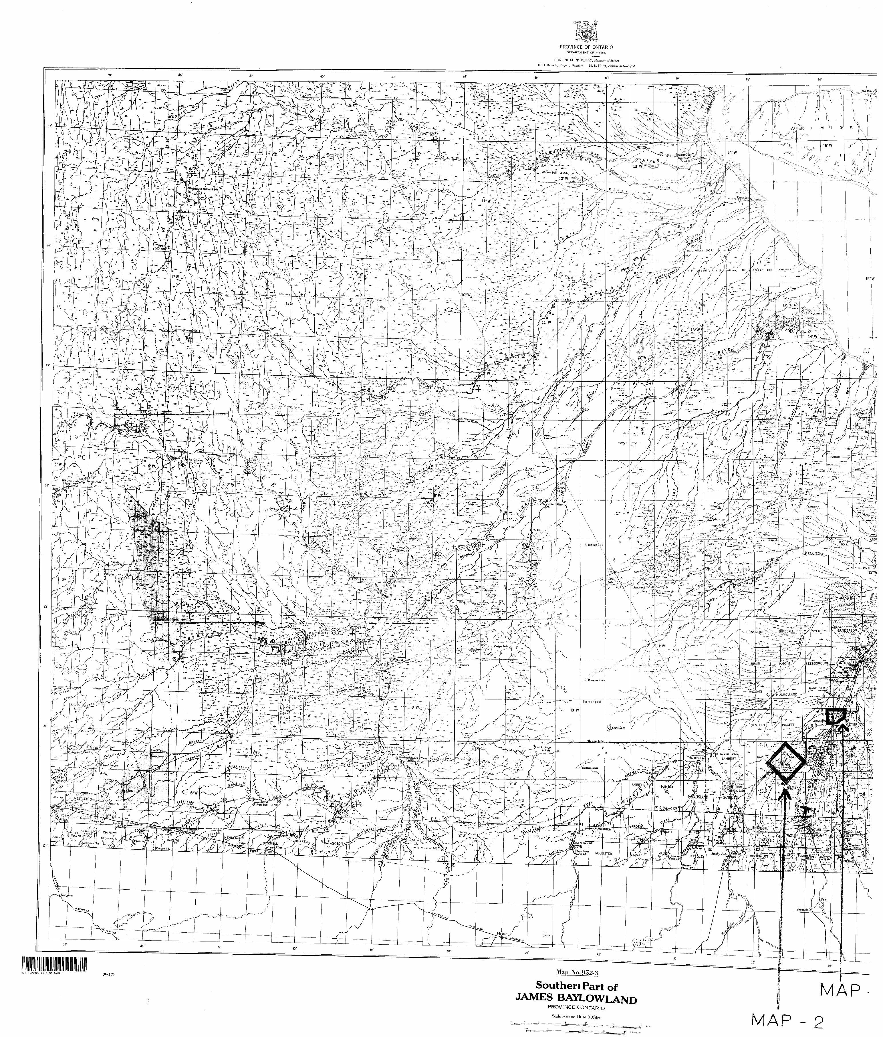
PROVINCE OF ONTARIODEPARTMENT OF MINES
HON. PHILIP T. KELLY, Minister of Mines
H. C. Rickaby, Deputy Minister M. K. Hurst, Provincial Geologist
83"
Atlawapiskat Tr/iuhc Mnn *i^ ^i- -
~^.--^-_kapiskau
* "'ra*^ *fart™ F*U* ~^L Rap*. h^\ a 14' ** -
Dyer4-192S) GAI
-4* BIRDSALL^
BESSBOROUG^lLt
Jjw.L2^
V (W. J. Wilson— 1903rX?
421 1 1SW0002 63. 1-32 DYER a^0 Map Noi952-g
Southen Part of JAMES BAYLOWLAND MAP
PROVINCE CONTARIO
Scale swiSiMi or l h Lo 8 Miles
20
P - 230