Embed Size (px)
Citation preview

1/5/2016
1
Do Now: 1. Who was Alfred
Wegener?
2. What was Pangaea?
3. Are continents fixed? (Can they move?)
4. What evidence supports the idea that continents have moved over time?
Objectives What evidence suggests that
continents move?
Why was the theory of continental
drift not supported?
What is seafloor spreading? How
does it explain continental drift?
What are tectonic plates and what
occurs near plate boundaries?
Vocabulary: Continental Drift
Pangea
Magnetometer
Magnetic reversal
Paleomagnetism
Isochron
Seafloor spreading
Vocabulary: Tectonic plate
Divergent boundary
Rift valley
Convergent boundary
Subduction
Transform boundary (strike-slip)
Ridge push
Slab pull
Section 17.1: Drifting Continents
Identify the lines of evidence that
led Wegener to suggest that
Earth’s continents have moved.
Discuss how evidence of ancient
climates supported continental
drift
Explain why continental drift was
not accepted when it was first
proposed.
1/5/2016
2
TIME SCALES:
What are some examples of
time scales that we often use?
Because of the immense age
of the Earth, geologic time
scales are in thousands,
millions, and billions of years.
Early Observations
Most of Earth’s Surface appears to
remain unchanged during the
course of our lifetime, with
exception to events such as
earthquakes, volcanic eruptions,
and landslides.
On the geologic time scale, Earth’s
surface has changed dramatically.
Early Observations
Cartographers were some of the
first people to suggest that Earth’s
surface has dramatically changed
with time.
In the late 1500s, Abraham Ortelius
noticed the apparent fit of the
continents on either side of the
Atlantic Ocean
Early Observations
Over the next 300 years, many
scientists and writers noticed and
commented on the matching
coastlines.
Antonio Snider-Pelligrini
1858
Early Observations
The first time that the idea of
moving continents was proposed
as a scientific hypothesis was in
the early 1900’s.
In 1912, German scientist Alfred
Wegener presented his ideas about
continental movement to the
scientific community.
1/5/2016
3
Early Observations
Alfred Wegener
Continental Drift
Wegener developed an idea that he
called continental drift.
Continental drift proposes that
Earth’s continents had once been
joined as a single land mass that
broke apart and sent the
continents adrift.
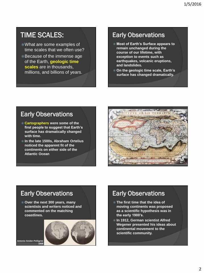
Continental Drift
Wegener called the original
supercontinent Pangaea.
Pangaea [from Greek, literally: all-earth]
Pangaea began to break apart
about 200 mya. Since that time,
the continents have continued to
slowly move to their present
positions.
1/5/2016
4
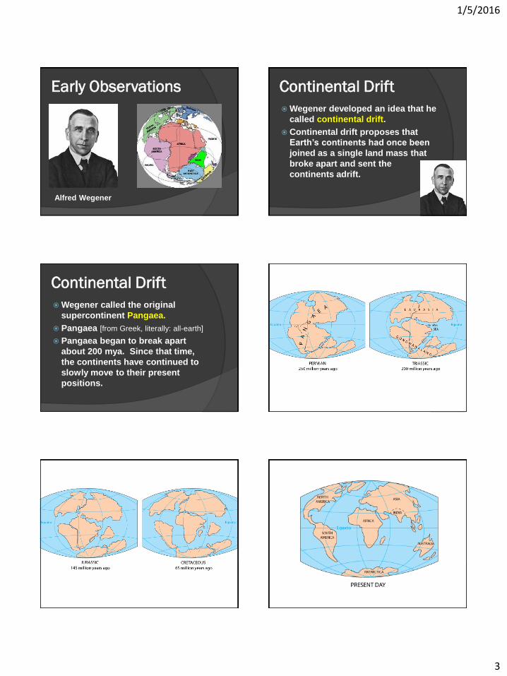
Evidence from Rock
Formation Wegener reasoned that when
Pangaea broke apart, large
geologic structures fractured
as the continents separated.
Rock layers in the Appalachian
Mountains were identical to
mountains in Greenland and
Europe.
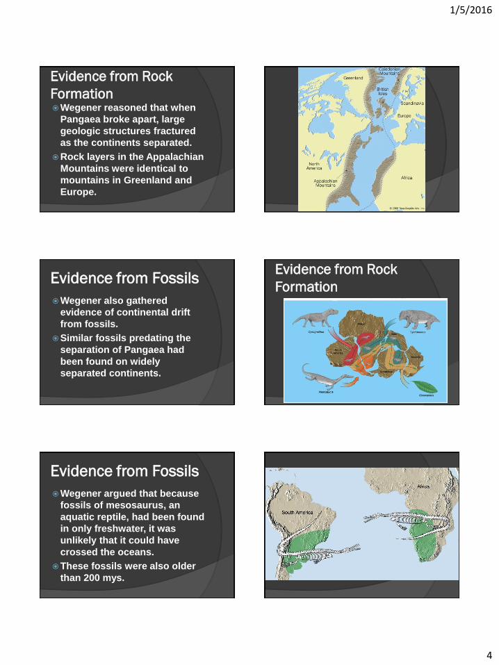
Evidence from Fossils
Wegener also gathered
evidence of continental drift
from fossils.
Similar fossils predating the
separation of Pangaea had
been found on widely
separated continents.
Evidence from Rock
Formation
Evidence from Fossils
Wegener argued that because
fossils of mesosaurus, an
aquatic reptile, had been found
in only freshwater, it was
unlikely that it could have
crossed the oceans.
These fossils were also older
than 200 mys.
1/5/2016
5
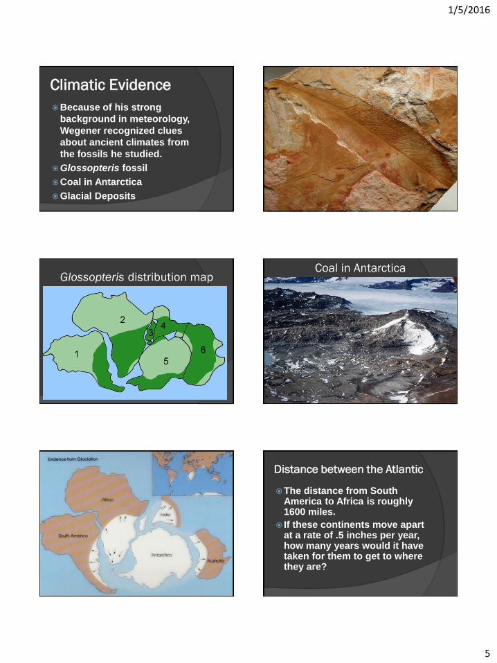
Climatic Evidence
Because of his strong
background in meteorology,
Wegener recognized clues
about ancient climates from
the fossils he studied.
Glossopteris fossil
Coal in Antarctica
Glacial Deposits
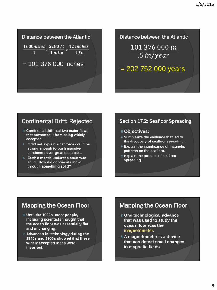
Glossopteris distribution map Coal in Antarctica
Distance between the Atlantic
The distance from South America to Africa is roughly 1600 miles.
If these continents move apart at a rate of .5 inches per year, how many years would it have taken for them to get to where they are?
1/5/2016
6
Distance between the Atlantic
𝟏𝟔𝟎𝟎𝒎𝒊𝒍𝒆𝒔
𝟏𝒙
𝟓𝟐𝟖𝟎 𝒇𝒕
𝟏 𝒎𝒊𝒍𝒆 𝒙
𝟏𝟐 𝒊𝒏𝒄𝒉𝒆𝒔
𝟏 𝒇𝒕
= 101 376 000 inches
Distance between the Atlantic
101 376 000 𝑖𝑛.5 𝑖𝑛/𝑦𝑒𝑎𝑟
= 202 752 000 years
Continental Drift: Rejected
Continental drift had two major flaws
that prevented it from being widely
accepted.
1. It did not explain what force could be
strong enough to push massive
continents over great distances.
2. Earth’s mantle under the crust was
solid. How did continents move
through something solid?
Section 17.2: Seafloor Spreading
Objectives: Summarize the evidence that led to
the discovery of seafloor spreading.
Explain the significance of magnetic
patterns on the seafloor.
Explain the process of seafloor
spreading.
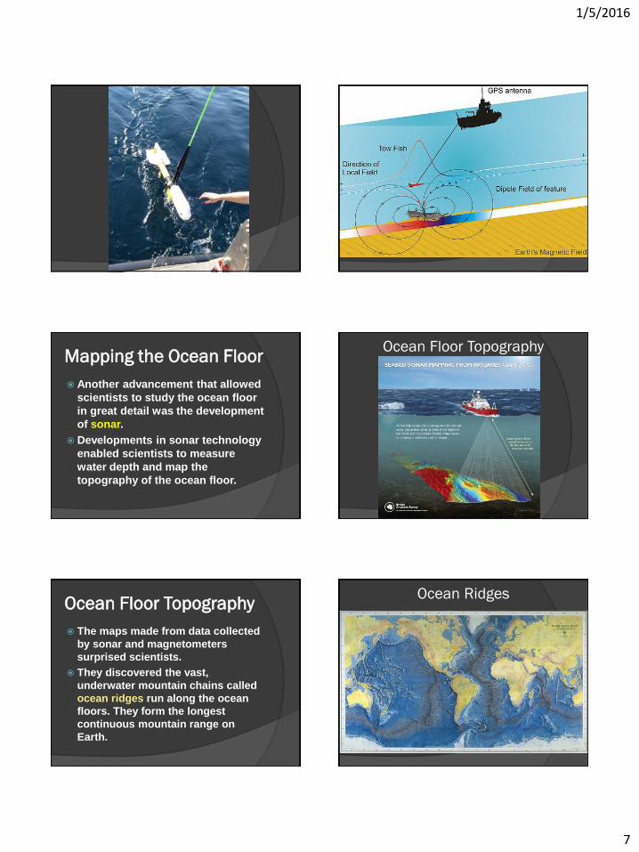
Mapping the Ocean Floor
Until the 1900s, most people,
including scientists thought that
the ocean floor was essentially flat
and unchanging.
Advances in technology during the
1940s and 1950s showed that these
widely accepted ideas were
incorrect.
Mapping the Ocean Floor
One technological advance
that was used to study the
ocean floor was the
magnetometer.
A magnetometer is a device
that can detect small changes
in magnetic fields.
1/5/2016
7
Mapping the Ocean Floor
Another advancement that allowed
scientists to study the ocean floor
in great detail was the development
of sonar.
Developments in sonar technology
enabled scientists to measure
water depth and map the
topography of the ocean floor.
Ocean Floor Topography
Ocean Floor Topography
The maps made from data collected
by sonar and magnetometers
surprised scientists.
They discovered the vast,
underwater mountain chains called
ocean ridges run along the ocean
floors. They form the longest
continuous mountain range on
Earth.
Ocean Ridges
1/5/2016
8
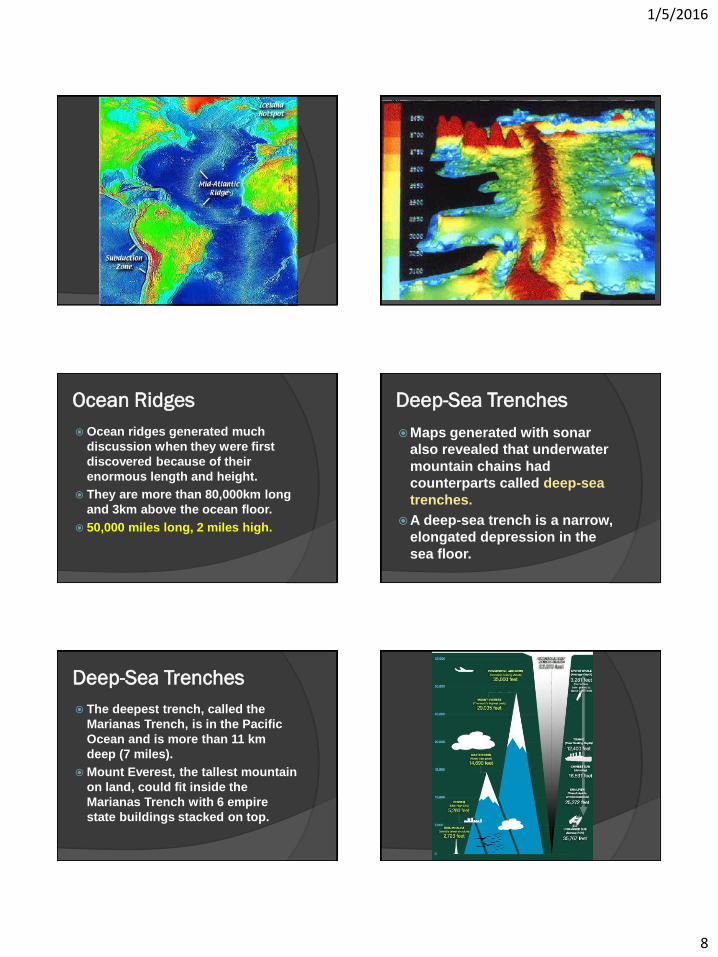
Ocean Ridges
Ocean ridges generated much
discussion when they were first
discovered because of their
enormous length and height.
They are more than 80,000km long
and 3km above the ocean floor.
50,000 miles long, 2 miles high.
Deep-Sea Trenches
Maps generated with sonar
also revealed that underwater
mountain chains had
counterparts called deep-sea
trenches.
A deep-sea trench is a narrow,
elongated depression in the
sea floor.
Deep-Sea Trenches
The deepest trench, called the
Marianas Trench, is in the Pacific
Ocean and is more than 11 km
deep (7 miles).
Mount Everest, the tallest mountain
on land, could fit inside the
Marianas Trench with 6 empire
state buildings stacked on top.

1/5/2016
9
Ocean Floor Topography
Ocean ridges and deep-sea
trenches puzzled geologists for
more than a decade after their
discovery.
They did not know what could have
formed these mountains and
trenches 6 times deeper than the
Grand Canyon
Ocean Rocks and
Sediments Scientists collected samples of
deep-sea sediments and the
oceanic crust.
They discovered that the age of
these rocks consistently increases
with distance from ocean ridges.
Thickness of ocean sediments
increase in depth away from ocean
ridges.
Magnetism
A magnetic reversal happens
when the flow in the outer core
changes, and Earth’s magnetic
field changes direction.
Magnetic reversals have
occurred many times in Earth’s
History.
Magnetism
Paleomagnetism is the study of
the history of Earth’s magnetic
field.
When lava solidifies, iron
minerals behave like
compasses and form crystals
which align with Earth’s
magnetic field.
1/5/2016
10
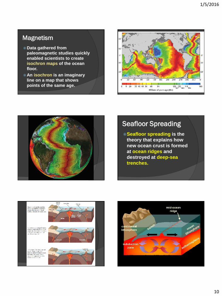
Magnetism
Data gathered from
paleomagnetic studies quickly
enabled scientists to create
isochron maps of the ocean
floor.
An isochron is an imaginary
line on a map that shows
points of the same age.
Seafloor Spreading
Seafloor spreading is the
theory that explains how
new ocean crust is formed
at ocean ridges and
destroyed at deep-sea
trenches.
1/5/2016
11
Section 17.3: Plate Boundaries
Objectives:
Describe how Earth’s tectonic plates
result in many geologic features.
Compare and contrast the three types of
plate boundaries and the features
associated with each.
Generalize the processes associated
with subduction zones.
Plate Boundaries:
Main Idea:
Volcanoes, mountains,
and deep-sea trenches
form at the boundaries
between the plates.
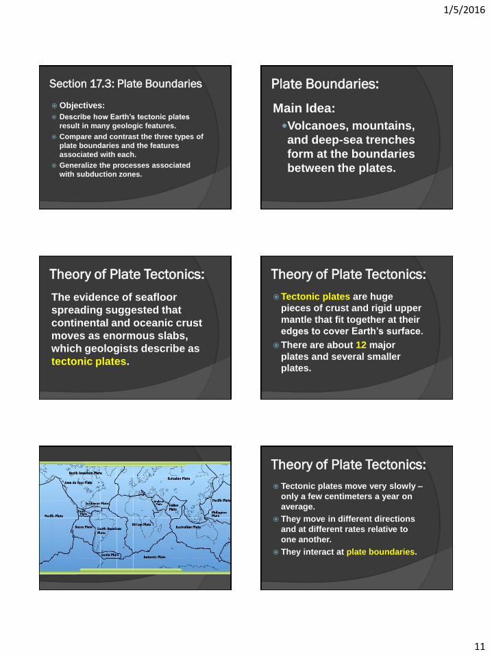
Theory of Plate Tectonics:
The evidence of seafloor
spreading suggested that
continental and oceanic crust
moves as enormous slabs,
which geologists describe as
tectonic plates.
Theory of Plate Tectonics:
Tectonic plates are huge
pieces of crust and rigid upper
mantle that fit together at their
edges to cover Earth’s surface.
There are about 12 major
plates and several smaller
plates.
Theory of Plate Tectonics:
Tectonic plates move very slowly –
only a few centimeters a year on
average.
They move in different directions
and at different rates relative to
one another.
They interact at plate boundaries.
1/5/2016
12
Plate Boundaries:
There are three main
types of plate
boundaries:
Divergent boundaries
Convergent boundaries
Transform boundaries.
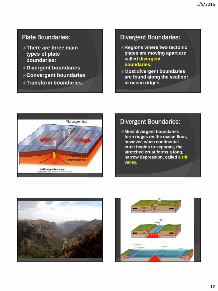
Divergent Boundaries:
Regions where two tectonic
plates are moving apart are
called divergent
boundaries.
Most divergent boundaries
are found along the seafloor
in ocean ridges.
Divergent Boundaries:
Most divergent boundaries
form ridges on the ocean floor,
however, when continental
crust begins to separate, the
stretched crust forms a long,
narrow depression, called a rift
valley.
1/5/2016
13
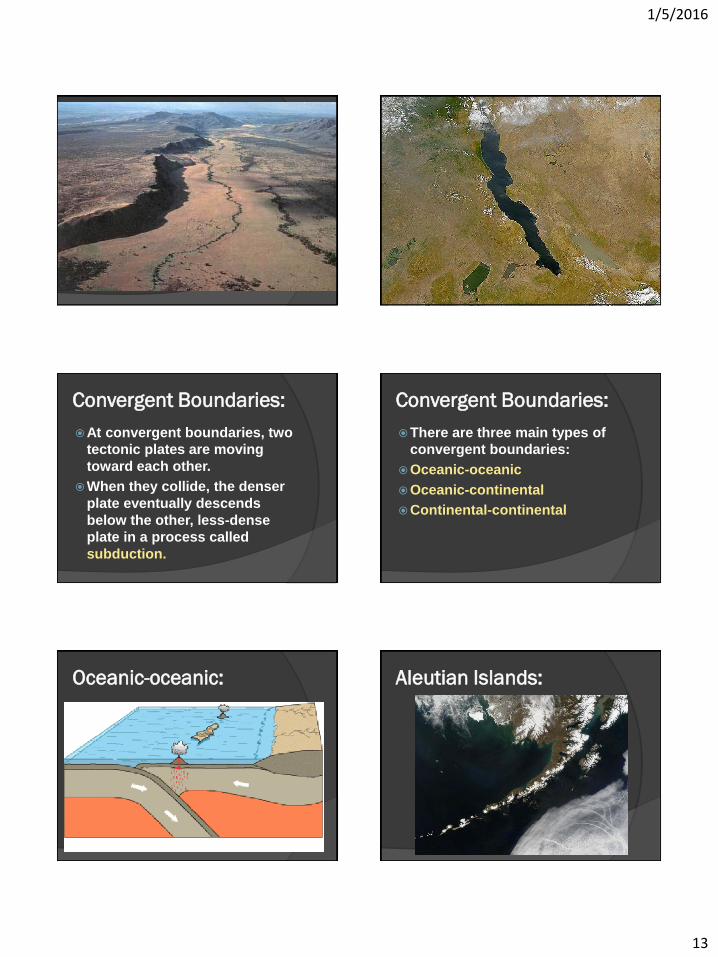
Convergent Boundaries:
At convergent boundaries, two
tectonic plates are moving
toward each other.
When they collide, the denser
plate eventually descends
below the other, less-dense
plate in a process called
subduction.
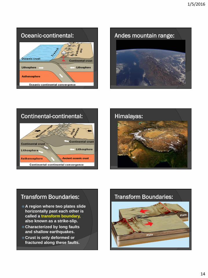
Convergent Boundaries:
There are three main types of
convergent boundaries:
Oceanic-oceanic
Oceanic-continental
Continental-continental
Oceanic-oceanic: Aleutian Islands:
1/5/2016
14
Oceanic-continental: Andes mountain range:
Continental-continental: Himalayas:
Transform Boundaries:
A region where two plates slide
horizontally past each other is
called a transform boundary,
also known as a strike-slip.
Characterized by long faults
and shallow earthquakes.
Crust is only deformed or
fractured along these faults.
Transform Boundaries:
1/5/2016
15
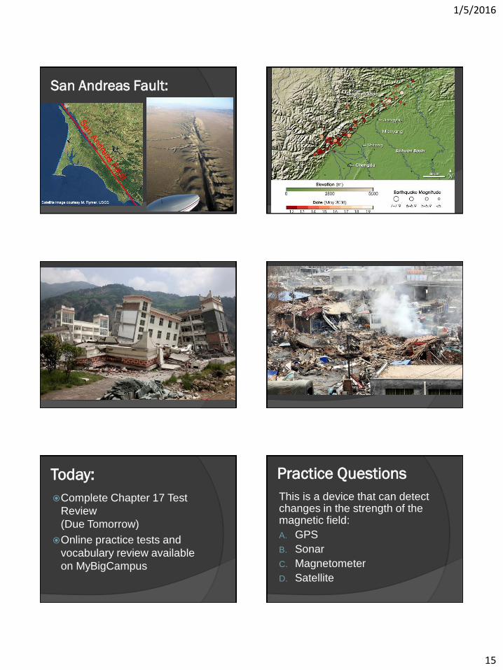
San Andreas Fault:
Today:
Complete Chapter 17 Test
Review
(Due Tomorrow)
Online practice tests and
vocabulary review available
on MyBigCampus
Practice Questions
This is a device that can detect changes in the strength of the magnetic field:
A. GPS
B. Sonar
C. Magnetometer
D. Satellite

1/5/2016
16
Practice Questions
This is a device that can detect changes in the strength of the magnetic field:
A. GPS
B. Sonar
C. Magnetometer
D. Satellite
Practice Questions
Places where two tectonic plates are moving away from each other are called __________.
A. convergent boundaries
B. divergent boundaries
C. earthquake boundaries
D. transform boundaries
Practice Questions
Places where two tectonic plates are moving away from each other are called __________.
A. convergent boundaries
B. divergent boundaries
C. earthquake boundaries
D. transform boundaries
Practice Questions
The thickness of ocean sediments that are close to a mid-ocean ridge is __________ the thickness of ocean sediments that are far from mid-ocean ridges.
A. more than
B. the same as
C. always 100 times
D. less than
Practice Questions
The thickness of ocean sediments that are close to a mid-ocean ridge is __________ the thickness of ocean sediments that are far from mid-ocean ridges.
A. more than
B. the same as
C. always 100 times
D. less than
Practice Questions
What evidence did Wegener use to estimate the time of Pangaea's break up? A. Magnetic isochrons
B. Coal deposits
C. Ocean-floor topography
D. Fossil data

1/5/2016
17
Practice Questions
What evidence did Wegener use to estimate the time of Pangaea's break up? A. Magnetic isochrons
B. Coal deposits
C. Ocean-floor topography
D. Fossil data
Practice Questions
What is the name of Alfred Wegener's hypothesis about moving landmasses?
A. Continental movement
B. Plate tectonics
C. Continental drift
D. Seafloor spreading
Practice Questions
What is the name of Alfred Wegener's hypothesis about moving landmasses?
A. Continental movement
B. Plate tectonics
C. Continental drift
D. Seafloor spreading
Practice Questions
When a divergent plate boundary forms on continents, a __________ forms.
A. Crater
B. Volcano
C. Mid-continent ridge
D. Rift valley
Practice Questions
When a divergent plate boundary forms on continents, a __________ forms.
A. Crater
B. Volcano
C. Mid-continent ridge
D. Rift valley
Practice Questions
Which type of information was NOT collected by Wegener to support his continental drift hypothesis?
A. Fossils
B. Seafloor magnetic data
C. Rocks
D. Glacial deposits

1/5/2016
18
Practice Questions
Which type of information was NOT collected by Wegener to support his continental drift hypothesis?
A. Fossils
B. Seafloor magnetic data
C. Rocks
D. Glacial deposits
Practice Questions
What evidence did Wegener use to suggest that Antarctica had once been closer to the equator?
A. fossils of ice age animals
B. freshwater reptile fossils
C. presence of coal beds
D. layers of sandstone and limestone
Practice Questions
What evidence did Wegener use to suggest that Antarctica had once been closer to the equator?
A. fossils of ice age animals
B. freshwater reptile fossils
C. presence of coal beds
D. layers of sandstone and limestone
Practice Questions
The tremendous amount of heat
within Earth powers _____.
A. plate tectonics
B. ocean currents
C. weather patterns
D. all of the above
Practice Questions
The tremendous amount of heat
within Earth powers _____.
A. plate tectonics
B. ocean currents
C. weather patterns
D. all of the above
Extra Credit Option:
Assessment
questions #1-31 on
pages 493-494 of the
Earth Science
textbook.


![Harrisson’s Workshop | Pangaea [estranged]](https://img.pdfslide.us/doc/110x75/6216411096ee9065c65379b6/harrissons-workshop-pangaea-estranged.jpg)