Embed Size (px)
DESCRIPTION
Sample pages from our guide to hillwalking in the South Downs National Park, including a free route from Cheriton.
Citation preview
designed & published by Vertebrate Publishing
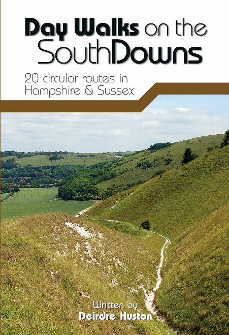
Day Walks on the South Downs features 20 circular routes, between 6 and 14 miles (9km and 22km) in length, suitable for hill walkers of all abilities.
The routes are split into three geographical areas – Hampshire, West Sussex and East Sussex – and include walks to the most historic and beautiful areas of the Downs, including Winchester Hill Fort, Black Down, Chanctonbury Ring, Devil’s Dyke, Ditchling Beacon and Beachy Head.
Written by a South Downs local, each route features:
» Ordnance Survey 1:25,000 maps» easy-to-follow directions » details of distance and navigation
information» refreshment stops and local information
357G
VG
03/
11
9 781906 148317 >
ISBN 9781906148317
PRICE: £12.95
Written by Deirdre Huston
Written by Deirdre Huston
20 circular routes in Hampshire & Sussex
DAY W
ALKS ON THE SO
UTH DO
WNS
357g Day Walks_South Downs Cover.indd 1 31/03/2011 09:40

Written by Deirdre Huston
357g Day Walks_South Downs Inside.indd 2 31/03/2011 11:11
Written by Deirdre Huston
20 circular routes in Hampshire & Sussex
357g Day Walks_South Downs Inside.indd 3 31/03/2011 11:11
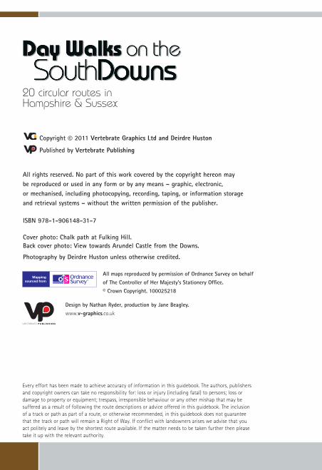
Copyright © 2011 Vertebrate Graphics Ltd and Deirdre Huston
Published by Vertebrate Publishing
All rights reserved. No part of this work covered by the copyright hereon may be reproduced or used in any form or by any means – graphic, electronic, or mechanised, including photocopying, recording, taping, or information storage and retrieval systems – without the written permission of the publisher.
ISBN 978-1-906148-31-7
Cover photo: Chalk path at Fulking Hill. Back cover photo: View towards Arundel Castle from the Downs.
Photography by Deirdre Huston unless otherwise credited.
All maps reproduced by permission of Ordnance Survey on behalf of The Controller of Her Majesty’s Stationery Office. © Crown Copyright. 100025218
Design by Nathan Ryder, production by Jane Beagley. www.v-graphics.co.uk
20 circular routes in Hampshire & Sussex
Every effort has been made to achieve accuracy of information in this guidebook. The authors, publishers and copyright owners can take no responsibility for: loss or injury (including fatal) to persons; loss or damage to property or equipment; trespass, irresponsible behaviour or any other mishap that may be suffered as a result of following the route descriptions or advice offered in this guidebook. The inclusion of a track or path as part of a route, or otherwise recommended, in this guidebook does not guarantee that the track or path will remain a Right of Way. If conflict with landowners arises we advise that you act politely and leave by the shortest route available. If the matter needs to be taken further then please take it up with the relevant authority.
357g Day Walks_South Downs Inside.indd 4 31/03/2011 11:11
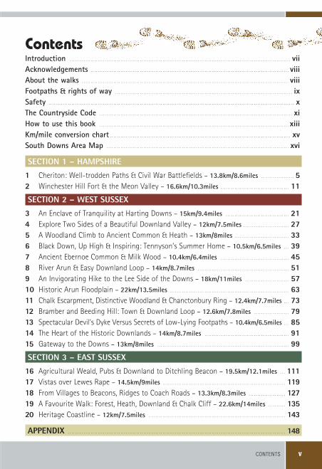
CONTENTS v
Introduction� . . . . . . . . . . . . . . . . . . . . . . . . . . . . . . . . . . . . . . . . . . . . . . . . . . . . . . . . . . . . . . . . . . . . . . . . . . . . . . . . . . . . . . . . . . . . . . . . . . . . . . . . . . . . . . . . . . . . . . . . . . . . . . . .viiAcknowledgements� . . . . . . . . . . . . . . . . . . . . . . . . . . . . . . . . . . . . . . . . . . . . . . . . . . . . . . . . . . . . . . . . . . . . . . . . . . . . . . . . . . . . . . . . . . . . . . . . . . . . . . . . . . . . . . . . . .viiiAbout�the�walks� . . . . . . . . . . . . . . . . . . . . . . . . . . . . . . . . . . . . . . . . . . . . . . . . . . . . . . . . . . . . . . . . . . . . . . . . . . . . . . . . . . . . . . . . . . . . . . . . . . . . . . . . . . . . . . . . . . . . . . .viiiFootpaths�&�rights�of�way� . . . . . . . . . . . . . . . . . . . . . . . . . . . . . . . . . . . . . . . . . . . . . . . . . . . . . . . . . . . . . . . . . . . . . . . . . . . . . . . . . . . . . . . . . . . . . . . . . . . . . . .ixSafety� . . . . . . . . . . . . . . . . . . . . . . . . . . . . . . . . . . . . . . . . . . . . . . . . . . . . . . . . . . . . . . . . . . . . . . . . . . . . . . . . . . . . . . . . . . . . . . . . . . . . . . . . . . . . . . . . . . . . . . . . . . . . . . . . . . . . . . . . . . . . .xThe�Countryside�Code� . . . . . . . . . . . . . . . . . . . . . . . . . . . . . . . . . . . . . . . . . . . . . . . . . . . . . . . . . . . . . . . . . . . . . . . . . . . . . . . . . . . . . . . . . . . . . . . . . . . . . . . . . . . . . . . .xiHow�to�use�this�book� . . . . . . . . . . . . . . . . . . . . . . . . . . . . . . . . . . . . . . . . . . . . . . . . . . . . . . . . . . . . . . . . . . . . . . . . . . . . . . . . . . . . . . . . . . . . . . . . . . . . . . . . . . . . . .xiiikm/mile�conversion�chart� . . . . . . . . . . . . . . . . . . . . . . . . . . . . . . . . . . . . . . . . . . . . . . . . . . . . . . . . . . . . . . . . . . . . . . . . . . . . . . . . . . . . . . . . . . . . . . . . . . . . . . . .xvSouth�Downs�Area�Map� . . . . . . . . . . . . . . . . . . . . . . . . . . . . . . . . . . . . . . . . . . . . . . . . . . . . . . . . . . . . . . . . . . . . . . . . . . . . . . . . . . . . . . . . . . . . . . . . . . . . . . . . . .xvi
SECTION 1 – HAMPSHIRE
1 . Cheriton: Well-trodden Paths & Civil War Battlefields .– .13.8km/8.6miles . . . . . . . . . . . . . . . . . . . . . . . . . . . . . . . . . . . . . . . .52 . Winchester Hill Fort & the Meon Valley .– .16.6km/10.3miles . . . . . . . . . . . . . . . . . . . . . . . . . . . . . . . . . . . . . . . . .11
SECTION 2 – WEST SUSSEX
3 . An Enclave of Tranquility at Harting Downs .– .15km/9.4miles . . . . . . . . . . . . . . . . . . . . . . . . . . . . . . . . . . . . . . .214 . Explore Two Sides of a Beautiful Downland Valley .– .12km/7.5miles . . . . . . . . . . . . . . . . . . . . . . . . . . . .275 A Woodland Climb to Ancient Common & Heath .– .13km/8miles . . . . . . . . . . . . . . . . . . . . . . . . . . . . . . . . .336 Black Down, Up High & Inspiring: Tennyson’s Summer Home .– .10.5km/6.5miles . . . . .397 Ancient Ebernoe Common & Milk Wood .– .10.4km/6.4miles . . . . . . . . . . . . . . . . . . . . . . . . . . . . . . . . . . . . . . . . . .458 . River Arun & Easy Downland Loop .– .14km/8.7miles . . . . . . . . . . . . . . . . . . . . . . . . . . . . . . . . . . . . . . . . . . . . . . . . . . . . . . .519 . An Invigorating Hike to the Lee Side of the Downs .– .18km/11miles . . . . . . . . . . . . . . . . . . . . . . . . . . . .5710 . Historic Arun Floodplain .– .22km/13.5miles . . . . . . . . . . . . . . . . . . . . . . . . . . . . . . . . . . . . . . . . . . . . . . . . . . . . . . . . . . . . . . . . . . . . . .6311 Chalk Escarpment, Distinctive Woodland & Chanctonbury Ring .– .12.4km/7.7miles . . . . .7312 Bramber and Beeding Hill: Town & Downland Loop .– .12.6km/7.8miles . . . . . . . . . . . . . . . . . . . . . . .7913 Spectacular Devil’s Dyke Versus Secrets of Low-Lying Footpaths .– .10.4km/6.5miles . . . . .8514 The Heart of the Historic Downlands .– .14km/8.7miles . . . . . . . . . . . . . . . . . . . . . . . . . . . . . . . . . . . . . . . . . . . . . . . . . . .9115 Gateway to the Downs .– .13km/8miles . . . . . . . . . . . . . . . . . . . . . . . . . . . . . . . . . . . . . . . . . . . . . . . . . . . . . . . . . . . . . . . . . . . . . . . . . . . . . .99
SECTION 3 – EAST SUSSEX
16 Agricultural Weald, Pubs & Downland to Ditchling Beacon .– .19.5km/12.1miles . . . . . .11117 Vistas over Lewes Rape .– .14.5km/9miles . . . . . . . . . . . . . . . . . . . . . . . . . . . . . . . . . . . . . . . . . . . . . . . . . . . . . . . . . . . . . . . . . . . . . . . .11918 From Villages to Beacons, Ridges to Coach Roads .– .13.3km/8.3miles . . . . . . . . . . . . . . . . . . . . . . .12719 A Favourite Walk: Forest, Heath, Downland & Chalk Cliff .– .22.6km/14miles . . . . . . . . . . . .13520 Heritage Coastline .– .12km/7.5miles . . . . . . . . . . . . . . . . . . . . . . . . . . . . . . . . . . . . . . . . . . . . . . . . . . . . . . . . . . . . . . . . . . . . . . . . . . . . . . . . .143
APPENDIX . . . . . . . . . . . . . . . . . . . . . . . . . . . . . . . . . . . . . . . . . . . . . . . . . . . . . . . . . . . . . . . . . . . . . . . . . . . . . . . . . . . . . . . . . . . . . . . . . . . . . . . . . . . . . . . . . . . . . . . . . . . . . . .148
Contents
357g Day Walks_South Downs Inside.indd 5 31/03/2011 11:11
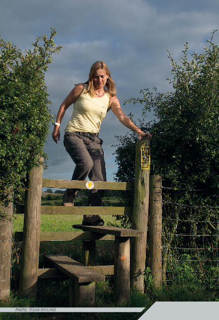
photo: tegan rayland
357g Day Walks_South Downs Inside.indd 6 31/03/2011 11:11
INTRODUCTION vii
IntroductionI�have�lived�in�Sussex�all�my�life�and�I�thought�that�I�knew�the�South�Downs�relatively�well.�I�set�out�to�explore�the�South�Downs�National�Park�and�discovered�how�wrong��I�was!�Researching�this�book�has�allowed�me�the�rare�privilege�of�exploring�a�wide�mix�of�trails�and�locations�over�one�year.�I’ve�marched�along�ridges�and�cliff-tops,�gazed�at�wide�expanses�of�open�downland�and�struggled�up�chalk�escarpments.�I’ve�discovered�unexpected�ruins,�desolate�battlefields�and�quiet�dewponds.�I’ve�navigated�tree-covered�downland�and�tiptoed�through�grazing�fields.�Sometimes,�what�you�see�makes�you�stop�in�your�tracks:�chalky�woods�or�copses�crammed�with�foxgloves,�rough�grassland�and�vibrant�meadows,�ancient�woodland�or�heath.
Walking is about more than travelling from A to B. It’s about physical exercise and having the wind in your face or the sun in your eyes. It’s about noticing how the seasons affect our landscape, external and internal. It’s about being out there in the environment, looking around, perhaps for the first time or perhaps with fresh eyes and seeing new things. It’s about noticing a tiny detail and the excitement of seeing how much is waiting to be discovered.
It’s finding out about the past, the stories, true or imagined, that have shaped the lives of those who’ve lived somewhere and how people’s actions can shape a place. It’s about noticing the different habitats and the plants, invertebrates, birds and mammals that might thrive in that specific location, given half a chance. Wildlife may be out of sight but simply knowing its name or that it could be there brings you closer to it and more likely to differentiate between different species.
Sometimes walking is about who you’re with, and the pleasure of sharing the experience with friends or family. Sometimes, it’s all about stopping at a welcoming authentic pub, eating good food with a hearty appetite or simply having a nice cup of tea or coffee and a chat. And sometimes, it’s all about the pleasure of arriving home after a good day out.
Whatever walking means to you, I hope that you enjoy the day walks in this book and share my excitement in exploring the South Downs National Park.
It’s all out there waiting for you! Find the time and take a walk. Who knows what you may discover?
Deirdre Huston
357g Day Walks_South Downs Inside.indd 7 31/03/2011 11:11
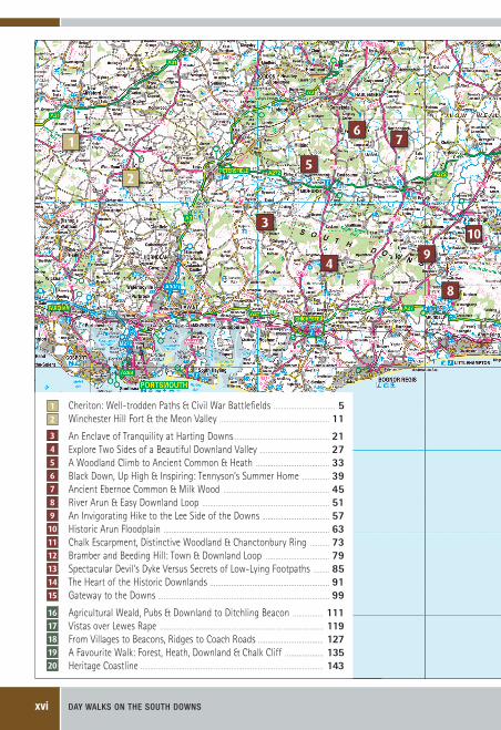
DAY WALKS ON THE SOUTH DOWNSxvi
1
2
3
4
5
67
8
9
10
1
2
3
4
5
6
7
8
9
10
11
12
13
14
15
17
16
18
19
20
Cheriton: Well-trodden Paths & Civil War Battlefi elds . . . . . . . . . . . . . . . . . . . . . . . . . . . . . . . . . . . . . . . . . . . . . . . . . . . . . . . . . . . . . . . . .5Winchester Hill Fort & the Meon Valley . . . . . . . . . . . . . . . . . . . . . . . . . . . . . . . . . . . . . . . . . . . . . . . . . . . . . . . . . . . . . . . . . . . . . . . . . . . . . . . . . . . . . . . . . . . . . . . . . . . . . . . . . . . . . . . . . . .11
An Enclave of Tranquility at Harting Downs . . . . . . . . . . . . . . . . . . . . . . . . . . . . . . . . . . . . . . . . . . . . . . . . . . . . . . . . . . . . . . . . . . . . . . . . . . . . . . . . . . . . . . . . . . . . . . . . . . . .21Explore Two Sides of a Beautiful Downland Valley . . . . . . . . . . . . . . . . . . . . . . . . . . . . . . . . . . . . . . . . . . . . . . . . . . . . . . . . . . . . . . . . . . . . . . . . .27A Woodland Climb to Ancient Common & Heath . . . . . . . . . . . . . . . . . . . . . . . . . . . . . . . . . . . . . . . . . . . . . . . . . . . . . . . . . . . . . . . . . . . . . . . . . . . . . .33Black Down, Up High & Inspiring: Tennyson’s Summer Home . . . . . . . . . . . . . . . . . . . . . . . . . . . . .39Ancient Ebernoe Common & Milk Wood . . . . . . . . . . . . . . . . . . . . . . . . . . . . . . . . . . . . . . . . . . . . . . . . . . . . . . . . . . . . . . . . . . . . . . . . . . . . . . . . . . . . . . . . . . . . . . . . . . . . . . . . . . . . . . . .45River Arun & Easy Downland Loop . . . . . . . . . . . . . . . . . . . . . . . . . . . . . . . . . . . . . . . . . . . . . . . . . . . . . . . . . . . . . . . . . . . . . . . . . . . . . . . . . . . . . . . . . . . . . . . . . . . . . . . . . . . . . . . . . . . . . . . . . . . . . . . . . . . . .51An Invigorating Hike to the Lee Side of the Downs . . . . . . . . . . . . . . . . . . . . . . . . . . . . . . . . . . . . . . . . . . . . . . . . . . . . . . . . . . . . . . . . . . . . . . .57Historic Arun Floodplain . . . . . . . . . . . . . . . . . . . . . . . . . . . . . . . . . . . . . . . . . . . . . . . . . . . . . . . . . . . . . . . . . . . . . . . . . . . . . . . . . . . . . . . . . . . . . . . . . . . . . . . . . . . . . . . . . . . . . . . . . . . . . . . . . . . . . . . . . . . . . . . . . . . . . . . . . . . . . . . . . . . . . . . . . . . . .63Chalk Escarpment, Distinctive Woodland & Chanctonbury Ring . . . . . . . . . . . . . . . . . . . . . .73Bramber and Beeding Hill: Town & Downland Loop . . . . . . . . . . . . . . . . . . . . . . . . . . . . . . . . . . . . . . . . . . . . . . . . . . . . . . . . . . . . . . . . . . . . .79Spectacular Devil’s Dyke Versus Secrets of Low-Lying Footpaths . . . . . . . . . . . . . . . . . . .85The Heart of the Historic Downlands . . . . . . . . . . . . . . . . . . . . . . . . . . . . . . . . . . . . . . . . . . . . . . . . . . . . . . . . . . . . . . . . . . . . . . . . . . . . . . . . . . . . . . . . . . . . . . . . . . . . . . . . . . . . . . . . . . . . . . . . . . . . .91Gateway to the Downs . . . . . . . . . . . . . . . . . . . . . . . . . . . . . . . . . . . . . . . . . . . . . . . . . . . . . . . . . . . . . . . . . . . . . . . . . . . . . . . . . . . . . . . . . . . . . . . . . . . . . . . . . . . . . . . . . . . . . . . . . . . . . . . . . . . . . . . . . . . . . . . . . . . . . . . . . . . . . . . . . . . . . . . . . . . . . . . . . . .99
Agricultural Weald, Pubs & Downland to Ditchling Beacon . . . . . . . . . . . . . . . . . . . . . . . . . . . . . . . . .111Vistas over Lewes Rape . . . . . . . . . . . . . . . . . . . . . . . . . . . . . . . . . . . . . . . . . . . . . . . . . . . . . . . . . . . . . . . . . . . . . . . . . . . . . . . . . . . . . . . . . . . . . . . . . . . . . . . . . . . . . . . . . . . . . . . . . . . . . . . . . . . . . . . . . . . . . . . . . . . . . . . . . . . . . . . . . . . . . . . . . . . .119From Villages to Beacons, Ridges to Coach Roads . . . . . . . . . . . . . . . . . . . . . . . . . . . . . . . . . . . . . . . . . . . . . . . . . . . . . . . . . . . . . . . . . . . . . .127A Favourite Walk: Forest, Heath, Downland & Chalk Cliff . . . . . . . . . . . . . . . . . . . . . . . . . . . . . . . . . . . . . . . . . .135Heritage Coastline . . . . . . . . . . . . . . . . . . . . . . . . . . . . . . . . . . . . . . . . . . . . . . . . . . . . . . . . . . . . . . . . . . . . . . . . . . . . . . . . . . . . . . . . . . . . . . . . . . . . . . . . . . . . . . . . . . . . . . . . . . . . . . . . . . . . . . . . . . . . . . . . . . . . . . . . . . . . . . . . . . . . . . . . . . . . . . . . . . . . . . . . . . . . . . . .143
357g Day Walks_South Downs Inside.indd 16 31/03/2011 11:11
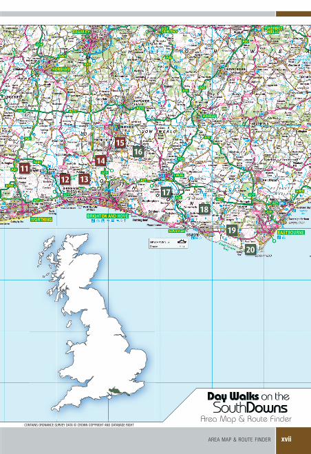
aREa Map & ROUTE FINDER xvii
Area Map & Route Finder
1112 13
14
1516
20
19
18
17
CONTAINS ORDNANCE SURVEY DATA © CROWN COPYRIGHT AND DATABASE RIGHT
357g Day Walks_South Downs Inside.indd 17 31/03/2011 11:12
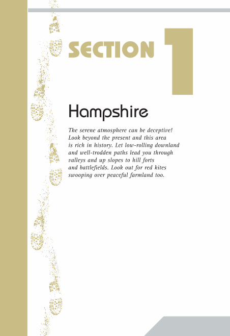
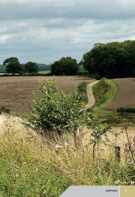
HampshireThe serene atmosphere can be deceptive! Look beyond the present and this area is rich in history. Let low-rolling downland and well-trodden paths lead you through valleys and up slopes to hill forts and battlefields. Look out for red kites swooping over peaceful farmland too.
SECTION1
357g Day Walks_South Downs Inside.indd 18 31/03/2011 11:12
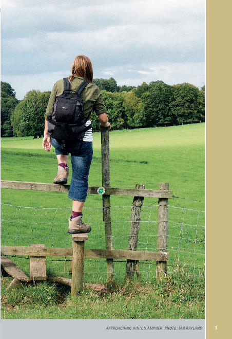
1apprOaching hintOn ampner photo: ian rayland
357g Day Walks_South Downs Inside.indd 1 31/03/2011 11:12
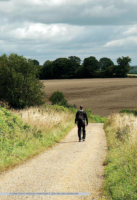
a farm track thrOugh hampShire'S lOw-rOlling dOwnland
357g Day Walks_South Downs Inside.indd 2 31/03/2011 11:12
HAmpSHirE 3
357g Day Walks_South Downs Inside.indd 3 31/03/2011 11:12
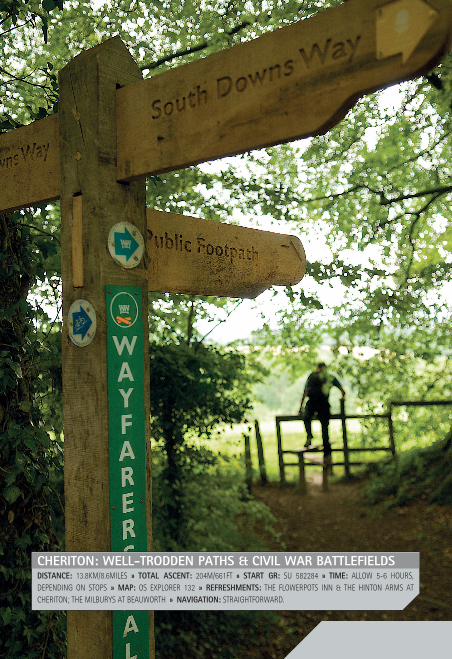
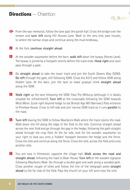
CHeriton: WeLL-troDDen PatHs & CiViL War BattLefieLDsDistanCe: 13.8KM/8.6MILES » totaL asCent: 204M/661FT » start Gr: SU 582284 » time: ALLOW 5-6 HOURS, DEPENDING ON STOPS » maP: OS ExPLORER 132 » refresHments: THE FLOWERPOTS INN & THE HINTON ARMS AT CHERITON; THE MILBURYS AT BEAUWORTH » naViGation: STRAIGHTFORWARD.
357g Day Walks_South Downs Inside.indd 4 31/03/2011 11:12
01 ChERITON – HAmpSHirE 5
StartAt�the�war�memorial�on�the�village�green.��Roadside�parking.�gR:�SU�582284.
The WalkThe village of Cheriton offers a charming mix of thatched cottages, a village green, a gentle stream and plenty of ducks! Meander out of the village to explore rolling downland on farm tracks. Join the South Downs Way and make the gentle climb to Milbarrow Down and the friendly Milburys free house. The 400-year-old building sits beside an intersection of historic pathways.
Milbarrow Down was a Bronze Age barrow cemetery and a barrow mound can be seen above the crossroads. Itself unspectacular, the background makes it more than interesting. Bronze Age barrow mounds are primarily burial places for individuals rather than communal burials like earlier long barrows. An important person could have been buried here, kept company by a collection of material possessions to indicate their importance. Alternatively, was this a non-burial barrow, intended to mark territory on the highly visible hilltop horizon where the resulting mound of fresh chalk would be a striking landmark?
Follow Wayfarers Walk across fields, through Kilmeston and on towards National Trust Hinton Ampner. We approach the house from the south, a simple way to appreciate the position and outlook of this garden, known for its stunning views. Explore the thirteenth century church or detour to see the elegant interior of the house and wander through its gardens to intimately appraise Ralph Dutton’s accomplished mix of formal and informal planting.
Beyond the A272, our route joins a section of the Cheriton Battlefield Walk. On the 29 March 1644, the Battle of Cheriton decided the course of the Civil War in Southern England. This walk is well signed with boards that point out where skirmishes between Royalists and Parliamentarians bloodied the landscape. We follow part of it, but if you want to divert to explore it more fully, please do so using the information boards and the optional route marked on our map. The sunken paths and lie of the land make it easy to imagine emotions and atmosphere as the battle unfolds.
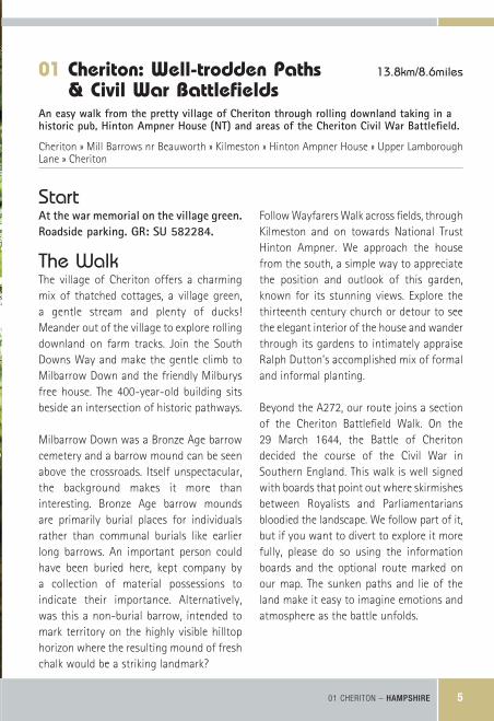
01 Cheriton: Well-trodden Paths 13.8km/8.6miles
& Civil War Battlefields
An�easy�walk�from�the�pretty�village�of�Cheriton�through�rolling�downland�taking�in�a�historic�pub,�Hinton�Ampner�House�(NT)�and�areas�of�the�Cheriton�Civil�war�Battlefield.
Cheriton » Mill Barrows nr Beauworth » Kilmeston » Hinton Ampner House » Upper Lamborough Lane » Cheriton
357g Day Walks_South Downs Inside.indd 5 31/03/2011 11:12
DAY WALKS ON THE SOUTH DOWNS6
357g Day Walks_South Downs Inside.indd 6 31/03/2011 11:12

01 Cheriton
01 ChERITON – HAmpSHirE 7
© CROWN COPYRIGHT AND/OR DATABASE RIGHT. ALL RIGHTS RESERVED. LICENCE NUMBER 100025218.
357g Day Walks_South Downs Inside.indd 7 31/03/2011 11:12
DAY WALKS ON THE SOUTH DOWNS8
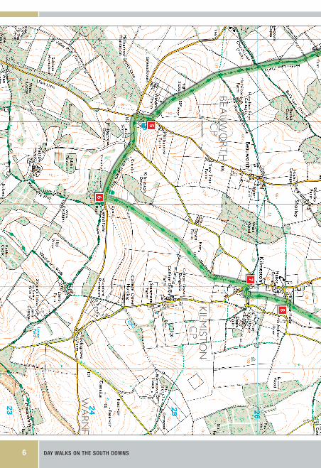
From the war memorial, follow the lane past the parish hall. Cross the bridge over the stream and turn� left along Hill Houses Lane. Walk to the very end, past houses, to where the tarmac stops and continue along the mud bridleway.
2 At the fork, continue�straight�ahead.
3 At the wooden waymarker before the barn, walk�left down the byway (Honey Lane). The byway is joined by a footpath shortly before the track ends. Head�right and soon pass through a gate.
4 Go straight� ahead to take the lower track and join the South Downs Way (SDW). go�left through the gate, still following SDW. Cross the A272 and follow SDW along Holden Lane. At the barn, join the lane to make gradual climb straight� ahead along the SDW.
5 walk�right up the lane following the SDW. Pass The Milburys (although it is ideally situated for refreshment!). Turn� left at the crossroads following the SDW towards West Meon. (Look right beyond hedge to see Bronze Age Mill Barrows.) Pass entrance to Preshaw House. Cross to left side and join narrow SDW track as it runs parallel to the road.
6 Turn�left leaving the SDW to follow Wayfarers Walk where the track rejoins the road. Walk down the hill along the edge of the field to the stile. Continue straight ahead across the next field and go through the gap in the hedge, following the path straight ahead through the crop field. At the far side, look for the wooden waymarker on your right to lead you onto a ‘hidden’ footpath between the hedge and the fence. Cross the stile and continue along the fence. Cross the stile, across the field and cross another stile.
7 You are now in Kilmeston, opposite the village hall. walk� across� the� road� and�straight�ahead, following the road to Dean House. Turn�left at the wooden signpost following Wayfarers Walk. Go through a double gate and walk along a wooded path. Cross another couple of stiles and follow the line of the telegraph poles straight�ahead to the far side of the field. Pass the church on your left and cross the stile.
Directions – Cheriton
357g Day Walks_South Downs Inside.indd 8 31/03/2011 11:12
01 ChERITON – HAmpSHirE 9
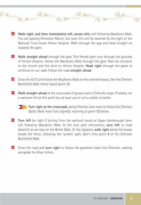
8 walk�right,�and�then�immediately�left,�across�stile, still following Wayfarers Walk. You are passing Kilmeston Manor, but soon this will be dwarfed by the sight of the National Trust house Hinton Ampner. Walk through the gap and head straight on towards the gate.
9 walk�straight�ahead through the gate. This fenced path runs through the grounds of Hinton Ampner. Follow the Wayfarers Walk through the gate. Pass the entrance to the church and the drive to Hinton Ampner. Head� right through the gates to continue on our walk. Follow the road straight�ahead.
10 Cross the A272 and follow the Wayfarers Walk on the concrete byway. See the Cheriton Battlefield Walk notice board (point 2).
11 walk�straight�ahead at the crossroads of grassy tracks. Climb the slope. Probably not a welcome hill at this point but at least you’re not a soldier at battle.
Turn�right�at�the�crossroads, along Cheriton Lane track to follow the Cheriton Battle Walk more fully (signed), rejoining at point 12 below.
12 Turn� left (or right if joining from the optional route) at Upper Lamborough Lane, still following Wayfarers Walk. At the next path intersection, turn� left to head downhill as we stay on the Battle Walk. At the signpost, walk�right along the byway beside the fence, following the ‘sunken’ path. Don’t miss point 4 of the Cheriton Battlefield Walk.
13 Cross the road and turn� right to follow the pavement back into Cheriton, walking alongside the River Itchen.
357g Day Walks_South Downs Inside.indd 9 31/03/2011 11:12