Embed Size (px)
Citation preview

Copyright © 2012 Poppy’s Bell
Thank you for downloading this item. I hope it is
helpful. I truly value all feedback and encourage you to
contact me if you have any questions, comments, or
suggestions for improvement.
Copyright © 2012 “Poppy’s Bell” (JW Shields) All rights reserved by author.
Permission to copy for single classroom use only. Electronic distribution limited to single classroom use only.
Not for public display.
Poppy’s Bell
Copyright © 2012 Poppy’s Bell
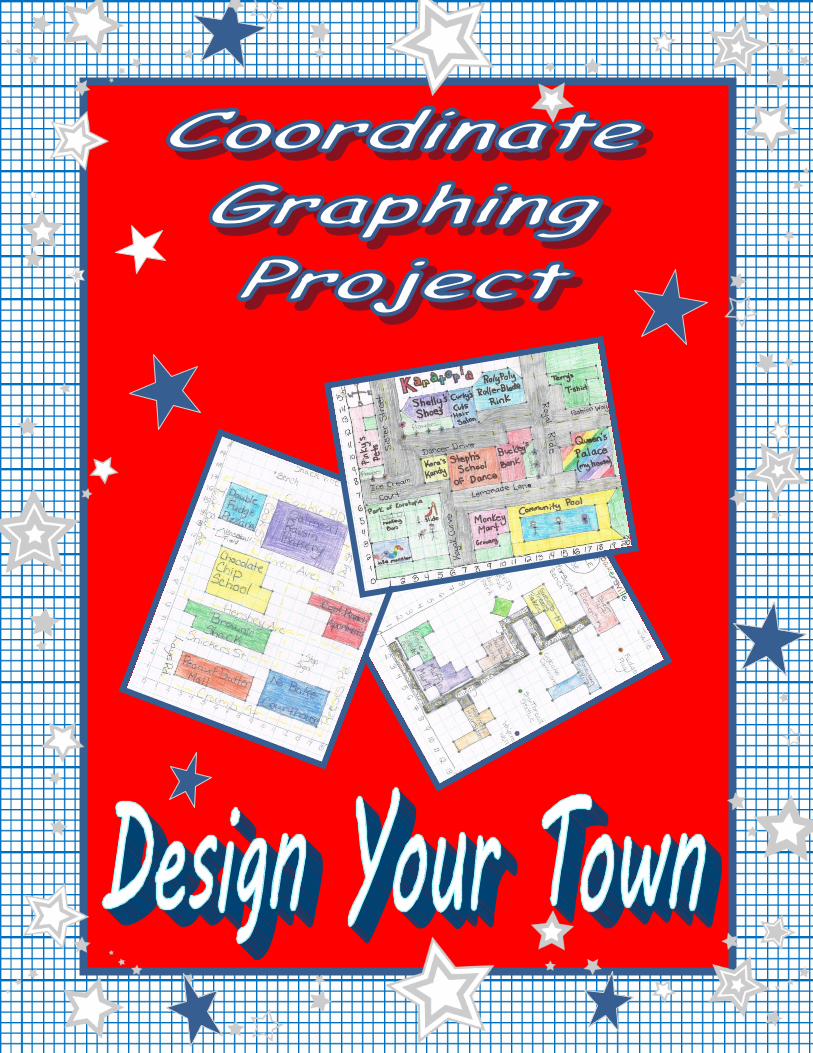
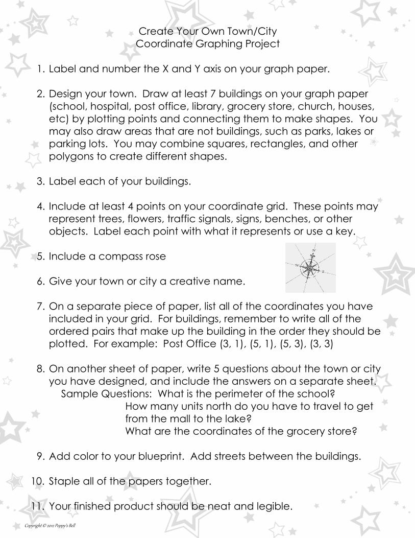
Create Your Own Town/City
Coordinate Graphing Project
1. Label and number the X and Y axis on your graph paper.
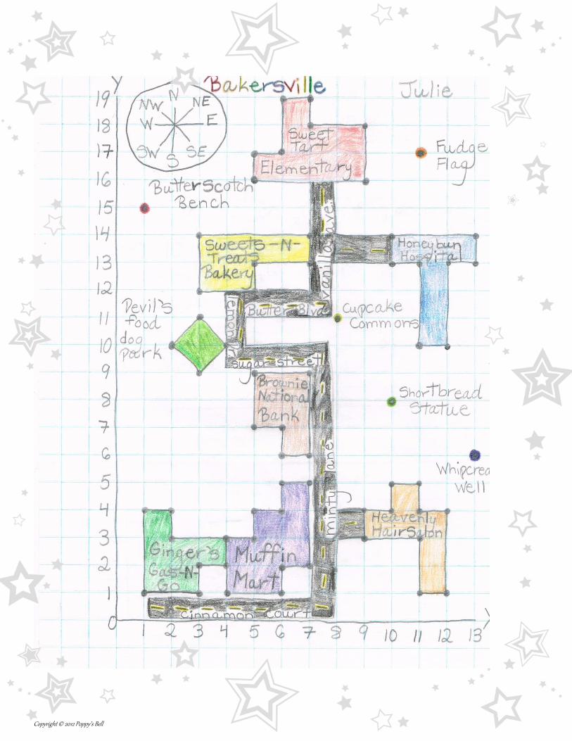
2. Design your town. Draw at least 7 buildings on your graph paper
(school, hospital, post office, library, grocery store, church, houses,
etc) by plotting points and connecting them to make shapes. You
may also draw areas that are not buildings, such as parks, lakes or
parking lots. You may combine squares, rectangles, and other
polygons to create different shapes.
3. Label each of your buildings.
4. Include at least 4 points on your coordinate grid. These points may
represent trees, flowers, traffic signals, signs, benches, or other
objects. Label each point with what it represents or use a key.
5. Include a compass rose
6. Give your town or city a creative name.
7. On a separate piece of paper, list all of the coordinates you have
included in your grid. For buildings, remember to write all of the
ordered pairs that make up the building in the order they should be
plotted. For example: Post Office (3, 1), (5, 1), (5, 3), (3, 3)
8. On another sheet of paper, write 5 questions about the town or city
you have designed, and include the answers on a separate sheet.
Sample Questions: What is the perimeter of the school?
How many units north do you have to travel to get
from the mall to the lake?
What are the coordinates of the grocery store?
9. Add color to your blueprint. Add streets between the buildings.
10. Staple all of the papers together.
11. Your finished product should be neat and legible.
Copyright © 2012 Poppy’s Bell
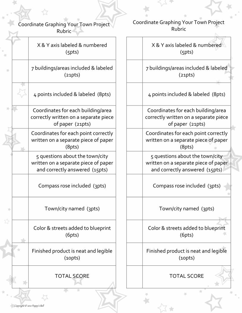
Coordinate Graphing Your Town Project
Rubric
Coordinate Graphing Your Town Project
Rubric
X & Y axis labeled & numbered
(5pts)
X & Y axis labeled & numbered
(5pts)
7 buildings/areas included & labeled
(21pts)
7 buildings/areas included & labeled
(21pts)
4 points included & labeled (8pts)
4 points included & labeled (8pts)
Coordinates for each building/area correctly written on a separate piece
of paper (21pts)
Coordinates for each building/area correctly written on a separate piece
of paper (21pts)
Coordinates for each point correctly written on a separate piece of paper
(8pts)
Coordinates for each point correctly written on a separate piece of paper
(8pts)
5 questions about the town/city written on a separate piece of paper
and correctly answered (15pts)
5 questions about the town/city written on a separate piece of paper
and correctly answered (15pts)
Compass rose included (3pts)
Compass rose included (3pts)
Town/city named (3pts)
Town/city named (3pts)
Color & streets added to blueprint
(6pts)
Color & streets added to blueprint
(6pts)
Finished product is neat and legible
(10pts)
Finished product is neat and legible
(10pts)
TOTAL SCORE
TOTAL SCORE
Copyright © 2012 Poppy’s Bell