Embed Size (px)
Citation preview
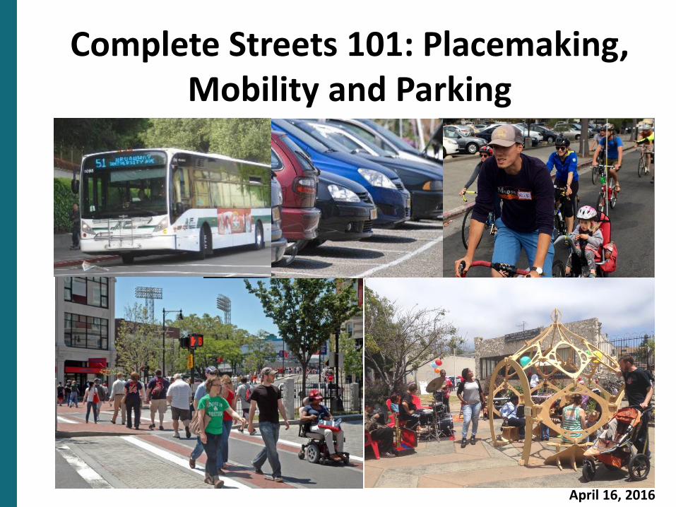
Complete Streets 101: Placemaking, Mobility and Parking
April 16, 2016
Today’s Agenda
Welcome
Complete Streets 101 Presentation
Panel Discussion and Q & A
Planning Process Next Steps
Open House
Summary and Recap
Adjourn
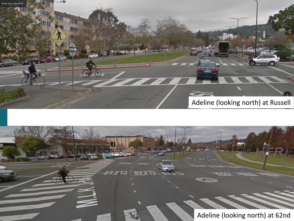
Adeline (looking north) at Russell
Adeline (looking north) at 62nd
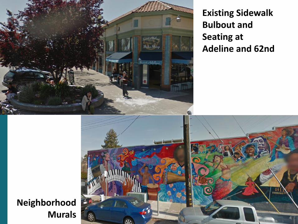
Existing Sidewalk Bulbout and Seating at Adeline and 62nd
Neighborhood Murals
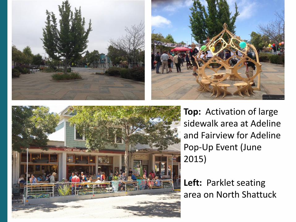
Top: Activation of large sidewalk area at Adeline and Fairview for Adeline Pop-Up Event (June 2015)
Left: Parklet seating area on North Shattuck
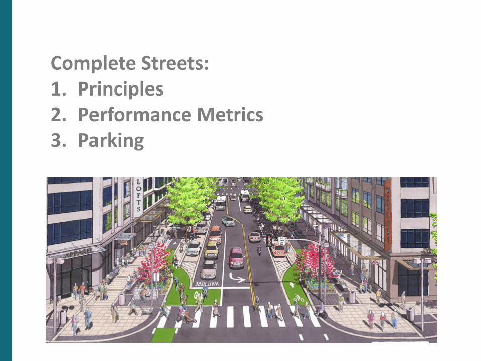
Complete Streets:1. Principles2. Performance Metrics3. Parking
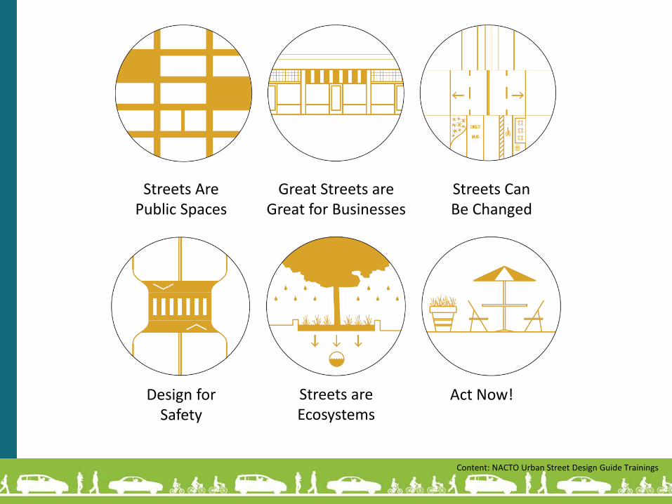
Streets Are Public Spaces
Great Streets are Great for Businesses
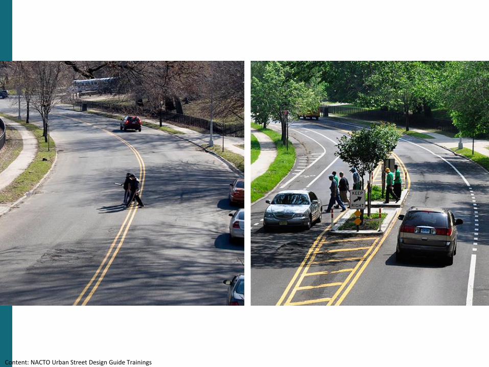
Streets Can Be Changed
Design for Safety
Streets are Ecosystems
Act Now!
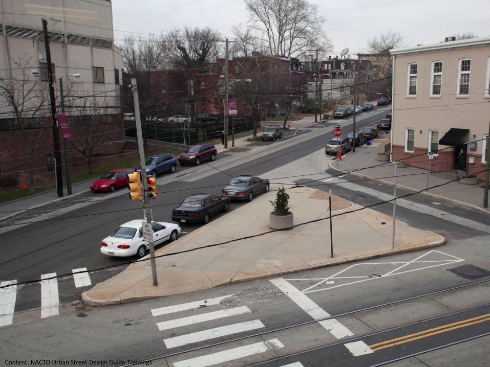
Content: NACTO Urban Street Design Guide Trainings
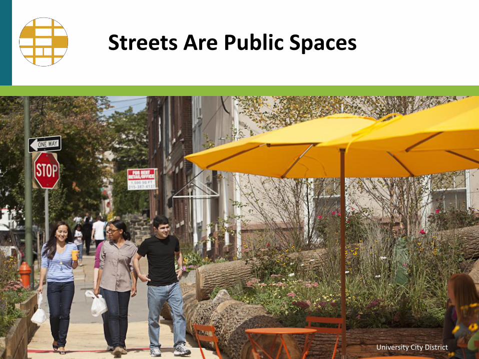
Streets Are Public Spaces
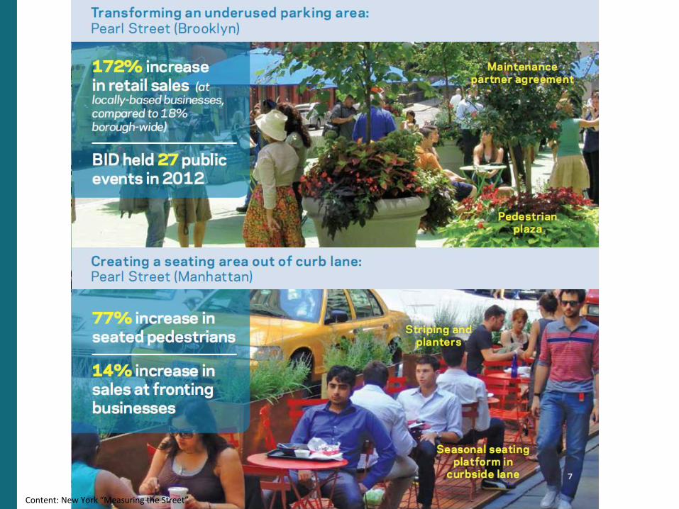
University City District
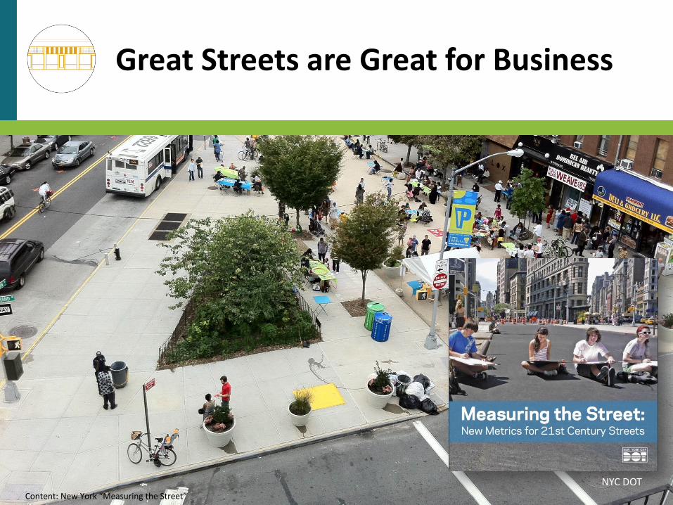
Great Streets are Great for Business
NYC DOTContent: New York “Measuring the Street”
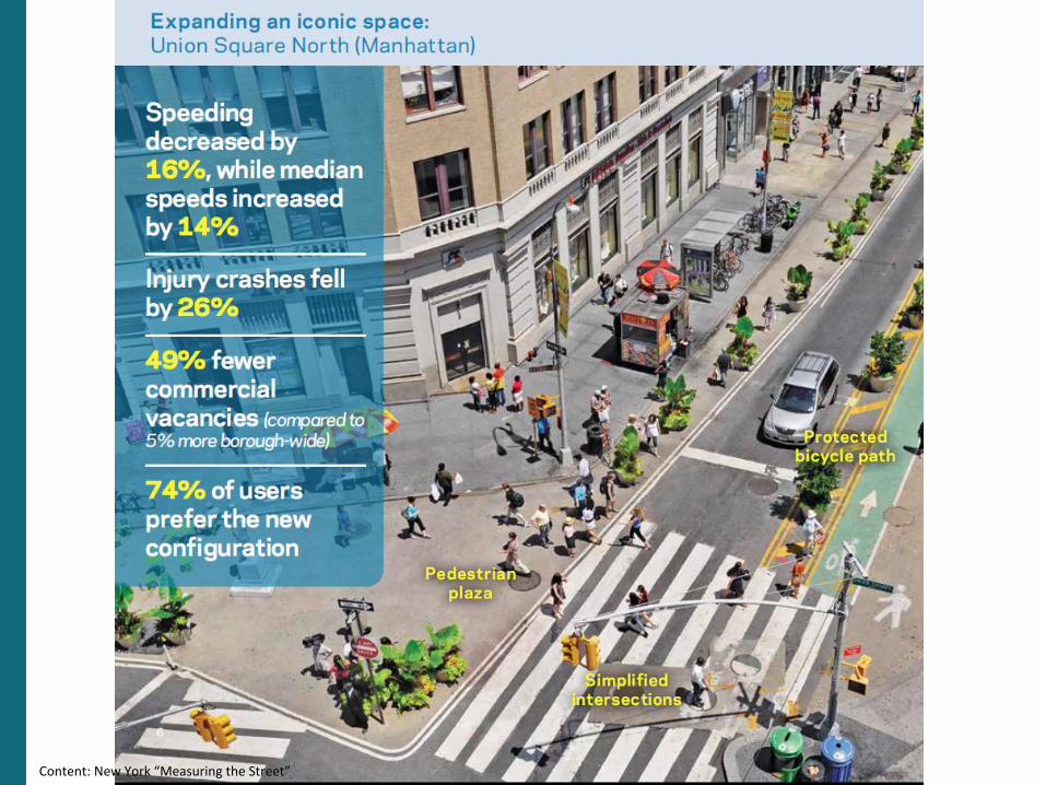
Content: New York “Measuring the Street”
Content: New York “Measuring the Street”
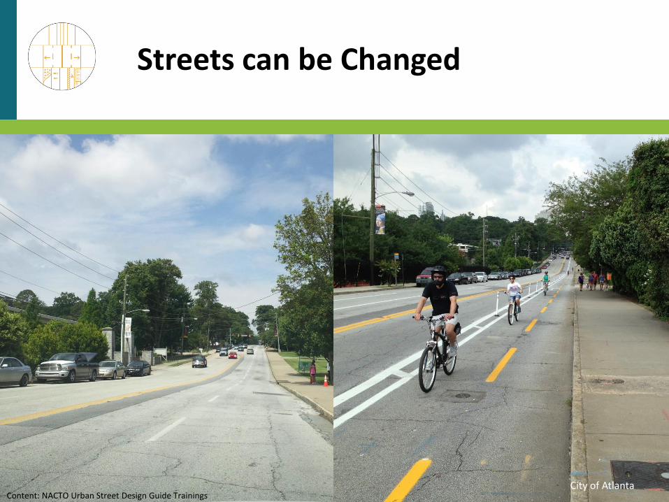
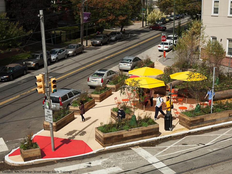
Streets can be Changed
City of AtlantaContent: NACTO Urban Street Design Guide Trainings
Content: NACTO Urban Street Design Guide Trainings
Content: NACTO Urban Street Design Guide Trainings
Content: NACTO Urban Street Design Guide Trainings
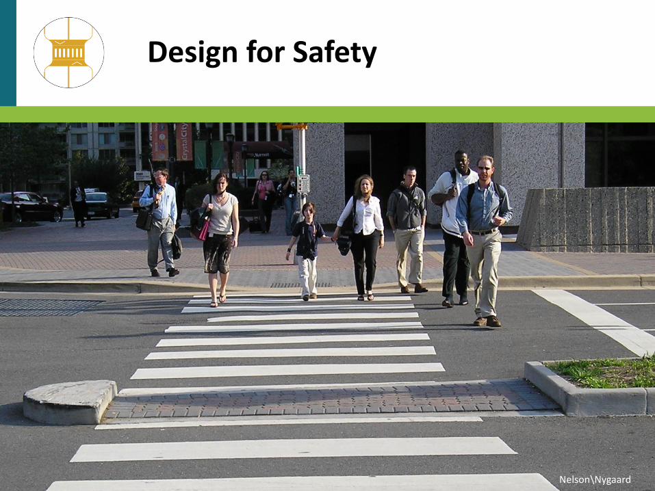
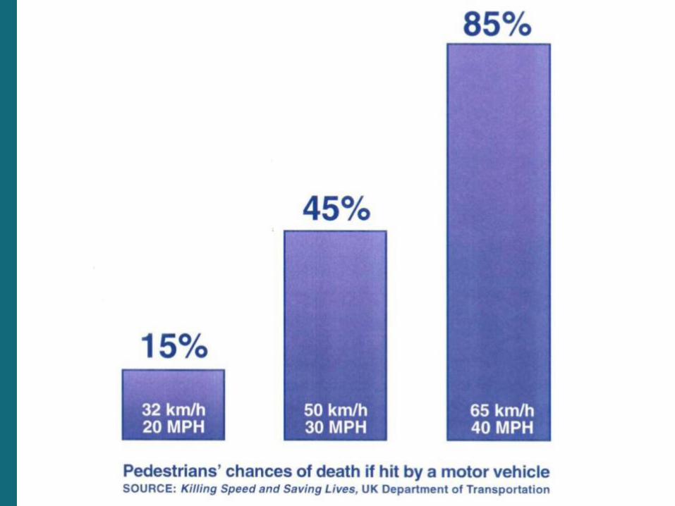
Design for Safety
Nelson\Nygaard
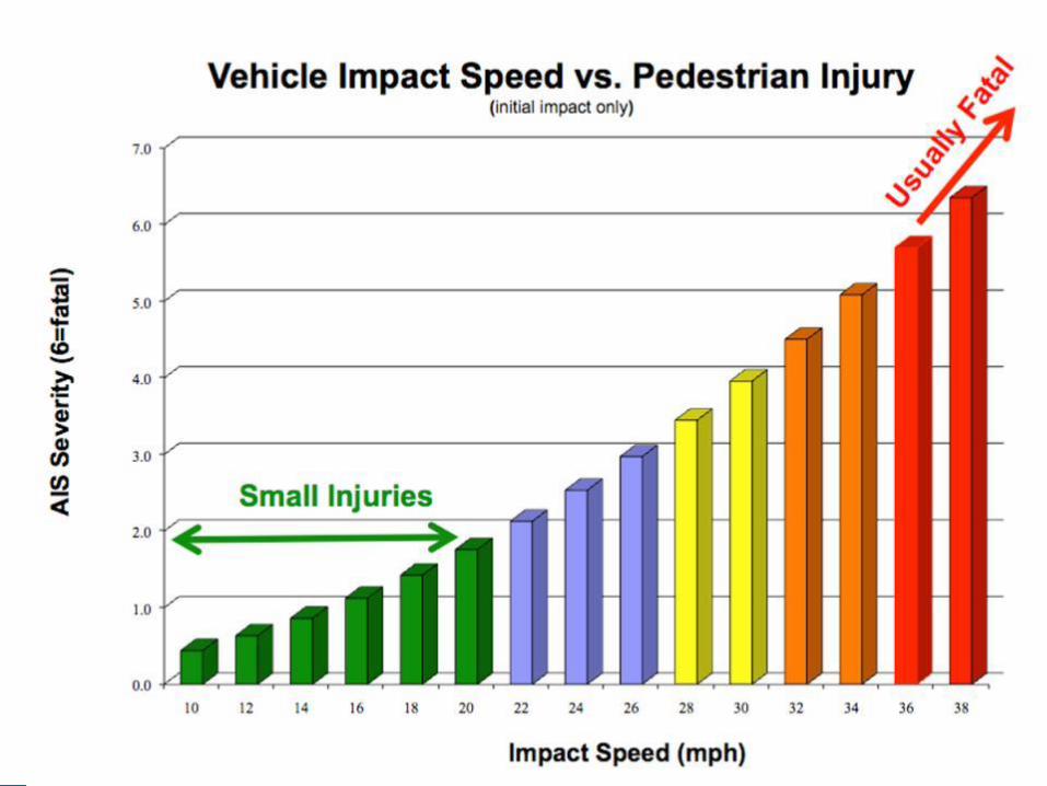
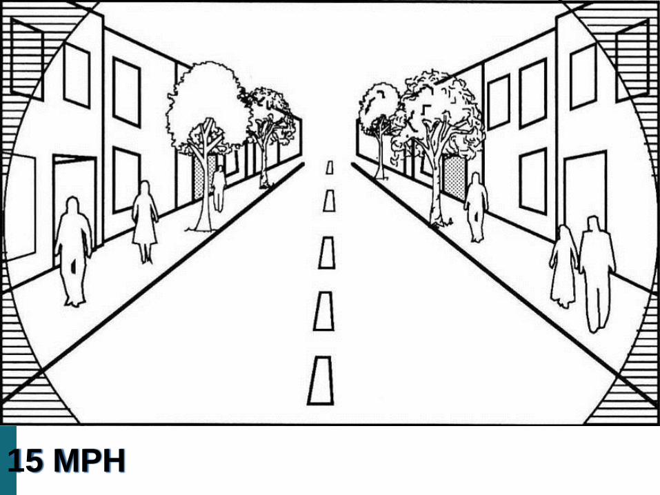
15 MPH
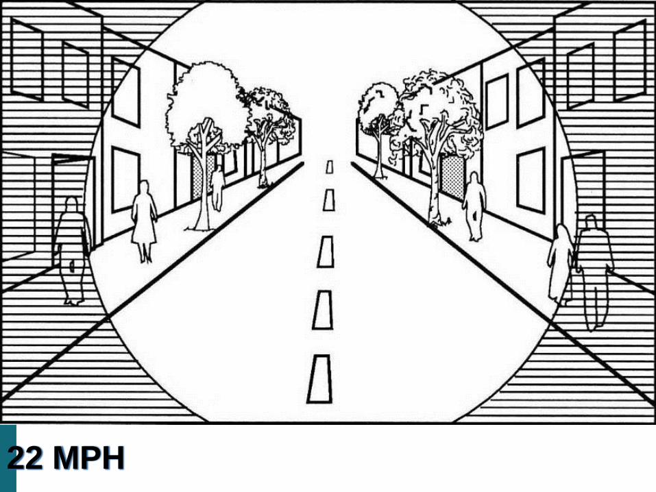
22 MPH
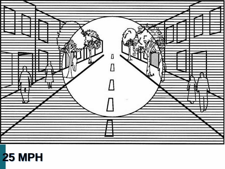
25 MPH
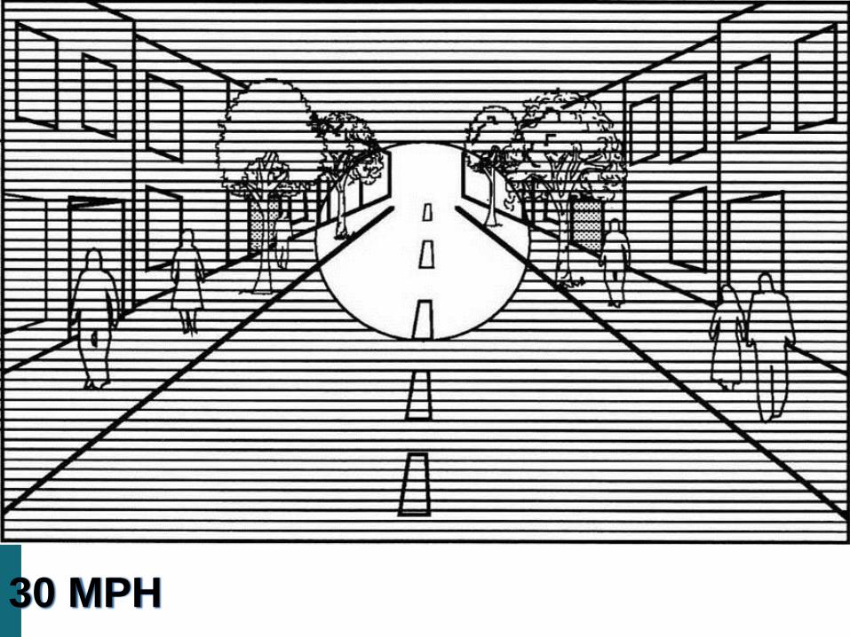
30 MPH
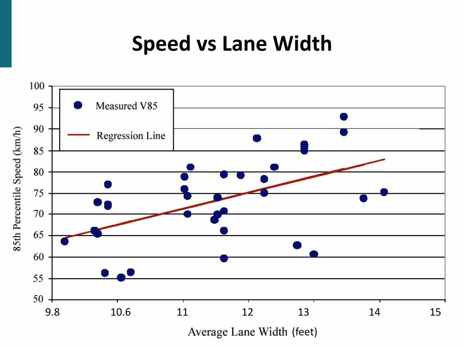
Speed vs Lane Width
9.8 11 13 1512 1410.6
(feet)
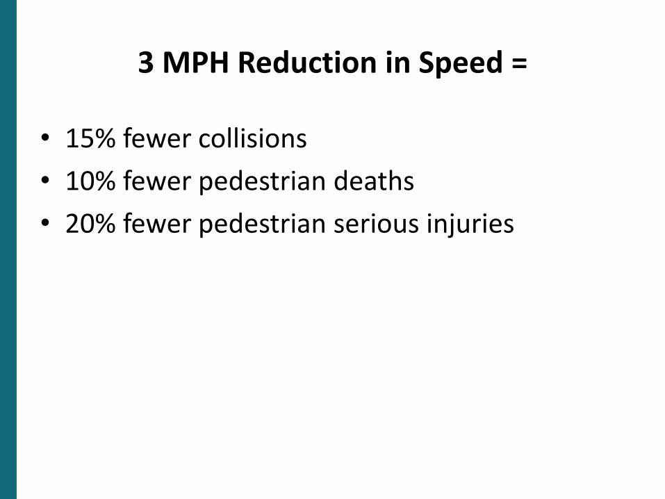
3 MPH Reduction in Speed =
• 15% fewer collisions
• 10% fewer pedestrian deaths
• 20% fewer pedestrian serious injuries
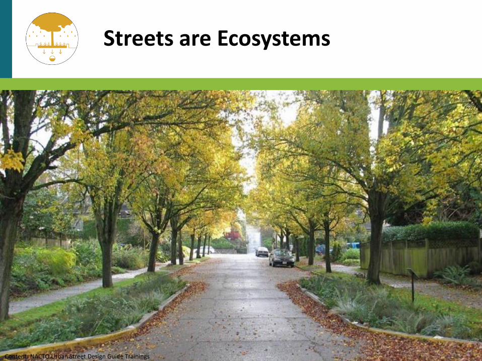
Streets are Ecosystems
Content: NACTO Urban Street Design Guide Trainings
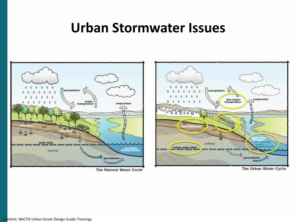
Urban Stormwater Issues
Source: Puget Sound Partnership, 2012, Integrating LID into Local Codes: A Guidebook for Local Governments, prepared by AHBL for the Puget Sound Partnership, July 2012
Content: NACTO Urban Street Design Guide Trainings
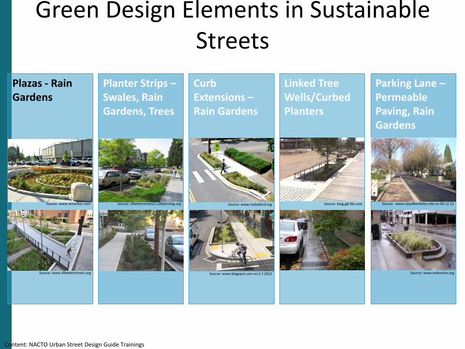
Parking Lane –Permeable Paving, Rain Gardens
Green Design Elements in Sustainable Streets
Plazas - Rain Gardens
Planter Strips –Swales, Rain Gardens, Trees
Curb Extensions –Rain Gardens
Linked Tree Wells/Curbed Planters
Source: blog.g8-life.comSource: www.myballard.org
Source: www.extension.org
Source: www.annarbor.com
Source: www.sfbetterstreets.org
Source: sfbetterstreets2.sZfplanning.org Source: www.cityofberkeley.info on 04.12.13
Source: www.blogspot.com on 3.7.2012
Content: NACTO Urban Street Design Guide Trainings
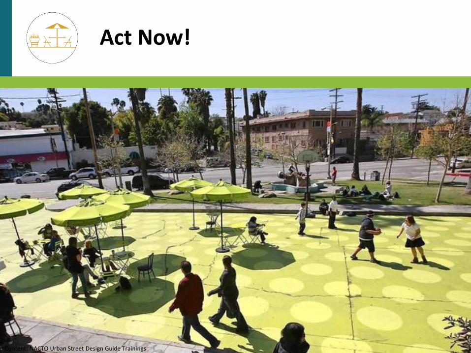
Act Now!
Content: NACTO Urban Street Design Guide Trainings
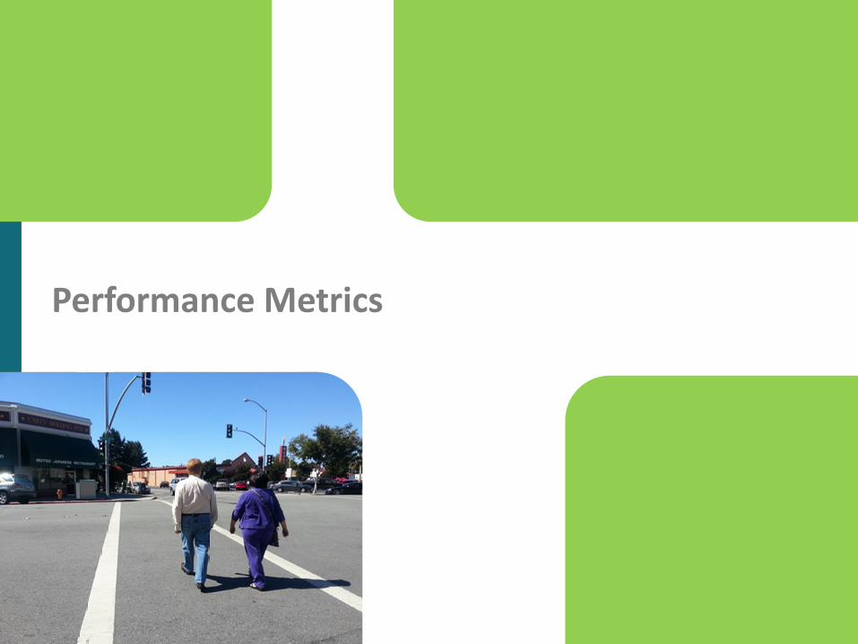
Performance Metrics
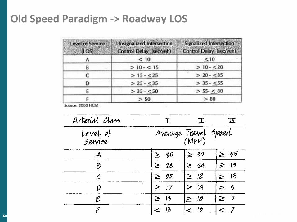
Old Speed Paradigm -> Roadway LOS
Source: Reid Ewing
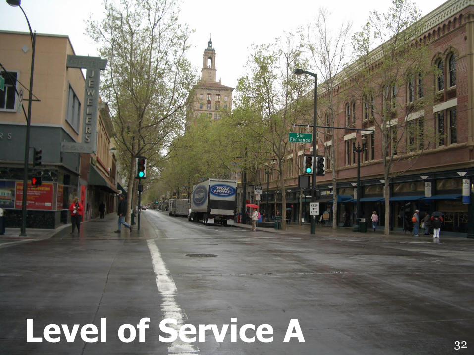
32Level of Service A
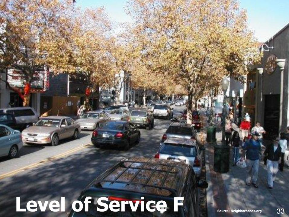
33Level of Service F Source: Neighborhoods.org
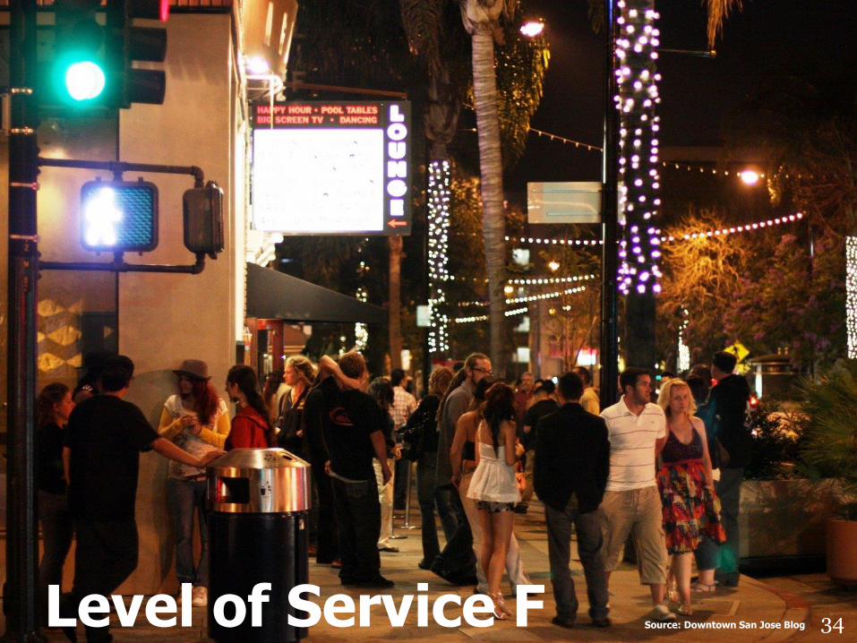
34Level of Service F Source: Downtown San Jose Blog
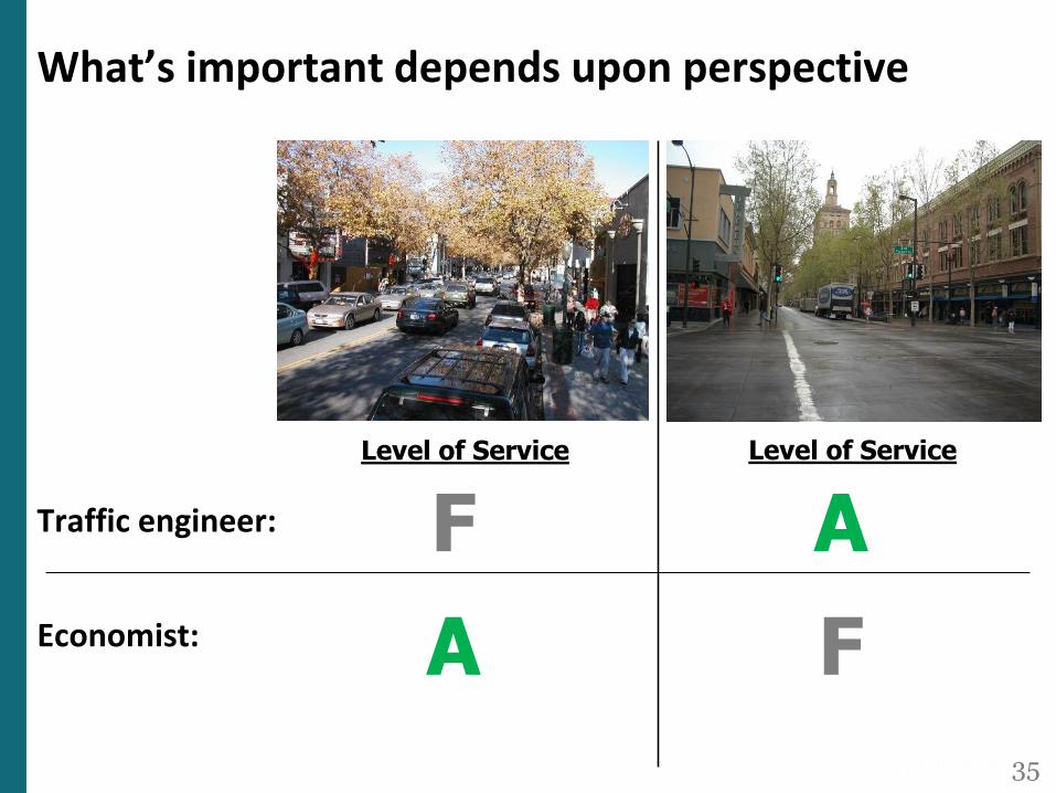
What’s important depends upon perspective
Traffic engineer:
35
F A
A FEconomist:
Level of Service Level of Service

What Gets Measured Gets Done
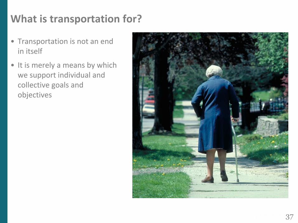
What is transportation for?
• Transportation is not an end in itself
• It is merely a means by which we support individual and collective goals and objectives
37
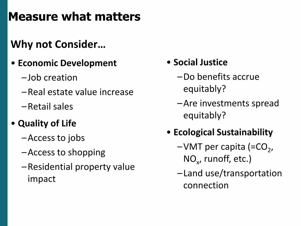
Why not Consider…
• Economic Development
– Job creation
–Real estate value increase
–Retail sales
• Quality of Life
–Access to jobs
–Access to shopping
–Residential property value impact
• Social Justice
–Do benefits accrue equitably?
–Are investments spread equitably?
• Ecological Sustainability
–VMT per capita (=CO2, NOx, runoff, etc.)
–Land use/transportation connection
Measure what matters
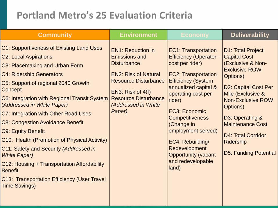
Portland Metro’s 25 Evaluation Criteria
Community Environment Economy Deliverability
C1: Supportiveness of Existing Land Uses
C2: Local Aspirations
C3: Placemaking and Urban Form
C4: Ridership Generators
C5: Support of regional 2040 Growth
Concept
C6: Integration with Regional Transit System
(Addressed in White Paper)
C7: Integration with Other Road Uses
C8: Congestion Avoidance Benefit
C9: Equity Benefit
C10: Health (Promotion of Physical Activity)
C11: Safety and Security (Addressed in
White Paper)
C12: Housing + Transportation Affordability
Benefit
C13: Transportation Efficiency (User Travel
Time Savings)
EN1: Reduction in
Emissions and
Disturbance
EN2: Risk of Natural
Resource Disturbance
EN3: Risk of 4(f)
Resource Disturbance
(Addressed in White
Paper)
EC1: Transportation
Efficiency (Operator –
cost per rider)
EC2: Transportation
Efficiency (System
annualized capital &
operating cost per
rider)
EC3: Economic
Competitiveness
(Change in
employment served)
EC4: Rebuilding/
Redevelopment
Opportunity (vacant
and redevelopable
land)
D1: Total Project
Capital Cost
(Exclusive & Non-
Exclusive ROW
Options)
D2: Capital Cost Per
Mile (Exclusive &
Non-Exclusive ROW
Options)
D3: Operating &
Maintenance Cost
D4: Total Corridor
Ridership
D5: Funding Potential
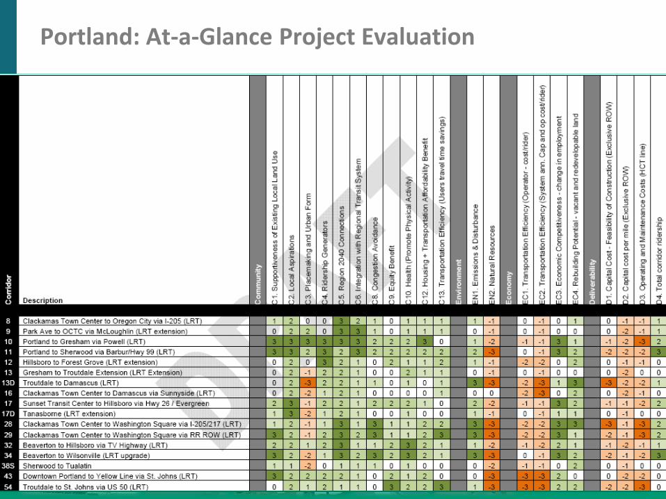
Portland: At-a-Glance Project Evaluation
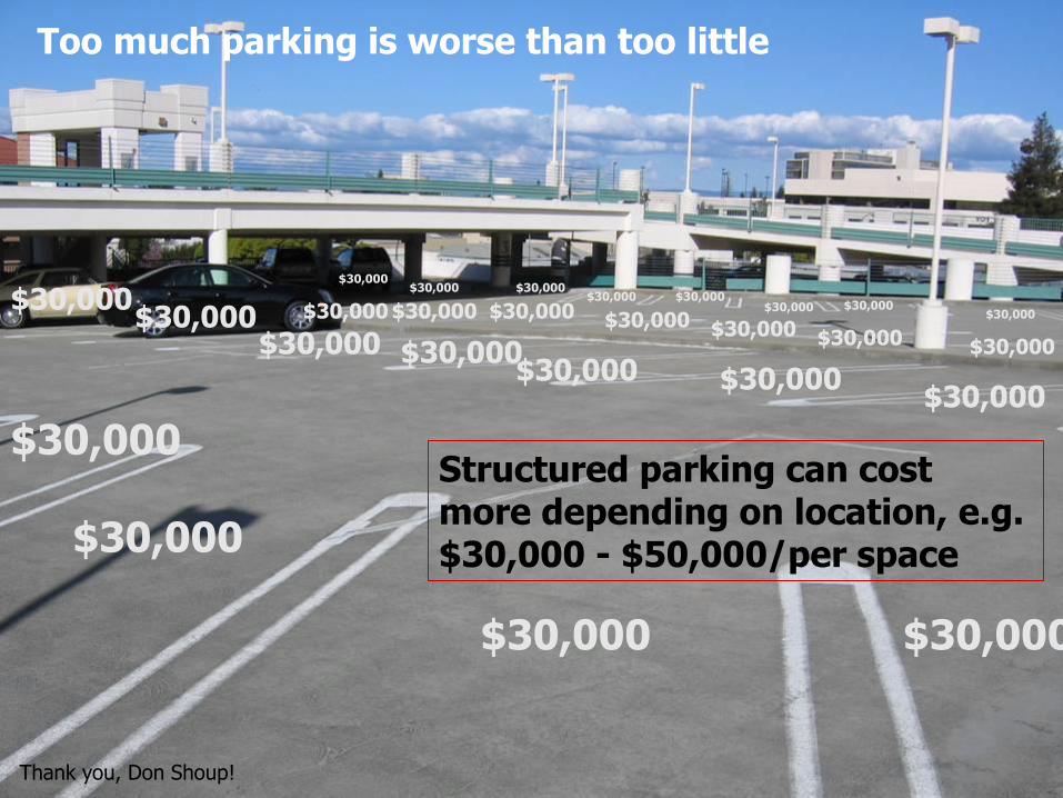
$30,000$30,000
$30,000
$30,000$30,000
$30,000$30,000$30,000$30,000
$30,000$30,000
$30,000$30,000$30,000$30,000$30,000$30,000$30,000 $30,000$30,000$30,000
$30,000$30,000$30,000$30,000
$30,000
Too much parking is worse than too little
Thank you, Don Shoup!
Structured parking can cost more depending on location, e.g. $30,000 - $50,000/per space
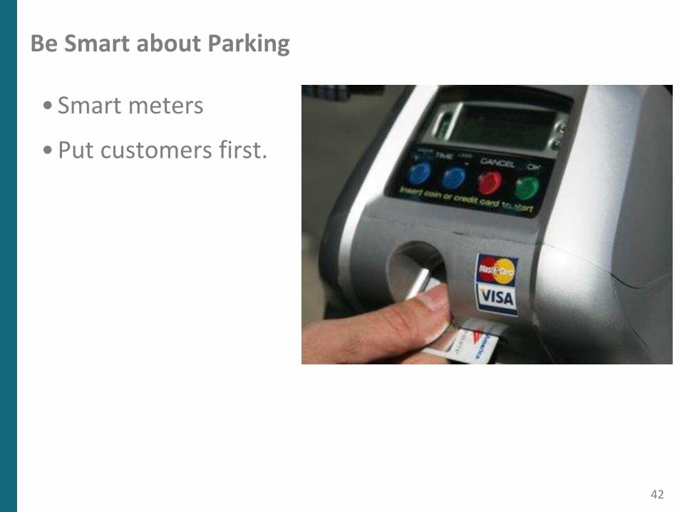
Be Smart about Parking
• Smart meters
• Put customers first.
42
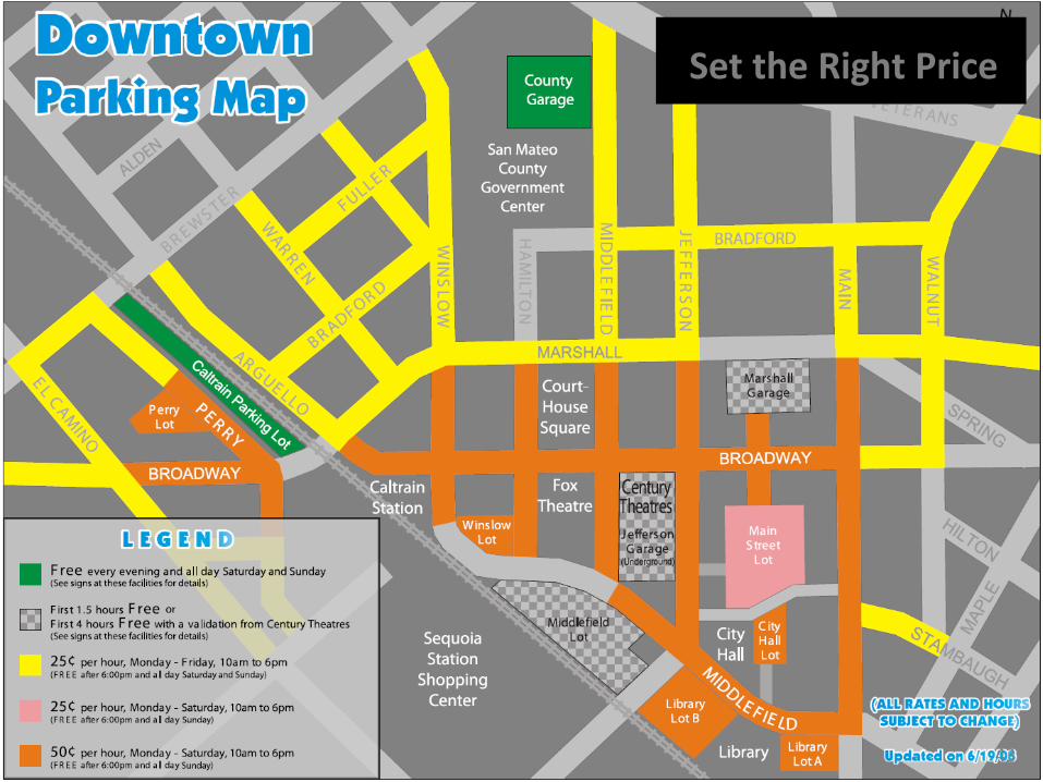
Set the Right Price
43
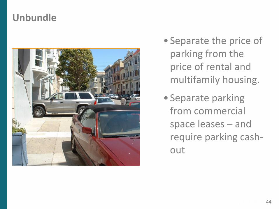
Unbundle
• Separate the price of parking from the price of rental and multifamily housing.
• Separate parking from commercial space leases – and require parking cash-out
44
School
Shop
PlayWork
PP
P
P
PP
T TTT
TTT
TTT
T
T
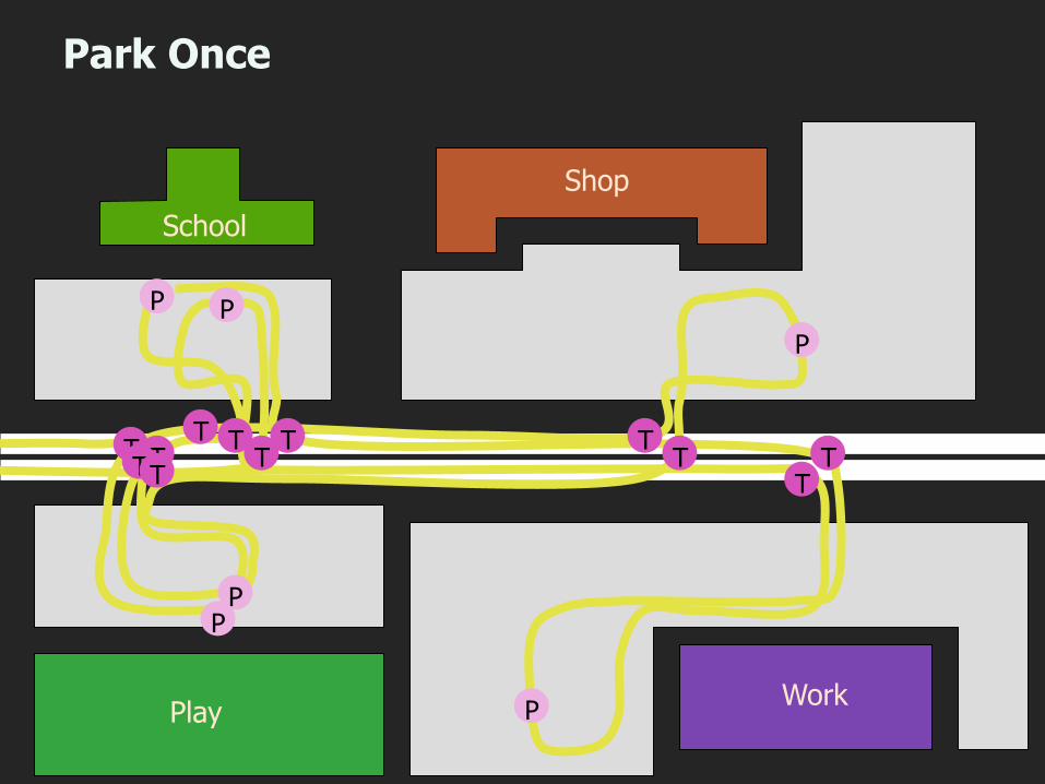
Park Once
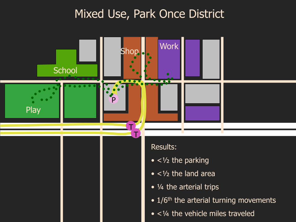
Mixed Use, Park Once District
School
Work
Play
Shop
P
TT
Results:
• <½ the parking
• <½ the land area
• ¼ the arterial trips
• 1/6th the arterial turning movements
• <¼ the vehicle miles traveled
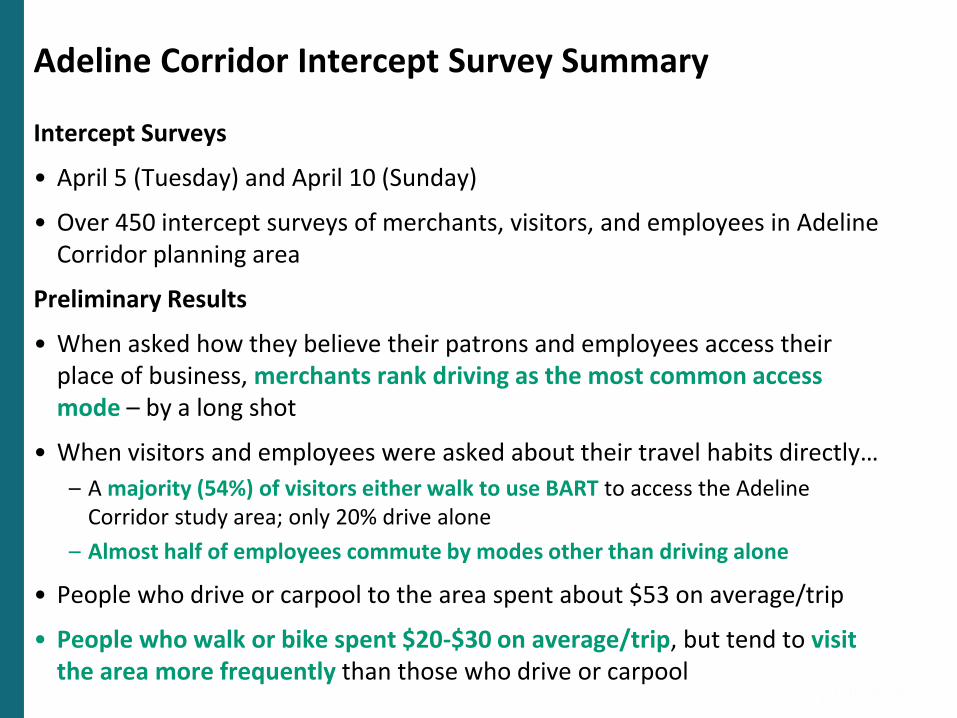
Adeline Corridor Intercept Survey Summary
Intercept Surveys
• April 5 (Tuesday) and April 10 (Sunday)
• Over 450 intercept surveys of merchants, visitors, and employees in Adeline Corridor planning area
Preliminary Results
• When asked how they believe their patrons and employees access their place of business, merchants rank driving as the most common access mode – by a long shot
• When visitors and employees were asked about their travel habits directly…
– A majority (54%) of visitors either walk to use BART to access the Adeline Corridor study area; only 20% drive alone
– Almost half of employees commute by modes other than driving alone
• People who drive or carpool to the area spent about $53 on average/trip
• People who walk or bike spent $20-$30 on average/trip, but tend to visit the area more frequently than those who drive or carpool
47
For More Information
Jeffrey Tumlin
Mobility Accessibility Sustainability
116 New Montgomery St, Ste 500San Francisco, CA 94103
Tel: 415-284-1544
ADELINE CORRIDOR PLANNING PROCESS NEXT STEPS
Second phase of work to create options based on community input from Phase 1 (Visioning)
Some upcoming community events:
Mobile IDEA Centers
Ed Roberts Campus – Wed. 5/4, Noon – 2pm
Malcolm X Elementary School Spring Fair – Sat. 5/7, Noon – 2pm
Adeline Community Outreach Team (ACOT) Meeting
South Berkeley Senior Center, Sat. 5/7, 10am – Noon
Community Workshop #2: Building A Plan Together: Options for the Adeline Corridor
Saturday, 5/21, South Berkeley Senior Center
49
ADELINE CORRIDOR PLANNING PROCESS NEXT STEPS
Even more events and ways to share your feedback to be announced soon
www.cityofberkeley.info/adelinecorridor
Call/email: Alisa Shen (510) 981.7409 or [email protected]
50
OPEN HOUSE: Information Stations
City of Berkeley
AC Transit
BART
Design your Adeline/South Shattuck
51
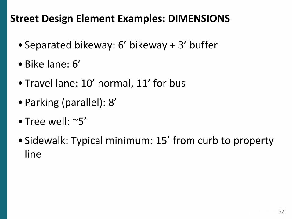
Street Design Element Examples: DIMENSIONS
• Separated bikeway: 6’ bikeway + 3’ buffer
• Bike lane: 6’
• Travel lane: 10’ normal, 11’ for bus
• Parking (parallel): 8’
• Tree well: ~5’
• Sidewalk: Typical minimum: 15’ from curb to property line
52
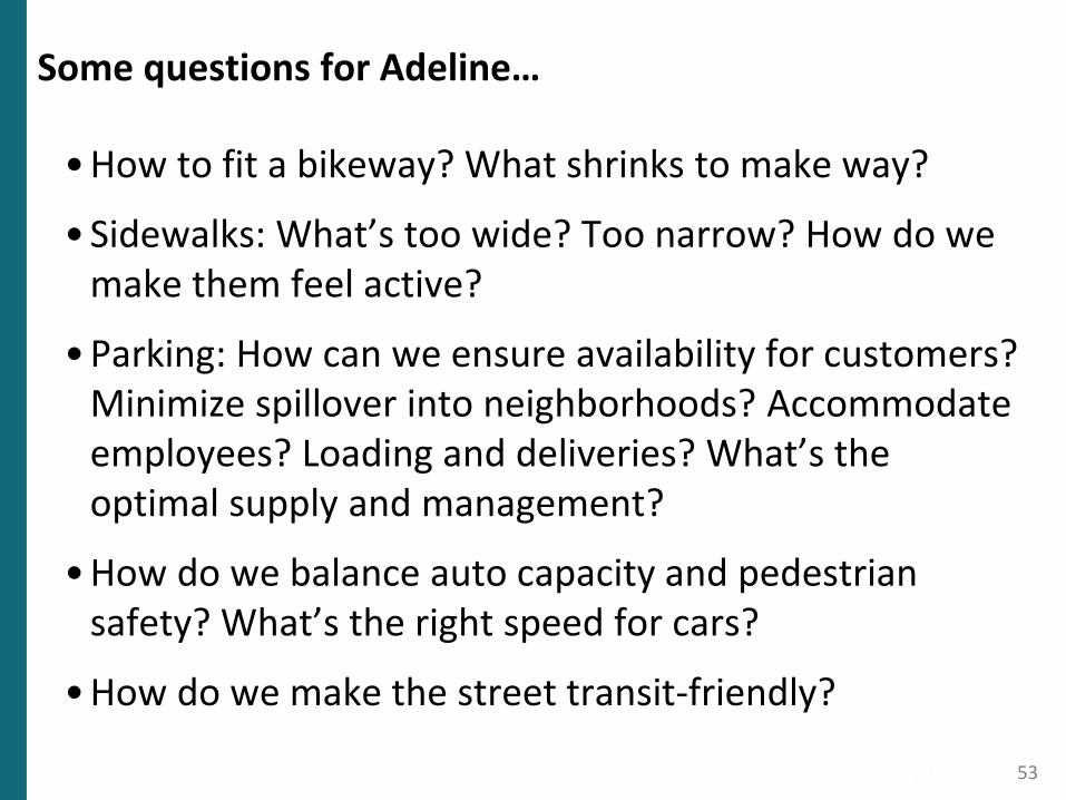
Some questions for Adeline…
• How to fit a bikeway? What shrinks to make way?
• Sidewalks: What’s too wide? Too narrow? How do we make them feel active?
• Parking: How can we ensure availability for customers? Minimize spillover into neighborhoods? Accommodate employees? Loading and deliveries? What’s the optimal supply and management?
• How do we balance auto capacity and pedestrian safety? What’s the right speed for cars?
• How do we make the street transit-friendly?
53