Embed Size (px)
Citation preview

CADASTRE INREPUBLIC OF BULGARIA
A GUARANTEE FOR THE RIGHT OF OWNERSHIP OF IMMOVABLE
PROPERTIES

Cadastre in Bulgaria for almostCadastre in Bulgaria for almost 100 100 yearsyearsCadastre ActCadastre Act (published(published SGSG, , issue 8 ofissue 8 of 1908 1908 ))Main objectiveMain objective: : -- physical and legalphysical and legal determination determination of immovable propertiesof immovable properties;;-- introduction of land booksintroduction of land books-- fair land taxationfair land taxation..Cadastre and Land Cadastre and Land Consolidation ActConsolidation Act (published(publishedSGSG, , issue 127, ofissue 127, of 19411941))ArtArt.1..1. ””Cadastre is geometric Cadastre is geometric representationrepresentation, , entry in a register entry in a register and and description of the immovable description of the immovable propertiesproperties””..

Law on the Unified Cadastre of Law on the Unified Cadastre of Peoples Republic of BulgariaPeoples Republic of Bulgaria
(published(published SGSG, , issueissue 35/197935/1979))-- clear routine for productionclear routine for production, , announcement and approval of announcement and approval of cadastral planscadastral plans;;
-- essentialessential drawbackdrawback –– requires requires collection of all data for the collection of all data for the territory of the country including territory of the country including the natural resourcesthe natural resources, , surface and surface and underground valuablesunderground valuables..Cadastre and Property Register Cadastre and Property Register ActAct (published(published SGSG, , issueissue34/200034/2000))

130 130 years of geodetic and cadastral activities years of geodetic and cadastral activities in Bulgariain Bulgaria
1877 1877 –– first topographic map infirst topographic map in scale scale 1:420001:420001919 1919 –– Geographic Institute was foundGeographic Institute was found(an independent surveying and (an independent surveying and cartographic office)cartographic office)1920 1920 -- 1942 1942 -- TheThe Geographic Institute Geographic Institute sets up a continuous network ofsets up a continuous network of 107 107 triangulation points of triangulation points of ІІstst orderorder1920 1920 -- 1926 1926 –– first measurement of the first measurement of the State Leveling Network State Leveling Network –– ІІstst orderorder, , length length –– 55 500 km with 4500 km with 4 500 500 benchmarks benchmarks

19321932 -- 1952 1952 –– topographic map topographic map of Bulgaria in scale 1:25000of Bulgaria in scale 1:250001985 1985 –– the whole territory of the the whole territory of the country is covered by a large scale country is covered by a large scale topographic map in scalestopographic map in scales 1:5000 1:5000 and and 1:100001:10000
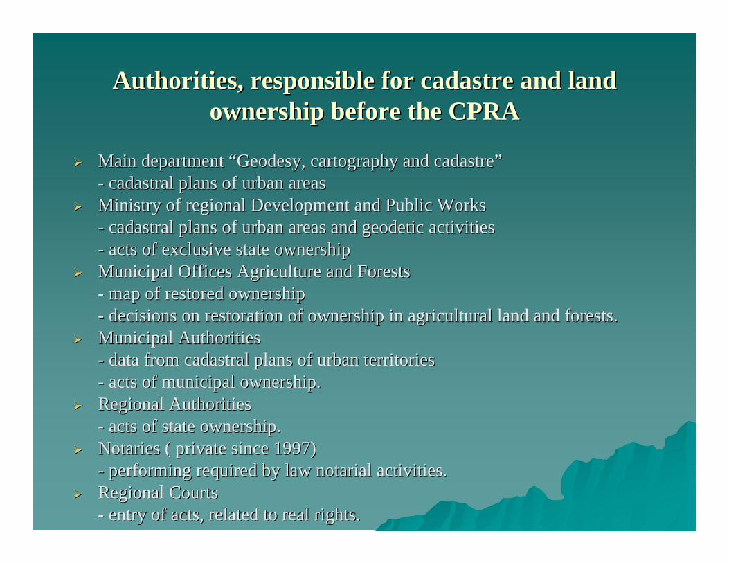
AuthoritiesAuthorities, , responsible for cadastre and land responsible for cadastre and land ownership before the CPRAownership before the CPRA
Main departmentMain department ““Geodesy, cartography and cadastreGeodesy, cartography and cadastre””-- cadastral plans of urban areascadastral plans of urban areasMinistry of regional Development and Public WorksMinistry of regional Development and Public Works-- cadastral plans of urban areascadastral plans of urban areas and geodetic activitiesand geodetic activities-- acts of exclusive state ownershipacts of exclusive state ownershipMunicipal Offices Agriculture and ForestsMunicipal Offices Agriculture and Forests-- map of restored ownershipmap of restored ownership-- decisions on restoration of ownership in agricultural land and fdecisions on restoration of ownership in agricultural land and forestsorests..Municipal AuthoritiesMunicipal Authorities-- data from cadastral plans of urban territoriesdata from cadastral plans of urban territories-- acts of municipal ownershipacts of municipal ownership..Regional AuthoritiesRegional Authorities-- acts of state ownershipacts of state ownership..Notaries (Notaries ( private sinceprivate since 19971997))-- performing required by law performing required by law notarialnotarial activitiesactivities..Regional CourtsRegional Courts-- entry of actsentry of acts, , related to real rightsrelated to real rights..

Process of creationProcess of creation, , maintenancemaintenance, , keeping and provisionkeeping and provision of information of information about immovable properties for territory of the whole countryabout immovable properties for territory of the whole countryMain basisMain basis for successful land managementfor successful land managementReliable source of information for taxation purposesReliable source of information for taxation purposesA basis for collectionA basis for collection, , processing and use of additional data about processing and use of additional data about immovable propertiesimmovable properties
Cadastral conceptCadastral concept

Reforms in the field of cadastre in BulgariaReforms in the field of cadastre in Bulgaria
Legal reformLegal reform::Restitution and privatization of immovable properties required aRestitution and privatization of immovable properties required amendment mendment of cadastre related legislationof cadastre related legislation-- Cadastre and Property Register ActCadastre and Property Register Act –– 20002000-- Geodesy and Cartography ActGeodesy and Cartography Act–– 20062006Institutional reformInstitutional reform::-- Cadastre AgencyCadastre Agency –– 20002000-- Registry AgencyRegistry Agency –– 20042004Cadastre Agency becomes the single institutionCadastre Agency becomes the single institution serving the users with serving the users with cadastral informationcadastral information

The reform in the field of cadastreThe reform in the field of cadastre ––a guarantee fora guarantee for::
The right of ownershipThe right of ownershipSecure transactions and mortgagesSecure transactions and mortgagesLimitation of court disputesLimitation of court disputesFair taxation policiesFair taxation policiesDevelopment of the immovable properties marketDevelopment of the immovable properties marketMore efficient investmentsMore efficient investments

General principles in the new Cadastre and Property Register Act
CPRA - passed in 2000, effective since 01.01.2001General principlesGeneral principles::- cadastre shall cover the territory of the whole country – including settlements, agricultural land, forests and other territories ;- providing data about the land properties, buildings and the self – contained objects in buildings (apartments, studious, shops, garages, recreation and health centres etc.);- each immovable property shall be given unique number (identifier);- The Geodesy Cartography and Cadastre Agency is the single authority, issuing sketches of immovable properties in case of change of the right of ownership and establishment of other real right;- From personal to property based system of registration;- Cadastre is basis for setting up of geographic information systems.

Geodesy, Cartography andGeodesy, Cartography andCadastre AgencyCadastre Agency16181618 СофияСофия,,1 1 MusalaMusala StrStr..teltel. . ++359 2 8188383359 2 8188383,,fax +fax +359 2 9555333,359 2 9555333,ee--mail : mail : [email protected]@cadastre.bg,,www.cadastre.bgwww.cadastre.bg
Collecting and maintenance of cadastral information for the wholCollecting and maintenance of cadastral information for the whole territory of e territory of BulgariaBulgaria
OrganizationOrganization, , financing and control of activities in the field of geodesy and financing and control of activities in the field of geodesy and cartographycartography
Control for compliance with the legal frameworkControl for compliance with the legal frameworkProvision of services to the publicProvision of services to the public

Maintenance of the state geodetic, cartographic and cadastral fuMaintenance of the state geodetic, cartographic and cadastral fundnd((GeocardfundGeocardfund) ) Keeping the registers of licensed surveyorKeeping the registers of licensed surveyor
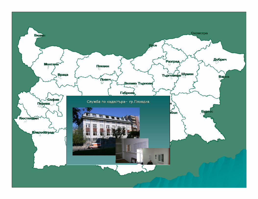
The Agency fulfils its role through itsThe Agency fulfils its role through its 28 28 regional unitsregional units –– Geodesy, Geodesy, Cartography and Cadastre OfficesCartography and Cadastre Offices..


ArchivesArchives

Main responsibilities of the Geodesy, Cartography Main responsibilities of the Geodesy, Cartography and Cadastre Agency according to CPRAand Cadastre Agency according to CPRA::
Creation and maintenance of cadastral map and cadastral registerCreation and maintenance of cadastral map and cadastral registers for the s for the whole territory of the countrywhole territory of the countrydrafting acts and regulations in the field of cadastre and geodedrafting acts and regulations in the field of cadastre and geodesy, as well sy, as well as programs and concepts on future developmentas programs and concepts on future developmentimplementation of cadastral activities in close coordination witimplementation of cadastral activities in close coordination with these of h these of the property register, UCATTU (Unified Classification of the property register, UCATTU (Unified Classification of AdministrativeAdministrative--Territorial and Territorial Units), BULSTAT (Unified Territorial and Territorial Units), BULSTAT (Unified Classification of identification of juridical persons), ESGRAON Classification of identification of juridical persons), ESGRAON (Unified (Unified System for identification of physical persons), registers of staSystem for identification of physical persons), registers of state and te and municipal propertiesmunicipal propertiesadministrative and technical servicing the public, state adminisadministrative and technical servicing the public, state administration, tration, municipalities and other users of cadastral informationmunicipalities and other users of cadastral informationmaintenance of the state geodetic, cartographic and cadastral fumaintenance of the state geodetic, cartographic and cadastral fundndmaintenance of register of physical and juridical persons, licenmaintenance of register of physical and juridical persons, licensed to sed to carry out activities in the filed of cadastre, geodesy and cartocarry out activities in the filed of cadastre, geodesy and cartographygraphy

Main responsibilities of the Geodesy, Cartography Main responsibilities of the Geodesy, Cartography and Cadastre Agency according to GCAand Cadastre Agency according to GCA::
creation and maintenance of topographic maps in scales 1:5000 ancreation and maintenance of topographic maps in scales 1:5000 and 1:10 000 d 1:10 000 for the territory of the countryfor the territory of the countrymaintenance of the state leveling network and the maintenance of the state leveling network and the mareographicmareographic stations stations networknetworkcreation and maintenance of topographic databases and the geogracreation and maintenance of topographic databases and the geographic phic information systeminformation systemimplementation of technical activities related to establishment implementation of technical activities related to establishment of the of the geographic names in the Republic of Bulgaria, keeping a registergeographic names in the Republic of Bulgaria, keeping a register of names, of names, creation and maintenance of databases and information systemcreation and maintenance of databases and information systemcooperation with the state administration, and other organizatiocooperation with the state administration, and other organizations in the ns in the country and abroadcountry and abroad

StateState GPS GPS networknetwork

Contents of cadastreContents of cadastre
Location, boundaries and area of immovable propertiesLocation, boundaries and area of immovable properties –– landed propertieslanded properties, , buildings and self contained objects in buildings (apartmentsbuildings and self contained objects in buildings (apartments, , shopsshops, , garagesgarages, , studious etcstudious etc.).)Data about the ownersData about the ownersData about the actsData about the acts, , which are grounds for the ownership rightswhich are grounds for the ownership rightsData about other real rights in immovable propertiesData about other real rights in immovable properties..Data about the immovable propertiesData about the immovable properties, , owners and acts are reflected inowners and acts are reflected in::-- the cadastral mapthe cadastral map; ; -- cadastral register of immovable propertiescadastral register of immovable properties..Information is kept and maintained in digital, graphical and wriInformation is kept and maintained in digital, graphical and written formatstten formats

Cadastral mapCadastral map


Immovable property according to CPRAImmovable property according to CPRA
Immovable property Immovable property –– cadastral cadastral object isobject is::-- landed propertylanded property ((basic cadastral basic cadastral unitunit););-- buildingbuilding;;-- self contained object in building self contained object in building (apartment)(apartment)..

Basic cadastral dataBasic cadastral data
For the landed propertiesFor the landed properties –– identifier; boundaries fixed by the geodetic coidentifier; boundaries fixed by the geodetic co--ordinates of the points defining them; area; durable land use; lordinates of the points defining them; area; durable land use; land use and use mode; addressmode; addressFor the buildingsFor the buildings –– identifier, built up area, number of floors, destinationidentifier, built up area, number of floors, destinationFor the self contained objects in buildingsFor the self contained objects in buildings -- identifier; location; floor identifier; location; floor number, usenumber, use

Sources of information for production of Sources of information for production of cadastral map and registerscadastral map and registers
The cadastral map is produced on the basis of information from:- cadastral plans (LUCPRB and LTRD);- regulation plans (LTRD and PPA);- map of restored ownership (OUALA and ROFFFLA);- geodetic, photogrammetric and other surveys.The cadastral registers are produced on the basis of information from:- registers to plans and maps;- acts submitted by municipalities, regional authorities and individual citizens;Data about the ownership right and other real rights are coordinated with these from the entry offices.

Cadastral map of territory, belonging to the village Cadastral map of territory, belonging to the village of of IgnatovtsiIgnatovtsi, , GabrovoGabrovo RegionRegion

The cadastre is requisite forThe cadastre is requisite for::
Guaranteeing the ownership rightGuaranteeing the ownership rightSecure transactionsSecure transactionsSecure mortgagingSecure mortgagingResolving disputesResolving disputes about property boundariesabout property boundariesFair taxation policyFair taxation policyRegional developmentRegional development –– land reformland reform,, land consolidationland consolidation, , regulation of territoriesregulation of territories, , forestry managementforestry management, , design of design of infrastructureinfrastructureDetermination of market values for compensationDetermination of market values for compensationInsuranceInsuranceStatistical analyses etcStatistical analyses etc..

Cadastre and Property Register Information SystemCadastre and Property Register Information System
Computerized Information Systems shall be developed for the cadaComputerized Information Systems shall be developed for the cadastre and the stre and the property register. The systems shall interlinkedproperty register. The systems shall interlinked..Dispersed Databases, located atDispersed Databases, located at::-- Geodesy, Cartography and Cadastre Offices Geodesy, Cartography and Cadastre Offices –– source of information about location source of information about location and boundaries of propertiesand boundaries of properties;;-- Entry OfficesEntry Offices –– source of information about owners and ownership rightssource of information about owners and ownership rights. . The bidirectional connection between the two databases is based The bidirectional connection between the two databases is based on immovable on immovable property identifierproperty identifierThe information system is linked to the other registers The information system is linked to the other registers -- UCATTU, UCATTU, BULSTATBULSTAT, , ESGRAONESGRAON, , registers of state and municipal properties etc.registers of state and municipal properties etc.The information system provides constant and direct access to daThe information system provides constant and direct access to data from the ta from the cadastral map through Internet. It is secured against unauthorizcadastral map through Internet. It is secured against unauthorized accessed access

The Integrated Cadastre and Property Register Information has three components:- cadastral component – set up for the Geodesy Cartography and Cadastre Agency needs, which supports the processes for creation and maintenance of cadastral map and cadastral registers data;- property registration component – set up for the Registry Agency needs and supporting the creation and maintenance of property register data processes;- web portal – providing users with access for search and use of data from both cadastre and property register.
Cadastre and Property Register Information Cadastre and Property Register Information SystemSystem

Users of the Cadastre and Property Register Users of the Cadastre and Property Register Information SystemInformation System
State AuthoritiesRegional AuthoritiesMunicipal AuthoritiesNotariesRegional offices ‘Agriculture and Forests’Municipal offices ‘Agriculture and Forests’Private geodetic companiesBanksReal estate agentsInvestorsothers
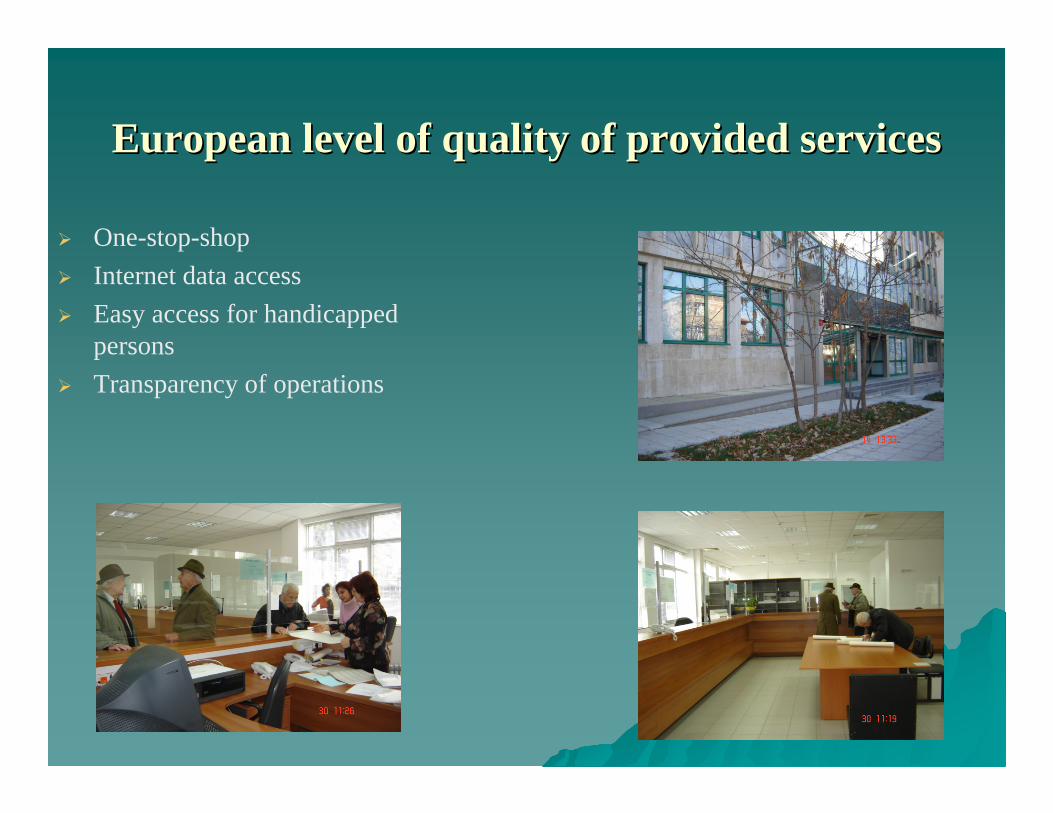
European level of quality of provided servicesEuropean level of quality of provided services
One-stop-shopInternet data accessEasy access for handicapped persons Transparency of operations

Servicing the Cadastral Information System Servicing the Cadastral Information System clientsclients
Realized through:28 Geodesy, Cartography and Cadastre Offices, located in regional centers and15 structural units of Geodesy, Cartography and Cadastre Offices – located in municipal centers.Geodesy, Cartography and Cadastre Agency provides generalized information about more than one region or the whole country.Cadastre is public. Access to data shall comply with the provisions under the Classified Information Act and Personal Data Protection Act.

Cadastral information about landed propertyCadastral information about landed property

Cadastral information about landed property Cadastral information about landed property and ownershipand ownership

Cadastral information about buildingCadastral information about building

Cadastral information about building and Cadastral information about building and ownershipownership

Cadastral information about self contained Cadastral information about self contained object in building (apartmentobject in building (apartment))

Cadastral information about self contained object in Cadastral information about self contained object in building (apartmentbuilding (apartment) ) and ownershipand ownership

Issuance of a sketchIssuance of a sketch

Chart of self contained object in buildingChart of self contained object in building

Production of cadastral map and cadastral Production of cadastral map and cadastral registers is based onregisters is based on::
Long Term Program for creation of cadastre and property register, passed by CM Decision 326 of 2001
Priorities:- regional centers;- municipal centers;- territories with active market (Black Sea coast, mountainous and sea resorts, border zones).

Cadastre and Property Registration Project Cadastre and Property Registration Project ––coco--financed with the World Bankfinanced with the World Bank
Partners:- Geodesy Cartography and Cadastre Agency- Registry AgencyGoals:- Production of new cadastral map and cadastral registers in digital format;- Production of property register in digital format;- Development of Cadastre and Property Register Information Systems;- Equipment for the Geodesy Cartography and Cadastre Agency; - Equipment for the Registry Agency.

State of the art and perspectives for production State of the art and perspectives for production of cadastre in Bulgariaof cadastre in Bulgaria
By 31 January 2007:CMCR – approved or in process of production - for 27 regional centers, 56municipal centers and another 400 settlements1 400 settlements, which is 32% of the territory of the country, have digitizedcadastral plansBy the end of 2007:CMCR will be produced for about 20% от of the territory of the country, which will cover approximately 3 000 000 immovable properties
By the end of 2010: Cadastral information about 70% of the immovable properties in the country will be available


What can be used the data forWhat can be used the data for
Information from cadastral map and registersInformation from cadastral map and registers::-- for creation of key registers of immovable properties and ownersfor creation of key registers of immovable properties and owners in in BulgariaBulgaria;;-- for control of tax declarationsfor control of tax declarations ((alternative for the way of capturing alternative for the way of capturing information for tax registersinformation for tax registers););-- as basis for various thematic mapsas basis for various thematic maps..Information from the large scale topographic mapInformation from the large scale topographic map::-- land administrationland administration;;-- infrastructure projectsinfrastructure projects; ; -- navigation etcnavigation etc..Geographic informationGeographic information::-- for GIS based applicationsfor GIS based applications;;-- national geographic data exchange standardnational geographic data exchange standard..

Cadastre and operation of municipalitiesCadastre and operation of municipalities
Cadastre is a basis for:- regional development plans;- investment projects;- physical planning maps;- thematic maps.Role of cadastre in the regional and municipal authorities operation:- development strategies;- maintenance of state and municipal ownership registers;- facilitation of state and municipal ownership management;- environment protection;- management of protected areas, territories of water sources, protected coast lines;- information for disaster recovery and repair works.

Thematic mapsThematic maps

Combined information from cadastre and Combined information from cadastre and urban development planningurban development planning

Combined information from cadastre and Combined information from cadastre and physical planningphysical planning

Thank you for your attentionThank you for your attention