Embed Size (px)
Citation preview

CONTRIBUTIONS TO A THEORY OF GEOGRAPHICAL INFORMATION ENGINEERINGScientific colloquium in honour ofProf. Andre U. FrankVienna, 2008
Gilberto Câmara National Institute for Space Research, Brazil
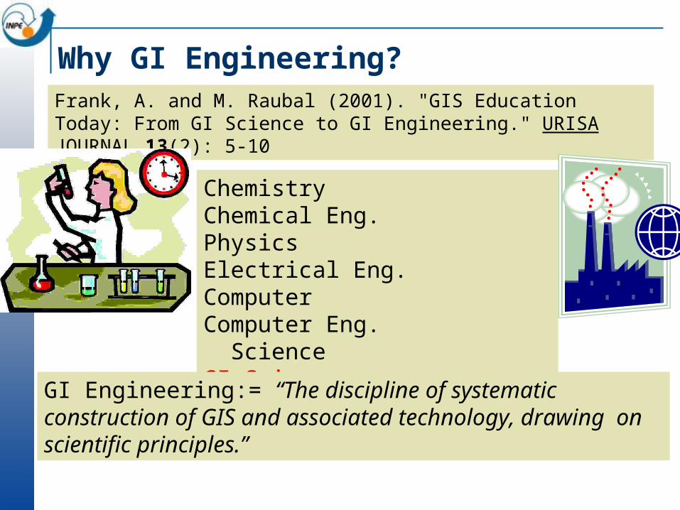
Why GI Engineering?Frank, A. and M. Raubal (2001). "GIS Education Today: From GI Science to GI Engineering." URISA JOURNAL 13(2): 5-10
Chemistry Chemical Eng.Physics Electrical Eng.Computer Computer Eng. Science GI Science GI Engineering
GI Engineering:= “The discipline of systematic construction of GIS and associated technology, drawing on scientific principles.”
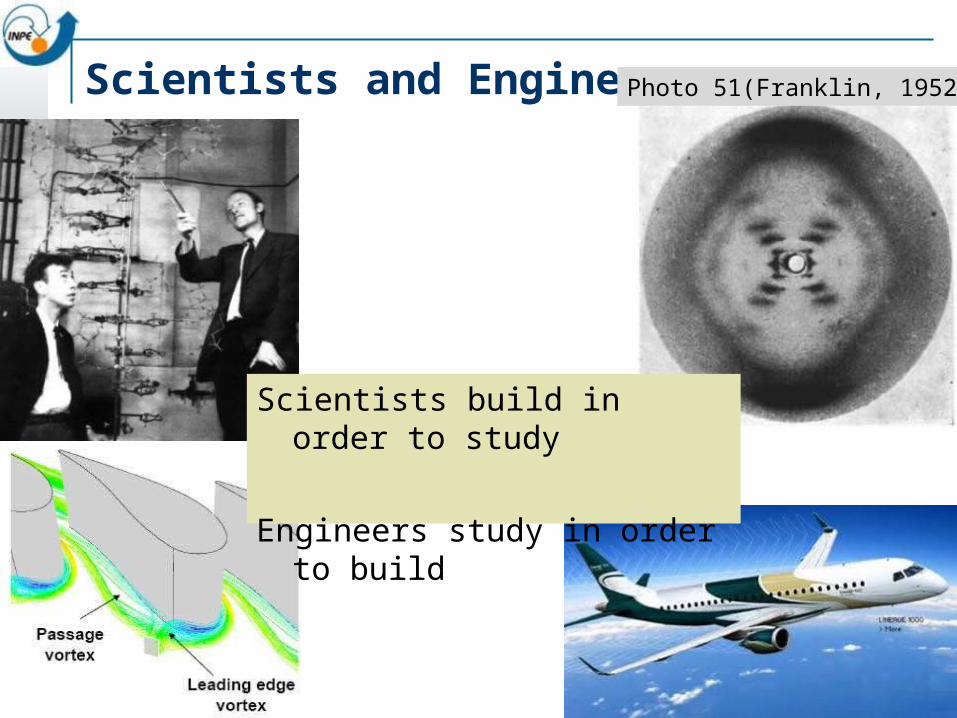
Scientists and EngineersPhoto 51(Franklin, 1952)
Scientists build in order to study
Engineers study in order to build
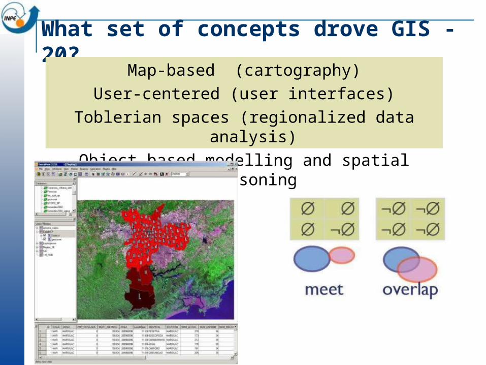
What set of concepts drove GIS -20?
Map-based (cartography)User-centered (user interfaces)
Toblerian spaces (regionalized data analysis)Object-based modelling and spatial reasoning
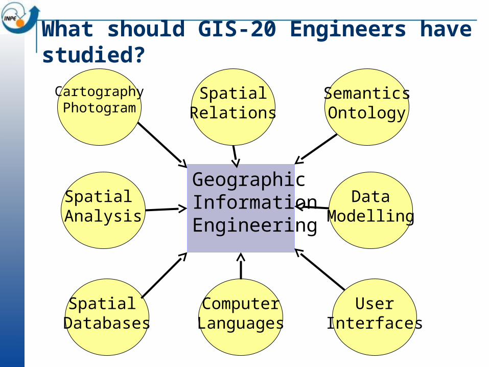
What should GIS-20 Engineers have studied?
CartographyPhotogram
SpatialRelations
SemanticsOntology
Spatial Analysis
DataModelling
Spatial Databases
ComputerLanguages
UserInterfaces
Geographic InformationEngineering

GIS-20: Object-oriented modelling
Egenhofer, M. and A. Frank (1992). "Object-Oriented Modeling for GIS." URISA Journal 4(2): 3-19.
SPRING´s object-oriented
data model (1995)
ARCGIS´s object-centred
data model (2002)
Geo-object
Cadastral
Coverage
Spatial database
Categorical
Geo-field
Numerical
Is-a Is-a
contains contains

GIS-20: Topological Spatial Reasoning
Egenhofer, M. and R. Franzosa (1991). "Point-Set Topological Spatial Relations." IJGIS 5(2): 161-174
OGC´s 9-intersection dimension-extended
Open source implementations (GEOS)
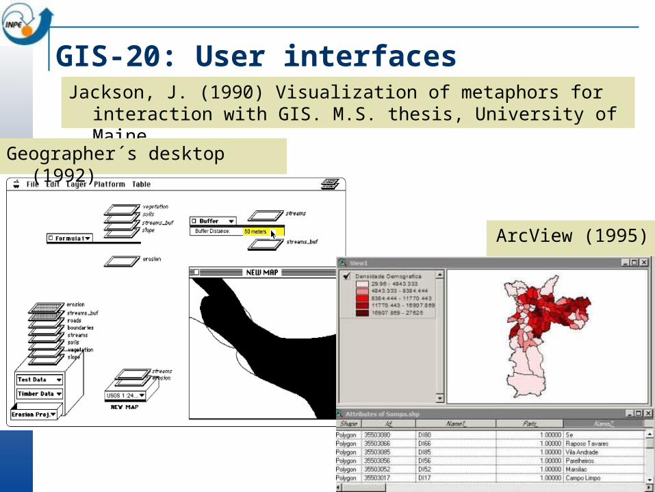
GIS-20: User interfacesJackson, J. (1990) Visualization of metaphors for interaction
with GIS. M.S. thesis, University of Maine.
Geographer´s desktop (1992)
ArcView (1995)
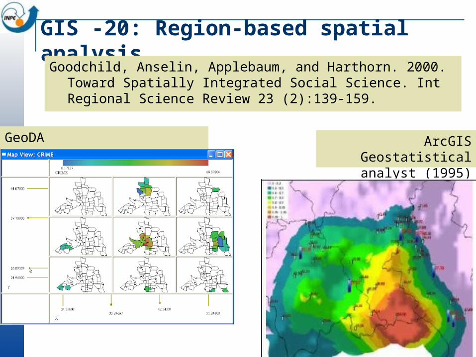
GIS -20: Region-based spatial analysis
Goodchild, Anselin, Applebaum, and Harthorn. 2000. Toward Spatially Integrated Social Science. Int Regional Science Review 23 (2):139-159.
GeoDA ArcGIS Geostatistical analyst (1995)

augmented reality
sensor networks
mobile devices
GIS-21
ubiquitous images and maps
Data-centered, mobile-enabled, contribution-based, field-based modelling

Global Change
Where are changes taking place? How much change is happening? Who is being impacted by the change?
Global Change: How is the Earth’s environment changing, and what are the consequences for human civilization?

TrackingPositions collected over a fixed period of time
MonitoringData from remote stations, fixed or mobile
Sensor Webs source: ARGOS
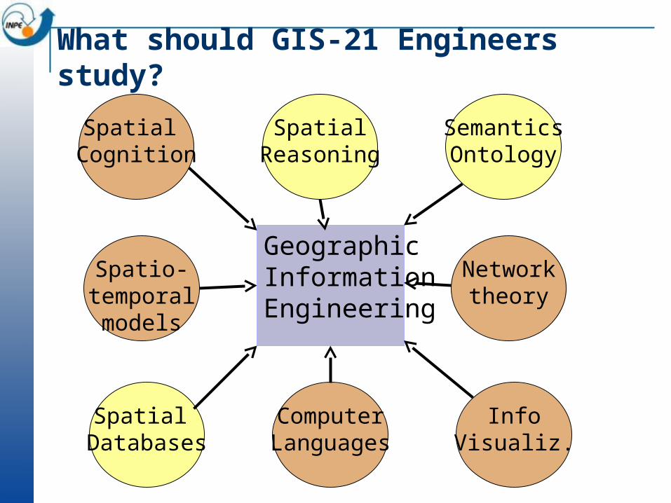
What should GIS-21 Engineers study?
Spatial Cognition
SpatialReasoning
SemanticsOntology
Spatio-temporalmodels
Networktheory
Spatial Databases
ComputerLanguages
InfoVisualiz.
Geographic InformationEngineering

GIE-21: Functional Programming Frank, A. (1997). Higher order functions necessary for spatial theory development. In: Auto-Carto 13.Frank, A. (1999). One Step up the Abstraction Ladder: Combining Algebras – From Functional Pieces to a Whole. COSIT 99
class Coverage cv where evaluate :: cv a b a Maybe b domain :: cv a b [a] num :: cv a b Int values :: cv a b [b]
Geospatial data processing is a collection of types and functions Functional programming allows rigorous development of GIS

GIS-21: Multiscale modelling
snap: T ⟶ (S1 ⟶ V) {snap1(t1),., snapn(tn)} space-based snapshots
hist : S2 ⟶ (T⟶V)the history of a location in space
Data modelling of human-environment issues poses unresolved problems
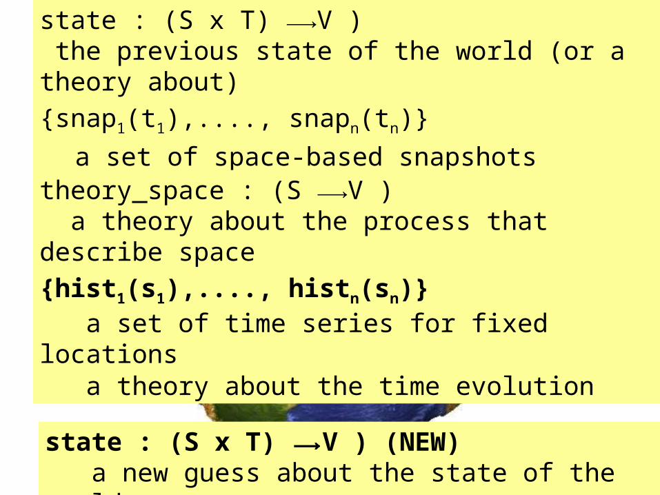
{snap1(t1),...., snapn(tn)}
a set of space-based snapshots
state : (S x T) ⟶V ) the previous state of the world (or a theory about)
state : (S x T) ⟶V ) (NEW) a new guess about the state of the world
theory_space : (S ⟶V ) a theory about the process that describe space
theory_time : (T ⟶V ) a theory about the time evolution
{hist1(s1),...., histn(sn)} a set of time series for fixed locations
f ( It+n )
. . FF
f (It) f (It+1) f (It+2)
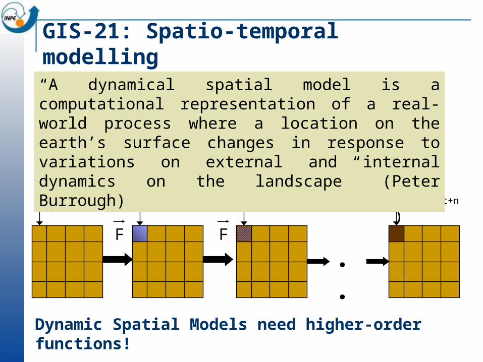
GIS-21: Spatio-temporal modelling
“A dynamical spatial model is a computational representation of a real-world process where a location on the earth’s surface changes in response to variations on external and internal dynamics on the landscape” (Peter Burrough)
Dynamic Spatial Models need higher-order functions!

GIS-21: Spatio-Temporal modellingwith Agents in Cell Spaces
Cell Spaces
Representation
Cell Spaces Generalized Proximity Matriz – GPM Hybrid Automata model Nested scales
TerraME: Based on functional programming concepts (second-order functions) to develop dynamical models

GIE-21: Spatial Cognition
Technology-enabled spatial cognition: revisit the metaphors, obtain quantitative results, design better systems
Collaborative GIS (Virtual Rome)
Relative location in microspaces
source: A. Camara (Ydreams)
Frank, A. U. (1996). "Qualitative Spatial Reasoning: Cardinal Directions as an Example." IJGIS 10(3): 269-290.Mark, D. and A. Frank (1991). Cognitive and Linguistic Aspects of Geographic Space. Dordrecht, Kluwer.

GIE-21: Network Theory
Bus traffic volume in São Paulo
Innovation network in Silicon Valley
Barabasi, A.-L. and Albert, R., Emergence of scaling in random networks, Science 286, 509–512 (1999).Newman, M. E. J., Barabasi, A.-L., and Watts, D. J., The Structure and Dynamics of Networks, Princeton University Press, Princeton (2003).

Consolidated area
GIE-21: Network-based analysis
Emergent area
Modelling beef chains in Amazonia

GIS-21: Human-enviroment interactions
Nature: Physical equations Describe processes
Society: Decisions on how to Use Earth´s resources
Frank, A. U. (2001). "Tiers of ontology and consistency constraints in GIS."IJGIS15(7): 667-678.
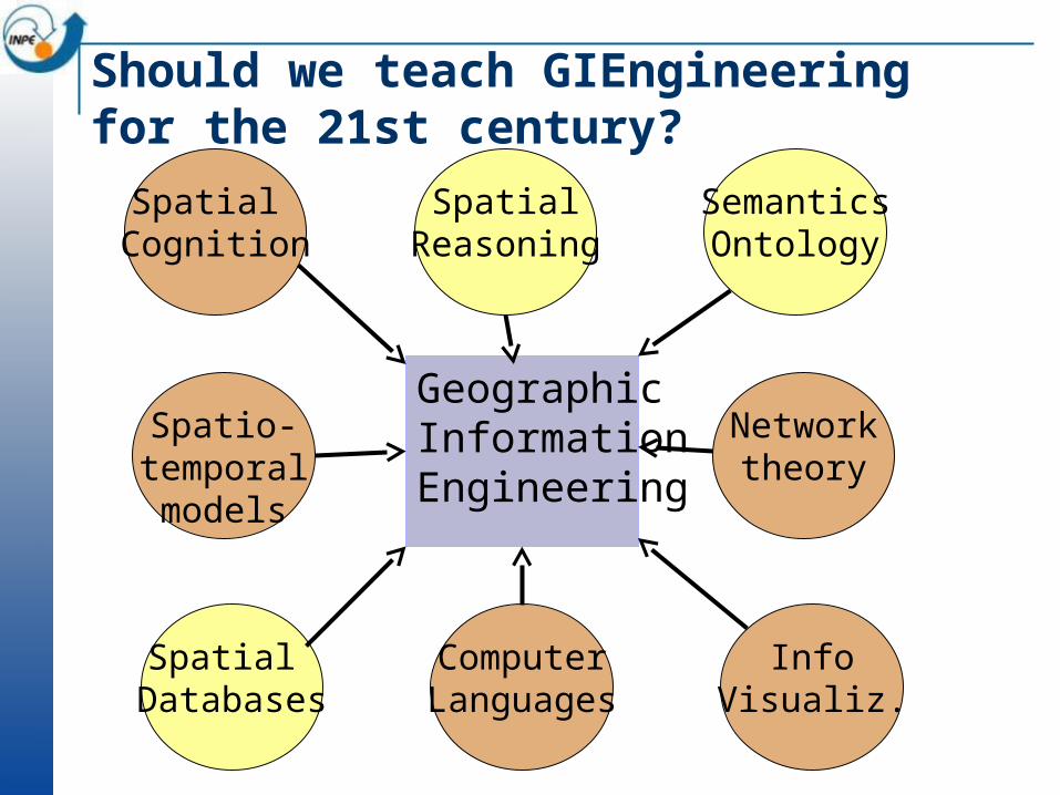
Should we teach GIEngineering for the 21st century?
Spatial Cognition
SpatialReasoning
SemanticsOntology
Spatio-temporalmodels
Networktheory
Spatial Databases
ComputerLanguages
InfoVisualiz.
Geographic InformationEngineering