Embed Size (px)
Citation preview
Army Geospatial Organizations & Systems “Geospatial Data, Concepts and Operations will give our soldiers the ‘home field advantage’ in any future national emergency.” GEN Peter J. Schoomacher – 29 April 2005
COL Michael Hendricks
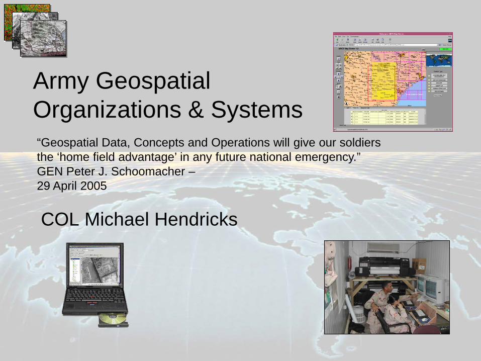
Geospatial Science in the Military
Key groups • Intelligence Community: GeoInt • Engineering Community: Geospatial Engineering • Space Operations Functional Area (FA 40) • Modeling and Simulation Functional Area (FA 57) • Many others
The military increasingly relies on geospatial technology and data to achieve information dominance on the battlefield. Examples include: GPS, satellite imagery, real-time force tracking, sensor integration, and massive geographic databases.
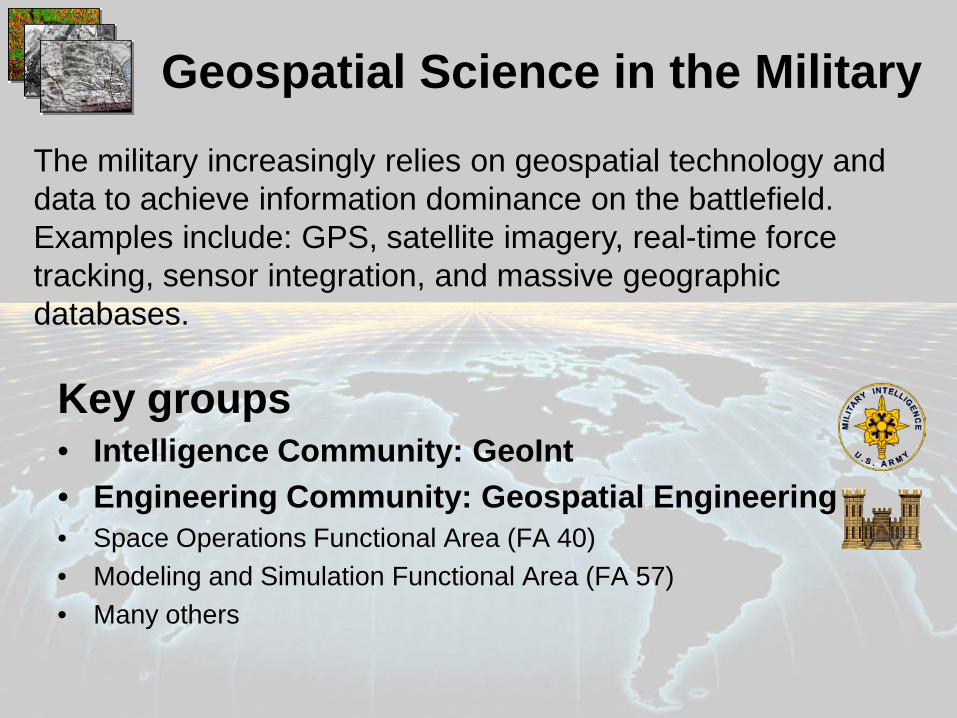
National System for Geospatial Intelligence (NSG)
• The National System for Geospatial Intelligence (NSG) is a unified community of geospatial intelligence (GEOINT) experts, producers and users organized around the goal of integrating technology, policies, capabilities and doctrine to produce GEOINT in a multi-intelligence environment. Members
•Office of the Director of National Intelligence •Central Intelligence Agency •Defense Intelligence Agency •National Security Agency •National Geospatial-Intelligence Agency (NGA) •National Reconnaissance Office •Drug Enforcement Agency •Joint Staff •Military Departments including:
•U.S. Army •U.S. Navy •U.S. Air Force •U.S. Marine Corps
•Department of State, Bureau of Intelligence and Research •Federal Bureau of Investigation •Department of Homeland Security, Office of Intelligence and Analysis •U.S. Coast Guard, Office of Intelligence •Department of Energy, Office of Intelligence •Department of Treasury, Office of Terrorism •Combatant Commands: •U.S. Functional Commands •U.S. Special Operations Command
Partners •U.S. Geological Survey •U.S. Department of Treasury •U.S. Department of the Interior •Environmental Protection Agency •U.S. Army Corps of Engineers •U.S. Department of Justice •U.S. Department of Agriculture
•Foreign Agricultural Service •Forest Service
•U.S. Department of Commerce •National Oceanic and Atmospheric Administration •U.S. Health and Human Services •Department of Homeland Security:
•Federal Emergency MAnagement Agency •U.S. Coast Guard •National Science Foundation •Defense Information Systems Agency •Defense and Civil GEOINT service providers •Commonwealth partners
•Australia •Canada •New Zealand •United Kingdom
•Industry •Academia
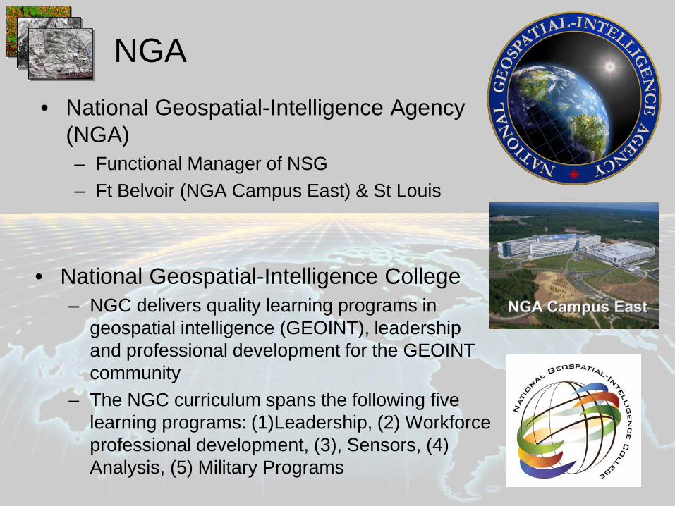
NGA • National Geospatial-Intelligence Agency
(NGA) – Functional Manager of NSG – Ft Belvoir (NGA Campus East) & St Louis
• National Geospatial-Intelligence College – NGC delivers quality learning programs in
geospatial intelligence (GEOINT), leadership and professional development for the GEOINT community
– The NGC curriculum spans the following five learning programs: (1)Leadership, (2) Workforce professional development, (3), Sensors, (4) Analysis, (5) Military Programs
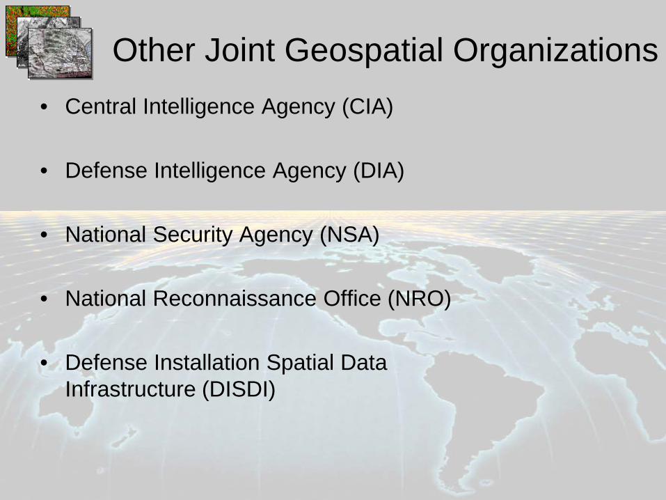
Other Joint Geospatial Organizations • Central Intelligence Agency (CIA)
• Defense Intelligence Agency (DIA)
• National Security Agency (NSA)
• National Reconnaissance Office (NRO)
• Defense Installation Spatial Data
Infrastructure (DISDI)
US Army Corps of Engineers BUILDING STRONG®
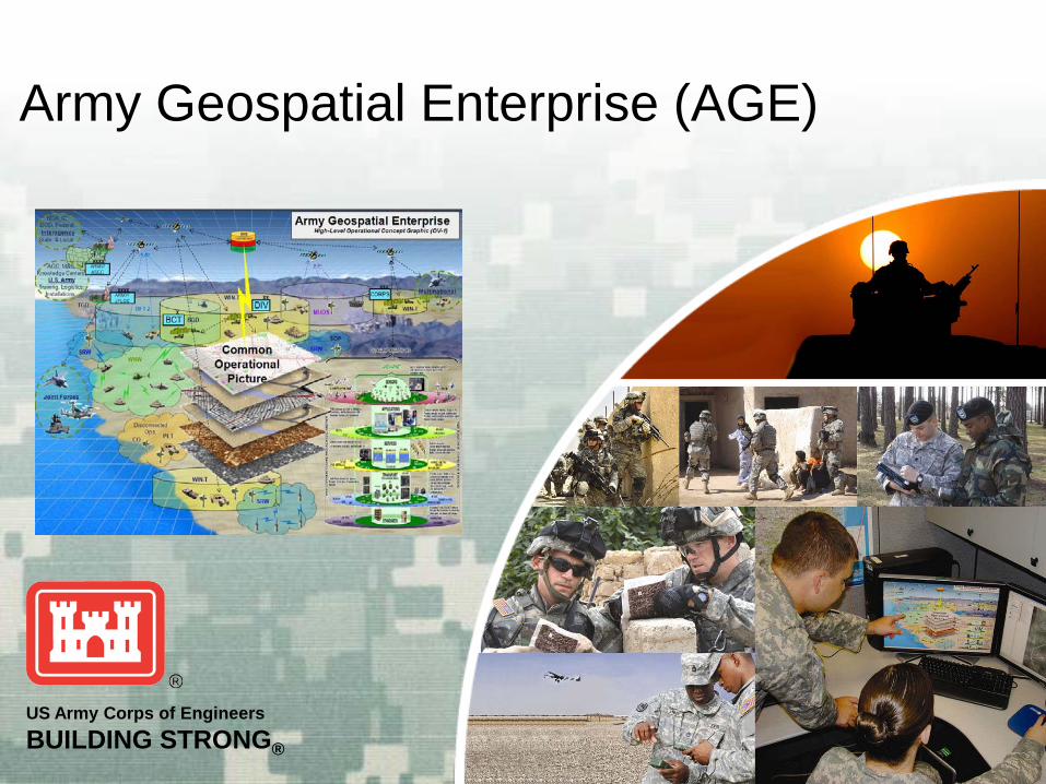
Army Geospatial Enterprise (AGE)
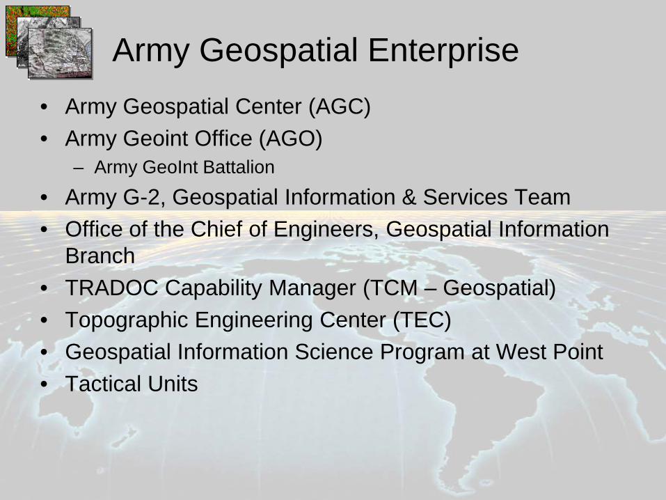
Army Geospatial Enterprise • Army Geospatial Center (AGC) • Army Geoint Office (AGO)
– Army GeoInt Battalion
• Army G-2, Geospatial Information & Services Team • Office of the Chief of Engineers, Geospatial Information
Branch • TRADOC Capability Manager (TCM – Geospatial) • Topographic Engineering Center (TEC) • Geospatial Information Science Program at West Point • Tactical Units
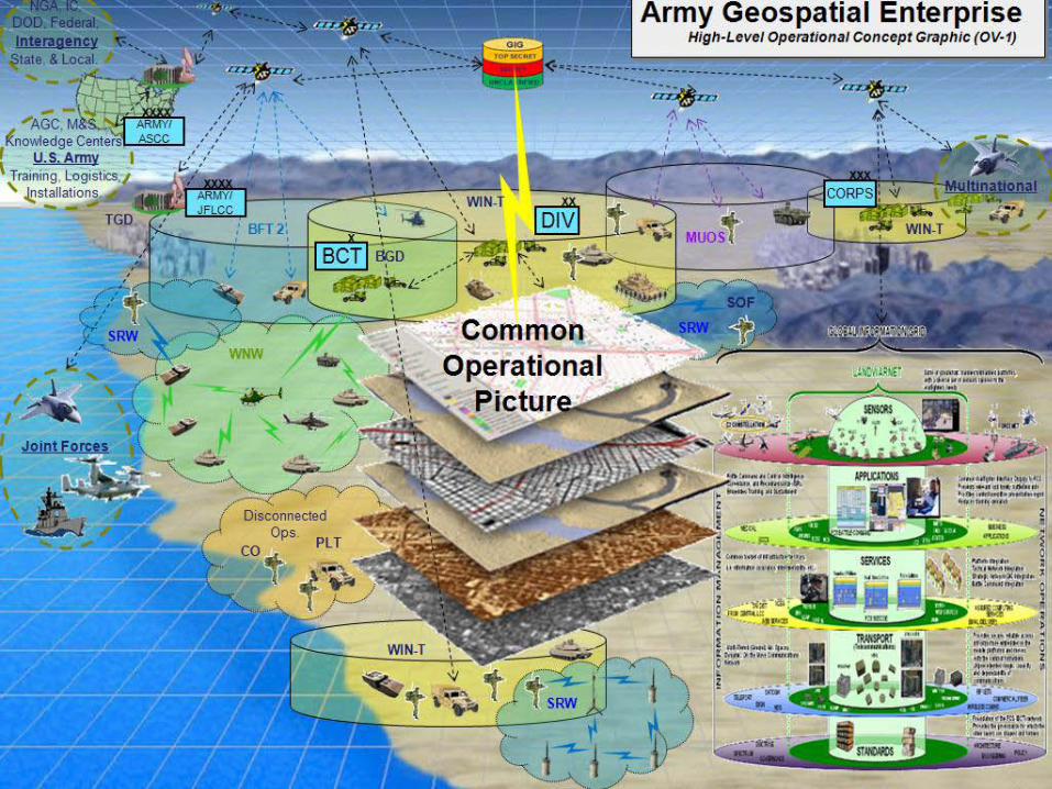
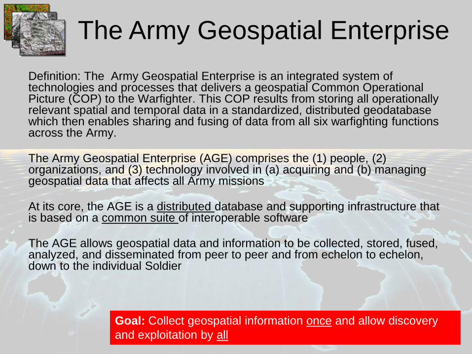
Definition: The Army Geospatial Enterprise is an integrated system of technologies and processes that delivers a geospatial Common Operational Picture (COP) to the Warfighter. This COP results from storing all operationally relevant spatial and temporal data in a standardized, distributed geodatabase which then enables sharing and fusing of data from all six warfighting functions across the Army. The Army Geospatial Enterprise (AGE) comprises the (1) people, (2) organizations, and (3) technology involved in (a) acquiring and (b) managing geospatial data that affects all Army missions At its core, the AGE is a distributed database and supporting infrastructure that is based on a common suite of interoperable software The AGE allows geospatial data and information to be collected, stored, fused, analyzed, and disseminated from peer to peer and from echelon to echelon, down to the individual Soldier
Goal: Collect geospatial information once and allow discovery and exploitation by all
The Army Geospatial Enterprise
10
Geospatial Engineer Group
Geospatial Enterprise Office
Warfighter Spt (AGC) Geosp
Cos
Corps, Div, Bde Tms
Systems & PM Dir
Geo Acq Spt Dir
ERDC Geospatial Research & Engineering
Business Area
Research Div
U.S. Army Geospatial Center (formerly TEC)
Policy/Reg
GGB Staff
Standards
Sys Arch
Prg Coord
Resrc Int
GSTF
OCE
G-2
G-3
G-6
G-8
TDC
NGA LNO
SOC LNO
USMC LNO
G-1 G-4
ATEC AMC
ASA (ALT)
JFCOM LNO
ACSIM
Army Geospatial Information Officer
Director, AGC Deputy Topographer of the Army
GPCs
Organizational Implementation
Director, AGC
Support Directorate
Management Integration Contracting
RM (HECSA)
HR (CPAC)
Facilities (HECSA)
Safety (HECSA)
Plans & Operations Directorate
Geospatial Systems Acq & Pgm Mgmt
Directorate
Imagery Systems
Topographic Systems
Technology Integration
Warfighter Geospatial Support & Production
Directorate
Geospatial Data
Terrain Analysis
Hydrologic & Environ Analysis
Operational Systems
Geospatial Applications
Data Representation
Data & Signature Anal
Info Generation & Mgmt
Geospatial Acquisition Support
Directorate
Systems Engr & Architecture
Data Modeling
Systems Requirements
Test & Certification
Geospatial Research & Engineering Division
Office of Technical Director
Geospatial Info Spt
Security
Geospatial Req Integration
Activity of the Engineer Research Development Center
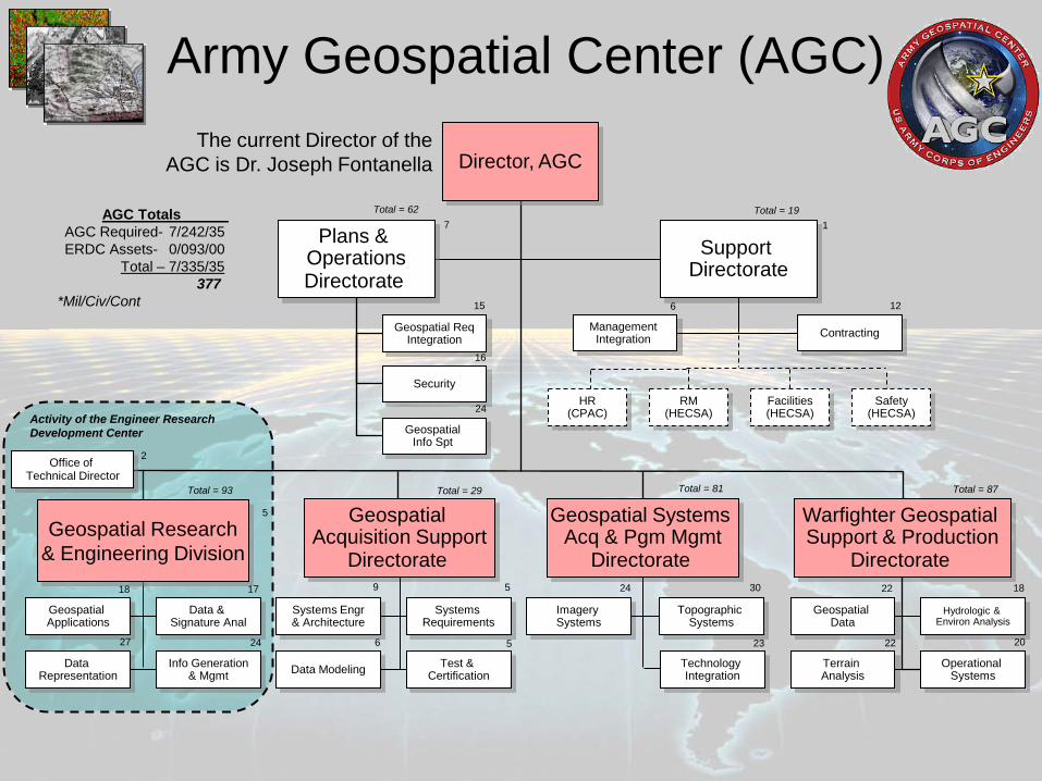
Army Geospatial Center (AGC)
1
6 12 15
16
24
7 Total = 62 Total = 19
9
6
5
5
24 30
23
22
22
18
20
Total = 29 Total = 81 Total = 87
18 17
24 27
5
2
Total = 93
AGC Totals
AGC Required- 7/242/35 ERDC Assets- 0/093/00 Total – 7/335/35
377 *Mil/Civ/Cont
The current Director of the AGC is Dr. Joseph Fontanella
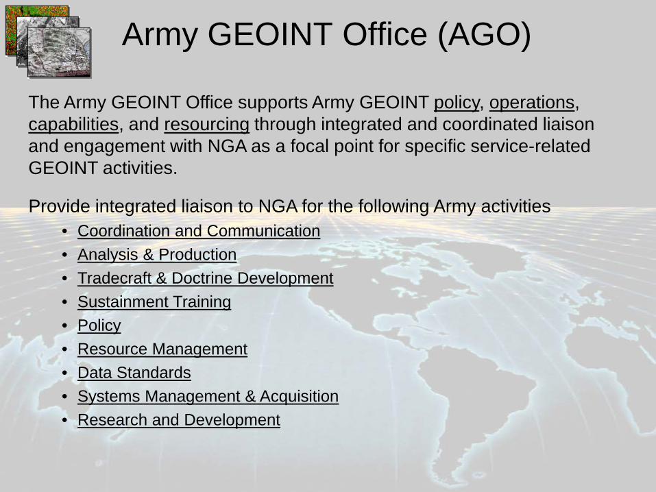
The Army GEOINT Office supports Army GEOINT policy, operations, capabilities, and resourcing through integrated and coordinated liaison and engagement with NGA as a focal point for specific service-related GEOINT activities.
Army GEOINT Office (AGO)
Provide integrated liaison to NGA for the following Army activities • Coordination and Communication • Analysis & Production • Tradecraft & Doctrine Development • Sustainment Training • Policy • Resource Management • Data Standards • Systems Management & Acquisition • Research and Development
13
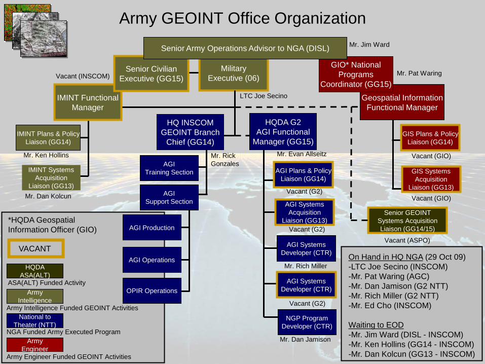
Army Intelligence
National to Theater (NTT)
Army Engineer
Army Intelligence Funded GEOINT Activities
NGA Funded Army Executed Program
Army Engineer Funded GEOINT Activities
VACANT
*HQDA Geospatial Information Officer (GIO)
HQDA ASA(ALT)
ASA(ALT) Funded Activity
IMINT Plans & Policy Liaison (GG14)
IMINT Systems Acquisition
Liaison (GG13) Mr. Dan Kolcun
Mr. Ken Hollins
Army GEOINT Office Organization
Military Executive (06)
Mr. Jim Ward
LTC Joe Secino
GIS Plans & Policy Liaison (GG14)
GIS Systems Acquisition
Liaison (GG13) Vacant (GIO)
Vacant (GIO)
Geospatial Information Functional Manager
Mr. Pat Waring
IMINT Functional Manager
Vacant (INSCOM)
HQDA G2 AGI Functional
Manager (GG15)
AGI Plans & Policy Liaison (GG14)
AGI Systems Acquisition
Liaison (GG13)
Mr. Evan Allseitz
Vacant (G2)
Vacant (G2)
Vacant (G2)
Mr. Dan Jamison
Mr. Rich Miller
AGI Systems Developer (CTR)
NGP Program Developer (CTR)
AGI Systems Developer (CTR)
HQ INSCOM GEOINT Branch
Chief (GG14)
AGI Training Section
AGI Support Section
AGI Production
AGI Operations
OPIR Operations
Mr. Rick Gonzales
GIO* National Programs
Coordinator (GG15)
Senior Civilian Executive (GG15)
Senior Army Operations Advisor to NGA (DISL)
Senior GEOINT Systems Acquisition Liaison (GG14/15)
Vacant (ASPO)
On Hand in HQ NGA (29 Oct 09) -LTC Joe Secino (INSCOM) -Mr. Pat Waring (AGC) -Mr. Dan Jamison (G2 NTT) -Mr. Rich Miller (G2 NTT) -Mr. Ed Cho (INSCOM)
Waiting to EOD -Mr. Jim Ward (DISL - INSCOM) -Mr. Ken Hollins (GG14 - INSCOM) -Mr. Dan Kolcun (GG13 - INSCOM)
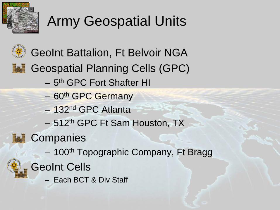
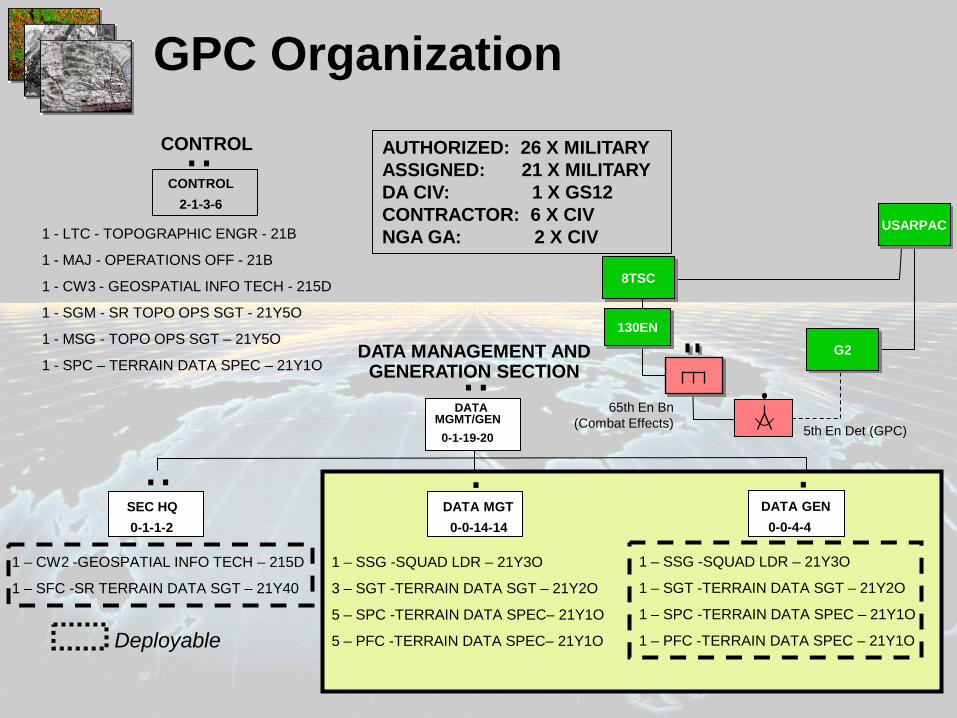
Army Geospatial Units
GeoInt Battalion, Ft Belvoir NGA Geospatial Planning Cells (GPC)
– 5th GPC Fort Shafter HI – 60th GPC Germany – 132nd GPC Atlanta – 512th GPC Ft Sam Houston, TX
Companies – 100th Topographic Company, Ft Bragg
GeoInt Cells – Each BCT & Div Staff
GeoInt Battalion
16
GPC Organization
.. SEC HQ 0-1-1-2
1 – CW2 -GEOSPATIAL INFO TECH – 215D
1 – SFC -SR TERRAIN DATA SGT – 21Y40
. DATA GEN 0-0-4-4
1 – SSG -SQUAD LDR – 21Y3O
1 – SGT -TERRAIN DATA SGT – 21Y2O
1 – SPC -TERRAIN DATA SPEC – 21Y1O
1 – PFC -TERRAIN DATA SPEC – 21Y1O
. DATA MGT 0-0-14-14
1 – SSG -SQUAD LDR – 21Y3O
3 – SGT -TERRAIN DATA SGT – 21Y2O
5 – SPC -TERRAIN DATA SPEC– 21Y1O
5 – PFC -TERRAIN DATA SPEC– 21Y1O
DATA MANAGEMENT AND GENERATION SECTION
DATA MGMT/GEN 0-1-19-20
..
1 - LTC - TOPOGRAPHIC ENGR - 21B
1 - MAJ - OPERATIONS OFF - 21B
1 - CW3 - GEOSPATIAL INFO TECH - 215D
1 - SGM - SR TOPO OPS SGT - 21Y5O
1 - MSG - TOPO OPS SGT – 21Y5O
1 - SPC – TERRAIN DATA SPEC – 21Y1O
.. CONTROL
2-1-3-6
CONTROL
Deployable
5th En Det (GPC)
65th En Bn (Combat Effects)
G2
8TSC
USARPAC
AUTHORIZED: 26 X MILITARY ASSIGNED: 21 X MILITARY DA CIV: 1 X GS12 CONTRACTOR: 6 X CIV NGA GA: 2 X CIV
130EN
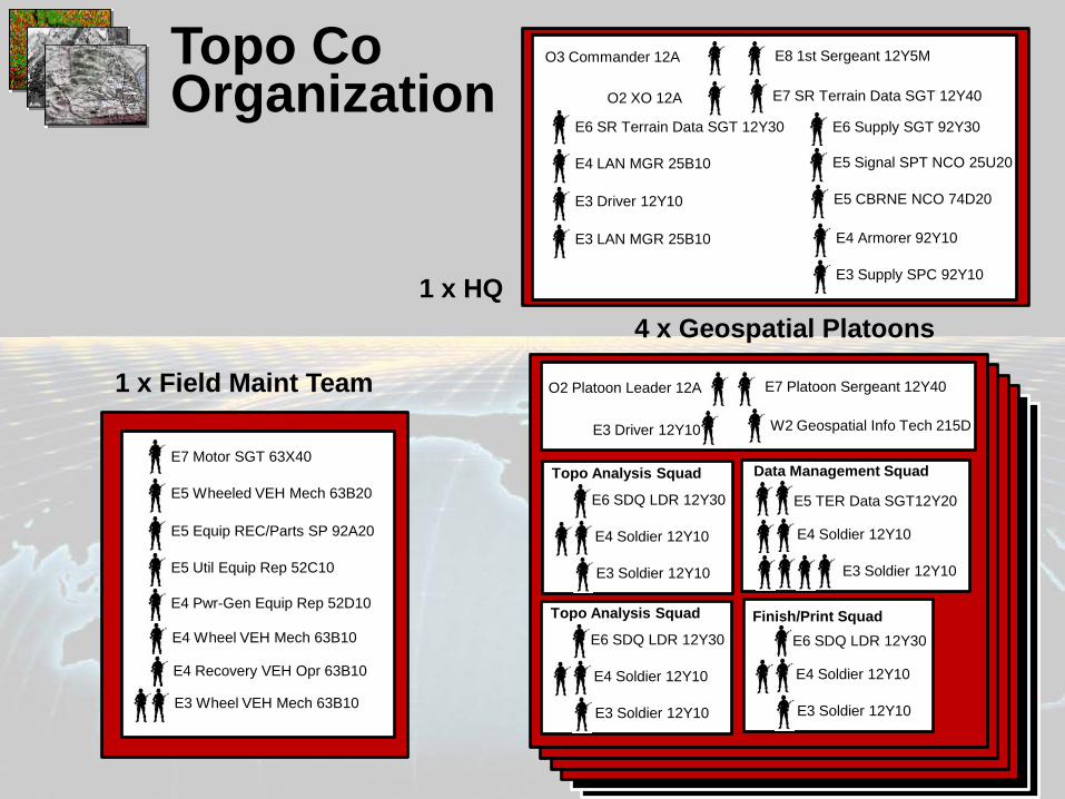
O2 Platoon Leader 12A
W2 Geospatial Info Tech 215D
E7 Platoon Sergeant 12Y40
E3 Driver 12Y10
Topo Analysis Squad
E6 SDQ LDR 12Y30
E4 Soldier 12Y10
E3 Soldier 12Y10
Data Management Squad
E5 TER Data SGT12Y20
E4 Soldier 12Y10
E3 Soldier 12Y10
Finish/Print Squad E6 SDQ LDR 12Y30
E4 Soldier 12Y10
E3 Soldier 12Y10
O3 Commander 12A
E7 SR Terrain Data SGT 12Y40
E8 1st Sergeant 12Y5M
O2 XO 12A
E6 SR Terrain Data SGT 12Y30 E6 Supply SGT 92Y30
E5 Signal SPT NCO 25U20
E5 CBRNE NCO 74D20
E4 LAN MGR 25B10
E4 Armorer 92Y10 E3 LAN MGR 25B10
E3 Driver 12Y10
E3 Supply SPC 92Y10
E7 Motor SGT 63X40
E5 Wheeled VEH Mech 63B20
E5 Util Equip Rep 52C10
E5 Equip REC/Parts SP 92A20
E4 Pwr-Gen Equip Rep 52D10
E4 Wheel VEH Mech 63B10
E4 Recovery VEH Opr 63B10
E3 Wheel VEH Mech 63B10
Topo Analysis Squad
E6 SDQ LDR 12Y30
E4 Soldier 12Y10
E3 Soldier 12Y10
1 x HQ
1 x Field Maint Team
4 x Geospatial Platoons
Topo Co Organization
GeoInt Cell
• Imagery Analysts and Geospatial Engineers working together – BCT – Division
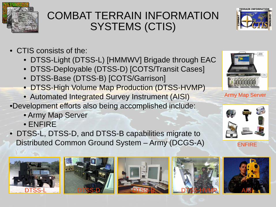
• CTIS consists of the: • DTSS-Light (DTSS-L) [HMMWV] Brigade through EAC • DTSS-Deployable (DTSS-D) [COTS/Transit Cases] • DTSS-Base (DTSS-B) [COTS/Garrison] • DTSS-High Volume Map Production (DTSS-HVMP) • Automated Integrated Survey Instrument (AISI)
•Development efforts also being accomplished include: • Army Map Server • ENFIRE
• DTSS-L, DTSS-D, and DTSS-B capabilities migrate to Distributed Common Ground System – Army (DCGS-A)
DTSS-HVMP DTSS-L DTSS-D DTSS-B HVMP AISI
ENFIRE
Army Map Server
COMBAT TERRAIN INFORMATION SYSTEMS (CTIS)