Embed Size (px)
Citation preview
April 29, 2017
RE: Recovery 32, Southerly end of Line of 55 Mile Trees – “The Landing” Dear Superintendent:
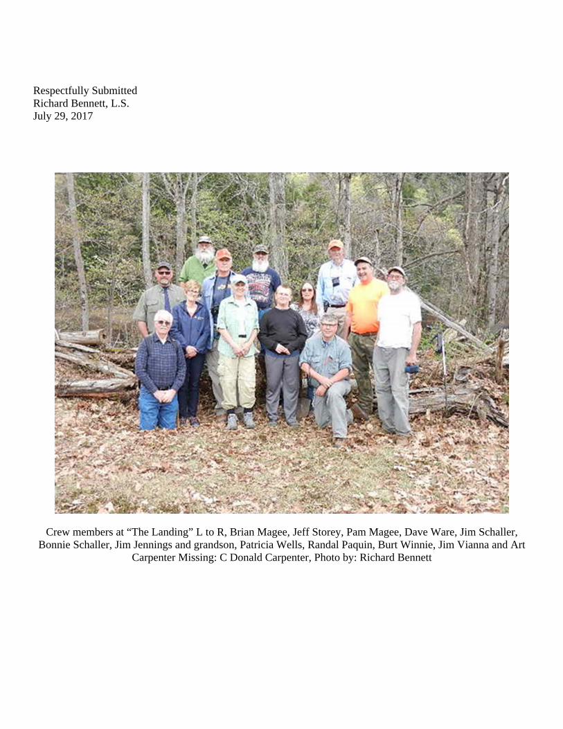
Fifteen members of the Crew meet near the
boundary line between the Towns of Thurman and Stony Creek in Warren County, on the northerly side of the Hudson River and the southerly side of the former Delaware and Hudson Railroad to search for Colvin monuments which were set in 1879 to re-mark the Initial Point of the 1772 Totten and Crossfield survey baseline.
Thanks to Patrick Galusha, the owner of the
property, we were granted access to the site including the use of his private drive.
Two Colvin’s monuments were recovered; the
Initial Signal Monument No. 7 and the Reference Monument set on the line between the Great and Little Dartmouth Patents; however both of the monuments have been disturbed and moved from their original locations. Reputedly a former property owner displaced the monuments while clearing land for agricultural purposes.
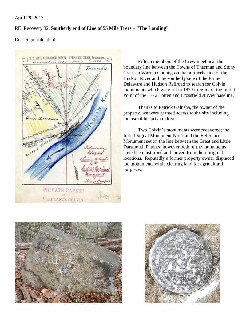
Colvin’s Signal Monument No. 7, found disturbed and used for target practice.
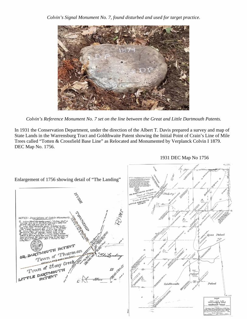
Colvin’s Reference Monument No. 7 set on the line between the Great and Little Dartmouth Patents. In 1931 the Conservation Department, under the direction of the Albert T. Davis prepared a survey and map of State Lands in the Warrensburg Tract and Goldthwaite Patent showing the Initial Point of Crain’s Line of Mile Trees called “Totten & Crossfield Base Line” as Relocated and Monumented by Verplanck Colvin I 1879. DEC Map No. 1756.
1931 DEC Map No 1756
Enlargement of 1756 showing detail of “The Landing”
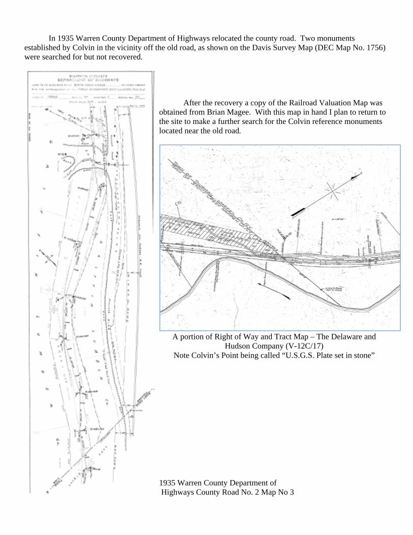
In 1935 Warren County Department of Highways relocated the county road. Two monuments established by Colvin in the vicinity off the old road, as shown on the Davis Survey Map (DEC Map No. 1756) were searched for but not recovered.
After the recovery a copy of the Railroad Valuation Map was
obtained from Brian Magee. With this map in hand I plan to return to the site to make a further search for the Colvin reference monuments located near the old road.
A portion of Right of Way and Tract Map – The Delaware and
Hudson Company (V-12C/17) Note Colvin’s Point being called “U.S.G.S. Plate set in stone”
1935 Warren County Department of Highways County Road No. 2 Map No 3
Respectfully Submitted Richard Bennett, L.S. July 29, 2017
Crew members at “The Landing” L to R, Brian Magee, Jeff Storey, Pam Magee, Dave Ware, Jim Schaller, Bonnie Schaller, Jim Jennings and grandson, Patricia Wells, Randal Paquin, Burt Winnie, Jim Vianna and Art
Carpenter Missing: C Donald Carpenter, Photo by: Richard Bennett


![Effect of disease and recovery on functional …... 335 Effect of disease recovery on functional anatomy in brain tumor patients REVIEWratio [32].Blocked design may have larger statisti](https://img.pdfslide.us/doc/110x75/5ea26553de6b7750f237d7d8/effect-of-disease-and-recovery-on-functional-335-effect-of-disease-recovery.jpg)


![[Recovery] Cwm Recovery 6.0.3](https://img.pdfslide.us/doc/110x75/55cf9443550346f57ba0c2b8/recovery-cwm-recovery-603.jpg)