Embed Size (px)
Citation preview

Grants Pass Airport B-1 Appendix B – PAC Summaries
Appendix B
PLANNING ADVISORY COMMITTEE -
MEETING SUMMARIES Master Plan Update Grants Pass Airport

P:\Josephine County\034252\Management\Meetings\PAC #1 Summary_GP.doc Page 1 of 4
Grants Pass Airport Master Plan & Airport Layout Plan Update
Meeting #1 Summary January 12, 2009
Grants Pass Airport, FBO Classroom
6:00 – 7:30 p.m.
Attendees:
Josephine County Department of Airports: Alex Grossi, Airport Manager
Public Advisory Committee Members: Trenor Scott, Brett Hopper, Tobin Shackelford, and Jeff
Tompkins
Liaison Commissioner: Sandi Cassanelli
Oregon Department of Aviation: Chris Cummings
WHPacific, Inc: Rainse Anderson and Sarah Lucas
General Public: Refer to attached sign-in sheet
Welcome and Introductions
Alex Grossi opened the meeting at 6:05 pm by introducing the Advisory
Committee members and WHPacific staff.
Purpose of the Master Plan
/ ALP Update
Rainse Anderson, Project Manager, gave an overview of the project’s
purpose. The intent is to update the 1990 Grants Pass Airport Layout
Plan (ALP) Update. This document is over 17 years old and needs to be
updated to reflect new facilities, current projections of airport activity,
new environmental and other regulatory constraints, and to plan for an
appropriate mix of land uses to support projected aviation and non-
aviation needs and the long-term financial health of the airport.
The updated Master Plan will help the Josephine County Department of
Airports select appropriate patterns of land use on the airfield and
adjoining County properties based on updated forecasts of demand for
aviation services such as hangars, tie downs, repair, flight instruction,
etc. Adjacent development will be considered to ensure growth is
compatible with airport operations. Paradise Ranch, and its connection
with the Airport, will also be evaluated. Obsolete elements of the
existing ALP will be corrected. An updated capital improvement plan
will allow the County to make strategic investments in needed airfield
projects.
Project Components Sarah Lucas, Project Planner, presented the Master Plan Components,

P:\Josephine County\034252\Management\Meetings\PAC #1 Summary_GP.doc Page 2 of 4
which are Inventory and Data Collection; Aeronautical Activity Forecast;
Facility Requirements; Airport Alternatives; ALP Drawings; and Capital
Improvement Plan. The ALP drawings consist of the following: Airport
Layout Plan, Airport Airspace Plan, Inner Portion of the Approach
Surface Drawing, Terminal Area Drawing, Land Use and Noise Contour
Drawing, Runway Departure Surfaces Drawing, and Airport Property
Map. Each component represents a chapter in the Master Plan.
Advisory Committee members will receive draft chapters 2 weeks in
advance of public meetings, in order for them to review and provide
input.
The 18-month project schedule is included in the Advisory Committee
member’s project binder. This schedule allows for review time from
the Committee, in addition to the County and Federal Aviation
Administration (FAA).
Roles of the Advisory
Committee
The Committee will serve as an advisor to the County. The County has
final authority over the Master Plan. The Committee is asked to
provide input, based on specific knowledge of the members, to help
produce a document that incorporates a wide range of interests.
The Committee is asked to bring comments and concerns of the public
forward at the meetings for discussions. It is also requested the
Committee help in “rumor control” to reduce misconceptions about the
Plan’s intent.
Comments from the Committee can be discussed during the meeting,
or at anytime between meetings by contacting the County or
WHPacific.
Inventory
WHPacific conducted a physical inventory of the airport on the day of
the meeting. A draft Inventory Chapter will be drafted and provided to
the Committee in the next few weeks.
Some of the items gathered are:
• Airport Acreage is approximately 400 acres
• Runway dimensions: 4,001’ x 75’
• Full Parallel Taxiway (35’ wide)
• Medium Intensity Runway Lighting (MIRL) is installed
• No taxiway edge reflectors
• Limited Airport signage
• GPS Approach
• 12 T-hangars with a total of 85 individual units
• 47 box hangars
• 41 tie downs

P:\Josephine County\034252\Management\Meetings\PAC #1 Summary_GP.doc Page 3 of 4
• 7 businesses located on-site
• 120 based aircraft
This information, along with other information such as fuel sales and
lease information, will be included in the draft Inventory chapter.
Open Discussion The following comments were made by members of the Advisory
Committee:
Tobin Shackelford –
• Paradise Ranch is planning on opening in Summer 2009
• Components of the through the fence arrangement include a
12,000 s.f. heated hangar and terminal building
• Paradise Ranch would like to bring in more business in addition
to their clients.
• A runway extension is vital
• The Airport is key to economic growth
• Paradise Ranch plans to employ 5-10 aviation only employees.
Total, the Ranch plans on hiring 80 full-time employees and up
to 40 part-time employees. These employees will be local.
• Paradise Ranch has done studies of aircraft used by potential
clients, which range from Citation I to a Falcon 900.
• The first line of the sewer system (referred to as the “spine”) is
planned for installation in the summer of 2009.
• An eastside parallel taxiway would encourage more
development on that side of the runway.
Brett Hopper –
• Runway extension of 1,000’ to 2,000’ is needed
• Airport has high approach minima
• UPS mail carrier discontinued service to the airport. It is
believed this happened because the airport’s airspace is Class G
up to 700’. UPS couldn’t take off in IFR conditions in Class G
airspace; Class C is preferred.
• Is it possible to have ADS-B technology at Airport?
• The Airport’s SuperAWOS doesn’t report to the FAA. ATC and
flight briefers do not have access to the weather reporting.
This has inhibited operations, especially life flight, and the
weather station needs to be modified or upgraded.
• Airport security and access is lacking. Codes need to be
changed periodically or people should have personal access
codes. Video cameras and a webcam would be useful.
• There are talks that Ameriflight would like to do their priority

P:\Josephine County\034252\Management\Meetings\PAC #1 Summary_GP.doc Page 4 of 4
overnight operations from the Airport in the BE-99.
• The County should have an out of the box, ready leases for
cookie-cutter development. The process needs to be
streamlined to encourage development.
Jeff Tompkins –
• There is natural gas near the Airport and it should be connected
into the Airport.
Alex Grossi –
• The fuel station needs to be relocated, preferably at the
Runway 12 end of the airfield.
• A new FBO location with more close-in ramp area is needed.
This would be beneficial for charter, life flight, and transient
operations. It would also increase security and safety at the
Airport.
The following comments were presented by members of the public
(responses in italics):
• Where does the Airport’s financing come from? The Airport is
funded by federal and state grants and user fees. No County
general funds have been used to date.
• Can the project timeline be compressed? Yes, we will try to
compress the schedule; however, things like review allowances
cannot be changed.
• Are projects on hold until the Master Plan is completed? No.
The County is underway with a fencing project at Illinois Valley
as an example.
• Are there any advantages for the Airport to staying small? Not
in the means of economic development.
• Would a larger airport mean Merlin would be incorporated into
Grants Pass? That would be extremely unlikely. There are
issues such as the Urban Growth Boundary that would prohibit
that.
• If the Airport is looking at changing zoning, they need to work
with the County. Yes, that is correct.
• Asked to Paradise Ranch: Are there any problems with the
Airport? Paradise Ranch response: Yes- runway length,
weather reporting. The summer high volume is estimated at 15
operations per day. This would double or triple fuel sales. The
Airport’s rural feel is attractive to their clients – they prefer the
privacy.

Grants Pass Airport - PAC #2 Meeting Summary Page 1 of 4
Grants Pass Airport Master Plan & Airport Layout Plan Update
Meeting #2 July 13, 2009
Grants Pass Airport, FBO Classroom
5:30 – 7:00 p.m.
Attendees:
Josephine County Department of Airports: Alex Grossi, Airport Manager
WHPacific, Inc: Rainse Anderson, Sarah Lucas and Sara Funk
Planning Advisory Committee (PAC): Brett Hopper, Tobin Shackleford and Del Renfro,
Welcome and
Introductions
Alex Grossi opened the meeting at 5:35 pm by introducing the Advisory
Committee members and WHPacific staff.
Project Update Rainse Anderson reported the project team has prepared and submitted draft
Chapters 1, 2 and 3 to the County, Federal Aviation Administration (FAA) and
PAC Members. The FAA has approved Chapter 2, Aeronautical Activity
Forecast.
Inventory Sarah Lucas presented a brief review of Chapter 1, Inventory.
Aeronautical Activity
Forecasts
Sara Funk and Sarah Lucas presented Chapter 2, Aeronautical Activity Forecast.
The purpose of the forecast is to determine the types and levels of aviation
activity expected at the Airport during a 20-year planning period. The method
used to prepare the forecast is to utilize national and regional aviation trends
and forecasts; review regional socioeconomic trends and forecasts; and
examine various FAA-approved forecasting models.
The Preferred Based Aircraft Forecast was chosen by selecting the mode of six
different forecasting models. An average annual growth rate (AAGR) of 1.10%
was selected for based aircraft at the Grants Pass Airport.
The Preferred Aircraft Operations Forecast is based on 250 operations per
based aircraft (FAA guidance for rural GA airports). Using this guidance,
operations are expected to grow at 1.09% AAGR over the planning period.
Chapter 2 also presents the Critical Aircraft, which is used for planning
purposes, as the most demanding aircraft performing at least 500 annual

Grants Pass Airport - PAC #2 Meeting Summary Page 2 of 4
itinerant operations at the Airport. The Airport’s Critical Aircraft was identified
as the Beech King Air 200, which represents an airport reference code of B-II.
Members of the PAC noted the forecast is difficult, given the current economic
conditions. It was reemphasized; however, that fuel sales are increasing at the
airport.
Facility
Requirements
The project team discussed Chapter 3, Facility Requirements. The intent of
this chapter is to identify the adequacy of existing facilities and outline what
new facilities may be needed to meet the projected demand. By utilizing
planning criteria defined by FAA and the Oregon Department of Aviation
(ODA), the requirements are developed. Industry guidance was also
presented for the PAC and County to understand the facilities and services
desirable for corporate aviation and air taxis. However, it was noted the FAA
cannot use industry criteria or economic development criteria to substantiate
funding.
Facility needs identified in the chapter are:
• precision instrument approach
• taxiway lighting
• terminal building
• cargo apron
• 24-hour fixed base operator (FBO) service
• nonstandard object free area
• grade of one taxilane
• full-parallel taxiway east of runway
• upgrade SuperAWOS to transmit data to FAA
• nine additional T-hangars by 2029
• ten additional conventional hangars by 2029
• 39 additional aircraft tiedowns
• fueling system access and possible relocation
• improved pedestrian gates
• zoning recommended to be changed to “Airport”
The existing runway length is adequate for the Airport’s critical aircraft, using
FAA and ODA criteria. However, using industry standards for small business
jet aircraft it was noted the runway length is deficient.
The PAC members had an opportunity to give input on their perceived needs

Grants Pass Airport - PAC #2 Meeting Summary Page 3 of 4
at the Airport. They were: weather reporting (FBO cannot transmit due to
liability concerns, data is erroneous sometimes, ceiling height data is needed,
and air ambulances cannot shoot approaches), reconnecting the pilot
controlled lighting system, medium intensity runway lighting (MIRL) system
and instrument approach to Runway 30, and taxiway at Rogue Aero needs to
be wider.
Airport Alternatives
Discussion
PAC members gave input on items the alternatives should include. These
items are:
• The FBO should be centrally located, with easy road access.
• Consider remodeling existing FBO facility.
• Consolidate FBO functions that are now spread around the airport.
• Some FBO functions can be separate.
• There are limitations to development due to utilities.
• The fuel station needs to be relocated, with more capacity. The jet
fuel tank is underground and will need remediation within 20 years.
• Water needs to be provided to the Airport.
• The Airport is within an enterprise zone and that may help with
funding projects, like utilities.
• Visual glideslope indicators would be beneficial at the Airport.
• National Guard fencing to secure the airfield will be done by the end
of August.
• Increase pavement strength for air attack (firefighting) operations.
Runway Overlay
Update
Rainse Anderson and Alex Grossi gave an update on the runway overlay
project. The scope and fees should be approved within 2 weeks of the
meeting date.
The project includes rehabilitation of Runway 12/30, new MIRL system, and
new electrical equipment building. The existing pavement strength is 19,000
lbs single wheel gear (SWG) and approximately 40,000 lbs dual wheel gear
(DWG).
Currently, construction is planned for summer of 2010.
Next Meeting Date
and Time
The next meeting will be to discuss the airport alternatives. The meeting will
be held in September. Notice will be sent once the date, time and location is
set.
Grants Pass Airport - PAC #2 Meeting Summary Page 4 of 4
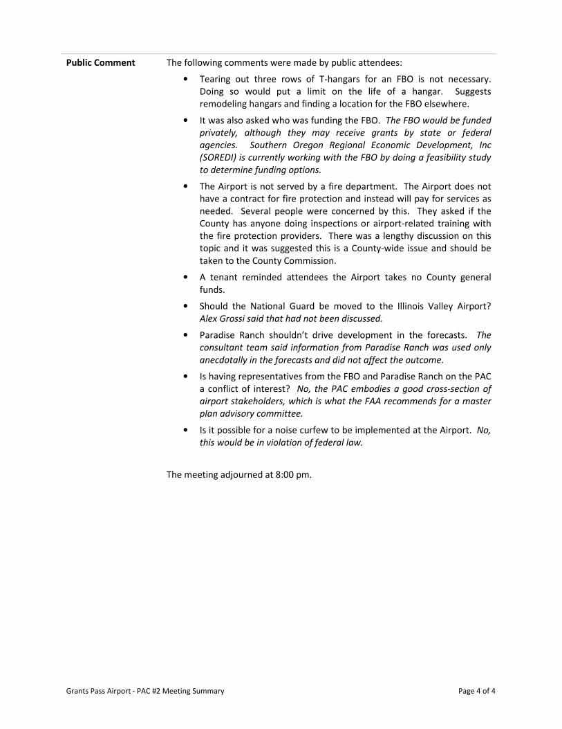
Public Comment The following comments were made by public attendees:
• Tearing out three rows of T-hangars for an FBO is not necessary.
Doing so would put a limit on the life of a hangar. Suggests
remodeling hangars and finding a location for the FBO elsewhere.
• It was also asked who was funding the FBO. The FBO would be funded
privately, although they may receive grants by state or federal
agencies. Southern Oregon Regional Economic Development, Inc
(SOREDI) is currently working with the FBO by doing a feasibility study
to determine funding options.
• The Airport is not served by a fire department. The Airport does not
have a contract for fire protection and instead will pay for services as
needed. Several people were concerned by this. They asked if the
County has anyone doing inspections or airport-related training with
the fire protection providers. There was a lengthy discussion on this
topic and it was suggested this is a County-wide issue and should be
taken to the County Commission.
• A tenant reminded attendees the Airport takes no County general
funds.
• Should the National Guard be moved to the Illinois Valley Airport?
Alex Grossi said that had not been discussed.
• Paradise Ranch shouldn’t drive development in the forecasts. The
consultant team said information from Paradise Ranch was used only
anecdotally in the forecasts and did not affect the outcome.
• Is having representatives from the FBO and Paradise Ranch on the PAC
a conflict of interest? No, the PAC embodies a good cross-section of
airport stakeholders, which is what the FAA recommends for a master
plan advisory committee.
• Is it possible for a noise curfew to be implemented at the Airport. No,
this would be in violation of federal law.
The meeting adjourned at 8:00 pm.

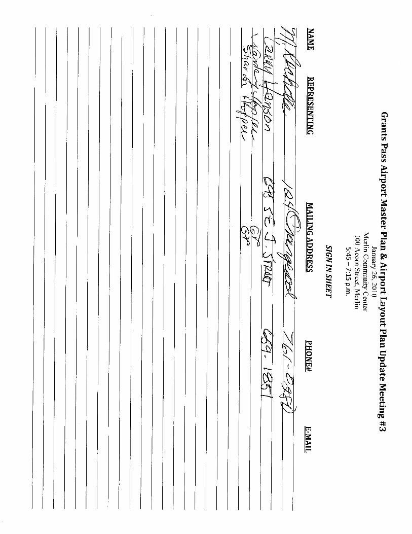
Grants Pass Airport – Master Plan Update, PAC Meeting #3 January 26, 2010
P:\Josephine County\034252\Management\Meetings\PAC #3 Summary_GP.docx
Grants Pass Airport Master Plan & Airport Layout Plan Update
Meeting #3 January 26, 2010
Merlin Community Center
100 Acorn Street, Merlin
5:45 – 7:15 p.m.
Attendees:
Josephine County Department of Airports: Alex Grossi, Airport Manager
WHPacific, Inc: Rainse Anderson and Sarah Lucas
Planning Advisory Committee: Trenor Scott, Brett Hopper, Tobin Shackleford and Jeff
Thompkins
Public Attendees: 29 members of the public signed in (see attached sheet)
Welcome and
Introductions
Alex Grossi opened the meeting at 5:45 pm by introducing the Planning Advisory
Committee (PAC) members and WHPacific staff.
Project Update Rainse Anderson reported the project team has prepared and submitted draft
Chapter 4, Airport Development Alternatives, to the County, Federal Aviation
Administration (FAA) and PAC Members.
The intent of this meeting is to select a preferred alternative that will ultimately
become the basis of the Airport Layout Plan (ALP). The preferred alternative can
be a hybrid of the alternatives presented.
Draft Chapter 4 –
Airport
Development
Alternatives
Rainse and Sarah Lucas presented the following: Chapter 4 presents several
development alternatives that focus on meeting the Airport’s facility needs for
the long-term future (2029 and beyond). The Airport’s needs are based on the
recommendations presented in Chapter 3, Facility Requirements. The
alternatives consider the ultimate potential of the airport property.
A summary of the Chapter 3 facility requirements was presented to the PAC:
Airfield:
• Increase Runway Protection Zone (RPZ), as appropriate, for future instrument
approach
• Upgrade to precision instrument approach
• Install approach lighting system, as appropriate
• Upgrade runway markings for instrument approach
• Clear Object Free Area (OFA)
Grants Pass Airport – Master Plan Update, PAC Meeting #3 January 26, 2010
P:\Josephine County\034252\Management\Meetings\PAC #3 Summary_GP.docx
• Extend runway
• Construct full-length eastern parallel taxiway
• Level taxilanes south of Hangar Row “A”, when appropriate
• Upgrade Medium Intensity Runway Lighting (MIRL) to a can / conduit system
• Install taxiway and taxilane edge lights
• Upgrade SuperAWOS (Automated Weather Observation System) to transmit
data to FAA
Landside:
• Construct nine T-hangars and ten conventional hangars
• Expand tiedown apron
• Install cargo apron
• Reserve land for locating a Fixed-Base Operator (FBO) facility
• Install punch type combination locks on pedestrian gates
• Relieve congestion around the self-service fueling station
Three alternatives, in addition to the no build alternative, were presented (and
are attached for reference). A brief overview of the alternatives follows:
No Build Alternative:
• Maintenance of existing facilities
• No expansion of airfield or landside facilities
◦ OFA would remain non-standard
◦ FBO would remain in inadequate facilities
◦ Congestion around the self-service fueling station would persist
◦ There would still be a financial impact to the County for maintenance
Alternative 1:
Airfield Components
• Runway and parallel taxiway extension of 1,200 to the NW
• Instrument approach to Runway 12, with minimums not lower than ¾ mile
(would require property acquisition or avigation easement)
• Full-parallel taxiway on the east side
• Installation of approach lighting system and taxiway/taxilane edge lights
• Helicopter operations area
Landside Components
• Expand FBO in current location, removal of T-hangars required
• Fuel station moved to the north
• Reserve areas for corporate, T-hangar and conventional hangars, aviation-
related business and aviation compatible commercial development

Grants Pass Airport – Master Plan Update, PAC Meeting #3 January 26, 2010
P:\Josephine County\034252\Management\Meetings\PAC #3 Summary_GP.docx
• Road relocation near the aviation-related business reserve
• Relocation of beacon and SuperAWOS
Alternative 2:
Airfield Components
• Runway and parallel taxiway extension of 2,000 to the NW
• Instrument approach to Runway 12 and 30, with minimums not lower than 1
mile
• Full-parallel taxiway on the east side
• Installation of taxiway/taxilane edge lights
• Helicopter operations area
Landside Components
• FBO relocation to the north of current location
• Fuel station would remain in its current location
• Extension of aircraft parking apron
• Reserve areas for corporate, T-hangar and conventional hangars, aviation-
related business and aviation compatible commercial development
• Road relocation near the aviation-related business reserve
Alternative 3:
Airfield Components
• Runway and parallel taxiway extension of 2,000 to the NW
• Instrument approach to Runway 12, with minimums not lower than ¾ mile
(would require property acquisition or avigation easement)
• Full-parallel taxiway on the east side
• Installation of approach lighting system and taxiway/taxilane edge lights
• Helicopter operations area
Landside Components
• FBO relocation to the north of current location
• Fuel station relocated near FBO facility
• Extension of aircraft parking apron
• Reserve areas for corporate, T-hangar and conventional hangars, aviation-
related business and aviation compatible commercial development
• Road relocation near the aviation-related business reserve and new main
airport access road
• New access road on the east side to access corporate development reserve
area
• Relocation of Super AWOS
• Potential land purchase near aviation-related business reserve

Grants Pass Airport – Master Plan Update, PAC Meeting #3 January 26, 2010
P:\Josephine County\034252\Management\Meetings\PAC #3 Summary_GP.docx
Financial Impact of Alternatives
Detailed cost estimates were not prepared. Order of magnitude capital costs
used to analyze impact.
• Alternative 3 would have highest capital cost
◦ Longer runway extension and more expensive instrument approach
improvements
• Alternative 2 would have second highest capital cost
◦ Less expensive instrument approach improvements
• Alternative 1would have the third highest capital cost
◦ Shorter runway and parallel taxiway extension
• No-Build Alternative would have the least capital cost
◦ Maintain only existing pavements and facilities
Environmental Screening
A high-level environmental screening of each alternative was prepared, based on
the 21 impact categories presented in FAA Order 1050.1E and guidance from the
Council on Environmental Quality, per the National Environmental Policy Act.
The review found that both Alternatives 2 and 3 would have the same
environmental impact, with Alternative 1 having a slightly less impact mostly
due to the shorter runway extension. The no build alternative would have the
least environmental impact, as it only maintains existing facilities.
Airport
Alternatives
Discussion
(PAC comments)
Questions from PAC members are presented, with responses in italics.
Explain restrictions of an avigation easement.
An avigation easement restricts the height and nature of buildings constructed
within an outlined area. Height restrictions are based on runway elevation;
therefore, lower lying areas have reduced restrictions.
What is aviation compatible commercial?
Aviation compatible commercial can be any business ranging from car rental,
hotels and restaurants. The development does not have to be aviation-related
(like an avionics shop); rather it must not conflict with airport operations (such as
a factory that produces smoke or steam).
Can we (the PAC) suggest that hangar replacements be built before the three T-
hangars (Rows A, B, C) are removed?
Yes, the County can choose to replace the T-hangars prior to removal. The
replacement can be accomplished by the County or by a developer through land
leases.
What does it mean when the report says the FAA cannot pay for items
pertaining to economic development?
The FAA can only pay for necessary safety, capacity or maintenance items. For

Grants Pass Airport – Master Plan Update, PAC Meeting #3 January 26, 2010
P:\Josephine County\034252\Management\Meetings\PAC #3 Summary_GP.docx
instance, a runway extension may prove to be an economic generator; however,
FAA must be able to justify the extension on a safety or capacity basis.
What was the process of developing the alternatives?
The consultant developed the alternatives based on recommendations from
Chapter 3, Facility Requirements, along with guidance from the County.
Why is there no alternative showing the FBO on the east side?
Considering set backs from the runway system and the County road, there is
limited area for the development of an FBO on the east side.
Could the fuel island be located on the existing tie down apron?
Yes, it could. However, other locations were shown that would locate the fuel
closer to the ultimate FBO facility.
If the FBO were located farther to the north, there would be potential residential
impacts. Was this considered?
Yes, residential impacts were considered in the analysis.
If the County were to extend the sewer system to the Airport and the
surrounding area, there would be a push for higher density development than
what currently surrounds the Airport. How do the plans address this issue?
It is recommended that high-density development not be allowed near the
Airport. This is an issue the County must consider when discussing the
implications of extending the sewer line.
What would the fencing plans for each alternative be?
Details of a fencing plan would be developed during actual project design.
The ground profile slopes down, the farther north you are on the Airport. How
would development be allowed in these areas to maintain appropriate taxiway
grades?
Any development would require fill material to raise the ground profile.
Would you have to bury the power lines to develop the triangle area?
No. Discussions with the power company indicate taxilanes are permitted.
Hangar development would need an 18-foot setback, while any fueling would
require a 100-foot setback.
What is the current runway strength?
The current runway is rated at 19,000 lbs single-wheel gear. However, testing
shows the actual rating is much lower. The proposed maintenance overlay will
bring the runway up to 12,500 lbs single-wheel gear for a 20-year pavement life.
Is it possible to extend the runway by going south, rather than north?
No. The RPZ would extend over public roadways, which is discouraged by the
FAA.
What happens if the Master Plan is prepared and there is public outcry? Do you
go back and make changes?
No. The PAC meetings are open to the public, so they are provided an
opportunity to give input throughout the entire planning process.
Grants Pass Airport – Master Plan Update, PAC Meeting #3 January 26, 2010
P:\Josephine County\034252\Management\Meetings\PAC #3 Summary_GP.docx
What is the Master Plan approval process?
The Airport Advisory Board would approve the document, prior to sending it to
the Board of County Commissioners.
General Comments from PAC Regarding a Preferred Alternative
◦ The instrument approach with minimums not lower than ¾ mile is preferred.
Provide land use protections for this approach at the current and planned
runway length.
◦ A precision instrument approach is a high priority.
◦ For operations purposes, the FBO and fuel station should be located near one
another.
◦ It was asked if the tie down apron ever fills up and another PAC member
indicated it does – especially in the summer months.
◦ The triangle area is a high development priority.
◦ The corporate development reserve shown on Alternative 3 is only
developable on the south half. The ground profile on the north half of the
reserve drops off too significantly for any development.
◦ There needs to be an area set aside for larger, heavy-lift helicopters to
operate. The forest service area on the east would provide a suitable
location, with good access (ground and air) and separation.
Airport
Alternatives
Discussion
(public comments)
Questions from members of the public are presented, with responses in italics.
How much grant money would the County get for these projects?
For all Airport Improvement Program (AIP)-eligible projects, the current funding
level is 95% FAA and 5% County. The Oregon Department of Aviation also has a
grant program that could provide for part of the County’s match. Currently, the
County receives $150,000 of entitlements annually from the FAA. Cost estimates
for the preferred alternative are forthcoming.
How did removing hangar rows A, B and C get considered in the alternatives?
With assistance from the County, all alternatives were developed to look at
expansion capabilities. One consideration was how to expand the FBO in its
current location.
The plans show major development on the east, so why was an FBO not shown
there?
The development is shown as mostly corporate aviation, with the majority of
the general aviation development remaining on the west. There are limitations
for development on the east and it would be difficult to locate fuel near the FBO.
Additionally, most users of self-service would still be located on the west, which
would create unnecessary runway crossings.
We are confused on the process. If the Airport Advisory Board is supposed to
endorse the final plan, why aren’t they involved now? Can we merge the Board
Grants Pass Airport – Master Plan Update, PAC Meeting #3 January 26, 2010
P:\Josephine County\034252\Management\Meetings\PAC #3 Summary_GP.docx
with the PAC?
Much discussion then followed regarding this issue. The meeting adjourned, so
the Airport Advisory Board could discuss their concerns. During their meeting
they decided the PAC is doing a good job representing the Airport and the Board
would support their decisions.
What kind of timeline are we looking at for making a decision on the preferred
alternative?
After tonight’s meeting, the consultant will work with the County to help them
make the decision on the preferred alternative recommendation from the PAC.
After the Airport Advisory Board meeting ended, the PAC members reconvened
and gave their recommendation for the preferred alternative that reflected their
discussion presented above. Main components of the recommended preferred
alternative were:
• 2,000-foot runway extension to the north
• Precision instrument approach with minimums not lower than ¾
mile
• Relocate the FBO and fuel farm to the north (near the current end of
Runway 12), with the appropriate surface access modifications
• Internal access roads for the corporate development reserve (east
side of airport) and for the T-hangar development in the triangle
area (west side of airport)
• Full parallel taxiway on the east side
• Locate future helicopter operations on the east of the airport, by the
US Forest Service lease area
• Update weather reporting to be compatible with FAA system
Next Meeting Date
and Time
The next PAC meeting will present the ALP and Capital Improvement Plan (CIP).
It is tentatively scheduled for the third week in April.