Embed Size (px)
Citation preview

ANNEX 1: MAPS TO THE SALEHURST AND ROBERTSBRIDGE NEIGHBOURHOOD DEVELOPMENT PLAN 2016-2028 July 2018
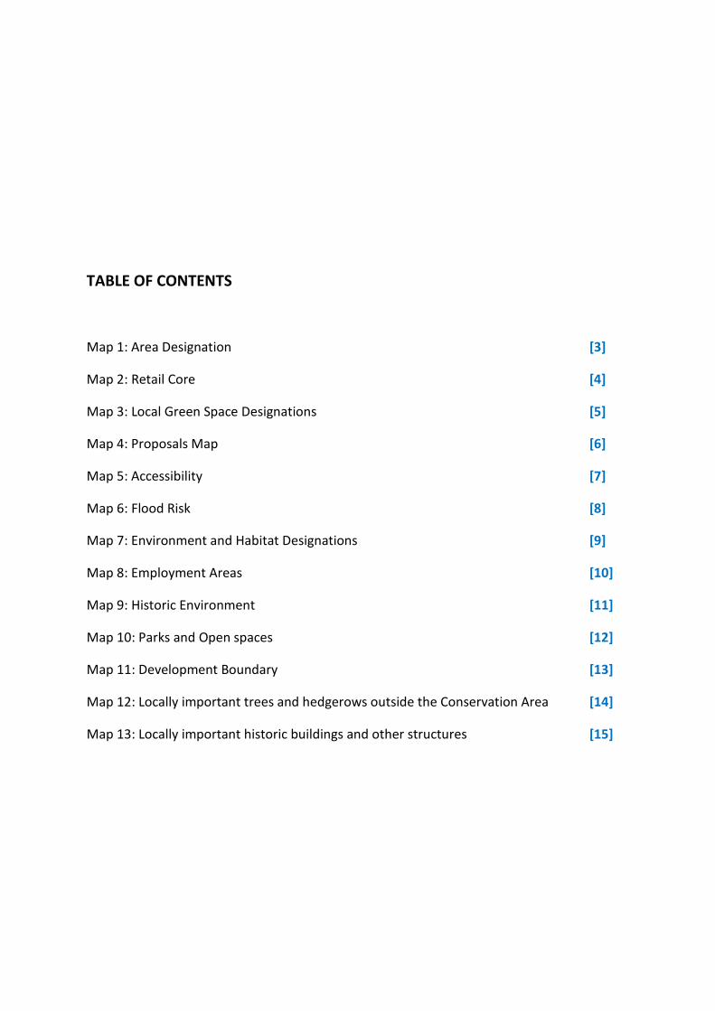
TABLE OF CONTENTS
Map 1: Area Designation [3]
Map 2: Retail Core [4]
Map 3: Local Green Space Designations [5]
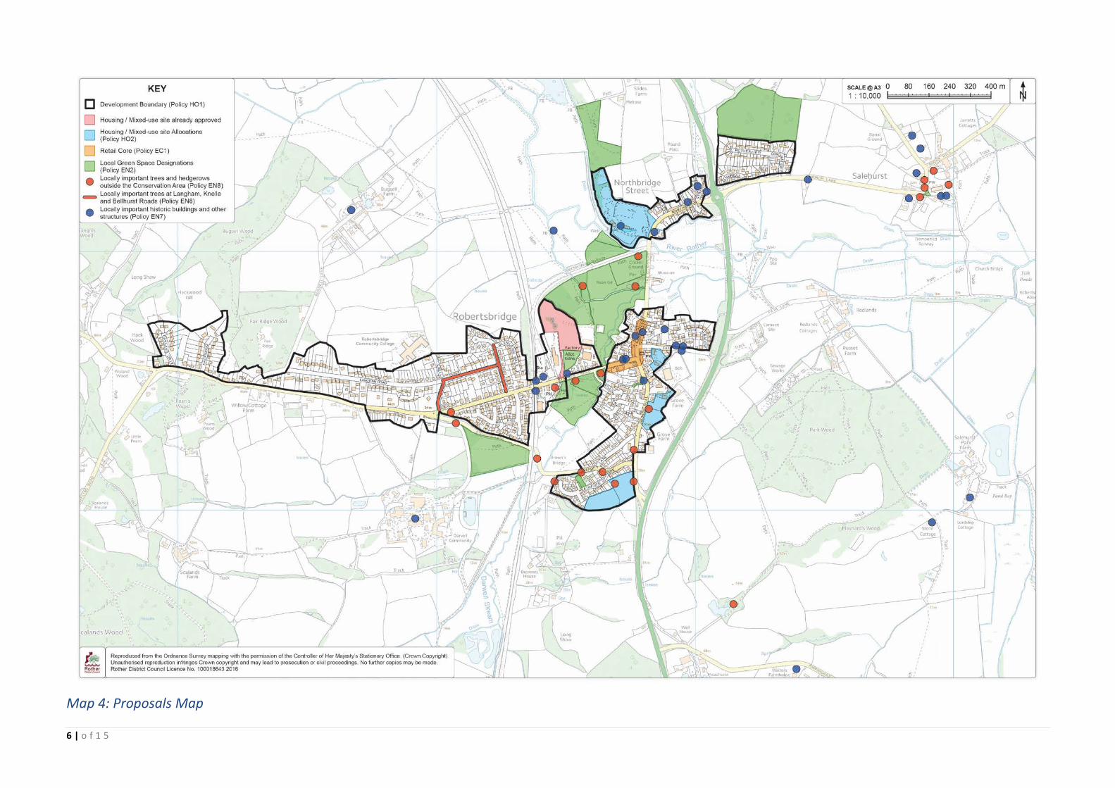
Map 4: Proposals Map [6]
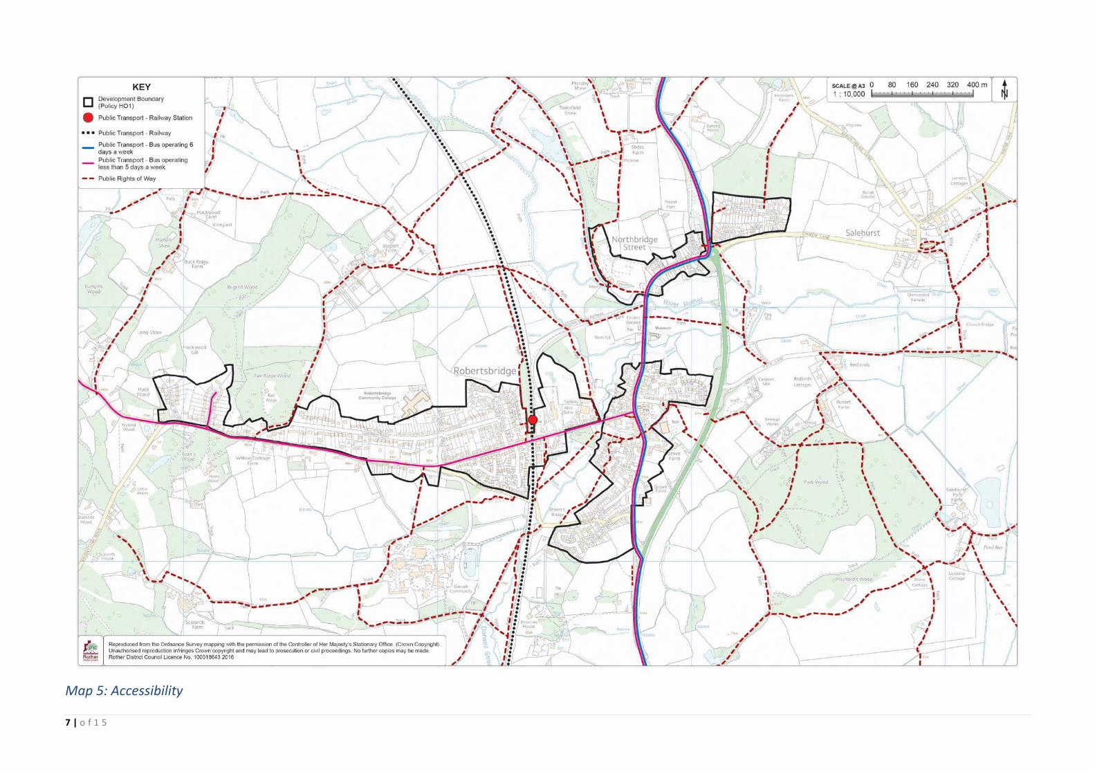
Map 5: Accessibility [7]
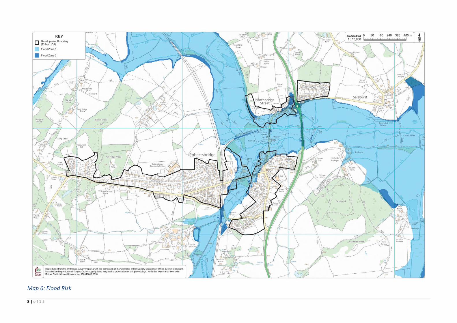
Map 6: Flood Risk [8]
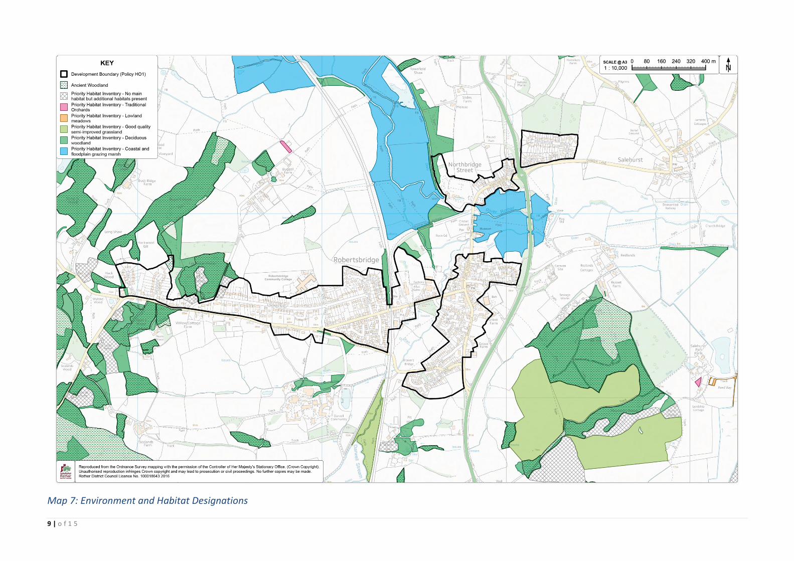
Map 7: Environment and Habitat Designations [9]
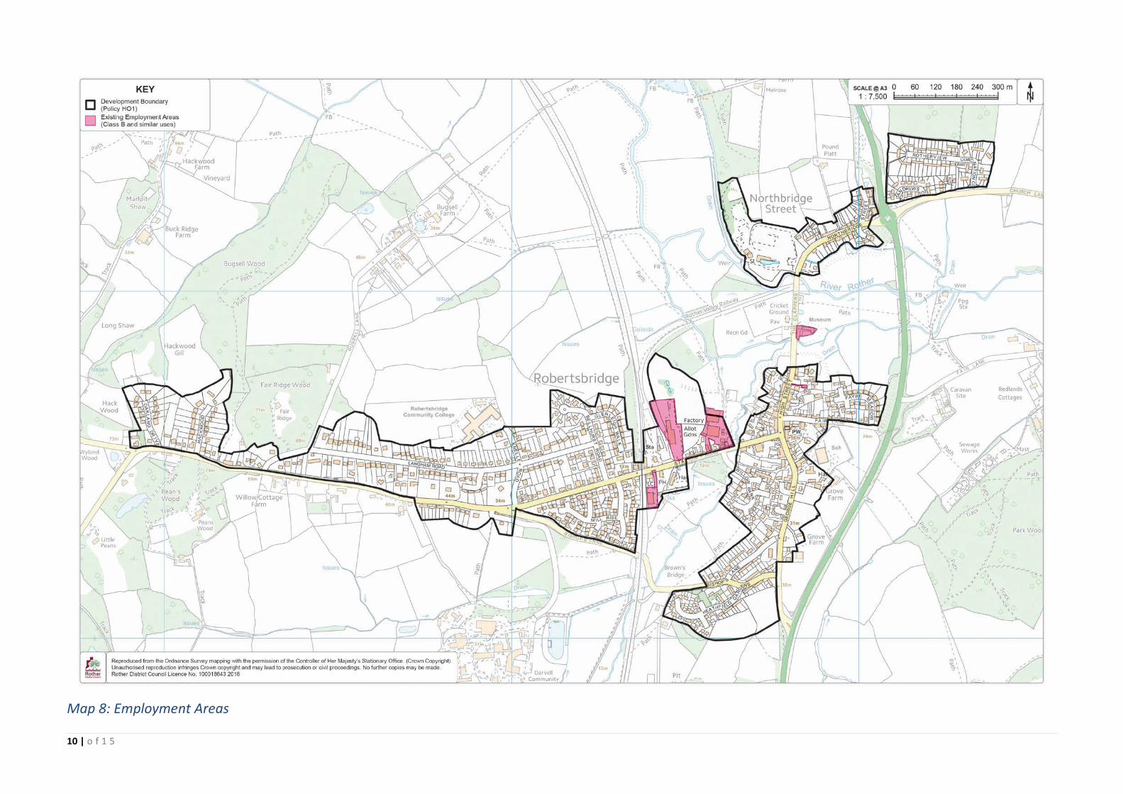
Map 8: Employment Areas [10]
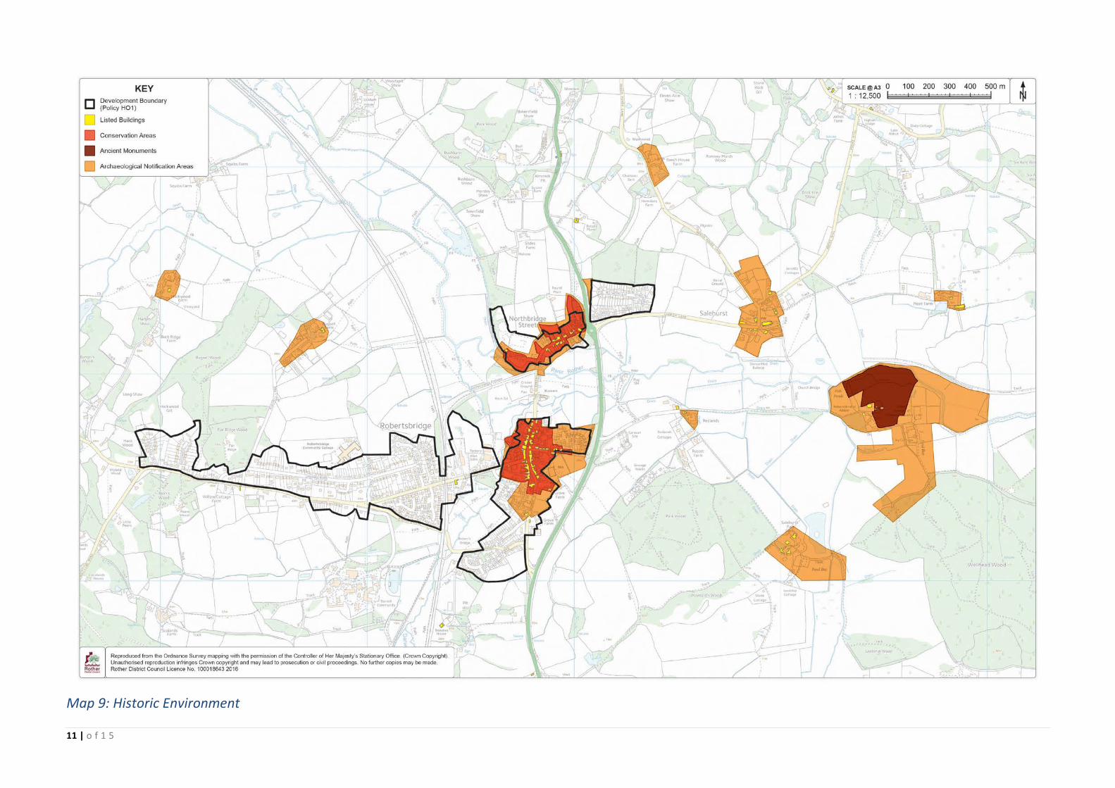
Map 9: Historic Environment [11]
Map 10: Parks and Open spaces [12]
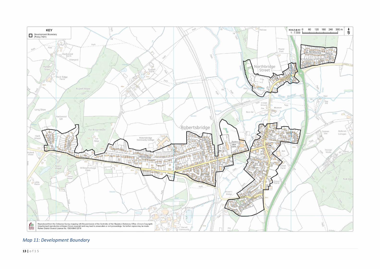
Map 11: Development Boundary [13]
Map 12: Locally important trees and hedgerows outside the Conservation Area [14]
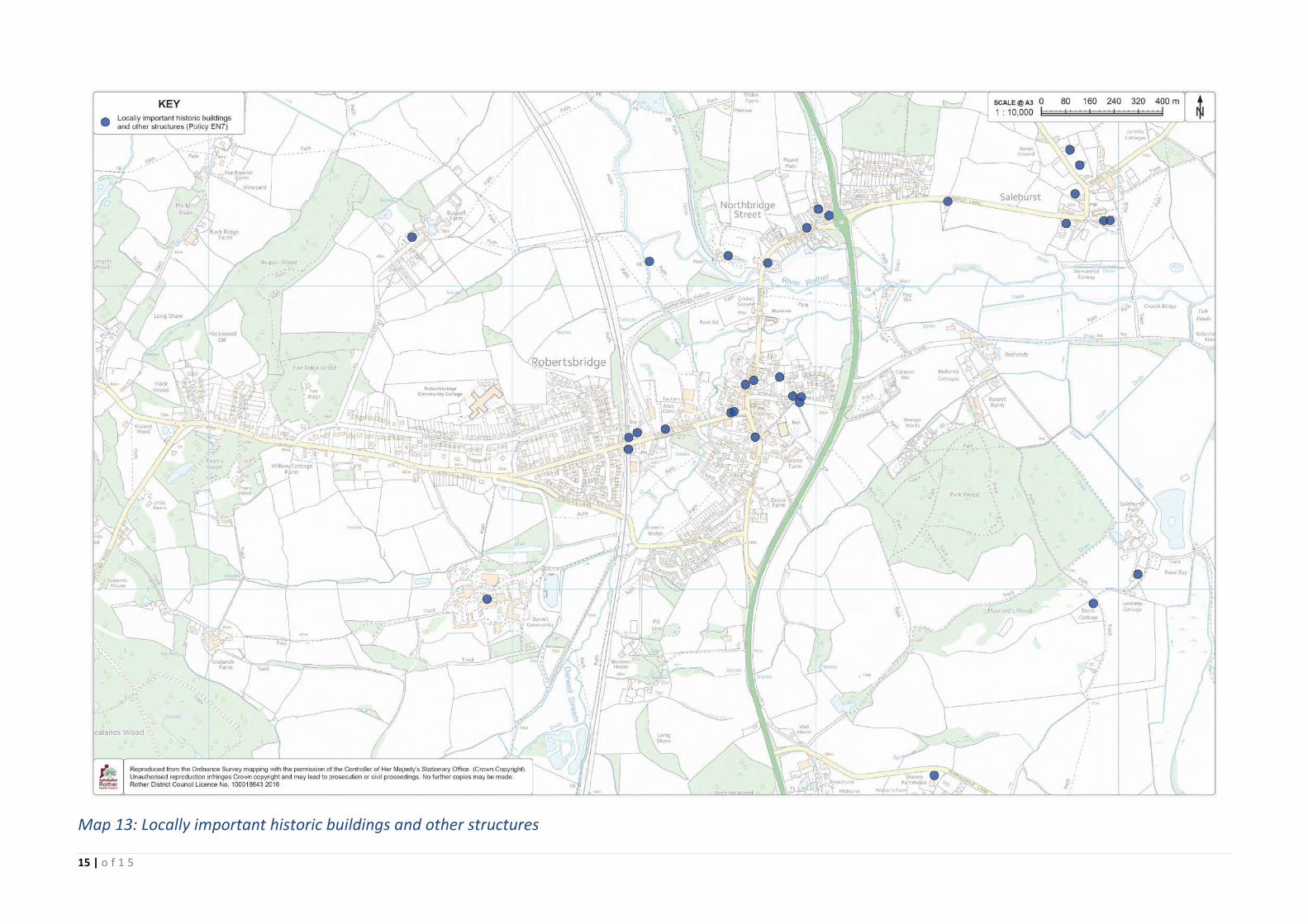
Map 13: Locally important historic buildings and other structures [15]
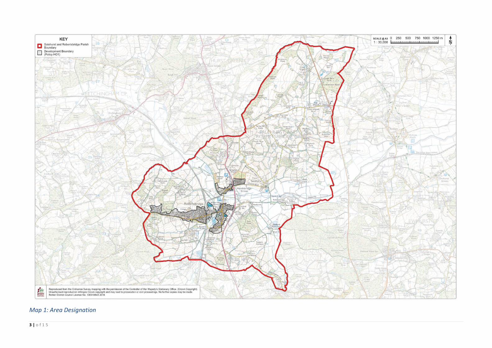
3 | o f 1 5
Map 1: Area Designation

4 | o f 1 5
Map 2: Retail Core

5 | o f 1 5
Map 3: Local Green Space Designations
6 | o f 1 5
Map 4: Proposals Map
7 | o f 1 5
Map 5: Accessibility
8 | o f 1 5
Map 6: Flood Risk
9 | o f 1 5
Map 7: Environment and Habitat Designations
10 | o f 1 5
Map 8: Employment Areas
11 | o f 1 5
Map 9: Historic Environment

12 | o f 1 5
Map 10: Parks and Open Spaces
13 | o f 1 5
Map 11: Development Boundary

14 | o f 1 5
Map 12: Locally important trees and hedgerows outside of the Conservation Area
15 | o f 1 5
Map 13: Locally important historic buildings and other structures