Embed Size (px)
Citation preview
Agrometshell
Workshop 15-17 September Rome
Peter Hoefsloot?Dutch NationalMarried, 2 children, 7 sheepMsc. In Agronomy/Meteorology/Comp. Science in Wageningen, The NetherlandsDo management of geo-info projects for Dutch consultancy firm (Haskoning)Have my own (little) company working for FAO and Dutch ministries writing software1989 – 1991 : Agrhymet, Niger 1991 – 1994 : RRSU, Harare, ZimbabweMany missions (most SADC and CILSS countries, Djibouti)
Parts of this demo
A bit of historyObjectives of AMSAMS seen from different perspectivesGeneral structure and functionsDemonstration
A bit of history
Drought sub-Sahara Africa (mid-seventies) : desertification1974 - CILSS founded Agrhymet in Niamey (West Africa)1986 - Intergovernmental Authority on Development (IGAD) formed Intergovernmental Authority on Drought and Development (IGADD) for East Africa in DjiboutiMid-eighties SADC – (Southern Africa) founded the Regional Early Warning Unit in HarareNow - New frontiers : Afghanistan, IRAQ, Bangladesh
Assisting “early warning”FAO (United Nations)
GIEWS (Global Information and Early Warning System) and support for national and regional EW units
ARTEMIS (Africa Real Time Environmental Monitoring Information System)
USAID (United States) FEWS - Famine Early Warning System
European UnionMany institutes
University of Venice , Italy University of Reading, UK (TAMSAT) ITC, The Netherlands USGS, United States (…)
What do you need for EW?
Data and informationMethods and modelsSoftwareFacilities (computers, communication)Skilled staff
Data for early warningStocks on staple foodsPricing of foods on marketsCrop YieldsWeather data (e.g. rainfall) through GTS (worldwide) and Met Services (national)Satellite data (mainly METEOSAT and NOAA)“Static” support data : maps, census data, agro-ecological zones, soil maps
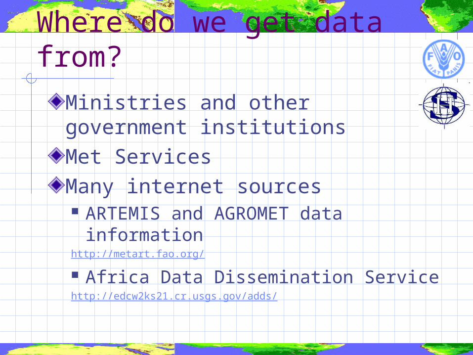
Where do we get data from?
Ministries and other government institutionsMet ServicesMany internet sources ARTEMIS and AGROMET data
informationhttp://metart.fao.org/
Africa Data Dissemination Servicehttp://edcw2ks21.cr.usgs.gov/adds/
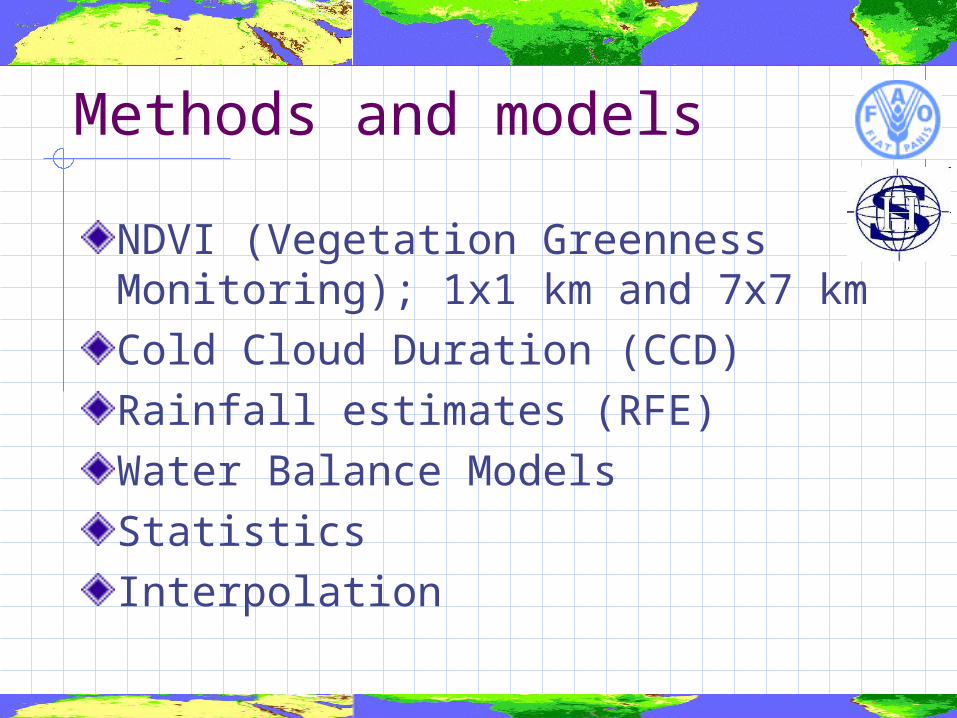
Methods and models
NDVI (Vegetation Greenness Monitoring); 1x1 km and 7x7 kmCold Cloud Duration (CCD)Rainfall estimates (RFE)Water Balance ModelsStatisticsInterpolation
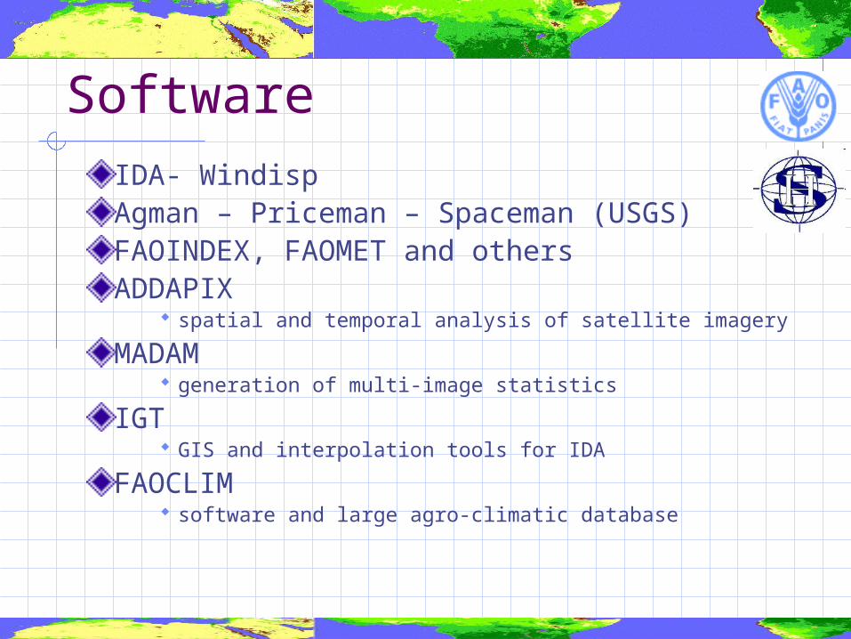
SoftwareIDA- Windisp Agman – Priceman – Spaceman (USGS)FAOINDEX, FAOMET and othersADDAPIX
spatial and temporal analysis of satellite imagery
MADAM generation of multi-image statistics
IGT GIS and interpolation tools for IDA
FAOCLIM software and large agro-climatic database
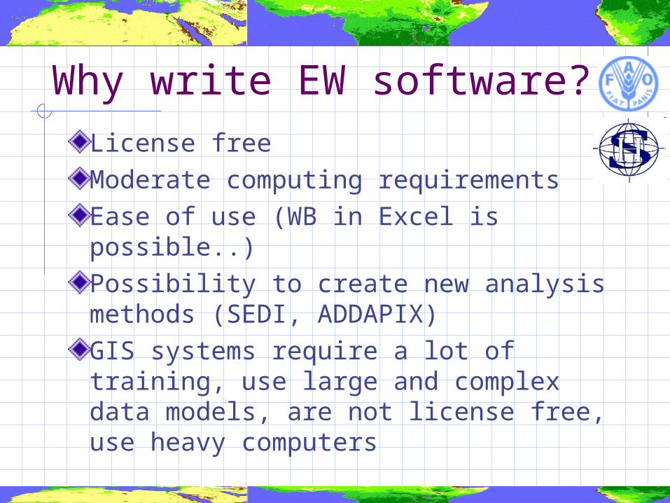
Why write EW software?
License freeModerate computing requirementsEase of use (WB in Excel is possible..)Possibility to create new analysis methods (SEDI, ADDAPIX)GIS systems require a lot of training, use large and complex data models, are not license free, use heavy computers
AgrometShell
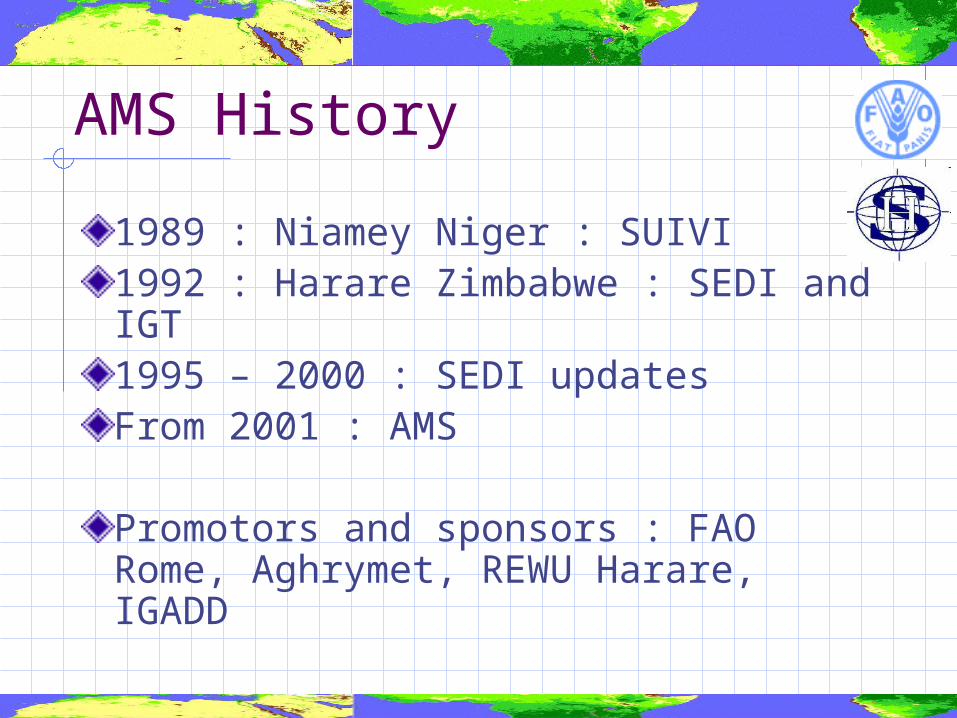
AMS History
1989 : Niamey Niger : SUIVI1992 : Harare Zimbabwe : SEDI and IGT1995 – 2000 : SEDI updatesFrom 2001 : AMS
Promotors and sponsors : FAO Rome, Aghrymet, REWU Harare, IGADD
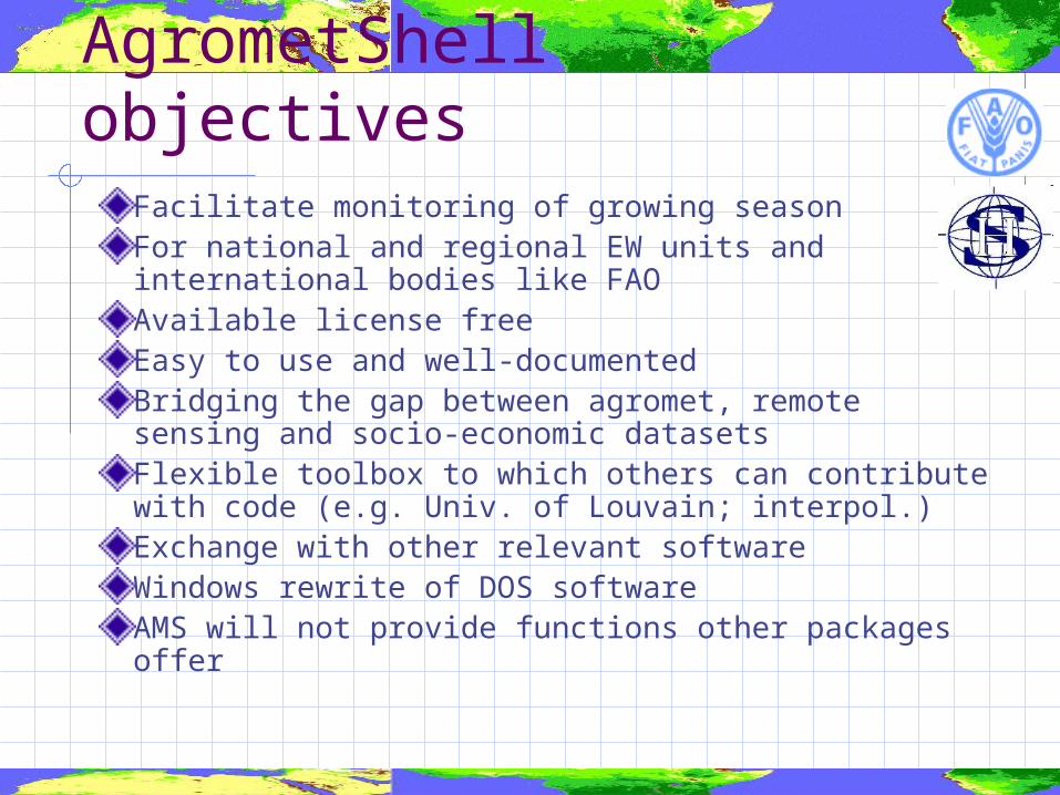
AgrometShell objectivesFacilitate monitoring of growing seasonFor national and regional EW units and international bodies like FAOAvailable license free Easy to use and well-documentedBridging the gap between agromet, remote sensing and socio-economic datasetsFlexible toolbox to which others can contribute with code (e.g. Univ. of Louvain; interpol.)Exchange with other relevant softwareWindows rewrite of DOS softwareAMS will not provide functions other packages offer
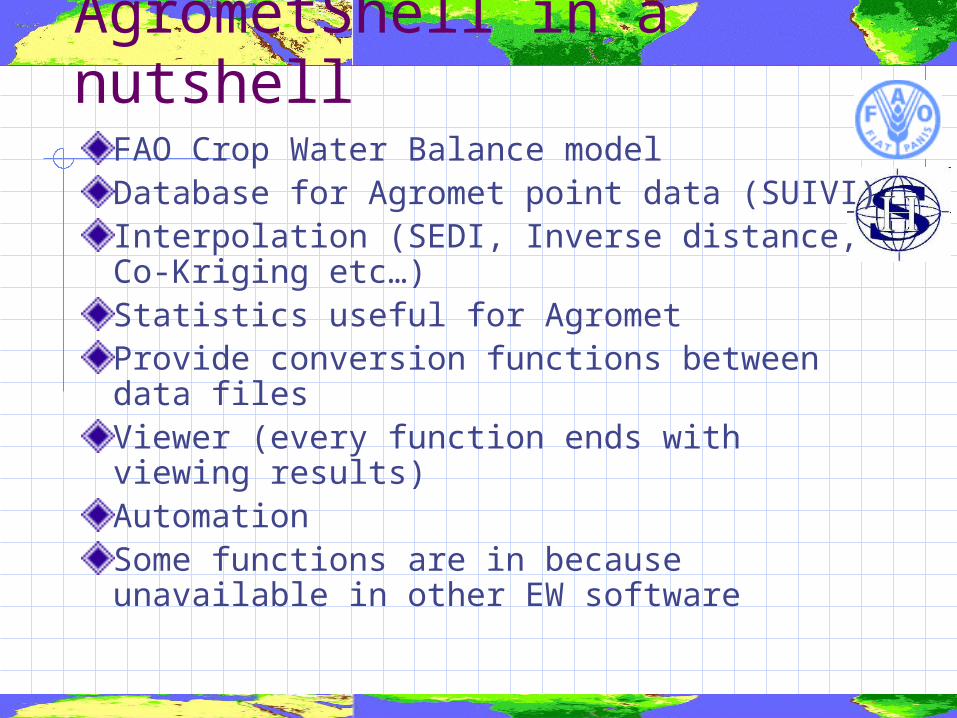
AgrometShell in a nutshellFAO Crop Water Balance modelDatabase for Agromet point data (SUIVI)Interpolation (SEDI, Inverse distance, Co-Kriging etc…)Statistics useful for AgrometProvide conversion functions between data filesViewer (every function ends with viewing results) AutomationSome functions are in because unavailable in other EW software
AMS technically
Programmed in Delphi (Pascal)Contributions by others in form of DLL’sAccess database (through ADO)Executable that does not require any other softwareShare database on network
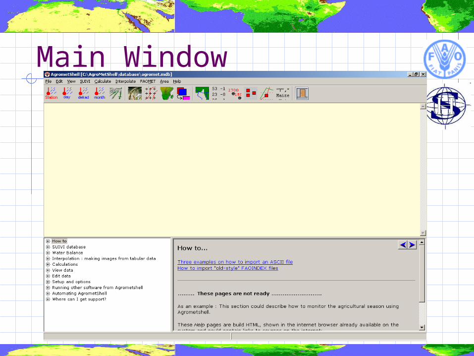
Main Window
DEMO 1
The agromet database
SUIVI : Database for agromet data
Daily, Dekadal and Monthly weather station (point) dataEvery operation through flexible stationlistAdd parameters easilyFlexible ASCII import
Database technicallyDatabase in Microsoft ACCESS 2000 formatAccessible from outside AMSVery common database formatQuery generator in AccessDatabase can be placed on networkExchange of data with large database (Oracle SQL Server etc.)Early versions had Paradox tables
DemoInventoryLists and base listParametersData entryView data on map, graph, reportFormulas and calculationAggregationImport from image and ASCII file
DEMO 2
Calculating a Water Balance
Water Balance Model based on the work of Frere/Popov and Rene GommesImprovements so far: Irrigation (amount at planting or dekad by
dekad) Phenological stages : initial, vegetative,
flowering, ripening Crop coefficients based on 9 rather than 4
graph points Daily Time Steps More sets of crop coefficients per crop “Run file” approach
Water Balance (2)
AMS does not operate directly on database, but on ASCII files.ASCII files are first exported from the databaseTwo possibilities:1. Monitoring (1 year; many stations)2. Risk Analysis (1 stations; many years)
DEMO
Close look at cropsDekadal and daily time stepsWith and without irrigationView resultsMake images from resultsAutomation
DEMO 3
Integrating and analyzing data
Data integration (1)
Technically data come as: Points Areas Images (or grids)
Images are best for analysis Very visual (easy to check results) A picture tells more than a 1000 words Easy arithmetic with pixels
Demo
Integrate Water Balance results with Yield dataWB results : point dataYields : From ministry (area aggregated)Turn both into imagesStudy the relation between Yield and Water Satisfaction Index geographically