Embed Size (px)
Citation preview
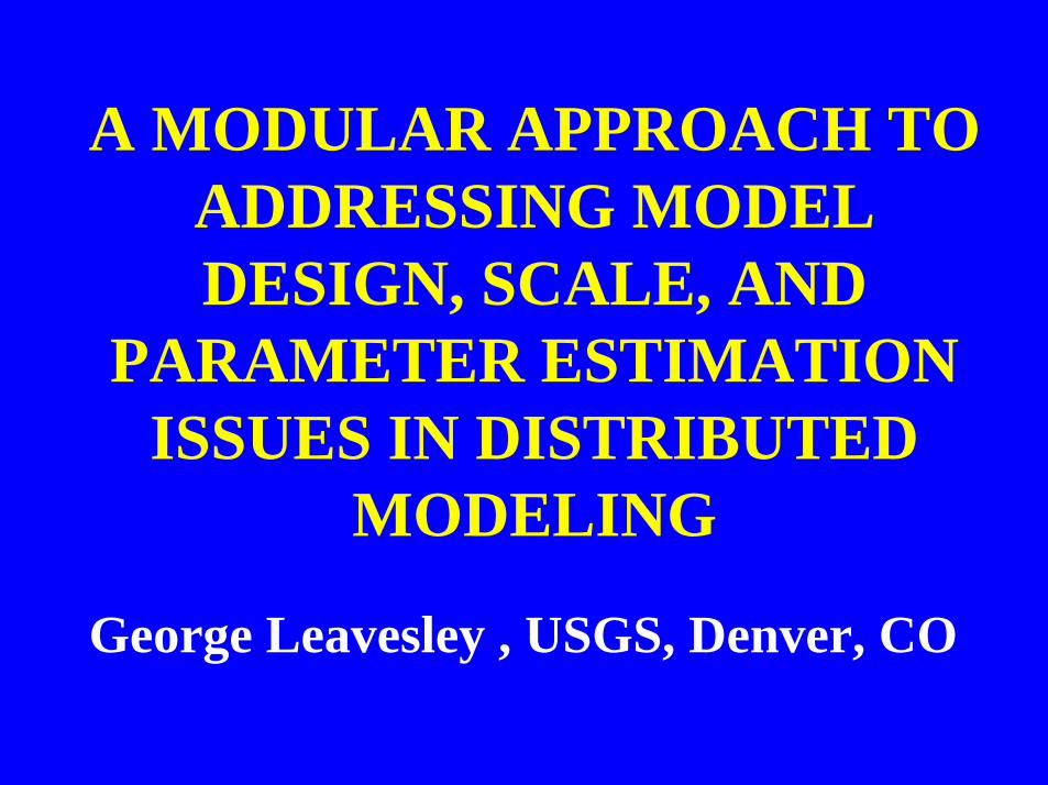
A MODULAR APPROACH TOADDRESSING MODELDESIGN, SCALE, AND
PARAMETER ESTIMATIONISSUES IN DISTRIBUTED
MODELING
George Leavesley , USGS, Denver, CO
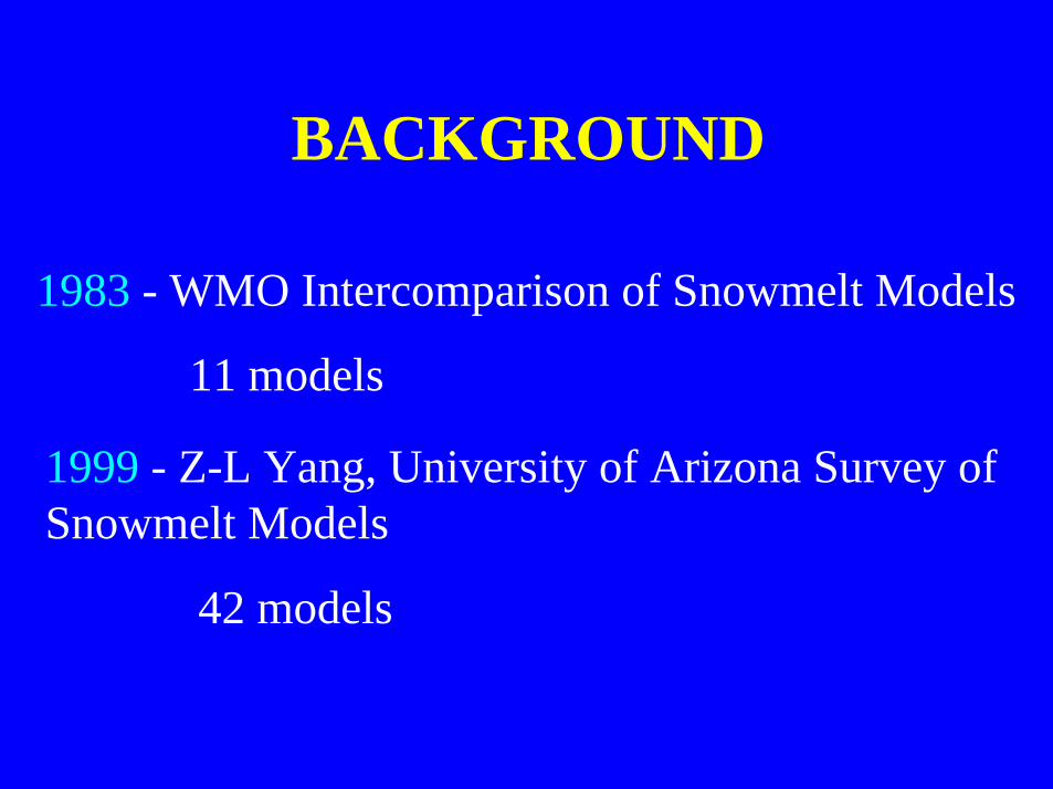
BACKGROUND
1983 - WMO Intercomparison of Snowmelt Models
11 models
1999 - Z-L Yang, University of Arizona Survey ofSnowmelt Models
42 models
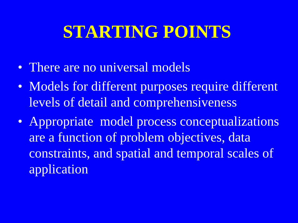
STARTING POINTS
• There are no universal models• Models for different purposes require different
levels of detail and comprehensiveness• Appropriate model process conceptualizations
are a function of problem objectives, dataconstraints, and spatial and temporal scales ofapplication
STARTING POINTS
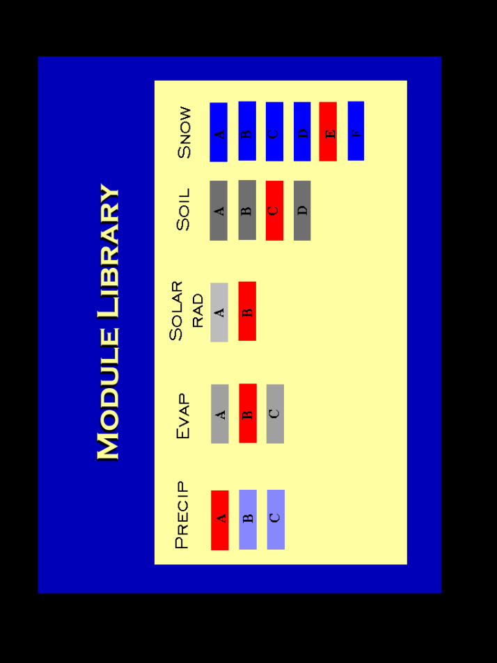
• For a given set of constraints, improveddistributed models can be created by couplingthe appropriate process conceptualizations
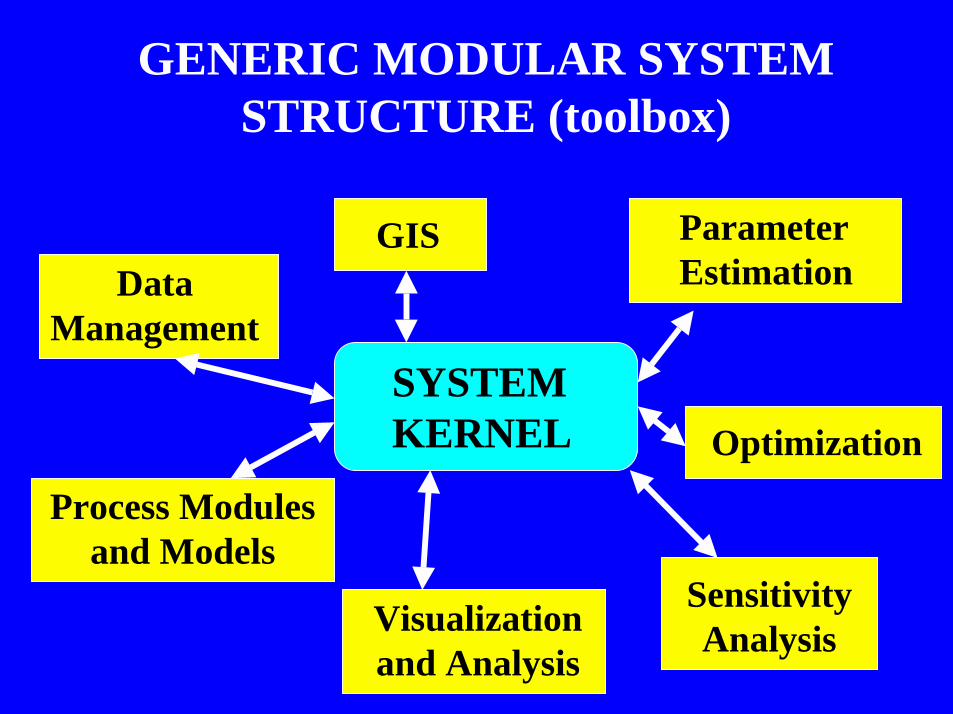
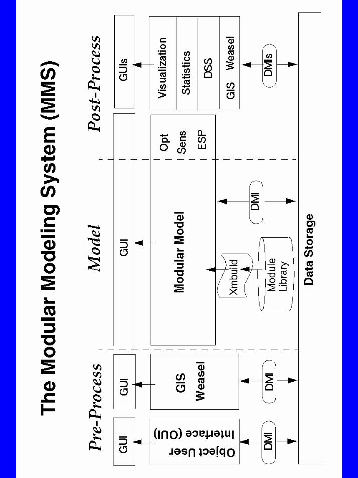
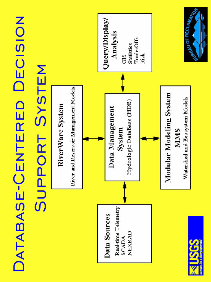
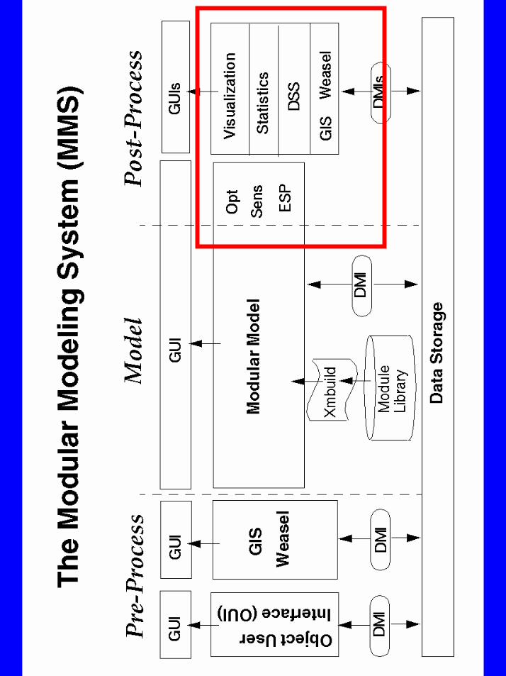
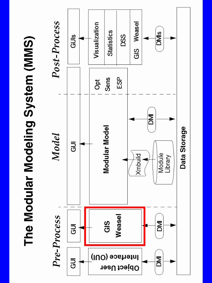
SYSTEMKERNEL
GIS ParameterEstimation
Process Modulesand Models
DataManagement
Optimization
SensitivityAnalysis
GENERIC MODULAR SYSTEMSTRUCTURE (toolbox)
Visualizationand Analysis
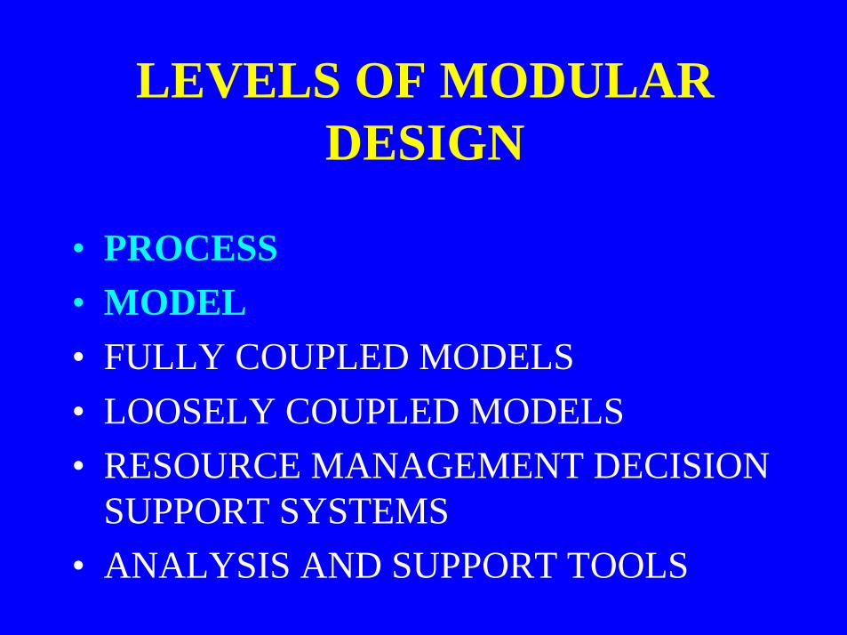
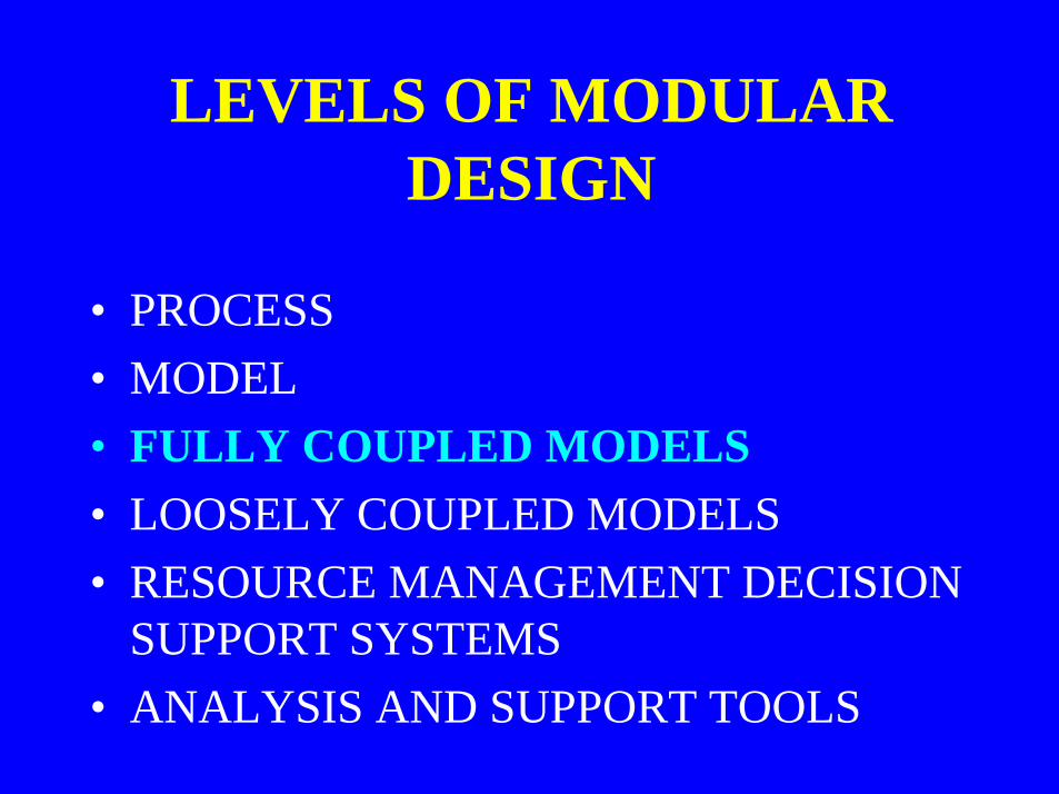
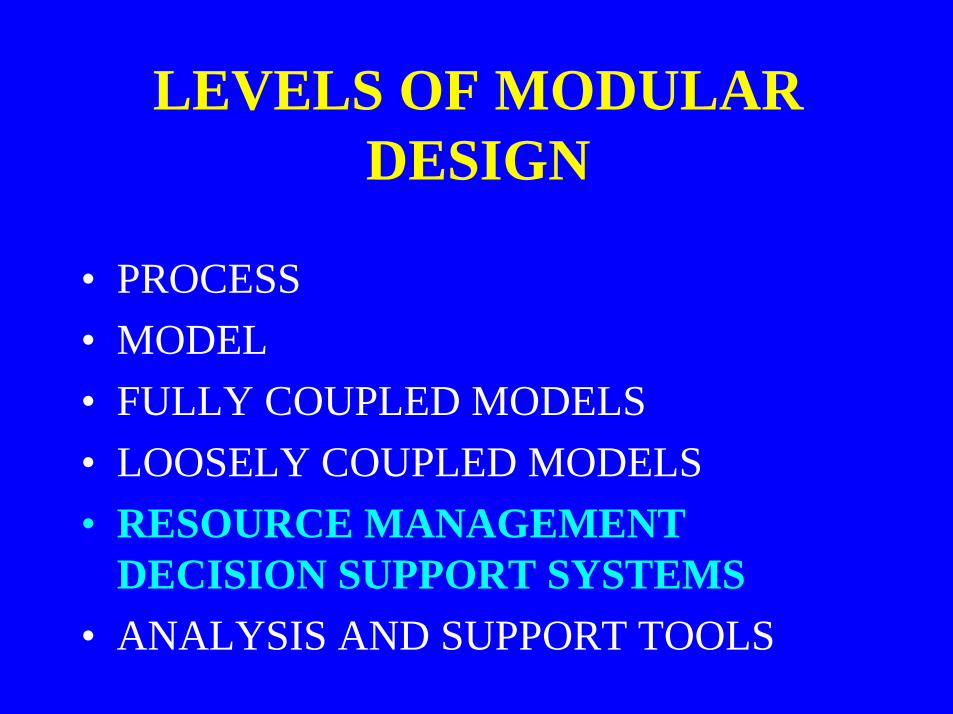
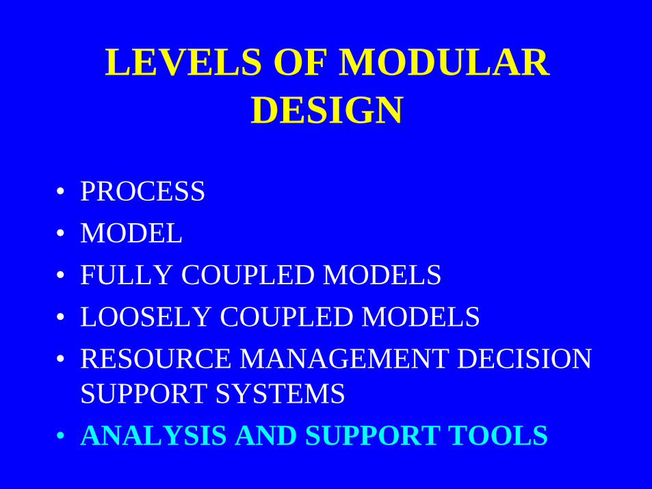
LEVELS OF MODULARDESIGN
• PROCESS• MODEL• FULLY COUPLED MODELS• LOOSELY COUPLED MODELS• RESOURCE MANAGEMENT DECISION
SUPPORT SYSTEMS• ANALYSIS AND SUPPORT TOOLS
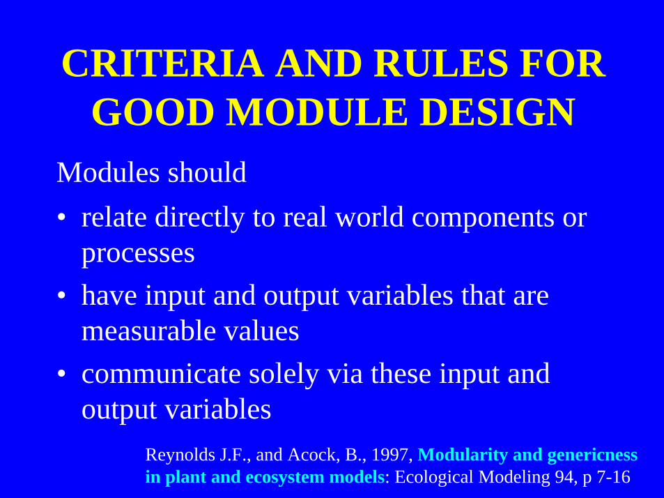
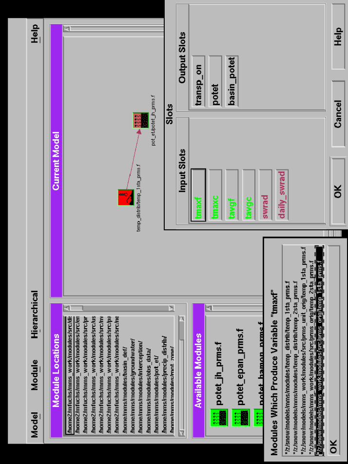
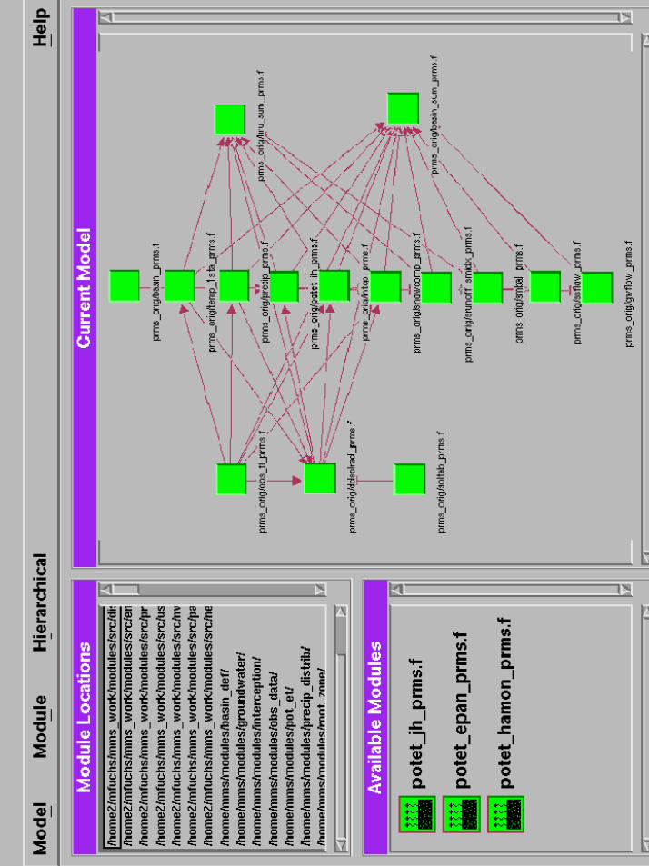
CRITERIA AND RULES FORGOOD MODULE DESIGN
• relate directly to real world components orprocesses
• have input and output variables that aremeasurable values
• communicate solely via these input andoutput variables
Modules should
Reynolds J.F., and Acock, B., 1997, Modularity and genericnessin plant and ecosystem models: Ecological Modeling 94, p 7-16
LEVELS OF MODULARDESIGN
• PROCESS• MODEL• FULLY COUPLED MODELS• LOOSELY COUPLED MODELS• RESOURCE MANAGEMENT DECISION
SUPPORT SYSTEMS• ANALYSIS AND SUPPORT TOOLS
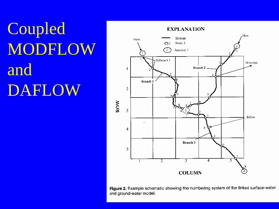
CoupledMODFLOWandDAFLOW
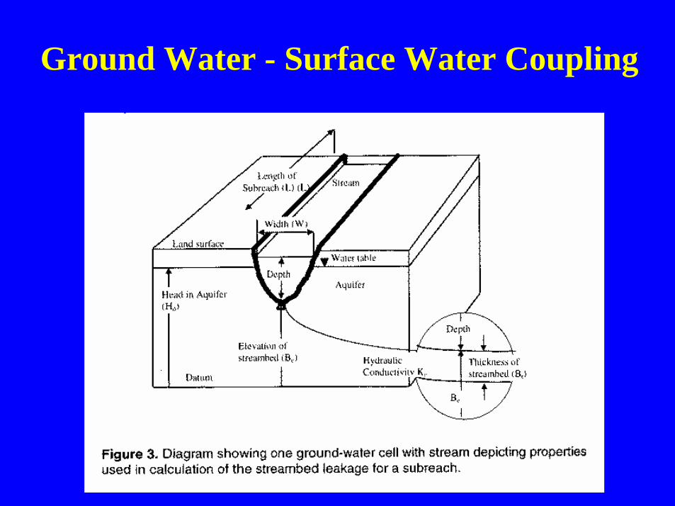
Ground Water - Surface Water Coupling
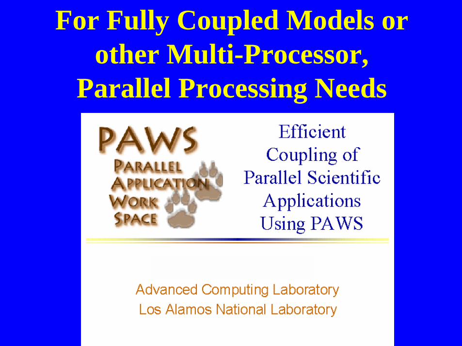
For Fully Coupled Models orother Multi-Processor,
Parallel Processing Needs
LEVELS OF MODULARDESIGN
• PROCESS• MODEL• FULLY COUPLED MODELS• LOOSELY COUPLED MODELS• RESOURCE MANAGEMENT DECISION
SUPPORT SYSTEMS• ANALYSIS AND SUPPORT TOOLS
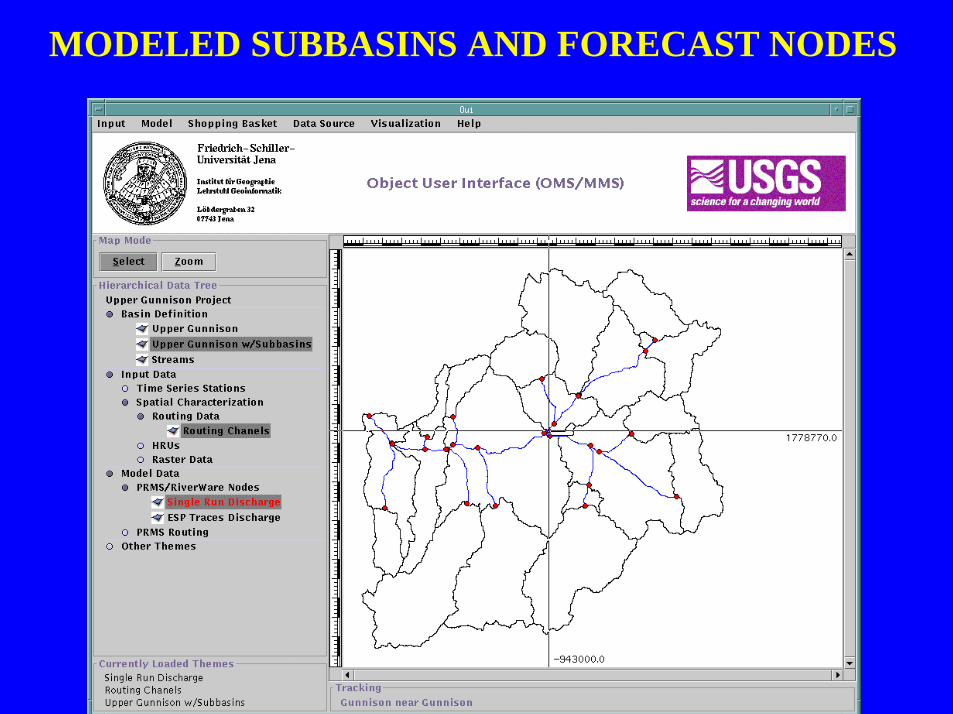
MODELED SUBBASINS AND FORECAST NODES
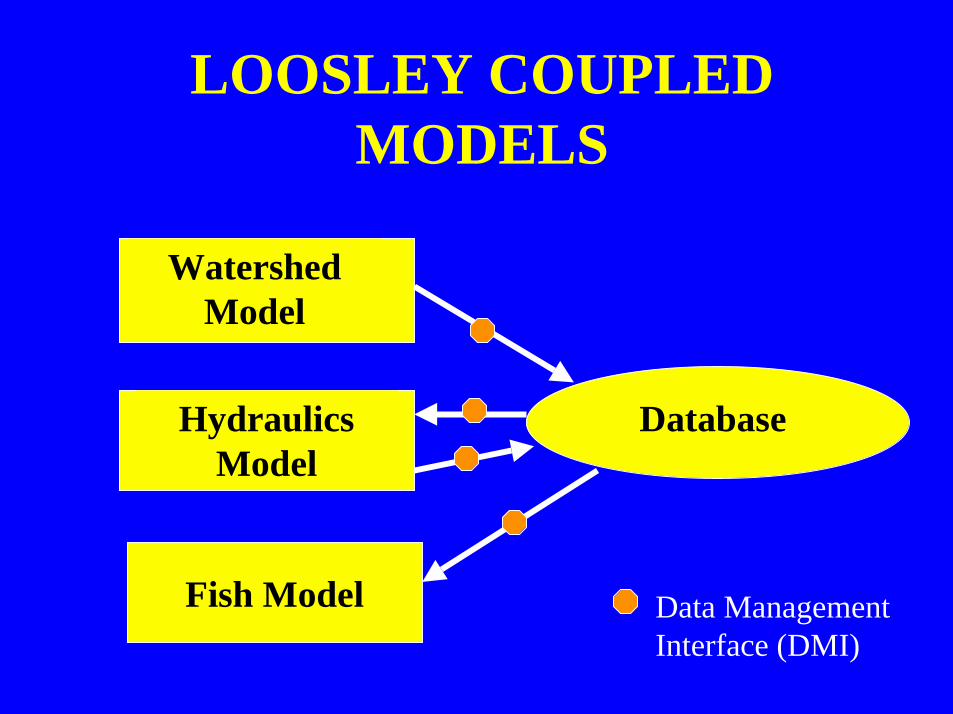
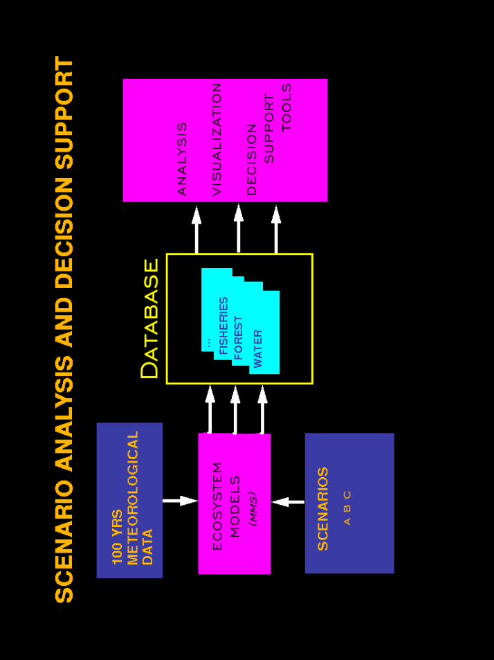
LOOSLEY COUPLEDMODELS
WatershedModel
HydraulicsModel
Database
Fish Model Data ManagementInterface (DMI)
LEVELS OF MODULARDESIGN
• PROCESS• MODEL• FULLY COUPLED MODELS• LOOSELY COUPLED MODELS• RESOURCE MANAGEMENT
DECISION SUPPORT SYSTEMS• ANALYSIS AND SUPPORT TOOLS
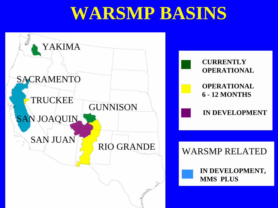
WARSMP BASINSYAKIMA
GUNNISONTRUCKEE
RIO GRANDESAN JUAN
SACRAMENTO
SAN JOAQUIN
CURRENTLYOPERATIONAL
OPERATIONAL6 - 12 MONTHS
IN DEVELOPMENT
IN DEVELOPMENT,MMS PLUS
WARSMP RELATED
LEVELS OF MODULARDESIGN
• PROCESS• MODEL• FULLY COUPLED MODELS• LOOSELY COUPLED MODELS• RESOURCE MANAGEMENT DECISION
SUPPORT SYSTEMS• ANALYSIS AND SUPPORT TOOLS
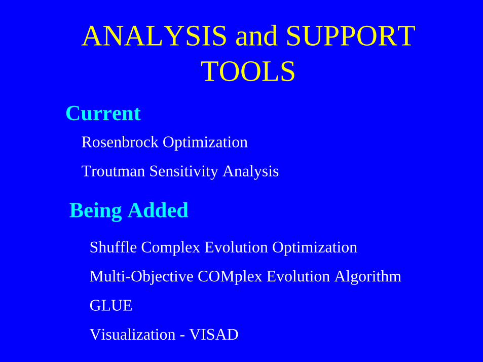
ANALYSIS and SUPPORTTOOLS
CurrentRosenbrock Optimization
Troutman Sensitivity Analysis
Being AddedShuffle Complex Evolution Optimization
Multi-Objective COMplex Evolution Algorithm
GLUE
Visualization - VISAD
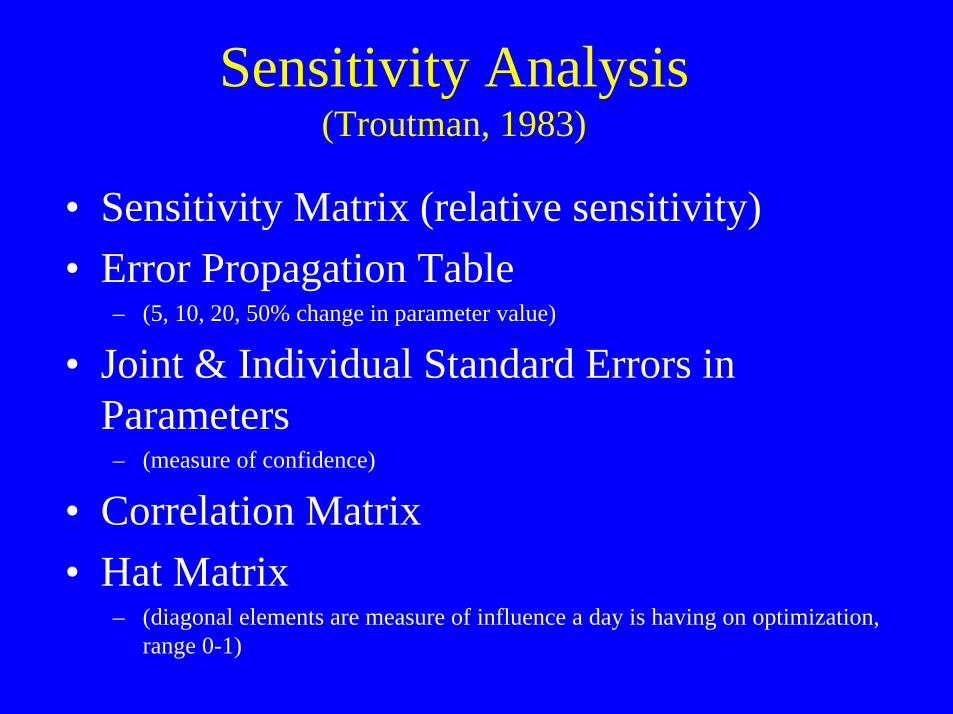
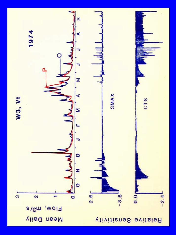
Sensitivity Analysis(Troutman, 1983)
• Sensitivity Matrix (relative sensitivity)• Error Propagation Table
– (5, 10, 20, 50% change in parameter value)
• Joint & Individual Standard Errors inParameters– (measure of confidence)
• Correlation Matrix• Hat Matrix
– (diagonal elements are measure of influence a day is having on optimization,range 0-1)
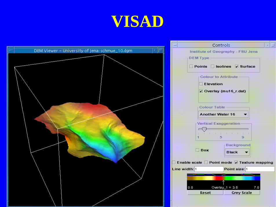
VISAD
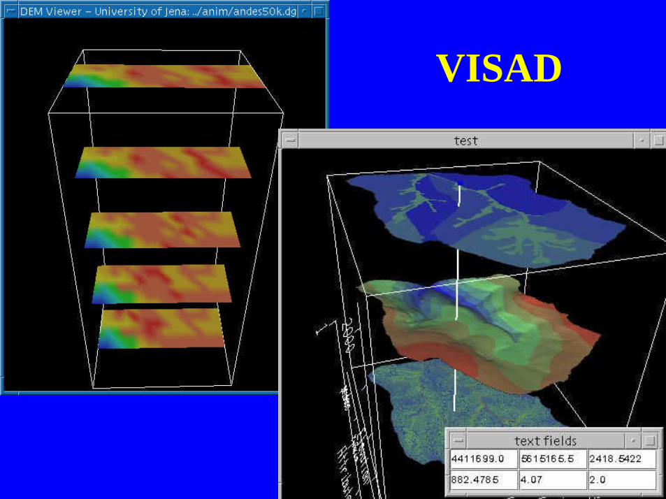
VISAD
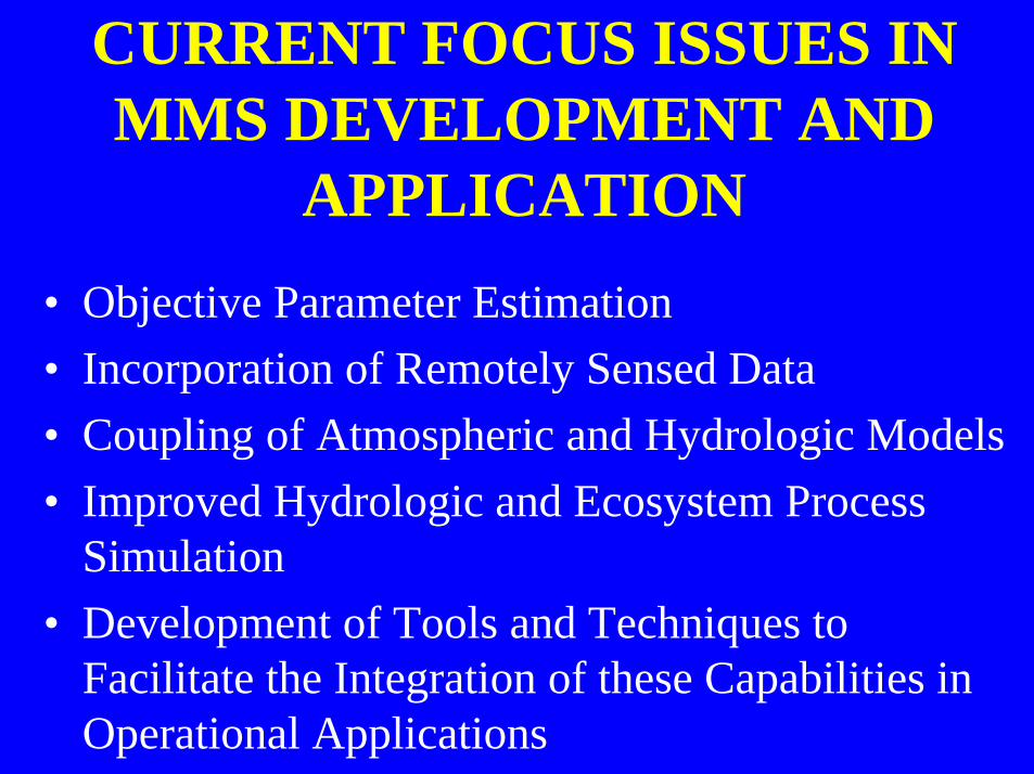
CURRENT FOCUS ISSUES INMMS DEVELOPMENT AND
APPLICATION• Objective Parameter Estimation• Incorporation of Remotely Sensed Data• Coupling of Atmospheric and Hydrologic Models• Improved Hydrologic and Ecosystem Process
Simulation• Development of Tools and Techniques to
Facilitate the Integration of these Capabilities inOperational Applications
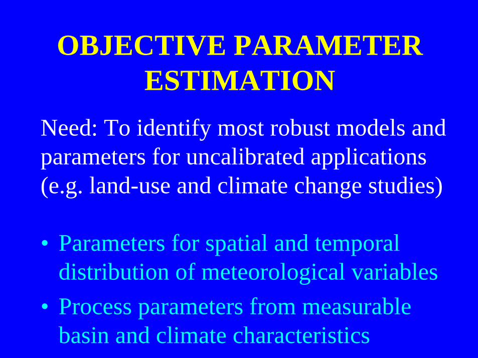
OBJECTIVE PARAMETERESTIMATION
• Parameters for spatial and temporaldistribution of meteorological variables
• Process parameters from measurablebasin and climate characteristics
Need: To identify most robust models andparameters for uncalibrated applications(e.g. land-use and climate change studies)
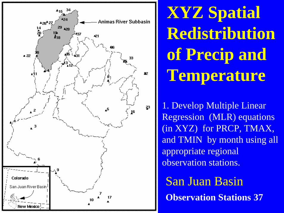
San Juan Basin Observation Stations 37
XYZ SpatialRedistributionof Precip andTemperature
1. Develop Multiple LinearRegression (MLR) equations(in XYZ) for PRCP, TMAX,and TMIN by month using allappropriate regionalobservation stations.
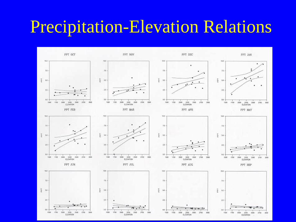
Precipitation-Elevation Relations
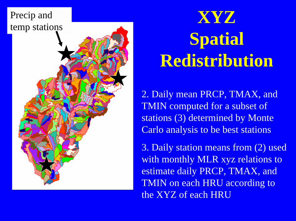
XYZSpatial
Redistribution
2. Daily mean PRCP, TMAX, andTMIN computed for a subset ofstations (3) determined by MonteCarlo analysis to be best stations
3. Daily station means from (2) usedwith monthly MLR xyz relations toestimate daily PRCP, TMAX, andTMIN on each HRU according tothe XYZ of each HRU
Precip andtemp stations
PROCESS PARAMETERESTIMATION
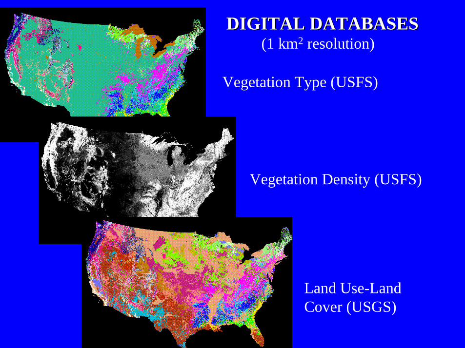
Vegetation Type (USFS)
Vegetation Density (USFS)
Land Use-LandCover (USGS)
DIGITAL DATABASESDIGITAL DATABASES (1 km2 resolution)
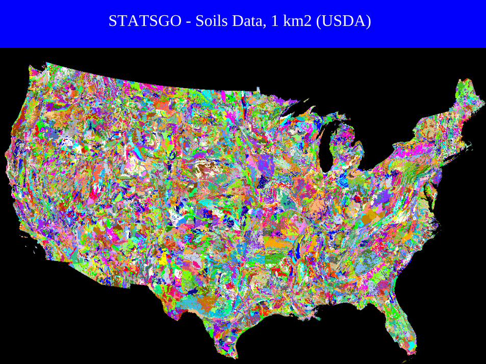
STATSGO - Soils Data, 1 km2 (USDA)
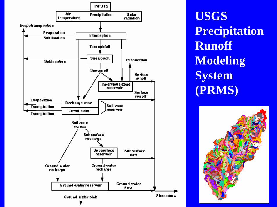
USGSPrecipitationRunoffModelingSystem(PRMS)
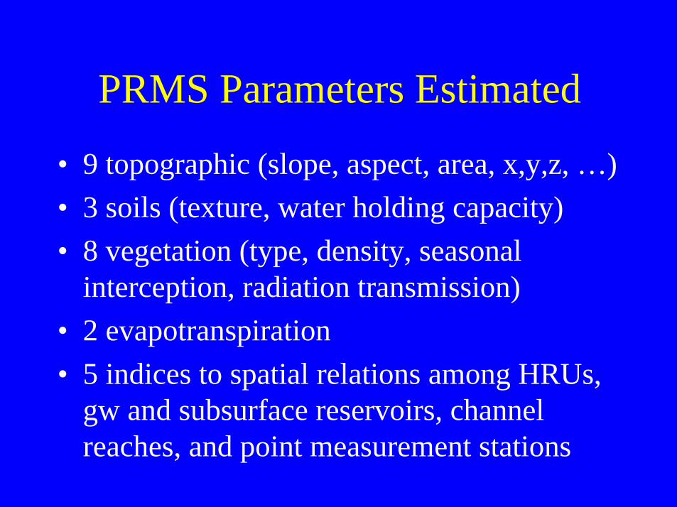
PRMS Parameters Estimated
• 9 topographic (slope, aspect, area, x,y,z, …)• 3 soils (texture, water holding capacity)• 8 vegetation (type, density, seasonal
interception, radiation transmission)• 2 evapotranspiration• 5 indices to spatial relations among HRUs,
gw and subsurface reservoirs, channelreaches, and point measurement stations
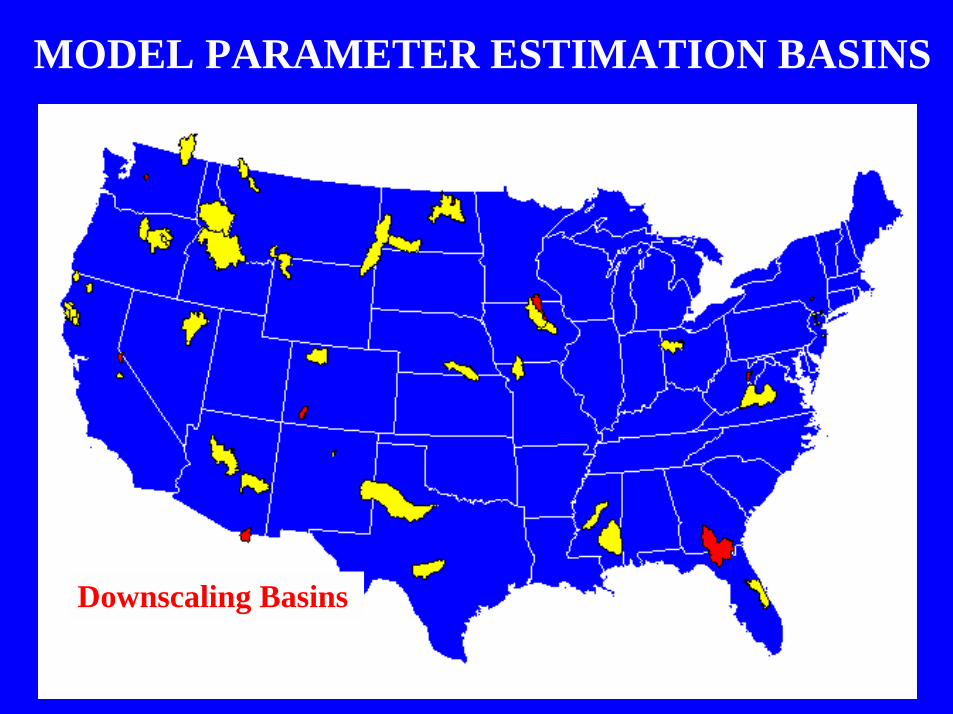
MODEL PARAMETER ESTIMATION BASINS
Downscaling Basins

BUREAU of LANDMANAGEMENT
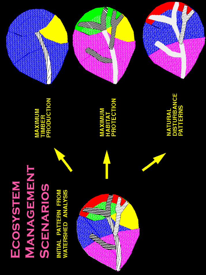
Tools for the Assessment of EnvironmentalImpacts of Alternative Forest-Management
Strategies
Oregon Coast Range
Initial system based on the findings of JohnRisley, Oregon District, WRI 93-4181
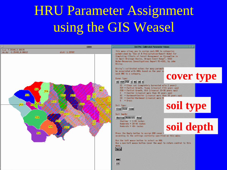
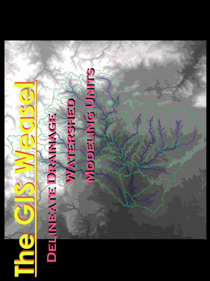
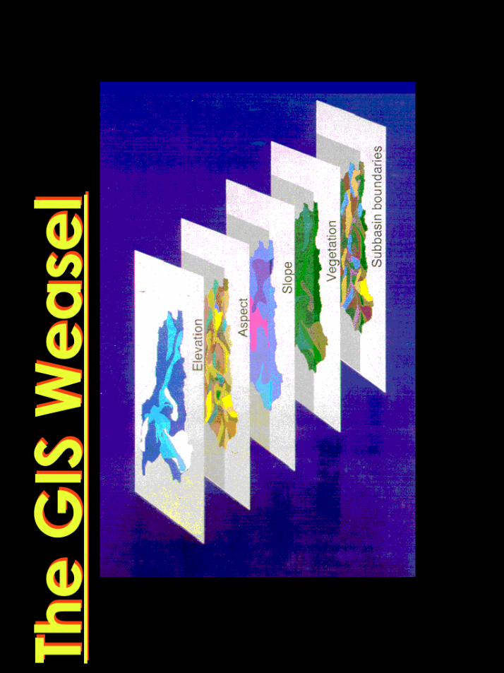
HRU Parameter Assignmentusing the GIS Weasel
cover type
soil type
soil depth
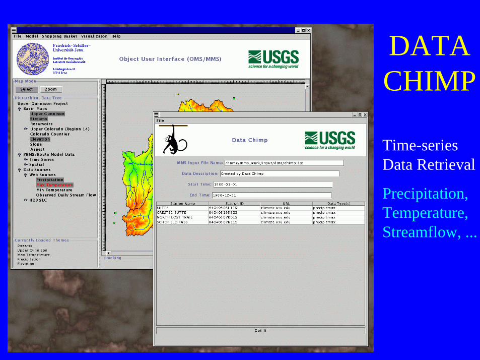
DATACHIMP
Time-seriesData Retrieval
Precipitation,Temperature,Streamflow, ...
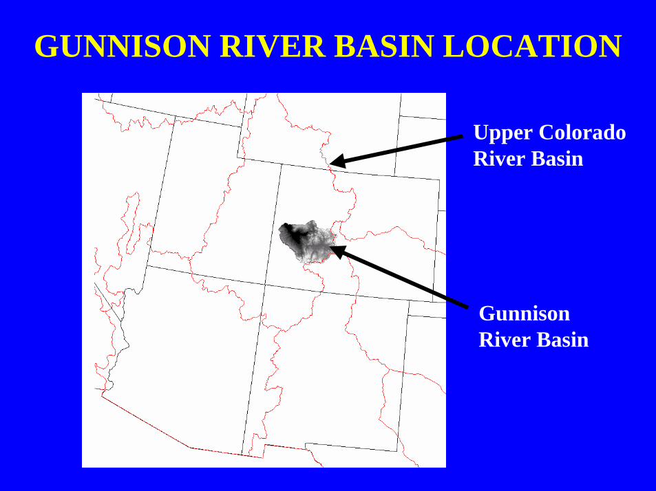
GUNNISON RIVER BASIN LOCATION
Upper ColoradoRiver Basin
GunnisonRiver Basin
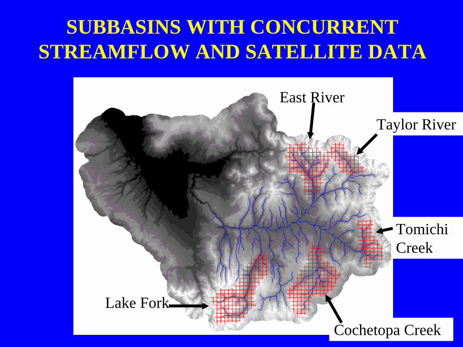
SUBBASINS WITH CONCURRENTSTREAMFLOW AND SATELLITE DATA
East River
Taylor River
Lake Fork
Cochetopa Creek
TomichiCreek
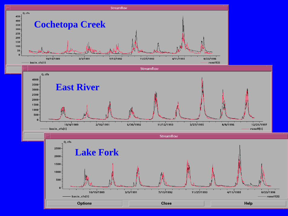
Cochetopa Creek
East River
Lake Fork
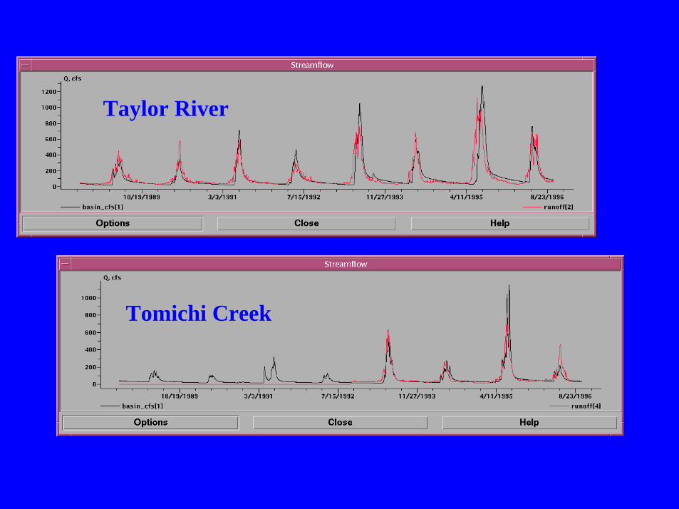
Taylor River
Tomichi Creek
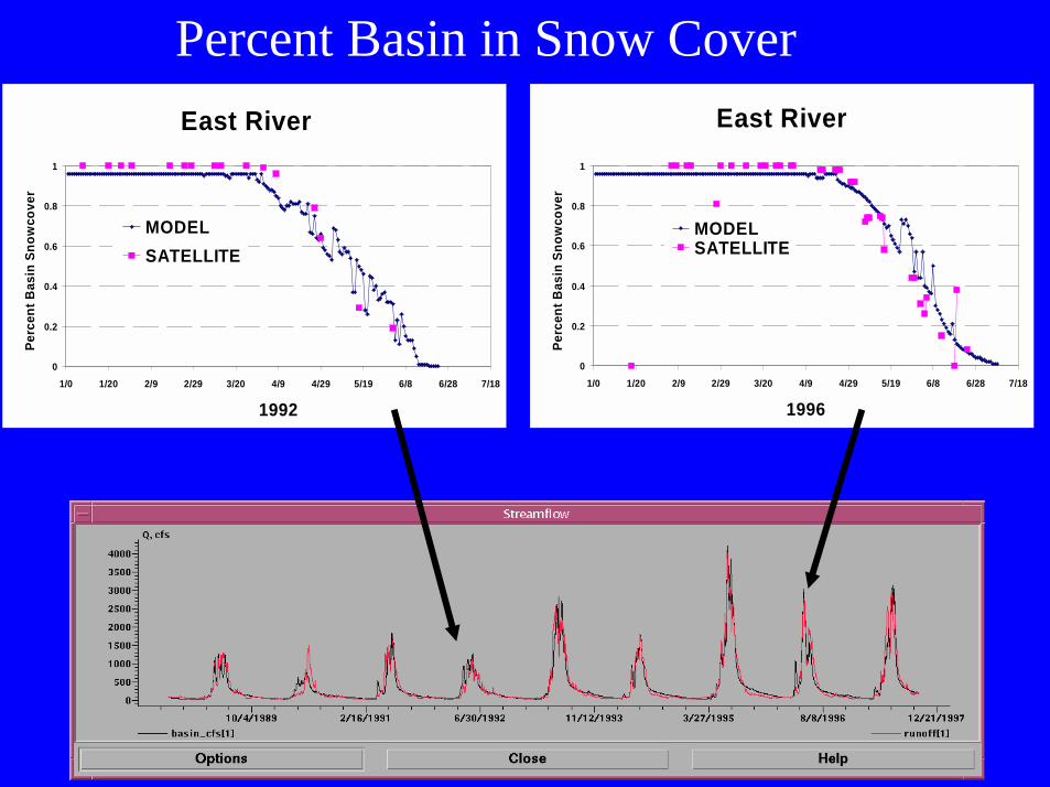
eastEast River
0
0.2
0.4
0.6
0.8
1
1/0 1/20 2/9 2/29 3/20 4/9 4/29 5/19 6/8 6/28 7/18
1996
Perc
ent B
asin
Sno
wco
ver
MODELSATELLITE
East River
0
0.2
0.4
0.6
0.8
1
1/0 1/20 2/9 2/29 3/20 4/9 4/29 5/19 6/8 6/28 7/18
1992
Perc
ent B
asin
Sno
wco
ver
MODELSATELLITE
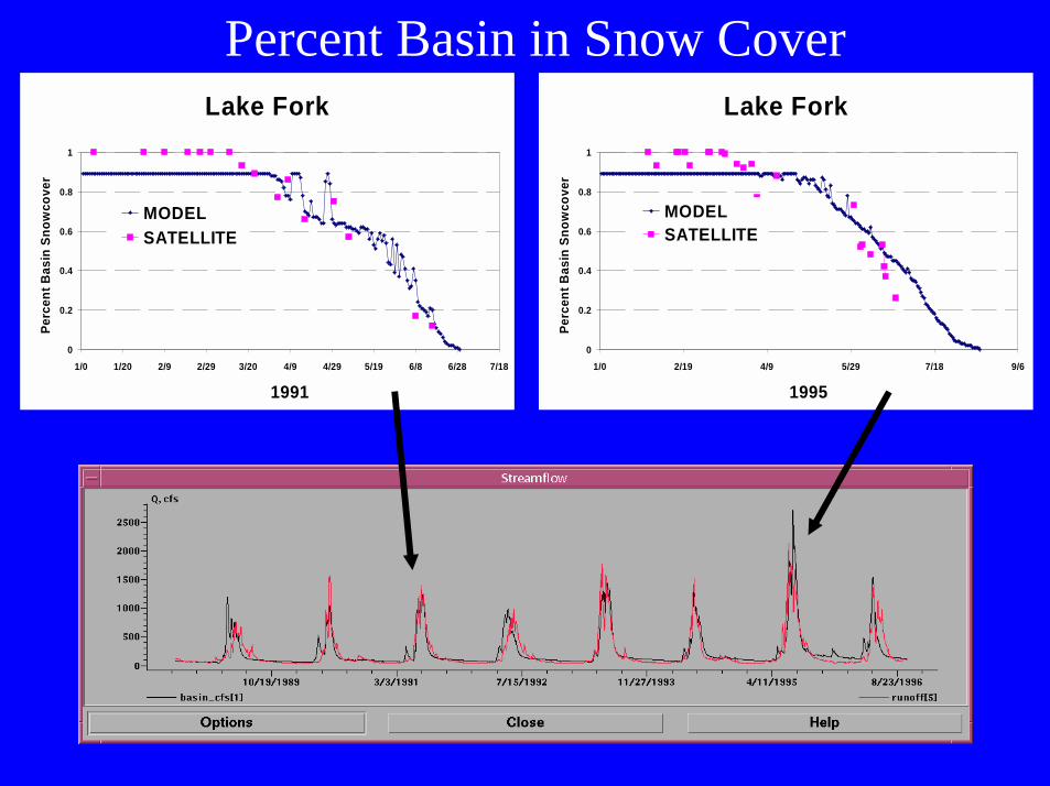
Percent Basin in Snow Cover
lake
Lake Fork
0
0.2
0.4
0.6
0.8
1
1/0 1/20 2/9 2/29 3/20 4/9 4/29 5/19 6/8 6/28 7/18
1991
Perc
ent B
asin
Sno
wco
ver
MODELSATELLITE
Lake Fork
0
0.2
0.4
0.6
0.8
1
1/0 2/19 4/9 5/29 7/18 9/6
1995
Perc
ent B
asin
Sno
wco
ver
MODELSATELLITE
Percent Basin in Snow Cover
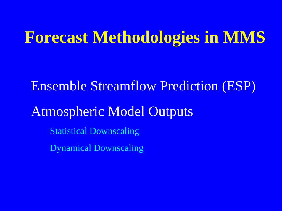
Forecast Methodologies in MMS
Ensemble Streamflow Prediction (ESP)
Atmospheric Model Outputs Statistical Downscaling
Dynamical Downscaling
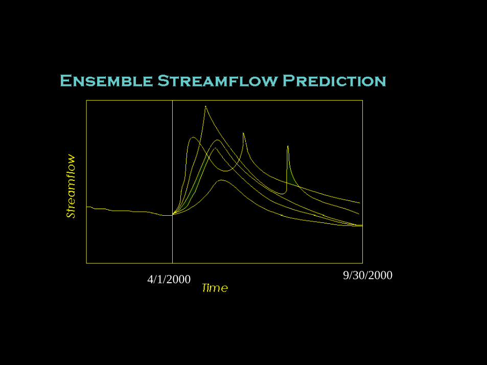
4/1/2000 9/30/2000
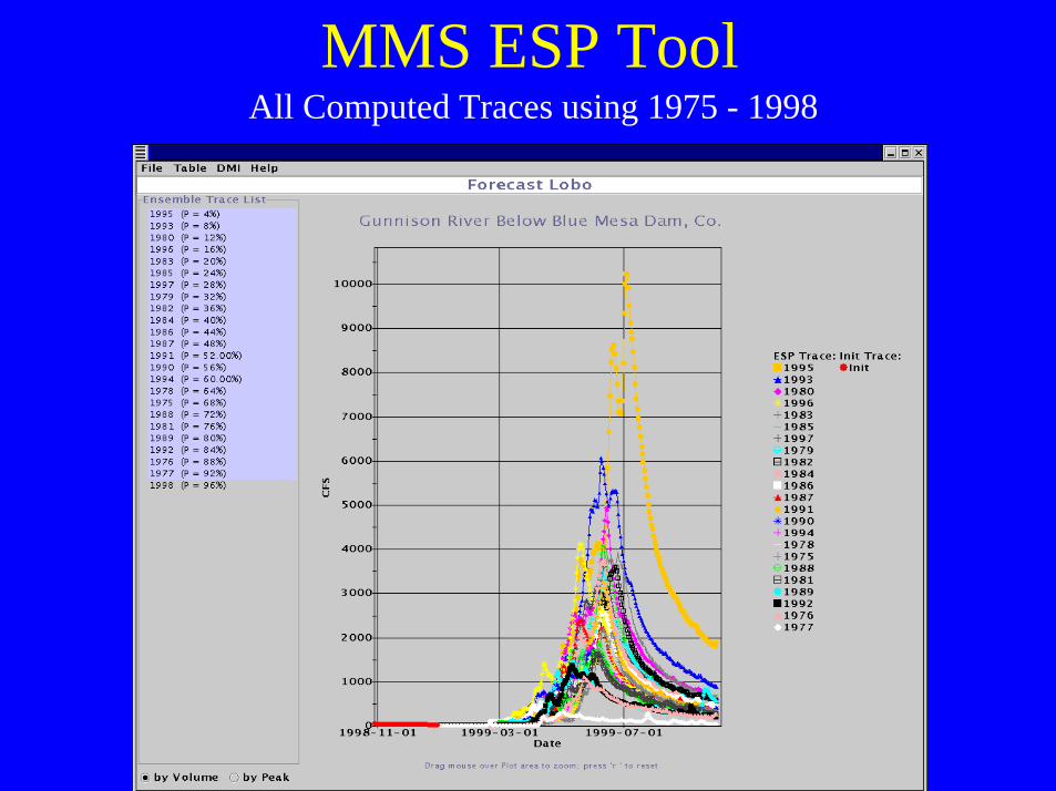
MMS ESP ToolAll Computed Traces using 1975 - 1998
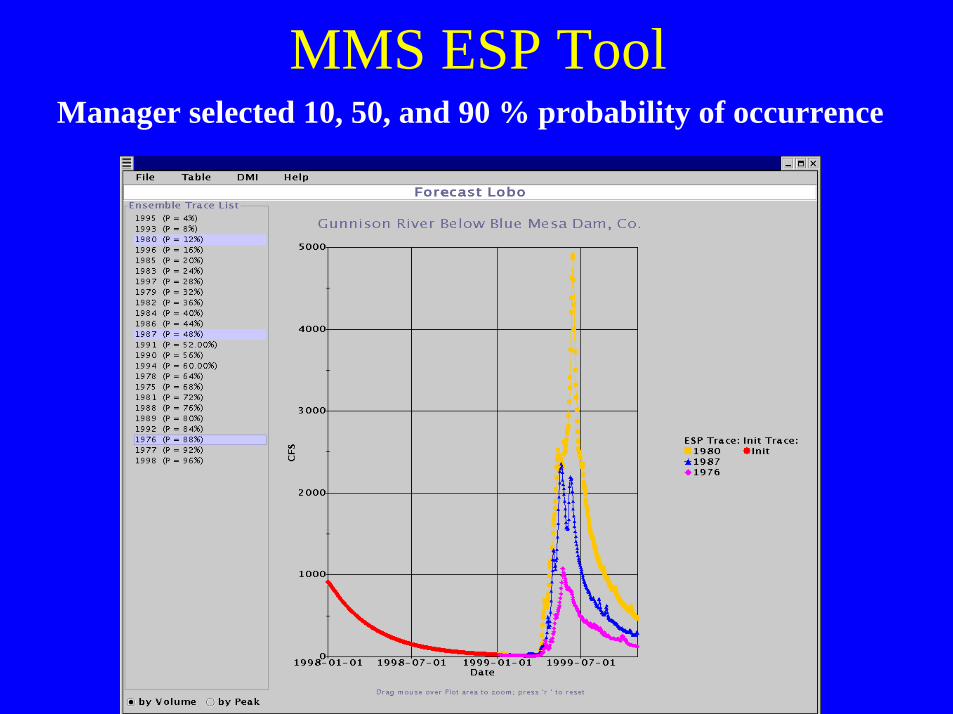
MMS ESP ToolManager selected 10, 50, and 90 % probability of occurrence
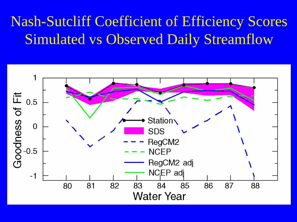
Nash-Sutcliff Coefficient of Efficiency ScoresSimulated vs Observed Daily Streamflow
Object Modeling System
Olaf DavidGPSR
January 17th 2001
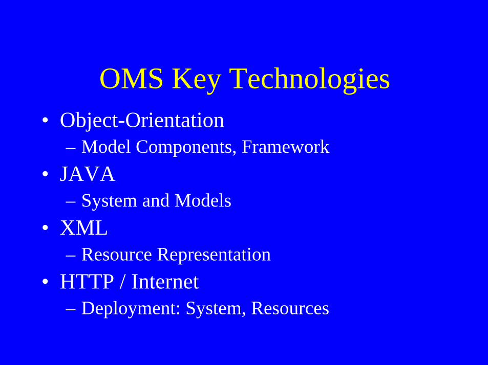
OMS Key Technologies• Object-Orientation
– Model Components, Framework• JAVA
– System and Models• XML
– Resource Representation• HTTP / Internet
– Deployment: System, Resources
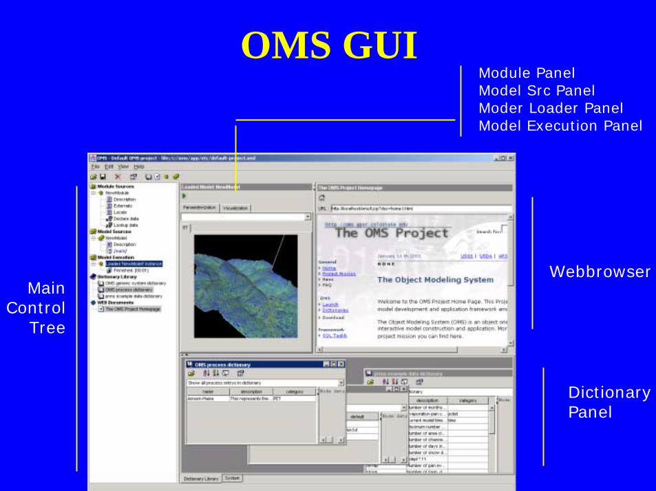
OMS GUI
MainControl
Tree
Webbrowser
DictionaryPanel
Module PanelModel Src PanelModer Loader PanelModel Execution Panel
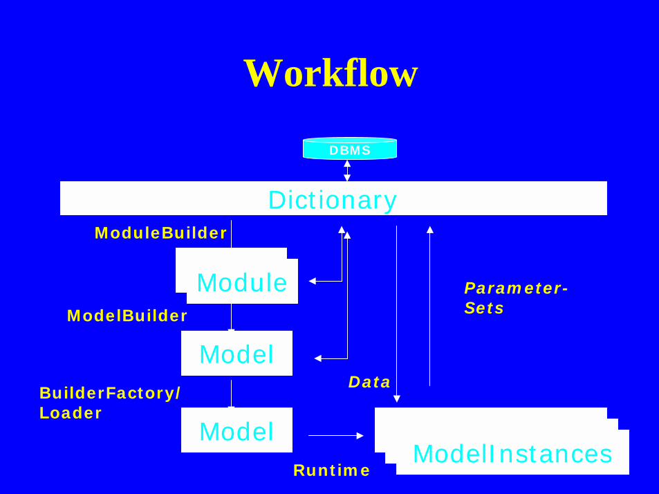
Workflow
Dictionary
ModuleModule
Model
Model ModelInstancesModelInstancesModelInstances
ModuleBuilder
ModelBuilder
BuilderFactory/Loader
Runtime
Data
Parameter-Sets
DBMS
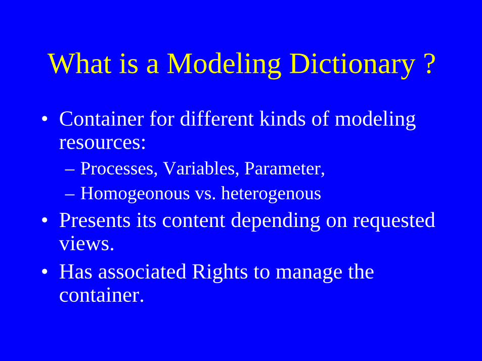
What is a Modeling Dictionary ?
• Container for different kinds of modelingresources:– Processes, Variables, Parameter,– Homogeonous vs. heterogenous
• Presents its content depending on requestedviews.
• Has associated Rights to manage thecontainer.
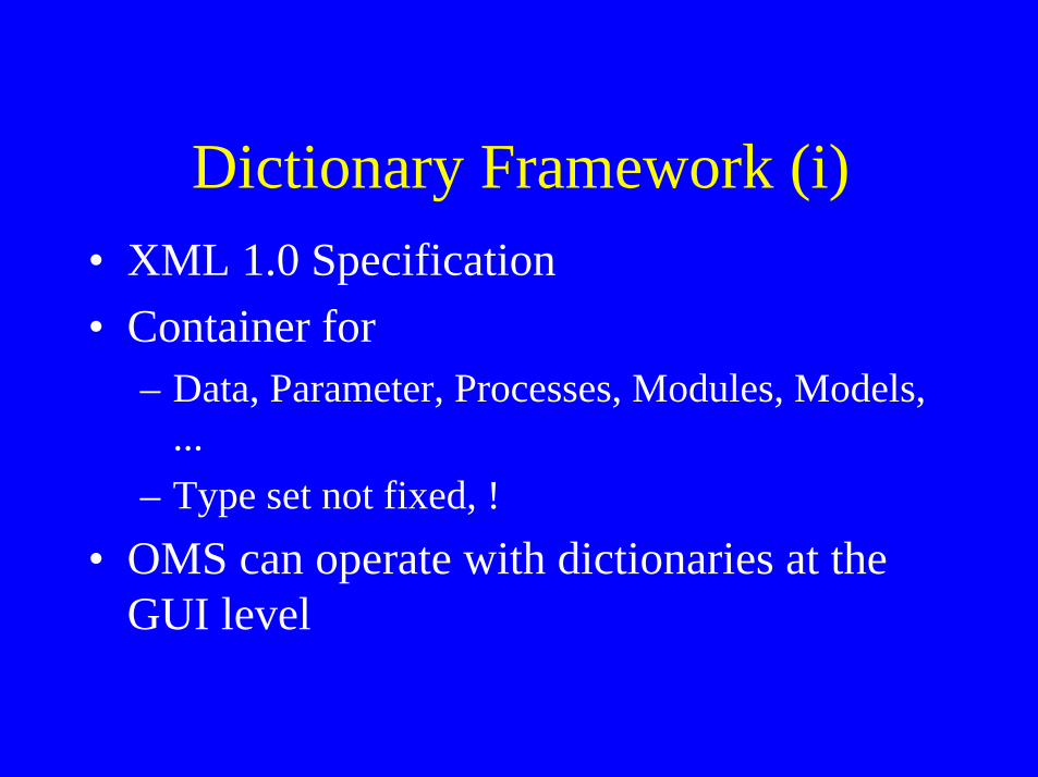
Dictionary Framework (i)• XML 1.0 Specification• Container for
– Data, Parameter, Processes, Modules, Models,...
– Type set not fixed, !• OMS can operate with dictionaries at the
GUI level
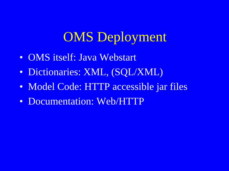
OMS Deployment• OMS itself: Java Webstart• Dictionaries: XML, (SQL/XML)• Model Code: HTTP accessible jar files• Documentation: Web/HTTP

Java WebStart ?
JAVA WebStarts
HTTP
Download OMS
Second Start:-Use local cached App-Download again if updated-Create Shorcut, Program Menu
HTTP
Launch OMS
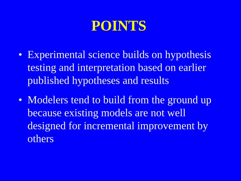
POINTS
• Experimental science builds on hypothesistesting and interpretation based on earlierpublished hypotheses and results
• Modelers tend to build from the ground upbecause existing models are not welldesigned for incremental improvement byothers

POINTS• Current trend of model competitions or
comparisons are of limited value withoutaddressing the question of “why”
• A modular framework provides the tools toobjectively ask the question “why”
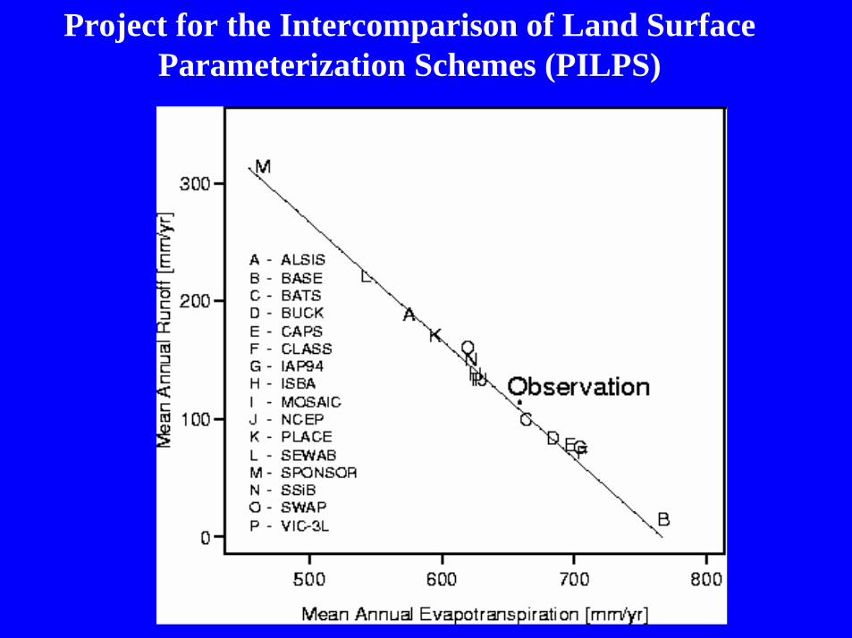
Project for the Intercomparison of Land SurfaceParameterization Schemes (PILPS)
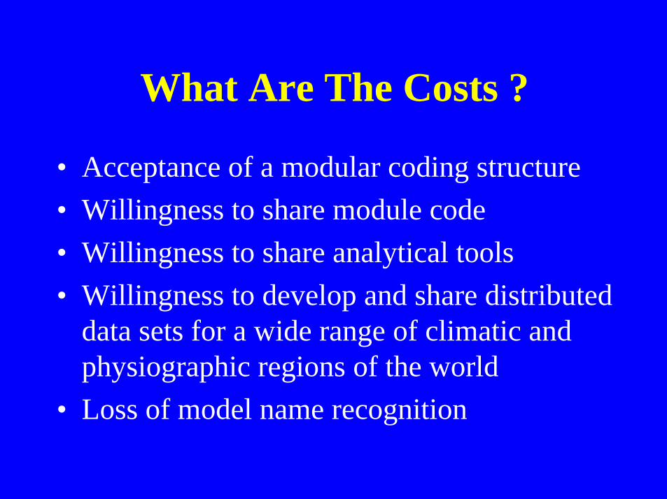
What Are The Costs ?
• Acceptance of a modular coding structure• Willingness to share module code• Willingness to share analytical tools• Willingness to develop and share distributed
data sets for a wide range of climatic andphysiographic regions of the world
• Loss of model name recognition

Benefits ?
• Share a community toolbox for model andsystem development and for addressing theissues of parameter estimation and scale
• Support a flexible framework that enablesthe incorporation of continuing advances inscience, databases, and computertechnology
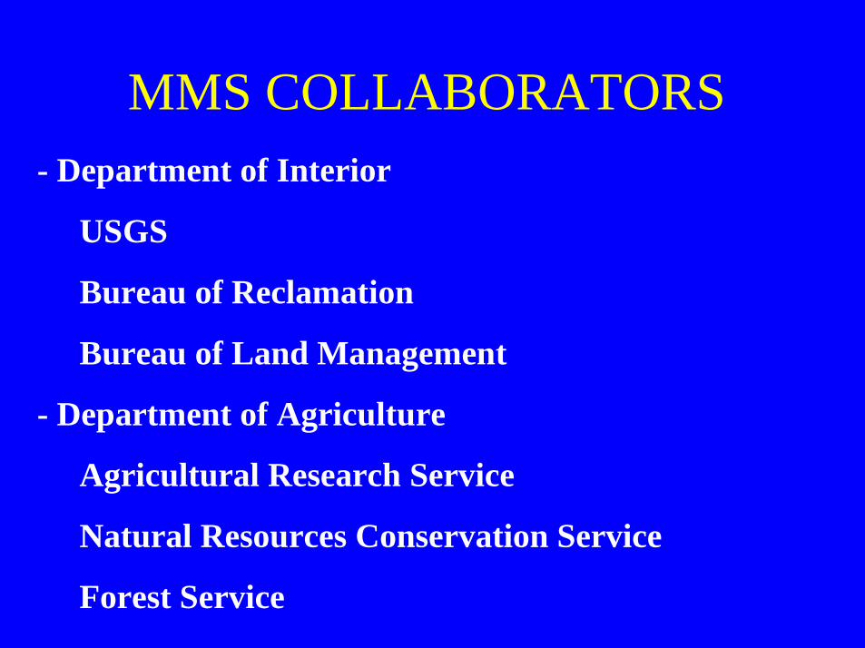
MMS COLLABORATORS- Department of Interior
USGS
Bureau of Reclamation
Bureau of Land Management
- Department of Agriculture
Agricultural Research Service
Natural Resources Conservation Service
Forest Service
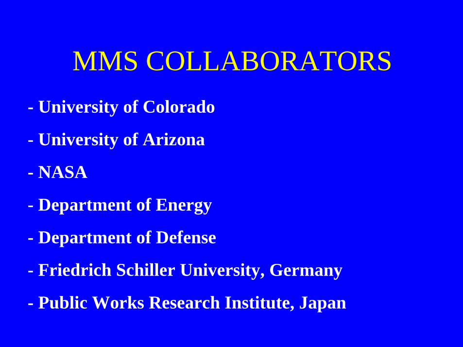
MMS COLLABORATORS- University of Colorado
- University of Arizona
- NASA
- Department of Energy
- Department of Defense
- Friedrich Schiller University, Germany
- Public Works Research Institute, Japan
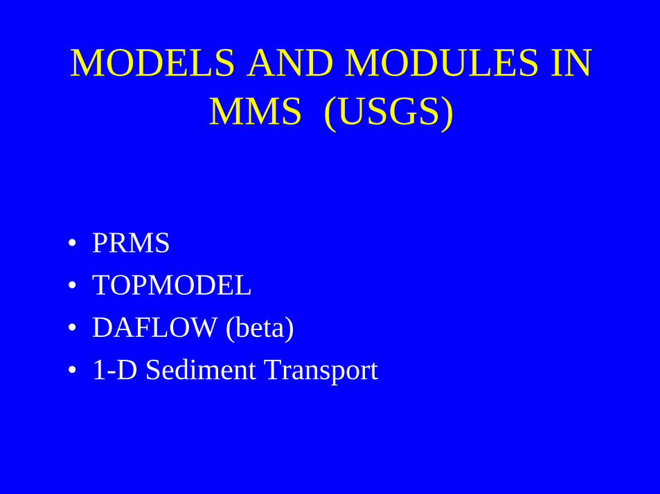
MODELS AND MODULES INMMS (USGS)
• PRMS• TOPMODEL• DAFLOW (beta)• 1-D Sediment Transport
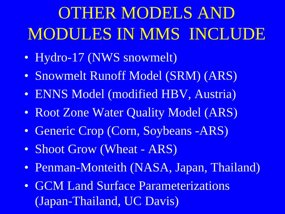
OTHER MODELS ANDMODULES IN MMS INCLUDE
• Hydro-17 (NWS snowmelt)• Snowmelt Runoff Model (SRM) (ARS)• ENNS Model (modified HBV, Austria)• Root Zone Water Quality Model (ARS)• Generic Crop (Corn, Soybeans -ARS)• Shoot Grow (Wheat - ARS)• Penman-Monteith (NASA, Japan, Thailand)• GCM Land Surface Parameterizations
(Japan-Thailand, UC Davis)
PRECIPITATION - RUNOFFMODELING PROJECT
OPEN SHOP
CONSULTATION
COLLABORATION

Chicken Soup for the Modeling Soul
“A fool with a toolis still a fool.”
System Development magazine
POINT
MORE INFORMATION
http://wwwbrr.cr.usgs.gov/mms
http://wwwbrr.cr.usgs.gov/weasel
http://wwwbrr.cr.usgs.gov/warsmp
http://wwwbrr.cr.usgs.gov/projects/
SW precip runoff/papers