Embed Size (px)
Citation preview

A Geo-spatial Perspectiveor
What’s Special about the Spatial?
Peter Burnhill
Director EDINA, UK National Data Centre
University of Edinburgh
CoSMiC Terminologies Day, National Library for Scotland, Edinburgh

Preamble
This is based on two earlier presentations:
1. Workshop on ‘Digital Gazetteers’, made (by AC & JJ) at ACM/IEEE-CS Joint Conference on Digital Libraries 2002, Portland, Oregon, USA, 14-18 July 2002
2. ‘New Directions in Metadata’, made (by PB & DMS) at OCLC/SCURL Pre-IFLA Conference, Edinburgh August 2002
So, acknowledgements to: David Medyckyj-Scott, Andy Corbett & James Reid
(Research & Geo-data Services, EDINA)
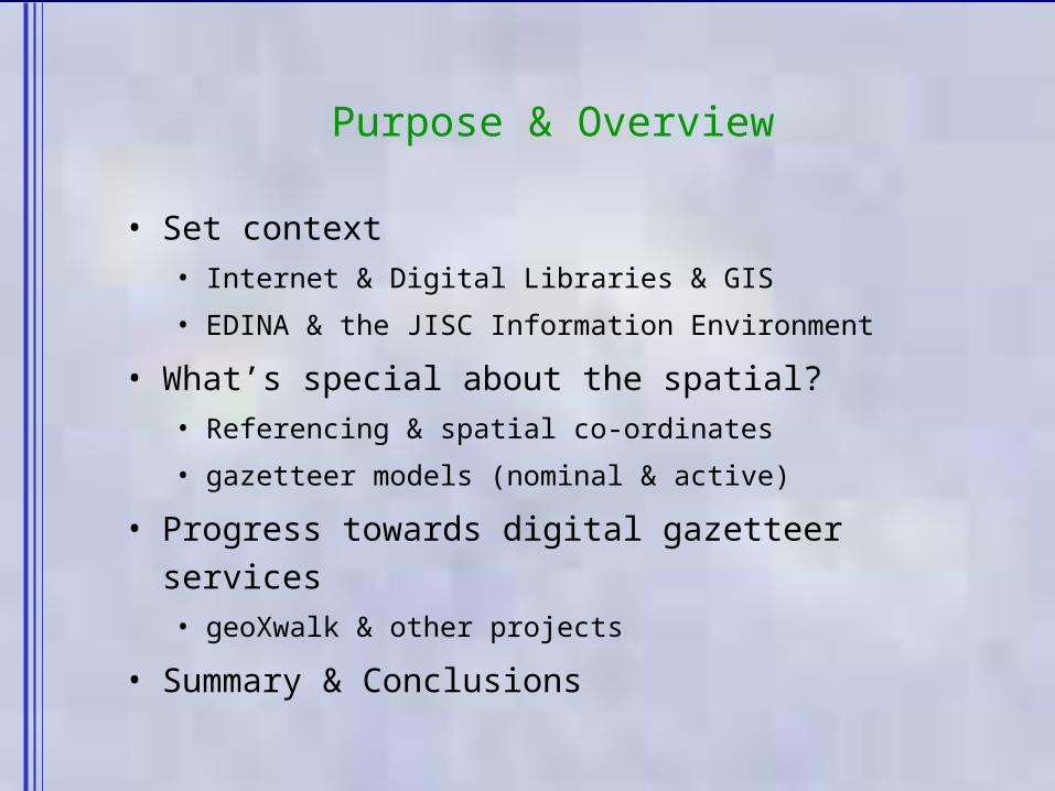
Purpose & Overview
• Set context • Internet & Digital Libraries & GIS
• EDINA & the JISC Information Environment
• What’s special about the spatial?• Referencing & spatial co-ordinates
• gazetteer models (nominal & active)
• Progress towards digital gazetteer services• geoXwalk & other projects
• Summary & Conclusions

Internet, Digital Libraries & GIS
1. Some Big Issues– Metadata & Interoperability– Naming, Identifiers & Authority Files– Ontologies– Shared services
2. Information Science – Digital Library, as mix of document & computation
traditions Michael Buckland, ‘The Landscape Of Information Science’ JASIS
Special Issue "JASIS at 50", Wiley 1999. (‘Presidential Address’)
3. Subject-matter methodology– Geographic Information Systems
• deconstructing the Map: both as database & as display device
• referencing: the cartographic trick ‘surface of sphere to flat paper/screen’

EDINA
• a JISC National Data Centre, 1995 -– part of Edinburgh University Data Library, 1984 -
• mission... to enhance productivity of research, learning and teaching in UK higher & further education
• major provider within the JISC Information Environment– range of bibliographic resources– launching sound and picture studio– key geo-spatial data and geo-referenced information
• UKBORDERS (1994 - ) boundary outlines & geo- reference database• Digimap (2000 -) online source of Ordnance Survey mapping
• strategic move toward interoperability & shared services role – adoption of appropriate standards
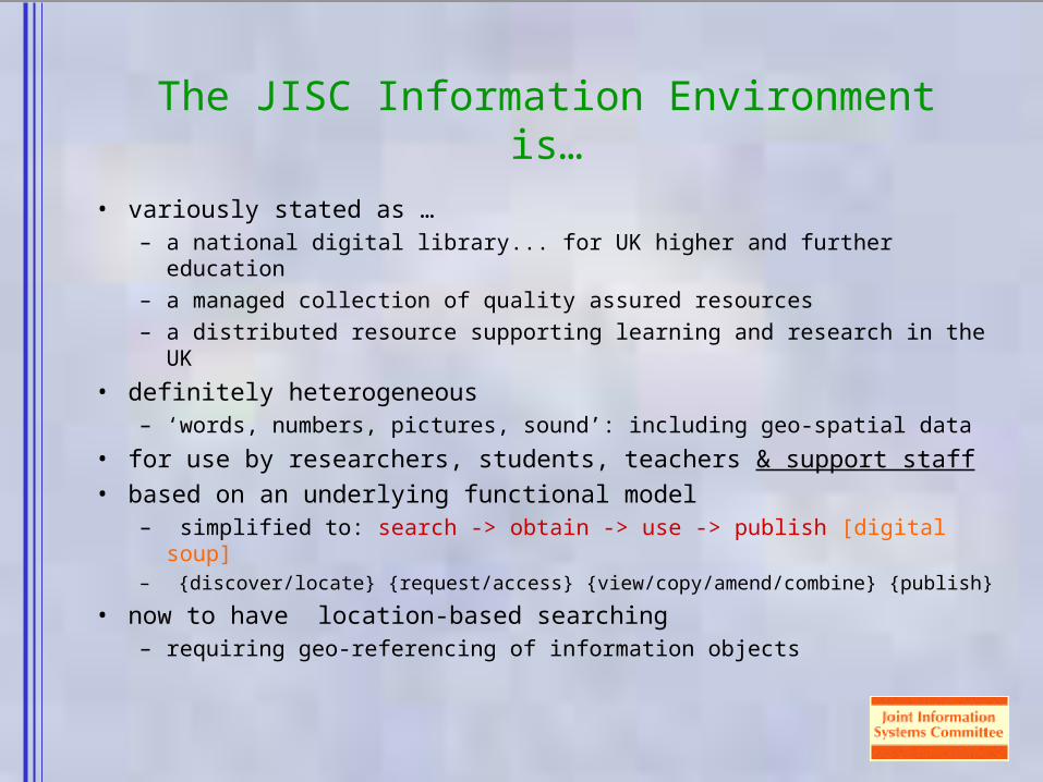
The JISC Information Environment is…
• variously stated as …– a national digital library... for UK higher and further education– a managed collection of quality assured resources– a distributed resource supporting learning and research in the
UK
• definitely heterogeneous– ‘words, numbers, pictures, sound’: including geo-spatial data
• for use by researchers, students, teachers & support staff • based on an underlying functional model
– simplified to: search -> obtain -> use -> publish [digital soup]– {discover/locate} {request/access} {view/copy/amend/combine}
{publish}
• now to have location-based searching– requiring geo-referencing of information objects

Q: What’s Special about the Spatial?
• subject content most often referenced by topic …… but much (80%?) can be referenced to specific
geographic places• broad disciplinary base for more powerful geographic
searching– across the social, life & physical sciences as well as the
humanities– also from libraries, archives and museums– now from digital libraries, service providers & data providers
• geo-referencing is thus a way of viewing information content:– subject, people, place and time
A: Geo-referencing, that’s what
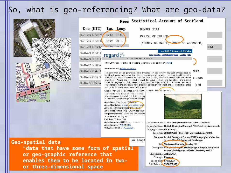
Geo-spatial data“data that have some form of spatial or geo-graphic reference that enables them to be located in two- or three-dimensional space”
Statistical Account of Scotland
NUMBER XIII.
PARISH OF CULLEN.
(COUNTY OF BANFF, SYNOD OF ABERDEEN, PRESBYTERY OF FORDYCE.)
By the Rev. Mr. ROBERT GRANT.
Royalty, Extent, Climate, etc.
CULLEN, as appears from old charters, was originallycalled Inverculan, because it stands upon the bank ofthe Burn of Cullen, which, at the N. end of the town, fallsinto the sea: but now it is known by the name of Cullen on-ly. Cullen is a royal burgh, formerly a constabulary, ofwhich the Earl of Findlater was hereditary constable. Theset, as it is called, of the council, consists of 19, in which num-ber are included the Earl of Findlater, hereditary preses, 3bailies, a treasurer, a dean-of-guild, and 13 counsellors. Theparish extends from the sea fouthward, about 2 English milesin length.
So, what is geo-referencing? What are geo-data?
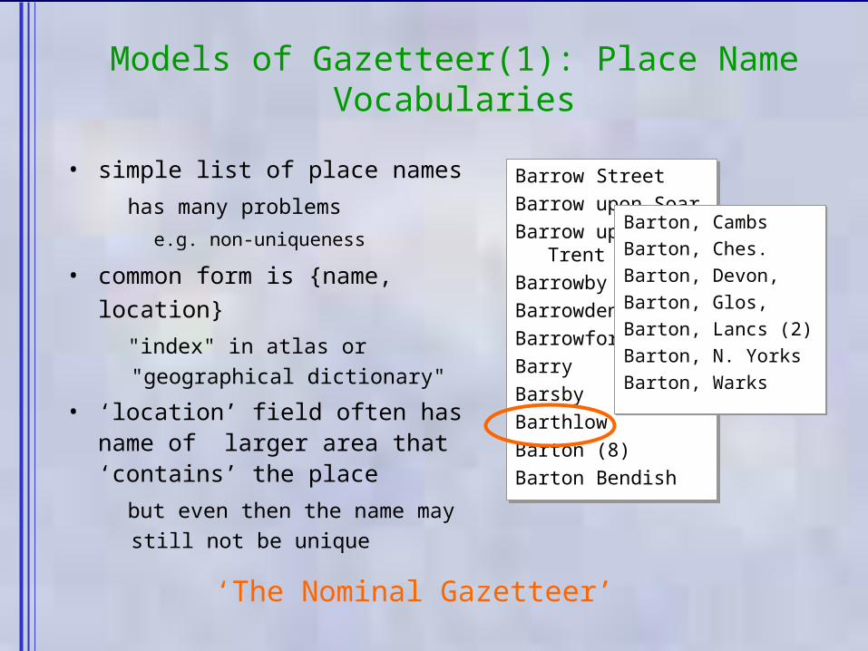
Barrow StreetBarrow upon SoarBarrow upon TrentBarrowbyBarrowdenBarrowfordBarryBarsbyBarthlowBarton (8)Barton Bendish
Barrow StreetBarrow upon SoarBarrow upon TrentBarrowbyBarrowdenBarrowfordBarryBarsbyBarthlowBarton (8)Barton Bendish
Models of Gazetteer(1): Place Name Vocabularies
• simple list of place names
has many problems
e.g. non-uniqueness
• common form is {name, location}
"index" in atlas or "geographical dictionary"
• ‘location’ field often has name of larger area that ‘contains’ the place
but even then the name may still not be unique
Barton, CambsBarton, Ches.Barton, Devon,Barton, Glos,Barton, Lancs (2)Barton, N. YorksBarton, Warks
Barton, CambsBarton, Ches.Barton, Devon,Barton, Glos,Barton, Lancs (2)Barton, N. YorksBarton, Warks
‘The Nominal Gazetteer’
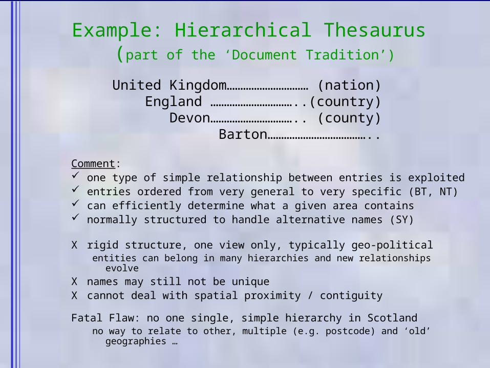
Example: Hierarchical Thesaurus (part of the ‘Document Tradition’)
Comment: one type of simple relationship between entries is exploited entries ordered from very general to very specific (BT, NT) can efficiently determine what a given area contains normally structured to handle alternative names (SY)
X rigid structure, one view only, typically geo-politicalentities can belong in many hierarchies and new relationships evolve
X names may still not be uniqueX cannot deal with spatial proximity / contiguity
Fatal Flaw: no one single, simple hierarchy in Scotlandno way to relate to other, multiple (e.g. postcode) and ‘old’
geographies …
United Kingdom………………………… (nation)England …………………………..(country)
Devon………………………….. (county)Barton………………………………..
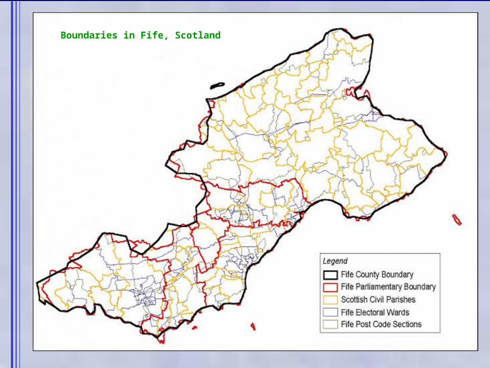
Boundaries in Fife, Scotland
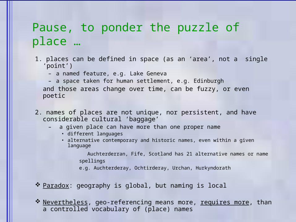
Pause, to ponder the puzzle of place …
1. places can be defined in space (as an ‘area’, not a single ‘point’)
– a named feature, e.g. Lake Geneva– a space taken for human settlement, e.g. Edinburgh
and those areas change over time, can be fuzzy, or even poetic
2. names of places are not unique, nor persistent, and have considerable cultural ‘baggage’
– a given place can have more than one proper name• different languages• alternative contemporary and historic names, even within a given
language
Auchterderran, Fife, Scotland has 21 alternative names or name spellings
e.g. Auchterderay, Ochtirderay, Urchan, Hurkyndorath
Paradox: geography is global, but naming is local
Nevertheless, geo-referencing means more, requires more, than a controlled vocabulary of (place) names

Getting geographic (1): Being coordinated
• how should we geo-reference?– with a co-ordinate system that can be related to a specific position
or location on the earth's surface
• geographic co-ordinates allow places to be represented by the appropriate footprint– settlements, lakes as areas; roads, rivers as lines; stations as point
• and offer persistence, regardless of name, political boundary
or other changes and a consistent framework for spatial queries
• geographic co-ordinates allow proximate places, those close to one another, to be identified– appropriate geo-referencing thus ‘enriches’ textual description
• as ever, not everyone uses the same standard spatial coding scheme– systems that relate to geo-graphic (Cartesian) coordinates are the
preferred metadata of choice, providing opportunity for ‘cross-walk’
Barrow StreetBarrow upon SoarBarrow upon TrentBarrowbyBarrowdenBarrowfordBarryBarsbyBarthlowBarton (8)Barton Bendish
Barrow StreetBarrow upon SoarBarrow upon TrentBarrowbyBarrowdenBarrowfordBarryBarsbyBarthlowBarton (8)Barton Bendish
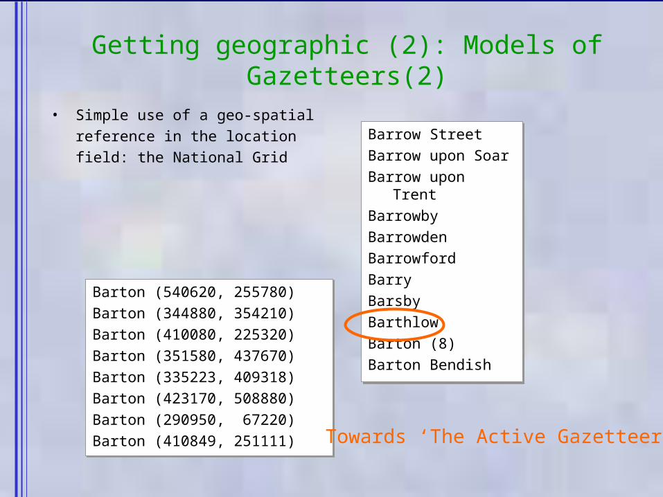
Getting geographic (2): Models of Gazetteers(2)
• Simple use of a geo-spatial reference in the location field: the National Grid
Barton (540620, 255780)Barton (344880, 354210)Barton (410080, 225320)Barton (351580, 437670)Barton (335223, 409318)Barton (423170, 508880)Barton (290950, 67220)Barton (410849, 251111)
Barton (540620, 255780)Barton (344880, 354210)Barton (410080, 225320)Barton (351580, 437670)Barton (335223, 409318)Barton (423170, 508880)Barton (290950, 67220)Barton (410849, 251111) Towards ‘The Active Gazetteer’
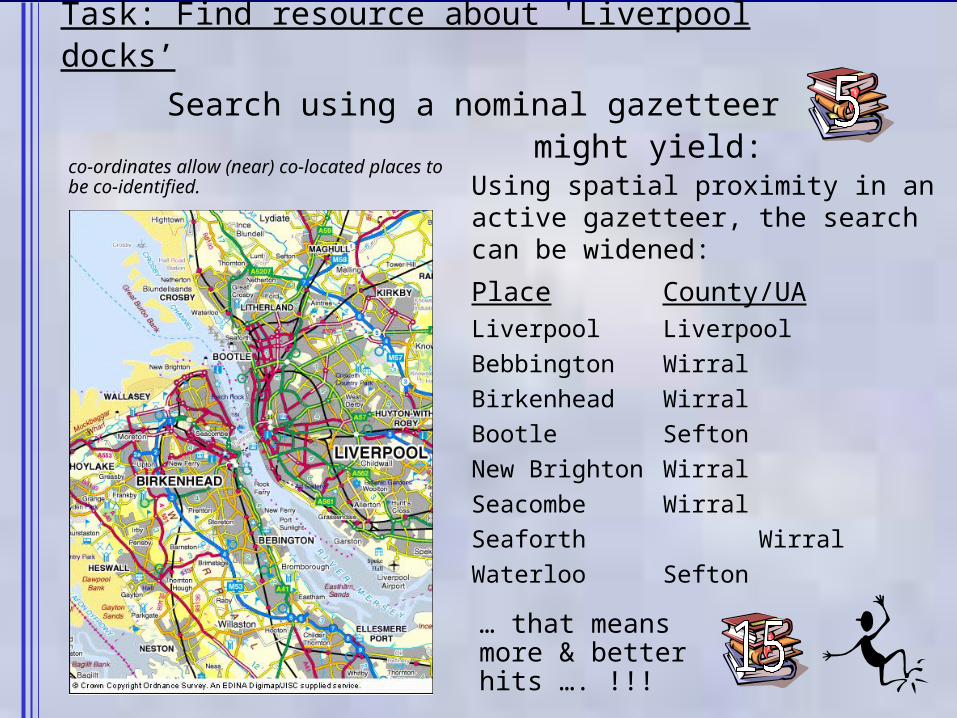
Task: Find resource about 'Liverpool docks’
Search using a nominal gazetteer might yield:
Using spatial proximity in an active gazetteer, the search can be widened:
Place County/UALiverpool Liverpool
Bebbington Wirral
Birkenhead Wirral
Bootle Sefton
New Brighton Wirral
Seacombe Wirral
Seaforth Wirral
Waterloo Sefton
… that means more & better hits …. !!!
co-ordinates allow (near) co-located places to be co-identified.
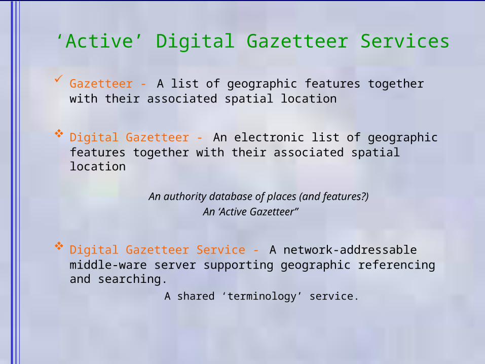
Gazetteer - A list of geographic features together with their associated spatial location
Digital Gazetteer - An electronic list of geographic features together with their associated spatial location
An authority database of places (and features?)An ‘Active Gazetteer”
Digital Gazetteer Service - A network-addressable middle-ware server supporting geographic referencing and searching.
A shared ‘terminology’ service.
‘Active’ Digital Gazetteer Services
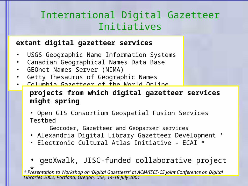
International Digital Gazetteer Initiatives
extant digital gazetteer services
• USGS Geographic Name Information Systems• Canadian Geographical Names Data Base• GEOnet Names Server (NIMA)• Getty Thesaurus of Geographic Names• Columbia Gazetteer of the World Online
projects from which digital gazetteer services might spring
• Open GIS Consortium Geospatial Fusion Services Testbed Geocoder, Gazetteer and Geoparser services
• Alexandria Digital Library Gazetteer Development *• Electronic Cultural Atlas Initiative - ECAI *
• geoXwalk, JISC-funded collaborative project *
* Presentation to Workshop on ‘Digital Gazetteers’ at ACM/IEEE-CS Joint Conference on Digital Libraries 2002, Portland, Oregon, USA, 14-18 July 2001
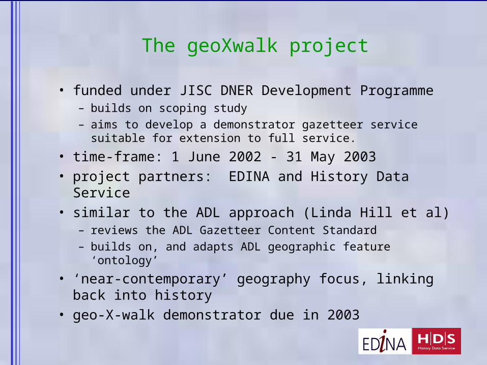
The geoXwalk project
• funded under JISC DNER Development Programme– builds on scoping study – aims to develop a demonstrator gazetteer service
suitable for extension to full service.
• time-frame: 1 June 2002 - 31 May 2003• project partners: EDINA and History Data Service• similar to the ADL approach (Linda Hill et al)
– reviews the ADL Gazetteer Content Standard– builds on, and adapts ADL geographic feature ‘ontology’
• ‘near-contemporary’ geography focus, linking back into history
• geo-X-walk demonstrator due in 2003
Reference use
Information server
Information server
Searching
Geo-parsing &indexing
The geoXwalkServer
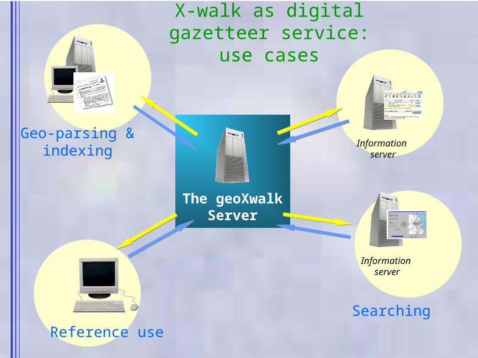
X-walk as digital gazetteer service: use
cases
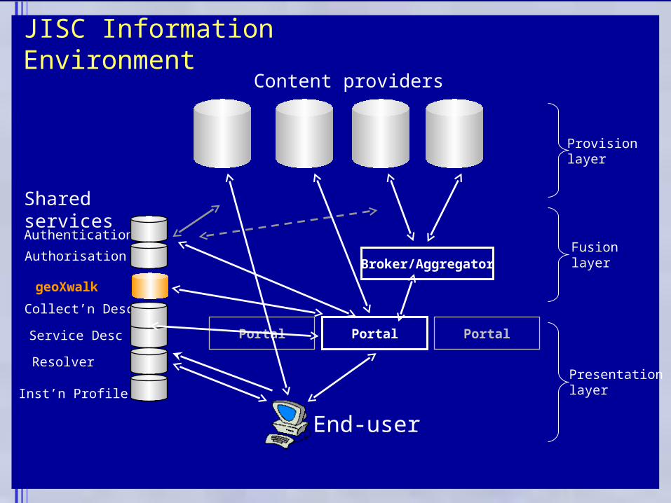
JISC Information Environment
Portal
Content providers
End-user
Portal
Broker/Aggregator
Authentication
Authorisation
Collect’n Desc
Service Desc
Resolver
Inst’n Profile
Shared services
Portal
Provision layer
Fusion layer
Presentationlayer
geoXwalk
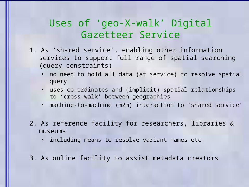
Uses of ‘geo-X-walk’ Digital Gazetteer Service
1. As ‘shared service’, enabling other information services to support full range of spatial searching (query constraints)• no need to hold all data (at service) to resolve spatial query• uses co-ordinates and (implicit) spatial relationships to
‘cross-walk’ between geographies• machine-to-machine (m2m) interaction to ‘shared service’
2. As reference facility for researchers, libraries & museums • including means to resolve variant names etc.
3. As online facility to assist metadata creators
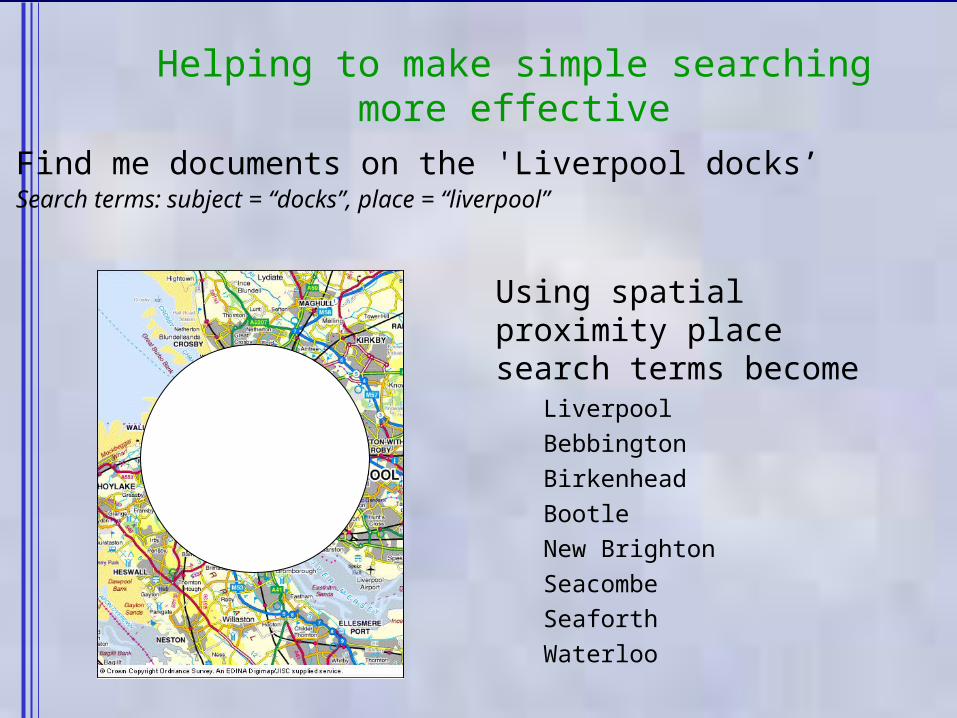
Helping to make simple searching more effective
Find me documents on the 'Liverpool docks’ Search terms: subject = “docks”, place = “liverpool”
Using spatial proximity place search terms become
Liverpool
Bebbington
Birkenhead
Bootle
New Brighton
Seacombe
Seaforth
Waterloo
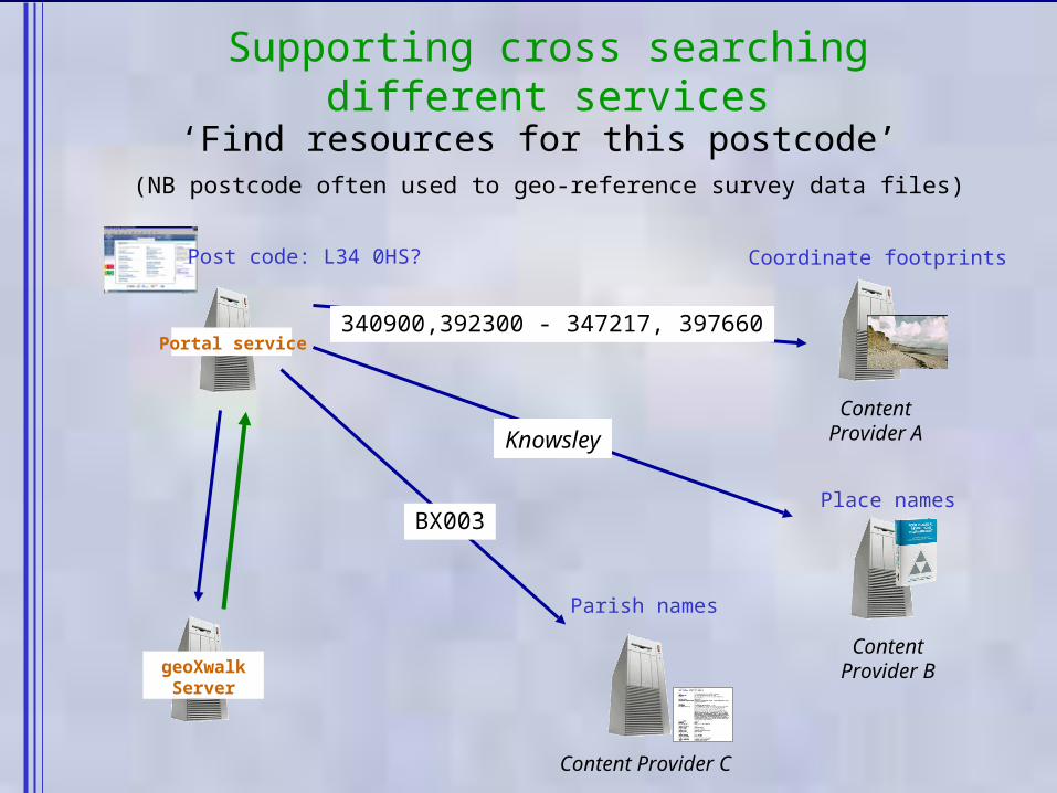
Supporting cross searching different services
geoXwalkServer
Content Provider C
ContentProvider A
ContentProvider B
Coordinate footprints
Parish names
Place names
Portal service
Post code: L34 0HS?
‘Find resources for this postcode’ (NB postcode often used to geo-reference survey data files)
Knowsley
340900,392300 - 347217, 397660
BX003
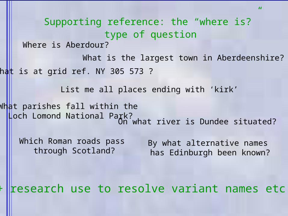
Supporting reference: the “where is?” type of question
What is at grid ref. NY 305 573 ?
Where is Aberdour?
What is the largest town in Aberdeenshire?
List me all places ending with ‘kirk’
What parishes fall within the Loch Lomond National Park?
On what river is Dundee situated?
Which Roman roads pass through Scotland?
By what alternative names has Edinburgh been known?
+ research use to resolve variant names etc.

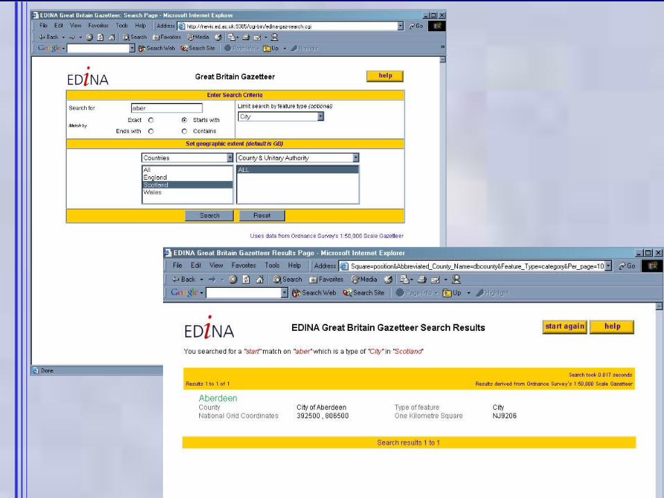
As online facility to assist metadata creators (1)
• Traditional use of ‘controlled vocabulary’ for ‘found’ place names
but, to be ‘found’, metadata records on objects must have appropriate geo-referencing
• This is achieved using an ‘analytical’ (geo-coded) gazetteer
e.g. BLGOa facility devised by EDINA for the British Library for use in its NOF-funded ‘A Sense of Place’ activity– uses 1:50 000 Gazetteer licensed from Ordnance Survey– presently ‘in test’ at the British Library by over 20
archival staff
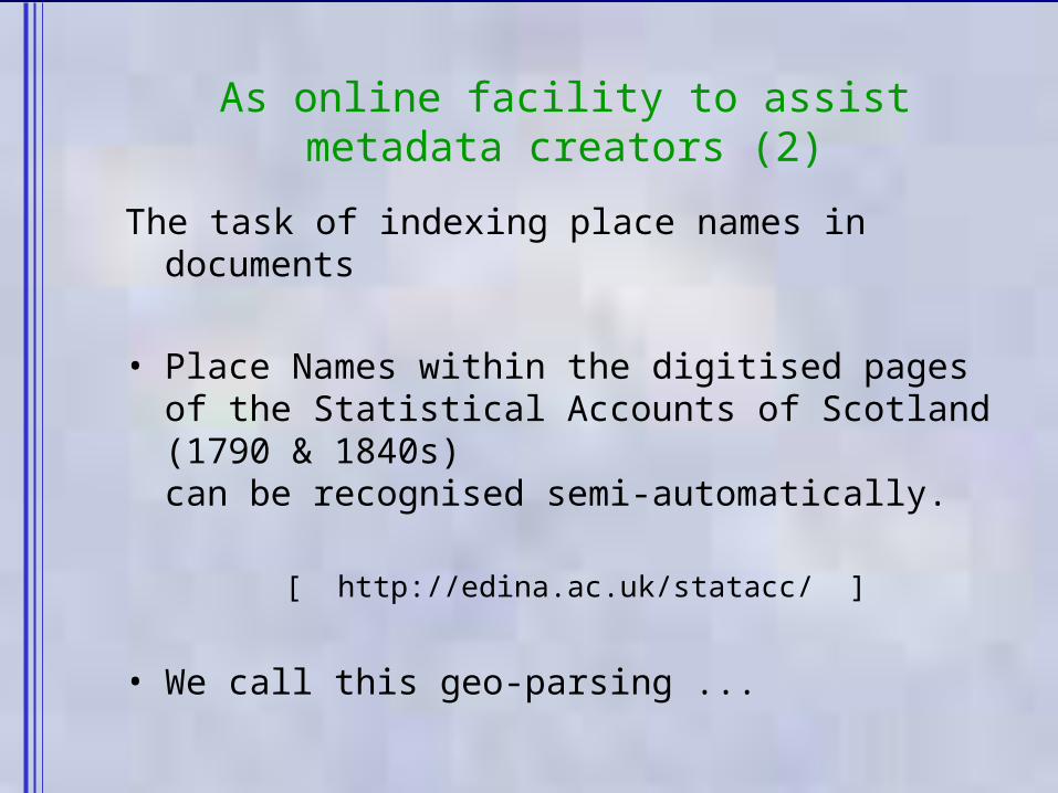
As online facility to assist metadata creators (2)
The task of indexing place names in documents
• Place Names within the digitised pages of the Statistical Accounts of Scotland (1790 & 1840s) can be recognised semi-automatically.
[ http://edina.ac.uk/statacc/ ]
• We call this geo-parsing ...
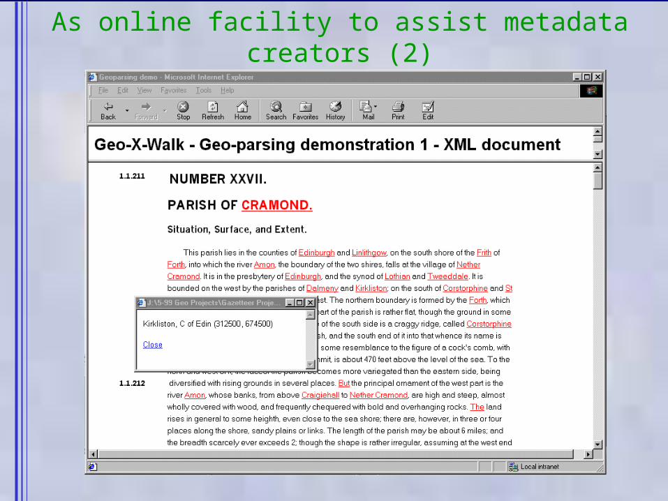
As online facility to assist metadata creators (2)
Need screen shot of parser here
Some Success, but also ‘Current Challenges’
1. Merging geo-names from different scales & from different sources1. when place names differ, should all names be regarded as proper!– do we trust positional accuracy & how do we express confidence?– how to minimise effort in de-duplication of place(s)?
• places have multiple names, types, and footprints• need to be able to identify duplicate entries for the same place
2. Presenting geo-names on different occasions?– many variant ‘proper’ names, what is preferred?
• what is the ‘name authority body’? - none in the Scotland or the UK• preferred name varies with location and use and culture
– there are language and character code set issues– standard codes for postal addresses and other geographies
3. There is IPR in metadata; and hence terms & conditions of use4. There are always service performance issues

Summary Conclusions
1. geographic referencing is needed in the digital library• for indexing information objects & for finding out what is
where
2. names as words are not enough• places need their co-ordinate numbers
3. ‘active’ digital gazetteer services can add value• a few initiatives internationally, now beginning to collaborate
• common data model, protocols, sharing data & interoperability
• licensing and copyright are serious issues• particularly if want wider, global access
• a variety of interesting technical challenges to tackle
4. EDINA has developed digital gazetteer services for Scotland
global answer is geo-referencing by co-ordinates but to ‘act global’ we must also ‘think local’ …
local to object, to location, to geographic vocabulary of user
Active Gazetteers offer more than Nominal Gazetters

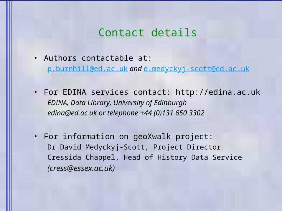
Contact details
• Authors contactable at:[email protected] and [email protected]
• For EDINA services contact: http://edina.ac.ukEDINA, Data Library, University of [email protected] or telephone +44 (0)131 650 3302
• For information on geoXwalk project:Dr David Medyckyj-Scott, Project DirectorCressida Chappel, Head of History Data Service

Gazetteer - A list of geographic features together with their associated spatial location
Digital Gazetteer
Digital Gazetteer Service
Some Definitions
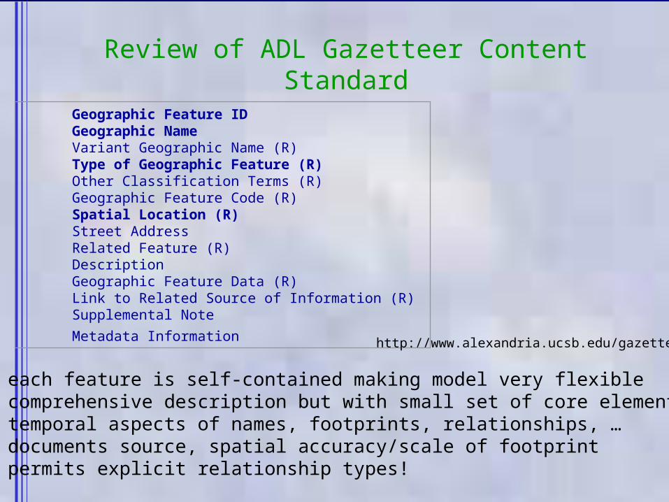
Review of ADL Gazetteer Content Standard
Geographic Feature ID Geographic Name Variant Geographic Name (R) Type of Geographic Feature (R) Other Classification Terms (R) Geographic Feature Code (R) Spatial Location (R) Street Address Related Feature (R) Description Geographic Feature Data (R) Link to Related Source of Information (R) Supplemental Note
Metadata Information http://www.alexandria.ucsb.edu/gazetteer
1. each feature is self-contained making model very flexible2. comprehensive description but with small set of core elements3. temporal aspects of names, footprints, relationships, …4. documents source, spatial accuracy/scale of footprint5. permits explicit relationship types!
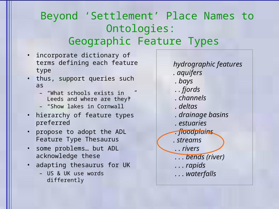
Beyond ‘Settlement’ Place Names to Ontologies:
Geographic Feature Types• incorporate dictionary of
terms defining each feature type
• thus, support queries such as – “What schools exists in Leeds
and where are they?”– “Show lakes in Cornwall”
• hierarchy of feature types preferred
• propose to adopt the ADL Feature Type Thesaurus
• some problems… but ADL acknowledge these
• adapting thesaurus for UK– US & UK use words differently
hydrographic features
. aquifers . bays . . fjords . channels . deltas . drainage basins . estuaries . floodplains. streams . . rivers . . . bends (river) . . . rapids . . . waterfalls