Embed Size (px)
Citation preview


Contents
Introduction 1
Part I: Mongolia and the Circumpolar World 3
Part II: Deer Stone Project Research Themes 11
Part III: Environment and Geobotanical Notes (S. Young) 17
Part IV: Field Narratives 2001, 2002 23
Part V: Traditional Knowledge of Lichens (P. DePriest) 33
Part VI: Archaeological Site Reports 37
Bibliography 53
Appendix I: Project GPS Log 2001, 2002 63
Appendix II: Radiocarbon Dates 69
Appendix III: Field Photographs 71
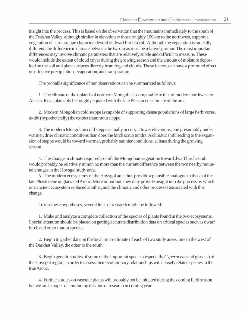
Cover photograph: G. Tsetsegmaa and relatives at Tsaatan camp on Minge Polog
river summer camp, 2001.


1
Introduction
This report presents the results of anthropological and environmental reconnaissance conducted
in 2001 and 2002 by the Arctic Studies Center in Hovsgol Aimag, northern Mongolia. The projectbegan as part of a humanitarian venture to aid the Tsaatan2 (Dukha) reindeer herders living in the WestDarkhat Valley, organized by Edward Nef, director of Inlingua Languages Services School of Arlington,Virginia, with his Mongolian subsidiary, Santis Foundation, in Ulaanbaatar. Nef had traveled previouslyto Hovsgol, where he had been impressed by the region’s deer stone sites and other archaeologicalmonuments. He had also met the Tsaatan reindeer herders living in the eastern Sayan mountains west ofLake Hovsgol, learning of their struggle to maintain their herds in the face of climatic warming andchanges in lichen pasture ecology, and of political, economic, and social changes brought about byMongolia’s release from Soviet domination. Hoping that scientific studies could assist the Tsaatan, Nefinvited Steven Young (an arctic botanist and paleoecologist) and me (an arctic archaeologist and anthro-pologist) to accompany his 2001 expedition. In addition to exploring the region’s environment andarchaeology, we planned to explore Mongolia’s cultural and biological connections to northern Asia andthe circumpolar region, a topic that heretofore has received no attention by natural scientists or anthro-pologists.
The 2001 expedition from 25 June to 6 July provided orientation and introduced us to the Hovsgolenvironment and archaeology, and its Mongol and Tsaatan residents. The subsequent 2002 seasonorganized in order to prepare a foundation for future archaeological, ethnographic, botanical, andpaleoenvironmental research. This report described these projects and the research questions thatbrought us to Mongolia in the first place, in four parts. Part I presents the broader rationale for studyingMongolia’s relationship to the circumpolar world. Part II describes research themes we are exploring innorthern Mongolia, where deer stone monuments and Bronze and Iron Age mortuary structures are adominant feature of the cultural landscape. Part III is a preliminary report by Stephen Young on theregion’s paleoecologyPart IV is a narrative sketch of the 2001-2 field activities; Part V is a preliminaryreport on Tsaatan reindeer ecology; and Part VI reports briefly on archaeological sites and finds,illustrates maps, photographs, and field sketches, and presents radiocarbon dates and preliminaryconclusions. The Appendices provide a selection of photographs, radiocarbon dates, and GPS coordi-nates of sites and field stations.
1 William W. Fitzhugh, Director, Arctic Studies Center, Department of Anthropology, National Museum of NaturalHistory, Smithsonian Institution, Washington D.C. ([email protected])
2 Tsaatan, meaning ‘reindeer herder’ in Mongolian, is the customary term used by Mongolians to refer to the peopleknown more anthropologically as Dukha, the name they used before their recent political isolation from other SouthSiberian Tuva-speaking peoples, who continue to live in Russia.
William W. Fitzhugh1


3
PART I
A principal goal of the Deer Stone Project is to explore Mongolia’s cultural, historical, and
environmental relationships to northern Eurasia and the North Pacific. Therefore, at the outset it may behelpful to explain why Mongolia – a sparsely-populated, nation of 2.5 million people located nearly2000 km south of the Arctic Circle – might have some bearing on arctic issues like reindeer breeding,the diffusion of metal and other technologies, and the spread of peoples, ideas, and art around theworld. In particular, as in the case of the peopling of the New World, the development of early Eskimocultures in the Bering Sea seems to havebeen influenced by Asian metal, shamanisticconcepts, and new artistic traditions. Per-haps most significant was one element ofEurasian arctic culture that did not enterAlaska: reindeer breeding. Although thespread of this technology resulted in aprofound transformation of almost all ofEurasian arctic hunters into herders andpastoralists, North American arctic andsubarctic peoples across Bering Straitremained isolated from this powerful agentof change. Mongolia may have had a role inthese innovations and transmissions.
For more than 100 years archaeolo-gists have searched without success for theroots of Eskimo culture in arctic regions, in the Bering Sea, and along the coast of northeast Asia fromJapan to Chukotka. Although physical similarities between Eskimos and Mongolians seemed to implyhistorical connections, Mongolia’s remoteness and different cultures discouraged investigation of apossible role in North Pacific history. Today, with Mongolia accessible to Westerners for the first time in80 years, it has become possible to explore such questions as: did Mongolia play a role as a center ofpopulation dispersal into Northeast Asia? was it involved in the development of reindeer domestication?and could its early cultures have been sources or transmitters of cultural information from Central Asiainto the North Pacific region? As part of my interest in these questions (Fitzhugh 2002a), I would like tobriefly describe why we are exploring these issues from a Mongolian perspective.
Mongolia and the Circumpolar World
Figure 1.1 Ushkin Uver deer stone complex
The Search for Asian Contactsand Eskimo Origins

4 The Hovsgol Deer Stone Project, 2001-2002
Figure 1.2 Sites and routes of the 2001 and 2002 expeditions

5Mongolia and the Circumpolar World
Bering Strait, Alaska
Since the 1930s, archaeologists investigating early Alaskan Eskimo cultures have suspected thatkey elements of this complex – including metallurgy, shamanism, art, and religion concepts – originatedin Asia (Jenness 1928, 1940; Collins 1937, 1951, 1972; Schuster 1951). Study of the engraved art ofthe Old Bering Sea II/III and Punuk cultures (A.D. 400-1000) show that these carvings were madewith iron-tipped engraving tools of Asian origin. While the origins of the art styles and motifs have notyet been traced reliably outside the Bering Sea region (Collins 1972; Bronshtein and Plumet 1995;Arutiunov 2003), some artifacts found in OBS burials, such as ivory chains and ivory open-workcarvings resembling bronze castings, clearly have Siberian prototypes (Arutiunov and Sergeev 1975;Arutiunov and Fitzhugh 1988). Asian contacts, however, are most dramatically seen at the Ipiutak site atPoint Hope, Alaska, where Larsen and Rainey (1948) found composite ivory death masks and hugenumbers of elaborate bone and ivory open-work carvings that mimic Siberian metal rattles andshamanic costume ornaments. The excavators attributed such exotic forms to the introduction of aSiberian shamanistic complex into Alaska and linked specific artifact styles to the Permian Bronze andIron Age of West Siberia (Larsen and Rainey 1948; Rainey 1971). Later, Henry Collins and Hans-Georg Bandi proposed that Ipiutak composite bone masks and other elements of the Ipiutak complexmight be have been inspired by composite jade masks and other artifacts in the Chou period in EasternChina (Collins 1971; Bandi 1974). Carl Schuster (1951) had similar ideas and linked early Eskimo artto Scytho-Siberian animal-style art of Central Asia, but without identifying specific archaeologicalintermediaries.
Figure 1.3 Old Bering Sea harpoon socket piece and hat ornament (lower) illustrating a hunter’s helping spirits. (Smithsonian Institution Collections)

6 The Hovsgol Deer Stone Project, 2001-2002
Despite such tantalizing clues, progress in exploring the Asian connections of Alaskan Eskimoprehistory was slow to materialize. For much of the 20th century, Western scientists had little access toSoviet scientists, publications, and archaeological sites, especially in the Soviet Far East and Chukotka.However, during the 1970s, scientific exchanges made it possible for arctic specialists from the U.S. andRussia to meet, and in the 1980s the Smithsonian’s Crossroads of Continents exhibition (Fitzhugh andCrowell 1988) and a subsequent post-glasnost ‘mini-Crossroads’ exhibit provided Soviet and NorthAmerican scholars with a chance to begin serious studies of trans-Beringian research.
An “Eskimo-like” Culture in Yamal
By 1990 it became possible for Russian and Western scientists to collaborate freely and sharefieldwork opportunities. Interested in exploring the little-known Eurasian circumpolar corridor, I beganworking with Russian colleagues on Neolithic, Bronze, and Iron Age sites in Yamal and on the lower ObRiver in Western Siberia. I had previously concluded that convergent development rather than trans-Atlantic contact was responsible for similarities between Scandinavia Younger Stone Age cultures and4000-year old Indian cultures of Northeastern North America, and that neither had contributed toEskimo origins (Fitzhugh 1974, 1975). But Chernetsov’s tentative conclusion that an early ‘Eskimo-like’culture existed during the Iron age on the Kara Sea coast of Yamal (Chernetsov 1935; Chernetsov1974; Moshinskaya 1974) – the same find that prompted Larsen and Rainey to propose West Siberianconnections at Ipiutak – remained unconfirmed. Their claim in 1948 was plausible if Eskimo cultureoriginated, as one early theory claimed, when European Paleolithic peoples followed the retreatingglacial ice and reindeer north into the Arctic. Although this idea was discredited when Henry Collinsdemonstrated a 2000-year history of Eskimo development in the Bering Sea, the earliest cultures ofCollins’ sequence – Okvik and Old Bering Sea cultures – were already fully ‘Eskimo’ in nature, with noknown ancestors in this region. Given the lack of knowledge of the huge expanse of the Russian Arctic,it was impossible to deny north Eurasian origins. Birnirk and Punuk-like Eskimo sites were known as farwest as the Kolyma River and the Bear Islands (Collins 1940; Jenness 1940; Chard 1958; Ackerman1984), but 3500 km of Arctic Ocean coast between here and Yamal was still mostly unexplored.
Figure 1.4 Map of North Pacific with human-face petroglyphs. (Y. Song, ASC Newsletter Suppl. 1998)

7Mongolia and the Circumpolar World
Nevertheless, three years of fieldwork with Russian archaeologists familiar with this area convinced methat Chernetsov’s early ‘arctic maritime culture’ of Yamal was neither maritime nor ‘Eskimo’ (Fitzhugh1997). Similar conclusions were beginning to be reached in Taimyr (Pitulko 1999c), along the LaptevSea and West Chukchi Sea, and at an 8000-year old Mesolithic site on Zhokhov Island (Pitulko1999a), all of which produced no proto-‘Eskimo’ evidence (Fitzhugh 2002a).
Primor’e to Bering Strait: Ritual Art, and Transformation
While explorations of the Russian arctic coast continued, new research between Bering Strait andVladivostok, long considered a potential area of influence related to Eskimo origins (Chard 1958),advanced knowledge of this little-known region and identified Asian prototypes for some archaeologicalcomplexes and elements known from Alaska (Dumond and Bland 1995), including the likely origins of4000 B.P. Denbigh Complex and Arctic Small Tool tradition ceramics and lithics in Siberian Neolithiccultures (Irving 1962; Powers and Jordan 1990). During these years, work on Old Koryak (Vasil’evskii1971; Dikov 1979), Ymyiakhtakh (Fedoseeva 1980), Tokarev and Tar’insk (Lebedintsev 1990), andLakhtina (Orekhov 1999) cultures expanded the inventory of early Northwest Pacific maritime cultures.But to date none have revealed prototypes for Old Bering Sea art and religion; nor has such informationemerged from studies further south around the mouth of the Amur, in Sakhalin, northern Japan, orKorea, although 6000 year old harpoon forms have been found in Jomon Japan (Yamaura 1978). Alsoof interest are developments in rock art research which expand knowledge of human face art and earlyAsian masking traditions dating to ca. 4000-1000 B.P. in the Lower Amur and northern China(Okladnikov 1981; Song 1992).These images indicate a long traditionof body decoration and labret use suchas that found among Old Bering Seaand later Beringian cultures andsuggest a possible medium for linksbetween Eastern Asia and the BeringSea that is usually not preserved inarchaeological complexes. Anotherpossible connection may be seen inground slate technology, which ap-pears in Old Bering Sea, NortheastAsian and Korean cultures about 2000years ago, shortly after the appearanceof metal technology in Central Asia andeastern Siberia. It seems likely thatslate grinding may have been begun asa metal substitute among peoples whoknew of this technology from theircontacts to the south but did notpractice it themselves, as was true inthe case of Old Bering Sea ivory chainsand East Siberian and Far Easternceramic copies of bronze vessels.
Figure 1.5 Deer stone iconography showing the ‘flying’ deer, and anthropomorhphic features such as ‘ear rings,’ belts and tools

8 The Hovsgol Deer Stone Project, 2001-2002
The fine decoration of ethnographic clothing from such groups as the Ainu, Nanai, Nivkhi, andother Lower Amur River peoples may be a legacy of the highly ornate Asian tradition of body decora-tion. These artistic ethnographic and prehistoric traditions of the northeast Asian maritime region may inturn be related to the decorative arts of Central Asia as seen especially in the Scythian tombs of theAltai. Mongolia’s deer stone monuments, representing an early form of animal-style art applied to amonumental human form, first attracted my attention because they are found in the Central Asian steppewhich forms a natural path of communication linking Central Asia with the North Pacific coast; becausethey date to Bronze and Early Iron Age period when Eskimo cultures must have been in its formativestages; and because they appear to embody religious, spiritual, and artistic concepts similar to those thatunderlie ancient and modern Bering Sea ethnographic art, but that are so far missing from intermediateperiods and regions of northerneastern Siberia (Fitzhugh 1988, 1993).
At this time I do not propose aspecific solution to the chain of Asianinfluence that may have contributed toEskimo culture, but only suggest amechanism as to how powerful sym-bolic elements of Asian culture mayhave infiltrated the indigenous culturesof Northeast Asia and Alaska. Thespecific artistic forms – whether they beScythian, proto-Scythian, early Korean,Jomon, or others – need detailedinvestigation with new archaeologicalevidence; but equally important arestudies of the cultural contexts – asdeath ritual, hunting magic, representa-tions of deities and animal spirits,shamanism, etc. – in which they occur.What strikes me as most interesting in comparing deer stone and early Eskimo art is the use of transfor-mation images. In the case of deer stones, this involves combining images (bills) of water birds (specialspirit-helpers of North Asian shamans) with the Asian elk – the most magnificent and powerful cervid ofEurasia. Similarly, Alaskan Eskimo have for hundreds of years have depicted wolf-killer whale, seal-water bird, and tao-tieh-like human-beast transformation figures, representing beings or spirits thatchanged physical forms while crossing barriers between land and water, water and air, or land and air.Lacking proto-Eskimo elements among early Northwest Coast cultures, and with a predominance ofAsian over North American influences in the culture history of the Bering Sea, it seems appropriate tosearch central Eastern Asia (Mongolia) for the sources that may have contributed to distinctive elementsof Eskimo culture during the past 4000 years.
Clearly we have a long way to go in terms of understanding the meaning of the deer stone imagesin Sibero-Mongolian contexts, where Esther Jacobson and her Russian colleagues have already ad-vanced knowledge to a considerable extent (Jacobson 1993, 2002). Establishing connections, if any, tothe cultures of the North Pacific region will certainly be an even greater challenge, given the process ofcultural translation involved across the many cultural boundaries in between. The relation of the deer
Figure 1.6 Ushkin Uver deer stone with lightning damage

9Mongolia and the Circumpolar World
stone image to North Pacific systems of knowledge is one of several topics needing study. Whenviewed from the perspective of arctic cultures, and especially regarding the art and religious beliefs ofthe peoples of the North Pacific rim, I am struck not so much by similarities in artistic form or style as bythe similar concepts that appear to lie behind the deer stone motif: the representation of a spirit-helper ortransformational being that linked earth and sky and served as a device to ensure an honored leader’ssafer passage into the upper world, much as designs on clothing and tattoos and body charms protectedthe living and the dead from spiritual dangers throughout much of eastern Asia and the Pacific world forthousands of years. Another more specific issue is Eskimo relationships to symbolic and representationalart within Late Bronze/Early Iron Age cultures of Central and East Asia. And a third is the searchamong intervening cultures of Northeast Asia for identical and similar forms. To date, that search hasbeen surprisingly unproductive in the recovery of comparable art.
Hovsgol and the Mongolian Arctic ConnectionInvestigation of deer stone art and its associated archaeological and landscape ritual features were
not the only reasons to begin research in Mongolia. Other topics include (1) the origins and history ofMongolian reindeer herding; (2) the culture history of northern Mongolia and in particular the develop-ment of its steppe and mountain peoples; (3) the ecology of Tsaatan reindeer husbandry and potentialthreats from global warming and changing environments; and (4) the broader question of Mongolia’scultural and historical relationships to peoples of Siberia and Northeast Asia. While considerableattention has been given to Mongolia’s Paleolithic past by Russian and American teams (Olson 2000);Bronze Age regional social structure (Honeychurch n.d.); the development of ‘nomadic’ empires and thesilk route trade (Rogers 2002; Rogers et al. n.d.); and relationships with China (Lattimore 1940),relatively little research has been conducted on Mongolia’s connections to Siberia and its role in popula-tion dispersal and culture contacts into the circumpolar region and maritime northeast Asia. Mongolia’snorthern connections also need to studied from the perspective of paleo-climate, vegetation, andlandscape change. Some of these factors are discussed in Steven Young’s field report (Part III of thisreport) which explores the interesting (and historically/culturally important) possibility of ancientpaleoenvironmental continuities between Beringia and the North Pacific. These subjects are exploredmore fully in the following section.


11
PART II
Continuing more sharply upon research to be conducted in the Hovsgol-Darkhat region, we turnnow to specific Deer Stone Project research themes, plans, and progress toward these goals. Results ofarchaeological research conducted to date are not included here as they are discussed in Part VI.
(1) The Tsaatan (Dukha) – South Siberian Reindeer Herders
An ethno-ecology focus on theTsaatan (Dukha) “Reindeer People,” isat the core of the Deer Stone Project(Fitzhugh et al. 2002b). Numberingabout 700 people and 1000 reindeer,the Tsaatan are the southernmostreindeer-herders in the world (Vainstein1980; Cultural Survival 2003). Of thefour Tuva-speaking groups betweenLakes Baikal and Hovsgol, only theTsaatan – the southernmost of thisgroup and the only one living inMongolia – still depend largely onreindeer herding (Wheeler 1999;Plumley and Battulag 1999; Donahoe2003; Solnoi et al. 2003). The 5000-7000 foot high forest and tundrapastures west of the Darkhat Valley,lying within a few miles of the Russian Tuva border, provide lichen forage for reindeer at the extremesouthern limit of their range in Asia. This reindeer range is at the same time a territorial outlier of the mainreindeer species distribution owing to a special geographic condition that has created a pocket of lichen-rich “Siberian” habitat in the East Sayan mountains. To the north of Hovsgol, elevations drop, causingreindeer habitat to become even more marginal in the thick, warmer larch forests. Today, the Tsaatan’sTuva-speaking relatives in Russia have largely given up reindeer herding, largely due to socioeconomicchanges, and the Tsaatan are experiencing many of the same forces: climatic warming which is causingtundra range reduction and reduced reindeer fitness; out-migration of herders to villages and cities; anddifficulties related to post-Soviet political, economic, and social change.
Deer Stone Project Research Themes
Figure 2.1 Minge Polog ‘West Tundra’ Tsaatan summer camp

12 The Hovsgol Deer Stone Project, 2001-2002
Our work relating to the Tsaatan is not intended as a detailed ethnographic, historical, or sociologi-cal study. Rather, it complements on-going ethnographic studies in the Darkhat region (Wheeler 19991,2000) and humanitarian projects such as the Totem Project (Plumley 2001) and Santis EducationProjects. Our goals include documenting Tsaatan ecological knowledge, herding practices, and ritual liferelating to reindeer husbandry (including shamanism) in order to better understand the challenges facingTsaatan reindeer-herding in the future.
(2) Mongolia’s Taiga Interface
One of the project’s goals is to counteract the anti-Mongolian bias that has resulted from historicalaccounts created during the past 500 years by Chinese and Soviet archaeologists and historians(Lattimore 1940, 1962; Ewing 1980; Sandorj 1980; Ishjamts 1994). Following the period of theMongol Empire when its neighbors were often brutally subjugated by Mongolian forces, China and laterthe Soviet Union followed similar policies, viewing Mongolia as a political and geographical buffer anda source of natural resources, suppressing Mongolian nationalism and identity. During these periodsresearch on Mongolian history and archaeology was dominated by Chinese or Soviet perspectives thattended to deny Mongolia had a unique past of its own especially before Genghis Khan and the MongolEmpire, and saw its earlier history as extensions of Chinese or Siberian culture history. Such viewsignore the fact that the Mongolia steppe was probably one of the most productive grazing environmentsin Eurasia. This Central Asian ‘Serengeti’ supported not only the immediate needs of local hunting andherding societies; it also provided protein, hides, fur, antler and horn for trade to taiga and temperatepeoples to the north and south. While the extent of regional trade during early periods is not yet known,the large numbers of archaeological sites from the Paleolithic to modern times suggests that the Mongo-lian steppe has always been ecologically productive and culturally vital. Given its geographical centralitywithin East Asia and the ease of communication across the open steppe, Mongolia is likely to have beenan important economic and cultural crossroads for thousands of years, as in historic times (Bawden1989; Christian 1998; Baabar 1999; Barfield 2001; DiCosmo 2002).
Compared to the greater attention given to studies of Chinese influence on and contacts withMongolia, and to studies of the Empire period, there has been less exploration of Mongolia’s easternand northern connections. During the Soviet period, northern Mongolia’s early cultures were viewedlargely as extensions of cultures known from the Siberian taiga. While significant ecological, subsistence,and cultural differences exist between cultures of the steppe and taiga, to suppose that this border wasstatic or impenetrable flies in the face of most anthropological research of borders and boundaries.Research along the Mongolian steppe-taiga frontier may reveal this border to have been as active azone of cultural development and dispersal across the steppe-taiga boundary as the fabled east-westSilk Road. Whereas it is likely that economic and social change and the introduction of new technolo-gies like early animal domestication, metallurgy, ceramics, textiles and fine decorative arts may havebeen transmitted first along the great open grasslands, north-south contacts would have distributed newideas and materials to taiga and arctic peoples, whose cultures may have made their own contributionsto Central Asian societies in such areas as shamanism, art, ivory, furs and other goods. Exploration ofMongolia’s environmental and cultural connections with southern Siberia, Northeast Asia, and the NorthPacific during the past 6000 years are of special interest in this regard.

13Research Themes
(3) Pingos, Paleoenvironments and Climate Change
Mongolia’s harsh winter climate qualifies it as an ‘arctic’ region, a point driven home by ourdiscovery in 2001 of cone-shaped permafrost features known as pingos in several areas south and westof Lake Hovsgol. We noted that their ice core centers, which can take decades if not hundreds of yearsto form, were in the last stage of collapse from abnormal recent climatic warming, a phenomena that hasalso been documented in Mongolian tree ring studies (Jacoby et al. 1996). It is almost certain thatconsiderable environmental change has occurred during the Holocene. Of special importance is thehistory of the steppe-taiga border zone, which may have shifted considerably during the past 10,000years due to changes in precipitation, temperature, and human-induced impacts of animal domesticationand grazing, forest clearance, fire, wood-cutting,and other activities.
An intriguing idea emerging from our 2001season was Steven Young’s observation thatMongolia’s tundra and alpine plant communitieswere quite similar to the ancient vegetation of theBeringian Land Bridge, suggesting the possibilityof phytogeographic connections with the arctic(Young n.d.). We plan to explore these connec-tions by working with scientists involved inreconstructing Mongolia’s vegetation history,and by comparing the DNA of specific plantspecies. We will also investigate local andregional environmental change in the vicinity ofour archaeological sites. Our 2002 discovery ofa 6000 B.P. buried forest and peat deposits atSoyö will provide information on thepaleoenvironment of this Neolithic archaeologi-cal site. In 2003, geologists from the Universityof Pittsburgh working with our project willconduct geological studies of lake sedimentsfrom the West Darkhat region which shouldprovide a record of climatic history for the post-glacial period for use in our environmental andcultural reconstructions. Coordination of ourwork with Canadian/ Russian Baikal Project andother international teams will help developregional environmental and climatic reconstruc-tions needed for interpreting culture history.
(4) Lichens and Reindeer
To date relatively little is known about Tsaatan reindeer herding and its biological and environmen-tal parameters. In 2002 Paula DePriest, a lichen specialist from the Smithsonian, began interviewingTsaatan herders and collecting botanical samples for classification and research. Tsaatan elders, she
Figure 2.2 Melting pingo north ofErkhelLake shown in 2001 (top); and after
collapse in 2002 (bottom)

14 The Hovsgol Deer Stone Project, 2001-2002
discovered, had detailed knowledge about reindeer feeding behavior, seasonal movements, and herdingstrategies relating to weather, local forage conditions, predation, disease, cures, and other factors.Somewhat surprisingly, she discovered Tsaatan lichen classification closely matches the establishedtaxonomy used in Western science, and that far more local knowledge about lichens and reindeerhusbandry is available than has been recorded in existing ethnographic and botanical reports. We alsodiscovered that the continuing Tsaatan shamanistic tradition includes extensive knowledge about medici-nal and ritual practices used to maintain human and reindeer health. Future research will explore thesetopics and will document plant and lichen flora in a number of reindeer-impacted and non-impactedareas in each of the four seasonal feeding grounds: alpine lichen tundra (summer), mountainous larchtaiga (winter), and transition zones (spring and fall). Following this research we will select field areas forstudies of species presence and biomass and will initiate a pilot study of the summer feeding groundusing vegetation inventory procedures developed for reindeer feeding ranges (Swanson et al. 1983). Bycomparing lichen species composition and biomass among different feeding grounds, we will determineif reindeer are selecting feeding grounds on the basis of lichens (Danell et al. 1994) and whether andhow grazing is affecting this resource. Project biologists and anthropologists will document Tsaatantraditional knowledge concerning reindeer grazing impacts, with the goal of providing information usefulfor reindeer management. We will also document vegetation changes that can be attributed to globalwarming. The invasion of shrub birch currently spreading into the tundra pasture lands is an ominoussignal of environmental response to climatic warming that poses a serious threat to reindeer habitat andTsaatan cultural survival (Milnius 2003; Donahoe and Plumley 2003).
(5) Reindeer Domestication
To date, anthropological theories ofthe origins of reindeer domesticationhave been based on ethnographic andhistorical models (Ingold 1980;Snirelman 1980; Krupnik 1993) ratherthan archaeology or zooarchaeology,with the result that the date and place ofthis important transformation in therelationship between humans andreindeer remains unknown. Despite thepreponderance of arctic Siberian andFennoscandian origin theories, environ-mental conditions and comparative ethnography suggest that the Tuva and north Mongolian steppe/taigaborder is a more likely initial domestication locale due to the proximity of reindeer habitat to the steppegrasslands where people were already utilizing domestic goat and sheep, horse, yak, cattle, and camel.Here forest hunters could have easily adapted the techniques being employed by nearby steppe herdersto mountain reindeer in South Siberia, whose annual altitudinal seasonal movements between winterforest ranges and summer tundra pastures did not require long-distance annual migration of animals andpeople as necessitated by ‘arctic style’ reindeer herding. For these reasons and because contemporarySouth Siberian reindeer herding practices are thought to be similar to those employed by early stagedomesticators, i.e. for milk, transport, and decoy hunting rather than for meat, antler and hides – as inthe arctic, Russian ethnologist SevianVainstein (1980, 1981) has hypothesized that Tuva-style mountain
Figure 2.3 Tsaatan reinder (note the saddle)

15Research Themes
reindeer husbandry may preserve elements of this early form of reindeer herding, and that reindeerdomestication is more likely to have occurred here, in an area geographically marginal to the mainreindeer habitat, and only later was adapted to migratory herding as utilized by Eurasian arctic peoplesduring the past 2000 years.
We plan to test this concept by further studies on Tsaatan ethnoecology, herding practices, speciescomposition and abundance, and reindeer foraging behavior combined with information from archaeo-logical evidence. Archaeological sites, including the Soya River Neolithic site (5-6000 B.P.) and others,may provide archaeofauna that may reveal changing reindeer exploitation strategies for different periodsin the past. We will also try to locate reindeer fauna from existing archaeological collections in museumsand research centers in Mongolia and Russia, and will work closely with Russian experts with knowl-edge of reindeer herding practices to test the South Siberian domestication hypothesis. In addition to theearly stages of this process, we hope to explore its later developmental history as represented in thenorthern Mongolian region. Given the importance of reindeer herding in the transformation of northernEurasian peoples from hunting and fishing to herding, this research will be of great importance forunderstanding cultural developments throughout northern Eurasia. The appearance of this technologymay also mark the turning point in which the ancient spiritual relationship between the Siberian hunterand prey are replaced by new religious and world views associated with human dominance and controlover the natural world (Fitzhugh 1988).
(6) Continuities and Connections: Neolithic Mongolia and Beyond
While transiting between Muron and Darkhat we noted large numbers of Bronze and Iron Agesites. Complexes containing deer stones, such as those at Ushkin Uver and Erkhel, were relatively rarecompared to the abundant stone mounds, kheretsurs, slab graves and other ritual features noted in thesteppe and steppe-tiaga region, wherever one could maintain sheep and goats. By contrast, habitationsites seemed nearly non-existent, other than the nearly obliterated palace of Mongke Khan. Closeinspection would surely have revealed more, but it is safe to say that the northern Mongolian steppe hasvery different archaeological landscape than central Mongolia or the Gobi. Large sites, permanent urbansettlements, and medieval complexes are rare. Archaeological landscapes catapult the viewer into theBronze and Iron Age, whose ritual boulder features, accumulating for perhaps 1000 years, are far morenumerous than the gers of modern herders. It will be interesting to see how these sites are distributed tothe north and east into other areas of Northeast Asia and whether these complexes contain elements thatcan be linked to North Siberian, North Pacific, and Bering Sea cultural complexes.


17
Part III
Notes on Environment and Geobotanical Investigations in
Northern Mongolia and Their Relationship to
Questions of the Late Pleistocene Mammoth Steppe
Steven B. Young1
Topography and Glacial History
Hovsgol Province includes the northernmost area of Mongolia and borders southern Siberia.
The topography is mountainous, with some peaks reaching over 3,000 meters. The other main geomor-phic features are two large north to south running valleys. The eastern valley contains Lake Hovsgol,whose surface elevation is about 1,800 meters. To the west lies the Darkhat valley, which is currentlymainly dry, although it contains several large lakes. The valley floor, which is clearly and old lake bed,lies at about 1,600 meters. Pleistocene glaciation of the region appears to have been mostly localized,but intense alpine glaciation seems to have occurred in the mountains that separate the Darkhat from theHovsgol Valleys. At some time the exit drainage from the north of the Darkhat valley was blocked,presumably by a glacier, so that a large ice-dammed lake was formed. Old shoreline features can beseen at elevations up to about 1,900 meters. In the mountains along the western border of the DarkhatValley there is evidence of numerous cirque glaciers and, apparently some valley glaciers, but the overalllandscape does not appear to have been overridden by ice sheets.
Climate
The climate of the region has been mapped (Mongolian Atlas) and fairly detailed information is alsoavailable on www.weatherbase.com. Two relatively long term weather stations are listed in the region.Hatgal lies near the outlet of Lake Hovsgol, at an elevation of about1,800 meters, and Rinchinlhumbelies on the eastern portion of the Darkhat Valley floor, at about 1,600 meters. It will be noted that theannual temperature regime of these stations is comparable to stations in the vicinity of timberline innorthern and western Alaska. The pattern or precipitation is also surprising; although the annual regimeis that of a typical cool semi-arid situation, virtually all precipitation occurs as rain in summer. The twoweather stations lie at the lowest elevations within the region. While they may be affected by tempera-ture inversions under some conditions, it seems safe to assume that temperatures at higher elevation aregenerally colder and can be predicted with some confidence on the basis of known values for theadiabatic lapse rate.
1Director, The Center for Northern Studies, Wolcott, Vermont

18 The Hovsgol Deer Stone Project, 2001-2002
In general, the growing seasonthroughout the region is short. A heavyovernight frost occurred on valley floorson the night of June 15, 2002. Such frostsappear to be common at any time duringthe summer in some situations where airdrainage is impeded.
Permafrost
The entire Hovsgol area is underlainby, apparently generally deep, continuouspermafrost. It is suggested that somepermafrost may be residual from coldertimes, but the current climatic regimeshould clearly support deep, active permafrost. However, typical permafrost features are seldom visible.The most conspicuous features are small open system pingos, virtually all of which are rapidly degrading(Young, in preparation). Localized, evenly distributed pits and troughs on the floor of the Darkhat Valleymay be the result of melt-out of ice-wedge polygons. The general lack of conspicuous permafrostfeatures seems most likely to be related to the formation of a deep active layer during the comparativelywarm, dry, sunny summers.
In some of the higher mountains a wide array of typical frost soil features occurs. On about 20June, 2002, frozen ground was encountered in an archaeological dig (about 2,300 meters elevation) atabout 50 cm depth.
Although permafrost features are relative inconspicuous, deposits of overflow ice (aufeis) in manyof the narrow valleys and gorges leading into the mountains are widespread and extensive in early July,and some probably last throughout the year. The late-lying ice has a significant effect on vegetation, andit probably is associated with summer frosts on the valley floors.
Vegetation
The vegetation of the Hovsgolregion can be divided roughly into fourcategories: steppe, larch forest, alpinetundra, and mesic herb/grassland. Tothis might be added a fifth type,wetlands, which occurs within areasotherwise dominated by each of thefour main types.
Larch forest is developed overextensive areas and in all but thehighest elevations. At lower elevations,it is generally confined to north-facing
Figure 3.2 The abrupt transition zone between larch forest and dry steppe
Figure 3.1 The author examines a degrading pingo

19Notes on Environment and Geobotanical Investigations
slopes, and the transition to dry steppe on south-facing slopes can be abrupt. North Americans who areused to the concepts of mixed species boreal forest, timberline and its relationship with summer tem-perature, and tundra as a treeless environment, need to rethink these concepts in light of the manyfeatures of larch forest which do not fit comfortably within our perspective. First, larch (Larixdahurica) is essentially the only species represented in the forest of Northern Mongolia. Stone pine(Pinus sibirica) is the sole exception of any significance; in some locations it may make up a significantportion of the forest at elevations of 2,000-2500 meters. Larch has an immensely broad ecologicalamplitude. It occurs as well-developed, extensive stands on most slopes with a northerly exposure atelevations above about 1,200 meters. These stands are generally dense and have little understory; thismay be partially due to periodic fires. Fires are sometimes intense enough to damage or destroy theforest, and most older stands show evidence of fire, usually in the form of hollows near ground level,where ground fire has destroyed the thick bark.
Larch trees generally reach their greatestsize and density on the floors and sides ofsteep valleys. Trees regularly reach a basaldiameter of one meter or more. I countedrings of a couple of stumps that were roughlyhalf a meter in diameter. They had grown quiteuniformly for about 200 years. The understoryin these stands is often heavy and may consistof Salix species, Rhododendron dahuricum,Ledum palustre and a wide variety of smallershrubs and graminoids. Where Ericaceaedominate the understory, the stands are oftenrelatively open, with smaller trees, and arereminiscent of black spruce stands on moist,north facing slopes in interior Alaska. Where the valley floors widen out, larch may occur in scatteredcopses. Even where overflow ice remains into July, larch trees may be leafing out while their roots aresurrounded by ice.
Individual larch trees occur far above the general timberline. Although often a bit dwarfed andscrubby, they can be common at elevations up to 3,000 meters. Extrapolating from the temperature datafrom the lowland stations, these trees must be growing in an environment in which summer temperaturesare well below the 10 degree mean generally accepted as the limit for North American conifers. Al-though they constitute a significant element of the otherwise typical tundra vegetation, they do not seemto be actively colonizing any tundra areas we visited.
A final comment on the forest is that the word taiga in southern Russia refers to an open type ofvegetation with only scattered trees. Thus, what is often referred to as taiga in Mongolia may, in fact, bemostly open steppe.
Alpine tundra generally occurs above about 2,200 meters, but is not found in all areas that reachthis elevation. The general aspect of this vegetation would be familiar to anyone who has worked alongthe Bering Sea coast of Alaska. On flat areas such as valley floors it is generally dominated by wetsedge meadows. Gentle slopes are largely covered by stands of Betula glandulosa, in a way that
Figure 3.3 Larch forest along the sides of a steep valley

20 The Hovsgol Deer Stone Project, 2001-2002
would, again, be familiar in many parts of Alaska. Higher, steeper areas support Dryas, Vacciniumvitis-idaea, V. uliginosum, and many other familiar circumpolar species. In addition to these, a broadarray of typically central Asian species is found. Among the more spectacular are Rhododendronaureum, R. ledeborianaum, Bergenia crassifolia, Trollius asiaticus, Gentiana sp. andDracocephalum sp. Even in the high, dry fell fields, individual larch trees are often found.
The Mammoth Steppe Problem
The past 20 years has seen a growing consensus among investigators that a semi-arid steppeenvironment (often called mammoth steppe) prevailed in unglaciated northern Asia and Alaska duringthe late Pleistocene, some 25,000 to 12,000 years BP. The exact nature of this steppe is still underinvestigation. New techniques (Stokstad 2003; Elias and Brigham-Grette, 2001) can be expected toexpand our knowledge of the composi-tion of the ancient ecosystem. It is alsoimportant to understand the processesby which the mammoth steppe wastransformed into the tundra boreal forestthat characterizes the area today. Ourwork in 2001 and 2002 may throwsignificant light on this problem.
The mountains to the west of theDarkhat Valley rise to slightly over 3,000meters. Above approximately 2,500meters, the vegetation is dominated by amoist alpine tundra similar in aspect tothat currently established widely in muchof Alaska and adjacent Russia. Ofparticular importance is scrub birch (Betula nana, sensu lato), which covers extensive areas below themore desolate higher alpine areas. This alpine ecosystem is also similar to that of more northerly regionsin that it provides good summer grazing for reindeer.
It is well known that major changes began to occur in the mammoth steppe region at about 13,000years BP. The most significant change as shown by pollen analysis is the rapid and widespread rise inbirch pollen at that time. This leads to the so-called >birch zone,= which continues for several thousandyears, or, in some cases until the present. It is usually interpreted (Young, 1982) as an indication thatscrub birch rapidly rose to dominance over broad areas of vegetation. This change from mammothsteppe to birch scrub was probably highly significant in the demise of many elements of the Pleistocenemegafauna that occurred on the mammoth steppe. Many of these animals (e.g. horse, bison, saigaantelope) were adapted for a grassland environment. Others, such as the wooly mammoth, are lesswell-known, but probably also depended on steppe, as did, indirectly, their predators.
It would be useful to know the nature of the climate change that would cause the transformation ofmammoth steppe to birch scrub. Our study area in Mongolia may provide a unique opportunity to gain
Figure 3.4 Alpine tundra at the Tsaatan summer grazing camp
21Notes on Environment and Geobotanical Investigations
insight into the process. This is based on the observation that the mountains immediately to the south ofthe Darkhat Valley, although similar in elevation to those roughly 100 km to the northwest, support avegetation of a true steppe character, devoid of dwarf birch scrub. Although the vegetation is radicallydifferent, the difference in climate between the two areas must be relatively minor. The most importantdifferences may involve climatic parameters that are relatively subtle and difficult to measure. Thesewould include the extent of cloud cover during the growing season and the amount of moisture depos-ited on the soil and plant surfaces directly from fog and clouds. These factors can have a profound effecton effective precipitation, evaporation, and transpiration.
The probable significance of our observations can be summarized as follows:
1. The climate of the uplands of northern Mongolia is comparable to that of modern northwesternAlaska. It can plausibly be roughly equated with the late Pleistocene climate of the area.
2. Modern Mongolian cold steppe is capable of supporting dense populations of large herbivores,as did (hypothetically) the extinct mammoth steppe.
3. The modern Mongolian cold steppe actually occurs at lower elevations, and presumably underwarmer, drier climatic conditions than does the birch scrub tundra. A climatic shift leading to the expan-sion of steppe would be toward warmer, probably sunnier conditions, at least during the growingseason.
4. The change in climate required to shift the Mongolian vegetation toward dwarf birch scrubwould probably be relatively minor, no more than the current difference between the two nearby moun-tain ranges in the Hovsgal study area.
5. The modern ecosystems of the Hovsgol area thus provide a plausible analogue to those of thelate Pleistocene unglaciated Arctic. More important, they may provide insight into the process by whichone ancient ecosystem replaced another, and the climatic and other processes associated with thischange.
To test these hypotheses, several lines of research might be followed:
1. Make and analyze a complete collection of the species of plants found in the two ecosystems.Special attention should be placed on getting accurate distribution data on critical species such as dwarfbirch and other tundra species.
2. Begin to gather data on the local microclimate of each of two study areas, one to the west ofthe Darkhat Valley, the other to the south.
3. Begin genetic studies of some of the important species (especially Cyperaceae and grasses) ofthe Hovsgol region, in order to assess their evolutionary relationships with closely related species in thetrue Arctic.
4. Further studies on vascular plants will probably not be initiated during the coming field season,but we are in hopes of continuing this line of research in coming years.


23
PART IV
Field Narratives 2001, 2002
The Nef Hovsgol Expedition, 2001
Following our arrival in Mongolia on June 19, 2001, and a week of orientation in Ulaanbaatar
that included meetings with officials, scientists, and logistics preparation, the Nef Hovsgol Expeditionflew to Muron, the capitol of Hovsgol Aimag (District), on 25 June. In Muron, we spent a day organiz-ing food, arranging jeep rentals, hiring a cook, and meeting with Governor Damdinsuren to obtainpermissions for access to the western Darkhat Valley and the remote mountainous region betweenDarkhat and the Tuva border. A visit to the Ushkin Uver site a few miles west of the Muron airportacquainted us with one of the most important Late Bronze / Early Iron Age sites in northern Mongolia,containing stone mounds, kheretsur enclosures,and the largest concentration of deer stones inthe province. We left Muron on the afternoon of25 June in a caravan of four jeeps and a van andmade brief visits to a small deer stone sitebetween Ushkin Uver and Erkhel and to thelarge Erkhel Lake site complex (GPS Station111-121). The latter contains scores of moundsand kheretsur and five fine deer stones, includingone extremely large, extraordinarily specimen,making it an excellent target for future study. Thatevening we camped (GPS Sta. 1) in the Yelt Ulacanyon pass northwest of Erkhel, finding severalkheretsur (Sta. 3), which we photographed, andtwo caves in the west wall of the canyon near itssouthern end. At the southern end of the pass afew meters east of the stream, north of the caves, we found a 2m high geological feature which werecognized as a pingo (Sta. 2), a conical landform found in regions associated with permafrost. North-ern Mongolia is near the southern limit of discontinuous permafrost, and this pingo (and others in thevicinity – Sta. 90) may be among the southernmost pingos in the world. The massive ice that forms itscore was melting, and through the large cracks radiating out from its sod- and earth-covered mantle wecould see the melting ice core at the base of the dome.
On the 26th we jeeped across the highlands south of the Darkhat valley, through the town of UlaanUul and across the southwest corner of the Darkhat plain, finally reaching Soyö, where the Khugiin Gol(Melody River, a headwater of the Little Yenesei) exits the mountains. Here we camped for the evening,
Figure 4.1 Eroded and broken deer stone at Ushkin Uver

24 The Hovsgol Deer Stone Project, 2001-2002
meeting the Tsaatan horsemen who were to escort us into the mountains, together with twenty horses EdNef purchased as a gift to the Tsaatan. One of these villages, Tsaagan Nuur, is the principal residence ofTsaatan who have given up reindeer herding. On the morning of the 27th we departed on horsebackinto the hills, following the valley of the Khugiin Gol, noting several burial mounds on the north side ofthe river a km up-stream from Soyö. After spending a night on the trail across from the last of theMongol sheep-herding camps in the Khugin-gol, we climbed over an 8000 ft high mountain pass andentered the Minge Polog valley, a 6500 foot high lichen-rich high basin where the ‘West Tundra’ Tsaatanspend summers camped in three clusters along the river. Subject to cloudy, wet ‘mountain weather,’ theMinge Polog receives a large amount of rainfall during the summer, making it an ideal climate for lichengrowth. Its vegetation is a grassy tundra, with patches of dwarf birch and isolated young larch trees,both of which appear to be expanding their range across the hillsides.
On the 29th I noticed a depression in the east sideof the Tsaatan camp ground, a short distance fromBatsaya’s tent, and found a flake of black chert on theground nearby. The depression gave the appearance ofan old pithouse with an entranceway. This brief three-day stay with the Tsaatan was more of a social than aresearch visit, and I had little time to make an archaeo-logical survey, but my short excursions near the villagedid not produce evidence of other old sites. Most ofvisit was spent discussing Tsaatan concerns, exchang-ing gifts, socializing, and drinking reindeer milk tea.One of the highlights of the visit was a meeting with the96 years old shaman Suyan. In addition demonstratingher shaman robe, headdress, drum, and other equip-ment, she told us about her life and efforts to maintainthe spiritual and physical health of the community andits reindeer.
We returned to the Darkhat Valley by a differentroute, via the pass at the northeastern end of the MingePolog valley, passing through a thick larch forest in
which some Tsaatan families spend the winter in more sheltered conditions, and out onto a finger ofgrassy steppe that contained burial mounds and rock features marked with standing stones. Some ofthese slabs had small circular pits cut into their surfaces that indicated they were simple types of deerstones. Re-joining the jeeps, we then traveled to Tsaagan Nuur where we spent the night at a smallguest house run by a Tsaatan family, and in the morning toured the much-dilapidated village school. Flintflakes and ceramics along the lakeshore near the village indicated an archaeological site in the vicinity –a likely prospect considering the excellent fishery in the lake. During our return to Muron we visited theMongke Khan archaeological site, saw the horse-shoe rock carvings nearby, and stopped briefly againat Ushkin Uver to inspect the many burial mounds and kheretsur located along the base of “LungMountain” west of the deer stone site. The huge number of stone monuments and burial features madethe location look like a Mongolian version of Egypt’s “Valley of the Kings.”
Figure 4.2 Suyan, the famous 96 yr-old Tsaatan shaman, in 2001

25Field Narrative
After a brief stop in Muron, we set out to the north again, this time to visit Lake Hovsgol, wherewe spent two nights at a small tourist camp, “Khokh Tenger Khovsgol,” During the day I surveyed ashort distance along the Hovsgol shore, noting eroding hearths and a possible pithouse. A small test pithere produced only charcoal. A gravel pit on the west side of the road a few hundred meters south ofour camp produced a few silicified slate pieces with unifacial flaking that seemed of ‘paleolithic’ mor-phology, but I could not isolate a culture zone or horizon in the pit. Local people we met had no knowl-edge of archaeological sites from the southwest shore of the lake, other than Bronze Age mounds. Theshoreline in this area of the lake is eroding from rising lake levels. We returned to Muron on 6 July andflew back to Ulaanbaatar the next day.
The major results of the 2001 project can be summarized. Archaeologically, the greatest resourceis clearly the Late Bronze Age and early Iron Age occupations, whose monument sites – including deerstones, kheretsur, and burial mounds – are found singly, in small groups, or concentrated in large com-plexes near lakes and rivers in grassy steppe zones wherever sheep and goat herding is possible. Thesesites were not found in the forest or tundra environments we visited. Other types of archaeological sitesare much less obvious and are infrequently found. The Erkhel Lake site offers an excellent opportunityfor research as it is a mid-size deer stone site that is relatively intact, although we learned that one ortwo of its deer stones had been raised and cemented in place by Sanjmiatov and his Mongolian andRussian partners in 1992-3. The Tsaatan pithouse offered a possibility for studying pre-herding exploita-tion of this tundra zone, and Tsaagan-nuur seemed likely to produce a variety of archaeological sites.The west shore of Hovsgol is less productive archeologically, although the Lake Hovsgol outlet atHotgol must have a long occupation history.
Prospects for ethnographic and environmental study are equally promising. As one of the fewremaining reindeer herding groups of southern Siberia, Tsaatan culture and adaptation needs urgentethnographic study. The same is true of their Dukha language, ritual, and belief systems. A detailed studyof Tsaatan reindeer husbandry isespecially important in relationto theories of reindeer domesti-cation, the variant forms ofreindeer husbandry and theirdevelopment, and their geo-graphic spread. Studies ofTsaatan relationships withMongol groups living nearby onthe steppe, and with SiberianTuva-speaking groups to thenorth, may shed light on theprocesses of ethnic and culturechange and environmentalinteractions that have character-ized the steppe-taiga transitionthrough time.
Figure 4.3 Tsaatan reindeer on their summer quest for salt

26 The Hovsgol Deer Stone Project, 2001-2002
Finally, the climate and environment of the Hovsgol-Darkhat region and its influence on culturaldevelopment need study, both in their own right as well as for their impacts on cultural development.Steve Young’s discovery of a layer of old wood eroding from the banks of the Khugin Gol at Soyö(now radiocarbon-dated to 6090 B.P.) offers tantalizing evidence of early forest and climatic history thatmay be correlated with Darkhat Lake level dessication, fossil lake terraces and beach lines, and regionalpollen and dendrochronological series (Jacoby et al. 1996; Peck et al. 2002). Such fossils will helpcontribute to interpretation of vegetation and landscape history and climate change in post-glacial times.Young’s hypothesis that the modern vegetation of high tundra-grasslands in the massif between Muronand Darkhat, and vegetation in the mountain tundra regions west of Hovsgol and Darkhat, resembles theflora of the ancient Bering Land Bridge, and the parallel concept that northern Mongolia may have beenthe source from which the vegetation (and perhaps fauna) of the land bridge derived, offer potential fornew understandings of biotic and human connections between these regions.
In short, Mongolia’s relations to the Arctic regions of Eurasia and potentially to North Americaduring the past 15,000 years make it an important area for a wide range of environmental archaeologyand cultural studies whose implications range beyond Mongolia and its Eurasian arctic connections andhistory of reindeer domestication to such topics as the peopling of the New World, origins of ancientEskimo art, and the development of reindeer domestication. The fact that modern climate is warming inways that may threaten Tsaatan cultural survival makes documentation of their reindeer husbandrysystem urgent and important. The current efforts to document Hovsgol’s biotic and physical ecosystembeing conducted to support its proposed designation as a World Heritage site by Clyde Goulden andcolleagues (Anonymous 2000) concentrate on biological rather than on cultural and historical studies.The work outlined here would be an important contribution to broader understanding of the Hovsgolregion, today and in the past.
Figure 4.4 A young Tsaatan jockey, with Sanjin

27Field Narrative
The 2002 Smithsonian Reconnaissance
Our second visit to Hovsgol tookplace between 14-26 June, 2002, andwas framed at either end by several daysin Ulaanbaatar. Whereas the 2001 expedi-tion was devoted to introductory work,the 2002 project explored opportunitiesfor archaeology, ethnology, botany,paleoecology, and cultural heritage. Theexpedition composition reflected thesegoals. Smithsonian botanists PaulaDePriest and Sue Lutz explored thenatural history of lichens and the lichen-reindeer-herding relationship; Ts.Tsendeekhuu provided expertise on localbotanical taxonomy and ecology. StevenYoung pursued palaeoecology andBeringian connections; William Fitzhughworked with T. Sanjmiatov and Mongolian students, surveying and testing archaeological sites; and O.Sukhbaatar provided knowledge of Tsaatan culture and geography. Field work was concentrated inthe West Darkhat region with additional work along the route between Muron and Darkhat. Animportant part of the project was devoted to obtaining a cast of a deer stone for use in the Smithsonianvenue of the Modern Mongolia exhibition, opening at the National Museum of Natural History inJune.
The scientific team arrived in Muron on 14 June with Smithsonian model-makers, Carolyn Thomeand Paul Rhymer and two representatives from the Mongolian Museum of Natural History,Ochirkhuyag Tseveendorj and Ayush. That evening we visited Ushkin Uver and decided to cast its
well-known ‘face stone,’ regardedas one of the most important deerstones in Mongolia. The expeditiondeparted for Darkhat the next day,leaving the deer stone casters tocomplete their work and returnindependently to the U.S. wherethey completed the replica andinstalled it in the Modern Mongoliaexhibition. The science team spentthe afternoon of the 15th inspectingthe small deer stone site south ofErkhel, and the Erkhel site onceagain, deciding to return to make asmall excavation. Camp that nightwas at the river site where we hadlunched in 2001 (Sta. 5).
Figure 4.5 The casting team at Ushkin Uver: Paul Rhymer, Carolyn Thome, Ochirkhuyag Tseveendorj and Ayush
Figure 4.6 Camp at the Soyö Neolithic site, view West

28 The Hovsgol Deer Stone Project, 2001-2002
The next morning, while traversing one of the high valleys northwest of our evening camp, wefound three more pingos (Sta. 90); two were still frozen, and one had collapsed. We stopped briefly atUlaan Uul, crossed the Baltan River ford at Sta. 91, and reached Soyö on the Khugin Gol by lateafternoon. Here we met local government and military authorities who cleared our project for Darkhatand informed us that two geologists whohad strayed too close to the Russianborder earlier in the year had been shotand killed by Tuva frontier guards. Wewere cautioned not travel west ofDjamps, a former Tsaatan herdingterritory located a few miles west of theircurrent village site on the Minge Polog.That evening I found microblades, red-painted pottery, bones, and hearthremains eroding from a buried soilhorizon in the river terrace near ourSoyö campsite (Sta. 92). The nextmorning (17 June) while our gear andhorses were being prepared I sketchedthe site and collected samples. We leftabout noon for the mountains with alarge retinue. Shortly after crossing theSoyö ford we found a site with burned slabs, ceramics, and bone in some blown-out sand dunes (Sta.93), but had no time for investigation. A short distance further I noted scattered animal bones in thenorth bank of the river (Sta. 94), but found no cultural layer. Our evening camp was at last year’s site(Sta. 95), and here the next morning Paula visited a winter reindeer winter pasture on a hill south side ofour camp with the Tsaatan elder and reindeer specialist, Sanjiim. We reached the Tsaatan village (Sta.97) in mid-afternoon on the 18th. Sanjmiatov and I surveyed a few miles west along the Minge Polog,finding three abandoned Tsaatan summer camp sites on the north bank and one on the south bank (Sta.98) with numerous hearth areas, manure piles, and a partial circle of a mounded earthen ring that had
served as a tent base. These camps appeared tohave been abandoned about a decade ago.
On the 19th I consulted with the villageleaders and received permission to test thepithouse. Batsaya’s family, whose tent was nearthe site, agreed. The project took two days, andfor the duration I was assisted by several of thechildren and men. Three short trenches wereexcavated across the upper, middle, and lowerportion of the depression (fig. 4.8). The results(see below) were confusing and inconclusive,suggesting the feature was more ‘pit’ than‘house’ and may have had three occupationperiods. Equally ambiguous was the collection
Figure 4.7 Tsaatan and expedition camps on the tundra, Baran-gol River
Figure 4.8 Pit house test excavations, view east

29Field Narrative
of crude quartz flakes and cores. While we were testing the site, Paula, Sue, and Steve investigated theregion’s botany, reindeer herding practices, and gathered information about Tsaatan seasonal camp andreindeer movements. Before our departure we met again with Suyan, the shaman, on the evening of 20June and heard more about her life and work and work. On the 22nd we took the northeast pass (Sta.99) out of the valley, leaving the botanists at Sta. 100 on the edge of the Darkhat plain to study the floraat one of the Tsaatan winter camp locales while the archaeologists visited a Bronze / Early Iron Agerock art site on the north side of the Khugin Gol a few km. northeast of Soyö (Sangimiatov 2003). Wefound the rock art site had been defaced by local people who stripped off parts of its red-paintedimages for sale; some pieces had made their way to UB where they were identified from a previouspublication of the site.
On the 23rd we made a long jeep run south toward Erkhel, passing over the high terrain (StevenYoung thought it resembled ‘mammothsteppe’) that rises nearly 7000 feet (Sta.106) south of the Darkhat valley. Thatevening, while camped at the top of aprominent hill 25km north of Erkhel, wediscovered a set of shaman’s equipment(Sta. 109) cached in a narrow crevice in therocks, looking like it had been placed there10-20 years ago. The next morning wephotographed and sketched the objects,then returned everything to its originallocation. We arrived at the Erkhel site thatafternoon, and for the next day and a half –June 24-25 – explored the region, tookGPS readings, and made test excavations atthe base of deer stone #4.
Figure 4.10 Crew at Erkhel Lake site
Figure 4.9 Damaged Bronze/ Early Iron Age Rock Art site on the Khugin Gol

30 The Hovsgol Deer Stone Project, 2001-2002
Two other finds from Erkhel should be noted. While exploring the site we found that a kheretsur(Sta. 119, 5.17) on the hill above the deer stone complex had been looted only days earlier. The stoneshad been thrown from the center of the mound to a depth of one meter below the ground surface, andthe skull and a few other bones of the deceased had been left in the pit. Elsewhere, I found a possiblePaleolithic discoidal core in the litter around a marmot burrow (Sta. 121). We arrived back in Muron onthe evening of the 25th and on the 26th flew to UB with the crew.
The 2002 excursion was important in establishing the feasibility of more detailed studies of Tsaatanreindeer herding. In particular, we now feel confident that the Tsaatan can provide important informationon ethnobiology, reindeer husbandry, pasture health, and botanical conditions, and we may be able tolink these issues of climate warming, vegetation shifts, and changing social and economic conditions. TheTsaatan have extensive knowledge of their lands and resources, and how their reindeer respond toenvironmental change. They eagerly assisted our inquiries and welcomed archaeological and environ-mental studies. Our test of the tundra pithouse was not conclusive, but discovery of a Neolithic site atSoya, with bone, charcoal and lithic and ceramic specimens is an important find, being one of the fewNeolithic sites known from the Hovsgol region. (In 2002 a Russian-American team found Neolithictraces on the East Hovsgol shore – pers. comm. from John Olson.) The Soya site may allow correlationof human occupations with Darkhat Valley lake level and paleoenvironmental change. Erkhel alsoshowed promise for landscape archaeology, dating, and functional studies. Discovery of a shaman’scache pointed toward changing religious and social conditions in the Mongol-occupied lands in thesouthern Darkat where shamanism is rarely practiced today. Its contents were remarkably similar to acache the author found in Yamal, Western Siberia, in 1994 (Fitzhugh and Golovnev 1998). Finally, thediscovery of more melting pingos further documents a pattern of recent warming in regions that musthave been considerably colder in previous decades. This trend is also suggested by the expansion ofdwarf birch and larch into the West Darkhat tundra reindeer pastures.
Figure 4.11 Tsaatan friends, including Ulzii, a blind elder in center

31Field Narrative
Deer Stone Documentation and Preservation
A major accomplishment in 2002 was the casting of the large human face deer stone from theUshkin Uver site near Muron. This task was completed by Carolyn Thome and Paul Rhymer of theSmithsonian’s Office of Exhibits Central, assisted by Ochirkhuyag Tseveendorj and Ayush of the Na-tional Museum of Mongolian History (NMMH). Arrangements for making the cast and bringing themold back to the Smithsonian’s model shop were made by joint agreement between the Smithsonianand the NMMH. Two casts were prepared from the mold, one of which was installed in the exhibition,Modern Mongolia – Reclaiming Genghis Khan, which was on display at the Smithsonian’s NationalMuseum of Natural History from June through December 2002. After the exhibit closed the deer stonewas put on permanent display near the entrance of the Hall of Asian Peoples. The second replica andthe original mold is being shipped to the National Museum of Mongolian History for installation. Areport on the deer stone casting was published in the October 2002 issue of Smithsonian Magazine.
One of the reasons for making the replica was todemonstrate the capabilities for latex casting as a methodfor documenting and preserving deer stone monuments inthe field in Mongolia. The procedure is not difficult to learnand could be accomplished by training museum specialists inMongolia. However, care must be taken to ensure that thesurface of the stone is sufficiently intact, solid, and withoutcrevices and pores that could be damaged while separatingthe latex mold from the stone. For this reason an experi-enced conservator familiar with the procedure is necessary.While the discussion continues in Mongolia and elsewhereabout the best method to preserve deer stones and otherexposed monuments from damage from natural and humancauses, latex casting provides a relatively safe, simple, andinexpensive method of replication. This method can accu-rately document carved decoration and inscriptions, and canalso faithfully record the surface qualities and granularity ofthe stone. Once cast, an experienced model-maker can thenaccurately render even the color and surface texture. Latexcasting thus may facilitate decisions about how best topreserve and document Mongolia’s monuments, whether byremoving them after careful archaeological excavation andreplacing them with exact replicas, or by making replicas toserve as ‘voucher’ copies of originals in the field, stored inmuseums or other secure locations.
Figure 4.12 Young visitors at NMNH enjoying the Ushkin Uver deerstone cast


33
PART V
Traditional Knowledge of Lichens by Mongolia’s
Dukha Reindeer Herders
Paula DePriest, Susan Lutz, Steve Young,Ts. Tsendeekhuu, and William Fitzhugh
Dukha Reindeer Herders of the Darkhat Valley in northwestern Mongolia are dependent on
lichen-dominated feeding grounds of the tundra and taiga for the survival of their domesticated reindeerherds. Their traditional knowledge includes a sophisticated recognition and nomenclature for lichenspecies in these feeding grounds. Our examination of summer feeding grounds on the tundra verified thepresence of 11 common lichen species, each with a corresponding Dukha name. As a result, theseherders have the taxonomic tools to access the condition of reindeer feeding grounds on the basis of theabundance and health of individual lichen species.
Reindeer (Rangifertarandus) are adapted to feedingon lichen, the fungi that formsymbiotic associations withphotosynthetic algae orcyanobacteria, that are importantcomponents of tundra ecosys-tems. In northern Europe and Asialichen represents a major portionof the forage of wild and domesti-cated reindeer especially in wintermonths when reindeer lichenrepresent 60-70% of thereindeer’s food intake (Boertje1984). This is true especially forthe speciose and highly conspicu-ous lichens such as the Cladonias, which carpet wide expanses of northern forests and arctic tundra.Estimates of their biomass have exceeded 300 g/m3 and their cover 40% (Manseau 1996). Reindeergrazing can have a significant impact on the lichen biomass in these communities (Bowertje 1984; Väreet al 1996), and recovery after intense grazing may require 10 to 20 years (Pegau 1968) and carefulmanagement.
Figure 5.1 Cladonia stellars or ‘Reindeer lichen’

34 The Hovsgol Deer Stone Project, 2001-2002
Traditional reindeer herding communities in northern Mongolia provide an opportunity to examinethe linking of lichens, reindeer, and reindeer herders. Three levels of questions can be addressed. 1. Arereindeer feeding grounds associated with certain dominate species of lichens? 2. Are reindeer herdersselecting feeding grounds on the basis of their traditional knowledge of lichen taxa and biomass? Doherders recognize and identify lichens and particular lichen species? 3. Is reindeer grazing effecting thelichen communities and populations? How does reindeer grazing and dispersal effect population size andgenetic variability of reindeer lichens? These research questions are critical to understanding selectionand possible coevolution between lichens and reindeer as a part of reindeer domestication.
The Dukha (variants Tofa, Tuba, Tuha, Tuva, Tyva), or in Mongolian Tsaatan literally ‘reindeerpossessing people,’ are nomadic hunter-gatherers (Plumley and Baattulag 2000) from the HovsgolAimag (Province) of northwestern Mongolia. At present, the approximately 400 Tsaatan (2000Mongolian census) live in two Soums (Districts), Tsaggan Nuur and Ulaan-Uul Soums. NomadicDukha, under 200 individuals representing 32 family groups, live in summer camps to the east and westof the Darkhat Valley, each including 20 to 150 individuals. Together camps herd approximately 700reindeer (Rangifer tarandus) down from a maximum of several thousand during the Soviet-dominatederas, moving them from summer feeding grounds on the tundra to winter feeding ground in thedeciduous larch taiga. In the fall and spring the herds are held on feeding grounds near the junctions ofthese biomes. In contrast to wild reindeer of the high Arctic, these woodland reindeer do not migratelong distances, but instead are herded among different elevations within a relatively small geographicrange. The reindeer provide milk and cheese, hides and felt, transport and transportation and, onlyrarely, meat in this subsistence culture.
The Dukha ethnic group is related to Reindeer Herders of the Tuva Autonomous Region andeastern Siberia of Russia, and traditionally remained in close contact through trading, intermarrying, andsharing of hunting territories (Plumley and Battulag 2000; Wheeler 2000). However, most recently theyhave been separated and their herding ranges reduced by closing of the Russian-Mongolian border. (Inpart, the Dukha, are descended from Tuvan reindeer herders that fled to Mongolia to avoidcollectivization after 1944.) The Dukha peoples maintain their native language ‘Hovsgol Uigur,’ a dialectof Tuvan in the Turkic language family. ‘Hovsgol Uigur’ is heavily influenced by Khalkha Mongolian andis not mutually intelligible with other Tuvan dialects. At present an estimated 200 people speak ‘HovsgolUigur’ and 235,000 Tuvan. These languages are related to an ancient ‘Uighur’ language (attributed toBold in A. Enebish IIAS Newsletter Online No. 26). For example, in ‘Hovsgol Uigur’ lichen is “shulan”(variant “shulung”), and in Khalkha Mongolian “khang;” both are used and recognized by the Dukha.The Dukha are also fluent and literate in Mongolian using either the traditional vertical Mongolian scriptor Russian Cyrillic alphabet. Reindeer herding among the Dukha and Tuvan people probably dates backseveral thousand years (Vainstein 1980; Solnoi et al. 2003), and represent one of the oldest and mostsouthern reindeer-herding cultures. It has been proposed as the region where reindeer were firstdomesticated 3,000 to 5,000 years ago and the source of their latter export throughout the Arctic.
In June 2001 and 2002, we traveled to the summer feeding grounds of the Dukha west of theDarkhat Valley near Ulaan Taiga. The feeding ground is alpine tundra with meadows, marshes, birchshrubs, and fell fields. The grasses, sedges, herbs and green twigs are an essential source of protein andminerals for the reindeer, although lichens are their mainstay. The meadows and marshes also are usedfor grazing of horses, increasing efficiency of reindeer herding, and some cows, goats and sheepimportant to supplement their diet. In summer most of the reindeer herd wanders freely, with calves and

35Traditional Knowledge of Lichens
some female reindeer used for milking andtransportation kept tethered or hobblednear the camps. Lichens are the majorsource of carbohydrates for the reindeerand are found in all areas of the feedingground and. In the birch shrub and fell-fieldzones lichens approach complete groundcover. From these two areas we identifiedapproximately 30 lichen-forming fungalspecies, eleven of which are widespreadand abundant. Of these several are includedin the Mongolian Red Book (Shiirerdamba1997). We observed the effects of reindeergrazing in the camp. In the meadows nearestthe settlements the lichens have beennibbled down but left rooted in soil ormosses – the rooting is critical for theirrecovery (pers. comm.). In a more distantfeeding ground, along the Jamts River(orthographic variant Jams), not used forover 15 years, the lichens could reachdepths of 10 cm. Occassionally wildreindeer have been reported from this sight(citation).
Our Dukha guide, Sanjiim, was able todistinguish and provide names for thedominant lichens in the habitat. Most of thenames represent descriptor and either the‘Hovsgol Uigur’ or Mongolian name oflichen, shulan or hag, respectively, and therefore correspond to the universal form of Linnaean binomialsand other folk taxonomies in representing a noun and adjective combination (Stevens 2002). Forexample, bujirach shulan, corresponding to the lichen-forming fungus Cladonia stellaris, is white lichenand garat shulan, Bryoria, is brown lichen. Other names use the Mongolian hag: jar hag is Peltigeraand dals hag Umbilicaria. Because the guide linked actual lichen specimens and names, we did notexplicitly test the circumscription of the names by modern concepts nor did we examine higherclassification concepts. For example, for many genera on one species is present in the site, therefore, wedon’t know if other species of the same genus would be distinguished with a distinct name. In the caseof Cladonia and Cetraria different species had distinct names, however, species within a genus did notshare nouns in a way that would indicate their hierarchical relationships. Nor do they seem toacknowledge the dual nature of lichens, their composition from fungus and algae, in these names as isconsistent with traditional and vernacular lichen taxonomy in other cultures (examples). One interestingexample was Cladonia rangiferina, named by Linnaeus in recognition of its association with thereindeer of Lapland. This lichen occurs at low frequency and abundance in the summer feeding groundsand is called ‘Tsaa hag,’ in Mongolian literally reindeer lichen. Dukha lichen taxonomy is thereforeutilitarian and focused on the use of lichens for reindeer feeding.
Figure 5.2 A sample of the different lichen species found in the Tsaatan area

36 The Hovsgol Deer Stone Project, 2001-2002
Dukha knowledge of lichens includespreference for feeding. For example, Sanjiimnoted that reindeer will eat bujirach, Cladoniastellaris, and gatig hag, Cetraria, in all of theseasonal feeding grounds. In contrast, the lushmosses associated with lichens in the feedinggrounds apparently are not eaten by the reindeerat any time of the year. Two lichens were notedas important for seasonal increases in the weightof reindeer, and indication of their increasedhealth, with lush colonies of bujirach and gatighag leading to fattened reindeer. For this reasonthe herders warn against disrupting these lichensfrom their loose rooting in the soil or mossesbecause they can not become rooted again andwill die. Although the feeding ground used in2002 show the effects of grazing by comparisonto the Jamts area that has not been grazed forover 15 years, it is still adequate for the currentlevel of around 700 reindeer. Increases in theherd size will require moving the herd more oftenor into currently unused and more remote areas.
The Dukha people, and their traditionalknowledge of lichens, are on the edge ofextinction. One of the major goal of theInternational Convention on Biological Diversityis that traditional knowledge about plants and animals held by indigenous peoples and local communitiesmust be respected, preserved, and maintained. At present the Reindeer Herders of Mongolia arethreatened by the diminished size and lack of veterinary care for their reindeer herds, loss of herderingsalaries present in the Soviet system, and the geopolitical partitioning of their traditional grazing grounds,and pressures for more sedentary lifestyles. Furthermore, large-scale global warming and landscapechanges potentially will degrade their feeding grounds. These limits threaten not only the ability of theherders to continue their hunting gathering lifestyle, but also threaten the loss of their symbioticknowledge of reindeer and lichens. Without domesticated reindeers and the reindeer herding culture, theDukha’s traditional knowledge of lichens will be lost forever.
Figure 5.3 Sanjiim, our Dukha informant, displays a bear skull covered with Caloplaca lichen

37
PART VI
Archaeological Site Reports
The archaeological work of the 2001 and 2002 expeditions was constrained by the short period
of field work and by the rapid travel schedule. The vast majority of sites noted were Bronze and EarlyIron Age stone mounds and features, some of which we photographed and located by GPS. It waspossible to study only a few of these sites, and only the Erkhel and Minge Polog sites were tested.During the two seasons, only a few artifacts were collected: none in 2001 and less than fifty in 2002.The latter and a few faunal and dating samples were turned over to the National Museum of MongolianHistory. The human skull and the few post-cranial bones recovered from the looted Erkhel burial moundwere deposited by Sanjmiatov at the physical anthropology laboratory in UB. In early 2003, NMMHsent a few bone and charcoal samples obtained in 2002 to the Smithsonian for radiocarbon dating. Alldates received are reported here. The following sites received specific attention.
Yelt-Ula Canyon
During the first night of our 2001excursion we camped north of theErkhel Plain in Yelt-Ula Canyon, wherea small stream has cut a deep passthrough the hills. This pass is an impor-tant travel route between Muron andthe Darkhat Valley. A few hundredmeters north of our campsite I foundtwo kheretsur on a grassy ridge isolatedfrom the main canyon by a smalltributary to the east so that it projectedsouth into the canyon (Sta. 3). Thecenter of the northern structure was aone meter-high domed rock moundabout 10 m in diameter, surrounded bya 20m diameter ring of close-packed rocks whose northern arc expanded into a box-like rectangularenclosure. Beyond the boulder ring was a series of about 15 small round or oval enclosure featuresabout 0.5-1.0m in diameter, concentric with the central mound and its surrounding boulder ring. Thispattern is typical of the ‘circle’ kheretsur type found in the Hovsgol region. The arrangement of therocks in the mound looked like they had not been disturbed. A second, smaller stone mound was found20-30 m to the south, near the south end of the terrace. The sites were photographed. No culturalmaterials were noted on the surface, and no sub-surface testing was done.
Figure 6.1 Northern Kheretsur in Yelt-Ula Canyon

38 The Hovsgol Deer Stone Project, 2001-2002
While camped here on our return trip I located a second kheretsur complex on the west side of themain canyon stream (Sta. 23-25) where a jeep track leaves the canyon road and proceeds up the westwall of the canyon. Of the two kheretsur found here, the lower (eastern) one a few meters above thevalley road consisted of a large mound (S1, Sta. 23) with heavy blocks surrounded by a square boulderenclosure with corner features, and a smaller rock mound (S2) with no boulder enclosure, lying uphill tothe east of the large mound. A third stone structure (S3, Sta. 24) up-slope from S2 consisted of anoblong boulder enclosure (3m by 10m) with standing plinths positioned at each end. Nearby, north ofthese structures, up-stream, and across the road, we found several depressions in the bank above thestream that might be pit dwellings or graves, without stone mounds. A rock ring 5x8m in dimension (Sta.25) was noted 200m to the east of the Sta. 23,4 group. No excavations were made, nor samples orartifacts collected.
Returning through this valley in late June 2002 we inspected two prominent caves in the lower partof the canyon, one on the west side about 25m above the canyon floor and the other near the road onthe east side. The west wall cave had a large chamber and its soot-covered walls indicated periodic useby shepherds. This cave seemed to have good prospects for archaeological deposits, but other than afew pieces of old-looking bone, we found nothing on the floor or talus below the cave entrance. Thewest canyon cave was more of a shelter than a cave and did not contain any obvious archaeologicalmaterial.
Minge Polog ‘Pithouse’
In 2001, while scouting the edge of the Tsaatan tundra camp located at Minge Polog, a tributary ofthe Little Yenesei, 20 miles east of the Russian border, I found a 7 by 8 m. saucer-shaped depressionwith what appared to be an entranceway cut into the terrace front. A few flakes of black chert wereeroding from the surface at the lower portion of the depression. The site was located in the middle ofour Tsaatan hosts’ summer camp, and when I inquired about excavating I was told that the Tsaatan hada taboo against digging. Like other Siberian people, they believe that the earth was the abode of the
ancestors and should be disturbed only bycreatures like reindeer and burrowinganimals, not by humans with shovels andtrowels. Fortunately, when I returned in2002 and the village leaders, they ex-pressed interest in seeing what I mightfind. Just to be safe, Sanjmiatov produceda small piece of reindeer antler tine tomake the first stroke to remove anypossible distress.
To my disappointment the three smallcuts I made (fig. 5.3) did not reveal arecognizable house pit, as it had no floor,slumped walls, or hearth. Rather, thedepression seemed to result from a conicalpit that had been excavated into the sandy
Figure 6.2 Excavation grid laid out on the pithouse prior to excavation

39Archaeological Site Reports
and cobble river terrace. Within the pit I found three stratigraphic levels, roughly following the outline ofthe pit walls, each about 25 cm thick in the center and lensing out at the surface: Level 1, cobble-freehomogeneous brown soil; Level II, mottled brown sandy loam with many cobbles, the majority of thelithic industry, and scattered charcoal; and Level III, a mixed sandy gravel with clay pockets and nocharcoal. A radiocarbon age of 1300±70 BP (2-sig. calib. A.D. 630-890) was produced on a compos-ite sample of charcoal scattered in Level II. Throughout these levels we found a handful of quartz andquartzite flakes, several quartz pièces esquillées (scaled bi-polar cores), a small quartz core, a possiblecoarse grindstone or axe blank, and in theupper strata just beneath the turf, a singleblack chert flake. Near the center of thedepression, 25 cm below the sod andabout the same distance above the base ofthe cultural deposit, we found a well-preserved horse tooth, and just beneaththe sod, a modern ash lens with burnedbones and pieces of wood. The Tsaatantold us that a Soviet-style reindeer brigadeand a mining survey team had occupiedthis terrace in the middle of the 20th
century; this may account for the recentash and bone refuse deposit. This depositwas not associated with the lower levels ofthe pit, whose L2 seems to have beenused in the 1st millenium AD. An earlier
Figure 6.3 Minge Polog Pithouse excation units
Figure 6.4 Unit A

40 The Hovsgol Deer Stone Project, 2001-2002
occupation, containing the bipolar quartztechnology, was mostly associated withL3. It is not clear if the black cherthorizon is related to the quartz industry,but no black chert flakes were found inthe pit fill. Rather they occurred in thesurface sod at the lower end of thefeature, and therefore seem to represent aseparate, later component. Furtherexcavation might clarify the lack ofartifacts and cultural definition of the threelayers, and the confusion as to whetherthis feature is a pit or a pithouse.
During our 2002 visit we surveyedseveral kilometers west along the MingePolog stream from the Tsaatan camp, butthe only sites noted were 20th centurysummer Tsaatan reindeer camps. Thesesurveys were very brief and did notinclude subsurface testing. Furthersurveys are planned for 2003. Before itsuse as a reindeer herding territory thisvalley must have been a good area forhunting wild reindeer in the summerseason.
Figure 6.5 Pithouse excavation artifacts
Figure 6.6 Pithouse excavation units A and B profiles

41Archaeological Site Reports
Figure 6.7 Pithouse excavation units C, D and E profiles

42 The Hovsgol Deer Stone Project, 2001-2002
The Soyö Neolithic Site
While staging our excursion into the mountains, we found a Neolithic site (Sta. 92) on the southbank of the Khugiin-gol at Soyö. The site is located on a grassy terrace about 9m above the river andimmediately below the prominent conical landmark known as Soya Hill and is situated at the locationwhere the river exits the mountain forest and emerges onto the Darkhat plain. This site is the obviousplace for a camp in this portion of the valley and probably has been used for many thousands of years.
We did not have time to test the Soyö site, but collected charcoal and bone samples from twohearths exposed at the terrace edge. The charcoal was present in large quantities, and some appearedonly partially carbonized. The hearths also contained bone and fire-cracked rock and slabs and werepart of a 15cm thick charcoal-stained buried soil horizon exposed by the erosion of the terrace front.Among the bones were large herbivore (deer or elk), small mammals, and a scapula of a sheep or goat.We collected a few artifacts on the terrace face below the buried soil and hearth level; these include asmall conical prismatic flint core, severalmicroblades, and a fragment of coarse, tan-colored ceramic with a red exterior wash orpaint. We assumed that these artifacts, datedto the Neolithic period, had eroded from theburied soil and hearth level, which is exposedfor a distance of about 100 m., beneath 1-3m of windblown sand derived from theeroding terrace front. A modern garbage pitabout 1 meter square cut into the terraceabout 10m west of Hearth 1 and 7m in fromthe terrace edge showed the same culturallevel buried beneath about 50cm of wind-blown sand. Our Mongolian colleagues saidthis was the first Neolithic site known fromthe Hovsgol region, but it seems that JohnOlson’s Russian-American-Mongolian surveyteam found a Neolithic site east of Hovsgolduring the 2003 season.
Based on the Neolithic artifacts weexpected the hearth charcoal to date ca. 5-6000 years ago. We were surprised there-fore to receive ages for Hearth 1 of 1170±50B.P. (calib. 2-sig. A.D. 720-740, 760-990)and Heath 2 of 1020±50 B.P. (calib. 2-sig.A.D. 910-920, 960-1060, 1080-1150). Theconsistency of these dates suggests that theydo indeed date the cultural zone found in thedark-stained buried soil horizon, and helpexplain the presence of unburned wood within
Figure 6.8 Soya site Neolithic ceramic sherd, microblades and microblade core (top); closeup of microblade core (bottom)

43Archaeological Site Reports
some of the charcoal samples (probably Siberian larch) and the extremely well-preserved bone remains.Although we did not notice a second cultural level in the bank exposure, these dates suggest that theNeolithic materials must originate either from the base of the upper buried soil or from a deeper levelthat we did not notice (this supposition was confirmed by excavations conducted in June, 2003-ed).
If sufficient material can be isolated, the Soyö site holds promise for studies of two differentperiods: Neolithic and Late Iron Age / Early Medieval. It will be important to identify the nature, rela-tionships, and subsistence economy of both components. The presence in the later horizon of bothforest game and domestic sheep or goats provides an interesting starting point for investigating localsubsistence practices. Hopefully, reindeer remains will also be found here and with the Neolithic level.An important environmental feature of the site is the presence of a buried timber horizon that outcropsfor a considerable distance along the south bank of the river. Although not yet identified as to species, asample of this wood has been dated to 6090±70 BP (2-sig. calib. 5230-4800 B.C.) The compositionof this buried forest may shed light on the local environment of this period, and it will be interesting tosee if its presence is related to the adjacent dwelling site, or contains cuts or axe marks. Of relatedinterest in the question of the dating of the former lake levels whose shorelines are clearly cut into thehills bordering the Darkhat Valley, and whether the 9 m. elevation of the Soyö site can be related toDarkhat level levels. It will be important to determine the relationship between the site, the river, and thelake level and shoreline location.
Erkhel Lake Site Complex
Eight km west of Lake Erkhel, which is about 30 km north of Muron, is a large ceremonial com-plex containing scores of boulder mounds and kheretsur. Located on the southeast side of a prominenthill known as Ulaan Tolgoi, which rises in the center of the valley floor, is a cluster of stone mounds andseveral ornamented deer stones that are among the finest in Hovsgol aimag, one of which may be thelargest and most beautifully-carved monuments in Mongolia. This stone is a beautiful slab of granitestanding almost 4m above ground, the second from the southern end of a north-south alignment of fiveother slabs having different shapes and degreesof decoration. The deer stone art has beenrecorded in drawings made by T. Sanjmiatov,and more recently Gary Tepfer photographedseveral of the stones when he and EstherJacobson visited the site. Sanjmiatov, who hadworked at this site as part of a Soviet-led teammany years ago, remarked that they had re-setat least one of the monuments that had beenfound toppled, and we were able to identify thisstone (the southernmost) by its concrete setting.Our team spent a few hours here in 2001 andreturned in 2002 to map one of the smaller deerstone settings. During the 2002 visit I exploredthe surrounding land and found the valley floorpacked with mounds and kheretsurs that extendedup the slopes into the rocks above. Clearly the
Figure 6.9 Erkhel Lake deer stones # 1,2 (left)

44 The Hovsgol Deer Stone Project, 2001-2002
Erkhel region was an important area, with Ulaan Tolgoi having special significance. During the day wespent here we completed a map of Deer Stone 5 and its associated stone setting, excavated a 1x2mtrench adjacent to the stone, and part of one of the oval ‘altar’ features 50m east of the deer stone.
The purpose of the trench was to see ifthe stone’s age could be determined directlyby dating organic artifacts, bones, or char-coal found either in the pit associated withthe stone’s original setting or in ritual fires,deposits, or other activities that could beinferred as having taken place at the time thestone was dedicated. While determining theassociation of anything other than the originalpit could be problematic due to the possibil-ity of later ritual activity, we might at leastdetermine the earliest dates associated with aparticular deer stone, and eventually comecloser to a true age for these monuments andtheir deer stone art, which Jacobson hassuggested may be ancestral to Scythian art. Figure 6.11 Erkhel Lake Deer Stone No. 5
Figure 6.10 Erkhel Lake site plan

45Archaeological Site Reports
Our small trench was laid out in E-Worientation with the center of its north wall75cm south of the stone to avoid undermin-ing its foundation. DS5 appeared to be in itsoriginal position. The excavation, whichterminated 40cm below ground surface,failed to reveal evidence of a pit associatedwith the original setting of the stone. Be-neath a 1-2cm thick turf zone we found fourstratigraphic levels. From the uppermost tothe deepest they include: Level I, being a4cm thick layer of loosely-packed gravellysand that appeared to have accreted aswind-blown deposits and contained nocultural material; Level II, a 5cm thickburied old ground surface containingorganic stains but no cultural material; LevelIII, a 20cm thick layer of gravel-free lightbrown silt-sand; and Level IV, a dark-stained zone reminiscent of an old groundsurface which contained fragments ofcharcoal. Two small charcoal samplessuitable for AMS dating were collected inthis zone directly beneath a 25cm diametercobble, in undisturbed context and yielded adate of 2090±40 BP (2-sig. calib. 200 B.C.to A. D. 10). Immediately adjacent to thedeer stone and clearly defined in the northwall of the trench was a rodent burrow(probably marmot) that terminated at thetop of a flat slab 35cm below the groundsurface, 50 cm north of the rock andcharcoal find. We recovered a few recentmouse bones from the center of this distur-bance. Beneath this level was sterile undis-turbed gravelly sand with small rocks whoseundersides were encrusted with whitemineral salts, indicating in situ undisturbedsoil. The rock and 5cm thick slab, lying flatand in the middle of the L-IV horizon wereclearly culturally-placed and probably wereassociated with the erection of DS4. How-ever since we were unable to note anystratigraphic evidence of a soil cut associ-ated with the monument, I presume that the
Figure 6.13 Erkhel Lake Deer Stone No. 5 excavation plan
Figure 6.12 Erkhel Lake Deer Stone No. 5 excavation trench

46 The Hovsgol Deer Stone Project, 2001-2002
slabs were part of the original site surface at the time of the stone’s erection and that the stone was setinto a very narrow pit, only large enough for the stone’s base, that had not extended into our excavationarea. Given the cemented nature of the subsoil, use of a deep narrow pit would provide the most solidfoundation. No artifacts, bones, or other cultural materials were found in the trench.
We also tested a single oval ring feature (F3) that consisted of a loose oval rock arrangement withits long axis oriented N-S and internal dimensions of 1 x 0.75m, located 47.5m and 100 degrees (mag.)From DS5. This feature seemed identi-cal in appearance to the small ovalfeatures found around the outside ofkheretsur structures, or associated, as inour present case, with a deer stonesetting. The feature rocks had beenchosen for their large blocky size andwere placed in a oval ring around acleared center. We excavated a 1 x0.50m trench inside the rock ring,finding two soil levels: Level I beingunconsolidated wind-blown sand, andLevel II being a tan sandy soil 20-30cmthick containing charcoal stains andcalcined bone fragments. These frag-ments were robust and are probablyfrom a single large animal, perhaps ahorse, although positive identification
Figure 6.15 Erkhel lake altar feature excavation, view SW
Figure 6.14 Erkhel Lake Deer Stone No. 5 excavation west profile

47Archaeological Site Reports
was not possible from the fragments we recovered. More work needs to be done here as the culturaldeposit extended beyond our trench under the east wall rocks. A small AMS sized charcoal sample wasobtained but has not yet been dated. In the future we plan to excavate and date a number of thesefeatures and other parts of these ceremonial complexes to determine their function, ritual, and speciesassociations; their chronological relationships within individual deer stone settings and kheretsur; whetherthe structures result from ceremonial events at a single point in time or take form over time with theaddition to new altars or other features. Since many of the mounds in the Erkhel complex are so large,mapping, sampling, and investigation of the outlying features is a practical way to begin their investiga-tion.
At this point I cannot offer any sweeping generalizations about our work at Erkhel, nor can I arguewith great assurance that the charcoal date of 200BC to AD 10 makes sense for the dating of DS5, as itcould be argued that this sample might have been contaminated by organic residue from the nearbyrodent burrow. However, it is a start in an attempt to provide chronometric dating for these monumentsthat have heretofore been dated largely by stylistic means. Hopefully future work will provide more data
Figure 6.16 Erkhel Lake Feature No. 3. North at top.

48 The Hovsgol Deer Stone Project, 2001-2002
for studying the Erkhel site in terms of its rituallandscapes, functional and stylistic differencesin stone constructions, construction histories ofdiscrete kheretsur and mound features, studiesof ring features and their relationship to centralconstructions, feature and stone setting dates,and other aspects of this fascinating site.
A Looted Kheretsur
While surveying on the southwest flank ofUlaan Tolgoi, we found a kheretsur (Sta. 119)whose central boulder mound (10m diameter,1 meter high) had been recently opened bylooters, whose food remains and candywrappers still lay in place around their lunchfire north of the mound. A human skull and afew other human bones were found lying in thebottom of the looted pit about one meterbelow the ground surface. We collected theskull, some vertebrae, and some long bones,and sifted through the disturbed soil in theopen pit, recovering a small bag of animalbones, most of which were marmot andmouse, but some appeared to be goat orsheep. These materials have not yet beenanalyzed, but we did not see any horse-sizedmaterials. We reported the vandalism of the siteto the Governor’s office in Muron and toofficials at the National Museum of Mongolian History. Both acknowledged a rising trend in archaeo-logical vandalism.
Erkhel Granite Quarry
On the north face of the hill rising from the south shore of Erkhel Lake we found high-qualitygranite outcrops which had been quarried in recent decades for architectural building stone. Modernextraction was by the plug-and-feather technique, and in one instance a single huge rectangular block ofgranite 15m long and 3m high had been cleanly split out. We did not see direct evidence of prehistoricquarrying but did note many naturally-occurring blocks which had widths similar to those used formaking deer stones. Many of these blocks had fused red-colored cleavages like those we had seen onsome of the deer stones. The rinds of these iron-stained cleavage faces was 0.5-1.0cm thick, similar tothose noted on deer stones. We believe that the red-stained rinds on the deer stones may have ageological origin and that these naturally-stained faces may have been selected because of the contrastthey provided when carvers worked through the stained level into the unstained granite beneath it. Thisquarry is a likely source for the Erkhel deer stones.
Figure 6.17 Looted kheretsur near Ulaan Tolgoi (top); and its human remains which were discarded by the looters (bottom)

49Archaeological Site Reports
A Paleolithic Core?
We found an interesting rock at Sta. 121 in thedetritus surrounding a patch of marmot holes on thevalley floor about one km southeast of the Erkhelmonument site. The specimen had the appearance ofa discoidal core heavily encrusted in travertine or saltdeposits. No other possible cultural materials werenoted. There may be an old buried site here, from atime when Erkhel Lake was much larger than today.
The Baga Ertseg Shaman’s Cache
An unusual find was made at Sta. 109 on a prominent hilltop in the highlands between Muron andthe Darkhat Valley. While camped here we found a shaman’s cache in the cleft of the rocks at thesummit of the hill. The location is dramatic, with rock pinnacles emerging from the crest of the hill, acave-like wooded forest glen between the pinnacle outcrops, and a view for miles around over thesurrounding hills and valleys; passing nearby, we had found ourselves drawn irresistibly to the hill crest,
sensing in it a place of power. Judging by the condi-tion of material, the cache had been brought hereperhaps a decade or more ago in a small woodenpacking crate which lay opened a few metersdownslope from the pinnacle outcrop on the westsummit of the hill. A shaman’s drum and drum-beaterlay at the base of the south-facing side of the hilltoppinnacle, in front of a cleft in which we found a cacheof shamanic paraphernalia including a small bronzelibation cup, several mouth harps, a tin cut-outdepicting a shaman with a feather headdress, andother implements. Respecting the devotional natureof the deposit (which we imagined had been placedhere upon the owner’s death; or upon a shaman’sconversion), we photographed the collection and leftthe offerings in their original find location places. Thedrum was almost identical to the one Shaman Suyanhad demonstrated to us in her tent in the tundra2001. Many of the pieces resembled items I oncefound in a shaman’s cache in Yamal, thousands ofmiles to the northwest, which contained a similarmetal cut-out figure of a shaman. Long distancesimilarities indeed, but ones that give pause whenthinking about the spread of religious ideas like thoserepresented at the old Ipiutak burial site in Alaska.
Figure 6.18 Possible Paleolithic core
Figure 6.19 Baga Ertseg Shaman’s Cache including a drum frame, rattles, bronze cup and other implements

50 The Hovsgol Deer Stone Project, 2001-2002
Conclusion
The work reported here is the exploratory stage of a longer-term project that we hope to under-take during the next several years, to investigate the history and dating of the cultures of the Hovsgolregion, examining its settlement patterns and adaptations so that they can then be compared with better-known regions like Egyin Gol (Crubezy et al. 1996; Honeychurch n.d.) east of Hovsgol and the Tuvataiga and Baikal region of southern Siberia. A primary goal of this research will be to determine how thesteppe-taiga boundary influenced cultural development and animal domestication in their respectivezones and how cultural and ecological boundaries have shifted in response to changing climate.
A second archaeological goal is to begin a study of Mongolian Bronze and Iron Age cultural andritual landscapes (Askarov et al. 1992; Bokovenko 1994; Sementsov et al. 1998; Mon-Sol Project1999/2000; Jacobson et al. 2001, 2002; National Museum of Korea 2002). The principal target forthis work will be investigation of the Erkhel Lake site. Our research will apply GPS mapping, modernrecovery techniques, and anthropological perspectives to describe and interpret this site and its struc-tures and features. Major questions to be resolved include the radiocarbon dating of deer stone artstyles, the function and relationships between burial mounds, khereksur, deer stones, and ritual altars,most of which contain cremated (datable) animal remains. These studies hopefully will contribute tobetter understanding of Bronze and Early Iron Age world-view and ritual landscapes, as well as thesocial and religious function of deer stones and their role in the religious life of their times.
A third goal will be to begin to assess Mongolia’s role in the origins of Scythian art and the hypoth-esis advanced by Jacobson (1993) (and others) that the elaborate ‘Mongolian style’ deer stone art is anearly form of Scytho-Siberian animal art. I would also like to explore Schuster’s hypothesis of aScytho-Siberian connection with Eskimo art by exploring possible transmission of Central Asian ideasthrough the Mongolian Bronze and Iron Age and its eastern neighbors. Hopefully this and related studiesin East Asia will confirm why Siberia has so far failed to produce materials related to ancient Eskimo art,and why the latter’s death masks, ivory ornaments, shamanistic elements, and animal motifs seem moreclosely related to Mongolian and East Asian.
A final caveat should be noted. Considering that The Deer Stone Project has a broad and diverseresearch plan ranging from geology and climatology to archaeology, ethnology, and natural history. Wedo not presume to be able to make rapid progress on all fronts, or resolve all of the questions raised inthis preliminary report. Nevertheless, the work accomplished in the brief expeditions during the past twoyears, and the encouragement we have received from Mongolian colleagues, from the Tsaatan, and fromAmerican colleagues and contributors, encourages us to proceed, confident that we will learn manyuseful things and will make many new friends in the process.

51Archaeological Site Reports
Figure 6.20 Large deer stone at Erkhel Lake
Acknowledgments
At the out-set I would like to thank colleagues Paula DePriest, Matthew Gallon, and otherSmithsonian staff who collaborated in our 2002 field program, and to Steven Young, Director of theCenter for Northern Studies, for his assistance in field work and paleoecological research. I owe a deepdebt of gratitude to Ed Nef of Inlingua Services, Arlington, Virginia, for his inspiration and supportthroughout the project, and to Dooloonjin Orgilmaa of Santis Corporation, who organized the logisticsand served as a gratious and efficient local host. I also thank the National Museum of MongolianHistory, and its Director, Dr. Sanduin Idshinnorov, and curators Ochirkhuyag Tseveendorj, DashdendevBumaa, and Ts. Ayush who made it possible for us to obtain a cast of one of the Ushkin Uver deerstones; Dr. Enktuvshin of the Mongolian Academy of Sciences; Dr. D.Tseveendorj, Director of theInstitution of Archaeology; L. Damdinsuren, Governor of Hovsgol Aimag, and Vice Governor O.Gunaajav; our Mongolian research colleagues, Drs. T. Sanjmiatov, O. Sukhbaatar, and Ts.Tsendeekhuu, who participated in our two expeditions in 2001 and 2002, and our student assistants in2002, Baterdene Sanjmiatov and Ishka. Other members of the 2001 expedition included Saruul Buyan,George Proctor, Stephanie and David Marek, and Sorena Griffin. We are deeply grateful to our Tsaatanfield hosts, especially Sanjiin, Bayandalai, Bayara, and Batsaya, for their support and assistance, and toour interpreters, Sangas Hajidsuren (2001) and Adiya Namkhai (2002), field managers DooloonhinOrgilmaa (2001) and Handaa (2002), Chief Driver Jigjav Zagd (2001-2), and our resourceful cooks,Daksmar (2001) and Amra (2002). Funding for the 2001-2 projects came from Ed Nef, the RobertBateman Arctic Fund, Robert Malott Foundation, and the National Museum of Natural History.
I also wish to acknowledge the untimely passing of Dr. Adiya Tsend, Second Minister of theMongolian Embassy in Washington, D.C. in 2003. Dr. Adiya assisted us with the Smithsonian venue ofthe Modern Mongolia exhibition and encouraged our Mongolian research. This report is dedicated tohis memory.


53
Bibliography
Ackerman, Robert E.1984 Prehistory of the Asian Eskimo Zone. In Handbook of North American Indians.
Volume 5: Arctic. Edited by David Damas. pp. 106-118. Washington: SmithsonianInstitution.
Aikens, C. Melvin, and T Higuchi1982 Prehistory of Japan. New York: Academic Press.
Anonymous2000 Hovsgol Lake and Nearby Shamanism and Tsaatan Landscape. Nomination for
World Heritage Inscription. Submitted to the United Nations through the Ministry ofEducation, Culture and Science and hte Ministry for Nature and the Environment,Government of Mongolia, Ulaanbaatar.
Arutiunov, Sergei2003 The Post-Jesup Century of Research into the Prehistory of North-Eastern Siberia. In
Constructing Cultures Then and Now: Celebrating Franz Boas and the JesupNorth Pacific Expedition. Arctic Studies Center. Washington: Smithsonian Institution.
Arutiunov, Sergei, and Dorian Sergeev1975 Problemy etnicheskoi istorii Beringomor’ia (Ekvenskii mogil’nik) [Problems of
ethno-history of the Bering Sea Region (Ekven Burial Site). Moscow: Nauka.
Arutiunov, Sergei, and William W. Fitzhugh1988 Prehistory of Siberia and the Bering Sea. In Crossroads of Continents: Cultures of
Siberia and Alaska, edited by William W. Fitzhugh and Aron Crowell. pp. 117-129.Washington: Smithsonian Institution Press.
Askarov, A., V. Volkov, and N. Ser-Odjav1992 Pastoral and Nomadic Tribes at the Beginning of the First Millennium B.C. In History
of Civilization of Centeral Asia: the Dawn of Civilization to 700 B. C., edited byA. H. Dani and V. M. Masson. pp. 459-468. Paris: UNESCO.

54 The Hovsgol Deer Stone Project, 2001-2002
Baabar (B. Batbayar)1999 History of Mongolia. Edited by C. Kaplonski. The Mongolia and Inner Asia Studies
Unit. University of Cambridge. Cambridge, U.K.: The Whitehorse Press.
Bandi, Hans-Georg1974 Chinesische Einflüsse aug prähistorische Eskimo-Kulturen [Chinese Influence on
Prehistoric Eskimo Culture]. Bulletin de la société suisse des américanistes38:17-20.
Barfield, Thomas2001 The Shadow Empires: Imperial State Formation Along the Chinese-Nomad Frontier. In
Empires: Perspectives from Archaeology and History, edited by S. E. Alcock, T. N.D’Altroy, K. D. Morrison, and C. M. Sinopoli. pp. 10-41. Cambridge: CambridgeUniversity Press.
Bawden, Charles R.1989 The Modern History of Mongolia. 2nd Ed. London: Keegan Paul International.
Boertje, R. D.1984 Seasonal diets of the Denali caribou herd, Alaska. Arctic 37: 161-165.
Bokovenko, N.A.1994 Tomb of Saka Princes Discovered in the Sayan, Siberia. In New Archaeological
Discoveries in Asiatic Russia and Central Asia, edited by V. M. Masson, A. G.Kozintsev, N.F. Solovyova, and V. Yu. Zuyev. Archaeological Studies 16:48-54.
Bronshtein, Mikhail M. and Patrick Plumet1995 Ekven: l’art préhistorique béringien et l’approche russe de l’origine de la tradition
culturelle esquimaude. Études/Inuit/Studies 19(2):5-59.
Chard, Chester S.1958 The western roots of Eskimo culture. In Actas del XXXII Congresso Internacional de
Americanistas, San Jose, Costa Rica 2:20-27. Costa Rica.
1960 Northwest Coast -- Northeast Asiatic Similarities: a New Hypothesis. Selected Papersof the Fifth International Congress of Anthropological and Ethnological Sciences..Edited by Anthony F. S. Wallace, pp. 236-240. Philadelphia: University of PennsylvaniaPress.
1974 Northeast Asia in Prehistory. Madison: University of Wisconsin Press.
Chernetsov, Valerii N.1935 An Early Maritime Culture on the Yamal Peninsula. Originally published in Sovietskaya
Etnografiia 4-5:109-133. (English translation on file at Arctic Studies Center, NationalMuseum of Natural History. Smithsonian Institution. Washington, D.C.)

55Bibliography
1970 On the Problem of Ancient Substratum in the Cultures of the Circumpolar Region. InSeventh International Congress of Anthropological and Ethnological Sciences.Vol. 10:260-267. Moscow.
Chernetsov, Valerii N., and Wanda Moshinskaya1974 Prehistory of Western Siberia. Edited by Henry N. Michael. Arctic Institute of North
America, Anthropology of the North: Translations from Russian Sources, 9. Montrealand London: Arctic Institute of North America and McGill-Queen’s University Press.
Christian, David1998 A History of Russia, Central Asia, and Mongolia. Vol. 1: Inner Asia From
Prehistory to the Mongol Empire. London: Blackwell.
Chugunov, and L.M. Lebedeva1998 Chronology of the Burial Finds from Scythian Monuments in southern Siberia and
Central Asia. Proceedings of the 16th International 14C Conference, edited by W. G.Mook and J. van der Plicht. Radiocarbon 40(2):713-720.
Collins, Henry B.1937 Archaeology of St. Lawrence Island, Alaska. Smithsonian Miscellaneous Collections
96(1). Washington: Smithsonian Institution.
1971 Composite masks: Chinese and Eskimo. Anthropologica n.s. 13(102):271-278.
1973 Eskimo Art. In The Far North. 2,000 years of American Eskimo and Indian art,edited by Henry B. Collins, Frederica de Laguna, Edmund Carpenter, and Peter Stone.Washington, DC: National Gallery of Art.
Colpaert, A. et al.1995 Remote Sensing, a Tool for Reindeer Range Land Management. Polar Record 31:
235-244.
Crubezy, E., H. Martin, P.-H. Giscard, Z. Batsaikhan, S. Erdenebaatar, J. P. Verdier, and B.Maureille1996 Funeral Practices and Animal Sacrifices in Mongolia in the Uigur Period:
Archaeological and Ethno-historical study of a kurgan in the Egyin Gol Valley (BaikalRegion). Antiquity 70(1996):891-899.
Donahoe, Brian, and Daniel Plumely, eds.2003 The Troubled Taiga: Survival on the Move for the Last Nomadic Reindeer Herders of
South Siberia, Mongolia, and China. Cultural Survival Quarterly, Spring 2003:12-63.

56 The Hovsgol Deer Stone Project, 2001-2002
Danell, K. et al.1994 Food Plant Selection by Reindeer During Winter in Relation to Plant Quality.
Ecography 17: 153-158
DePriest, Paula T.2002 Reindeer, Reindeer Lichens, and Reindeer Herding: Systematics for Cultural
Survival. 2002 Field Report and Project Description. Washington, D.C.: NationalMuseum of Natural History, Smithsonian Institution,
DiCosmo, Nicola2002 Ancient China and Its Enemies: the Rise of Nomadic Power in East Asian History.
Cambridge: Cambridge University Press.
Donahoe, Brian2003 The Troubled Taiga: Survival on the Move for the Last Nomadic Reindeer Herders of
South Siberia, Mongolia, and China. Cultural Survival Quarterly, Spring 2003:12-15.
Dumond, Don E., and Richard L. Bland1995 Holocene Prehistory of the Northernmost North Pacific. Journal of World Prehistory
9:401-51.
Dumond Don E., and Richard L. Bland (eds.)2001 Archaeology in the Bering Strait Region. University of Oregon Anthropological
Papers 95. Eugene.
Elias, S. A., and J. Brigham-Grette2001 Beringian Paleoenvironments. Quaternary Science Reviews 20.
Fedoseeva, S. A.1980 Ymyiakhtakhskaia kul’tura Severo-Vostochnoi Azii [The Ymiakhtakh Culture of
Northeast Asia]. Novosibirsk: Nauka.
Fitzhugh, William W.1974 Ground Slates in the Scandinavian Younger Stone Age with Reference to Circumpolar
Maritime Adaptations. Proceedings of the Prehistoric Society 40:45-58.
1975 A Comparative Approach to Northern Maritime Adaptations. In: Prehistoric MaritimeAdaptations of the Circumpolar Zone, edited by William W. Fitzhugh. Pp. 339-386.World Anthropology. The Hague: Mouton.
1988 Persistence and Change in Art and Ideology in Western Alaskan Cultures. In: The LatePrehistoric Development of Alaska’s Native Peoples. Alaska AnthropologicalAssociation Monograph 4, pp. 81-105. Aurora Press.

57Bibliography
1993 Art and Iconography in the Hunting Ritual of North Pacific Peoples. In: Proceedings ofthe 7th International Abashiri Symposium. pp. 1-13. Abashiri: Abashiri Museum ofNorthern Peoples.
1997 Searching for the Grail: Virtual Archaeology in Yamal and Circumpolar Theory. In: FiftyYears of Arctic Research: Anthropological Studies from Greenland to Siberia.Edited by Rolf Gilberg and H.-C. Gulløv. pp. 99-117. Publications of the Departmentof Ethnography. National Museum of Denmark. Copenhagen.
2002a Yamal to Greenland: Global Connections in Circumpolar Archaeology. InArchaeology: The Widening Debate. Edited by Barry Cunliffe, Endy Davis andColin Renfrew. pp.91-144 Oxford: Oxford University Press.
2002b The Deer Stone Project: Anthropology, Natural History, and Global Change inNorthern Mongolia. 2002 Field Report and Project Description. Washington, DC:National Museum of Natural History, Smithsonian Institution.
Fitzhugh, William W., and Andrei Golovnev1998 The Drovyanoj 3 Shaman’s Cache: Archaeology, Ethnography and ‘Living Yamal.’
Arctic Anthropology 35(2): 177-198.
Honeychurch, Williamn.d. Inner Asian Warriors and Khans: a Regional Spatial Analysis of Nomadic Political
Organization and Interaction. PhD. Dissertation in preparation, Dept. of Anthropology, University of Michigan.
Ingold, Tim1980 Hunters, Pastoralists, and Ranchers. Cambridge Studies in Social Anthropology.
Cambridge: Cambridge University Press.
Irving, William N.1962 A Provisional Comparison of Some Alaskan and Asian Stone Industries. In Prehistoric
Cultural Relations Between the Arctic and Temperate Zones of North America, editedby J. M. Campbell. pp. 55-68. Arctic Institute of North America Technical Paper11. Montreal.
Ishjamts, N.1994 Nomads in Eastern Central Asia. In History of Civilization of Central Asia. Vol. III,
edited by Janos Harmatta. pp. 151-169. UNESCO.
Jacobson, Esther1993 The Deer Goddess of Ancient Siberia. A Study in the Ecology of Belief. Leiden,
New York, Kohn: E. J. Brill.
2002 Petroglyphs and the Qualification of Bronze Age Morturary Archaeology. Archaeology,Ethnology, and Anthropology of Eurasia 3(11):32-47.

58 The Hovsgol Deer Stone Project, 2001-2002
Jacobson, Esther, V. D. Kubarev, and D. Tseevendorj2001 Mongolie du Nord-Ouest: Tsagaan Salaa/Baga Oigor. 2 vols. Paris: De Boccard
(Répertoire des pétroglyphes d’Asie Centrale; Fasc. No. 6).
Jacoby, G. C., R. D. D’Arrigo, T. Davaajamts1996 Mongolian Tree Rings and 20th Century Warming. Holocene 10:1-7.
Jenness, Diamond1928 Archaeological Investigations in Bering Strait, 1926. Annual Report of the National
Museum of Canada for the Fiscal Year 1926. Bulletin 50:71-80. Ottawa.
1940 Prehistoric Culture Waves from Asia to America. Journal of the WashingtonAcademy of Sciences 30(1):1-15.
Karabanov, E. B., A. A. Prokopenko, D. F. Williams, and G. K. Khursevich2000 A New Record of Holocene Climate Change from the Bottom Sediments of Lake
Baikal. Palaeogeography, Palaeoclimatology, Palaeoecology 156:211-224.
Krupnik, Igor1993 Arctic Adaptations: Native Whalers and Reindeer Hunters of Northern Eurasia.
Hanover: University Press of New England.
Larichev, V., U. Khol’ushkin, and I. Laricheva1992 Northeastern Siberia and the Russian Far East. In The Upper Paleolithic of Northern
Asia: Achievements, Problems, and Perspectives III. Journal of World Prehistory6:441-76.
Larsen, Helge, and Froelich Rainey1948 Ipiutak and the Arctic Whale Hunting Culture. Anthropological Papers of the
American Museum of Natural History 42. New York.
Lattimore, Owen1940 Inner Asian Frontiers of China. New York: Oxford University Press.
Lattimore, Owen1962 Nomads and Commissars: Mongolia Revisited. Oxford: Oxford University Press.
Lebedintsev, A. I.1990 Drevnie Primorskie kul’tury severo-zapadnogo Preokhot’ia Leningrad: Nauka.
[Trans. by Richard L. Bland as Early Maritime Cultures of NorthwesternPreokhot’ia. Anchorage: National Park Service, Shared Beringian Heritage Program.2000.]
Manseau, M. et al.1996 Effects of summer grazing by caribou on composition and productivity of vegetation:
community and landscape level. Journal of Ecology, 84, 503-513.

59Bibliography
Milnius, Susan2003 Southern Reindeer Folk: As Far from Santa as the Old Herders Go. Science News,
Jan. 18, 2003, vol 163:40-42.
Mongolian Atlas1990 Mongolian People’s Atlas. Ulaanbataar: Mongolian Academey of Sciences.
Mon-Sol Project2001 Project report for 1999, 2000. National Musuem of Korea and National Museum of
Mongolian History. Seoul and Ulaanbaatar.
National Museum of Korea2002 Korean Mongolian Joint Expedition in Mongolia 1997-2001. Special exhibition
Catalog. National Museum of Korea.
Olson, John et al.2000 Archaeological Studies Carried out by the Joint Russian-Mongolian-American
Expedition in Mongolia in 1997-1998. Novosibirsk: Russian Academy of Sciences.Institute of Archaeology and Ethnology.
Orekhov, Alexander A.1987 Drevniaia kul’tura Severo-Zapadnogo Beringomoryia. Moscow: Nauka. [Trans. by
Richard L. Bland as An Early Culture of the Northwest Bering Sea. Anchorage:National Park Service, Shared Beringian Heritage Program. 1999.]
Okladnikov, A. P.1981 Ancient Art of the Amur Region. Leningrad: Nauka.
Pavlinskaya, Larisa R.2003 Reindeer Herding in the Eastern Sayan. Cultural Survival Quarterly, Spring 2003:
44-47. Cambridge.
Peck, John A., P. Khosbayar, Sarah J. Fowell, Richard B. Pierce, S. Ariunbileg, Barbara C. S. Hansen, Nergui Soninkhishig
2002 Mid to Late Holocene Climate Change in North Central Mongolia as Recorded in theSediments of Lake Telmen. Palaeogeography, Palaeoclimatology, Palaeoecology183:135-153.
Pegau, R. E.1968 Growth Rates of important reindeer forage lichens on the Seward Peninsula, Alaska.
Arctic 21: 255-259
Petzold, D. and S. N. Goward1998 Reflectance Spectra of Subarctic Lichens. Remote Sensing of Environment 24: 481-
492.

60 The Hovsgol Deer Stone Project, 2001-2002
Pitulko, Vladimir1993 An Early Holocene Site in the Siberian High Arctic. Arctic Anthropology 30(1):13-21.
1999a The Zhokhov site. St. Petersburg: Dm. Bulanin Publishing House.
1999b Ancient Humans in Eurasian Arctic Ecosystems: Environmental Dynamics and ChangingSubsistence. World Archaeology 30(3):421-436.
1999c Archaeological Survey in Central Taymyr. Land-ocean systems in the Siberian Arctic:dynamics and history, edited by Kassens H., H. A. Bauch, I. Dmitrenko, H. Eichen,H.-W. Hubberten, M. Melles, J. Thiede, and L. Timokhov. Pp. 457-467. Berlin:Springer-Verlag.
Plumley, Daniel2001 Requiem or recovery: The 21st Century Fate of the Reindeer Herding Peoples of Inner
Asia. Manuscript.
Plumley, Daniel and S. Battulag2000 We are Dukha: This is the Way of our People. Cultural Survival Quarterly, Summer
24(2):19-21.
Powers, William R., and Richard H. Jordan1990 Human Biogeography and Climate Change in Siberia and Arctic North America in the
Fourth and Fifth Millennia B.P. Philosophical Transactions of the Royal Society ofLondon A330:665-70.
Rainey, Froelich1971 The Ipiutak Culture: Excavations at Point Hope, Alaska. Module 8: Mccaleb Module
in Anthropology. pp. 1-32. Addison Wesley Publications.
Rogers, Daniel J.2002 Smithsonian Research on Mongolian Empires. 2002 Field Report and Project
Description. Washington D.C.: National Museum of Natural History, SmithsonianInstitution.
Roger, Daniel J., Erdenebat U. and Matthew Gallonn.d. The Organization of Urban Centers in Central Mongolia.
Sandmeier, St. and D. W. Deering1999 Structure Analysis and Classification of Boreal Forests Using Airborne Hyperspectral
BRDF Data from ASAS. Remote Sensing of Environment 69: 281-295.
Sanjmiatov, A.2003 Mongol ornii khalan Dder eocon bygaar teregrii durc ankh oldloo. Chingis sudlal ba
tookh coelin dursgal. Center for Chinggis Studies, Ulaanbaatar. pp. 100-106.

61Bibliography
Schnirelman, Victor A.1980 The Origins of Animal Husbandry: a Cultural and Historical Issue.
Moscow: Nauk.Schuster, Carl
1951 A Survival of the Eurasiatic Animal Style in Modern Alaskan Eskimo Art. SelectedPapers of the 29th Congress of Americanists, New York, 1949. Edited by Sol Tax,pp. 35-45. Chicago: University of Chicago Press.
Shiirevdamba, ed.1997 Mongolian red Book. 2nd Edition. Ministry for Nature and the Environment.
Solnoi, Batulag, Purev Tsogtsaikhan, and Daniel Plumley2003 Following the White Stag: the Dukha and their Struggle for Survival. Cultural Survival,
27(1):56-58.
Song, Yioliang1992 The Deified Human-Face Petroglyphs of Prehistoric China. Hong Kong: Joint
Publishing Company Ltd.
Stokstad, Erik2003 Ancient DNA Pulled from Soil. Science 300 (5618):407.
Swanson, J. D., M. P. Kinney, and P. C. Scorup1983 Reindeer Range Vegetation Inventory Procedures. Acta Zoology Fennica 175: 39-41.
Vainstein, Sevian I.1980 Nomads of South Siberia: the Pastoral Economies of Tuva. Trans, by Michael
Colenso; edited by Caroline Humphrey. Cambridge: Cambridge University Press.
1981 On the Distribution of the Reindeer Economy Among the Samoyed Peoples. InCongressus Quintus Internationalis Finno-Ugristarum 8:118-123. Turku, Finland.(In Russian)
Väre, H. et al.1996 The effect and extent of heavy grazing by reindeer in oligotropic pine heaths in north
eastern Fennoscandia. Ecography 19: 245-253.
Vasil’evskii, Ruslan S.1971 Proiskhozhdenie i Drevnaiaia Kul’tura Koriakov [The Origin and Early Culture of
the Koryak]. Novosibirsk: Nauka.
Wheeler, Alan1999 The Dukha: Mongolia’s Reindeer Herders. Mongolia Survey 6:58-66.
2000 Lords of the Mongolian Taiga: an Ethnohistory of the Dukha Reindeer Herders.MA thesis presented to the Department of Central Eurasian Studies, Indiana University.

62 The Hovsgol Deer Stone Project, 2001-2002
Whitaker, Ian1981 Tuvan Reindeer Husbandry in the Early 20th Century. Polar Record 20(127): 337-351.
Willersler, Eske et. al2003 Diverse Plant and Animal Genetic Records from Holocene and Pleistocene Sediments.
Science 300:791-95.
Yamaura, Kiyoshi1978 On the Developmental Process of the Toggle Harpoon Heads Around the Bering Strait.
Journal of the Archaeological Society of Nippon 64(4):23-50.
Young, Stephen1982 The Vegetation of Land Bridge Beringia. In Hopkins, D. M., J. V. Matthews, C. E.
Schweger, and S. B. Young, eds. Paleoecology of Beringia, Academic Press, NewYork.
1989 To the Arctic: an Introduction to the Far Northern World. New York: John Wileyand Sons. Wiley Science Editions.

63
APPENDIX I
Project GPS Log 2001, 2002
All elevations uncalibrated/uncorrected:
2001 GPS Readings
Station 1 Ravine camp northwest of Erkhel Lake site, 25 June 2001N 49-58.828', E. 99-38.556'
Station 2 Pingo landform in ravine NW of EL site, 25 June 2001N49-58.330', E 99-39.181' 5848 ft
Station 3 Kheretsur in ravine/canyon north of camp, 25 June 2001N 49-59.125', E 99-38.533'; elev. 6084 ft
Station 4 Ford at clear-water river, with huge boulder mounds, 26 JuneN 50-18.764', E 99-19.337' 4951 ft
Station 5 Lunch place with large flood plain, former aimag meeting placeN 50-22.820', E 99-19.118'; elev. 6171 ft
Station 6 Crest of high pass with 13 omos, wild-flower collecting; 158 km from Muron,and the only road through these hills to Darkhat V., route taken by GenghisKhan’s son when he expanded the empire into SiberiaN 50-34.661', E 99-08.599'; elev. 7004 ft
Station 7 Rinchinlhumbe village, south end Darkhat V. [or is this Ulan Uul = ‘RedMountain’, district center?]N 51-22.997', E 99-19.315' 6202 ft
Station 8 Two large stone mounds on SW side of Darkhat V.N 50-37.120', E 99-10.485'; elev. 5285 ft
Station 9 Possible arch. site on hillside at edge of valley (blowouts or beach lines?)N 50-59.854' E 99-10.736'; elev. 5321 ft
Station 10 Khugin-gol (‘Melody’) River (Soya) campsite, 27 JuneN 50-59.853', E 99-10.738'; elev. 5304 ft

64 The Hovsgol Deer Stone Project, 2001-2002
Station 11 Khugin-gol Soya site N 50-59.853’, E 99-10.738’; elev. 5301 ft
Station 12 Khugin-gol Soya site N 50-59.855’, E 99-10.739’; elev. 5411 ft
Station 13 Rest stop on horse trek into mountains, river terrace with large larch treesN 51-01.539', E 99-02.600'; elev. 5827 ft
Station 14 Evening camp on north side of river across from highest winter sheep pastureN 51-05.621', E 98.58.484', elev. 6346 ft
Station 15 West side just below crest of pass entering Tsaatan summer pasture, 28 JuneN 51-05.543', E 98-58.452'; elev, ca. 7836 ft
Station 16 Tsaatan camp locale called Minge Poluk, in summer tundra pasture, 28 JuneN 51-11.402', E 98-54.976'; elev. 7236 ft
Station 17 Archaeological ‘pithouse’ in middle of Tsaatan camp, with flake of black chert,29 JuneN 51-11.451', E 98-54.972'; elev. 7281 ft
Station 18 Tsaagan-nur (‘white lake’) village, 1 JulyN 51-21.267', E 99-21.010'; 5103 ft
Station 19 Pingo? or archaeological site? (viewed only from the jeep)N 51-18.270’, E 99-18.994’; elev. 5129 ft
Station 20 “Sixty Years” spelled out in boulders along terrace below roadN 51-18.235’, E 99-18.877’; elev. 5108 ft
Station 21 Two mounds at rocky headland along road north side Tsaagan nur valley, withlots of small cairns along north side of roadN 51-02.055', E 99-15.797'; elev. 5227 ft
Station 22 Evening camp on hilltop overlooking river ford, 1 JulyN 50-48.485', E 99-16.093'; elev. 5476 ft
Station 23 The river ford where we were pulled across by tractor owned by Batmonkh. 2JulyN 50-47.774', E 99-16.567'; elev. 5254 ft
Station 24 Another mound site in canyon pass camp area, a small boulder mound withoutenclosure, east of a main, large mound with square enclosure and cornerstructures. 2 JulyN 49-58.119', E 99-39.406'; elev. 5949 ft

65Appendix I: GPS Log
Station 25 200 m to east at same site, down-valley from #24: a rock ring feature 5x8m. 2 JulyN 49-58.032', E 99-39.474'; elev. 5953 ft
Station 26 Ushkin Uul Uver deer stone site, south of ‘lung mountain’. 3 JulyN 49-39.352', E 99-55.647'; elev. 4564 ft
Station 27 Lake Hovsgol, 6 July. Hotgol town, 51 degree mean July temp, colder than Kotzebue,AK, acc Steve YoungN 50-40.931', E 100-14.546'; elev. 5428 ft
Station 28 Hilltop above West shore of L. Hovsgol, transition grassland to tundra with addition ofdwarf birch, cladonia, and other speciesN 50-45.382', E 100-11.655'; elev. 7500 ft
2002 GPS Readings
Station 89 Ushkin Uver site, deer stone location; casting face stone with Paul Rhymer andCarolyn Thome. 15 JuneN 49-39.269', E 99-55.653'; elev. 4359 ft
Station 90 Three pingos (two intact, one collapsed) in valley north of first night camp site(2001 lunch site). 16 JuneN 49-39.269', E 99-55.653'; elev. 4354 ft
Station 91 Baltag River ford. 16 JuneN 50-47.818', E 99-16.659'; elev 5288ft
Station 92 Khugin-gol (‘Melody’) River Soya Neolithic archaeological site at camp wheremet Tsaatan. Sketch in WF pocket notebook. 17 JuneN 50-59.727', E 99-09.705'; elev. 5312 ft, 1618 m
Station 93 Eroding dune site on sandy ridge on north side of Khugin-gol river noted whiletreking up into mountains. Charcoal, burned slabs, burned bone. No collectionsmade. Sketch in WF small pocket notebook. 17 JuneN 50-59.809', E 99-06.296'; elev. 5326 ft
Station 94 Lunch site along east bank of river, during trek, at southeast end of big clearing;surveyed 300 m along eroding river bank and found a few old bones, but notarchaeological site. 17 JuneN 51-01.195', E 99-02.772'; elev. 5692 ft
Station 95 Camp at same spot (sta 14) as 2001, across river from last sheep winter camp. 17 JuneN 51-05.538', E 98-58.428'; elev. 6342 ft (6346 was 2001 elev.!)

66 The Hovsgol Deer Stone Project, 2001-2002
Station 96 N 51-08.273’, E 98-54.935’; elev. 7923ft
Station 97 Our camp on the Minge Polog, east of Tsaatan camp, as in 2001.N 51-11.398', E 98-54.977'; elev. 7251 ft
Station 98 An abandoned Tsaatan summer herding camp west of present village, surveyedbriefly during a walk down (west) the river. Many hearth areas, manure piles, andone earth-mounded tent foundation with opening on the east side, with earth-mounded tent ring, mounded 10 cm high and 50 cm wide.N 51-11.888', E 98-54.450'; elev. 7247 ft
Station 99 The pass at the northeast end of Tsaatan mountain valley. 21 JulyN 51-09.590', E 98-59.978'; elev. 7522 ft
Station 100 Our botanists evening camp of 21 JulyN 51-08.099', E 99-06.594'; elev. 5815 ft
Station 101 Two upright stone slabs east of three stone burial mounds up against the hill. 21July.N 50-00.874', E 99-12.173'; elev. 5274 ft
Station 102 Sulfur mineral springs in West Darkhat, on small hill, with several stone mounds.21 June.N 51-00.881', E 99-20.923'; elev. 5095 ft
Station 103 New Bridge constructed west of our tractor-pulled crossing in 2001.N 50-48.098', E 99-15.635'; elev. 5268 ft
Station 104 “Breakdown hill”, where in 2001 we had to replace blown-out tire. Spectacularview of the mountains to the north. Interesting tundra-like vegetation withBeringian ‘feel’ acc. To Steve Young. 20 JuneN 50-26.343', E 99-09.433'; elev. 7275 ft
Station 105 New bridge location near the lunch 2001/night camp 2002 sum meeting place.Four large stone mounds, on of which lies directly SE of bridge, aligned with thebridge traffic. East of the ‘three pingo’ valley. 20 June.N 50-28.339', E 99-18.846'; elev. 6158 ft
Station 106 Hilltop ‘mammoth steppe’ locale, with Beringian type vegetation (and patches of larch)according to Steve Young. 20 JuneN 50-16.859', E 99-29.153'; elev. 6950 ft
Station 107 N 50-10.993’, E 99-32.711’; elev. 6930 ft
Station 108 N 50-08.662’, E 99-38.845’; elev. 7198 ft

67Appendix I: GPS Log
Station 109 Shaman’s equipment cache location in cleft in rock at summit of a hill east of our road.Campsite for night of 20 June. Sketch of site area and artifacts in WF field notebook.N 50-08.663', E 99-38.832'; elev. 7187 ft
Station 110 Field location where we saw huge numbers of grasshoppers, en route to Erkhel sitearea. 21 June50-00.970', E 99-37.679'; elev. 6432 ft
Station 111 Deer stone area of Erkhel site complex. 21 JuneN 50-00.969’, E 99-37.678’; elev. 6421 ft
Station 112 Khurel type Late Bronze Age burial with round-rectangular boulder pavementlevel with ground surface, at northwest end of granite quarry area on south side ofErkhel Lake. Burial type identified as such by Sanjmiatov. 21 JuneN 49-54.486', E 99-56.230'; elev. 5217 ft
Station 113 A fine kheretsur with central low stone mound surrounded by square boulderenclosure with upright slabs at each corner, in oval feature, at southwest entry toErkhel valley, 20 m north of the ‘road’. A great site for land-satellite visibility. 21JuneN 49-55.422', E 99-47.154'; elev. 5279 ft
Station 114 Kheretsur with a central burial mound and a round enclosure, on the hillslopnorth of Station 113. Mound is 2-3 m high and appears to be undisturbed, withintact (original) stone construction at its top. 21 JuneN 49-55.540', E 99.47.225'; elev. 5384 ft
Station 115 Two mounds on the hillslope above #114, one with a round enclosure and onewith a square enclosure (the round being the upper-most). 21 JuneN 49-55.836', E 99-47.203'; elev. 5564 ft
Station 116 The higher of the mounds adjacent to the deer stone complex, having a squareenclosure and external ‘altar’ features on the SE side only. 21 JuneN 49-55.878', E 99-48.079'; elev. 5320 ft
Station 117 The huge Erkhel burial mound, a roughly square-shaped mound, partially dismantled forstone, but with some of the upper structure intact as seen by the coursed construction.21 JuneN 49-55.850', E 99-48.234'; elev. 5289
Station 118 The lowest deer stone area burial mound, SE of deer stones, with a circularenclosure and altar features outside the enclosure. Mound has a depressed centralarea as though looted or a collapsed grave. 21 JuneN 49-55.806', E 99-48.339'; elev. 5235 ft

68 The Hovsgol Deer Stone Project, 2001-2002
Station 119 Looted kheretsur/burial mound with a circular enclosure on an upper ridge NW of thedeer stone complex, near the juncture of the steppe with the bare rocky hillside. Burialmound had been opened by looters several days before our arrival, and a human skullhad been left in the excavated pit about 1m below ground surface. Skull was collectedby Sanjmiatov for phys. anthr. lab. Animals bones were collected for radiocarbondating. Many mice and rodent bones may post-date the burial. Sheep scapula, leather,dog (?) fur, and bird bones also found and collected from the looted pit.N 49-55.876', E 99-47.597'; elev. 5521
Station 120 punched by mistake. Disregard
Station 121 Erkhel. Among gravel and rock brought up from marmot burrows here I found ahighly-weathered, fist-size discoidal rock that appears to have been flaked in themanner of a Middle/Late Paleolithic discoidal core. No other flakes or potential culturalmaterials found. Find locale at the precise GPS location. No test excavationmade.N 49-55.889', E 99-49.097'; elev. 5246 ft.
Station 129 Gobi Hotel MuronN 49-38.455’, E 100-08.648’; elev. 4311’

69
Site ASC # Lab No. Material BP Calib AD/BC (2 sig.)
Erkhel DS-4 2002-1 B-169296* charcoal 2090±40 200 BC to AD10
Baran-gol 2002-1 B-169297 charcoal 1300±70 AD 630 to 890
Soya (paleo) 2002-3 B-169298 wood 6090±70 5230 to 4910 BC
Soya (L1) 2002-5 B-177013 charcoal 1170±50 AD 720-740, 760-990
Soya (L1) 2002-6 B-177014 charcoal 1020±50 AD 910-920, 960-1060, 1080-1150
Erkhel Md 2002-7 B-177015* Bone collag. 210±40 AD 1500-1670
*AMS date
APPENDIX II


71
The following images are a selection of William Fitzhugh’s digital photographs that do notappear in the text section of this report. All of these photographs were taken with a Sony DSRPD-150 during the 2002 expedition. Dr. Fitzhugh also shot digital video and 35mm slide film.In many cases the 35mm photos duplicate the compositions depicted here and for this reason, aswell as time and space limitations, have not been included.
Ushkin Uver deer stone ‘belt’ motifs
Ushkin Uver deer stone during process of casting bySmithsonian staff
Radiocarbon Dates
APPENDIX III
Selected Field Photographs, 2002

72 The Hovsgol Deer Stone Project, 2001-2002
Ushkin Uver site overview to south
Ushkin Uver site overview to west
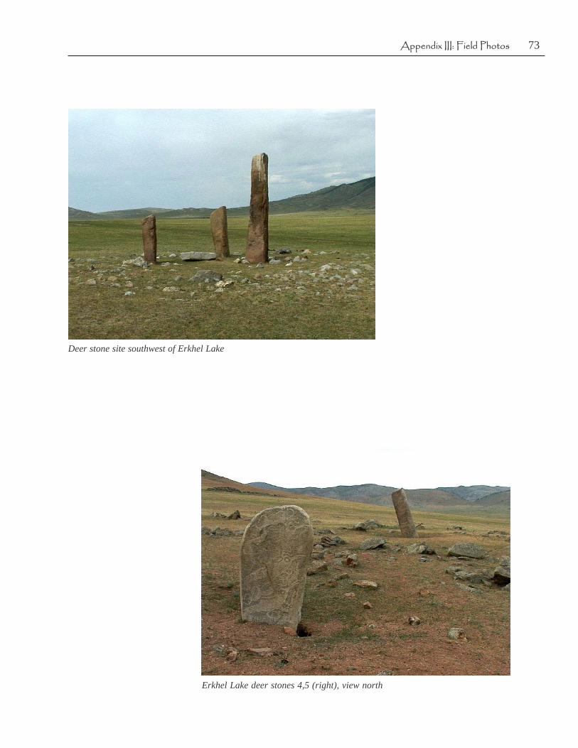
73Appendix III: Field Photos
Deer stone site southwest of Erkhel Lake
Erkhel Lake deer stones 4,5 (right), view north

74 The Hovsgol Deer Stone Project, 2001-2002
Sanjiamiatov at Erkhel Lake site, Deer Stone 5
Crew at site near Erkhel Lake

75Appendix III: Field Photos
North of Ulaan Uul
Darkhat Valley view toward Lake Hovsgol Range

76 The Hovsgol Deer Stone Project, 2001-2002
Darkhat Valley ford
Soyö military briefing with Tsaatan

77Appendix III: Field Photos
Tsaatan at Soyö
Tsaatan man and horse at Soyö

78 The Hovsgol Deer Stone Project, 2001-2002
At Soya with Biayandalai, Bayara, Adiyabold
Tsaatan shaman’s son, Bayara, at Soyö

79Appendix III: Field Photos
Soyö Neolithic site, view to NW
Paula DePriest and Steven Young prepare to ride at Soyö

80 The Hovsgol Deer Stone Project, 2001-2002
Travel camp- Tsaatan shelter- Bayara and Sanjim
Tsaatan camp en route to tundra

81Appendix III: Field Photos
Travel camp
Wildflowers

82 The Hovsgol Deer Stone Project, 2001-2002
Tsaatan horses
Mingit Polog pithouse excavation in tundra

83Appendix III: Field Photos
Mingit Polog pithouse excavation
Mingit Polog pithouse excavation

84 The Hovsgol Deer Stone Project, 2001-2002
Paula and a Tsaatan family
Tsaatan group picture at Mingit Polog summer camp

85Appendix III: Field Photos
Tsaatan group
Tsaatan youngster
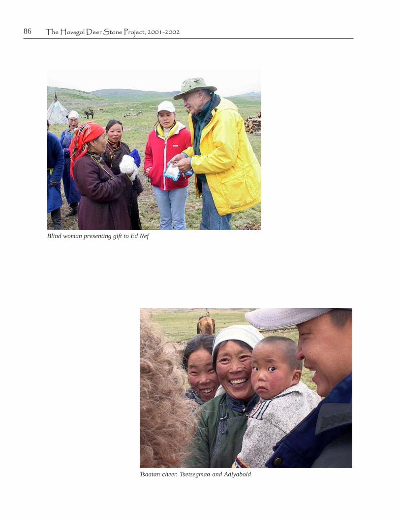
86 The Hovsgol Deer Stone Project, 2001-2002
Blind woman presenting gift to Ed Nef
Tsaatan cheer, Tsetsegmaa and Adiyabold

87Appendix III: Field Photos
In shaman’s tent- her daughter in law
In shaman’s tent- her son Bayara

88 The Hovsgol Deer Stone Project, 2001-2002
In shaman’s tent- Sanjiamiatov
In shaman’s tent, Tsendeekhuu

89Appendix III: Field Photos
In shaman’s tent- Sue Lutz
In shaman’s tent- Handaa

90 The Hovsgol Deer Stone Project, 2001-2002
In shaman’s tent- Sukhbaatar
Sukhbaatar reading the newspaper with Tsaatan

91Appendix III: Field Photos
Vandalized Rock art site at Soyö

92 The Hovsgol Deer Stone Project, 2001-2002
Soyö rock art site
Soyö rock art site

93Appendix III: Field Photos
Soyö rock art site
Darkhat Valley, Khugin-gol River - near rock art site

94 The Hovsgol Deer Stone Project, 2001-2002
Darkhat Valley - new bridge built by the Japanese this year
Lichen patterns at shaman’s cache site

95Appendix III: Field Photos
Shaman’s drum at cache site
Shaman’s cache site

96 The Hovsgol Deer Stone Project, 2001-2002
Shaman’s cache site area
Shaman’s cache site, drum hoop and metal accoutrements, left rear

97Appendix III: Field Photos
Shaman’s rattles and paraphenalia
S. Young and Sanjmiatov at Iron Age burial site near shaman’s cache site

98 The Hovsgol Deer Stone Project, 2001-2002
Erkhel Lake site mound
Large deer stone at Erkhel Lake
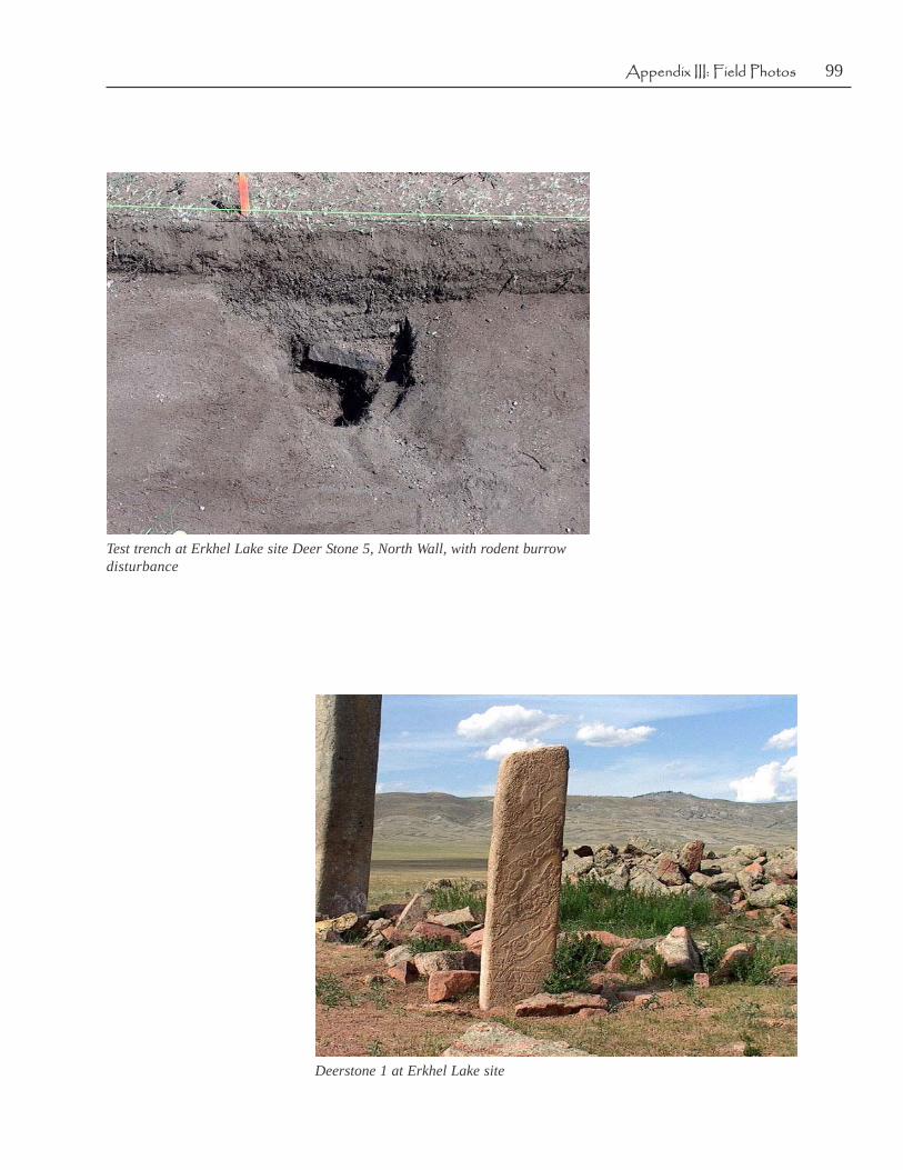
99Appendix III: Field Photos
Test trench at Erkhel Lake site Deer Stone 5, North Wall, with rodent burrowdisturbance
Deerstone 1 at Erkhel Lake site

100 The Hovsgol Deer Stone Project, 2001-2002
Looted burial mound at Erkhel Lake site, skull at pit bottom
Looted mound at Erkhel Lake site, view east
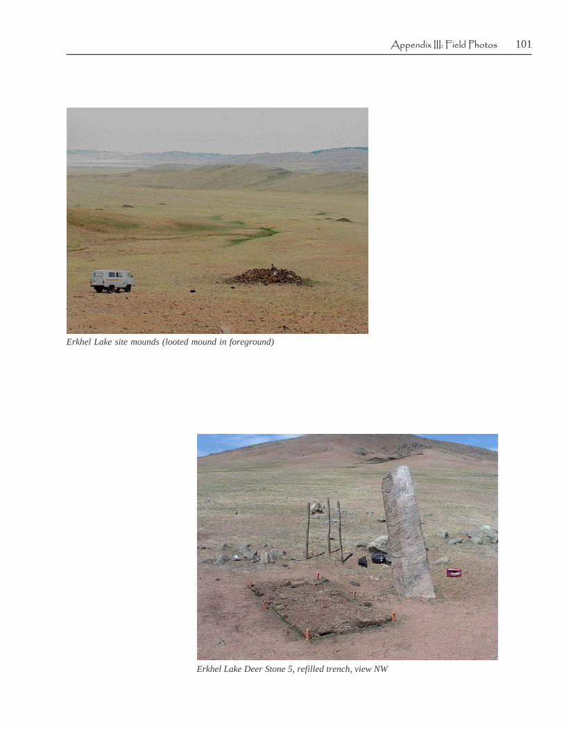
101Appendix III: Field Photos
Erkhel Lake site mounds (looted mound in foreground)
Erkhel Lake Deer Stone 5, refilled trench, view NW

102 The Hovsgol Deer Stone Project, 2001-2002
Erkhel Lake Deer Stone 1
Erkhel Lake Deer Stone 2

103Appendix III: Field Photos
Mingit Polog Pithouse site collection
Mingit Polog Pithouse site collection

104 The Hovsgol Deer Stone Project, 2001-2002
Mingit Polog Pithouse site collection
Soyö Neolithic site artifacts

105Appendix III: Field Photos
Soyö Neolithic site artifacts
Erkhel Lake marmot hole surface find


![NexPress Rpt Editable 6-28-11 · 2019. 1. 7. · NWZ \PZMM [KZMMVQVO [a[\MU[ KTI[[QK WX\QU]U IVL TQVM _Q\P \_W KWTWZ [MXIZI\QWV[ =+: IVL /+: IZM KZMI\ML .WZ =VQ^MZ[IT 1++ XZWÅTM](https://img.pdfslide.us/doc/110x75/610a68546812ed1e080036a5/nexpress-rpt-editable-6-28-11-2019-1-7-nwz-pzmm-kzmmvqvo-amu-ktiqk.jpg)

![FFU ,SJTUJO -VOB KPVSOBMJTU CZ USBEF 4PVUIFSOFS CZ … · ;]zm )v qvnt]mvkmz kiuxiqov q[ i ozmi\ _ia \w [xzmil \pm um[[iom ijw]\ aw]z jzivl wz lm[\qvi\qwv qv iv i]\pmv\qk ^wqkm \pzw]op](https://img.pdfslide.us/doc/110x75/6103bee113764f68441058a2/ffu-sjtujo-vob-kpvsobmjtu-cz-usbef-4pvuifsofs-cz-zm-v-qvntmvkmz-kiuxiqov-q.jpg)


![Hkw] ?kk] Qk]](https://img.pdfslide.us/doc/110x75/5a8368347f8b9a38478ebcef/hkw-kk-qk-k-s-ks-hkk-hkh-hkw-kk-qk-k-gem-000611-mrigashira-3.jpg)