Embed Size (px)
Citation preview

Supplementary Report to the Arrow LNG Plant EIS Arrow LNG Plant
Coffey Environments 7033_16_Ch03_v3.doc
3-1
3. ASSESSMENT OF ALTERNATIVES
The Arrow LNG Plant Environmental Impact Statement (EIS) (Coffey Environments, 2012) described the range of alternatives considered by Arrow Energy when developing the Arrow LNG Plant. This included alternative sites for the LNG plant and ancillary infrastructure, including the LNG jetty, materials offloading facility (MOF), mainland launch facility and temporary workers accommodation facility (TWAF), the feed gas pipeline route and construction method, and dredge spoil disposal sites. The advantages and disadvantages of each alternative site or option were evaluated, and a shortlist of sites and options was assessed in the EIS.
The EIS assessed those options taken forward in the project front-end engineering design (FEED) study. This chapter discusses the options that have been discontinued, retained, or added to the project. They are summarised in Table 3.1 and described below.
Table 3.1 Summary of alternatives
Site or Infrastructure
Options Presented in the EIS Options Presented in the Supplementary Report
Ancillary Infrastructure Sites and Options
Materials offloading facility (MOF)
• Boatshed Point (preferred site)
• Hamilton Point South
• Hamilton Point (Gladstone LNG Project (GLNG))
• Boatshed Point (preferred)
• Hamilton Point (GLNG)
Pioneer mainland launch site
Not defined at the time of writing the EIS.
Passengers, equipment and materials:
• Mission Landing and other landing facilities, Gladstone Marina
• Auckland Point/Barney Point
• Other LNG project facilities
Bulk materials:
• Mission Landing and other landing facilities, Gladstone Marina
• Fishermans Landing
• Other LNG project facilities
Pioneer landing site (Curtis Island)
Not defined at the time of writing the EIS.
• GLNG’s pioneer ramp on Hamilton Point
• Gladstone Area Water Board (GAWB) ramp on Hamilton Point
• Pioneer ramp on Boatshed Point
Mainland launch site
• Launch site 1: Calliope River (preferred site)
• Launch site 4N: Western Basin Reclamation Area
• Launch site 1 (preferred)
• Launch site 4N
Mainland launch site access road
Not defined at the time of writing the EIS.
• Option 1: Existing access road
• Option 2: New road west of Calliope River Sewage Treatment Plant
• Option 3: Combination of existing access road and Option 2

Supplementary Report to the Arrow LNG Plant EIS Arrow LNG Plant
Coffey Environments 7033_16_Ch03_v3.doc
3-2
Table 3.1 Summary of alternatives (cont’d)
Site or Infrastructure
Options Presented in the EIS Options Presented in the Supplementary Report
Ancillary Infrastructure Sites and Options (cont’d)
Mainland accommodation and laydown areas
• TWAF 7 (accommodation, laydown, staging)
• TWAF 8 (accommodation, laydown)
• Third-party accommodation facility
• Red Rover Road (accommodation, staging, carparking and laydown)
• TWAF 8 (accommodation, laydown)
• TWAF 7 (laydown, carparking and staging)
Ancillary Infrastructure Options
LNG plant power • Base case: all mechanical drive
• Option 1: mechanical/electrical configuration A
• Option 2: mechanical/electrical configuration B
• Option 3: all electrical drive
• Mechanical/electrical (Partial Auxiliary Import Power Mode) (preferred)
• All mechanical (power island mode)
Water supply • Desalination plant to treat seawater
• Mains water supply (GAWB pipeline) referred to as an option undergoing feasibility
• Mains water supply (GAWB pipeline) (preferred)
• Desalination plant to treat seawater
Wastewater treatment system
• Effluent treatment plant
• Controlled discharge facility
• Gladstone Regional Council (GRC) category A and category B sewer mains (preferred)
• Effluent treatment plant
• Controlled discharge facility
3.1 Materials Offloading Facility
Boatshed Point has been confirmed as the preferred location of the MOF and passenger jetty. Its proximity to the LNG plant site and construction camp located on the northern part of Boatshed Point offer significant advantages for personnel, equipment and materials logistics over the other options investigated. The option to utilise the GLNG MOF and associated haul road is still under consideration. Hamilton Point South has been discontinued as an option, as the land use may constrain potential future port development at Hamilton Point as proposed in the Gladstone Ports Corporation 50 Year Strategic Plan 2012 update (GPC, 2012a).
3.2 Pioneer Mainland Launch Site
The EIS referred to the need for a pioneer mainland launch site and potential options had not been identified at that time. The FEED study has identified a range of options (Figure 3.1) to satisfy the early works phase of the project, including:
• Mission Landing at Gladstone Marina, Auckland Point/Barney Point or both for passengers, materials and equipment.
• Mission Landing at Gladstone Marina, Fishermans Landing adjacent to the Australia Pacific LNG Project mainland launch site or both for bulk materials.

Bruce Highway
Dawson Highway
Targi
nie R
oad
Gladstone-Mount Larcom Road
Glad
stone
-Ben
araby
Roa
d
Calliope
River
Port Curtis
Gladstone Marina
Maroon Group Calliope Camp
Auckland Point/Barney Point
MAC Services Group Cammiope Camp
GLNG-QCLNG bulk materials launch site
Potential accommodation, staging, carparking and laydown area (Red Rover Road)
GLNG mainlandlaunch site
Proposed laydown, carparking and staging area (TWAF 7)
Proposed launch site 1
Potential accommodation facility and laydown area (TWAF 8)
APLNG mainland launch site
Potential launch site 4N
Hamilton PointBoatshed PointFishermans Landing
Yarwun Gladstone
LEGEND
Railway
Road
Proposed Arrow Surat Pipeline
Project area
Mainland facility option
Mainland facility option
Western Basin Reclamation Area
Page size: A4Scale 1:125,000
Projection: GDA 94 MGA Zone 56
N
0 km 2
305 000
305 000
310 000
310 000
315 000
315 000
320 000
320 000
325 000
325 000
7 345
000
7 350
000
7 350
000
7 350
000
7 355
000
7 355
000
7 360
000
7 360
000
7 365
000
7 365
000
7370
000
7370
000
7375
000
7 375
000
Figure No:
3.17033CC_16_GIS114_v1_1
7033_16_F03.01_GIS_GL
10.12.2012Date:
File Name:
MXT:
Arrow LNG Plant
Arrow EnergyMainland facility options
Source:Place names, roads and railways from DME. Pipelines, proposed ancillary facilities and marine infrastructure from Arrow Energy.Project area and mainland facility options from Coffey Environments.Western Basin Reclamation Area from Gladstone Ports Corporation.Imagery from Nearmap (captured 7 August 2012).

Supplementary Report to the Arrow LNG Plant EIS Arrow LNG Plant
Coffey Environments 7033_16_Ch03_v3.doc
3-4
Gladstone Marina is currently being used for early works logistics by other LNG projects. As mainland launch facilities for those projects become established, capacity in Gladstone Marina will become available. Arrow Energy is negotiating access to facilities in Gladstone Marina for its early works.
Existing facilities and vacant land at Auckland Point/Barney Point are further options being investigated for the pioneer mainland launch site. Access to existing facilities and/or land/water frontage is dependent on negotiations with the facility operators and Gladstone Ports Corporation.
Berthing facilities are being established adjacent to the Australia Pacific LNG Project mainland launch facility at the site of the old barge landing facility at Fishermans Landing. Undeveloped land at Fishermans Landing provides an opportunity for establishment of a bulk materials launch facility at that site.
Further opportunities are the mainland launch facilities developed for the other LNG projects at Fishermans Landing, Auckland Point/Barney Point and adjacent to the RG Tanna Coal Terminal. Options for use of these facilities are being considered and will be identified in consultation and negotiations with the owners and operators of those facilities.
The timing of early works will determine whether some or all of the proposed sites for the pioneer launch site will be required.
3.3 Pioneer Landing Site
A pioneer landing site on Curtis Island is required to facilitate establishment of other pioneer facilities on the island. The FEED study has identified a range of options (Figure 3.2) to satisfy the early works phase of the project including:
• GLNG’s pioneer ramp located just north of the GLNG MOF for passengers, equipment and materials.
• The GAWB ramp located on the southern tip of Hamilton Point for passengers, equipment and materials.
• A pioneer ramp to be constructed at Boatshed Point for passengers, equipment and materials. This ramp would eventually be decommissioned and replaced by the Boatshed Point MOF, which would encompass the pioneer facility.
The sites utilised for early works will be determined by the timing of early works with respect to existing activities at those sites and the outcome of negotiations with the facility owners and operators.
3.4 Mainland Launch Site
Launch site 1 remains Arrow Energy’s preferred mainland launch site. Launch site 4N located at the northern end of the Western Basin reclamation area, which is presently under construction, is still an option. The feasibility of this site will be dependent, in part, on the timing of completion of filling and stabilisation of the reclamation area, which is proceeding from south to north.

Port Curtis
Proposed pioneer ramp
GAWB ramp
GLNG pioneer ramp
GLNG pioneer MOF
GLNG MOF
Proposed MOF and integrated personnel jetty
Arrow LNG Plant
ProposedLNG jetty
Hamilton Point
Boatshed Point
Curtis Island
North China Bay
LEGEND
Arrow LNG Plant site boundaryGladstone LNG Project haul road and marine facilitiesProposed LNG plant layout
Project areaPage size: A4Scale 1:15,000
Projection: GDA 94 MGA Zone 56
N
0 m 200
317 500
317 500
318 000
318 000
318 500
318 500
319 000
319 000
319 500
319 500
320 000
320 000
320 500
320 500
321 000
321 000
7 367
000
7 367
000
7 367
500
7 367
500
7 368
000
7 368
000
7 368
500
7 368
500
7 369
000
7 369
000
Figure No:
3.27033CC_16_GIS127_v1_2
7033_16_F03.02_GIS_GL
10.12.2012Date:
File Name:
MXD:
Source:Property boundary, proposed auxiliary facilities and marine infrastructure from Arrow Energy.Project area and proposed landing sites from Coffey Environments.Imagery from Nearmap (captured 7 August 2012).
Potential pioneer landing sitesCurtis Island
Arrow Energy
Arrow LNG Plant

Supplementary Report to the Arrow LNG Plant EIS Arrow LNG Plant
Coffey Environments 7033_16_Ch03_v3.doc
3-6
3.5 Mainland Launch Site Access Options
Arrow Energy investigated five options for access to mainland launch site (launch site 1), which is located on the Calliope River behind the RG Tanna Coal Terminal. The options included access to the site from:
• The existing access road to the Calliope River Sewage Treatment Plant. • The roundabout at the Port Curtis Way–Red Rover Road intersection. • Alf O’Rourke Drive.
Options from the Port Curtis Way–Red Rover Road intersection and from Alf O’Rourke Drive were discounted as they involved railway crossings and, for one option, a crossing of the cooling water inlet channel of Gladstone Power Station.
Three options utilising the existing access road to the Calliope River Sewage Treatment Plant are still under consideration. They are shown in Figure 3.3 and described below.
Option 1 is the existing access road that passes south and east of the sewage treatment plant before running north between existing and former ash ponds to the proposed mainland launch site adjacent to the RG Tanna Coal Terminal.
Option 2 is a new road that would pass west of the sewage treatment plant and Clinton ash ponds (current Gladstone Power Station ash disposal ponds) before joining Option 1 at the southern boundary of the proposed mainland launch site.
Option 3 adopts the alignment of Option 2 as it passes west of the sewage treatment plant, after which it passes between the sewage treatment plant and Clinton ash ponds to join Option 1 (near the Gladstone Power Station rail loop), which it then follows to the proposed mainland launch site.
Each option has its advantages and disadvantages, and these are being evaluated by Arrow Energy to determine the preferred option.
The existing access road is the most direct route to the proposed mainland launch site. However, it may need to be upgraded to a dual carriageway in the vicinity of the sewage treatment plant. Buildings and pipeline and rail infrastructure constrain Option 1 where it passes east of the sewage treatment plant between workshops and loading bays and the Gladstone power station rail loop. This option presents a number of issues, particularly in the vicinity of the loading bays where people and heavy vehicles are operating in proximity to the proposed access road.
Options 2 and 3 involve minor reclamation of intertidal mudflats and removal of mangroves in previously undisturbed areas, as well as potential impacts on the current Gladstone Power Station settling ponds.

Calliope River
RG Tanna Coal Terminal
Alf O'Rourke Drive
Gladstone-Mount Larcom Road (Port Curtis Way)
Clinton ash ponds
Proposed launch site 1
GladstonePower Station
Calliope RiverSewage
Treatment Plant
RG Ta
nna C
oal T
ermina
l rail l
oop
Gladst
one Power Station rail loop
LEGENDProposed launch site 1 layoutProposed access road option 1Proposed access road option 2Proposed access road option 3Existing rail lineProposed access channel
Proposed Arrow LNG dredge extent
Project area
Page size: A4Scale 1:12,500
Projection: GDA 94 MGA Zone 56
N
0 m 200
318000
318000
318500
318500
319000
319000
319500
319500
7361
500
7361
500
7362
000
7362
000
7362
500
7362
500
7363
000
7363
000
7363
500
7363
500
7364
000
7364
000
Figure No:
3.37033CC_16_GIS011_v1_1
7033_16_F03.03_GIS_VS
10.12.2012Date:
File Name:
MXT:
Arrow LNG Plant
Arrow EnergyAccess options for launch site 1
Source:Roads from DME.Proposed access roads, existing railway and access channels from Arrow Energy.Project area from Coffey Environments.Imagery from Nearmap (captured 7 August 2012).
Supplementary Report to the Arrow LNG Plant EIS Arrow LNG Plant
Coffey Environments 7033_16_Ch03_v3.doc
3-8
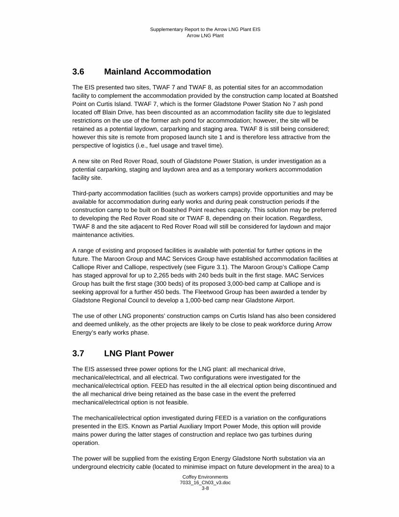
3.6 Mainland Accommodation
The EIS presented two sites, TWAF 7 and TWAF 8, as potential sites for an accommodation facility to complement the accommodation provided by the construction camp located at Boatshed Point on Curtis Island. TWAF 7, which is the former Gladstone Power Station No 7 ash pond located off Blain Drive, has been discounted as an accommodation facility site due to legislated restrictions on the use of the former ash pond for accommodation; however, the site will be retained as a potential laydown, carparking and staging area. TWAF 8 is still being considered; however this site is remote from proposed launch site 1 and is therefore less attractive from the perspective of logistics (i.e., fuel usage and travel time).
A new site on Red Rover Road, south of Gladstone Power Station, is under investigation as a potential carparking, staging and laydown area and as a temporary workers accommodation facility site.
Third-party accommodation facilities (such as workers camps) provide opportunities and may be available for accommodation during early works and during peak construction periods if the construction camp to be built on Boatshed Point reaches capacity. This solution may be preferred to developing the Red Rover Road site or TWAF 8, depending on their location. Regardless, TWAF 8 and the site adjacent to Red Rover Road will still be considered for laydown and major maintenance activities.
A range of existing and proposed facilities is available with potential for further options in the future. The Maroon Group and MAC Services Group have established accommodation facilities at Calliope River and Calliope, respectively (see Figure 3.1). The Maroon Group’s Calliope Camp has staged approval for up to 2,265 beds with 240 beds built in the first stage. MAC Services Group has built the first stage (300 beds) of its proposed 3,000-bed camp at Calliope and is seeking approval for a further 450 beds. The Fleetwood Group has been awarded a tender by Gladstone Regional Council to develop a 1,000-bed camp near Gladstone Airport.
The use of other LNG proponents’ construction camps on Curtis Island has also been considered and deemed unlikely, as the other projects are likely to be close to peak workforce during Arrow Energy’s early works phase.
3.7 LNG Plant Power
The EIS assessed three power options for the LNG plant: all mechanical drive, mechanical/electrical, and all electrical. Two configurations were investigated for the mechanical/electrical option. FEED has resulted in the all electrical option being discontinued and the all mechanical drive being retained as the base case in the event the preferred mechanical/electrical option is not feasible.
The mechanical/electrical option investigated during FEED is a variation on the configurations presented in the EIS. Known as Partial Auxiliary Import Power Mode, this option will provide mains power during the latter stages of construction and replace two gas turbines during operation.
The power will be supplied from the existing Ergon Energy Gladstone North substation via an underground electricity cable (located to minimise impact on future development in the area) to a

Supplementary Report to the Arrow LNG Plant EIS Arrow LNG Plant
Coffey Environments 7033_16_Ch03_v3.doc
3-9
point near the RG Tanna Coal Terminal. From there, power will be supplied via two high-voltage electricity cables installed in ducts in two horizontal directionally drilled holes that will extend approximately 2.2 km to Hamilton Point. The ducts will be installed on a similar alignment to the GAWB and GRC pipelines installed for water supply and wastewater disposal, respectively. The ducts will be installed approximately 60 m below the seabed and west of the ducts carrying the water pipes and sewer mains. On Curtis Island, the underground electricity cables will be laid in an easement west of the GAWB and GRC lines to minimise clearing and impact on future development.
3.8 Water Supply
The EIS referred to the supply of mains water to Curtis Island via a pipeline installed by GAWB as an option undergoing feasibility. This option has since progressed beyond feasibility and is now Arrow Energy’s preferred water supply option. However, in the event that mains water becomes unavailable or restricted (e.g., in a time of drought), Arrow Energy will retain the option to develop a desalination plant to ensure the plant is self-sufficient. Consequently, a desalination plant remains a water supply option for the proposed LNG plant.
3.9 Wastewater Treatment System
The project design now includes the option to dispose of wastewater via GRC’s sewer mains installed under Port Curtis. Two sewer mains have been installed, one for category A waste and one for category B waste. The sewer mains will have a capacity of 864 m3 per day, which will be sufficient to meet peak demand for both the LNG plant and construction camp.
While Arrow Energy’s preferred wastewater disposal option is disposal by GRC sewer mains Arrow Energy will retain the option to develop an effluent treatment plant in the event the preferred option becomes unavailable. Consequently, an effluent treatment plant remains a wastewater treatment and disposal option for the proposed LNG plant.

Supplementary Report to the Arrow LNG Plant EIS Arrow LNG Plant
Coffey Environments 7033_16_Ch03_v3.doc
3-10