Embed Size (px)
Citation preview

2010:The Year the Geospatial
Industry Came of Age
David DiBiase, CMS, GISPPenn State University National Geospatial Technology Center
Rocket City Geospatial ConferenceHuntsville ALNovember 17, 2010
Sponsors include the National Science Foundation’s Advanced Technological Education program [DUE #0801893]. Author’s opinions are not necessarily shared by NSF.
“Just as nobody likes a wiseguy, nobody likes a
definition.” Davis, Michael (2002). Ethics and the University. New York: Routledge.
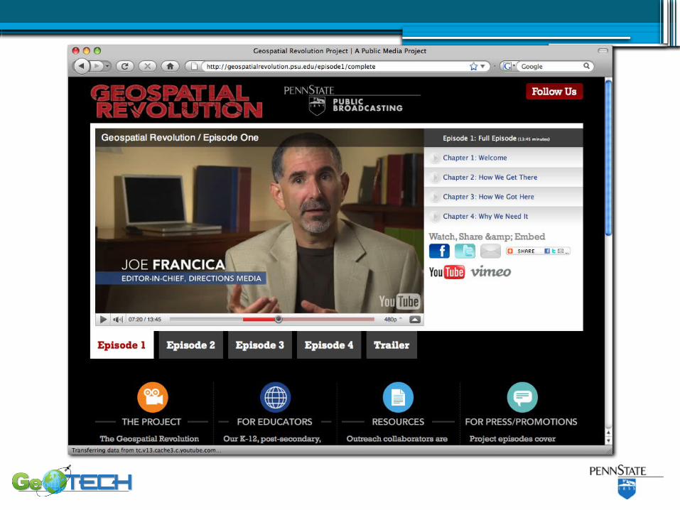
1.Six new geospatial occupations established
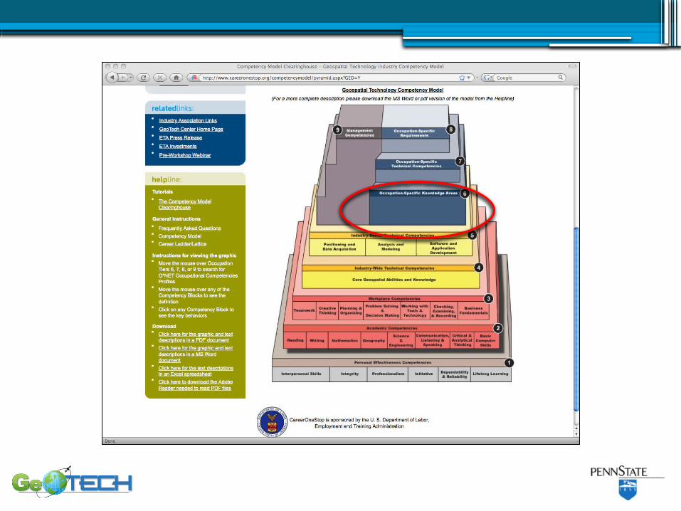
2.New Geospatial Technology Competency Model (GTCM) published
Two important developments at DOLETA
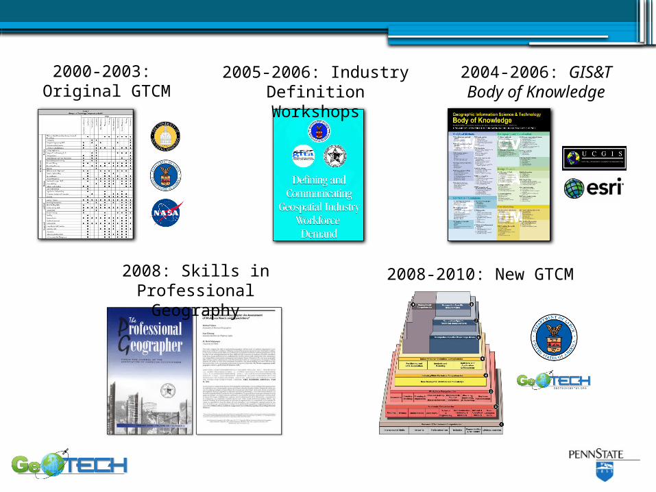
2000-2003: Original GTCM
2005-2006: IndustryDefinition Workshops
2004-2006: GIS&TBody of Knowledge
2008: Skills in Professional Geography
2008-2010: New GTCM
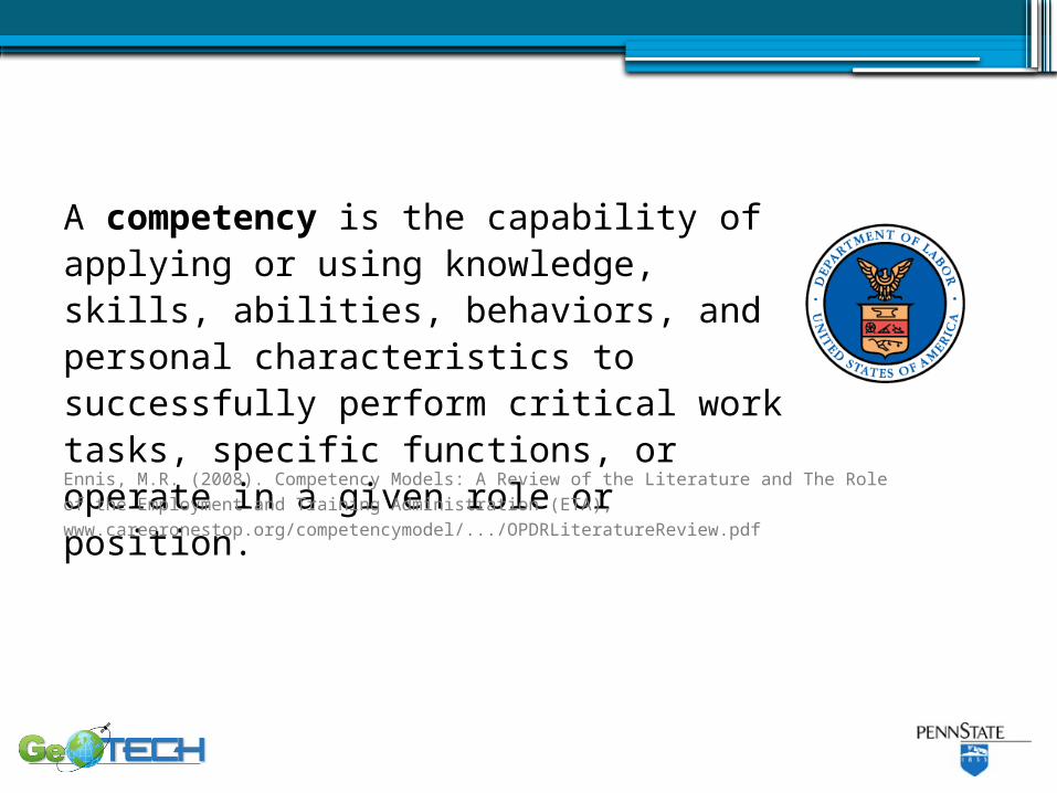
A competency is the capability of applying or using knowledge, skills, abilities, behaviors, and personal characteristics to successfully perform critical work tasks, specific functions, or operate in a given role or position.Ennis, M.R. (2008). Competency Models: A Review of the Literature and The Role of the Employment and Training Administration (ETA), www.careeronestop.org/competencymodel/.../OPDRLiteratureReview.pdf
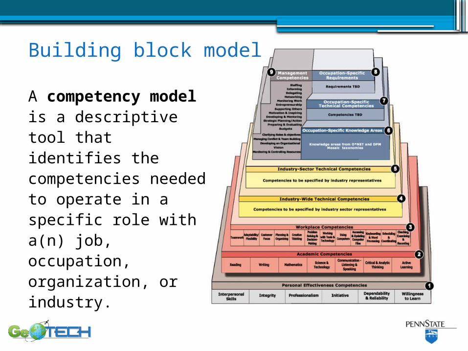
A competency model is a descriptive tool that identifies the competencies needed to operate in a specific role with a(n) job, occupation, organization, or industry.
Building block model
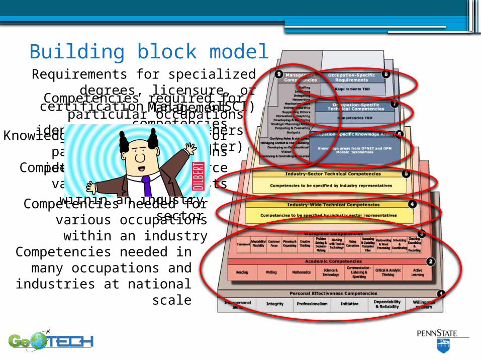
Competencies needed in many occupations and
industries at national scale
Competencies needed for various occupations within
an industry
Competencies needed for various occupations within
an industry sector
Competencies required for particular occupations identified
by DoL partners (e.g., GeoTech Center)
Requirements for specialized degrees, licensure, or certification
(e.g., GISCI)
Knowledge areas required for particular occupations identified
by workforce analysts
Management competencies
Building block model
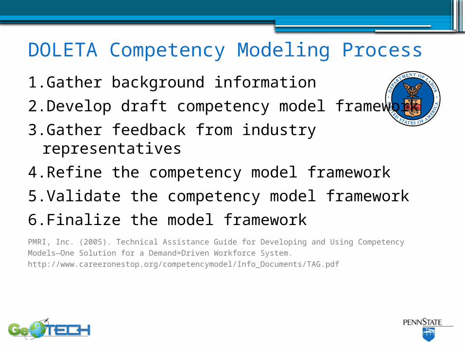
1.Gather background information
2.Develop draft competency model framework
3.Gather feedback from industry representatives
4.Refine the competency model framework
5.Validate the competency model framework
6.Finalize the model framework
DOLETA Competency Modeling Process
PMRI, Inc. (2005). Technical Assistance Guide for Developing and Using Competency Models—One Solution for a Demand=Driven Workforce System. http://www.careeronestop.org/competencymodel/Info_Documents/TAG.pdf
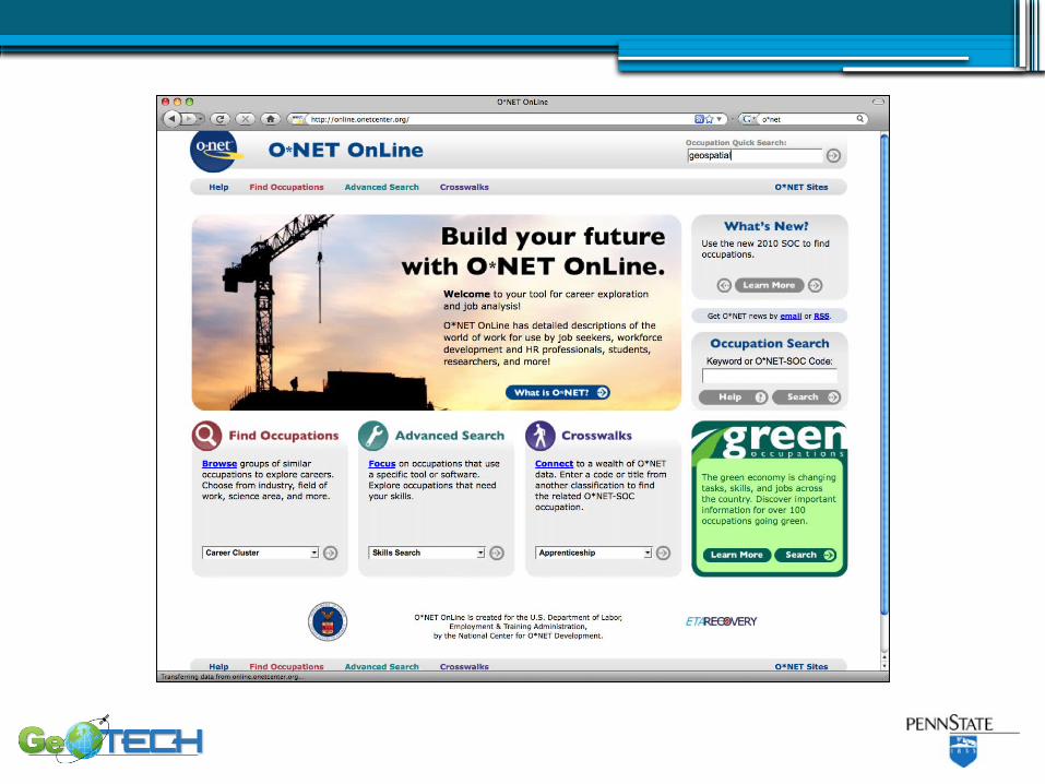
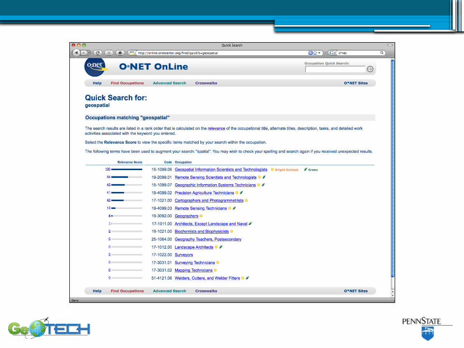
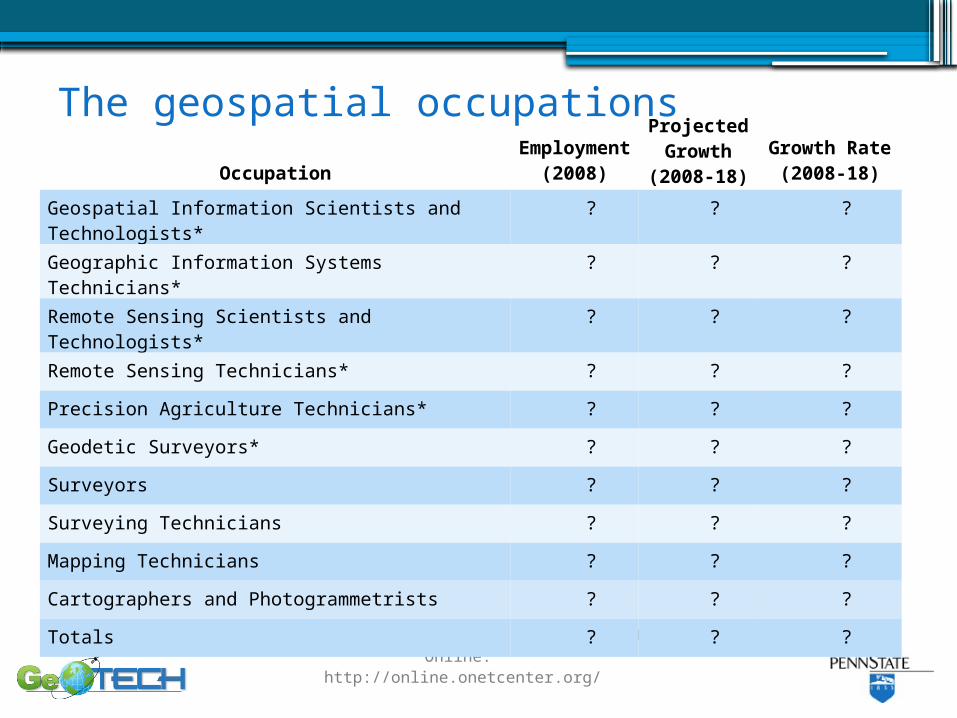
The geospatial occupations
Department of Labor Employment and Training Administration (2010). O*Net Online. http://online.onetcenter.org/
Occupation
Employment
(2008)
Projected Growth
(2008-18)
Growth Rate
(2008-18)
Geospatial Information Scientists and Technologists*
? ? ?
Geographic Information Systems Technicians* ? ? ?
Remote Sensing Scientists and Technologists* ? ? ?
Remote Sensing Technicians* ? ? ?
Precision Agriculture Technicians* ? ? ?
Geodetic Surveyors* ? ? ?
Surveyors ? ? ?
Surveying Technicians ? ? ?
Mapping Technicians ? ? ?
Cartographers and Photogrammetrists ? ? ?
Totals ? ? ?
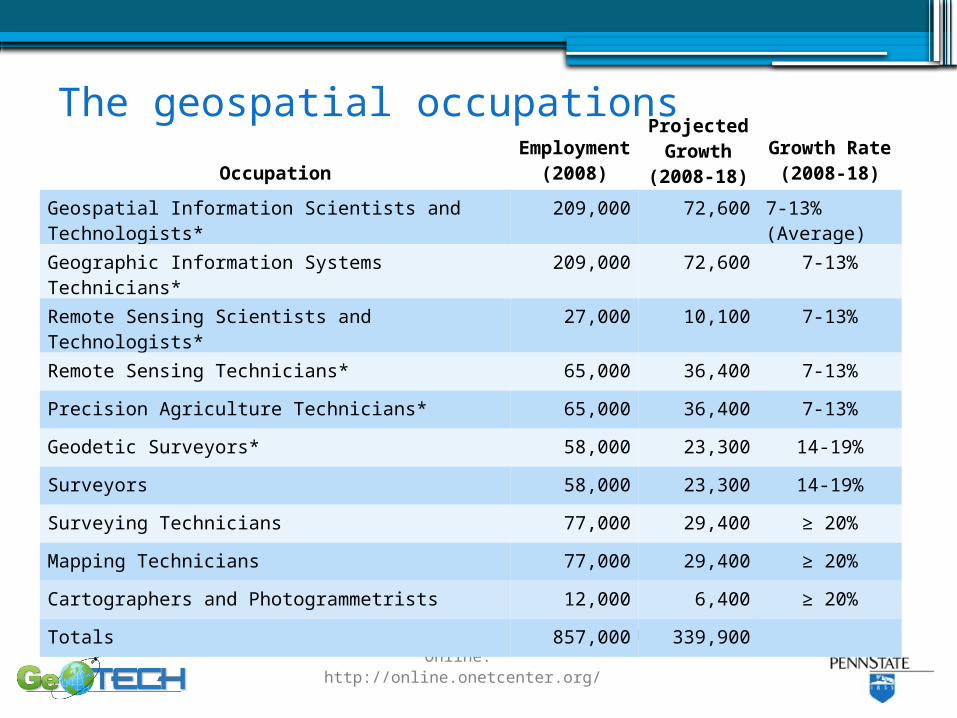
The geospatial occupations
Department of Labor Employment and Training Administration (2010). O*Net Online. http://online.onetcenter.org/
Occupation
Employment
(2008)
Projected Growth
(2008-18)
Growth Rate
(2008-18)
Geospatial Information Scientists and Technologists*
209,000 72,600 7-13% (Average)
Geographic Information Systems Technicians* 209,000 72,600 7-13%
Remote Sensing Scientists and Technologists* 27,000 10,100 7-13%
Remote Sensing Technicians* 65,000 36,400 7-13%
Precision Agriculture Technicians* 65,000 36,400 7-13%
Geodetic Surveyors* 58,000 23,300 14-19%
Surveyors 58,000 23,300 14-19%
Surveying Technicians 77,000 29,400 ≥ 20%
Mapping Technicians 77,000 29,400 ≥ 20%
Cartographers and Photogrammetrists 12,000 6,400 ≥ 20%
Totals 857,000 339,900
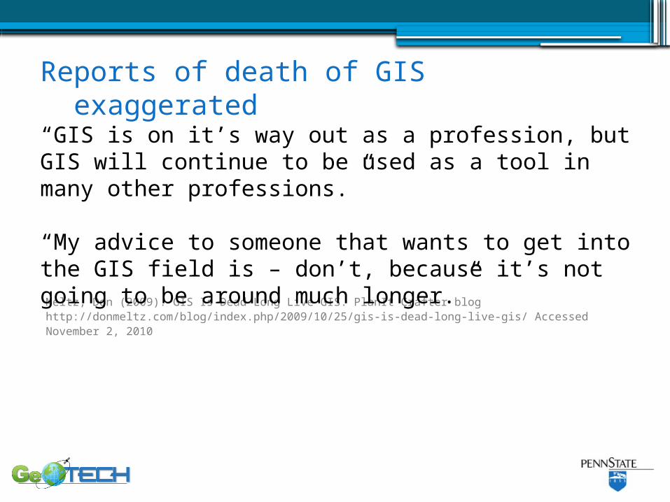
Meltz, Don (2009). GIS Is Dead–Long Live GIS. PlanIt Crafter blog http://donmeltz.com/blog/index.php/2009/10/25/gis-is-dead-long-live-gis/ Accessed November 2, 2010
“GIS is on it’s way out as a profession, but GIS will continue to be used as a tool in many other professions.”
“My advice to someone that wants to get into the GIS field is – don’t, because it’s not going to be around much longer.”
Reports of death of GIS exaggerated
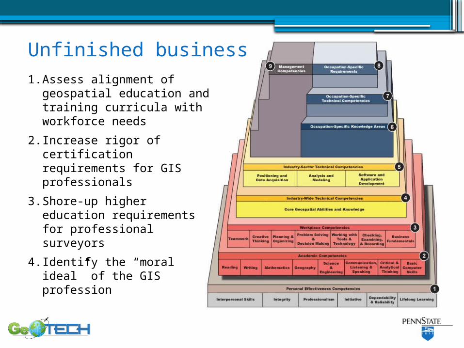
1. Assess alignment of geospatial education and training curricula with workforce needs
2. Increase rigor of certification requirements for GIS professionals
3. Shore-up higher education requirements for professional surveyors
4. Identify the “moral ideal” of the GIS profession
Unfinished business
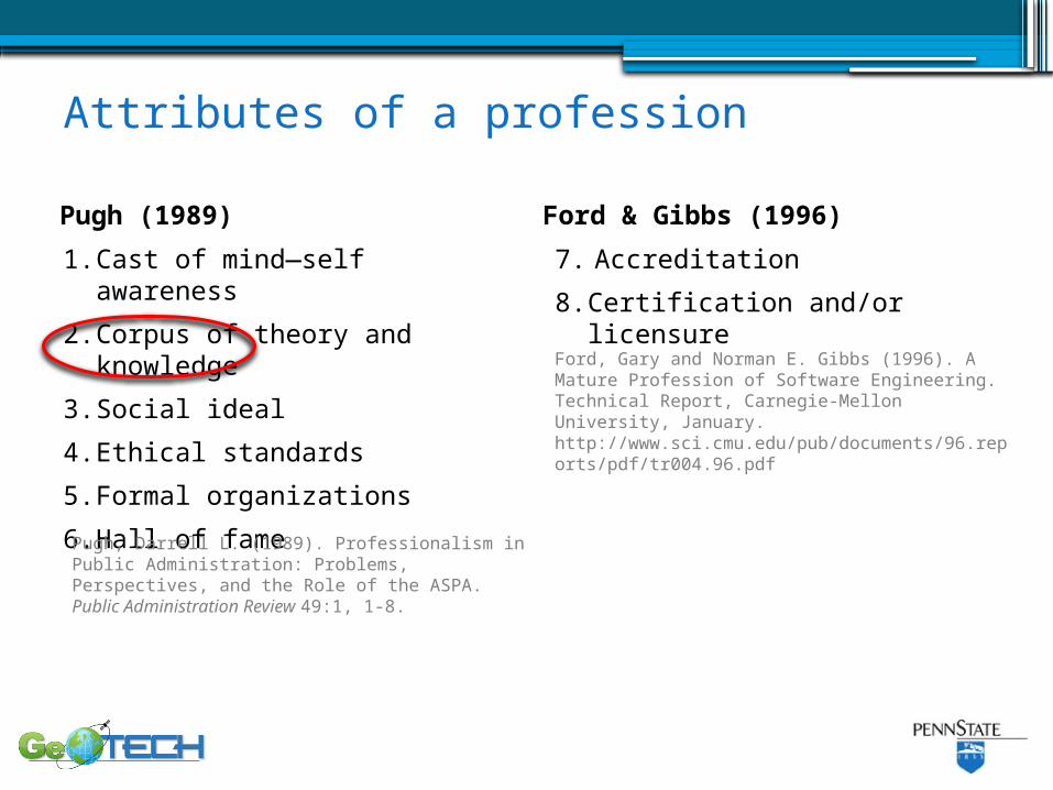
1. Cast of mind—self awareness
2. Corpus of theory and knowledge
3. Social ideal
4. Ethical standards
5. Formal organizations
6. Hall of fame
Attributes of a profession
Pugh (1989)
7. Accreditation
8. Certification and/or licensure
Ford & Gibbs (1996)
Pugh, Darrell L. (1989). Professionalism in Public Administration: Problems, Perspectives, and the Role of the ASPA. Public Administration Review 49:1, 1-8.
Ford, Gary and Norman E. Gibbs (1996). A Mature Profession of Software Engineering. Technical Report, Carnegie-Mellon University, January. http://www.sci.cmu.edu/pub/documents/96.reports/pdf/tr004.96.pdf
What is the GIS profession’s moral ideal?
“A profession is a number of individuals in the same occupation voluntarily organized to earn a living by openly serving a certain moral ideal in a morally-permissible way…”
Davis, Michael (1999). Profession, Code, and Ethics. Burlington VT: Ashgate, p. 3.
2010:The Year the Geospatial
Industry Came of Age
David DiBiase, CMS, GISPPenn State University National Geospatial Technology Center
Rocket City Geospatial ConferenceHuntsville ALNovember 17, 2010
Sponsors include the National Science Foundation’s Advanced Technological Education program [DUE #0801893]. Author’s opinions are not necessarily shared by NSF.