Embed Size (px)
Citation preview
NATIONAL OCEANIC AND ATMOSPHERIC ADMINISTRATION
Fourth Interim, Partial Claim for Assessment and Restoration Planning Costs
20 April 2010 Deepwater Horizon (MC252) Incident
Submitted By: Troy L. Baker Jeff Smith NOAA Assessment & Restoration Division NOAA Restoration Center 7600 Sand Point Way NE 1315 East West Highway, Room 14716 Seattle, Washington 98115 Silver Spring, MD 20910 206-526-6606 301-427-8648 Dr. Robert Haddad Chris Doley Chief, NOAA Assessment & Restoration Division Chief, NOAA Restoration Center 1305 East-West Highway, SSMC4 Room 10128 1315 East-West Highway, SSMC3 Silver Spring, MD 20910 Silver Spring, MD 20910 301-713-4248 301-427-8660
October 3, 2014
TABLE OF CONTENTS
Executive Summary ...................................................................................................... 6 Claimant eligibility ...................................................................................................... 9 Co-Trustee Coordination ............................................................................................ 9
Uncertainty of Co-Trustee Interactions .......................................................... 10 BP Funding Interactions ................................................................................ 11
Responsible Party Information ................................................................................. 11 Determination of Jurisdiction .................................................................................... 11 Time Limitations on Claims ...................................................................................... 11 Legal Action ............................................................................................................. 11 Claim Presentation ................................................................................................... 12 Overview of Assessment Approach ......................................................................... 12 Unified Data Management Approach ....................................................................... 14 Restoration Planning Approach ............................................................................... 14
Injury Assessment Activities ..................................................................................... 15 A. Water Column ..................................................................................................... 15 B. Marine Mammals ................................................................................................ 16 C. Shoreline ............................................................................................................ 19 D. Oysters ............................................................................................................... 22 E. Chemistry: Long-Term Sample Management and Archive ................................. 24 F. Carcass Storage and Carcass Disposal ............................................................. 25 G. Total Value ......................................................................................................... 26 H. Restoration Planning Activities ........................................................................... 27
Leadership, Management and Oversight ....................................................... 27 Finance ......................................................................................................... 28 Damage Assessment and Restoration Plan (DARP), Programmatic Environmental Impact Statement (PEIS), and Associated Regulatory Compliance ................................................................................................... 29 Data Management ......................................................................................... 31 Communications ........................................................................................... 32
References ................................................................................................................... 34 Attachments ................................................................................................................ 35
LIST OF TABLES Table 1. Summary of activity costs and labor effort by injury assessment and restoration procedure......................................................................................................................................... 8 LIST OF ATTACHMENTS Attachment A-1. List of Final Signed Work Plans Posted on NOAA’s Gulf Spill Restoration Website as of July 18, 2014 (NOAA 2014) Attachment A-2. Signed Work Plans Since October 30, 2013 Attachment A-3. List of PI’s and Other Expert Staff Attachment A-4 Supplemental Budget Tables Attachment A-5. Restoration Planning Background Materials Attachment A-6. Selected Peer-Reviewed Manuscripts
LIST OF ACRONYMS AND ABBREVIATIONS
Acronym Definition
Anadarko Anadarko Petroleum
Anadarko E&P Anadarko E&P Company LP
BIA Bureau of Indian Affairs
BLM Bureau of Land Management
BP BP Exploration and Production, Inc.
Claim Fourth Interim, Partial Claim for Assessment and Restoration Planning Costs
CY calendar year
DARP Damage Assessment and Restoration Plan
DISL Dauphin Island Sea Lab
DIVER Data Integration, Visualization, Exploration, and Reporting
DMT Data Management Team
DOC Department of Commerce
DOD U.S. Department of Defense
DOI U.S. Department of the Interior
DWH Deepwater Horizon
EFH Essential Fish Habitat
EPA Environmental Protection Agency
ESA Endangered Species Act
FTE Full time equivalent
GIS Geographic Information System
GOM Gulf of Mexico
IEc Industrial Economics, Incorporated
Incident Deepwater Horizon oil spill
IPC Interim Partial Claim
IT Information Technology
km kilometers
KSA Knox Storage Archive
LiDAR Light Detection and Ranging
MC252 Deepwater Horizon/Mississippi Canyon 252
MMPA Marine Mammal Protection Act
MOEX MOEX Offshore 2007 LLC
MSA Magnuson-Stevens Fishery Conservation and Management Act
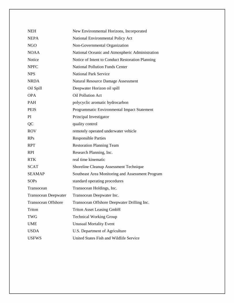
NEH New Environmental Horizons, Incorporated
NEPA National Environmental Policy Act
NGO Non-Governmental Organization
NOAA National Oceanic and Atmospheric Administration
Notice Notice of Intent to Conduct Restoration Planning
NPFC National Pollution Funds Center
NPS National Park Service
NRDA Natural Resource Damage Assessment
Oil Spill Deepwater Horizon oil spill
OPA Oil Pollution Act
PAH polycyclic aromatic hydrocarbon
PEIS Programmatic Environmental Impact Statement
PI Principal Investigator
QC quality control
ROV remotely operated underwater vehicle
RPs Responsible Parties
RPT Restoration Planning Team
RPI Research Planning, Inc.
RTK real time kinematic
SCAT Shoreline Cleanup Assessment Technique
SEAMAP Southeast Area Monitoring and Assessment Program
SOPs standard operating procedures
Transocean Transocean Holdings, Inc.
Transocean Deepwater Transocean Deepwater Inc.
Transocean Offshore Transocean Offshore Deepwater Drilling Inc.
Triton Triton Asset Leasing GmbH
TWG Technical Working Group
UME Unusual Mortality Event
USDA U.S. Department of Agriculture
USFWS United States Fish and Wildlife Service
EXECUTIVE SUMMARY
On April 20, 2010, an explosion and fire on the Deepwater Horizon (DWH) mobile offshore drilling unit resulted in 11 worker fatalities and discharges of oil and other substances from the rig and seabed wellhead into the Gulf of Mexico (GOM). Pursuant to section 1006 of the Oil Pollution Act (OPA), 33 U.S.C. §§ 2701, et seq., federal, state, and federally recognized tribes are Trustees for natural resources and are authorized to act on behalf of the public to: (1) assess natural resource injuries resulting from a discharge of oil or the substantial threat of a discharge and response activities and; (2) develop and implement a plan for restoration of such injured resources.
Immediately following the Deepwater Horizon/Mississippi Canyon 252 (MC252) Oil Spill, the affected Trustees initiated joint efforts to begin the collection and analysis of: (1) data reasonably expected to be necessary to make a determination of jurisdiction or a determination to conduct restoration planning; (2) ephemeral data; and (3) information needed to design or implement anticipated emergency restoration and assessment activities as part of the Restoration Planning Phase. In addition, pursuant to Natural Resource Damage Assessment (NRDA) regulations (15 CFR § 990.14), one of the identified Responsible Parties (RPs), BP Exploration and Production, Inc., “BP”, informed the Trustees of its intent to participate in the NRDA. As a result, the Trustees provided opportunities for BP to comment on Trustee-developed assessment plans and to participate in field work when the Trustees and BP reached a mutual agreement. As a condition of participation, BP is required to fund the joint plans. In this Fourth Interim, Partial Claim for Assessment and Restoration Planning Costs (Claim), the Deepwater Horizon/MC252 Oil Spill is referred to as “Oil Spill” or “Incident” which may include, as applicable, all Incident(s) related to the events of the explosion, fire and subsequent discharges of oil and other substances from the rig and wellhead on the seabed into the GOM.
Pursuant to the NRDA regulations applicable to OPA, 15 C.F.R. Part 990 (NRDA regulations), the Trustees issued a Notice of Intent to Conduct Restoration Planning (Notice). That Notice confirmed the Trustees were ready to proceed with restoration planning to fully evaluate, assess, and quantify and develop plans for restoring, replacing or acquiring the equivalent of natural resources and their services injured by and losses resulting from the Incident. The restoration planning process will include collection of information that the Trustees determine is appropriate for identifying and quantifying natural resource injuries and associated losses of resources and their services, and determination of the need for, and type and scale of, restoration actions.
This Claim document identifies assessment and restoration planning activities that the U.S. Department of Commerce (DOC), National Oceanic and Atmospheric Administration (NOAA) plans to implement to inform injury determination, injury quantification, and restoration selection activities associated with the Incident. The collection of activities identified in this Claim reflect consideration of the factors identified in 15 C.F.R. §990.27 (use of assessment procedures), §990.51 (injury determination) and §990.52 (injury quantification). The assessment activities also reflect consideration of data and analyses conducted during the pre-assessment phase of the NRDA. Restoration planning activities identified reflect consideration of the factors identified in 15 C.F.R. §990.53 (developing restoration alternatives), §990.54 (evaluation of alternatives), and §990.55 (developing restoration plans). NOAA also will be evaluating injury assessment and restoration planning and implementation records for inclusion into Administrative Record(s) (§990.61). Scientific information to support injury determination and quantification, although
NOAA’s Fourth Interim, Partial Claim for Assessment and Restoration Planning Costs 6
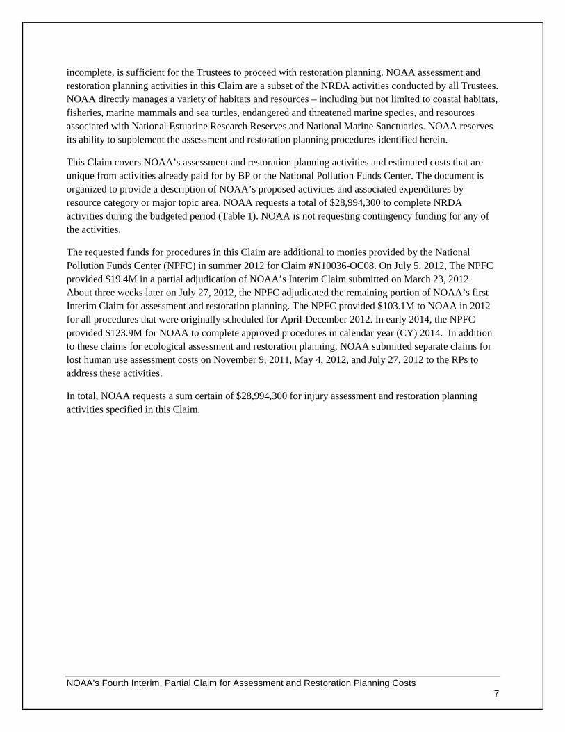
incomplete, is sufficient for the Trustees to proceed with restoration planning. NOAA assessment and restoration planning activities in this Claim are a subset of the NRDA activities conducted by all Trustees. NOAA directly manages a variety of habitats and resources – including but not limited to coastal habitats, fisheries, marine mammals and sea turtles, endangered and threatened marine species, and resources associated with National Estuarine Research Reserves and National Marine Sanctuaries. NOAA reserves its ability to supplement the assessment and restoration planning procedures identified herein.
This Claim covers NOAA’s assessment and restoration planning activities and estimated costs that are unique from activities already paid for by BP or the National Pollution Funds Center. The document is organized to provide a description of NOAA’s proposed activities and associated expenditures by resource category or major topic area. NOAA requests a total of $28,994,300 to complete NRDA activities during the budgeted period (Table 1). NOAA is not requesting contingency funding for any of the activities.
The requested funds for procedures in this Claim are additional to monies provided by the National Pollution Funds Center (NPFC) in summer 2012 for Claim #N10036-OC08. On July 5, 2012, The NPFC provided $19.4M in a partial adjudication of NOAA’s Interim Claim submitted on March 23, 2012. About three weeks later on July 27, 2012, the NPFC adjudicated the remaining portion of NOAA’s first Interim Claim for assessment and restoration planning. The NPFC provided $103.1M to NOAA in 2012 for all procedures that were originally scheduled for April-December 2012. In early 2014, the NPFC provided $123.9M for NOAA to complete approved procedures in calendar year (CY) 2014. In addition to these claims for ecological assessment and restoration planning, NOAA submitted separate claims for lost human use assessment costs on November 9, 2011, May 4, 2012, and July 27, 2012 to the RPs to address these activities.
In total, NOAA requests a sum certain of $28,994,300 for injury assessment and restoration planning activities specified in this Claim.
NOAA’s Fourth Interim, Partial Claim for Assessment and Restoration Planning Costs 7
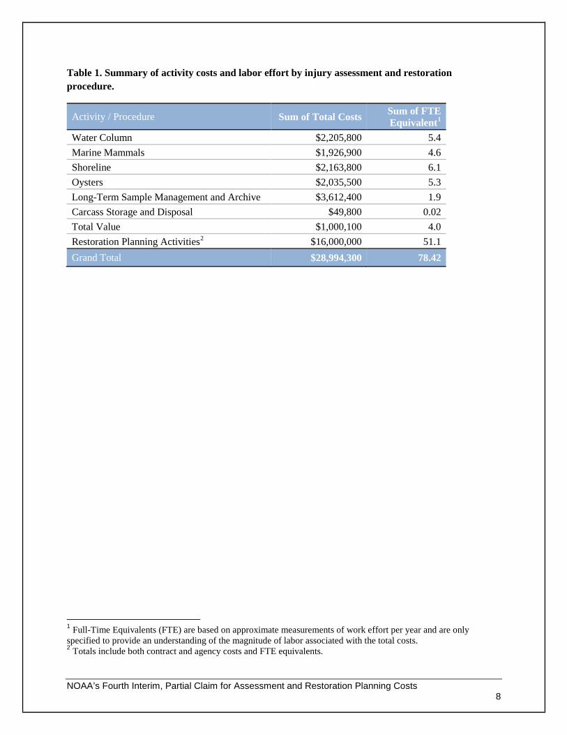
Table 1. Summary of activity costs and labor effort by injury assessment and restoration procedure.
Activity / Procedure Sum of Total Costs Sum of FTE Equivalent1
Water Column $2,205,800 5.4 Marine Mammals $1,926,900 4.6 Shoreline $2,163,800 6.1 Oysters $2,035,500 5.3 Long-Term Sample Management and Archive $3,612,400 1.9 Carcass Storage and Disposal $49,800 0.02 Total Value $1,000,100 4.0 Restoration Planning Activities2 $16,000,000 51.1 Grand Total $28,994,300 78.42
1 Full-Time Equivalents (FTE) are based on approximate measurements of work effort per year and are only specified to provide an understanding of the magnitude of labor associated with the total costs. 2 Totals include both contract and agency costs and FTE equivalents.
NOAA’s Fourth Interim, Partial Claim for Assessment and Restoration Planning Costs 8
Claimant eligibility The following entities are designated natural resource Trustees under OPA and are acting as Trustees for this Incident:
• NOAA, on behalf of the DOC; • the U.S. Department of Interior (DOI), as represented by the National Park Service (NPS), United
States Fish and Wildlife Service (USFWS), Bureau of Indian Affairs (BIA), and Bureau of Land Management (BLM);
• the Environmental Protection Agency (EPA); • the U.S. Department of Agriculture (USDA); • the U.S. Department of Defense (DOD); • the State of Louisiana's Coastal Protection and Restoration Authority, Oil Spill Coordinator's
Office, Department of Environmental Quality, Department of Wildlife and Fisheries and Department of Natural Resources;
• the State of Mississippi's Department of Environmental Quality; • the State of Alabama's Department of Conservation and Natural Resources and Geological Survey
of Alabama; • the State of Florida's Department of Environmental Protection; and Florida Fish and Wildlife
Conservation Commission; and • the State of Texas' Parks and Wildlife Department, General Land Office, and Commission on
Environmental Quality.
In addition to acting as Trustees for this Incident, the States of Louisiana, Mississippi, Alabama, Florida and Texas are also acting pursuant to their applicable state laws and authorities, including the Louisiana Oil Spill Prevention and Response Act of 1991, La. R.S. 30:2451 et seq., and accompanying regulations, La. Admin. Code 43: 10 1 et seq.; the Texas Oil Spill Prevention and Response Act, Tex. Nat. Res. Code, Chapter 40, Section 376.011 et seq., Fla. Statutes, and Section 403.161, Fla. Statutes; the Mississippi Air and Water Pollution Control Law, Miss. Code Ann. § § 49-17-1 through 49-17-43; and Alabama Code § § 9-2-1 et seq. and 9-4-1 et seq.
These Trustees may be potential claimants for the same injured natural resources (33 CFR §136.209 (c)).
Co-Trustee Coordination NOAA coordinates regularly with all the Trustees on the collection and interpretation of injury assessment data described in NRDA work plans. We also coordinate with Trustees on all aspects of restoration planning. In 2014 for injury assessment, a large focus of NOAA’s Claim was the preparation of draft technical reports that summarize injury findings in many of the major resource/habitat areas affected by the Oil Spill. These preliminary summaries of injury findings are necessary for us to discuss injury quantification approaches with Trustees that account for different types of documented injuries across resources and habitats, and spatial, temporal, and trophic scales. The process-oriented limitation of these initial technical summaries is that each “report” is necessarily focused on data in a narrow topic area (e.g., oyster larvae recruitment from long-term assessment monitoring at stations across Northern Gulf of
NOAA’s Fourth Interim, Partial Claim for Assessment and Restoration Planning Costs 9
Mexico). Our initial presentations of injury findings are not always in the form that might accompany a final restoration plan(s) for the Incident or reflect full Trustee consensus. Although we will present achievements in each of the funded activities per the NPFC’s requirement for annual progress reports, and are in constant communication with co-Trustees about important findings, we have to expend more effort to reach NRDA documentation milestones.
In this IPC, funds are requested for the preparation of assessment and restoration technical documents that will feed into the draft Damage Assessment and Restoration Plan (DARP). As done in previous Interim Partial Claims (IPCs), we will have a multi-pronged focus to our co-Trustee coordination.
1. Conduct desktop analyses and associated documentation to quantify injuries from the Incident. Data for all injury proxies and from our injury analyses will be integrated in a high-level, ecosystem scale description of injuries that is ready for public review;
2. Develop and evaluate compensatory restoration projects; 3. Develop technical documents that will support the comprehensive restoration plan(s) for the
NRDA; and 4. Evaluate technical records for inclusion into the Administrative Record.
In summary, the desired milestone for funding from this IPC is to record our technical findings and restoration planning analyses into documents for trustee review and for inclusion in a forthcoming draft DARP. We will coordinate with Trustees through the Trustee Council and regularly scheduled calls on technical topics. As appropriate, we also will consider data and technical information transmitted from BP.
Uncertainty of Co-Trustee Interactions
As we put together this Claim, we identified many variables outside of NOAA’s control. The two most important aspects of timetable uncertainty are the scientific complexity and ongoing nature of this NRDA. The effects from this Spill of National Significance are ecosystem-wide in the northern GOM. The final restoration plan(s) will be equally complex to account for the many types of ecological and human services lost from the Incident. Several other uncertainty factors were identified:
• We cannot fully anticipate the number, type, or content of questions from co-Trustees on numerous injury quantification technical appendices, either in their initial technical form or in refined forms that reflect Trustee consensus and connections with yet-to-be-written planning documents;
• We cannot fully anticipate the number, type, or content of requests for NOAA scientists to perform data re-analysis or interpretation based on co-Trustee questions;
• Provisional nature of integrating injury quantification results into a Gulf-wide package of compensatory restoration types/projects that has yet to be determined; and
• We cannot fully anticipate the co-Trustee needs for injury assessment data delivery or the NOAA-led manipulation of large volumes of data to support their technical documentation needs.
Although we cannot fully anticipate what the other co-Trustee injury assessment and restoration planning needs will be, all Trustees are active at the Trustee Council level and each agency’s scientists are collaborating at every level. We strongly believe our work is complementary and not duplicative of co-
NOAA’s Fourth Interim, Partial Claim for Assessment and Restoration Planning Costs 10
Trustee injury assessment evaluations and restoration planning activities. As previously stated, we are presenting a sum certain for NOAA to write injury assessment DARP sections that will be associated with a draft restoration plan and to write, with significant assistance by other Trustees, restoration technical documents that will inform the preferred restoration alternative(s). Funds for these activities are needed for NOAA to fulfill its Trustee obligations under OPA and all appropriate laws and regulations, and all of these activities require co-Trustee coordination. All of our presented activities are consistent with the six factors in 33 CFR §136.209, Proof for Natural Resources Claims.
BP Funding Interactions
All funds received by NOAA previously from BP have not been applied to any of the proposed activities in this Claim.
Responsible Party Information The RPs identified for this Incident thus far are BP; Transocean Holdings Inc. (Transocean); Triton Asset Leasing GmbH (Triton); Transocean Offshore Deepwater Drilling Inc. (Transocean Offshore); Transocean Deepwater Inc. (Transocean Deepwater); Anadarko Petroleum (Anadarko); Anadarko E&P Company LP (Anadarko E&P); and MOEX Offshore 2007 LLC (MOEX). Pursuant to 15 CFR § 990.14(c), concurrent with the publication of the Notice to Conduct Restoration Planning, the Trustees invited the Responsible Parties (RPs) identified above to participate in a NRDA. The Trustees have coordinated with BP, the only RP who accepted this invitation to actively participate in the NRDA process. When the term “Responsible Party” or “RP” (in the singular form) is used in the remainder of this document, it refers to BP.
Determination of Jurisdiction For reasons identified in the Notice for this Incident, the Trustees determined they have jurisdiction to pursue restoration under OPA. 75 Fed. Reg. 60800 (Oct. 1, 2010).
Time Limitations on Claims This Claim is for funding of reasonably necessary assessment and restoration planning procedures to inform Incident- specific analyses. This Claim is presented in writing to the Director, NPFC within time limits specified in 33 C.F.R. §136. 101. The NRDA for this Incident is not complete.
Legal Action On December 15, 2010, the United States filed its complaint against the RPs in the Eastern District of Louisiana (Civil Case no.2:10-cv-04536). At this time, the Court has not scheduled the trial for the natural resources damages claim.
NOAA’s Fourth Interim, Partial Claim for Assessment and Restoration Planning Costs 11
Claim Presentation This Claim has been presented for a sum certain, in accordance with OPA to all of the identified RPs by letters dated October 3, 2014.
NOAA certifies the accuracy and integrity of this Claim and certifies that any actions taken or proposed were or will be conducted in accordance with the Act and consistent with all applicable laws and regulations.
NOAA certifies our assessment was conducted in accordance with applicable provisions of the natural resources damage assessments regulations promulgated under section 1006(e)(l) of the Act (33 U.S.C. 2706(e)(1)).
NOAA certifies that, to the best of our knowledge and belief, payment of any subpart of the claim presented would not constitute a double recovery for the same natural resources damages.
Overview of Assessment Approach This Claim presents a sum certain for NOAA to complete essential injury assessment elements associated with a draft of the DARP, including technical sections that will underpin our assertions about injuries to natural resources and the types and amounts of restoration needed. Our quantification analysis is nearing completion so we have fewer assessment activities for this IPC compared to previous years. However, the types of data management needs for assessment are projected to remain similar to past years, even as we transition to DARP and Programmatic Environmental Impact Statement (PEIS) milestones that are restoration-focused. Data management is discussed in more detail later in this section.
With funds from this IPC, the Principal Investigators (PIs) and our assessment team (including data management personnel) are preparing draft/final technical reports and creating annotated outlines for DARP injury assessment sections. These types of deliverables will, among other factors, address (i) a summary of injury assessment procedures used; and (ii) a description of the nature, degree, and spatial and temporal extent of injuries resulting from the incident (15 CFR § 990.51, § 990.52, and § 990.55). The PI technical reports will contain information related to injury determination, quantification, and, if appropriate, time to natural recovery without restoration, but may not be in a format suitable to connect findings to restoration scaling, alternatives evaluation, and overall restoration planning.
With the requested funds in this Claim, we will write essential injury assessment sections that will support the DARP. The injury assessment elements will support an organized and connected presentation of all assessment information necessary to document injuries and support the evaluation of restoration alternatives, restoration scaling, restoration plans, and project objectives and monitoring provided in the DARP (15 CFR – Subpart E, Restoration Planning Phase [§ 990.53 to § 990.55]).
Similar to previous years, we envision significant interaction with co-Trustees during the period of this Claim. The complexity of the NRDA and our agency’s role among the Trustees prompted us to consider many factors as we developed our assessment budget needs. NOAA staff and contractors were the leads for implementing more than 100 NRDA studies on injured resources. The final signed work plans have been shared in previous Claims but are summarized again in Attachment A-1 for work plans related to
NOAA’s Fourth Interim, Partial Claim for Assessment and Restoration Planning Costs 12
procedures in this current claim. Relevant updated or new signed work plans since October 30, 2013 are included in Attachment A-2. Because of that assessment footprint, many of our agency staff and contractors will lead the development of technical sections of the DARP, and entering material into the Administrative Record, as appropriate [15 CFR, Subpart D-Preassessment Phase § 990.45]. We budgeted labor costs in each assessment procedure to ensure NOAA can coordinate with co-Trustees on data, products, interpretive analyses, and reports that will support the DARP. More specifically, we envisioned these general types of interactions:
• co-Trustee comments we might receive on draft/final technical reports and other supporting documents in each major resource area (i.e., peer review);
• co-Trustee requests for delivery of interpretive results or parcels of data necessary for injury quantification and scaling;
• co-Trustee requests for NOAA agency staff or contractors to re-run technical analyses after their agency review and interpretive discussions;
• Focused co-Trustee discussions on restoration scaling or habitat/resource recovery using DWH assessment information.
NOAA determined that the assessment procedures identified in this document meet the requirements set forth in the OPA regulations, and are integrated with and not duplicative of co-Trustee NRDA data collection and analysis activities. Modifications to the identified assessment procedures may be made because of the participation of BP in the NRDA pursuant to 15 CFR § 990.14. A description of each assessment activity’s purpose and related implementation information is provided in subsequent sections of this document, and in some cases, in the related work plans. Additional budget detail or information about the proposed activities can be provided upon request.
NOAA regularly posts final NRDA work plans and study-related data on the Internet. For the official record of Trustee NRDA investigations, visit the Deepwater Horizon Oil Spill NRDA Administrative Record. As of July 23, 2014, the site contains links to more than 165 NRDA work plans. Many of these work plans provide detailed technical methods and implementation information, and are incorporated by reference into this Claim.
NRDA work plans and study-related data
http://www.gulfspillrestoration.noaa.gov/oil-spill/gulf-spill-data/
NRDA Administrative Record
http://www.doi.gov/deepwaterhorizon/adminrecord/index.cfm
A list of all signed work plans related to this Claim is presented in Attachment A-1, which lists the title and date each work plan was signed, as well as the general objectives of the plans. Almost all of these assessment work plans were focused intentionally on the data collection phase after the Incident. Therefore, the assessment plans do not address Trustee activities focused on data compilation, synthesis, analysis, interpretation, reporting, and restoration planning. Many of our activities in this Claim are focused on the analysis and interpretation of scientific data necessary to quantify injuries from the Incident, complete NRDA restoration scaling analyses, and plan for restoration.
NOAA’s Fourth Interim, Partial Claim for Assessment and Restoration Planning Costs 13
Unified Data Management Approach
Immediately after the Incident, NOAA established foundational data systems and management approaches that integrate the environmental data central to the analysis of oil spill impacts and restoration efforts. These approaches promote expeditious collection, management, and analysis of the unprecedented volume of NRDA data. To provide this ongoing Trustee-wide access to new and previously collected data, the NOAA-led data management team (DMT) continues to host several online applications, which requires ongoing infrastructure support, user training, and preparation and deployment of associated information security policies required for Federal data systems.
The NOAA DMT developed and now continues to maintain the data systems and extend the services to meet the ongoing and evolving needs associated with completing the case. Through the use of Data Integration, Visualization, Exploration, and Reporting (DIVER) Explorer, an online data access tool, co-Trustees can search and access such new data as well as previously generated case data, metadata, and files. Trustee and RP representatives can gather available environmental data and trace back from each record to the underlying supporting information developed as part of the case (e.g., Chain of Custody). Over 500 Trustee representatives use the DIVER and other tools to access huge volumes of data associated with the case (>60 terabytes).
To meet the needs of public transparency and restoration reporting requirements, such as the progress reports, technical reports, PEIS, and the essential DARP elements, the NOAA Information Management Portal will continue to guide Trustee representatives in their delivery of project-specific planning and implementation updates for restoration projects. As the number of projects and associated information needs grow, the system architecture will also expand to provide a mechanism to manage additional information crucial to long term tracking and reporting, such as project monitoring information submitted by non-NOAA scientists for completed projects. The team will also provide overarching support in documentation of the data relied upon in the case and the interconnection between baseline, assessment, and restoration data as well as associated analysis products.
In this Claim, NOAA’s data management costs are factored into each assessment activity and as a sub-task in the restoration planning activity.
Restoration Planning Approach NOAA’s overall approach to restoration planning is described in Section H- Restoration Planning Activities later in this document.
NOAA’s Fourth Interim, Partial Claim for Assessment and Restoration Planning Costs 14
INJURY ASSESSMENT ACTIVITIES
A. Water Column The release of MC252 oil and application of chemical dispersants had a high probability of causing substantial harm to organisms throughout the GOM. Fish and invertebrates throughout the water column, from ocean depths to surface, were exposed to both dissolved and droplet forms of contaminants by swimming through the water column, passing water over respiratory structures, and ingesting water and particulates contaminated with oil as part of feeding. The Water Column Work Group undertook a large, multifaceted oceanographic field program involving 42 cooperative workplans with BP that required multiple oceanographic research vessels, remotely operated underwater vehicles (ROVs), aircraft, satellite resources, and much specialized equipment. The study area was large and diverse, covering the full range of environments from deep sea, to the ocean surface, to the shoreline and across nearly 700 kilometers (km) of the northern GOM. This effort produced a large inventory of biological and chemical samples and voluminous electronic data, all of which required extensive processing.
The processed field-collected data, historical data, and models have been used to describe the extent and severity of surface and subsea oil and quantify injury to water column organisms in the GOM. The Incident also occurred during the peak of the known Atlantic bluefin tuna spawning period, thereby exposing these fish at all life stages to discharged oil. Tagged tuna behavior and models have been used to demonstrate that oiled waters in the GOM exposed spawning adults and injured larval tuna and eggs. Oceanographic conditions suitable for spawning adults were documented in and near waters oiled in 2010.
Funds are requested to write a draft DARP section focused on water column habitat and resources, including Atlantic bluefin tuna, visualize and manage the most important data for the water column DARP section, and continue to deliver data to Trustees for joint interpretation of injuries. We will use interpretive technical reports from the PIs (2014 IPC milestones) to help us write the water column DARP section and support our interpretation of offshore aquatic injuries from the Oil Spill. Completion of water column documentation requires extensive coordination among contract scientists and data managers, and we will coordinate extensively with co-Trustees. Funding requested in this Claim will not allow NOAA to address all offshore NRDA data and analysis completely. Our treatment of water column NRDA results and injury interpretations will be sufficient to support injury conclusions in the DARP, but our injury assessment results, analyses, maps, and interpretation will not be presented in complete detail, for example, by cruise or signed workplan.
Data/Deliverables Produced
Once water column data records are complete and the quality review conducted, the data are published to different repositories external to the NOAA trustee group. Funds in this activity will be used to conduct review of water column data ready for posting to ensure all information is ready to share. In particular, at least four categories of injury assessment information are envisioned to be shared among Trustees:
• Updated oil on water injury analyses; • Updated Atlantic bluefin tuna habitat modeling and injury analyses;
NOAA’s Fourth Interim, Partial Claim for Assessment and Restoration Planning Cost 15
• Updated hydrodynamic and fate and transport modeling results; and • Updates to large biological datasets or spatial layers, including plankton and the Southeast Area
Monitoring and Assessment Program (SEAMAP).
Our DMT will coordinate with Trustee system contacts to ensure new data are represented correctly in the end-user systems. The tracking of analysis product data usage helps ensure that all Trustees are using consistent, up-to-date data products. These data management tasks are necessary to ensure proper documentation and data preservation and develop consistent data suitable for application in the injury assessment.
Level of Effort
The total estimated cost for this activity is $2.2M in contract funds. These costs translate to 5.4 FTE contract equivalents, but cover essential participation by more than thirty PIs, subject matter experts, and data managers. See Attachment A-4 for an additional breakdown of costs.
Injury Assessment Contract PIs
Dr. Deborah French McCay, Dr. Malcolm Spaulding, Dr. Yong Kim, Dr. Mathew Horn, Jamie Holmes, Dr. Oscar Garcia-Pineda, Dr. Ian MacDonald, Dr. Chuanmin Hu, Dr. Frank Muller-Karger, Dr. Jan Svejkovsky, Dr. Malinda Sutor, Dr. Richard Heard, Sara LeCroy, Dr. Robert Cowen, Maria Criales, Dr. Tracey Sutton, Dr. Jon Moore, Dr. Tamara Frank, Dr. Heather Judkins, Dr. David Wells, Dr. Marsh Youngbluth.
PI’s related to the management of data for this procedure include: Jim Anderton (Solea), Daniel Hudgens (Industrial Economics, Incorporated (IEc)), Peggy Myre (Exa), and Tyler Vick (MFA). Attachment A-3 provides further details of PI qualifications.
Administrative Record
The NOAA team will continue to respond to requests for documents to complete the Administrative Record. This activity will include providing new documents and data related to the preparation of the draft water column section in the DARP. The costs of the NOAA team in gathering and providing these water column records for Administrative Record purposes is captured here.
B. Marine Mammals NOAA’s approach to marine mammal injury assessment is to use both live animal health assessment and examination of dead animals to address causal linkages to oil and other stressors in areas exposed to oil compared to reference populations. Data from longitudinal mark/recapture surveys (photo-ID), stranding counts, and aerial surveys and satellite tagging are used to assess abundance of exposed population, survivorship, mortality rates, fecundity, and movement—all important for quantifying losses and scaling restoration. Follow-up reproductive surveys of known pregnant females provide information on reproductive success. Genetics, satellite tagging and stable isotope analysis help to identify stock structure and site fidelity (important to documenting exposure and identifying appropriate restoration).
NOAA’s Fourth Interim, Partial Claim for Assessment and Restoration Planning Cost 16
Multiple stocks of bottlenose dolphins (Tursiops truncatus) in bays, sounds, estuaries and coastal areas were likely exposed to oil and response activities from the Oil Spill. The NRDA initiated a combination of cooperative preassessment and assessment field work beginning in the summer of 2010, with the last of the cooperative field work ending in summer 2013. Non-cooperative studies continued into 2014. In addition, 2010 was the first of several years of unusually high marine mammal strandings in the northern GOM, precipitating the declaration of an Unusual Mortality Event (UME) under the Marine Mammal Protection Act (MMPA). Data and analyses from marine mammal strandings are being incorporated into the injury assessment for estuarine and coastal dolphins.
Information from NRDA live animal studies and stranding response for the northern GOM cetacean UME have documented heightened mortality, a high incidence of reproductive failure, and a number of health issues. To date, the dolphin health assessment studies have found endocrine, respiratory, and hepatic disease in Barataria Bay dolphins consistent with adverse health effects reported from experimental oil exposure studies. Specifically, severe lung damage, evidence of poor adrenal stress response, and abnormal liver enzymes were observed. These health conditions were not observed in reference dolphins from Sarasota Bay. The dolphin health assessments from 2011 indicate that bottlenose dolphins in Barataria Bay showed signs of severe ill health, with 44% of dolphins sampled in Barataria Bay given a “guarded”, “poor”, or “grave” prognosis. Symptoms included low body weight, anemia, low blood sugar, and/or symptoms of liver and lung disease. Nearly half of the 32 dolphins examined also had abnormally low levels of the hormones that help with stress response, metabolism, and immune functions. Schwacke et al. (2014a) summarized findings from 2011 health assessments. The authors also responded to questions in a supplemental journal response (Schwacke et al. 2014b).
Reproductive effects have also been documented based on health assessments, follow-up reproductive surveys, and the prevalence of neonates in the stranding record. Similar to activities in 2011-12, dolphins known to be pregnant from 2013 health assessments were surveyed in the spring and summer 2014 (just after their due dates) for presence of calves. Based on our preliminary analyses, we think there are ongoing adverse reproductive effects in both Mississippi Sound and Barataria Bay.
In June 2014, NOAA conducted one additional health assessment in Barataria Bay targeting previously-captured dolphins. We observed poor overall body condition and lung disease in some animals, although at a lower prevalence than in 2011.
Funds are requested to write a draft DARP section focused on marine mammals. We will quantify adverse effects and quantify losses to dolphins by analyzing data from health assessments (2011, 2013, and 2014), reproductive follow up to those health assessments, analysis of stranding demographics and causes of death, and tissue analysis from stranded dolphins. Quantification of losses is being done by modeling of mark-recapture results to determine population numbers and survivorship over time and reproductive rate over time. Stranding records and hydrodynamic modeling are being used to support mortality rates and model carcass recovery. We also will visualize and manage the most important marine mammal data for the DARP section and deliver data to Trustees for joint interpretation of injuries. Marine mammal data analyses include but are not limited to documenting quantified losses of estuarine and coastal dolphins and the mechanisms of loss from longitudinal surveys (2010-2014), reproductive follow up surveys (2012-2014), aerial surveys (2010-2011), stranding response (2010 to present), health assessments (2010-2014), remote biopsy (2010-2012) and other data sources.
NOAA’s Fourth Interim, Partial Claim for Assessment and Restoration Planning Cost 17
We will use interpretive technical reports from the PIs (2014 IPC milestones) to help us write the marine mammal DARP section and support our interpretation of marine mammal injuries from the Oil Spill. Its completion requires extensive coordination among contract scientists and data managers, and we will coordinate extensively with co-Trustees. Funding requested in this Claim will not allow NOAA to address all marine mammal NRDA data and analysis completely. Our treatment of marine mammal NRDA results and injury interpretations will be sufficient to support injury conclusions in the DARP, but our injury assessment results, analyses, maps, and interpretation will not be presented in complete detail, for example, by field effort or signed workplan.
Data/Deliverables Produced
Once marine mammal data records are complete and the quality review conducted, the data are published to different repositories external to the NOAA trustee group. Funds in this activity will be used to conduct review of marine mammal data ready for posting to ensure all information is ready to share. In particular, at least four categories of injury assessment information are envisioned to be shared among Trustees:
• Updated estuarine dolphin injury analyses; • Updated oceanic and coastal/shelf marine mammal injury analyses; • Updated inhalation analyses; and • Updated marine mammal stranding injury analyses.
Our DMT will coordinate with Trustee system contacts to ensure new data are represented correctly in the end-user systems. The tracking of analysis product data usage helps ensure that all Trustees are using consistent, up-to-date data products. These data management tasks are necessary to ensure proper document and data preservation and develop consistent data suitable for application in the injury assessment.
Level of Effort
The total estimated cost for this activity is for $1.9M in contract funds. These costs translate to 4.6 FTE contract equivalents, but cover essential technical activities by more than 10 contract scientists, subject matter experts, and data managers. See Attachment A-4 for an additional breakdown of costs.
Injury Assessment Contract PIs
Several IEc contract scientists and peer reviewer subcontractors will assist NOAA with writing the draft DARP section on marine mammal injuries.
PI’s related to the management of data for this procedure include: Jim Anderton (Solea), Daniel Hudgens (IEc), Peggy Myre (Exa), and Tyler Vick (MFA). Attachment A-3 provides further details of PI qualifications.
Administrative Record
The NOAA team will continue to respond to requests for documents to complete the Administrative Record. This activity will include providing new documents and data related to the preparation of a draft
NOAA’s Fourth Interim, Partial Claim for Assessment and Restoration Planning Cost 18
marine mammal section in the DARP. The costs of the NOAA team in gathering and providing these marine mammal records for Administrative Record purposes is captured here.
C. Shoreline We are requesting contract funds to integrate shoreline exposure and injury assessment findings into the draft DARP. In this Claim, shoreline analyses include shoreline oiling, coastal wetland vegetation, faunal, shoreline change, and marsh response injuries and mapping. Relevant results from nearshore sediment and biota workplans and associated analyses also will be integrated into shoreline analyses for the DARP. We will write a draft DARP section focused on shoreline injuries, visualize and manage the most important data for shoreline DARP sections, and deliver appropriate data to Trustees for joint interpretation of injuries. We will use interpretive technical reports from the PIs (2014 milestones) in each subject area to help us write the shoreline DARP sections and support our interpretation of shoreline injuries from the Oil Spill. The shoreline section requires extensive coordination among contract scientists and data managers, and we will coordinate extensively with co-Trustees throughout the period of this Claim. Funding requested in this Claim will not allow NOAA to completely address all shoreline-associated data and analysis. Our treatment of NRDA results and injury interpretations using requested funds will be sufficient to support injury conclusions in the DARP, but our injury assessment results, analyses, maps, and interpretation will not be presented in complete detail, for example, by monitoring event or workplans.
The following sections describe key components of our effort to document shoreline injuries:
Shoreline Oiling: Trustees developed a comprehensive set of shoreline oiling data compiling information from a series of datasets characterizing the nature and extent of shoreline oiling. The geospatial database combines shoreline oiling datasets collected by response and NRDA groups, including Shoreline Cleanup Assessment Technique (SCAT) and NRDA rapid assessment data. These data were compiled in several deliverables contained in a spatial database for use with Geographic Information System (GIS) software. These data consist of unique shoreline segments with attributes summarizing the surface and subsurface observational oiling category, timeline, and character and habitat of that segment. Additional components describe shoreline fetch, wave exposure, aspect, and geometry. These data may be used to generate maps and calculate summary statistics to assist in quantifying and understanding the scope, extent, and spatial distribution of shoreline oil exposure as a result of the Incident.
Coastal Wetland Vegetation: The Trustees are using the coastal wetland vegetation study to assess injury to coastal marshes and mangroves resulting from exposure to MC252 oil. The workplan for this effort, Sampling and Monitoring Plan for the Assessment of MC252 Oil Impacts to Coastal Wetland Vegetation in the Gulf of Mexico (coastal wetland vegetation plan), describes the study methodology in detail. The coastal wetland investigations are designed to detect changes in primary production, reproduction, and soil function. Data have been collected across five sampling seasons (fall 2010, spring 2011, fall 2011, fall 2012, and fall 2013) in Louisiana and across four sampling seasons (spring 2011, fall 2011, fall 2012, and fall 2013) in Mississippi and Alabama. Sampling sites represent a spectrum of oiling conditions (including sites where no oil was observed) and a variety of coastal wetland vegetation habitat types (including mainland herbaceous salt marsh, back barrier herbaceous salt marsh, coastal mangroves, and Phragmites). A total of 200 sites have been sampled. At many of these sites, multiple “zones” have been
NOAA’s Fourth Interim, Partial Claim for Assessment and Restoration Planning Cost 19
sampled at various distances from the marsh edge (e.g., edge, middle, and furthest inland, with the furthest inland zone located at the inland boundary of observed oiling), resulting in the study of more than 500 zones. At each zone, field observation and measurement data have been collected. Key metrics include: visual measures of oiling, vegetative condition (based on degree of chlorosis), percent live and dead vegetative cover, canopy height, chlorophyll content, light adapted fluorescence, and elevation, among others. Soil and vegetative biomass samples have also been collected from each zone for a variety of metrics, including polycyclic aromatic hydrocarbons (PAHs) and chemical fingerprinting, sediment grain size, soil bulk density, soil organic matter, nutrients, and extractable elements. Field collection methods are based on standard methods published in peer-reviewed journals and standard NRDA methods. Laboratory methods are standard methods used by academic or commercial laboratories. These field and lab measurements allow for an evaluation of a range of ecological services, including primary production, provision of marsh habitat, marsh sustainability (i.e., resilience to land loss), and soil function.
Initial data analyses have indicated adverse impacts (for metrics such as vegetative health, biomass, and percent vegetative cover) to coastal wetland vegetation in oiled areas compared to unoiled areas, particularly in heavily oiled areas and when the oiling was persistent in nature. Greater adverse impacts to the vegetation have also been observed along the marsh edge, compared to the marsh interior.
Coastal Wetland Fauna: The potential effects of oiling on fiddler crabs and marsh periwinkles will be used to represent effects on secondary production more broadly in salt marsh communities and will complement the assessment of effects on vegetation. The fiddler crab and marsh periwinkle are good indicator species because of their abundance, importance to the marsh community and food web, and sensitivity to oil. Under the work plan Work Plan for MC252 Oil Impacts to Fiddler Crabs and Periwinkles along the Gulf of Mexico, faunal data were collected in fall 2011 at 41 herbaceous salt marsh sites along the Louisiana coast. Sites included unoiled and heavily oiled locations adjacent to established coastal wetland vegetation sites. In addition to these two oiling categories, a third category included sites that were previously heavily oiled but were cleaned up under the DWH response. At each of these sites, three zones were sampled at various distances from the marsh edge (edge, middle, and furthest inland, with the further inland zone located just outside the region of observed oiling). At each zone, field observations and measurement data were collected. More than 100 types of data were collected for each zone, resulting in more than 60,000 individual data elements. Field collection methods were based on standard methods published in peer-reviewed journals. Periwinkle abundance was lower at the heavily oiled sites (both treated and untreated) compared to the unoiled sites. Data from the fall 2011 sampling will be interpreted in combination with the results of laboratory toxicity testing and several non-NRDA studies. A report will include data interpretation and an evaluation of recovery. The degree and spatial extent of injuries to coastal wetland fauna over time will be used in conjunction with the coastal wetland vegetation injury assessment to determine restoration projects of sufficient magnitude to compensate for lost ecological services.
Shoreline Change: Loss of substrate and structure of wetland habitat is an important component of the injury assessment for coastal wetlands. Vegetation stabilizes soil and helps minimize loss due to waves and wind. Loss of vegetation along the marsh edge due to oiling may render areas vulnerable to erosion. Accelerated erosion due to oiling is of significant concern in light of current loss of wetlands in Louisiana. Coastal wetland vegetation sites are located across Louisiana, Mississippi, and Alabama. In Louisiana, sites
NOAA’s Fourth Interim, Partial Claim for Assessment and Restoration Planning Cost 20
were established in fall 2010. In subsequent resampling in 2011, site erosion was documented. Therefore, Trustees are interested in determining erosion as another component of shoreline injury.
Various datasets have been collected to evaluate potential erosion. Real Time Kinematic (RTK) elevation surveys were conducted in association with 150 Louisiana coastal wetland vegetation sites. The RTK surveys provide horizontal and vertical coordinate data along a specified transect. These data characterize geomorphology and the elevation of substrate and coastal wetland vegetation at specific sites. Repeated surveys provide data on topographic changes at the coastal wetland vegetation edge. The first survey was conducted November 2010 through June 2011. These sites were resurveyed in 2012 (April – May) and 2013 (March – May). Light Detection and Ranging (LiDAR) data were acquired in spring of 2011 in oiled and reference areas in Louisiana. The LiDAR data allow for the mapping of elevation and shoreline position continuously along impacted and reference shorelines. In addition, the RP funded acquisition of aerial imagery, which is suitable for shoreline mapping and change analysis, during the fall of 2010, the spring/fall of 2011, spring of 2012, pre/post Isaac in the fall of 2012, spring/fall 2013, and spring 2014. BP independently collected shoreline staking data at the Louisiana coastal wetland vegetation sites in the fall of 2011, spring of 2012, and fall of 2012.
These datasets provide shoreline change information that will be used to determine to what extent and for how long coastal wetlands are experiencing land loss due to oiling.
Marsh Response Injury: As part of the response to the continued release of oil from the DWH well blowout, protection strategies were used at priority protection areas in area contingency plans and other sensitive areas identified during the response. Most of the protection efforts involved deployment of “hard” boom (floating barrier with a skirt below the surface and freeboard above the surface to contain or divert the oil) and “soft” boom (round sorbent material that floats on the surface). During the passage of storms in early July 2010, many of these booms became stranded on the shoreline throughout Louisiana, Mississippi, Alabama, and Florida, with the bulk of the strandings in sensitive salt marsh and mangrove habitats in Louisiana. A study was conducted to: 1) document the types of injuries from stranded boom and boom removal operations, and 2) estimate the number, location, and areal footprint of stranded boom in emergent marshes, mangroves, and other wetland environments. A comprehensive evaluation was conducted of available stranded boom across all shorelines where boom was deployed.
Data/Deliverables Produced
Once shoreline data records are complete and the quality review conducted, the data are published to different repositories external to the NOAA trustee group. We will coordinate with end-user system contacts to ensure all shoreline data are represented correctly in the end-user systems. In particular, at least four categories of injury assessment information are envisioned to be shared among Trustees:
• Updated shoreline change analyses • Updated coastal wetland vegetation assessment • Updated faunal assessment • Updated marsh response injury
NOAA’s Fourth Interim, Partial Claim for Assessment and Restoration Planning Cost 21
The tracking of analysis product data usage helps ensure that all Trustees are using consistent, up-to-date data products. These data management tasks are necessary to ensure proper document and data preservation and develop consistent data suitable for application in the injury assessment.
Level of Effort
The total estimated cost for this activity is for $2.2M in contract funds. These costs translate to 6.1 FTE contract equivalents for technical experts (subcontracted under IEc), and shoreline-focused contract support from IEc, and they support more than 15 scientists, subject matter experts, and data mangers. See Attachment A-4 for an additional breakdown of costs.
Injury Assessment Contract PIs
Dr. James Gibeaut (Texas A&M) is the PI for shoreline change. Dr. Mark Hester (University of Louisiana, Lafayette) is the lead PI for the coastal wetland vegetation study along with Dr. Jonathan Willis (University of Louisiana, Lafayette). Dr. Jacqueline Michel and Zach Nixon, both of Research Planning Incorporated (RPI), are the PIs for marsh response injury. Zach Nixon (RPI) is the PI for developing the shoreline oiling exposure database. Dr. Sean Powers of Dauphin Island Sea Lab (DISL) is a PI for the coastal wetland faunal assessment, with peer reviewing assistance from Dr. Steven Pennings (University of Houston) is a peer reviewer for the coastal wetland faunal assessment. Dr. Scott Zengel (RPI) is a PI for the coastal wetland faunal analysis. Dr. Shahrokh Rouhani (NewFields) provides statistical analysis support across all aspects of the shoreline portfolio.
PI’s related to the management of data for this procedure include: Jim Anderton (Solea), Daniel Hudgens (IEc), Peggy Myre (Exa), and Tyler Vick (MFA). Attachment A-3 provides further details of PI qualifications.
Administrative Record
The NOAA team will continue to respond to requests for documents to complete the Administrative Record. This activity will include providing new documents and data related to the preparation of the draft shoreline section in the DARP. The costs of the NOAA team in gathering and providing these shoreline records for Administrative Record purposes is captured here.
D. Oysters In the Third Interim, Partial Claim for Assessment and Restoration Planning Costs submitted to the NPFC on October 30, 2013, we stated that preliminary data observed to date suggested an extended injury period with little evidence of recovery in the oyster population. Recent preliminary abundance and recruitment data from samples collected in 2013 continue to show extremely low levels of abundance and recruitment in oyster populations across the north central GOM. Over four years following the Incident, zero to low recruitment and abundance continue to be seen across the footprint of the Oil Spill as well as in areas affected by the 2010 freshwater diversions opened by the state of Louisiana as part of response activities. This continued lack of recovery extends well beyond what would be expected following a significant freshwater event. The persistence of low recruitment and abundance several years after the Incident is unlikely due solely to impacts of freshwater exposure. In addition, laboratory testing of oil toxicity
NOAA’s Fourth Interim, Partial Claim for Assessment and Restoration Planning Cost 22
performed under the NRDA has shown that very low concentrations of oil kill oyster larvae, prevent normal fertilization from occurring, and produce developmental abnormalities in embryos and free-swimming larvae that ultimately lead to death.
NOAA requests funding to continue coordination with co-Trustees, support data management activities (specific to oysters), and create oyster sections in the draft DARP. This activity requires funds for contractor-provided project management, analysis, and drafting support for briefings and reports, plus support from oyster specialists and statisticians. We will write a DARP section specific to oysters, visualize and manage the most important oyster data, and to deliver data to Trustees for joint interpretation of injuries. We will use interpretive technical reports from the PIs (2014 milestones) to help us write the oyster DARP section. NOAA will be required to address comments across all aspects of the oyster injury assessment, including subtidal, nearshore, and reproductive injury. Addressing comments may require NOAA to re-evaluate previous analyses, and potentially revisit associated data and statistical analysis. We may need to evaluate modified approaches to our assessment from co-Trustees or consider datasets not currently incorporated. Co-Trustees have historically played a very active role in the oyster injury assessment. As a result, we are planning for a significant level of effort to coordinate with co-Trustees and address their comments.
The draft oyster section in the DARP will be a lengthy, complex deliverable that supports our interpretation of oyster injuries from the Oil Spill. Its completion requires extensive coordination among contract scientists and data managers. Funding requested under this Claim will not allow NOAA to completely address oyster data and analysis. Our treatment of NRDA results and injury interpretations using requested funds will be sufficient to support injury conclusions in the DARP, but our injury assessment results, analyses, maps, and interpretation will not be presented in complete detail, for example, by oyster monitoring event or workplans.
Data/Deliverables Produced
Once oyster data records are complete and the quality review conducted, the data are published by the DMT to different repositories external to the NOAA trustee group. Funds in this activity will be used to conduct review of oyster data ready for posting to ensure all information is ready to share. In particular, at least four categories of oyster injury assessment information are envisioned to be shared among Trustees:
• Updated oyster abundance injury analyses; • Updated oyster biomass injury analyses; • Updated oyster recruitment injury analyses; and • Updated oyster resource coverage analyses.
Our DMT will coordinate with Trustee system contacts to ensure new data are represented correctly in the end-user systems. The tracking of analysis product data usage helps ensure that all Trustees are using consistent, up-to-date data products. These data management tasks are necessary to ensure proper document and data preservation and develop consistent data suitable for application in the injury assessment.
Level of Effort
NOAA’s Fourth Interim, Partial Claim for Assessment and Restoration Planning Cost 23
The total estimated cost for the oyster activity is $2.0M in contract funds. These costs translate to 5.3 FTE contract equivalents, with more than 10 PIs, subject matter experts, and data managers contributing to essential analyses and oyster documentation. See Attachment A-4 for an additional breakdown of costs.
Injury Assessment Contract PIs
Dr. Sean Powers is the PI who will oversee data analyses and injury estimation and quantification across all oyster tasks detailed in this claim. He has been the lead oyster biologist advising and overseeing the Oyster TWG sampling activities since the start of the DWH NRDA injury assessment.
Dr. Jonathan Grabowski is an associate professor of biology at Northeastern University. Dr. Grawbowski works with Dr. Powers in all aspects of the oyster injury estimation and quantification.
Other key personnel include: Henry Roman (IEc), the primary NOAA contractor for managing oyster field collection efforts and analytical work, Dr. Lyman McDonald, the lead statistician for the oyster TWG at WEST, Inc., who oversees all statistical work, including statistical analyses of NRDA and non-NRDA data, statistical design of sampling plans, and verification of observational and laboratory datasets, and Shahrokh Rouhani, the lead statistician at NewFields.
PI’s related to the management of data for this procedure include: Jim Anderton (Solea), Daniel Hudgens (IEc), Peggy Myre (Exa), and Tyler Vick (MFA). Attachment A-3 provides further details of PI qualifications.
Administrative Record
The NOAA team will continue to respond to requests for documents to complete the Administrative Record. This activity will include providing new documents and data related to the preparation of the draft oyster section in the DARP. The costs of the NOAA team in gathering and providing these oyster records for Administrative Record purposes is captured here.
E. Chemistry: Long-Term Sample Management and Archive NOAA continues to require storage of and access to samples collected as part of the DWH case. The need to retain samples (except those which meet established legal criteria and which all parties have agreed may be disposed of) has led to the preservation of large numbers and volumes of samples. Some of these costs are paid directly by BP (e.g., mammal, turtle, and bird carcasses stored at the Marques warehouse in Harvey, Louisiana). Other costs are billed to NOAA, such as storage charges from contracted chemistry laboratories for chemistry samples and large quantities of oil and dispersant products. Costs associated with archive sample tracking as well as the transport of samples from a number of distributed sites to a storage facility in Fort Collins, Colorado, are itemized below:
• Sample Archive and Shipment • Frozen and refrigerated storage, tracking, and management of all samples held at NOAA-led
analytical chemistry laboratories (tens of thousands of samples): $3.10M • Coordination of storage, tracking, and inventory/auditing, and occasional shipment of
samples archived at Knox Storage Archive (KSA): $500,000.
NOAA’s Fourth Interim, Partial Claim for Assessment and Restoration Planning Cost 24
Level of Effort
Our request is for $3.6M in contract funds. These costs include 1.9 FTE contract equivalents to coordinate the storage, tracking, shipping, and auditing of our sample inventory. See Attachment A-4 for an additional breakdown of costs.
Injury Assessment Contract PIs
Dr. Nancy Rothman of New Environmental Horizons, Incorporated (NEH) will be the PI for long term sample management and archive.
PI’s related to the management of data for this procedure include: Jim Anderton (Solea), Daniel Hudgens (IEc), Peggy Myre (Exa), and Tyler Vick (MFA). Attachment A-3 provides further details of PI qualifications.
Administrative Record
The NOAA team will continue to respond to requests for documents to complete the Administrative Record. This activity will include providing new documents and data related to the storage, tracking, shipping, and auditing of our sample inventory. The costs of the NOAA team in gathering and providing these records for Administrative Record purposes is captured here.
F. Carcass Storage and Carcass Disposal NOAA requests funds for the disposal of specific turtle carcasses collected since 2010, which have been jointly approved for disposal by the RP and other Trustees. Disposal may occur by rendering, incinerating, or moving carcasses to landfills.
Data/Deliverables Produced
Data records related to disposal will be published to different repositories and case tools.
Level of Effort
The total estimated cost for this activity is $50K in contract funds. These costs include 0.02 FTE contract equivalents. See Attachment A-4 for an additional breakdown of costs.
Injury Assessment Contract PIs
Funding is being requested for IEc contract scientists to assist NOAA with this effort. Attachment A-3 provides further details of PI qualifications.
Administrative Record
The NOAA team will continue to respond to requests for documents to complete the Administrative Record. This activity will include providing new documents and data related to sea turtle carcass disposal.
NOAA’s Fourth Interim, Partial Claim for Assessment and Restoration Planning Cost 25
The costs of the NOAA team in gathering and providing these records for Administrative Record purposes is captured here.
G. Total Value The total value assessment will estimate the value of lost passive and direct use of the injured natural resources. Major tasks have included focus group script and other instrument development activities, including survey instrument testing, survey administration, data management and analyses, econometric/statistical modeling, report writing, public outreach and peer review. Focused research in support of the total value assessment addresses economic and econometric theory, psychology, judgment, and decision-making associated with the development and implementation of the survey instrument and analysis of the data and interpretation of results.
Interim, preliminary results from the total value assessment effort in 2013 and 2014 indicate significant lost value has accrued to a broad spectrum of American households as a result of the MC252 oil spill and its ecological impacts in the GOM. Additional funds are requested to support new work to write technical appendices and for the DARP, to conduct new/additional data analyses as necessary, and continue to provide documents for development and maintenance of the Administrative Record. Specific assessment activities include:
Evaluation of new/additional options for econometric and statistical modeling and analyses of total value datasets
Specific activities, supplemental to earlier assessment plans, included:
• New/additional evaluation and testing of additional econometric models, • New/additional evaluation and testing of subsampling and application of appropriate sample
weights, and • Development of new/additional construct and other types of validity checks of the data.
Outreach and coordination with co-trustees and public
Ongoing outreach and coordination with co-Trustees will be continued to ensure that the assessment efforts undertaken to date fully account for total value losses due to the spill, to help address questions or concerns about the methodology used throughout the assessment, and to prepare for comments from the public. A set of meetings are planned during the next year and half to allow co-Trustee technical representatives to interact directly with the team of Experts that developed the assessment. Additional meetings or outreach activities will be necessary during the DARP public comment period. These meetings and outreach activities require the participation of all, or a subset, or our Expert team to ensure that co-Trustees and the public have a full understanding of the set of decisions made, assessment techniques utilized, and the basis for the Trustee claim.
Finalization of technical memos and reports
The primary work product of earlier assessment efforts is a set of approximately 25 Technical Memos which outline the data collection, modeling decisions, and outcomes of the earlier assessment tasks. These
NOAA’s Fourth Interim, Partial Claim for Assessment and Restoration Planning Cost 26
Technical Memos are currently in draft-final stages of completion; however NOAA anticipates additional activities which will require NOAA and expert input. Specifically, these Technical Memos will need to be peer reviewed, updated to reflect potential comments from co-Trustees, and finalized so that all (or a subset) of them can be drawn from in the development of DARP sections, the final expert report(s), or both. The total value team will also prepare additional final expert report(s) as needed.
Administrative Record
For the total value component of the DARP, the Trustees are also organizing files, emails, memos, and datasets generated over the last four years into a comprehensive Administrative Record. Trustee technical staff and consultants will be sorting through these potentially relevant documents and attributing them based on attorney guidelines. The NOAA team will continue to respond to requests for documents to complete the Administrative Record.
Anticipated Deliverables
The following types of deliverables will be prepared as needed:
• Draft components of the DARP • Technical Memos • Administrative Record • Expert Reports • Coordination calls and meetings
Level of Effort
The total estimated cost for this activity is $1.0M in in new contract funds. This represents the equivalent of 4.0 FTEs for technical experts (subcontracted to IEc) and technical support staff at IEc. See Attachment A-4 for an additional breakdown of costs.
H. Restoration Planning Activities Restoration planning activities are presented in five categories.
Restoration Planning Categories Leadership, Management, and Oversight Finance Damage Assessment and Restoration Plan, Programmatic Environmental Impact Statement, and Associated Regulatory Compliance Data Management Communications
Leadership, Management, and Oversight
Work continues on OPA restoration planning, and NOAA, in coordination with the Trustees, is developing analysis and interim products which will inform restoration planning decisions that will
NOAA’s Fourth Interim, Partial Claim for Assessment and Restoration Planning Cost 27
eventually be included in the DARP and the PEIS. Managers, supervisors and senior staff, including attorneys with NOAA General Counsel for Natural Resources, are actively engaged in prioritizing and coordinating the day-to-day work of teams composed of both Agency and contract personnel. Coordinating and communicating relevant information on the progress and status of ongoing efforts with the DOC, other NOAA offices, federal co-trustees and other federal entities (e.g., the Council on Environmental Quality and the United States Army Corps of Engineers), state co-trustees, the Trustee Council and its Executive Council, members of Congress, and a variety of interested non-governmental organizations (NGOs), local governments, and members of the public also falls upon senior managers, supervisors and senior staff. Additionally, senior managers are responsible for the broad financial oversight and fiscal management of restoration planning funds.
NOAA staff will participate in developing the overall Trustee Council support structure and governance requirements for long term restoration. Standard operating procedures (SOPs), protocols, common terms of reference, and internal controls will be necessary to govern what may be a decade’s worth of restoration implementation. Because there is no precedent for multi-state and federal NRDA trustee governance agreements, crafting procedures agreeable to all parties continues to take time and effort.
For the purposes of this claim presentment, labor for managers, supervisors, General Counsel for Natural Resources support of Restoration Planning, and some senior staff is being budgeted under the single category of Leadership, Management, and Oversight despite their active participation in multiple Restoration Planning categories.
Level of effort: A total of $1,040,600 in contract and agency funds is projected for this requirement, which includes 2.7 agency FTEs and 0.5 FTE contractor equivalents3.
Other requirements for this effort: There are no contract requirements under Leadership, Management, and Oversight. Travel costs for personnel across all restoration planning activities are included in this category and are projected at $221,700.
Total required for Leadership, Management and Oversight: $1,262,300
Finance
Finance team activities are ongoing and include budget planning, tracking and execution as well as documenting expenditures for cost recovery. The finance team supports contract or other procurement vehicle requirements for major restoration planning expenditures that support the activities and development of products described in the DARP and PEIS section below. Finance and Contract staff apply knowledge of both agency policies and Federal Acquisition Regulations in order to execute day-to-day budget execution requirements.
Additionally, cost recovery teams compile documentation for all NOAA program offices engaged in NRDA restoration planning. Contract and Agency personnel track, review, and compile all supporting
3 Because NOAA staff are working across this and other restoration planning categories, the number of staff working under any one category is dynamic. Consequently, actual labor effort within any category may shift between planning activities from projections.
NOAA’s Fourth Interim, Partial Claim for Assessment and Restoration Planning Cost 28
cost documentation needed to satisfy all requirements. All cost documentation packages undergo both internal NOAA review and external 3rd party validation prior to submission to BP or NPFC.
Level of effort: A total of $514,900 in contract and agency funds is projected for this requirement, which includes 0.6 agency FTEs and 1.2 FTE contractor equivalents.
Other requirements for this effort: There are no other contract or other support requirements under Finance.
Total required for Finance: $514,900
Damage Assessment and Restoration Plan (DARP), Programmatic Environmental Impact Statement (PEIS), and Associated Regulatory Compliance
NOAA will use funding provided through this IPC to develop important products for internal trustee review to meet OPA restoration alternative development, alternative evaluation, and restoration plan drafting requirements. In addition, funding will be used to develop components of the PEIS National Environmental Policy Act (NEPA) analyses for restoration planning. NOAA is leading the development of the DARP, which will serve as the foundation of the OPA claim to compensate the public for injured natural resources and lost services. Consistent with NRDA regulations, restoration plan development is subject to NEPA, and NOAA is leading the development of the PEIS in conjunction with the DARP. The scope of restoration planning, including development of these documents, requires a substantial effort to ensure that a thorough, detailed presentation of injury information and all proposed restoration planning actions are carefully linked.
OPA Analysis
NOAA will use funds from this IPC to continue leading the development of restoration actions and to begin the development of subsequent restoration alternatives and their evaluation. Given the extent and nature of the injury in this Incident, there are a large number and wide variety of restoration actions that must be developed and evaluated. A series of restoration planning sub-teams, with science, technical, and scaling support, are undertaking that effort through a rigorous screening process. NOAA Agency and contract staff, trustee technical representatives, and external restoration scientists participate in topic-specific sub-teams. The sub-teams conduct rigorous technical analysis of restoration options to determine those that are recommended for inclusion in a full evaluation of restoration alternatives. Sub-teams will also be responsible for devising scaling approaches for calculating the appropriate scale of restoration to compensate for a given level of resource injury. With funds from this IPC, the sub-teams will complete the restoration options screening process, develop scaling approaches for screened restoration options, and record key aspects of their work in reports that will support decisions in the DARP.
A NOAA-led management team called the Restoration Planning Team (RPT) oversees restoration planning analysis and associated products and will develop restoration alternatives from the restoration actions analyzed in the sub-teams. With funds from this IPC, the RPT will use outputs from the sub-team screening process to begin developing restoration alternatives that address the injury information
NOAA’s Fourth Interim, Partial Claim for Assessment and Restoration Planning Cost 29
outlined in the injury technical reports. As required by the OPA regulations, the Trustees must develop and evaluate a reasonable range of restoration alternatives before identifying their preferred alternative(s). Each restoration alternative is comprised of restoration components that must address one or more specific injury(ies) associated with the Incident. The alternatives must be designed so that, as a package of one or more actions, the alternative would make the environment and public whole.
NOAA’s leadership role via the RPT must account for the dynamic nature of the restoration planning for this Incident. For example, as restoration is accelerated via Early Restoration, each successive early restoration plan must be accounted for in the ongoing work on the draft DARP and supporting PEIS. Similarly, as injury determination and quantification studies draw to a close, these data are integrated into the DARP planning efforts to refine the restoration approaches and their appropriate scale. Therefore, early restoration and injury assessment have significant influence on the timing and development of the component parts of the DARP and supporting PEIS.
NEPA Analysis
NOAA continues to lead development of the draft PEIS supporting the DARP. The PEIS must evaluate the reasonable range of alternatives that meet the purpose and need for restoration planning (discussed above), and provide the basis for a meaningful comparison of alternatives with respect to their environmental consequences. The PEIS considers the direct, indirect and cumulative impacts of the preferred restoration action and alternatives, and explores options for mitigating adverse effects associated with restoration actions.
Since the PEIS will analyze and compare the impacts of restoration alternatives developed through the OPA restoration planning process, development of the PEIS analysis and documentation will continue throughout the OPA restoration planning process. Drafting of the PEIS content, in coordination with the Trustees and additional cooperating agencies, will continue to be a combination of Agency and contractor staff and contract supported efforts. Considerable effort from other NOAA line offices, including Agency and contract labor, will be utilized for development of the NEPA analysis to ensure it is technically sufficient and accurately analyzes the restoration alternatives.
Regulatory Compliance
The DARP must consider and appropriately comply with multiple environmental statutes including but not limited to Section 7 of the Endangered Species Act (ESA) and the Essential Fish Habitat (EFH) provisions of the Magnuson-Stevens Fishery Conservation Management Act (MSA). Coordination with regulatory agencies to determine compliance needs associated with the DARP will ensure all necessary compliance is initiated at the appropriate times in DARP development. Integration of regulatory and environmental compliance and coordination efforts will be critical to consider in describing, analyzing, scaling and costing preferred actions. These compliance efforts also inform the potential environmental consequences of actions and are important to assessing impacts to protected resources in the PEIS.
Level of effort: A total of $12,410,700 in contract and agency funds is projected for the DARP, PEIS, and Associated Environmental Compliance, which includes 17.2 agency FTEs and 26.6 FTE contractor equivalents.
NOAA’s Fourth Interim, Partial Claim for Assessment and Restoration Planning Cost 30
Other requirements for this effort: There are no other contract or other support requirements under DARP, PEIS, and Associated Regulatory Compliance.
Total required for Damage Assessment and Restoration Plan (DARP), Programmatic Environmental Impact Statement (PEIS), and Associated Regulatory Compliance: $12,410,700
Data Management
Like Assessment data management, NOAA plays a unique corporate role in overall support of the Trustee Council. A Restoration Planning DMT continues to support the information management needs of the DWH Restoration Planning case team through a variety of data management approaches, systems, and tools. This team develops and maintains solutions for managing and tracking restoration projects through project planning, implementation, and long-term monitoring. The team coordinates with other federal and state trustees to determine tracking and reporting needs for current and future projects. This effort requires dedicated time to coordinate with a number of trustees as well as Information Technology (IT) staff to fully scope the requirements, to define business rules, workflows, and protocols, and to support the development and management of the project tracking and monitoring systems. Finally, the DMT supports the restoration planning spatial data and mapping needs of NOAA and the Trustee Council and actively works to integrate data into existing mapping and visualization tools.
The DMT also supports document management and collaboration as well as facilitates NOAA’s submission of appropriate documentation to the Administrative Record. Data Management personnel continue to manage a DWH SharePoint site and provide ongoing guidance, technical expertise, and problem solving skills to Restoration Planning case team members (federal and state). This team interfaces with IT staff as well to ensure the site is configured according to evolving requirements, that user accounts and access are managed appropriately, and that the infrastructure and software maintenance issues are addressed.
The DMT continues to maintain and manage a database to collect and analyze restoration project suggestions from the public. The team maintains coordination with other federal and state trustees to provide periodic data exports of all suggested projects and maintains a web-based interactive project atlas that allows for viewing the project information. The team provides technical support to the public to assist with submitting project ideas through the online database or with viewing the project information on the NOAA Gulf Spill Restoration website (www.gulfspillrestoration.noaa.gov). Attachment A-5 includes a subset of documents that can be found on this website.
Level of effort: A total of $407,100 in contract and agency funds is projected for this requirement, which includes 0.4 agency FTEs and 1.2 FTE contractor equivalents.
Other requirements for this effort: Data management contract support includes the following:
• A database and web-based solution for managing, tracking, and reporting restoration projects through project planning, implementation, and long-term monitoring continues to be developed and maintained in support of project tracking and reporting needs. The initial version of the project tracking system, which leverages the data management infrastructure developed for the injury assessment, was released in 2013 to support basic restoration project status tracking requirements and progress report generation, review, and submittal. Subsequent development has refined financial tracking and reporting capabilities driven by financial SOPs developed by
NOAA’s Fourth Interim, Partial Claim for Assessment and Restoration Planning Cost 31
the trustee Program Implementation Group. The full suite of restoration actions eventually identified in the DARP will expand information requirements. Recent database planning and development efforts address capturing monitoring plan information, identifying approaches for tracking project “as-built” data, and expanding spatial data management capabilities. Further development is needed to incorporate data services and modules such as project planning document management, additional spatial data integration and mapping services, and expanded data display, access, and reporting features to support trustee analysis and to ensure public transparency. ($500,000)
• A database and web-based solution for collecting, storing, and interpreting baseline and long-term monitoring data is needed to track restoration progress and regulatory compliance, and to facilitate associated reporting and public access to that information. Initial database planning and development work has laid the groundwork for a phased approach to developing the capacity to collect and manage raw monitoring data. As with the project tracking database, the raw monitoring database leverages the foundational data management systems and approaches used for the assessment data. Contract services would support the additional technical requirements and further development needed to support raw monitoring data capture, access, visualization, reporting, and interconnection with baseline and assessment data. ($500,000)
• Document management and information needs of the DWH Restoration Planning case teams are supported through the use of a Microsoft SharePoint site. Contracted services are needed to provide development and maintenance as well as cover software licensing and infrastructure costs associated with improving and expanding capacity to support growing document load and user activity. ($100,000)
• Project ideas are submitted by the public on an ongoing basis and previously submitted ideas may be updated by the proponent at any time. This activity of project idea collection and consideration is anticipated to support development of the DARP. Contracted services are needed to provide infrastructure and software maintenance support for the data system used for ongoing restoration project idea collection and management. ($40,000)
Total requirement for Data Management: $1,547,100
Communications
The NOAA communications team will provide support integral to the overall damage assessment and restoration planning effort. Ensuring that the American public is well-informed about and fully engaged in the NRDA process will continue to be central to its responsibilities. The NOAA Gulf Spill Restoration website (www.gulfspillrestoration.noaa.gov), social media channels and list-serves the communications team manages are critical to this effort. The website is the centerpiece of this effort, as it provides the avenues for the public to submit restoration project ideas; view/map all projects submitted for consideration; review and comment on the restoration planning documents; and explore the natural resource injuries that drive restoration planning decisions. This platform has been embraced by the Trustees as the central repository for materials, an invaluable function, and houses a restoration project tracking database critical to providing public transparency during project implementation.
Level of effort: A total of $185,000 in contract and agency funds is required for this requirement, which
NOAA’s Fourth Interim, Partial Claim for Assessment and Restoration Planning Cost 32
includes 0.3 agency FTEs and 0.4 FTE contractor equivalents.
Other requirements for this effort: Communications contract support includes the following:
• Graphic design, printing, and translation services costs for posters, fact sheets and other outreach materials. ($80,000)
Total requirement for Communications: $265,000
Total Level of Effort for the Restoration Planning Activity
Our request for the restoration planning activity is $16.0M, including $8,595,000 in contract funds. The request includes 21.2 agency FTEs and 29.9 contract equivalents.
NOAA’s Fourth Interim, Partial Claim for Assessment and Restoration Planning Cost 33
REFERENCES4 NOAA. 2014. Gulf Spill Restoration. Damage Assessment, Remediation, and Restoration Program.
http://www.gulfspillrestoration.noaa.gov/oil-spill/gulf-spill-data/
Schwacke, L.H., et al. 2014a. Health of Common Bottlenose Dolphins (Tursiops truncatus) in Barataria Bay, Louisiana, Following the Deepwater Horizon Oil Spill. Environmental Science and Technology, 48 (1): 93–103. DOI: 10.1021/es403610f
Schwacke, L.H., et al. 2014b. Response to Comment on Health of Common Bottlenose Dolphins (Tursiops truncatus) in Barataria Bay, Louisiana Following the Deepwater Horizon Oil Spill. Environmental Science and Technology, 48 (7): 4209-4211. DOI: 10.1021/es5009278
4 See Attachment A-6 for selected PDFs of peer-reviewed manuscripts.
NOAA’s Fourth Interim, Partial Claim for Assessment and Restoration Planning Cost 34
ATTACHMENTS
NOAA’s Fourth Interim, Partial Claim for Assessment and Restoration Planning Cost 35